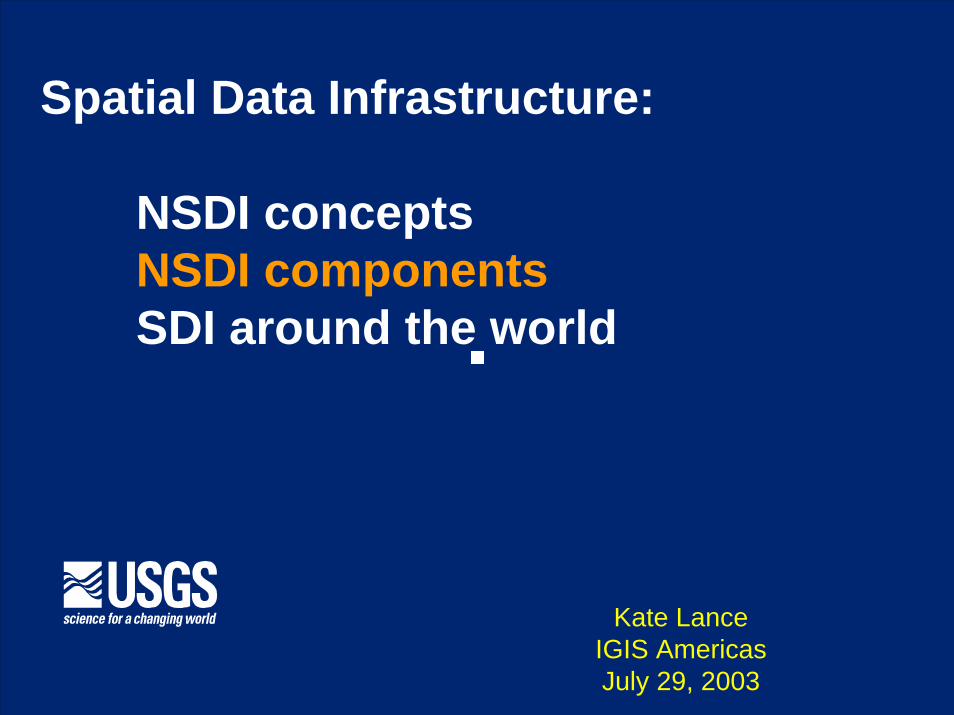
spatial data infrastructure: nsdi concepts nsdi...
TRANSCRIPT
Spatial Data Infrastructure:
NSDI conceptsNSDI componentsSDI around the world
Kate LanceIGIS AmericasJuly 29, 2003
July 2003
A bit about me
U.S. Geological Survey EROS Data Center
Global Spatial Data Infrastructure Secretariat
U.S. Federal Geographic Data Committee
E-INFORM (Africa) / SDI Africa Newsletter
PCIDEA
PROCIG

Instituto Nacional de Estadística y CensosMinisterio Agropecuario y Forestal Ministerio de Ambiente y Rec. Naturales INETER
Instituto Nacional de Estadística y CensosMinisterio de Agricultura y GanaderíaMinisterio de Ambiente y EnergíaInstituto Geográfico NacionalCATIE
Dirección de Estadística y CensosAutoridad Nacional de AmbienteInstituto Geográfico NacionalSENACYT
Instituto Geográfico NacionalSEGEPLAN
CIAT
Dirección General de Estadística y CensosMinisterio de Agricultura y GanaderíaMinisterio de Medio Ambiente y Recursos NaturalesViceministerio de Vivienda y Desarrollo UrbanoInstituto Geográfico Nacional
Instituto Nacional de EstadísticaSecretaría de Agricultura y GanaderíaSecretaría de Recursos Naturales y AmbienteInstituto Geografica Nacional
Central American Geographic Information Project Central American Geographic Information Project (PROCIG)(PROCIG)
27 participating 27 participating institutionsinstitutions
Land Information Center
http://www.procig.org July 2003
July 2003
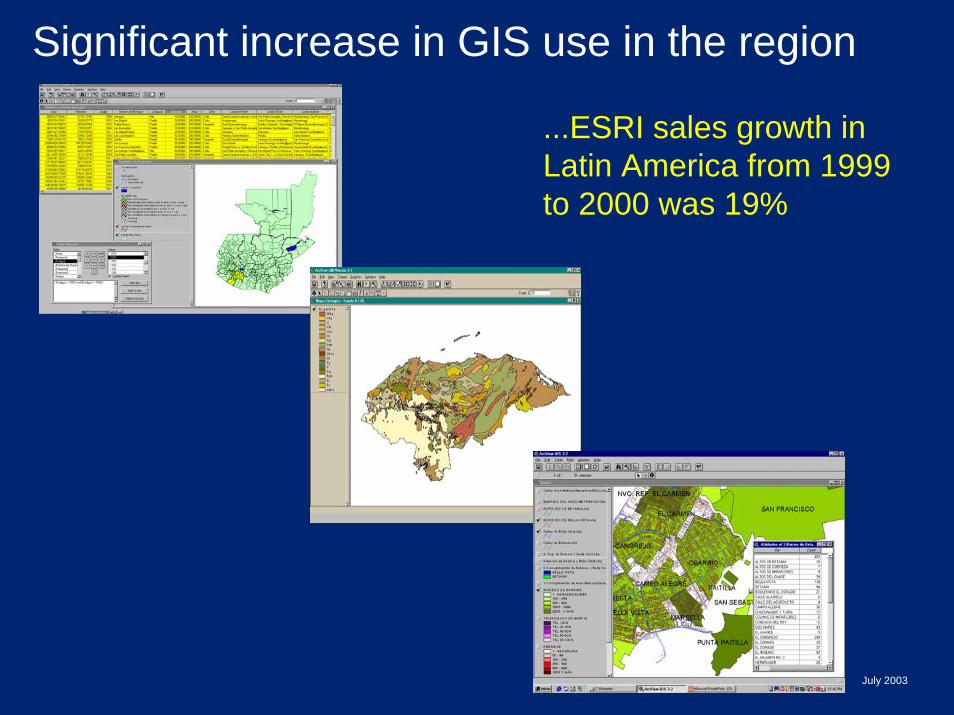
Significant increase in GIS use in the region
...ESRI sales growth in Latin America from 1999 to 2000 was 19%

Information Management Initiatives in Honduras (March 2001)
Initiative Date of Initiation
Source of Funding
Orientation
SINIAAOT - SIGIT[SERNA]
August 1999 World Bank National Environmental Information System & Land Administration System
Center for Geographic Information- CIGEO[UNITEC]
May 2000 USAID Spatial data documentation and exchange
National Network for Permanent Capacity in Risk Management [COPECO]
June 2000 OFDA/USAID Natural Disaster Network for disaster information exchange
National Forest Information System [COHDEFOR]
in development
World Bank Information management for sustainable forestry
National Statistical Information System[INE]
January 2001 UNDP, ASDI Census and statistics for development and democracy
National Systems for Evaluation and Management [Ministry of the President]
August 1999 IDB Monitoring of policies, programs, projects and activities related to Modernization of the State
In Honduras, several projects promote better development and use of spatial data
However, there is duplication and little coordination between projects.
Donors are Donors are part of the part of the problemproblem
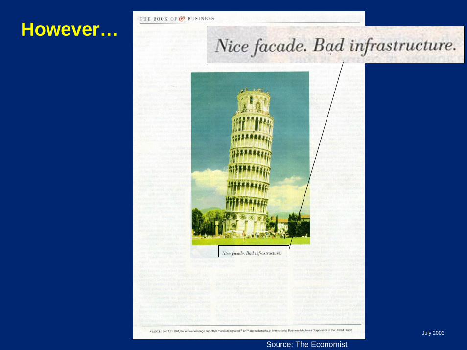
Source: The EconomistJuly 2003
However…
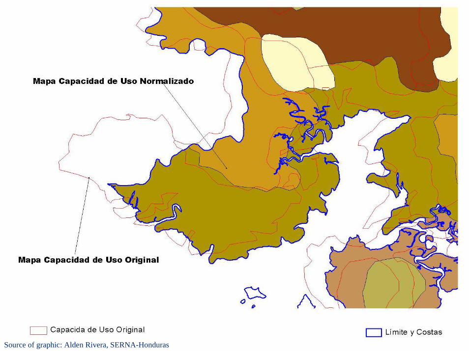
Source of graphic: Alden Rivera, SERNA-Honduras
July 2003
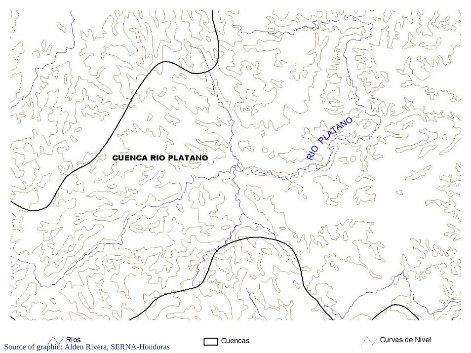
Source of graphic: Alden Rivera, SERNA-Honduras
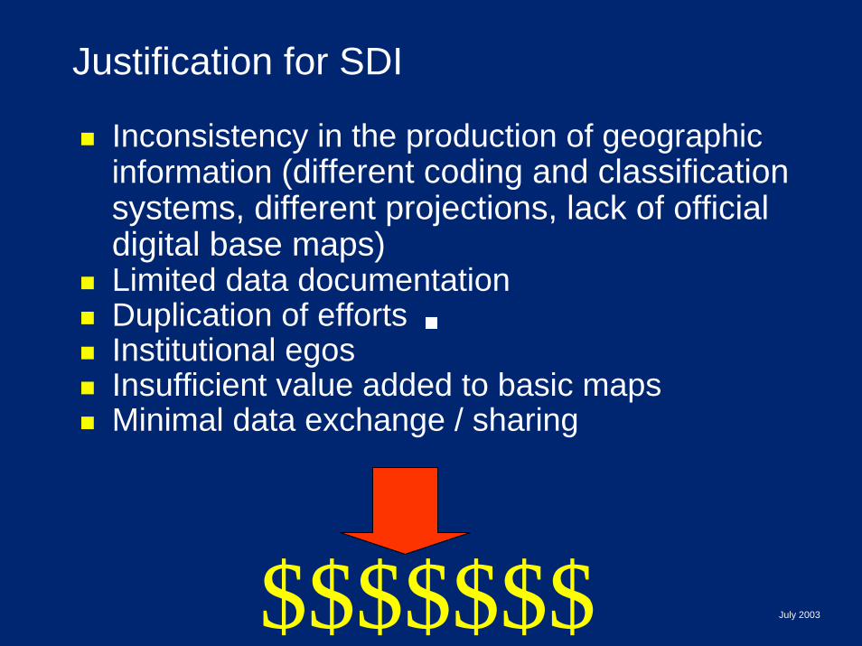
Justification for SDI
Inconsistency in the production of geographic information (different coding and classification systems, different projections, lack of official digital base maps) Limited data documentationDuplication of effortsInstitutional egosInsufficient value added to basic maps Minimal data exchange / sharing
$$$$$$$ July 2003
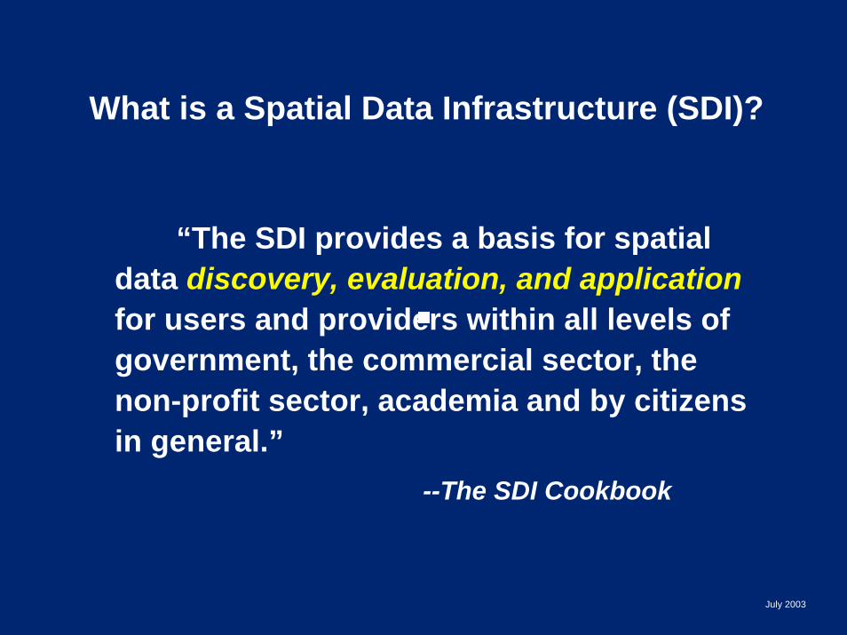
What is a Spatial Data Infrastructure (SDI)?
“The SDI provides a basis for spatial data discovery, evaluation, and applicationfor users and providers within all levels of government, the commercial sector, the non-profit sector, academia and by citizens in general.”
--The SDI Cookbook
July 2003
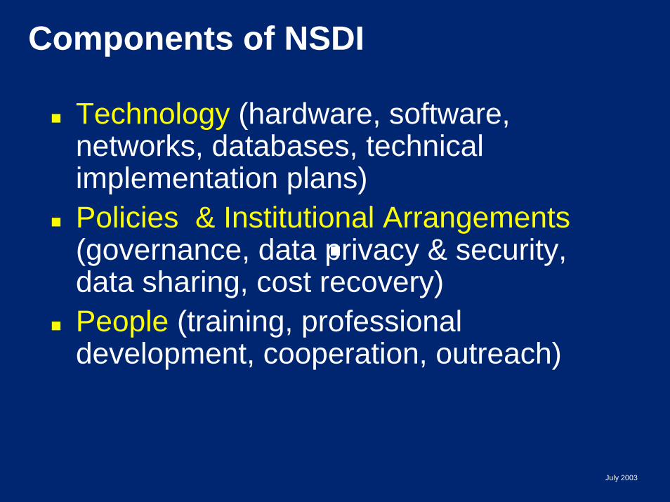
Components of NSDI
Technology (hardware, software, networks, databases, technical implementation plans)Policies & Institutional Arrangements(governance, data privacy & security, data sharing, cost recovery)People (training, professional development, cooperation, outreach)
July 2003
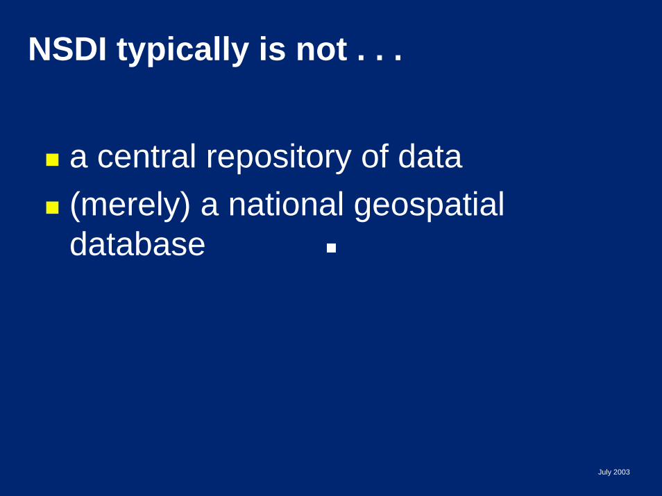
NSDI typically is not . . .
a central repository of data (merely) a national geospatial database
July 2003
Spatial Data Infrastructure:
NSDI conceptsNSDI componentsSDI around the world
Kate LanceIGIS AmericasJuly 29, 2003
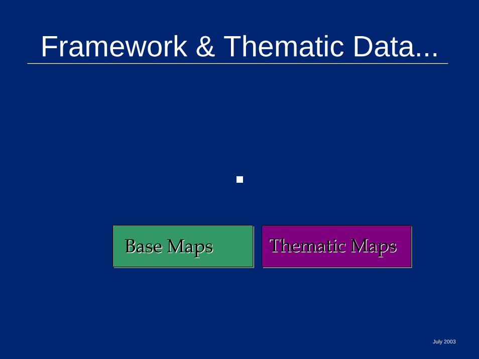
Framework & Thematic Data...
Base MapsBase Maps Thematic Maps Thematic Maps
July 2003
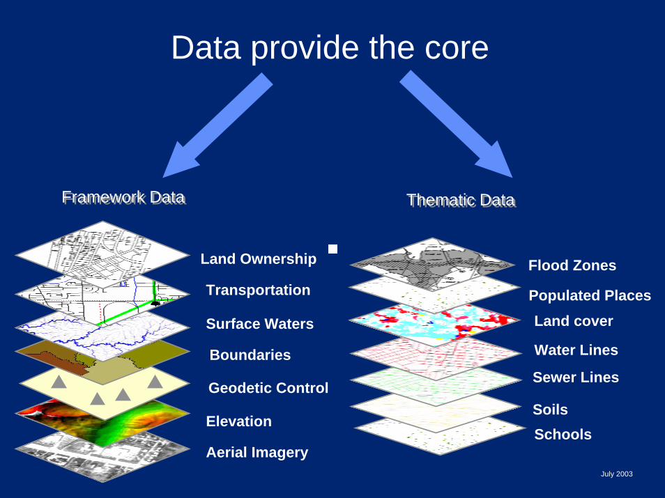
Data provide the core
Thematic DataThematic DataFramework DataFramework Data
Aerial Imagery
Elevation
Geodetic Control
Boundaries
Surface Waters
Transportation
Land Ownership
Sewer Lines
Soils
Water Lines
Land coverPopulated Places
Flood Zones
Schools
July 2003
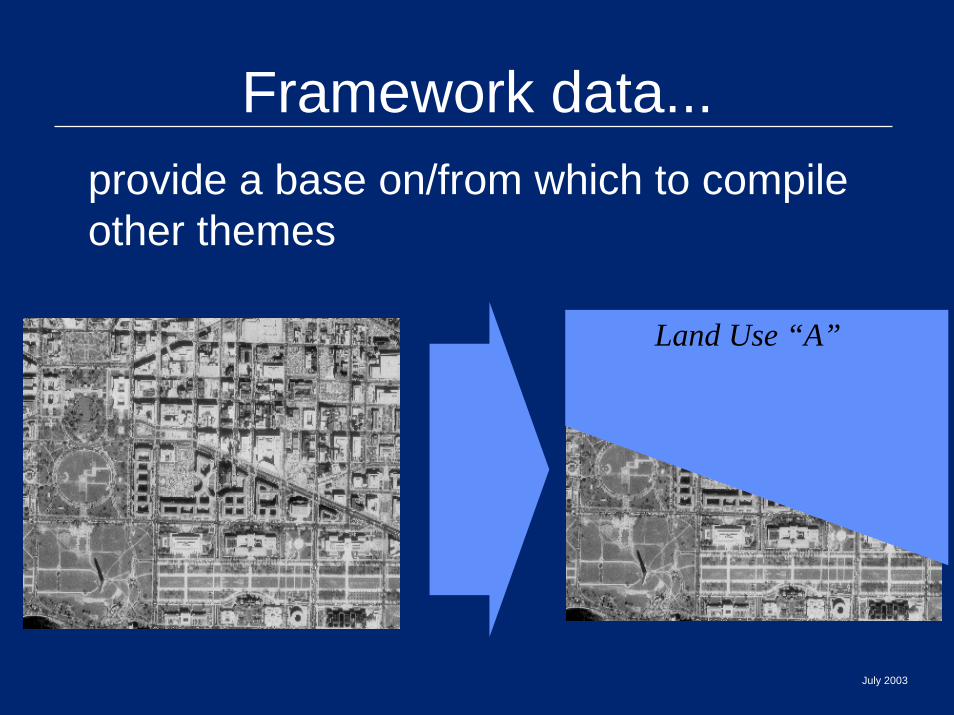
Framework data...provide a base on/from which to compile other themes
Land Use “A”
July 2003

Development of Geodetic ControlDevelopment of Geodetic Control
Source of graphic: Janice Sessing, NOAA
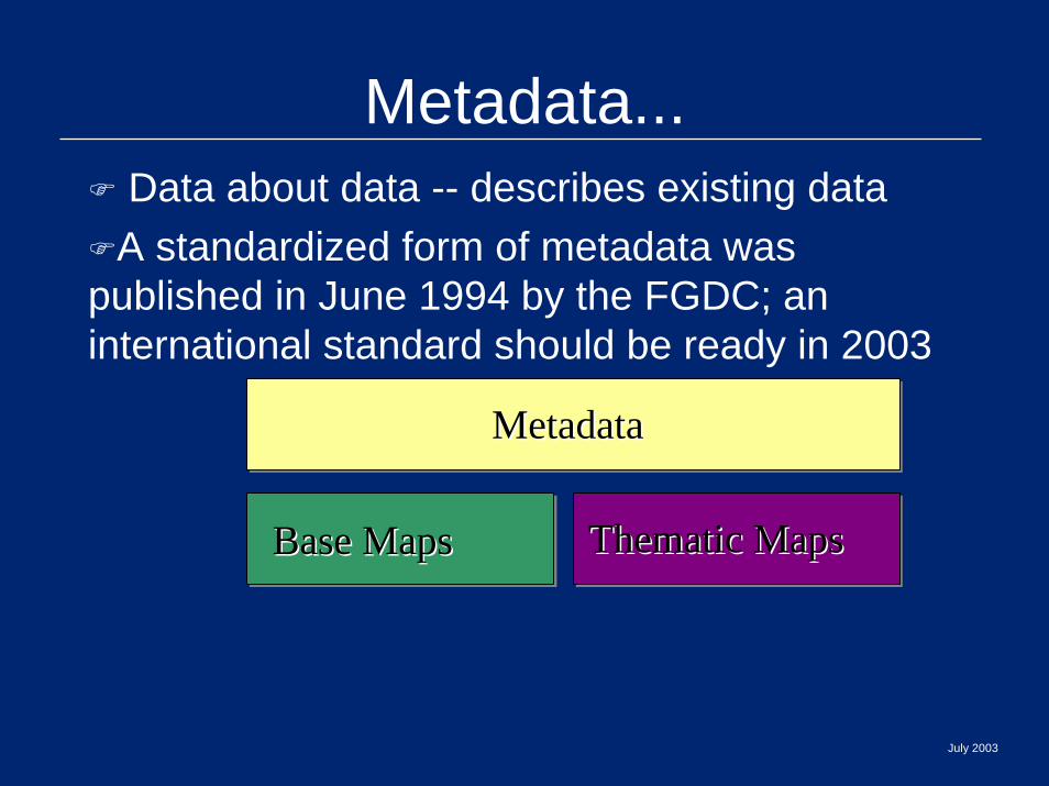
MetadataMetadata
Metadata...Data about data -- describes existing data
A standardized form of metadata was published in June 1994 by the FGDC; an international standard should be ready in 2003
Base MapsBase Maps Thematic Maps Thematic Maps
July 2003
July 2003
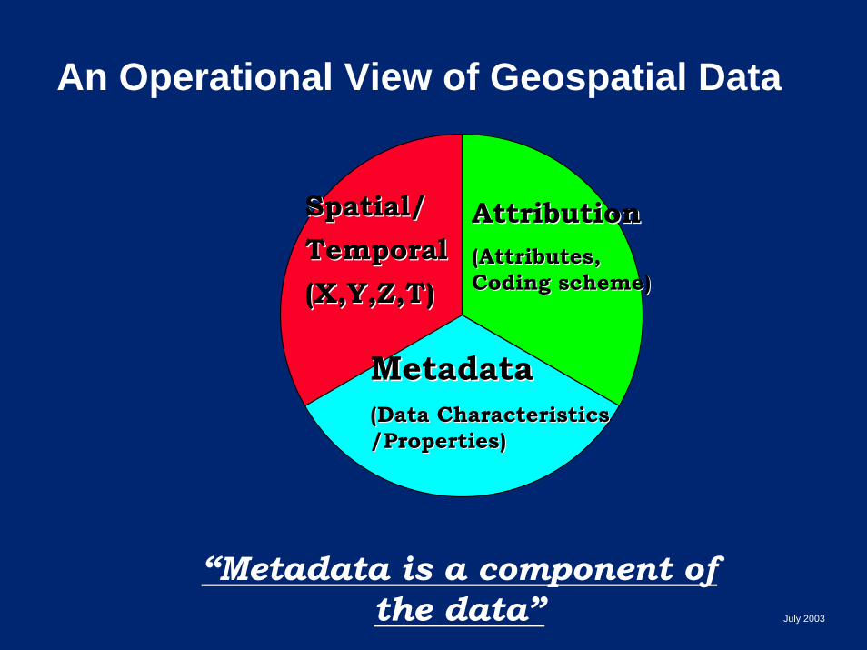
An Operational View of Geospatial Data
AttributionAttribution(Attributes, (Attributes, Coding scheme)Coding scheme)
Spatial/Spatial/TemporalTemporal(X,Y,Z,T)(X,Y,Z,T)
MetadataMetadata(Data Characteristics (Data Characteristics /Properties)/Properties)
“Metadata is a component of the data”
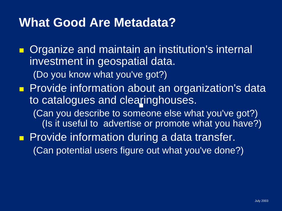
What Good Are Metadata?
Organize and maintain an institution's internal investment in geospatial data.(Do you know what you've got?)
Provide information about an organization's data to catalogues and clearinghouses. (Can you describe to someone else what you've got?)
(Is it useful to advertise or promote what you have?)Provide information during a data transfer.(Can potential users figure out what you've done?)
July 2003

Publication of metadataClearinghouse...
Clearinghouse (catalog) + ServicesClearinghouse (catalog) + Services
MetadataMetadata
Base MapsBase Maps Thematic Maps Thematic Maps
July 2003
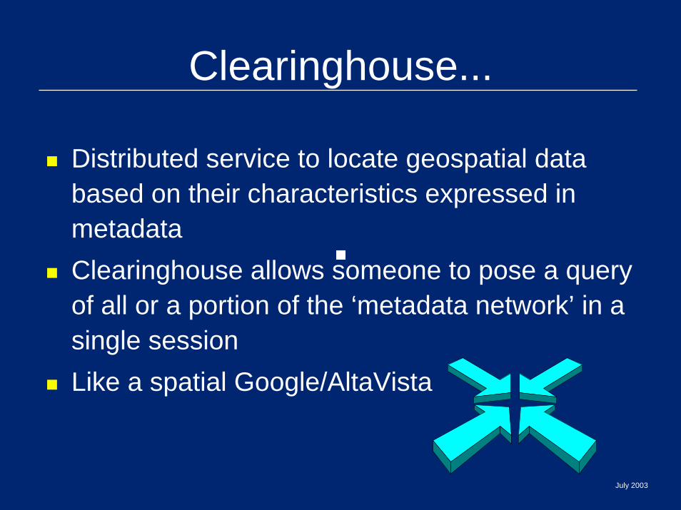
Clearinghouse...
Distributed service to locate geospatial data based on their characteristics expressed in metadataClearinghouse allows someone to pose a query of all or a portion of the ‘metadata network’ in a single sessionLike a spatial Google/AltaVista
July 2003

July 2003
Discovery in Clearinghouse
WebClientWeb
Client
ClearinghouseNodes
Gateway(s)
Z39.50 protocolHTTP protocol
ServiceRegistryServiceRegistry
WebServerWeb
Server
Planning Com.
IGN
Municipal Council
University
INE
User

Search CriteriaGeographic Coordinates
place names bounding rectangle coordinatesdraw bounding box on interactive map
Timebefore, after and equal to
Full / Field Textfull textfielded search - (14 metadata fields)
Data Sourcesall registered nodesselected nodes
July 2003
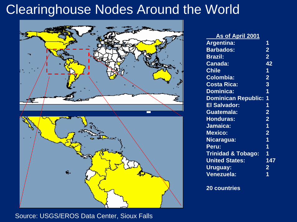
Clearinghouse Nodes Around the World
As of April 2001Argentina: 1Barbados: 2Brazil: 2Canada: 42Chile 1Colombia: 2Costa Rica: 3Dominica: 1Dominican Republic: 1El Salvador: 1Guatemala: 2Honduras: 2Jamaica: 1Mexico: 2Nicaragua: 1Peru: 1Trinidad & Tobago: 1United States: 147Uruguay: 2Venezuela: 1
20 countries
Source: USGS/EROS Data Center, Sioux Falls

Base MapsBase Maps Thematic Maps Thematic Maps
MetadataMetadata
StandardsStandardsStandardsStandards
Standards...Standards allow NSDI to function,
ensures compatibility/interoperabilityClearinghouse (catalog) + ServicesClearinghouse (catalog) + Services
July 2003
July 2003
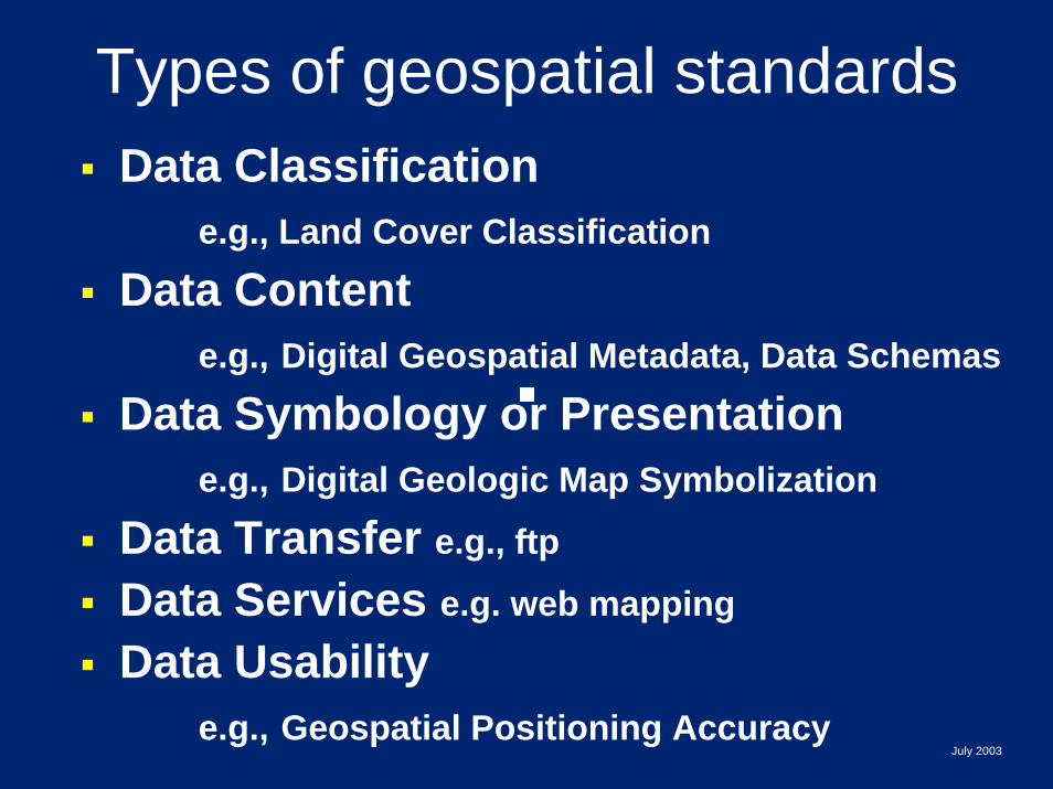
Types of geospatial standardsData Classification
e.g., Land Cover Classification
Data Contente.g., Digital Geospatial Metadata, Data Schemas
Data Symbology or Presentatione.g., Digital Geologic Map Symbolization
Data Transfer e.g., ftp
Data Services e.g. web mapping
Data Usabilitye.g., Geospatial Positioning Accuracy
July 2003
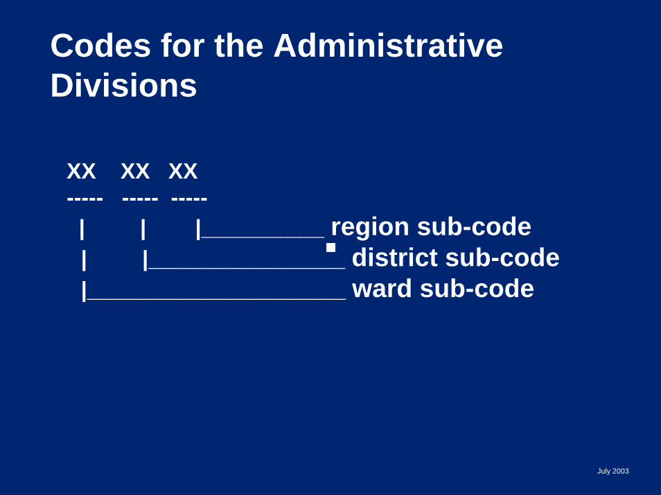
Codes for the Administrative Divisions
XX XX XX----- ----- -----| | |__________ region sub-code | |________________ district sub-code|_____________________ ward sub-code
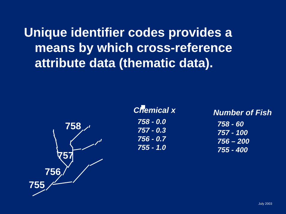
Unique identifier codes provides a means by which cross-reference attribute data (thematic data).
Chemical x 758 - 0.0757 - 0.3756 - 0.7755 - 1.0
Number of Fish 758 - 60757 - 100756 – 200755 - 400
755
758
757756
July 2003
ISO/TC 211
Geographic Information /Geomatics
International International Organization for Organization for StandardizationStandardizationTechnical Technical Committee 211Committee 211
StandardsStandards
Base MapsBase Maps Thematic Maps Thematic Maps
MetadataMetadata
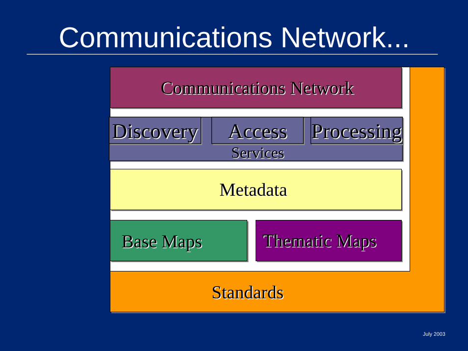
Communications NetworkCommunications Network
Communications Network...
DiscoveryDiscoveryDiscovery AccessAccessAccess ProcessingProcessingProcessingServicesServices
July 2003
StandardsStandards
Base MapsBase Maps Thematic Maps Thematic Maps
MetadataMetadata
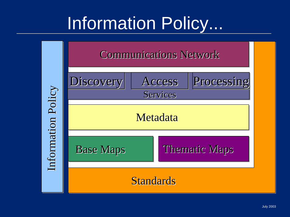
Communications NetworkCommunications NetworkIn
form
atio
n Po
licy
Info
rmat
ion
Polic
y
Information Policy...
DiscoveryDiscoveryDiscovery AccessAccessAccess ProcessingProcessingProcessingServicesServices
July 2003
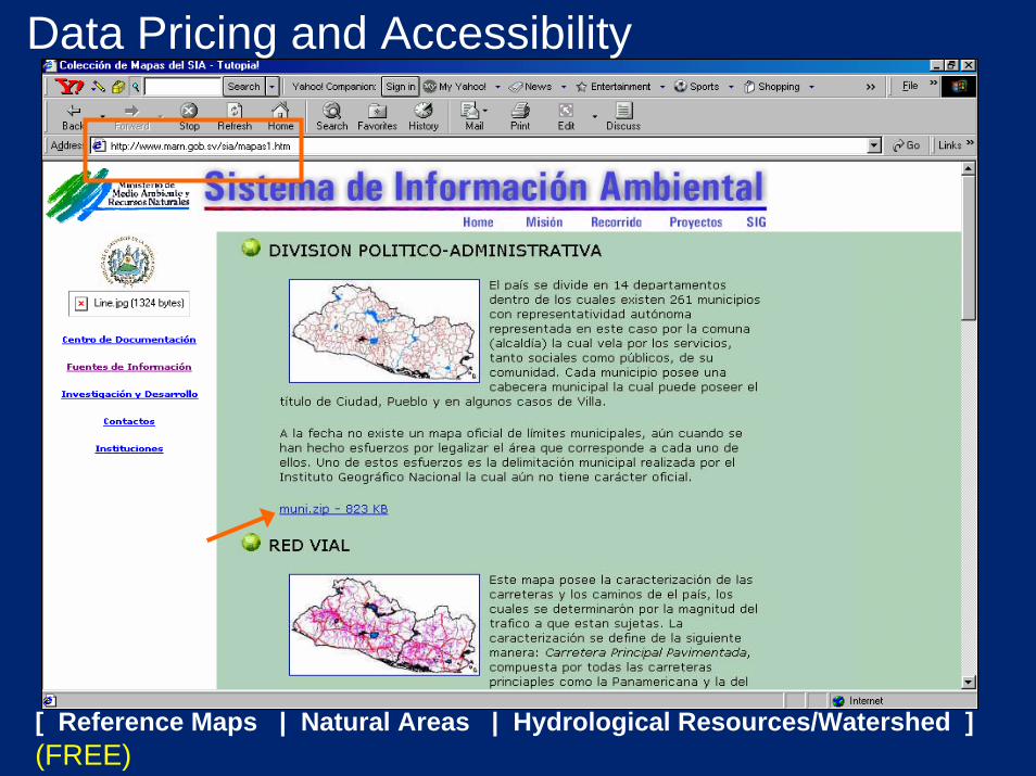
[ Reference Maps | Natural Areas | Hydrological Resources/Watershed ](FREE)
Data Pricing and Accessibility
StandardsStandards
Base MapsBase Maps Thematic Maps Thematic Maps
MetadataMetadata
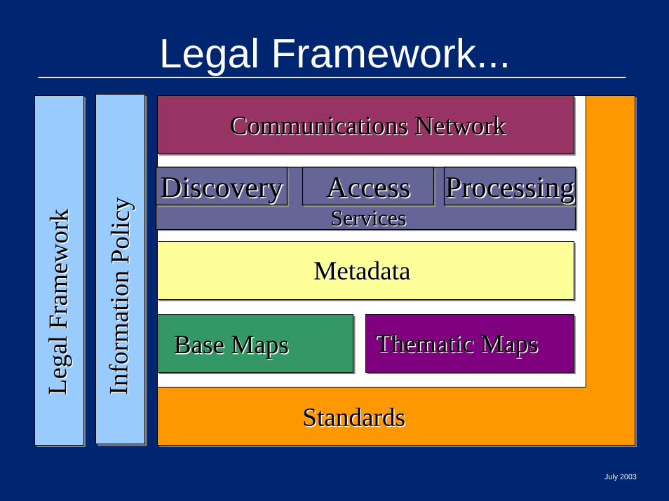
Communications NetworkCommunications NetworkIn
form
atio
n Po
licy
Info
rmat
ion
Polic
y
Lega
l Fra
mew
ork
Lega
l Fra
mew
ork
Legal Framework...
DiscoveryDiscoveryDiscovery AccessAccessAccess ProcessingProcessingProcessingServicesServices
July 2003

Leadership and partnerships Leadership and partnerships hold it all togetherhold it all together
July 2003

InterInter--institutional Leadership/Partnershipinstitutional Leadership/Partnership
StandardsStandards
Base MapsBase Maps Thematic Maps Thematic Maps
MetadataMetadata
Communications NetworkCommunications NetworkIn
form
atio
n Po
licy
Info
rmat
ion
Polic
y
Lega
l Fra
mew
ork
Lega
l Fra
mew
ork
DiscoveryDiscoveryDiscovery AccessAccessAccess ProcessingProcessingProcessingServicesServices
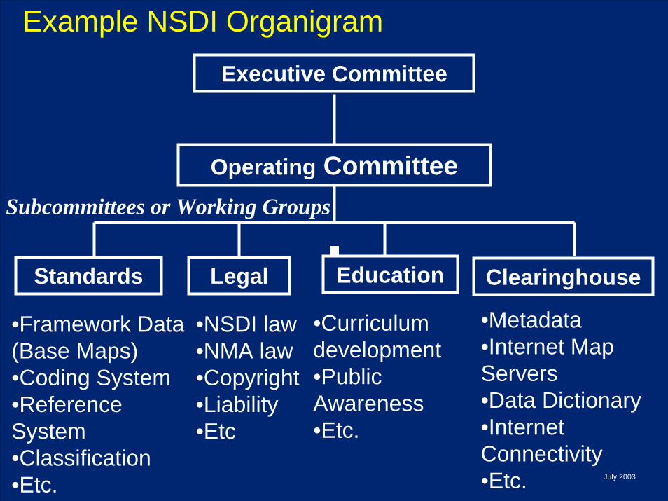
•Framework Data (Base Maps)•Coding System•Reference System•Classification•Etc.
Executive Committee
Operating Committee
Standards ClearinghouseEducationLegal
•Metadata•Internet Map Servers•Data Dictionary•Internet Connectivity•Etc.
•Curriculum development•Public Awareness•Etc.
•NSDI law•NMA law•Copyright•Liability•Etc
Example NSDI Organigram
Subcommittees or Working Groups
July 2003

InterInter--institutional Leadership/Partnershipinstitutional Leadership/Partnership
StandardsStandards
Base MapsBase Maps Thematic Maps Thematic Maps
MetadataMetadata
Clearinghouse + Web ServicesClearinghouse + Web Services
Communications NetworkCommunications Network
Lega
l Fra
mew
o rk
Lega
l Fra
mew
o rk
Info
rmat
ion
P olic
yIn
form
atio
n P o
licy
The technical obstacles are The technical obstacles are minor compared to the minor compared to the institutional obstaclesinstitutional obstacles

July 2003
Source of graphic: http://www.ahajokes.com/crt017.html
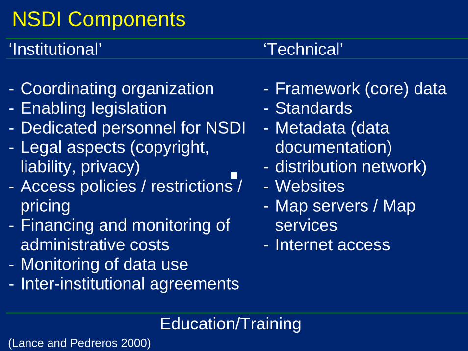
‘Institutional’ ‘Technical’ - Coordinating organization - Enabling legislation - Dedicated personnel for NSDI - Legal aspects (copyright,
liability, privacy) - Access policies / restrictions /
pricing - Financing and monitoring of
administrative costs - Monitoring of data use - Inter-institutional agreements
- Framework (core) data - Standards - Metadata (data
documentation) - distribution network) - Websites - Map servers / Map
services - Internet access
Education/Training
NSDI Components
(Lance and Pedreros 2000)
Synchronized SchedulesSynchronized Schedules
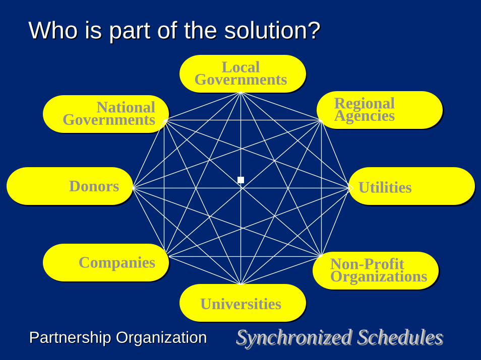
Local Governments
RegionalAgencies
Utilities
Non-ProfitOrganizations
Universities
Donors
National Governments
Companies
Who is part of the solution?Who is part of the solution?
Partnership OrganizationPartnership Organization
Spatial Data Infrastructure:
NSDI conceptsNSDI componentsSDI around the world
Kate LanceIGIS AmericasJuly 29, 2003
July 2003
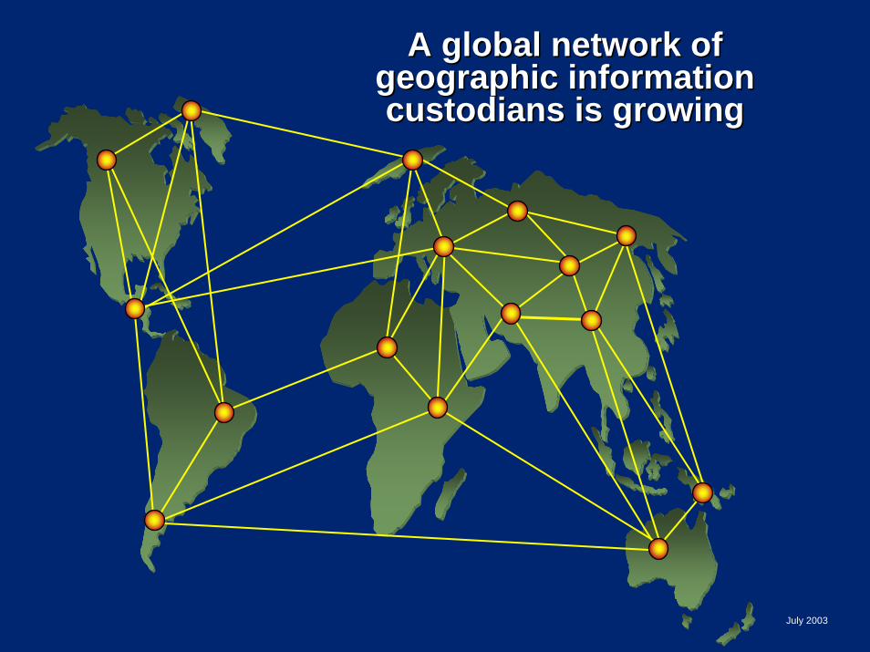
A global network of A global network of geographic information geographic information custodians is growingcustodians is growing
July 2003
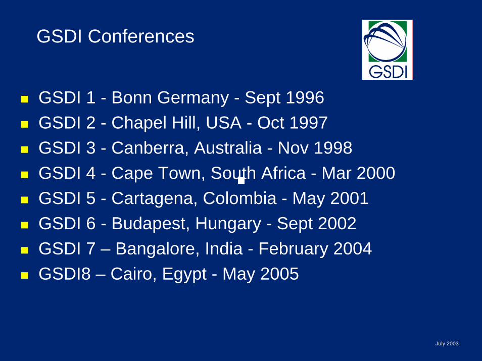
GSDI Conferences
GSDI 1 - Bonn Germany - Sept 1996GSDI 2 - Chapel Hill, USA - Oct 1997GSDI 3 - Canberra, Australia - Nov 1998GSDI 4 - Cape Town, South Africa - Mar 2000GSDI 5 - Cartagena, Colombia - May 2001GSDI 6 - Budapest, Hungary - Sept 2002 GSDI 7 – Bangalore, India - February 2004GSDI8 – Cairo, Egypt - May 2005

Regional consensus has been achieved –a forum for nations from the Americas to develop SDI
May 2003
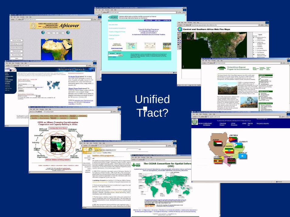
Unified Tract?