space syntax, an inspiring design-tool guido...
TRANSCRIPT

The House of Illusion : Extending the Boundaries of Space
The space syntax system which is presented in this paper has been developed to help the designer to evaluate and to define the form of complex spatial environments, especially the urban structures. The system has a double nature. On the one hand, it is a way to consider those environments. On the other hand, it includes an computerized model which calculates, on the basis of morphological properties of the spatial environment, several output-variables which represent measure, in which certain urban phenomena are spatially distributed. Instances of urban phenomena are: circulation, framing, functions, population…These correlations oblige the designer to take into account those urban facets at every stage of the project. The disciplinary fragmentation is then made very difficult for him. Besides, the contradictions or incompatibilities from local-global interests become an integral part of the urbanity. Those correlations re-open also a track which seemed to be abandoned - the one of the functionality of the urban and architectural structures - and, therefore, force the designers to confront their social responsibilities. All this has been made possible thanks to a categorical revision of what is essentially the city. According to the theoretical framework of Space Syntax, environments are above all considered as a distributive system of spaces and less of buildings.
Space Syntax, an Inspiring Design-Tool
Guido Stegen Architectenbureau Stegen - Remy
Belgium

The House of Illusion : Extending the Boundaries of Space
SPACE SYNTAX, an Inspiring Design-Tool.
Introduction Paul KLEE used to say that ‘art not represent what visible is, but makes visible’. It makes conscious of realities who are hidden behind other signs, concepts, images, biases. “Models are a matter of inspiration, not deduction ...” (B.De Moor,1994) suggests that the same conceptual dimension can be given to models. Then we use them more like metaphors, who help us oversee complex situations in a non-analytic way, without reduction. This definition stands far away from what we usually expect from models. Generally one prefers models with a high prediction-capacity. But experiences with predictionmodels has shown that theoretical scientists and practicians have different images of the ideal model, due to what engineers call the existence of a ‘trade-off’ between robustness and performance: the more precise a model can predict a situation, the more he’s sensitive to small deviations. In some applications the use of computertechnology and the integration of feedback-control can reduce this effect into acceptable proportions. Even then, models work as long as the systems they are trying to simulate, are highly consistent. What can we allow a computer to do when he’s confronted with non-consistency and contradictions? This is still one of the fundamental questions in the development of artificial intelligence. Do we ask him to be statistically relevant, or random, reasonable or maybe brilliant? Some scientists hope that in the future a quantum-computer-technology will be able to deal with contradictions by generating parallel procedures and using suspended decisions, the possibilities. However, once these possibilities fall down into irreversible positions, somewhere between probability and a smart accident. The fall of the contradiction is a question of time. The practician in environmental design experiences that many contradictions occur in the legal, historical, technical, sociological, economical, cultural context of his projects. Cities are known as the most complex artifacts, containing complex processes,
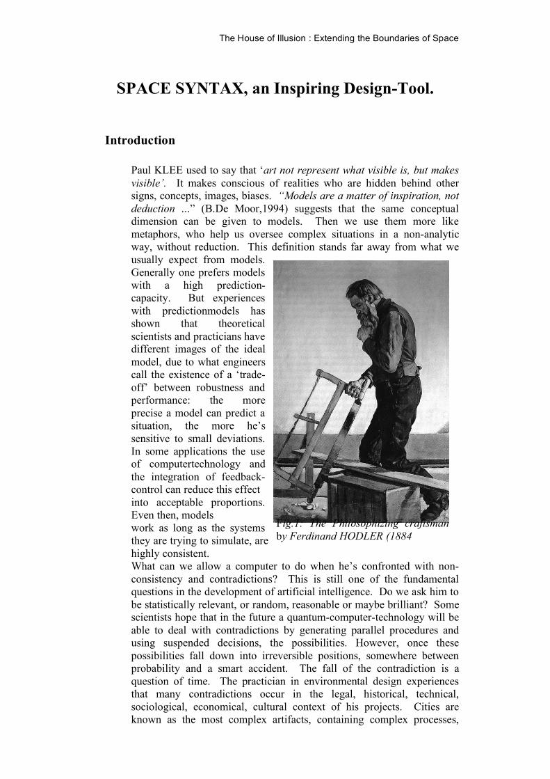
Fig.1: The Philosophizing craftsman by Ferdinand HODLER (1884

Stegen
324
caused by a more and more complex population. By then, deductive or inductive methods lead to highly arbitrary decisions. The model I’m invited to present here, is a successful compromise between ‘the matter of inspiration’ and the predictionmodel. ‘Space Syntax© is a set of techniques usually, but not always, involving computers for the analysis of spatial configurations of all kinds, especially where spatial configuration seems to be a significant aspect of human affairs as it is in buildings and cities. Originally conceived by Professor Bill Hillier and his colleagues in the Bartlett School of architecture and Planning at University College London in the 1970’s as a tool to help architects simulate the likely effects of their designs, it has since then grown to become a tool used around the world in a variety of research fields and applications. It has been extensively applied in architecture and urban design, and more recently has been used for researching problems specific to the planning, transportation and interior design fields. Over the past decade, Space Syntax techniques have also been used for research in fields as diverse as archaeology, information technology, urban and human geography, and anthropology’1. Books and articles published on this theme are mentioned in the appended references. For the UCL-developpers, the combination of inspiration- and predictioncapabilities was an essential part of the underlying scientific approach, close to the Popperian vision. This claims that, when the research-object is complex and full of internal contradictions, an hypothesis or proposition is scientifically acceptable only if falsification is possible. In such a pragmatic scientific approach, the mechanisms behind the correlation between the observation and the outputvariables, are not the major points of interest. Put into practice, the propositions are first used as ‘problematic regulative ideas’. Further, the falsification needs also output-variables, produced by the model, proving significant correlations with observed facts. The Space Syntax system has this double nature and that opens a field where the several disciplines, concerned in urban and building design, can find common points of impact.
The functionality of the environmental design If we examine the utility of the CAD, we inevitably arrive at the question of the task of the designer. Since the belief in the functionality of architectural and urban structures has strongly diminished, the tendency exists to consider the means utilized in the design from an auto-referent point of view, that is, to see in which measure the means are allowed to express themselves better. On the other hand, the configurational modelling finds its interest above all in the stages which precede the presentation and the expression. Because of its ‘hard-ware’-character, architecture cannot set aside the question of the general interest in time and space. Indeed, "First we shape our buildings and then they shape
1 Mentioned on the brochure for the International Space Syntax symposium on the 16-18/04/97.

Space Syntax, an Inspiring Design-Tool
325
us"1. The criteria used to define the quality of a proposition are far from being universal. Nevertheless, it seems to me obvious that projects which concern a large heterogeneous population will have to answer to utility and interest criteria vastly different from those which are reserved for individuals. The criteria of general interest reach us by way of democratic, scientific institutions, but remain highly abstract. The risk of paternalist behaviour from the environmental designer is in this case real. This trap can be avoided by questioning the functionality of the project. What is the problem? Is this really a problem? For whom is this a problem? Is my proposition an answer to this problem? If the answer is no, the proposition is paternalistic and it has an interest only for a reduced population. The would-be interest must be the result of the interest of the majority.
I conclude from it that the urban project must be functional. But which functionality can still be credible? Designers reject more and more this idea because of the "skid" which has taken place in the past. The origin of the defeat and at the same time a new hope are summarized by the following dialogue: "Une maison est une machine à habiter"(Le Corbusier, 1923). "But I thought that all this functionalist stuff had been refuted. Buildings aren't machines"(Student). "You haven't understood. The building isn't the machine. Space is the machine" (Nick Dalton, Computerprogrammer at UCL)2. The pertinence of this answer is defensible on the basis of the Space Syntax system.
Which functionality of the form? The modernist functionalism used to be very mechanical. It tried to realize a functionality between the form and the singular fact. This implies a specialization on behalf of certain possibilities but to the disadvantage of many other possibilities. Instead of a functionalism of possibility, appears a functionalism of impossibility which culminates in "zoning". This system of rules puts the responsibility on the individual who must manage to organize as best he can, the imposed function. Zoning is the summit of the functionalism of the non-possibilities or of non-functionality of the built environment. This defeat has led to an anti-functionalism which is translated in "Where there is nothing, everything is possible…" (R.Koolhaas, 1996). In the light of this statement, we can ask ourselves if at the end "…everything must be possible everywhere?"
The mechanistic functionalism as well as the anti-functionalism are aspects of a functionalism of possibilities. The functionalism which is here defended, and for which this model can be useful for us, is a
1 This statement is been attributed to Schweitzer, Bakeme, Emmerson, but mostly to Churchill.
2 Extracted from Space is the machine p.VII, Bill HILLIER.

Stegen
326
functionalism of probability. It is a functionalism which is not pointed at the singular fact, but based, in a statistical way, on deterministic and spontaneous evolutions. "The view of self-organization takes into account the 'collective' dimension of individual actions, and emphasizes that individuals acting according to their own particular criteria may find that the resulting evolution of the system may carry them in an entirely unexpected direction,…and this results from the fact that for non-linear systems, the whole is not given trivially by the sum of the parts." (ALLEN P.M., 1981). If the management of the environment is helped by such a determinism, it can limit itself to the possible correction of the excesses and not, like in the case of the non-functionalism, to see itself constrained to interfere with each singularity. Because of their formal complexity and their population, cities are the ideal frame for this functionalism of probabilities. Maybe, we should restate what used to be said between the thirteenth and the nineteenth century: "city-air makes free". The big divergences that we have to accept in this approach between singularity and globality imply a redefinition of both responsibility and the task of the environmental design. The acceptance of their unavoidable character should lead to the management of the social and lawful contradictions to which we have referred at the beginning of this text. "The contradiction between particular and general interest receives very few attention in the decisionmaking. However appears a great disparity between ‘who wins, who loses and who pays'' (J.KORMIT). This discomfort affects particularly the authors of projects. More and more, they have to notice contradictions between what they considered and their propositions or between their propositions on the global scale and those on a local scale. In order to have access to possible solutions, it is therefore high time to recognize this problem. In the presence of those divergences and of this recovered functionality, the task of an environmental designer in a society ought to be to propose and to inform the society of the spatial conditions which are necessary for the desired development. The sense or nonsense of the configurational modelling, informatized or not, depends principally on its ability to help designers in this mission.
Which determinism for a functionalism of probabilities? We have pretended before that the morphology of space has an influence on the development in a deterministic way. This implies the two following questions: ‘What are the conditions for a determinism to exist?’, and ‘Do those conditions already exist in space?’. For the theoretical1 bases of the hypothesis of this subject, I have to be quite dogmatic and to refer the reader to other publications. On the basis of what one accepts about what happens in complex processes in different fields, we can suppose that two conditions are necessary.
The first one concerns the environment in which the process takes place: "For open systems, where energy and matter can and do flow through the
1 Of psychological, phenomenological and philosophical kind

Space Syntax, an Inspiring Design-Tool
327
boundaries, then the system can exhibit spontaneous self-organization". (P.M.ALLEN, M.SANGLIER, G.ENGELEN, F.BOON, 1985. "Dissipative structures apparently go in the opposite direction to the law of entropy and are able to diminish locally the entropy and can create order out of chaos". (H.VAN BELLE). The dissipative spatial environment is above all the public space. It is the urban space and it generates the developments. Compared to this first condition for deterministic and durable developments, we can note that the actual tendency to fragmentation and specialization of spaces, leads us in a wrong direction. The second condition is related to the influence of the human substance on the transformation of places. It has been previously claimed that the global effect cannot be obtained by addition, deduction or induction of the composing parts. The condition is the existence of what used to be called occasionally an attractor. This is an unchanging fact, even small and implicit, in the majority of the dynamic substance in the system. In the urban system this is the human behaviour. This attractor will necessarily appear through the interaction between the environment and the human behaviour. • The interaction includes three processes which influence each other
and resupply themselves by feedback. Environments are transformed according to the effective use that we make of them. By this, we mean material and social environments and concerning the use, we mean the physical use. Places must be physically accessible.
• The second process concerns mental accessibility: humans use environments if and like they know them.
• People know an environment through perception. For the spatial behavior, it's the view which plays a predominant role, because it informs us in a very precise way about our position and movements.
A space undergoes then transformations if it is perceived (PER), known or conceptualized (CON), and if it is accessible or available (AV). For those reasons, we see a complex spatial system as a system of elementary spatial relations PER/CON/AV, linked together. Therefore, such a network is often called a topological network. It can be considered like a "mental map" but without objects. The most exclusive or fragile link in the feedback mechanism of the PER/CON/AV system is the CON stage. As soon as we forget a place, we lose any intention directed towards this place. Moreover, even tough we have an image of a place, but if the spatial relation with this place, the path, is not known by us, the place becomes de facto inaccessible. It is in this weak link (CON) that we will look for the determinism because it has a critical position in the survival of purposive acts. It is in the conceptualization phase of the environment that differences of accessibility should appear and that our spatial behavior will be differentiated in a deterministic way. Complexity seems there, like in many other domains, to be the determinative and differentiating factor. Complexity is “more object”, disorder, unintelligible and inaccessible. Confronted with complexity we become “more subject”, dependent and unfree. For spatial behaviour it is the complexity of the path, also called the topologic depth, that is probably the determinative factor of accessibility of a place. If this hypothesis is

Stegen
328
correct, complexity joins the economical criteria accepted as decisive for the choice of the pathways, for instance the metric distance, duration, the costs, etc… This hypothesis will appear so obvious that the economical criteria become often accessories. Complexity takes a lot of our mental reserves. It is yet to be demonstrated whether these hypotheses can be falsified.
Necessary variables for falsification and prediction "To be is a value of a variable" (W.Van Orman Quine, 1939). How are we to attribute variables that express the degree of accessibility of places and whose correlation with reality can be checked? How can we formalize a spatial elementary element (called PER/CON/AV) and from there formalize the complexity of a pathway? I propose to see such elements in a instrumentalistical way (cf. J.Dewey). That means that components of knowledge are models or concepts generated outside the reality. Those elements don't have a reality which precedes this process of knowledge. They are not reductions but abstractions of the reality. Because of that, transformation into abstract elements is an interpretation of the reality. In the application of the Space Syntax model, the transformation such as I will explain hereafter is only the general rule which is often re-examined according to the principle, already explained, of the tendency towards simplicity in the conceptualization of our surrounding world.
Input-variables
Reality has been taken into account as follows for the input of the model. The example taken is the example of the public urban space since this is the most accessible and the most dissipative one.

Space Syntax, an Inspiring Design-Tool
329
1. Within the outlines of this space, we draw the way between couples of places by means of a minimum of interconnected straight lines.(see figure 2). These lines represent the elementary spaces, the components of the model (PER/CON/AV).
2. Further, the obtained network is revised until he contains a minimum of lines. The first condition is always respected.
This network is the input for the computer program Axman, which is part of the Space Syntax system. On the basis of this network, the program gives a variable to each line.
the Relative Depth (RD)-value of one space in relation to another is the topological inter-distance. This value corresponds to the number of folds and knots on the way between the two spaces. On the figure 2, the RD between A and B is 3. Figure 3-a and 3-b show two different depth patterns in the Brussels Region. the Mean Depth (MD)-value of a space is the average value of the RD in relation with the other spaces of the spatial system concerned. The spaces with a low MD-value are called swallow spaces. They are mainly responsible for the coherence within their environment. The program doesn't always take into account all the spaces of the network. The operator (programmer) can ask the MD-value of a space for a set of lines, limited to a specific depth from that space (MD3, MD4,…). When all the lines of a network are taken into account, the symbol is MDn. the Connectivity (Conn)-value of a space, or a line, indicates the number of other lines to which a line is connected. the Integration (int or R)-value: of a line is the reciprocal of his relativised mean depth value. Then a swallower or more integrated line acquires a greater value than a deeper and more segregated one. Like for MD, the integration value can be asked for a local or global environment. Here too, the symbols comprise the depth which is taken into account. For example, R3 is the integration value of a line, taking into account an environment limited to a depth of 3. All the sizes of the environment are possible as far as the total network. In this last case, the symbol is Rn, similar to MDn. Thus, a distinction is made between the more local integration values (R3, R4,…) and the more global integration values (R8, R9,…Rn). As, shown on the figures 3-c and 3-d, global and local integration patterns may be very different. The differences signify that the spatial coherence is not understood in the same way by local people and by people living outside the area (district). When global and local integration patterns are quit different, the local and global users behave differently and they seems unpredictable for each other. Figure 3-a figure 3-b

Stegen
330
figure 3-c figure 3-d
Correlations between variables and reality, falsification and prediction Correlations between observations and modelvariables indicate that mental accessibility, mathematically defined in the variables, plays a decisive part in urban determinism. Of all the possible spatial behaviour, presence is of course the most elementary. Because of the nature of the supposed attractor in the determinism, by the mental accessibility, the observed movements and the spatial integration should above all be related. That seems to be the case. Figure 4 shows the correlation between pedestrian movement (men, 8->10a.m.) and a combination of local integration and building density in the historical center of Antwerp. The two black dots represent the Meir, the major shopping street. Generally, shopping streets overact because of the so called amplifier-effect. Without this space, the correlation r=0.81 becomes r=0.93.
fig.4

Space Syntax, an Inspiring Design-Tool
331
fig.5 fig.6
Figure 5 shows the degree of road-saturation by motorised traffic in Brussels, correlating most with a global integration pattern (Rn) represented under fig. 3-d. Also the distribution of land use and builded density follows the morphological characteristics of the streetgrid. Figure 6 shows that office buildings and areas are mostly located where global integration (3-d) is high and topologically close to the highest
integrated space (3-a). fig.7-a fig.7-b fig.7-c
That land- and building-values and also environmental quality often correlate with spatial integration is probably responsible for the correlation we can see in figure 7: that a population with a higher income generally lives in more integrated spaces. All those simple relations between facts and the values of the variables are visible on the scattergrams and on maps. But, the available maps based on statistical sectors falsify the image of the phenomena because they lack a homogeneous repartition of these phenomena within the zones. Therefore, we tend to attribute the data on the PER/CON/AV-elements, i.c. the Space Syntaxlines, either than to zones. Used this way, The Space Syntax model becomes an aid for perception (Computer Aided Perception) even before being an aid for design (CAD).
The local-global interface

Stegen
332
One may come to the conclusion that the model is good, when its output variables correspond with the observations. But, this is by no means a quality criterion of the environment. The high or low values of the variables may not automatically be considered as indications for the spatial quality1. Nevertheless, also the spatial quality can be measured by means of the model. It is the so called local-global interface or the degree of synergy. The arbitrary aspect of the correlations between the phenomena and the variables can be wiped out by using double correlations or double proportions. In this case, the relations between the variables of the model indicate the quality. Up till now, the observations confirm the following hypothesis: that the patterns of the different variables must be interlinked. For example : • a good correlation between the local and the global integration creates
a state of synergy, favourable for development and stability. • as the previous one, a good inverse relation between the integration
values and the values of the relative depths from generators of presence like stations, motorways exits, shopping malls, office clusters, …)
• a good correlation between the integration values and the connectivity enables the spatial structure to be intelligible and therefore more accessible.
The state of synergy makes that the urban scales do not contradict each other and pays its contribution to a spontaneous non-conventional social synchronization. Implicitly, the individual feels then confirmed by the spatial behaviour of his social environment. “These local to global correlations between spatial properties are exactly what allow the parts of cities to come together to form a global whole, and more importantly, they are what makes the urban network intelligible to us - whether we are pedestrians or drivers. Essentially, intelligible space allows individuals to behave in a rational way as they move around the city and so to gain autonomy. At the same time, the consistent relations between local and global movement patterns are what allows us to work, sell or live. It is the effects of the configuration of urban space that allows individuals to behave rationally which would seem to be precondition for the social function of the city and so for the civilization of new techno-logical innovations such as the motor car ..." (Penn A., Hillier B., Banister D., Xu j. - 1993).
The need for synergy is applicable to an entire network as well as to a local part of a network, as for instance a neighbourhood. It is on the basis of these characteristics that areas are defined in the Space Syntax system. That is to say: looking for an area, a locality, means looking for a
1 It is tempting to associate disquality to segregated space, because of
occuring correlations, like for example: land- and building value, decay of the environment, socio-economical caracteristics of the population, etc. This should not be done since those phenomena are of social interest and they are acceptable if kept within certain limits. Moreover, it is possible that the correlation will become the reverse if the price of the mobility continues to raise.

Space Syntax, an Inspiring Design-Tool
333
set of spaces where the variables are the most correlative. Mostly, the spaces of those clusters have developed in the same period and under the same morpho-sociological circumstances. It has not been proved yet that the recognition of the areas has any importance for the environmental policy, but it has been clearly established that, the correlations between the movement observations and the model variables are much better if areas are defined as described above. Figure 8 shows how the local-global interface can be visualised by scattergrams. The gray dots are all the public spaces of the Brussels Region. The black dots are the spaces making two different areas. The Leopold-area, a business district, shapes a local scatter, close to the local regression line. The Marollen, a more marginalized cluster, has a layered scatter; this is an indication that the local/global-interface is broken.
fig.8
Figure 9 shows that entire towns (here Brussels and Antwerp) can bee seen as mega-clusters and that even on that scale the local/global-interface is still a qualitative description of space. The table indicates by several numerical characteristics that the spatial coherence and harmony are better in Brussels. This is confirmed by the graphs which shows that insecurity is lower in Brussels. This correlations between insecurity and the local/global-interface exists have also been seen by examination of smaller areas in towns.
Fig.9-a fig.9-b

Stegen
334
Space Syntax as a design tool All the examples given so far, show that the model is able to give us a reliable image of spatial potentials. But the essential aim of configurational modelling is to help with the elaboration of projects and to conduct and guide developments. Because of the good correlations between the movement and the model variables of centrality, it is obvious that Space Syntax can be used for the configuration of urban movement networks. It has been established that “the configuration of the street grid, the capacity of the street segment, the distribution of land uses, the distribution of development density.” (A.PENN, 1993, p.12) influence differently the intensities of vehicles and pedestrians. By modulating these morphological and functional factors, the townplanner can arrive to a better controlled relationship between “speeds”. Those factors, each one in its own way, have also an influence on what is called the global-local interface. They can correct morphological disharmony. Nevertheless, since their evolutions are deterministically linked to each other, their correction-capacities are restricted. In a concrete project, the model is a mean of supervision and control. This is due to his non-metrical character. Once an architectural and structural proposal has been metrically elaborated (forms, densities, programs,…), his topology can be verified and checked by means of the model. Shortcomings can be corrected by changing the configuration of the street grid, the building density or the land use. The most difficult, but certainly the most rewarding utilization of the model consists in its use as a means of evaluation of an existing urban structure in order to define the simplest morphological adjustments, necessary to remedy of community problems. It is in this kind of application that the model is stressed since there is no other way to deal with this complex reality. Examples of the application by LaSE and G.Stegen&F.Remy-arch.(Brussels), of these techniques, resulting in instruments for the daily routine of the environmental policy are: • The development plan for the central station-area in Antwerp (august
1995). Commissioned by the Belgian Railway Company (NMBS-SNCB) / Eurostation n.v.. This study had a triple interest. First: discover the origins of the decline of the large area around the central station. Second: evaluate the effect of the raising with 100% of the existing capacity of the station. Third: propose a development plan which discontinues the assessed urban disharmonies
• Particular lay-out plans (PPAS-BBP) in the area around the boulevard Leopold-II (1991-1993), one of the most integrated spaces in Brussels. Commissioned by the local authorities of the Commune of Molenbeek in the Brussels region.
In these documents the formal definitions of the buildings are limited to what’s relevant for the urban potentials. Architectural details are absent. The land use requirements are allocated to space by using a matrix, filled by conditions which are linked with the potentials of spatial morphology, given by the Space Syntax model. This technique admit a certain flexibility of land use. Such instruments are different from masterplans, which are a different concept of the urban management.

Space Syntax, an Inspiring Design-Tool
335
Behind the variables From these surprising correlations, we can draw the conclusion that the morphology of the environment has undeniable repercussions on various urban phenomena. Of course, besides the field where the model is consistent, there are fields where it is not. This is inherent in the model which is one of spatial potentialities. In any case, systems like Space Syntax prove that it is possible to create instruments enabling the environmental designer to verify the functionality of his proposals. Continuous research with this model will increase its performances and sharpen the interpretation of variables. At the same time, its limits will become clearer. In view of the heterarchical character of the phenomena in the real world, it would seem necessary to adopt the means to this situation. Each model will take into account his sector of favourite pertinence. In the Bartlett School of Architecture and Planning-UCL, other computerized models are being developed of those who worked out Space Syntax. LaSE, the research cell of the architects bureau G.Stegen&F.Remy, in Brussels, made a model, called ‘Sequence-2’, which simulate and explain the variance in development within an elementary space. Combined with Space Syntax, it should enable a better understanding of the intelligibility of spatial environments. These researches require a systematic observation of the effects of the morphology of the space on events and therefore on its functionality. On the other hand, these models require of the users to take into account the laws governing space and the available margins.
When space, as the main subject of the project, gains its own rights, the quibbling over styles and façades will fade. The incompatibilities between global and local interest, between price and architectural quality, between the space and the object will disappear. This way of thinking allows the designer to work on a global and local scale at the same time. The global/local-interface makes contradictions relevant either than problematic. The inclusive thinking becomes an attitude due to the complexity of the model variables. Interdisciplinary contradictions will be diminished , or they will be accepted. It will be admitted that the morphology has correlation with various sector that are part of the architecture and the urban planning. A particular difficulty in the generalization of this approach seems to be the acceptation of determinisms in human spatial behaviour. Nevertheless, there is nothing “blasphemous” on making physical environments which consider human mind. It is surely not the case if it makes people feel free and in harmony with their social environment.
Text-references DE MOOR Bart (1994), Cirkelen om de wereld-Werelbeelden, wetenschap en technologie, p.127, Pelckmans, Kapellen.
HILLIER Bill (1996), Space is the machine : A configurational theory of architecture, Cambridge University Press.
KOOLHAAS Rem. (1996), S, M, L, XL, p.199

Stegen
336
KORSMIT Jan. (1994), Stilstaan bij mobiliteit - Mobiliteit, een tweesnijdend zwaard, p.77 - Garant, Leuven. ALLEN P.M. (1981), SANGLIER M., Urban Evolution, Self-organisation and Decisionmaking - Environment and Planning, volume 13, p.167-183.
ALLEN P.M. (1985), SANGLIER M., ENGELEN G., BOON F. - Toward a new synthesis in the modeling of Evolving Complex Systems - Environment and Planning B, Vol. 12, p.65. VAN BELLE Hubert (1994), Cirkelen om de wereld - Het denkkader van de systeemtheorie, p.162, Pelckmans, Kapellen. PENN Alan (1993), HILLIER B., BANISTER D., XU J. - Configurational modelling of Urban Movement networks - Bartlett Research, UCL, London.
Figure-references
Figure 1: Filosoferende Handwerksman, painting by Ferdinand HODLER (1884)
Figure 2: LaSE and G.Stegen&F.Remy-arch., Brussels Figure 3 and 7: Space Syntax model of the Brussels Region, made in 1996 with the Wizzy Axman-software (version 1.6.1) of the Space Syntax-system. Authors: LaSE and G.Stegen&F.Remy-architects, Brussels. Figure 4:. Observations made in Antwerp for the Belgian Railway Company (NMBS-SNCB) and Eurostation n.v., The development plan for the central station-area.(august 1995). Authors: LaSE and G.Stegen&F.Remy-arch. - Brussels Figure 5-a: Ministerie van het Brusselse Hoofdstedelijke Gewest, 1993 - published in B.I.M.-rapport nr.9, (1994) by Brussels Instituur voor milieubeheer (BIM-IBGE).
Figure 5-b: represents Parcels destinated for offices or office-projects - state 1/7/1993. Source: BRAT; production: COOPARCH-R.U. with BRUSSELS Urbis ®©-1.0.2. Published in the R.R.D. - GEWOP for the Brussels Region (3/3/1995) as fig.4.1.
Figure 6-a and -b: maps 25 and 31 in Kansarmoede in de Grootstad Antwerpen - Deel II published by the Koning Boudewijnstichting and the Universitaire Instelling Antwerpen (UIA). Authors: R. MARIJNISSEN, E. POPPE, Th. JACOBS, E. VAN HOVE.
Figure 6-c: Space Syntax model of Great-Antwerp, made in 1995, with the Wizzy Axman-software (version 1.6.1) of the Space Syntax-system. Authors: LaSE and G.Stegen&F.Remy-arch., Brussels. Figure 8: Criminaliteitsstatistieken 1995, Kristien DESMET in Pretekst nr.11 - july 1996, p.10-11. - ed. Kluwer.

Space Syntax, an Inspiring Design-Tool
337
Space Syntax-references Contacts: Space Syntax Laboratory
The Bartlett School of Graduate Studies, (1-19 Torrington Place), University College London, Gowerstreet London WC1E 6 BT Tel. +44 (0) 171 813 4364 - Fax +44 (0) 171 916 1887
Personnel : Prof. Bill Hillier <[email protected]>, Tim Stonor <[email protected]>, Alan Penn, Dr. Julienne Hanson.
International Space Syntax Symposium: 16-18th April 1997. Symposium organiser: [email protected])
Publications : Space Syntax, a different urban perspective, B. Hillier, J.Hanson, J.Hudson, R.Burdett - in The Architects Journal, 30/11/1983. The Social logic of Space B.Hillier & J. Hanson / Cambridge University Press / 1984 The axis as symbol and as instrument B.Hillier / B.S.A. & P - UCL.
Against enclosure B.Hillier / Mai 1987 Configurational modelling of urban movement networks. A.Penn, B.Hillier, D.Banister, J.Xu /1993. Natural Movement: or configuration and attraction in urban pedestrian movement B.Hillier, A.Penn, J.Hanson, T.Grajewski, J.Xu / 1993 / Pion London.
Space as a material B.Hillier / Association Internationale de Semmiotique de l'Espace / Conference at Berkeley / June 1994.
The Architecture of Society : stochastic simulations of urban pedestrian movement in SIMULATING SOCIETIES, in N.Gilbert & J.Doran (eds), ch.5, UCL Press London, 1994. Space is the machine Bill Hillier / 1996 / Cambridge University Press.
