sonoma creek & tributaries feasibility study … · u.s. army corps of engineers san francisco...
TRANSCRIPT

U.S. Army Corps of Engineers San Francisco District South Pacific Division
SONOMA CREEK & TRIBUTARIES FEASIBILITY STUDY
SONOMA, CALIFORNIA
PROJECT MANAGEMENT PLAN
San Francisco District South Pacific Division
April 2001
Southern Sonoma County Resource Conservation District


Sonoma Creek & Tributaries Feasibility Study Project Management Plan (PMP)
U.S Army Corps of Engineers Table of Contents
SONOMA CREEK AND TRIBUTARIES FEASIBILITY REPORT
PROJECT MANAGEMENT PLAN
TABLE OF CONTENTS
Chapter 1- Purpose and Scope 1 1.1 Introduction 1 1.2 Definition of Project Management Plan 1 Chapter 2 - Section 905(b)(WRDA) Analysis 3 2.1 Study Authority 3 2.2 Study Purpose 3 2.3 Location of Study. Non-Federal Sponsor & Congressional District 4 2.4 Prior Reports and Exiting Projects 5 2.5 Plan Formulation 5 2.6 Federal Interest 14 2.7 Preliminary Financial Analysis 14 2.8 Feasibility Phase Milestones 14 2.9 Feasibility Phase Cost Estimate 15 2.10 Views of Other Resource Agencies 16 2.11 Potential Issues Affecting Initiation of Feasibility Phase 16 2.12 Project Area Map 17 2.13 Letter of Intent 17 2.14 Recommendation 17 Chapter 3 - Work Breakdown Structure 18 Chapter 4 - Scopes of Work 21 4.1 Planning Tasks 21 4.1.1 Physical Data Collection and Analysis to Support Flood
Protection and Ecological Restoration 22 4.1.1.1 Fluvial and Geomorphic Processes Analyses 22 4.1.1.2 Channel Geomorphology Evaluation 25 4.1.1.3 Hydrology Analyses 27 4.1.1.4 Hydraulic Analyses 28 4.1.1.5 Tidal Zone Processes Modeling 29 4.1.1.6 Groundwater Modeling 31 4.1.1.7 Geotechnical Investigation 32 4.1.1.8 Engineering and Design Analysis and Report 32 4.1.1.9 Engineering Review and Documentation 33 4.1.2 Biological Data Collection and Analysis to Support Flood
Protection and Ecological Restoration 33 4.1.2.1 Biological Restoration Parameters 33
4.1.3 Project Durability and Feasibility: Socioeconomic Data Collection Analysis and Studies 34 4.1.3.1 Socioeconomic Water Resources Dynamics
Evaluation 34

Sonoma Creek & Tributaries Feasibility Study Project Management Plan (PMP)
U.S Army Corps of Engineers Table of Contents
4.1.3.2 Socioeconomic Restoration and Flood Protection Analyses 35
4.1.4 Sonoma Creek and Tributaries Historical Ecology Project 36 4.1.5 Geographic Information System (GIS) Support
for Planning 40 4.1.6 Real Estate Analysis/Report 40 4.1.7 Environmental Studies/Report 42 4.1.7.1 Initiate & Complete Environmental Cert. Process 42 4.1.7.2 Recreation Analysis 43 4.1.7.3 Fish and Wildlife Coordination Act Report 43 4.1.7.4 HTRW Evaluation/Report 43 4.1.7.5 Cultural Resources Studies/Report 43 4.1.8 Design and Cost Estimates 44 4.1.9 Public Involvement Documentation 44 4.2 Plan Formulation and Evaluation 44 4.3 Draft Report Preparation and Review 45 4.4 Feasibility Report Submittal 45 4.5 Program and Project Management 46 Chapter 5 - Responsibility Assignment 47 Chapter 6 – Feasibility Study Schedule 49 6.1 Local Sponsor Commitments 49 6.2 Milestone Schedule 49 Chapter 7 - Feasibility Cost Estimate 50 Chapter 8 - Quality Control Plan 52 8.1 Quality Control Plan Objective 52 8.2 Guidelines Followed for Technical Review 52 8.3 Executive Committee 52 8.4 Roster of Project Study Team 53 8.5 Roster of the Technical Team and Scientific Review Panel 53 8.6 Technical Review Support 55 8.7 Documents to be Reviewed & Schedules 55 Chapter 9 - Identification of Procedures and Criteria 56 9.1 Evaluation of the PMP 56 9.2 The Planning Process 56 9.3 Policy 56 9.4 Corps Regulations 56 9.5 Processing Requirements 56
9.6 Regional Restoration Planning Document 57 Chapter 10 - Coordination Mechanisms 62 10.1 CESPD Milestones 62 10.2 Public Outreach, Understanding, and Review 62

Sonoma Creek & Tributaries Feasibility Study Project Management Plan (PMP)
U.S Army Corps of Engineers Table of Contents
ENCLOSURES
Enclosure A - Project Area Map A-1 Enclosure B - CESPD Milestone System – Feasibility Phase B-1 Enclosure C - List of Acronyms C-1 Enclosure D - Letter of Intent D-1
Enclosure E – Completion of Project Tasks E-1
Sonoma Creek & Tributaries Feasibility Study Project Management Plan (PMP)
U.S Army Corps of Engineers Chapter 1 Purpose and Scope 1
CHAPTER 1
PURPOSE AND SCOPE 1.1 INTRODUCTION
The San Francisco District of the U.S. Army Corps of Engineers (Corps) and the Southern Sonoma County Resource Conservation District (RCD), the non-Federal sponsor, developed this Project Management Plan (PMP) with input from stakeholders in the watershed. The PMP outlines the planning process that would take place to develop the Sonoma Creek & Tributaries Integrated Feasibility NEPA/CEQA Report (Report). The Report will facilitate the potential implementation of a lower Sonoma Creek watershed flood protection and restoration project. The Report would benefit the restoration and economic enhancement of the Sonoma Creek watershed. The planning process would identify, review, refine, and prioritize steps for restoration of the watershed’s physical functions that minimize flooding and maintain a healthy ecosystem, e.g.: appropriate hydraulic geomorphology that minimizes accelerated rates of bank erosion, bed erosion and sedimentation; important plant communities that increase habitat diversity (i.e.: wetland and riparian) while minimizing bank erosion; and decreases in water temperature and water supply of sufficient quantity and quality to support endemic wildlife and fish populations, especially those that are rare and endangered). The development of the Report would be an iterative process to foster support for flood protection and restoration within the Sonoma Creek and tributaries ecosystem. HQUSACE guidance indicates that the National Environmental Protection Act/California Environmental Quality Act (NEPA/CEQA) document should be integrated into the text of the feasibility report. The results of this integration should eliminate inconsistencies, put all of the information important for decision making in one place, provide more complete information to the public, save resources, require planners and others to address and understand issues raised through the NEPA/CEQA process and, most importantly, increase teamwork by integrating the NEPA/CEQA document preparers directly into the problem solving and decision making process.
An overview purpose and scope is provided in Chapter 2, Reconnaissance
Overview, Section 905(b) Analysis. The Analysis was reviewed and approved by U.S. Army Corps of Engineers, Headquarters, February 2001.
The Corps and the RCD developed this document with input from Sonoma
Ecology Center, Sonoma Valley Vintners and Growers Alliance, State Coastal Conservancy San Francisco Bay Program, Environmental Protection Agency, Regional Water Quality Control Board (RWQCB), San Francisco Estuary Institute (SFEI), and other regional and local stakeholders. Coordination of local and regional restoration programs would be critical in this planning process to provide a watershed management plan that identifies best management practices for the watershed and leads to the implementation of flood protection and restoration projects. The regional monitoring and assessment strategy currently being developed by regional interests would be used to

Sonoma Creek & Tributaries Feasibility Study Project Management Plan (PMP)
U.S Army Corps of Engineers Chapter 1 Purpose and Scope 2
develop the feasibility report, as appropriate. The monitoring and assessment strategy uses different indicators and classifications to recommend potential projects that will provide demonstrations for future restoration efforts.
1.2. DEFINITION OF PROJECT MANAGEMENT PLAN
a. The Project Management Plan (PMP) defines the planning approach, activities
to be accomplished, schedule, and associated costs to the Federal Government and the RCD. The PMP would be an attachment to the Feasibility Cost Sharing Agreement (FCSA). The PMP, therefore, defines a contract between the Corps and the non-Federal Sponsor(s). It reflects a "buy in" on the part of the financial backers, as well as those who would be performing, and reviewing the activities involved in the development of the plan.
b. The PMP would be subject to scope changes as the technical pictures unfold. The planning process would be iterative without a predetermined outcome, more or less costs and time may be required to accomplish reformulation and evaluations of the tasks and restoration opportunities identified in the PMP. The scopes and assumptions outlined in the PMP enable deviations and the associated impact in either time or money to be easily assessed so that decisions can be made on how to proceed.
c. The PMP includes the work task descriptions; a cost summary table; a work
breakdown structure; and a division of responsibilities to be accomplished during the plan development by the San Francisco District and the RCD, according to the 50% - 50% cost sharing requirements of the Water Resources Development Act of 1986 (WRDA, 1986) and other Federal policies and guidelines.
d. The PMP would be used as the basis to determine if the draft feasibility report has been developed in accordance with established Corps procedures and previous agreements. The objective would be to provide early assurance that the plan is being developed in a way that would be supported. The PMP would reflect and document changes during the plan development. The PMP is a flexible document that can be modified as necessary to reflect changes agreed upon by plan development participants in order to achieve solutions for flood protection and restoration in the Sonoma Creek watershed. Any changes to the PMP will require the support and concurrence of the Executive Committee, see Chapter 8, Section 8.3.
e. The Federal Clean Water Action Plan obligates the development of a Unified
Watershed Assessment (UWA) to guide allocation of new federal resources for watershed protection. Using three areas of importance - high value, high risk, and high opportunity - watersheds are prioritized. The San Pablo Bay watershed (Reference Number 18050002) is grouped in the highest category, Priority I (Impaired), by the State of California. Sonoma Creek is a key sub-watershed in the San Pablo Bay watershed, adding urgency to the development of this plan.

Sonoma Creek & Tributaries Feasibility Study Project Management Plan (PMP)
U.S Army Corps of Engineers Chapter 2 Section 905(b) (WRDA) Analysis 3
CHAPTER 2
Sonoma Creek and Tributaries SECTION 905(b) (WRDA 86) Analysis
1. STUDY AUTHORITY a. This Section 905(b) (WRDA) Analysis was prepared in accordance with the San Pablo Bay Watershed Study, Project Study Plan (PSP), June 1999 and authorized by the Energy and Water Development Appropriations Bill of the United States House of Representatives as Resolution, (House Report No. 105-190, dated 21 July 1997 for fiscal year 1998) as an initial response under the authority of the River and Harbor Act of 1962 (Northern California Streams Authority), Title 1, Sec 206, which states:
“The Secretary of the Army is hereby authorized and directed to cause surveys for flood control and allied purposes, including channel and major drainage improvements,…, in drainage areas of the United States and its territorial possessions, which include…: Sacramento River Basin and streams in northern California draining into the Pacific Ocean for the purpose of developing, where feasible, multi-purpose water resource projects…” b. Funds in the amount of $100,000 were appropriated in Fiscal Year 2000 to conduct the reconnaissance phase of the study. 2. STUDY PURPOSE The purpose of the feasibility study is to determine if there is a Federal (Corps) interest in ecosystem restoration for Sonoma Creek and its tributaries through the development of the Sonoma Creek and Tributaries feasibility study to provide “conservation and restoration of natural habitats and the improvement of Sonoma Creek flood capacity” as specified in the San Pablo Bay Watershed Study. The San Pablo Bay Watershed Study and studies and/or projects developed from the study (e.g.: Sonoma Creek and Tributaries) will meet the following objectives and purposes: to provide technical, planning, and design assistance to non-Federal interests for carrying out watershed management, restoration, and development projects … for the following purposes: 1) Management and restoration of water quality. 2) Control and remediation of toxic sediments. 3) Restoration of degraded streams, rivers, wetlands, and other waterbodies to their natural condition as a means to control flooding, excessive erosion, and sedimentation. 4) Protection and restoration of watersheds, including urban watersheds. 5) Demonstration of technologies for nonstructural measures to reduce destructive impacts of flooding, and other purposes as necessary.
The planning process would rely on extensive community involvement to evaluate and support the scientific and technical evaluation that would be completed for Sonoma Creek and its tributaries. The evaluation would determine the best alternatives for two potential restoration projects identified during the reconnaissance study and
Sonoma Creek & Tributaries Feasibility Study Project Management Plan (PMP)
U.S Army Corps of Engineers Chapter 2 Section 905(b) (WRDA) Analysis 4
establish future ecosystem needs. The evaluation would provide the framework to support the implementation of a flood protection project for the community of Schellville by setting back levees and restoring tidal and seasonal wetland functions. Also, the evaluation will outline the best alternatives for the restoration of the publicly owned portion of Skaggs Island.
One of the objectives of the evaluation would identify community supported watershed restoration goals. With the development of the feasibility study, the Federal and non-Federal sponsor(s) will determine whether there is sufficient local interest in developing and implementing the Lower Sonoma Creek Watershed Flood Protection and Restoration Project.
This reconnaissance study identified several other areas in need of watershed
evaluation. For example, a tributary of Sonoma Creek, Fowler Creek, was channelized to increase farming opportunities. The destruction of the natural channel is believed to cause increased flooding in the lower watershed. Identifying and evaluating existing and potential beneficial stream channel modifications would be completed during the feasibility study. Also, accelerated rates of erosion and sedimentation in the tributaries headwaters are damaging geomorphic stability of the various channels throughout the watershed, including Sonoma Creek. Watershed management improvement measures would be developed during the feasib ility study. These examples are potential areas for future restoration and flood protection projects.
In response to the study authority, the reconnaissance phase of this study was
initiated on February 15, 2000. This phase of the study has resulted in the finding that there is a Federal interest in continuing this study into the feasibility phase. The purpose of this Section 905(b) (WRDA) Analysis is to document the basis for this finding and establish the scope of the feasibility phase. The Section 905(b) (WRDA) Analysis is used as the framework for the Scope of Work chapter of the Project Management Plan. 3. LOCATION OF STUDY, NON-FEDERAL SPONSOR AND CONGRESSIONAL DISTRICTS
a. The Sonoma Creek watershed is located within the San Francisco Bay drainage basin in Sonoma County, California. The Sonoma Creek watershed drains a 170 square mile area into San Pablo Bay, a northern portion of the San Francisco Estuary, see Attachment A.
b. The non-Federal sponsor for the feasibility phase of the study is the Southern
Sonoma County Resource Conservation District. c. The study area lies within the jurisdiction of the following Congressional
District: 6th Congressional District, Rep. Lynn Woolsey
Sonoma Creek & Tributaries Feasibility Study Project Management Plan (PMP)
U.S Army Corps of Engineers Chapter 2 Section 905(b) (WRDA) Analysis 5
4. PRIOR REPORTS AND EXISTING PROJECTS
a. The following reports are being reviewed as a part of this study: 1) San Pablo Bay Watershed Study, Project Study Plan, June 1999. 2) Baylands Ecosystem Habitat Goals, 1999 3) California Freshwater Shrimp Recovery Plan (Draft), 1997 4) CALFED Bay-Delta Program Ecosystem Restoration Program Plan, 1999
b. This study recognizes the following on-going programs and projects within the region and will incorporate information from these programs as appropriate:
1) The Sonoma Creek Watershed Conservancy, Southern Sonoma
County Resource Conservation District, San Francisco Estuary Institute, Sonoma Ecology Center, and Sonoma Valley Vintners and Growers Alliance, and Coastal Conservancy San Francisco Bay Program, are assessing and documenting historic and existing conditions, determining changes in supply and distribution of water and sediments as influenced by the past 170 years, and implementing stream channel restoration and monitoring, as well as other watershed restoration activities in the Sonoma Creek Watershed.
2) The Resource Conservation Districts with the assistance of Federal, State, and local agencies are implementing Watershed Stewardship Programs for tributary watersheds. The stewardship programs encourage and support local involvement and awareness of the ecosystem functions.
3) The Corps of Engineers, Department of Fish and Game and the Coastal Conservancy are developing a plan to convert approximately 8,000 acres of salt ponds to tidal wetlands in the San Pablo Baylands. The U.S. Geological Survey and University of California at Davis research project are providing assistance for this effort.
4) The Estuary Project of the Environmental Protection Agency, the multi-agency CalFed programs, and the Watershed Management Initiative of the State Water Resources Control Board and its San Francisco Bay Regional Board have initiated a program to coordinate basic watershed scientific assessment through the San Francisco Estuary Institute using the Bay Area Watershed Science Approach (WSA). The WSA integrates watershed science at all levels of government with local watershed interest groups.
5) The Regional Monitoring Program, Interagency Ecological Program, the Coastal Intensive Sites Network and other programs are or have been developing processes to address the ecosystem problems in the project area.
6) The CALFED Bay-Delta Program is initiating a science-based adaptive management program to restore ecological health to the Sonoma Creek Ecological Management Unit.
5. PLAN FORMULATION

Sonoma Creek & Tributaries Feasibility Study Project Management Plan (PMP)
U.S Army Corps of Engineers Chapter 2 Section 905(b) (WRDA) Analysis 6
The reconnaissance phase specifies problems and opportunities that will be refined during the feasibility phase of the study. It is an iterative planning process to eventually select and recommend a plan for authorization. The sub-paragraphs that follow present the results of the initial iterations conducted during the reconnaissance phase. This information will be refined in future iterations of the planning process to be accomplished during the feasibility phase.
a. National Objective: The Corps has a national objective for economic development and ecosys tem restoration in response to legislation and administration policy. The Federal objective in flood protection is to contribute to National Economic Development (NED) in order to alleviate problems and/or realize opportunities related to water and related land resources. The Federal objective in ecosystem restoration is to contribute to National Ecosystem Restoration (NER) in order to improve the environmental integrity of our water and related land resources. The NER measures do not need to exhibit net NED benefits, but will be based on a combination of monitory and non-monetary benefits. Therefore, with both economic and environmental tradeoffs and outputs, a NED/NER plan will be developed and recommended to exhibit benefits to water quality improvement, habitat restoration, recreation, flood damage reduction, etc.”
b. Public Concerns: A number of public concerns have been identified during the course of the reconnaissance study. Input was received through coordination with the Southern Sonoma Resource Conservation District, Sonoma Ecology Center, Sonoma Valley Vintners Growers Alliance, San Francisco Estuary Institute, Environmental Protection Agency, Department of Fish and Game, Coastal Conservancy, Fish and Wildlife Service, Sonoma County Water Agency, and Regional Water Quality Control Board and other agencies, non-profits, and interested parties. The public concerns that are related to the establishment of planning objectives and planning constraints are:
1) Need for public outreach and involvement throughout the Sonoma Creek
watershed communities to ensure that the major component of the feasibility study would have public input. Public involvement would ensure that the planning objectives would meet community goals and support the development of the identified flood protection and restoration projects on Sonoma Creek and selected tributaries.
2) Concern about continual loss of wetland habitat. An estimated 75% of the original tidal wetlands of San Pablo Bay have been converted to other uses. Wetlands in the watershed are critically important to migratory waterbirds on the Pacific Flyway and several endangered species. Urban encroachment, agricultural use, pollution, and exotic species are increasing threats to the estuarine environments.
3) Concern over abundant or depleted supply of sediment may impact aquatic and riparian habitat, including wetlands and the geomorphic stability of the
Sonoma Creek & Tributaries Feasibility Study Project Management Plan (PMP)
U.S Army Corps of Engineers Chapter 2 Section 905(b) (WRDA) Analysis 7
Sonoma Creek and San Pablo Bay. Increased supply and deposition of fine sediment has reduced habitat values for some species. Excessive sediment deposition will increase the dredging frequency of San Pablo Bay shipping channels. Dredging, disposal and associated activities are performed on navigation channels, flood control levees, and armored streambanks and shorelines. These actions are constrained by environmental, regulatory, and economic limits. Depletion of sediment supply could effect tidal reaches or newly formed delta reaches.
4) Concern that erosion of stream banks and mass wasting, particularly from large landslides, are reducing property values and the economic viability of the land.
5) Concern about potential impacts to Sonoma Creek watershed from urbanization and agricultural conversions. Certain areas in the watershed are heavily impacted and degraded due to discharges into the waterways.
6) Concern that human induced alterations of the estuarine system over the last one and a half centuries are contributing to the decline of diversity and the Federal and State listings of several threatened or endangered species (see below). In addition, the agricultural, residential, commercial, and industrial development (with the supporting infrastructure) have degraded aquatic habitat, riparian wetlands and woodlands habitats, and altered the dominant geomorphic process and function of Sonoma Creek watershed channels.
7) Concern that local municipalities within their respective jurisdictions are joining together in an effort to identify solutions to their long-term water supply and wastewater discharge needs. The challenges before local municipalities in this area are significant. It will be critical to find innovative and efficient management solutions to reduce operation and maintenance costs, and while improving water quality.
8) Concern that flooding during periods of heavy rainfall in the winter and spring months are causing significant economic loss. Increased urbanization, past agricultural practices, and other watershed management activities are leading to increases in peak floods. Dominant landuse practices have included grazing viticulture, rural and urban development. There are regional efforts that illustrate how flood reduction and wetland restoration benefit local flood protection needs.
9) Concern that channelization, revetments, and levees in the upper watershed have changed the natural rates of geomorphic and hydraulic processes and may be causing increased flood damage and erosion.
c. Problems and Opportunities:
The evaluation of public concerns often reflects a range of needs, which are perceived by the public. This section describes these needs in the context of problems and opportunities that can be addressed through water and related land resource management. Input was received through coordination with the Southern Sonoma Resource Conservation District, Sonoma Ecology Center, Sonoma Valley Vintners Growers Alliance, San Francisco Estuary Institute, Environmental Protection Agency, Department of Fish and Game, Coastal
Sonoma Creek & Tributaries Feasibility Study Project Management Plan (PMP)
U.S Army Corps of Engineers Chapter 2 Section 905(b) (WRDA) Analysis 8
Conservancy, Fish and Wildlife Service, Sonoma County Water Agency, and Regional Water Quality Control Board and other agencies, non-profits, and interested parties. The identified problems and opportunities are:
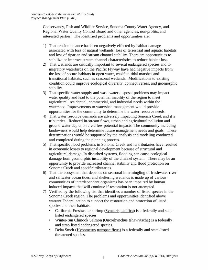
1) That erosion balance has been negatively effected by habitat damage
associated with loss of natural wetlands, loss of terrestrial and aquatic habitats and loss of riparian and stream channel stability. There are opportunities to stabilize or improve stream channel characteristics to reduce habitat loss.
2) That wetlands are critically important to several endangered species and to migratory waterbirds on the Pacific Flyway have had negative impacts from the loss of secure habitats in open water, mudflat, tidal marshes and transitional habitats, such as seasonal wetlands. Modifications to existing condition could improve ecological diversity, connectiveness, and geomorphic stability.
3) That specific water supply and wastewater disposal problems may impact water quality and lead to the potential inability of the region to meet agricultural, residential, commercial, and industrial needs within the watershed. Improvements to watershed management would provide opportunities for the community to determine the water resource needs.
4) That water resource demands are adversely impacting Sonoma Creek and it’s tributaries. Reduced in-stream flows, urban and agricultural pollution and ground water depletion are a few potential impacts. The community including landowners would help determine future management needs and goals. These determinations would be supported by the analysis and modeling conducted and completed during the planning process.
5) That specific flood problems in Sonoma Creek and its tributaries have resulted in economic losses to regional development because of structural and agricultural damage. In disturbed systems, flooding can cause ecological damage from geomorphic instability of the channel system. There may be an opportunity to provide increased channel stability and flood protection on Sonoma Creek and specific tributaries.
6) That the ecosystem that depends on seasonal intermingling of freshwater river and saltwater ocean tides, and sheltering wetlands is made up of various communities of interdependent organisms has been impaired by human induced impacts that will continue if restoration is not attempted.
7) Verified by the following list that identifies a number of listed species in the Sonoma Creek region. The problems and opportunities identified above warrant Federal action to support the restoration and protection of listed species and their habitats. • California Freshwater shrimp (Syncaris pacifica) is a federally and state-
listed endangered species. • Winter-run Chinook Salmon (Oncorhynchus tshawytscha) is a federally
and state- listed endangered species. • Delta Smelt (Hypomesus transpacificus) is a federally and state- listed
threatened species.

Sonoma Creek & Tributaries Feasibility Study Project Management Plan (PMP)
U.S Army Corps of Engineers Chapter 2 Section 905(b) (WRDA) Analysis 9
• Sacramento Splittail (Pogonichthys macrolepidotus ) is a proposed federal listing as threatened.
• Steelhead (Oncorhynchus gairdnerii) is federally listed as threatened. • California Brown Pelican (Pelecanus occidentalis) is a federally and state-
listed endangered species. • California Black Rail (Laterallus jamaicensis) is state- listed as threatened
and a federal species of concern. • California Clapper Rail (Rallus longirostris ) is a federally and state- listed
endangered species. • Western Snowy Plover (Charadrius alexandrinus) is a federally listed
threatened species and a CDFG species of special concern. • Salt Marsh Harvest Mouse (Reithrodontomys raviventris) is a federally
and state- listed endangered species. • Mason’s lilaeopsis (Lilaeopsis masonii) is a state rare species and a federal
species of concern. • Sebastopol Meadowfoam Limnanthes vinculans federally listed • Soft Bird’s-beak (Cordylanthus mollis ssp mollis) is a state- listed as rare
and is proposed for listing federally as an endangered species. • Contra Costa goldfields (Lasthenia conjugens) is a federal proposed
endangered species • Other plants associated with estuarine wetland habitats and their edges,
which are now rare in the San Pablo Bay marshes, include Senecio hydrophilus, Sium suave, Castilleja ambigua, Lasthenia glabrata, Lasthenia platycarpha, Cicuta maculata, Aster lentus, Aster chilensis (tidal marsh ecotypes), and Lathyrus jepsonii var.jepsonii
d. Planning Objectives:
The water and related land resource problems and opportunities identified in this study are stated as specific planning objectives to provide focus for the formulation of alternatives. These planning objectives reflect the problems and opportunities and represent desired positive changes. The planning objectives are specified as follows:
1) Wetland restoration in Sonoma Creek and its tributaries could increase
the wetland area in California. Loss of natural wetlands may be addressed by “reach of stream” initiatives in which entire sections of stream ecosystems may be positively effected via cons truction of replacement wetlands and protection from additional pollution. The objective would be to evaluate the creation of habitats that would increase the biodiversity values and habitat protection for the watersheds endangered aquatic and upland communities. By linking other uses such as agriculture, wastewater discharge, dredge material disposal, and recreation, a multi-objective approach to wetland restoration could be achieved.
2) Flood protection would economically benefit the watershed. Flood protection will be part of the multi-objective restoration goals to prevent loss of property and to better manage our natural resources. Positive hydromodification

Sonoma Creek & Tributaries Feasibility Study Project Management Plan (PMP)
U.S Army Corps of Engineers Chapter 2 Section 905(b) (WRDA) Analysis 10
evaluation for upland and wetland areas in the watershed would assist in identifying the measures necessary to meet this objective.
3) Disposal sites for dredged material are of critical importance for the economic stability of the area. The diked baylands have the potential of providing long term disposal sites as a part of the environmental benefits of wetland creation. Many of the diked and drained wetlands in the Baylands have subsided to several feet below sea level. The placement of dredged materials in these areas could accelerate the restoration of tidal wetlands. Identifying the means to increase wetland restoration through the proper dredged material disposal would be an objective of the feasibility study with the support of the local community.
4) One of the objectives of the feasibility study would be to develop watershed mapping that identifies sediment sources and the upland effects on the stream network, including storm drain systems and culverts. From this evaluation, a model could be created that shows how changes in drainage and sediment supply will effect peak flows, to enable the local community to understand the current situations and the impacts of future watershed managment changes to downstream flooding. Also, the modeling could assist in the testing of future restoration scenarios.
5) Recent technology has demonstrated that urban and rural detention basins can greatly reduce non-point pollution. With the responsive nature of the ecosystem, additional freshwater and saltwater fish communities may be lost if non-point discharge problems are not remediated. Retention basins, however, can alter the routing of sediment and potentially increase incision of the downstream channel bed. An objective of the feasibility study would be to identify ways to decrease sedimentation of the waterways resulting from increases in urban and agricultural development. Local and regional cooperation will be required to improve management practices. One of the best ways to deal with high rates of sedimentation is to stabilize the sources of sediment supply. This may require stability efforts and best management practices in the headwater stream, steep hillslopes and valleys
6) In order to ensure that a reliable public water supply is available, future cooperation and multipurpose use of the existing systems may be necessary. The objective would be to positively effect aquatic and terrestrial habitat by providing regional coordination and planning of water resource issues in the watershed. An option being considered by water supply and wastewater discharge agencies is to use treated wastewater for agricultural production and managed wetlands. Increasing regulation of wastewater (point source) discharge will require cooperation between municipal agencies and the local communities.
7) Changes in future watershed management practices may effect both peak and base flows. Increased development may impact water reliability. Locally supported limitations on water resource development and urban growth amount or quantity would be an objective of the planning process to minimize further adverse environmental impacts to Sonoma Creek and tributaries. Protection of ground water tables would be an objective of the
Sonoma Creek & Tributaries Feasibility Study Project Management Plan (PMP)
U.S Army Corps of Engineers Chapter 2 Section 905(b) (WRDA) Analysis 11
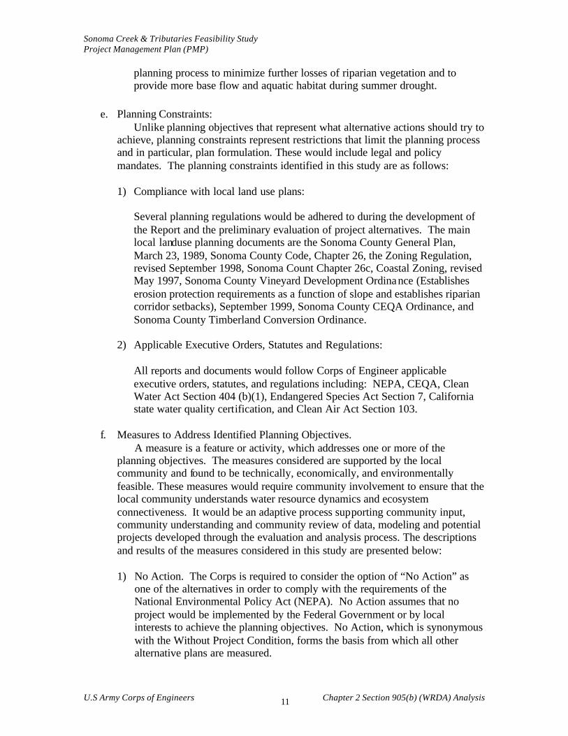
planning process to minimize further losses of riparian vegetation and to provide more base flow and aquatic habitat during summer drought.
e. Planning Constraints:
Unlike planning objectives that represent what alternative actions should try to achieve, planning constraints represent restrictions that limit the planning process and in particular, plan formulation. These would include legal and policy mandates. The planning constraints identified in this study are as follows:
1) Compliance with local land use plans:
Several planning regulations would be adhered to during the development of the Report and the preliminary evaluation of project alternatives. The main local landuse planning documents are the Sonoma County General Plan, March 23, 1989, Sonoma County Code, Chapter 26, the Zoning Regulation, revised September 1998, Sonoma Count Chapter 26c, Coastal Zoning, revised May 1997, Sonoma County Vineyard Development Ordinance (Establishes erosion protection requirements as a function of slope and establishes riparian corridor setbacks), September 1999, Sonoma County CEQA Ordinance, and Sonoma County Timberland Conversion Ordinance.
2) Applicable Executive Orders, Statutes and Regulations:
All reports and documents would follow Corps of Engineer applicable executive orders, statutes, and regulations including: NEPA, CEQA, Clean Water Act Section 404 (b)(1), Endangered Species Act Section 7, California state water quality certification, and Clean Air Act Section 103.
f. Measures to Address Identified Planning Objectives.
A measure is a feature or activity, which addresses one or more of the planning objectives. The measures considered are supported by the local community and found to be technically, economically, and environmentally feasible. These measures would require community involvement to ensure that the local community understands water resource dynamics and ecosystem connectiveness. It would be an adaptive process supporting community input, community understanding and community review of data, modeling and potential projects developed through the evaluation and analysis process. The descriptions and results of the measures considered in this study are presented below:
1) No Action. The Corps is required to consider the option of “No Action” as
one of the alternatives in order to comply with the requirements of the National Environmental Policy Act (NEPA). No Action assumes that no project would be implemented by the Federal Government or by local interests to achieve the planning objectives. No Action, which is synonymous with the Without Project Condition, forms the basis from which all other alternative plans are measured.
Sonoma Creek & Tributaries Feasibility Study Project Management Plan (PMP)
U.S Army Corps of Engineers Chapter 2 Section 905(b) (WRDA) Analysis 12
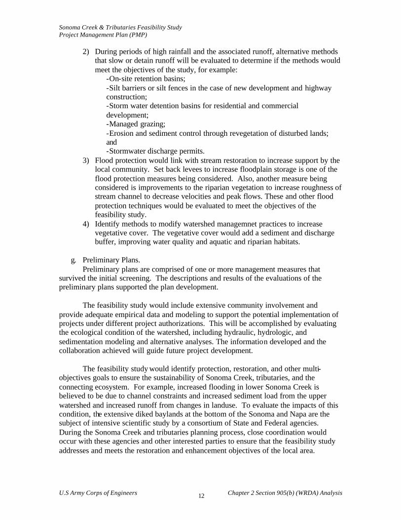
2) During periods of high rainfall and the associated runoff, alternative methods that slow or detain runoff will be evaluated to determine if the methods would meet the objectives of the study, for example:
-On-site retention basins; -Silt barriers or silt fences in the case of new development and highway construction; -Storm water detention basins for residential and commercial development; -Managed grazing; -Erosion and sediment control through revegetation of disturbed lands; and -Stormwater discharge permits.
3) Flood protection would link with stream restoration to increase support by the local community. Set back levees to increase floodplain storage is one of the flood protection measures being considered. Also, another measure being considered is improvements to the riparian vegetation to increase roughness of stream channel to decrease velocities and peak flows. These and other flood protection techniques would be evaluated to meet the objectives of the feasibility study.
4) Identify methods to modify watershed managemnet practices to increase vegetative cover. The vegetative cover would add a sediment and discharge buffer, improving water quality and aquatic and riparian habitats.
g. Preliminary Plans.
Preliminary plans are comprised of one or more management measures that survived the initial screening. The descriptions and results of the evaluations of the preliminary plans supported the plan development.
The feasibility study would include extensive community involvement and
provide adequate empirical data and modeling to support the potential implementation of projects under different project authorizations. This will be accomplished by evaluating the ecological condition of the watershed, including hydraulic, hydrologic, and sedimentation modeling and alternative analyses. The information developed and the collaboration achieved will guide future project development.
The feasibility study would identify protection, restoration, and other multi-
objectives goals to ensure the sustainability of Sonoma Creek, tributaries, and the connecting ecosystem. For example, increased flooding in lower Sonoma Creek is believed to be due to channel constraints and increased sediment load from the upper watershed and increased runoff from changes in landuse. To evaluate the impacts of this condition, the extensive diked baylands at the bottom of the Sonoma and Napa are the subject of intensive scientific study by a consortium of State and Federal agencies. During the Sonoma Creek and tributaries planning process, close coordination would occur with these agencies and other interested parties to ensure that the feasibility study addresses and meets the restoration and enhancement objectives of the local area.
Sonoma Creek & Tributaries Feasibility Study Project Management Plan (PMP)
U.S Army Corps of Engineers Chapter 2 Section 905(b) (WRDA) Analysis 13
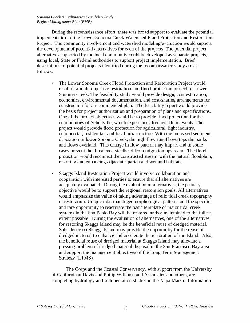
During the reconnaissance effort, there was broad support to evaluate the potential implementation of the Lower Sonoma Creek Watershed Flood Protection and Restoration Project. The community involvement and watershed modeling/evaluation would support the development of potential alternatives for each of the projects. The potential project alternatives supported by the local community could be developed as separate projects, using local, State or Federal authorities to support project implementation. Brief descriptions of potential projects identified during the reconnaissance study are as follows:
• The Lower Sonoma Creek Flood Protection and Restoration Project would result in a multi-objective restoration and flood protection project for lower Sonoma Creek. The feasibility study would provide design, cost estimation, economics, environmental documentation, and cost-sharing arrangements for construction for a recommended plan. The feasibility report would provide the basis for project authorization and preparation of plans and specifications. One of the project objectives would be to provide flood protection for the communities of Schellville, which experiences frequent flood events. The project would provide flood protection for agricultural, light industry, commercial, residential, and local infrastructure. With the increased sediment deposition in lower Sonoma Creek, the high flow runoff overtops the banks and flows overland. This change in flow pattern may impact and in some cases prevent the threatened steelhead from migration upstream. The flood protection would reconnect the constructed stream with the natural floodplain, restoring and enhancing adjacent riparian and wetland habitats.
• Skaggs Island Restoration Project would involve collaboration and cooperation with interested parties to ensure that all alternatives are adequately evaluated. During the evaluation of alternatives, the primary objective would be to support the regional restoration goals. All alternatives would emphasize the value of taking advantage of relic tidal creek topography in restoration. Unique tidal marsh geomorphological patterns and the specific and rare opportunity to reactivate the basic template of major tidal creek systems in the San Pablo Bay will be restored and/or maintained to the fullest extent possible. During the evaluation of alternatives, one of the alternatives for restoring Skaggs Island may be the beneficial reuse of dredged material. Subsidence on Skaggs Island may provide the opportunity for the reuse of dredged material to enhance and accelerate the restoration of the Island. Also, the beneficial reuse of dredged material at Skaggs Island may alleviate a pressing problem of dredged material disposal in the San Francisco Bay area and support the management objectives of the Long Term Management Strategy (LTMS).
The Corps and the Coastal Conservancy, with support from the University
of California at Davis and Philip Williams and Associates and others, are completing hydrology and sedimentation studies in the Napa Marsh. Information
Sonoma Creek & Tributaries Feasibility Study Project Management Plan (PMP)
U.S Army Corps of Engineers Chapter 2 Section 905(b) (WRDA) Analysis 14
form these hydrologic and sedimentation studies could serve to support projects in Sonoma Creek Marsh and connecting Baylands.
h. Conclusions from the Preliminary Screening.
The conclusions from the preliminary screening forms the basis for the next iteration of the planning steps that will be conducted in the feasibility phase. The likely array of alternatives that will be considered in the next iteration include flood plain restoration, setback levees for flood protection and stream channel restoration, beneficial reuse of dredged material, and geomorphic modifications to protect, restore, and enhance Sonoma Creek and tributaries and listed species. The potential magnitude and types of benefits from the proposed actions would include the restoration of over 14,000 acres of tidal, seasonal, and fresh water wetlands; environmental enhancement of 10 to 50 miles of riparian corridor; and significant benefits to over 20 threatened or endangered listed species. Also, there would be significant economic and environmental benefit for the community and the surrounding area of Schellville by providing flood protection linked with ecosystem restoration.
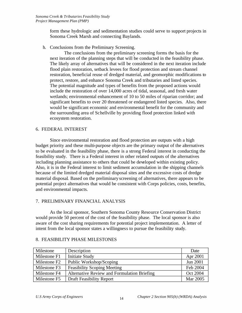
6. FEDERAL INTEREST Since environmental restoration and flood protection are outputs with a high budget priority and these multi-purpose objects are the primary output of the alternatives to be evaluated in the feasibility phase, there is a strong Federal interest in conducting the feasibility study. There is a Federal interest in other related outputs of the alternatives including planning assistance to others that could be developed within existing policy. Also, it is in the Federal interest to limit sediment accumulation in the shipping channels because of the limited dredged material disposal sites and the excessive costs of dredge material disposal. Based on the preliminary screening of alternatives, there appears to be potential project alternatives that would be consistent with Corps policies, costs, benefits, and environmental impacts. 7. PRELIMINARY FINANCIAL ANALYSIS As the local sponsor, Southern Sonoma County Resource Conservation District would provide 50 percent of the cost of the feasibility phase. The local sponsor is also aware of the cost sharing requirements for potential project implementation. A letter of intent from the local sponsor states a willingness to pursue the feasibility study. 8. FEASIBILITY PHASE MILESTONES Milestone Description Date Milestone F1 Initiate Study Apr 2001 Milestone F2 Public Workshop/Scoping Jun 2001 Milestone F3 Feasibility Scoping Meeting Feb 2004 Milestone F4 Alternative Review and Formulation Briefing Oct 2004 Milestone F5 Draft Feasibility Report Mar 2005
Sonoma Creek & Tributaries Feasibility Study Project Management Plan (PMP)
U.S Army Corps of Engineers Chapter 2 Section 905(b) (WRDA) Analysis 15
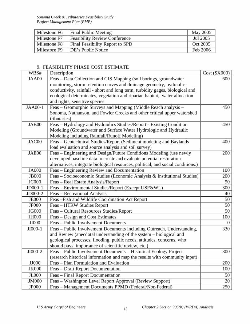
Milestone F6 Final Public Meeting May 2005 Milestone F7 Feasibility Review Conference Jul 2005 Milestone F8 Final Feasibility Report to SPD Oct 2005 Milestone F9 DE’s Public Notice Feb 2006 9. FEASIBILITY PHASE COST ESTIMATE
WBS# Description Cost ($X000) JAA00 Feas – Data Collection and GIS Mapping (soil borings, groundwater
monitoring, storm retention curves and drainage geometry, hydraulic conductivity, rainfall - short and long term, turbidity gages, biological and ecological determinates, vegetation and riparian habitat, water allocation and rights, sensitive species
600
JAA00-1 Feas – Geomorphic Surveys and Mapping (Middle Reach analysis – Sonoma, Nathanson, and Fowler Creeks and other critical upper watershed tributaries)
450
JAB00 Feas – Hydrology and Hydraulics Studies/Report - Existing Condition Modeling (Groundwater and Surface Water Hydrologic and Hydraulic Modeling including Rainfall/Runoff Modeling)
450
JAC00 Feas – Geotechnical Studies/Report (Sediment modeling and Baylands load evaluation and source analysis and soil survey)
400
JAE00 Feas – Engineering and Design/Future Conditions Modeling (use newly developed baseline data to create and evaluate potential restoration alternatives, integrate biological resources, political, and social conditions.)
200
JA000 Feas – Engineering Review and Documentation 100 JB000 Feas – Socioeconomic Studies (Economic Analysis & Institutional Studies) 200 JC000 Feas – Real Estate Analysis/Report 50
JD000-1 Feas – Environmental Studies/Report (Except USF&WL) 300 JD000-2 Feas – Recreational Analysis 40 JE000 Feas –Fish and Wildlife Coordination Act Report 50 JF000 Feas – HTRW Studies Report 50 JG000 Feas – Cultural Resources Studies/Report 50 JH000 Feas – Design and Cost Estimates 100 JI000 Feas – Public Involvement Documents 0
JI000-1 Feas – Public Involvement Documents including Outreach, Understanding, and Review (anecdotal understanding of the system – biological and geological processes, flooding, public needs, attitudes, concerns, who should pays, importance of scientific review, etc.)
330
JI000-2 Feas – Public Involvement Documents – Historical Ecology Project (research historical information and map the results with community input)
300
JJ000 Feas – Plan Formulation and Evaluation 200 JK000 Feas – Draft Report Documentation 100 JL000 Feas – Final Report Documentation 50 JM000 Feas – Washington Level Report Approval (Review Support) 20 JP000 Feas – Management Documents PPMD (Federal/Non-Federal) 250

Sonoma Creek & Tributaries Feasibility Study Project Management Plan (PMP)
U.S Army Corps of Engineers Chapter 2 Section 905(b) (WRDA) Analysis 16
LA000 Feas – Planning/Engineering Admin 100 JJ000 Feas – Quality Control Documentation 60
Feas – Contingencies 50 TOTAL 4500
10. VIEWS OF OTHER RESOURCE AGENCIES Input was received through coordination with the Sonoma Ecology Center, Sonoma Valley Vintners and Growers Alliance, San Francisco Estuary Institute, Environmental Protection Agency, Department of Fish and Game, Coastal Conservancy, Fish and Wildlife Service, and Regional Water Quality Control Board and other agencies, non-profits, and interested parties. Views that have been expressed are as follows:
a. The CALFED Bay-Delta Program supports the Sonoma Creek and Tributaries feasibility study as it is consistent with CALFED’s vision of restoring large patches of tidal marsh along San Pablo Bay, restoring tidal marsh along Sonoma Creek, establishing managed marsh or enhanced seasonal pond habitat for shorebirds, enhancing riparian habitat along Sonoma Creek, and enhancing marsh/upland transitional habitats.
b. The San Francisco Bay Regional Water Quality Control Board and the U.S. Environmental Protection Agency are in the process of defining their Total Maximum Daily Load (TMDL) requirements for the Sonoma Creek watershed, as well as adjacent watersheds. There has been collaboration and input provided during the Sonoma Creek reconnaissance study to ensure the efficient use of public funds.
c. California Department of Fish and Game staff attended the outreach meetings and provided input to the development of the reconnaissance study documents. This interest is supported by the on-going feasibility study being implemented by the California Department of Fish and Game, the State Coastal Conservancy, and the Corps to restore over 8,000 acres to tidal marsh.
d. The State Coastal Conservancy is directly involved by provide funding for the Sonoma Creek and Tributaries feasibility study. The Coastal Conservancy is interested in being a project partner as the process moves forward.
11. POTENTIAL ISSUES AFFECTING INITIATION OF FEASIBILITY PHASE
a. Continuation of this study into the cost-shared feasibility phase is contingent upon an executed FCSA. Preliminary discussions with the potential sponsor indicates no issues which would preclude their signing of the Feasibility Cost Sharing Agreement. Failure to achieve an executed FCSA within 18 months of the approval date of the Section 905(b) Analysis may result in termination of the study. At this time, there are no apparent issues that impact on the implementation of the feasibility phase.
Sonoma Creek & Tributaries Feasibility Study Project Management Plan (PMP)
U.S Army Corps of Engineers Chapter 2 Section 905(b) (WRDA) Analysis 17
b. The schedule for signing the Feasibility Cost Sharing Agreement (FCSA) is
February 2001. Based on the schedule of milestones and tasks in Paragraph 8 and 9, identification of the potential projects and completion of the feasibility report would be September 2007, with a potential Congressional Authorization for separate projects in a WRDA 2006 and/or WRDA 2008, respectively.
12. PROJECT AREA MAP A map of the study area is provided as Enclosure A. 13. LETTER OF INTENT
A letter of intent is provided as Enclosure E. 14. RECOMMENDATIONS I recommend that the Sonoma Creek and Tributaries proceed into the feasibility phase.
26 September 2000 Timothy S. O’Rouke Lieutenant Colonel, Corps of Engineers District Engineer


Sonoma Creek & Tributaries Feasibility Study Project Management Plan (PMP)
U.S Army Corps of Engineers Chapter 3 Work Breakdown Structure
20
Assessment Tools: Conceptualization Modeling Reference Sites Historical Analysis
Preliminary Understanding of
Alterations, Problems, Objectives and Goals
Project Team: Corps RCD SFEI SEC PWA
Stakeholders
Work Products
STEP 1
Establish Baseline Conditions
Physical Processes Hydrology Hydraulics Sediment Regime Tidal System Geomorphic
Biotic Processes Vegetation Wildlife Aquatic Habitat Fisheries
Water Quality Suspended Sediments Chemical Physical
Land Use / Economics Rural Urban
Identify Watershed Management Structure
Stakeholders Identify Key Groups & Individuals Identify Process for Inclusion During Planning Process Longer Term
Regulatory Agencies Identity Roles & Responsibility
Funding Agencies/ Implementation Groups
RCD, SEC, Stakeholders
Watershed Baseline Conditions Report
STEP 2 STEP 6 STEP 5 STEP 4 STEP 3
Project Refinement Project Alternatives/Options Management Plan Implementation Adaptive Management
Description of Impact/Losses & Watershed Problems
Refinement of Watershed Baseline Conditions in an Opportunity & Constraints Analysis
Refinement of Project Goals and Objectives
Stakeholder Input
Regulatory Issues
Project Goals & Spec. Objectives (Opps/Constraints/Analysis Report)
Ongoing Monitoring, Recommendations and
Refinements
Project Constructed Watershed Management PlanProject Options & Alternatives
Regulatory Issues
Stakeholder Input
Preliminary Proj. Costs/Funding
Project Options Identified by Scale:
Watershed Scale Sub-watershed Scale Channel Scale Tidal Zone Options
Project Options Identified by Objective: e.g.
Flood Hazard Reduction Watershed Sediment Reduction Channel Restoration WQ Improvements Groundwater
Develop the Preferred Plan:
• Elements • Priorities • Phasing • Funding
Implementation
Permitting
Funding
Monitoring Activities
Adaptive Management Programs
Future Plan Revision
SOURCE: Phillip Williams & Associates
Sonoma Creek & Tributaries Feasibility Study Project Management Plan (PMP)
U.S Army Corps of Engineers Chapter 4 Scope of Work
21
CHAPTER 4
SCOPE OF WORK
The following is a description of the major tasks to be completed, as necessary, during the development of the Report. These tasks would support the on-going activities in the Sonoma Creek watershed. Existing scientific and technical data will be used when available and where information is not available, new scientific and technical research will be undertaken as necessary to ensure that the appropriate data is available to support restoration opportunities identified during the feasibility study. The development of flood protection and restoration project(s) in Sonoma Creek watershed will be supported by the development of the Report. The reconnaissance effort identified a project that had broad support for potential implementation, a lower Sonoma Creek watershed flood protection and restoration project. The following tasks support the potential future implementation of this combination flood protection and restoration project. Flood protection for the local community, restoration of critical wetland and riparian habitats, and other goals will be possible with the implementation of the Report. The first step is to develop detailed models of hydrology and hydraulics, ecological functions, and flood damage assessments analyses of critical areas in the watershed. From these analyses, alternatives will be developed to restore, protect, and enhance wetlands and riverine systems in the watershed. They may include rerouting flood waters by constructing weirs, setting back levees, constructing new levees, and building up existing levees for flood protection. The alternatives may include the acquisition of priority sites by project partners when there is a willing seller. The Corps completed a field survey of a portion of the watershed in 1957, which will add to local historical data for Report development. The watershed analyses, the existing research data, and other engineering, scientific, and planning tasks will provide the necessary tools to develop alternatives for implement ing flood protection and restoration in the Sonoma Creek watershed. The analyses will augment the methods of assessing water and sediment supplies of on-going evaluations taking place in the region.
The following tasks will be completed, as appropriate, to provide the information required for the future development of a flood protection and/or restoration project(s) in the lower Sonoma Creek watershed. The proposed tasks cover numerous aspects pertaining to a determination of the most appropriate flood protection and restoration alternative. Community input and funding will determine the scope of project development. 4.1 PLANNING TASKS
The data required to support the development of the Report and the project
alternatives will be available to the public on the internet. A website will support public involvement as described in Chapter 10. A report of existing data was completed by San

Sonoma Creek & Tributaries Feasibility Study Project Management Plan (PMP)
U.S Army Corps of Engineers Chapter 4 Scope of Work
22
Francisco Estuary Institute during the reconnaissance study, www.spn.usace.army.mil/sonoma creek. During the feasibility study, existing data will be further evaluated, as necessary, to support economically sustainable ecosystem restoration and protection strategies with benefits for flood protection, erosion control, sedimentation management, and pollution abatement. The Corps and the RCD, with input from the Technical Team, see Chapter 8, would identify and develop important data needs as they relate to project development and assessment and planning objectives of the local community. The Technical Team would present project findings to the local community and set priorities for data development and/or monitoring activities and future development of flood protection and restoration projects.
4.1.1 (JAA00) Physical Data Collection and Analyses to Support Flood Protection &
Ecological Restoration
4.1.1.1 (JAA00-1) Fluvial and Geomorphic Processes Analyses Geomorphic and fluvial processes component for the Report will provide an
understanding of how watershed management practices affect the spatial and temporal supply and distribution of water and sediment throughout the watershed. The investigation will provide an understanding of why specific creeks look as they do, why they may flood or appear unstable, and the effects within the lower Sonoma Creek watershed. The basic objectives are to 1) determine the major sources of sediment in the watershed, the location of the sources, and the geomorphic processes associated with supply within the project area; 2) determine if the magnitude of supply, significance of different processes, or location of sediment source has changed; 3) determine how supply and demand of surface water, surface water runoff, and groundwater may have changed within the project area; 4) determine if channel capacity to transport or store water and sediment has changed within the project area; 5) determine the effects of land alterations in the marshlands on the conveyance of upland flood waters and sediment transported to the San Pablo Bay and their impact on flood protection and restoration within the project area; and 6) assess the physical channel attributes that contribute to the diverse and viable habitat of the fluvial system.
Although a number of habitat parameters will be assessed within the biological components of the PMP, the following parameters will also be assessed within the geomorphic processes component: 1) large woody debris, its distribution and recruitment; 2) the presence and effectiveness of riparian vegetation on bank stability; 3) the low-flow distribution of pools and processes associated with their formation; and 4) the distribution and influence of fine sediments on channel bed characteristics. To achieve these objectives at different spatial scales in the watershed, two different methods of assessing sediment yield will be carried out as follows:
1. Review and analyze existing data, perform reconnaissance and determine sediment processes at the large-scale watershed level.
• Review available reports and maps pertaining to landslides, geology, seismicity, groundwater, and soils.
Sonoma Creek & Tributaries Feasibility Study Project Management Plan (PMP)
U.S Army Corps of Engineers Chapter 4 Scope of Work
23
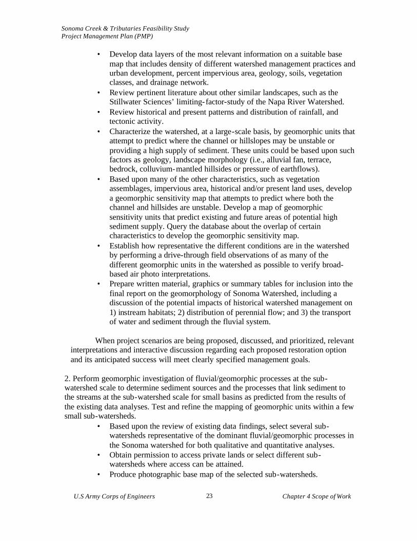
• Develop data layers of the most relevant information on a suitable base map that includes density of different watershed management practices and urban development, percent impervious area, geology, soils, vegetation classes, and drainage network.
• Review pertinent literature about other similar landscapes, such as the Stillwater Sciences’ limiting-factor-study of the Napa River Watershed.
• Review historical and present patterns and distribution of rainfall, and tectonic activity.
• Characterize the watershed, at a large-scale basis, by geomorphic units that attempt to predict where the channel or hillslopes may be unstable or providing a high supply of sediment. These units could be based upon such factors as geology, landscape morphology (i.e., alluvial fan, terrace, bedrock, colluvium-mantled hillsides or pressure of earthflows).
• Based upon many of the other characteristics, such as vegetation assemblages, impervious area, historical and/or present land uses, develop a geomorphic sensitivity map that attempts to predict where both the channel and hillsides are unstable. Develop a map of geomorphic sensitivity units that predict existing and future areas of potential high sediment supply. Query the database about the overlap of certain characteristics to develop the geomorphic sensitivity map.
• Establish how representative the different conditions are in the watershed by performing a drive-through field observations of as many of the different geomorphic units in the watershed as possible to verify broad-based air photo interpretations.
• Prepare written material, graphics or summary tables for inclusion into the final report on the geomorphology of Sonoma Watershed, including a discussion of the potential impacts of historical watershed management on 1) instream habitats; 2) distribution of perennial flow; and 3) the transport of water and sediment through the fluvial system.
When project scenarios are being proposed, discussed, and prioritized, relevant
interpretations and interactive discussion regarding each proposed restoration option and its anticipated success will meet clearly specified management goals.
2. Perform geomorphic investigation of fluvial/geomorphic processes at the sub-watershed scale to determine sediment sources and the processes that link sediment to the streams at the sub-watershed scale for small basins as predicted from the results of the existing data analyses. Test and refine the mapping of geomorphic units within a few small sub-watersheds.
• Based upon the review of existing data findings, select several sub-watersheds representative of the dominant fluvial/geomorphic processes in the Sonoma watershed for both qualitative and quantitative analyses.
• Obtain permission to access private lands or select different sub-watersheds where access can be attained.
• Produce photographic base map of the selected sub-watersheds.

Sonoma Creek & Tributaries Feasibility Study Project Management Plan (PMP)
U.S Army Corps of Engineers Chapter 4 Scope of Work
24
• Gather all localized detailed information on geology, soils, landslides, faults, rainfall, and stream flow.
• Using recent and historical aerial photographs, map the active and inactive landslides, gullies, headward extension of the drainage network, and extent of dirt roads and trails in the selected sub-watersheds. Landslides should be classified as to whether they are earthflow or debris flow-type slides, and noted as to whether they supply sediment to a stream.
• Compare new information to the GIS data layer on published landslides from existing data. Develop a confidence rating, if possible, for preexisting information.
• Verify aerial photo interpretation maps of landslides, gullying and headward extension of streams by conducting a more detailed field reconnaissance. Start with questionable areas and from these determine the coverage necessary for field verification. Perform ground-truthing in various areas of the sub-watersheds to determine volume of sediment supplied from the hillsides to the channels.
• Walk the length of as much of the mainstem channel as possible to qualitatively assess its condition, i.e., whether it is stable, incising, aggrading, laterally migrating at an accelerated rate, perennial or intermittent, general size of bed sediment, and whether there is available habitat and riparian overstory.
• During fieldwork and aerial photo mapping refine the information on extent of roads and trails and provide information to GIS Team.
• Using the GIS base map and digital road maps, estimate the area of roads and other impermeable surfaces within the study areas.
• Compile newly developed historical and recent watershed management information and provide them with evolving questions about sub-watershed history.
• Analyze quantitative and qualitative information to determine if there are accelerated rates of landsliding and surface erosion processes. Discuss possible changes in dominance of different geomorphic processes, sources of sediment, discharge, and rates of erosion.
• To the extent possible, estimate the proportion of these changes associated with human activities.
• Using the information gained from field observations at the sub-watershed scale, add to or modify hypotheses or conclusions generated by the watershed scale review and analysis of existing data.
• Prepare and interim report which will include written material, graphics or summary tables for the final report on the geomorphology of Sonoma Watershed.
4.1.1.2 (JAA00-2) Channel Geomorphology Evaluation
The geomorphic processes assessment for the lower Sonoma Creek watershed will provide analyses, with supporting data, that describes processes affecting the fluvial
Sonoma Creek & Tributaries Feasibility Study Project Management Plan (PMP)
U.S Army Corps of Engineers Chapter 4 Scope of Work
25
system to its transition with the tidal system of the Baylands. The tasks for this work item will assess the reconnaissance study documentation of existing information, www.sdn.usace.army .mil/sonomacreek, to ensure redundancy of effort does not occur. The task will focus on addressing the needs of project development, as follows:
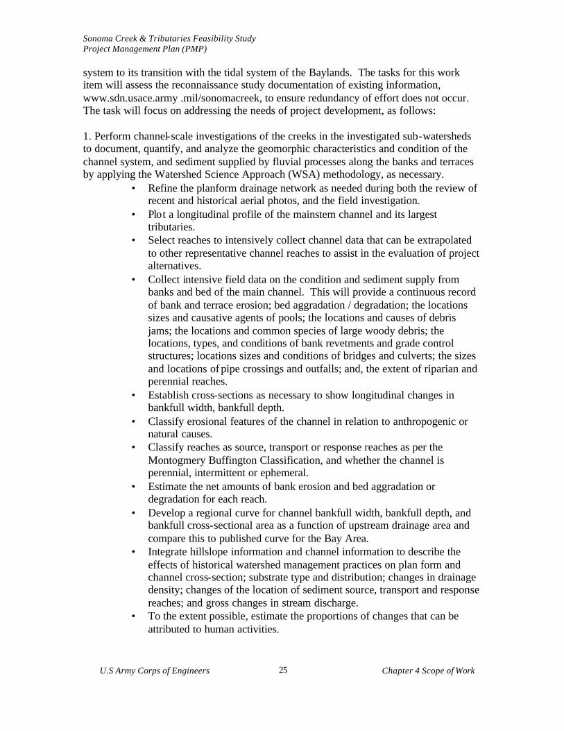
1. Perform channel-scale investigations of the creeks in the investigated sub-watersheds to document, quantify, and analyze the geomorphic characteristics and condition of the channel system, and sediment supplied by fluvial processes along the banks and terraces by applying the Watershed Science Approach (WSA) methodology, as necessary.
• Refine the planform drainage network as needed during both the review of recent and historical aerial photos, and the field investigation.
• Plot a longitudinal profile of the mainstem channel and its largest tributaries.
• Select reaches to intensively collect channel data that can be extrapolated to other representative channel reaches to assist in the evaluation of project alternatives.
• Collect intensive field data on the condition and sediment supply from banks and bed of the main channel. This will provide a continuous record of bank and terrace erosion; bed aggradation / degradation; the locations sizes and causative agents of pools; the locations and causes of debris jams; the locations and common species of large woody debris; the locations, types, and conditions of bank revetments and grade control structures; locations sizes and conditions of bridges and culverts; the sizes and locations of pipe crossings and outfalls; and, the extent of riparian and perennial reaches.
• Establish cross-sections as necessary to show longitudinal changes in bankfull width, bankfull depth.
• Classify erosional features of the channel in relation to anthropogenic or natural causes.
• Classify reaches as source, transport or response reaches as per the Montogmery Buffington Classification, and whether the channel is perennial, intermittent or ephemeral.
• Estimate the net amounts of bank erosion and bed aggradation or degradation for each reach.
• Develop a regional curve for channel bankfull width, bankfull depth, and bankfull cross-sectional area as a function of upstream drainage area and compare this to published curve for the Bay Area.
• Integrate hillslope information and channel information to describe the effects of historical watershed management practices on plan form and channel cross-section; substrate type and distribution; changes in drainage density; changes of the location of sediment source, transport and response reaches; and gross changes in stream discharge.
• To the extent possible, estimate the proportions of changes that can be attributed to human activities.
Sonoma Creek & Tributaries Feasibility Study Project Management Plan (PMP)
U.S Army Corps of Engineers Chapter 4 Scope of Work
26
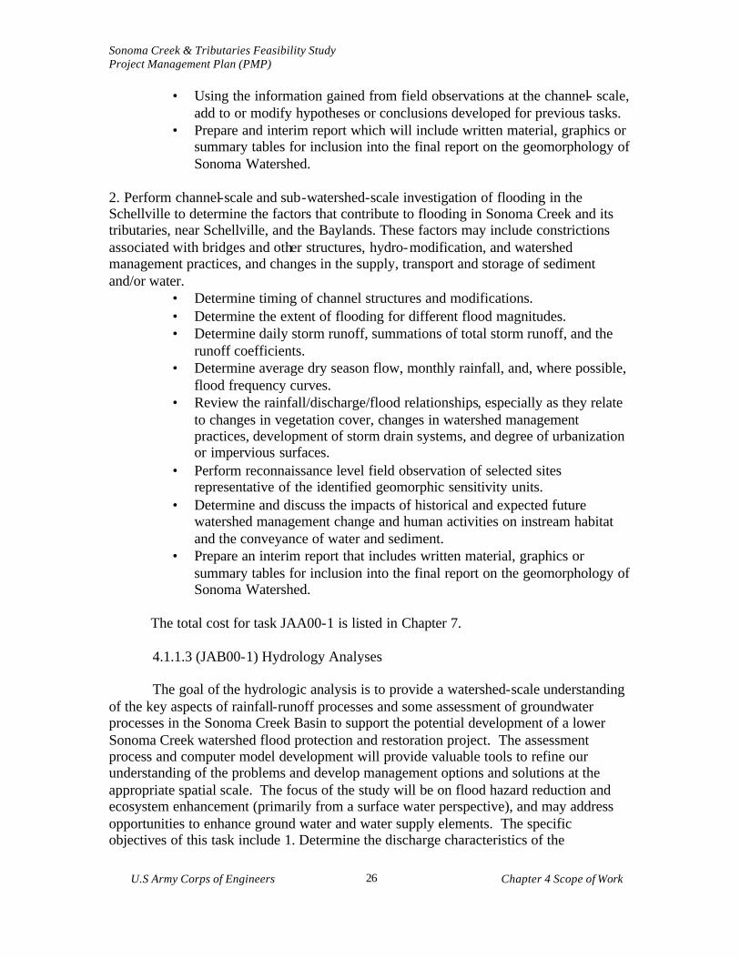
• Using the information gained from field observations at the channel- scale, add to or modify hypotheses or conclusions developed for previous tasks.
• Prepare and interim report which will include written material, graphics or summary tables for inclusion into the final report on the geomorphology of Sonoma Watershed.
2. Perform channel-scale and sub-watershed-scale investigation of flooding in the Schellville to determine the factors that contribute to flooding in Sonoma Creek and its tributaries, near Schellville, and the Baylands. These factors may include constrictions associated with bridges and other structures, hydro-modification, and watershed management practices, and changes in the supply, transport and storage of sediment and/or water.
• Determine timing of channel structures and modifications. • Determine the extent of flooding for different flood magnitudes. • Determine daily storm runoff, summations of total storm runoff, and the
runoff coefficients. • Determine average dry season flow, monthly rainfall, and, where possible,
flood frequency curves. • Review the rainfall/discharge/flood relationships, especially as they relate
to changes in vegetation cover, changes in watershed management practices, development of storm drain systems, and degree of urbanization or impervious surfaces.
• Perform reconnaissance level field observation of selected sites representative of the identified geomorphic sensitivity units.
• Determine and discuss the impacts of historical and expected future watershed management change and human activities on instream habitat and the conveyance of water and sediment.
• Prepare an interim report that includes written material, graphics or summary tables for inclusion into the final report on the geomorphology of Sonoma Watershed.
The total cost for task JAA00-1 is listed in Chapter 7.
4.1.1.3 (JAB00-1) Hydrology Analyses The goal of the hydrologic analysis is to provide a watershed-scale understanding
of the key aspects of rainfall-runoff processes and some assessment of groundwater processes in the Sonoma Creek Basin to support the potential development of a lower Sonoma Creek watershed flood protection and restoration project. The assessment process and computer model development will provide valuable tools to refine our understanding of the problems and develop management options and solutions at the appropriate spatial scale. The focus of the study will be on flood hazard reduction and ecosystem enhancement (primarily from a surface water perspective), and may address opportunities to enhance ground water and water supply elements. The specific objectives of this task include 1. Determine the discharge characteristics of the
Sonoma Creek & Tributaries Feasibility Study Project Management Plan (PMP)
U.S Army Corps of Engineers Chapter 4 Scope of Work
27
subwatersheds that flow into the Schellville area and Sonoma Baylands and therefore directly contribute to flooding and channel stability, 2. On a broader, channel-system scale, identify the role of altered hydrology as it affects channel stability. 3. Combine the hydrologic results with the watershed and channel geomorphic studies to provide an integrated understanding of spatial extent and severity of problems. 4. Provide input on water quality issues with the cooperation of the local community and local, State, and Federal agencies. 5. On a longer temporal scale and with community input, develop an understanding of the water budget for groundwater issues, including opportunities for recharge.
Data acquisition will include the information on a GIS base of appropriate topographic, soils, land cover, watershed management, and climatic (precipitation, evaporation etc.) required to characterize the watershed and provide input parameters for the selected hydrologic model. Additional field data collection may include flow gauging; soil borings, rainfall intensity, and any other data that may be required to develop a hydrologic model suitable for evaluating low flow and high flow events.
The hydrologic model or models selected for use on the project employed for this task should be capable of integrating with the hydraulic and sediment transport, groundwater and tidal models and information management systems (i.e.: GIS). Traditionally, event-based, “lumped” models have been used for flood hazard assessment, while continuous models have been used for various other watershed scale assessments. It would be desirable to develop a versatile model of the watershed which can be used as a tool to address a wide range of the above discussed management issues (flood hazards, low-flows, channel forming flows, water quality, groundwater issues etc. During the initial project refinement, members of the technical team will review a variety of models and make recommendations to the local community on further action. Information developed with the hydrologic model will be used to support the development of recommendations for ecosystem restoration and flood protection associated with Sonoma Creek and tributaries. Specific actions completed in this task will include, as necessary:
• Compilation and review of previous studies, definition of the historic hydrological conditions (including local landowner input). Where data gaps exist, new information will be developed to support project objectives.
• Existing precipitation records (USGS and other data sources) will be utilized to develop a synthetic precipitation record that reflects the known multi-year range of precipitation patterns inclusive of drought, below normal, normal, above normal and El Nino years.
• A rainfall-runoff model will be selected and developed to predict peak discharges and to generate hydrographs at key locations along the stream. Historic conditions, current conditions and projected future conditions (absent of proposed project components) will be evaluated.
• Frequency-discharge relationships at designated locations will be determined.

Sonoma Creek & Tributaries Feasibility Study Project Management Plan (PMP)
U.S Army Corps of Engineers Chapter 4 Scope of Work
28
The total cost for task JAB00-1 is listed in Chapter 7.
4.1.1.4 (JAB00-2) Hydraulic Analyses
The goals of the hydraulic analysis are to provide flow characteristics at key points with the channel system to aid in the identification of flood hazard, sediment transport, channel erosion and deposition, and water quality issues. The analysis will support a HEC-RAS (or another appropriate application) effort, which will utilize in risk-based analysis for flood damage reduction. The hydraulic and hydrologic uncertainties will be integrated with economic uncertainties to calculate expected damage for the potential with- and without- project conditions. The specific objectives include:
1. Determine the flow characteristic of Sonoma Creek within a dynamic range that is representative of varying hydrologic conditions,
2. Determine the sediment transport characteristics of Sonoma Creek and the discharge of sediments (suspended and bed- load) to the Baylands.
3. Develop a tool suitable for evaluating the hydraulic affects associated with flood management and restoration options.
4. Integrate with the geomorphic assessment to refine the understanding of channel conditions.
5. Link with the lower reaches (tidal) study elements regarding flow, sediment and potential wetland restoration management options. Existing stream gage data from the United States Geological Survey (USGS) for in-watershed or nearby gages will be reviewed and analyzed as part of this task. New data collection may include collection of additional stream gage data at strategic locations, flow velocity measurements, collection and analysis of bed-load and suspended sediments and field reconnaissance to identify channel condition, erosion and sedimentation characteristics.
The model options for this task include the traditional HEC-1 model, which has
been used extensively for flood hazard assessment. However, this model is limited for use in low flow analysis, and is not valid in the tidal zone. The DHI MIKE 11 model is an integrated hydraulic and sediment transport model capable of interfacing with the hydrologic and tidal models and information management systems (GIS), and has recently been approved by FEMA for flood studies. Other more complex models are available for the tidal zone modeling (Mike 21, RMA-2, etc.). Specific task elements will include:
• Collection and analysis of data the USGS and Federal Emergency Management Administration, Sonoma County, Caltrans and other data sources.
• Compilation of stream cross-section, geomorphic, and vegetation, flood plain and other data into a reach based hydraulic model of Sonoma Creek and its tributaries.
• Model parameterization and calibration • Determination of major sources of sediment contribution and their causes; • Calculation of sediment/debris yields for selected concentration points; • Identification of stream reaches where aggradation/degradation is occurring;
Sonoma Creek & Tributaries Feasibility Study Project Management Plan (PMP)
U.S Army Corps of Engineers Chapter 4 Scope of Work
29
• Estimation of average scour depth and deposition for various flood frequencies and development of preliminary planning level design criteria for bridge foundations, bank stabilization and other flood improvement and restoration actions.
• Evaluation of flood reduction alternatives and conceptual designs and prioritizing actions by sub-reach.
• Development of a channel maintenance plan that identifies reaches where future channel maintenance would most likely be required, an estimation of the frequency, volume and limits of sediment remova l and appropriate revegetation methods consistent with the restoration objectives of the Report;
• Development of other needed evaluations to support the restoration needs of the watershed.
The total cost for task JAB00-2 is listed in Chapter 7. 4.1.1.5 (JAB00-3) Tidal Zone Modeling
Lower portions of Sonoma Creek transition into the Napa-Sonoma marsh complex prior to ultimate discharge to San Francisco Bay. In this zone, the hydraulic conditions result from a more complex interaction of both tidal and fluvial/watershed processes. Sediment and water delivered from the upper watershed are conveyed through a complex system of channels towards San Pablo Bay. The Sonoma Creek Watershed study work will interface with a number of prior and ongoing studies at various scales in San Pablo Bay, and the Napa Sonoma Marsh complex by the USGS, UC Davis and other local agencies/firms, i.e.: Phillip Williams and Associates
The modeling work for the watershed and creek will be extended into the tidal zone, either using a continuation of the upstream hydraulic model (if an unsteady flow model such as Mike 11 is being used), or separately modeled using an appropriate tidal system model to interface with the upstream modeling. This modeling will incorporate the tidal parameters of the lower system, and include the topographic data on tidal slough system geometry, cross-sectional data etc. Specific Tasks will include, as necessary:
• Identification of the lower channel system using existing data, air photos, maps etc.
• Cross-sectional channel data based on available information or surveyed cross-sections
• Tidal parameters, include tidal elevation regime, salinity data, sediment concentrations etc.
• Fluvial data input including watershed flows for various recurrence interval events, sediment inflow, etc.
Sonoma Creek & Tributaries Feasibility Study Project Management Plan (PMP)
U.S Army Corps of Engineers Chapter 4 Scope of Work
30
• Model identification, setup, parameterization, calibration, and runs. Integration of the model with the various spatial scales of relevance to the physical system, and focused on the issues of importance to Sonoma Creek.
• Problem assessment, opportunity and constraints analysis, project options and development of recommended management plans.
• Testing of expected plan element functioning.
The goal is to describe the ecology of the Baylands of the Sonoma Creek Watershed as necessary to support the development of a lower Sonoma Creek watershed flood protection and restoration project. The Baylands include tidal marshes, tidal flats, and diked marshes. The geographic scope of the work will include Baylands that are strongly influenced by the hydrology of Sonoma Creek. This scope extends upstream to the upper limits of tidal influence of water stage in Sonoma Creek, downstream to the lower limits of tidal flats at the mouth of Sonoma Creek in San Pablo Bay, west to the tidal reaches of Tolay Creek, and east to the tidal convergence zones between Sonoma Creek and the Napa River.
This task will include a written report detailing the historical and present distributions of key habitats and species (including native and invasive non-native species) and predictions of future distributions based on projected watershed management changes and restoration project scenarios.
The ecology of the Baylands is highly variable from season to season and year to year due to changes in water supplies that affect water salinity and Baylands hydroperiod, due to colonization and migration of wildlife, and due to changes in watershed management practice. This task will draw upon the findings of a number of other studies, as appropriate, of these Baylands, including the ecological surveys conducted by the CDFG in the 1970s and 1980s, the rail surveys conducted by the Navy and CDFG in the early 1990s, the multi-agency hydrological studies being conducted by the Napa-Sonoma Marsh Restoration Study Team, the ongoing interdisciplinary CISnet study, the CALFED Breech 2 study, the ongoing USGS studies of avian use patterns in the Napa marshlands, the current North Bay mitigation site studies for the SFO Expansion project, and the Baylands Community Profiles recently produced through the Wetlands Goals Project, as well as local studies of specific Baylands projects, such as the Tolay Creek, Sonoma Baylands, Culinan Ranch, Leanard Ranch, and Duchman Slough restoration studies.
The Scientific Focus Teams of the Bay Area Wetlands Regional Monitoring Program (WRMP) will be consulted with regard to regional protocols for qualitative field surveys and quantitative sampling. To the extent possible, the ecological descriptions of the Sonoma Creek Baylands will incorporate the results of local tidal marsh monitoring that is being planned by the WRMP and CALFED through SFEI.
The following subtasks would help fill gaps in our understanding of the current
distributions and ecology of key habitats and species as required to improve predictions of ecological response to the various restoration project scenarios.
Sonoma Creek & Tributaries Feasibility Study Project Management Plan (PMP)
U.S Army Corps of Engineers Chapter 4 Scope of Work
31
• To the extent possible, use the protocols provided by the WRMP to collect original field data on the distribution and abundance of key species in relation to dominant physical gradients, such as tidal hydroperiod, distance from tidal source, and soil salinity, that might be affected by the restoration scenarios. The surveys will focus on the composition and structure of the plant communities because they strongly influence geomorphic processes; they largely determine the structure of animal communities; they are sensitive to changes in tidal hydroperiod, sediment supply, and salinity; and the responses of the plant community are relatively easy to measure. There is considerable expertise among many organizations throughout the Bay Area regarding Baylands plant surveys that needs to be coordinated for this study. The WRMP is the logical avenue for such coordination.
• Reduce the data to tables and graphs for interpretation. • Enlist the WRMP Focus Teams to help interpret the findings and to define
testable hypotheses that relate directly to predicting the ecological costs and benefits of the various restoration scenarios.
• Make predictions of the effects of possible restoration design scenarios.
4.1.1.6 (JAB00-4) Groundwater Modeling
Groundwater is an important component of the hydrologic cycle in the Sonoma Creek Watershed. It represents an important source of water supply, supports various wetland and riparian habitats, and provides base flow to the stream system during the low flow period. While a comprehensive assessment and groundwater management plan (esp. re: water supply) are beyond the scope of the current project, many of the report elements can contribute to improved groundwater management. If a comprehensive watershed model is selected (such as the Mike-SHE model) the groundwater component can be refined in future studies to produce a fully integrated surface-groundwater model for use in analyzing water supply options. In addition, the soils and watershed assessment tasks may identify key groundwater recharge areas for use in future watershed management decisions.
The specific objectives of this task are to 1. gain an understanding of the groundwater regime, 2. describe the interaction between groundwater and surface water bodies, particularly in riparian restoration actions, 3. identify on a regional basis the role groundwater plays as a water supply resource for urban and agricultural uses, 4. identify opportunities for enhancement of groundwater infiltration and what affect infiltration enhancement would have on runoff rate and watershed conditions and investigate groundwater conditions subwatersheds that are selected for geomorphic study to support flood reduction damage and restoration. Existing data and reports will be used to identify groundwater depth and trends in the watershed. New data collection could include installation of strategically located shallow groundwater monitoring wells to develop a better understanding of seasonal variations in ground water gradient in proximity to Sonoma Creek. The information developed in this task will be important in assessing the interaction between the creek and tributaries and groundwater recharge. The model
Sonoma Creek & Tributaries Feasibility Study Project Management Plan (PMP)
U.S Army Corps of Engineers Chapter 4 Scope of Work
32
selected for this task should be capable of interfacing with the hydrologic, hydraulic and sediment transport and tidal models and information management systems (GIS). Specific tasks that will be performed include, as necessary:
• Collection and review of available data on ground water wells, historic and contemporary groundwater levels. Sources would include the USGS the California Department of Water Resources and others.
• Compilation of water supply/ water use information to identify order of magnitude existing and future agricultural and domestic uses.
• Collection of available data on groundwater hydrodynamics and recharge characteristics of the watershed;
• Review of existing soils and geological mapping to identify (at a screening level) opportunities for groundwater infiltration enhancements;
The total cost for task JAB00-4 is listed in Chapter 7.
4.1.1.7 (JAC00) Geotechnical Investigations
The geotechnical work will include drilling, sampling, and testing of soils, as required, for input into the comprehensive evaluation. This analysis may include Baylands load evaluation and sediment source analysis. The geotechnical analyses will be used in the design of potential solutions and support the implementation of potential restoration and flood protection projects. The total cost for task JAC00 is listed in Chapter 7.
4.1.1.8 (JAE00) Engineering and Design Analysis and Report
The engineering and design effort would evaluate potential project alternatives for flood reduction, restoration, erosion control, and sedimentation management. Design efforts would coordinate the necessary technical elements to evaluate proposed project features, including the compilation of data to support separable project alternatives.
Engineering and design features for various potential solutions will include review drawings, site visit, peer review, verification of quantities, preparation of construction cost estimate, preparation of submittal package, meeting support, response to comments, and supplemental documentation to meet the restoration requirement of this investigation.
The total cost for task JAE00 is listed in Chapter 7.
4.1.1.9 (JA000) Engineering Review and Documentation

Sonoma Creek & Tributaries Feasibility Study Project Management Plan (PMP)
U.S Army Corps of Engineers Chapter 4 Scope of Work
33
The engineering analyses will be presented as an appendix to the Report. It would include the tasks and data analyses and further refinement of the next steps. In addition, the appendix will include the cost estimates for various alternatives. It would also contain a summary sheet of potential indirect and direct costs reported to the sub-feature level, and cost estimates for Operation, Maintenance, Repair, Replacement, and Rehabilitation (OMRR&R) responsibilities per ER 1110-2-1150. The total cost for task JA000 is listed in Chapter 7. 4.1.2 Biological Data Collection to Support Flood Protection and Ecological
Restoration
Future flood protection and restoration project(s) that may be developed from the feasibility study will have a net restorative effect on the physical and biological resources of Sonoma Valley. Biotic elements are often excellent ind icators of healthy ecological processes important to hydrologic and flood systems. Many species are also subject to federal and state laws, such as the Clean Water Act and Endangered Species Act. Some of the biological resources of interest include: § steelhead, CA freshwater shrimp, and other riverine aquatic species § anadromous species dependent on San Pablo Bay § riparian and wetland habitats § transition areas between uplands and riparian/wetland areas § oak woodlands § tidal zone habitats and communities § other sensitive species such as red- legged frog and rare or T/E plant species
A general, working goal for restoration and recovery of these species and habitat quality is to create conditions that enable populations and communities to be self-sustaining.
4.1.2.1 (JAA00-3) Biological Restoration Parameters To plan actions that will have a net restorative effect on listed species and
habitats, it will be necessary to have a clear understanding of the following information. § factors which promote or discourage their success § pre-project conditions of these resources § high-value locations that should not be disturbed § the potential for restoration success under varying scenarios
It is generally known which factors affect population or habitat health.
Nevertheless, other types of information are not known and are necessary to ensure that a restoration project meets the local needs. The following tasks will be completed, as necessary, to support the development of a locally supported restoration and flood protection project(s):
§ mapping species and habitat distributions (e.g. fish population and distribution
survey, rare plant mapping, aerial photo based mapping of oak woodlands, etc.) § assessment of population health and habitat condition

Sonoma Creek & Tributaries Feasibility Study Project Management Plan (PMP)
U.S Army Corps of Engineers Chapter 4 Scope of Work
34
§ summary of general environmental factors that influence the health of each species or habitat, and a comparison of these influences to specific current conditions in the watershed
§ identification of high-value locations that should not be disturbed by project actions
§ identification of high-value locations that could benefit from project actions § estimation quantitative effects of possible project actions under various scenarios § selection of a limited number of high-priority actions that would result in strong,
durable, cost-efficient benefits. These would preferentially addresses causes, not symptoms, and would benefit multiple species and habitats.
§ develop measures to monitor effects of selected actions on the species and habitats of interest, based on the goal of creating conditions that support self-sustaining populations, communities, and habitats This task will use scientific evaluation methods that are acceptable and
understandable to the general public to assess biological and ecological values. This will include using existing information and new data, as necessary, to identify baseline and future-without-project conditions for wetland and riparian habitat, water quality, fish, wildlife, and endangered species habitat, and other relevant environmental conditions. The restoration opportunity assessment will include mapping and area inventory of all major watershed habitat types. The data would be mapped in GIS and be accessible to the public and downloadable.
The total cost for task JAA00-5 is listed in Chapter 7. 4.1.3 (JB000) Project Durability and Feasibility: Socioeconomic Data Collection,
Analyses and Studies
The socioeconomic analysis will be of a sufficient level of detail to evaluate a potential lower Sonoma Creek watershed flood protection and restoration project and opportunities for future restoration and flood reduction project performance. This will provide a picture of project alternatives to enable the local community to evaluate alternatives for project implementation.
4.1.3.1 (JB000-1) Socioeconomic Water Resources Dynamics Evaluation The newly developed baseline data will be used to create and evaluate restoration
alternatives, integrating biological resources, political, and social conditions. Modeling should take account of predictions of increasing populations and changes in impervious surfaces. Expected future changes in watershed management (especially vineyards), and changes in channel morphology predicted by the historical morphology will be evaluated. The evaluation will support the application of the Watershed Science Approach (WSA). The total cost for task JB000-1 is listed in Chapter 7.

Sonoma Creek & Tributaries Feasibility Study Project Management Plan (PMP)
U.S Army Corps of Engineers Chapter 4 Scope of Work
35
4.1.3.2 (JB000-2) Socioeconomic Restoration and Flood Protection Analyses Flood protection and environmental restoration cost effectiveness analysis
will ensure that the highest benefit solution at the least cost is identified for each possible level of output. A cost analysis will ensure that a rational, supportable, focused, and traceable approach is used for considering and selecting alternative methods to produce desired outputs. Some of the actions required to define the evaluation are:
iEstimate future water related and wastewater discharge needs to support the
evaluation of project alternatives. iEstimate future dredging requirement to determine benefits and cost associated
with sediment accumulation reduction. iEstimate the costs of watershed management impacts on sedimentation and
sensitive habitats (especially, riparian habitat). i Inventory recreation activities and describe of existing and potential
recreational resources. i Flood reduction benefits will be displayed using a risk-based analysis. Risk-
based analysis will be performed in the evaluation of flood damage reduction projects via HEC-FDA. Risk-based analysis will use the combined economic uncertainties and integrated them with the hydraulic and hydrologic uncertainties to calculate expected damages for the potential with- and without- project conditions. Assess inundation damage, stage-damage relationships and associated probability functions for all without- and potential with- project stages before entering into the HEC-FDA or other applicable program(s).
iAssess erosion damages to determine the future without project damages from erosion within the watershed. Hydraulic studies and historic documentation will support forecast damages.
iDetermine the most efficient, durable, locally acceptable, and cost-effective alternatives for flood protection and/or ecosystem restoration projects. Cost effectiveness/incremental cost analyses will be performed to evaluate ecosystem restoration elements. Habitat benefits and values will be displayed in terms of habitat units (from the HEP analysis or other appropriate methodology). An incremental cost analysis will be performed in cooperation with Environmental Branch to determine the most efficient and cost-effective alternative for ecosystem restoration. Values for the proposed alternative will be compared to cost in the selection of recommended management alternatives. qDisplay environmental outputs (Habitat units) and flood reduction outputs qIdentify combinations of the combinable management measure increments
and calculate each combination of output and cost. qEliminate economically inefficient solutions (e.g. those solutions which
have a higher cost and produce less output).
All data collected and/or developed to support the alternatives and different project factors will be collected and displayed in the Report as an economics appendix.

Sonoma Creek & Tributaries Feasibility Study Project Management Plan (PMP)
U.S Army Corps of Engineers Chapter 4 Scope of Work
36
The total cost for task JB000-2 is listed in Chapter 7. 4.1.4 (JI000-1) Sonoma Creek and Tributaries Historical Ecology Project
A historical ecology of Sonoma Creek and Tributaries would be completed as necessary to support a lower Sonoma Creek watershed flood protection and restoration project. Current geomorphic and ecological conditions in the Sonoma Creek watershed have been altered by intensive watershed management activities during the last two centuries. To develop appropriate management and/or restorative measures for the stream system, technical information about watershed changes through time is required to accurately determine the causes of present-day watershed changes. Gathering and analyzing a broad array of historical data with a multidisciplinary analytical approach can provide the necessary tools to accomplish this. Completion of this task will focus on information relevant to the implementation of a flood protection and restoration project in the Lower Sonoma Creek watershed. Products of the historical ecology research will be well-documented and based upon careful analysis of the accuracy, meaning, and relevance of historical data. Historical ecology, which is inherently integrative of the scientific and social questions involved in watershed management, has the potential to identify fundamental aspects of the ecology and history of watersheds that might otherwise be overlooked. The investigation will establish the necessary foundation for documenting and integrating local knowledge and public involvement, as follows: 1. Public Education and Data Collection
A large collection of historical documents, and related information pertaining to
historical conditions, will be analyzed and cataloged in a database. The data collection will contribute to public awareness and understanding of the project, as numerous local institutions and individuals will participate in the search. A preliminary analysis of the historical data available was completed by SFEI during the reconnaissance study and can be viewed at www.spn.usace.army.mil/sonomacreek. The RCD will: • Meet with other project and technical team members, see Chapter 8, to define and
prioritize historical study needs and begin to design the preferred format for findings. • Develop database for cataloging and retrieving historical ecology data sources.
Assess partner platform issues. Database may be developed from existing databases. • Choose site to house local archive and develop organizational structure. • Assemble and copy existing historical documents from local archives, including SFEI
EcoAtlas. • Coordinate data collection effort. Prioritize archival research expeditions. The
project partners will train and supervise local data collection assistant(s) in efficient data acquisition, and archival documentation. Review incoming materials and adjust search priorities in an iterative fashion.
• Identify and develop relationships with the key local historical experts, including professional and amateur historians, ecologists, longtime landowners, etc.
Sonoma Creek & Tributaries Feasibility Study Project Management Plan (PMP)
U.S Army Corps of Engineers Chapter 4 Scope of Work
37
• Carry out initial field reconnaissance in coordination with other teams. Follow-up with field visits to identify habitat remnants.
• Identify potential historical archives in Sonoma, the North Bay, the greater Bay Area, and Sacramento.
• Find and copy historical data sources. A wide array of historical documents will be collected, including early federal, state, and local maps; General Land Office surveys and maps; Spanish land grant case transcripts and associated maps; archeological and ethnographic information; mission records; early settlers journals; landscape paintings, historical photographs; early newspaper articles; and County Recorder's Office information.
• Catalog each historical document in the project database, recording the documents bibliographic information, institutional source, time period covered, and keywords noting the kinds of ecological and geomorphic information it provides.
• The RCD will initiate interviews with longtime residents, especially regarding changes to land uses and fishing accounts, in collaboration with the Public Involvement task. Develop list of key interviewees. The RCD will conduct initial interviews and conduct follow-up interviews as field team questions become more focused, including the transcription of pertinent information.
• Acquire relevant modern information sources, inc luding geology and soils maps; recent and 1930s direct overhead aerial photography showing watershed vegetation types; digital terrain model; digital USGS quadrangles; existing maps of habitats and rare plant species.
• If satisfactory maps of present-day vegetation and channel network are not available, make recommendations for their development.
• Meet regularly with other technical team members and interested parties to acquire field-based information and questions and to convey findings of historical data.
2. Analysis of Early Watershed Conditions
To understand the impacts of recent landscape change, a well-documented picture
of earlier watershed conditions is needed. As it relates to project development, a picture would be developed of early watershed conditions to show the distribution and abundance of major terrestrial and wetland habitat types, and the channel network, including connectivity of tributaries and distributors. This picture of habitat types would provide information on changes in infiltration and runoff, sediment delivery, and dispersion of flood flows through the floodplain, floodprone areas, and seasonal wetlands. The picture of habitat types, which will aid in planning restoration, will help identify the location of historical habitats that supported fish, waterfowl, and / or endangered species. These tasks provide an illustration of the watershed as it was in "good health", and as an interconnected system. The task would support the development of a set of GIS coverages in Arc/Info that are publicly accessible and downloadable, including the potential development of: • Develop Mylar base maps for compilation of historical data. Rectify to modern
coordinates, including topography: contours, USGS quadrangles; historical boundaries: land grant borders, Township and range lines, watershed boundary;

Sonoma Creek & Tributaries Feasibility Study Project Management Plan (PMP)
U.S Army Corps of Engineers Chapter 4 Scope of Work
38
historical cultural framework: early roads, railroads, homesteads, Indian villages and trails.
• Translate all non-cartographic descriptions of landscape features (written materials, less accurate maps and sketches, oblique photographs, paintings, drawings) into planform representation using base maps and other documents to define boundaries.
• Compare and integrate multiple depictions of historical features to develop single cartographic representations with assessments of potential error.
• Map selected habitat types. Record accuracy of each feature as definite, probable, or possible certainty for the categories of presence, size, and location. Record all sources contributing to each mapped feature.
• Assess potential major changes in terrestrial vegetation, including potential shifts in grassland, chaparral, and woodland by assessing differences between 1930s vintage and present-day aerial photography, 1850s vintage General Land Office and land grant surveys and present-day, and paired historical and modern written accounts, photographs, and paintings.
• Assess and infer expected local climatic changes from local and regional rainfall records, tree ring, and other data.
• Assess historical width, composition, and extent of riparian corridor and valley oak woodland to the extent possible.
• Assess location and extent of seasonal and perennial freshwater resources such as springs, seasonal wetlands, floodplain habitat, ponds and lakes, vernal pools, as native habitat and indicators of surface waters and groundwater.
• Determine how modern technologies may have changed the way the land was managed for different types of agricultural practices, i.e., hand plowing using horses, verses tractors; dry farming verses irrigated fields; numbers of cattle the land could support when dairy machines were invented, changes caused by converting from wells to water distribution through municipal water districts or local reservoirs; vineyards with no ground cover verses cover, etc.
• Use historical photographs and maps to reconstruct the 19th-century hydrological network of the watershed. Map and record all sections of definite, probable, or possible differences in historical channel location from the present-day channel.
• Meet with other project and technical team members regularly to exchange data. • Digitize, rectify, edit, and feature-code integrated historical GIS atlas. Input certainty
and source documentation for historical features into database. • Produce narrative documentation of methods used and outstanding questions as part
of final report. • Produce a report describing the ecological and geomorphic characteristics of the early
Sonoma Creek Watershed, with particular attention to implications for sediment and water supply.
3. Analysis of Watershed and Landscape Change
Information about historical and the recent evolution of watershed management could potentially identify the extent to which modern problems are associated with natural or anthropogenic causes. Historical information may deduce whether anthropogenic-related
Sonoma Creek & Tributaries Feasibility Study Project Management Plan (PMP)
U.S Army Corps of Engineers Chapter 4 Scope of Work
39
sediment supply is caused by historical, recent, or present day activities. Once this information is ascertained, current environmental trends and practical solutions can be identified. Using the information gathered, watershed activities and corresponding landscape changes will be recorded and analyzed to analyze cause-and-effect relationships between watershed events and subsequent landscape responses: a timeline of significant watershed events, a series of maps showing watershed management impacts during the Native, Spanish, Agricultural, and Modern eras; a series of maps showing the recent evolution of the landscape during these periods; and related information about flooding, rainfall, groundwater, fishing, etc. gained from other project teams carrying out physical and biological studies. • Using archeological, ethnographic, and material culture information in collaboration
with the local Wappo people, there is the opportunity to develop an understanding of the role of native management techniques, such as burning, fish traps, selective harvesting of riparian species, and how they may have affected desired watershed functions.
• Develop annotated timeline of significant watershed impacts, including beginning and end points of major activities, dates of major infrastructure construction, years of unusual rainfall or droughts, dates of major floods and fires.
• Develop Watershed Management Maps showing the spatial extent of major land use activities at selected interva ls during the watershed history. Activities which have a potentially significant effect on valued watershed functions will be documented, including native management, grazing, agricultural activities, roads, bridges, railroads, dams, diversions, channelization, reclamation, logging, mining, etc.
• Using the information collected in the three phases, develop an integrated series of maps showing landscape change at selected intervals between the native and present-day landscape.
• Follow-up interviews with longtime residents during public meetings to verify findings.
• Use flood plain maps and local flooding knowledge to the extent possible the spatial extent of major flood events.
• Using early photographs and paintings, surveyor notes, "as-builts," and anecdotal accounts in coordination with the Watershed Geomorphology team, collect and assemble information about main channel creek depth at different points in time to assess channel aggradation/degradation.
• Produce Watershed Maps and Landscape Change Maps into GIS coverages. • Document the fishing history of the creek, with particular attention to identify
differences between sub-watersheds and periods of decline. • Produce a report summarizing the landscape history of the Sonoma Creek and
Tributaries. 4. Analysis of Habitat and Species Changes
Identify and estimate historical and modern distributions of key Baylands habitats
and species of plants and animals, and describe the rates of historical change and their most likely causes. The key habitats and species are ident ified in the Wetlands Goals

Sonoma Creek & Tributaries Feasibility Study Project Management Plan (PMP)
U.S Army Corps of Engineers Chapter 4 Scope of Work
40
Project Final Report, the Baylands Community Profiles, CALFED, and the indicator species list of the WRMP. Subtasks will include the following, as necessary.
• Compile existing ecological information for the Sonoma Creek Baylands derived from published and unpublished reports and surveys conducted by private consultants, government agencies, and NGO’s, including the studies listed above.
• The RCD will interview long-term landowners about past and present local watershed management practices and ecological changes.
• Develop historical maps of the key habitats as GIS coverage to incorporate the historical Coast Survey Topographic Maps.
• Describe how changes in water supply, sediment supply, and other watershed management issues may have caused the documented changes in the distribution and abundance of key Baylands habitats and species.
• Interpret the findings and to help define critical gaps in ecological information.
4.1.5 (JAA00-4) Geographic Information Systems (GIS) Support for Planning
The GIS database would provide high quality spatial information for watershed and Baylands modeling. GIS data should include coverage including, but not limited to, historic and contemporary land uses, vegetation types, soil/geologic formations, topographic data, isohyetal rainfall distribution, wildlife habitats, sensitive species distributions and habitat requirements, water diversions/extractions, water quality data, and human population distributions. In the case of rapidly changing information (such as area of vineyard), information should be mapped with higher temporal frequency and include the previous years distributions where possible to allow rate of change to be determined. The GIS database should be designed to provide analysis tools for use by the project study and technical teams. These tools include, but are not limited to, developing baseline sediment yield modeling using MUSLE, models for evaluating various scenarios of future conditions, and tools for monitoring changing conditions with adaptive management. The GIS mapping task should be interactive with the needs of any other technical tasks being performed as part of the planning process. The total cost for sub-task JAA00-5 is listed in Chapter 7 4.1.6 (JC000) Real Estate Analysis/Report
Real Estate Studies Task may include the evaluations of the sites as they pertains to overflow mapping, inundation damage analysis, land development analysis, and a gross appraisal of real estate acquisition associated with the preferred alternatives. The Corps would, as necessary, prepare a "gross appraisal" (this would be a cost estimate for planning purposes rather than a site specific appraisal) for future real estate acquisition if a locally acceptable restoration and flood protection project is identified. This valuation, which is based on "highest and best use" regardless of ownership, would be included in a Real Estate Plan. This estimate of value would be considered along with
Sonoma Creek & Tributaries Feasibility Study Project Management Plan (PMP)
U.S Army Corps of Engineers Chapter 4 Scope of Work
41
the other project costs in determining the overall project costs and potential cost sharing. The Corps would review sponsor’s credit appraisals during crediting phase. The Real Estate Plan will be an appendix to the Feasibility Report. This report discusses the real estate involved to accommodate the recommended plan. Preparation of the Real Estate Plan (REP) includes project real estate mapping, the results of the gross appraisal of lands, easements, rights-of-way, relocations, and disposal sites (LERRDs) required for project construction description of the minimum real estate requirements for the proposed project, discussion of the estates to be acquired and the acreage of each, the total number of ownerships and the types of properties within the project area, the baseline cost estimate comprised of the land values and the Federal and Non Federal administrative cost to acquire the lands, and the proposed schedule of acquisition. Following are the tasks required for preparation of the Real Estate Plan:
• Coordination – Participation in team meetings, negotiation of work requirements, coordination with other offices on project data needed for Real Estate’s study products, and monitoring or progress and finding associated with the overall process.
• Rights-of-Entry – Requests and work with the sponsor to obtain rights-of-
entry (ROE) for the survey, HTRW, cultural resource, and geotechnical exploration work required. ROE’s must be obtained before any testing can be done of privately owned property. The sponsor may obtain ROE’s as “work-in-kind”.
• Preparation of Real Estate Maps – Determine tract ownership and acreage in
addition to preparing preliminary and final take line drawings. • Preparation of Gross Appraisal – Preparation of a detailed estimate of all real
estate costs associated with acquisition of the projects real property requirements; in accordance with engineering Regulation 405-1-12, Chapter 12, Section III – Planning, Section VI - Appraisal paragraph 12-28-b, and real estate Policy Guidance Letter Number 3, Guidance for preparation of the Gross Appraisal.
• Preparation of Real Estate Supplement – Preparation of the overall plan
describing the minimum real estate requirements for the project requirements, in accordance with Engineering Regulation 405-1-12, Chapter 12.
• Physical Taking Analysis – Analytical task to evaluate if the project
development hydraulically impacts privately owned property, by taking or diminishing private property or right for the public’s use, by modifying the frequency, depth, duration of water upon the property preliminary Attorney’s Opinion of Compensability – An investigation and attorney’s determination if
Sonoma Creek & Tributaries Feasibility Study Project Management Plan (PMP)
U.S Army Corps of Engineers Chapter 4 Scope of Work
42
owners of projected affected facilities or utilities have a vested interest and compensable interest in terms of real estate. If so the obligation or liability of the U.S. is to provide substitute facilities or utilities (relocation), for existing publicly owned and utilities as well as privately owned railroads and utilities.
• Baseline Real Estate Cost Estimate – Accounting for the project’s total
estimated teal estate cost in code of accounts format as required by Engineering Code 1110-2-528 under Feature Codes 01, Land and Damages. This estimate of total real estate cost includes estimated cost for all Federal and Non-Federal Sponsor activities necessary for completion of the project.
• Real Estate Input to the Project Management Plan (PMP) – Preparation of the
Real Estate work plan for the further work on the projects development. • Institutional Capability Financial Analysis – Review the Non-Federal
sponsor’s financial arrangement required implementing the re-commended plan and determine their financial capability.
• Independent Technical Review • Response of HQ Comments
The RCD would work with the local community to identify priority sites for
acquisition by project partners to assist in the flood protection and restoration work. Such sites would be determined by willing sellers, environmental sensitivity, and criticality of site to potential project development. The real estate appraisal would be linked with the habitat evaluation and cross-referenced with biological data and parameters. The total cost for task JC000 is listed in Chapter 7. 4.1.7 (JD000) Environmental Studies/Report
4.1.7.1 (JD000-1) Initiate and Complete Environmental Certification Process
In accordance with requirements of National Environmental Protection Act
(NEPA) and California Environmental Quality Act (CEQA), an environmental compliance process would be conducted, as necessary, to assess the effects of the proposed plan alternatives on the environment. The environmental assessment process will be conducted concurrently with the planning process to complete the Sonoma Creek & Tributaries Integrated Feasibility NEPA/CEQA Report. The intent of the integrated document is to promote efficiency to reduce paperwork and redundancy, and to consolidate planning documentation into a consistent report. It is also encouraged by the NEPA regulations (40 CFR 1500.2 and 1506.4).
Sonoma Creek & Tributaries Feasibility Study Project Management Plan (PMP)
U.S Army Corps of Engineers Chapter 4 Scope of Work
43
The purpose of the environmental assessment process is to provide full disclosure of all of the impacts of the proposed alternatives, including impacts on flood protection, habitat values, agricultural production, and the other secondary foci previously identified. Economic and social impact analyses and regulatory analyses will be incorporated into the document. During the clarification of the feasibility phase, the environmental compliance documentation will be integrated into the feasibility report, as necessary, to support the development of the Report. The total cost for task JD000-1 is listed in Chapter 7. 4.1.7.2 (JD000-2) Recreation Analysis
The recreation analysis will determine recreation opportunities in the designated
sites. Aesthetic considerations and environmental constraints will be a factor in the location and construction of all recreational features. This process will be coordinated with other recreational planning efforts by Sonoma County and the local community. The total cost for task JD000-2 is listed in Chapter 7. 4.1.7.3 (JE000) Fish and Wildlife Coordination Act Report
The U. S. Fish and Wildlife Service will prepare a draft and final Fish and Wildlife Coordination Act Report (CAR) pursuant to the Fish and Wildlife Coordination Act and lead the Habitat Evaluation Procedure (HEP). The Corps will arrange transfer of funds to the Service for the above activities. The CAR will provide information for the EIS/EIR during the Feasibility Study. A finalized project layout will be required before the HEP or an alternate acceptable evaluation can be conducted. Consultation with the Service will be requested to determine which, if any, listed endangered or threatened species occur in the project area and whether a Biological Assessment will be required. The total cost for task JE000 is listed in Chapter 7. 4.1.7.4 (JF000) Hazardous, Toxic, Radioactive Waste (HTRW) Evaluation This task would be completed, as necessary, to summarize and evaluate the existing archival data, including literature and data search for potential projects. Field investigations would be conducted as needed for verification. The HTRW work would be documented in a report, which may be utilized in the EIS, and for potential project siting evaluation and design purposes. The total cost for task JF000 is listed in Chapter 7. 4.1.7.5 (JG000) Cultural Resources
The Corps would complete cultural resources activities, as necessary, to satisfy requirements under section 106 of the National Historic Preservation Act (1966 as

Sonoma Creek & Tributaries Feasibility Study Project Management Plan (PMP)
U.S Army Corps of Engineers Chapter 4 Scope of Work
44
amended). The assessments and consultation results would be incorporated into the EIS/EIR, as necessary.
The total cost for task JG000 is listed in Chapter 7. 4.1.8 (JH000) Design and Cost Estimates The modeling and field research and other potential project components would support the selection of a preferred alternative. The design and cost estimates would support the selection of a preferred alternative. The design and cost estimates would provide a sufficient level of detail to evaluate potential project performance and cost. Cost evaluation of potential projects would also be performed and provide adequate information to ensure sound watershed management decisions.
The total cost for task JH000 is listed in Chapter 7. 4.1.9 (JI000-2) Public Involvement Documentation
The public outreach, understanding, and review component will bring together community members from agricultural, vintner, environmental, public, governmental, building industry, and other stakeholders to discuss and review watershed management practices. The process will look at watershed management issues and their effect on project development, for example, importance of agriculture to the local economy and the quality of life issues for the residents in the area.
The Southern Sonoma County Resource Conservation District, the Corps, and other regional partners will conduct public meetings as required by NEPA. The project partners would determine the extent of additional public meeting to discuss project alternatives, data collection and restoration opportunities. Newsletters, fact sheets, and/or individually written letters may be generated to keep interested parties updated on the status of the project. The analyses and GIS mapping of the historical current and future conditions in the watershed will be reviewed and evaluated by the local community to ensure that there is community support for future project implementation. Chapter 10 provides a description of the coordination mechanisms that would be used during Report development.
The total cost for sub-task JI000-1 is listed in Chapter 7 4.2 (JJ000) PLAN FORMULATION AND EVALUATION
It is expected that a number of management measures will be identified during the course of the feasibility study to address the planning objectives. These management measures will be assessed and alternative plans developed. The alternative plans would support a risk analysis evaluating the highest benefit to achieve the project objectives and consistent with the watershed restoration goals and objectives as defined in the San Pablo Bay Watershed Restoration Program,
Sonoma Creek & Tributaries Feasibility Study Project Management Plan (PMP)
U.S Army Corps of Engineers Chapter 4 Scope of Work
45
www.spn.usace.army.mil/sanpablobay . This is an iterative part of the planning process. The Corps would work with the non-Federal sponsor to review and screen the management measures and alternatives throughout the planning process. The hydrology and hydraulics, ecological functions, and flood damage assessments models will be used to test alternatives for consistency with the restoration goals. The evaluation of alternatives would include a comparison of the without-project condition and with-project condition.
Based on the evaluation and comparison of each of the alternatives and the input
received at public meetings, a preferred alternative would be specified in the Report. The Report would meet pertinent engineering, environmental, and economic guidance and regulations. The total cost for task JJ000 is listed in Chapter 7. 4.3 (JK000) DRAFT REPORT PREPARATION AND REVIEW The Corps will compile task data developed by the technical team or other partners into a draft Sonoma Creek & Tributaries Integrated Feasibility NEPA/CEQA Report. The Technical Team, Scientific Review Panel and the public will review the draft document to ensure it meets the local needs and objectives.
After comments are addressed, the Corps will prepare the final Report. The Corps will be responsible for the preparation and printing of the draft and final reports. All reports will have Division and Washington level review as part of plan development. The total cost for task JK000 is listed in Chapter 7. 4.4 (JL000) FEASIBILITY REPORT SUBMITTAL The results of the feasibility study would be presented in the final Sonoma Creek & Tributaries Integrated Feasibility NEPA/CEQA Report. The report would determine potential impacts of different project design scenarios by integrating information gained from relevant tasks, such as fluvial and geomorphic process, hydrology and hydraulic analyses historical ecology task and other tasks, to determine the likely impacts of different project design scenarios. The report would reference investigations of the geomorphic processes at the watershed, sub-watershed, and channel scales. Relevant information developed for the PMP will be compiled and integrated to discuss the impacts of the different project scenarios, including the future trend if “no project” option is chosen.
The report would be the vehicle for project authorization of the potential
restoration project, i.e.: a lower Sonoma Creek watershed flood protection and restoration project. The report will qualify the environmental outputs and benefits to be achieved and include the appropriate appendices developed during the study.

Sonoma Creek & Tributaries Feasibility Study Project Management Plan (PMP)
U.S Army Corps of Engineers Chapter 4 Scope of Work
46
The total cost for task JL000 is listed in Chapter 7. 4.5 (JP000) PROGRAM AND PROJECT MANAGEMENT
The Corps and non-Federal sponsor program management would include budget preparation for current year and out years, monitoring costs, and accounting allocations. Project management would include point of contact responsibilities, and development and negotiation of the Project Cooperation Agreement (PCA), Memorandum of Agreements (MOA's) and other customer agreements. Periodic meetings would be held between the Corps and the RCD to report on the status of the planning process and responsible in-kind services and credits.
Status reports covering selected financial and performance measurements would
be provided by the Corps and the RCD. Responsibilities include the finalizing of the planning network based on resource availability, and the maintenance and management of the network during the course of the planning process.
The Corps’ Project Manager would coordinate with the RCD for the management
of negotiated in-kind services and coordination with Corps review, coordination of cost-sharing procedures, and management of budgets and schedules for the Report. Negotiation of tasks and costs, review of reports, and participation in meetings on Report results and issues are included in this task.
The Corps’ Project Manager would establish, manage and maintain a plan
network to facilitate cost accounting and schedule purposes. The total cost for task JP000 is listed in Chapter 7.

Sonoma Creek & Tributaries Feasibility Study Project Management Plan (PMP)
U.S Army Corps of Engineers Chapter 5 Responsibility Assignment Matrix
47
CHAPTER 5
RESPONSIBILITY ASSIGNMENT MATRIX The scope of work for each task are grouped by the parent task that they support and the primary responsible organization for each parent task is identified by the organization codes in the following Responsibility Assignment Matrix (RAM). The responsibility assignment would be refined during the first year of Report development.
WBS Code
Project Tasks Corps Org Partners &
Contractors
Other
JAA00-1 Fluvial and Geomorphic Processes Analyses
CESPN-ET-EG PWA & SFEI All
JAA00-2 Channel Geomorphology Evaluation CESPN-ET-EG PWA & SFEI All JAA00-1 Hydrology Analyses CESPN-ET-EG PWA & SFEI All JAB00-2 Hydraulics Analyses CESPN-ET-EH PWA & SFEI All JAB00-3 Tidal Zone Processes Modeling CESPN-ET-EH PWA & SFEI All JAB00-4 Groundwater Modeling CESPN-ET-EH PWA & SFEI All JAC00 Geotechnical Investigations CESPN-ET-EG PW, SFEI &
SEC All
JAE00 Engineering & Design Analysis and Report CESPN-ET-ED PWA & SFEI All JA000 Engineering Review and Documentation CESPN-ET-EH - JAA00-3 Biological Restoration Parameters CESPN-ET-PS SEC & SFEI All JAA00-4 Biological Water Resources Sustainable
Parameters CESPN-ET-PS SEC & SFEI All
JB000-1 Socioeconomic Water Resources Dynamics Evaluation
CESPN-ET-PC CESPN- ET-PS
RCD & SEC All
JB000-2 Socioeconomic Restoration and Flood Protection Analyses
CESPN- ET-PC CESPN- ET-PS
RCD & SEC All
JAA00-5 GIS Support for Planning CESPN-ET-EG SEC & SFEI All JC000 Real Estate Studies CESPK-RE - JD000 Institute and Complete Environmental
Documentation CESPN- ET-PS - All
JE000 Fish and Wildlife Studies CESPN- ET-PS - USFWS JF000 HTRW Studies CESPN- ET-PS - All JG000 Cultural Resources Studies CESPN- ET-PS - JH000 Design and Cost Estimates CESPN-ET-EE - JI000-1 Sonoma Creek and Tributaries Historical
Ecology Project CESPN-ET-P SFEI, SEC &
RCD All
JI000-2 Public Involvement Documents CESPN-ET-P RCD All JJ000 Plan Formulation CESPN-ET-P All All JK000 Draft Report Preparation and Review CESPN-ET-P All All JL000 Feasibility Report Submittal CESPN-ET-P - JP000 Programs/Project Mgmt PPMD SSCRCD JM000 Washington Level Review HQUSACE - Q0000 PED Cost Sharing Agreement PPMD SSCRCD

Sonoma Creek & Tributaries Feasibility Study Project Management Plan (PMP)
U.S Army Corps of Engineers Chapter 5 Responsibility Assignment Matrix
48
FUNCTIONAL ORGANIZATIONS The scope of work represent agreements between the Project Manager and first line supervisors of functional organizations. The functions of these organizations in support of the project are defined by the work that is assigned. All organizations responsible for tasks, including the local sponsor and other agencies, would be established during the first year of the feasibility study. Broadly defined responsibilities are described in the cost estimates, Chapter V. SAN FRANCISCO DISTRICT ORG CODE Planning Branch CESPN-ET-P Plan Formulation CESPN-ET-PF Environmental Planning & Science CESPN- ET-PS Economics CESPN- ET-PC Real Estate CESPK-RE Engineering CESPN-ET-E Hydraulic/Coastal Engineering CESPN-ET-EH Civil Design CESPN-ET-ED Geotechnical Engineering CESPN-ET-EG Specs and Estimating CESPN-ET-EE NON-FEDERAL SPONSOR ORG CODE Southern Sonoma County Resource Conservation District SSCRCD PARTNERS & CONTRACTORS Philip Williams and Associates PWA Sonoma Ecology Center SEC San Francisco Estuary Institute SFEI State Coastal Conservancy SCC OTHER ORGANIZATIONS ORG CODE U. S. Fish and Wildlife Service FWS National Marine Fisheries Service NMFS Natural Resources Conservation Service NRCS Environmental Protection Agency EPA California Department of Fish and Game F&G Regional Water Quality Control Board RWQCB San Francisco Estuary Project SFEP
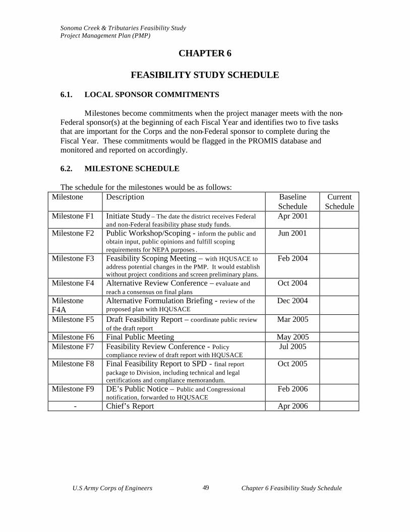
Sonoma Creek & Tributaries Feasibility Study Project Management Plan (PMP)
U.S Army Corps of Engineers Chapter 6 Feasibility Study Schedule
49
CHAPTER 6
FEASIBILITY STUDY SCHEDULE 6.1. LOCAL SPONSOR COMMITMENTS Milestones become commitments when the project manager meets with the non-Federal sponsor(s) at the beginning of each Fiscal Year and identifies two to five tasks that are important for the Corps and the non-Federal sponsor to complete during the Fiscal Year. These commitments would be flagged in the PROMIS database and monitored and reported on accordingly. 6.2. MILESTONE SCHEDULE The schedule for the milestones would be as follows:
Milestone Description Baseline Schedule
Current Schedule
Milestone F1 Initiate Study – The date the district receives Federal and non-Federal feasibility phase study funds.
Apr 2001
Milestone F2 Public Workshop/Scoping - inform the public and obtain input, public opinions and fulfill scoping requirements for NEPA purposes .
Jun 2001
Milestone F3 Feasibility Scoping Meeting – with HQUSACE to address potential changes in the PMP. It would establish without project conditions and screen preliminary plans.
Feb 2004
Milestone F4 Alternative Review Conference – evaluate and reach a consensus on final plans
Oct 2004
Milestone F4A
Alternative Formulation Briefing - review of the proposed plan with HQUSACE
Dec 2004
Milestone F5 Draft Feasibility Report – coordinate public review of the draft report
Mar 2005
Milestone F6 Final Public Meeting May 2005 Milestone F7 Feasibility Review Conference - Policy
compliance review of draft report with HQUSACE Jul 2005
Milestone F8 Final Feasibility Report to SPD - final report package to Division, including technical and legal certifications and compliance memorandum.
Oct 2005
Milestone F9 DE’s Public Notice – Public and Congressional notification, forwarded to HQUSACE
Feb 2006
- Chief’s Report Apr 2006
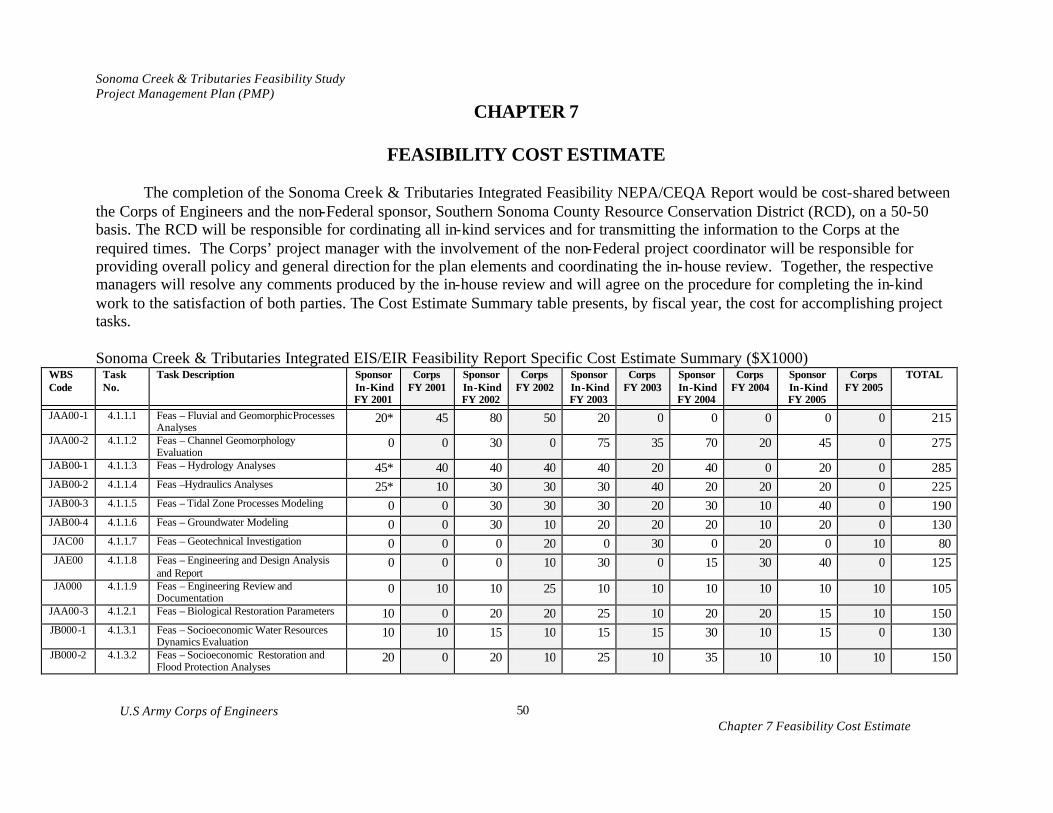
Sonoma Creek & Tributaries Feasibility Study Project Management Plan (PMP)
U.S Army Corps of Engineers Chapter 7 Feasibility Cost Estimate
50
CHAPTER 7
FEASIBILITY COST ESTIMATE
The completion of the Sonoma Creek & Tributaries Integrated Feasibility NEPA/CEQA Report would be cost-shared between the Corps of Engineers and the non-Federal sponsor, Southern Sonoma County Resource Conservation District (RCD), on a 50-50 basis. The RCD will be responsible for cordinating all in-kind services and for transmitting the information to the Corps at the required times. The Corps’ project manager with the involvement of the non-Federal project coordinator will be responsible for providing overall policy and general direction for the plan elements and coordinating the in-house review. Together, the respective managers will resolve any comments produced by the in-house review and will agree on the procedure for completing the in-kind work to the satisfaction of both parties. The Cost Estimate Summary table presents, by fiscal year, the cost for accomplishing project tasks. Sonoma Creek & Tributaries Integrated EIS/EIR Feasibility Report Specific Cost Estimate Summary ($X1000)
WBS Code
Task No.
Task Description Sponsor In-Kind FY 2001
Corps FY 2001
Sponsor In-Kind FY 2002
Corps FY 2002
Sponsor In-Kind FY 2003
Corps FY 2003
Sponsor In-Kind FY 2004
Corps FY 2004
Sponsor In-Kind FY 2005
Corps FY 2005
TOTAL
JAA00-1 4.1.1.1 Feas – Fluvial and Geomorphic Processes Analyses
20* 45 80 50 20 0 0 0 0 0 215
JAA00-2 4.1.1.2 Feas – Channel Geomorphology Evaluation
0 0 30 0 75 35 70 20 45 0 275
JAB00-1 4.1.1.3 Feas – Hydrology Analyses 45* 40 40 40 40 20 40 0 20 0 285 JAB00-2 4.1.1.4 Feas –Hydraulics Analyses 25* 10 30 30 30 40 20 20 20 0 225 JAB00-3 4.1.1.5 Feas – Tidal Zone Processes Modeling 0 0 30 30 30 20 30 10 40 0 190 JAB00-4 4.1.1.6 Feas – Groundwater Modeling 0 0 30 10 20 20 20 10 20 0 130 JAC00 4.1.1.7 Feas – Geotechnical Investigation 0 0 0 20 0 30 0 20 0 10 80 JAE00 4.1.1.8 Feas – Engineering and Design Analysis
and Report 0 0 0 10 30 0 15 30 40 0 125
JA000 4.1.1.9 Feas – Engineering Review and Documentation
0 10 10 25 10 10 10 10 10 10 105
JAA00-3 4.1.2.1 Feas – Biological Restoration Parameters 10 0 20 20 25 10 20 20 15 10 150 JB000-1 4.1.3.1 Feas – Socioeconomic Water Resources
Dynamics Evaluation 10 10 15 10 15 15 30 10 15 0 130
JB000-2 4.1.3.2 Feas – Socioeconomic Restoration and Flood Protection Analyses
20 0 20 10 25 10 35 10 10 10 150

Sonoma Creek & Tributaries Feasibility Study Project Management Plan (PMP)
U.S Army Corps of Engineers Chapter 7 Feasibility Cost Estimate
51
WBS Code
Task No.
Task Description Sponsor In-Kind FY 2001
Corps FY 2001
Sponsor In-Kind FY 2002
Corps FY 2002
Sponsor In-Kind FY 2003
Corps FY 2003
Sponsor In-Kind FY 2004
Corps FY 2004
Sponsor In-Kind FY 2005
Corps FY 2005
TOTAL
JI000-1 4.1.4 Feas – Sonoma Creek and Tributaries Historical Ecology Project
0 0 60 15 60 15 60 10 60 0 280
JAA00-4 4.1.5 Feas – GIS Support for Planning 10* 10 45 25 50 20 50 10 50 5 275 JC000 4.1.6 Feas – Real Estate Analysis/Report 0 0 0 5 0 10 0 15 0 15 45
JD000-1 4.1.7.1 Feas – Institute and Complete Environmental Documentation
0 0 20 15 40 35 30 80 30 40 290
JD000-2 4.1.7.2 Feas – Recreation Analysis 0 0 0 0 10 0 10 0 10 0 30 JE000 4.1.7.3 Feas –Fish and Wildlife Coordination Act
Report 0 0 0 0 0 20 0 10 0 10 50
JF000 4.1.7.4 Feas – HTRW Evaluation/Report 0 0 0 10 0 10 0 20 0 10 50 JG000 4.1.7.5 Feas – Cultural Resources Studies/Report 0 0 0 0 10 20 5 5 0 10 50 JH000 4.1.8 Feas – Design and Cost Estimates 0 0 0 0 10 20 0 20 0 40 90 JI000-2 4.1.9 Feas – Public Involvement Documentation 50 20 30 30 20 20 85 20 45 20 330 JJ000 4.2 Feas – Plan Formulation and Evaluation 0 30 0 40 0 40 0 50 0 40 200 JK000 4.3 Feas – Draft Report Preparation and
Review 0 0 0 0 0 20 0 30 0 50 100
JL000 4.4 Feas – Final Feasibility Report Submittal 0 0 0 0 0 0 0 10 0 40 50
JM000 Feas – Washington Level Report Approval (Review Support)
0 0 0 0 0 5 0 0 0 15 20
JP000 4.5 Feas – Management Documents PPMD 10 10 20 55 30 60 30 65 30 65 375 LA000 Feas – Planning/Engineering Admin 0 10 0 20 0 25 0 25 0 15 95 JJ000 Feas – Quality Control Documentation 0 0 0 0 0 10 0 20 0 30 60
Feas – Contingencies 0 5 0 10 0 10 0 10 0 15 50 SUB-TOTAL 200 200 480 480 550 550 560 560 460 460 0 TOTAL 400 960 1100 1120 920 4500
* Sponsor plans to contributed cash in lieu of in-kind services for specific tasks

Sonoma Creek & Tributaries Project Management Plan (PMP)
U.S Army Corps of Engineers Chapter 8 Quality Control Plan 52
Chapter 8 QUALITY CONTROL PLAN
8.1 QUALITY CONTROL PLAN OBJECTIVE
The quality control objective is to achieve feasibility phase documents and services that meet or exceed customer requirements, and are consistent with Corps policies and regulations. The Sonoma Creek & Tributaries Integrated Feasibility NEPA/CEQA Report would support a potential flood protection and watershed restoration project and provide technical, planning, and design analyses to assist in watershed restoration. There may be opportunities for specific flood protection and/or restoration projects, e.g. lower Sonoma Creek watershed flood protection and restoration project and other restoration and flood protection opportunities in the Sonoma Creek and tributaries, as they are identified and supported by the local community. 8.2 GUIDELINES FOLLOWED FOR TECHNICAL REVIEW
The quality control process requires that technical products are in compliance with applicable laws, regulations, and sound technical practices. The Quality Control Plan (QCP) ensures that an independent technical review process would be put in place to successful completion and delivery quality documents to the customer. Some of the goals of the QCP are to enhance the quality of decision and implementation documents through timely independent review, to reduce human resource requirements through timely review, to allow continuous in-progress review of documents, and to provide quality review without creating dedicated technical review positions. The guidelines for independent technical review are set forth in the South Pacific Division Quality Management Plan, CESPD R 1110-1-8, and in the corresponding San Francisco District’s Quality Management Plan (QMP), CESPN OM 1110-1-12. 8.3 EXECUTIVE COMMITTEE
An Executive Committee will be established to sign and implement the Feasibility Cost Share Agreement (FCSA) . The Executive Committee co-chaired by the Corps and the RCD will maintain a working knowledge of the progress of the study, provide oversight to changes in study scope, costs, and schedule; provide direction on resolution of policy issues; and provide guidance to ensure study results and policies are consistent and coordinated with the overall desired outputs and programs. The Executive Committee will participate in Issue Resolution Conferences (IRCs). IRCs will be held, as required, throughout the study to resolve any problems that may arise. Executive Committee
Organization
Name/Title
Address
Phone Corps of Engineers CESPN-PPMD
Arijs Rakstins , Project Management Chief
333 Market Street San Francisco, CA 94105
(415) 977-8702
Southern Sonoma County Resouce Conservation District
Leandra Swent, Director 1301 Redwood Way #170 Petaluma, CA 94954
(707) 794-1234x3
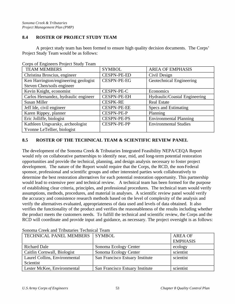
Sonoma Creek & Tributaries Project Management Plan (PMP)
U.S Army Corps of Engineers Chapter 8 Quality Control Plan 53
8.4 ROSTER OF PROJECT STUDY TEAM
A project study team has been formed to ensure high quality decision documents. The Corps’ Project Study Team would be as follows: Corps of Engineers Project Study Team TEAM MEMBERS SYMBOL AREA OF EMPHASIS Christina Broscius, engineer CESPN-PE-ED Civil Design Ken Harrington/engineering geologist Steven Chen/soils engineer
CESPN-PE-EG Geotechnical Engineering
Kevin Knight, economist CESPN-PE-C Economics Carlos Hernandez, hydraulic engineer CESPN-PE-EH Hydraulic/Coastal Engineering Susan Miller CESPK-RE Real Estate Jeff Ide, civil engineer CESPN-PE-EE Specs and Estimating Karen Rippey, planner CESPN-PE-P Planning Eric Jolliffe, biologist CESPN-PE-PS Environmental Planning Kathleen Ungvarsky, archeologist Yvonne LeTellier, biologist
CESPN-PE-PP Environmental Studies
8.5 ROSTER OF THE TECHNICAL TEAM & SCIENTIFIC REVIEW PANEL The development of the Sonoma Creek & Tributaries Integrated Feasibility NEPA/CEQA Report would rely on collaborative partnerships to identify near, mid, and long-term potential restoration opportunities and provide the technical, planning, and design analysis necessary to foster project development. The nature of the Report would require that the Corps, the RCD, the non-Federal sponsor, professional and scientific groups and other interested parties work collaboratively to determine the best restoration alternatives for each potential restoration opportunity. This partnership would lead to extensive peer and technical review. A technical team has been formed for the purpose of establishing clear criteria, principles, and professional procedures. The technical team would verify assumptions, methods, procedures, and material in analyses. A scientific review panel would verify the accuracy and consistence research methods based on the level of complexity of the analysis and verify the alternatives evaluated, appropriateness of data used and levels of data obtained. It also verifies the functionality of the product and verifies the reasonableness of the results including whether the product meets the customers needs. To fulfill the technical and scientific review, the Corps and the RCD will coordinate and provide input and guidance, as necessary. The project oversight is as follows: Sonoma Creek and Tributaries Technical Team TECHNICAL PANEL MEMBERS SYMBOL AREA OF
EMPHASIS Richard Dale Sonoma Ecology Center ecology Caitlin Cornwall, Biologist Sonoma Ecology Center scientist Laurel Collins, Environmental Scientist
San Francisco Estuary Institute scientist
Lester McKee, Environmental San Francisco Estuary Institute scientist
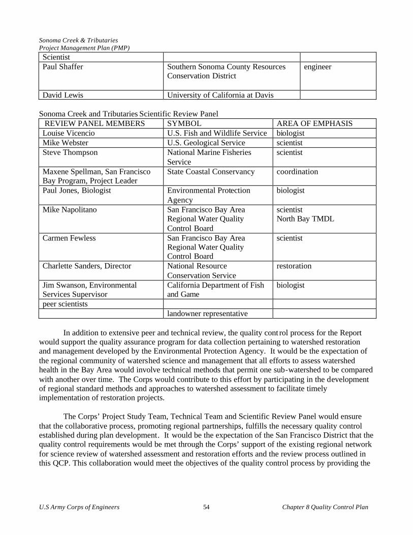
Sonoma Creek & Tributaries Project Management Plan (PMP)
U.S Army Corps of Engineers Chapter 8 Quality Control Plan 54
Scientist Paul Shaffer Southern Sonoma County Resources
Conservation District
engineer
David Lewis University of California at Davis Sonoma Creek and Tributaries Scientific Review Panel REVIEW PANEL MEMBERS SYMBOL AREA OF EMPHASIS Louise Vicencio U.S. Fish and Wildlife Service biologist Mike Webster U.S. Geological Service scientist Steve Thompson National Marine Fisheries
Service scientist
Maxene Spellman, San Francisco Bay Program, Project Leader
State Coastal Conservancy coordination
Paul Jones, Biologist Environmental Protection Agency
biologist
Mike Napolitano San Francisco Bay Area Regional Water Quality Control Board
scientist North Bay TMDL
Carmen Fewless San Francisco Bay Area Regional Water Quality Control Board
scientist
Charlette Sanders, Director National Resource Conservation Service
restoration
Jim Swanson, Environmental Services Supervisor
California Department of Fish and Game
biologist
peer scientists landowner representative
In addition to extensive peer and technical review, the quality cont rol process for the Report
would support the quality assurance program for data collection pertaining to watershed restoration and management developed by the Environmental Protection Agency. It would be the expectation of the regional community of watershed science and management that all efforts to assess watershed health in the Bay Area would involve technical methods that permit one sub-watershed to be compared with another over time. The Corps would contribute to this effort by participating in the development of regional standard methods and approaches to watershed assessment to facilitate timely implementation of restoration projects.
The Corps’ Project Study Team, Technical Team and Scientific Review Panel would ensure that the collaborative process, promoting regional partnerships, fulfills the necessary quality control established during plan development. It would be the expectation of the San Francisco District that the quality control requirements would be met through the Corps’ support of the existing regional network for science review of watershed assessment and restoration efforts and the review process outlined in this QCP. This collaboration would meet the objectives of the quality control process by providing the

Sonoma Creek & Tributaries Project Management Plan (PMP)
U.S Army Corps of Engineers Chapter 8 Quality Control Plan 55
required technical oversight and would ensure that the schedule and milestones identified in the PMP would be adhered to. Documentation would be minimized when there is no controversy. 8.6 TECHNICAL REVIEW SUPPORT
The low-risk nature of the process would enable the functional chiefs to provide the necessary internal technical review for the project study team. The functional chiefs would support the schedule and milestones requirements listed above, which are based upon information available at this time. The non-Federal sponsor supports the decision of the San Francisco District to use the above-described collaborative process to review plan documents. The non-Federal sponsor requests that the Corps’ internal review be minimized to meet the study timeframe and the local quality control objectives. 8.7 DOCUMENTS TO BE REVIEWED AND SCHEDULE FOR REVIEW ACTIVITES a. All of the products of the tasks listed in the detailed scope of work in Chapter 4, Scope of Work, would be subject to independent technical review. Seamless single discipline review would be accomplished prior to the release of materials to other members of the study team or integrated into the overall plan. Section Chiefs shall be responsible for accuracy of the computations through design checks and other internal procedures, prior to the independent technical review.
b. Quality Control review would meet the schedule and milestone dates identified in Chapter 6. Independent product review would occur prior to major decision points in the planning process at the CESPD milestones so that the technical results can be relied upon in setting the course for further study. These products would include documentation for the CESPD mandatory milestone conferences (F3 & F4), HQUSACE issue resolution conferences (F4A & F7) and the draft and final reports. These products shall be essentially complete before review is undertaken. Since this quality control would have occurred prior to each milestone conference, the conference is free to address critical outstanding issues and set direction for the next step of the plan, since a firm technical basis for making decisions would have already been established. In general, the independent technical review would be initiated at least two week prior to a CESPD mandatory milestone conference and at least two weeks prior to the submission of documentation for a HQUSACE issue resolution conference.
c. For products that are developed under contract, the contractor would be responsible for quality control through an independent technical review. Quality assurance of the contractor’s quality control would be the responsibility of the District.
Sonoma Creek & Tributaries Project Management Plan (PMP)
U.S Army Corps of Engineers Chapter 9 Identification of Procedures and Criteria 56
CHAPTER 9
IDENTIFICATION OF PROCEDURES AND CRITERIA
9.1 EVOLUTION OF THE PMP
The PMP describes all activities from the initial tasks of the feasibility phase through the preparation of the Report and PED cost-sharing agreement, and the district's support during the Washington- level review. As the PMP is based primarily on existing information, it will be subject to scope changes as the technical picture unfolds. Because of the limited evaluations in the reconnaissance phase, the PMP will include significantly more uncertainty and must make appropriate allowances. As an example, this PMP assumes the requirement for an Environmental Impact Statement, because of the limited environmental evaluations conducted in the reconnaissance phase. The PMP, including the documentation of agreements on changes to the conduct of the study, will be addressed at each of the CESPD milestone conferences and at the formal issue resolution conferences with HQUSACE, including the AFB and FRC. 9.2 THE PLANNING PROCESS
The Water Resource Council's Principles and Guidelines (P&G) is the basic planning guidance which establishes a six-step planning process. This process is a conceptual planning sequence for developing solutions to water resource problems and opportunities. The Planning Manual and Planning Primer, both published by IWR provide excellent coverage of the planning process. The South Pacific Division also provides training in the six- step process. 9.3 POLICY The policies that govern the development of projects are contained in the DIGEST OF WATER REOURCES POLICIES AND AUTHORITIES, EP 1165-2-1. 9.4 CORPS REGULATIONS All of the Corps’ current regulations are included on the HQUSACE homepage. The most important of these regulations is ER 1105-2-100, PLANNING GUIDANCE. Policy compliance review is addressed in EC 1165-2-203, TECHNICAL AND POLICY COMPLIANCE REVIEW. And, quality control is covered in the CESPD Quality Management Plan, CESPD R 1110-1-8. The review of the products will be accomplished with the review checklist that is provided in EC 1165-2-203 as Appendix B, POLICY COMPLIANCE REIVEW CONSIDERATIONS. 9.5 PROCESSING REQUIREMENTS In addition to ER 1105-2-100, the South Pacific Division has provided additional guidance on the processing requirements for each of the milestone submittals. This guidance is contained in CESPD-ET-P memorandum, subject: Processing of Planning Reports in the South Pacific Division.

Sonoma Creek & Tributaries Project Management Plan (PMP)
U.S Army Corps of Engineers Chapter 9 Identification of Procedures and Criteria 57
9.6 REGIONAL RESTORATION PLANNING DOCUMENTS The following regional scientific and planning documentation will be integrated into the evaluation report, as appropriate. The integration of the documentation will allow the Report to focus on completing the technical, planning, and design assistance critical for future implementation of restoration opportunities identified in the Sonoma Creek watershed. It is not the intent of the Report to duplicate completed research but to build off of the data produced to provide the next level of analysis to restore the ecological health of the watershed. a. Bay Area Watersheds Science Approach This 1998 report defines the role of watershed science to support environmental planning and resource protection. Watershed science is the integral sum of individual scientific disciplines that contribute to a better understanding of the physical, biological, and social relations among terrestrial and aquatic environments. b. California Salmonid Stream Habitat Restoration Manual This manual formally synthesizes and describes the Department of Fish and Game’s approach and technical methods for anadromous salmonid habitat restoration. The second and third edition expanded the manual to include stream habitat inventory and restoration practices, as well as monitoring and implementation. c. California Wetlands Conservation Policy This 1993 policy of the Governor of California establishes goals of no overall net loss of wetlands, reducing procedural complexity in administration of wetland conservation programs, and encouraging partnerships and landowner incentives to improve wetlands protection. d. Comprehensive Conservation and Management Plan This 1993 plan was prepared as part of the San Francisco Estuary Project. The plan establishes wetland ecosystem goals, a regional wetlands management plan, and geographically focused cooperative efforts to protect wetlands. The San Francisco Estuary Project developed a Comprehensive Conservation and Management Plan which presented strategies to protect and restore the health of the San Francisco Estuary. The plan found that the region's wetlands were subject to uneven protection efforts and called for a coordinated intergovernmental system to ensure maximum protection, restoration, and management of wetlands. SFBCDC is the lead agency to assist in developing and implementing local wetland protection programs to minimize impacts of urbanization on wetland and agricultural resources. e. Fremontia - Special Issue: Weeds One of the greatest threats to California’s native plants, both rare and common, is the increasing number of aggressive weedy plant species that may endanger and eliminate many native species. This

Sonoma Creek & Tributaries Project Management Plan (PMP)
U.S Army Corps of Engineers Chapter 9 Identification of Procedures and Criteria 58
special issue, October1998, details some of California’s problem with invasive exotic weeds in various habitats and in parks and reserves. f. Handbook on California and Federal Wetlands Regulation The handbook was developed by the wetlands discussion group to give members of the public an overview of the wetland regulation process and a list of references and contacts for further information. g. Long-term Management Strategy A Long-term Management Strategy (LTMS) for Dredging and Dredged Material Disposal in the San Francisco Bay/Sacramento-San Joaquin Delta Estuary was initiated in 1991 by the Corps as the lead. SFBCDC, U.S. Environmental Protection Agency, State Water Resources Control Board, and the San Francisco Bay and Central Valley Regional Water Quality Control Boards are among the 30 other participating agencies in this multiple federal and state agency initiative. The purpose of the LTMS plan is to secure timely, technically feasible, cost-effective, and environmentally acceptable dredged material disposal options in an orderly, sequential process. The long-term dredged material disposal plan, which is not yet finalized, has identified a number of disposal alternatives: in-bay, ocean, and upland disposal/reuse. A number of sites in the Baylands have been identified and evaluated for the latter alternative. The use of clean dredged material, suitable for aquatic disposal, for wetland restoration in formerly tidal, diked sites that have undergone subsidence has been recognized as a beneficial reuse of dredged material. Such use provides an opportunity to offset losses of historic habitat and substitutes for unconfined aquatic disposal and other less beneficial methods. Major dredging areas in the Baylands, which need disposal sites and could contribute to restoration projects, include the Petaluma River, Napa River, Mare Island Naval Ship Yard, and Mare Island Strait. h. North Bay Corridor Study The Metropolitan Transportation Commission recently initiated a multi-agency planning study to recommend strategies for improving transportation, fish and wildlife habitats, and recreational trail access in the North Bay Corridor. The corridor extends across the Baylands from 1-80 in the east to Route 101 in the west, and includes Routes 37, 12, 116, and 121. A central goal is to increase significantly the amount and quality of fish and wildlife habitat in the corridor. A major focus will be to explore options for enhancing wetland north of Highway 37 by opening them to tidal action. The project will be completed in 1997. i. North Bay Forum The U.S. Environmental Protection Agency sponsors the North Bay Forum, formally known as the North Bay Iniciative, to facilitate the cooperative efforts of 12 local, state, and federal agencies by integrating resource management with preservation of agriculture in the North Bay. The forum is designed to coordinate wetland and watershed resource management and regulation, while troubleshooting regulatory conflicts, streamlining wetland permit reviews and helping landowners and local governments solve problems. Since 1992, the forum has engaged in regular problem solving and
Sonoma Creek & Tributaries Project Management Plan (PMP)
U.S Army Corps of Engineers Chapter 9 Identification of Procedures and Criteria 59
information sharing and has conducted technical and stewardship workshops for landowners and government entities. j. North Bay Wetlands Protection Program The North Bay Wetlands Protection Program developed out of the San Francisco Estuary Project initiative with SFBCDC as the lead coordinating agency. The program is patterned after similar efforts such as the Suisun Marsh Protection Plan, the Richardson Bay Special Area Plan, and the Benicia Waterfront Special Area Plan. The North Bay Wetlands Protection Program area includes portions of Marin, Sonoma, Napa, and Solano counties from the north fork of Gallinas Creek to the Carquinez Strait. The North Bay Wetlands Protection Program identifies the Baylands planning area as the largest undeveloped assemblage of wetlands, diked historic baylands, and associated uplands remaining in the San Francisco Bay Estuary (SFBCDC 1995). This regional planning effort is a voluntary partnership with SFBCDC and includes the local governments of the four counties and the cities of Novato, San Rafael, American Canyon, and Vallejo. The planning effort is designed to coordinate the various city and county General Plan revisions, the San Francisco Estuary Project's North Bay Implementation Subcommittee, the U.S. Environmental Protection Agency's North Bay Forum, and the Regional Water Quality Control Board's Wetlands Planning Program. The partnership was initiated in 1994. The group is developing a North Bay Wetlands Protection Plan with land use, conservation, and open space elements and implementation recommendations. k. Partnership for San Pablo Baylands Beginning in 1995, Save San Francisco Bay Association has sponsored a program to preserve, restore, and enhance wildlife habitats and agriculture in the Baylands region. The Partnership seeks to build grassroots support for Baylands protection through public education and voluntary land stewardship. The Partnership will develop a non-regulatory wetland restoration, enhancement, and management plan for the North Bay, followed by a demonstration project(s). The plan will describe voluntary methods that private landowners can use to enhance wetlands, while maintaining the economic vitality of the region's agriculture. l. San Francisco Bay Conservation and Development Commission Strategic Plan The strategic plan outlines the three-year goals of BCDC and the short-term objectives for achieving those goals. The strategic plan serves as the foundation of BCDC’s budget planning by identifying the specific initiatives and activities the Commission wants to undertake to improve the manner in which the Commission and its staff carry out their mandated responsibilities. m. San Francisco Bay Joint Venture This public-private partnership began in 1995 with a coalition of public agencies, environmental organizations, hunting and fishing groups, the business community, local governments, and landowners. Encompassing most of the San Francisco Bay Watershed west of the Suisun Marsh, the joint venture is developing an Implementation Strategy establishing specific goals and strategies for

Sonoma Creek & Tributaries Project Management Plan (PMP)
U.S Army Corps of Engineers Chapter 9 Identification of Procedures and Criteria 60
wetland acquisition, protection, and restoration. The approach is to leverage existing resources, develop new funding sources, and create unique partnerships for completing on-the-ground projects. n. San Francisco Bay Plan San Francisco Bay Conservation and Development Commission completed this report to emphasize the Bay as a single physical mechanism in which actions affecting one part may also affect other parts. The Bay Plan provides a formula for developing the Bay and shoreline to their highest potential, while protecting the Bay as an irreplaceable natural resource. o. San Francisco Bay Water Quality Control Plan (Basin Plan) The Basin Plan is the policy document of the San Francisco Regional Water Quality Control Board. The plan was updated in 1995 and provides legal, technical, and programmatic bases of water quality regulation in the region. The plan calls for a "no net loss" policy for wetlands. p. San Francisco Estuary Baylands Ecosystem Goals San Francisco Bay Area Wetlands Ecosystem Goals Project (June 1998) presents a long-term vision for the “baylands”, a part of the San Francisco Bay-Delta estuary. The Goals Project is designed to be useful for those interested in enhancing and restoring wetlands. The project seeks to develop a shared vision of what is needed to ensure the health of the region's wetland ecosystems. Based on scientific input from a broad spectrum of experts, the project will identify the types, amounts, and distribution of wetlands and related habitats needed to sustain diverse and healthy wetland communities. These goals will provide biologically sound guidance for wetland restoration and management programs. This project began in 1994, encompassing the entire Bay Area, and is led by a multi-agency Resource Managers Group. The San Francisco Bay Regional Water Quality Control Board is the lead contact agency. q. Sonoma Creek Enhancement Plan The Sonoma Creek Enhancement Plan established an advisory committee of landowners, residents, agricultural interests, and community groups with support from agency representatives to determine the needs, visions, and goals for the watershed. The goals of the Plan are to maintain long term, local control of watershed planning and enhancement, conserve and improve the natural resources of the watershed, manage streams to maximize wildlife habitat while maintaining effective flood control, and educate the community about the natural features of the watershed, its people, and economy. r. Watershed Management Initiative Integrated Plan The San Francisco Regional Water Quality Control Board developed this work plan to effectively use staff and grant resources for the prevention and control of water pollution on a watershed scale while meeting regulatory program mandates. It outlines the goals and objectives over the next five years and builds upon the considerable local watershed efforts led by other entities. s. Wetlands in the North Bay Planning Area

Sonoma Creek & Tributaries Project Management Plan (PMP)
U.S Army Corps of Engineers Chapter 9 Identification of Procedures and Criteria 61
The San Francisco Bay Conservation and Development Commission produced this report in 1997 to inform the reader about the nature of the wetlands and related habitats found in the historic marshlands of the North Bay, why they are important, their relationship to other areas of habitat va lue, and their current status and location. The report also describes opportunities for wetlands enhancement and restoration in the North Bay.
Sonoma Creek & Tributaries Project Management Plan (PMP)
U.S Army Corps of Engineers Chapter 10 Coordination Mechanisms 62
CHAPTER 10
COORDINATION MECHANISMS 10.1 CESPD MILESTONES Two of the milestones in the CESPD milestone sys tem (F2 & F6, see page 49) have been established specifically for the purpose of providing a public forum to receive public input. The first of these is the initial public workshop. This workshop is an opportunity to present the study to the public, obtain input and public opinions, and fulfill the NEPA scoping meeting requirements. The second milestone in the system is the final public meeting. This meeting is after the release of the draft report for public review and is an opportunity to present the findings of the draft report to the public and receive public comment. Also, there will be extensive public involvement to ensure that all activities undertaken in the watershed have received public input and review. The Corps’ project study team, technical team, and scientific review panel would provide information and input as part of the public involvement process. Public involvement at a minimum would include: • Landowners • groups/organizations • local agencies • Valley of the Moon Water District • elected officials • other interested parties 10.2 Public Outreach, Understanding, and Review The Sonoma Creek Watershed Conservancy was formed to implement a CALFED grant in 1998. In addition prior to 1998, a Sonoma Creek Watershed Council was formed by a Technical Advisory Committee to invite interested local citizens to work on watershed issues. The Sonoma Creek Watershed Conservancy would be expanded to be a broader stakeholder group, including local landowners, the Sonoma Creek Watershed Council, Southern Sonoma County Resource Conservation District, San Francisco Estuary Institute, Sonoma Ecology Center, Sonoma Valley Vintners and Growers Alliance, the Coastal Conservancy San Francisco Bay Program, and other interested parties. In addition, the agencies, such as the Environmental Protection Agency, San Francisco Bay Conservation and Development Commission, California Department of Fish and Game, U.S. Fish and Wildlife Service and Regional Water Quality Control Board, would provide input to Report development.
A technical team and scientific review panel (see chapter 8) would be formed to integrate public consultation, evaluate and fill data gap needs and design scenarios, perform future conditions modeling, and other tasks to determine the best alternatives for flood protection and environmental restoration. Careful management, coordination, and communication between consultants and/or task working groups would be important to ensure that coordination and communication occurs. The technical team progress and recommendations and scientific review panel’s evaluation would be reported to the Sonoma Creek Watershed Conservancy on a regular basis. The Corps and the RCD

Sonoma Creek & Tributaries Project Management Plan (PMP)
U.S Army Corps of Engineers Chapter 10 Coordination Mechanisms 63
would be responsible for reviewing task progress, helping to find solutions to problems, external review of documents, and data and information coordination between tasks. Regular public workshops will be held to share crucial data and information. The workshops would provide a forum for local community involvement and support.
The technical team would support integrating each task into the design, development, writing
and review of the feasibility planning documentation. The document would be the culmination and synthesis of all the existing information into a readable document suitable for a range of audiences (public, science and management. Specific public outreach, education, and review tasks would include public workshops and briefings, as well as the preparation and distribution of fact sheets and information papers to interested parties and local news agencies. One of the goals would be to have public agencies and local organizations evaluate the restoration opportunities in the watershed. It is important to compile, organize, and manage past, present, and future information in a central location and to begin identifying, prioritizing, and filling critical data gaps in areas where sufficient data is lacking to make informed policy and land management decisions. A process would be developed to inform and engage the citizenry to promote land stewardship through an understanding and appreciation of the ecosystem. The RCD will be conducting landowner interviews to determine watershed concerns and flooding issues in the flood prone areas of Sonoma Creek watershed. This data will be integrated with the hydrologic and hydraulic modeling to ensure that on the ground historical data is incorporated into the engineering report. Also, an informed citizenry is critical importance to ensure healthy and vibrant fish and wildlife habitats. To ensure an effective comprehensive evaluation and syntheses of data and dissemination of information to interested parties possible, a webbased information distribution system will be developed.
As the Report develops, data systemization, data quality assurance, and data collection
coordination will be completed. The data would be integrated and merged from multiple sources, ranking for accuracy and consistency, and monitored with protocols put in place to provide a means to evaluate the reliability and accuracy of the data.
The interactive mapping and other watershed information efforts will be supported by regional information organizations such as the RCD, Sonoma County, Bay Model Association, the Sonoma Ecology Center, the San Francisco Estuary Institute, and other non- profits in the Sonoma Creek watershed. The Geographic Information System (GIS) mapping would, as necessary, promote watershed involvement in the Sonoma Creek watershed. GIS is a computer-based system that allows information including topographic, public policy, and watershed management issues to be mapped digitally for a quick comprehensive look at watershed conditions and functions.
One of the goals is to make responsible watershed management decisions to prevent unwise management decisions from adversely impacting the health of the Sonoma Creek and its watershed. Responsible watershed management decisions would help the ecology of the watershed. The associated outreach and educational tools may include: • mailing list/database – A master mailing list will be developed to inform the public about
upcoming meeting and events involving plan development. This process will include working closely with non-Federal sponsor to augment existing outreach efforts.

Sonoma Creek & Tributaries Project Management Plan (PMP)
U.S Army Corps of Engineers Chapter 10 Coordination Mechanisms 64
• web page – A Sonoma Creek watershed website will be established on the Corps website to link with the local websites. This will assist in ensuring that interested parties have access to information as it is being developed. The web site will be linked to other web sites that have information relevant to the Sonoma Creek and the San Pablo Bay (e.g.: the RCD, San Francisco Estuary Institute, EPA, RWQCB)
• media packet and multimedia presentations – Packets and news conferences with presentations will be arranged as appropriate for regional and national recognition of the cooperative regional restoration effort taking place.
• Other tools might be: tours, public involvement record/summary documents, public meetings, kitchen-table meetings with landowners
Sonoma Creek & Tributaries Project Management Plan (PMP)
U.S Army Corps of Engineers Enclosure A Project Area Map
ENCLOSURE A
PROJECT AREA MAP

Sonoma Creek & Tributaries Project Management Plan (PMP)
U.S Army Corps of Engineers Enclosure B Milestone System B-1
ENCLOSURE B
CESPD MILESTONE SYSTEM – FEASIBILITY PHASE
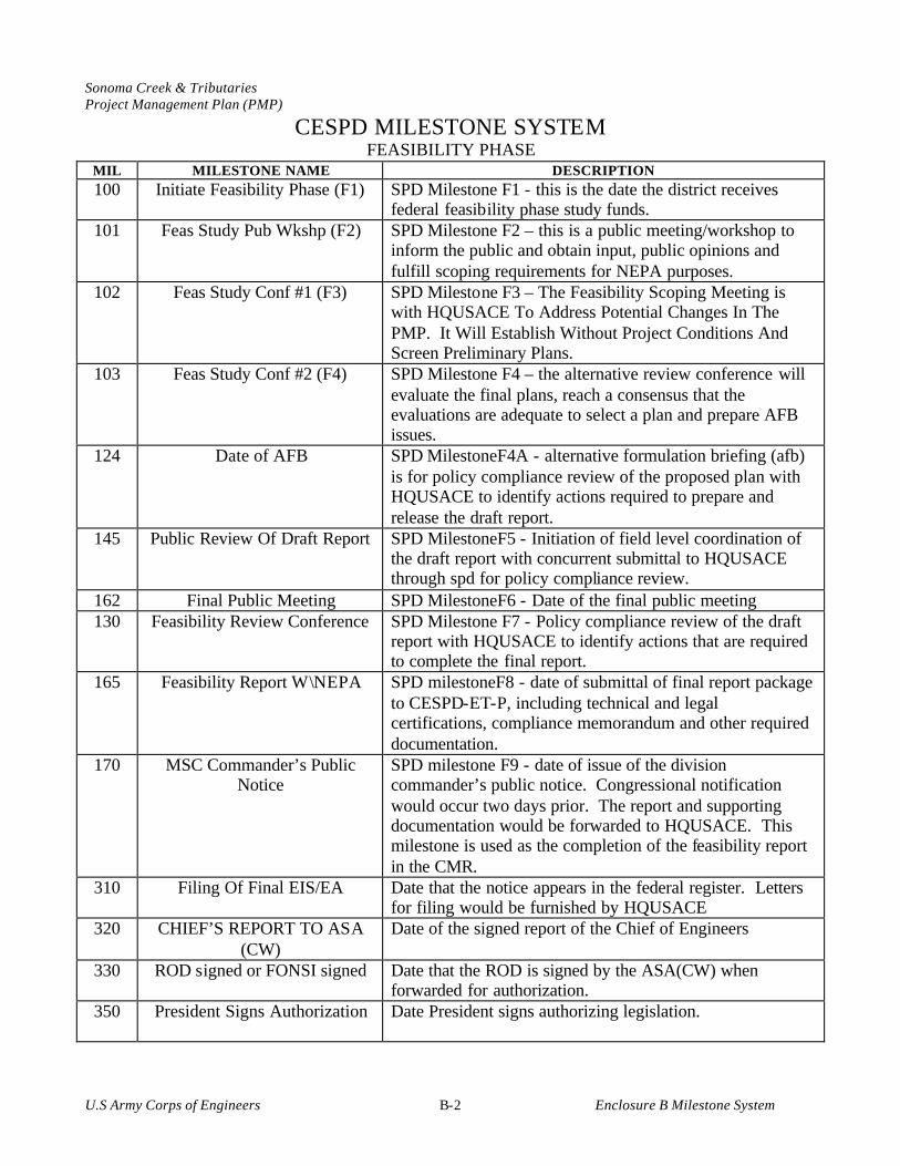
Sonoma Creek & Tributaries Project Management Plan (PMP)
U.S Army Corps of Engineers Enclosure B Milestone System B-2
CESPD MILESTONE SYSTEM FEASIBILITY PHASE
MIL MILESTONE NAME DESCRIPTION 100 Initiate Feasibility Phase (F1) SPD Milestone F1 - this is the date the district receives
federal feasibility phase study funds. 101 Feas Study Pub Wkshp (F2) SPD Milestone F2 – this is a public meeting/workshop to
inform the public and obtain input, public opinions and fulfill scoping requirements for NEPA purposes.
102 Feas Study Conf #1 (F3) SPD Milestone F3 – The Feasibility Scoping Meeting is with HQUSACE To Address Potential Changes In The PMP. It Will Establish Without Project Conditions And Screen Preliminary Plans.
103 Feas Study Conf #2 (F4) SPD Milestone F4 – the alternative review conference will evaluate the final plans, reach a consensus that the evaluations are adequate to select a plan and prepare AFB issues.
124 Date of AFB SPD MilestoneF4A - alternative formulation briefing (afb) is for policy compliance review of the proposed plan with HQUSACE to identify actions required to prepare and release the draft report.
145 Public Review Of Draft Report SPD MilestoneF5 - Initiation of field level coordination of the draft report with concurrent submittal to HQUSACE through spd for policy compliance review.
162 Final Public Meeting SPD MilestoneF6 - Date of the final public meeting 130 Feasibility Review Conference SPD Milestone F7 - Policy compliance review of the draft
report with HQUSACE to identify actions that are required to complete the final report.
165 Feasibility Report W\NEPA SPD milestoneF8 - date of submittal of final report package to CESPD-ET-P, including technical and legal certifications, compliance memorandum and other required documentation.
170 MSC Commander’s Public Notice
SPD milestone F9 - date of issue of the division commander’s public notice. Congressional notification would occur two days prior. The report and supporting documentation would be forwarded to HQUSACE. This milestone is used as the completion of the feasibility report in the CMR.
310 Filing Of Final EIS/EA Date that the notice appears in the federal register. Letters for filing would be furnished by HQUSACE
320 CHIEF’S REPORT TO ASA (CW)
Date of the signed report of the Chief of Engineers
330 ROD signed or FONSI signed Date that the ROD is signed by the ASA(CW) when forwarded for authorization.
350 President Signs Authorization Date President signs authorizing legislation.
Sonoma Creek & Tributaries Project Management Plan (PMP)
U.S Army Corps of Engineers Enclosure C List of Acronyms C-1
ENCLOSURE C
LIST OF ACRONYMS
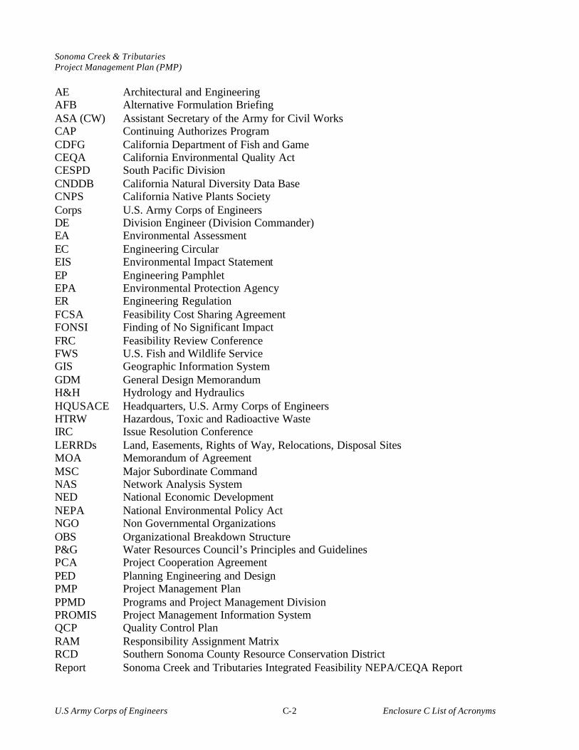
Sonoma Creek & Tributaries Project Management Plan (PMP)
U.S Army Corps of Engineers Enclosure C List of Acronyms C-2
AE Architectural and Engineering AFB Alternative Formulation Briefing ASA (CW) Assistant Secretary of the Army for Civil Works CAP Continuing Authorizes Program CDFG California Department of Fish and Game CEQA California Environmental Quality Act CESPD South Pacific Division CNDDB California Natural Diversity Data Base CNPS California Native Plants Society Corps U.S. Army Corps of Engineers DE Division Engineer (Division Commander) EA Environmental Assessment EC Engineering Circular EIS Environmental Impact Statement EP Engineering Pamphlet EPA Environmental Protection Agency ER Engineering Regulation FCSA Feasibility Cost Sharing Agreement FONSI Finding of No Significant Impact FRC Feasibility Review Conference FWS U.S. Fish and Wildlife Service GIS Geographic Information System GDM General Design Memorandum H&H Hydrology and Hydraulics HQUSACE Headquarters, U.S. Army Corps of Engineers HTRW Hazardous, Toxic and Radioactive Waste IRC Issue Resolution Conference LERRDs Land, Easements, Rights of Way, Relocations, Disposal Sites MOA Memorandum of Agreement MSC Major Subordinate Command NAS Network Analysis System NED National Economic Development NEPA National Environmental Policy Act NGO Non Governmental Organizations OBS Organizational Breakdown Structure P&G Water Resources Council’s Principles and Guidelines PCA Project Cooperation Agreement PED Planning Engineering and Design PMP Project Management Plan PPMD Programs and Project Management Division PROMIS Project Management Information System QCP Quality Control Plan RAM Responsibility Assignment Matrix RCD Southern Sonoma County Resource Conservation District Report Sonoma Creek and Tributaries Integrated Feasibility NEPA/CEQA Report

Sonoma Creek & Tributaries Project Management Plan (PMP)
U.S Army Corps of Engineers Enclosure C List of Acronyms C-3
ROD Record of Decision RWQCB Regional Water Quality Control Board SACCR Schedule and Cost Change Request S&A Supervision and Administration SEC Sonoma Ecology Center SFEI San Francisco Estuary Institute SPD South Pacific Division (CESPD) TPD Technical, Planning, and Design USF&WL U.S. Fish and Wildlife Service WBS Work Breakdown Structure WIC Watershed Information Center WRDA Water Resources Development Act WRMP Bay Area Wetlands Regional Monitoring Program WSA Watershed Science Approach

Sonoma Creek & Tributaries Project Management Plan (PMP)
U.S Army Corps of Engineers Enclosure D Letter of Intent D-1
ENCLOSURE D
Letter of Intent


Sonoma Creek & Tributaries Project Management Plan (PMP)
U.S Army Corps of Engineers Enclosure E Project Tasks Completion Record
E-1
ENCLOSURE E
COMPLETION OF PROJECT TASKS

Sonoma Creek & Tributaries Project Management Plan (PMP)
U.S Army Corps of Engineers Enclosure E Project Tasks Completion Record
E-2
ENCLOSURE E – COMPLETION OF PROJECT TASKS The tasks identified in Chapter 3, Work Breakdown Structure, and Chapter 4, Scope of Work, would provide the structure for the development of the Report. As specific tasks are complete, they would be attached to Enclosure E to keep on-going documentation of work being completed during the development of the Report.
WBS# DESCRIPTION J0000 Feasibility Report (Feas) J0000 Milestones Initiate Feasibility Phase Feas Study Pub Wkshhp (F2) Feas Study Conf #1 (F3) Feas Study Conf #2 (F4) Date of AFB Public Review of Draft Report Final Public Meeting Feasibility Review Conference Feasibility Report w/ NEPA MSC Commander's Public Notice Filing of Final EIS/EA Chief's Report to ASA (CW) ROD Signed or FONSI Signed President Signs Authorization JA000 Engineering Appendix JAA00 Feas-Surveys and Mapping except Real Estate Surveys and Mapping -without Project Conditions Mapping - with Project Conditions Mapping - AFB documentation Mapping - Draft Report Mapping - Final Report JAB00 Feas -Hydrology and Hydraulics Studies/Report (Coastal) H&H –without Project Conditions & Preliminary Plans H&H - with Project Conditions for Final Plans H&H - AFB documentation H&H - Draft Report H&H- Final Report JAC00 Feas - Geotechnical Studies/Report Geotech –without Project Conditions & Preliminary Plans Geotech – with Project Condtions for Final Plans Geotech – AFB documentation Geotech – Draft Report Geotech – Final Report JAE00 Feas – Engineering and Design Analysis/Report Engr & Design – without Project Conditions & Preliminary Plans Engr & Design – with Project Conditions for Final Plans
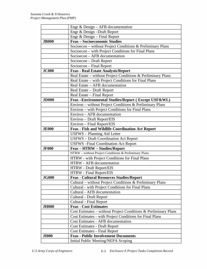
Sonoma Creek & Tributaries Project Management Plan (PMP)
U.S Army Corps of Engineers Enclosure E Project Tasks Completion Record
E-3
Engr & Design – AFB documentation Engr & Design –Draft Report Engr & Design – Final Report JB000 Feas – Socioeconomic Studies Socioecon – without Project Conditions & Preliminary Plans Socioecon – with Project Conditions for Final Plans Socioecon – AFB documentation Socioecon – Draft Report Socioecon – Final Report JC000 Feas - Real Estate Analysis/Report Real Estate – without Project Conditions & Preliminary Plans Real Estate – with Project Conditions for Final Plans Real Estate – AFB documentation Real Estate – Draft Report Real Estate – Final Report JD000 Feas –Environmental Studies/Report ( Except USF&WL) Environ – without Project Conditions & Preliminary Plans Environ – with Project Conditions for Final Plans Environ – AFB documentation Environ – Draft Report/EIS Environ – Final Report/EIS JE000 Feas - Fish and Wildlife Coordination Act Report USFWS – Planning Aid Letter USFWS – Draft Coordination Act Report USFWS –Final Coordination Act Report JF000 Feas – HTRW – Studies/Report HTRW – without Project Conditions & Preliminary Plans
HTRW - with Project Conditions for Final Plans HTRW - AFB documentation HTRW - Draft Report/EIS HTRW - Final Report/EIS JG000 Feas - Cultural Resources Studies/Report Cultural – without Project Conditions & Preliminary Plans Cultural - with Project Conditions for Final Plans Cultural - AFB documentation Cultural - Draft Report Cultural - Final Report JH000 Feas - Cost Estimates Cost Estimates – without Project Conditions & Preliminary Plans Cost Estimates - with Project Conditions for Final Plans Cost Estimates - AFB documentation Cost Estimates - Draft Report Cost Estimates - Final Report JI000 Feas - Public Involvement Documents Initial Public Meeting/NEPA Scoping

Sonoma Creek & Tributaries Project Management Plan (PMP)
U.S Army Corps of Engineers Enclosure E Project Tasks Completion Record
E-4
Public Workshops in Support of Plan Selection Public Involvement Support to AFB Final Public Meeting Public Involvement Support to FRC JJ000 Feas - Plan Formulation and Evaluation Plan Formulation of Preliminary Plans Plan Formulation for Final Plans Plan Formulation - AFB documentation Plan Formulation - Draft Report Plan Formulation - Final Report Plan Formulation - Support to Division Commander's Notice JL000 Feas - Final Report Documentation Reproduction and Distribution of F3 Documentation Reproduction and Distribution of F4 Documentation Reproduction and Distribution of AFB Documentation Reproduction and Distribution of Draft Report Reproduction and Distribution of Final Report JLD00 Feas - Technical Review Documents Independent Technical Review - F3 Documentation Independent Technical Review - F4 Documentation Independent Technical Review - AFB Documentation Independent Technical Review - Draft Report Independent Technical Review - Final Report JM000 Feas - Washington Level Report Approval (Review Support) JP000 Feas - Management Documents JPA00 Project Management and Budget Documents Programs and Project Management to F3 Milestone Program and Project Management to F4 Milestone Program and Project Management - AFB documentation Program and Project Management - Draft Report Program and Project Management - Final Report Program and Project Management - DE's Notice JPB00 Supervision and Administration S&A - Planning Division S&A - Engineering Division S&A - Real Estate Division S&A - PPMD S&A - Contracting Division JPC00 Contingencies L0000 Project Management Plan (PMP) PMP -Draft PMP PMP- Final PMP Q0000 PED Cost Sharing Agreement