socio-environmental responsibility in paraguay · content 1. the plant – the energy generation...
TRANSCRIPT

SOCIO-ENVIRONMENTAL RESPONSIBILITY
IN PARAGUAY
Benefits and cost sharing from energy generation in a binational facility
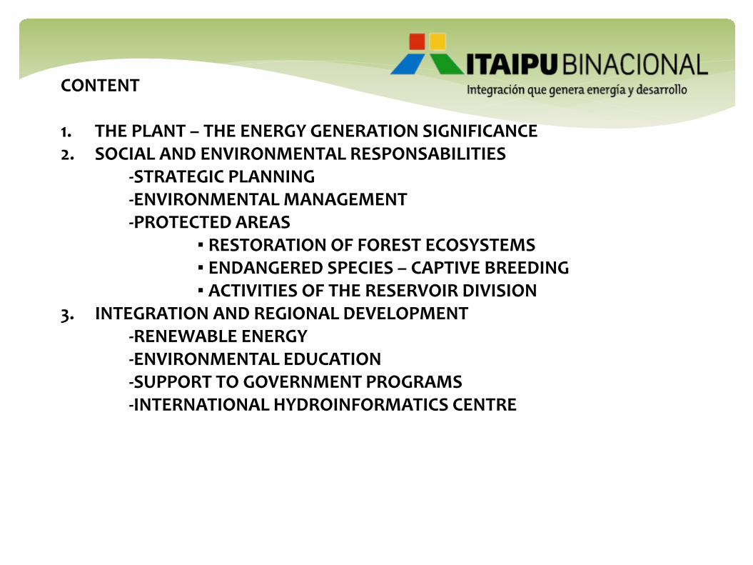
CONTENT 1. THE PLANT – THE ENERGY GENERATION SIGNIFICANCE 2. SOCIAL AND ENVIRONMENTAL RESPONSABILITIES
-STRATEGIC PLANNING -ENVIRONMENTAL MANAGEMENT -PROTECTED AREAS
▪ RESTORATION OF FOREST ECOSYSTEMS ▪ ENDANGERED SPECIES – CAPTIVE BREEDING ▪ ACTIVITIES OF THE RESERVOIR DIVISION
3. INTEGRATION AND REGIONAL DEVELOPMENT -RENEWABLE ENERGY -ENVIRONMENTAL EDUCATION
-SUPPORT TO GOVERNMENT PROGRAMS -INTERNATIONAL HYDROINFORMATICS CENTRE
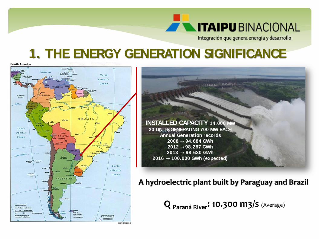
1. THE ENERGY GENERATION SIGNIFICANCE
INSTALLED CAPACITY 14.000 MW 20 UNITS GENERATING 700 MW EACH
Annual Generation records 2008 → 94.684 GWh 2012 → 98.287 GWh 2013 → 98.630 GWh
2016 → 100.000 GWh (expected)
A hydroelectric plant built by Paraguay and Brazil
Q Paraná River: 10.300 m3/s (Average)

THE IMPORTANCE OF ITAIPU BINACIONAL
PARAGUAY Market share
9699.375 9446.316
9857.086 9574.134
8907.974
9530.315
10107.373 10099.021
8735.273 8897.177
20 19 19 19
16 17 17 17 14 15
0
10
20
30
40
50
6000.0
7000.0
8000.0
9000.0
10000.0
11000.0
2006 2007 2008 2009 2010 2011 2012 2013 2014 2015
Participación (%)
MW promedio
Suministro de ITAIPU al Brasil
Participación de ITAIPU en el Mercado Brasileño
BRAZIL Market share
840.886 864.194 883.425 838.815 830.149 917.356
996.183 1074.304
1215.024 1214.192
94 91
87
77 71 73 72
75 79
75
0
25
50
75
100
.0
400.0
800.0
1200.0
1600.0
2006 2007 2008 2009 2010 2011 2012 2013 2014 2015
Participación (%)
MW promedio
Suministro de ITAIPU al Paraguay Participación de ITAIPU en el Mercado Paraguayo

2. SOCIAL AND ENVIRONMENTAL RESPONSIBILITY
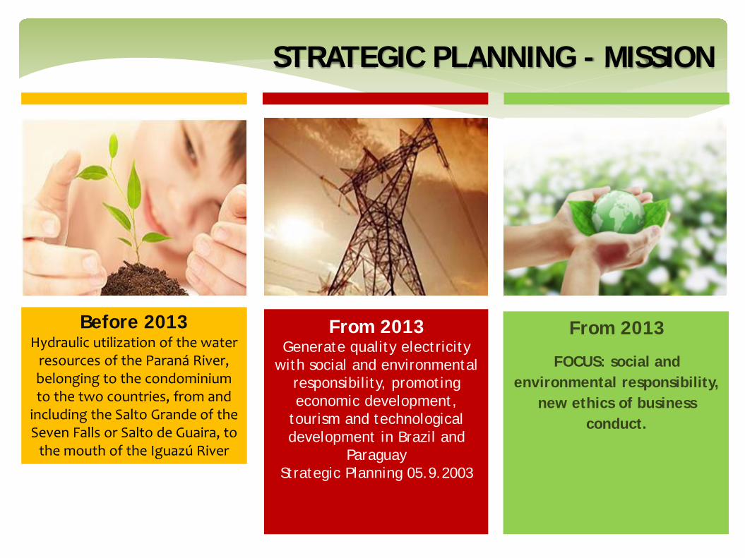
STRATEGIC PLANNING - MISSION
Before 2013 Hydraulic utilization of the water
resources of the Paraná River, belonging to the condominium to the two countries, from and
including the Salto Grande of the Seven Falls or Salto de Guaira, to
the mouth of the Iguazú River
From 2013 Generate quality electricity
with social and environmental responsibility, promoting economic development,
tourism and technological development in Brazil and
Paraguay Strategic Planning 05.9.2003
From 2013
FOCUS: social and environmental responsibility,
new ethics of business conduct.

ENVIRONMENTAL MANAGEMENT MODEL
Environmental management.
ISO 14000
Territorial management
Participative Management
Management by Programs
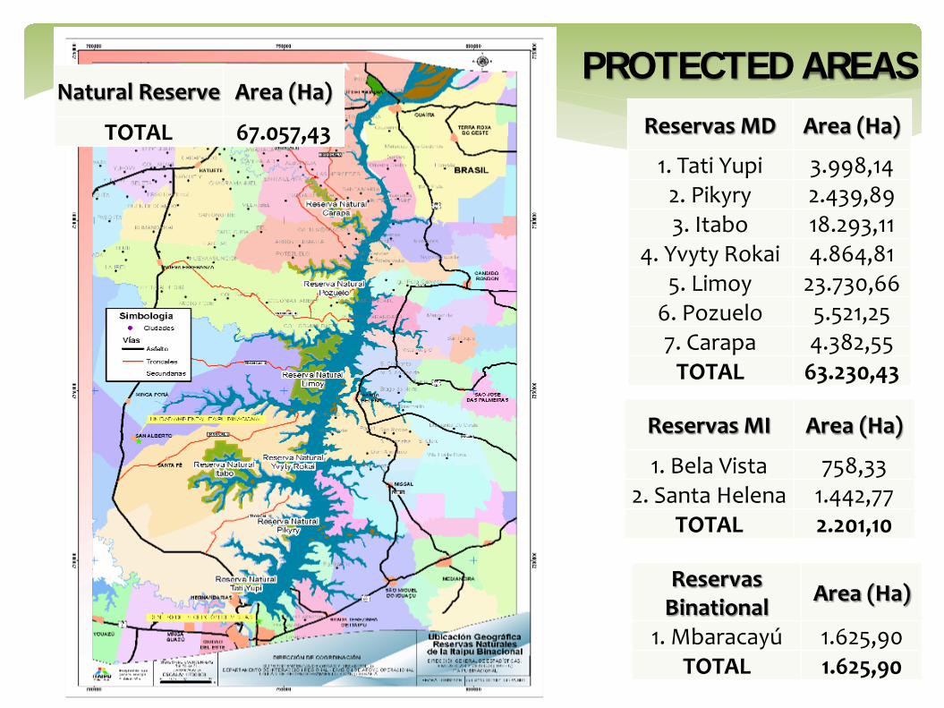
PROTECTED AREAS Reservas MD Area (Ha)
1. Tati Yupi 3.998,14 2. Pikyry 2.439,89 3. Itabo 18.293,11
4. Yvyty Rokai 4.864,81 5. Limoy 23.730,66
6. Pozuelo 5.521,25 7. Carapa 4.382,55
TOTAL 63.230,43
Reservas MI Area (Ha)
1. Bela Vista 758,33 2. Santa Helena 1.442,77
TOTAL 2.201,10
Natural Reserve Area (Ha)
TOTAL 67.057,43
Reservas Binational Area (Ha)
1. Mbaracayú 1.625,90 TOTAL 1.625,90

RESTORATION OF FOREST ECOSYSTEMS
Physical recovery of the biodiversity corridor areas of the Itaipu-MD protection strip
Production of native and exotic plants. Medicinal plants

ENDANGERED SPECIES – CAPTIVE BREEDING
Speothos venaticus (jagua yvyguy) Tapirus terrestris (tapir, mborevi)

ACTIVITIES OF THE RESERVOIR DIVISION
LIMNOLOGY PISCICULTURE ICHTHYOLOGY CLIMATOLOGY

3. INTEGRATION AND REGIONAL DEVELOPMENT

Bioenergy Obtaining renewable energy from porcine waste Farm San Bernardo, Naranjal
Solar Energy Isolated Areas of the Chaco with Solar Energy
RENEWABLE ENERGY

- Promoting environmental responsibility of individuals and social groups
- Workshop on Environmental Education directed to
Teachers and students
- Ecological parks and handicraft recycling courses.
ENVIRONMENTAL EDUCATION
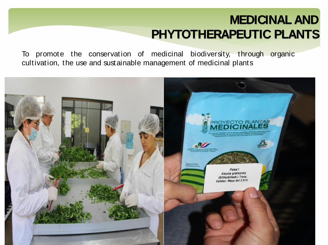
To promote the conservation of medicinal biodiversity, through organic cultivation, the use and sustainable management of medicinal plants
MEDICINAL AND PHYTOTHERAPEUTIC PLANTS

SUPPORT TO GOVERNMENT PROGRAMS
Access to quality social services; Income generation; The integral family accompaniment and others.

SUPPORT TO FARMERS AND INDIGENOUS COLONIES
Contribute to the improvement of life quality in rural areas
Agricultores Indígenas 6 departamentos del país
4 departamentos del país
45 distritos 12 distritos 185 colonias 33 colonias 34.045 familias 1.066 familias 305.365 hectáreas 21.582 hectáreas

ACTIVITIES MADE BY ITAIPU BINACIONAL 1- Ypacarai Lake Information Center 2- Automatic water quality stations 3- Monitoring of water quality by sampling 4- Application of ultrasound 5- Photographic monitoring 6- Phytoremediation 7- Biological treatment with fish 8- Laboratory of water quality 9- Socio-economic feasibility study of PT Arroyo Yukyry 10- Technical support in physical hydrology 11- Bathymetry of Lake Ypacarai 12- Installation of cairns in the lake(Topographical support for bathymetry) 13- Determination of the shoreline 14- Study of the background profile of Lake Ypacarai 15- Donation of electric canoes 16- Reduction of contamination of the basin by biodigesters 17- Hydrometric measurements in the basin 18- Ichthyological Monitoring 19- Support to Foundation Fundapueblos 20- Cleaning of coastal lake area in downpour 21- Application of bioremediation with plant extracts 22- Evaluation of other alternatives of biomanipulation.
YPACARAI LAKE RECOVERY PROJECT

YPACARAI LAKE RECOVERY PROJECT
+
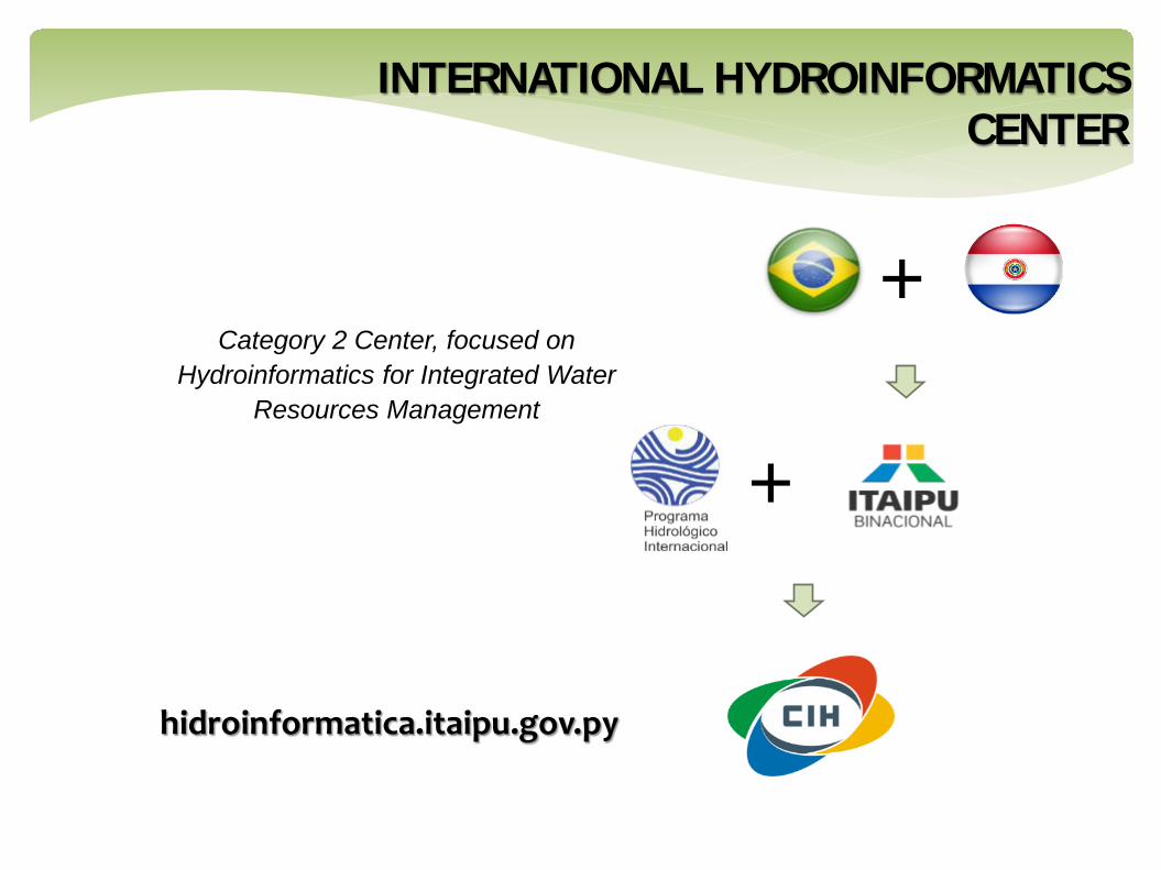
+ Category 2 Center, focused on
Hydroinformatics for Integrated Water Resources Management
hidroinformatica.itaipu.gov.py
INTERNATIONAL HYDROINFORMATICS CENTER
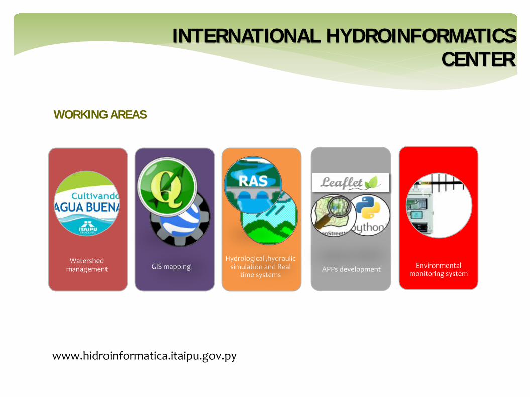
WORKING AREAS
www.hidroinformatica.itaipu.gov.py
Hydrological ,hydraulic simulation and Real
time systems GIS mapping
Watershed management Environmental
monitoring system
1
APPs development
INTERNATIONAL HYDROINFORMATICS CENTER

WATERSHED MANAGEMENT PROGRAM
Cutivating Good Water program is a strategy adopted by Itaipu to give local contribution
to decrease climate change and other environmental issues caused by man.
SUST
AIN
ABIL
ITY
CU
LTU
RE
ENVIRONMENT
SOCIETY
TECHNOLOGY
EDUCATION
PRODUCTION
MANAGEMENT
TOURISM
ECONOMY
Watershed management
CULTIVATING GOOD WATER (CULTIVANDO AGUA BUENA)

Flood in January 2016, Landsat8. Water mask (without validation).
Flood in January 2016, Landsat8. Water mask (without validation).
Alberdi
Flood in January 2016, Landsat8. Water mask (without validation). Villa Florida
GIS MAPPING – FLOOD EVENT (JAN 2016) AT REGIONAL/NATIONAL LEVEL
GIS mapping

APPS DEVELOPED– HYDROMETRIC MONITORING OF MAIN RIVERS
Web-based app Mobile app (1)
APPs development Mobile app (2)
At present Water stage monitoring Alert levels definition Countor lines, subbasins, streams, water
bodies, etc In the future Inclusion of information from neighboring
countries Water stage forecast Estimation of areas number of people and
damage caused by floods
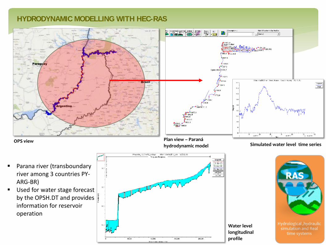
HYDRODYNAMIC MODELLING WITH HEC-RAS
Hydrological ,hydraulic simulation and Real
time systems
Simulated water level time series
Water level longitudinal profile
Plan view – Paraná hydrodynamic model
Parana river (transboundary river among 3 countries PY-ARG-BR)
Used for water stage forecast by the OPSH.DT and provides information for reservoir operation
OPS view

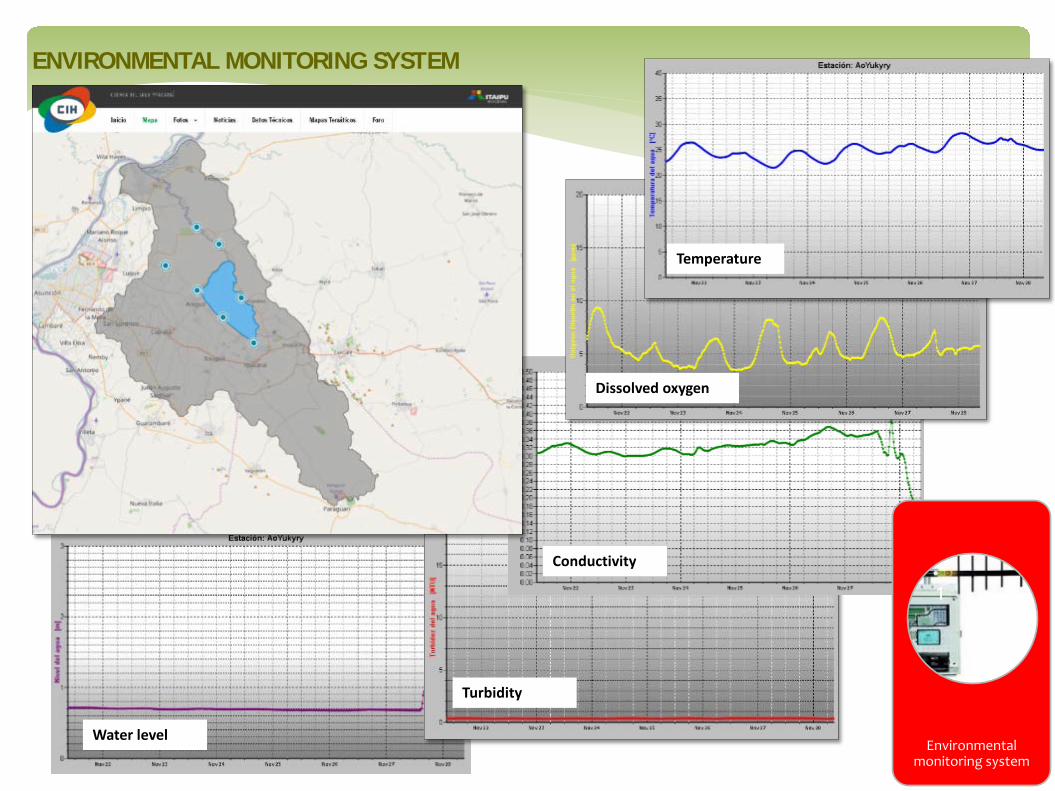
Environmental monitoring system
River Plate Basin’s hydrological database (Developing)
APPs development
Web: www.cicplata.org
Database: sstd.cicplata.org/sstd
Areas: Argentina: 920.000 km2
Brasil: 1.415.000 km2
Bolivia: 205.000 km2
Paraguay: 410.000 km2
Uruguay: 150.000 km2
Total: Around 3.100.000 km2, 17 % of South America
1
Environmental monitoring system
ENVIRONMENTAL MONITORING SYSTEM
Temperature
Dissolved oxygen
Conductivity
Turbidity
Water level

MUCHAS GRACIAS
www.itaipu.gov.py
hidroinformatica.itaipu.gov.py