similarities between gravity and magnetics and application of different geophysical methods
TRANSCRIPT

Similarities Between Gravity and Magnetics and Application of different geophysical methods
• Jyoti Anischit•MSc in Engineering
Geology• TU•Roll 10/2072
Applications of the following Gravity surveyMagnetic surveyElectrical resistivity surveySeismic survey

01: GRAVITY SURVEY METHOD

Definition: It is a method
of measuring the force of gravity in drill holes by means of gravimeters in order to determine the mean density values of rocks at different depths in their natural bed.

Application of Gravity Method Survey:
Hydrocarbon explorationRegional geological studies Isostatic compensation determinationExploration for mass estimation of mineral deposits Detection of subsurface cavities Location of buried rock valley Determination of glacier thickness Shape of earth(geodesy) Monitoring volcanoes

Hydrocarbon exploration
This is also called oil and gas exploration is the search by geophysicist for hydrocarbon deposits beneath the Earth's surface such as oil and natural gas . Oil and gas exploration are grouped under the science of petroleum geology.

Engineering application Gravity surveys can be carried out to locate
iron rich accumulations within furnace, cinder piles .

Accumulations Of Hydrocarbons
Gravity Surveys are used either alone or in conjunction with magnetic surveys, to determine the location and size of the major source structures which contain accumulations of hydrocarbons.

Hydrogeology
Determination of the major structures that control the location of aquifers.
Additionally, Magneto telluric and Magnetics surveys may also be used for the same purpose

The gravity method is a nondestructive geophysical technique that measures differences in the earth’s studies including locating voids and karst features, buried stream valleys, water table levels and the determination of soil layer thickness.
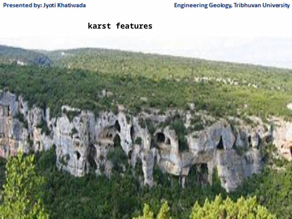
karst features
Gravity data in engineering and environmental applications should be collected in a grid or along a profile with stations spacing 5 meters or less. In addition, gravity station elevations must be determined to within 0.2m
Using the highly precise locations and elevations plus all other quantifiable disturbing effects, the data are processed to remove all these predictable effects.

02: Magnetic survey method

Magnetic survey
Magnetic survey is one of a number of methods used in archaeological geophysics Magnetic surveys record variation in the Earth's magnetic field. In archaeology , magnetic surveys are used to detect and map archaeological artifacts and features. Magnetic surveys are used in both terrestrial and marine archaeology.

• Basic Concepts• The Earth possesses a magnetic field caused
primarily by sources in the core. The form of the field is roughly the same as would be caused by a dipole or bar magnet located near the Earth's center and aligned sub parallel to the geographic axis

Magnetic survey of an archaeological site

APPLICATION OF MAGNETIC METHOD SURVEY

Locating buried Pipes, cables, tank and drums Fault studies Ore exploration identification of metalliferous
deposits, for example massive sulphides Geothermal exploration Mapping buried utilities

Exploration of fossil fuels (oil and gas) Exploration of ore deposit Regional and global tectonics Large scale of geological structures ,volcanology Engineering construction site investigation Burried foundation ,fine pits for archeology Mineral exploration

Locating buried Pipes, cables, tank and drums
Magnetic geophysical surveys measure small, localized variations in the Earth's magnetic field. The magnetic properties of naturally occurring materials such as magnetic ore bodies and basic igneous rocks.
Magnetometer surveys find underground storage tanks, drums, piles and reinforced concrete foundations by detecting the magnetic anomalies they produce.
Exploration Mineral
Magnetic survey, one of the tools used by exploration mineral-bearing ore bodies or even oil-bearing sedimentary structures and locate on map the remains of buried structures.

Marine Magnetic Methods
Magnetic methods, as employed in marine applications, differ little in theory from surface magnetic surveys. The instrument measures the earth’s total magnetic field at each measurement location. However, practical applications of field techniques, field equipment, and geographic control can vary greatly between surface and marine surveys.

Magnetics surveys measure the magnitude and orientation of the Earth’s magnetic field.
Magnetic field at Earth’s surface depends on field generated in Earth’s core, magnetic mineral content of surface materials, and remnant magnetization of surface rocks.
03: Electrical Resistance Survey Method

Definition: Electrical resistance survey also called earth
resistance or resistivity survey is one of a number of methods used in archaeological geophysics. In this type of survey electrical resistance meters are used to detect and map subsurface archaeological features and patterning.

Electrical resistance survey of an archaeological site using a twin probe system. (Wenner electrode array.)

APPLICATION ELECTRICAL RESISTANCE SURVEY METHOD

The presence of certain metallic ore The temperature of sub surface Geothermal energy The presence of archeological feature Graves Fire pits Pot holes .

Amount of ground water present
I. Amount of dissolved saltII. Presence of contaminantsIII.% porosity and permeability

Specific Applications
Determine electrical characteristics of surrounding area.
Determine depth of water table Detect contaminant plumes Determine extent of saltwater intrusion Detect fracture zones and faults Detect areas of potentially unstable ground, e.g.
mine shafts, sinkholes, voids

Assist in dam stability analysisDetermine overburden depthLocate buried mafic dikesProvide data for corrosion control designDetermine lithology/structure.

Electrical resistivity method is also useful for simultaneously detecting lateral and vertical changes in subsurface electrical properties
04 :Seismic Surveys
Methods

Definition
Seismic survey, method of investigating subterranean structure, particularly as related to exploration for petroleum, natural gas, and mineral deposits.
A seismic survey is a technique similar to an ultrasound that is used to develop images of the rock layers below ground.

Seismic Surveys Methods

Applications Seismic Surveys Methods

• Seismic surveys are used to locate and estimate the size of offshore oil and gas reserves.
• To carry out such surveys, ships tow multiple air gun arrays that emit thousands of high-decibel explosive impulses to map the seafloor.
• The auditory assault from seismic surveys has been found to damage or kill fish eggs and larvae and to impair the hearing and health of fish and marine mammals.
Hydrocarbon exploration
It is used by the hydrocarbon industry to provide a high resolution map of acoustic impedance contrasts at depths of up to 10 km within the subsurface. This can be combined with seismic attribute analysis and other exploration geophysics tools and used to help geologists build a geological model of the area of interest.

Land survey Land seismic surveys tend to be large entities,
requiring hundreds of tons of equipment and employing anywhere from a few hundred to a few thousand people, deployed over vast areas for many months.

Marine surveyTraditional marine seismic surveys are conducted
using specially-equipped vessels that tow one or more cables containing a series of hydrophones at constant intervals
Seismic surveying is also play vital part of exploring for oil and gas. That makes it critical to producing the energy we need to power our homes and businesses.

Similarities Between Gravity and Magnetics
1) Geophysical exploration techniques that employ both gravity and magnetic are passive. By this, we simply mean that when using these two methods we measure a naturally occurring field of the earth. Collectively, the gravity and
magnetic methods are often referred to as potential methods and the gravitational and
magnetic fields that we measure are referred to as potential fields.
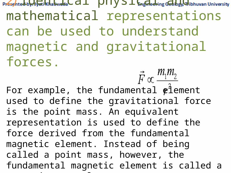
2) Identical physical and mathematical representations can be used to understand magnetic and gravitational forces.
For example, the fundamental element used to define the gravitational force is the point mass. An equivalent representation is used to define the force derived from the fundamental magnetic element. Instead of being called a point mass, however, the fundamental magnetic element is called a magnetic monopole.

3) The acquisition ,reduction, and interpretation of gravity and magnetic observations are very similar.4) Vary from place to place.5) Both are Vector fields6) Both fields are force fields.7) Drift correction is applied in both methods.8) Both fields exert force with a speed equal to the speed of light.

Differences Between Gravity and Magnetics
1) The fundamental parameter that controls gravity variations of interest to us as exploration geophysicists
is rock density. The highest densities we typically observe are about 3.0 gm/cm3and
the lowest densities are about 1.0 gm/cm3.
The fundamental parameter controlling the magnetic field variations of interest to us, is
magnetic susceptibility.This variation is not only present amongst different rock types, but wide variations in susceptibility also occur within a given rock type.
2) Gravitational field is always perpendicular to the surface of earth. While Direction of Magnetic field changes from place to place (it might be same at different places but unlike g it is not always perpendicular).

3) Value of g is less near the equator than at the poles (about 5 gals) for two reasons (1-The distance to the earth's center is greater 2-The rotation of the earth introduces centripetal acceleration V2/r ).
Magnetic field varies from the equator to the poles in a range that goes from 20000 nT to 70000 nT.

4) Gravity (mass) is monopolar it always attracts.
Magnetism is dipolar; like poles repel while unlike poles attract.
5) All matter has mass therefore contributes to g.
While main magnetic field is due to convection currents in the core; it effects on some minerals not all.

6) Gravitational field is measured by Mechanical Instrument. While magnetic field is measured by purely electronic Instruments.
7) Gravimeter is relative instrument; magnetometer is absolute.

8) tides are only external effect on value of g and can be corrected; effect of magnetic storms cannot be removed9) A properly reduced gravitational field is always generated by subsurface variations in rock density. ; A properly reduced magnetic field, however, can have as its origin at least two possible sources. It can be produced via an induced magnetization, or it can be produced via a remanent magnetization.
10) Unlike the gravitational field, which does not change significantly withtime; the magnetic field is highly time dependent.

53
Geophysical Surveying Using Magnetic Methods
Introduction Historical OverviewUnlike the gravitational observations described in the previous section, man has been systematically observing the earth's magnetic field for almost 500 years. Sir William Gilbert published the first scientific treatise on the earth's magnetic field entitled De magnate. In this work, Gilbert showed that the reason compass needles point toward the earth's north pole is because the earth itself appears to behave as a large magnet. Gilbert also showed that the earth's magnetic field is roughly equivalent to that which would be generated by a bar magnet located at the center of the earth and oriented along the earth's rotational axis. During the mid-nineteenth century, Karl Frederick Gauss confirmed Gilbert's observations and also showed that the magnetic field observed on the surface of the earth could not be caused by magnetic sources external to the earth, but rather had to be caused by sources within the earth.

54
Similarities Between Gravity and MagneticGeophysical investigations employing observations of the earth's magnetic field have much in common with those employing observations of the earth's gravitational field. Thus, you will find that your previous exposure to, and the intuitive understanding you developed from using, gravity will greatly assist you in understanding the use of magnetic. In particular, some of the most striking similarities between the two methods include:1- Geophysical exploration techniques that employ both gravity and magnetic are passive. By this, we simply mean that when using these two methods we measure a naturally occurring field of the earth: either the earth's gravitational or magnetic fields. Collectively, the gravity and magnetic methods are often referred to as potential methods and the gravitational and magnetic fields that we measure are referred to as potential fields.2- Identical physical and mathematical representations can be used to understand magnetic and gravitational forces. For example, the fundamental element used to define the gravitational force is the point mass. An equivalent representation is used to define the force derived from the fundamental magnetic element. Instead of being called a point mass, however, the fundamental magnetic element is called a magnetic monopole. Mathematical representations for the point mass and the magnetic monopole are identical.
3- The acquisition, reduction, and interpretation of gravity and magneticobservations are very similar.

55
Differences Between Gravity and MagneticsUnfortunately, despite these similarities, there are several significant differences between gravity and magnetic exploration. By-in-large, these differences make the qualitative and quantitative assessment of magnetic anomalies more difficult and less intuitive than gravity anomalies.1- The fundamental parameter that controls gravity variations of interest to us as exploration geophysicists is rock density. The densities of rocks and soils vary little from place to place near the surface of the earth.The highest densities we typically observe are about 3.0 gm/cm3 ,and the lowest densities are about 1.0 gm/cm3. The fundamental parameter controlling the magnetic field variations of interest to us, magnetic susceptibility, on the other hand, can vary as much as four to five orders of magnitude. This variation is not only present amongst different rock types, but wide variations in susceptibility also occur within a given rock type. Thus, it will be extremely difficult with magnetic prospecting to determine rock types on the basis of estimatedsusceptibilities.2- Unlike the gravitational force, which is always attractive, the magnetic force can be either attractive or repulsive. Thus, mathematically, monopoles can assume either positive or negative values.3- Unlike the gravitational case, single magnetic point sources (monopoles) can never be found alone in the magnetic case. Rather, monopoles always occur in pairs. A pair of magnetic monopoles, referred to as a dipole, always consists of one positive monopole and one negative monopole.

56
4- A properly reduced gravitational field is always generated by subsurface variations in rock density. A properly reduced magnetic field, however, can have as its origin at least two possible sources. It can be produced via an induced magnetization, or it can be produced via a remanent magnetization. For any given set of field observations, both mechanisms probably contribute to the observed field. It is difficult, however, to distinguish between these possible production mechanisms from the field observations alone.5- Unlike the gravitational field, which does not change significantly withtime, the magnetic field is highly time dependent.