shelly bay development proposal
TRANSCRIPT
1
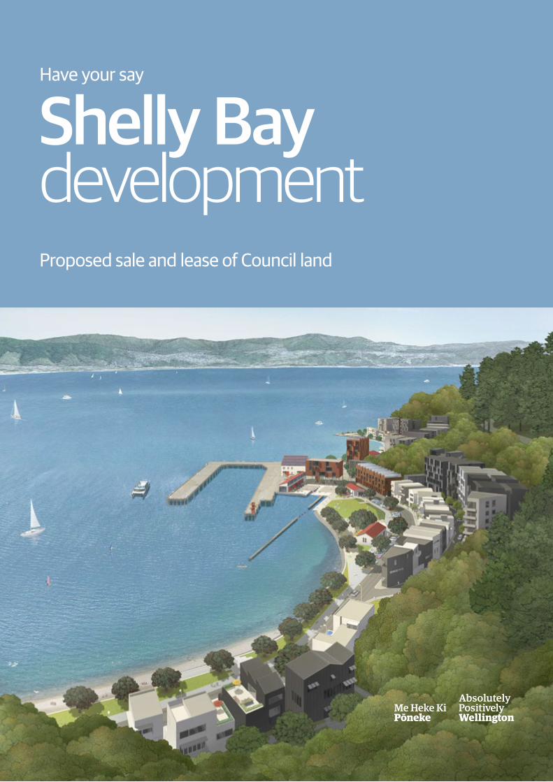
Shelly Bay developmentProposed sale and lease of Council land
Have your say

Contents
Shelly Bay a brief history 3 Shelly Bay today 4
Shelly Bay – what is planned 5
Shelly Bay – overview of planned development 6–7
Shelly Bay – infrastructure 8
Shelly Bay – proposed sale and lease agreement 9
Have your say on Shelly Bay 10
The Council would like your views on the proposal to enter into an agreement to sell and lease land to Shelly Bay Ltd so the planned development of housing and public space can go ahead as envisaged.

3
Shelly Bay a brief history
Above left: Submarine and Torpedo Mining Corps annual camp, Shelly Bay, Wellington. Smith, Sydney Charles, 1888-1972 :Photographs of New Zealand. Ref: 1/1-020236-G. Alexander Turnbull Library, Wellington, New Zealand. /records/22769110
Shelly Bay is set within the northern end of Te Motu Kairangi Miramar Peninsula – an area recognised for its outstanding natural characteristics.Te Āti Awa settled areas around the bay before European settlement and remained there for some time after 1839 when Shelly Bay and most of Wellington was sold to the New Zealand Company.
The bay has an extensive military history dating from the late 19th century. It has naval origins but was later used by the New Zealand Air Force before decommissioning in 1995.
On 14 February 2009 land at Shelly Bay was purchased by iwi mana whenua Taranaki Whānui ki Te Upoko o Te Ika as part of a Treaty of Waitangi settlement.
Port Nicholson Block Settlement Trust (PNBST) was set up in August 2008 to receive and manage the Treaty settlement package for the iwi.
In 2016, PNBST joined forces with developers The Wellington Company in a joint venture (Shelly Bay Ltd) to develop a proposal to regenerate Shelly Bay. They gave the proposed development the Māori name Taikuru.
Left: Aerial view of Shelly Bay, with Mount Crawford Prison, and a flying boat. Evening post (Newspaper. 1865-2002): Photographic negatives and prints of the Evening Post newspaper. Ref: EP/1959/1451-F. Alexander Turnbull Library, Wellington, New Zealand. /records/23261280
Shelly Bay

4
The Council owns about a third of Shelly Bay (3.5 hectares) including the foreshore and land and buildings next to it, running the length of the bay. The remaining two thirds (7.8 hectares) – mainly the flat ground on the landward side of Shelly Bay Road – is owned by Shelly Bay Ltd.
A small number of commercial tenants are based in the bay – including the Chocolate Fish Café; film and event service firm Propeller Studios; and Blackmore and Best art gallery and studio.
In the last 20 years, deferred maintenance has resulted in some of the buildings in Shelly Bay becoming run down and they are now in need of either a major upgrade or demolition. The seawall and other infrastructure are also in need of attention.
Shelly Bay todayWellington City Council negotiated with the Crown over many years to maintain part ownership of land in Shelly Bay to provide public access for the scenic marine drive and to provide open space and access to the foreshore.
From top: Shelly Bay from south headland; the foreshore; Shed 8 existing condition; Shelly Bay from the north.

5
What are the economic benefits of the development?During construction, about $200 million would flow directly into the Wellington economy and a further $300 million would come from indirect spending linked to the development.
After construction, more than 100 people would work full time in Shelly Bay creating an additional $7.5 million in wages and salaries.
What are the benefits to the iwi?The development of Shelly Bay will assist the iwi to meet their aspirations within the takiwā, including with papakainga and other housing; iwi development; and their education, social and cultural objectives.
The Council granted resource consent in April 2017 to The Wellington Company for a plan that would develop Shelly Bay into a new neighbourhood with housing and a range of public spaces and facilities.
The development is an opportunity for the Council to resolve the future of Shelly Bay, enhance the open space and public access to the waterfront, and tackle deferred maintenance to its infrastructure and buildings there.
There are plans including a waterfront walkway; green space; parking and seating; cafes, bars and shops; a microbrewery and a 50-bed hotel.
The development would add 350 homes to Wellington’s housing stock, providing more choice in housing and bringing in rates revenue of $1.5 million a year to the city.
Shelly Bay what is planned
From top: Proposed development; view southwards into proposed development in Shelly Bay Central; view towards the proposed village green. Images by Stantiall Studio

6
Shelly Bay overview of planned development
Shelly Bay would be a new visitor destination with attractive open public spaces and facilities. It would become a more appealing part of the popular scenic coastal route.
The vision of Shelly Bay Limited for the bay incorporates new high quality housing, public facilities located in a mix of new and refurbished premises, and improved infrastructure.
The development would complement existing local attractions such as Scorching Bay, Massey Memorial and the proposed heritage reserve above Shelly Bay on the Miramar Peninsula Te Motu Kairangi.
Housing It is proposed the new homes would comprise 280 apartments, 58 townhouses and 14 standalone homes.
The front row of houses would be three-level townhouses and detached homes with front doors and gardens facing the road.
Behind these, at the base of the steep hill, would be apartment buildings up to six storeys. A road would separate the two levels of housing and provide vehicle access and parking.
North and south headlandsThe headlands at the north and south of Shelly Bay remain as public spaces with views into Shelly Bay and the harbour – but with added facilities including picnic tables, low level planting, parking, kiosks with interpretive information, displays and sculptures.
Public walkway/cycleway A coastal walkway would link the north and south headlands, opening up the foreshore between the two and providing opportunities for walking, cycling, sightseeing, fishing, picnicking and other activities.
Village greenThis area would be retained as public space, with café facilities close by.
It is proposed to realign the public road so the village green and adjoining walkway/cycleway are traffic-free.
Central Shelly BayCentral Shelly Bay would be the public focal point of the village with a mix of new and refurbished buildings providing public facilities including a community space, cafes, restaurants, a microbrewery and a boutique hotel.
Mixed use
Commercial/Community
Carparking
Apartment building
Townhouse
Detached house
Wellington City Council
Shelly Bay Ltd
Proposed new boundary
Area to sell
Area to leaseHotel
View south from north headland to the hotel
N
View between housing, down laneway to sea
Mixed use
Commercial/Community
Carparking
Apartment building
Townhouse
Detached house
Wellington City Council
Shelly Bay Ltd
Proposed new boundary
Area to sell
Area to leaseHotel
View south from north headland to the hotel
View between housing, down laneway to sea

7
Mixed use
Commercial/Community
Carparking
Apartment building
Townhouse
Detached house
Wellington City Council
Shelly Bay Ltd
Proposed new boundary
Area to sell
Area to leaseHotel
View south from north headland to the hotel
View north from south headland to Central Shelly Bay
View between housing, down laneway to sea
Hotel veranda looking north across the Bay
Village green looking south
A new commercial/housing building, with shed 8 in the foreground
Mixed Commercial/Residential
Commercial/Community
Carparking
Hotel
Apartment building
Townhouse
Detached house
Images by architecture+ and Wraight + Associates

8
The public road through Shelly BayIt is proposed that the road from the Miramar Avenue intersection to Shelly Bay be six metres wide with a 1.5-metre adjacent pathway. This would allow for two-way vehicle traffic, cyclists and pedestrians.
The Miramar Avenue intersection may need minor improvements. A final roading plan would be submitted to Council for approval. Within the southern part of Shelly Bay, it is proposed the roadway will be re-routed to the back of the village green, away from the water. This would provide a clear separation between vehicles and cyclists/pedestrians.
TrafficIt is expected that traffic would increase from 1200 vehicles a day to 4700. The speed limit at Shelly Bay is 40 kilometres an hour. Roads of similar width but higher speed limits around Wellington cope satisfactorily with this sort of traffic capacity.
A ferry serviceA passenger ferry service is proposed by the developer between Shelly Bay and Central Wellington.
This would provide public transport to and from the bay and would be an attractive alternative for those who wish to experience a harbour trip.
Stormwater and wastewaterThe development of Shelly Bay would require the public stormwater network to be extended. The public wastewater network to the area would need to be replaced including a new pump station.
Water supplyIt is expected a new reservoir and water supply pipework would be required to support the Shelly Bay development.
Shelly Bay infrastructureImprovements would need to be made to the public road, water supply, and stormwater and wastewater systems if the development of Shelly Bay goes ahead as envisaged.
architecture+ McIndoeURBAN Wraight + Associates PAGE 70
Type 3: Shelly Bay Road
Shelly Bay Road takes its cues from the coastal road leading into the Shelly Bay area, introducing raised pedestrian crossings, narrow lanes and street trees all assist to create a low speed environment. Existing Pohutukawa street trees are generally retained but with some thinning to open views and create space for the now mature trees and new dwellings. New Pohutukawa trees are planted at regular intervals on the coastal side of the road.
DESIGN GUIDANCE
Objective O1 To establish a high quality, low speed street along South Bay providing both local access and through movement.
GuidelinesG1 Provide safe pedestrian access to the Village Green along the north and west edge and footpaths for residential activity along the south and east edge.
G2 Provide a shared pedestrian/ cycle path along the coastal edge.
G3 Provide on street public car parking.
G4 Connect materiality to the wider public realm palette and coastal road language, while introducing a more robust and constructed wharf language for crossings and kerbs.
G5 Maintain a consistency of streetscape treatment with Massey Road in North Bay.
G6 Plant new Pohutukawa trees at regular intervals on the coastal side of the road.
G7 Provide furniture that is simple, robust and consistent throughout the North and South Bay environments.
G8 Use pole mounted lights with light directed down to avoid night sky pollution and away from residential dwellings.
G
SHELLY BAY ROAD
TECHNICAL SPECIFICATION
T1 Minimum 1.5m wide footpath to the landward-side of road along residential frontages.
T2 Minimum 2.5m wide shared pedestrian / cycle path along the coastal edge (refer South Bay Promenade) 6m two way carriageway where no parking.
T3 7m two-way carriageway with parking. Parking 90 degree 4.8m with kerb overhang to Promenade (Scorching Bay roadside parking precedent).
T4 Carriageway surface to be asphalt with fine grade asphalt to footpaths.
T5 Raised pedestrian crossings to be rough stone setts to ramps to provide rumble strips and exposed aggregate concrete top surface.
T
fig. DG 3.2.5
Diagram showing proposed road and pathway widths between Miramar Avenue and Shelly Bay. Cyclists will use the road.
Existing road through Shelly Bay Proposed road, relocated to the back of the village green

9
Shelly Bay proposed sale and lease agreement
BackgroundDeferred maintenance means the Council needs to spend money in the near future at Shelly Bay to maintain infrastructure at an acceptable level and prevent property suffering irreparable damage. The buildings and infrastructure have been around a long time and, in the case of the buildings, their condition is affected by the marine environment and strong winds.
It is estimated it would cost the Council $5.85 million just to refurbish the buildings and maintain the infrastructure to a minimum standard.
Alternatively, the Council could enter into the proposed agreement with Shelly Bay Ltd.
The proposalUnder the proposal, the total infrastructure upgrades (including roading, seawalls, water, sewerage and wastewater) are estimated at $13 million.
The proposal also covers the upgrade of public space, including the development of three park areas, with walkways connecting them, at a cost of $7 million. Completing that upgrade will significantly increase the value of the Council’s land.
Under the proposal, Shelly Bay Ltd would meet half the cost of the Shelly Bay infrastructure upgrade and the public space development ($10 million) and purchase/lease the land at a ‘fully serviced’ value of $8 million. The land without infrastructure upgrade and public space development is worth significantly less.
The net cost to the Council would be $2 million ($10 million cost of infrastructure/public space, minus $8 million income from the sale/lease of Council land). For that amount, the proposed Shelly Bay development would become a reality including greatly enhanced public spaces and facilities – and the Council’s existing building and infrastructure issues at Shelly Bay would be resolved.
Proposed development including public spaces, Central Shelly Bay
Village green
Boutique hotel including refurbished building
commercial and retail (refurbished buildings)
Proposed café (refurbished building)
N
Part of waterfront walkway
commercial and retail (refurbished buildings)
Community space (refurbished building)

10
Have your say on Shelly BayThe Council would like your views on the proposal to enter into an agreement to sell and lease land to Shelly Bay Ltd so the planned development of housing and public space can go ahead as envisaged.
*These figures are the current market valuation for the fully serviced sites, provided by an independent valuer.
Main terms of the proposed agreementThe Council owns 3.5 hectares of land at Shelly Bay, mainly close to the waterfront.
The Council and Shelly Bay Ltd have agreed in principle on the main terms for a sale and lease agreement. These terms will be considered by the Council in September:
• The Council and Shelly Bay Limited would each pay $10 million towards the costs of public infrastructure and public space associated with the development.
• Shelly Bay Ltd would buy 0.3 hectares of land from the Council for $2.5 million* to be used for housing.
• Shelly Bay Ltd would sign a 125-year lease with Council for $5.5 million* for 0.6 hectares of land, and Shed 8 and the former Shipwright’s Building – to be used for commercial facilities and waterfront public space. Shelly Bay Ltd would be liable for the upgrade and maintenance of the two buildings.
How can you have your say?You can find more detailed information, make a submission online or print a submission form at wellington.govt.nz/shellybay or you can email your submission to [email protected]
Copies of the consultation documents are at the Central Library, 65 Victoria Street, and the Council Service Centre, 101 Wakefield Street.
Your feedback will be considered by the Council when it makes a final decision on the proposed sale and lease agreement for Shelly Bay in September 2017.
Final boundaries subject to surveyWellington City Council ownership
Shelly Bay Limited ownership
Mixed use
Commercial/Community
Carparking
Apartment building
Townhouse
Detached house
Wellington City Council
Shelly Bay Ltd
Proposed new boundary
Indicative area to sell
Indicative area to leaseHotel
Mixed use
Commercial/Community
Carparking
Apartment building
Townhouse
Detached house
Wellington City Council
Shelly Bay Ltd
Proposed new boundary
Indicative area to sell
Indicative area to leaseHotel
Area to sell
Area to leaseMixed use
Commercial/Community
Carparking
Apartment building
Townhouse
Detached house
Wellington City Council
Shelly Bay Ltd
Proposed new boundary
Indicative area to sell
Indicative area to leaseHotel
Areas for sale and lease

11
Final boundaries subject to survey
Please submit your feedback by 5pm on Monday 14 August 2017.
Come to the drop-in sessions at Shelly Bay:Sunday 23 July, 11am–3pmSunday 30 July, 11am–3pm
There will be a short presentation from Shelly Bay Ltd on the proposed development at 12pm and 1pm at each of the drop-in sessions.
J003729

12