serving fremont employeeswith a “one stop shop” enterprise … · o mobile solutions available...
TRANSCRIPT

Serving Fremont Employeeswith a “One Stop Shop”
Enterprise Web App
Enterprise GIS: Lessons from the Trenches
ByJohn Leon and Christine Frost
City of Fremont GIS Division2015 Esri international User Conference 1
City of Fremont GIS Division2015 Esri international User Conference 2
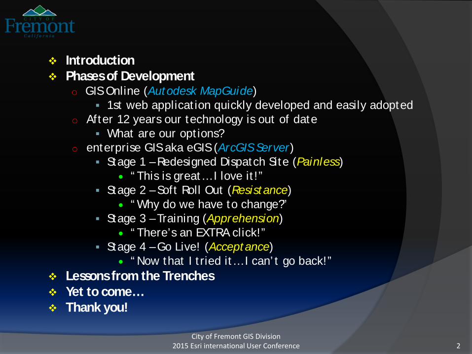
Introduction Phases of Development
o GIS Online (Autodesk MapGuide) 1st web application quickly developed and easily adopted
o After 12 years our technology is out of date What are our options?
o enterprise GIS aka eGIS (ArcGIS Server) Stage 1 – Redesigned Dispatch Site (Painless)
• “This is great… I love it!” Stage 2 – Soft Roll Out (Resistance)
• “Why do we have to change?” Stage 3 – Training (Apprehension)
• “There’s an EXTRA click!” Stage 4 – Go Live! (Acceptance)
• “Now that I tried it… I can’t go back!” Lessons from the Trenches Yet to come… Thank you!

City of Fremont GIS Division2015 Esri international User Conference 3
City of Fremont Facts
4th most populous city in San Francisco Bay Areao 90 Square Mileso 220,000 populationo 900 employees
GIS Team of 4
Lead Agency of the Southern Alameda County GIS Authority (SACGISA) o City of Newark, Alameda County Water District (ACWD) and
Union Sanitary District (USD)o 120 Square Mileso Over 1400 employees

City of Fremont GIS Division2015 Esri international User Conference 4
Phases of DevelopmentBackground
Year 2000, had spent 5 years developing data with no obvious end-producto Needed to prove investment dollars
Critical demand for access to property information and ability to generate mailing notifications
Initial implementation of Esri MapObjects mailing list application proved unsuccessful
1 month pilot project with AutoDesk MapGuide gave us…

City of Fremont GIS Division2015 Esri international User Conference 5
Autodesk MapGuide 6.5PoD - GISO

Established technology since 1996 with a solid customer baseo Affordable and bundled with all required software
Autodesk Author – quickly author maps Autodesk Server – mapping service Macromedia ColdFusion - quickly allowed for us to create custom
reports JavaScript based Extremely stable with fast mapping and reporting performance Proven quick development and deployment Required minimal training for end users
o Trained over 300 Extremely flexible and customizable
o Ability to add layers, data and reports without consultant assistance
City of Fremont GIS Division2015 Esri international User Conference 6
GIS Online (Autodesk MapGuide 6.5)Reasons for Selection
PoD - GISO

City of Fremont GIS Division2015 Esri international User Conference 7
Property SelectionPoD - GISO

City of Fremont GIS Division2015 Esri international User Conference 8
The Kitchen Sink Layer Legend(that Overflowed)
PoD - GISO

City of Fremont GIS Division2015 Esri international User Conference 9
Property Report(Left Hand Report)
PoD - GISO

City of Fremont GIS Division2015 Esri international User Conference 10
Automatic Mailing NotificationPoD - GISO

City of Fremont GIS Division2015 Esri international User Conference 11
Mailing Report(Listing of all properties – non filtered)
PoD - GISO

City of Fremont GIS Division2015 Esri international User Conference 12
Mailing Report(Duplicate owners removed)
PoD - GISO
City of Fremont GIS Division2015 Esri international User Conference 13
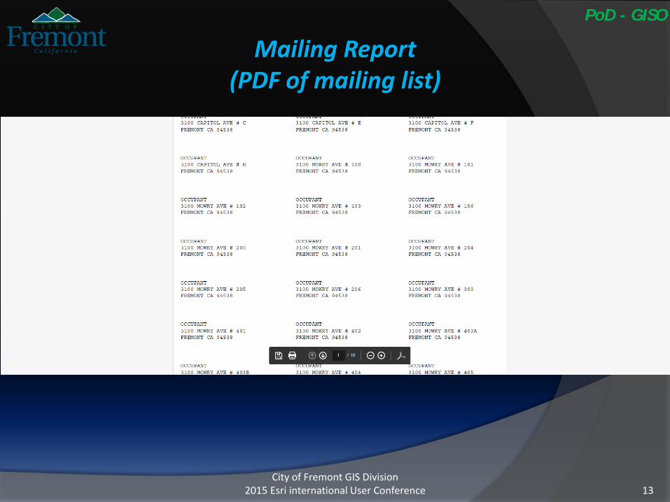
Mailing Report(PDF of mailing list)
PoD - GISO

City of Fremont GIS Division2015 Esri international User Conference 14
Permit ReportsPoD - GISO

GIS Online quickly became the alternative Document Management System
o Linked Assessor Maps, Alameda County Assessor, etc.
o Linked to Permitting system to retrieve Project and CASE reports
o Linked Tract Maps, Fire maps, etc.
o Linked Historical Planning Documents, Plans, Photos, Construction Drawings, etc.
o Linked Buildings to Maintenance Work Order System, Facility Drawings, etc.
City of Fremont GIS Division2015 Esri international User Conference 15
From “Basic GIS” to “One Stop Shop”Feed it and they will come
PoD - GISO

City of Fremont GIS Division2015 Esri international User Conference 16
Reality sets in – the Workhorse technology is out of date
o Product and Server OS are no longer supported
o No mobile solution available
o Mapping and Cartography quality was basic at best
o Dated user interface
o Biggest user complaints Only programmed for Internet Explorer Download and install ActiveX plug-in for Internet Explorer
12 Years later

City of Fremont GIS Division2015 Esri international User Conference 17
How do we come close to matching performance, ease of use, functionality and retain our custom reporting?
How do we come close to matching the Google user experience?
o Needed regional mapping to get away from the floating island effect
How do we handle the kitchen sink data layers approach?
o Single use web applications were clearly not an option
Do we have ANY money?
What do we next?PoD –12 Years

City of Fremont GIS Division2015 Esri international User Conference 18
What are our options?
Do we know if anyone has migrated from MapGuide to Esri?
Do we go with Esri or Open Source solution?
Do we look at Commercial Off-the-Shelf (COTS) solutions?
Do we contract out as custom work?
PoD –12 Years
City of Fremont GIS Division2015 Esri international User Conference 19
Pilot Testing
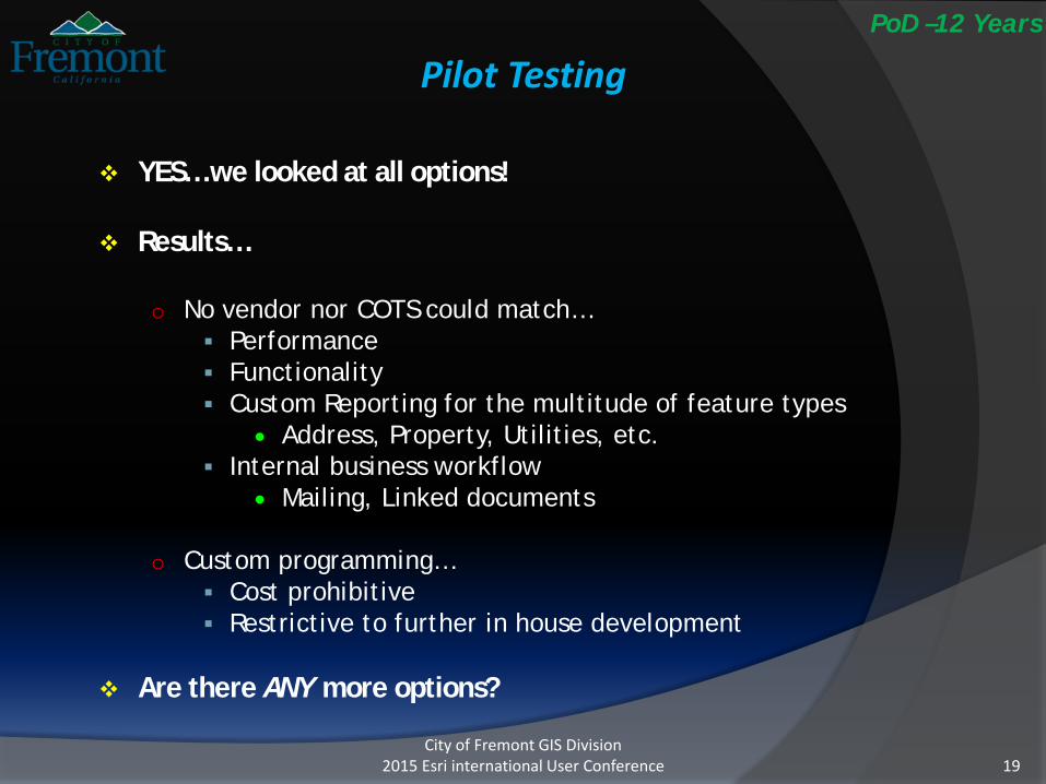
YES… we looked at all options!
Results…
o No vendor nor COTS could match… Performance Functionality Custom Reporting for the multitude of feature types
• Address, Property, Utilities, etc. Internal business workflow
• Mailing, Linked documents
o Custom programming… Cost prohibitive Restrictive to further in house development
Are there ANY more options?
PoD –12 Years

City of Fremont GIS Division2015 Esri international User Conference 20
The “Light Bulb” moment…
Hey, maybe we can do this in house
o After Attending Esri UC, coding for web application development was demystified
o “Piggy backed” on consultant’s “knowledge transfer”
Created our own pilot
o More promising results than previous options
PoD –12 Years

City of Fremont GIS Division2015 Esri international User Conference 21
eGIS Stage 1Knock, knock… Who’s there?
Fremont Police Dispatch was the first at the door
o Needed to have spatial reference outside of our jurisdiction for stakeouts, SWAT situations, serve warrants, mutual aid, etc..
Developed an application within a week
o Expanded Basemapso World wide address locatoro Integrated Google Street Viewo Linked into web services –Santa Clara County, USGS, FEMA, etc.o Added PG&E and National Pipeline and Utility datao Enhanced phone search and ability to select from the map
The reaction was?
PoD – eGIS-S1

City of Fremont GIS Division2015 Esri international User Conference 22
“This is great… I love it!”
Instant adoption
No complaints
Immediately requested to add more
Minimal training
Painless deployment
PoD – eGIS-S1

City of Fremont GIS Division2015 Esri international User Conference 23
eGIS for DispatchPoD – eGIS-S1

City of Fremont GIS Division2015 Esri international User Conference 24
Santa Clara County(Web Service)
PoD – eGIS-S1

City of Fremont GIS Division2015 Esri international User Conference 25
eGIS Stage 2Soft Roll Out
Based on eGIS for Dispatch success, decision was made to create version for City staff
Sent “All User” email introducing new application
Gave a “Show and Tell” to various departments
Sent another “All User” email asking to “Please!” give it a try and provide feedbacko Crickets, Nada, Nothing, Niet, etc.
No choice but give deadline for MapGuide to be turned offo Countdown timer was visibly placed
The reaction was?
PoD – eGIS-S2

City of Fremont GIS Division2015 Esri international User Conference 26
Noooooooooooo!!! #%$#!PoD – eGIS-S2
City of Fremont GIS Division2015 Esri international User Conference 27
eGIS Stage 3Training
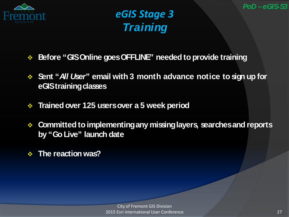
Before “GIS Online goes OFFLINE” needed to provide training
Sent “All User” email with 3 month advance notice to sign up for eGIS training classes
Trained over 125 users over a 5 week period
Committed to implementing any missing layers, searches and reports by “Go Live” launch date
The reaction was?
PoD – eGIS-S3

City of Fremont GIS Division2015 Esri international User Conference 28
There’s an EXTRA click!PoD – eGIS-S3

City of Fremont GIS Division2015 Esri international User Conference 29
eGIS Stage 4Go Live!
Received some feedback during training
Aweek before launch we got a lot MORE feedback
Scrambled to meet deadline of promised commitments and incorporate feedback
Finally… we’re LIVE!
The reaction was?
PoD – eGIS-S4

City of Fremont GIS Division2015 Esri international User Conference 30
Take your PickPoD – eGIS-S4

City of Fremont GIS Division2015 Esri international User Conference 31
Welcome to eGISPoD – eGIS-S4

City of Fremont GIS Division2015 Esri international User Conference 32
Selecting a propertyPoD – eGIS-S4

City of Fremont GIS Division2015 Esri international User Conference 33
Search byText Input or Graphic Selection
PoD – eGIS-S4

City of Fremont GIS Division2015 Esri international User Conference 34
Results and BufferingPoD – eGIS-S4

City of Fremont GIS Division2015 Esri international User Conference 35
Buffered Results,Datagrid and Report Options
PoD – eGIS-S4
City of Fremont GIS Division2015 Esri international User Conference 36
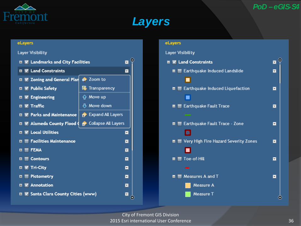
LayersPoD – eGIS-S4

City of Fremont GIS Division2015 Esri international User Conference 37
USGS Landslides(Web Service)
PoD – eGIS-S4

City of Fremont GIS Division2015 Esri international User Conference 38
Widgets Galore!PoD – eGIS-S4

City of Fremont GIS Division2015 Esri international User Conference 39
Basemap Options,Share Map Location and Link List
PoD – eGIS-S4

City of Fremont GIS Division2015 Esri international User Conference 40
Draw and Measure widgetPoD – eGIS-S4

City of Fremont GIS Division2015 Esri international User Conference 41
Swipe Spotlight widgetPoD – eGIS-S4

City of Fremont GIS Division2015 Esri international User Conference 42
Google Street View widgetPoD – eGIS-S4

City of Fremont GIS Division2015 Esri international User Conference 43
Drop Coordinateswith Street Views widget
PoD – eGIS-S4

Benefitso Fast mapping performanceo Works w ColdFusiono Ability to pull in REST services from other agencies
Weather, FEMA, USGS, etc.o Clean interface with Flex or JavaScripto Widgets contributed from ESRI communityo Mobile solutions availableo Available to multiple web browserso Available to PC and MACo Setup of editing sessions via web browsero Web token security and integrating with our City’s Active
Directoryo Multiple basemaps for user to choose fromo No conversion of GIS data sources
City of Fremont GIS Division2015 Esri international User Conference 44
eGIS (ArcGIS Server)Benefits and Challenges
PoD – eGIS-S4

Challengeso Handling large datasets
Contourso Data publishing
Caching versus Map Service versus Feature Serviceo Programming
Widgets versus API Integrating ColdFusion reports
o SDE versus File Geodatabase Syntax differences
o Programming for multiple web browsers IE versus Firefox versus Google Chrome
o Server configuration and setup Security issues – Authentication, Active Directory, IIS, etc. Performance – load balancing Number of users potentially accessing eGIS
City of Fremont GIS Division2015 Esri international User Conference 45
eGIS (ArcGIS Server)Benefits and Challenges
PoD – eGIS-S4

City of Fremont GIS Division2015 Esri international User Conference 46
Underestimated how comprehensive and replied upon GIS Online truly was
False Assumptionso We have savvy userso People like and want new technology similar to their own
personal deviceso If you ask nicely, people will be happy to help out and test (for
their own benefit) o We can do this in-house, no problem
If it works for one group, it will work for another
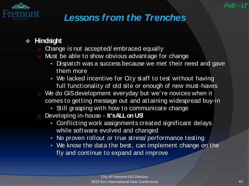
Lessons from the TrenchesPoD – LT
City of Fremont GIS Division2015 Esri international User Conference 47
Hindsighto Change is not accepted/embraced equallyo Must be able to show obvious advantage for change
Dispatch was a success because we met their need and gave them more
We lacked incentive for City staff to test without having full functionality of old site or enough of new must-haves
o We do GIS development everyday but we’re novices when it comes to getting message out and attaining widespread buy-in Still grasping with how to communicate change
o Developing in-house - It’s ALL on US! Conflicting work assignments created significant delays
while software evolved and changed No proven rollout or true stress/performance testing We know the data the best, can implement change on the
fly and continue to expand and improve
Lessons from the TrenchesPoD – LT

City of Fremont GIS Division2015 Esri international User Conference 48
Yet to come…
Incorporate Pictometry widgeto View Oblique Photoso Measurements – height, diameter, elevations, etc.
Reformat reportso Separate data into categories
Add demographic data
Add user preferences option to save settings
Migrate to JavaScript, HTML5, etc.
Link to additional business systems
GO Mobile

City of Fremont GIS Division2015 Esri international User Conference 49
Thank you!
Christine Frost – [email protected]
John Leon – [email protected]
eGIS Home Page – http://egis.fremont.govo Open Data Portalo Public eGIS Interactive Map
Acknowledgementso Esri
Srinivas Suryanarayanaiah Venu Kanaparthy
o Honorable mention Robert J Scheitlin, GISP