rural living areas - rules - qldc.govt.nz · rules within this plan, ... have been used to limit...
TRANSCRIPT

RURAL LIVING AREAS - RULES
Queenstown-Lakes District Council –DISTRICT PLAN (July 2016) 8 - 6
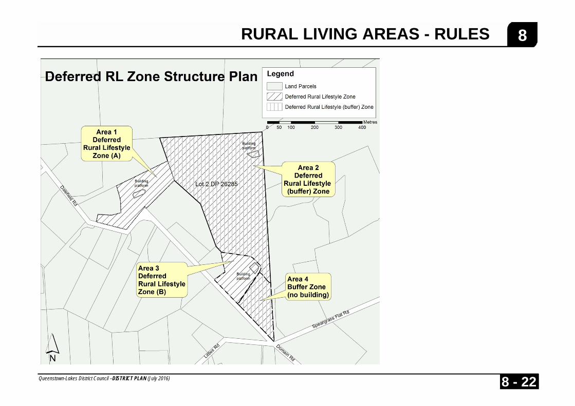
8 8.2 Rural Living Areas Rules The purpose of Rural-lifestyle and Rural-Residential Zones is to provide for low density residential opportunities as an alternative to the suburban living areas of the District. The Rural-lifestyle Zone recognises that in some locations low density rural living development is appropriate. Subdivision rules are aimed at creating a diversity of allotment sizes which may be utilised for a diversity of rural and/or residential activities. The imposition of a minimum and average allotment size is to protect the character and viability of the zone, as well as adjoining rural activities. The Rural Residential Zone is anticipated to be characterised by low density residential areas with ample open space, landscaping and with minimal adverse environmental effects experienced by residents. Rural activities are not likely to remain a major use of land in the Rural Residential Zone or a necessary part of the rural residential environment. The Rural Residential zone at the north of Lake Hayes is anticipated to be characterised by a diversity of lot sizes, comprehensive amenity and riparian planting, and generous setbacks from roads and internal boundaries. The Rural Residential sub-zone at Bob’s cove is unique in that it provides an opportunity for integrated and comprehensive development while maintaining and enhancing the ecological values of the native flora and fauna of the area and protecting the scenic values of the Glenorchy-Queenstown Road and Lake Wakatipu. A Deferred Rural Lifestyle (Buffer) zone has been created to place firm limits to the expansion of rural lifestyle development east of Dalefield Road. The rules within this plan, in addition to covenants volunteered by a landowner, have been used to limit development to one residential unit and restrict the planting of vegetation within a buffer area situated between the rural general and rural lifestyle zones.
Clarification of Terms Development Area Within the Rural Residential sub-zone at Bob’s Cove, the “development area” shall include all that land used for: a) Buildings; b) Outdoor living areas; c) Pathways and accessways, but excluding the main accessway
leading from the Glenorchy-Queenstown Road to the development areas;
d) Private garden; and e) Mown grass surfaces, but excluding large areas of commonly-owned
mown pasture or grazed areas which are to be used for recreational purposes.
Undomesticated Area Within the Rural Residential sub-zone at Bob’s Cove, all other land not included in the definition of “Development Area” shall be deemed to be “Undomesticated Area”. 8.2.1 District Rules Attention is drawn to the following District Wide Rules which may apply in addition to any relevant Zone Rules. If the provisions of the District Wide Rules are not met then consent will be required in respect of that matter: (i) Heritage Protection - Refer Section 13 (ii) Transport - Refer Section 14 (iii) Subdivision, Development and Financial Contributions - Refer Section 15 (iv) Hazardous Substances - Refer Section 16
RURAL LIVING AREAS - RULES
Queenstown-Lakes District Council –DISTRICT PLAN (July 2016) 8 - 7
8 (v) Utilities - Refer Section 17 (vi) Signs - Refer Section 18 (vii) Relocated Buildings and Temporary Activities - Refer Section 19 (viii) Earthworks - Refer Section 22 8.2.2 Activities 8.2.2.1 Permitted Activities Any Activity which complies with all the relevant Site and Zone Standards and is not listed as a Controlled, Discretionary, Non-Complying or Prohibited Activity, shall be a Permitted Activity. 8.2.2.2 Controlled Activities The following shall be Controlled Activities provided that they are not listed as a Prohibited, Non-Complying or Discretionary Activity and they comply with all the relevant Site and Zone Standards. The matters in respect of which the Council has reserved control are listed with each Controlled Activity. i Buildings
(i) The addition, alteration or construction of buildings, including Residential Units added to, altered or constructed within Residential Building Platforms approved pursuant to Rule 15.2.6.3, in respect of:
(a) the location and external appearance of the buildings and
associated earthworks, access and landscaping, to avoid or mitigate adverse effects on landscape and visual amenity values, nature conservation values and the natural character of the rural environment; and
(b) the provision of water supply, sewage treatment and
disposal, electricity and telecommunication services; and
(c) the avoidance or mitigation of effects of natural hazards in the Makarora Rural Lifestyle Zone.
(ii) In the Deferred Rural Lifestyle (Buffer) zone, the erection of one
non-residential building.
ii Retail Sales Retail Sales in respect of vehicle access and car parking. iii Residential Flat iv Visitor Accommodation Activities within the Visitor Accommodation Sub-Zones 8.2.2.3 Discretionary Activities The following shall be Discretionary Activities provided they are not listed as a Prohibited or Non-Complying Activity and they comply with all the relevant Zone Standards: i Visitor Accommodation ii Airports In the Rural Lifestyle Zone, Airports other than the use of land and water
for emergency landings, rescues and fire fighting or for activities ancillary to farming activities.
iii The boarding of dogs and cats, and the keeping of pigs in the Bob’s
Cove Rural Residential Zone. iv Any Activity which is not listed as a Non-Complying or Prohibited
Activity and complies with all the Zone Standards but does not comply with one or more of the Site Standards shall be a Discretionary Activity

RURAL LIVING AREAS - RULES
Queenstown-Lakes District Council –DISTRICT PLAN (July 2016) 8 - 8
8 with the exercise of the Council’s discretion being restricted to the
matter(s) specified in the standard(s) not complied with. v Structures
Any structure erected within 10 metres of a road boundary, which is greater or equal to 5 metres in length, and greater than or equal to 1 metre in height and less than 2 metres in height, except for: − post and rail, post and wire and post and mesh fences, including
deer fences; − any structure associated with farming activities as defined in this
plan; − any structure that is erected in accordance with a landscaping plan
associated with a subdivision consent or resource consent for a building, where that landscaping plan is approved as a condition on the resource consent.
The Council’s discretion is restricted to the consideration of effects on views and amenity from public roads.
(vi) In the Deferred Rural Lifestyle (Buffer) zone, the erection of more than one non-residential building.
8.2.2.4 Non-Complying Activities The following shall be Non-Complying Activities, provided that they are not listed as a Prohibited Activity: i Commercial Activities Commercial activities except for retail sales of: (a) Farm and garden produce, reared or produced on the site; or (b) Handicrafts produced on the site.
ii Factory Farming Factory Farming except for the boarding of animals. iii Forestry Activities iv Mining Activities v Airports In the Rural Residential Zone Airports other than the use of land and
water for emergency landings, rescues and fire fighting. vi Residential Units
a) In the Rural Lifestyle Zone - Any Residential Unit not contained within a Residential Building Platform approved under Rule 15.2.6.3.
b) In the Ferry Hill Rural Residential sub-zone -
Any residential Unit not contained within a Residential Building Platform shown on the Concept Development Plan
vii Any Activity, which is not listed as a Prohibited Activity and which, does
not comply with one or more of the relevant Zone Standards, shall be a Non-Complying Activity.
8.2.2.5 Prohibited Activities The following shall be Prohibited Activities: i Panelbeating, spray painting, motor vehicle repair or dismantling,
fibreglassing, sheet metal work, bottle or scrap storage, motorbody building or fish or meat processing or any activity requiring an Offensive Trade Licence under the Health Act 1956.
ii It is a prohibited activity in the Johns Creek Rural Residential zone to
plant the following tree species:

RURAL LIVING AREAS - RULES
Queenstown-Lakes District Council –DISTRICT PLAN (July 2016) 8 - 9
8 • Pinus radiata • Pinus muricata • Pinus contorta • Pinus ponderosa • Pinus sylvestris • Pinus nigra • Douglas Fir • All Eucalyptus varieties iii It is a prohibited Activity in the Ferry Hill Rural Residential sub-zone to
plant those species listed in Rule 8.2.2.5(ii) above, with the exception that Eucalyptus varieties shall be permitted in this sub-zone.
iv It is a prohibited activity in the Bob’s Cove Rural Residential Zone to
plant the following tree species: • Pinus contorta (Lodgepole) • Pinus radiata • Corsican Pine (Pinus Nigra) • Douglas Fir • Gorse • Pinus muricata • Pinus ponderosa • European Larch • All Eucalyptus varieties • Broom • Sycamore • Hawthorn • Boxthorn • Lupin • Pinus sylvestris 8.2.3 Non-Notification of Applications Any application for a resource consent for the following matters may be considered without the need to obtain a written approval of affected persons and need not be notified in accordance with Section 93 of the Act, unless the Council considers special circumstances exist in relation to any such application:
i All applications for Controlled Activities. ii Applications for the exercise of the Council’s discretion in respect
of the following Site Standards: • Access • Retail Sales 8.2.4 Standards – Rural Lifestyle and Rural Residential 8.2.4.1 Site Standards i Building Coverage Maximum building coverage for all activities on any site shall be 15%. ii Setback from Internal Boundaries (a) Minimum setback from internal boundaries of any building for any
activity shall be: Rural Lifestyle Zone - 10m Rural Residential Zone - 6m The Rural Residential zone at the north of Lake Hayes - 15m Bob’s Cove Rural Residential Zone - 10m iii Access Each site shall have legal access to a formed legal road. iv Retail Sales (a) Buildings in excess of 25 m², which are to be used for retail sales,
shall be setback from road boundaries by a minimum distance of 15 m, except in the Bob’s Cove Rural Residential zone, where they shall be setback by a minimum distance of 30m.
RURAL LIVING AREAS - RULES
Queenstown-Lakes District Council –DISTRICT PLAN (July 2016) 8 - 10
8 (b) Parking associated with retail sales shall not be located within
such a setback. v Nature and Scale of Activities (a) In the Rural-Residential Zone the maximum gross floor area of
non-residential activities shall not exceed 40m² (b) In the Rural-lifestyle Zone the maximum gross floor area of non-
farming or non-residential activities shall not exceed 100 m². vi Residential Density In the Rural Residential zone at the north of Lake Hayes (a) for allotments less than 8000m² in size, there shall be only one
residential unit; (b) for allotments equal to or greater than 8000m² there shall be no
more than 1 residential unit per 4000m² , on average. (c) In each area of the Deferred Rural Lifestyle zone east of Dalefield
Road up to two residential allotments may be created with a single residential building platform on each allotment pursuant to Rule 15.2.6.3 (iii)(a).
(d) The land in the Deferred Rural Lifestyle (Buffer) zone shall be
held in a single allotment containing no more than one residential building platform pursuant to Rule 15.2.6.3 (iii)(a).
vii Indigenous Vegetation (Forest Hill) The minimum area on any site within the “Forest Hill” Rural/Residential
zone, to be retained or reinstated in indigenous vegetation shall be 70 percent of the net site area. For the purpose of this rule net area shall exclude access to the site and the building restriction area.
viii Building Restriction (Forest Hill) The “Forest Hill” Rural Residential building restriction area, adjoining the
Queenstown-Glenorchy Road, shall be retained and/or reinstated in indigenous vegetation.
ix Boundary Planting (John’s Creek) No tree or hedgerow boundary planting shall exceed 1.9 metres in height
within 2 metres of the boundary, at any point of its length. x Deleted
xi Building Height - Rural Residential sub-zone at Bob’s Cove
Within the Rural Residential sub-zone at Bob’s Cove, no part of any building shall protrude through a surface drawn parallel to and 6m vertically above the ground level.
xii Open space - Rural Residential sub-zone at Bob’s Cove
Within the Rural Residential sub-zone at Bob’s Cove, those areas that are set aside as “open space” shall not contain any vegetation of a height greater than 2 metres, such that the vegetation does not disrupt the open pastoral character or the views of the lake and mountains beyond.
xiii Boundary Planting - Rural Residential sub-zone at Bob’s Cove
Within the Rural Residential sub-zone at Bob’s Cove, where the 15 metre Building Restriction Area adjoins a development area, it shall be planted in indigenous tree and shrub species common to the area, at a density of one plant per square metre; and Where a building is proposed within 50 metres of the Glenorchy-Queenstown Road, such indigenous planting shall be established to a height of 2 metres and shall have survived for at least 18 months prior to any residential buildings being erected.

RURAL LIVING AREAS - RULES
Queenstown-Lakes District Council –DISTRICT PLAN (July 2016) 8 - 11
8 xiv Building setbacks Bob’s Cove
Where a building is proposed within 50 metres of the Glenorchy-Queenstown Road, all landscaping to be undertaken within this distance on the subject property shall consist of native species in accordance with Attachment A, subject to the requirement below: All landscaping within 15 metres of the Glenorchy-Queenstown Road shall be planted prior to the commencement of the construction of the proposed building. All landscaping from 15 metres to 50 metres from the Glenorchy-Queenstown Road shall be established within the first planting season after the completion of the building on the site.
8.2.4.2 Zone Standards i Building Line Restriction (a) No building to be used for residential purposes shall be erected
within 150 m of the sewage ponds on the adjoining land described as Sections 1 and 2, SO Plan 24120 Albert Town.
(b) No building shall be erected on the elevated land of Part Lot 17
DP 12678 and Part Lot 18 DP 12678, (as shown on Planning Map 26).
(c) No building or structure shall be erected within the building
restriction area at the “Forest Hill” Rural Residential zone. (d) No building shall be erected within the Building Restriction Area
at Wilsons Bay, as shown on Planning Map 38. (e) Within the Rural Residential sub-zone at Bob’s Cove Zone:
i No building shall be erected within an area that has been identified as “Undomesticated Area” in accordance with Zone Standards 8.2.4.2(xi) or 15.2.6.3(iv).
ii No building shall be erected within 15 metres of the road
boundary fronting the Glenorchy-Queenstown Road. (Refer Planning Map 38).
(f) Within the Rural Residential Zone at Bob’s Cove, no building shall
be erected within 15 metres of the road boundary fronting the Glenorchy – Queenstown Road (Refer Map 38).
ii Building Height
(a) The maximum height for any building shall be 8m.
(b) The maximum height for any building located between Beacon Point Road and the margins of Lake Wanaka shall be 7m.
(c) Notwithstanding (a) no part of any building within Lots 9-15 as
shown on the Concept Development Plan for the Ferry Hill Rural Residential sub-zone shall protrude through a surface drawn parallel to and 5.5. metres above the ground level, provided that chimney and ventilation structures may exceed the height by a maximum of 1.2 metres only.
(d) In the Deferred Rural Lifestyle (Buffer) zone, no part of a building
in the building platform identified on the Deferred Rural Lifestyle zone Structure Plan included in part 8 of the District Plan shall protrude through a surface drawn parallel to and 6.5m vertically above the ground level.
Refer to Appendix 4 and the definitions of Height and Ground Level.
iii Noise
(a) Sound from non-residential activities measured in accordance with NZS 6801:2008 and assessed in accordance with NZS

RURAL LIVING AREAS - RULES
Queenstown-Lakes District Council –DISTRICT PLAN (July 2016) 8 - 12
8 6802:2008 shall not exceed the following noise limits at any point within any other site in this zone:
daytime (0800 to 2000 hrs) 50 dB LAeq(15 min) (i)
night-time (2000 to 0800 hrs) 40 dB LAeq(15 min) (ii)
night-time (2000 to 0800 hrs) 70 dB LAFmax (iii)
(b) Sound from non-residential activities which is received in another zone shall comply with the noise limits set in the zone standards for that zone.
(c) The noise limits in (a) shall not apply to construction sound which shall be assessed in accordance and comply with NZS 6803:1999.
(d) The noise limits in (a) shall not apply to sound associated with airports or windfarms. Sound from these sources shall be assessed in accordance and comply with the relevant New Zealand Standard, either NZS 6805:1992, or NZS 6808:1998. For the avoidance of doubt the reference to airports in this clause does not include helipads other than helipads located within any land designated for Aerodrome Purposes in this Plan.
iv Glare (a) All fixed exterior lighting shall be directed away from the adjacent
roads and sites. (b) No activity on any site shall result in greater than a 3 lux spill
(horizontal and vertical) of light to any other site measured at any point inside the boundary of the other site.
v Nature and Scale of Activities (a) No non-farming goods, materials or equipment shall be stored
outside a building, except for vehicles associated with the activity parked on the site overnight.
(b) All manufacturing, altering, repairing, dismantling or processing of
any materials, goods or articles shall be carried out within a building except this zone standard shall not apply to any utility building or to any farming activities.
vi Heavy Vehicle Storage No more than one heavy vehicle shall be stored or parked overnight on
any site for any activity. This standard applies cumulatively to residential and non-residential activities, except for farming activities, and only one heavy vehicle in total shall be stored or parked overnight on any site. This limitation does not apply to farming activities.
vii Screening Storage areas for waste materials, outdoor display areas and parking
associated with commercial activities and other productive activities shall generally be positioned and managed to minimise any adverse visual effect.
viii Residential Density In the Rural Residential Zone, except in the Rural Residential area at the
north of Lake Hayes: (a) for allotments less than 8000m² there shall be only one residential
unit. (b) for allotments equal to or greater than 8000m² there shall be no
more than 1 residential unit per 4000 m².
Except that in the Ferry Hill Rural Residential sub-zone, there shall be no more than one residential unit per lot
RURAL LIVING AREAS - RULES
Queenstown-Lakes District Council –DISTRICT PLAN (July 2016) 8 - 13
8 (c) Except that within the Rural Residential zone at Bobs Cove The maximum average density of residential units shall be 1
residential unit per 4000m calculated over the total area within the zone.
ix Setback from Roads Minimum setback from road boundaries of any building for any activity
shall be 10m, except that in the Rural Residential zone at the north of Lake Hayes, the minimum setback from Speargrass Flat Road shall be 15m
x Roof Colours The colour of any roof on any dwelling or accessory building situated on
any part of the land situated south of State Highway 6 (“Ladies Mile”) and southwest of Lake Hayes which is zoned Rural Residential as shown on Planning Map 30 shall be within the range of browns, greens, greys, and blue greys.
xi Areas within the Rural Residential sub-zone at Bob’s Cove Within the Rural Residential sub-zone at Bob’s Cove, where
development areas and undomesticated areas have not been identified as part of a previous subdivision, at least 75% of the total area of the zone shall be set aside as “Undomesticated Area” and the remainder as “Development Area”; and at least 50% of the ‘undomesticated area’ shall be retained, established, and maintained in indigenous vegetation with a closed canopy such that this area has total indigenous litter cover. This rule shall be given effect to by consent notice registered against the title of the lot created, to the benefit of the lot holder and the Council.
Such areas shall be identified and given effect to by way of covenant, as
part of any land use consent application.
xii Within the Rural Residential sub-zone at Bob’s Cove, the provision and maintenance of areas of indigenous vegetation
(a) At least 50% of the undomesticated area within the zone shall be
retained, established, and maintained in indigenous vegetation with a closed canopy, such that complete indigenous litter cover is maintained over the area; and
The landscaping and maintenance of the undomesticated area shall be
detailed in a landscaping plan that is provided as part of any subdivision application. This Landscaping Plan shall identify the proposed species and shall provide details of the proposed maintenance programme to ensure a survival rate of at least 90% within the first 5 years.
xiii In the Ferry Hill Rural Residential sub-zone –
(a) The location of buildings shall be in accordance with the Concept Development Plan for the Ferry Hill Rural Residential sub-zone.
(b) Within Lots 9-15 as shown on the Concept Development Plan for
the Ferry Hill Rural Residential sub-zone:
(i) The roof pitch shall be between 20° and 30° and roof dormers and roof lights are to be incorporated in the roof pitch;
(ii) Roof finishes of buildings shall be within the following
range: Slate shingle, cedar shingle, steel roofing (long run corrugated or tray) in the following colours, or similar, only: Coloursteel colours New Denim Blue, Grey Friars, Ironsand or Lignite;
(iii) Wall claddings of buildings shall be within the following
range: cedar shingles, natural timber (clear stain), painted plaster in the following colours or similar: Resene 5YO18, 5B025, 5B030, 4GR18, 1B55, 5G013, 3YO65, 3YO20; stone cladding provided the stone shall be limited to Otago schist only and all pointing/mortar shall be recessed.

RURAL LIVING AREAS - RULES
Queenstown-Lakes District Council –DISTRICT PLAN (July 2016) 8 - 14
8 (c) Any application for resource consent shall be accompanied by a
landscape Plan which shows the species, number, and location of all plantings to be established, and shall include details of the proposed timeframes for all such plantings and a maintenance programme.
The landscape plan shall ensure: i. That the escarpment within Lots 18 and 19 as shown on
the Concept Development Plan for the Ferry Hill Rural Residential sub-zone is planted with a predominance of indigenous species in a manner which enhances naturalness; and
ii. That residential development is subject to screening along Tucker Beach Road.
(d) Plantings at the foot of, on, and above the escarpment within lots
18 and 19 as shown on the Concept Development Plan for the Ferry Hill Rural Residential sub-zone shall include indigenous trees, shrubs, and tussock grasses.
Plantings elsewhere may include Lombardy poplar, willow, larch, maple as well as indigenous species.
(e) The on-going maintenance of plantings established in terms of (c)
above shall be subject to a condition of resource consent.
(f) The erection of solid or paling fences is not permitted. xiv In the Deferred Rural Lifestyle (Buffer) zone, maintenance of the
open landscape character
In the Deferred Rural Lifestyle (Buffer) zone, apart from the curtilage area, the land shall be maintained substantially in pastoral sward. Tree planting and natural revegetation shall be confined to gullies and watercourses, as specified in covenants and on landscape plans. Buildings necessary for the maintenance of the land in this condition are controlled activities pursuant to Rule 15.2.7.1.
8.2.5 Resource Consents – Assessment Matters The Assessment Matters, which apply to the consideration of resource consents in the Rural Living Areas, are specified in Rule 8.3. 8.3 Resource Consents - Assessment
Matters - Rural Living Areas 8.3.1 General i The following Assessment Matters are methods or matters included in
the District Plan, in order to enable the Council to implement the Plan’s policies and fulfil its functions and duties under the Act.
ii In considering resource consents for land use activities, in addition to the
applicable provisions of the Act, the Council shall apply the relevant Assessment Matters set out in Clause 8.3.2 below.
iii In the case of Controlled and Discretionary Activities, where the exercise
of the Council’s discretion is restricted to the matter(s) specified in a particular standard(s) only, the assessment matters taken into account shall only be those relevant to that/these standard(s).
iv In the case of Controlled Activities, the assessment matters shall only
apply in respect to conditions that may be imposed on a consent. v Where an activity is a Discretionary Activity because it does not comply
with one or more relevant Site Standards, but is also specified as a Controlled Activity in respect of other matter(s), the Council shall also apply the relevant assessment matters for the Controlled Activity when considering the imposition of conditions on any consent to the discretionary activity.
RURAL LIVING AREAS - RULES
Queenstown-Lakes District Council –DISTRICT PLAN (July 2016) 8 - 15
8 8.3.2 Assessment Matters In considering whether or not to grant consent or impose conditions, the Council shall have regard to, but not be limited by, the following assessment matters: i General - Nature Conservation Values (a) The extent to which activities will result in opportunities for
protection and enhancement of indigenous ecosystems. (b) The extent to which the activity provides opportunities for making
information available regarding indigenous ecosystems. (c) The extent to which activities will protect and enhance the
survival and well being of indigenous plants and/or animals that are rare, vulnerable or endangered, or significant within the District, Region or nationally.
(d) The preservation and enhancement of the indigenous vegetation
within the area of building restriction adjoining the Queenstown-Glenorchy Road, and the removal and control of wilding pines in relation to the “Forest Hill” Rural Residential zone.
(e) The preservation and enhancement of the indigenous vegetation
on 70 per cent of the net site area within the “Forest Hill” Rural Residential zone.
At the Rural Residential zone at the north of Lake Hayes, whether and
the extent to which the proposed development will: (f) Result in adverse effects on water qualities, fisheries and other
wildlife values, and whether and to what extent it is possible to avoid, remedy or mitigate such effects;
(g) Result in opportunities for the protection and enhancement of the
water quality of Mill Creek, the wetland area, and Lake Hayes through the creation of new wetland areas, and the fencing off of
areas within close proximity to Mill Creek in order to enable the protection and re-vegetation of riparian margins.
(h) Within the Ferry Hill Rural Residential sub-zone, the extent to
which:
• plantings with a predominance of indigenous species enhances the naturalness of the escarpment within Lots 18 and 19 as shown on the Concept Development Plan for the Ferry Hill Rural Residential sub-zone; and
• the species, location, density, and maturity of the planting
is such that residential development will be successfully screened from views obtained when travelling along Tucker Beach Road.
Within the Rural Residential sub-zone at Bob’s Cove (i) Whether and the extent to which the proposed landscaping
contains predominantly indigenous species (comprising a mix of trees, shrubs, and grasses) that are suited to the general area, such as red beech, native tussocks, hebes, pittosporum, coprosmas, cabbage trees, and lancewoods.
ii Natural Hazards - General In all Zones: (a) Whether the activity will exacerbate any natural hazard, including
erosion, sedimentation, subsidence and landslips. In the Makarora Rural Lifestyle Zone: In addition to (a) above: (b) The likelihood of the building being subject to the effects of any natural or
other hazard, the degree to which the hazard could result in damage, destruction and/or loss of life, and the need to avoid or mitigate any potential damage or danger from the hazard.
RURAL LIVING AREAS - RULES
Queenstown-Lakes District Council –DISTRICT PLAN (July 2016) 8 - 16
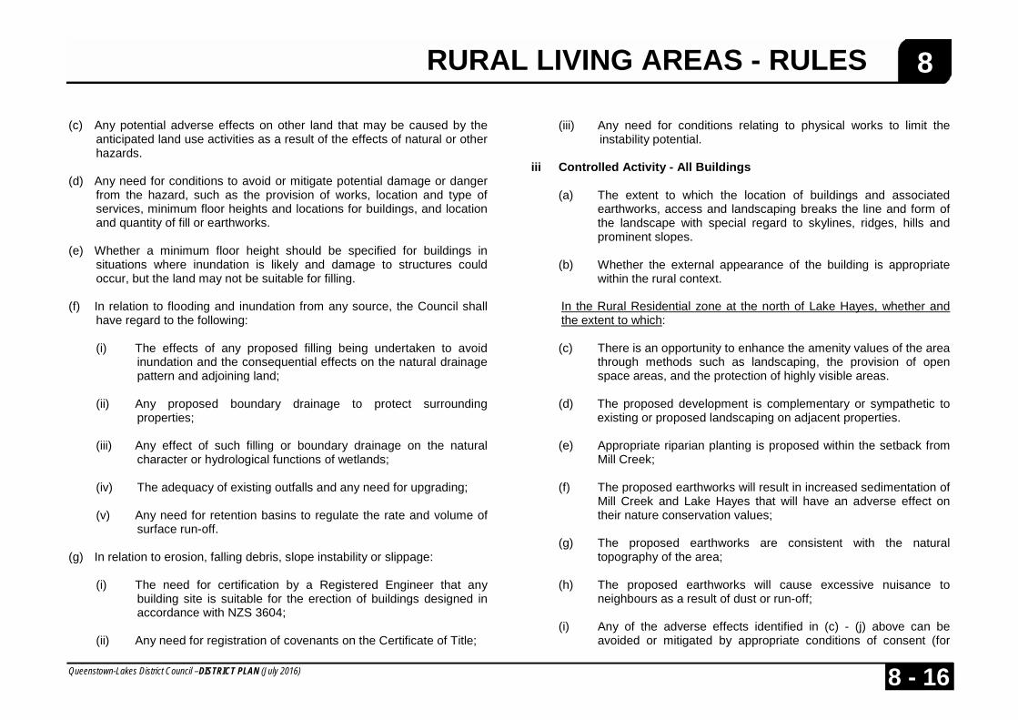
8 (c) Any potential adverse effects on other land that may be caused by the
anticipated land use activities as a result of the effects of natural or other hazards.
(d) Any need for conditions to avoid or mitigate potential damage or danger
from the hazard, such as the provision of works, location and type of services, minimum floor heights and locations for buildings, and location and quantity of fill or earthworks.
(e) Whether a minimum floor height should be specified for buildings in
situations where inundation is likely and damage to structures could occur, but the land may not be suitable for filling.
(f) In relation to flooding and inundation from any source, the Council shall
have regard to the following:
(i) The effects of any proposed filling being undertaken to avoid inundation and the consequential effects on the natural drainage pattern and adjoining land;
(ii) Any proposed boundary drainage to protect surrounding
properties; (iii) Any effect of such filling or boundary drainage on the natural
character or hydrological functions of wetlands; (iv) The adequacy of existing outfalls and any need for upgrading; (v) Any need for retention basins to regulate the rate and volume of
surface run-off. (g) In relation to erosion, falling debris, slope instability or slippage:
(i) The need for certification by a Registered Engineer that any
building site is suitable for the erection of buildings designed in accordance with NZS 3604;
(ii) Any need for registration of covenants on the Certificate of Title;
(iii) Any need for conditions relating to physical works to limit the
instability potential. iii Controlled Activity - All Buildings (a) The extent to which the location of buildings and associated
earthworks, access and landscaping breaks the line and form of the landscape with special regard to skylines, ridges, hills and prominent slopes.
(b) Whether the external appearance of the building is appropriate
within the rural context.
In the Rural Residential zone at the north of Lake Hayes, whether and the extent to which:
(c) There is an opportunity to enhance the amenity values of the area
through methods such as landscaping, the provision of open space areas, and the protection of highly visible areas.
(d) The proposed development is complementary or sympathetic to
existing or proposed landscaping on adjacent properties. (e) Appropriate riparian planting is proposed within the setback from
Mill Creek; (f) The proposed earthworks will result in increased sedimentation of
Mill Creek and Lake Hayes that will have an adverse effect on their nature conservation values;
(g) The proposed earthworks are consistent with the natural
topography of the area; (h) The proposed earthworks will cause excessive nuisance to
neighbours as a result of dust or run-off; (i) Any of the adverse effects identified in (c) - (j) above can be
avoided or mitigated by appropriate conditions of consent (for

RURAL LIVING AREAS - RULES
Queenstown-Lakes District Council –DISTRICT PLAN (July 2016) 8 - 17
8 example; voluntary covenants, consent notices and other restrictive mechanisms)
Within the Rural Residential sub-zone at Bob’s Cove, whether and the
extent to which: (j) The form and density of development (including buildings and
associated accessways) are designed to: • compliment the landscape and the pattern of existing and
proposed vegetation; and • mitigate the visual impact of the development when viewed
from lake Wakatipu and the Glenorchy-Queenstown Road.
(k) The vegetation is, or is likely to be of sufficient maturity to effectively minimise the impact of the proposed building when viewed from Lake Wakatipu and the Glenorchy-Queenstown Road.
iv Controlled Activity - Retail Sales
Conditions may be imposed to ensure: (a) The location and design of vehicle access (including acceleration
and deceleration lanes), parking and loading areas so as to protect the safe and efficient movement of vehicles on the adjoining road(s), having regard to:
• the classification of the road(s) in the Roading Hierarchy -
Appendix 6; • the design standards in Appendix 7 in relation to Arterial
Roads; and • in relation to Local and Collector Roads, the need to form
and seal the carriageway on the access side of the centreline for a distance of 15m on either side of the vehicle entrance and to a width of not less than 5m when measured from the carriageway centreline.
(b) The size, location and design of parking and loading areas and
their relationship to the retail sales, buildings and outdoor display areas are such as to allow vehicles to park on the site (excluding the setback) and are capable of accommodating likely vehicle demand.
(c) The location and design of vehicle access, parking and loading
areas so as to avoid adverse effects on neighbouring properties in terms of noise, vibration and glare from vehicles entering and leaving the site.
v Restricted Discretionary Activity – Structures In considering the external appearance of any proposed structures, the
Council shall take into account the following matters: (a) The materials used, including their colour and permeability; (b) Whether the structure will be consistent with traditional rural
elements. vi Discretionary Activity - Visitor Accommodation (a) The extent to which the visitor accommodation will result in levels
of traffic generation or pedestrian activity which are incompatible with the character of the surrounding area.
(b) Any adverse effects of the proposed visitor accommodation in
terms of: (i) Noise, vibration and lighting from vehicles entering and
leaving the site or adjoining road. (ii) Loss of privacy.
(iii) Levels of traffic congestion or reduction in levels of traffic safety inconsistent with the classification of the adjoining road.

RURAL LIVING AREAS - RULES
Queenstown-Lakes District Council –DISTRICT PLAN (July 2016) 8 - 18
8 (iv) Pedestrian safety in the vicinity of the activity. (v) Any cumulative effect of traffic generation from the activity
in conjunction with traffic generation from other activities in the vicinity.
(c) The ability to mitigate any adverse effects of the additional traffic
generation such as through the location and design of vehicle crossings, parking and loading areas or through the provision of screening and other factors which may reduce the effect of additional traffic generation.
(d) Any potential adverse effects of the activity on the quality of
ground and/or surface waters.
Within the Rural Residential sub-zone at Bob’s Cove, whether and to what extent to which:
(e) The development provides for 75% of the zone to be established
and maintained as undomesticated, such that there is a predominance of indigenous vegetation.
(f) The form of development mitigates the visual impact from Lake Wakatipu and the Glenorchy-Queenstown Road.
vii Building Coverage In the Rural Residential zone at the north of Lake Hayes-
(a) the proximity of the site, the proposed building and other hard surfaces to the margins and esplanade reserves of Mill Creek and to Lakes Hayes.
(b) With regard to proposals that breach one or more zone standard(s), whether and the extent to which the proposal will facilitate the provision of a range of Residential Activity that contributes to housing affordability in the District.
viii Setback from Internal Boundaries
(a) The extent to which the intrusion towards the internal boundary is necessary to enable more efficient, practical and/or pleasant use of the remainder of the site.
(b) Any adverse effects of the proximity or bulk of the building, in
terms of the amenity of adjoining sites.
(c) Any adverse effects of the proximity of the building in terms of difficulty of access.
(d) Any adverse effects of the proximity of buildings housing animals
in terms of noise, smell, flies or vermin on adjoining sites.
(e) The ability to mitigate any adverse effects of the proposal on adjoining sites.
(f) In the Rural Residential zone at the north of Lake Hayes, whether
and the extent to which any buildings are associated works located within the setback from Mill Creek will have an adverse effect on the fisheries values and water quality of Mill Creek and Lake Hayes.
ix Access (a) The extent to which alternative access can be assured to the
residential unit in the long-term. (b) In the Rural Residential zone at the north of Lake Hayes, whether
and the extent to which there is the opportunity to utilise common access ways in order to minimise the area of hard surfaces and land disturbance.
(c) In the Ferry Hill Rural Residential sub-zone the extent to which:
• the number of accesses to roads is minimised; and • the location and design of on-site vehicular access avoids
or mitigates adverse effects on the landscape and visual amenity values by following the natural form of the land to

RURAL LIVING AREAS - RULES
Queenstown-Lakes District Council –DISTRICT PLAN (July 2016) 8 - 19
8 minimise earthworks, providing common driveways and by ensuring that appropriate landscape treatment is an integral component when constructing such access.
x Scale and Nature of Activities (a) The extent to which the scale of the activity and the proposed use
of buildings will be compatible with the scale of other buildings and activities in the surrounding area.
(b) The extent to which materials or equipment associated with an
activity need to be stored outside the building, and the extent to which all manufacturing, altering, repairing, dismantling or processing of any goods or articles associated with the activity need to be carried outside a building, taking account of:
(i) The nature, coverage area and height of materials or
equipment associated with the activity. (ii) The extent to which provisions would be needed for: • security • control of litter and vermin • prevention or containment of fire hazard. (c) The extent of noise or visual impact, and the degree to which
materials or equipment associated with an activity are visible from any public road or place.
(d) The extent to which the activities on the site remain dominated by
rural activities, rather than by activities, which are not associated with, or incidental to rural activities.
(e) The extent to which the activity requires a rural location in terms
of scale, use of or relationship to rural resources, effluent disposal requirements, or potential adverse effects on an urban environment.
(f) The effect of the activity on the life-supporting capacity of soils.
(g) Any adverse effects of traffic generation from the activity in terms of:
(i) Noise, vibration and glare from vehicles entering and leaving
the site of adjoining road. (ii) Levels of traffic congestion or reduction in levels of traffic
safety which are inconsistent with the classification of the adjoining road.
(ii) Any cumulative effect of traffic generation.
(h) The ability to mitigate any adverse effects of the additional traffic generation such as through the location and design of vehicle crossings, parking and loading areas or through the provision of screening and other factors which may reduce the effects of the additional traffic generation.
xi Building Height in the Rural Residential sub-zone at Bob’s Cove Whether and the extent to which the proposed building is positioned and
designed is such a manner so as to not dominate the existing and proposed patterns of vegetation.
xii Building Height (Zone Standard) (a) Whether any earthworks have been carried out on the site prior to
the date of notification (10 October 1995) that have lowered the level of the site.
(b) Whether there are rules requiring the site to be built up.
(c) With regard to proposals that breach one or more zone standard(s), whether and the extent to which the proposal will facilitate the provision of a range of Residential Activity that contributes to housing affordability in the District.
RURAL LIVING AREAS - RULES
Queenstown-Lakes District Council –DISTRICT PLAN (July 2016) 8 - 20
8 xiii Setback from Roads (a) The ability to provide adequate parking and manoeuvring space
for vehicles clear of the road. xiv Deleted xv Residential Density
(a) With regard to proposals that breach one or more zone standard(s), whether and the extent to which the proposal will facilitate the provision of a range of Residential Activity that contributes to housing affordability in the District.

RURAL LIVING AREAS - RULES
Queenstown-Lakes District Council –DISTRICT PLAN (July 2016) 8 - 21
8
RURAL LIVING AREAS - RULES
Queenstown-Lakes District Council –DISTRICT PLAN (July 2016) 8 - 22
8