riverland regional assessment panel meeting agenda 21 ... · agenda for a meeting of the riverland...
TRANSCRIPT

Riverland
Regional Assessment Panel Meeting
AGENDA
21 February 2019
at 1-30pm.

BERRI BARMERA COUNCIL
DISTRICT COUNCIL OF LOXTON WAIKERIE
RENMARK PARINGA COUNCIL
Notice is hereby given that a meeting of the Riverland Regional Assessment Panel will be held in the District Council of Loxton Waikerie Council Chamber, 29 East Terrace, Loxton, on Thursday 21 February 2019, commencing at 1.30pm.
CHERYLE PEDLER
ASSESSMENT MANGER
13 February 2019

THE BERRI BARMERA COUNCIL, DISTRICT COUNCIL OF LOXTON WAIKERIE, RENMARK PARINGA COUNCIL AGENDA FOR A MEETING OF THE RIVERLAND REGIONAL ASSESSMENT PANEL TO BE HELD
THURSDAY FEBRUARY 21 2019 AT 1.30 PM AT THE DISTRICT COUNCIL OF LOXTON WAIKERIE COUNCIL CHAMBER, 29 EAST TERRACE, LOXTON.
Members:
Independent Presiding Member Mr B.G. Ballantyne Independent Members Messrs G.D. Parsons, J.B. McVicar, Ms J Lewis Elected Member Mr T Norton Staff Berri Barmera Council Mr D. Grieve (Senior Development Officer – Planning) District Council of Loxton Waikerie Mr J. Hunt (Development Officer – Planning) Renmark Paringa Council Mr R. Semrau (Principal Planner)
Mr D.J. Altmann (Consultant Planner)
Assessment Manager Mrs C.G. Pedler
ITEM 1 WELCOME: ITEM 2 PRESENT: ITEM 3 APOLOGIES: ITEM 4 CONFIRMATION OF MINUTES The minutes of the meeting held December 13 2018 are attached at appendix for members information
and adoption. RECOMMENDATION: That the minutes of the meeting held December 13 2018 be taken as read and confirmed.

ITEM 5 BUSINESS ARISING FROM THE PREVIOUS MINUTES ITEM 6 DECLARATION OF INTEREST BY MEMBERS OF PANEL: ITEM 7 HEARING OF REPRESENTATIONS: ITEM 8 REPORTS:
Item 8.1 Development Application 551/209/18 – Stallard Meek Architects ............................................................. 1
Item 8.2 Development application 551/276/18 – Riverland Steel Supplies ........................................................... 16
Item 8.3 – Development application 551/D023/18 – Mr B Steinert .............................................................................. 24
Item 8.4 Development application 551/D024/18 – KC & JS Scroop ...................................................................... 30
Item 8.5 Development application 753/048/18 – Mark Yates ................................................................................ 35
Item 8.6 Development Application 753/D015/17 – Rover ...................................................................................... 39

The Berri Barmera Council, District Council of Loxton Waikerie, Renmark Paringa Council Agenda for a meeting of the Riverland Regional Assessment Panel, to be held Thursday 21 February 2019.
Page 1
Item 8.1 Development Application 551/209/18 – Stallard Meek Architects
Application No: 551/209/18
Council: District Council of Loxton Waikerie
Relevant Authority: District Council of Loxton Waikerie
Applicant: Stallard Meek Architects
Owner: Craig & Louise Thiel
Lodgement date: September 11 2018
Description of development: Two storey detached dwelling with garage and alfresco under main roof, in ground swimming pool, and demolition of existing dwelling
Property details: Lot 251, 322 Ramco Road, Ramco, as contained in Certificate of Title Volume 5954 Folio 659
Zone / Policy Area: Township Zone, Map LoWa/27
Development plan provisions: Loxton Waikerie Development Plan, consolidated 19 April 2017
Referrals / Agency consultations: Department for Environment, and Water
Form of assessment: Merit
Public notification category: Category 1
Recommendation: Grant Development Plan Consent, subject to conditions and notes
Officer: Jordan Hunt
File reference: 551/209/18
Appendices follow report: Development Application Form
Electricity Declaration
Certificate of Title
Site Plan, Demolition Plan, and Roof Plan
Elevations Plan
Floor Plan
Applicant’s response to relevant PDC’s
BACKGROUND:
The applicant is seeking Development Plan Consent for a two storey detached dwelling with a garage and alfresco under the main roof, an in ground swimming pool, and the demolition of the existing dwelling. It is proposed that the detached dwelling is to be located 23.1 metres from Ramco Road and 5 metres from the rear property boundary. It is proposed the building has an overall height of 8.45 metres.
PROPOSED DEVELOPMENT:
The proposed development comprises:
Two storey detached dwelling, with a double garage, two balconies, an in ground swimming pool, and an alfresco area. The dwelling is setback 23.13 metres from the front boundary, 5 metres from the rear boundary, 1.7 metres from the western side boundary, and 3.5 metres from the eastern side boundary. The wall height of the proposed dwelling is 5.9 metres, whilst the overall height is 8.45 metres.
Demolition of the existing single storey detached dwelling.

The Berri Barmera Council, District Council of Loxton Waikerie, Renmark Paringa Council Agenda for a meeting of the Riverland Regional Assessment Panel, to be held Thursday 21 February 2019.
Page 2
SUBJECT LAND AND LOCALITY:
The subject land is known as allotment 251, 332 Ramco Road, Ramco as contained in Certificate of Title Volume 5954 Folio 659. The subject land is rectangular in shape and is 1012 square metres in size (as seen in figure 1 below).
The subject land is within the Township Zone as defined by the Loxton Waikerie Development Plan (as seen in figure 2 below). The land is situated within the centre of the Ramco Township and currently contains an existing dwelling (see figure 3 below). Access to the land is via Ramco Road, which is a DPTI managed road; the proposal utilises the existing crossover, therefore no new access point is required.
The subject land is adjoined to the east and west by residential dwellings, which are also located within the Township Zone. The land to the north of the subject land is a Crown Reserve, which is leased by the applicant. To the south of the subject land are existing horticultural land uses, which are located within the Primary Production Zone, Horticulture Policy Area 1.
The locality is predominately made up of residential land uses, consisting of single storey detached dwellings and associated outbuildings. The existing dwellings to the east and west of the subject land are approximately 7 metres from Ramco Road; with this being a common front setback distance for the older dwellings in the locality. The existing dwelling on the subject land is approximately 16 metres from Ramco Road, which is considerably different to the neighbouring allotments.
Figure 1– aerial photograph of the subject land. Approximation of subject land outlined in red.

The Berri Barmera Council, District Council of Loxton Waikerie, Renmark Paringa Council Agenda for a meeting of the Riverland Regional Assessment Panel, to be held Thursday 21 February 2019.
Page 3
Figure 2 - excerpt Zone Map LoWa/27. Approximation of subject land outlined in red.
Figure 3 – photograph of the subject land from Ramco Road.

The Berri Barmera Council, District Council of Loxton Waikerie, Renmark Paringa Council Agenda for a meeting of the Riverland Regional Assessment Panel, to be held Thursday 21 February 2019.
Page 4
Figure 4 – photograph of 324 and 326 Ramco Road, Ramco
Figure 5 - photograph of 324 Ramco Road, Ramco
To the east of the subject land are lots 324 and 26 Ramco Road - these allotments contain reasonably new dwellings, which are setback approximately 21 metres from Ramco Road, and approximately 4 metres from their rear boundaries (see figures 4 and 5 above). It is important to note that in recent times, the positioning of these dwellings and their associated outbuildings have caused some community concerns and conflict.
It is clear that the setback pattern for Ramco has progressively been changing through out time, as existing dwellings are demolished and new dwellings are proposed.
NATURE OF DEVELOPMENT:
In determining the nature of the development, Council must consider the provisions of the Township Zone of the Loxton Waikerie Development Plan, which did not advise if the application was complying nor non-complying. The application is therefore to be considered neither complying, no non-complying, and therefore must be assessed “on merit” against the provisions of the Development Plan.
In consideration of the category of public notification of the development, Schedule 9 of the Development Regulations 2008 provided specific categorisation, viz

The Berri Barmera Council, District Council of Loxton Waikerie, Renmark Paringa Council Agenda for a meeting of the Riverland Regional Assessment Panel, to be held Thursday 21 February 2019.
Page 5
Schedule 9—Public notice categories
Part 1—Category 1 development
2 Except where the development is classified as non-complying under the relevant Development
Plan, any development which comprises—
(a) the construction of any of the following (or of any combination of any of the
following):
(i) 1 or more detached dwellings;…………..
(d) the construction of (or of any combination of) a carport, garage, shed, pergola,
verandah, fence, swimming pool, spa pool or outbuilding if it will be ancillary to a
dwelling;………. my emphasis
Given that the proposal comprises of a detached dwelling, and a swimming pool; pursuant to schedule 9, Part 1, 2, (a), (i), and (d) of the Development Regulations 2008, the proposed development can be considered Category 1.
The application is therefore considered one which is to be assessed on its merits against the principles of the Development Plan, and as category 1.
REFERRALS:
External
The Department for Environment and Water were refereed the application pursuant to Schedule 8, 19, of the Development Regulations 2008. DEW advised that the proposal generally complies with the Objects of the River Murray Act 2003. DEW has directed that 4 conditions and 6 notes be attached to any approval.
Internal
Nil
PUBLIC NOTIFICATION:
As the proposal was identified as a Category 1 form of development, no public notification or advertising was undertaken.
SERIOUSLY AT VARIANCE:
In making an assessment of the application, section 35(2) of the Act provides direction to the Panel, in that it must give consideration as to whether the application is seriously at variance with the Loxton Waikerie Development Plan.
35—Special provisions relating to assessment against Development Plan
(2) Subject to subsection (1), a development that is assessed by a relevant authority as
being seriously at variance with the relevant Development Plan must not be granted
consent.
The concept of being “seriously at variance” with the Development Plan is always difficult to define with precision. Debelle J said at (33) in Mar Mina (SA) Pty Ltd v City of Marion Anor “… the expression “seriously at variance with the Development Plan” refers to that which is an important or grave departure in either quantity or degree from the Development Plan.” And it “….is not enough that the proposal might conflict with the Development Plan; it must be seriously at variance with it….”

The Berri Barmera Council, District Council of Loxton Waikerie, Renmark Paringa Council Agenda for a meeting of the Riverland Regional Assessment Panel, to be held Thursday 21 February 2019.
Page 6
The application is for a two storey detached dwelling within the Township Zone. Within the Township Zone, Principles of Development Control 1 clearly envisages development of this nature to occur. The application can therefore not be considered seriously at variance with the Development Plan.
DEVELOPMENT PLAN PROVISIONS:
General Module - Design and Appearance
Principle of Development Control 1
The design of a building may be of a contemporary nature and exhibit an innovative style provided the overall form is sympathetic to the scale of development in the locality and with the context of its setting with regard to shape, size, materials and colour.
The proposed dwelling is exhibitive of a contemporary modern design, which is sympathetic to the scale of the locality. The design achieves synergy with the locality through utilising a neutral colour palate, and setback distances which emulate the newer dwellings within the locality. The design proposes wall heights of 5.9 metres, which is well within the maximum building height of 8 metres for the Zone. The design also includes a roof pitch of 30 degrees, which aims to limit overshadowing and be similar to the existing buildings in the locality. The proposal is considered to meet with Principle of Development Control 1.
Principle of Development Control 3
Buildings should be designed to reduce their visual bulk and provide visual interest through design elements such as:
(a) articulation (b) colour and detailing (c) small vertical and horizontal components (d) design and placing of windows (e) variations to facades.
The proposal incorporates a front façade which is distinct, however not dominate. The use of a varied colours and materials palate allows the proposal to clearly define its façades, as well as highlight the smaller, more intricate details of the architectural design. The design of the proposed dwelling clearly meets with all five parts of Principle of Development Control 3.
Principle of Development Control 4
Where a building is sited on or close to a side boundary, the side boundary wall should be sited and limited in length and height to minimise:
(a) the visual impact of the building as viewed from adjoining properties (b) overshadowing of adjoining properties and allow adequate sun light to neighbouring buildings.
The proposal incorporates a 1.7 metre western side setback distance and a 3.5 metre eastern side setback distance. Both setback distances exceed the minimum 1 metre parameter, in order to reduce the visual impact of the proposal on the adjoining properties. The side setbacks account for any impacts in regard to overshadowing; as justified by the shadow diagrams. The proposal is considered to meets with Principle of Development Control 4.

The Berri Barmera Council, District Council of Loxton Waikerie, Renmark Paringa Council Agenda for a meeting of the Riverland Regional Assessment Panel, to be held Thursday 21 February 2019.
Page 7
Principle of Development Control 6
The external walls and roofs of buildings should not incorporate highly reflective materials which will result in glare.
The selected colours and finishes of the proposed dwelling are anti reflective, and are unlikely to cause any glare impact. The proposal meets with Principle of Development Control 6.
Principle of Development Control 11
Buildings (other than ancillary buildings or group dwellings) should be designed so that their main façade faces the primary street frontage of the land on which they are situated.
The façade of the proposed dwelling is clearly defined, and faces Ramco Road; therefore allowing the proposal to be consistent with Principle of Development Control 11.
Principle of Development Control 15
Balconies should:
(a) be integrated with the overall architectural form and detail of the building (b) be sited to face predominantly north, east or west to provide solar access (c) have a minimum area of 2 square metres.
The proposal incorporates two balconies, one at the front of the dwelling and one large balcony at the rear of the dwelling. The large balcony faces to the north, and allows for large amounts of northern sunlight to fill the dwelling. Both of the proposed balconies are over 2 square metres in size. The proposal is therefore considered to be consistent with Principle of Development Control 15.
Principle of Development Control 17
Development should be of natural colours so as to be unobtrusive with the rural landscape and minimise any visual obtrusion.
The proposed detached dwelling includes timber cladding, as well as white weatherboard; these finishes are seen to harmonise with the natural colours of the rural landscape. The other colours and finishes included in the proposal are generally darker in shade. The proposed dwelling partially accords with Principle of Development Control 17.
Principle of Development Control 18
Development should be compatible with the character of the existing buildings in the locality and exhibit a high standard of design and external appearance which takes into account the scale, mass and siting of the buildings, the materials to be used (including their texture and colour) and elements of building detail.
The proposed dwelling is considered to be compatible with some of the existing buildings within the locality, specifically the dwellings approved in the last 10 years. Given that the surrounding dwellings are likely from the mid 1950-60s, it is difficult for the proposal to be entirely compatible within the locality. The design however does attempt to blend within the existing streetscape, through generous setbacks, a neutral colour palate which includes colours shown in the locality, traditional angles and roof lines, and a significant attention to detail. The proposal is considered to mostly meet with Principle of Development Control 18.
Principle of Development Control 21
The setback of buildings from public roads should:
(a) be similar to, or compatible with, setbacks of buildings on adjoining land and other buildings in the locality
(b) contribute positively to the streetscape character of the locality

The Berri Barmera Council, District Council of Loxton Waikerie, Renmark Paringa Council Agenda for a meeting of the Riverland Regional Assessment Panel, to be held Thursday 21 February 2019.
Page 8
(c) not result in or contribute to a detrimental impact upon the function, appearance or character of the locality.
The proposal incorporates setback distances which are similar to the dwellings located at 324 and 326 Ramco Road. The existing dwelling was setback deeper than the neighbouring dwellings, with the newly proposed dwelling not being setback that much further than what currently exists. The design is not considered to detrimentally impact the function, appearance, or character of the locality, rather it is anticipated to improve the streetscape appearance, modernise the locality, and assist in allowing the prevailing setback pattern to modernise and account for new designs. The proposal is considered to accord with Principle of Development Control 21.
General Module - Infrastructure
Principle of Development Control 1
Development should not occur without the provision of adequate utilities and services, including:
(a) electricity supply (b) water supply (c) drainage and stormwater systems (d) waste disposal (e) effluent disposal systems (f) formed all-weather public roads (g) telecommunications services
The subject land is already connected to an electricity supply, water supply, drainage and storm water system, formed all weather road, and telecommunications service. Whilst a wastewater application has not been lodged with Council as of yet, the applicant has indicated a wastewater system on allotment. The application is considered to meet with Principle of Development Control 1.
Principle of Development Control 5
Development in urban areas should not occur without provision of an adequate reticulated domestic quality mains water supply and an appropriate waste treatment system.
The allotment is connected to an appropriate water supply and can accommodate an appropriate wastewater system; the proposal is considered consistent with Principle of Development Control 5.
General Module - Interface between land uses
Principle of Development Control 3
Development adjacent to a Residential Zone or residential area within a Township Zone should be designed to minimise overlooking and overshadowing of adjacent dwellings and private open space.
The proposal incorporates generous setback distances so as to reduce any overshadowing or overlooking on adjacent dwellings or private open space. Fixed screening and 1.5 metre sill heights have also been included in the design, in order to mitigate any impacts. The proposal meets with Principle of Development Control 3.
General Module - Residential Development
Principle of Development Control 6
Any residential development within a Township Zone, Residential Zone or Rural Living Zone should have access to a potable water supply, and also be provided with a rainwater storage of at least 5000 litres intended exclusively for domestic use associated with the dwelling and be plumbed throughout the dwelling.
The proposed dwelling has provided with three 5000 litre rainwater tanks, alongside a 22,000 litre settling tank. The proposal is considered to meet with Principle of Development Control 6.

The Berri Barmera Council, District Council of Loxton Waikerie, Renmark Paringa Council Agenda for a meeting of the Riverland Regional Assessment Panel, to be held Thursday 21 February 2019.
Page 9
Principle of Development Control 7
Where a dwelling has direct frontage to a street the dwelling should be designed to provide surveillance and address the street.
Whilst the design incorporates a deep front setback, the façade still clearly addresses Ramco Road, and will provide passive surveillance. The proposal is consistent with Principle of Development Control 7.
Principle of Development Control 8
Entries to dwellings should be clearly visible from the streets that they front to enable visitors to identify a specific dwelling easily.
The dwelling is design incorporates a distinct façade which faces Ramco Road, allowing the front entry to be clearly identifiable to visitors. The proposed development is therefore considered to accord with Principle of Development Control 8.
Principle of Development Control 10
The design and location of buildings should ensure that direct winter sunlight is available to adjacent dwellings, with particular consideration given to:
(a) windows of habitable rooms, particularly living areas (b) ground-level private open space (c) upper-level private balconies that provide the primary open space area for any dwelling (d) access to solar energy.
The applicant provided shadow diagrams for the proposed dwelling. The diagrams indicate that during winter and summer, that minimal overshadowing will occur on the neighbouring dwellings; therefore allowing the proposal to be consistent with Principle of Development Control 10.
Principle of Development Control 11
Development should ensure that north-facing windows to habitable rooms of existing dwelling(s) on the same allotment, and on adjacent allotments, receive at least three hours of direct sunlight over a portion of their surface between 9.00 am and 5.00 pm on the 21 June.
The orientation of the subject land and the adjoining allotments is almost north-south. The proposed dwelling incorporates numerous spaces which will receive northern sunlight. The shadow diagrams show that the neighbouring dwellings will not be significantly overshadowed, and will receive ample sunlight. The proposal is therefore considered to be consistent with Principle of Development Control 11.
Principle of Development Control 16
Garages, carports and outbuildings should have a roof form and pitch, building materials and detailing that complement the associated dwelling.
The proposed garage has been incorporated into the design of the dwelling, and is located under the main roof. The proposal is considered to meet Principle of Development Control 16.

The Berri Barmera Council, District Council of Loxton Waikerie, Renmark Paringa Council Agenda for a meeting of the Riverland Regional Assessment Panel, to be held Thursday 21 February 2019.
Page 10
Principle of Development Control 17
Garages and carports facing the street should:
(a) not dominate the streetscape. (b) have a maximum width of garage or carport opening of 7 metres
The proposed development incorporates the garage into the façade of the dwelling, therefore preventing the garage from dominating the streetscape. The garage opening is 7 metres in width. The proposal is deemed to meets with Principle of Development Control 17.
Principle of Development Control 18
Residential outbuildings, including garages and sheds, should not be constructed unless in association with an existing dwelling.
The garage has been included into the main design of the dwelling, and therefore will clearly be used in association with the residential use. The proposal meets Principle of Development Control 18.
Principle of Development Control 19
Dwellings should be setback from allotment or site boundaries to:
(a) contribute to the desired character of the area (b) provide adequate visual privacy by separating habitable rooms from pedestrian and vehicle movement
The surrounding allotments to the subject land contain older dwellings. The proposal indicates the dwelling being setback 23.1 metres from the front boundary which is drastically different to the neighbouring dwellings. The proposals setbacks are however similar to several newer dwellings to the north. It is considered that the proposal contributes to the evolving character of the area, rather than complying with the older character. The proposed dwelling locates all of its habitable rooms and spaces to the north of the allotment, therefore providing visual privacy. The proposal is considered to meet Principle of Development Control 19.
Principle of Development Control 20
Dwelling setbacks from side and rear boundaries should be progressively increased as the height of the building increases to:
(a) minimise the visual impact of buildings from adjoining properties (b) minimise the overshadowing of adjoining properties.
The design of the proposed development has included side setback distances which exceed the expressed minimums for the Zone. These setbacks reduce any visual impacts or overshadowing on the adjoining properties. The proposal is considered to accord with Principle of Development Control 20.
Principle of Development Control 23
Site coverage should be limited to 60 per cent to ensure sufficient space is provided for:
(a) pedestrian and vehicle access and vehicle parking (b) domestic storage (c) outdoor clothes drying (d) a rainwater tank (e) private open space and landscaping (f) front, side and rear boundary setbacks that contribute to the desired character of the area (g) convenient storage of household waste and recycling receptacles.
The proposed dwelling does not cover more than 60 per cent of the subject land. The placement and positioning of the dwelling allow for private open space, vehicle access and parking, outdoor clothes drying,

The Berri Barmera Council, District Council of Loxton Waikerie, Renmark Paringa Council Agenda for a meeting of the Riverland Regional Assessment Panel, to be held Thursday 21 February 2019.
Page 11
and rain water tanks. The front, side, and rear setbacks are considered to contribute to the desired character of the area. The proposal is deemed consistent with Principle of Development Control 23.
Principle of Development Control 24
Private open space (land available for exclusive use by residents of each dwelling) should be provided for each dwelling and should be sited and designed:
(a) to be accessed directly from the internal living areas of the dwelling (b) generally at ground level to the side or rear of a dwelling and screened for privacy (c) to take advantage of but not adversely affect natural features of the site (d) to minimise overlooking from adjacent buildings (e) to achieve separation from bedroom windows on adjoining sites (f) to have a northerly aspect to provide for comfortable year-round use (g) to not be significantly shaded during winter by the associated dwelling or adjacent development (h) to be shaded in summer.
Private open space for the proposed dwelling is located on the northern side of the subject land, and accessed directly via the living area. The open space will be screened by fencing, and will not suffer any overlooking for adjoining buildings. The proposal is considered to meet with all aspects of Principle of Development Control 24.
Principle of Development Control 25
Dwellings should have associated private open space of sufficient area and shape to be functional, taking into consideration the location of the dwelling, and the dimension and gradient of the site.
The proposed private open space on the subject land is in a location which will be accessed directly via the dwelling and will be functional all year round. The design of the building will allow for areas which are shaded, as well as other areas which will receive direct sunlight. The proposal meets with Principle of Development Control 25.
Principle of Development Control 27
Balconies should make a positive contribution to the internal and external amenity of residential buildings and should be sited adjacent to the main living areas, such as the living room, dining room or kitchen, to extend the dwelling’s living space.
The main balcony of the proposed dwelling is an extension of the upstairs kitchen, dining, and living room. The balcony complements the external appearance of the dwelling, and does not appear as if it is just an added on feature. The proposal meets with Principle of Development Control 27.
Principle of Development Control 30
Upper level windows, balconies, terraces and decks should have a sill height of not less than 1.5 metres or be permanently screened to a height of not less than 1.5 metres above finished floor level to avoid overlooking into habitable room windows or onto the useable private open spaces of other dwellings.
The upper level windows which face the eastern and western boundaries have been permanently screened via frosted glazing. The balconies are screened to a height of 1.5 metres above the finished floor level. These screening measures proposed allow the dwelling to meet with Principle of Development Control 30.

The Berri Barmera Council, District Council of Loxton Waikerie, Renmark Paringa Council Agenda for a meeting of the Riverland Regional Assessment Panel, to be held Thursday 21 February 2019.
Page 12
Principle of Development Control 31
Permanently fixed external screening devices should be designed and coloured to blend with the associated building’s external material and finishes.
The fixed external screening on the balconies will complement the colours and finishes of the proposed dwelling. The eastern and western second storey windows will consist of frosted glazing, which will be a similar colour to the other windows. The screening devices utilised throughout the design, will blend with the external appearance of the dwelling. The proposal is consistent with Principle of Development Control 31.
Township Zone
Principle of Development Control 1
The following forms of development are envisaged in the zone:
- dwelling
The proposed detached dwelling is an envisaged form of development within the Township Zone; the proposal is consistent with Principle of Development Control 1.
Principle of Development Control 3
Residential development should be mainly in the form of low-density detached dwellings, with a limited range of increased density development.
The proposed two storey detached dwelling is considered to be a low-density form of development, therefore allowing the proposal to meet with Principle of Development Control 3.
Principle of Development Control 7
Development should not be undertaken unless it is consistent with the desired character for the zone.
The proposal does not seek to change the land use of subject land, or change the function of the locality, rather it seeks to establish a modern dwelling in an area clearly established for residential uses. Therefore the proposed development is considered to meet with Principle of Development Control 7.
Principle of Development Control 8
Dwellings should be designed within the following parameters:
The proposed dwelling meets with all of the above parameters except for the maximum building height. The proposal has an overall height of 8.45 metres, which is 0.45 metres above the expressed maximum. Given

The Berri Barmera Council, District Council of Loxton Waikerie, Renmark Paringa Council Agenda for a meeting of the Riverland Regional Assessment Panel, to be held Thursday 21 February 2019.
Page 13
that the proposal incorporates generous setbacks, it is considered that the overall height is appropriate and unlikely to pose any impacts on the locality. The proposal is considered to mostly meet with Principle of Development Control 8.
SUMMARY:
The proposal seeks to establish a two storey detached dwelling within a locality which solely is made up of single storey dwellings. Whilst the proposal is dissimilar to what exists in the locality, it is clear that the provisions of the Zone envisage and set guiding parameters for a dwelling of this nature. The prevailing character of Ramco is considered to be evolving, as older dwellings are demolished to make way for newer dwellings. It is clear that this is in fact the case, when considering the positioning and setbacks of newer dwellings within the locality. The proposal reflects the setbacks and positioning of the newer dwellings within the locality, as opposed to the existing neighbouring dwellings.
The design is sympathetic to the overall height and shape of the proposed dwelling. Through the use of a traditional roof pitch, and generous side setbacks, the applicant was able to produce a design which creates very little overshadowing on the adjoining allotments. The use of frosted glazing on the eastern and western second storey windows, as well as permanently fixed screening on the balconies reduces any potential overlooking. It is anticipated that the proposal will not produce any negative impacts in regard to overlooking or overshadowing on the adjoining allotments.
The design of the proposed dwelling is considered to be mostly consistent with the provisions of the Township Zone, as well as the relevant provisions of the General Modules of Council’s Development Plan. The proposal does not meet with the maximum building height parameter expressed in the Township Zone, however this is considered to be a minor aspect when reviewing the generous side setbacks and the building positioning on the allotment. The colours and finishes of the proposed dwelling are significantly different to the colours seen in the locality, however it is anticipated that the proposed finishes as they are all quite neutral, will allow the building to blend in with the locality.
Whilst the proposed two storey detached dwelling is significantly different to what currently exists within the locality, it is anticipated that dwellings of this type, scale, and style will continue to occur in Ramco as it slowly develops. The design is considered to be sympathetic to the locality, with it unlikely that proposal will create any negative impacts.
I therefore believe, on balance, that the application is worthy of Development Plan Consent, subject to conditions and notes.
The Berri Barmera Council, District Council of Loxton Waikerie, Renmark Paringa Council Agenda for a meeting of the Riverland Regional Assessment Panel, to be held Thursday 21 February 2019.
Page 14
RECOMMENDATION: 1. The Riverland Regional Assessment Panel determines that Development Application
551/209/18 is not seriously at variance with the Loxton Waikerie Development Plan. 2. The Riverland Regional Assessment Panel determines to grant Development Plan Consent to
Development Application 551/209/18 subject to the following conditions and notes: Council conditions:
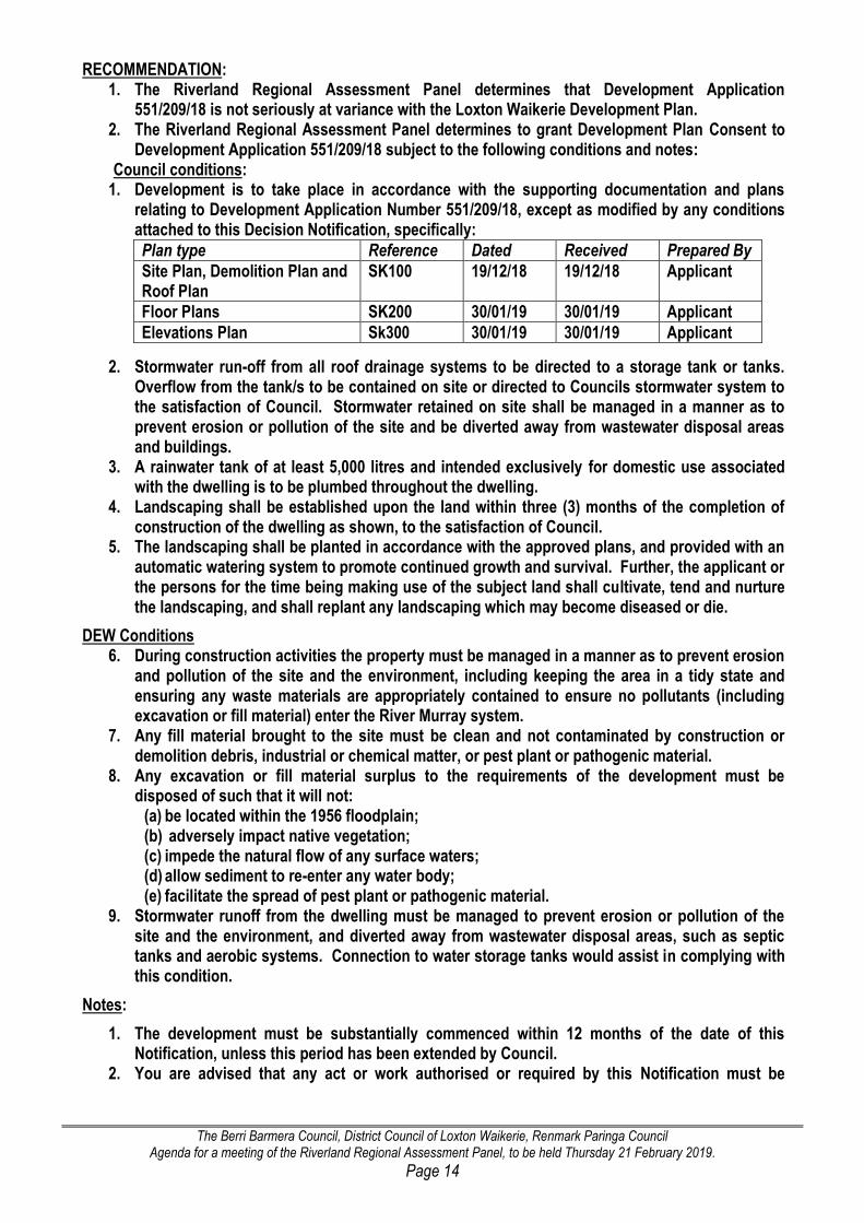
1. Development is to take place in accordance with the supporting documentation and plans relating to Development Application Number 551/209/18, except as modified by any conditions attached to this Decision Notification, specifically:
Plan type Reference Dated Received Prepared By
Site Plan, Demolition Plan and Roof Plan
SK100 19/12/18 19/12/18 Applicant
Floor Plans SK200 30/01/19 30/01/19 Applicant
Elevations Plan Sk300 30/01/19 30/01/19 Applicant
2. Stormwater run-off from all roof drainage systems to be directed to a storage tank or tanks. Overflow from the tank/s to be contained on site or directed to Councils stormwater system to the satisfaction of Council. Stormwater retained on site shall be managed in a manner as to prevent erosion or pollution of the site and be diverted away from wastewater disposal areas and buildings.
3. A rainwater tank of at least 5,000 litres and intended exclusively for domestic use associated with the dwelling is to be plumbed throughout the dwelling.
4. Landscaping shall be established upon the land within three (3) months of the completion of construction of the dwelling as shown, to the satisfaction of Council.
5. The landscaping shall be planted in accordance with the approved plans, and provided with an automatic watering system to promote continued growth and survival. Further, the applicant or the persons for the time being making use of the subject land shall cultivate, tend and nurture the landscaping, and shall replant any landscaping which may become diseased or die.
DEW Conditions 6. During construction activities the property must be managed in a manner as to prevent erosion
and pollution of the site and the environment, including keeping the area in a tidy state and ensuring any waste materials are appropriately contained to ensure no pollutants (including excavation or fill material) enter the River Murray system.
7. Any fill material brought to the site must be clean and not contaminated by construction or demolition debris, industrial or chemical matter, or pest plant or pathogenic material.
8. Any excavation or fill material surplus to the requirements of the development must be disposed of such that it will not:
(a) be located within the 1956 floodplain; (b) adversely impact native vegetation; (c) impede the natural flow of any surface waters; (d) allow sediment to re-enter any water body; (e) facilitate the spread of pest plant or pathogenic material.
9. Stormwater runoff from the dwelling must be managed to prevent erosion or pollution of the site and the environment, and diverted away from wastewater disposal areas, such as septic tanks and aerobic systems. Connection to water storage tanks would assist in complying with this condition.
Notes:
1. The development must be substantially commenced within 12 months of the date of this Notification, unless this period has been extended by Council.
2. You are advised that any act or work authorised or required by this Notification must be

The Berri Barmera Council, District Council of Loxton Waikerie, Renmark Paringa Council Agenda for a meeting of the Riverland Regional Assessment Panel, to be held Thursday 21 February 2019.
Page 15
completed within three years of the date of the Notification unless this period is extended by the Council.
3. The applicant is reminded of its general environmental duty, as required by section 25 of the Environment Protection Act 1993, to take all reasonable and practical measures to ensure that the activities on the whole site, including during construction, do not pollute the environment in a way which causes or may cause environmental harm.
4. A Wastewater works approval will be required prior to the issue of Development Approval. 5. The applicant is advised of their general duty of care under the River Murray Act 2003 to take
all reasonable measures to prevent any harm to the River Murray through his or her actions or activities.
6. If there is an intention to clear native vegetation on the land at any time, the applicant should consult the Native Vegetation Council to determine relevant requirements under the Native Vegetation Act 1991 and its Regulations, which may include the provision of a Significant Environmental Benefit. Note that "clearance" means any activity that could cause any substantial damage to native plants, including cutting down and removing plants, burning, poisoning, slashing of understorey, removal or trimming of branches, severing roots, drainage and reclamation of wetlands, and in some circumstances grazing by animals. For further information contact the Native Vegetation Council on telephone 8303 9777 or visit: http://www.nvc.sa.gov.au
7. The applicant is strongly encouraged to incorporate locally indigenous plant species into any landscaping, screen planting or revegetation activities at the site to enhance the natural character of the locality, stabilise soils and provide habitat for native species. For information on appropriate species to be planted, please contact State Flora at Bremer Road, Murray Bridge on telephone 8539 2105 or within Belair National Park on telephone 8278 7777 or visit: http://www.stateflora.com.au.
8. If the applicant wishes to use water (other than for firefighting purposes) from the River Murray Prescribed Watercourse or wells, then they may be required to apply to the Department for Environment and Water (DEW) for a water licence, pursuant to the Natural Resources Management Act 2004. Further, a permit is required for any work to be carried out on a well or for new wells to be drilled. For further information contact the DEW Water Licensing Branch on telephone 8595 2053 or visit http://www.environment.sa.gov.au/licences-and-permits/water-licence-and-permit-forms.
9. The River Murray and many of its tributaries and overflow areas have abundant evidence of Aboriginal occupation and Aboriginal sites, objects or remains may be present on the subject land. Under Section 20 of the Aboriginal Heritage Act 1988 (the Act), an owner or occupier of private land, or an employee or agent of such an owner or occupier, must report the discovery on the land of any Aboriginal sites, objects and remains to the Minister responsible for the administration of the Act, as soon as practicable, giving the particulars of the nature and location of the Aboriginal sites, objects or remains. It is an offence to damage, disturb or interfere with any Aboriginal site or damage any Aboriginal object (registered or not) without the authority of the Minister for Aboriginal Affairs and Reconciliation (the Minister). If the planned activity is likely to damage, disturb or interfere with a site or object, authorisation of the activity must be first obtained from the Minister under Section 23 of the Act. Penalties may apply for failure to comply with the Act.
10. This approval does not obviate any considerations that may apply to the Environment Protection and Biodiversity Conservation Act 1999 (Cth). For further information visit: http://www.environment.gov.au/epbc.
The Berri Barmera Council, District Council of Loxton Waikerie, Renmark Paringa Council Agenda for a meeting of the Riverland Regional Assessment Panel, to be held Thursday 21 February 2019.
Page 16
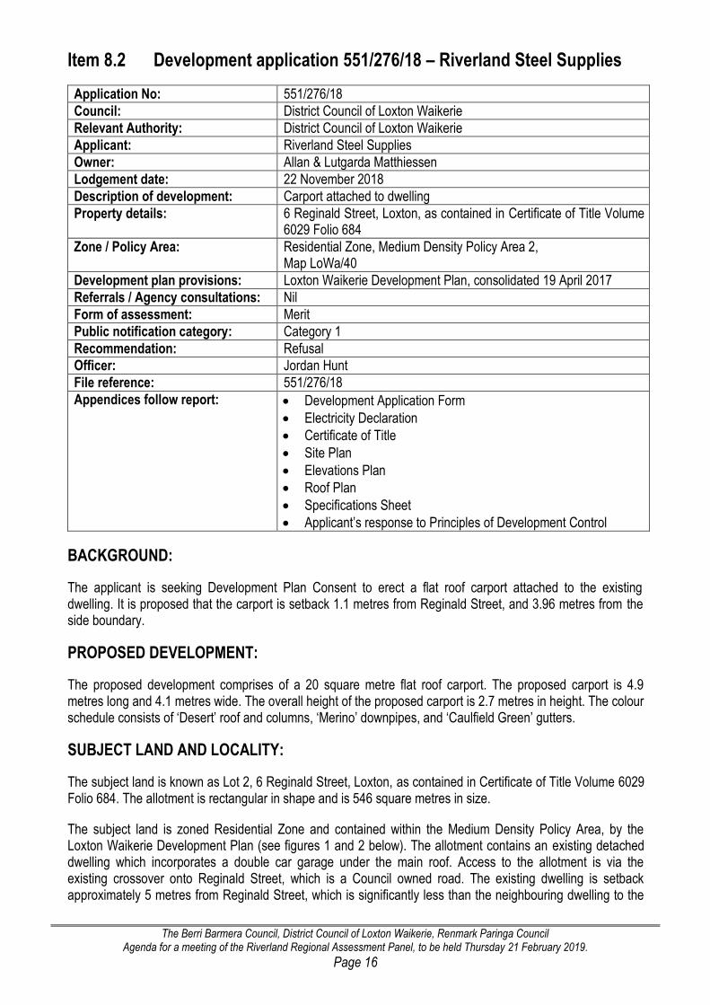
Item 8.2 Development application 551/276/18 – Riverland Steel Supplies
Application No: 551/276/18
Council: District Council of Loxton Waikerie
Relevant Authority: District Council of Loxton Waikerie
Applicant: Riverland Steel Supplies
Owner: Allan & Lutgarda Matthiessen
Lodgement date: 22 November 2018
Description of development: Carport attached to dwelling
Property details: 6 Reginald Street, Loxton, as contained in Certificate of Title Volume 6029 Folio 684
Zone / Policy Area: Residential Zone, Medium Density Policy Area 2, Map LoWa/40
Development plan provisions: Loxton Waikerie Development Plan, consolidated 19 April 2017
Referrals / Agency consultations: Nil
Form of assessment: Merit
Public notification category: Category 1
Recommendation: Refusal
Officer: Jordan Hunt
File reference: 551/276/18
Appendices follow report: Development Application Form
Electricity Declaration
Certificate of Title
Site Plan
Elevations Plan
Roof Plan
Specifications Sheet
Applicant’s response to Principles of Development Control
BACKGROUND:
The applicant is seeking Development Plan Consent to erect a flat roof carport attached to the existing dwelling. It is proposed that the carport is setback 1.1 metres from Reginald Street, and 3.96 metres from the side boundary.
PROPOSED DEVELOPMENT:
The proposed development comprises of a 20 square metre flat roof carport. The proposed carport is 4.9 metres long and 4.1 metres wide. The overall height of the proposed carport is 2.7 metres in height. The colour schedule consists of ‘Desert’ roof and columns, ‘Merino’ downpipes, and ‘Caulfield Green’ gutters.
SUBJECT LAND AND LOCALITY:
The subject land is known as Lot 2, 6 Reginald Street, Loxton, as contained in Certificate of Title Volume 6029 Folio 684. The allotment is rectangular in shape and is 546 square metres in size.
The subject land is zoned Residential Zone and contained within the Medium Density Policy Area, by the Loxton Waikerie Development Plan (see figures 1 and 2 below). The allotment contains an existing detached dwelling which incorporates a double car garage under the main roof. Access to the allotment is via the existing crossover onto Reginald Street, which is a Council owned road. The existing dwelling is setback approximately 5 metres from Reginald Street, which is significantly less than the neighbouring dwelling to the

The Berri Barmera Council, District Council of Loxton Waikerie, Renmark Paringa Council Agenda for a meeting of the Riverland Regional Assessment Panel, to be held Thursday 21 February 2019.
Page 17
south, which has a front setback distance of approximately 9 metres (as seen in figures 3 and 4 below). The existing dwelling’s front setback distance does align with the side setback of the dwelling to the north, which faces Railway Terrace.
Figure 1 – excerpt Zone Map LoWa/40. Approximation of subject land outlined in red.
Figure 2 – excerpt Policy Area Map LoWa/40. Approximation of subject land outlined in red.
Figure 3 – photograph of existing dwelling and subject land

The Berri Barmera Council, District Council of Loxton Waikerie, Renmark Paringa Council Agenda for a meeting of the Riverland Regional Assessment Panel, to be held Thursday 21 February 2019.
Page 18
Figure 4 – photograph of existing front setback pattern
Figure 5 - aerial photograph of the subject land and locality.
Locality identified and outlined in black
Approximation of subject land outlined in red.
The locality, as seen in figure 5, is predominately made up of residential land uses. The western side of Reginald Street comprises
a group of residential units which do not face Reginald Street,
a residential dwelling with a front setback distance of approximately 4.5 metres, and
‘The Pines’, Loxton’s historic house and garden.
To the north of the subject land is a residential dwelling which faces Railway Terrace. This allotment does include domestic structures, however none of these structures are close to the road.
Adjoining to the south is a residential dwelling, which is setback from Reginald Street significantly deeper than the dwelling which exists on the subject land. All of the domestic structures associated with the neighbouring dwelling are located at the rear or side of the land. Further south, there is a dwelling which faces onto Rudolph Street; this dwelling does have associated domestic structures, one of which is a carport located approximately

The Berri Barmera Council, District Council of Loxton Waikerie, Renmark Paringa Council Agenda for a meeting of the Riverland Regional Assessment Panel, to be held Thursday 21 February 2019.
Page 19
1 metre from the side boundary (Reginald Street). Whilst this existing carport has a similar setback to the proposal, as it is located on the dwelling side boundary (Reginald Street), and incorporates vegetation screening, this setback distance is considered to be appropriate.
The locality is quite unique in that there are only three dwellings which front onto Reginald Street, all of which have moderately different front setback distances; this is all the more reason why the setback pattern should not be prejudiced by the proposal.
NATURE OF DEVELOPMENT:
In determining the nature of the development, Council must consider the provisions of the Residential Zone, (Medium Density Policy Area 2), of the Loxton Waikerie Development Plan, which did not advise if the application was complying nor non-complying. The application is therefore to be considered on merit against the provisions of the Development Plan.
In consideration of the category of public notification of the development, Schedule 9 of the Development Regulations 2008 provided specific categorisation, viz
Schedule 9—Public notice categories
Part 1—Category 1 development
2 Except where the development is classified as non-complying under the relevant Development
Plan, any development which comprises—…………
(d) the construction of (or of any combination of) a carport, garage, shed, pergola,
verandah, fence, swimming pool, spa pool or outbuilding if it will be ancillary to a
dwelling; or………..
The proposed carport will be ancillary to the existing dwelling; pursuant to Schedule 9, Part 1, 2, (d) of the Development Regulations 2008, the proposed development can be considered Category 1.
The application is therefore considered one which is to be assessed on its merits against the principles of the Development Plan, and as category 1.
PUBLIC NOTIFICATION:
As the proposal was identified as a Category 1 form of development, no public notification or advertising was undertaken.
SERIOUSLY AT VARIANCE:
In making an assessment of the application, section 35(2) of the Act provides direction to the Panel, in that it must give consideration as to whether the application is seriously at variance with the Loxton Waikerie Development Plan.
35—Special provisions relating to assessment against Development Plan
(2) Subject to subsection (1), a development that is assessed by a relevant authority as
being seriously at variance with the relevant Development Plan must not be granted
consent.
The concept of being “seriously at variance” with the Development Plan is always difficult to define with precision. Debelle J said at (33) in Mar Mina (SA) Pty Ltd v City of Marion Anor “… the expression “seriously at variance with the Development Plan” refers to that which is an important or grave departure in either quantity

The Berri Barmera Council, District Council of Loxton Waikerie, Renmark Paringa Council Agenda for a meeting of the Riverland Regional Assessment Panel, to be held Thursday 21 February 2019.
Page 20
or degree from the Development Plan.” And it “….is not enough that the proposal might conflict with the Development Plan; it must be seriously at variance with it….”
The application is for a carport (domestic structure) in association with the existing dwelling. Within the Residential Zone, Principle of Development Control 1 envisages development of this nature. Furthermore Principle of Development Control 1 of the Medium Density Policy Area 1 envisages this form of development. The application can therefore not be considered seriously at variance with the Development Plan.
DEVELOPMENT PLAN PROVISIONS:
Design and Appearance
Objective 1
Development of a high architectural standard that responds to and reinforces positive aspects of the local environment and built form.
The proposed carport comprises of a standard manufacturer designed structure. The structure has a flat roof, and is held up by a connection to the existing dwelling and two columns. The owner has selected colours which will blend with the colour scheme of the existing dwelling. The proposal is not considered to meet with Objective 1, in that it is very basic structure which will not improve the façade of the existing dwelling, nor increase the character of the area.
Principle of Development Control 21
The setback of buildings from public roads should:
(a) be similar to, or compatible with, setbacks of buildings on adjoining land and other buildings in the locality
(b) contribute positively to the streetscape character of the locality
(c) not result in or contribute to a detrimental impact upon the function, appearance or character of the locality.
The proposed carport is setback 1.1 metres from Reginald Street. Within the locality, no other buildings or structures are setback as close as the proposed carport. The proposal will not be similar, or compatible with the setbacks of other buildings or structures in the locality, given that the closest existing structure or building is the side of a domestic shed, with a setback of approximately 2 metres from Reginald Street (Marked on Figure 5 above). It is unlikely that the proposed carport will contribute positively to the streetscape of the locality, with it being more likely that the proposal will instead detrimentally impact on the appearance and character by protruding in front of the main building line. The proposal is considered to not be in accordance with Principle of Development Control 21.
Residential Development
Principle of Development Control 16
Garages, carports and outbuildings should have a roof form and pitch, building materials and detailing that complement the associated dwelling.
The proposed carport is a flat roof structure; this does not match or complement the roof form and pitch of the existing dwelling. The colour schedule chosen for the carport will however match the colours of the existing dwelling. The proposal is considered to partially meet PDC 16.
Principle of Development Control 17
Garages and carports facing the street should:
(a) not dominate the streetscape.
(b) have a maximum width of garage or carport opening of 7 metres

The Berri Barmera Council, District Council of Loxton Waikerie, Renmark Paringa Council Agenda for a meeting of the Riverland Regional Assessment Panel, to be held Thursday 21 February 2019.
Page 21
The proposed carports position is anticipated to be detrimental on the character of the streetscape, due to the carport significantly protruding outside of the locality setback pattern. The width of the proposed carport is only 4.9 metres, however it is still anticipated that due to the position of the structure on the subject land that it potentially may dominate the streetscape. The proposal is considered be mostly at odds with Principle of Development Control 17.
Principle of Development Control 22
Carports and garages should be setback from road and building frontages so as to:
(a) contribute to the desired character of the area
(b) not adversely impact on the safety of road users
(c) provide safe entry and exit
(d) not dominate the appearance of dwellings from the street
(e) be consistent with the setback of an associated dwelling or to have a deeper setback than the associated dwelling.
The proposal does not contribute to the desired character of the area, in that the carport will be in front of the main building line of the existing dwelling. It also has the potential to dominate the appearance of the dwelling, and not complement or contribute to the desired character of the area. The proposed carport will provide for safe entry and exit, given there is no sides, and is unlikely to adversely impact on the safety of road users. Albeit the fact the proposal meets with parts (b) and (c), the proposal is still considered to be mostly at odds with Principle of Development Control 22.
Residential Zone
Principle of Development Control 5
The use and placement of outbuildings should be ancillary to and in association with a dwelling or dwellings.
The proposed carport is intended to be used for domestic purposes and be used in association with the existing dwelling. The proposal meets with Principle of Development Control 5.
Principle of Development Control 7
Garages and carports facing the street (other than an access lane way) should be designed with a maximum width of 6 metres or 50 per cent of the allotment or building site frontage width, whichever is the lesser distance
The proposed carport has a width of 4.9 metres, and does not exceed 50 per cent of the length of the allotment. The proposal meets with Principle of Development Control 7.

The Berri Barmera Council, District Council of Loxton Waikerie, Renmark Paringa Council Agenda for a meeting of the Riverland Regional Assessment Panel, to be held Thursday 21 February 2019.
Page 22
Principle of Development Control 9
Sheds, garages and similar outbuildings should be designed within the following parameters:
Parameter Value
Maximum floor area for sites: (a) less than 800 square metres (b) greater than 800 square metres
60 Square Metres 72 Square Metres
Maximum building height (from natural ground level) 4 Metres
Maximum wall height (from natural ground level) 3 Metres
Minimum setback from side and rear boundaries Have no more than one wall located closer than 0.6 metres whichever is the greater.
Minimum setback from a public road or public open space area
No closer to the boundary than the dwelling with which the building is associated or 6 metres whichever is the greater.
The proposed development meets with most of the parameters of Principle of Development Control 9; however it is unable to meet with the minimum setback from a public road, due to being located in front of the main building line and 1.1 metres from Reginald Street. The proposal mostly meets with Principle of Development Control 9; however the front setback parameter is severally departed from.
Residential Zone – Medium Density PA2
Principle of Development Control 1
The following forms of development are envisaged in the Policy Area:
- domestic structure
The proposed carport is considered to be a domestic structure, therefore allowing the proposal to be considered consistent with Principle of Development Control 1.
Principle of Development Control 2
The use and placement of outbuildings should be ancillary to and in association with residential purposes.
The proposed carport is intended to be used for domestic purposes and will be used in association with the existing dwelling. The proposal meets with Principle of Development Control 2.
SUMMARY:
The consideration as to whether Development Plan Consent should be granted to the proposed development involves three primary concerns. The first requires an identification of the intended character imprinted upon the particular locality by the Development Plan. Secondly, there must be an assessment as to how the features of the proposed development may impinge upon that character and the associated amenity. Thirdly, a planning judgment made in the exercise of discretion will be reached by weighing the extent of compatibility between the proposed development and the Development Plan. The implications of the application should be carefully scrutinised.
Further, in making an assessment, the Panel must also consider that not all planning issues are of equal weight. The first consideration must be of the suitability of the proposed use: "at least prima facie, a suitable and appropriate use of the subject land having regard to the provisions of the development plan", and after the land use is found suitable, then issues of, for example, architectural merit, character and amenity, and functional performance, should be considered. Whilst the provisions of a Development Plan are not mandatory, provisions of the Plan are directory and persuasive and one would normally expect a planning authority and the court to apply them unless, as a matter of judgment, there is good reason to depart from them.

The Berri Barmera Council, District Council of Loxton Waikerie, Renmark Paringa Council Agenda for a meeting of the Riverland Regional Assessment Panel, to be held Thursday 21 February 2019.
Page 23
The proposed carport is clearly a domestic structure, which is intended to be used directly in association with existing dwelling. A carport would therefore, on first consideration, be a appropriate form of development in the Zone. Carports and other domestic structures exist in the locality, however all of these structures are not located in front of the main building lines, and generally have greater setbacks then what is proposed. The proposed front setback distance for the carport proposed by this Development Application is considered to be a significant departure from the intent and setback requirements of the Residential Zone, as well as be at odds with the relevant principles from the General Modules.
The carport is unlikely to complement or improves the existing character of the streetscape; rather it is considered that it will be a dominant feature, which will create detrimental impacts on the existing character of the dwelling and overall streetscape. No overshadowing is anticipated from the proposal, nor are any safety risks or hazards anticipated on road users, due to their being clear site lines. The design of the proposed carport is not of an architectural design, and is unlikely to complement the dwelling or the locality. The proposal incorporates a colour schedule which will match the existing dwelling; however the structure does not match the dwelling roof form or pitch.
Whilst the proposal can be considered consistent with several provisions of the Zone and the General Modules, it is determined that the proposal does not accord with a significant amount of PDC’s which hold substantial weight and should not be varied from. I therefore recommend that Development Application 551/276/18 is refused.
RECOMMENDATION: 1. The Riverland Regional Assessment Panel determines that Development Application 551/276/18 is
not seriously at variance with the Loxton Waikerie Development Plan. 2. The Riverland Regional Assessment Panel determines to REFUSE Development Plan Consent to
Development Application 551/276/18, for the following reasons: 2.1 The application is at variance with
Objective 1 and Principle of Development Control 21 of the Design and Appearance - General Module in that the design is not of a high architectural standard, and that the proposed front setback distance is not compatible with the surrounding allotments and will likely create detrimental impacts on the locality;
Principle of Development Control 16 of the Residential Development - General Module in that the proposed carport will not have a roof form or pitch which matches the existing dwelling;
Principle of Development Control 17 (a), of the Residential Development - General Module in that due to the positioning of the proposed carport, that it will likely dominate the streetscape;
Principle of Development Control 22 (a) (d) (e) of the Residential Development - General Module in that the proposal will not contribute to the desired character of the area, will be dominate to the streetscape, and will not be setback in alignment with the existing dwelling;
Principle of Development Control 9 of the Residential Zone in that the proposal cannot meet with the minimum front setback distance.

The Berri Barmera Council, District Council of Loxton Waikerie, Renmark Paringa Council Agenda for a meeting of the Riverland Regional Assessment Panel, to be held Thursday 21 February 2019.
Page 24
Item 8.3 – Development application 551/D023/18 – Mr B Steinert
Application No: 551/D023/18
Council: District Council of Loxton Waikerie
Relevant Authority: District Council of Loxton Waikerie
Applicant: Brad Steinert c/- Pinksterboer Property
Owner: Brad Steinert
Lodgement date: 02/11/18
Description of development: Land Division (1 allotment into 14 allotments)
Property details: 55 Playford Road, Sunlands, as contained in Certificate of Title Volume 5598 Folio 99
Zone / Policy Area: Primary Production Zone, Horticulture Policy Area 1, Map LoWa/7
Development plan provisions: Loxton Waikerie Development Plan, consolidated 19 April 2017
Referrals / Agency consultations: Development Assessment Commission – Response Attached SA Water – Response Attached DPTI – Mark Maintenance Section – No Comment Central Irrigation Trust – Response Attached
Form of assessment: Non-complying
Public notification category: Category 3
Recommendation: Determine to proceed with an assessment pursuant to the Development Act 1993 and Regulation 17(3)(b) of the Development Regulations 2008.
Officer: Jordan Hunt
File reference: 551/D023/18
Appendices follow report: Development application
Certificate of title
Plan of division
Statement in support
No government administrative interests
Location plan
Location plan – enlargement
SCAP lodgement letter
SCAP referral response
SA Water referral response
Central Irrigation Trust referral response
Central Irrigation Trust site history letter
Letter from applicant in regard to site history
BACKGROUND:
This application proposes a land division, which aims to create allotments to be directly associated with the Waikerie Golf Club, which is owned by the applicant. The proposed allotments are intended for the purposes of providing additional residential housing, tourist accommodation, and other associated facilities. Lot 4 Playford Road, Sunlands (seen in figure 1), was rezoned to Recreation in a previous DPA; the rezoning occurred in order to allow for growth of the golf course. Lot 4 and the subject land are identified to be two pieces of land which hold a significant amount of value to the applicant, as the lots would easily facilitate an extension to the existing golf courses. It is important to note that the proposed plan of division would be a merit form of development if it was located within the Recreation Zone.

The Berri Barmera Council, District Council of Loxton Waikerie, Renmark Paringa Council Agenda for a meeting of the Riverland Regional Assessment Panel, to be held Thursday 21 February 2019.
Page 25
PROPOSED DEVELOPMENT:
The applicant proposes to divide the existing 4.5 hectare allotment into 14 new allotments. The proposed allotments are intended to accommodate residential land uses, directly associated with the Waikerie Golf Club. The proposed plan of division will also create a large allotment which will allow the existing courses to expand. If approved, seven of the proposed allotments will have a frontage to Playford Road, whilst the remaining seven will either have a frontage to Dunlop Road or Sheehan Road. All of the proposed allotments will be able to accommodate safe and convenient access to an all weather road.
The proposed plan of division is identified as a non-complying form of development within the Primary Production Zone and Horticulture Policy Area, in that the newly created allotments are less than 8 hectares in size and are not intended for horticultural purposes.
SUBJECT LAND AND LOCALITY:
The subject land is 55 Playford Road, Sunlands as contained in Certificate of Title Volume 5598 Folio 99. The land is wholly located within the Primary Production Zone (as seen in figure 2 below) and is currently a vacant parcel of land (see figure 3 below). The subject land was formally owned by the Central Irrigation Trust, who used the allotment as a location to store surplus equipment and materials. As detailed in the CIT attachment, the allotment was originally set aside for community/recreation purposes, and was referred to as the Sunlands Oval.
The locality is predominately made up of residential allotments to the east and west; which are a similar size, if not smaller than the allotments proposed in the plan of division. All of the allotments to the north of the subject land are currently used for horticultural purposes. The land to the south of the subject land comprises of the Waikerie Golf Club.
Figure 1 – aerial photograph of the subject land. Approximation of subject land outlined in red.

The Berri Barmera Council, District Council of Loxton Waikerie, Renmark Paringa Council Agenda for a meeting of the Riverland Regional Assessment Panel, to be held Thursday 21 February 2019.
Page 26
Figure 2 – excerpt Zone Map LoWa/7. Approximation of subject land outlined in red.
Primary Production
Recreation
Figure 3 – photograph of the subject land from the corner of Playford Road and Dunlop Road
Figure 4 – excerpt Policy Area Map LoWa/7. Approximation of subject land outlined in red.
Horticulture Policy Area
Figure 5 – excerpt Precinct Map LoWa/7. Approximation of subject land outlined in red.
Precinct 4 – Settlement Areas

The Berri Barmera Council, District Council of Loxton Waikerie, Renmark Paringa Council Agenda for a meeting of the Riverland Regional Assessment Panel, to be held Thursday 21 February 2019.
Page 27
PUBLIC NOTIFICATION:
If this application is to proceed it will require Category 3 public notification in The River News and notices sent to adjoining land owners. Following public notification and referral responses, a detailed report would then be presented to the Panel for a decision.
STATEMENT OF SUPPORT
A Statement of Support has been provided by Access Planning, in accordance with Regulation 17(1) of the Development Regulations 2008; it is attached to this report.
SERIOUSLY AT VARIANCE:
In making an assessment of the application, section 35(2) of the Act provides direction to the Panel, in that it must give consideration as to whether the application is seriously at variance with the Loxton Waikerie Development Plan.
35—Special provisions relating to assessment against Development Plan
(2) Subject to subsection (1), a development that is assessed by a relevant authority as
being seriously at variance with the relevant Development Plan must not be granted
consent.
The concept of being “seriously at variance” with the Development Plan is always difficult to define with precision. Debelle J said at (33) in Mar Mina (SA) Pty Ltd v City of Marion Anor “… the expression “seriously at variance with the Development Plan” refers to that which is an important or grave departure in either quantity or degree from the Development Plan.” And it “….is not enough that the proposal might conflict with the Development Plan; it must be seriously at variance with it….”
The application is for a land division within the Primary Production (Horticulture Policy Area 1). Within the Primary Production Zone (Horticulture Policy Area 1), it is clear that the Zone and Policy Area both envisage land division, albeit it not at the intensity this application proposes. However, given the application does propose land division, it can not therefore be considered seriously at variance with the Development Plan.

The Berri Barmera Council, District Council of Loxton Waikerie, Renmark Paringa Council Agenda for a meeting of the Riverland Regional Assessment Panel, to be held Thursday 21 February 2019.
Page 28
PLANNING CONSIDERATIONS
Primary Production Zone
Principle of Development Control 20
Land should only be divided where it is to facilitate the more intensive use of the land where the plan of division demonstrates that:
a) water, of sufficient quality and quantity, is available to sustain the proposed use b) the land is appropriate for the proposed use, or the division seeks to support an existing lawfully
operating rural based industry c) the use will be compatible with adjacent or nearby uses of land d) there will be no adverse impacts on water flow and either no change or a reduction in the type and
volume of discharge of pollutants.
The proposed plan of division, whilst non-complying is considered to somewhat meet with PDC 20 of the Primary Production Zone. It is considered that the proposed allotments will be able to be serviced by a dedicated water supply, will be an appropriate size and configuration, will allow for the expansion of the lawfully existing rural based industry use (the golf course), will be compatible with the nearby residential land uses, and will not create any adverse impacts on water flow or increase the volume of pollutants.
Primary Production Zone (Horticulture Policy Area 1)
Desired Character Statement
Residential development has occurred at Golden and Ramco Heights and it is desirable that the Golden Heights area (and an area at Sunlands and Taylorville) be used for this purpose to inhibit possible intrusion into the horticultural areas.
The area in Sunlands, specifically referenced in the desired character statement is Precinct 4 of the Primary Production Zone, Horticulture Policy Area 1. Precinct 4 surrounds 55 Playford Road, and creates a clear separation between the existing horticultural allotments to the east and west. It is assumed that if a horticultural pursuit was to occur on the subject land, that this could create adverse impacts on the surrounding residential land uses. The desired character statement, clearly envisages that residential uses should be included in this portion of Sunlands. The subject land is considered unsuitable for horticultural purposes, due to potential adverse impacts on surrounding allotments, and the potential that the allotment is too small to accommodate commercially viable horticultural activities. Therefore the land division proposal could be a viable and suitable land use.
Given that the proposal intends to create rural living allotments, it would be prudent to request a preliminary site assessment to provide advice regarding the suitability of the land for the proposed use.
Non-complying Development
Land division
Except where it achieves any of the following:
(b) it is within the Horticulture Policy Area 1 and either (i) (ii) or (iii) apply:
(i) all allotments resulting from the division are at least 8 hectares and are for the purpose of facilitating the use of the land for horticultural activities
(ii) to excise a dwelling that existed as of 1 December 2011 from an allotment that also existed as of 1 December 2011, provided that the:
(A) excised allotment contains the existing dwelling

The Berri Barmera Council, District Council of Loxton Waikerie, Renmark Paringa Council Agenda for a meeting of the Riverland Regional Assessment Panel, to be held Thursday 21 February 2019.
Page 29
(B) excised allotment has a minimum area of 4 hectares
(C) all new allotment boundaries for an excised allotment are located at least 40 metres from the existing dwelling unless where it is located adjacent to a road reserve or existing non-farming activities (D) remaining allotment has a minimum area of 100 hectares
(iii) the land division comprises of a boundary realignment (where no additional allotments are created) and the realigned allotment(s) have a minimum area of 4 hectares in order to maximise the area of the balance lot(s)
Comment
The proposed plan of division seeks to create 14 allotments for residential purposes, which are all less than 8 hectares in size. The proposal plan of divisions is considered to be a non-complying form of development within the Primary Production Zone, Horticulture Policy Area 1, as it cannot meet with any of the non-complying exceptions.
SUMMARY:
The proposed land division for 55 Playford Road, Sunlands aims to create 14 allotments for the purpose of residential land uses in association with the Waikerie Golf Club. The proposed division is a non-complying form of development within the Zone, as the division does not create allotments of at least 8 hectares, and the use of the lots is not for horticultural purposes. The subject land is surrounded by residential land uses to the east and west (Precinct 4), and is considered to not be large enough to accommodate a viable horticultural activity.
The proposed land division is considered to be an appropriate use of the subject land, as it will assist in clustering residential development in the locality, allow for the existing golf course to expand, and utilise an allotment which is considered to not be a viable or suitable allotment for horticultural purposes.
RECOMMENDATION:
The Riverland Regional Assessment Panel resolves to 1. determine to proceed with an assessment pursuant to the Development Act 1993 and Regulation
17(3)(b) of the Development Regulations 2008, and 2. request a Stage 1 Preliminary Site Assessment, given the proposed use of the land for more
sensitive land uses.

The Berri Barmera Council, District Council of Loxton Waikerie, Renmark Paringa Council Agenda for a meeting of the Riverland Regional Assessment Panel, to be held Thursday 21 February 2019.
Page 30
Item 8.4 Development application 551/D024/18 – KC & JS Scroop
Application No: 551/D024/18
Council: District Council of Loxton Waikerie
Relevant Authority: District Council of Loxton Waikerie
Applicant: KC & JS Scroop c/- Alexander & Symonds Pty Ltd
Owner: Kenneth & Joylene Scroop
Lodgement date: 05/12/18
Description of development: Land Division (1 allotment into 3 allotments)
Property details: Lot 100, 1585 Lowbank Road, Holder Siding, as contained in Certificate of Title Volume 6053 Folio 605
Zone / Policy Area: Primary Production Zone, Map LoWa/1
Development plan provisions: Loxton Waikerie Development Plan, consolidated 19 April 2017
Referrals / Agency consultations: State Commission Assessment Panel SA Water
Form of assessment: Non-complying
Public notification category: Category 3 – Not yet advertised
Recommendation: Determine to proceed with an assessment pursuant to the Development Act 1993 and Regulation 17(3)(b) of the Development Regulations 2008.
Officer: Jordan Hunt
File reference: 551/D024/18
Appendices follow report: Development Application Form
Certificate of Title
Plan of Division
Statement in Support
SCAP Lodgement Letter
No Government Administrative Interests
Location Plan
Location Plan – Enlargement
SCAP Referral Response
SA Water Referral Response
PROPOSED DEVELOPMENT:
The proposed land division seeks to divide existing Lot 100 into three separate allotments, one of which will be made up of two pieces. The existing allotment is 122.6 hectares in size, and is currently occupied by two dwellings. The division seeks to excise the two existing dwellings, by creating two additional allotments which each contain a dwelling.
The proposed land division is classified as non-complying, as the proposed dwelling excisions are not able to achieve the minimum 40 metre setback distance between the existing dwelling’s and the proposed boundaries.
SUBJECT LAND AND LOCALITY:
The subject land is known as Lot 100, 1585 Lowbank Road, Holder Siding as contained in Certificate of Title Volume 6053 Folio 605. The land is located within the Primary Production Zone (as seen in figure 1 below) and is currently used for dryland farming as well as general agricultural purposes. The land contains two existing dwellings, which have existed since the 1950’s; it is assumed that at one point in time, one of the dwellings would have acted as a manager’s residence.

The Berri Barmera Council, District Council of Loxton Waikerie, Renmark Paringa Council Agenda for a meeting of the Riverland Regional Assessment Panel, to be held Thursday 21 February 2019.
Page 31
Figure 1 – excerpt Zone Map LoWa/1. Approximation of subject land outlined in red.
Figure 2 – aerial photograph of the subject land. Approximation of subject land outlined in red.
The subject land is considerably smaller in size than the other allotments within the locality (see figure 2 above), and appears to be one of only several allotments which incorporate dwellings. The subject land contains some vegetation; however this will not be disturbed by the land division proposal (see figure 3 below). The existing access points to the property are via both English Road and Lowbank Road (see figures 4 and 5 below). Both roads are unsealed, and generally only cater for the allotments in the locality.
The surrounding allotments are located within the Primary Production Zone, and are predominately used for dryland farming pursuits. The allotments which make up the locality are considerably larger than the subject land. It is relevant to note that to the west of the subject land, it appears that a dwelling excision occurred many years ago.

The Berri Barmera Council, District Council of Loxton Waikerie, Renmark Paringa Council Agenda for a meeting of the Riverland Regional Assessment Panel, to be held Thursday 21 February 2019.
Page 32
Figure 3 – Existing vegetation and sheds on subject land
Figure 4 - Existing access point on English Road
Figure 5 - Existing access point on Lowbank Road
PUBLIC NOTIFICATION
If this application is to proceed it will require Category 3 public notification in the River News and notices sent to adjoining land owners. Following public notification and referral responses a detailed report would then be presented to the Panel for a decision.
The Berri Barmera Council, District Council of Loxton Waikerie, Renmark Paringa Council Agenda for a meeting of the Riverland Regional Assessment Panel, to be held Thursday 21 February 2019.
Page 33
STATEMENT OF SUPPORT
A Statement of Support has been provided in accordance with 17(1) of the Development Regulations 2008; it is attached to this report.
SERIOUSLY AT VARIANCE:
In making an assessment of the application, section 35(2) of the Act provides direction to the Panel, in that it must give consideration as to whether the application is seriously at variance with the Loxton Waikerie Development Plan.
35—Special provisions relating to assessment against Development Plan
(2) Subject to subsection (1), a development that is assessed by a relevant authority as
being seriously at variance with the relevant Development Plan must not be granted
consent.
The concept of being “seriously at variance” with the Development Plan is always difficult to define with precision. Debelle J said at (33) in Mar Mina (SA) Pty Ltd v City of Marion Anor “… the expression “seriously at variance with the Development Plan” refers to that which is an important or grave departure in either quantity or degree from the Development Plan.” And it “….is not enough that the proposal might conflict with the Development Plan; it must be seriously at variance with it….”
The application is for a land division within the Primary Production. Within the Primary Production Zone, Principles of Development Control 16, 17, 18, and 19 expresses parameters for development of this nature to occur. The application can therefore not be considered seriously at variance with the Development Plan.
PLANNING CONSIDERATIONS
Primary Production Zone
Principle of Development Control 18
Land division to excise an existing dwelling outside of the Horticulture Policy Area 1 should not occur unless:
a) the new allotment containing the existing dwelling has a minimum area of 4 hectares; b) all new allotment boundaries are located at least 40 metres from the existing dwelling unless where it
is located adjacent to a road reserve or existing non-farming activities; c) the remaining allotment has a minimum area of at least 100 hectares.
The proposed dwelling excisions clearly meet with parts a) and c) of PDC 18, in that proposed lots 1 and 2 are 4 hectares, and the remaining lot comprising of pieces 3 and 4 totals to 109.4 hectares in size. The proposed division however does not meet with part b) of PDC 18 in that both of the existing dwellings will be within 40 metres of a boundary of a property which is used for farming (piece 3). Given that there are existing sheds on piece 3, to some extent these sheds form a buffer between proposed lots 1 and 2. It is considered that the existing structures potentially reduce any negative impacts from the future farming activities on piece 3.

The Berri Barmera Council, District Council of Loxton Waikerie, Renmark Paringa Council Agenda for a meeting of the Riverland Regional Assessment Panel, to be held Thursday 21 February 2019.
Page 34
Non-complying Development
Land division
Except where it achieves any of the following:
a) it is outside of the Horticulture Policy Area 1 and either (i) (ii) or (iii) apply:
(ii) to excise a dwelling that existed as of 1 December 2011 from an allotment that also existed as of 1 December 2011, provided that the:
(A) excised allotment contains the existing dwelling
(B) excised allotment has a minimum area of 4 hectares
(C) all new allotment boundaries for an excised allotment are located at least 40 metres from the existing dwelling unless where it is located adjacent to a road reserve or existing non-farming activities
(D) remaining allotment has a minimum area of 100 hectares
Comment
The land division proposal is considered to be non-complying, in that the existing dwellings will not be located 40 metres from boundaries which are adjacent to farming activities; therefore not allowing the proposal to meet with part (C) of the non-complying exception.
SUMMARY:
The proposed land division seeks to excise the existing dwellings by creating two, 4 hectare lots and one large lot, which will facilitate a range of agricultural pursuits. The existing dwellings are currently located reasonably close to each other and therefore are unable to achieve the minimum 40 metre boundary setback. Given that piece 3 contains existing sheds, and abuts proposed lots 1 and 2, it is considered that the existing sheds will create a buffer from the farming activities, and therefore allow the lesser setback distance to be considered appropriate.
RECOMMENDATION: The Riverland Regional Assessment Panel resolves to determine to proceed with an assessment pursuant to the Development Act 1993 and Regulation 17(3)(b) of the Development Regulations 2008.

The Berri Barmera Council, District Council of Loxton Waikerie, Renmark Paringa Council Agenda for a meeting of the Riverland Regional Assessment Panel, to be held Thursday 21 February 2019.
Page 35
Item 8.5 Development application 753/048/18 – Mark Yates
Application No: 753/048/18
Relevant Authority: Renmark Paringa Council
Applicant: Mark Yates
Owner: BT & SJ Lambert
Lodgement date: 6 April 2018
Description of development: Solar Farm – ground mounted solar panels on tilt frames
Property details: 93 Paroo Street, Renmark, as contained in Certificate of Title Volume 5401 Folio 342
Zone / Policy Area: Primary Production Zone – Horticulture Policy Area 4
Development plan provisions: Renmark Paringa Council - Consolidated 31 October 2017
Referrals / Agency consultations: Department of Environment, Water and Natural Resources (DEW)
Form of assessment: Merit
Public notification category: Category 3
Recommendation: To accept the compromise put before the Panel
Officer: Ralph Semrau
File reference: A1943
Appendices follow report: ERD Court documents
Notice of Appeal
Amended plans, Site Plan (A101) and Elevation Drawing of fence received 31 January 2019
BACKGROUND:
I refer to my report to the Panel on 20 September 2018 whereby the Panel requested further information from the applicant. The additional information provided by the applicant was presented to the Panel at the 15 November 2018 meeting. The Panel approved the development and a Decision Notification Form for Planning Consent was issued to the applicant on 20 November 2018.
The Representors lodged a Notice of Appeal with the Environment Resources and Development Court and Council were notified of the Appeal on 7 December 2018.
A Preliminary Conference was held at the ERD Court in Adelaide on 21 January 2019. It was determined during this conference that a compromise to the satisfaction of all parties might be possible. In working toward a satisfactory compromise all parties met on-site on 22 January 2019 and again at the Council office on 31 January 2019. In reaching a compromise, the applicant had provided amended plans and after some further negotiation with the Representors, the applicant provided final amended plans to Council on 31 January 2019.
In all parties agreeing to the compromise, we also discussed applying to the ERD Court for a postponement of the next Conference scheduled for 30 January 2019. The ERD Court had granted the request and consequently has listed the Conference for 4 March 2019. The objective is to present the compromise to the ERD Court at the earliest opportunity.

The Berri Barmera Council, District Council of Loxton Waikerie, Renmark Paringa Council Agenda for a meeting of the Riverland Regional Assessment Panel, to be held Thursday 21 February 2019.
Page 36
ADDITIONAL INFORMATION
The additional information comprises of the following:
1. A repositioning of the solar farm so it is moved north east of the current site; 2. A pre-colour treated steel panel fence; and 3. Amended plans.
In negotiating for a repositioning of the solar farm, it was suggested that the new location would have less impact on nearby properties. The 2.1 metre high fence would also offer an immediate and effective screening of the solar farm. The colour of the fencing has been discussed and a Pale Eucalypt colour would blend in well with the immediate surrounds. A pre-colour treated fence, although more suited to residential areas, is possibly a better outcome than an industrial type of fence with barb wire. The height of the fence at 2.1 metres in itself is not development, as the property is not located within the 1956 River Murray Flood Zone. (RPC DP 31 October 2017: RePa/7 Development Constraints). The fence will be located 2 metres in from the north east boundary; this boundary is shared with Jim Tzanos, one of the Appellants. Jim Tzanos is satisfied with the repositioning of the Solar Farm and is in agreeance with the 2 metre buffer distance from the shared boundary.
Whilst the essential nature of the development has not changed, the plans indicate there are now 720 solar panels – 300w solar modules. The original application was for 800 panels – 270w solar modules. The amended plans indicate the same capacity for electricity generation and that is, 216kw, with 80 less panels.
The Representors have also indicated that they were concerned with the approval of the plants and spacings that were proposed in providing an adequate screening. There is also general concern (in today’s drought conditions) with the irrigation (that is the amount of water that will be required), for the vegetation and the maintenance required to nurture the plants so that they grow into a hedge to offer a proper screening. This raises a very good point in regard to the upkeep of the screening and the possibility that Council may be required to carry out future enforcement measures.
In consideration of the procedural issues and the compromise before the Panel, legal advice has been sought. The advice reinforces Council’s position on this matter and in supporting the procedural matters that have been followed.
The Representors and Applicant have expressed that they are all keen for the Riverland Regional Assessment Panel to accept the compromise. They are all satisfied with the amended plans before the Panel. Attendance to the ERD Court is costly, not only to Council but is also at a cost to the Representors and the Applicant. All parties therefore would like to avoid a further attendance to the ERD Court.
SUMMARY
The compromise offers a practical solution to this matter, whereby all parties have accepted the amended plans. The repositioning of the Solar Farm to the north east of the current site, is to the satisfaction of all four Representors. The fence and the preferred colour, offers an immediate screening that will not be reliant on maintenance and water to establish itself. All parties have expressed their satisfaction with the outcome.
In order for this matter to be presented to the ERD court, Council as Respondent together with the Applicant and the Appellants request the Riverland Regional Assessment Panel to accept the compromise together with the amended plans and conditions.

The Berri Barmera Council, District Council of Loxton Waikerie, Renmark Paringa Council Agenda for a meeting of the Riverland Regional Assessment Panel, to be held Thursday 21 February 2019.
Page 37
RECOMMENDATION: 1. Pursuant to Section 35(2) of the Development Act 1993, the proposal is NOT considered to be
seriously at variance with the relevant provisions of the Renmark Paringa Council Development Plan (consolidated - 31 October 2017).
2. The Environment, Resources and Development Court be advised that the Riverland Regional Assessment Panel CONSENTS to Order being granted by the Council to resolve ERD Appeal ERD-18-245 on the basis that Development Plan consent be granted to the compromise proposal provided for Development Application No. 753/048/18 subject to the following conditions:
Council conditions:
1. Development is to take place in accordance with the supporting documentation and plans relating to Development Application Number 753/048/18, except as modified by any conditions attached to this Decision Notification, specifically:
Plan type Reference Dated Received Prepared By
Site Plan A-101 31/1/19 31/1/19 Potato Graphick
Fence Elevation Drawing 31/1/19 31/1/19 Potato Graphick
2. The solar panels must be constructed of anti-reflective glass to assist in the prevention of glare impacting surrounding land users, occupiers and traffic.
3. The fencing must be constructed to 2.1 metres in height and must be in a Pale Eucalypt colourbond finish. The fencing must be erected in conjunction with the solar panels being erected on the land, in order to provide an immediate visual barrier and security for the development.
4. All components of the development including the fence must be maintained in good appearance and condition at all times.
5. The vegetation in and around the site of the solar panels must be properly maintained so the vegetation does not present a fire risk throughout the year.
6. A construction environmental management plan must be provided, to Council’s satisfaction, prior to works commencing, so as to limit impact from the construction of the proposed development on adjoining owners and occupiers.
7. The fencing as shown on the plans and referenced in Condition 1 must be properly maintained with any panels that are damaged being replaced or repainted as required, to the satisfaction of Council.
8. The applicant/owner is required to comply with obligations under the Electricity Act 1996, in accordance with the declaration made by the applicant – please also note advice from the Technical Regulator that states (where applicable), that any generator with a rated nameplate output of more than 100kVA requires a generation licence from ESCOSA.
The following conditions are attached at the direction of the Department for Environment and Water:
9. During construction activities the property must be managed in a manner as to prevent erosion and pollution of the subject site and the environment, including keeping the area in a tidy state and ensuring any waste materials are appropriately contained to ensure no pollutants (including excavation or fill material) enter the River Murray system.
10. Any fill material brought to the site must be clean and not contaminated by construction or demolition debris, industrial or chemical matter, or pest plant or pathogenic material.
11. Any excavation or fill material surplus to the requirements of the development must be disposed of such that it will not:
a. Be located within the 1956 floodplain; b. Impede the natural flow of any surface waters; c. Allow sediment to enter any water body; d. Adversely impact native vegetation; e. Facilitate the spread of pest plant and pathogenic material.
12. Stormwater run-off from any hard surfaced areas associated with the development must be managed to prevent erosion or pollution of the site and the environment.
Council Notes:
a) The development must be substantially commenced within 12 months of the date of this

The Berri Barmera Council, District Council of Loxton Waikerie, Renmark Paringa Council Agenda for a meeting of the Riverland Regional Assessment Panel, to be held Thursday 21 February 2019.
Page 38
Notification, unless this period has been extended by Council. b) You are advised that any act or work authorised or required by this Notification must be completed
within three years of the date of the Notification unless this period is extended by the Council. c) Building work must not be commenced until Provisional Building Rules Consent and Development
Approval is granted. d) The applicant is reminded of its general environmental duty, as required by section 25 of the
Environment Protection Act 1993, to take all reasonable and practical measures to ensure that the activities on the whole site, including during construction, do not pollute the environment in a way which causes or may cause environmental harm.
e) The FX Plan 254152 attached to the Lease is not part of this application. Notes as requested by the Department for Environment and Water:
f) The applicant is advised of their general duty of care under the River Murray Act 2003 to take all reasonable measures to prevent any harm to the River Murray through his or her actions or activities.
g) If there is any intention to clear native vegetation on the land at any time, the applicant should consult the Native Vegetation Council to determine relevant requirements under the Native Vegetation Act 1991 and its Regulations, which may include the provision of a Significant Environment Benefit. Note that ‘clearance’ means any activity that could cause any substantial damage to native plants, including cutting down and removing plants, burning, poisoning, slashing of understorey, removal or trimming of branches, severing roots, drainage and reclamation of wetlands, and in some circumstances grazing by animals. For further information contact the Native Vegetation Council on telephone 8303 9777 or visit: http://www.stateflora.sa.gov.au
h) The applicant is encouraged to incorporate locally indigenous plant species into any landscaping, screen planting or revegetation activities at the site to enhance the natural character of the locality, stabilise soils and provide habitat for native species. For information on appropriate species to be planted, please contact State Flora at Bremer Road, Murray Bridge on telephone 8539 2105, or within Belair National Park on telephone 8278 7777 or visit; http://www.stateflora.sa.gov.au
i) The River Murray and many of its tributaries and overflow areas have abundant evidence of Aboriginal occupation and Aboriginal sites, objects or remains may be present on the subject land. Under Section 20 of the Aboriginal Heritage Act 1988 (the Act), an owner or occupier of private land, or an employee or agent of such an owner or occupier, must report the discovery on the land of any Aboriginal sites, objects and remains to the Minister responsible for the administration of the Act, as soon as practicable, giving the particulars of the nature and location of the Aboriginal sites, objects or remains. It is an offence to damage, disturb or interfere with any Aboriginal site or damage any Aboriginal object (registered or not) without the authority of the Minister for Aboriginal Affairs and Reconciliation (the Minister). If the planned activity is likely to damage, disturb or interfere with a site or object, authorisation of the activity must be first obtained from the Minister under Section 23 of the Act. Penalties may apply for failure to comply with the Act.
j) This approval does not obviate any considerations that may apply to the Environment Protection and Biodiversity Conservation Act 1999 (CTH). For further information visit: http://www.environment.gov.au/epbc

The Berri Barmera Council, District Council of Loxton Waikerie, Renmark Paringa Council Agenda for a meeting of the Riverland Regional Assessment Panel, to be held Thursday 21 February 2019.
Page 39
Item 8.6 Development Application 753/D015/17 – Rover
Application No: 753/D015/17
Council: Renmark Paringa Council
Relevant Authority: Renmark Paringa Council
Applicant: C Rover
Owner: C Rover
Lodgement date: 29 June 2017
Description of development: Land division (1 into 2)
Property details: 266 Lindsay Point Road, Wonuarra Section 13 Hundred of Paringa
Zone Primary Production Zone
Development Plan Renmark Paringa Council, dated 24 November 2016
Referrals / Agency consultations: Yes – SCAP - internal
Form of assessment: Non-complying
Public notification category: Category 3
Recommendation: To grant Development Plan and Land Division Consent
Officer: Ralph Semrau
File reference: 753/D015/17
Appendices follow report: Plan of Division (dated 11/1/19)
Memorandum of Encumbrance (Dealing Number 8262804A)
Phillips Surveyors (dated 5 February 2019)
BACKGROUND:
I refer back to the report to the Panel on 13 December 2018 and the minutes of the meeting as follows:
MOTION (RRAP 037/18):
The Riverland Regional Assessment Panel determines to DEFER consideration of Development Application 753/D015/17 to allow for further discussion with the applicant for further information, regarding the following:
An amended plan of division, showing the following:
1. location of the waste water system, including the location of the septic tank and extent of the waste water disposal area and setback from the boundary, and
2. location of access to proposed allotments 101 and 102. Mr G.D. Parsons / Mrs R.L. Centofanti CARRIED
ADDITIONAL INFORMATION
Further to the report presented to the Panel, the surveyor has provided an amended Plan of Division dated 11 January 2019. The Plan indicates the on-site septic as being located 6.5 metres from the dwelling with the associated drainage line running east of the tank, being located 20 metres within the boundary. The septic tank and associated soakage are contained within the proposed Allotment 101.
The easement is subject to an encumbrance for water supply purposes and is being shown on the Plan of Division. The existing pipeline is shown to be running between the septic tank and the drainage line; however this is a large scale of approximately 1:4000. This is an existing pipeline for the purpose of pumping water through the property. Requirements of the LTO are that the easement is shown on the Plan of Division and the Surveyor has now provided this information accordingly.

The Berri Barmera Council, District Council of Loxton Waikerie, Renmark Paringa Council Agenda for a meeting of the Riverland Regional Assessment Panel, to be held Thursday 21 February 2019.
Page 40
The Memorandum of Encumbrance Dealing Number 8262804A has been included with this report. Please refer to the Plan Number 676/1987 that shows the existing Easement.
As requested by the Panel, the crossover points from the main road have been shown on the amended Plan of Division.
SUMMARY
The applicant has provided the information requested from the Riverland Regional Assessment Panel and the following recommendation is for the Panel’s revaluation.
RECOMMENDATION: 1 The Riverland Regional Assessment Panel determines that pursuant to Section 35(2) of the
Development Act, Development Application 753/D015/17 is not seriously at variance with the Renmark Paringa Development Plan.
2 The Riverland Regional Assessment Panel, pursuant to Section 33 of the Development Act, determines to grant Development Plan and Land Division Consent to Development Application 753/D015/17 by Rover, for land division at 266 Lindsay Point Road, Wonuarra, Section 13 Hundred of Paringa, subject to the CONCURRENCE of the State Planning Commission and subject to the following conditions:
1. Development is to take place in accordance with the supporting documentation and amended Plan of Division (dated 11/1/2019) relating to Development Application Number 753/D015/17, except as modified by any conditions attached to this Decision Notification.
Council 2. The waste control system for the dwelling must be contained wholly within the proposed
allotment and conform to the minimum boundary setback requirement as detailed in the South Australian Health Commission Standard for the Construction, Installation and Operation of Septic Tank Systems in South Australia.
State Commission Assessment Panel 3. A final plan complying with the requirements for plans as set out in the Manual of Survey
Practice Volume 1 (Plan Presentation and Guidelines) issued by the Registrar General to be lodged with the Development Assessment Commission for Land Division Certificate purposes.

The Berri Barmera Council, District Council of Loxton Waikerie, Renmark Paringa Council Agenda for a meeting of the Riverland Regional Assessment Panel, to be held Thursday 21 February 2019.
Page 41
ITEM 9 OTHER BUSINESS: ITEM 10 NEXT MEETING: The next scheduled meeting of the RRAP is February 21 2019. ITEM 11 CLOSE: