river nene regional park - nene valley ... nene valley strategic plan is the culmination of a...
TRANSCRIPT
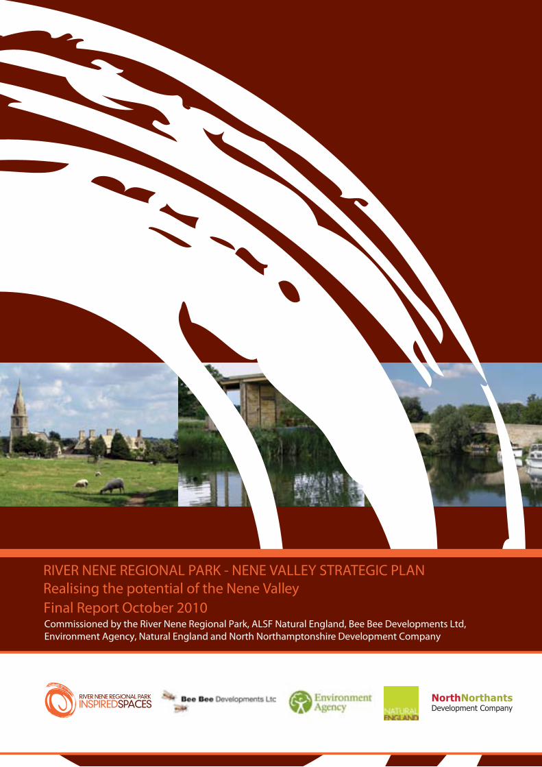
Commissioned by the River Nene Regional Park, ALSF Natural England, Bee Bee Developments Ltd, Environment Agency, Natural England and North Northamptonshire Development Company
Final Report October 2010
RIVER NENE REGIONAL PARK - NENE VALLEY STRATEGIC PLANRealising the potential of the Nene Valley
2

3
Foreword ........................................................................................................................................................................................... 4
PART 1: INTRODUCTION AND CONTEXT
1. Introduction ............................................................................................................................................................................ 6 2. Strategic Context .................................................................................................................................................................... 9 3. Nene Valley Today ................................................................................................................................................................ 15
PART 2: THE NENE VALLEY STRATEGIC PLAN
4. Vision, Objectives and Themes .......................................................................................................................................... 24 5. A More Enjoyed River Nene ................................................................................................................................................ 28 6. Reinvigorated Nene Towns ................................................................................................................................................ 36 7. A Living Countryside .......................................................................................................................................................... 40 8. A Connected Nene Valley ................................................................................................................................................... 48 9. Enhanced Cultural and Natural Attractions and a Natural Playground ........................................................................ 56
PART 3: NENE VALLEY PROJECTS AND DELIVERY
10. Projects ................................................................................................................................................................................. 62 11. Moving Forward ................................................................................................................................................................... 76
APPENDICES
Appendix A: Consultation Appendix B: References Appendix C: Northamptonshire Green Infrastructure Appendix D: Upper Nene Valley Gravel Pits Potential Special Protection Area (pSPA) Appendix E: Strategic Plan
FIGURES
Figure 1: Nene Valley Location Plan Figure 2: Nene Valley Strategy Plan (separate A2 fold out plan) Figure 3: River Nene CruisingTimes Figure 4: Nene Valley Environmentally Protected Areas
BOXES
Box 1: Locations for Waterside Facilities along the River Nene Box 2: Upper Nene Valley Gravel Pits Potential Special Protection Area (pSPA) Box 3: Food, Craft and Eco-tourism related businesses in the Nene Valley Box 4: Northamptonshire Rights of Way Improvement Plan 20072011: Opportunities for North Northamptonshire
TABLES
Table 1: Nene Valley Strategy: Key Policy Drivers and Policy Documents Table 2: Comparison of Strategy Objectives and Themes
CONTENTS

4
FOREWORD
The Nene Valley Strategic Plan is the culmination of a programme of extensive consultation and stakeholder engagement that brings together and deals in a comprehensive way with a wide variety of environmental, leisure, tourism, economic, planning and land use matters in a single document. The Plan is not the end of the process, but rather a starting point for the development and implementation of a myriad of initiatives that will have a profound effect on the wellbeing of existing and new communities, and on the long-term use and management of the Nene Valley, in its widest sense.
In the past, Northamptonshire has been somewhat reluctant to promote itself and its assets, possibly because, as an inland county with no coastline, no areas of outstanding natural beauty or designated green belt, we have been unable to find a suitable way to express the subtlety and beauty of the Northamptonshire landscape and its river valleys. However, supported by the Environmental Character Assessment and Green Infrastructure (ECA&GI) suite, and the opportunities for conservation and enhancement that exist in the context of appropriate growth, this new Strategic Plan provides a unique opportunity to harness the wide range of experience, knowledge and expertise that already exists, and to draw this together in a shared vision for the long-term future of the Nene Valley.
Michel Kerrou CHIEF ExECUTIVE RIVER NENE REGIONAL PARK
PART 1: INTRODUCTION AND CONTExT

6
THE NENE VALLEyThe Nene Valley is a beautiful but largely under enjoyed part of Northamptonshire extending for around 56 kilometres (35 miles) between Northampton and Peterborough. It incorporates the River Nene, which winds through a network of lakes and wetland areas disused and currently worked sand and gravel quarries with the river meandering through a broad, largely flat valley. The valley includes countryside known for its quintessentially English character and has a number of unspoilt villages and market towns.
The Nene valley is best appreciated from within the area itself (as its appeal is not immediately apparent from the A45/A605 or train routes), and is already enjoyed by boaters, walkers, bird watchers, anglers and those visiting its lakes, historic houses and natural landscape. The wider catchment includes the rapidly growing areas of Milton Keynes, Cambridgeshire and Leicestershire. Within the valley there are popular attractions, which already draw visitors such as Summer Leys, Stanwick Lakes, Barnwell and Irchester Country Parks and historic villages such as Wadenhoe. However, these assets are not always well known or promoted; other areas have the potential to be enjoyed by more people if appropriate provision is made.
The Plan has been developed in conjunction with a wide range of stakeholders and sets out proposals to allow the area to be more easily enjoyed by those who live and work in Northamptonshire or those visiting the valley. It recognises the valley’s subtle character and the need to improve access through sensitive management: protecting the special environment while allowing appropriate infrastructure, such as waterside moorings and marinas, waterside facilities, places to enjoy the area’s special wildlife accessed by recreational paths in suitable locations.
The aim is to provide an integrated plan that develops improved recreational and environmental experiences in the Nene Valley. A wide range of potential users can be identified: narrow boaters on route to the River Ouse, canoeists, providing facilities for existing and new families, that have moved into the area, weekend visitors, anglers and cycle tourists.
THE ROLE OF THE PLANThe Plan provides an overarching leisure and environmental framework to help develop the Valley’s existing assets – environmental, natural, cultural and economic – through conservation, enhancement and as an integral part of new development. It brings together partners and initiatives to deliver a co-ordinated approach to improving the Nene Valley’s green infrastructure, including access and appreciation of the area’s special character and attractions.
The Plan:
Recognises the significance of the River Nene and surrounding natural, historic, cultural and heritage assets
Recognises the importance of the assets as complementing appropriate planned growth in Northamptonshire
Guides strategic development in the Valley to support green infrastructure as appropriate to the area
Supports the realisation of the significant economic and social benefits that can be achieved
Sits alongside, complements and assists the delivery of other strategies, which meet its objectives
Aims to attract funding resources and partners to assist in the implementation of the strategy
Provides a framework that identifies opportunities to improve social, economic and environmental wellbeing
Promotes active partnership working
Delivers the above in accordance with sustainable development objectives
The Nene Valley has the opportunity
to offer improved experiences of
its natural and cultural assets e.g.
through enjoyment of waterside
pubs, unique wetland birds, river
kayaking and spire to spire walks
SECTION 1: INTRODUCTION
7
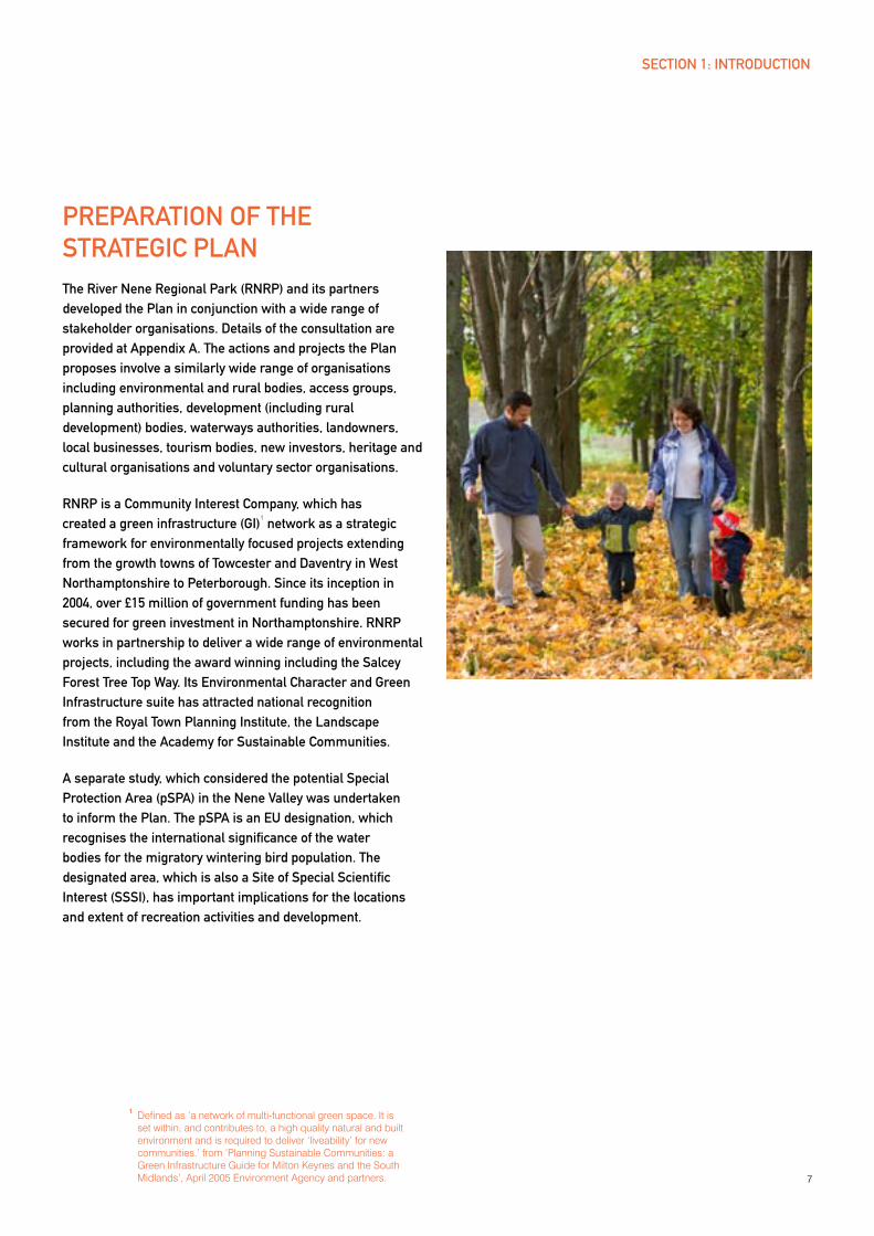
PREPARATION OF THE STRATEGIC PLANThe River Nene Regional Park (RNRP) and its partners developed the Plan in conjunction with a wide range of stakeholder organisations. Details of the consultation are provided at Appendix A. The actions and projects the Plan proposes involve a similarly wide range of organisations including environmental and rural bodies, access groups, planning authorities, development (including rural development) bodies, waterways authorities, landowners, local businesses, tourism bodies, new investors, heritage and cultural organisations and voluntary sector organisations.
RNRP is a Community Interest Company, which has created a green infrastructure (GI)
1 network as a strategic
framework for environmentally focused projects extending from the growth towns of Towcester and Daventry in West Northamptonshire to Peterborough. Since its inception in 2004, over £15 million of government funding has been secured for green investment in Northamptonshire. RNRP works in partnership to deliver a wide range of environmental projects, including the award winning including the Salcey Forest Tree Top Way. Its Environmental Character and Green Infrastructure suite has attracted national recognition from the Royal Town Planning Institute, the Landscape Institute and the Academy for Sustainable Communities.
A separate study, which considered the potential Special Protection Area (pSPA) in the Nene Valley was undertaken to inform the Plan. The pSPA is an EU designation, which recognises the international significance of the water bodies for the migratory wintering bird population. The designated area, which is also a Site of Special Scientific Interest (SSSI), has important implications for the locations and extent of recreation activities and development.
1 Defined as ‘a network of multi-functional green space. It is set within, and contributes to, a high quality natural and built environment and is required to deliver ‘liveability’ for new communities.’ from ‘Planning Sustainable Communities: a Green Infrastructure Guide for Milton Keynes and the South Midlands’, April 2005 Environment Agency and partners.
SECTION 1: INTRODUCTION
8
STRUCTURE OF THE PLANThe strategy is split into three parts:
PART 1
Part 1 continues by providing the context
and background for this strategy:
Section 2 provides the strategic and policy context including the Northamptonshire growth agenda, tourism and recreation, green infrastructure, rural development and waterways development contexts and other national policies of relevance, focusing on healthy lifestyles, economic benefits and sustainable development
Section 3 provides a ‘Current Picture’ of the Nene Valley
PART 2
Part 2 sets out the main strategy
proposals in sections 4-9:
Section 4 sets the framework for the strategy drawing on the contextual review in Part 1
Sections 5 to 9 identify opportunities and proposals according to five themes:
Section 5, A More Enjoyed River Nene
Section 6, Enhanced Nene Towns
Section 7, A Living Countryside
Section 8, A Connected Nene Valley
Section 9, Natural Attractions and a Natural Playground
PART 3
Part 3 provides details of actions and projects to support the delivery of the strategy (Section 10), together with a delivery plan (Section 11).
SECTION 1: INTRODUCTION

9
SECTION 2: CONTExT
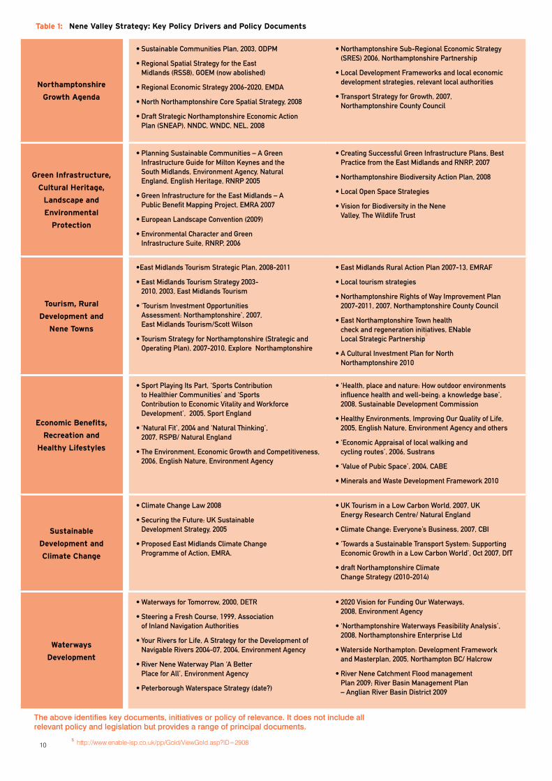
The wide ranging nature of this strategy, from recreation, tourism and rural development to waterways development and protection and enhancement of biodiversity, means that it is influenced by a wealth of policy and strategic drivers/ trends. Table 1. provides a summary of key policy and strategy documents. This section briefly reviews the main relevance of these, grouped as follows:
North Northamptonshire Growth Agenda
Green Infrastructure and Environmental Protection
Tourism and Rural Development
Waterways Development
Economic Benefits, Recreation and Healthy Lifestyles
Sustainable Development, Climate Change and Sustainable Transport
NORTHAMPTONSHIRE GROWTH AGENDAAs part of the previous Government’s Milton Keynes and South Midlands Sub-Regional growth area, as identified within the Sustainable Communities Plan, within which the Nene Valley is located, major growth and change was planned for Northamptonshire. This was to be focused around the towns of Corby, Kettering and Wellingborough in North Northamptonshire, with a smaller amount of growth in Rushenden/Higham Ferrers and the other towns and villages of east Northamptonshire. Now that the Regional Spatial Strategy has been abolished the level of any additional growth and the timetable for change in these areas will be determined locally.
The county town of Northampton was identified as a Principal Urban Area within the Milton Keynes and South Midlands Sub-Region. The role of the town as an important centre will also be shaped locally now that the Regional Spatial Strategy has been abolished.
The Nene Valley has an important role in providing a sensitively managed, green recreational ‘playground’ for both the existing population and any population growth planned for Northamptonshire and accompanying new jobs. In addition, it has the potential to provide an important contribution to employment growth in green employment, recreation and tourism. The river is also an important source of water.
Economic strategies for the region and Northamptonshire2
recognise the relative prosperity of much of Northamptonshire, compared to other areas in the East Midlands, but that higher deprivation levels exist in Corby, with pockets in Wellingborough, Kettering, Rushden, Higham Ferrers, Irthlingborough, Raunds and Northampton. Northamptonshire has close functional links with London (London St Pancras is just 50 minutes from Wellingborough), the South East, East of England and the West Midlands. Tourism and the development of a higher value visitor economy is a key economic opportunity for the county. The River Nene Regional Park Vision is identified as the ‘biggest potential project’ in East Northamptonshire
3.
GREEN INFRASTRUCTURE AND ENVIRONMENTAL PROTECTIONGreen infrastructure (GI) is defined in brief as an interconnected network of multi-functional green
space. The term is used as a way of ensuring open space, the countryside, parks and important natural or cultural featured are planned and recognised, particularly for the contribution they make to our quality of life. Green infrastructure is at the heart of sustainable development, which provides a ‘high quality natural and built environment and is required to deliver ‘liveability’ for new communities’
4.
2 East Midlands Regional Economic Strategy 2006-20, EMDA, Sub-regional Economic Strategy, 2006, Northamptonshire Partnership, Draft Strategic Northamptonshire Economic Action Plan, 2008, NEL/ NNCD/WNDC
3 Draft Strategic Northamptonshire Economic Action Plan (‘SNEAP’), 2008, NEL/NNDC/WNDC
4 ‘Planning Sustainable Communities: A Green Infrastructure Guide for Milton Keynes and the South Midlands’, 2005, Environment Agency, Natural England and partners
105 http://www.enable-lsp.co.uk/pp/Gold/ViewGold.asp?ID=2908
The above identifies key documents, initiatives or policy of relevance. it does not include all relevant policy and legislation but provides a range of principal documents.
Table 1: Nene Valley Strategy: Key Policy Drivers and Policy Documents
Northamptonshire
Growth Agenda
•SustainableCommunitiesPlan,2003,ODPM
•RegionalSpatialStrategyfortheEastMidlands (RSS8), GOEM (now abolished)
•RegionalEconomicStrategy2006-2020,EMDA
•NorthNorthamptonshireCoreSpatialStrategy,2008
•DraftStrategicNorthamptonshireEconomicActionPlan (SNEAP), NNDC, WNDC, NEL, 2008
•NorthamptonshireSub-RegionalEconomicStrategy(SRES) 2006, Northamptonshire Partnership
•LocalDevelopmentFrameworksandlocaleconomicdevelopment strategies, relevant local authorities
•TransportStrategyforGrowth,2007,Northamptonshire County Council
Green Infrastructure,
Cultural Heritage,
Landscape and
Environmental
Protection
•PlanningSustainableCommunities–AGreenInfrastructure Guide for Milton Keynes and the South Midlands, Environment Agency, Natural England, English Heritage, RNRP 2005
•GreenInfrastructurefortheEastMidlands–APublic Benefit Mapping Project, EMRA 2007
•EuropeanLandscapeConvention(2009)
•EnvironmentalCharacterandGreenInfrastructure Suite, RNRP, 2006
•CreatingSuccessfulGreenInfrastructurePlans,BestPractice from the East Midlands and RNRP, 2007
•NorthamptonshireBiodiversityActionPlan,2008
•LocalOpenSpaceStrategies
•VisionforBiodiversityintheNeneValley, The Wildlife Trust
Tourism, Rural
Development and
Nene Towns
•EastMidlandsTourismStrategicPlan,2008-2011
•EastMidlandsTourismStrategy2003-2010, 2003, East Midlands Tourism
•‘TourismInvestmentOpportunitiesAssessment: Northamptonshire’, 2007, East Midlands Tourism/Scott Wilson
•TourismStrategyforNorthamptonshire(StrategicandOperating Plan), 2007-2010, Explore Northamptonshire
•EastMidlandsRuralActionPlan2007-13,EMRAF
•Localtourismstrategies
•NorthamptonshireRightsofWayImprovementPlan2007-2011, 2007, Northamptonshire County Council
•EastNorthamptonshireTownhealthcheck and regeneration initiatives, ENable Local Strategic Partnership
5
•ACulturalInvestmentPlanforNorthNorthamptonshire 2010
Economic Benefits,
Recreation and
Healthy Lifestyles
•SportPlayingItsPart,‘SportsContributionto Healthier Communities’ and ‘Sports Contribution to Economic Vitality and Workforce Development’, 2005, Sport England
•‘NaturalFit’,2004and‘NaturalThinking’,2007, RSPB/ Natural England
•TheEnvironment,EconomicGrowthandCompetitiveness,2006, English Nature, Environment Agency
•‘Health,placeandnature:Howoutdoorenvironmentsinfluence health and well-being: a knowledge base’, 2008, Sustainable Development Commission
•HealthyEnvironments,ImprovingOurQualityofLife,2005, English Nature, Environment Agency and others
•‘EconomicAppraisaloflocalwalkingandcycling routes’, 2006, Sustrans
•‘ValueofPubicSpace’,2004,CABE
•MineralsandWasteDevelopmentFramework2010
Sustainable
Development and
Climate Change
•ClimateChangeLaw2008
•SecuringtheFuture:UKSustainableDevelopment Strategy, 2005
•ProposedEastMidlandsClimateChangeProgramme of Action, EMRA.
•UKTourisminaLowCarbonWorld,2007,UKEnergy Research Centre/ Natural England
•ClimateChange:Everyone’sBusiness,2007,CBI
•‘TowardsaSustainableTransportSystem:SupportingEconomic Growth in a Low Carbon World’, Oct 2007, DfT
•draftNorthamptonshireClimateChange Strategy (2010-2014)
Waterways
Development
•WaterwaysforTomorrow,2000,DETR
•SteeringaFreshCourse,1999,Associationof Inland Navigation Authorities
•YourRiversforLife,AStrategyfortheDevelopmentofNavigable Rivers 2004-07, 2004, Environment Agency
•RiverNeneWaterwayPlan‘ABetterPlace for All’, Environment Agency
•PeterboroughWaterspaceStrategy(date?)
•2020VisionforFundingOurWaterways,2008, Environment Agency
•‘NorthamptonshireWaterwaysFeasibilityAnalysis’,2008, Northamptonshire Enterprise Ltd
•WatersideNorthampton:DevelopmentFrameworkand Masterplan, 2005, Northampton BC/ Halcrow
•RiverNeneCatchmentFloodmanagementPlan 2009; River Basin Management Plan – Anglian River Basin District 2009
11
Extensive and award winning GI mapping work has been undertaken for Northamptonshire in the interactive ECA&GI suite (www.rnrpenvironmentalcharacter.org.uk) which identifies landscape, historic and biodiversity character areas. This provides assessments, strategy and guidelines for each of the character types and areas and establishes GI corridors, with proposals for their enhancement in North Northamptonshire, described further in Section 3 and in more detail at Appendix C. It also has a role to play in delivering the requirements of the European Landscape Convention.
Northamptonshire’s Biodiversity Action Plan sets priorities and targets for habitat restoration and enhancement. It also highlights the relevance to the local community, the economic benefits which stem from visitors enjoying wildlife and landscapes and that an area of greater habitat and wildlife diversity is more likely to be an attractive place to live and work. Northamptonshire’s biodiversity is under severe pressure, due mainly to built development and a history of agricultural intensification. However the farmed landscape is still important for some species and farmers are crucial to help reverse some of the declines and restore habitats. The county has one of the lowest proportions of protected areas for biodiversity in the country but even so, has one of only five internationally recognised sites for birds in the region.
The Northamptonshire Wildlife Trust’s Nene Valley Vision also sets out a priority for enhancing biodiversity through restoring, creating and linking up habitats.
TOURISM, RURAL DEVELOPMENT AND TOWNS IN THE NENE VALLEyNorthamptonshire sees around 20 million visitors annually, around 90% of which are day visitors6. There are around 2 million visitors in East Northamptonshire, a further 2 million in the borough of Wellingborough and nearly 2.8 million in the borough of Kettering.
Regional tourism strategies identify the need to develop the visitor offer in Northamptonshire
7. They also recognise
the value and opportunity presented by the River Nene Regional Park
8. Northamptonshire’s Tourism Strategy
9
recognises the ‘very appealing mix of beautiful villages and associated archetypal English countryside’ as a particular tourism asset for the county, supported by market research conducted amongst new visitors (2005). Some visitors identified the Northamptonshire countryside and its villages as ‘among the best in the country’. The opportunity offered by the River Nene Regional Park, its waterways and water-based activities, and associated land management initiatives complementing that of the historic houses (such as Rockingham Castle and Boughton House) are identified as key themes. The strategy also recognises the need to improve the quality and availability of accommodation and eateries to be able to attract more overnight stay visitors.
At a regional level, rural policy priorities are set out in the East Midlands Rural Action Plan and include improving green infrastructure, employment, enterprise and land based rural businesses, access to services, active communities and addressing climate change
10. The Rural Action Plan recognises
that the region has the poorest overall biodiversity of all the English regions. It therefore supports the enhancement of local economic benefits from tourism and visitor attractions and improvements to rural transport and accessibility.
Town action plans or health checks have been prepared for each of the East Northamptonshire towns; Higham Ferrers and Rushden, Irthlingborough, Raunds, Thrapston and Oundle
11. These identify a range of regeneration
and tourism related proposals and initiatives, including town centre and public realm improvements, heritage open days and access to recreation and leisure.
6 2007 STEAM report for Northamptonshire identified 19,864 visitors, of whom 17,489 were day visitors. Northamptonshire STEAM Tourism Statistics, Northamptonshire Observatory
7 East Midlands Tourism Strategic Plan 2008-11 8 East Midlands Tourism Strategy 2003-10
9 Northamptonshire Tourism Strategy 2007-2010, Northamptonshire Enterprise Ltd
10 East Midlands Rural Action Plan 2007-2013, East Midlands Rural Affairs Forum
11 See www.enable-lsp.co.uk/pp/gold/viewGold.asp?IDType=Page&ID=11525 for town partnerships and action plans
SECTION 2: CONTExT
12
WATERWAyS DEVELOPMENT AND RECREATIONIn recent years Britain’s waterways have seen record levels of leisure use. In 2006 spending on waterborne leisure in general was estimated to be growing at 6-8% per annum
12. This spending will undoubtedly be
affected by the changing economic climate. However, with increasing emphasis on recreational activities close to home, it is likely that waterways based leisure will continue to be an important, and in the medium term a growing part of the leisure and tourism economy.
Recent assessment of the Northamptonshire waterways13
identified the potential to significantly increase the economic and employment benefit to the county by realising the full visitor potential of the waterways. It also identified the need to establish a ‘Northamptonshire Waterways’ brand as a marketing opportunity. Northamptonshire has the greatest quantity of water of any land-locked county in England. There are also significant opportunities to link it to wider waterway networks. For example the Bedford and Milton Keynes waterway proposal is a significant tourism and recreation opportunity that would link the Nene the Fenland ‘cruising ring’ and further inland waterway networks in the East Midlands, East of England and South East regions. Proposals address this potential Section 5 and include improved provision for visitors at waterways gateways, the creation of purpose built marinas and better links between the River Nene and nearby towns and villages.
The Environment Agency (EA) is addressing the backlog of under-investment in the local waterways.
14 Around £1.5
million per annum is being invested by the EA in maintenance and upgrading of facilities on the Nene Valley corridor. The current programme of investment is planned to ensure 95% of facilities are in fair or good condition by 2011.
There is significant additional boating carrying capacity on the Nene, as the river is underused, and it is estimated that an additional 1000 boats could be registered / moored along the Nene between Northampton, where a new marina is being constructed, and Peterborough. The EA is very supportive of well-managed additional recreation and tourism on the waterways it manages, and recognises the economic and social benefits in maximising regeneration opportunities.
Enjoyment of the waterways can also be land-based. Increasing numbers of people are visiting waterways making use of trails/towpaths, accommodation, pubs/cafes and other waterside facilities at marinas and moorings. British Waterways recently reported a 13% annual increase in the number of people using its towpaths
15.
ECONOMIC BENEFITS, RECREATION AND HEALTHy LIFESTyLESInvestment in green infrastructure, recreation and tourism generates significant employment, health and well-being benefits. Assessments of these benefits have been undertaken by bodies ranging from Commission for Architecture and the Built Environment (CABE) to the Wildlife Trusts, NHS, Sustrans and the Sustainable Development Commission.
As an example, the economic benefits, including jobs and expenditure in the local economy, has been calculated for the Thames Waterway Plan. This estimates tourism spending associated with the waterway reaches £119 million annually and supports 18,400 jobs in the local economy
16. In another
example Natural Economy Northwest estimates that the ‘environmental economy’ generates £2.6bn GVA within the North West region every year and employs 109,000 people.
The outdoor environment is important in increasing levels of physical activity, supporting well-being, delivering public health (tackling obesity, stress and other major health issues), creating inclusive communities / tackling exclusion and supporting business investment. There is a wealth of research that supports this. The Sustainable Development Commission’s work
17 identifies over 200 references in
support of the fact that: ‘some of the UK’s biggest
health challenges - including mental illness and
obesity-related diseases - can be addressed through
increased access to the outdoor environment’.
Exposure to natural spaces is good for health in its own right, but it also facilitates physical activity and social contact. ‘People are more likely to walk, cycle and play in natural spaces, enjoying the benefits of the physical activity and getting out and meeting people’
14. Natural environments and
inspiring landscapes encourage both informal recreation, such as walking and formal or structured recreation,
12 ‘Inland Marina Investment Guide’, March 2006, British Waterways13 ‘Northamptonshire Waterways Feasibility Analysis’,
2008, Northamptonshire Enterprise Ltd14 2020 Vision for Funding Our Waterways, 2008, Environment Agency15 British Waterways Annual Report and Accounts 2007/8
16 ‘Case Study 5 Thames Social and Economic Benefits’, 2020 Vision for Funding Our Waterways, 2008, Environment Agency
17 ‘Health, place and nature; How outdoor environments influence health and well-being: a knowledge base’, March 2008, Sustainable Development Commission
SECTION 2: CONTExT
13
such as organised sports. This is particularly the case where this is supported by quality infrastructure e.g. trails, interpretation panels/facilities, marketing etc, much of which can also create cultural and educational benefits.
In addition involving artists in the process can visually animate the landscape and increase the legibility of trails through bespoke way marking, sculpture and land art for example.
Poor health due to lack of exercise is estimated to cost England’s economy several billion pounds a year: estimates range from £2bn to £6.5bn per year as a result of direct NHS costs and loss of working days. Lost output due to ill health (as opposed to costs of the NHS) is between £90m and £320m pa for the North East region alone. It is estimated that an increase in levels of physical activity by 10% in adults in the NE region would deliver savings of around at least £25m per annum in the economic benefits from improved health
18.
Other research for the RSPB suggests that physical inactivity costs the UK over £8 billion and the total cost of mental healthcare in England is £41.8 billion. Both these figures include substantial costs in the care sector (to the NHS, local authorities, privately funded services, family and friends) and in the economy, caused by people being unable to work19.
SUSTAINABLE DEVELOPMENT, CLIMATE CHANGE AND SUSTAINABLE TRANSPORT Sustainable development and tackling climate change affect multiple aspects of the Plan. Sustainable development principles are wide ranging and have been used in planning and regional development for a number of years. Their complexity and the challenge of ensuring robust delivery means some aspects are often overlooked. The more recent and heightened imperative to address climate change has direct implications for the Plan in terms of environmental adaptation and the transition to a low carbon economy and society.
Biodiversity and land management plans recognise the need to create wildlife or ‘climate’ corridors in order to sustain biodiversity20. Flood risk and catchment management are critically important areas directly affecting the River Nene and its environs. Proposals have also been developed for the creation of a Carbon Sink Forest to increase the woodland cover of the Rockingham Forest by 15% to combat climate change. Carefully balancing the need for carbon reduction whilst maintaining and protecting a rich biodiversity will be an important challenge.
The UK Government’s Commitment to achieve an 80% reduction in greenhouse gas emissions by 205021 provides an immediate focus on developing changes to the way energy is sourced, produced and distributed, on emissions associated with transport and on reducing waste. Carbon reduction and the movement to clean energy have important implications for leisure and tourism. Greater energy efficiency, increasing renewable energy and micro energy generation create tourism and employment opportunities. Carbon reduction and low impact, ‘carbon conscious’ lifestyles further increase the importance of sustainable transport (and associated recreation opportunities), the opportunities for local food production and sourcing and a ‘re-localisation’ of economies. The latter sees a reduction in the sourcing and transportation of some goods, services and energy and an increased trend to source closer to home. Whilst these changes may appear small and piecemeal, they nevertheless can be significant to sustainable rural development especially where there is a tourism focus22.
‘Being in contact with nature
both encourages people to take
exercise and sustains participation
in physical activity. Sociable
walking is a simple, cheap and very
accessible form of exercise even to
high risk health groups.’ RSPB, 2004
18 The Department of Health publication ‘Be Active Be Healthy: A Plan for Getting the Nation Moving’ (Feb 2009) estimates the annual costs to the NHS as a result of physical inactivity are between £1 billion and £1.8 billion. It identifies the total cost of primary and secondary care attributable to physical inactivity for the Northamptonshire Teaching Primary Care Trust is £9,170,500 for 2006/07 or £1,433,729 per 100,000 population (less than the population of Wellingborough and the Three Towns).
19 Countryside Access Study, Health Summary, 2005, Regeneris for Countryside Agency
20 ‘Natural Fit’ 2004, ‘Natural Thinking’ 2007 and ‘Natural Health’ 2007, RSPB/ Natural England/ Faculty of Public Health
21 ‘A Living Landscape; A Call to Restore the UK’s Battered Ecosystems for Wildlife and People’, The Wildlife Trusts
22 As legislated by the UK Climate Change Act 2008
SECTION 2: CONTExT
14
SUMMARyThe range of interests and policy applicable to environmental planning, recreation and tourism in Northamptonshire is huge. This cursory review highlighted particular contextual aspects and drivers focusing on those likely to be important both in terms of their challenge (e.g. sustainable development and potential growth in Northamptonshire) and in terms of understanding the importance, value and benefits of investment in the protection and enjoyment of green infrastructure. Particular points or trends of relevance include:
Potential growth planned for Northamptonshire
The Nene Valley’s role in providing green infrastructure to support potential growth
The need to strengthen Northamptonshire’s biodiversity given the severe pressure it is under
The strength of Northamptonshire’s tourism assets and the significant opportunity to increase enjoyment of these, particularly with more visitors staying the in the area
The opportunity to greatly increase the financial and employment benefit of the Nene waterways through a significant increase in waterways related activity
The health, well-being, social and economic benefits associated with encouraging use and enjoyment of the cultural and natural environment
The implications and opportunities for rural development and tourism associated with delivering robust sustainable development, increased energy efficiency and the transition to a low carbon economy.
Trends associated with the growing health, well-being and recreation sectors, the increasing interest and propensity to spend time and money on ‘experiences’, increased opportunities for domestic tourism and increasing eco and sustainable tourism, mean that, in conjunction with the above points, the opportunities for improved sustainable access and enjoyment of the Nene Valley are extremely timely.
SECTION 2: CONTExT
15
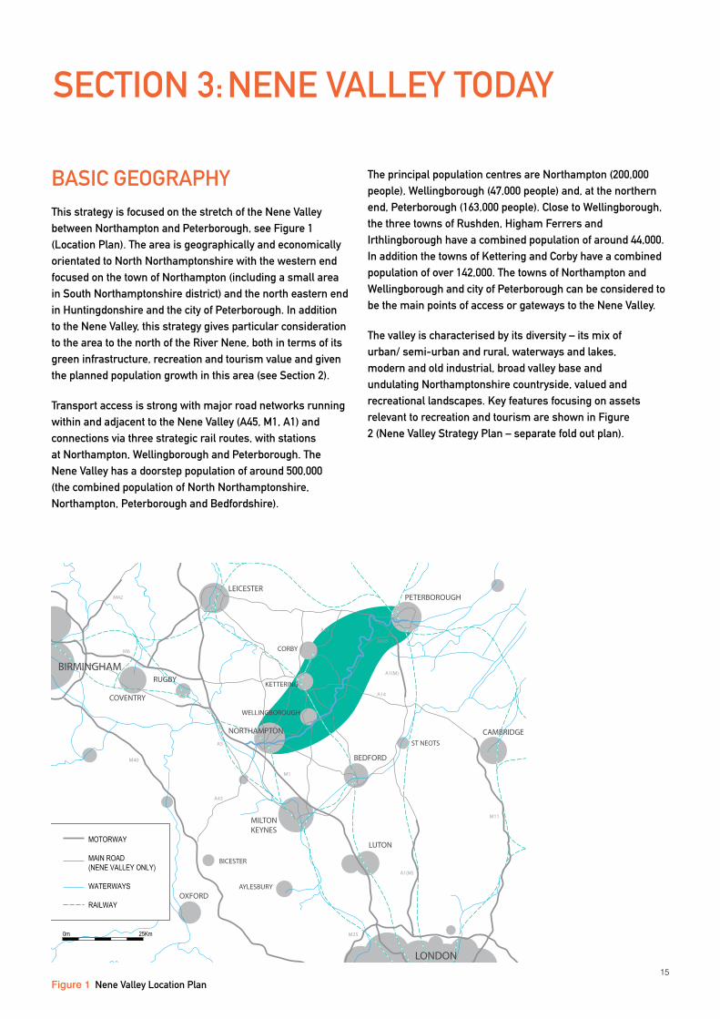
BASIC GEOGRAPHyThis strategy is focused on the stretch of the Nene Valley between Northampton and Peterborough, see Figure 1 (Location Plan). The area is geographically and economically orientated to North Northamptonshire with the western end focused on the town of Northampton (including a small area in South Northamptonshire district) and the north eastern end in Huntingdonshire and the city of Peterborough. In addition to the Nene Valley, this strategy gives particular consideration to the area to the north of the River Nene, both in terms of its green infrastructure, recreation and tourism value and given the planned population growth in this area (see Section 2).
Transport access is strong with major road networks running within and adjacent to the Nene Valley (A45, M1, A1) and connections via three strategic rail routes, with stations at Northampton, Wellingborough and Peterborough. The Nene Valley has a doorstep population of around 500,000 (the combined population of North Northamptonshire, Northampton, Peterborough and Bedfordshire).
The principal population centres are Northampton (200,000 people), Wellingborough (47,000 people) and, at the northern end, Peterborough (163,000 people). Close to Wellingborough, the three towns of Rushden, Higham Ferrers and Irthlingborough have a combined population of around 44,000. In addition the towns of Kettering and Corby have a combined population of over 142,000. The towns of Northampton and Wellingborough and city of Peterborough can be considered to be the main points of access or gateways to the Nene Valley.
The valley is characterised by its diversity – its mix of urban/ semi-urban and rural, waterways and lakes, modern and old industrial, broad valley base and undulating Northamptonshire countryside, valued and recreational landscapes. Key features focusing on assets relevant to recreation and tourism are shown in Figure 2 (Nene Valley Strategy Plan – separate fold out plan).
SECTION 3: NENE VALLEy TODAy
NORTHAMPTON
WELLINGBOROUGH
KETTERING
CORBY
PETERBOROUGHLEICESTER
COVENTRY
BIRMINGHAM
MILTON KEYNES
BEDFORD
ST NEOTS
LUTON
AYLESBURY
LONDON
THETFORD
KING’S LYNN
OXFORD
CHELMSFORD
COLCHESTER
BURY ST EDMUNDSCAMBRIDGE
NOTTINGHAMDERBY
BICESTER
RUGBY
M1
M40
A1(M)
M11
M25
A1(M)
A605
A5
M42
M6
A43
A43
A14
GRANTHAM
NENE VA
LLEY
MOTORWAY
MAIN ROAD(NENE VALLEY ONLY)
WATERWAYS
RAILWAY
0m 25Km
Figure 1 Nene Valley Location Plan
16
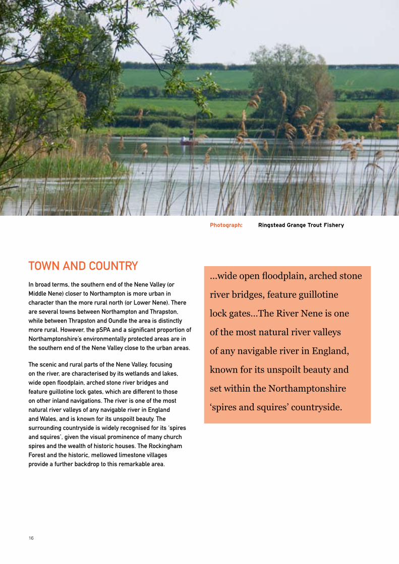
TOWN AND COUNTRyIn broad terms, the southern end of the Nene Valley (or Middle Nene) closer to Northampton is more urban in character than the more rural north (or Lower Nene). There are several towns between Northampton and Thrapston, while between Thrapston and Oundle the area is distinctly more rural. However, the pSPA and a significant proportion of Northamptonshire’s environmentally protected areas are in the southern end of the Nene Valley close to the urban areas.
The scenic and rural parts of the Nene Valley, focusing on the river, are characterised by its wetlands and lakes, wide open floodplain, arched stone river bridges and feature guillotine lock gates, which are different to those on other inland navigations. The river is one of the most natural river valleys of any navigable river in England and Wales, and is known for its unspoilt beauty. The surrounding countryside is widely recognised for its ‘spires and squires’, given the visual prominence of many church spires and the wealth of historic houses. The Rockingham Forest and the historic, mellowed limestone villages provide a further backdrop to this remarkable area.
...wide open floodplain, arched stone
river bridges, feature guillotine
lock gates…The River Nene is one
of the most natural river valleys
of any navigable river in England,
known for its unspoilt beauty and
set within the Northamptonshire
‘spires and squires’ countryside.
Photograph: Ringstead Grange Trout Fishery
17
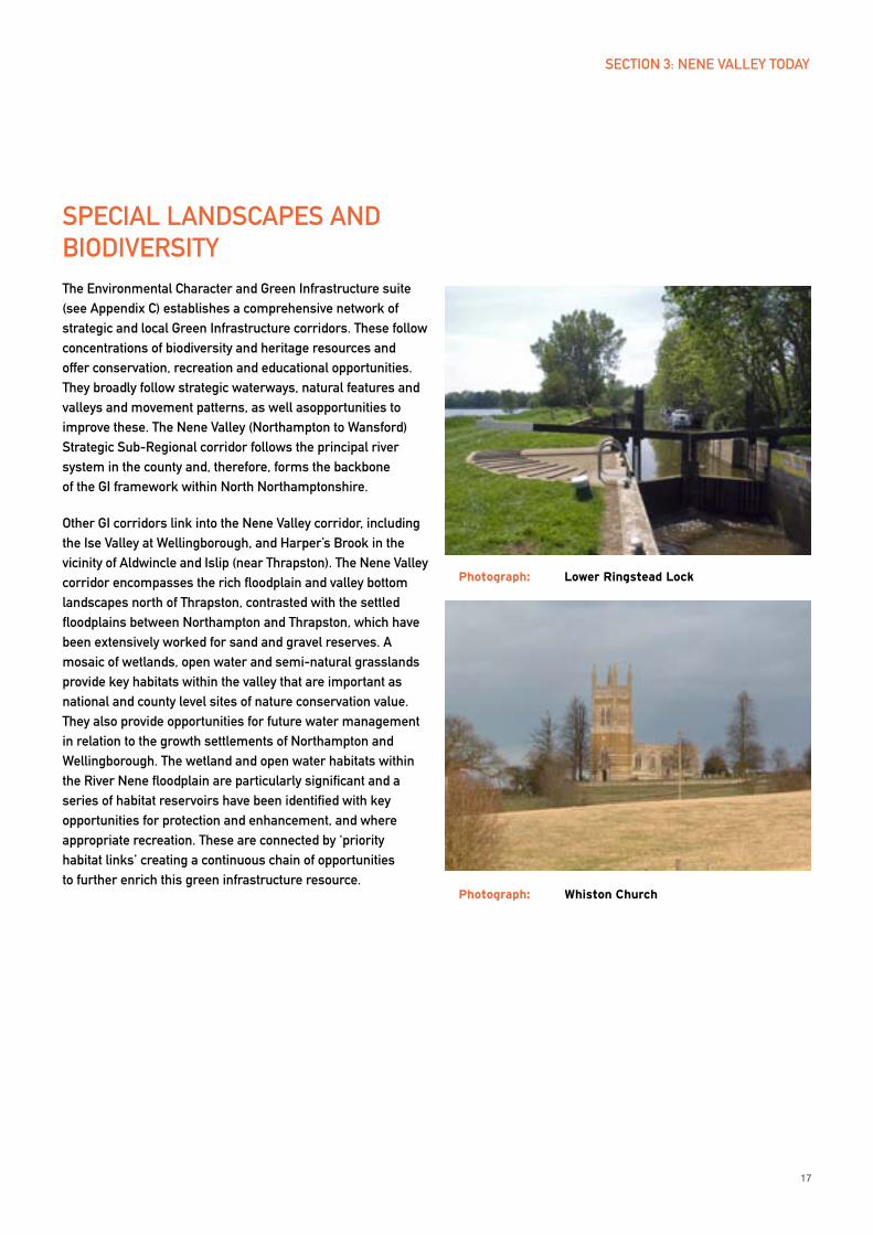
SPECIAL LANDSCAPES AND BIODIVERSITyThe Environmental Character and Green Infrastructure suite (see Appendix C) establishes a comprehensive network of strategic and local Green Infrastructure corridors. These follow concentrations of biodiversity and heritage resources and offer conservation, recreation and educational opportunities. They broadly follow strategic waterways, natural features and valleys and movement patterns, as well asopportunities to improve these. The Nene Valley (Northampton to Wansford) Strategic Sub-Regional corridor follows the principal river system in the county and, therefore, forms the backbone of the GI framework within North Northamptonshire.
Other GI corridors link into the Nene Valley corridor, including the Ise Valley at Wellingborough, and Harper’s Brook in the vicinity of Aldwincle and Islip (near Thrapston). The Nene Valley corridor encompasses the rich floodplain and valley bottom landscapes north of Thrapston, contrasted with the settled floodplains between Northampton and Thrapston, which have been extensively worked for sand and gravel reserves. A mosaic of wetlands, open water and semi-natural grasslands provide key habitats within the valley that are important as national and county level sites of nature conservation value. They also provide opportunities for future water management in relation to the growth settlements of Northampton and Wellingborough. The wetland and open water habitats within the River Nene floodplain are particularly significant and a series of habitat reservoirs have been identified with key opportunities for protection and enhancement, and where appropriate recreation. These are connected by ‘priority habitat links’ creating a continuous chain of opportunities to further enrich this green infrastructure resource.
Photograph: Lower Ringstead Lock
Photograph: Whiston Church
SECTION 3: NENE VALLEy TODAy
18
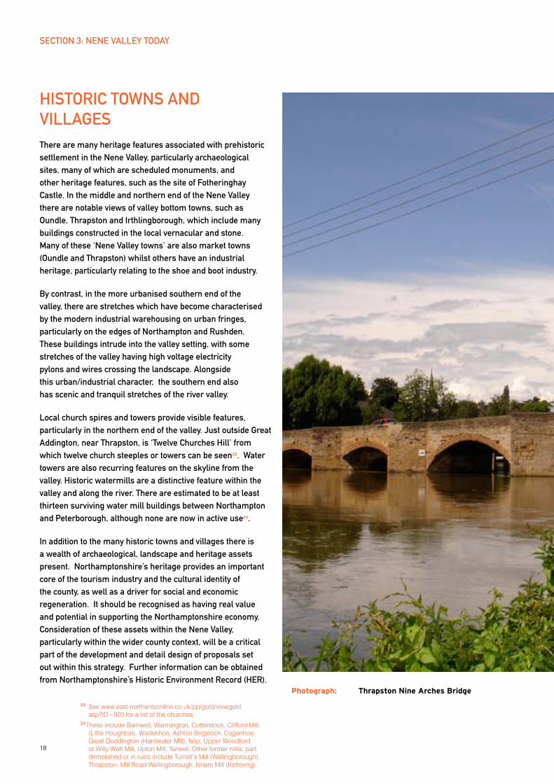
HISTORIC TOWNS AND VILLAGES There are many heritage features associated with prehistoric settlement in the Nene Valley, particularly archaeological sites, many of which are scheduled monuments, and other heritage features, such as the site of Fotheringhay Castle. In the middle and northern end of the Nene Valley there are notable views of valley bottom towns, such as Oundle, Thrapston and Irthlingborough, which include many buildings constructed in the local vernacular and stone. Many of these ‘Nene Valley towns’ are also market towns (Oundle and Thrapston) whilst others have an industrial heritage, particularly relating to the shoe and boot industry.
By contrast, in the more urbanised southern end of the valley, there are stretches which have become characterised by the modern industrial warehousing on urban fringes, particularly on the edges of Northampton and Rushden. These buildings intrude into the valley setting, with some stretches of the valley having high voltage electricity pylons and wires crossing the landscape. Alongside this urban/industrial character, the southern end also has scenic and tranquil stretches of the river valley.
Local church spires and towers provide visible features, particularly in the northern end of the valley. Just outside Great Addington, near Thrapston, is ‘Twelve Churches Hill’ from which twelve church steeples or towers can be seen23. Water towers are also recurring features on the skyline from the valley. Historic watermills are a distinctive feature within the valley and along the river. There are estimated to be at least thirteen surviving water mill buildings between Northampton and Peterborough, although none are now in active use24.
In addition to the many historic towns and villages there is a wealth of archaeological, landscape and heritage assets present. Northamptonshire’s heritage provides an important core of the tourism industry and the cultural identity of the county, as well as a driver for social and economic regeneration. It should be recognised as having real value and potential in supporting the Northamptonshire economy. Consideration of these assets within the Nene Valley, particularly within the wider county context, will be a critical part of the development and detail design of proposals set out within this strategy. Further information can be obtained from Northamptonshire’s Historic Environment Record (HER).
Photograph: Thrapston Nine Arches Bridge
23 See www.east-northantsonline.co.uk/pp/gold/viewgold.asp?ID=920 for a list of the churches
24 These include Barnwell, Warmington, Cotterstock, Clifford Mill (Little Houghton), Wadenhoe, Ashton Brigstock, Cogenhoe, Great Doddington (Hardwater Mill), Islip, Upper Woodford or Willy Watt Mill, Upton Mill, Yarwell. Other former mills, part demolished or in ruins include Turnell’s Mill (Wellingborough), Thrapston, Mill Road Wellingborough, Isham Mill (Kettering).
SECTION 3: NENE VALLEy TODAy
19
SUB AREA AND ATTRACTIONSAs identified above, the Nene Valley can be characterised as two broad halves:
The southern end south of Raunds, including the three towns (Rushden, Higham Ferrers and Irthlingborough), Wellingborough and extending to Northampton which is more urban in character, depicts stronger industrial character and has higher population levels; and
The northern end between Raunds and Peterborough, which is generally much more rural, particularly north of Thrapston.
For the purposes of this strategy and in better understanding the particular character and features of the Nene Valley, the area can be broken down into the following sub areas:
The Northampton end of the valley, dominated by the opportunities of the Northampton waterside, particularly the new marina at Beckets Park and the connection of this area to the town centre. To the east of Northampton is the Nene Whitewater Centre, whilst the stretch of valley around Billing and Earls
Barton includes the vast Billing Aquadrome holiday park including marina and nearby waterside pubs / eateries. Nearby, Grendon Lakes watersports centre is a strategic leisure site for the Nene Valley.
Wellingborough and the Three Towns. Aside from Northampton and Peterborough, this is the most urbanised part of the Nene Valley. Wellingborough is located at the point where the River Ise meets the River Nene. Victoria Mills is a significant riverside building on the River Nene and on the edge of Wellingborough and is still used by Whitworth Bros flour millers. To the immediate east of this is the historic site of Chester Farm, the former walled Roman Town, deserted medieval village and eighteenth century parkland, which overlooks the pSPA. There is also the popular Irchester Country Park alongside other Wellingborough attractions. Irthlingborough, Rushden and Higham Ferrers (the ‘three towns’) together with Earls Barton and Raunds all owe much of their historic character to the shoe and boot industry of the 19th and early 20th century. They have varying levels of economic prosperity with parts of the towns in need of regeneration. The towns are dotted either side of the River Nene and are in close proximity to a range of environmental, recreation and tourism assets including Summer Leys Nature Reserve and Irchester Country Park. The proposed Special Protection Area
(pSPA) is also a feature in this stretch of the valley.
Stanwick, Raunds, and villages to Thrapston.
Raunds is similar in character to the ‘three towns’ with some industrial heritage. Stanwick Lakes has become a significant outdoor recreation site for the Nene Valley. Focused on a series of restored gravel pits, it also offers appreciation of the wildlife, being based around the pSPA, and its archaeological heritage.
Nearby villages have notable historic character and Denford has a very high quality riverside environment. The Kinewell Lake nature reserve near Ringstead typifies the high waterscape quality found in the Nene Valley.
Thrapston is market charter town with a historic centre and some tourism potential.
Villages north of Thrapston to Oundle. From Titchmarsh to Wansford is the least urbanised stretch of the Nene and is arguably the most scenic. Villages such as Aldwincle and Wadenhoe, and stretches of the Nene as far as Peterborough fit the ‘rural idyll’ image of this part of Northamptonshire.
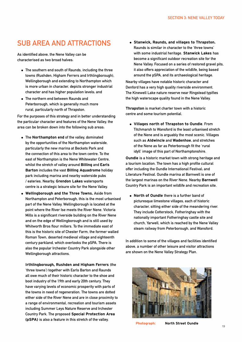
Oundle is a historic market town with strong heritage and a tourism location. The town has a high profile cultural offer including the Oundle International Festival; and Literature Festival. Oundle marina at Barnwell is one of the largest marinas on the River Nene. Nearby Barnwell Country Park is an important wildlife and recreation site.
North of Oundle there is a further band of picturesque limestone villages, each of historic character, sitting either side of the meandering river. They include Cotterstock, Fotheringhay with the nationally important Fotheringhay castle site and church, yarwell, which is reached by the Nene Valley steam railway from Peterborough, and Wansford.
In addition to some of the villages and facilities identified above, a number of other leisure and visitor attractions are shown on the Nene Valley Strategy Plan.
SECTION 3: NENE VALLEy TODAy
Photograph: North Street Oundle
20
OPPORTUNITIES AND CHALLENGES FOR THE NENE VALLEyThe above gives an insight into the character and assets of the Nene Valley and its environs, which remain relatively unknown. The Plan brings these together to consider the area in its entiretyand identify approaches to enhance it and make it more accessible. The River Nene and the Nene Way recreational footpath both create some awareness, and a significant number of local businesses use the Nene in their name. However, the Nene Valley has not received the same degree of recognition when considered against other waterway areas and or national/regional parks in the UK.
In understanding the opportunities and challenges, the following are identified as being particularly important for this strategy to address:
Connectivity within the Nene Valley to promote enjoyment
Orientation of towns to Nene Valley
Managing encroaching urbanisation and growth
Encouraging use of the water facilities
Increasing biodiversity and conservation
Managing visitors and recreational users
Improving and developing facilities and ‘creating places’
Improving access into the area
Creating recognition and identity for Nene Valley
These are examined below.
CONNECTIONS AND ORIENTATION
The Nene Valley is well located within the East Midlands in terms of the strategic road and rail network and proximity to towns, but the area is not cohesive or well connected internally. The A45/A605 forms a spinal route for the area and part of the strategic road network, but ignores and is removed from the Nene Valley and River Nene, providing little visual connection to either (the area near Stanwick being the main exception).
Similarly, many of the towns within or flanking the sides of the Nene Valley typically have little connectivity with the river or orientation to the valley. This contrasts with their previous 19th and 20th century industrial roles when the valley railway and river directly supported the town economies.
The principal exception to the above is the Nene Way long distance footpath running the length of the Nene Valley, which provides good orientation within the Nene Valley.
There are significant opportunities to strengthen the relationship between the towns and the Nene Valley as well as between the towns themselves, through trail development (footpath and cycle connectivity), signposting, visual links and functional links e.g. between the towns and River Nene waterside activities. Connectivity and linkage between the diverse environmental reserves and landscapes is also a priority, to overcome the existing disconnection.
The involvement of artists and creative practitioners in enhancing the legibility of links through bespoke features, way finding, sculpture and land art for example, can add value to proposals. Consideration should be given to the inclusion of artists and creative practitioners in design teams from the outset.
URBANISATION
The growth planning for North Northamptonshire recognises that green infrastructure (GI) should be an integral part of any new development. Providing this significantly enhances quality of life and brings important health and well-being benefits. This Strategic Plan not only identifies ways to enhance the Nene Valley’s GI but, in so doing, assists in minimising the ‘urban effect’. This is particularly important in considering ways to mitigate the existing urban encroachment and industrial edges causing visual intrusion in the southern end of the Nene Valley.
WATERWAyS AND LAKES
Increasing use and enjoyment of the Nene Valley’s key asset – the river and network of lakes – is fundamental to the realisation of the Plan. There are major opportunities to increase all water-based activities, including sailing, canoeing/kayaking, other water sports and angling, without negative environmental impact, drawing in more residents and visitors to enjoy these. Of particular importance is the strong synergistic role that can be developed between the waterway and local communities. Activity on the river can act as a catalyst for development and recreation alongside the river and in the surrounding areas, bringing significant local benefits: economic and social, directly and indirectly. As identified above, interaction between the river and land
SECTION 3: NENE VALLEy TODAy
21
is currently poor and access and signposting to the river is often inadequate: often the river is effectively hidden or not promoted. New infrastructure, which encourages and entices people to enjoy the river and valley should be a priority. This will also serve boaters/users of the Nene for whom there is sometimes a lack of facilities/locations to stop, particularly between Northampton and Wellingborough.
BIODIVERSITy AND MANAGING VISITORS
Strengthening biodiversity and conservation management are an integral part of green infrastructure provision. The essential importance of biodiversity enhancement in Northamptonshire was highlighted in Section 2. In encouraging better appreciation of the Nene Valley’s environmental assets, access needs to be managed so that more people enjoy their beauty and character but protection, particularly of the most sensitive areas, can be enhanced and any potential impact mitigated against. Appropriate recreation should be delivered in appropriate locations: there will be areas which should be retained as ‘quiet experience’ locations and others which can be promoted as ‘busier’ locations with more intensive recreation activities and access.
CREATING PLACES AND IMPROVING FACILITIES
Investment in facilities can help create places, which allow more people to better enjoy the area: facilities where people want to ‘meet, eat and stay’. A co-ordinated and managed approach is needed to ensure adequate, rather than overprovision, of facilities and ensure these are well-located e.g. at sites that maximise access but do not create adverse environmental impact and support use of sustainable transport. There are opportunities to provide facilities in locations which maximise enjoyment of the area e.g. eateries on the river (there are few River Nene waterside pubs) or at other locations with valley views or ‘gateway’ visitors centres. Facilities can include natural based attractions (wildlife and landscape interpretation), water-based activities and infrastructure (e.g. boating, sailing, canoeing, angling), heritage appreciation, art and cultural development, facilities based on local rural industries including food and craft as well as eateries (cafes, tea rooms, restaurants and waterside pubs).
There should also be diversity of investment in natural, heritage and cultural facilities and attractions. Festivals and events focused on the valley’s assets will also boost enjoyment and provide economic and social benefit.
IMPROVING ACCESS INTO AND PROMOTING THE NENE VALLEy
‘Invitation’ into the valley should be much stronger with the development of ‘gateway’ access points. This needs to consider all modes of travel but with a strong emphasis on sustainable travel including public transport, cycling and walking. ‘Gateways’ will be different for different modes of travel – car drivers, public transport, boat user etc. As with the road network identified above, rail access to the area does not provide much visual or functional connection into the valley, although the River Nene itself can be seen on approach into Wellingborough and Northampton stations, creating scope for generating a better sense of arrival.
All of the above can create a much stronger sense of the Nene Valley as a place, build recognition and give it a stronger identity. This should itself be encouraged through better marketing and promotion of the existing facilities which could include more brown tourism signs in the area.
SUMMARy The issues and opportunities are further developed in the five main themes in the main body of the Plan: Part 2. This section has provided a flavour of the diversity and wealth of appealing features and locations, from historic mills, lake based country parks and nature reserves and traditional markets towns. Some such as Stanwick Lakes and Oundle have become sought after visitor locations. But others have the potential to be better appreciated.
The increase in access and enjoyment of the area must be managed. Certain locations are more easily accessible, particularly close to the urbanised areas and the southern end of the valley. These may more appropriate for handling higher levels of visitors than other areas. Environmental designations including the proposed Special Protection Area, nature reserves and wildlife sites, (all of which also dominate the southern end of the valley) determine the level of protection at some locations. For other locations sustainable, managed access will need to be implemented.
SECTION 3: NENE VALLEy TODAy

22
PART 2: THE PLAN
24
DEVELOPING A VISIONThe opportunities in Nene Valley are significant, exciting and opportune. The area’s untapped potential for greater enjoyment has strong impetus given a number of strategic drivers. These include:
the valley’s location in one of the country’s major growth areas and the potential funding this may bring
the heightened importance of delivering higher levels of sustainable development
the trend towards enjoying high quality leisure experiences closer to home and
the need and benefits associated with encouraging use and enjoyment of the natural environment (health and associated economic benefits).
The Strategic Plan sets out proposals to capture the wealth of opportunities whilst ensuring the protection of the area’s environmental assets. It seeks to deliver an enhanced and better appreciated resource for
Northamptonshire and the wider East Midlands / South Midlands / East of England area. In so doing it seeks to:
Support the significant economic and social
benefits which can be achieved for Northampton, North Northamptonshire and also neighbouring Huntingdonshire and Peterborough
Support the revitalisation of the Nene Towns and
the wider Nene Valley
Different stakeholders can draw from and contibute to the delivery of the Plan. Local authorities, tourism operators, employers, developers, investors, local community, land owners, voluntary sector as well as statutory agencies (the Environment Agency, Natural England, English Heritage) should all use the strategy to inform decision making, prioritise investment and ensure a planned, consistent approach for the Nene Valley.
Recognising both the existing situation in the Nene Valley and the opportunities and drivers to enhance this, the strategy’s vision is as follows:
SECTION 4: VISION, OBJECTIVES AND THEMES
NENE VALLEy STRATEGy VISION
By 2021, the Nene Valley will be nationally recognised as an exemplar for
the innovative enhancement and management of its natural and cultural
environment, leading to a better quality of life for new and existing
communities, whilst accommodating appropriate levels of growth.
OBJECTIVESUnderpinning the vision is a set of nine objectives, which guide the direction and implementation of the strategy. These objectives are:
Strengthening rural–urban integration
Protecting and enhancing the natural environment
Improving access
Investing in facilities and attractions (natural, heritage, cultural, recreational)
Investing in waterways
Creating places which people will enjoy
Building recognition of the Nene Valley
Delivering sustainable development
Supporting the rural economy
25
More details on each are provided below.
1. STRENGTHENING INTEGRATION BETWEEN URBAN AND RURAL Strengthen the integration of the Nene Valley and wider sub-region. ‘Integration’ covers functional links
including economic, visual, access, environmental and recreational. It should include integration between urban (growth towns and Nene towns) and rural/green infrastructure and between the River Nene and its hinterland.
2. PROTECTING AND ENHANCING THE NATURAL ENVIRONMENT Ensure the protection of sensitive areas, enhancement of biodiversity, effective land management and
access to and enjoyment of protected areas, as appropriate.
3. IMPROVING ACCESS Develop better access to and within the Nene Valley and surrounding area, including ‘gateways’ to the area
and trails/connectivity within the area. This should support the delivery of sustainable transport, increased provision for recreation and associated with this the encouragement of healthy lifestyles.
4. INVESTING IN FACILITIES AND ATTRACTIONS Facilitate investment in a diversity of projects – natural, heritage, cultural and recreational facilities – to
deliver greater enjoyment of the Nene Valley by both local residents and visitors.
5. INVESTING IN WATERWAyS Stimulate appropriate waterside and waterways investment to ensure more access and enjoyment of the
Nene.
6. CREATING PLACES Create ‘places’ where people want to visit and enjoy i.e. destinations, however small.
7. BUILDING RECOGNITION OF THE NENE VALLEy Develop a stronger identity for the Nene Valley and acknowledgement of its ‘visitor, recreational and
environmental offer’.
8. DELIVERING SUSTAINABLE DEVELOPMENT WHICH TACKLES CLIMATE CHANGE Ensure robust sustainable development principles and measures to tackle and adapt to climate change
including a strong focus on reducing emissions, increasing energy efficiency and adaptation to climate change.
9. SUPPORTING THE RURAL ECONOMy Support those who live and work in the Nene Valley to promote a thriving, sustainable and forward-
thinking living and working countryside.
SECTION 4: VISION, OBJECTIVES AND THEMES
The Vision and supporting objectives were developed and agreed at Stakeholder workshops held during the early preparation of this Plan and encompass social, environment and economic issues. The nine supporting objectives are interrelated to the five themes of the strategy.
26
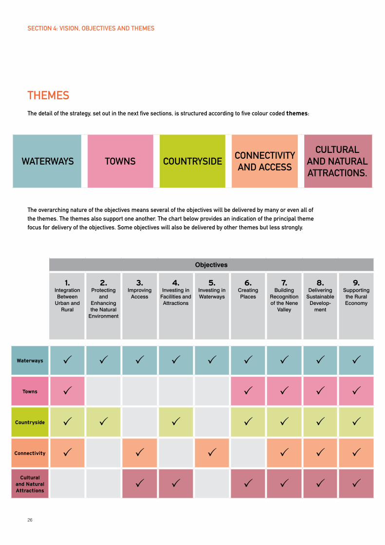
THEMESThe detail of the strategy, set out in the next five sections, is structured according to five colour coded themes:
The overarching nature of the objectives means several of the objectives will be delivered by many or even all of the themes. The themes also support one another. The chart below provides an indication of the principal theme focus for delivery of the objectives. Some objectives will also be delivered by other themes but less strongly.
WATERWAyS TOWNS COUNTRySIDECONNECTIVITy AND ACCESS
CULTURAL AND NATURAL ATTRACTIONS.
Objectives
1.integration Between
urban and rural
2.Protecting
and enhancing the Natural
environment
3.improving
Access
4.investing in
Facilities and Attractions
5.investing in Waterways
6.creating Places
7.Building
recognition of the Nene
Valley
8.Delivering
Sustainable Develop-
ment
9.Supporting the rural economy
Waterways
Towns
Countryside
Connectivity
Cultural and Natural Attractions
SECTION 4: VISION, OBJECTIVES AND THEMES
27
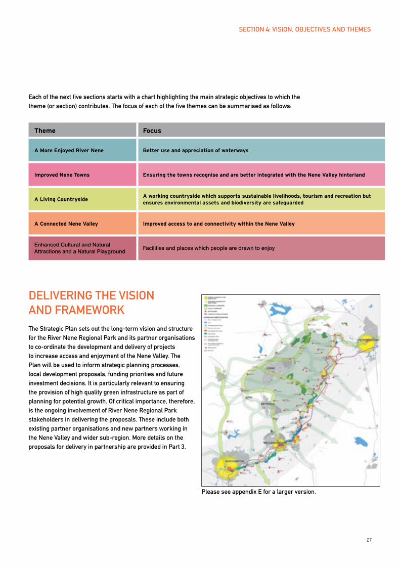
Each of the next five sections starts with a chart highlighting the main strategic objectives to which the theme (or section) contributes. The focus of each of the five themes can be summarised as follows:
Theme Focus
A More Enjoyed River Nene Better use and appreciation of waterways
Improved Nene Towns Ensuring the towns recognise and are better integrated with the Nene Valley hinterland
A Living CountrysideA working countryside which supports sustainable livelihoods, tourism and recreation but ensures environmental assets and biodiversity are safeguarded
A Connected Nene Valley Improved access to and connectivity within the Nene Valley
enhanced cultural and Natural Attractions and a Natural Playground
Facilities and places which people are drawn to enjoy
DELIVERING THE VISION AND FRAMEWORKThe Strategic Plan sets out the long-term vision and structure for the River Nene Regional Park and its partner organisations to co-ordinate the development and delivery of projects to increase access and enjoyment of the Nene Valley. The Plan will be used to inform strategic planning processes, local development proposals, funding priorities and future investment decisions. It is particularly relevant to ensuring the provision of high quality green infrastructure as part of planning for potential growth. Of critical importance, therefore, is the ongoing involvement of River Nene Regional Park stakeholders in delivering the proposals. These include both existing partner organisations and new partners working in the Nene Valley and wider sub-region. More details on the proposals for delivery in partnership are provided in Part 3.
SECTION 4: VISION, OBJECTIVES AND THEMES
Please see appendix E for a larger version.
28
SECTION 5: A MORE ENJOyED RIVER NENE IMPROVING THE USE AND APPRECIATION OF WATERWAyS
ExISTING CONTExTTHE RIVER NENE
The River Nene is navigable from the point where it joins the Grand Union Canal at Northampton all the way to The Wash, and connects to the Fen waterways network at Peterborough. The River Nene,
therefore, provides a valuable link between England’s canal
system and the Fen waterways network. The river becomes tidal closer to The Wash (after Dog-in-a-Doublet lock just east of Peterborough), but boaters can avoid the more difficult tidal stretch by joining the Middle Level system, the waterways network stretching across the Fens, at Peterborough which connects to the Great Ouse.
There are 37 locks on the Nene between and including both Northampton and Peterborough. The Northampton arm of the Grand Union Canal linking the Canal with the River Nene is heavily locked. Nearly all the locks on the Nene have upstream pointing doors and downstream guillotine gates. This is a unique design and a distinct heritage feature of the river. During times of flood, at certain locks, the pointing doors are chained back and the bottom guillotine gate controls the flow of water.
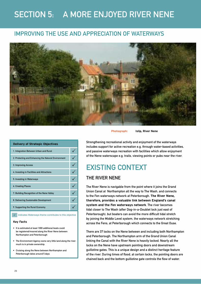
Photograph: Islip, River Nene
Delivery of Strategic Objectives
1. Integration Between Urban and Rural 2. Protecting and Enhancing the Natural Environment 3. Improving Access 4. Investing in Facilities and Attractions 5. Investing in Waterways 6. Creating Places 7. Building Recognition of the Nene Valley 8. Delivering Sustainable Development 9. Supporting the Rural Economy
Key Facts
• Itisestimatedatleast1000additionalboatscouldbe registered/moored along the River Nene between Northampton and Peterborough
• TheEnvironmentAgencyownsverylittlelandalongtheriver:much is in private ownership.
• CruisingalongtheNenebetweenNorthamptonandPeterborough takes around 5 days
indicates Waterways theme contributes to this objective
Strengthening recreational activity and enjoyment of the waterways includes support for active recreation e.g. through water-based activities, and passive waterways recreation with facilities which allow enjoyment of the Nene waterscape e.g. trails, viewing points or pubs near the river.
29
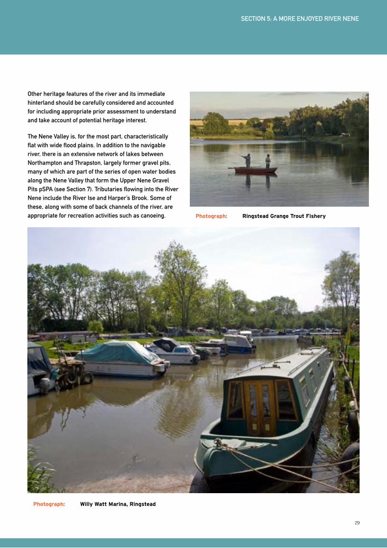
Photograph: Willy Watt Marina, Ringstead
SECTION 5: A MORE ENJOyED RIVER NENE
Other heritage features of the river and its immediate hinterland should be carefully considered and accounted for including appropriate prior assessment to understand and take account of potential heritage interest.
The Nene Valley is, for the most part, characteristically flat with wide flood plains. In addition to the navigable river, there is an extensive network of lakes between Northampton and Thrapston, largely former gravel pits, many of which are part of the series of open water bodies along the Nene Valley that form the Upper Nene Gravel Pits pSPA (see Section 7). Tributaries flowing into the River Nene include the River Ise and Harper’s Brook. Some of these, along with some of back channels of the river, are appropriate for recreation activities such as canoeing. Photograph: Ringstead Grange Trout Fishery

30
NENE CAPACITy, USE AND UPGRADE
The Environment Agency (EA) is the statutory navigable authority with responsibility for the River Nene between Northampton and a location just south of Wisbech (at Bevis Hall). Its ongoing investment programme (see Section 2) is planned to ensure the river’s navigation facilities such as locks, moorings and water points are in ‘fair’ or ‘good’ condition by 2011.
Boat traffic has been gradually increasing on the River Nene but is generally still noticeably quieter than on nearby waterways, particularly the Grand Union Canal and the River Great Ouse. Travel times on the river are shown in Figure 3 (River Nene Cruising Times). Around 1000 boats are currently registered on the river between Northampton and Peterborough and the EA estimates at least 1000 additional boats could comfortably be accommodated without detrimental environmental impacts. No detailed assessment work has been undertaken and this figure could be notably higher.
Figure 3: River Nene Travel Times Source: Environment Agency ‘River Nene: a guide for river users’, 2007
SECTION 5: A MORE ENJOyED RIVER NENE
31
MARINAS, MOORINGS AND ACTIVITy
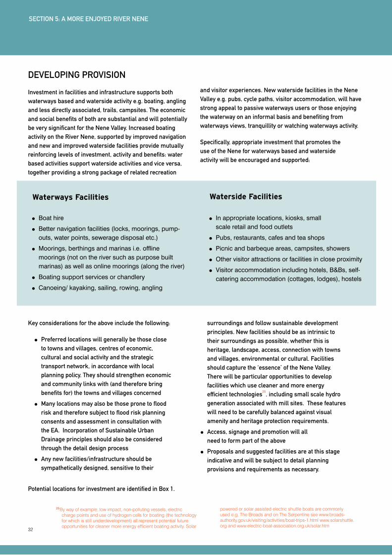
There are two main existing marinas along the River Nene: at Billing, near Northampton and Barnwell (Oundle), with an additional small marina (Willy Watt Marina) at Ringstead and a nearby new marina on Blackthorne Lake, which is also at Ringstead. Other locations offer substantial moorings such as at yarwell. The locations of public and private moorings, and those moorings under development along the river, are show on the Environment Agency’s detailed map guide; ‘The River Nene: A guide for users’.
Waterways activity is spread along the River Nene. The lower Nene (downstream or north east and stretching from Ringstead to Peterborough) generally has more boating clubs and facilities, but the upper Nene (south of Wellingborough and the three towns) has the valley’s two key water-based recreation centres: the Nene Whitewater Centre (Northampton) and Grendon Lakes, both of which have watersports activities (jet skis, wakeboarding, whitewater rafting etc). Fishing is one of the river’s most important recreational activities and there are substantial fisheries and angling events along the river.
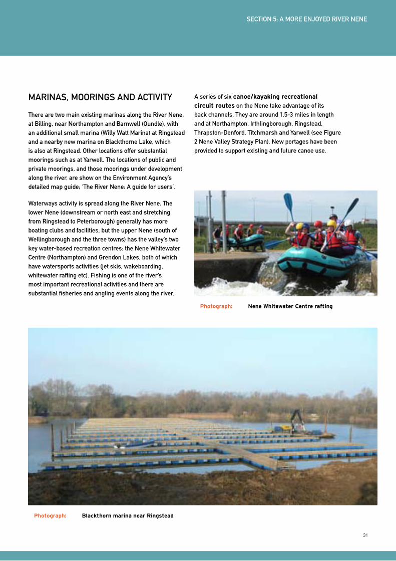
A series of six canoe/kayaking recreational
circuit routes on the Nene take advantage of its back channels. They are around 1.5-3 miles in length and at Northampton, Irthlingborough, Ringstead, Thrapston-Denford, Titchmarsh and yarwell (see Figure 2 Nene Valley Strategy Plan). New portages have been provided to support existing and future canoe use.
Photograph: Blackthorn marina near Ringstead
Photograph: Nene Whitewater Centre rafting
SECTION 5: A MORE ENJOyED RIVER NENE
32
25 By way of example, low impact, non-polluting vessels, electric charge points and use of hydrogen cells for boating (the technology for which is still underdevelopment) all represent potential future opportunities for cleaner more energy efficient boating activity. Solar
powered or solar assisted electric shuttle boats are commonly used e.g. The Broads and on The Serpentine see www.broads-authority.gov.uk/visiting/activities/boat-trips-1.html www.solarshuttle.org and www.electric-boat-association.org.uk/solar.htm
Key considerations for the above include the following:
Preferred locations will generally be those close to towns and villages, centres of economic, cultural and social activity and the strategic transport network, in accordance with local planning policy. They should strengthen economic and community links with (and therefore bring benefits for) the towns and villages concerned
Many locations may also be those prone to flood risk and therefore subject to flood risk planning consents and assessment in consultation with the EA. Incorporation of Sustainable Urban Drainage principles should also be considered through the detail design process
Any new facilities/infrastructure should be sympathetically designed, sensitive to their
surroundings and follow sustainable development principles. New facilities should be as intrinsic to their surroundings as possible, whether this is heritage, landscape, access, connection with towns and villages, environmental or cultural. Facilities should capture the ‘essence’ of the Nene Valley. There will be particular opportunities to develop facilities which use cleaner and more energy efficient technologies
25. including small scale hydro
generation associated with mill sites. These features will need to be carefully balanced against visual amenity and heritage protection requirements.
Access, signage and promotion will all need to form part of the above
Proposals and suggested facilities are at this stage indicative and will be subject to detail planning provisions and requirements as necessary.
DEVELOPING PROVISION
Investment in facilities and infrastructure supports both waterways based and waterside activity e.g. boating, angling and less directly associated, trails, campsites. The economic and social benefits of both are substantial and will potentially be very significant for the Nene Valley. Increased boating activity on the River Nene, supported by improved navigation and new and improved waterside facilities provide mutually reinforcing levels of investment, activity and benefits: water based activities support waterside activities and vice versa, together providing a strong package of related recreation
and visitor experiences. New waterside facilities in the Nene Valley e.g. pubs, cycle paths, visitor accommodation, will have strong appeal to passive waterways users or those enjoying the waterway on an informal basis and benefiting from waterways views, tranquillity or watching waterways activity.
Specifically, appropriate investment that promotes the use of the Nene for waterways based and waterside activity will be encouraged and supported:
Waterways Facilities
Boat hire
Better navigation facilities (locks, moorings, pump-outs, water points, sewerage disposal etc.)
Moorings, berthings and marinas i.e. offline moorings (not on the river such as purpose built marinas) as well as online moorings (along the river)
Boating support services or chandlery
Canoeing/ kayaking, sailing, rowing, angling
Waterside Facilities
In appropriate locations, kiosks, small scale retail and food outlets
Pubs, restaurants, cafes and tea shops
Picnic and barbeque areas, campsites, showers
Other visitor attractions or facilities in close proximity
Visitor accommodation including hotels, B&Bs, self-catering accommodation (cottages, lodges), hostels
SECTION 5: A MORE ENJOyED RIVER NENE
Potential locations for investment are identified in Box 1.

33
The following are highlighted as possible locations for enhanced or new facilities. There will be additional locations for small scale investment (campsites, online moorings, kiosks) elsewhere along the river, particular where these can be linked to local villages. Indicative and suggested proposals may be subject to Appropriate Assessment under the Habitat Regulations.
Northampton riverside – proposals for a new marina at Beckets Park (under construction) and opportunities for new development at Nunn Mills
Billing – at or near Billing Aquadrome
Cogenhoe Mill – Cogenhoe Mill Holiday Park
Grendon Lakes – proposals for potential expansion of lake-based recreation activity
Wellingborough
Higham Ferrers, Rushden and Irthlingborough – possible sites given these centres of population and their proximity to the Nene
Ditchford Lakes, near Rushden
Rushden - as part of ‘Rushden Lakes’ proposals
Stanwick Lakes – as part of the Stanwick Lakes recreational and nature reserve
Ringstead – potential additional facilities (Woodford Mill/ Willy Watt Marina) alongside new Blackthorne Lake Marina
Thrapston Mill Marina - consent to rebuild the restaurant and locate a chandlery
Thrapston ‘Nine Arches Bridge’ site – adjacent to bridge, between town centre and river
Lilford proposals at Lilford Lodge Farm including low density berthing, fishing and ‘ecotourism’ style lodge accommodation
Oundle Marina at Barnwell
Oundle riverside pub site - site on NE edge of town, near bridge and A605. Includes a disused building
yarwell – at yarwell Mill Caravan and Camping Park
Upton Country Park
SECTION 5: A MORE ENJOyED RIVER NENE
BOx 1: LOCATIONS FOR WATERWAyS AND WATERSIDE FACILITIES
34
Prioritisation of locations and types of investment will need to be considered under a boating development plan. Planning permissions already exist at some sites e.g. Grendon Lakes watersports centre (for holiday lodges). Stanwick Lakes has medium-long terms proposals for continued enhancement and development of the site (outdoor recreation and conservation proposals). Both sites would benefit from direct links with the nearby Nene which would be an attraction for boaters and provide commercial opportunities. Oundle Marina at Barnwell is one of the largest existing marina facilities on the river and investment in links with the town, supported by orientation, information and interpretation facilities, would bring mutual benefits. Billing Aquadrome is a very significant tourism and waterways facility for the Nene Valley and there would again be benefits in integrating the facility within the wider area/Nene valley tourism and waterways product. Proposals at Northampton Waterside, including construction of the Beckets Marina, can potentially bring very significant regeneration benefits for the town, encourage much greater waterways enjoyment and allow greatly improved access to the town and its facilities for waterways users. In addition the new Upton Country Park lies to the south of Upton in the Upper Nene. This public park will provide approximately 43 ha of open space and will include footpaths, bridleways and cycleways and improved access to the River Nene, as well as new areas of woodland. Importantly, the land’s function as an existing flood plain will be enhanced. Northampton is also a pivotal location given its proximity to the River Nene’s link with the Grand Union Canal and the extensive connections of this with large parts of the central and southern England waterways network. Its potential role as a gateway location is of central importance for the Nene Valley as well providing opportunities for the waterways network in central and southern England. There are also significant opportunities to link it to wider waterway networks. For example the Bedford and Milton Keynes waterway proposal is a significant tourism and recreation opportunity that would link the Nene the Fenland ‘cruising ring’ and further inland waterway networks in the East Midlands, East of England and South East regions.
In addition to the above sites, the following are supported as part of expanded waterways provision:
Waterways gateways, which may be the same as visitor gateways to the Nene Valley (see Section 8). These gateways involve provision of visitor infrastructure e.g. an information centre to inform and orientate visitors. In some cases these could be expansion of existing visitor centre provision such as at Billing Aquadrome
Waterways events including potential waterways festival(s) such as those operated by the IWA
Waterways branding and marketing to support new facilities and activities
Potential riverbus/ passenger boat service development on the Nene which might be possible during peak season visiting times.
A potential Angling Centre of Excellence and support for ongoing fishing events (Proposed increases in the number of boats on the river do not impact affect the fishing ability of the Nene)
Many of the above concur directly with proposals in the recent assessment of Northamptonshire’s waterways
26.
The scale of the economic and community benefits associated with the above investment are very significant. There are strong synergistic benefits and catalytic effects associated with waterways and waterside investment where this is linked to the local communities. New employment, tourism, cultural, heritage, health and well-being benefits can all accrue from investment in such facilities. Good access, promotion, branding and signposting of the facilities are all critical to ensure their use and maximise benefits.
26 ‘Northamptonshire Waterways Feasibility Analysis’, 2008, Northamptonshire Enterprise Ltd
SECTION 5: A MORE ENJOyED RIVER NENE
35
SUMMARy PRIORITIESThe following priorities are identified to ensure investments and improvements in the
use and appreciation of waterways:
Details on proposals and projects to take forward the above priorities are provided in Section 10.
1.
Support investment in waterways
and waterside facilities in appropriate
locations focusing on those listed in Box 1 and in accordance with local planning policy and other considerations listed above
2.
Develop a boating development
plan to provide a co-ordinated and prioritised approach to the provision of boating infrastructure, particularly new or expanded marinas and moorings
3.
Identify and develop ‘waterways
gateways’ which provide information, orientate visitors and provide a ‘sense of arrival’ in the Nene Valley
4.
Support waterways events, branding,
marketing, potential passenger
boat services as well as waterways recreational activities particularly boating, canoeing/kayaking, angling, sailing and watersports in appropriate locations
5.
Improve access and links between the
villages, towns and the waterways also with other nearby attractions, points of interest and facilities with a particular emphasis on cycling and walking provision (see Section 8)
SECTION 5: A MORE ENJOyED RIVER NENE
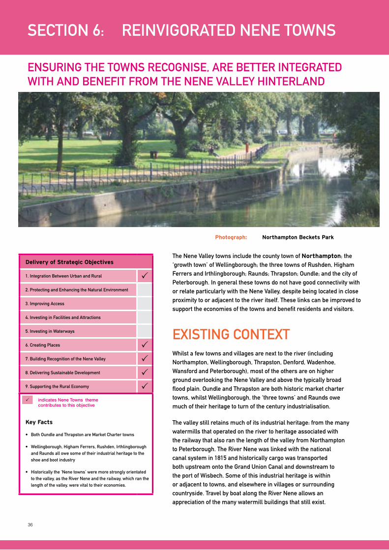
36
The Nene Valley towns include the county town of Northampton; the ‘growth town’ of Wellingborough; the three towns of Rushden, Higham Ferrers and Irthlingborough; Raunds; Thrapston; Oundle; and the city of Peterborough. In general these towns do not have good connectivity with or relate particularly with the Nene Valley, despite being located in close proximity to or adjacent to the river itself. These links can be improved to support the economies of the towns and benefit residents and visitors.
SECTION 6: REINVIGORATED NENE TOWNS
ENSURING THE TOWNS RECOGNISE, ARE BETTER INTEGRATED WITH AND BENEFIT FROM THE NENE VALLEy HINTERLAND
Photograph: Northampton Beckets Park
Delivery of Strategic Objectives
1. Integration Between Urban and Rural 2. Protecting and Enhancing the Natural Environment
3. Improving Access
4. Investing in Facilities and Attractions
5. Investing in Waterways
6. Creating Places 7. Building Recognition of the Nene Valley 8. Delivering Sustainable Development 9. Supporting the Rural Economy
Key Facts
• BothOundleandThrapstonareMarketChartertowns
• Wellingborough,HighamFerrers,Rushden,Irthlingboroughand Raunds all owe some of their industrial heritage to the shoe and boot industry
• Historicallythe‘Nenetowns’weremorestronglyorientatedto the valley, as the River Nene and the railway, which ran the length of the valley, were vital to their economies.
indicates Nene Towns theme contributes to this objective
ExISTING CONTExTWhilst a few towns and villages are next to the river (including Northampton, Wellingborough, Thrapston, Denford, Wadenhoe, Wansford and Peterborough), most of the others are on higher ground overlooking the Nene Valley and above the typically broad flood plain. Oundle and Thrapston are both historic market charter towns, whilst Wellingborough, the ‘three towns’ and Raunds owe much of their heritage to turn of the century industrialisation.
The valley still retains much of its industrial heritage: from the many watermills that operated on the river to heritage associated with the railway that also ran the length of the valley from Northampton to Peterborough. The River Nene was linked with the national canal system in 1815 and historically cargo was transported both upstream onto the Grand Union Canal and downstream to the port of Wisbech. Some of this industrial heritage is within or adjacent to towns, and elsewhere in villages or surrounding countryside. Travel by boat along the River Nene allows an appreciation of the many watermill buildings that still exist.
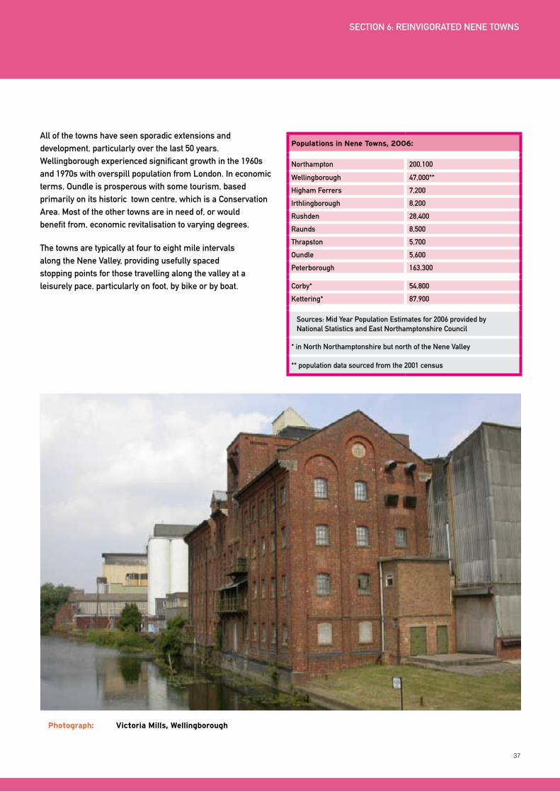
37
All of the towns have seen sporadic extensions and development, particularly over the last 50 years. Wellingborough experienced significant growth in the 1960s and 1970s with overspill population from London. In economic terms, Oundle is prosperous with some tourism, based primarily on its historic town centre, which is a Conservation Area. Most of the other towns are in need of, or would benefit from, economic revitalisation to varying degrees.
The towns are typically at four to eight mile intervals along the Nene Valley, providing usefully spaced stopping points for those travelling along the valley at a leisurely pace, particularly on foot, by bike or by boat.
Photograph: Victoria Mills, Wellingborough
Populations in Nene Towns, 2006:
Northampton 200,100
Wellingborough 47,000**
Higham Ferrers 7,200
Irthlingborough 8,200
Rushden 28,400
Raunds 8,500
Thrapston 5,700
Oundle 5,600
Peterborough 163,300
Corby* 54,800
Kettering* 87,900
Sources: Mid year Population Estimates for 2006 provided by National Statistics and East Northamptonshire Council
* in North Northamptonshire but north of the Nene Valley
** population data sourced from the 2001 census
SECTION 6: REINVIGORATED NENE TOWNS
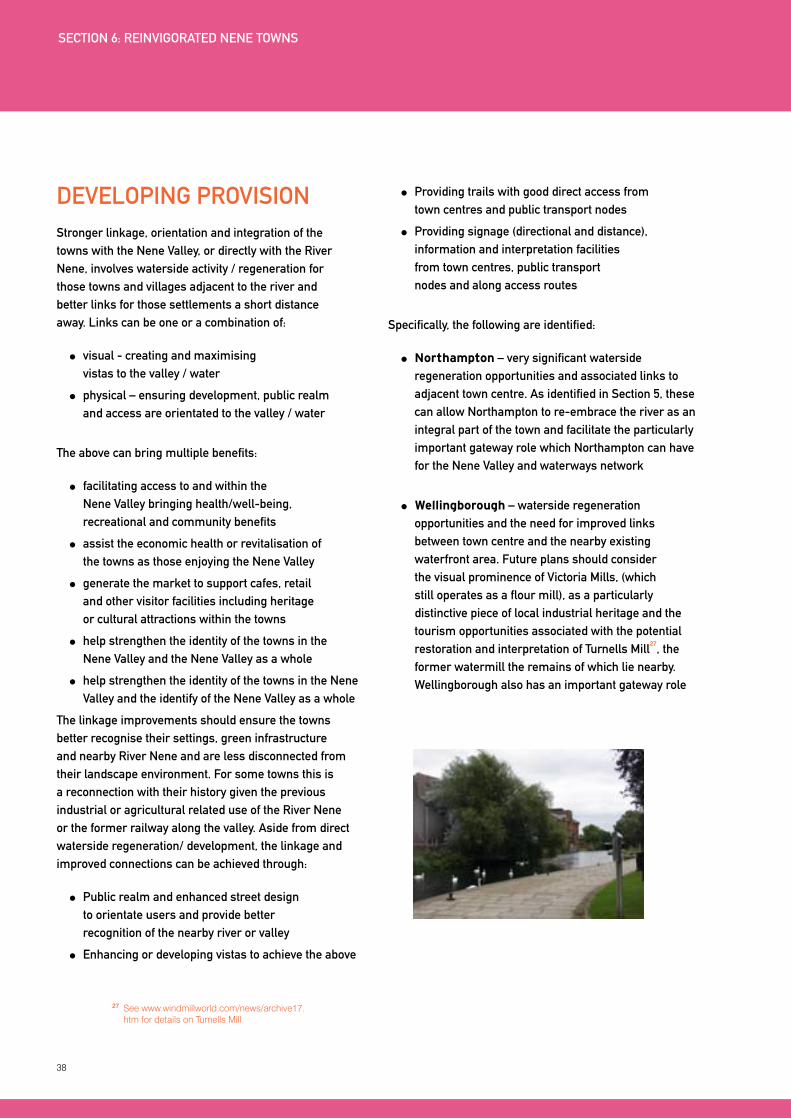
38
DEVELOPING PROVISIONStronger linkage, orientation and integration of the towns with the Nene Valley, or directly with the River Nene, involves waterside activity / regeneration for those towns and villages adjacent to the river and better links for those settlements a short distance away. Links can be one or a combination of:
visual - creating and maximising vistas to the valley / water
physical – ensuring development, public realm and access are orientated to the valley / water
The above can bring multiple benefits:
facilitating access to and within the Nene Valley bringing health/well-being, recreational and community benefits
assist the economic health or revitalisation of the towns as those enjoying the Nene Valley
generate the market to support cafes, retail and other visitor facilities including heritage or cultural attractions within the towns
help strengthen the identity of the towns in the Nene Valley and the Nene Valley as a whole
help strengthen the identity of the towns in the Nene Valley and the identify of the Nene Valley as a whole
The linkage improvements should ensure the towns better recognise their settings, green infrastructure and nearby River Nene and are less disconnected from their landscape environment. For some towns this is a reconnection with their history given the previous industrial or agricultural related use of the River Nene or the former railway along the valley. Aside from direct waterside regeneration/ development, the linkage and improved connections can be achieved through:
Public realm and enhanced street design to orientate users and provide better recognition of the nearby river or valley
Enhancing or developing vistas to achieve the above
Providing trails with good direct access from town centres and public transport nodes
Providing signage (directional and distance), information and interpretation facilities from town centres, public transport nodes and along access routes
Specifically, the following are identified:
Northampton – very significant waterside regeneration opportunities and associated links to adjacent town centre. As identified in Section 5, these can allow Northampton to re-embrace the river as an integral part of the town and facilitate the particularly important gateway role which Northampton can have for the Nene Valley and waterways network
Wellingborough – waterside regeneration opportunities and the need for improved links between town centre and the nearby existing waterfront area. Future plans should consider the visual prominence of Victoria Mills, (which still operates as a flour mill), as a particularly distinctive piece of local industrial heritage and the tourism opportunities associated with the potential restoration and interpretation of Turnells Mill
27, the
former watermill the remains of which lie nearby. Wellingborough also has an important gateway role
27 See www.windmillworld.com/news/archive17.htm for details on Turnells Mill
SECTION 6: REINVIGORATED NENE TOWNS
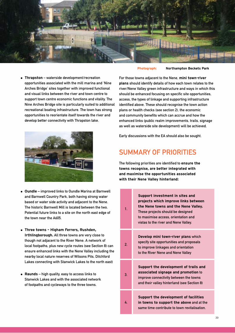
39
Photograph: Northampton Beckets Park
Thrapston – waterside development/recreation opportunities associated with the mill marina and ‘Nine Arches Bridge’ sites together with improved functional and visual links between the river and town centre to support town centre economic functions and vitality. The Nine Arches Bridge site is particularly suited to additional recreational boating infrastructure. The town has strong opportunities to reorientate itself towards the river and develop better connectivity with Thrapston lake.
Oundle – improved links to Oundle Marina at Barnwell and Barnwell Country Park, both having strong water based or water side activity and adjacent to the Nene. The historic Barnwell Mill is located between the two. Potential future links to a site on the north east edge of the town near the A605.
Three towns – Higham Ferrers, Rushden,
Irthlingborough. All three towns are very close to though not adjacent to the River Nene. A network of local footpaths, plus new cycle routes (see Section 8) can ensure enhanced links with the Nene Valley including the nearby local nature reserves of Wilsons Pits, Ditchford Lakes connecting with Stanwick Lakes to the north east)
Raunds – high quality, easy to access links to Stanwick Lakes and with the associated network of footpaths and cycleways to the three towns.
SUMMARy OF PRIORITIESThe following priorities are identified to ensure the
towns recognise, are better integrated with
and maximise the opportunities associated
with their Nene Valley hinterland:
1.
Support investment in sites and
projects which improve links between
the Nene towns and the Nene Valley.
These projects should be designed to maximise access, orientation and vistas to the river and Nene Valley.
2.
Develop mini town-river plans which specify site opportunities and proposals to improve linkages and orientation to the River Nene and Nene Valley
3.
Support the development of trails and
associated signage and promotion to improve connectivity between the towns and their valley hinterland (see Section 8)
4.Support the development of facilities
in towns to support the above and at the same time contribute to town revitalisation.
For those towns adjacent to the Nene, mini town-river
plans should identify details of how each town relates to the river/Nene Valley green infrastructure and ways in which this should be enhanced focusing on specific site opportunities, access, the types of linkage and supporting infrastructure identified above. These should recognise the town action plans or health checks (see section 2), the economic and community benefits which can accrue and how the enhanced links (public realm improvements, trails, signage as well as waterside site development) will be achieved.
Early discussions with the EA should also be sought.
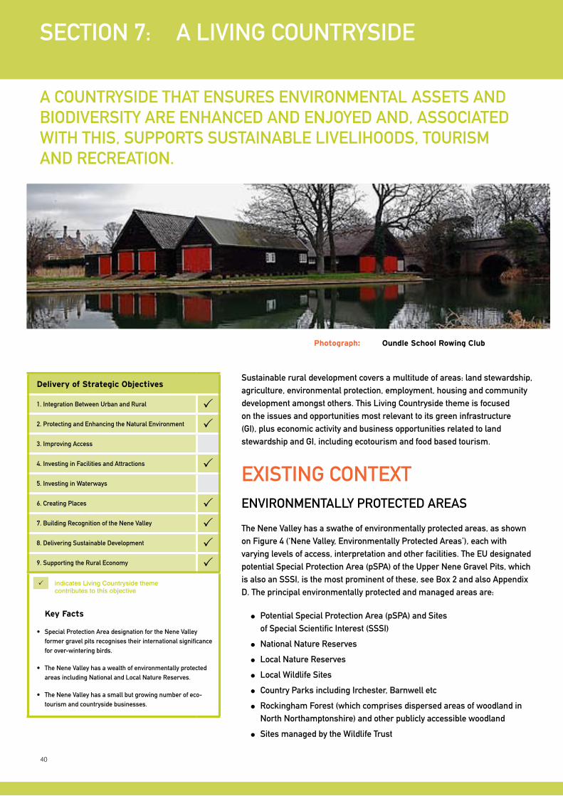
40
Sustainable rural development covers a multitude of areas: land stewardship, agriculture, environmental protection, employment, housing and community development amongst others. This Living Countryside theme is focused on the issues and opportunities most relevant to its green infrastructure (GI), plus economic activity and business opportunities related to land stewardship and GI, including ecotourism and food based tourism.
SECTION 7: A LIVING COUNTRySIDE
A COUNTRySIDE THAT ENSURES ENVIRONMENTAL ASSETS AND BIODIVERSITy ARE ENHANCED AND ENJOyED AND, ASSOCIATED WITH THIS, SUPPORTS SUSTAINABLE LIVELIHOODS, TOURISM AND RECREATION.
ExISTING CONTExTENVIRONMENTALLy PROTECTED AREAS
The Nene Valley has a swathe of environmentally protected areas, as shown on Figure 4 (‘Nene Valley, Environmentally Protected Areas’), each with varying levels of access, interpretation and other facilities. The EU designated potential Special Protection Area (pSPA) of the Upper Nene Gravel Pits, which is also an SSSI, is the most prominent of these, see Box 2 and also Appendix D. The principal environmentally protected and managed areas are:
Potential Special Protection Area (pSPA) and Sites of Special Scientific Interest (SSSI)
National Nature Reserves
Local Nature Reserves
Local Wildlife Sites
Country Parks including Irchester, Barnwell etc
Rockingham Forest (which comprises dispersed areas of woodland in North Northamptonshire) and other publicly accessible woodland
Sites managed by the Wildlife Trust
Photograph: Oundle School Rowing Club
Delivery of Strategic Objectives
1. Integration Between Urban and Rural 2. Protecting and Enhancing the Natural Environment 3. Improving Access
4. Investing in Facilities and Attractions 5. Investing in Waterways
6. Creating Places 7. Building Recognition of the Nene Valley 8. Delivering Sustainable Development 9. Supporting the Rural Economy
Key Facts
• SpecialProtectionAreadesignationfortheNeneValleyformer gravel pits recognises their international significance for over-wintering birds.
• TheNeneValleyhasawealthofenvironmentallyprotectedareas including National and Local Nature Reserves.
• TheNeneValleyhasasmallbutgrowingnumberofeco-tourism and countryside businesses.
indicates living countryside theme contributes to this objective
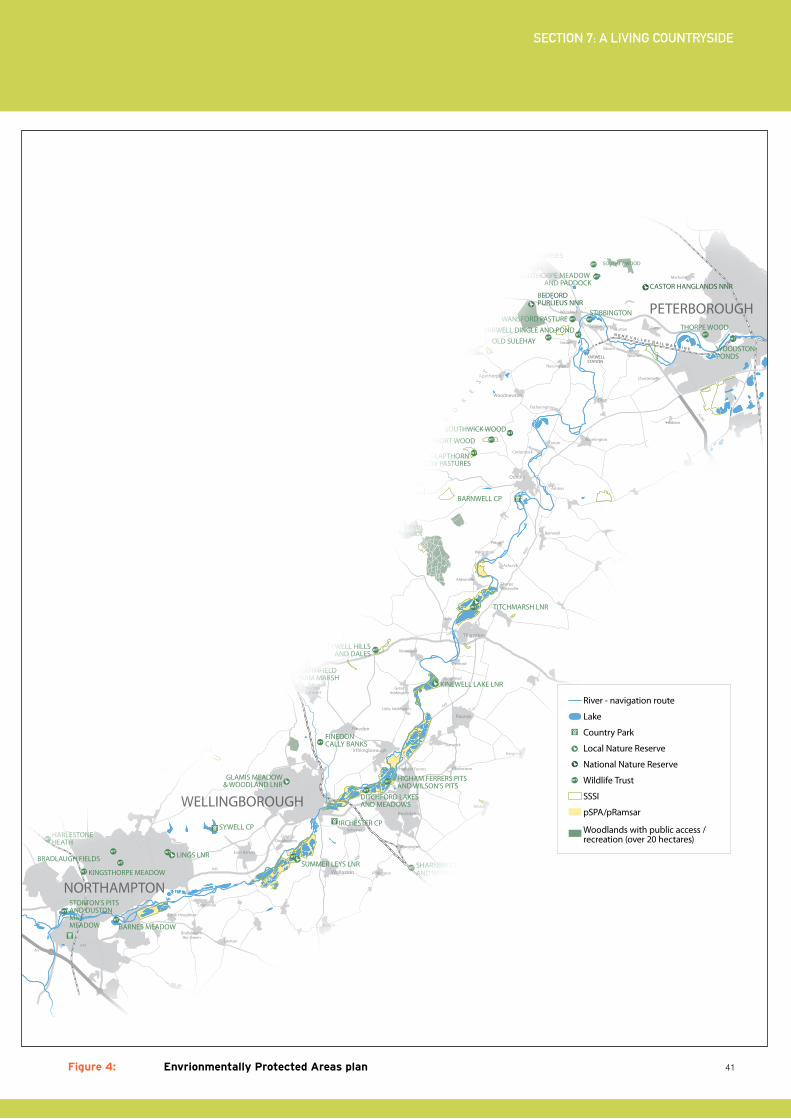
41
SECTION 7: A LIVING COUNTRySIDE
Chesterton
Haddon
Marholm
M1A45
A45
A45
A43
A14
A14
A1(M)
A605
Rockingham
Geddington
Stanion
Brigstock
Finedon
Wollaston
WansfordUppingham
Oundle
Rushden
Irthlingborough
Raunds
Burton Latimer
OakhamStamford
Wittering
Desborough
Rothwell
Great Doddington
Earls Barton
Cogenhoe
Higham Ferrers
Little Addington
Great Addington
Caldecott
Gretton
King’s Cli�e
Apethorpe
Woodnewton
Eastern on the Hill
Ringstead
Woodford
Denford
Thorpe Waterville
Wadenhoe
Barnwell
Pilton
Achurch
Ashton
Cotterstock
Tansor
Fotheringhay
Warmington
Elton
Nassington
Yarwell
SuttonStibbington
Water Newton
Sibson
Thrapston
Aldwinkle
Irchester
Stanwick
Islip
Pitsford Water
Bozeat
Podington
Wymington
Yelden
Chelveston
Hargrave
Caster
Denton
Bra�eld-on-the-Green
Little Houghton
WELLINGBOROUGH
NORTHAMPTON
KETTERING
CORBY
PETERBOROUGH
HARLESTONE HEATH
STORTON’S PITS AND DUSTON MILL MEADOW
COLLYWESTERN QUARRIES
IRCHESTER CP
BARNWELL CP
FERMYN WOODS CP
EASTCARLTON CP
SYWELL CP
YARWELL STATION
N E N E V A L L E Y R A I L W A Y L I N E
CASTOR HANGLANDS NNRCOLLYWESTON GREAT WOOD& EASTON HORNSTOCKS NNR BEDFORD
PURLIEUS NNR
TITCHMARSH LNR
KINEWELL LAKE LNR
SUMMER LEYS LNR
GLAMIS MEADOW& WOODLAND LNR
GREAT OAKLEYMEADOW LNR
KINGSWOOD LNR
TAILBY MEADOW LNR
BRIXWORTH CP
TYWELL HILLSAND DALES
SOUTHFIELD FARM MARSH
FINEDON CALLY BANKS
LINGS LNR
BARNES MEADOW
BRADLAUGH FIELDS
KINGSTHORPE MEADOW
PITSFORD RESERVOIR
DITCHFORD LAKES AND MEADOWS
HIGHAM FERRERS PITS AND WILSON’S PITS
SHARNBROOK SUMMIT AND WYMINGTON MEADOW
FELMERSHAM GRAVEL PITS
BARFORD WOOD AND MEADOWSROTHWELL GULLETT
THE PLENS
STOKE WOOD END QUARTER
GLAPTHORN COW PASTURES
SHORT WOOD
SOUTHWICK WOOD
OLD SULEHAY
WANSFORD PASTUREYARWELL DINGLE AND POND
STIBBINGTON
SOUTHORPE MEADOW AND PADDOCK
THORPE WOOD
WOODSTON PONDS
WAKERLEY GREAT WOOD
FINESHADE WOOD
RO
CK
IN
GH
AM
F
OR
ES
T
FERMYN WOODS
SOUTHEY WOOD
River - navigation route
Lake
Country Park
Local Nature Reserve
National Nature Reserve
Wildlife Trust
SSSI
pSPA/pRamsar
Woodlands with public access / recreation (over 20 hectares)
Figure 4: Envrionmentally Protected Areas plan
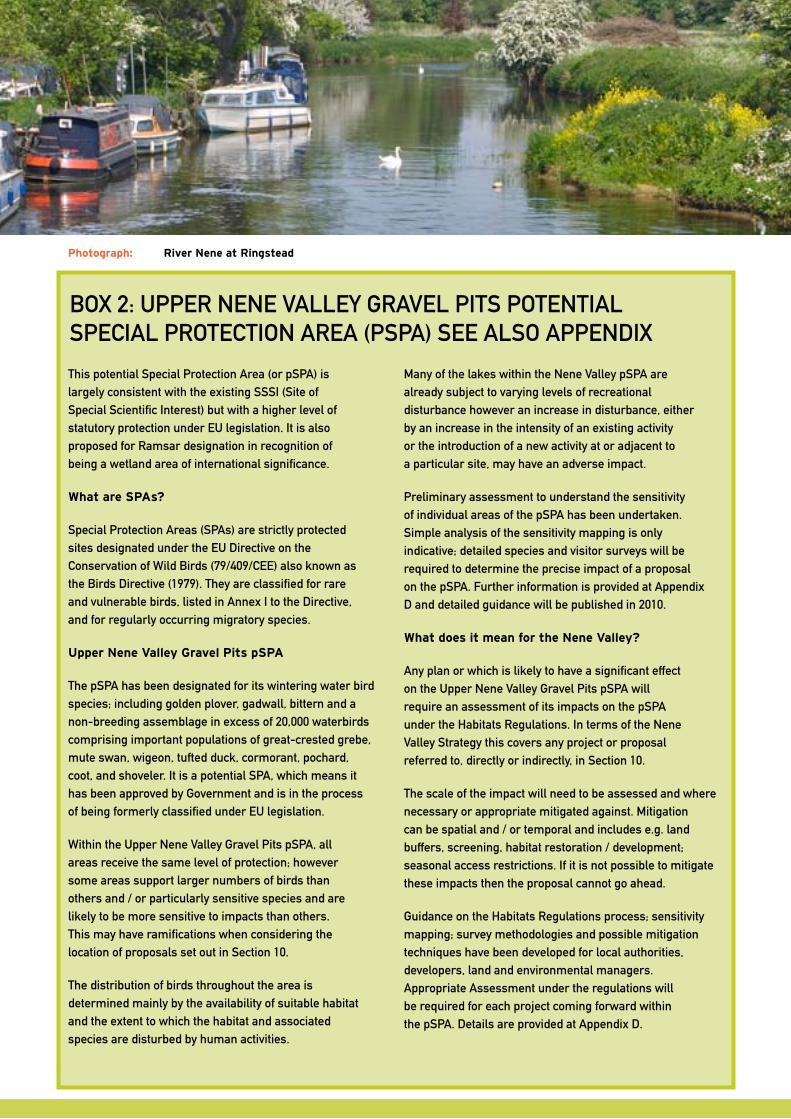
42
Photograph: River Nene at Ringstead
This potential Special Protection Area (or pSPA) is largely consistent with the existing SSSI (Site of Special Scientific Interest) but with a higher level of statutory protection under EU legislation. It is also proposed for Ramsar designation in recognition of being a wetland area of international significance.
What are SPAs?
Special Protection Areas (SPAs) are strictly protected sites designated under the EU Directive on the Conservation of Wild Birds (79/409/CEE) also known as the Birds Directive (1979). They are classified for rare and vulnerable birds, listed in Annex I to the Directive, and for regularly occurring migratory species.
Upper Nene Valley Gravel Pits pSPA
The pSPA has been designated for its wintering water bird species; including golden plover, gadwall, bittern and a non-breeding assemblage in excess of 20,000 waterbirds comprising important populations of great-crested grebe, mute swan, wigeon, tufted duck, cormorant, pochard, coot, and shoveler. It is a potential SPA, which means it has been approved by Government and is in the process of being formerly classified under EU legislation.
Within the Upper Nene Valley Gravel Pits pSPA, all areas receive the same level of protection; however some areas support larger numbers of birds than others and / or particularly sensitive species and are likely to be more sensitive to impacts than others. This may have ramifications when considering the location of proposals set out in Section 10.
The distribution of birds throughout the area is determined mainly by the availability of suitable habitat and the extent to which the habitat and associated species are disturbed by human activities.
Many of the lakes within the Nene Valley pSPA are already subject to varying levels of recreational disturbance however an increase in disturbance, either by an increase in the intensity of an existing activity or the introduction of a new activity at or adjacent to a particular site, may have an adverse impact.
Preliminary assessment to understand the sensitivity of individual areas of the pSPA has been undertaken. Simple analysis of the sensitivity mapping is only indicative; detailed species and visitor surveys will be required to determine the precise impact of a proposal on the pSPA. Further information is provided at Appendix D and detailed guidance will be published in 2010.
What does it mean for the Nene Valley?
Any plan or which is likely to have a significant effect on the Upper Nene Valley Gravel Pits pSPA will require an assessment of its impacts on the pSPA under the Habitats Regulations. In terms of the Nene Valley Strategy this covers any project or proposal referred to, directly or indirectly, in Section 10.
The scale of the impact will need to be assessed and where necessary or appropriate mitigated against. Mitigation can be spatial and / or temporal and includes e.g. land buffers, screening, habitat restoration / development; seasonal access restrictions. If it is not possible to mitigate these impacts then the proposal cannot go ahead.
Guidance on the Habitats Regulations process; sensitivity mapping; survey methodologies and possible mitigation techniques have been developed for local authorities, developers, land and environmental managers. Appropriate Assessment under the regulations will be required for each project coming forward within the pSPA. Details are provided at Appendix D.
BOx 2: UPPER NENE VALLEy GRAVEL PITS POTENTIAL SPECIAL PROTECTION AREA (PSPA) SEE ALSO APPENDIx
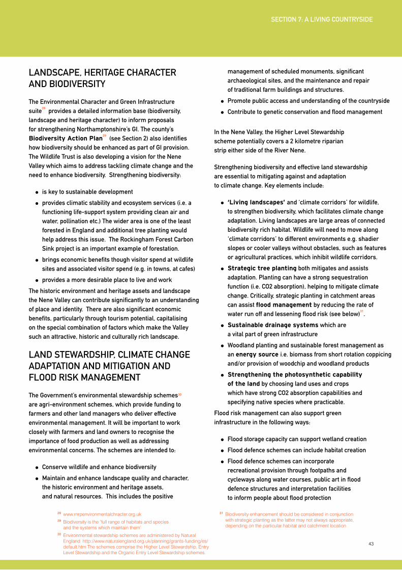
43
LANDSCAPE, HERITAGE CHARACTER AND BIODIVERSITy
The Environmental Character and Green Infrastructure suite
28 provides a detailed information base (biodiversity,
landscape and heritage character) to inform proposals for strengthening Northamptonshire’s GI. The county’s Biodiversity Action Plan
29 (see Section 2) also identifies
how biodiversity should be enhanced as part of GI provision. The Wildlife Trust is also developing a vision for the Nene Valley which aims to address tackling climate change and the need to enhance biodiversity. Strengthening biodiversity:
is key to sustainable development
provides climatic stability and ecosystem services (i.e. a functioning life-support system providing clean air and water, pollination etc.) The wider area is one of the least forested in England and additional tree planting would help address this issue. The Rockingham Forest Carbon Sink project is an important example of forestation.
brings economic benefits though visitor spend at wildlife sites and associated visitor spend (e.g. in towns, at cafes)
provides a more desirable place to live and work
The historic environment and heritage assets and landscape the Nene Valley can contribute significantly to an understanding of place and identity. There are also significant economic benefits, particularly through tourism potential, capitalising on the special combination of factors which make the Valley such an attractive, historic and culturally rich landscape.
LAND STEWARDSHIP, CLIMATE CHANGE ADAPTATION AND MITIGATION AND FLOOD RISK MANAGEMENT
The Government’s environmental stewardship schemes30 are agri-environment schemes, which provide funding to farmers and other land managers who deliver effective environmental management. It will be important to work closely with farmers and land owners to recognise the importance of food production as well as addressing environmental concerns. The schemes are intended to:
Conserve wildlife and enhance biodiversity
Maintain and enhance landscape quality and character, the historic environment and heritage assets, and natural resources. This includes the positive
management of scheduled monuments, significant archaeological sites, and the maintenance and repair of traditional farm buildings and structures.
Promote public access and understanding of the countryside
Contribute to genetic conservation and flood management
In the Nene Valley, the Higher Level Stewardship scheme potentially covers a 2 kilometre riparian strip either side of the River Nene.
Strengthening biodiversity and effective land stewardship are essential to mitigating against and adaptation to climate change. Key elements include:
‘Living landscapes’ and ‘climate corridors’ for wildlife, to strengthen biodiversity, which facilitates climate change adaptation. Living landscapes are large areas of connected biodiversity rich habitat. Wildlife will need to move along ‘climate corridors’ to different environments e.g. shadier slopes or cooler valleys without obstacles, such as features or agricultural practices, which inhibit wildlife corridors.
Strategic tree planting both mitigates and assists adaptation. Planting can have a strong sequestration function (i.e. CO2 absorption), helping to mitigate climate change. Critically, strategic planting in catchment areas can assist flood management by reducing the rate of water run off and lessening flood risk (see below)
31.
Sustainable drainage systems which are a vital part of green infrastructure
Woodland planting and sustainable forest management as an energy source i.e. biomass from short rotation coppicing and/or provision of woodchip and woodland products
Strengthening the photosynthetic capability
of the land by choosing land uses and crops which have strong CO2 absorption capabilities and specifying native species where practicable.
Flood risk management can also support green infrastructure in the following ways:
Flood storage capacity can support wetland creation
Flood defence schemes can include habitat creation
Flood defence schemes can incorporate recreational provision through footpaths and cycleways along water courses, public art in flood defence structures and interpretation facilities to inform people about flood protection
28 www.rnrpenvironmentalchracter.org.uk29 Biodiversity is the ‘full range of habitats and species
and the systems which maintain them’30 Environmental stewardship schemes are administered by Natural
England http://www.naturalengland.org.uk/planning/grants-funding/es/default.htm The schemes comprise the Higher Level Stewardship, Entry Level Stewardship and the Organic Entry Level Stewardship schemes.
31 Biodiversity enhancement should be considered in conjunction with strategic planting as the latter may not always appropriate, depending on the particular habitat and catchment location
SECTION 7: A LIVING COUNTRySIDE
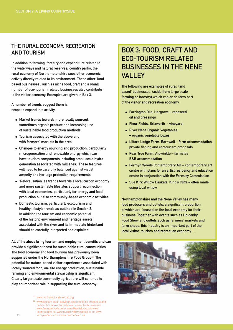
44
32 www.northamptonshirefood.org33 www.bigbarn.co.uk provides details of local producers and
outlets. For more information on examples businesses: www.farrington-oils.co.uk www.fleurfields.co.uk www.peartreefarm.net www.suekirkwillowbaskets.co.uk www.fermynwoods.co.uk www.rivernene.co.uk
THE RURAL ECONOMy, RECREATION AND TOURISM
In addition to farming, forestry and expenditure related to the waterways and natural reserves/ country parks, the rural economy of Northamptonshire sees other economic activity directly related to its environment. These other ‘land based businesses’, such as niche food, craft and a small number of eco-tourism related businesses also contribute to the visitor economy. Examples are given in Box 3.
A number of trends suggest there is scope to expand this activity:
Market trends towards more locally sourced, sometimes organic produce and increasing use of sustainable food production methods
Tourism associated with the above and with farmers’ markets in the area
Changes to energy sourcing and production, particularly microgeneration and renewable energy which can have tourism components including small scale hydro generation associated with mill sites. These features will need to be carefully balanced against visual amenity and heritage protection requirements.
‘Relocalisation’ as trends towards a local carbon economy and more sustainable lifestyles support reconnection with local economies, particularly for energy and food production but also community-based economic activities
Domestic tourism, particularly ecotourism and healthy lifestyle trends as outlined in Section 2. In addition the tourism and economic potential of the historic environment and heritage assets associated with the river and its immediate hinterland should be carefully interpreted and exploited.
All of the above bring tourism and employment benefits and can provide a significant boost for sustainable rural communities. The food economy and food tourism has previously been supported under the Northamptonshire Food Group32. The potential for nature-based visitor experiences associated with locally sourced food, on-site energy production, sustainable farming and environmental stewardship is significant. Clearly larger scale commodity agriculture will continue to play an important role in supporting the rural economy.
BOx 3: FOOD, CRAFT AND ECO-TOURISM RELATED BUSINESSES IN THE NENE VALLEyThe following are examples of rural ‘land based’ businesses, (aside from large scale farming or forestry) which can or do form part of the visitor and recreation economy.
Farrington Oils, Hargrave – rapeseed oil and dressings
Fleur Fields, Brixworth - vineyard
River Nene Organic Vegetables – organic vegetable boxes
Lilford Lodge Farm, Barnwell – farm accommodation, private fishing and ecotourism proposals
Pear Tree Farm, Aldwinkle – farmstay B&B accommodation
Fermyn Woods Contemporary Art – contemporary art centre with plans for an artist residency and education centre in conjunction with the Forestry Commission
Sue Kirk Willow Baskets, King’s Cliffe – often made using local willow
Northamptonshire and the Nene Valley has many food producers and outlets, a significant proportion of which are focused on the local economy for their business. Together with events such as Holdenby Food Show and outlets such as farmers’ markets and farm shops, this industry is an important part of the local visitor, tourism and recreation economy33.
SECTION 7: A LIVING COUNTRySIDE
45
DEVELOPING PROVISIONDeveloping green infrastructure (GI) provision and maximising the role of the productive landscape in a sustainable rural economy is focused on the following:
Investing in the protection and enhancement of biodiversity and, associated with this, promotion of land stewardship
Maximising appropriate access to GI corridors and attractions including historic, archaeological and heritage assets
Promoting commercial opportunities related to food, craft, ecotourism and further developing GI
The above seeks to maximise the benefits of GI including:
High levels of health, well-being, recreational and social benefits for both the local community and visitors
Strong environmental benefits through increased protection for GI and biodiversity
Sustainable economic and community benefits through commercial opportunities in rural industries related to GI
Specific proposals to achieve the above are listed below.
Co-ordinated approach to the enhancement
of environmentally protected areas for visitor
access The number and proximity of reserves in the Nene Valley, particularly the southern end between Thrapston and Northampton (Summer Leys, Irchester Country Park, Ditchford Meadows, Wilsons Pits, Stanwick Lakes, Kinewell, Titchmarsh), requires a co-ordinated approach. The sites should:
Complement each other in terms of their ‘offer’ to visitors and ensure avoidance of ‘overprovision’ of access to too many sites which might effectively compete for the same visitor market
Be linked with one another to effectively create a co-ordinated package of reserves with managed visitor access. The linkage should comprise a network of cycling and walking trails as set out in section 8.
Recognise the SPA designation. The wintering bird population will increase the sensitivity of the SPA but winter also sees lower visitor numbers. Nevertheless, the area will attract more visitors in the future, which will require appropriate mitigation to avoid disturbance to the birds and their habitats.
Co-ordinated Visitor Centre Provision Provision of visitor information centres and interpretation facilities at the reserves should ensure each has a particular focus and appeal as far as possible, complementing one another and avoiding overprovision. The marketing and promotion of such sites should ensure there is clarity amongst visitors about the appeal and potential experience of different sites.
Increasing Biodiversity and Delivering
Land Stewardship The Biodiversity Action Plan and existing environmental land stewardship programmes, ranging from land acquisition to habitat restoration, form part of the overall co-ordinated approach to enhancing GI in the Nene Valley
Enhanced and co-ordinated GI provision
elsewhere in the Nene Valley Several stretches of the Nene Valley and North Northamptonshire provide a focus for improvements:
The stretch between Thrapston and Wansford is particularly scenic offering a very appealing destination which can be promoted/packaged as such. Rights of way improvements and trail development together with landscape changes under the land stewardship scheme and improved public access to water meadows can facilitate the recreation/visitor access and enjoyment of this area
Nature reserves near Wansford and west of
Yarwell, largely managed by the Wildlife Trust, provide the potential to be enhanced and linked with a recreational trail extending to the Nene Valley Railway and potentially towards Corby
Twywell Hill and Dales, SSSI just east of Kettering, is a popular visitor countryside site and will benefit from recreational trail links with the nearby Ise meadows, the urban extensions proposed for Kettering, and also with nearby Nene Valley trails such as the former rail trail between Thrapston and Stanwick Lakes
SECTION 7: A LIVING COUNTRySIDE
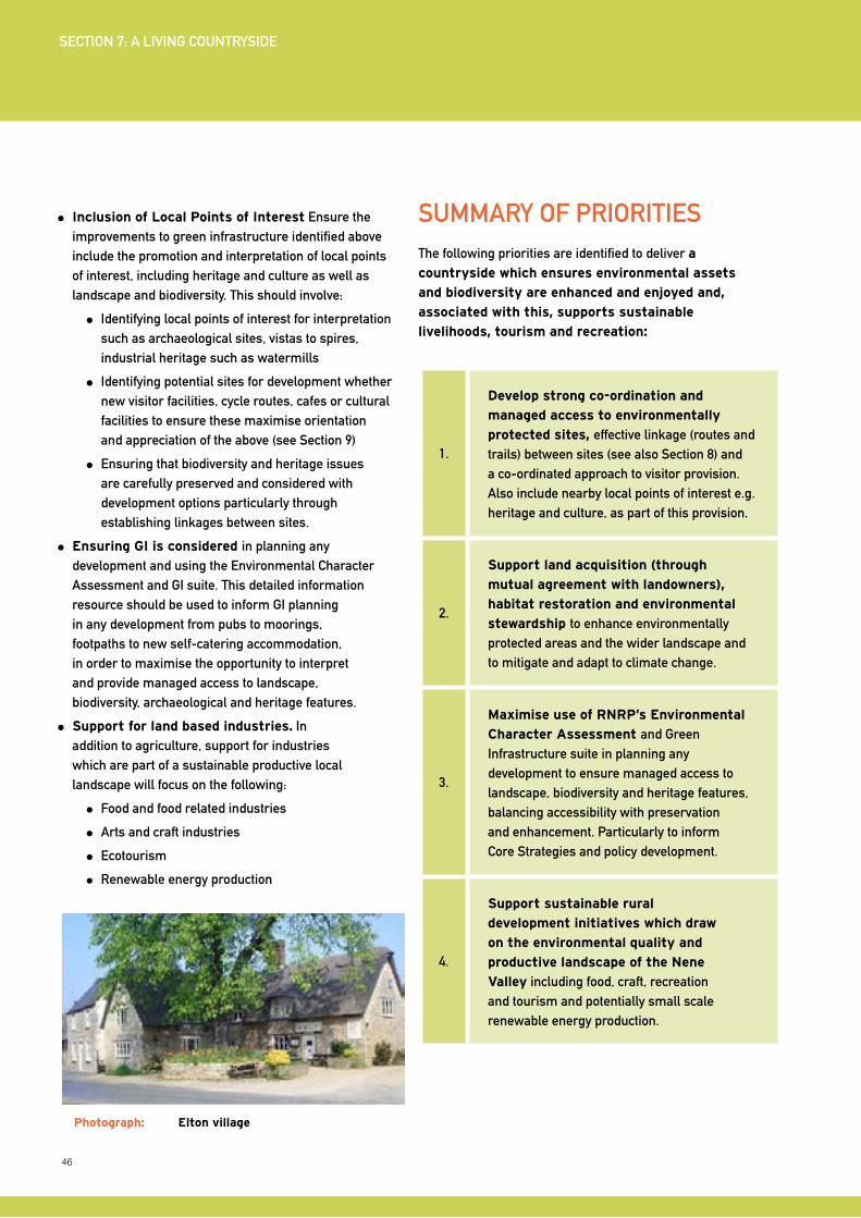
46
Inclusion of Local Points of Interest Ensure the improvements to green infrastructure identified above include the promotion and interpretation of local points of interest, including heritage and culture as well as landscape and biodiversity. This should involve:
Identifying local points of interest for interpretation such as archaeological sites, vistas to spires, industrial heritage such as watermills
Identifying potential sites for development whether new visitor facilities, cycle routes, cafes or cultural facilities to ensure these maximise orientation and appreciation of the above (see Section 9)
Ensuring that biodiversity and heritage issues are carefully preserved and considered with development options particularly through establishing linkages between sites.
Ensuring GI is considered in planning any development and using the Environmental Character Assessment and GI suite. This detailed information resource should be used to inform GI planning in any development from pubs to moorings, footpaths to new self-catering accommodation, in order to maximise the opportunity to interpret and provide managed access to landscape, biodiversity, archaeological and heritage features.
Support for land based industries. In addition to agriculture, support for industries which are part of a sustainable productive local landscape will focus on the following:
Food and food related industries
Arts and craft industries
Ecotourism
Renewable energy production
SUMMARy OF PRIORITIESThe following priorities are identified to deliver a
countryside which ensures environmental assets
and biodiversity are enhanced and enjoyed and,
associated with this, supports sustainable
livelihoods, tourism and recreation:
1.
Develop strong co-ordination and
managed access to environmentally
protected sites, effective linkage (routes and trails) between sites (see also Section 8) and a co-ordinated approach to visitor provision. Also include nearby local points of interest e.g. heritage and culture, as part of this provision.
2.
Support land acquisition (through
mutual agreement with landowners),
habitat restoration and environmental
stewardship to enhance environmentally protected areas and the wider landscape and to mitigate and adapt to climate change.
3.
Maximise use of RNRP’s Environmental
Character Assessment and Green Infrastructure suite in planning any development to ensure managed access to landscape, biodiversity and heritage features, balancing accessibility with preservation and enhancement. Particularly to inform Core Strategies and policy development.
4.
Support sustainable rural
development initiatives which draw
on the environmental quality and
productive landscape of the Nene
Valley including food, craft, recreation and tourism and potentially small scale renewable energy production.
Photograph: Elton village
SECTION 7: A LIVING COUNTRySIDE
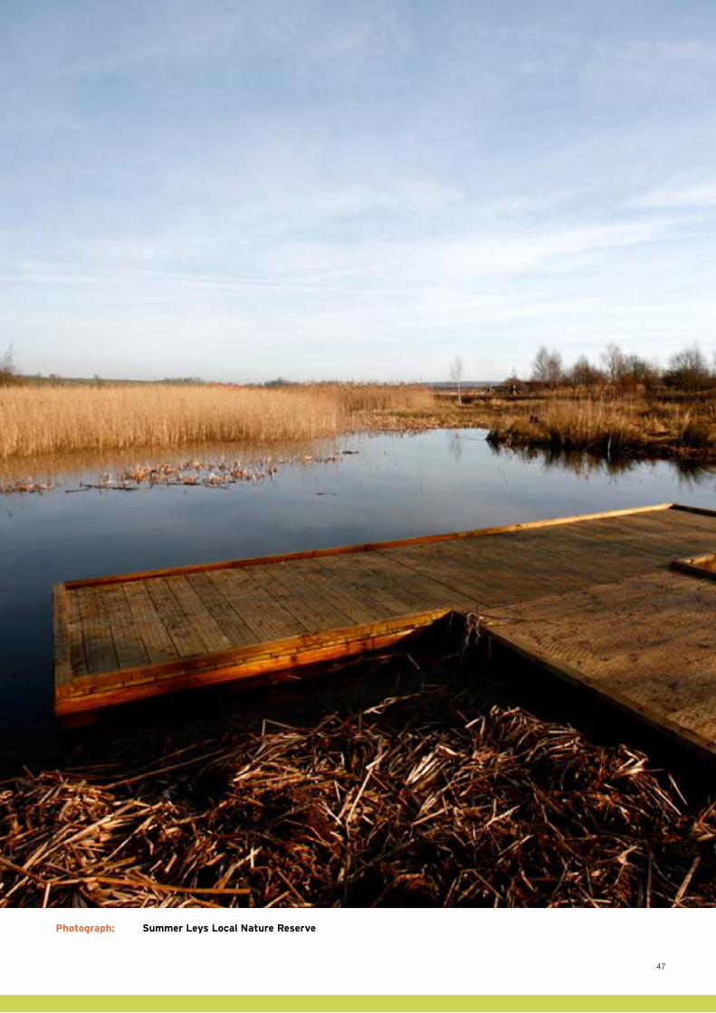
47
Photograph: Summer Leys Local Nature Reserve
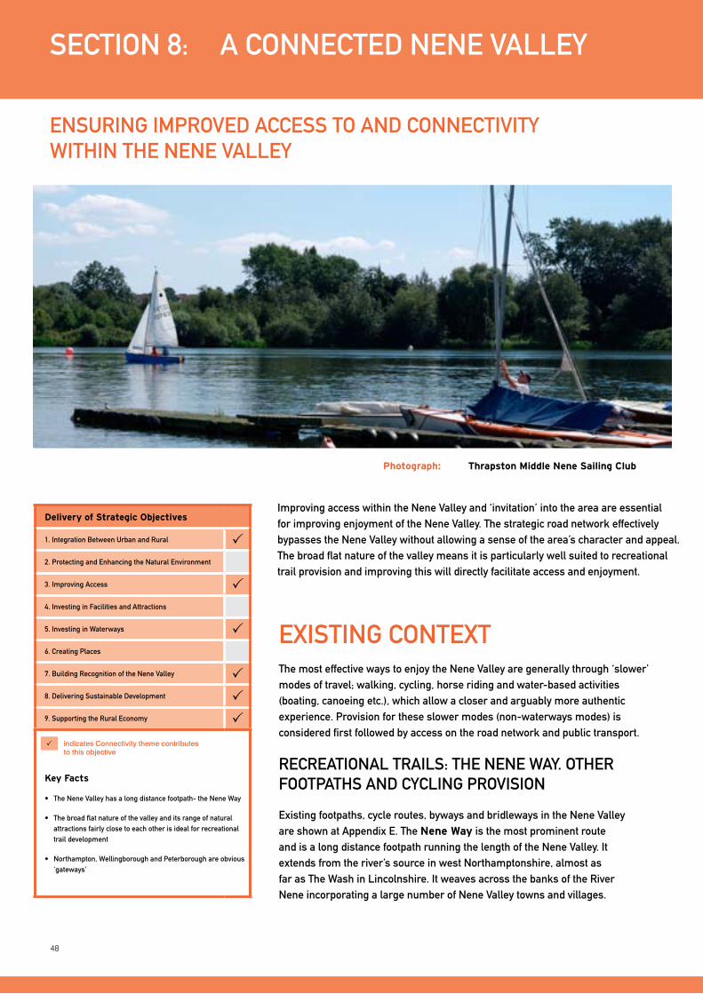
48
Improving access within the Nene Valley and ‘invitation’ into the area are essential for improving enjoyment of the Nene Valley. The strategic road network effectively bypasses the Nene Valley without allowing a sense of the area’s character and appeal. The broad flat nature of the valley means it is particularly well suited to recreational trail provision and improving this will directly facilitate access and enjoyment.
SECTION 8: A CONNECTED NENE VALLEy
ENSURING IMPROVED ACCESS TO AND CONNECTIVITy WITHIN THE NENE VALLEy
ExISTING CONTExTThe most effective ways to enjoy the Nene Valley are generally through ‘slower’ modes of travel; walking, cycling, horse riding and water-based activities (boating, canoeing etc.), which allow a closer and arguably more authentic experience. Provision for these slower modes (non-waterways modes) is considered first followed by access on the road network and public transport.
RECREATIONAL TRAILS: THE NENE WAy. OTHER FOOTPATHS AND CyCLING PROVISION
Existing footpaths, cycle routes, byways and bridleways in the Nene Valley are shown at Appendix E. The Nene Way is the most prominent route and is a long distance footpath running the length of the Nene Valley. It extends from the river’s source in west Northamptonshire, almost as far as The Wash in Lincolnshire. It weaves across the banks of the River Nene incorporating a large number of Nene Valley towns and villages.
Photograph: Thrapston Middle Nene Sailing Club
Delivery of Strategic Objectives
1. Integration Between Urban and Rural 2. Protecting and Enhancing the Natural Environment
3. Improving Access 4. Investing in Facilities and Attractions
5. Investing in Waterways 6. Creating Places
7. Building Recognition of the Nene Valley 8. Delivering Sustainable Development 9. Supporting the Rural Economy
Key Facts
• TheNeneValleyhasalongdistancefootpath-theNeneWay
• Thebroadflatnatureofthevalleyanditsrangeofnaturalattractions fairly close to each other is ideal for recreational trail development
• Northampton,WellingboroughandPeterboroughareobvious‘gateways’
indicates connectivity theme contributes to this objective

49
SECTION 8: A CONNECTED NENE VALLEy
Photograph: The Nene Way from Doddington Lock
34 www.northamptonshire.gov.uk/Transport/ROW/Rowip
Photograph: Footpaths
Parts of Nene Way are to be realigned under the Northamptonshire Rights of Way Improvement Plan 2007-2011
34 to provide a better, more appealing route
for users. There is scope to align some sections of the route closer to the river or establish new public rights of way, via more scenic sections of the valley/particular viewpoints or via attractions/points of interest (heritage, archaeological or cultural sites/features etc).
Opportunities to make better use of existing historic routes and transport networks should also be explored including ancient green lanes, hollow-ways and Roman roads.
The Northamptonshire Rights of Way Improvement Plan outlines proposals for improving footpaths, bridleways and byways in Northamptonshire. Details are given in Box 4.
Photograph: Bridleways
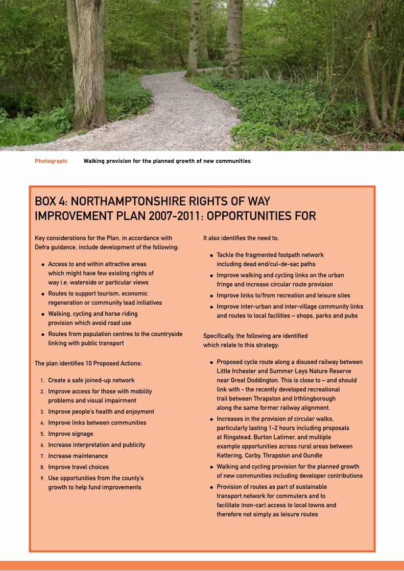
50
Key considerations for the Plan, in accordance with Defra guidance, include development of the following:
Access to and within attractive areas which might have few existing rights of way i.e. waterside or particular views
Routes to support tourism, economic regeneration or community lead initiatives
Walking, cycling and horse riding provision which avoid road use
Routes from population centres to the countryside linking with public transport
The plan identifies 10 Proposed Actions:
1. Create a safe joined-up network
2. Improve access for those with mobility problems and visual impairment
3. Improve people’s health and enjoyment
4. Improve links between communities
5. Improve signage
6. Increase interpretation and publicity
7. Increase maintenance
8. Improve travel choices
9. Use opportunities from the county’s growth to help fund improvements
It also identifies the need to:
Tackle the fragmented footpath network including dead end/cul-de-sac paths
Improve walking and cycling links on the urban fringe and increase circular route provision
Improve links to/from recreation and leisure sites
Improve inter-urban and inter-village community links and routes to local facilities – shops, parks and pubs
Specifically, the following are identified which relate to this strategy:
Proposed cycle route along a disused railway between Little Irchester and Summer Leys Nature Reserve near Great Doddington. This is close to – and should link with - the recently developed recreational trail between Thrapston and Irthlingborough along the same former railway alignment.
Increases in the provision of circular walks, particularly lasting 1-2 hours including proposals at Ringstead, Burton Latimer, and multiple example opportunities across rural areas between Kettering, Corby, Thrapston and Oundle
Walking and cycling provision for the planned growth of new communities including developer contributions
Provision of routes as part of sustainable transport network for commuters and to facilitate (non-car) access to local towns and therefore not simply as leisure routes
BOx 4: NORTHAMPTONSHIRE RIGHTS OF WAy IMPROVEMENT PLAN 2007-2011: OPPORTUNITIES FOR
Photograph: Walking provision for the planned growth of new communities
51
Sustrans, the national cycle network organisation has several proposals within North Northamptonshire which are partially complete or underway. They are shown on the plans at Appendix E and include:
National Route 53, extending from Peterborough to Birmingham (complete between Peterborough and Oundle, but proposed west of Oundle to Kettering and onwards via Rugby to Birmingham).
National Route 6, a north-south route extending through Northampton (complete) which includes the Brampton Valley Way.
Regional Routes 71, 73 and 74. Route 71 extends between Oundle, Thrapston and Irthlingborough (part complete), Route 73 extends from Corby south to Kettering and (part complete) and Route 74 extends from Corby south eastwards towards Thrapston (part complete).
‘Connect 2’ proposals for new local routes between Wellingborough, Rushden, Higham Ferrers, Irthlingborough and Raunds. These are designed to be local community routes and therefore to bring significant benefits providing access to town centres, schools, local facilities etc.
Some local authorities e.g. Wellingborough and Kettering, also have cycling plans for their areas which connect with the above proposals. The Thrapston to Irthlingborough recreational trail (shared footpath and cycle trail), which connects Stanwick Lakes and runs close to Denford and Woodford is well used, particularly between Stanwick Lakes and Thrapston. It would benefit from increased signposting the promotion in the towns and villages it serves. The Peterborough Millennium Green Wheel35 is a continuous network of cycleways, footpaths and bridleways around Peterborough including the Nene Valley. It connects with regional Sustrans routes 21 and national Sustrans routes 12 and 53 (see maps at Appendix E).
In general, as the Rights of Way Improvement Plan (RWIP) indicates, there is strong scope for improving footpath provision. Recreational trails which include cycling generally prove to be a popular and very beneficial local resource for which there is high demand
36. The lack of undulation for
significant tracts of the Nene Valley makes it very suitable
for ‘access for all’ recreational trail provision. The relatively proximity of many of the towns to one another, particularly between Wellingborough and Thrapston (typically towns are 2-6 miles apart), the wealth of natural reserves in between the towns, the growth proposed for many local towns and the current disconnection between the towns and communities of the Nene Valley (which are typically dissected by the A45) means increased trail provision to provides an obvious and ideal way to allow more people to access the Nene Valley, River Nene and nearby local towns.
Lower vehicle speeds and lorry restrictions will need to be addressed through the RWIP and Rural Areas Access Forum.
ROAD, RAIL AND PUBLIC TRANSPORT
The Nene Valley is well connected by road and rail services but these need to provide stronger ‘invitation’ into the Nene Valley. The lack of visual connection between both the road and rail networks and the Nene Valley highlights the importance of tourism signage and information provision regarding Nene Valley attractions and facilities. The A45/A605 and wider strategic road network (M1, A1(M), A509, A6, A6116, A14, A43) provides multiple points of access to the Nene Valley. There may be opportunities to highlight views from key transport corridors into the valley helping to raise the profile of the area. There are rail stations at Northampton, Wellingborough and Peterborough, all on separate radial rail routes from London (Euston and King’s Cross St Pancras), but each potentially providing direct access to the Nene Valley. Each of these towns also has strategically important bus/coach stations and/or services.
In promoting sustainable transport, initiatives need to maximise access by public transport and more sustainable private car use e.g. car sharing, in order to avoid increasing traffic congestion and placing undue pressure on the road network particularly in rural areas. Bus services in the area are generally fairly limited. The area was previously served by a saunter bus service which provided weekend summer services to attractions along the Nene Valley. Given the growth in North Northamptonshire, provision of a visitor/community hopper style bus service is likely to be appropriate.
35 Peterborough Millennium Green Wheel www.pect.net/green_wheel.html 36 The Northamptonshire Rights of Way Improvement Plan
indicates that ‘there is great demand for off-road recreational cycling in the county as demonstrated by the popularity of cycling on the Brampton Valley Way and enjoying the circuit around Pitsford Water (Brixworth Country Park)’ pg 21
SECTION 8: A CONNECTED NENE VALLEy
52
DEVELOPING PROVISIONDeveloping accessibility and connectivity in the Nene Valley, within the context of improved access and enjoyment of its natural environment, focuses particularly on sustainable and healthy travel modes, both within the area and to the area. Specifically, it includes:
Improving cycling and walking
More sustainable transport access to the area
Improving public transport
Better ‘invitation’ into the area through ‘gateways’
Ensuring the above maximise opportunities to become facilities and attractions in their own right and, of critical importance, that they support and facilitate other attractions in the Nene Valley
There are multiple, interrelated benefits associated with the above. This provision will:
directly introduce more people (residents and visitors) to the Nene Valley, bringing benefits to local communities, both the growth towns and existing communities
lever investment in other recreation and tourism infrastructure and support existing infrastructure, from cycle hire to waterside pubs, craft or local food based retail to new or enhanced visitor attractions, creating significant economic benefits
directly help deliver access and enjoyment of the Nene Valley and the waterways
support healthy lifestyle, fitness and wellbeing benefits from both green infrastructure and recreation
provide sustainable, low carbon, healthy travel to the attractions, facilities and local centres (employment, shops, schools etc.) in the Nene Valley
create greater connectivity and cohesion between the local communities
help strengthen the identity and raise awareness of the Nene Valley
To generate maximum effectiveness the links, access routes and gateways must focus on arrival points, attractors and destinations and the needs of both local communities and visitors. They should capture vistas and create visual connectivity, link the reserves (as identified in Section 7) and provide access to and interpret local features and points of interest. There is potential for the involvement of artists and creative practitioners in the design teams to deliver locally specific features to highlight the routes. By doing so they can become attractions in their own right as well as catalysts for enhancing GI and for other recreation and tourism infrastructure. New routes and linkages must be secured through mutual agreement and partnership working with farmers and landowners.
Specific proposals to achieve the above are provided in more detail below.
‘Nene Valley Trail’ – north south recreational
route along the Nene Valley. An off-road trail for cycling and walking is particularly appropriate for the Nene Valley for a number of reasons:
The lack of undulation in the largely flat bottomed valley makes the Nene Valley particularly suitable for off road recreational cycling provision which could easily be used by a large proportion of the population. It can also be accessible to those with restricted mobility
Relatively evenly spaced towns along the valley, typically at 4-8 mile intervals, together with nearby villages provide an ideal infrastructural base for supporting recreational routes (see below)
A trail (or combination of trails) provides an access route between local towns and villages as well as a recreational facility. It can therefore provide better access to local services/town centres and strengthen the links between the towns and villages. In so doing it can help strengthen the identity of the Nene Valley overall
The rail stations at Northampton, Peterborough and Wellingborough, all of which should be on the route of the Nene Valley trail, mean this route could be a regionally significant recreational facility accessible by public transport from outside the region and promoting access into the Nene Valley
The existing cycle/walking trail between Thrapston and Irthlingborough along the former railway alignment provides an obvious basis for the extension of a trail along the valley
SECTION 8: A CONNECTED NENE VALLEy
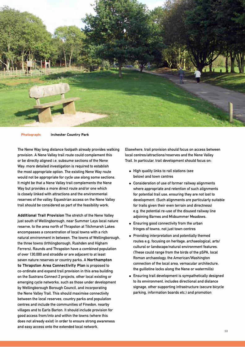
53
The Nene Way long distance footpath already provides walking provision. A Nene Valley trail route could complement this or be directly aligned i.e. subsume sections of the Nene Way: more detailed investigation is required to establish the most appropriate option. The existing Nene Way route would not be appropriate for cycle use along some sections. It might be that a Nene Valley trail complements the Nene Way but provides a more direct route and/or one which is closely linked with attractions and the environmental reserves of the valley. Equestrian access on the Nene Valley trail should be considered as part of the feasibility work.
Additional Trail Provision The stretch of the Nene Valley just south of Wellingborough, near Summer Leys local nature reserve, to the area north of Thrapston at Titchmarsh Lakes encompasses a concentration of local towns with a rich natural environment in between. The towns of Wellingborough, the three towns (Irthlingborough, Rushden and Higham Ferrers), Raunds and Thrapston have a combined population of over 130,000 and straddle or are adjacent to at least seven nature reserves or country parks. A Northampton
to Thrapston Area Connectivity Plan is proposed to co-ordinate and expand trail provision in this area building on the Sustrans Connect 2 projects, other local existing or emerging cycle networks, such as those under development by Wellingborough Borough Council, and incorporating the Nene Valley Trail. This should maximise connectivity between the local reserves, country parks and population centres and include the communities of Finedon, nearby villages and to Earls Barton. It should include provision for good access from/into and within the towns (where this does not already exist) in order to ensure strong awareness and easy access onto the extended local network.
Elsewhere, trail provision should focus on access between local centres/attractions/reserves and the Nene Valley Trail. In particular, trail development should focus on:
High quality links to rail stations (see below) and town centres
Consideration of use of former railway alignments where appropriate and retention of such alignments for potential trail use, ensuring they are not lost to development. (Such alignments are particularly suitable for trails given their even terrain and directness) e.g. the potential re-use of the disused railway line adjoining Barnes and Midsummer Meadows.
Ensuring good connectivity from the urban fringes of towns, not just town centres
Providing interpretation and potentially themed routes e.g. focusing on heritage, archaeological, arts/cultural or landscape/natural environment features. (These could range from the birds of the pSPA, local Roman archaeology, the American/Washington connection of the local area, vernacular architecture, the guillotine locks along the Nene or watermills)
Ensuring trail development is sympathetically designed to its environment, includes directional and distance signage, other supporting infrastructure (secure bicycle parking, information boards etc.) and promotion
A LIVING COUNTRySIDE
Photograph: Irchester Country Park
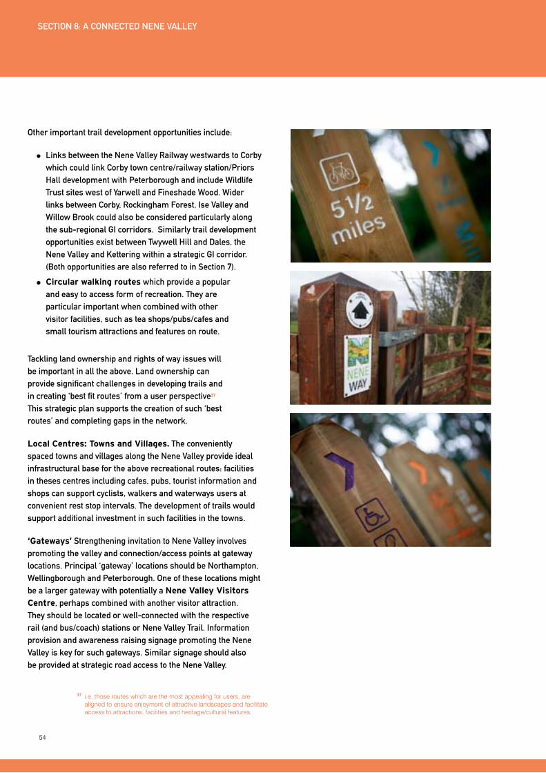
54
Other important trail development opportunities include:
Links between the Nene Valley Railway westwards to Corby which could link Corby town centre/railway station/Priors Hall development with Peterborough and include Wildlife Trust sites west of yarwell and Fineshade Wood. Wider links between Corby, Rockingham Forest, Ise Valley and Willow Brook could also be considered particularly along the sub-regional GI corridors. Similarly trail development opportunities exist between Twywell Hill and Dales, the Nene Valley and Kettering within a strategic GI corridor. (Both opportunities are also referred to in Section 7).
Circular walking routes which provide a popular and easy to access form of recreation. They are particular important when combined with other visitor facilities, such as tea shops/pubs/cafes and small tourism attractions and features on route.
Tackling land ownership and rights of way issues will be important in all the above. Land ownership can provide significant challenges in developing trails and in creating ‘best fit routes’ from a user perspective37 This strategic plan supports the creation of such ‘best routes’ and completing gaps in the network.
Local Centres: Towns and Villages. The conveniently spaced towns and villages along the Nene Valley provide ideal infrastructural base for the above recreational routes: facilities in theses centres including cafes, pubs, tourist information and shops can support cyclists, walkers and waterways users at convenient rest stop intervals. The development of trails would support additional investment in such facilities in the towns.
‘Gateways’ Strengthening invitation to Nene Valley involves promoting the valley and connection/access points at gateway locations. Principal ‘gateway’ locations should be Northampton, Wellingborough and Peterborough. One of these locations might be a larger gateway with potentially a Nene Valley Visitors
Centre, perhaps combined with another visitor attraction. They should be located or well-connected with the respective rail (and bus/coach) stations or Nene Valley Trail. Information provision and awareness raising signage promoting the Nene Valley is key for such gateways. Similar signage should also be provided at strategic road access to the Nene Valley.
37 i.e. those routes which are the most appealing for users, are aligned to ensure enjoyment of attractive landscapes and facilitate access to attractions, facilities and heritage/cultural features.
SECTION 8: A CONNECTED NENE VALLEy
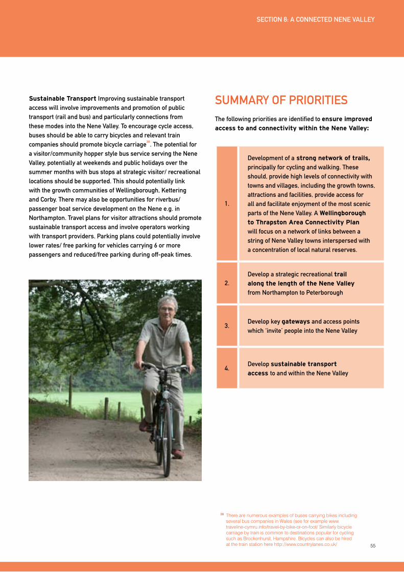
55
SUMMARy OF PRIORITIESThe following priorities are identified to ensure improved
access to and connectivity within the Nene Valley:
1.
Development of a strong network of trails, principally for cycling and walking. These should, provide high levels of connectivity with towns and villages, including the growth towns, attractions and facilities, provide access for all and facilitate enjoyment of the most scenic parts of the Nene Valley. A Wellingborough
to Thrapston Area Connectivity Plan will focus on a network of links between a string of Nene Valley towns interspersed with a concentration of local natural reserves.
2.Develop a strategic recreational trail
along the length of the Nene Valley
from Northampton to Peterborough
3.Develop key gateways and access points which ‘invite’ people into the Nene Valley
4.Develop sustainable transport
access to and within the Nene Valley
SECTION 8: A CONNECTED NENE VALLEy
Sustainable Transport Improving sustainable transport access will involve improvements and promotion of public transport (rail and bus) and particularly connections from these modes into the Nene Valley. To encourage cycle access, buses should be able to carry bicycles and relevant train companies should promote bicycle carriage
38. The potential for
a visitor/community hopper style bus service serving the Nene Valley, potentially at weekends and public holidays over the summer months with bus stops at strategic visitor/ recreational locations should be supported. This should potentially link with the growth communities of Wellingborough, Kettering and Corby. There may also be opportunities for riverbus/ passenger boat service development on the Nene e.g. in Northampton. Travel plans for visitor attractions should promote sustainable transport access and involve operators working with transport providers. Parking plans could potentially involve lower rates/ free parking for vehicles carrying 6 or more passengers and reduced/free parking during off-peak times.
38 There are numerous examples of buses carrying bikes including several bus companies in Wales (see for example www.traveline-cymru.info/travel-by-bike-or-on-foot/ Similarly bicycle carriage by train is common to destinations popular for cycling such as Brockenhurst, Hampshire. Bicycles can also be hired at the train station here http://www.countrylanes.co.uk/
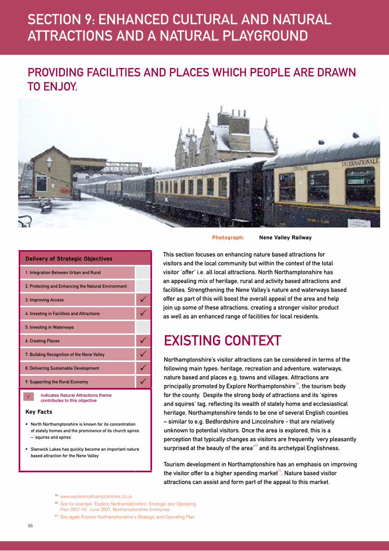
56
This section focuses on enhancing nature based attractions for visitors and the local community but within the context of the total visitor ‘offer’ i.e. all local attractions. North Northamptonshire has an appealing mix of heritage, rural and activity based attractions and facilities. Strengthening the Nene Valley’s nature and waterways based offer as part of this will boost the overall appeal of the area and help join up some of these attractions, creating a stronger visitor product as well as an enhanced range of facilities for local residents.
SECTION 9: ENHANCED CULTURAL AND NATURAL ATTRACTIONS AND A NATURAL PLAyGROUND
PROVIDING FACILITIES AND PLACES WHICH PEOPLE ARE DRAWN TO ENJOy.
Delivery of Strategic Objectives
1. Integration Between Urban and Rural
2. Protecting and Enhancing the Natural Environment
3. Improving Access 4. Investing in Facilities and Attractions 5. Investing in Waterways
6. Creating Places 7. Building Recognition of the Nene Valley 8. Delivering Sustainable Development 9. Supporting the Rural Economy
Key Facts
• NorthNorthamptonshireisknownforitsconcentrationof stately homes and the prominence of its church spires – ‘squires and spires’
• StanwickLakeshasquicklybecomeanimportantnaturebased attraction for the Nene Valley
indicates Natural Attractions theme contributes to this objective
ExISTING CONTExTNorthamptonshire’s visitor attractions can be considered in terms of the following main types: heritage, recreation and adventure, waterways, nature based and places e.g. towns and villages. Attractions are principally promoted by Explore Northamptonshire
39, the tourism body
for the county. Despite the strong body of attractions and its ‘spires and squires’ tag, reflecting its wealth of stately home and ecclesiastical heritage, Northamptonshire tends to be one of several English counties – similar to e.g. Bedfordshire and Lincolnshire - that are relatively unknown to potential visitors. Once the area is explored, this is a perception that typically changes as visitors are frequently ‘very pleasantly surprised at the beauty of the area’
40 and its archetypal Englishness.
Tourism development in Northamptonshire has an emphasis on improving the visitor offer to a higher spending market
41. Nature based visitor
attractions can assist and form part of the appeal to this market.
Photograph: Nene Valley Railway
39 www.explorenorthamptonshire.co.uk40 See for example ‘Explore Northamptonshire: Strategic and Operating
Plan 2007-10’, June 2007, Northamptonshire Enterprise41 See again Explore Northamptonshire’s Strategic and Operating Plan

57
HERITAGE ATTRACTIONS
North Northamptonshire has a notable array of historic houses and gardens including:
Rockingham Castle
Deene Park
Kirby Hall
All stately homes near Corby
Boughton House Stately home near Kettering
Elton Hall Stately home between Oundle and Peterborough (and in Cambridgeshire)
Prebendal Manor
Medieval Centre
Historic house and gardens near Oundle
Castle Ashby
Gardens
Historic gardens near Northampton
Lyveden New Bield Elizabethan mansion shell (never completed) and garden, near Oundle
Kirby Hall Historic House near Corby
Other heritage attractions include the Fotheringhay castlemotte(whereMaryQueenofScotswasexecuted),the Eleanor Cross at Geddington and Chichele College (medieval building) in Higham Ferrers. Many of North Northamptonshire’s churches are renowned for their architecture or historic features42. The Nene Valley has a particular concentration of medieval churches with spires43. It also has numerous archaeological assets such as Chester Farm, near Wellingborough, the site of a walled Roman town and deserted medieval village, and the sites uncovered by the Raunds area prehistoric project44. All historic environment and heritage assets play a key role in understanding and appreciating the character of the Nene Valley and must be carefully accounted for.
RECREATION, ADVENTURE AND OTHER VISITOR ATTRACTIONS
Key recreation, adventure and other visitor attractions within or in close proximity to the Nene Valley include:
Wicksteed Park Family focused amusement and entertainment park near Kettering
Billing Aquadrome Leisure holiday park near Northampton
Grendon Lakes
Nene Whitewater
Centre
Both are watersports venues between Wellingborough and Northampton
Rockingham Motor
Racing Circuit
Motor sport venue near Corby
Sacrewell Farm and
Country Centre
Near Wansford
Fermyn Woods
Contemporary Art
Gallery and arts educational centre, near Kettering
Country Parks Irchester Country Park, Barnwell Country Park, Stanwick Lakes Country Park, Upton Country Park, Fermyn Woods Country Park, Sywell Country Park
SECTION 9: ENHANCED CULTURAL AND NATURAL ATTRACTIONS AND A NATURAL PLAyGROUND
Photograph: Rockingham Castle
42 See for example the distinctive Saxon tower on the church at Earls Barton dating from 970AD, St Mary and All Saints Church in Fotheringhay with its distinctive tall octagonal tower
43 As identified in N Pevsener ‘Northamptonshire (Pevsner Buildings of England)’, 1973
44 http://www.english-heritage.org.uk/server/show/ConWebDoc.13537
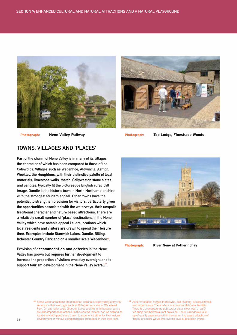
58
45 Some visitor attractions are contained destinations providing activities/services in their own right such as Billing Aquadrome or Wicksteed Park. On a smaller scale Grendon Lakes and Nene Whitewater centre are also important attractions. In this context ‘places’ can be defined as locations which people are drawn to experience either for their natural environment or without being managed attractions in their own right..
46 Accommodation ranges from B&Bs, self-catering, boutique hotels and larger hotels. There is lack of accommodation for families. There is a strong country pub sector but a lower level of café/ tea shop and bar/restaurant provision. There is moderate take-up of quality assurance within the sector: increased adoption of this by providers would improve the level of provision overall.
TOWNS, VILLAGES AND ‘PLACES’
Part of the charm of Nene Valley is in many of its villages, the character of which has been compared to those of the Cotswolds. Villages such as Wadenhoe, Aldwincle, Ashton, Weekley, the Houghtons, with their distinctive palette of local materials; limestone walls, thatch, Collyweston stone slates and pantiles, typically fit the picturesque English rural idyll image. Oundle is the historic town in North Northamptonshire with the strongest tourism appeal. Other towns have the potential to strengthen provision for visitors, particularly given the opportunities associated with the waterways, their unspoilt traditional character and nature based attractions. There are a relatively small number of ‘place’ destinations in the Nene Valley which have notable appeal i.e. are locations which local residents and visitors are drawn to spend their leisure time. Examples include Stanwick Lakes, Oundle, Billing, Irchester Country Park and on a smaller scale Wadenhoe45.
Provision of accommodation and eateries in the Nene Valley has grown but requires further development to increase the proportion of visitors who stay overnight and to support tourism development in the Nene Valley overall
46.
Photograph: River Nene at Fotheringhay
Photograph: Nene Valley Railway Photograph: Top Lodge, Fineshade Woods
SECTION 9: ENHANCED CULTURAL AND NATURAL ATTRACTIONS AND A NATURAL PLAyGROUND

59
DEVELOPING PROVISIONThe above complement the nature-based and waterways assets of the Nene Valley. Integrating green infrastructure provision and improved use of the waterways and waterside with the above will support the creation of the Nene Valley as a significantly enhanced and sought after destination for local people and visitors. Achieving this integration focuses on:
Supporting the creation of ‘places’ that people are drawn to experience during their leisure time
Linking attractions, waterways and green infrastructure provision, both physically e.g. through activities and trails and in terms of their marketing
Supporting businesses and initiatives to achieve the above
More details on the above are outlined below.
CREATING ‘PLACES’ OR NEW DESTINATIONS IN THE NENE VALLEy
The concept of places or destinations relates to relatively small localities or specific sites which people are drawn to visit: they are leisure or tourism nodes ideally connected to (or within) a town or village centre or other access point such as rail stations or main roads. They might be visitors’ centres, heritage sites, waterside locations or viewpoints. Existing ‘places’ or nodes in the Nene Valley or North Northamptonshire can be considered to be:
The Country Parks of Barnwell, Brigstock and Irchester
Billing waterside
The King’s Head at Wadenhoe and the Queen’sHeadatNassington
Oundle market place / town centre
Top Lodge, Fineshade Woods (RSPB and Forestry Commission site)
Elton Hall, nearby restaurant and garden centre
Stanwick Lakes
In keeping with the focus for this strategic plan, nature based visitor attractions have been included in the above but existing contained or isolated visitor attractions, including some stately homes, have been excluded.
Other sites, either existing or new, and with potential to become more significant ‘places’, include:
Localities within the Wellingborough to Thrapston area, extending slightly north and south of both towns, as identified in Section 8. Public transport, accessibility and a developed trail network will generate scope for new/expanded tourism or leisure nodes in this area, which could include Stanwick Lakes, especially with more connectivity/ access to and from the river, Higham Ferrers market square, Wellingborough waterfront and potentially smaller scale localities at Ringstead / Great Addington including the waterside activities, and at Denford.
Thrapston itself, particularly sites near its waterside but also extending to the town centre (as identified in Section 6)
Northampton waterside (see Section 6) and Upton Park
Barnwell marina, Barnwell Country Park and the nearby Oundle Mill (formerly Barnwell Mill), Oundle
yarwell and Wansford in association with the Nene Valley Railway and River Nene locations
Billing, where currently not all waterside uses are orientated or maximise the waterfront location
Ferry Meadows
The above shortlist is not exhaustive and there will be other locations that provide the opportunity to become leisure and tourism nodes of varying scales. Some villages or rural locations such as mill sites may be appropriate, but the sensitivity of any rural location means these will only be appropriate as small or very small-scale nodes.
These ‘destinations’ or ‘places’ should seek to encourage a high quality leisure experience, which might itself be linked with wider experiences involving green infrastructure, leisure activities or visitor attractions. They should be places that are enjoyed and supported by local residents
SECTION 9: ENHANCED CULTURAL AND NATURAL ATTRACTIONS AND A NATURAL PLAyGROUND
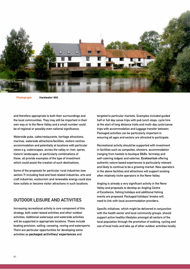
60
and therefore appropriate to both their surroundings and the local communities. They may still be important in their own way or to the Nene Valley and a small number could be of regional or possibly even national significance.
Waterside pubs, cafes/restaurants, heritage attractions, marinas, waterside attractions/facilities, visitors centres, accommodation and potentially at locations with particular views e.g. waterscapes, across the valley or river, spires, historic landscapes, or particularly combinations of these, all provide examples of the type of investment which could assist the creation of such destinations.
Some of the proposals for particular rural industries (see section 7) including food and food related industries, arts and craft industries, ecotourism and renewable energy could also have outlets or become visitor attractions in such locations.
OUTDOOR LEISURE AND ACTIVITIES
Increasing recreational activity is core component of this strategy, both water-based activities and other outdoor activities. Additional waterways and waterside activities will be supported in appropriate locations. These include boating provision, sailing, canoeing, rowing and watersports. There are particular opportunities for developing some activities as packaged activities/ experiences and
targeted to particular markets. Examples included guided half or full day canoe trips with pub lunch stops, cycle hire at the start of long distance trails and multi-day cycle/canoe trips with accommodation and luggage transfer between. Packaged activities can be particularly important in ensuring all ages and sectors are attracted to participate.
Recreational activity should be supported with investment in facilities such as campsites, showers, accommodation (ranging from hostels to boutique B&Bs, farmstay and self-catering lodges) and eateries. Ecotourism offering authentic nature based experiences is particularly relevant and likely to continue to be a growing market. New operators in the above facilities and attractions will support existing often relatively niche operators in the Nene Valley.
Angling is already a very significant activity in the Nene Valley and proposals to develop an Angling Centre of Excellence, fishing holidays and additional fishing events are proposed. Packaged holidays/ breaks will need to link with local accommodation providers.
Specific initiatives, which might be delivered in conjunction with the health sector and local community groups, should support active healthy lifestyles amongst all sectors of the local population through the promotion of walking, cycling and use of local trails and take up of other outdoor activities locally
A LIVING COUNTRySIDE
Photograph: Hardwater Mill
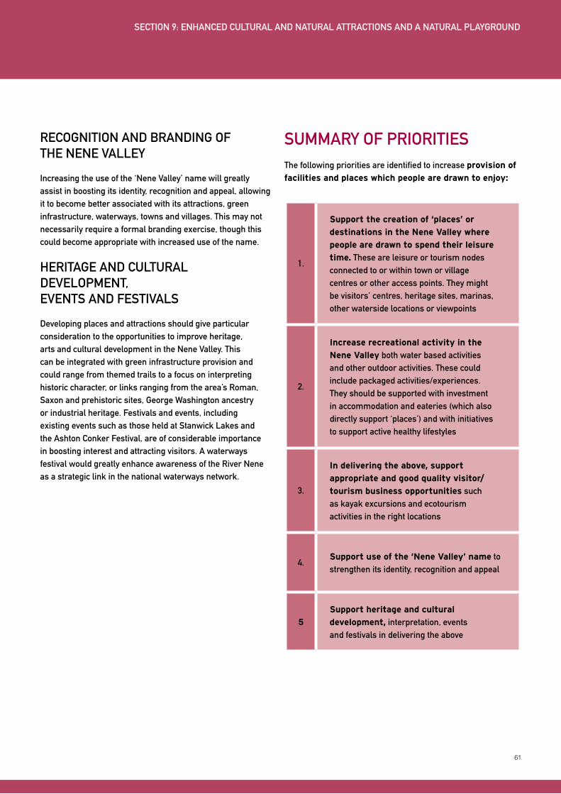
61
RECOGNITION AND BRANDING OF THE NENE VALLEy
Increasing the use of the ‘Nene Valley’ name will greatly assist in boosting its identity, recognition and appeal, allowing it to become better associated with its attractions, green infrastructure, waterways, towns and villages. This may not necessarily require a formal branding exercise, though this could become appropriate with increased use of the name.
HERITAGE AND CULTURAL DEVELOPMENT, EVENTS AND FESTIVALS
Developing places and attractions should give particular consideration to the opportunities to improve heritage, arts and cultural development in the Nene Valley. This can be integrated with green infrastructure provision and could range from themed trails to a focus on interpreting historic character, or links ranging from the area’s Roman, Saxon and prehistoric sites, George Washington ancestry or industrial heritage. Festivals and events, including existing events such as those held at Stanwick Lakes and the Ashton Conker Festival, are of considerable importance in boosting interest and attracting visitors. A waterways festival would greatly enhance awareness of the River Nene as a strategic link in the national waterways network.
SUMMARy OF PRIORITIESThe following priorities are identified to increase provision of
facilities and places which people are drawn to enjoy:
1.
Support the creation of ‘places’ or
destinations in the Nene Valley where
people are drawn to spend their leisure
time. These are leisure or tourism nodes connected to or within town or village centres or other access points. They might be visitors’ centres, heritage sites, marinas, other waterside locations or viewpoints
2.
Increase recreational activity in the
Nene Valley both water based activities and other outdoor activities. These could include packaged activities/experiences. They should be supported with investment in accommodation and eateries (which also directly support ‘places’) and with initiatives to support active healthy lifestyles
3.
In delivering the above, support
appropriate and good quality visitor/
tourism business opportunities such as kayak excursions and ecotourism activities in the right locations
4.Support use of the ‘Nene Valley’ name to strengthen its identity, recognition and appeal
5Support heritage and cultural
development, interpretation, events and festivals in delivering the above
SECTION 9: ENHANCED CULTURAL AND NATURAL ATTRACTIONS AND A NATURAL PLAyGROUND
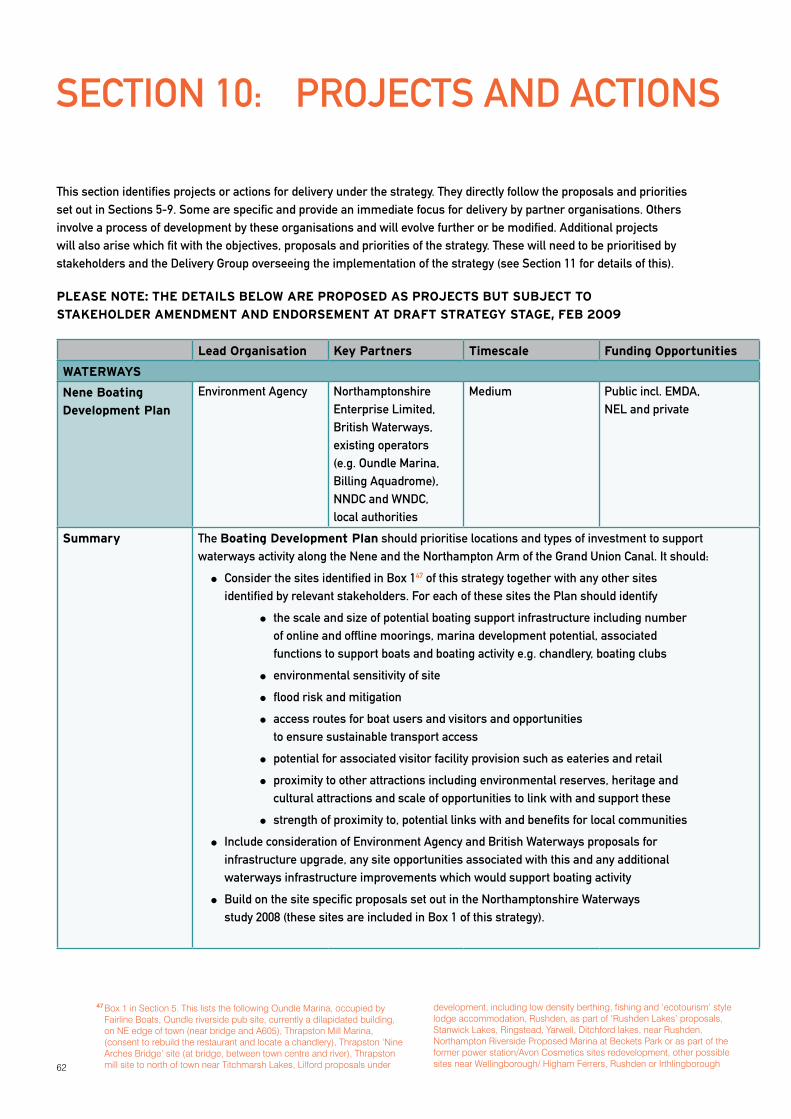
62
SECTION 10: PROJECTS AND ACTIONS
This section identifies projects or actions for delivery under the strategy. They directly follow the proposals and priorities set out in Sections 5-9. Some are specific and provide an immediate focus for delivery by partner organisations. Others involve a process of development by these organisations and will evolve further or be modified. Additional projects will also arise which fit with the objectives, proposals and priorities of the strategy. These will need to be prioritised by stakeholders and the Delivery Group overseeing the implementation of the strategy (see Section 11 for details of this).
PLEASE NOTE: THE DETAILS BELOW ARE PROPOSED AS PROJECTS BUT SUBJECT TO
STAKEHOLDER AMENDMENT AND ENDORSEMENT AT DRAFT STRATEGY STAGE, FEB 2009
Lead Organisation Key Partners Timescale Funding Opportunities
WATERWAYS
Nene Boating
Development Plan
Environment Agency Northamptonshire Enterprise Limited, British Waterways, existing operators (e.g. Oundle Marina, Billing Aquadrome), NNDC and WNDC, local authorities
Medium Public incl. EMDA, NEL and private
Summary The Boating Development Plan should prioritise locations and types of investment to support waterways activity along the Nene and the Northampton Arm of the Grand Union Canal. It should:
Consider the sites identified in Box 147 of this strategy together with any other sites identified by relevant stakeholders. For each of these sites the Plan should identify
the scale and size of potential boating support infrastructure including number of online and offline moorings, marina development potential, associated functions to support boats and boating activity e.g. chandlery, boating clubs
environmental sensitivity of site
flood risk and mitigation
access routes for boat users and visitors and opportunities to ensure sustainable transport access
potential for associated visitor facility provision such as eateries and retail
proximity to other attractions including environmental reserves, heritage and cultural attractions and scale of opportunities to link with and support these
strength of proximity to, potential links with and benefits for local communities
Include consideration of Environment Agency and British Waterways proposals for infrastructure upgrade, any site opportunities associated with this and any additional waterways infrastructure improvements which would support boating activity
Build on the site specific proposals set out in the Northamptonshire Waterways study 2008 (these sites are included in Box 1 of this strategy).
47 Box 1 in Section 5. This lists the following Oundle Marina, occupied by Fairline Boats, Oundle riverside pub site, currently a dilapidated building, on NE edge of town (near bridge and A605), Thrapston Mill Marina, (consent to rebuild the restaurant and locate a chandlery), Thrapston ‘Nine Arches Bridge’ site (at bridge, between town centre and river), Thrapston mill site to north of town near Titchmarsh Lakes, Lilford proposals under
development, including low density berthing, fishing and ‘ecotourism’ style lodge accommodation, Rushden, as part of ‘Rushden Lakes’ proposals, Stanwick Lakes, Ringstead, Yarwell, Ditchford lakes, near Rushden, Northampton Riverside Proposed Marina at Beckets Park or as part of the former power station/Avon Cosmetics sites redevelopment, other possible sites near Wellingborough/ Higham Ferrers, Rushden or Irthlingborough
63
Lead Organisation Key Partners Timescale Funding Opportunities
Waterside Facilities
Development
NEL or RNRP Environment Agency, British Waterways, local authorities, NNDC, WNDC, existing operators, Natural England, EMRAF, CLA
Short Primarily the cost of personnel resources of stakeholder organisations
Summary: Develop a checklist or mini brochure of potential types of waterside activity together with key considerations for these and promote the checklist/mini brochure locally.
Waterside activities will include those listed in Section 5, i.e.
Kiosks, small scale retail and food outlets
Pubs, restaurants, cafes and tea shops
Picnic and barbeque areas, campsites, showers
Other visitor attractions or facilities in close proximity
Visitor accommodation including hotels, B&Bs, self catering accommodation (cottages, lodges), hostels
‘Key considerations’ should expand upon the following:
Details on planning consents required for the above
Likely locations in accordance with LDFs and the sites at Box 1
Areas of environmental sensitivity and flood risk and mitigation considerations
Access routes and opportunities associated with new proposals e.g. Nene Valley Trail
Links and proximity to existing attractions
Scale of activities likely to be appropriate
Maximising GI, heritage interpretation e.g. through use of the EC&GI suite
Potential funding or indirect support for the above e.g. through promotion once operating
Priority support for authentic ecotourism proposals and those with strong sustainability principles
The checklist/ mini brochure should be widely available both electronically on stakeholders’ websites and hard copy through many stakeholder organisations and local business and tourism groups and to landowners directly.
Waterways
Gateways
See Gateways project under ‘Connectivity’ below
64
Lead Organisation Key Partners Timescale Funding Opportunities
Waterways
Development
Projects: Events, branding, marketing, boat hire, potential passenger boat service, waterways recreational activities, energy generation and ‘green boating’
Environment Agency NEL, RNRP, British Waterways, local authorities, NNDC, WNDC, existing operators
Short but ongoing Initially focused on cost of personnel resources of stakeholder organisations
Summary: Establishment of a working group which might be a subsidiary of NVSP Delivery Group (see Section 11) to oversee the following:
Event opportunities in association with the Nene waterways including a potential waterways festival for Northampton
Development of Nene waterways marketing/ branding
Identification of ways to support waterways recreational activities including increasing boat hire provision, canoeing/kayaking, angling, sailing This is likely to include working proactively to identify and support potential operators through networks and contacts within the waterways industry
Consideration of the viability of passenger boat services
Identification of opportunities for renewable energy generation including hydro-electric power along the River Nene, particularly given the significant income this generates48
Identification of ‘green boating’ initiatives such as those led by ‘The Green Blue’49
The group should:
Consider the benefits and suitability of the above for the Nene Valley
Identify practical ways forward to deliver the above including roles by stakeholder organisations
Develop Nene Valley marketing in accordance with existing publicity as part of Explore Northamptonshire50. This should include website pages providing site specific details within a River Nene section, as set out in the design concepts in the Northamptonshire Waterways report 2008
Angling Centre of
Excellence, angling
holidays and events.
See also ‘Natural
Attractions’ below
Nene Angling Club or Environment Agency
Other angling groups, Environment Agency, NEL, RNRP, British Waterways, local authorities, other waterways operators
Medium To be considered under project
48 Hydro-electric and wind projects are being developed by British Waterways in conjunction with Partnerships for Renewables which will generate sufficient power for 45,000 homes. See www.britishwaterways.co.uk/newsroom/all-press-releases/display/id/2275 and www.forumforthefuture.org/greenfutures/articles/liquid_energy
49 The Green Blue is led by the British Marine Federation and the Royal Yachting Association and supported by the Environment Agency amongst other partners www.thegreenblue.org.uk
50 www.explorenorthamptonshire.co.uk

65
Lead Organisation Key Partners Timescale Funding Opportunities
Summary: Development of an Angling Centre of Excellence by the Nene Angling Club potentially in conjunction with other local angling clubs. Developing proposals for this should consider:
Other comparable initiatives and angling centres which might provide useful examples
Ways to organise provision of tuition for all ability levels in trout, pike and coarse fishing
Specialist retail opportunities
Site, management, access, costs and funding
Lead Organisation Key Partners Timescale Funding Opportunities
NENE TOWNS
Mini Town-
River Plans
NNDC or local authorities
RNRP, town councils, WNDC, Environment Agency, British Waterways, NEL
Medium NNDC and local authority planning resources
Summary: The Mini Town-River Plans should identify visual and physical links to enhance connectivity between the town and the river. They should be concise documents prepared by local authorities in conjunction with other stakeholders, particularly town councils. Plans should be prepared for Wellingborough, Thrapston, Oundle, the three towns of Higham Ferrers, Rushden and Irthlingborough. They should:
Identify existing vistas and opportunities to create or enhance vistas to the valley/ water
Review the built form, access and development opportunities adjacent to the river, between the town and the river and on the edge of the town/town centre. Early discussions with the EA should be sought.
Identify opportunities to improve access and particularly to provide recreational trails which provide direct links and are visually prominent in the town centres and at the river/in the valley
Identify public realm improvements and site development opportunities to provide stronger links and better visual orientation between the town and the river
Focus on improvements which ensure the towns
Better recognise their settings, green infrastructure and the river and are less disconnected from their landscape environment
Support and enhance recognition of their heritage particularly any previous industrial or agricultural related use of the valley
Identify proposals to provide signage (directional and distance), information and interpretation facilities from town centres, public transport nodes and along access route
The above will build on the existing Local Development Framework documents and also the town action plans or health checks undertaken for several of the towns. They should also utilise characterisation studies such as conservation area appraisals and extensive urban survey techniques (available from the County HER).
Brief details for each of the towns are provided in Section 6. Proposals for Northampton are being developed under waterside regeneration and town centre link studies already underway.
66
Lead Organisation Key Partners Timescale Funding Opportunities
Facilities
Development in
Nene Towns
Town Councils NEL, local authorities, local businesses, business and tourism groups, Local Strategic Partnerships (LSPs), EMRAF, NNDC, WNDC, HCA
Ongoing – Short-Long Public (existing stakeholder funding streams) and local business
Summary: The improvement of Nene Town facilities to support recreation and visitor use in the Nene Valley should identify the extent of existing provision and ways to enhance this. It should consider:
Eateries – cafes, tea shops, pubs, restaurants
Retail, including niche retail such as craft outlets, farmers’ markets, cycle or outdoor shops
Accommodation – pubs, B&Bs, hotels, campsites, self-catering
Toilets, water fountains and recycling bins, whether provided separately or at visitor centres, pubs etc
Visitor information, interpretation and signage
Access, focusing on arrival in the towns, including public transport, car parking, signage, cycle parking
The opening hours, access and quality of the above should be given particular consideration. Improvement of these aspects will involve greater take up of quality accreditation schemes in conjunction with NEL and potentially an increase of opening hours e.g. during summer and public holidays.
Identification of the above will be ongoing with opportunities for new and enhanced provision increasing as more people (residents and visitors) use/visit the Nene Valley. Initially towns should review provision and identify ways to enhance this e.g. over a five year period as part of town regeneration or ongoing town management and building on the town action plans/health checks.
Lead Organisation Key Partners Timescale Funding Opportunities
LIVING COUNTRYSIDE
Access and visitor
provision for
environmentally
protected sites
RNRP or Wildlife Trust Natural England, RSPB, Rockingham Forest Trust, Groundwork, Forestry Commission, local authorities, NNDC, WNDC, NEL, English Heritage
Short-medium Wide ranging and as for GI funding e.g. GAF, Landfill Tax Credit Scheme, community infrastructure levy
67
Lead Organisation Key Partners Timescale Funding Opportunities
Summary: Develop a co-ordinated approach to the enhancement of environmentally protected
areas for visitor access, linkage between sites and co-ordinated approach to visitor centre provision in the Nene Valley and North Northamptonshire more widely. This should:
Review existing site provision, access and linkage including the visitor ‘offer’ (key attributes) at individual sites and opportunities to improve each of these
Identify how the sites/reserves can or should best complement one another in terms of their visitor offer e.g. wildlife, landscape, recreation, quiet areas, points of interest (heritage and culture including archaeological sites, industrial heritage e.g. watermills) and visitor facilities including visitor centres and interpretation
Identify the need or potential for new visitor facilities, recreational routes, cafes or cultural facilities
Develop proposals for types of enhancement and investment at different sites/reserves
Work closely with those developing recreational trail provision in the Nene Valley to ensure this provides a network of trails between sites and promotes sustainable access (see Connectivity below)
Work closely with those developing gateway proposals to ensure these recognise visitor centre provision e.g. the centre developed at Stanwick Lakes and link with this
The above will involve documenting existing provision, proposals and a process of
prioritisation by the stakeholders. It could focus initially on existing reserves, primarily in the southern end of the valley between Thrapston and Northampton. However, it should also consider:
The reserves near Wansford and west of yarwell and the opportunities to link these with the Nene Valley railways and potentially a recreational trail extending to Corby
Twywell Hill and Dales SSSI just east of Kettering and the opportunities for trail connection with the nearby Nene Valley including the former rail trail between Thrapston and Stanwick Lakes
Enhancement of GI provision and trail development between Thrapston and Wansford (see below)
Increasing
Biodiversity, land
stewardship and
climate change
mitigation and
adaptation
RNRP landowners and farmers, EA, CLA, NFU, FWAG, EMRAF, DEFRA, Natural England, ACRE
Ongoing Defra/ Natural England, other public and private as for ‘Environmentally protected sites’ above
68
Summary: Existing biodiversity proposals and agri-environment schemes, together with more specific flood risk management and climate change mitigation and adaptation schemes, are ongoing amongst partner organisations but further supported under this strategy. The ongoing support of partners is therefore critical to achieving the principles of sustainable development and will assist greatly in providing climatic stability. However, they also form part of the strategic green infrastructure (GI) provision and provide valuable opportunities to understand and benefit from enjoyment of our natural environment. They therefore also provide visitor and educational development opportunities which can be incorporated at visitors centres (see Environmentally Protected Sites above).
Opportunities to increase Biodiversity, land stewardship and mitigate and adapt to climate change should:
Support the Northamptonshire Biodiversity Action Plan (NBAP), produced by the Wildlife Trust for guidance in the management of wildlife sites and habitats. It identifies target areas, which are a priority for action
Develop a landscape ecology approach to identify and protect key habitats, open up new habitats and develop and maintain wildlife corridors
Reduce habitat fragmentation and protect and restore areas of floodplains and wetlands
Participate in Entry and High Level Stewardship schemes, managed by Natural England to provide land owners with advice and grants towards the sustainable management of the countryside
Support measures by the EA for their River Basin Management Plan to increase the water quality of rivers and catchments and the management of adjacent farmland, to improve riverine habitats and associated wildlife
Adopt measures to reduce water use as, with increasing demands, it is critical to the wellbeing of new and existing communities and wildlife in the Nene Valley
Minimise the risk of flooding through care in the siting of development, adopt more sustainable uses and sources of energy and reduce the rate of water run off
Identify opportunities for site based and landscape scale responses
to Climate Change through mitigation and adaptation
Where appropriate, encouragement will be given to extending existing woodlands and, within the new planting, provision made for Carbon Sink Forestry ‘(e.g. the
Rockingham Forest) and short rotation coppicing as an energy crop. This will absorb CO2, help to meet local energy needs and support the local economy. Reduce travel costs, reinforce the character of the area and increase the benefits of GI
Seek opportunities to create “soft dams”, by planting new woodland on appropriate valley slopes and ridgelines to reduce the rate of water run off
Identify appropriate locations for wet woodlands and meadows in the Nene Valley to increase habitats and minimise the risk of flooding
Increase habitats and connectivity between them to allow the migration of flora and fauna to more favourable locations affected by Climate Change
Consider measures to reduce energy use as this contributes to Climate Change, a major area of concern as this causes additional pressure on the landscape and wildlife of the Nene Valley
69
Lead Organisation Key Partners Timescale Funding Opportunities
Environmental
Character and
GI Suite
RNRP Local authorities, NNDC, WNDC, landowners, developers, NFU
Ongoing EMDA, Defra, other public and private
Summary: The ECA and GI suite is used to consider, incorporate and enhance Northamptonshire GI and environmental character in planning and development proposals including using the ECA and GI suite to inform Core Strategies and policy development.. It will continue to need to be promoted and training provided for its use to deliver GI and provide managed access to landscape, biodiversity and heritage assets.
Use the ECA&GI suite, which underpins Landscape Sensitivity studies, to assess the relative sensitivity of the natural, cultural and visual components of the landscape to specific development proposals
Determine optimal directions for Sustainable Urban Extensions to growth settlements by sensitivity analysis
Identify and develop Strategic Green Infrastructure networks in relation to settlements and their surrounding landscapes using the framework provide by the ECA&GI suite
Refer to the opportunities provided by strategic and local GI corridors, which sets out their potential to increase wildlife reservoirs and connectivity
Identify opportunities using the ECA&GI suite on the landscape character of different areas and their natural, cultural and visual assets, on strategies and guidelines for their management
Sustainable local
rural industry
initiatives
RNRP but with partners depending on initiative
NEL, CLA, EMRAF, FWAG, ACRE, partners in previous Northamptonshire Food Group, local authorities, Local strategic Partnerships, tourism and business groups, existing businesses, landowners, NFU.
Medium Wide ranging – public and private
70
Summary: The NVSP Delivery Group (see section 11) should identify specific proposals to support the following:
Food and food related industries, which might involve a second phase of the work of the Northamptonshire Food Group
51
Arts and craft industries, such as support for a network, outlets and/or promotion of art and craft businesses in the Nene Valley/ North Northamptonshire. This currently operates informally through existing local businesses, farmers’ markets, craft outlets such as those at Top Lodge, Fineshade Woods and other fairs and events. Creative Northants is the county’s vehicle for arts based creative industries, providing; networking, information, advise, CPD and organizational development
Ecotourism, as identified in the Waterside Facilities project above and Natural Attractions projects below
Renewable energy production, focusing on proposals by partner organisations. Opportunities might range from anaerobic digestion, biomass production from short rotation coppicing as well as wind power and hydro-electric opportunities associated with the Nene and identified in the Waterways Development Projects above. Appropriate siting of anaerobic digestion facilities relative to residents and amenity attractions will be important.
These will largely be led by partner organisations but should be supported by others e.g. in terms of marketing (expertise or inclusion in existing tourism promotion), research or knowledge base, desk space
51 www.northamptonshirefood.org
71
Lead Organisation Key Partners Timescale Funding Opportunities
CONNECTIVITY
Nene Valley Trail Sustrans or Northamptonshire County Council
RNRP, local authorities, Ramblers Association, local cycling and walking groups, equestrian groups, landowners, existing businesses and tourism operators, developers
Short-Medium Public and private opportunities e.g. GAF, Lottery, DoH/NHS, developers, local businesses and groups, community infrastructure levy
Summary: The proposal for a Nene Valley Trail, a recreational trail primarily for cycling and walking along the length of the Nene Valley, is a core project for this strategic plan as it supports many other proposals and facilities, is a potential key attraction in its own right and provides a sustainable and healthy travel access option for the Nene Valley, both for local residents and visitors. More detailed justification for the proposal is set out in Section 8.
A feasibility study will need to consider route alignment and consult further with stakeholders. The following will be of particular consideration:
Route option alignment including best fit routes between local communities/attractions/environmental reserves, scenic routes and direct routes
Opportunity to combine with sections of a (partly realigned) Nene Way. There would be both advantages and disadvantages to this. The topography of parts of the Nene Way would not be suitable for cycling
Connectivity to the rail stations at Northampton, Wellingborough and Peterborough to promote trail use/ access to the Nene Valley by rail
Consideration of use of former railway alignment – the former Nene Valley Railway
Land ownership
Ensuring access for all (for those with limited mobility)
Viability of and suitability for equestrian use along part or all of the trail
Flood risk and management issues given that the trail will be suited to the lack of undulation in the low lying flat valley bottom close to the river and providing access to the river
Links to the towns which are spaced at 4-8mile intervals providing an ideal infrastructural base and also support their integration with the Nene Valley
Interpretation and potential themes along sections of route according to heritage/archaeological, arts/cultural and landscape/ natural environment features
Trail design which is sympathetic to its natural environment
Supporting infrastructure including signage (distance, directional), information and map boards and leaflets, bicycle parking, water fountains, seats, shelter, public toilet provision. Some of this will be provided at visitor centres and other attractions along the route
Route development including funding, implementation and maintenance
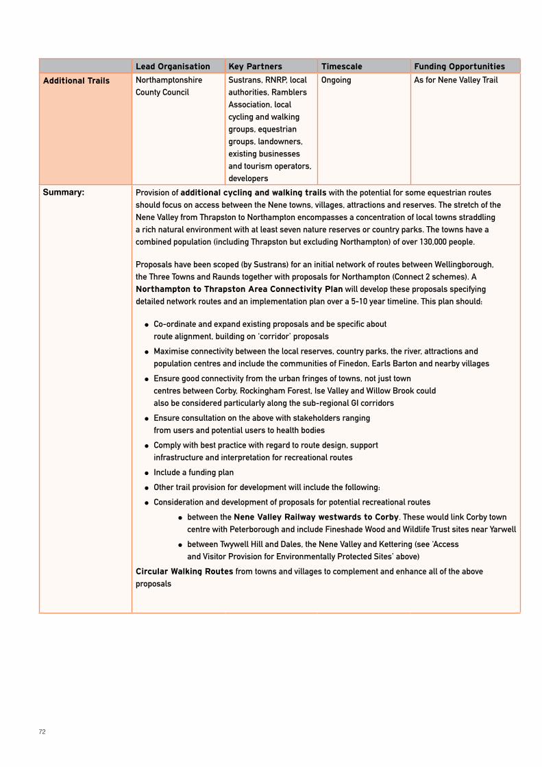
72
Lead Organisation Key Partners Timescale Funding Opportunities
Additional Trails Northamptonshire County Council
Sustrans, RNRP, local authorities, Ramblers Association, local cycling and walking groups, equestrian groups, landowners, existing businesses and tourism operators, developers
Ongoing As for Nene Valley Trail
Summary: Provision of additional cycling and walking trails with the potential for some equestrian routes should focus on access between the Nene towns, villages, attractions and reserves. The stretch of the Nene Valley from Thrapston to Northampton encompasses a concentration of local towns straddling a rich natural environment with at least seven nature reserves or country parks. The towns have a combined population (including Thrapston but excluding Northampton) of over 130,000 people.
Proposals have been scoped (by Sustrans) for an initial network of routes between Wellingborough, the Three Towns and Raunds together with proposals for Northampton (Connect 2 schemes). A Northampton to Thrapston Area Connectivity Plan will develop these proposals specifying detailed network routes and an implementation plan over a 5-10 year timeline. This plan should:
Co-ordinate and expand existing proposals and be specific about route alignment, building on ‘corridor’ proposals
Maximise connectivity between the local reserves, country parks, the river, attractions and population centres and include the communities of Finedon, Earls Barton and nearby villages
Ensure good connectivity from the urban fringes of towns, not just town centres between Corby, Rockingham Forest, Ise Valley and Willow Brook could also be considered particularly along the sub-regional GI corridors
Ensure consultation on the above with stakeholders ranging from users and potential users to health bodies
Comply with best practice with regard to route design, support infrastructure and interpretation for recreational routes
Include a funding plan
Other trail provision for development will include the following:
Consideration and development of proposals for potential recreational routes
between the Nene Valley Railway westwards to Corby. These would link Corby town centre with Peterborough and include Fineshade Wood and Wildlife Trust sites near yarwell
between Twywell Hill and Dales, the Nene Valley and Kettering (see ‘Access and Visitor Provision for Environmentally Protected Sites’ above)
Circular Walking Routes from towns and villages to complement and enhance all of the above proposals
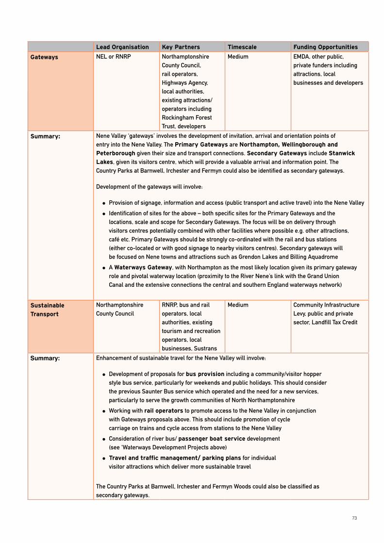
73
Lead Organisation Key Partners Timescale Funding Opportunities
Gateways NEL or RNRP Northamptonshire County Council, rail operators, Highways Agency, local authorities, existing attractions/ operators including Rockingham Forest Trust, developers
Medium EMDA, other public, private funders including attractions, local businesses and developers
Summary: Nene Valley ‘gateways’ involves the development of invitation, arrival and orientation points of entry into the Nene Valley. The Primary Gateways are Northampton, Wellingborough and
Peterborough given their size and transport connections. Secondary Gateways include Stanwick
Lakes, given its visitors centre, which will provide a valuable arrival and information point. The Country Parks at Barnwell, Irchester and Fermyn could also be identified as secondary gateways.
Development of the gateways will involve:
Provision of signage, information and access (public transport and active travel) into the Nene Valley
Identification of sites for the above – both specific sites for the Primary Gateways and the locations, scale and scope for Secondary Gateways. The focus will be on delivery through visitors centres potentially combined with other facilities where possible e.g. other attractions, café etc. Primary Gateways should be strongly co-ordinated with the rail and bus stations (either co-located or with good signage to nearby visitors centres). Secondary gateways will be focused on Nene towns and attractions such as Grendon Lakes and Billing Aquadrome
A Waterways Gateway, with Northampton as the most likely location given its primary gateway role and pivotal waterway location (proximity to the River Nene’s link with the Grand Union Canal and the extensive connections the central and southern England waterways network)
Sustainable
Transport
Northamptonshire County Council
RNRP, bus and rail operators, local authorities, existing tourism and recreation operators, local businesses, Sustrans
Medium Community Infrastructure Levy, public and private sector, Landfill Tax Credit
Summary: Enhancement of sustainable travel for the Nene Valley will involve:
Development of proposals for bus provision including a community/visitor hopper style bus service, particularly for weekends and public holidays. This should consider the previous Saunter Bus service which operated and the need for a new services, particularly to serve the growth communities of North Northamptonshire
Working with rail operators to promote access to the Nene Valley in conjunction with Gateways proposals above. This should include promotion of cycle carriage on trains and cycle access from stations to the Nene Valley
Consideration of river bus/ passenger boat service development (see ‘Waterways Development Projects above)
Travel and traffic management/ parking plans for individual visitor attractions which deliver more sustainable travel
The Country Parks at Barnwell, Irchester and Fermyn Woods could also be classified as secondary gateways.
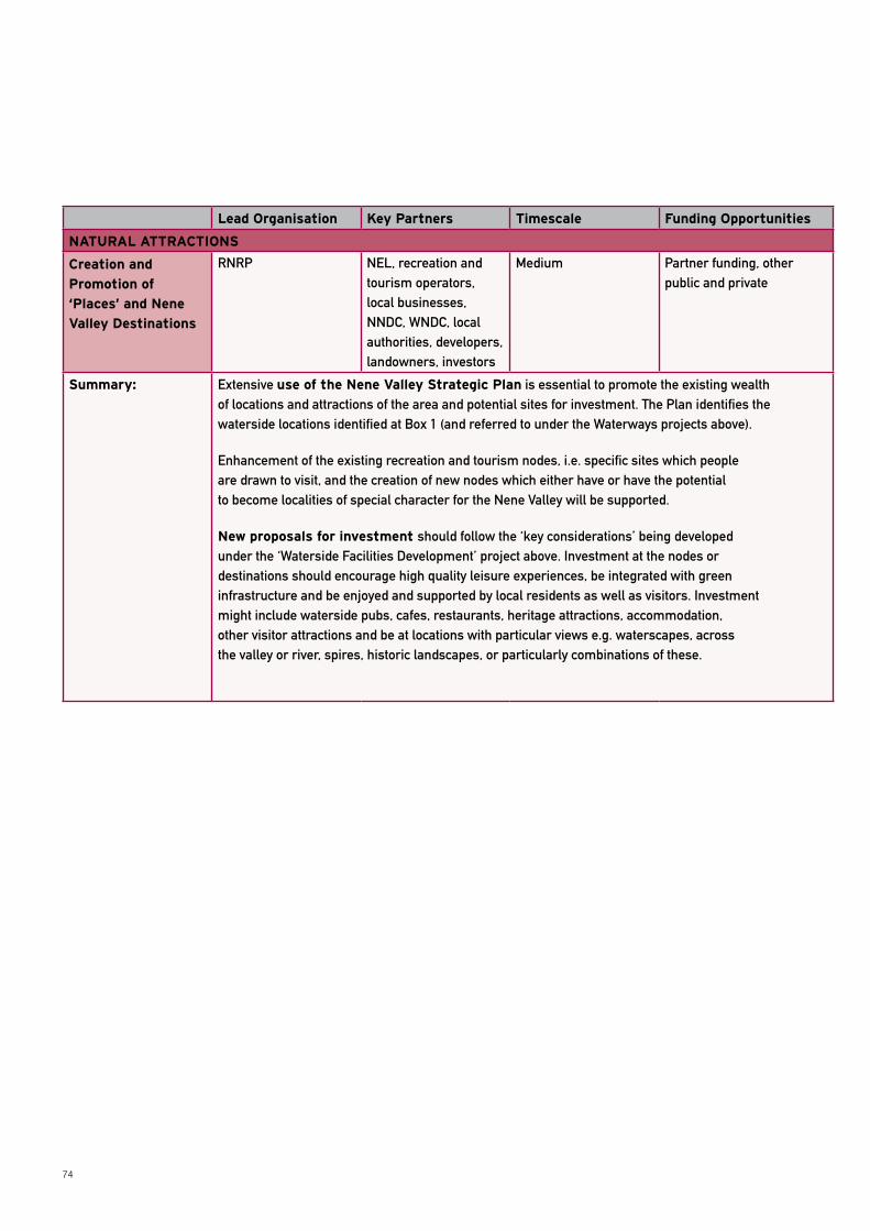
74
Lead Organisation Key Partners Timescale Funding Opportunities
NATURAL ATTRACTIONS
Creation and
Promotion of
‘Places’ and Nene
Valley Destinations
RNRP NEL, recreation and tourism operators, local businesses, NNDC, WNDC, local authorities, developers, landowners, investors
Medium Partner funding, other public and private
Summary: Extensive use of the Nene Valley Strategic Plan is essential to promote the existing wealth of locations and attractions of the area and potential sites for investment. The Plan identifies the waterside locations identified at Box 1 (and referred to under the Waterways projects above).
Enhancement of the existing recreation and tourism nodes, i.e. specific sites which people are drawn to visit, and the creation of new nodes which either have or have the potential to become localities of special character for the Nene Valley will be supported.
New proposals for investment should follow the ‘key considerations’ being developed under the ‘Waterside Facilities Development’ project above. Investment at the nodes or destinations should encourage high quality leisure experiences, be integrated with green infrastructure and be enjoyed and supported by local residents as well as visitors. Investment might include waterside pubs, cafes, restaurants, heritage attractions, accommodation, other visitor attractions and be at locations with particular views e.g. waterscapes, across the valley or river, spires, historic landscapes, or particularly combinations of these.
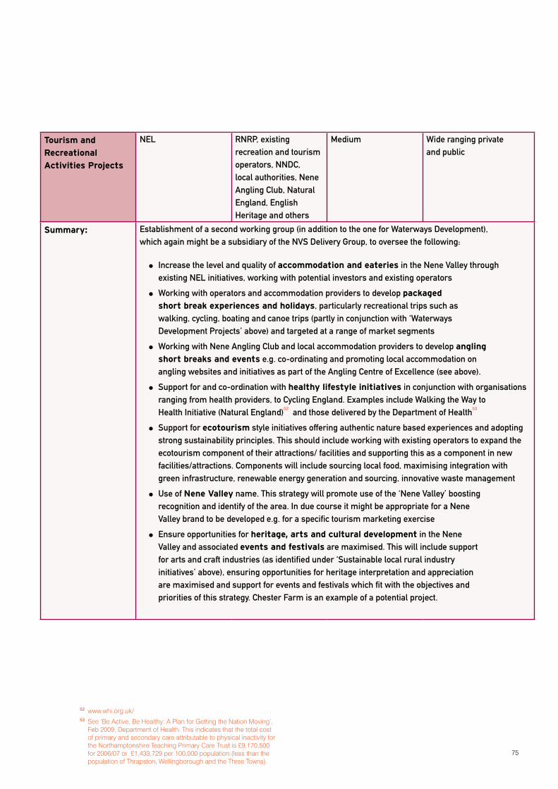
75
Tourism and
Recreational
Activities Projects
NEL RNRP, existing recreation and tourism operators, NNDC, local authorities, Nene Angling Club, Natural England, English Heritage and others
Medium Wide ranging private and public
Summary: Establishment of a second working group (in addition to the one for Waterways Development), which again might be a subsidiary of the NVS Delivery Group, to oversee the following:
Increase the level and quality of accommodation and eateries in the Nene Valley through existing NEL initiatives, working with potential investors and existing operators
Working with operators and accommodation providers to develop packaged
short break experiences and holidays, particularly recreational trips such as walking, cycling, boating and canoe trips (partly in conjunction with ‘Waterways Development Projects’ above) and targeted at a range of market segments
Working with Nene Angling Club and local accommodation providers to develop angling
short breaks and events e.g. co-ordinating and promoting local accommodation on angling websites and initiatives as part of the Angling Centre of Excellence (see above).
Support for and co-ordination with healthy lifestyle initiatives in conjunction with organisations ranging from health providers, to Cycling England. Examples include Walking the Way to Health Initiative (Natural England)
52 and those delivered by the Department of Health
53
Support for ecotourism style initiatives offering authentic nature based experiences and adopting strong sustainability principles. This should include working with existing operators to expand the ecotourism component of their attractions/ facilities and supporting this as a component in new facilities/attractions. Components will include sourcing local food, maximising integration with green infrastructure, renewable energy generation and sourcing, innovative waste management
Use of Nene Valley name. This strategy will promote use of the ‘Nene Valley’ boosting recognition and identify of the area. In due course it might be appropriate for a Nene Valley brand to be developed e.g. for a specific tourism marketing exercise
Ensure opportunities for heritage, arts and cultural development in the Nene Valley and associated events and festivals are maximised. This will include support for arts and craft industries (as identified under ‘Sustainable local rural industry initiatives’ above), ensuring opportunities for heritage interpretation and appreciation are maximised and support for events and festivals which fit with the objectives and priorities of this strategy. Chester Farm is an example of a potential project.
52 www.whi.org.uk/53 See ‘Be Active, Be Healthy: A Plan for Getting the Nation Moving’,
Feb 2009, Department of Health. This indicates that the total cost of primary and secondary care attributable to physical inactivity for the Northamptonshire Teaching Primary Care Trust is £9,170,500 for 2006/07 or £1,433,729 per 100,000 population (less than the population of Thrapston, Wellingborough and the Three Towns).
76
This Strategic Plan has involved consultation and engagement with a wide range of stakeholders and partner organisations. The multifaceted nature of many of the proposals and projects in the Plan means a multi-dimensional partnership approach will often be needed for effective delivery, drawing on a range of public, private and other funding sources. Ongoing engagement and high levels of commitment by stakeholders, together with new partners, will be key to effective delivery.
This section considers various aspects of delivery of the Plan, including an overview of this, engagement and involvement, investment and funding and specific proposals for the Nene Valley Strategic Plan Delivery Group.
OVERVIEW OF USE OF THE STRATEGyThe Strategic Plan and proposals for its delivery have been developed and considered both at a strategic level and to reflect the actions, initiatives and opportunities at a practical implementation level. Delivery of the Plan will involve its use in multiple ways, focusing on the following:
Recognition of the strategy’s priorities and projects in the strategies and plans of the partner organisations. Local Development Frameworks and other local authority strategies e.g. relating to open space, economic development, tourism and leisure will all take forward the proposals in this strategy. Other partner organisations will similarly use the strategy to underpin their plans and programmes from a high level e.g. by NNDC to a practical delivery level e.g. by Groundwork. Developers and landowners will also use the strategy to support proposals, either directly or ensuring integration of their proposals with priorities and projects in this strategy.
Engagement of new partners by inviting interest in proposals in the strategy
Implementation of the strategy’s projects and actions though the proposed Nene Valley Strategy Delivery
Group (see below) and partner organisations
Use of the strategy to support new projects
and opportunities that are consistent with and assist implementation of strategy priorities
Support for the Plan from new partners could potentially be substantial, given the benefits associated with the strategy’s implementation. Investing in green infrastructure to generate improved recreational and environmental experiences brings very significant quality of life and well-being benefits, aside from economic and environmental benefits. Economic benefits range from higher land and property values to reduced healthcare costs, as well as proving support for the local rural economy. Investment will draw on a wide mix of funding opportunities: public, private and non-government organisations. A considerable amount of the green infrastructure delivery will occur through the development process: the new Community Infrastructure Levy (CIL) and integration of new developments into the wider green infrastructure network.
ENGAGEMENT AND INVOLVEMENT Each of the stakeholders and/or partner organisations involved in the strategy should consider the various ways they can support and make use of the strategic plan and the relevance of specific elements to their work/remit. They should identify how they can effectively contribute to projects, in terms of staff resources or financial assistance, and the implications of this over the next few years. Identifying targets for involvement and delivery by partners at an early stage, and monitoring and reviewing these, will assist momentum in delivering the strategy.
Many organisations will be directly involved:
in delivering projects either as a lead body or partner organisation
in overseeing implementation of the strategy through their role on the NVSP Delivery Group or the working groups
by using the strategy to endorse and influence their own proposals.
SECTION 11: MOVING FORWARD
77
Others may be involved more peripherally as partner organisations engaged on specific projects or in recognising the role of this strategic plan in the wider strategic aims of their own organisation’s work.
Ongoing partnership working and a process of engagement will underpin effective delivery of the strategy and its projects. This will involve stakeholders informing, promoting and engaging on the delivery of the strategy and on specific projects with each other, with new partner organisations and with the wider local and business community. Much of this will be led by the NVSP Delivery Group but also other stakeholder organisations, ranging from specific local community groups such as those involved in conservation or recreation, e.g. BTCV green gym or community groups54, to higher level strategic bodies such as EMDA. Cross-boundary working to ensure cross-regional connections will be particularly important e.g. between organisations in Northamptonshire, and those in Peterborough, and between local authority and development company/corporation areas in Northamptonshire.
It will be essential to build on preparatory work underway, projects already achieved and local or partner knowledge regarding new opportunities. A number of the projects in the strategy build on existing work or proposals such as visitor access proposals to environmental reserves, proposed cycle trails and the existing achievements at Stanwick Lakes. This strategy will support proposals being developed which fit with its priorities. Many of these will be at various stages in terms of planning and funding.
Importantly stakeholders and partner organisation should consider how specific projects can be embedded within Development Plan Documents, particularly Core Strategies and Local Development Frameworks, as well as Community Strategies. This will help bring forward key proposals as part of the statutory plan making process and allow for appropriate community engagement that takes place as part of that process. Community involvement, particularly through schools, can help shape projects and proposals.
INVESTMENT AND FUNDING The proposals in this plan form a critically important element of the growth planned for North Northamptonshire in ensuring a high quality living and working environment. They also support the growth for West Northamptonshire, Peterborough and other neighbouring sub-regions. Importantly, they significantly enhance the living and working environment of existing communities and create additional sub-regional recreational, biodiversity and tourism benefits. To this end, and particularly given the scale of planned growth, investment in the proposals should not be considered optional. Without this investment there are significant risks associated with further development of disconnected communities, which lack the green infrastructure and associated provision to support reasonable levels of health and well-being in the local population and quality living and working environments i.e. essential components of sustainable communities.
The multiplicity of benefits associated with the strategic plan generates a very varied range of funding opportunities. Nearly all the projects and actions will require a mix of private and public funding together with opportunities from quasi-public, voluntary and not-for-profit sources. Funding proposals will need to:
be considered on a per project basis, though in conjunction with other projects under the strategic plan (see below)
be cogniscent of the requirements and timelines (bidding and implementation) for particular grant schemes
ensure bids are made selectively for the most appropriate funding sources i.e. avoid multiple bids within the same bidding round, particularly under the same funding category – or co-ordinate projects to create a single more attractive proposition
be innovative in terms of the public/private/other mix for each project and particularly ensuring strong engagement with the private sector locally
ensure opportunities for community and voluntary sector involvement are maximised
be targeted in terms of the funding opportunities available and those most appropriate to a project
Partnership development and assembling funding for delivery will be the main executive role for delivering the strategy. More details are provided below.
54 See http://www.btcv.org.uk/cgi-bin/database_searches/website_groups.pl for details of Northamptonshire community groups which work with BTCV

78
NVSP DELIVERy GROUP AND WORKING GROUPSDelivery of the plan should be the responsibility of a Nene Valley Strategic Partnership (NVSP) Delivery Group. It is proposed that this group is made up of not more than eight senior representatives of key stakeholder organisations, which should include Environment Agency, NNDC, Natural England, NEL, RNRP and at least one private sector/operator in the area. Others can be drawn from the existing RNRP Board, RNRP Stakeholder Steering Group or from project delivery organisations (see for example the stakeholders listed at Appendix A).
The role of the Delivery Group will be to manage implementation of the strategy by the proposed two working groups and by the lead organisations identified for the projects/actions in Section 10. Strategy delivery should be based on a short annual business plan delivered by the working groups and through implementation of the individual projects. The plan should specify timescales and targets for project implementation. It is proposed that the Delivery Group meet to guide implementation and review progress on a quarterly basis.
In addition to the direct role of implementing the projects and actions under the strategy, the Delivery Group should have responsibility for championing the proposals and priorities under the strategy and building interest, partnership and investment opportunities.
Two working groups are identified to deliver particular projects and actions under this strategy:
a Waterways Development Projects Working
Group, led by the Environment Agency
a Tourism and Recreation Development Working
Group
Both should comprise a cohesive group of around 5-6 key relevant stakeholder organisations which are involved in delivery and which include a private sector operator in the Nene Valley. Details about the remit of the groups are given in Section 10.
It is likely that Strategic Plan delivery can most effectively be served by a dedicated manager. A Partnerships and Investment Manager, based either within RNRP or another of the stakeholder organisations, would work with lead project partners, assist in assembling project and programme funding (through working with partners and potential investors, preparing funding bid and project plans) and service the Delivery Group. Alternatively this work could be split amongst the partner organisations. Additional support will be needed to support the working groups from within the lead organisation for each of the working groups
.
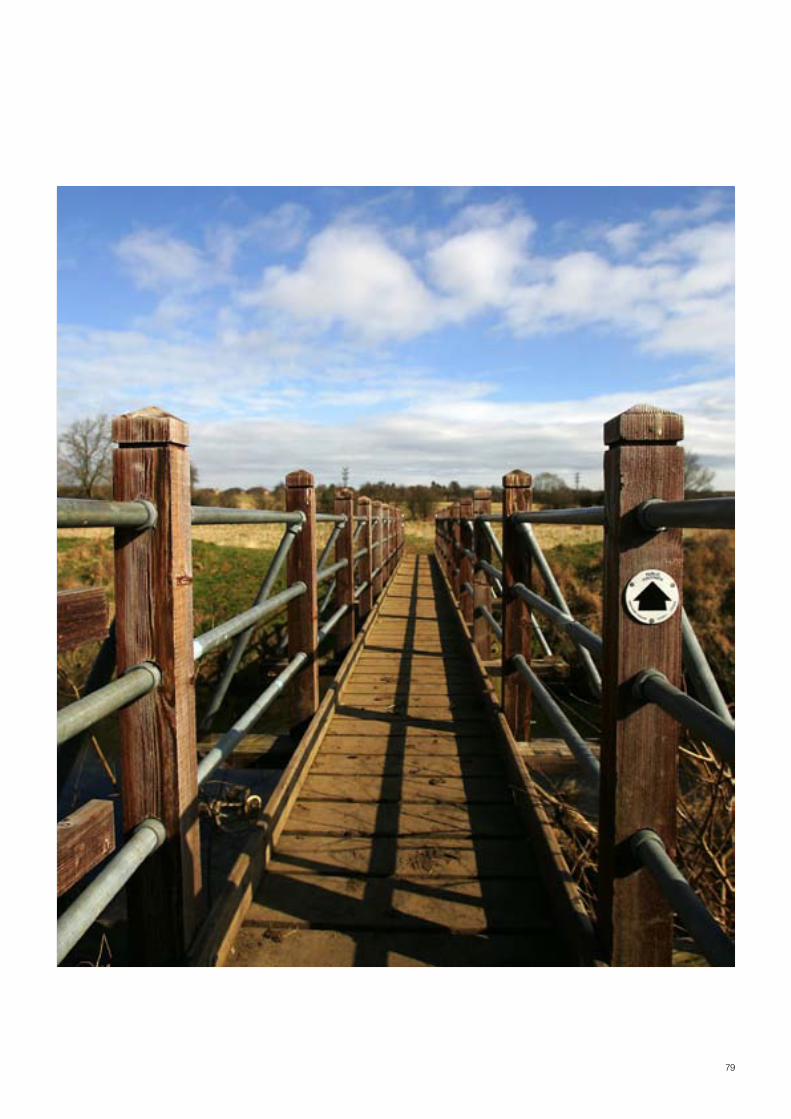
79
80
APPENDIx A: STRATEGy CONSULTATION
This strategy was developed through a process of stakeholder engagement, principally focused on three participatory workshops held in the Nene Valley. A list of the organisations involved in these workshops is provided below. A number of other organisations have provided input through the River Nene Regional Park. Consultation on the draft strategy involved core partners including Environment Agency, local authorities, Natural England, Northamptonshire Enterprise and North Northamptonshire Joint Planning Unit.
Barnabas Trust
Bee Bee Developments Ltd
Billing Aquadrome
Borough Council of Wellingborough
Country Land and Business Association
Corby Borough Council
Daventry District Council
East Midlands Rural Affairs Forum East Northamptonshire Council
East Northamptonshire Council
English Heritage East Midlands Region
Environment Agency
Fisher German LLP
Grendon Lakes
Groundwork North Northamptonshire
HCA
Kettering Borough Council
Lilford Lodge Farm
Natural England
Northampton Borough Council
Northamptonshire County Council
Northamptonshire Enterprise Limited
Northamptonshire Local Access Forum
North Northants Development Company
North Northamptonshire Joint Planning Unit
River Nene Regional Park
R S Brayshaw ECS
81
Rockingham Forest Trust
RSPB
South Northamptonshire Council
Sustrans
West Northamptonshire Development Corporation
West Northamptonshire Joint Planning Unit
Wicksteed Park
Wildlife Trust for Bedfordshire, Cambridgeshire, Northamptonshire & Peterborough
Thanks to David Lock Associates for the preparation and production of this strategy.
82
APPENDIx B: REFERENCES
Association of Inland Navigation Authorities, 1999, Steering a Fresh Course
British Waterways, March 2006, ‘Inland Marina Investment Guide’
British Waterways, 2008, Annual Report and Accounts 2007/8
CABE, 2004, Value of Pubic Space
CBI, 2007, Climate Change: Everyone’s Business
Countryside Agency/ Regeneris 2005, Countryside Access Study, Health Summary
DfT, 2007, ‘Towards a Sustainable Transport System: Supporting Economic Growth in a Low Carbon World’,
DETR, 2000, Waterways for Tomorrow
East Midlands Tourism, 2008, East Midlands Tourism Strategic Plan, 2008-2011
East Midlands Tourism, 2003, East Midlands Tourism Strategy 2003-2010
East Midlands Tourism/Scott Wilson, 2007, Tourism Investment Opportunities Assessment: Northamptonshire
East Northamptonshire Council, January 2008, Rural North, Oundle and Thrapston Plan
East Northamptonshire Council, 2005, East Northamptonshire Tourism Strategy 2010-2015
EMDA, 2006, East Midlands Regional Economic Strategy 2006-20
East Midlands Rural Affairs Forum, 2007, East Midlands Rural Action Plan 2007-13
EMRA, 2007, Green Infrastructure for the East Midlands – A Public Benefit Mapping Project
EMRA, 2007 and 2008, East Midlands Climate Change Programme of Action, EMRA. http://www.emra.gov.uk/what-we-do/housing-planning-transport/climate-change-programme-of-action
ENable Local Strategic Partnership East Northamptonshire Town health check and regeneration initiatives, see www.enable-lsp.co.uk
English Nature, Environment Agency, 2006, The Environment, Economic Growth and Competitiveness
English Nature, Environment Agency and others, 2005, HealthyEnvironments,ImprovingOurQualityofLife
Environment Agency, Countryside Agency, English Nature,
English Heritage et al, 2005 Planning Sustainable Communities: a Green Infrastructure Guide for Milton Keynes and the South Midlands’
Environment Agency, 2004, your Rivers for Life, A Strategy for the Development of Navigable Rivers 2004-07
Environment Agency, 2006, River Nene Waterway Plan A Better Place for All
Environment Agency, 2008, 2020 Vision for Funding Our Waterways
Explore Northamptonshire, 2007, Tourism Strategy for Northamptonshire (Strategic and Operating Plan) 2007-2010
GOEM, Regional Spatial Strategy for the East Midlands (RSS8)
83
HM Government, 2008, Climate Change Act
HM Government, 2005, Securing the Future: UK Sustainable Development Strategy
Jeremiah, Josephine, 2003, The River Nene: A Pictorial History, Published by Phillimore and Co. Ltd
Northamptonshire Biodiversity Partnership, 2008, Northamptonshire Biodiversity Action Plan
North Northamptonshire Joint Planning Unit, 2008, North Northamptonshire Joint Core Spatial Strategy
Northamptonshire County Council, 2007, Transport Strategy for Growth
Northamptonshire County Council, 2007, Northamptonshire Rights of Way Improvement Plan 2007-2011
Northamptonshire Enterprise Ltd, North Northamptonshire Development Company, West Northamptonshire Development Company, 2008, Draft Strategic Northamptonshire Economic Action Plan (‘SNEAP’)
Northamptonshire Enterprise Ltd, 2008, Northamptonshire Waterways Feasibility Analysis
Northamptonshire Enterprise Ltd, 2007, Explore Northamptonshire: Strategic and Operating Plan 2007-10
Northamptonshire Enterprise Ltd, 2007, Northamptonshire Tourism Strategy 2007-2010
Northamptonshire Observatory, 2007, 2007 STEAM Tourism Statistics for Northamptonshire
Northamptonshire Partnership, 2006, Sub-regional Economic Strategy (‘SRES’)
Northampton Borough Council / Halcrow, 2005, Waterside Northampton: Development Framework and Masterplan,
ODPM, 2003, Sustainable Communities Plan
Pevsener, N, 1973, Northamptonshire (Pevsner Buildings of England)
River Nene Regional Park, 2006, Environmental Character and Green Infrastructure Suite, RNRP www.rnrpenvironmentalcharacter.org.uk
River Nene Regional Park, 2007, Creating Successful Green Infrastructure Plans, Best Practice from the East Midlands and RNRP
RSPB/ Natural England/ Faculty of Public Health, 2004, Natural Fit, 2007, Natural Thinking and 2007 Natural Health
Sport England, 2005, Sport Playing Its Part, ‘Sports Contribution to Healthier Communities’ and ‘Sports Contribution to Economic Vitality and Workforce Development’
Sustainable Development Commission, 2008, Health, place and nature: How outdoor environments influence health and well-being: a knowledge base
Sustrans, 2006, Economic Appraisal of local walking and cycling routes
UK Energy Research Centre/ Natural England, 2007, UK Tourism in a Low Carbon World
The Wildlife Trusts, 2006, A Living Landscape; A Call to Restore the UK’s Battered Ecosystems for Wildlife and People
The Wildlife Trust (Bedfordshire, Cambridgeshire, Northamptonshire & Peterborough) Vision for Biodiversity in the Nene Valley
84
APPENDIx C: NORTHAMPTONSHIRE GREEN INFRASTRUCTURE
Northamptonshire’s Environmental Character and Green Infrastructure Suite (www.rnrpenvironmentalcharacter.org.uk) is a very detailed set of documentation, totalling around 1000 pages, which provides:
Green infrastructure policy context
Environmental character assessment for Northamptonshire
Historic landscape character assessment for Northamptonshire
Biodiversity character assessment for Northamptonshire
Green Infrastructure strategy for the county (Section 5.0 of the suite), informed by the detailed environmental, historic landscape and biodiversity character assessments. This includes proposals for the biodiversity network, sustainable movement network and strategic areas for GI investment.
Strategic GI studies for West and North Northamptonshire (Sections 5, Study A and 5.2, Study B respectively)
The GI suite is used by a wide range of authorities and private sector organisations A key role is in delivering green infrastructure as part of the planning process
NORTH NORTHAMPTONSHIRE
The proposals for North Northamptonshire (Section 5.2) were reviewed and incorporated into this strategy for the Nene Valley. The section includes:
An assessment of ‘the resource’ including natural and human systems, the latter including heritage, culture, green space, leisure and tourism, access and movement, transport
Proposals for the sustainable movement network
Proposals for sub-regional GI corridors in North Northamptonshire
The assessment of the resource identifies the following of particular relevance to this strategy:
HERITAGE AND CULTURE
Rockingham Forest, an area of former hunting forest being a major historic asset with Anglo Saxon origins and a strong medieval past
Important historical destinations and parks and gardens of strategic significance
Industrial heritage, particularly iron working having origins in the Roman period and continuing into the 20th century
Historic railways particularly the former branch line which followed the length of the River Nene
85
STRATEGIC GREEN SPACE (AS MAPPED IN THIS STRATEGy, SEE FIGURE 1)
The proximity of many wildlife sites to monuments and landscape of heritage interest and the opportunity this presents in terms of interpretation
The opportunity to celebrate the rich industrial heritage of the area
How the value of a park or open space increase exponentially when easily accessible and connected to a larger strategic green space network
Increasing local population could increase visitor numbers to country parks to levels where litter, erosion, traffic congestion and damage to wildlife and heritage assets occur
Publicly accessible woodland and nature reserves are critical green space destinations and should be promoted
Incidental picnic areas and nature trails are under used and not widely promoted
LEISURE, RECREATION AND TOURISM
Camping, caravanning, water sport and sailing centres (as mapped in this strategy)
Mooring sites act as focal points for visitors and are sometimes accompanied by cafes, pubs and other rural visitor attractions
Five golf courses in north Northamptonshire
Museums, most of which are in urban areas with the exception of Oundle Museum, Irchester Narrow Gauge Railway and Earls Barton
Opportunities for further promotion of the use of the Nene as a watercourse to meet new tourism markets focusing on activity holidays.
The need to address tourism weaknesses namely lack of brown signage, poor public transport, lack of identity and poor public perceptions of the region
Opportunities for improving participation in recreational physical activity, both informal and informal
Potential for farm diversification to contribute more widely to leisure and tourism
ACCESS AND MOVEMENT
Principal recreational walking routes are the Nene Way and Jurassic Way. The Lyveden Way offers a circular route linking with the Nene Way and Lyveden New Bield
Opportunities for the delivery of environmentally sustainable transport solutions improving access to workplaces, education, health, shopping and other facilities for all the population, encouraging healthier travel choices and minimising the effect of traffic and transport on the built and natural environment
Opportunities for improvements to the Rights of Way network, principally through the reconnection of obstructed and disjointed paths. Also improving access for the disabled, improving site interpretation and opportunities for education and an increase in travel choices. Growth Areas Funding (GAF) has included improvements to ROWs which exceed statutory requirements
86
Opportunities to focus on the Rural Priority Areas identified in the county’s Accessibility Strategy (2006)
Opportunity to reinforce the Nene Way as a centre piece to the Regional Park
The need to overcome the severance of many cycle and pedestrian routes created by the A605/A45. This route, which borders the Nene, forms a significant physical barrier between areas to the north and south and is infrequently crossed by bridges. Principal vehicular crossings are at Wellingborough, Irthlingborough, Thrapston and Oundle
The abrupt urban-rural interface exacerbated by busy roads encircling the area’s principal settlements. These strong urban edges act as a barrier to town and countryside particularly around Wellingborough, Kettering and Corby
Opportunity for development of the recreational route along the old railway line between Irthlingborough, Stanwick/Raunds and Thrapston so which could ultimately become part of a Nene Cycleway
SUSTAINABLE MOVEMENT NETWORK AND SUB-REGIONAL GI CORRIDORS
Sustainable movement is focused on provision of environmentally sustainable transport solutions linking communities along GI corridors. ‘Green Ways’ and ‘Blue Ways’ seek to provide the broad geographic focus for sustainable movement. The Green Way network ‘would provide a continuous network of safe, attractive and well signposted system of footpaths, cyclepaths and bridleways thought the open countryside. They would be well promoted and accessible’. ‘The design of the proposed network has utilised existing public rights of way…’. ‘Over much of the landscape Green Ways would comprise surfaced tracks, footpaths and cycle lanes’. (Section 5.0, Chapter 9.9)
The proposed Blue Ways network ‘would operate and function in a similar way as the Green Ways. However, their route is dictated by river courses. Towpaths and riverside footpaths would offer the same opportunities for pedestrian and cycle traffic as Green Ways. Blue Ways would offer additional travel options for private waterways users and with the potential for ‘boat taxis to service popular stretches of the network’.
THE SUB-REGIONAL GREEN INFRASTRUCTURE CORRIDORS (CHAPTER 20.1):
‘broadly follow the strategic waterways and valleys’,
‘also follow notable concentrations of biodiverse areas or well defined movement patterns and opportunities..including linkages between settlements’
‘often function as transportation routeways, support flood storage areas or are rich in biodiversity or heritage resources and offer recreation and leisure opportunities’
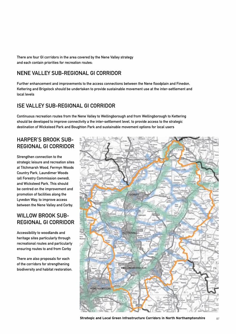
87
There are four GI corridors in the area covered by the Nene Valley strategy and each contain priorities for recreation routes:
NENE VALLEy SUB-REGIONAL GI CORRIDOR
Further enhancement and improvements to the access connections between the Nene floodplain and Finedon, Kettering and Brigstock should be undertaken to provide sustainable movement use at the inter-settlement and local levels
ISE VALLEy SUB-REGIONAL GI CORRIDOR
Continuous recreation routes from the Nene Valley to Wellingborough and from Wellingborough to Kettering should be developed to improve connectivity a the inter-settlement level, to provide access to the strategic destination of Wicksteed Park and Boughton Park and sustainable movement options for local users
HARPER’S BROOK SUB-REGIONAL GI CORRIDOR
Strengthen connection to the strategic leisure and recreation sites at Titchmarsh Wood, Fermyn Woods Country Park, Laundimer Woods (all Forestry Commission owned), and Wicksteed Park. This should be centred on the improvement and promotion of facilities along the Lyvedon Way, to improve access between the Nene Valley and Corby.
WILLOW BROOK SUB-REGIONAL GI CORRIDOR
Accessibility to woodlands and heritage sites particularly through recreational routes and particularly ensuring routes to and from Corby
There are also proposals for each of the corridors for strengthening biodiversity and habitat restoration.
Strategic and Local Green Infrastructure Corridors in North Northamptonshire
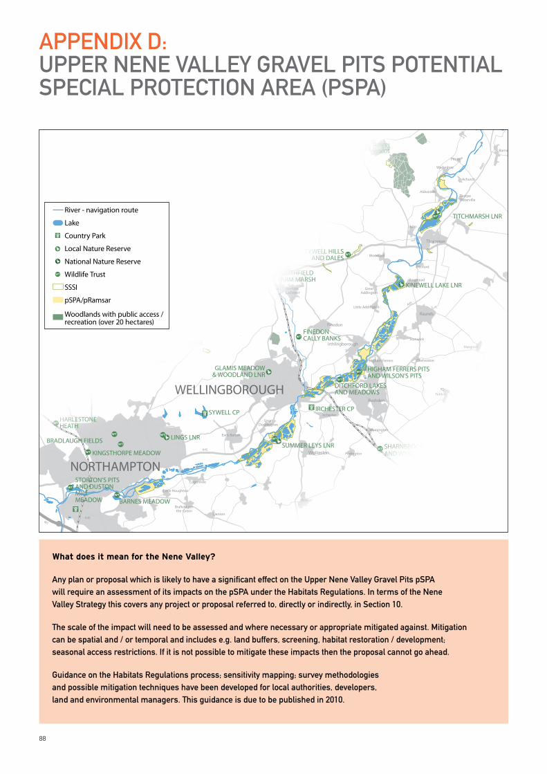
88
APPENDIx D: UPPER NENE VALLEy GRAVEL PITS POTENTIAL SPECIAL PROTECTION AREA (PSPA)
What does it mean for the Nene Valley?
Any plan or proposal which is likely to have a significant effect on the Upper Nene Valley Gravel Pits pSPA will require an assessment of its impacts on the pSPA under the Habitats Regulations. In terms of the Nene Valley Strategy this covers any project or proposal referred to, directly or indirectly, in Section 10.
The scale of the impact will need to be assessed and where necessary or appropriate mitigated against. Mitigation can be spatial and / or temporal and includes e.g. land buffers, screening, habitat restoration / development; seasonal access restrictions. If it is not possible to mitigate these impacts then the proposal cannot go ahead.
Guidance on the Habitats Regulations process; sensitivity mapping; survey methodologies and possible mitigation techniques have been developed for local authorities, developers, land and environmental managers. This guidance is due to be published in 2010.
Chesterton
Haddon
Marholm
M1A45
A45
A45
A43
A14
A14
A1(M)
A605
Rockingham
Geddington
Stanion
Brigstock
Finedon
Wollaston
WansfordUppingham
Oundle
Rushden
Irthlingborough
Raunds
Burton Latimer
OakhamStamford
Wittering
Desborough
Rothwell
Great Doddington
Earls Barton
Cogenhoe
Higham Ferrers
Little Addington
Great Addington
Caldecott
Gretton
King’s Cli�e
Apethorpe
Woodnewton
Eastern on the Hill
Ringstead
Woodford
Denford
Thorpe Waterville
Wadenhoe
Barnwell
Pilton
Achurch
Ashton
Cotterstock
Tansor
Fotheringhay
Warmington
Elton
Nassington
Yarwell
SuttonStibbington
Water Newton
Sibson
Thrapston
Aldwinkle
Irchester
Stanwick
Islip
Pitsford Water
Bozeat
Podington
Wymington
Yelden
Chelveston
Hargrave
Caster
Denton
Bra�eld-on-the-Green
Little Houghton
WELLINGBOROUGH
NORTHAMPTON
KETTERING
CORBY
PETERBOROUGH
HARLESTONE HEATH
STORTON’S PITS AND DUSTON MILL MEADOW
COLLYWESTERN QUARRIES
IRCHESTER CP
BARNWELL CP
FERMYN WOODS CP
EASTCARLTON CP
SYWELL CP
YARWELL STATION
N E N E V A L L E Y R A I L W A Y L I N E
CASTOR HANGLANDS NNRCOLLYWESTON GREAT WOOD& EASTON HORNSTOCKS NNR BEDFORD
PURLIEUS NNR
TITCHMARSH LNR
KINEWELL LAKE LNR
SUMMER LEYS LNR
GLAMIS MEADOW& WOODLAND LNR
GREAT OAKLEYMEADOW LNR
KINGSWOOD LNR
TAILBY MEADOW LNR
BRIXWORTH CP
TYWELL HILLSAND DALES
SOUTHFIELD FARM MARSH
FINEDON CALLY BANKS
LINGS LNR
BARNES MEADOW
BRADLAUGH FIELDS
KINGSTHORPE MEADOW
PITSFORD RESERVOIR
DITCHFORD LAKES AND MEADOWS
HIGHAM FERRERS PITS AND WILSON’S PITS
SHARNBROOK SUMMIT AND WYMINGTON MEADOW
FELMERSHAM GRAVEL PITS
BARFORD WOOD AND MEADOWSROTHWELL GULLETT
THE PLENS
STOKE WOOD END QUARTER
GLAPTHORN COW PASTURES
SHORT WOOD
SOUTHWICK WOOD
OLD SULEHAY
WANSFORD PASTUREYARWELL DINGLE AND POND
STIBBINGTON
SOUTHORPE MEADOW AND PADDOCK
THORPE WOOD
WOODSTON PONDS
WAKERLEY GREAT WOOD
FINESHADE WOOD
RO
CK
IN
GH
AM
F
OR
ES
T
FERMYN WOODS
SOUTHEY WOOD
River - navigation route
Lake
Country Park
Local Nature Reserve
National Nature Reserve
Wildlife Trust
SSSI
pSPA/pRamsar
Woodlands with public access / recreation (over 20 hectares)
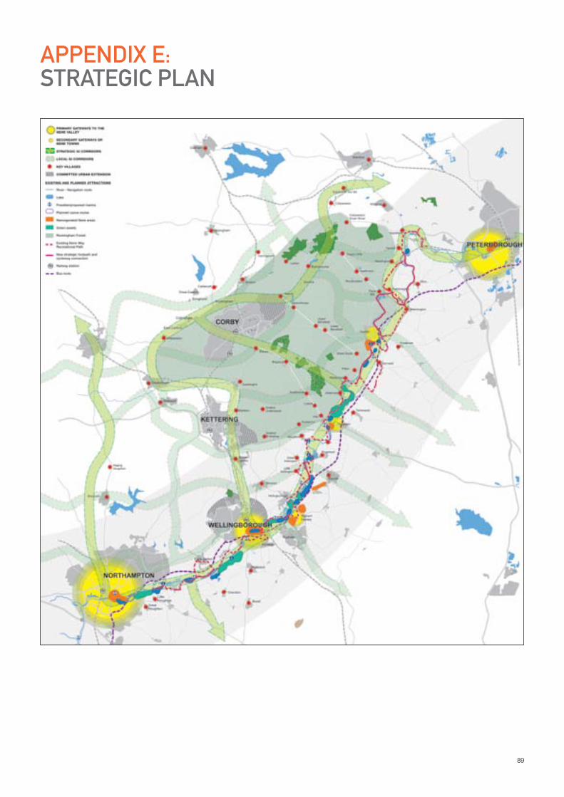
89
APPENDIx E: STRATEGIC PLAN

RIVER NENE REGIONAL PARK COMMUNITY INTEREST COMPANYc/o Northamptonshire County Council
PO Box 221. John Dryden House . 8-10 The Lakes . Northampton . NN4 7DE
T: 01604 237648 F: 01604 236696 W: WWW.RIVERNENEREGIONALPARK.ORG
Registered in England and Wales . Company Registration no: 6286982 Registered O�ce: Anthony Collins Solicitors LLP, 134 Edmund Street, Birmingham, B3 2ES
VAT Reg No: 947 4389 75