results of a detailed gravity survey in the alamosa area, alamosa county, colorado 6979261
TRANSCRIPT

8/12/2019 Results of a Detailed Gravity Survey in the Alamosa Area, Alamosa County, Colorado 6979261
http://slidepdf.com/reader/full/results-of-a-detailed-gravity-survey-in-the-alamosa-area-alamosa-county-colorado 1/39
IDOE/ID/12079-L109
DE84 012188
NOTICE
PORTIONS OF THIS REPORT ARE ILLEGIBLE. It
has been reproduced rom the best availablecopy to permit the broadest possible avail-sbtlity.
RESULTS OF A DETAILED G R A V I T Y SURVEY I N THEALANOSA AREA, ALANOSA COUNTY, COLORADO
bY
C l a r o n E. Vacke lp rang
September, 1983
Work performed under Contract Number DE-AC07-801012079

8/12/2019 Results of a Detailed Gravity Survey in the Alamosa Area, Alamosa County, Colorado 6979261
http://slidepdf.com/reader/full/results-of-a-detailed-gravity-survey-in-the-alamosa-area-alamosa-county-colorado 2/39
DISCLAIMER
This report was prepared as an account of work sponsored by anagency of the United States Government. Neither the United StatesGovernment nor any agency Thereof, nor any of their employees,makes any warranty, express or implied, or assumes any legalliability or responsibility for the accuracy, completeness, orusefulness of any information, apparatus, product, or processdisclosed, or represents that its use would not infringe privatelyowned rights. Reference herein to any specific commercial product,process, or service by trade name, trademark, manufacturer, orotherwise does not necessarily constitute or imply its endorsement,recommendation, or favoring by the United States Government or anyagency thereof. The views and opinions of authors expressed hereindo not necessarily state or reflect those of the United StatesGovernment or any agency thereof.

8/12/2019 Results of a Detailed Gravity Survey in the Alamosa Area, Alamosa County, Colorado 6979261
http://slidepdf.com/reader/full/results-of-a-detailed-gravity-survey-in-the-alamosa-area-alamosa-county-colorado 3/39
DISCLAIMER
Portions of this document may be illegible inelectronic image products. Images are producedfrom the best available original document.

8/12/2019 Results of a Detailed Gravity Survey in the Alamosa Area, Alamosa County, Colorado 6979261
http://slidepdf.com/reader/full/results-of-a-detailed-gravity-survey-in-the-alamosa-area-alamosa-county-colorado 4/39
00E/ID/12079-1
ESL -12
RESULTS OF A DETAILED GRAVITY SURVEY I N THEALAMOSA AREA, ALAMOSA COUNTY, COLORADO
Cla ron E. backe lp r ang
September, 1983
Work performed under Contract Number DE-AC07-80ID12079
E a r t h S c i en c e L a b o r a t o r yU n i v e r s i t y o f Ut ah Res ear ch I n s t i t u t e
420 Chi pet a Way, Su i t e 120
P re p ar ed f o r U.S. Department o f Energy
D i v i s i o n o f Geo th er m al En er g y

8/12/2019 Results of a Detailed Gravity Survey in the Alamosa Area, Alamosa County, Colorado 6979261
http://slidepdf.com/reader/full/results-of-a-detailed-gravity-survey-in-the-alamosa-area-alamosa-county-colorado 5/39
T *
NOTI E
T h i s r epor t was prepared t o document work sponsored by the United States
Government.
Department of Energy nor any Federal employees nor any of their contractors
subcontractors or their employees makes any warranty express or imp1Sed o r
assumes any 1egal 1 ab i 1 t y or responsi b i 1i t y f o r the accuracy completeness .
Neither the U n i t e d States nor i t s agent t h e United S t a t e s
o r usefulness o f any information apparatus product o r process disclo sed o r
represents t h a t i t s use would not infringe privately owned r i g h t s .
NOTICE
Reference t o a company o r product name does not imply approval o r
recommendation of the product y the Univers i ty of Utah Research Institute o r
t he U.S. Department of Energy t o the excl usion of ot he rs t h a t may be s u i t ab l e .
8/12/2019 Results of a Detailed Gravity Survey in the Alamosa Area, Alamosa County, Colorado 6979261
http://slidepdf.com/reader/full/results-of-a-detailed-gravity-survey-in-the-alamosa-area-alamosa-county-colorado 6/39
TABLE OF CONTENTS
Page
ABSTRACT. ............................................................. .l
INTRODUCTION. ......................................................... .2
GENERAL GEOLOGY.. ..................................................... .2Gravi ty Data. .................................................... . 3
Survey Procedure.............................................5Survey Resul ts. ............................................. -5
Model Results................................................6
GEOLOGIC IMPLICATIONS..................................................8/
A P P E NDIX B.................................,
ILLUSTRATIO
F i g u r e 1. Location Map
P1 a te I A1 amosa Basin Geologic Cross-Seci
P l a t e I 1 Simple Bouguer Gravity Map o f thcA1 amosa Coun ty, Col or ad o
P l a t e 111 Computed three-d imensiona l g ra v i l
P l a t e I V 21/2- Dimensiona l Gravi ty Model Ba
P l a t e V 2 1/2- Dimensional Gravi ty Model D g
........................... 9
.......................... 11
.......................... 12
).........................13
ions
A 1 amosa Area,
1 Alamosa Area, Co lor ad o
I , Alamosa Area, Co lora do
B Alamosa Area, Co lor ad o
8/12/2019 Results of a Detailed Gravity Survey in the Alamosa Area, Alamosa County, Colorado 6979261
http://slidepdf.com/reader/full/results-of-a-detailed-gravity-survey-in-the-alamosa-area-alamosa-county-colorado 7/39
ABSTRACT
A t o t a l o f 322 s ta t i o n s , ce n te re d on t h e City o f Alamosa, were surve yed
These data have shown the Alamosai th a gravimeter dur ing September, 1981.h o r s t t o have an i r r e g u l a r t op . T h is i r r e g u l a r i t y i s th ou gh t t o be caused by
pa leova l ey s and /o r down-d ropped f a u l t b locks w i t h in t he Precambr ian ho rs t .
The City o f Alamosa l i e s d i r e c t l y o ve r a l o c a l g r a v i t y low. V o lc a ni c r o c k s
w i t h i n t h i s l o w may co n ta i n a r e s e rv o i r f o r ge oth erma l f l u i d s , as ye t
u n su b s ta n t i at e d by d r i l l i n g . Thermal f l u i d s a re t h o u gh t t o e n t e r t h e Alamosa
a r e a v i a a q u i f e r s from the west (San-Juan Mountains) and/or from t h e R i o
Grande R i f t zone with t h e f l u i d s r i s i n g al on g f r a c t u re s w i t h i n and b o r de r in g
t h e h o r s t. The m ost fa v o r a b l e d r i l l i n g t a r g e t s a pp ea r t o be e i t h e r n ea r t h e
c e n te r o f t h e l o c a l g r a v i t y lo w o r i n t h e f r a c t u r e zone a t t h e edges o f t h e
in fe r r e d down-dropped f a u l t b locks .
\
1

8/12/2019 Results of a Detailed Gravity Survey in the Alamosa Area, Alamosa County, Colorado 6979261
http://slidepdf.com/reader/full/results-of-a-detailed-gravity-survey-in-the-alamosa-area-alamosa-county-colorado 8/39
I NTRO DUCTI O N
A t t h e r e q u e s t o f DOE/DGE Idaho Operat ions Off ice th e E art h Science
Lab ora t ory /U n ive rs i ty o f U tah Research I n s t i t u t e (ESL/UURI) undertook a
d e t a i l e d g r a v i t y s ur ve y o f a 200 square m i l e a rea centered on th e City o f
Alamosa, Colorado.
bein g used by seve ral bus inesses i n o r nea r Alamosa.
he at in g o f motels , shopping ma l ls and pu b l i c swimming pools .
Low tempera ture (90-110°F) geothermal f l u id s are cu r r e n t l y
These i nc l ude d i rec t
The City o f A lamosa, t hr ou g h p a r t i c i p a t i o n i n t h e DOE/DGE User-Coupled
D r i l l i n g Program, had c o n t r a c t e d t o d r i l l f o r t h er m al f l u i d s w h ic h w ou ld be
used f o r d i s t r i c t h ea ti ng and i n d u s t r i a l processing. A d r i l l s i t e had been
se le c ted and d r i l l i n g scheduled b u t p r i o r t o i t s commencement, ESL rece ived
t h e r e qu e s t from DQE/DGE I da ho O pe ra ti on s O f f i c e t o p e rf o rm a g r a v i t y
survey.
t h e s e l e c ti o n o f a d r i l l s i t e w i t h i n t h e a re a most p r o m is in g f o r th er ma l
f l u i d s .
T h is g r a v i t y s u rv e y was t o p r o v i d e a d d i t i o n a l d a ta w hi ch w ou ld a i d i n
A meet ing was h e l d w i t h t h e d r i l l i n g c on tr ac to r, D r . Jay Kunze o f Energy
AServ ices Inc., Idaho Fa l l s , Idaho, immedia te ly fo l l o w in g th e f i e l d survey.
rough copy o f th e Bouguer g ra v i t y map was presented and i t s genera l
impl icat ions were d iscussed.
d r i l l e d i r r e s p e c t i v e o f t h e g r a v i t y r e s ul ts .
U nfo rt un ate ly , t h e i n i t i a l d r i l l s i t e was
GENERAL GEOLOGY
The gene ral ize d geology of th e Alamosa are a pre sen ted i n t h i s r e p o r t i s ,
f o r t h e most p a r t , a summary o f Colorado Geological Survey Sp ecia l Pu bl ic at io n
17 by D r . Ri ch ar d L. Burroughs (1981).
2

8/12/2019 Results of a Detailed Gravity Survey in the Alamosa Area, Alamosa County, Colorado 6979261
http://slidepdf.com/reader/full/results-of-a-detailed-gravity-survey-in-the-alamosa-area-alamosa-county-colorado 9/39
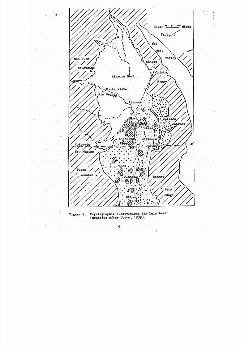
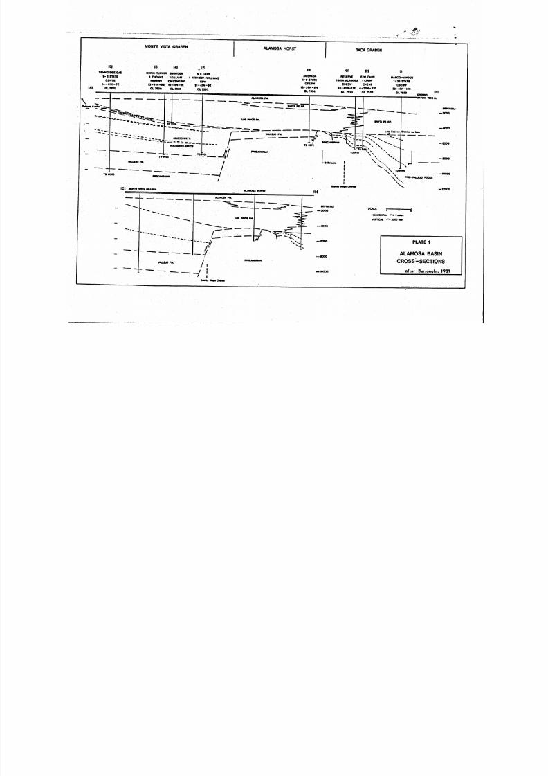
The City o f Alamosa i s l oca ted a t th e south-cent ra l end o f an
in te rmontane s t ru c t u r a l depression . Th is va l l e y i s app rox ima te ly 40 m i l e s
w ide and 70 m i le s lon g (F igure 1) and i s des ignate d t h e Alamosa Basin.
Trending nor th -south th rough th e center o f th e Alamosa Bas in i s a b u r i e d
bedrock ho rs t. The City o f A lamosa l i e s d i r e c t l y above t h i s h o r s t wh ic h
co ns is t s o f Precambrian rocks and has been penetrated a t a depth of about 5400
f ee t by a d r i l l t e s t l o c at ed ro ug hly 10 m i l e s n o r t h o f town i n t h e CSESW Sec.
16, T.29N., R.1OW.
A d d i t io n a l d r i l l i n g s t i l l f u r t h e r t o t h e n o r th o f town h as shown t h a t t h e
two grabens formed on e i t h e r s id e o f t h e Alamosa H ors t (P la te I ) have
developed a t d i f f e r e n t t i me s g e o l o g ic a l ly and t o s i g n i f i c a n t l y d i f f e r e n t
depths. The Baca Graben which formed t o t h e ea st o f Alamosa has an
a c cu m u la ti on o f v a l l e y f i l l e s ti m a te d t o be a t l e a s t 19,000 f e e t t h i c k .
g raben was w e l l formed p r i o r t o th e l a t e Eocene.
Th is
formed west o f t he ho rs t du r i ng t he Pre-Miocene and has accumulated about
10,000 f ee t o f ma te r i a l wh ich con ta i ns ash -f low t u f f s and vo l ca noc la s t i c s f rom
t h e San Juan v o l ca n i c f i e l d s t i l l f u r t h e r t o t h e west.
no t t hough t t o ex tend , i n any s i g n i f i c a n t t hi ckness , ac ross th e Alamosa Hors t
no r a re they p resen t i n t h e Baca Graben t o t h e east .
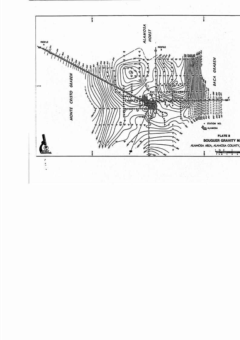
G r a v i t y Data
These volcanics are
'
/
The g r a v i t y d a ta i n t h e Alamosa B as in p r i o r t o t h e ESL survey consis ted,
i n p ar t , o f USGS data presented on Map GP-895 by Behrendt and Gajwa (1974); a
Masters Thesis, Un iv er s i ty o f Texas
approx imate ly 3500 s t a t i o n s from t h
Paso (Davis, 1979) which in cl ud ed
of the Department of Defense
g rav i t y l i b ra ry ; and recen t unpub l i shed da ta l from th e Co lorado Schoo l o f
Mines. Wi th th e except ion o f th e Co lorado Schoo l o f M ines data, these g ra v i ty
8/12/2019 Results of a Detailed Gravity Survey in the Alamosa Area, Alamosa County, Colorado 6979261
http://slidepdf.com/reader/full/results-of-a-detailed-gravity-survey-in-the-alamosa-area-alamosa-county-colorado 10/39
Figure 1 Pinysiographic subdivisions San Luis basin
modified after Upson 1939 .
4

8/12/2019 Results of a Detailed Gravity Survey in the Alamosa Area, Alamosa County, Colorado 6979261
http://slidepdf.com/reader/full/results-of-a-detailed-gravity-survey-in-the-alamosa-area-alamosa-county-colorado 11/39
a 3
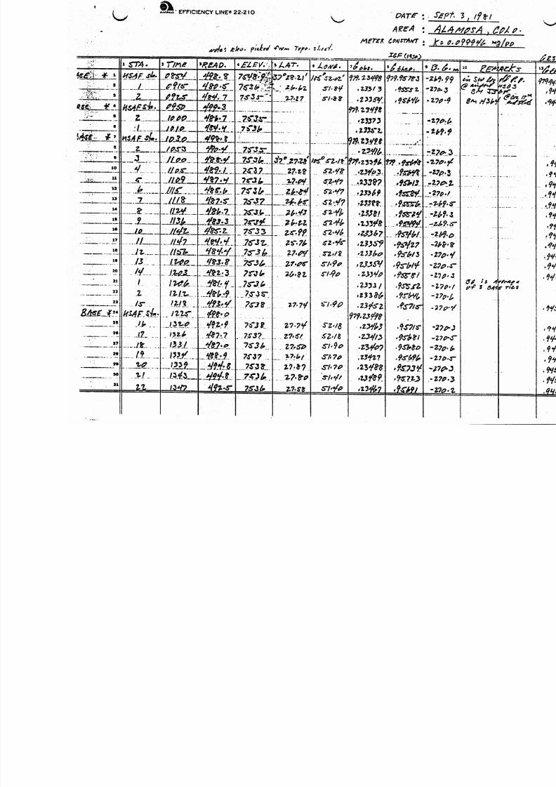
d a t a a r e o f a r e g i o n a l n a t u r e w i t h s t a t i o n s l b e i n g o c cu p ie d g e n e r a ll y a t two
Avenues. An a l t e r n a t e base s ta t i o n was setI
a t benchmark H364 loc ate d on t h e
co ns is t i ng o f s ta t io ns numbered 20 0 1 to 2060 and 1 8 0 1 to 1822, was p rov ided by
1967 (Wool l a r d , 1979).
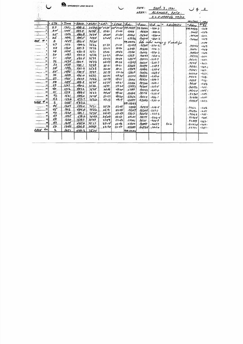
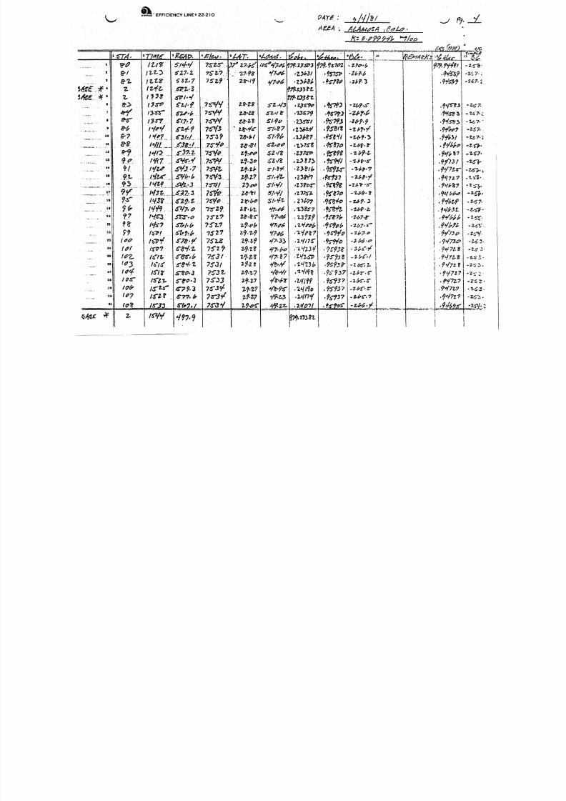
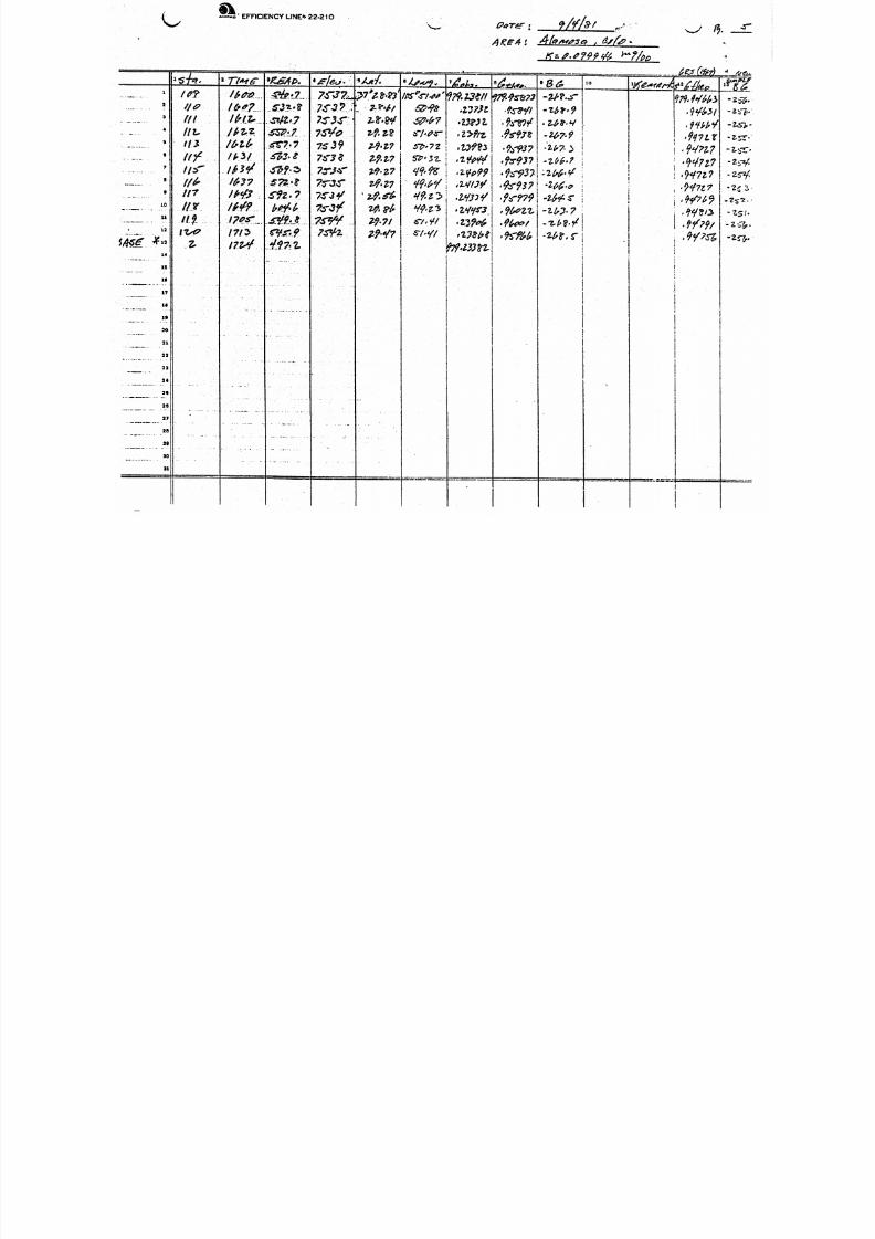
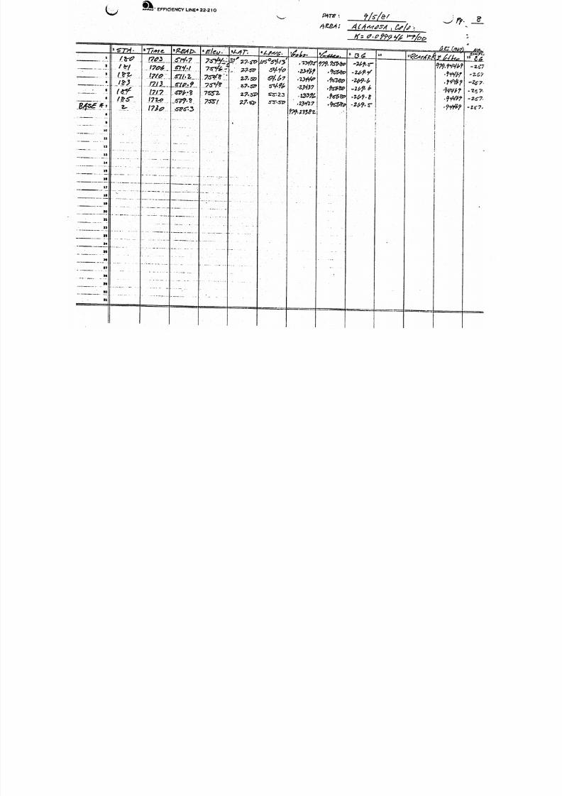
Survey Results
T h e re su l t s o f t h e su rve y a re p re se n te d
5
as the Simple Bouguer Gravity Map

8/12/2019 Results of a Detailed Gravity Survey in the Alamosa Area, Alamosa County, Colorado 6979261
http://slidepdf.com/reader/full/results-of-a-detailed-gravity-survey-in-the-alamosa-area-alamosa-county-colorado 12/39
*
O r . Ralph C. Holmer o f th e Colorado School o f M'ines. Th is pr o f i l e ind ica tes
the weste rn edge o f th e A lamosa h ors t as a s teep loc a l g rad ien t wh ich i s
These t roughs then fo rm an i nb ein g a t t h e i r j un c t i on .
Model Resu?ts
r t e dT (
superimposed upon a strong regional g r av i t y g rad ien t. The reg iona l t ren d
u n do u bte dl y co n ti n ue s wes tward i n t o t h e t h i c k vo l ca n i c se c t i o n co mp r i s in g t h e
San Juan vo l ca n i c f i e l d . The g r a v i t y p r o f i l e a c ro ss t h e h o rs t i n d i ca te s t h a t
th e c i t y o f Alamosa se ts on a gr a v i t y low. The Colorado School o f Mines data
d id no t de f ine the easte rn edge o f the A lamosa Hors t .
the re fo re ex tended an add i t i ona l f o u r m i l e s t o t h e e a s t b y ESL. The eastern
edge o f the h o rs t appears t o be loca te d approx imate ly one m i le east o f the
p o i n t where t h e School o f M ines p r o f i l e ended, ( a t s t a t i o n 1822). Whi le the
ESL exten s ion d i d no t comp le te l y c ross th e Baca g raben, s u f f i c ie n t da ta were
Th is p ro f i l e was
1 w i t h t h el o w
o n t h e h o rs t
a cq ui re d t o i n d i c a t e t h i s graben i s l i k e l y formed from severa l down-fau l ted
b locks
Three g r a v i t y h ighs, separa te and d i s t i n c t f rom each o the r , were
d e l i n e a t e d within t h e l i m i t s o f t h i s survey. These occur t o t he no r thwest ,
no r t hea st and sou th o f town and border the lo c a l g r av i t y l ow a t A lamosa.
low i s ce ntered roug hly midway between main s t r e e t (Highway 160) and the
This
a i r p o r t . The lo w i s l o c a l i z e d
ampl i tude. An east-west t r e n d
Monte Vista and Baca grabens.
and i t s t he s e t ro ug hs t h a t
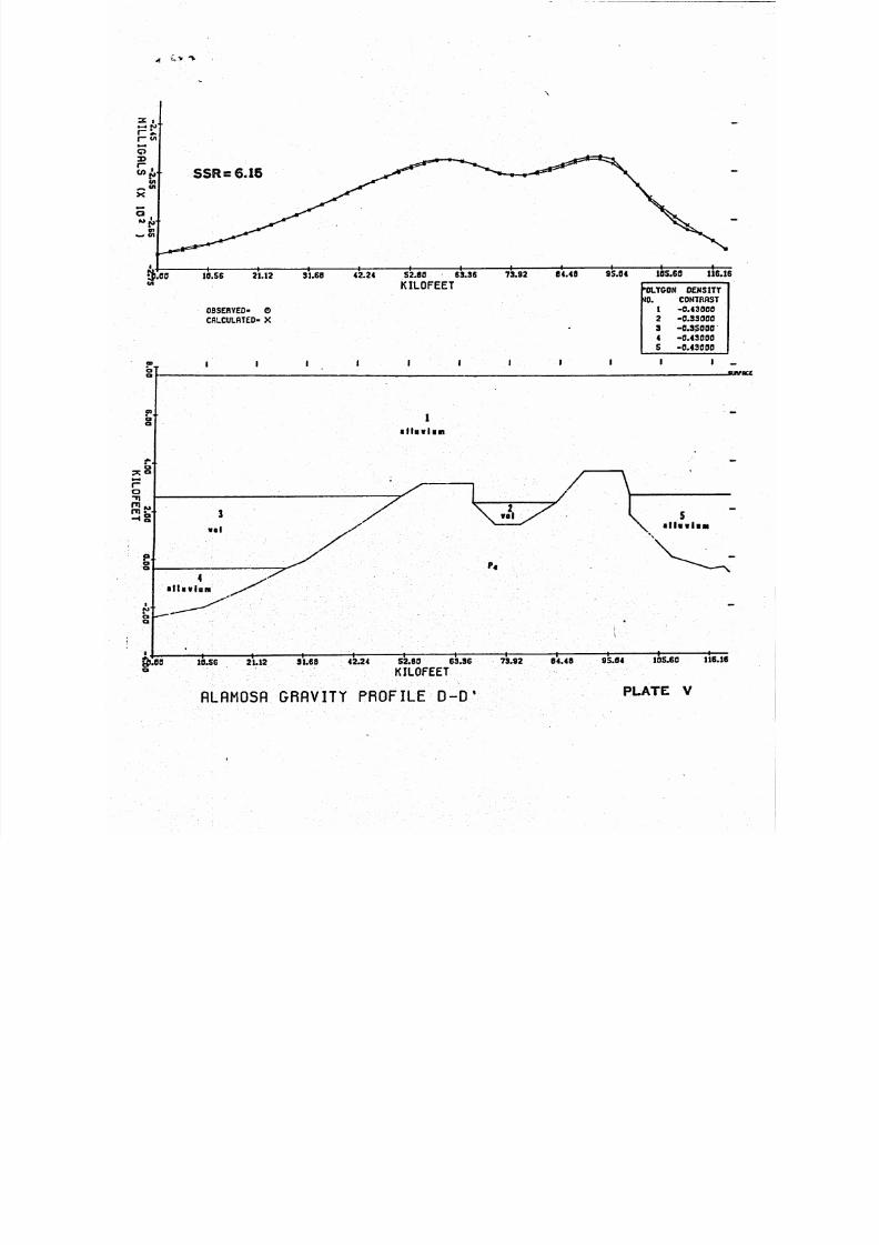
The g rav i t y da ta p resen ted on P la te I were i n t e r p r e t e d i n te rm s o f
subsur face st r u c tu re by comput ing two and one-h a l f d imensiona l and thr ee -
6

8/12/2019 Results of a Detailed Gravity Survey in the Alamosa Area, Alamosa County, Colorado 6979261
http://slidepdf.com/reader/full/results-of-a-detailed-gravity-survey-in-the-alamosa-area-alamosa-county-colorado 13/39
d imens iona l models us ing a lgo r i th ms mo d i f i ed a t ESL. The resul tant models,
shown as Plate I11 t o P la te V, a r e e x c e ll e n t f i t s t o t h e Bouguer g r a v i t y
data. I n t e r p r e t a t i o n a l a m b ig u i t ie s i n c l u d e t h e d e n s it y , d e pt h o f b u r i a l and
th i ckn e ss o f t h e va r i o u s ro cks u n i t s , and t h ese r e s u l t i n a no n-un iq ue
i n t e r p r e t a t i o n o f t h e g r a v i t y data.
I n computing the th ree -d imens iona l model, rec ta ngu la r p r isms o f va ry ing
d ime ns io ns and d e n s i t y a r e co mbined t o a p p ro x ima te i r r e g u l a r i t i e s i n t h e
subsurface bedrock. The parameters f o r th e model determined t o be a best
f i t t o t h e Bouguer g r a v i t y map a r e l i s t e d i n Appendix A.
The model on Plate I11 suggests the two nor the rn g rav i t y h ighs a re caused
by Precambr ian rocks o cc ur r in g a t depths between 4,750 fee t and 5,600 f e e t .
The g ra v i t y l o w be twee n t h e n o r t h e rn h i g h s i s f ormed i n t h e model b y p l a c i n g a
down-dropped b lo ck a t a depth o f 5,600 f e e t . T h i s b l o ck h as an i n f e r r e d
s e c t i o n o f v o l c a n i c l a s t i c s 600 f e e t t h ic k above th e Precambr ian rocks. The
g r a v i t y l o w upon wh ich A lamosa i s l o ca t e d was modeled wi t h two down-dropped
b l o cks . The f i r s t , ce q te re d on t h e ow has i n f e r r e d v o l c a n i c l a s t i c s , 1400
feet t h i c k , i n the depth i n t e r v a l o f 5,600 f e e t t o 7,000 feet. The second,
wh ich f o r ce s a n e a s twa rd e l o n g a t i o n o f t h e lo w, h as i n f e r r e d vo l ca n i c l a s t i c s ,
900 e e t t h i c k , i n t h e d ep th i n t e r v a l o f 5,600 f e e t t o 6,500 f e e t . F i n a l l y ,
t h e g r a v i t y h i g h t o th e s ou th o f town was modeled w i th Precambr ian rock s a t a
d e p t h o f 5,000 f e e t .
P l a t e s I V and V show model r e s u l t s usi ng a - d imens iona l a lgo r i thm
o r i g i n a l l y d ev el oped by
d im e ns io na l i n t h a t i t a llo ws f o r p oly go ns o f f i n i t e r a th e r th an i n f i n i t e
USGS (Cady, 1977). T hi s al g or i t h m i s 2l/2-
7

8/12/2019 Results of a Detailed Gravity Survey in the Alamosa Area, Alamosa County, Colorado 6979261
http://slidepdf.com/reader/full/results-of-a-detailed-gravity-survey-in-the-alamosa-area-alamosa-county-colorado 14/39
4
Two p ro f i l e s , lab e le d B-B' and D - D , were computed as north-south and
east -west p r o f i l e s , respe c t i ve l y , across the su rvey a rea (P la te 11). Geologic
c o n t r o l f o r th es e p r o f i l e s i s t ak en fro m P l a t e I o f Burroughs, 1981. Th is
geo log i c c ross -sec t ion c rosses the A lamosa ho rs t t o t h e no r t h o f t he su rvey
' a r e a a nd u t i l i z e s deep d r i l l h o le d ata f o r c o n t r o l .
GEOLOGIC IMPL I C A T I O N S
O b vi ou sl y t h e t o p o f t h e Alamosa h o r s t i s v er y i r r e g u l a r , t h e most l i k e l y
cause b ei ng s t r u c t u r a l d e fo rm a ti on ( f a u l t i n g ) o f t h e h o r s t i t s e l f due t o
r i f t i n g . Based upon the picture presented by the ESL Bouguer gravi ty map and
the computer models, i t i s hypothes ized th a t t h e t roughs de f i ne down-faul ted
b locks w i th i n t h e ho rs t . The g r av i t y h i ghs a re more s ta b le po r t i o ns of t he
ho rs t and the l o ca l g r av i t y l ow cen te red on Alamosa i s p oss ib l y due t o an
i n t e r s e c t i o n o f e as t-w es t and n o r t h t r e n d i n g f a u l t s e t s wh ic h may have caused
a smal l b lo ck t o be down-dropped a few hundred feet.
C u t t i n g s from t h e d r i l l h o le r e c e n t ly c om pleted f o r t h e City o f Alamosa
show the presence of a s i g n i f i c a n t t hi ck n es s o f O l ig oc en e ( ? ) v o l c a n i c l a s t i c s
f i l l i n g i n t h e t ro ug hs . These v o l c a n i c l a s t i c s were e nc ou nte re d a t a depth
o f a p p r o xi m a te l y 5,300 fe e t and cont inued u n t i l t h e Precambr ian was
i n t e r s e c t e d a t 6,370 feet J . Z e i s l o f
l o c a t e d on t h e sou thwes t f l an k o f t h e l o c a l g r a v i t y l ow ; hence, a t h i c k e r
s e c t io n o f v o l c a n i c l a s t i c s p ro ba bly e x i s t s w i t h i n t h e c e n t er o f t h e g r a v i t y
1OW.
pers. comm.). T h is d r i l l h o l e was
It i s not known I f volcanic last ic rocks cap Precambrian basement beneath
th e g r av i t y h ighs. Concei vab ly t h e vo l c an i c l a s t i c s cou ld have fo rmed a
b la nk et over Precambrian h ighs and these vo lca n i c l as t i c s were subsequentl y
8\

8/12/2019 Results of a Detailed Gravity Survey in the Alamosa Area, Alamosa County, Colorado 6979261
http://slidepdf.com/reader/full/results-of-a-detailed-gravity-survey-in-the-alamosa-area-alamosa-county-colorado 15/39
J5
eroded during the Late Eocene.
in d ic a t i v e of Precambr ian rocks wi tho ut associa ted vo lcan ic cover as assumed
b y t h e 3-D model.
It i s a l s o p o s s ib l e t h a t t h e g r a v i t y h ig hs a r e
I n any event, th e recen t d r i l l - h o l e has shown th e presence
o f t h e v o l c a n i c l a s t i c s w i t h i n t h e l o c a l g r a v i t y l o w a nd t he s e ve ry p r o b ab l y
ex tend th roughout th e pos tu la te d t roughs .
EXPLORATION TARGET
Burroughs 1981) has mentioned th e presence o f p aleo val ey s and/or down-
dropped b locks a long the Alamosa ho rs t and has d iscussed t h e i r importance t o
th e d iscove ry o f geothe rma l f l u i ds . The de ta i l e d g r av i t y su rvey comple ted by
ESL ha s f u r t h e r i n d i c a t e d what appears t o be pa le ov al ley s and/or down-dropped
b lock s w i t h i n t h e Alamosa ho rs t . These appear t o t rave r se the c re s t o f t he
h or s t i n a no r t h and eas t-wes t d i re c t i o n and cou ld a l l ow f o r commun ication o f
water between the Monte Vista and Baca grabens.
Serv ices, Inc. has shown th e presence o f a t le a s t 1,060 f e e t o f
vo l can i c l as t i c s upon the A lamosa ho rs t nea r t he a i rpo r t .c om p ri se p a r t o f what i s c a l l e d t h e c o n fi n ed a q u i f e r t h e r e ap pea rs t o b e
a d e q u a t e r e s e r v o i r p o t e n t i a l f o r ponded g eo th erm al f l u i d s p a r t i c u l a r l y w i t h i n
the areas of the down-dropped b locks.
The ho le d r i l l e d by Ene rgy
Since these rocks
The source o f th e t te rs w i t h in th e A lamosa area i s no t known.
e R i f t zone sohe ar ea i s p a r t o f t h e R i
waters i s poss ib le .
f a u l t s o f t h e Alamosa h o r s t an d c o u l d co n c e iv a b ly f i l t e r t hr ou gh . t h e h o r s t
a long th e f ra c tu re s o f th e down-dropped b locks .
c o u l d be moving l a t e r a l l y away from a heat source i n th e San Juan vo lcan ic
f i e l d and i n t o t he A lamosa a rea as pos tu l a ted by Bu rroughs 1981). C e r t a i n l y
th e h ig h heat f low measurements 2.85 + 0.65 HFU) i n t he San Juan vo l ca n i c
ep c i r c u l a t i o n o f m e te or icI
These h e at ed f l u i d s w o uld l i k e l y r i s e al o ng t h e b o r d er
A l te rna t i ve l y , t he rma l wa te rs

8/12/2019 Results of a Detailed Gravity Survey in the Alamosa Area, Alamosa County, Colorado 6979261
http://slidepdf.com/reader/full/results-of-a-detailed-gravity-survey-in-the-alamosa-area-alamosa-county-colorado 16/39
f i e l d s u pp o rt t h e p re se nce o f a bur ied heat source.
vo lca nic rocks w i t h in t h e Monte V is ta graben would p la ce th e Alamosa area down
d ip and a l ong the hyd ro log i c g rad ien t .
The eas tward d ip o f the
Regard less o f t he therma l f l u i d source, i t i s s t i l l p os s ib le t o f orm ula te
an e xp l o ra t i on ta rg e t i n t he Alamosa a rea.
f o r t h e r m a l f l u id s, then an area such as t h e l o c a l g rav i t y l ow cen te red on
Alamosa wou ld l i k e l y have a th ic k e r v o lca n ic s ec t io n and hence a grea te r
I f t h e v o l ca n i cs f or m a r e s e r v o i r
chance fo r development o f a s iza b le res erv o i r .
th e same te x tu re or , more impo r tan t l y , th e same p or os i ty and permea b i l i t y .
d r i l l - h o l e c en te re d on t h e g r a v i t y low would l i k e l y i n t e r s e c t t h e g r e a te s t
Not a l l vo l can i c f l ows have
A
t h i ckness o f vo l c an i c l as t i c s and thus i nc rease th e odds f o r a p roduc t i ve we l l .
S i nce f l u i ds m igh t be f l ow ing a l ong f rac tu res as we l l as t h rough
a q u if e rs , an a l t e r n a t i v e d r i l l l o c a t i o n c o u l d t e s t a m a j o r f r a c t u r e zone.
Wh i l e t h e ma jo r bound ing f a u l t s t o t h e A lamosa h o r s t can no t be ove r l ooked as
p o t e n t i a l ta r g e t s , a b e t t e r a re a m i gh t be f ou nd on t h e h o r s t i t s e l f a l on g one
o f t he bo rde rs t o t he pos tu l a ted down-faul ted b l ocks. An a rea cou ld be
Id e n t i f i e d where two o r more o f these locks a nd /o r f a u l t s i n t e r s e c t .
a r e a m a y e x i s t a l o n g t h e n o r t h e r n s i d e o f t h e l o c a l g r a v i t y l o w .
necessa ry t o b e t t e r de f i ne t he edges o f any down-fau lt ed b l ocks be fo re
Such an
It would be
, *
i s area. Th is cannot be done w i t h a dd i t io n a l g r a v i t y d a ta b u t
d w i th a r e f l e c t i o n s e i sm i c s urve y. T h is c o u l d be q u i t e
expensive ($20,000 t o $40,000) b u t i t would s t i l l b e 1
a dry hole.
o s t l y t h a n d r i l l i n g
10
8/12/2019 Results of a Detailed Gravity Survey in the Alamosa Area, Alamosa County, Colorado 6979261
http://slidepdf.com/reader/full/results-of-a-detailed-gravity-survey-in-the-alamosa-area-alamosa-county-colorado 17/39
P
ACKNOWLEDGEMENTS
Spec ia l t hanks a re g i ven t o Dr. Ralph C. Holmer o f th e Colorado School o f
M ine s f o r h i s t i m e s p en t i n d i s cu s s in g t h e g e op h ys ic a l d a ta i n
Area and f o r pe rm iss i on t o use the g r av i t y da ta acqu i red by t h e
Mines along Highway 160. Thanks ar e a ls o gi ve n t o Bear Creek M
i n Tucson, A r iz o n a f o r t h e i r generous l o a n o f a grav imeter .
he Alamosa
School o f
ning Company
11

8/12/2019 Results of a Detailed Gravity Survey in the Alamosa Area, Alamosa County, Colorado 6979261
http://slidepdf.com/reader/full/results-of-a-detailed-gravity-survey-in-the-alamosa-area-alamosa-county-colorado 18/39
REFERENCES
Behrendt, John C., and Bajwa, LaCretia Y., 1974, Bouguer Gra v it y Map of
Bur roug hs, R ic hard L., 1981, A Summary o f t h e Geology o f the San Luis Basin,
Colorado Geolog ica l Survey Specia l Publ ica t ion 18.
Colorado, Geop hysical In v e s ti g a ti o n s Map GP-895.
Colorado-New Mexico w i t h emphasis on th e Geothermal Po te nt ia l f o r th eMonte Vista Graben.35 PP.
Da vis , Gene Ho we ll, 1979, A G ra vi t y Study o f th e San Lui s Basin, Colorado.
Wool lard, G. P. 1979, The New G ra vi ty System--Changes i n in te rn a ti o n a l
Thesis, Master of Science , Un ive rs i t y o f Texas a t E l Paso.
g r a v i t y base valu es and anomaly values. Geophysics, v. 44, no. 8, p.1352-1 366.
8/12/2019 Results of a Detailed Gravity Survey in the Alamosa Area, Alamosa County, Colorado 6979261
http://slidepdf.com/reader/full/results-of-a-detailed-gravity-survey-in-the-alamosa-area-alamosa-county-colorado 19/39
?
APPENDIX AProject name: A1amosa Area, Col orado
G r a v i t y S u r v e y
Model : 3-D G r a v i t y Model
U n i t s i n F eet
PRISM x1 x2 Y1 Y2 D1 D2 Dc
1
2
3
4
5
6
7
8
9
10
11
12
13
14
16
17
18
20
21
-85000.
-21120.
-12144.
15840.
8448.
21120.
18480.
-13728.
-26400.
-2640.
8448.
31680.
-26400.
-85000.
-26500.
-2640.
-85000.
75000.
52800.
-85000.
-26400.
8448.
100000. -85000. 265000. 0. 20000. -0.83
-2640. 10560. 27984. 5000. 5200. 0.83
-7392. 20000. 25000. 4900. 5200. 0.83
24816. 10000. 15840. 4500. 5200. 0.83
21120. 29568. 32736. 4750. 5200. 0.83
24816. 15840. 40000. 5000. 5200. 0.83
31680. -18480. -7392. 5400. 5600. 0.83
-2640. -18480. -5280. 5300. 5600. 0.83
52800. -85000. -18480. 5000. 20000. 0.83
8448. -10560. 6500. 5600. 7000. -0.45
2112. 5600. 6500. -0.45 #
18480. -10560.
52800. -18480. 265000. 7000. 20000. 0.83
31680. -18480. 47520. 5600. 20000. 0.83
-26400. -85000. 265000. 5600. 8000. 0.63
31680. 47520. 265000 5400. 20000. 0.83
8448. 6500. 47520. 5600. 6200. -0.45
-26400. -85000. 265000. 8000. 10000. 0.35
-85000. 265000. 12500. 20000. 0.83
75000. 5000. 265000. 10000. 20000. 0.83
-26400. -85000. 265000. 10000. 20000. 0.83
-2640. 6500. 40000. 5200. 5600. 0.83
31680. 6500. 40000. . 5200. 5600. 0.83
13
8/12/2019 Results of a Detailed Gravity Survey in the Alamosa Area, Alamosa County, Colorado 6979261
http://slidepdf.com/reader/full/results-of-a-detailed-gravity-survey-in-the-alamosa-area-alamosa-county-colorado 20/39
. v
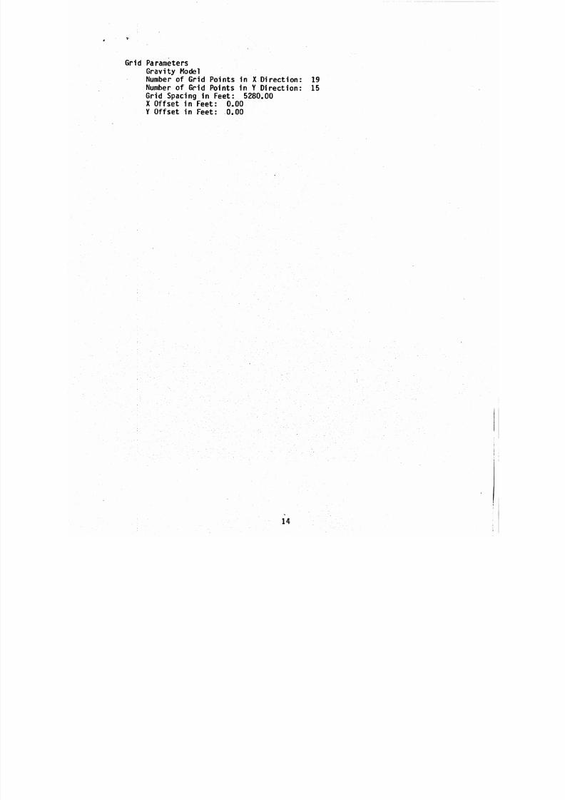
Grid ParametersG r a v i t y ModelNumber o f Gr i d Po in ts i n X D i r e c t i o n : 19 Number o f Gr id Po in ts i n Y D i r e c t i o n : 15 G r i d Sp ac in g i n F e e t : 5280.00
X O f fs e t i n F eet : 0.00Y O f f s e t i n Feet : 0.00
8/12/2019 Results of a Detailed Gravity Survey in the Alamosa Area, Alamosa County, Colorado 6979261
http://slidepdf.com/reader/full/results-of-a-detailed-gravity-survey-in-the-alamosa-area-alamosa-county-colorado 21/39
A P P E N D I X B
P R I N C I P A L F A CT O RS FO R G R A V I T Y S T A T I O N S
15
8/12/2019 Results of a Detailed Gravity Survey in the Alamosa Area, Alamosa County, Colorado 6979261
http://slidepdf.com/reader/full/results-of-a-detailed-gravity-survey-in-the-alamosa-area-alamosa-county-colorado 22/39
.E a
2
8/12/2019 Results of a Detailed Gravity Survey in the Alamosa Area, Alamosa County, Colorado 6979261
http://slidepdf.com/reader/full/results-of-a-detailed-gravity-survey-in-the-alamosa-area-alamosa-county-colorado 23/39

8/12/2019 Results of a Detailed Gravity Survey in the Alamosa Area, Alamosa County, Colorado 6979261
http://slidepdf.com/reader/full/results-of-a-detailed-gravity-survey-in-the-alamosa-area-alamosa-county-colorado 24/39
--
Et .
8/12/2019 Results of a Detailed Gravity Survey in the Alamosa Area, Alamosa County, Colorado 6979261
http://slidepdf.com/reader/full/results-of-a-detailed-gravity-survey-in-the-alamosa-area-alamosa-county-colorado 25/39
EFFICIENCYLINE 22-210
L.
8/12/2019 Results of a Detailed Gravity Survey in the Alamosa Area, Alamosa County, Colorado 6979261
http://slidepdf.com/reader/full/results-of-a-detailed-gravity-survey-in-the-alamosa-area-alamosa-county-colorado 26/39
EFFICIENCY LINE 22-210
L
...

8/12/2019 Results of a Detailed Gravity Survey in the Alamosa Area, Alamosa County, Colorado 6979261
http://slidepdf.com/reader/full/results-of-a-detailed-gravity-survey-in-the-alamosa-area-alamosa-county-colorado 27/39
.
I

8/12/2019 Results of a Detailed Gravity Survey in the Alamosa Area, Alamosa County, Colorado 6979261
http://slidepdf.com/reader/full/results-of-a-detailed-gravity-survey-in-the-alamosa-area-alamosa-county-colorado 28/39
L
8/12/2019 Results of a Detailed Gravity Survey in the Alamosa Area, Alamosa County, Colorado 6979261
http://slidepdf.com/reader/full/results-of-a-detailed-gravity-survey-in-the-alamosa-area-alamosa-county-colorado 29/39
.... .- - . . ..- .
... -. .
. . . . . . . .- . .._ . - . .. - .
. . . . . . . . .
. . .
. . - -. .. - ....
. . . . . . . . ._
..._ . . . - -. . . ~ _._..
I
8/12/2019 Results of a Detailed Gravity Survey in the Alamosa Area, Alamosa County, Colorado 6979261
http://slidepdf.com/reader/full/results-of-a-detailed-gravity-survey-in-the-alamosa-area-alamosa-county-colorado 30/39
-*
J
8/12/2019 Results of a Detailed Gravity Survey in the Alamosa Area, Alamosa County, Colorado 6979261
http://slidepdf.com/reader/full/results-of-a-detailed-gravity-survey-in-the-alamosa-area-alamosa-county-colorado 31/39
b ,.......
@ * EFFICIENCYLlNEa 22-2IO
8/12/2019 Results of a Detailed Gravity Survey in the Alamosa Area, Alamosa County, Colorado 6979261
http://slidepdf.com/reader/full/results-of-a-detailed-gravity-survey-in-the-alamosa-area-alamosa-county-colorado 32/39
* EFFICIENCY LlNEe 22-2 1 0 Ld
8/12/2019 Results of a Detailed Gravity Survey in the Alamosa Area, Alamosa County, Colorado 6979261
http://slidepdf.com/reader/full/results-of-a-detailed-gravity-survey-in-the-alamosa-area-alamosa-county-colorado 33/39
@ * EFnCIENCY LlNEe 22-2 1 0
LJ I-,
ll p= WJ

8/12/2019 Results of a Detailed Gravity Survey in the Alamosa Area, Alamosa County, Colorado 6979261
http://slidepdf.com/reader/full/results-of-a-detailed-gravity-survey-in-the-alamosa-area-alamosa-county-colorado 34/39
.
8/12/2019 Results of a Detailed Gravity Survey in the Alamosa Area, Alamosa County, Colorado 6979261
http://slidepdf.com/reader/full/results-of-a-detailed-gravity-survey-in-the-alamosa-area-alamosa-county-colorado 35/39
MONTE VlSTA GRABEN ALAMOSA HORST
PLATE 1
ALAMOSA BASIN
CROSS-SECTIONS
ak er 8urroughr. 1981
8/12/2019 Results of a Detailed Gravity Survey in the Alamosa Area, Alamosa County, Colorado 6979261
http://slidepdf.com/reader/full/results-of-a-detailed-gravity-survey-in-the-alamosa-area-alamosa-county-colorado 36/39

8/12/2019 Results of a Detailed Gravity Survey in the Alamosa Area, Alamosa County, Colorado 6979261
http://slidepdf.com/reader/full/results-of-a-detailed-gravity-survey-in-the-alamosa-area-alamosa-county-colorado 37/39

8/12/2019 Results of a Detailed Gravity Survey in the Alamosa Area, Alamosa County, Colorado 6979261
http://slidepdf.com/reader/full/results-of-a-detailed-gravity-survey-in-the-alamosa-area-alamosa-county-colorado 38/39
X f :
h
n
W
ba
mb7;;a
,N.
aa
SSR=3 88
-
* *I II I I
II
0 10.56 21.82 31.68 42.24 52 80 63.36
K LOFEET
OBSERVED=CRLCULATED= X
I I I # '
1a l l u v i u m
OLYGON DENSITY
CONTRRST1 -0.43000
2 -0.331308
I I
1 WRFRCE
6
KILOFEET PLATE I V
8/12/2019 Results of a Detailed Gravity Survey in the Alamosa Area, Alamosa County, Colorado 6979261
http://slidepdf.com/reader/full/results-of-a-detailed-gravity-survey-in-the-alamosa-area-alamosa-county-colorado 39/39
\
10.56 21.12 31.68 42.24 52.80 6S36 73.92 84.48 55.04 115.60 116.16
OLYGON OENSUYILOFEET
OBSERVED=
CRLCULATED- X -o.ssoeo-0.s5oou-0.4soee-0.43000
I I I I I I I II I 1 .
W
1
a l l a v i a n