prof. nicola casagli
TRANSCRIPT
Landslide riskProf. Nicola Casagli
Director of ICL European Centre,
University of Florence (Italy)
Preparatory Workshop on Science and
Technology for the Global Platform for
Disaster Risk Reduction Third Session
Pavia, Italy, 5-6 April 2011
Consortium on
Landslides

Consortium on LandslidesThe ICL is an International non-governmental and
profit scientific organization, which is supported
by UNESCO, WMO, FAO and UN/ISDR and other
governmental bodies
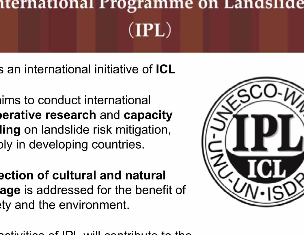
is an international initiative of ICL
aims to conduct international
cooperative research and capacity
building on landslide risk mitigation,
notably in developing countries.
Protection of cultural and natural
heritage is addressed for the benefit of
society and the environment.
activities of IPL will contribute to the
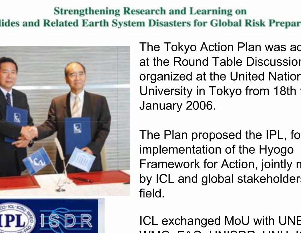
The Tokyo Action Plan was adopted
at the Round Table Discussion
organized at the United Nations
University in Tokyo from 18th to 20th
January 2006.
The Plan proposed the IPL, for the
implementation of the Hyogo
Framework for Action, jointly manged
by ICL and global stakeholders
field.
ICL exchanged MoU with UNESCO,
WMO, FAO, UNISDR, UNU, ICSU

A Workshop on Landslide Risk Reduction
organized at IDRC in Davos 2006 for
launching the Davos Appeal

The 1st World Landslide Forum (18-21 November 2008, Tokyo, Japan),
convened by the ICL and other supporting organizations
participants from 48 countries adopted the 2008 Tokyo Declaration

ICL-Europe
European Centre of ICL established at the Earth
Sciences Department of the University of Florence with
following objectives:
to raise funds, from the EC and otherfunding agencies, for supporting IPL
to promote IPL in order to bringtogether the landslide community in Europe
to aid the co-ordination of activities of European members in ICL
On 29th June 2006 in
Heidelberg, a MoU between
ICL and UNIFI was
exchanged to establish
European Centre of ICL

ICL/IPL members

ICL/IPL members

Landslides International Journal
the journal addresses a wide array
disciplines, is of broad interest,
widely readable and of high quality
issues per year
started from January 2004
edited by Springer
Full color
types of contributions: Landslide
News, Scientific papers and
technological development

Machu Picchu Co-ordinating Project
The IPL Project Landslide
Investigation in Machu Picchu,
Peru, involves working groups
of ICL from Peru, Japan, Italy,
Czech, Slovakia, Canada and
Investigation by all working
groups is coordinated as an
IPL project, and the report of
investigation are presented to
Peruvian Government through
UNESCO as a single

IPL Project coordinated by
H. Fukuoka
The project contains
working groups from all
members
Objectives:
to create a global landslide
database of major events
register them in a
standard data-format on-
represent them on a
global map service on the
Site: VajontNation: Italy
Date: 10 Oct. 1963Type: rock slide
Volume: 270 106mVelocity: 12 m/s
Travel angle: 18.8Victims: 1917
Trigger: reservoir

Site: VajontNation: Italy
Date: 10 Oct. 1963Type: rock slide
Volume: 270 106m3Velocity: 12 m/s
Travel angle: 18.8°Victims: 1917
Trigger: reservoir
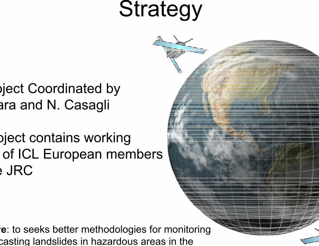
Strategy
IPL Project Coordinated by
Takara and N. Casagli
The project contains working
of ICL European members
and the JRC
Objective: to seeks better methodologies for monitoring
forecasting landslides in hazardous areas in the

The IGOS GeoHazards Initiative intends to respond
scientific and operational geospatial information needs
prediction and monitoring of geophysical hazards
namely earthquakes, volcanoes and land instability.
Integrated Global
Observing
Strategy

Global Monitoring for
Environment and Security
(GMES)
GMES is a European initiative for the implementationof information services dealing with environment and security
GMES will be based on observation data receivedfrom Earth Observation satellites and ground basedinformation.
GMES is a set of services for European citizenshelping to improve their quality of life regardingenvironment and security.

EC GMES: Preview
Prevention Information and Early WarningEC Integrated Project
Coordinator: ASTRIUM
New information services to help risk managementBased on Core Users needs - Mature and New Services
Dissemination & Training - Pre operational Validation
Operational platformsFloods
Windstorms
Fires
Earthquake & Volcanoes
Landslides
Man-made Risks
58 partners
from 15 nations
Scientists - Operators
Industries - End
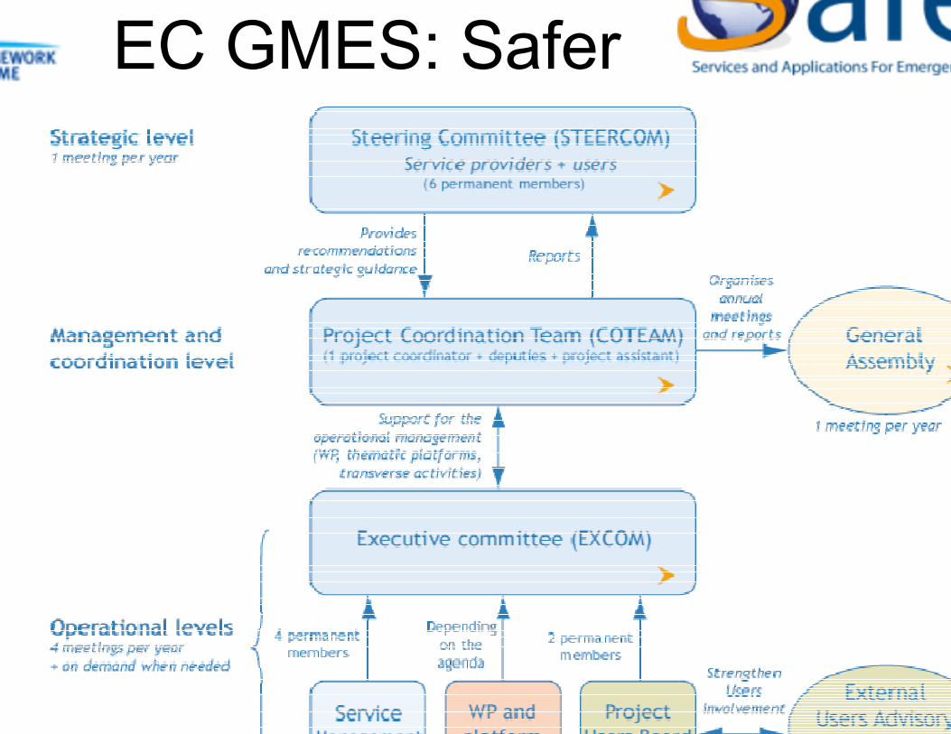
EC GMES: Safer
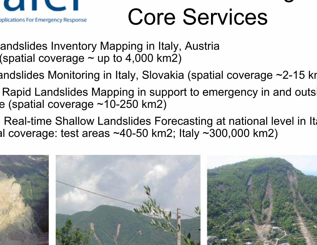
Landslides Inventory Mapping in Italy, Austria (spatial coverage ~ up to 4,000 km2)
Landslides Monitoring in Italy, Slovakia (spatial coverage ~2-15 km2)
RLM: Rapid Landslides Mapping in support to emergency in and outsideEurope (spatial coverage ~10-250 km2)
RSLF: Real-time Shallow Landslides Forecasting at national level in Italyspatial coverage: test areas ~40-50 km2; Italy ~300,000 km2)
Landslide Emergency
Core Services

Core Services

Rapid Landslide Mapping (RLM)
coverage: ~10-250 km2
requirements: ~6 weeks
phase: emergency response
Italian Civil Protection Dept.; Disaster
Research Center of the National Cheng
., Taiwan; Central Geological Survey,
Rapid Landslide Mapping

Second level - DETERMINISTIC MODEL
First level - EMPIRICAL MODEL
Real-time Shallow Landslides Forecasting (RSLF)
coverage: ~300,000 km2 (Italy)
requirements: ~16-24 weeks
phase: preparedness/prevention, emergency response
Civil Protection Dept.
Landslide Forecasting
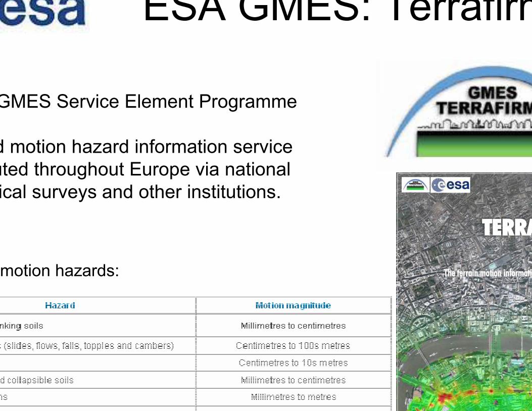
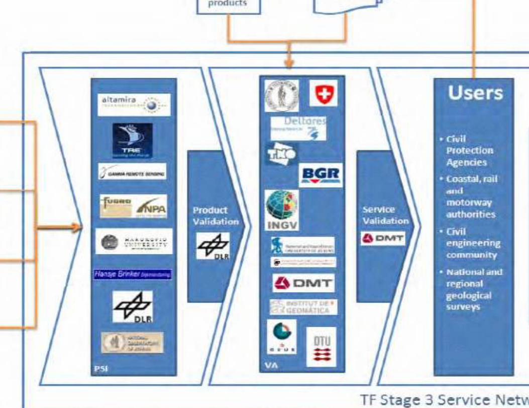
ESA GMES: Terrafirma
GMES Service Element Programme
Ground motion hazard information service
distributed throughout Europe via national
geological surveys and other institutions.
motion hazards:


Mountain Risksfrom prediction to management and governance
EU FP6 project - Marie Curie Research Training Network
framework for the professional development of the nextgeneration of researchers in the field of hazard and risk
management
Objective: to develop an
advanced understanding of
mountain hydro-
geomorphological hazards and
this knowledge to long-
cohabitation with such
hazards
institutions in 7 countries

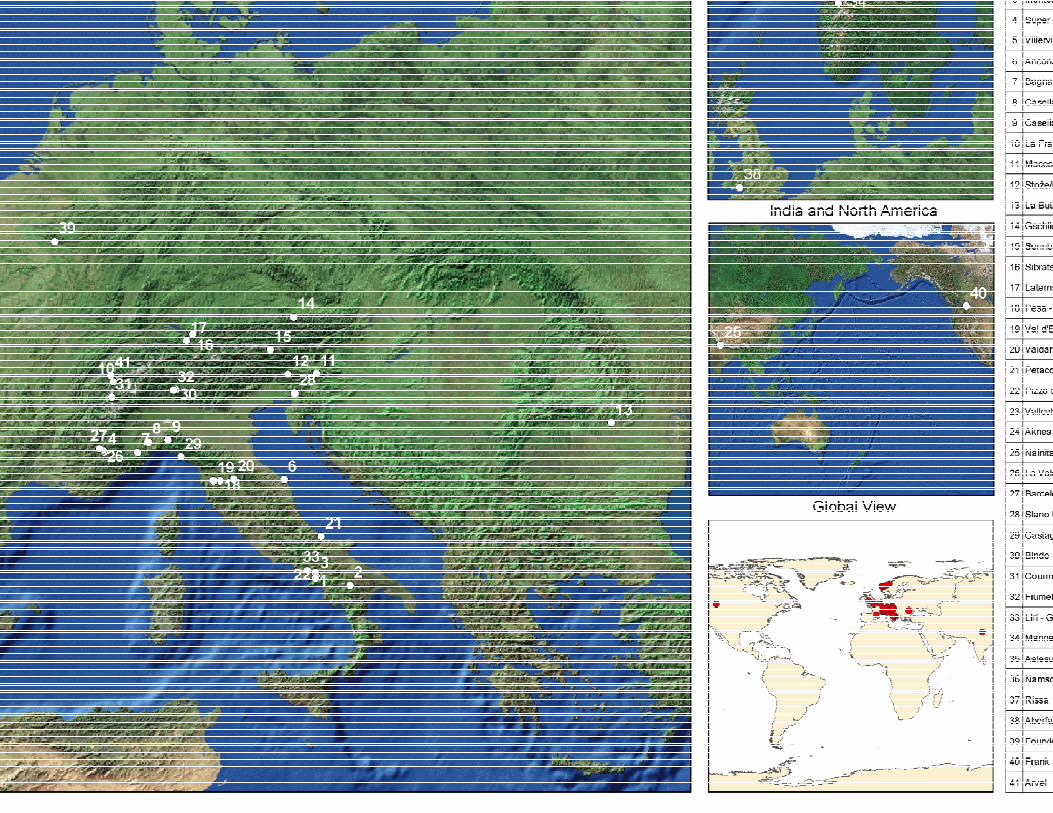
41 Landslides test sites

Cosmo LM
Optical imagery
Radar imagery
TLS


Doris Techniques
PSInSAR
GBInSAR
Hyperspectral
Laser scanning

COSMOSkyMed - GBInSAR

ca. 500 pre-registered participants from 66 countries


Science and technical
advancements and innovationscoordinating activities (HFA1): ICL, IPL, FP7, GMES
monitoring (HFA2): remote sensing
predicting and warning (HFA2): Landslide forecasting
models based on rainfalls or deformation time series
education, advocacy and awareness (HFA3): training
networks FP7 MC RTN, UNITWIN, Laram School, IPL
Landslide School Network
reducing risk (HFA4): Planning, Civil Protection,
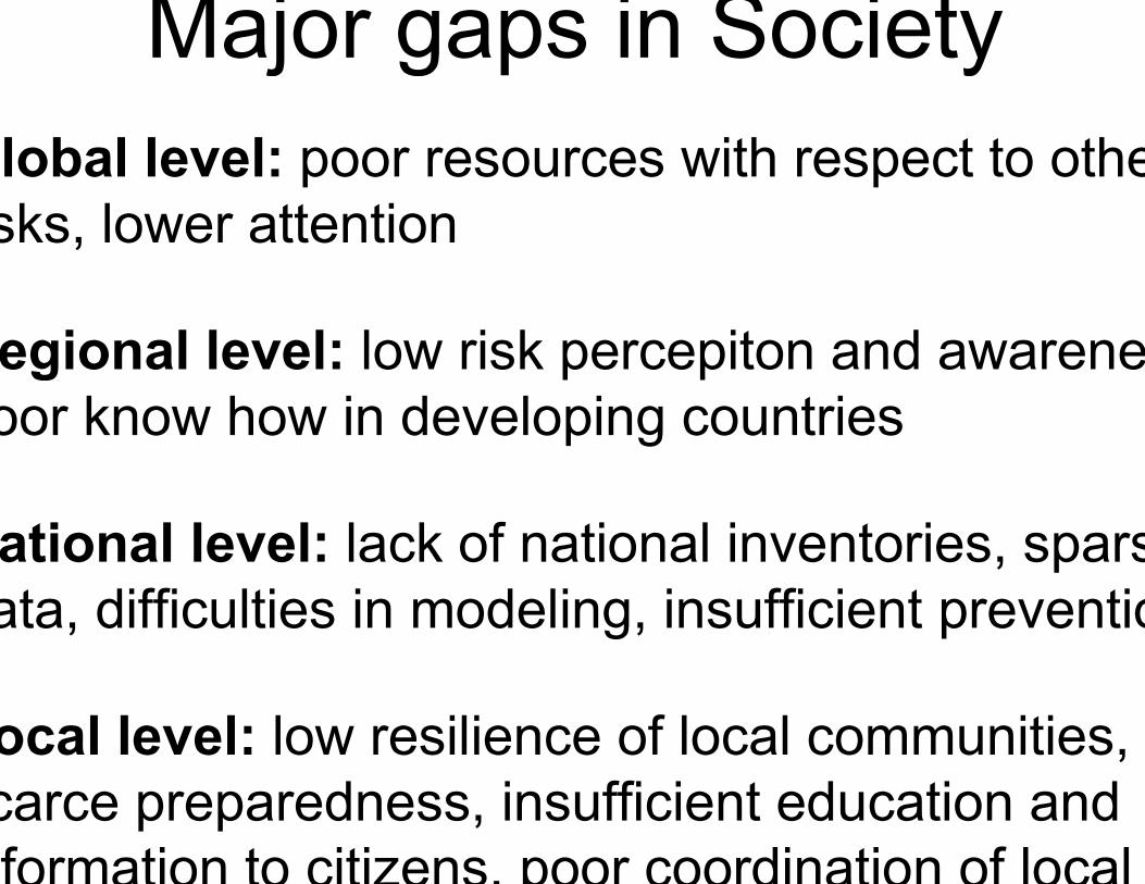
Global level: poor resources with respect to other
risks, lower attention
Regional level: low risk percepiton and awareness
poor know how in developing countries
National level: lack of national inventories, sparse
data, difficulties in modeling, insufficient prevention
Local level: low resilience of local communities,
scarce preparedness, insufficient education and
information to citizens, poor coordination of local
Major gaps in Society
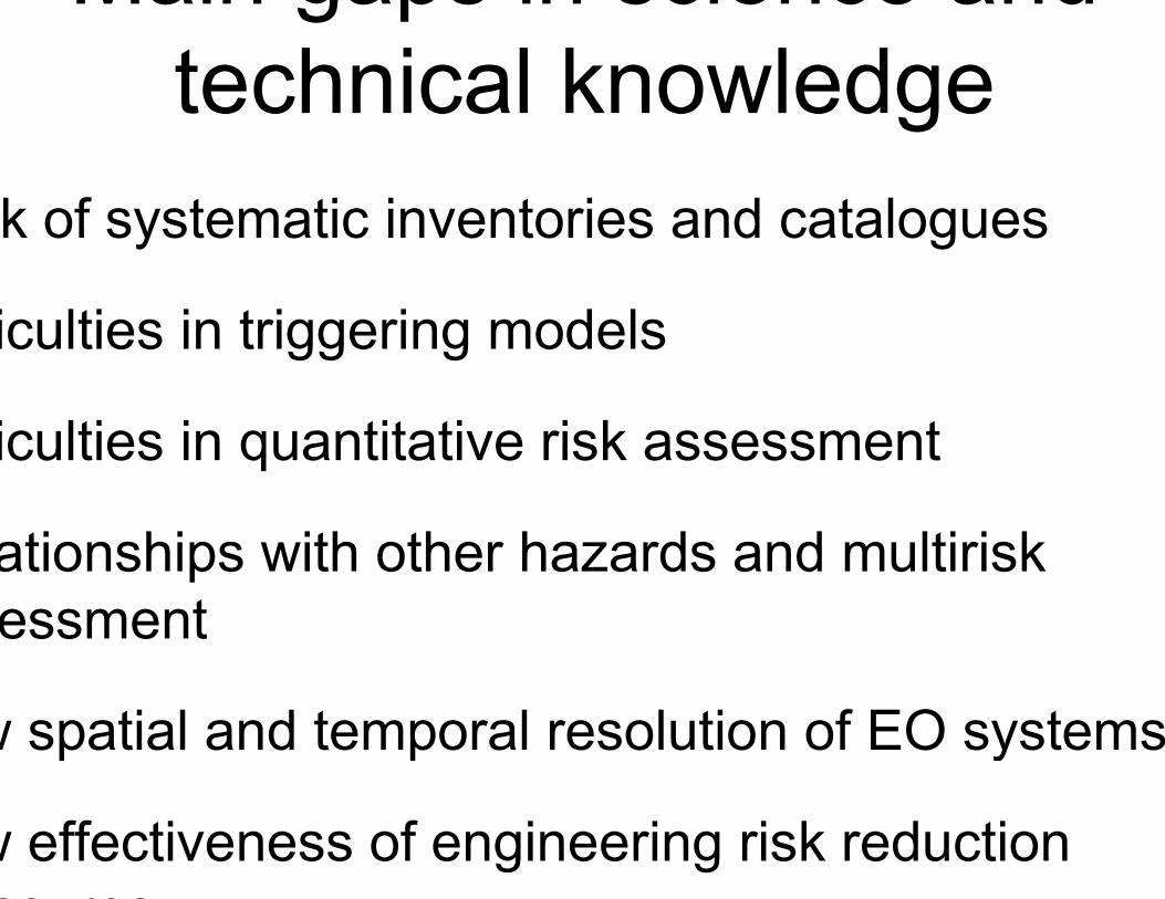
Lack of systematic inventories and catalogues
Difficulties in triggering models
Difficulties in quantitative risk assessment
Relationships with other hazards and multirisk
assessment
Low spatial and temporal resolution of EO systems
Low effectiveness of engineering risk reduction
measures
Main gaps in science and
technical knowledge


Thank [email protected]