plate tectonics - petal school district...seismic waves: vibrations that travel thru earth carrying...
TRANSCRIPT
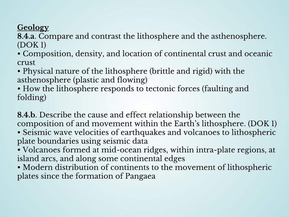
Geology8.4.a. Compare and contrast the lithosphere and the asthenosphere. (DOK 1)• Composition, density, and location of continental crust and oceanic crust • Physical nature of the lithosphere (brittle and rigid) with the asthenosphere (plastic and flowing)• How the lithosphere responds to tectonic forces (faulting and folding)
8.4.b. Describe the cause and effect relationship between the composition of and movement within the Earth’s lithosphere. (DOK 1)• Seismic wave velocities of earthquakes and volcanoes to lithospheric plate boundaries using seismic data• Volcanoes formed at mid-ocean ridges, within intra-plate regions, at island arcs, and along some continental edges• Modern distribution of continents to the movement of lithospheric plates since the formation of Pangaea
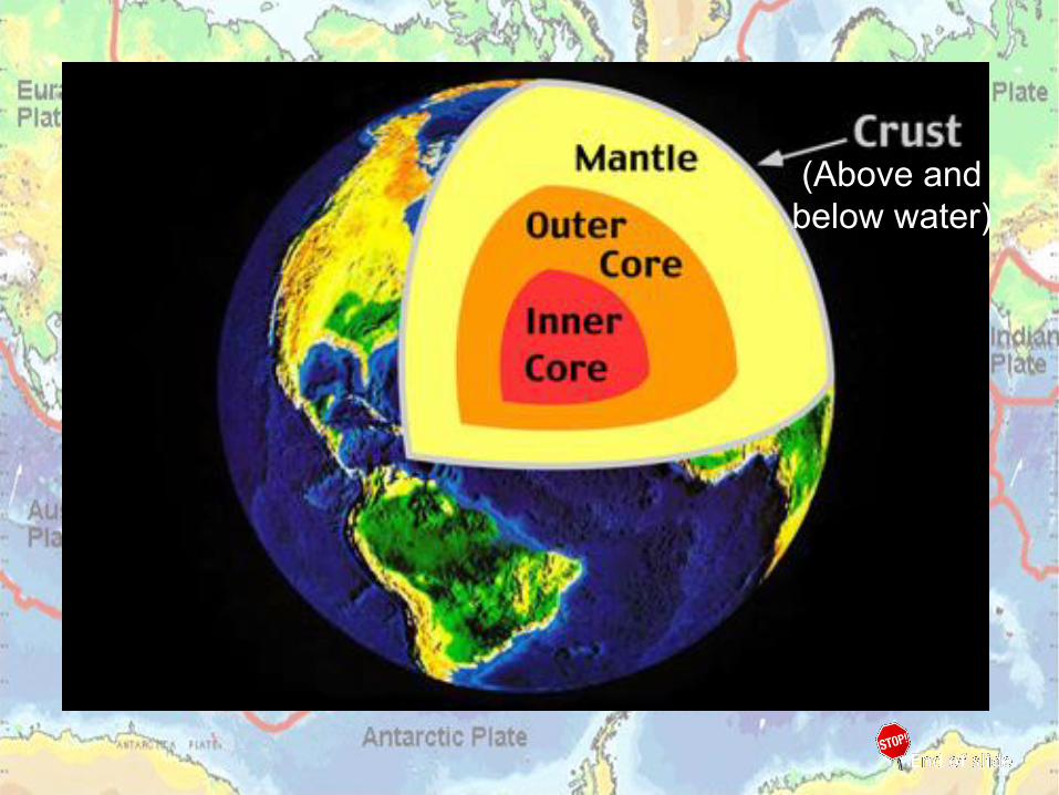
(Above and below water)
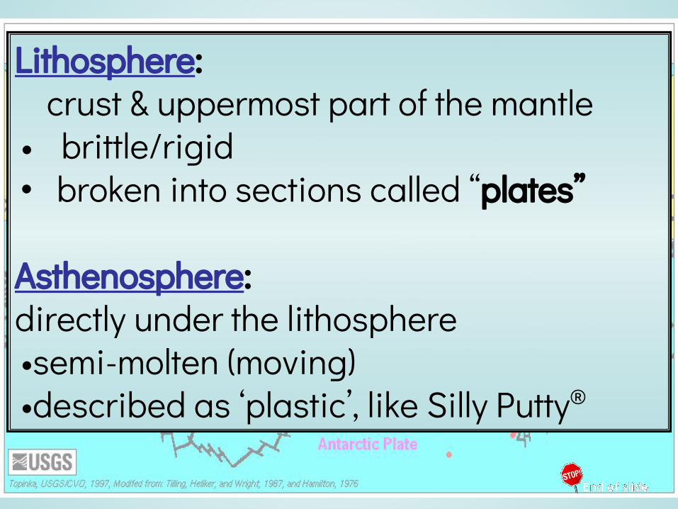
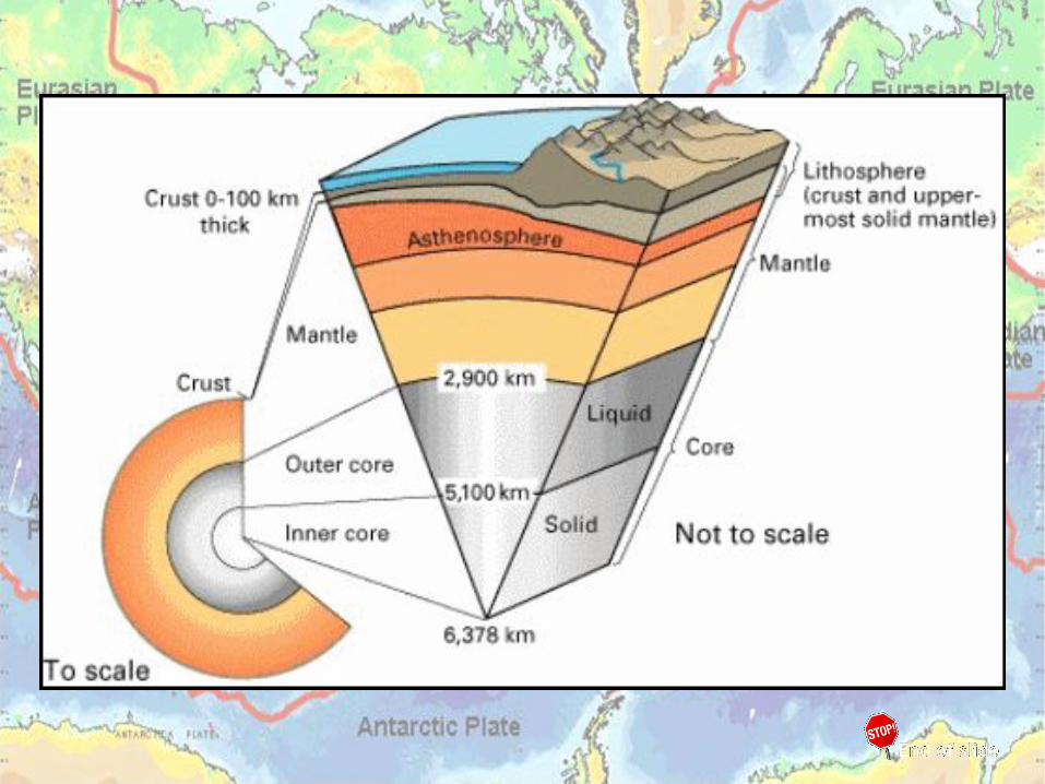
Lithosphere: crust & uppermost part of the mantle• brittle/rigid• broken into sections called “plates”
Asthenosphere: directly under the lithosphere •semi-molten (moving) •described as ‘plastic’, like Silly Putty®

{{
{oceanic
crust
mantle
outer core
lithosphere
asthenosphere
continentalcrust
inner core
{
Layers of the Earth Worksheet
Correctly label your Layers of the Earth worksheet. You will have a quiz on this.
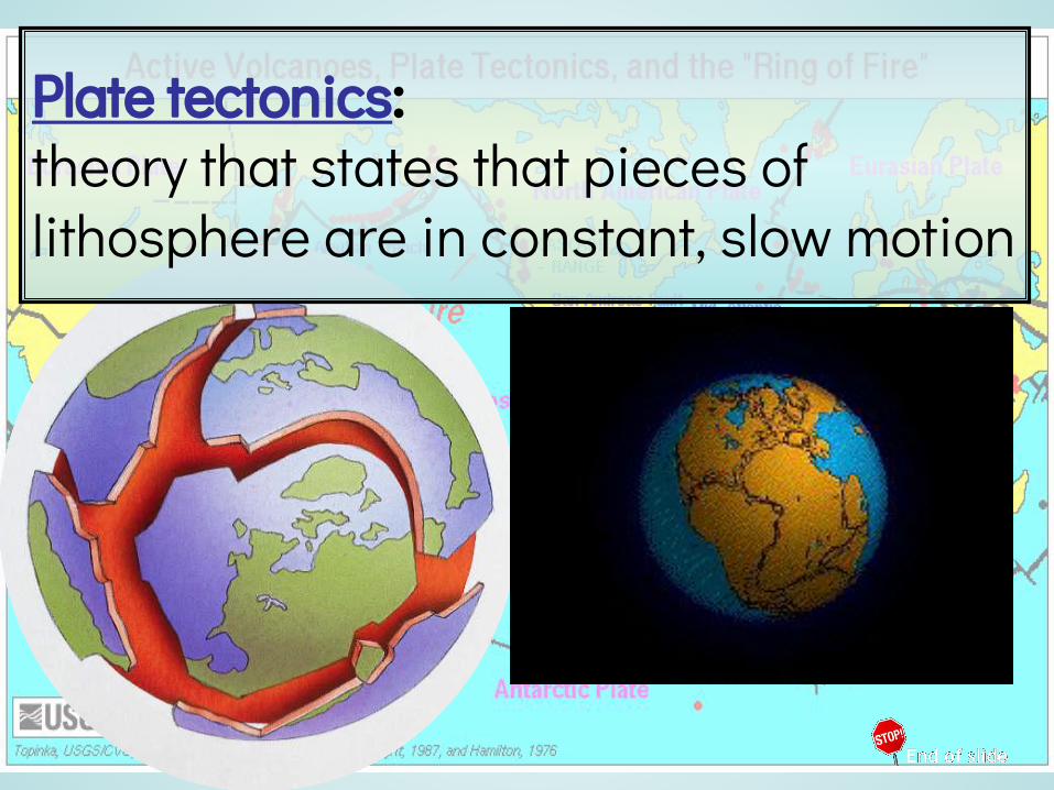
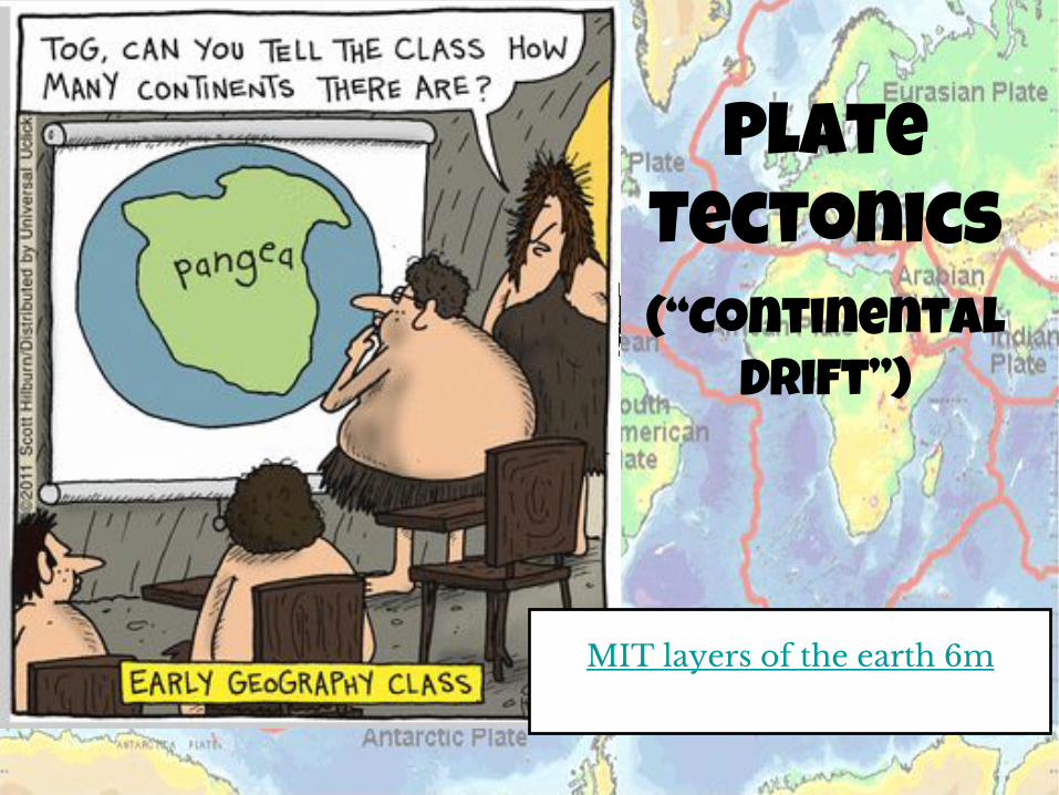
Plate tectonics:theory that states that pieces of lithosphere are in constant, slow motion

Plate movement causes changes:Slow changes:•mountain chains•trenches •rift valleysFast changes:
• earthquakes• tsunamis • volcanoes

Use your textbook to define the following terms in your notes: 1. Radiation2. Conduction3. Convection4. Density5. Convection Current
Science Explorer TextbookInside Earth
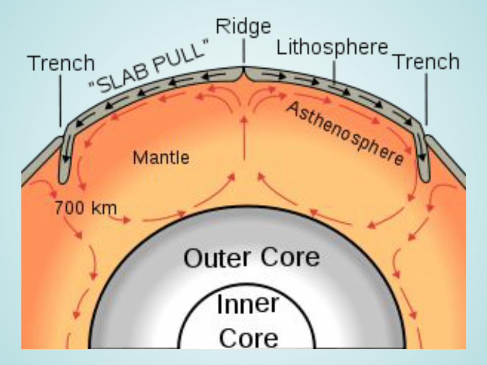
Convection Currents in the Mantle: pages 25-27

Plate boundaries: area where plates meet • resembles cracked shell of hard
boiled egg
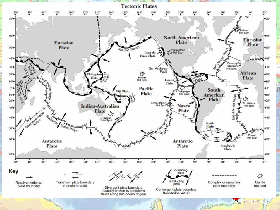
3 types of plate boundaries: 1. Divergent boundary2. Convergent boundary3. Transform boundary
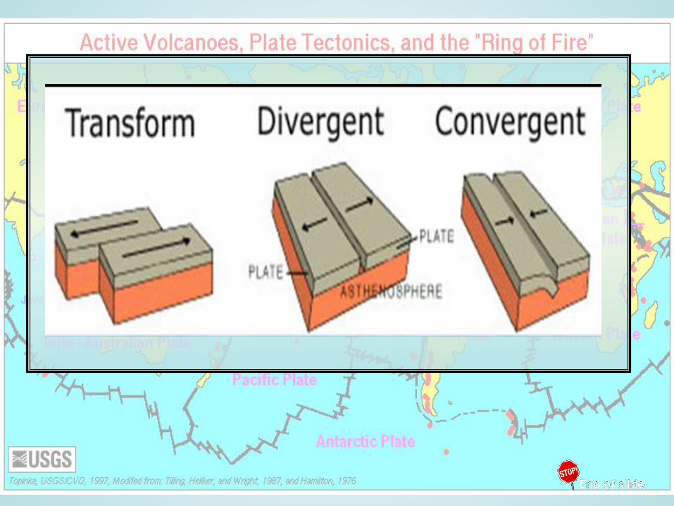
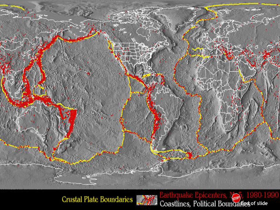
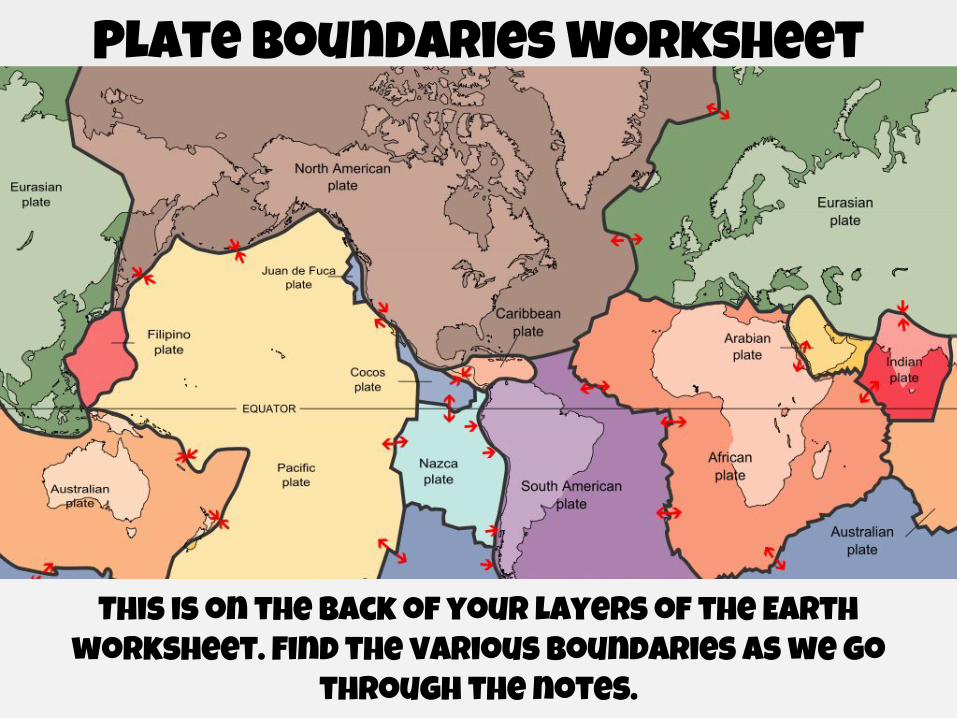
Plate Boundaries Worksheet
This is on the back of your layers of the Earth worksheet. Find the various boundaries as we go
through the notes.
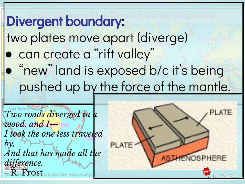
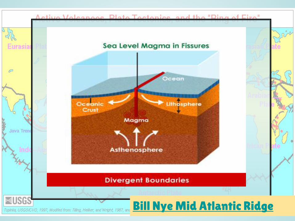
Divergent boundary: two plates move apart (diverge) ● can create a “rift valley”● “new” land is exposed b/c it’s being
pushed up by the force of the mantle.
Two roads diverged in a wood, and I—I took the one less traveled by,And that has made all the difference.- R. Frost

Find a divergent boundary

RIFT VALLEY

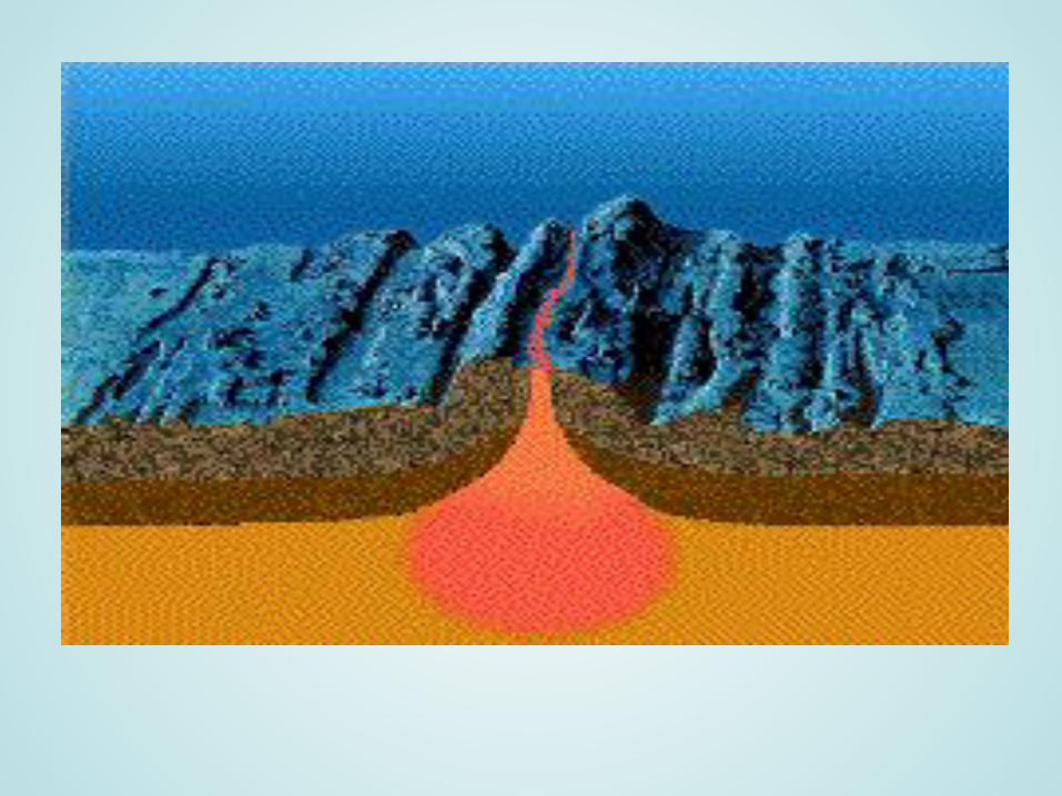
Sea-floor spreading: as molten material rises thru the cracks in the ocean floor, ridges (mountains) are formed.•caused by underwater volcanoes •occurs at DIVERGENT boundaries
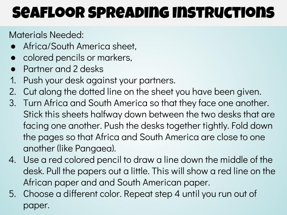
Seafloor Spreading InstructionsMaterials Needed: ● Africa/South America sheet, ● colored pencils or markers, ● Partner and 2 desks1. Push your desk against your partners.2. Cut along the dotted line on the sheet you have been given. 3. Turn Africa and South America so that they face one another.
Stick this sheets halfway down between the two desks that are facing one another. Push the desks together tightly. Fold down the pages so that Africa and South America are close to one another (like Pangaea).
4. Use a red colored pencil to draw a line down the middle of the desk. Pull the papers out a little. This will show a red line on the African paper and and South American paper.
5. Choose a different color. Repeat step 4 until you run out of paper.
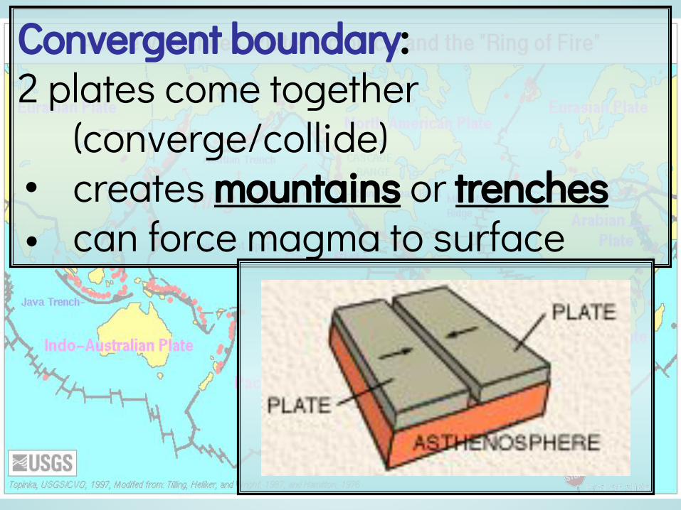
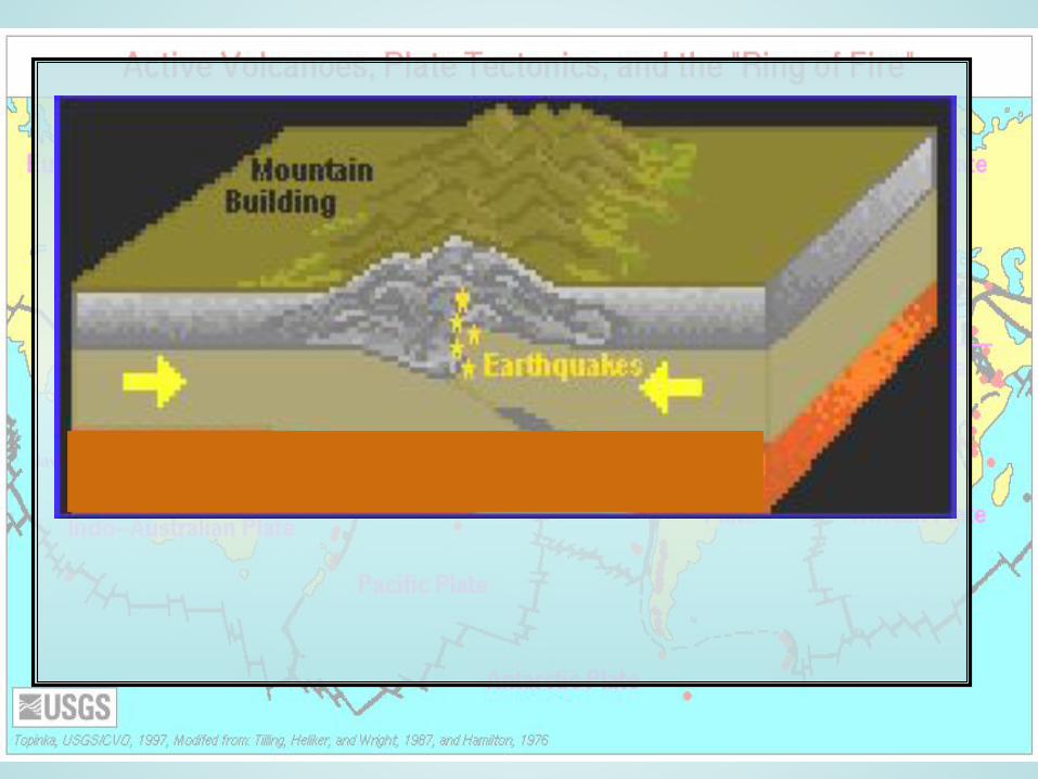
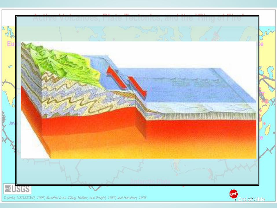
Convergent boundary: 2 plates come together
(converge/collide) • creates mountains or trenches• can force magma to surface
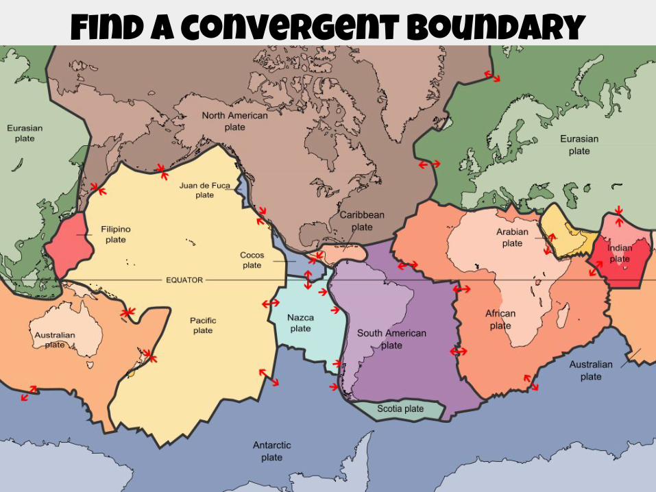
Find a convergent boundary
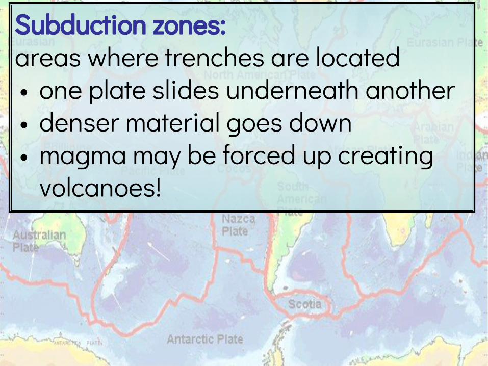
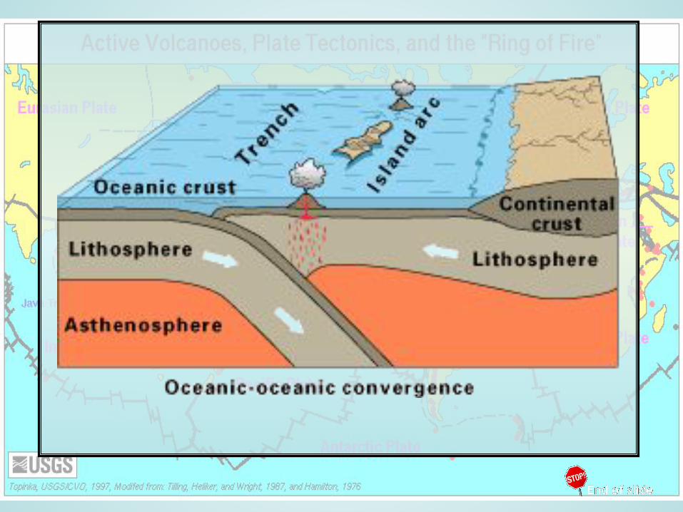
Subduction zones: areas where trenches are located• one plate slides underneath another• denser material goes down• magma may be forced up creating
volcanoes!
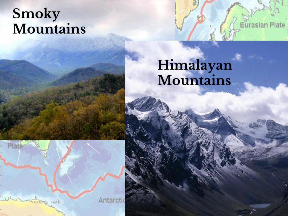
Smoky Mountains
Himalayan Mountains
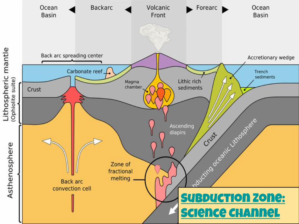
Subduction Zone: Science Channel
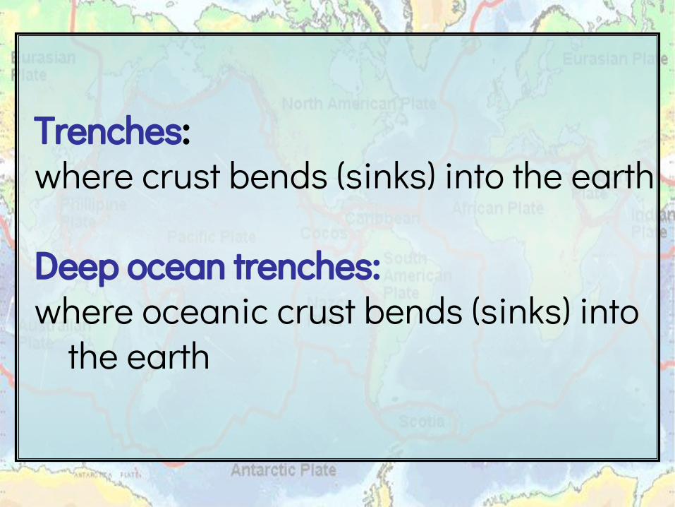
Trenches: where crust bends (sinks) into the earth
Deep ocean trenches: where oceanic crust bends (sinks) into
the earth

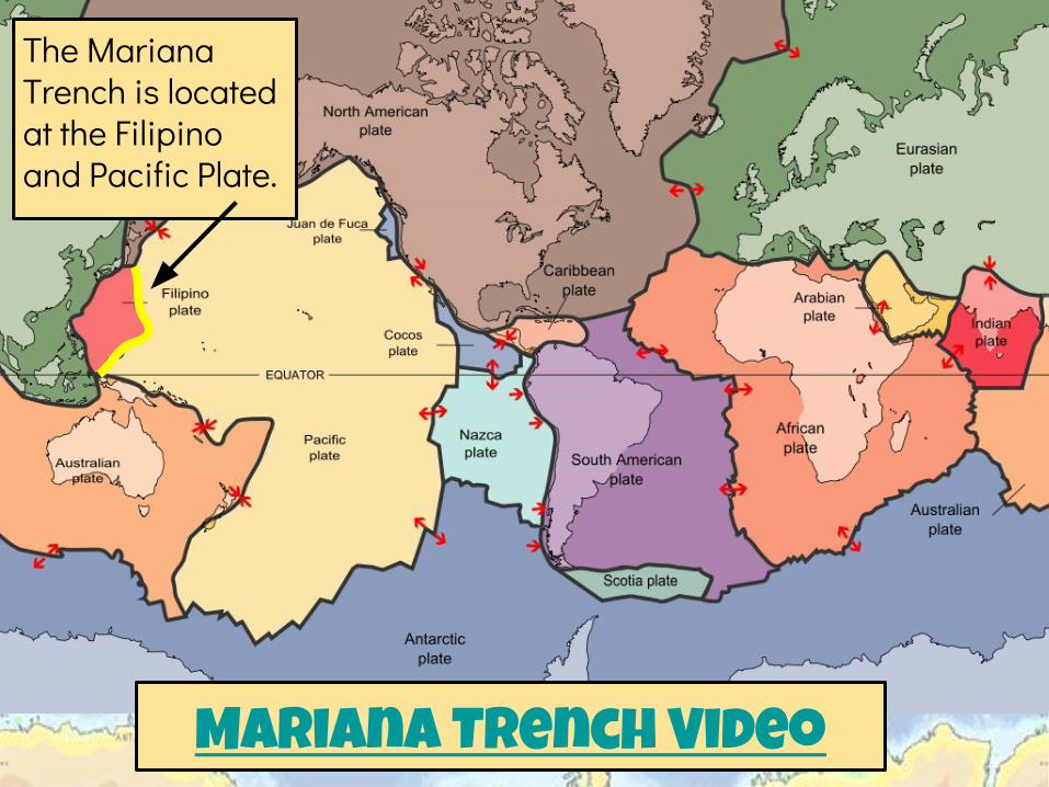
Mariana Trench Video
The Mariana Trench is located at the Filipino and Pacific Plate.
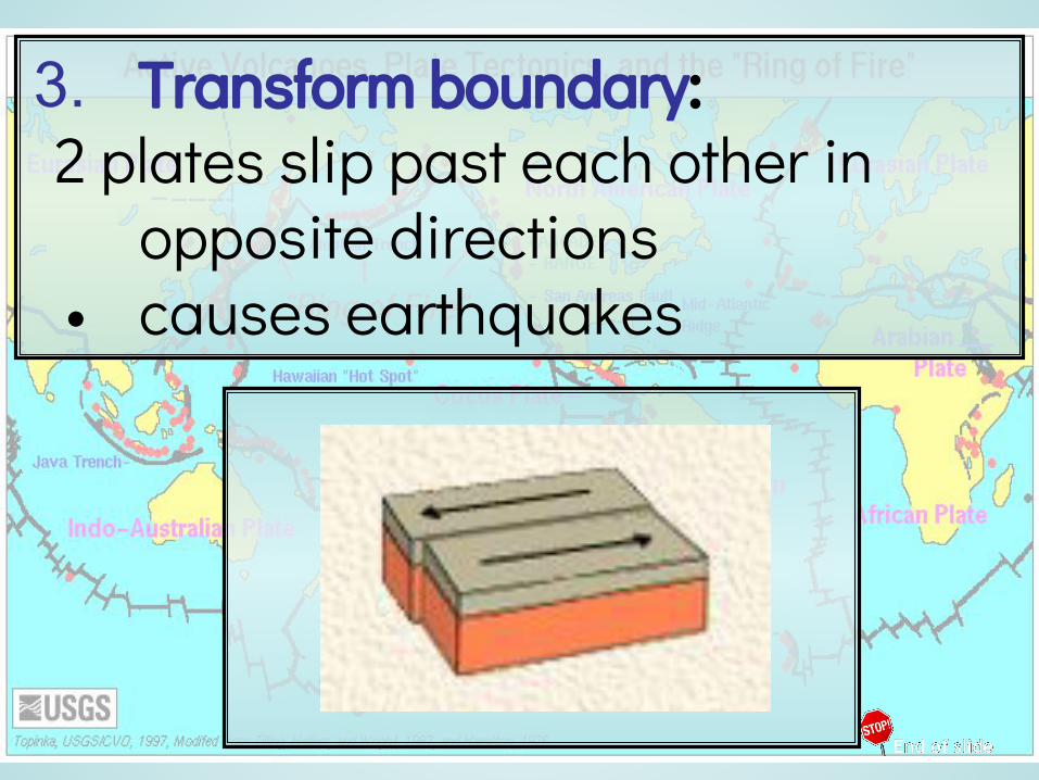
3. Transform boundary: 2 plates slip past each other in
opposite directions • causes earthquakes
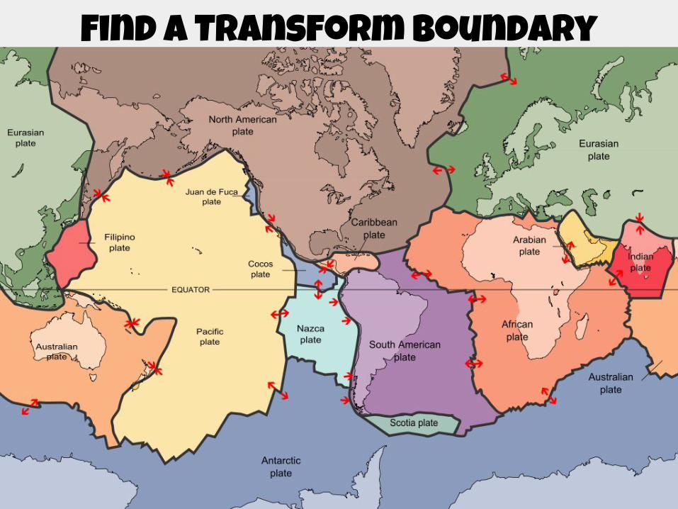
Find a Transform boundary
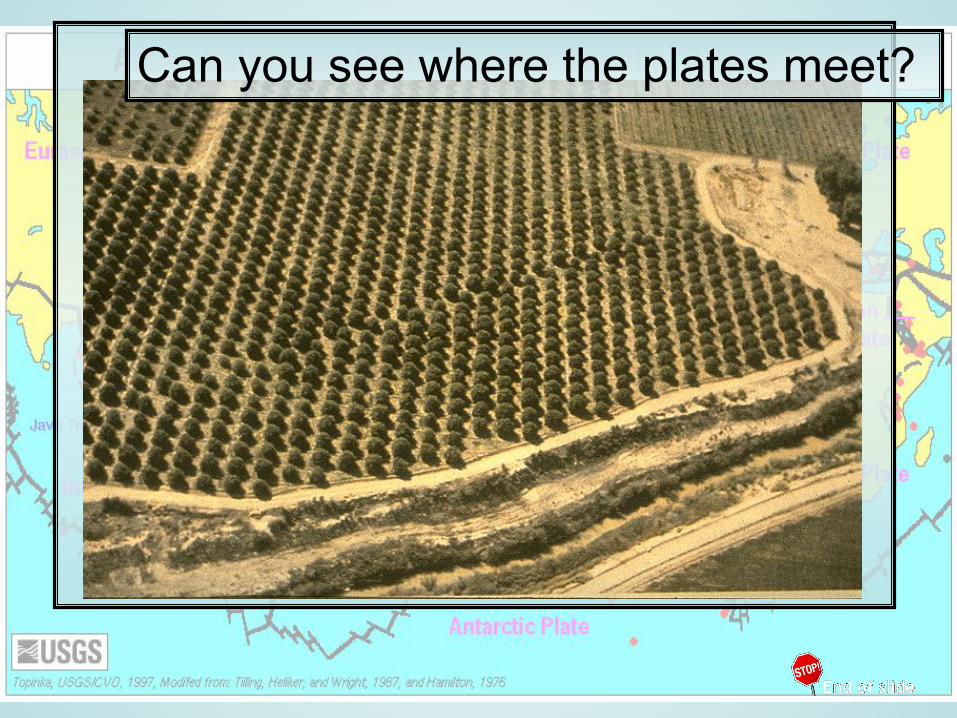
Can you see where the plates meet?
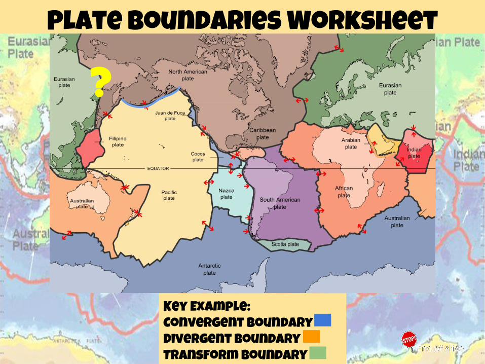
Plate Boundaries Worksheet
Key Example: Convergent BoundaryDivergent BoundaryTransform Boundary
?
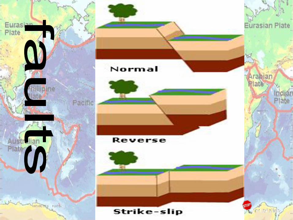
Fault: break in Earth’s crust where rocks have slipped past each other •often forms at plate boundaries•It’s what you see!•may not break completely thru the plate
3 types of fault:1. Normal2. Reverse3. Strike-slip

Robert Krampf, The Happy Scientist: Faults

Normal fault: occur where plates diverge (at a
divergent boundary)

Reverse fault: occur where plates collide (at a
convergent boundary)

Strike-slip fault: rocks slide past each other
sideways w/ little up or down motion (at a transform boundary)

Aerial View of a Strike Slip Fault


San Andreas fault clip
Covers over 800 miles!
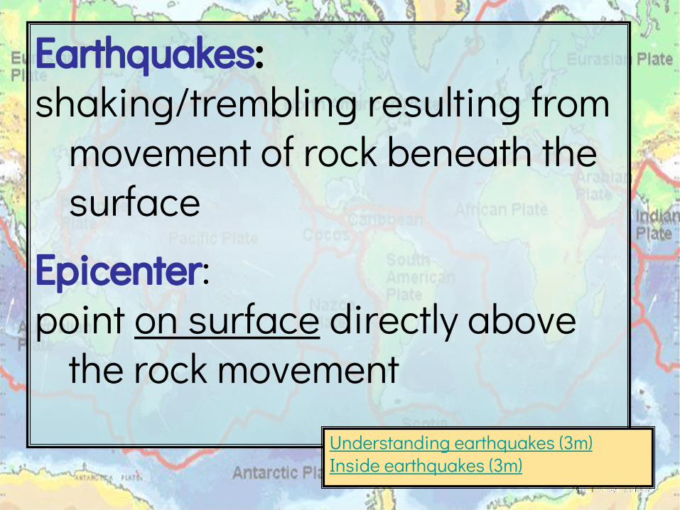
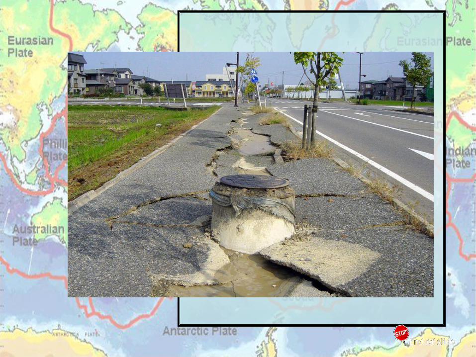
Earthquakes: shaking/trembling resulting from
movement of rock beneath the surface
Epicenter: point on surface directly above
the rock movementUnderstanding earthquakes (3m)Inside earthquakes (3m)


Seismic waves: vibrations that travel thru Earth
carrying the energy released during an earthquake
• move like ripples in a pond• change speed & direction
depending on material traveled thru

P waves:(Primary waves)• Push-pull motion• Fastest & 1st to be felt
S waves:(Secondary waves)• Up & down and back & forth motion• Cannot travel thru liquid
(outer core)
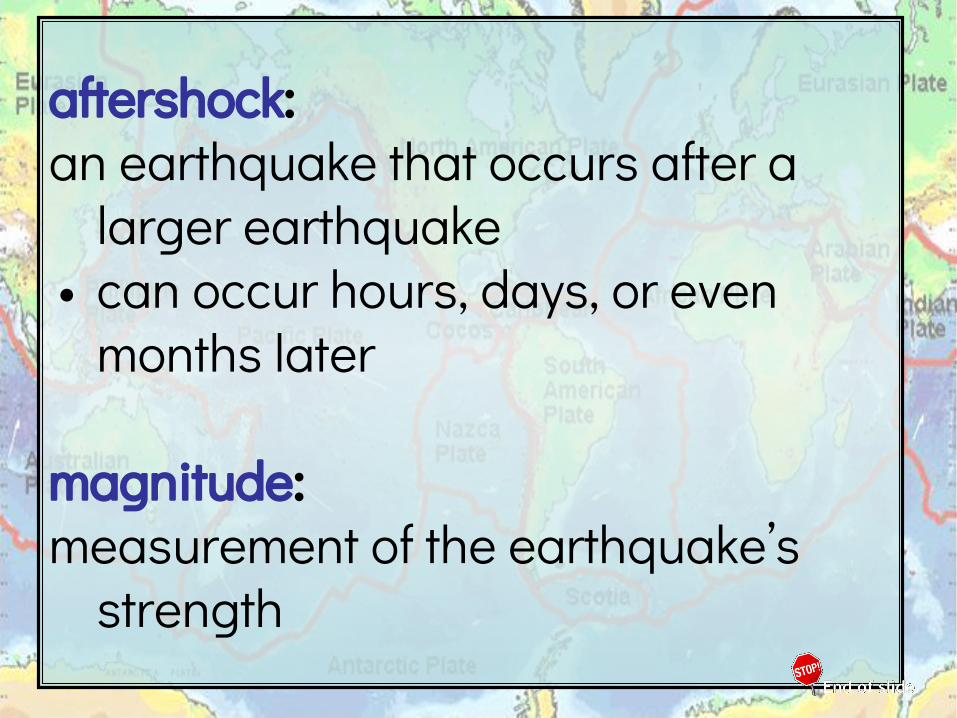
aftershock: an earthquake that occurs after a
larger earthquake• can occur hours, days, or even
months later
magnitude: measurement of the earthquake’s
strength
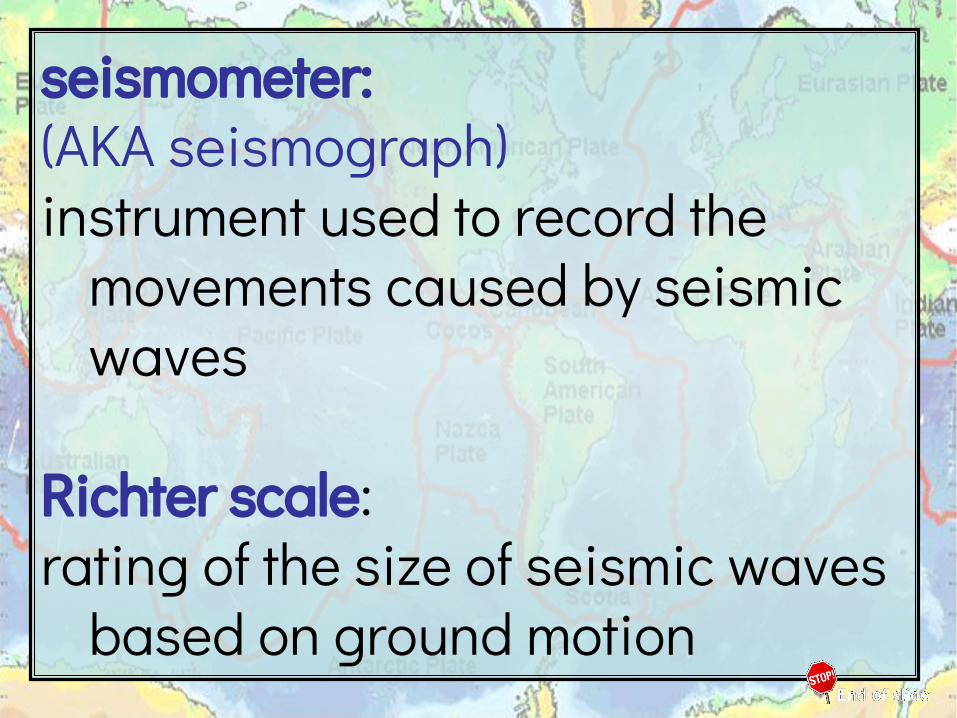
seismometer: (AKA seismograph)instrument used to record the
movements caused by seismic waves
Richter scale: rating of the size of seismic waves
based on ground motion


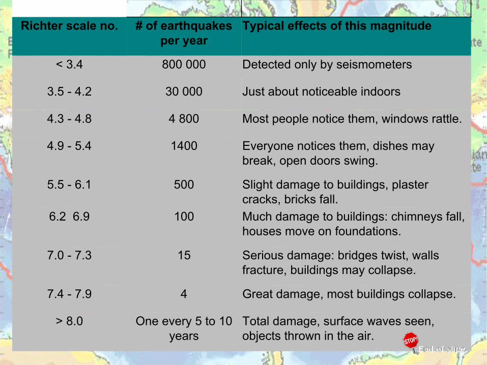
Richter scale no. # of earthquakes per year
Typical effects of this magnitude
< 3.4 800 000 Detected only by seismometers
3.5 - 4.2 30 000 Just about noticeable indoors
4.3 - 4.8 4 800 Most people notice them, windows rattle.
4.9 - 5.4 1400 Everyone notices them, dishes may break, open doors swing.
5.5 - 6.1 500 Slight damage to buildings, plaster cracks, bricks fall.
6.2 6.9 100 Much damage to buildings: chimneys fall, houses move on foundations.
7.0 - 7.3 15 Serious damage: bridges twist, walls fracture, buildings may collapse.
7.4 - 7.9 4 Great damage, most buildings collapse.
> 8.0 One every 5 to 10 years
Total damage, surface waves seen, objects thrown in the air.
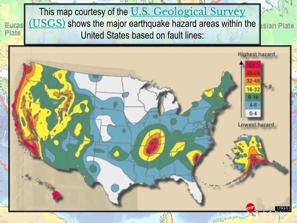
This map courtesy of the U.S. Geological Survey (USGS) shows the major earthquake hazard areas within the
United States based on fault lines:
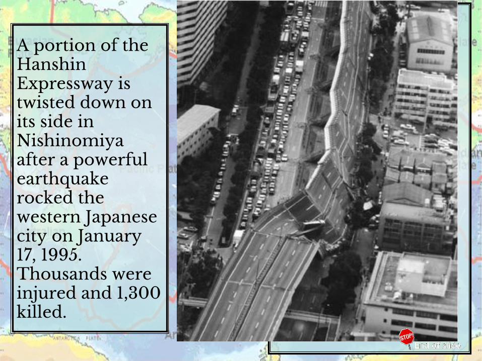
A portion of the Hanshin Expressway is twisted down on its side in Nishinomiya after a powerful earthquake rocked the western Japanese city on January 17, 1995. Thousands were injured and 1,300 killed.

2010 Haiti earthquake
magnitude of 7.0
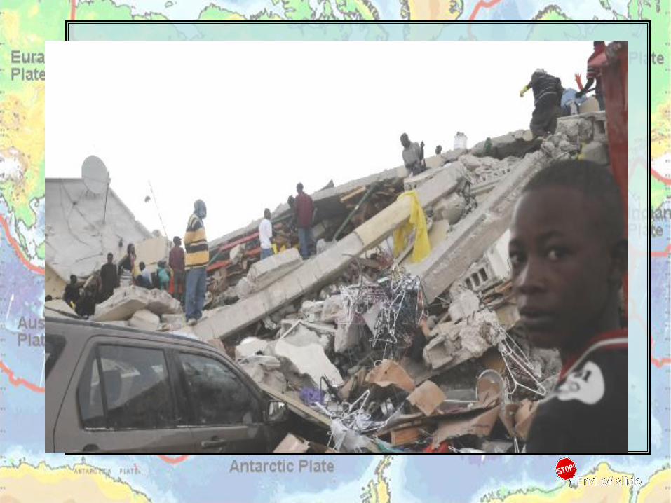

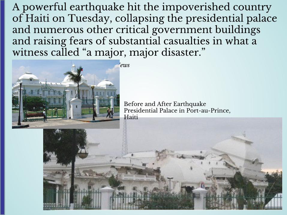
A powerful earthquake hit the impoverished country of Haiti on Tuesday, collapsing the presidential palace and numerous other critical government buildings and raising fears of substantial casualties in what a witness called “a major, major disaster.”
NBC News
Before and After EarthquakePresidential Palace in Port-au-Prince, Haiti

Seismic Waves Cross the Country SBNY
CHCA
Google Earth
UPOR
EMIL
CAOK
NLNC
Magnitude 7.0 HAITITuesday, January 12, 2010 at 21:53:09 UTC
Haitian earthquakes seismic wave path
across the US.
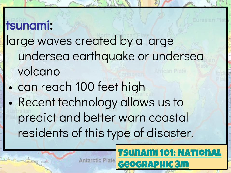
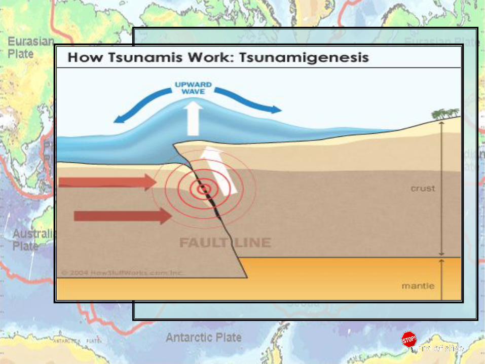
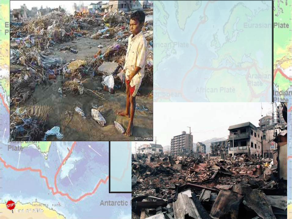
tsunami: large waves created by a large
undersea earthquake or undersea volcano
• can reach 100 feet high• Recent technology allows us to
predict and better warn coastal residents of this type of disaster.
Tsunami 101: National Geographic 3m
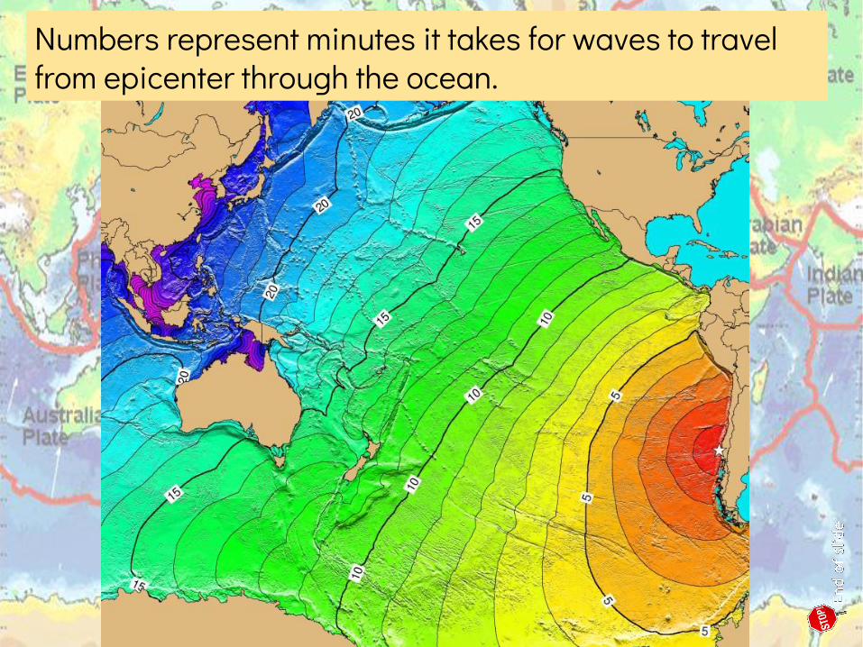
Numbers represent minutes it takes for waves to travel from epicenter through the ocean.
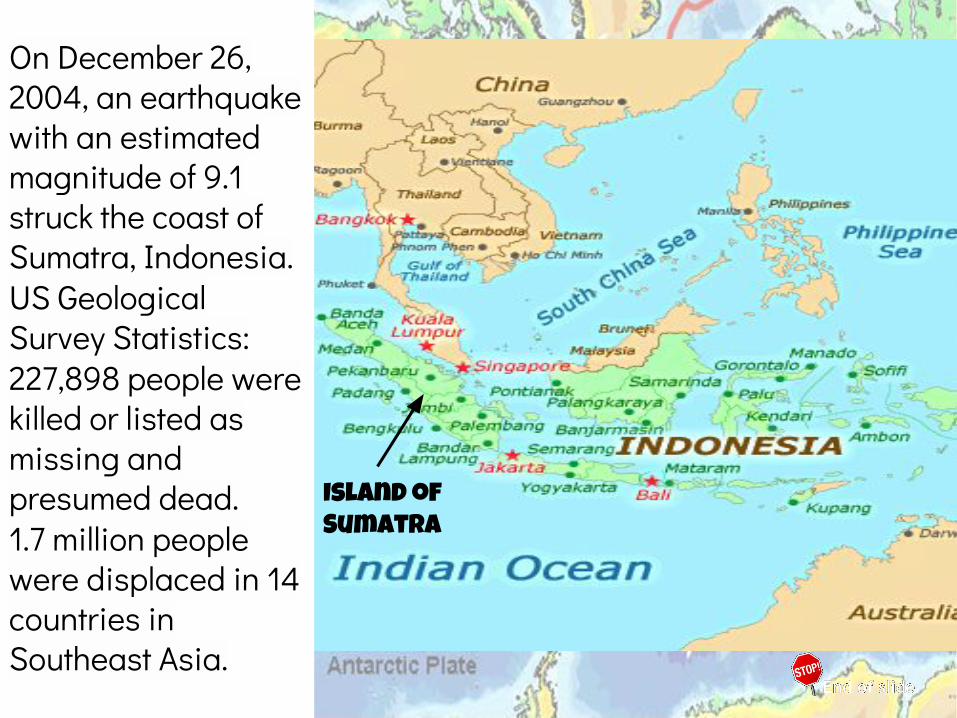
On December 26, 2004, an earthquake with an estimated magnitude of 9.1 struck the coast of Sumatra, Indonesia.US Geological Survey Statistics:227,898 people were killed or listed as missing and presumed dead.1.7 million people were displaced in 14 countries in Southeast Asia.
Island of Sumatra
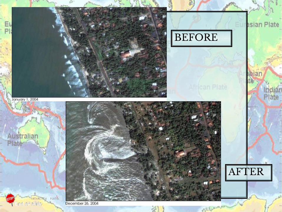
BEFORE
AFTER


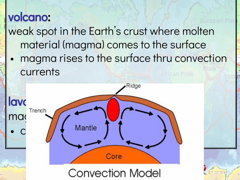
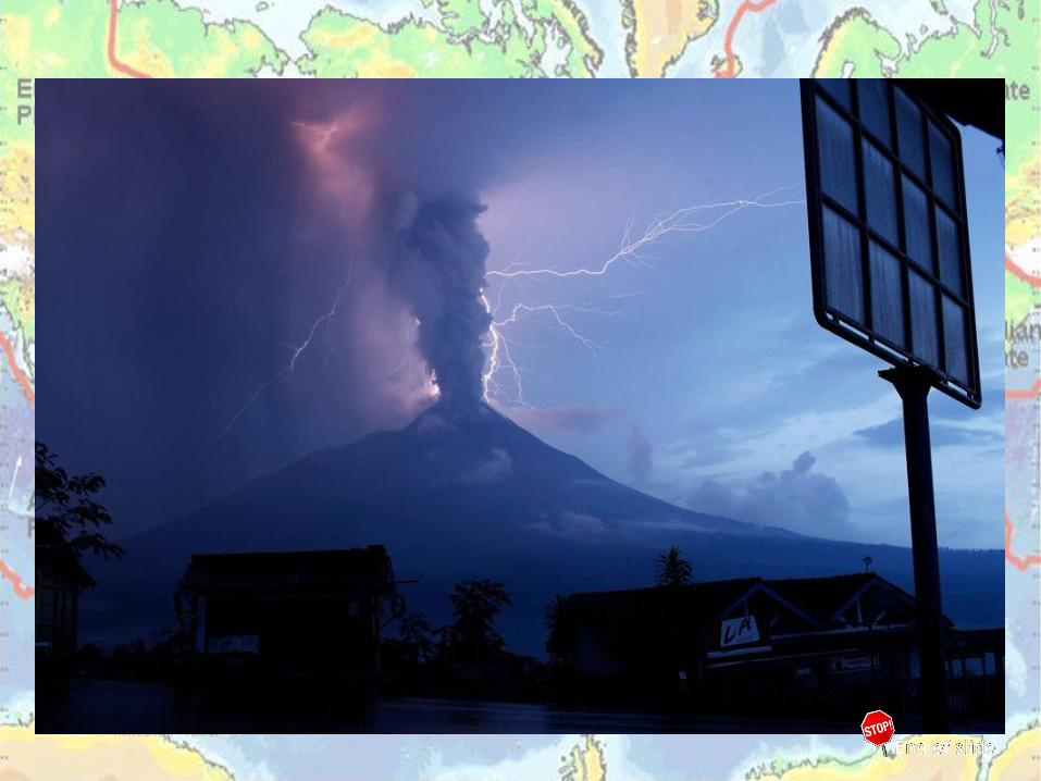
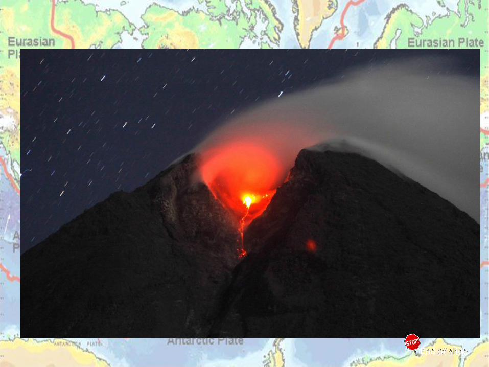
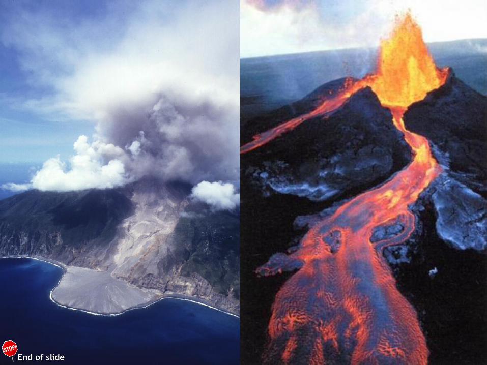
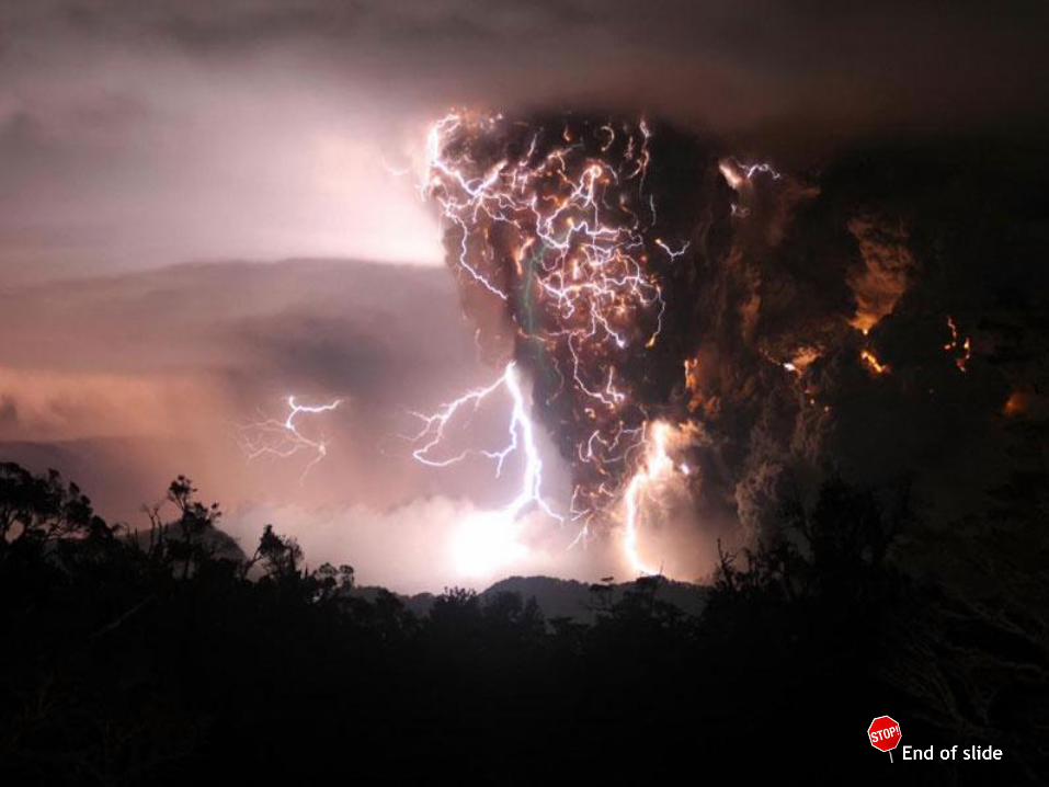
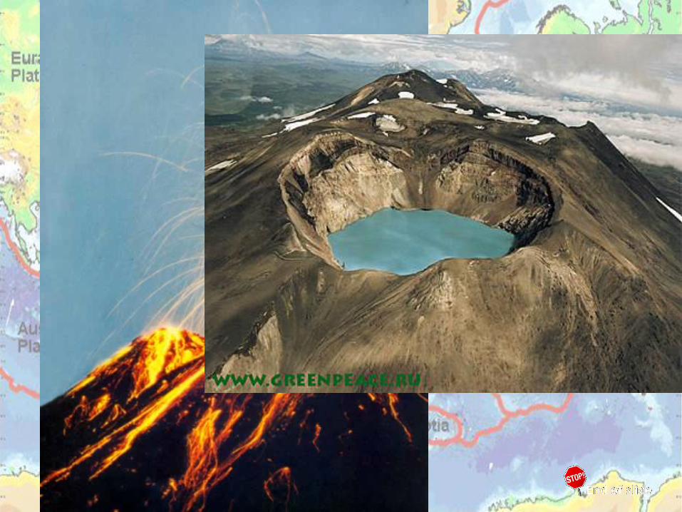
volcano: weak spot in the Earth’s crust where molten
material (magma) comes to the surface • magma rises to the surface thru convection
currents
lava: magma that has reached the surface• cooled lava forms solid rock
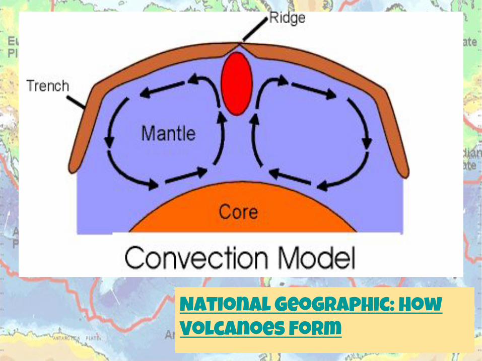
National Geographic: How Volcanoes Form
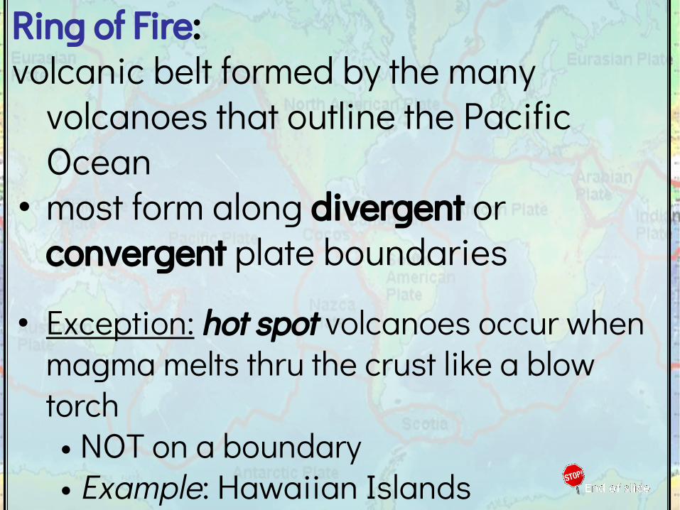
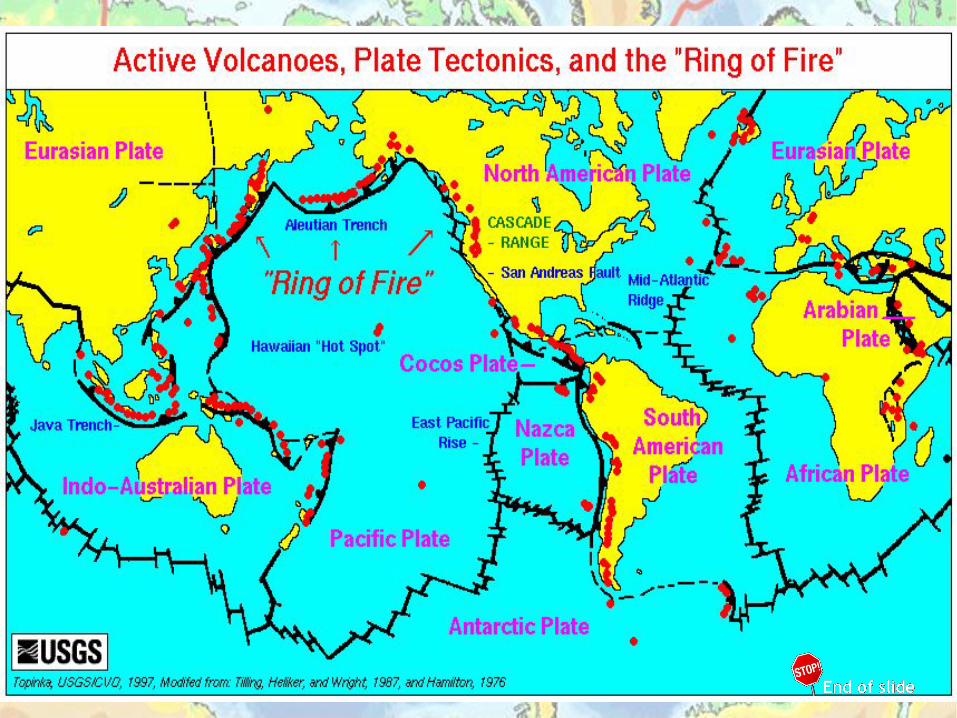
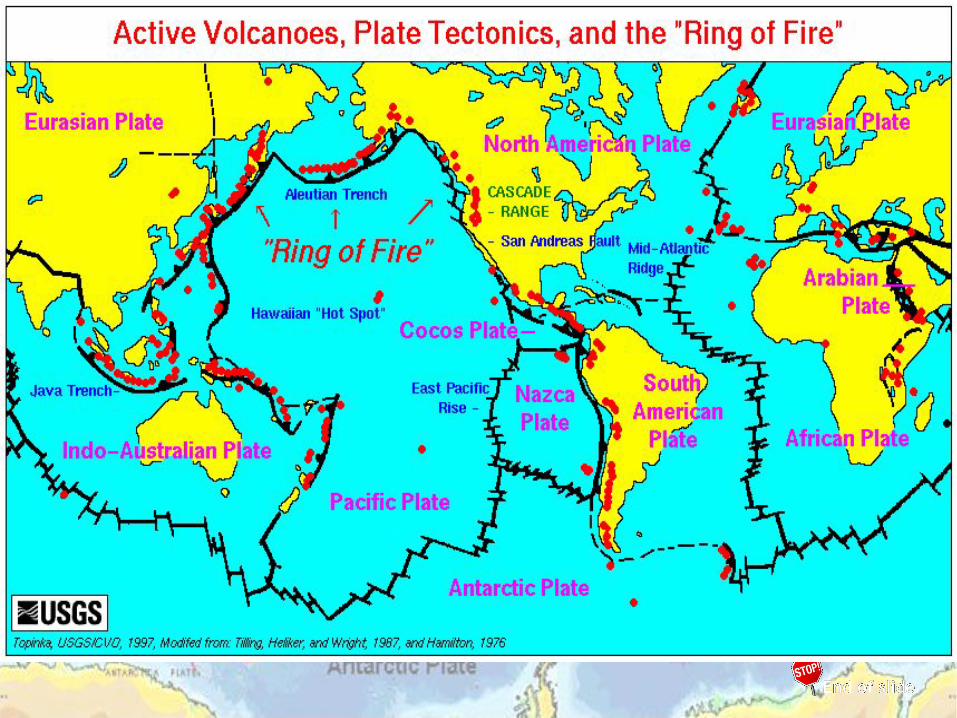
Ring of Fire: volcanic belt formed by the many
volcanoes that outline the Pacific Ocean
• most form along divergent or convergent plate boundaries
• Exception: hot spot volcanoes occur when magma melts thru the crust like a blow torch• NOT on a boundary• Example: Hawaiian Islands
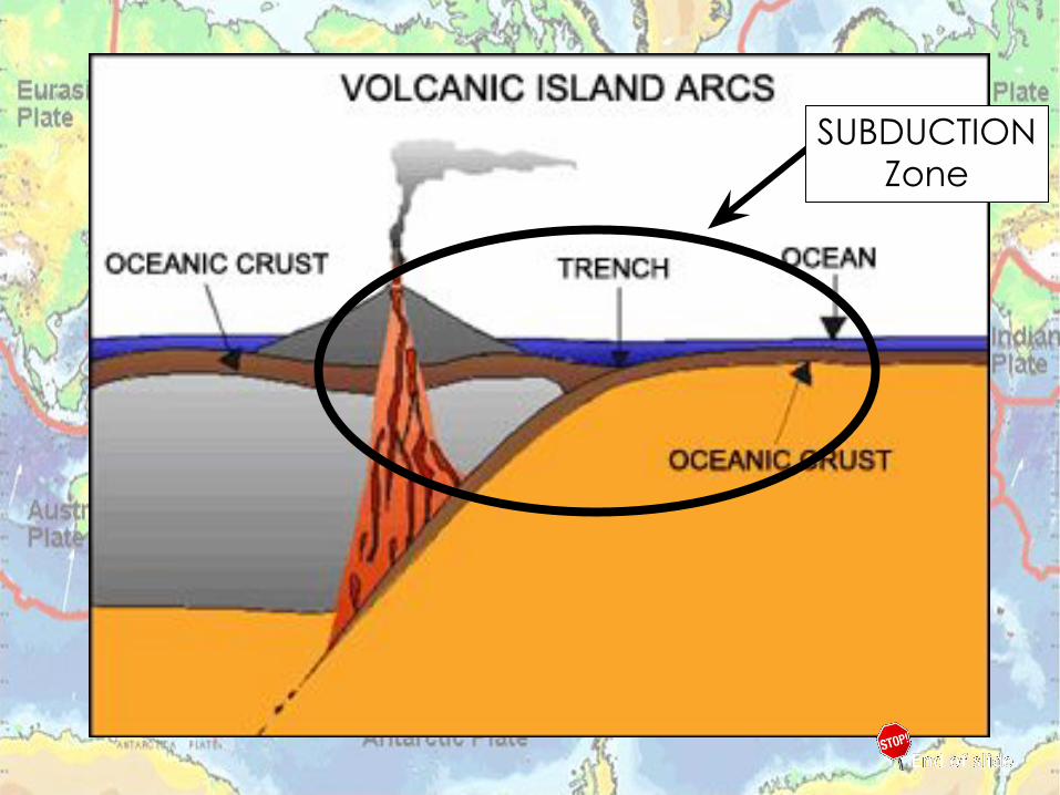
SUBDUCTIONZone

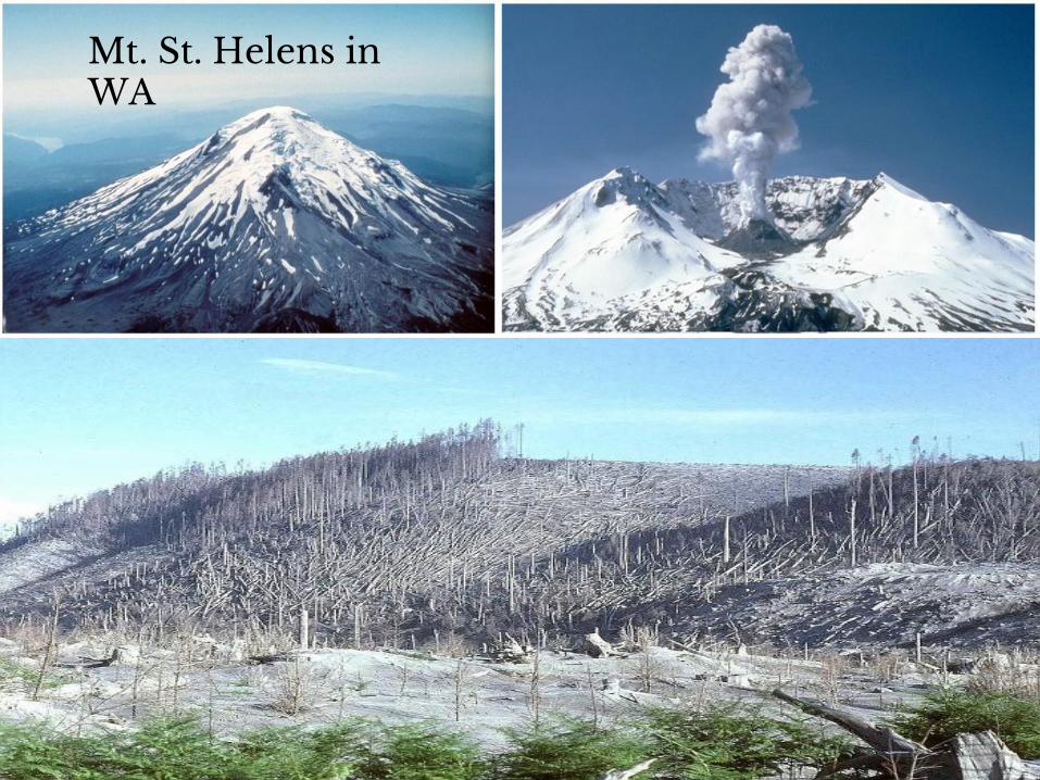
Mt. St. Helens in WA
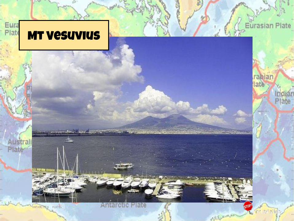
Mt Vesuvius
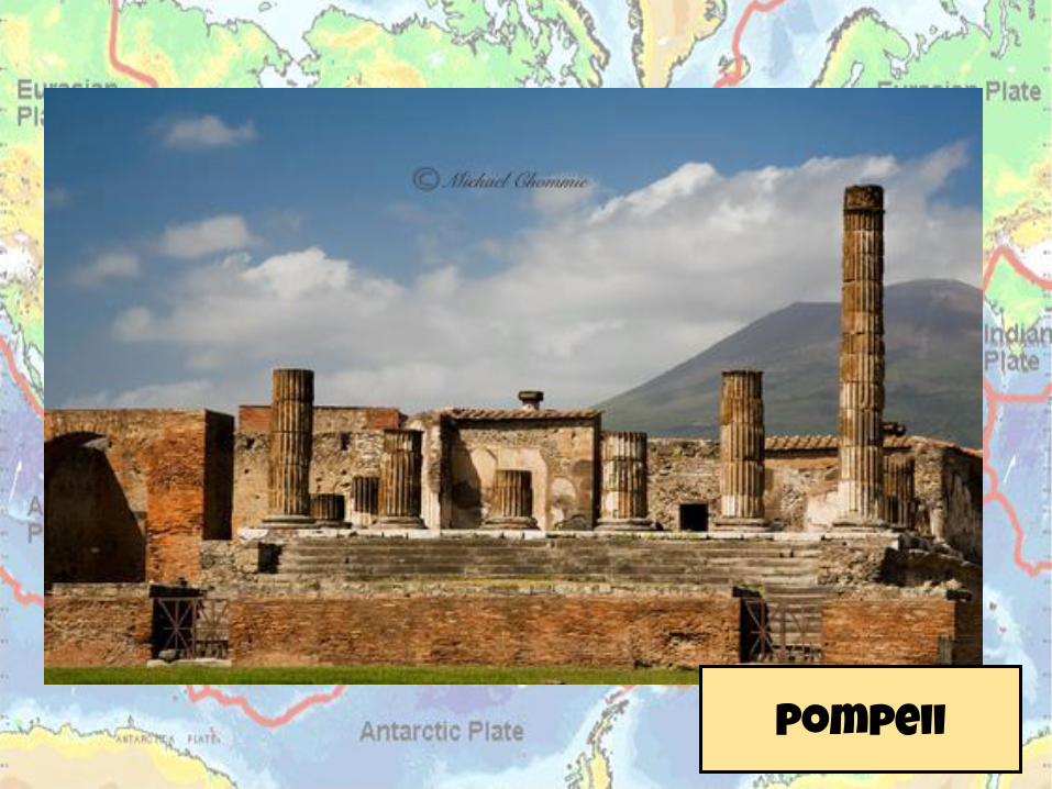
Pompeii

The End plate tectonics
notes 2017

Plate Boundaries Practice Worksheet

2010 Iceland Volcano Eruption

1. Make sure you have your colored pencils and a regular pencil. If you do not have any I have some you can borrow.
2. Get out a piece of notebook paper and make it look like the sheet to the right.
Reuniting Pangaea #Name
Conclusion Questions1.
4.
3.
2.
Bell Ringer
Reuniting Pangaea Activity
1. Set your paper up like the one to the right.
2. Complete the top portion of the Reuniting Pangaea worksheet. Glue down Pangaea onto the top portion of your notebook paper.
3. Answer the conclusion questions at the bottom of your notebook paper. USE COMPLETE SENTENCES.
4. This will be taken for a grade. You will be told what to do with this at the end of class.
5. CLEAN UP YOUR AREA.
Reuniting Pangaea Name #
Conclusion Questions1.
4.
3.
2.

Alfred Wegener- Continental Shelf
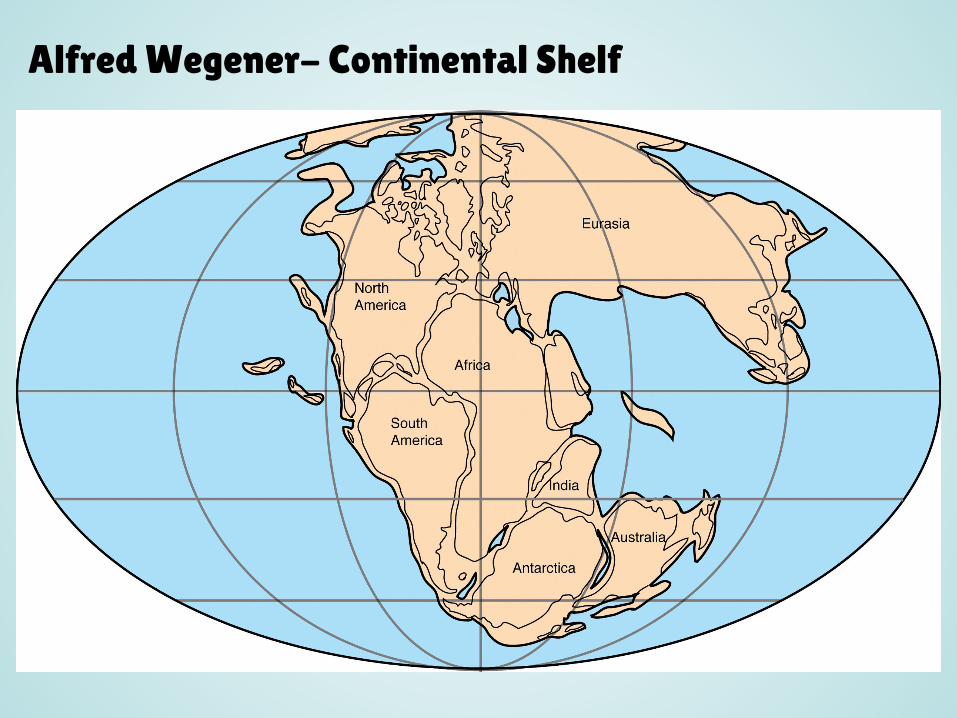
Alfred Wegener- Continental Shelf

Earth’s Interior
1. Read the text and answer the questions as you read. Keep this assignment in your binder.
2. Work on your Reuniting Pangaea or Alfred Wegener Activity.
3. Read or work quietly.

After the Quiz
1. Check your spelling. 2. Turn your test over. 3. You may draw on the back of your
quiz or read a book.