planning requirements checklist
TRANSCRIPT

USE BY SPECIAL REVIEW (USR) PROCEDURAL GUIDE DEPARTMENT OF PLANNING SERVICES
1555 N. 17TH Avenue, Greeley, CO 80631 | 970-400-6100 | www.weldgov.com
Note: A Pre-Application Request Form must be submitted to the Department of Planning Services prior to the submittal of a USR application.
Note: 1041 land uses require a separate application. Submit all the application components as separate documents, in PDF format, in the order outlined in the checklist below.
PLANNING REQUIREMENTS CHECKLIST
_____ Application Form. (See attached). _____ Authorization Form, if applicable. (See attached). _____ Deed identifying the surface estate ownership interest in the property and relevant Lease documents. _____ Articles of Organization or Incorporation documents if the owner is a business entity. Include
Statement/Delegation of Authority documentation. _____ Trustee documents if the owner is a Trust. _____ A Certificate of Conveyances (COC) prepared by a Title Company. Once signed, the COC expires
within 30 days. _____ A signed Statement of Taxes from the County Treasurer showing no delinquent property taxes for
subject property. The Statement shall be from the current tax year. _____ Completed Planning Questionnaire. (See attached). _____ Draft USR map. (See attached for map requirements.) _____ Lighting Plan following the standards set forth in Section 23-2-250.D, if applicable. _____ Landscape and Screening Plan detailing the existing and proposed landscaping, property
maintenance, installation schedule, irrigation method, security and/or privacy fencing, trash enclosure, portable toilet screening, etc. if applicable.
_____ Soil Report of the site prepared by the Natural Resource Conservation Service or a soils engineer. _____ Communication or Decommissioning Plan, if applicable. _____ Emergency Contact Form. (See attached). _____ Notice of Inquiry (NOI) Form from a municipality or municipalities if the site is located within an
Intergovernmental Agreement (IGA) boundary or a Coordinated Planning Agreement (CPA) boundary, if applicable.
_____ Buffer Report, signed, of the names, addresses and parcel numbers of the surrounding property owners within 500 feet of the property. Once signed, the buffer report expires within 30 days.
_____ Community meeting sign-in sheet, minutes, and summary (optional). _____ The names and addresses of any owner, operator of any oil and gas facilities, irrigation
ditches/laterals, pipelines, overhead lines, railroad, etc. on the property, if applicable. _____ A copy of any Surface Use Agreement with mineral owners associated with the subject property,
stipulating that the oil and gas activities on the subject property have been adequately incorporated into the design of the site in accordance with Section 23-2-160.Z.
_____ Application fee. A 50% investigation fee is required if this is application is in response to a violation.
Continued on the next page
12/15/21 1

USE BY SPECIAL REVIEW (USR) PROCEDURAL GUIDE
DEVELOPMENT REVIEW CHECKLIST
_____ Completed Public Works Questionnaire. (See attached). _____ A Preliminary Drainage Report or Drainage Narrative. (See attached drainage requirements). _____ A Traffic Impact Study (or Traffic Narrative). (See attached traffic requirements). _____ MS4 Requirements, if applicable. (A Preliminary drainage report providing water quality will be
required for the completeness review if the project site falls within an MS4 area.)
ENVIRONMENTAL HEALTH REQUIREMENTS CHECKLIST
_____ Completed Environmental Health Questionnaire. (See attached). _____ Water Supply Documentation. Example: A letter or bill from a water district or municipality, or a well
permit or permit application from the State Division of Water Resources. Provide a statement if upgrading the water source from agricultural or residential usage to commercial or industrial.
_____ Sewage Disposal Documentation. Example: An On-site wastewater treatment system permit or application or bill from a sanitary sewer district.
_____ Noise Study including a noise abatement plan documenting the methods to be utilized to meet the applicable noise standard, as determined by Environmental Health.
_____ Waste Handling Plan, as determined by Environmental Health. _____ Dust Abatement Plan, as determined by Environmental Health. _____ Engineering, Design and Operations Plan, as determined by Environmental Health. _____ Nuisance Abatement Plan (pest, manure, etc.), as determined by Environmental Health. Any other item(s) deemed necessary to process the Use by Special Review application may be requested by the Departments of Planning Services, Public Works and Public Health and Environment.
SUPPLEMENTAL REQUIREMENTS
Applications for the following USR types require additional submittal requirements as detailed in Chapter 23, Article IV of the Weld County Code, as amended. Mines Feedlots Kennels Solar Facilities Wind Generators Outdoor Shooting Ranges Telecommunication Towers Residential Therapeutic Center Solid or Hazardous Waste Disposal Facilities Organic Fertilizer Production and Composting Facilities _____ Supplemental Requirement Submittal Packet, if applicable.
12/15/21 2

A Microsoft Word (.docx) version of the questionnaires is available by request. USE BY SPECIAL REVIEW (USR) PROCEDURAL GUIDE
USR TYPE FEE
Home Business Bed and Breakfast Facility Oil and Gas Storage Facilities Second Single-Family Dwelling Unit in Ag-zoned subdivisions and townsites Exceeding maximum lot coverage
$1,200
Livestock Confinement Operation (LCO)Less than or equal to 1,000 animal unitsUp to and including each additional 1,000 animal units(Animal Units defined in Section 23-1-90 of the Weld County Code)
$2,415
$500
Mining$5,000 for the first ten acres plus $20 per acre or fraction thereof in excess of ten acres
Solid Waste Disposal Site $20,000 Hazardous Waste Disposal Site, excluding injection wells $100,000 Non-1041 Major Facility of a Utility, other than Sewage Treatment Facility $5,000 Sewage Treatment Facility $10,000 All other Use by Special Review Permits $2,500
Recording fee (due upon recordation of the final USR map) $13 for the first sheet and $10 for each additional sheet.
Fees are non-refundable and due at time of application submittal. Fees are set by the Board of County Commissioners. County Staff is not authorized to negotiate fees and cannot, under any circumstance, waive, reduce, or amend the fees set forth in the Weld County Planning Fee Schedule per Appendix 5-J of the Weld County Code.
Do not attempt to contact Planning Commissioners or the County Commissioners about your project in order to refrain from ex parte communication, defined as any material oral or written communication
relevant to the merits of the case that was neither on the record nor included the reasonable prior notice to all parties.
It is the applicant’s responsibility to meet the application requirements outlined in Section 23-2-260 of the Weld County Code. No Use by Special Review application shall be assigned a case number to be reviewed until all required items on the Use by Special Review submittal checklist have been completed and submitted to the Department of Planning Services.
The Department of Planning Services is responsible for reviewing and processing the application in accordance with Section 23-2-210 of the Weld County Code. The Planner will post one or more notification signs on the property and will mail notice to owners of property within five-hundred (500) feet of the subject property.
The Planning Commission will consider the application in accordance with Section 23-2-220 of the Weld County Code and provide a recommendation to the Board of County Commissioners concerning the application. The Board of County Commissioners will consider the application in accordance with Section 23-2-230 of the Weld County Code. See the flowchart in this procedural guide for more detail.
The applicant shall attend all hearings scheduled for consideration of the application in order to present the proposal and answer any questions. The applicant is also encouraged to communicate with the Planner assigned to process and review the application once it has been submitted in order to keep up to date with any developments pertaining to the application.
It is also recommended that the applicant contact owners of property within at least five-hundred (500) feet of the subject property about the proposed use prior to applying.
Major Amendments to existing Use by Special Review Permits shall be processed using the standard USR application per Section 23-2-280.A of the Weld County Code.
12/15/21 3

USE BY SPECIAL REVIEW (USR) CODE REQUIREMENTS
The submittal requirements and review procedures are stated in Chapter 23, Article II, Division 4 of the County Code. The Weld County Code is available online at www.weldgov.com (Useful Links > Weld County Code).
REVIEW CRITERIA
Per Sections 23-2-220.A and 23-2-230.B of the Weld County Code, the applicant shall demonstrate:
1. That the proposal is consistent with in Chapter 22 (the Weld County Comprehensive Plan) and any other applicable code provisions or ordinances in effect.
2. That the proposal is consistent with the intent of the district in which the use is located. 3. That the uses which would be permitted will be compatible with the existing surrounding land uses. 4. That the uses which would be permitted will be compatible with the future development of the surrounding area as
permitted by the existing zone and with future development as projected by Chapter 22 of this Code and any other applicable code provisions or ordinances in effect, or the adopted master plans of affected municipalities.
5. That the application complies with Articles V and XI of this Chapter if the proposal is located within an overlay zoning district or a special flood hazard area identified by maps officially adopted by the county.
6. That if the use is proposed to be located in the A (Agricultural) Zone District, the applicant has demonstrated a diligent effort has been made to conserve prime farmland in the locational decision for the proposed use.
7. That there is adequate provision for the protection of the health, safety and welfare of the inhabitants of the neighborhood and the county.
DESIGN STANDARDS
Per Section 23-2-240 of the Weld County Code. A. An applicant for a Use by Special Review shall demonstrate compliance with the following design standards in the
application and shall continue to meet these standards if approved for development. 1. Adequate water service in terms of quality, quantity and dependability is available to the site to serve the uses
permitted. 2. Adequate sewer service is available to the site to serve the uses permitted. 3. If soil conditions on the site are such that they present moderate or severe limitations to the construction of
structures or facilities proposed for the site, the applicant has demonstrated how such limitations can and will be mitigated.
4. Adequate fire protection measures are available on the site for the structures and facilities permitted. 5. Uses shall comply with the stormwater drainage criteria requirements set forth in this Code. 6. All parking and vehicle storage shall be provided on the site. Parking and loading areas shall be designed and
constructed in accordance with Division 1 of Article IV of this Chapter. 7. The use shall comply with all the Bulk Standards requirements of the zone district. 8. The access shall be located and designed to be safe; ingress and egress shall not present a safety hazard to the
traveling public or to the vehicle accessing the property. For uses generating high traffic volumes and large number of large, slow-accelerating vehicles, acceleration and deceleration lanes may be required to mitigate a potential traffic hazard.
9. New accesses to public rights-of-way shall be constructed in accordance with this Code. 10. Buffering or screening of the proposed use from adjacent properties may be required in order to make the
determination that the proposed use is compatible with the surrounding uses. buffering or screening may be accomplished through a combination of berming, landscaping and fencing.
11. Uses by Special Review in the A (Agricultural) Zone District shall be located on the least prime soils on the property in question unless the applicant can demonstrate why such a location would be impractical or infeasible.
12. The placement of signs on the site shall comply with the requirements of Article IV, Division of this Chapter. 13. Trash collection areas or facilities shall be screened from public rights-of-way and adjacent properties. These areas
shall be designed and used in a manner that will prevent wind- or animal-scattered trash.
12/15/21 4

USE BY SPECIAL REVIEW (USR) CODE REQUIREMENTS
OPERATION STANDARDS
Per Section 23-2-250 of the Weld County Code. An applicant for a Special Review Permit shall demonstrate conformance with the following operation standards in the Special Review Permit application to the extent that the standards affect location, layout and design of the Use by Special Review prior to construction and operation. Once operational, the operation of the USES permitted shall conform to these standards. A. The operation of the uses shall comply with the noise standards enumerated in Section 25-12-101, et seq., C.R.S. B. The operation of the uses shall comply with the air quality regulations promulgated by the Colorado Air Quality Control
Commission. C. The operation of the uses shall comply with the water quality regulations promulgated by the Colorado Water Quality
Control Commission. D. The uses shall comply with the following lighting standards:
1. Sources of light, including light from high-temperature processes such as combustion or welding, shall be shielded so that light rays will not shine directly onto adjacent properties where such would cause a nuisance or interfere with the use on the adjacent properties; and
2. Neither direct nor reflected light from any light source may create a traffic hazard to operators of motor vehicles on public or private streets/roads and no colored lights may be used which may be confused with or construed as traffic control devices.
E. The uses shall not emit heat so as to raise the temperature of the air more than five degrees (5°) Fahrenheit at or beyond the lot line.
F. Property shall be maintained in such a manner that grasses and weeds are not permitted to grow taller than twelve (12) inches. In no event shall the property owner allow the growth of noxious weeds.
G. Any off-site and on-site Improvements Agreement shall be made in conformance with the county policy on collateral for improvements.
OTHER LIMITATIONS
Per Section 23-2-200.G of the Weld County Code, applications for a USR shall be accepted only for proposed uses on legal lot(s). An application for a USR shall include the entire lot(s) upon which the USR will be located.
Per Section 23-2-270 of the Weld County Code, an applicant for a USR shall demonstrate conformance with and shall continue to meet any Development Standards approved and adopted by the county. The Development Standards shall be placed on the USR map prior to recording. Noncompliance with any of the approved development standards may be reason for revocation or suspension of the USR by the Board of County Commissioners.
Per Section 23-2-280.C of the Weld County Code, the conditions of approval shall be met and the map recorded within one hundred twenty (120) days from the date the resolution was signed. If the map has not been recorded within one hundred twenty (120) days from the date the resolution was signed, or if an applicant is unable to meet all of the conditions within one hundred twenty (120) days of approval, the applicant may request an extension from the Director of the Department of Planning Services. The Director may grant a one-time extension of up to one hundred twenty (120) days, for good cause shown, upon a written request by the applicant. Before this extension has expired, the applicant may seek a further extension from the Board of County Commissioners by written request to the Director of Planning. If the Board of County Commissioners denies the extension or if the conditions are not met and the map recorded by the date specified by the Board, the approval shall be voided, and the application denied.
Per Section 23-2-290.A of the Weld County Code, construction or use pursuant to approval of a USR shall be commenced within three (3) year from the date that the USR map is recorded, unless otherwise specified by the Board of County Commissioners when issuing the original Permit, or the Permit shall be vacated. The Director of Planning Services may grant an extension of time, for good cause shown, upon a written request by the landowner using the Extension Request Form.
Per Section 23-2-290.B of the Weld County Code, a USR shall terminate when the use is discontinued for a period of three (3) consecutive years, the use of the land changes or the time period established by the Board of County Commissioners through the approval process expires. The landowner may notify the Department of Planning Services of a termination of the use, or Planning Services staff may observe that the use has been terminated. When either the Department of Planning Services is notified by the landowner, or when the Department of Planning Services observes that the use may have been terminated, the Planner shall send certified written notice to the landowner asking that the landowner request to vacate the USR.
12/15/21 5

CONTACT INFORMATION AND OFFICE LOCATIONS Weld County Planning and Zoning Planning Floodplain Administration 1555 N 17th Avenue Greeley, CO 80631 (970) 400-6100 www.weldgov.com/Government/Departments/Planning-and-Zoning Weld County Building Inspection Building Permits Department of Planning 1555 N. 17th Avenue Greeley, CO 80631 (970) 400-6100 www.weldgov.com/Government/Departments/Building Weld County Development Review Access Permits Engineering 1555 N. 17th Avenue Greeley, CO 80631 (970) 400-6100 www.weldgov.com/Government/Departments/Planning-and-Zoning Weld County Department of Public Health and Environment Weld County Septic Permits On Site Waste Water Systems (OWTS) 1555 N 17th Avenue Greeley, CO 80631 (970) 304-6415 www.weldgov.com/Government/Departments/Health-and-Environment
Colorado Department of Transportation (CDOT) 10601 W. 10th Street Greeley, CO 80634 (970) 353-1232 www.codot.gov/ Division of Water Resources Water Wells 1313 Sherman St. Room 818 Denver, CO 80203 (303) 866-3581 810 Ninth St Second Floor Greeley, CO 80631 (970) 352-8712 https://dwr.colorado.gov/ Well Permitting Information: https://dwr.colorado.gov/services/well-permitting Soil Conservation Districts Big Thompson (Fort Collins) – 970-493-1638 Boulder Valley (Longmont) – 303-776-4034 Centennial – 970-522-7440 x3 Fort Collins – 970-221-0611 Morgan – 970-867-9659 x4 Platte Valley (Brighton) – 303-857-6721 Southeast Weld (Brighton) – 303-659-7004 x101 West Adams (Brighton) – 303-659-2080 West Greeley – 970-356-8097 x 3 www.coloradoacd.org Colorado Geological Survey Division of Minerals and Geology 1313 Sherman Street Room 715 Denver, CO 80203 (303) 384-2643 www.coloradogeologicalsurvey.org
12/15/21 6

APPROVAL PROCESS FLOWCHART
Pre-application meeting (no fee)
Application submitted
Completeness review by staff
Incomplete submittal Complete submittal
Applicant submits additional application
materials
Planner sends application materials to referral agencies
for comment (28 days)
Planner schedules hearings and writes and sends staff report with referral agency comments to applicant (approx. 30 days after referral comments received)
Applicant sends notice to mineral rights owners per CRS Section 24-65.5-103 (30 days prior to Planning Commission hearing)
Map and conditions incomplete
Map and conditions complete
Application fee submitted
Planning Commission public hearing and recommendation
Planner sends notice of hearings to owners of land within 500'
Board of County Commissioners public hearing and decision
Applicant submits Mylar map for recording (within 120 days
of approval by the Board)
Planner records Mylar(within 2 weeks)
Applicant addresses conditions of approval
Applicant submits corrections
12/15/21 7

PAGE INTENTIONALLY LEFT BLANK
12/15/21 8

USE BY SPECIAL REVIEW (USR) APPLICATION
PROPERTY INFORMATION
Is the property currently in violation? ☐ No / ☐ Yes Violation Case Number:
Parcel Number: ___ ___ ___ ___ - ___ ___ - ___ - ___ ___ - ___ ___ ___ Site Address:
Legal Description:
Section: ______, Township ______ N, Range ______ W Zoning District: ________ Acreage: _______
Within subdivision or townsite? ☐ No / ☐ Yes Name:
Water (well permit # or water district tap #):
Sewer (On-site wastewater treatment system permit # or sewer account #):
Floodplain ☐ No / ☐ Yes Geological Hazard ☐ No / ☐ Yes Airport Overlay ☐ No / ☐ Yes
PROJECT
USR Use being applied for:____________________________________________________________ Name of proposed business: ___________________________________________________________
PROPERTY OWNER(S) (Attach additional sheets if necessary.)
Name: Company: Phone #: Email: Street Address: City/State/Zip Code:
APPLICANT/AUTHORIZED AGENT (Authorization Form must be included if there is an Authorized Agent)
Name: Company: Phone #: Email: Street Address: City/State/Zip Code:
I (We) hereby depose and state under penalties of perjury that all statements, proposals, and/or plans submitted with or contained within the application are true and correct to the best of my (our) knowledge. All fee owners of the property must sign this application. If an Authorized Agent signs, an Authorization Form signed by all fee owners must be included with the application. If the fee owner is a corporation, evidence must be included indicating the signatory has the legal authority to sign for the corporation.
Signature Date Signature Date
Print Print
FOR PLANNING DEPARTMENT USE: DATE RECEIVED: AMOUNT $ CASE # ASSIGNED:APPLICATION RECEIVED BY PLANNER ASSIGNED:
12/15/21 9

PAGE INTENTIONALLY LEFT BLANK
12/15/21 10

DEPARTMENTS OF PLANNING BUILDING, DEVELOPMENT REVIEW
AND ENVIRONMENTAL HEALTH 1555 NORTH 17TH AVENUE
GREELEY, CO 80631
AUTHORIZATION FORM
I, (We), _______________________________, give permission to _________________________________ (Owner – please print) (Authorized Agent/Applicant–please print) to apply for any Planning, Building, Access or OWTS permits on our behalf, for the property located at (address or parcel number) below: ______________________________________________________________________________________ Legal Description: _________________________ of Section _______, Township______ N, Range______ W Subdivision Name: ________________________________________________ Lot________ Block_______ Property Owners Information: Address: _______________________________________________________________________________ Phone: ______________________________ E-mail: ____________________________________________ Authorized Agent/Applicant Contact Information: Address: _______________________________________________________________________________ Phone: ______________________________ E-Mail: ____________________________________________ Correspondence to be sent to: Owner ____ Authorized Agent/Applicant ____ by: Mail_____ Email_____ Additional Info:__________________________________________________________________________ ______________________________________________________________________________________ ______________________________________________________________________________________ Owner Signature: _____________________________________________ Date:______________________ Owner Signature: _____________________________________________ Date:______________________
12/15/21 11

FOR COMMERCIAL OR INDUSTRIAL BUILDINGS, PLEASE COMPLETE THE FOLLOWING INFORMATION:
Business Name: Phone:
Address: City, state, zip:
Business Owner: Phone:
Home Address: City, state, zip:
List up to three persons in the order to be called in the event of an emergency:
NAME TITLE PHONE ADDRESS
Business Hours: Days:
UTILITY SHUT OFF LOCATIONS:
Main Electrical:
Gas Shut Off:
Exterior Water Shutoff:
Interior Water Shutoff:
12/15/21 12

USE BY SPECIAL REVIEW (USR) PLANNING QUESTIONNAIRE
Answer the following questions per Section 23-2-260. A, B, C & E of the Weld County Code. Please type on a separate sheet. If a question does not pertain to your proposal, please respond with an explanation – do not leave questions blank. 1. Explain the proposed use and business name. 2. Explain the need for the proposed use. 3. Describe the current and previous use of the land. 4. Describe the proximity of the proposed use to residences. 5. Describe the surrounding land uses of the site and how the proposed use is compatible with them. 6. Describe the hours and days of operation (i.e. Monday thru Friday 8:00 a.m. to 5:00 p.m.). 7. Describe the number of employees including full-time, part-time and contractors. If shift work is proposed,
detail number of employees, schedule and duration of shifts. 8. Describe the maximum number of users, patrons, members, buyers or other visitors that the site will
accommodate at any one time. 9. List the types and maximum numbers of animals to be on the site at any one time (for dairies, livestock
confinement operations, kennels, etc.). 10. List the types and number of operating and processing equipment. 11. List the types, number and uses of the existing and proposed structures. 12. Describe the size of any stockpile, storage or waste areas. 13. Describe the method and time schedule of removal or disposal of debris, junk and other wastes associated
with the proposed use. 14. Include a timetable showing the periods of time required for the construction of the operation. 15. Describe the proposed and existing lot surface type and the square footage of each type (i.e. asphalt, gravel,
landscaping, dirt, grass, buildings). 16. How many parking spaces are proposed? How many handicap-accessible parking spaces are proposed? 17. Describe the existing and proposed fencing and screening for the site including all parking and outdoor
storage areas. 18. Describe the existing and proposed landscaping for the site. 19. Describe reclamation procedures to be employed as stages of the operation are phased out or upon
cessation of the Use by Special Review activity. 20. Describe the proposed fire protection measures. 21. Explain how this proposal is consistent with the Weld County Comprehensive Plan per Chapter 22 of the
Weld County Code. 22. Explain how this proposal is consistent with the intent of the zone district in which it is located. (Intent
statements can be found at the beginning of each zone district section in Article III of Chapter 23 of the Weld County Code.)
23. Explain how this proposal will be compatible with future development of the surrounding area or adopted master plans of affected municipalities.
24. Explain how this proposal impacts the protection of the health, safety and welfare of the inhabitants of the neighborhood and the County.
25. Describe any irrigation features. If the proposed use is to be located in the A (Agricultural) Zone District, explain your efforts to conserve prime agricultural land in the locational decision for the proposed use.
26. Explain how this proposal complies with Article V and Article XI of Chapter 23 if the proposal is located within any Overlay Zoning District (Airport, Geologic Hazard, or Historic Townsites Overlay Districts) or a Special Flood Hazard Area identified by maps officially adopted by the County.
27. Detail known State or Federal permits required for your proposed use(s) and the status of each permit. Provide a copy of any application or permit.
12/15/21 13

USE BY SPECIAL REVIEW (USR) MAP REQUIREMENTS
Submit the draft USR map in PDF format per the map requirements in Section 23-2-260.D of the Weld County Code. Upon USR approval, a 24” x 36” Mylar map will be required along with the recording fee. _____ Vicinity Map. 1” = 2,000’ or another suitable scale if approved by Planning Services.
Delineate all of the following within ½ mile of the subject parcel: _____ Section, township and range. _____ Scale and north arrow. _____ Outline of the perimeter of the subject parcel. _____ The general classifications and distribution of soils over the parcel under consideration. Soil
classification names and agricultural capability classifications shall be noted in the legend. _____ Locations and names of all streets/roads, irrigation ditches, and water features. _____ Existing residences, existing and proposed accesses to the subject property, any abutting
subdivision outlines and names, and the boundaries of any adjacent municipality. _____ Any other relevant information.
_____ Plot Plan. 1” = 100’ or another suitable scale if approved by Planning Services. Delineate all of the following within 200 feet of the subject parcel as well as within the parcel itself. _____ Outline of the perimeter of the subject parcel. _____ All public rights-of-way of record (including names and document creating the right-of-way). _____ All existing and proposed structures and other improvements. _____ All easements and rights-of-way. _____ Irrigation ditches. _____ Adjacent property lines. _____ All hydrographic features including year-round and ephemeral streams, rivers, lakes, ponds and
reservoirs. _____ Location of areas of moderate or severe soil limitations as defined by the Natural Resources
Conservation Service or by a soil survey and study prepared by a soils engineer or scientist for the uses and associated structures proposed for the parcel.
_____ Location and design of stormwater management devices or structures per the approved Drainage Narrative or Report.
_____ Complete traffic circulation and parking plan showing locations and sizes. _____ Location, amount, size and type of any proposed landscape material, including fencing, walls,
berms or other screening. _____ Location of any special flood hazard area, geologic hazard area, airport-overlay or mineral
resource areas, if applicable. _____ Show and label the location of the lighting. Include a dimensioned elevation drawing of any light
pole and the cutsheet of any light fixture including the shield design. _____ Additional maps may be required to reflect drainage and/or landscaping conditions.
_____ Development standards per the Final Resolution. _____ Certification blocks. (See next page).
12/15/21 14

USE BY SPECIAL REVIEW (USR) CERTIFICATION BLOCKS
*** To be included on the maps. Do NOT sign at this time. ***
PROPERTY OWNER'S CERTIFICATION
The undersigned property owner(s) do(es) hereby agree to the Site Specific Development Plan and Use by Special
Review Development Standards as described hereon this _____ day of __________________, 20_____.
________________________________ ________________________________ Name of Property Owner Name of Property Owner
PLANNING COMMISSION CERTIFICATION This is the certify that the Weld County Planning Commission has certified and does hereby recommend to the
Board of County Commissioners, Weld County, Colorado, for its confirmation, approval and adoption this Site
Specific Development Plan and Use by Special Review as shown and described hereon this ______ day of
________________, 20_____.
__________________________________ Chair, Weld County Planning Commission
BOARD OF COUNTY COMMISSIONERS CERTIFICATION This is to certify that the Board of County Commissioners, Weld County, Colorado, does hereby confirm and adopt
this Site Specific Development Plan and Use by Special Review and the Development Standards as shown and
described hereon this _____ day of ___________________, 20 _______.
__________________________________ Chair, Board of County Commissioners ATTEST: Weld County Clerk to the Board BY: _______________________________________ Dated: _________________ Deputy Clerk to the Board
12/15/21 15

PAGE INTENTIONALLY LEFT BLANK
12/15/21 16

USE BY SPECIAL REVIEW (USR) ENVIRONMENTAL HEALTH QUESTIONNAIRE
Answer the following questions per the Weld County Code, Chapters 14, 23 and 30. Please type on a separate sheet. If a question does not pertain to your proposal, please respond with an explanation – do not leave questions blank.
1. Discuss the existing and proposed potable water source. If utilizing a drinking water well, include either the
well permit or well permit application that was submitted to the State Division of Water Resources. If utilizing a public water tap, include a letter from the Water District, a tap or meter number, or a copy of the water bill.
2. Discuss the existing and proposed sewage disposal system. What type of sewage disposal system is on the property? If utilizing an existing on-site wastewater treatment system, provide the on-site wastewater treatment permit number. (If there is no on-site wastewater treatment permit due to the age of the existing on-site wastewater treatment system, apply for a on-site wastewater treatment permit through the Department of Public Health and Environment prior to submitting this application.) If a new on-site wastewater treatment system will be installed, please state “a new on-site wastewater treatment system is proposed.” (Only propose portable toilets if the use is consistent with the Department of Public Health and Environment’s portable toilet policy.)
3. If storage or warehousing is proposed, what type of items will be stored? 4. Describe where and how storage and/or stockpile of wastes, chemicals, and/or petroleum will occur on this
site. 5. If there will be fuel storage on site, indicate the gallons and the secondary containment. State the number of
tanks and gallons per tank. 6. If there will be washing of vehicles or equipment on site, indicate how the wash water will be contained. 7. If there will be floor drains, indicate how the fluids will be contained. 8. Indicate if there will be any air emissions (e.g. painting, oil storage, etc.). 9. Provide a design and operations plan if applicable (e.g. composting, landfills, etc.). 10. Provide a nuisance management plan if applicable (e.g. dairies, feedlots, etc.). 11. Additional information may be requested depending on type of land use requested. ENVIRONMENTAL HEALTH CONTACT LIST Environmental Planner: Lauren Light [email protected] (970) 400-2211 On-site Wastewater Treatment Systems Coordinator: Katie Sall [email protected] (970) 400-2216 Waste Program Supervisor: Ben Frissell [email protected] (970) 400-2220
12/15/21 17

PAGE INTENTIONALLY LEFT BLANK
12/15/21 18

USE BY SPECIAL REVIEW (USR) DEVELOPMENT REVIEW QUESTIONNAIRE
Answer the following questions per Section 8-11-40, Appendix 8-Q, and Section 8-14-10 of the Weld County Code. Please type on a separate sheet. If a question does not pertain to your proposal, please respond with an explanation – do not leave questions blank. 1. Describe the access location and applicable use types (i.e., agricultural, residential, commercial/industrial,
and/or oil and gas) of all existing and proposed accesses to the parcel. Include the approximate distance each access is (or will be if proposed) from an intersecting county road. State that no existing access is present or that no new access is proposed, if applicable.
2. Describe any anticipated change(s) to an existing access, if applicable. 3. Describe in detail any existing or proposed access gate including its location. 4. Describe the location of all existing accesses on adjacent parcels and on parcels located on the opposite
side of the road. Include the approximate distance each access is from an intersecting county road. 5. Describe any difficulties seeing oncoming traffic from an existing access and any anticipated difficulties
seeing oncoming traffic from a proposed access. 6. Describe any horizontal curve (using terms like mild curve, sharp curve, reverse curve, etc.) in the vicinity of
an existing or proposed access. 7. Describe the topography (using terms like flat, slight hills, steep hills, etc.) of the road in the vicinity of an
existing or proposed access.
12/15/21 19

USE BY SPECIAL REVIEW (USR) DRAINAGE REQUIREMENTS
DRAINAGE REQUIREMENTS A preliminary drainage report and detention pond design shall be submitted with your application materials. To have a complete application, the preliminary drainage report shall include detailed information for all highlighted items on the attached Drainage Report Checklist. (It is possible that your project qualifies for an exception to stormwater detention per Weld County Code, Section 8-11-40.I. If determined as such, a drainage narrative as described in the aforementioned Code shall be provided. All eight narrative items must be addressed for a complete application.) If using the Rational Method to calculate your site’s historic and developed stormwater runoff, coefficients and spreadsheets located on the Weld County website shall be used. Links for downloads are provided below. Please note that Urban Drainage Full Spectrum Detention is NOT allowed. Urban Drainage Rational Section: https://www.weldgov.com/files/sharedassets/public/departments/public-works/documents/urban-drainage_rational-section-2007.pdf Rational Method Coefficients, C: https://www.weldgov.com/files/sharedassets/public/departments/public-works/documents/pages-from-050-chapter-05-runoff-2008-04-rev.pdf Peak Runoff Prediction Workbook – Rational Method: https://www.weldgov.com/files/sharedassets/public/departments/public-works/documents/ud-rational-v1.02a.xls Urban Drainage Storage (Modified FAA Method for Pond Sizing): https://www.weldgov.com/files/sharedassets/public/departments/public-works/documents/urban-drainage_storage-2011.pdf Detention Pond Basin Volume Estimating Spreadsheet for Modified FAA Method: https://www.weldgov.com/files/sharedassets/public/departments/public-works/documents/ud-detention_v2.35.xls
Tips for Preparing a Successful Preliminary Drainage Report: The County requires detention as the default for ponds. Retention ponds are allowed only when the site
topography does not allow for outfall location. Per Weld County Code, Section 8-11-40.C., a variance will need to be requested to the County Engineer for a retention pond design. The variance process requires additional time for review.
Urban Drainage Full Spectrum Detention is NOT allowed. The County requires detention ponds be sized using the historic runoff value (5-year runoff for urbanizing;
10-year runoff non-urbanizing) as the pond release rate during the 100-year, 1-hour storm event. The County classifies a site as “Urbanizing” if it falls within ¼ mile of a municipal boundary.
When calculating the weighted C value for the proposed site, please model the pond water surface area using a 100% impervious value.
All historic basins should be modeled using 2% imperviousness. The Regional Tc ((total length/180)+10) should not be used in calculation of historic runoff. The WQCV can be included within the detention volume. Contact Public Works if you have questions.
12/15/21 20

Drainage Report Checklist
Department of Planning and Zoning | Development Review | 1555 N. 17th Avenue, Greeley, CO 80631 | Ph: 970-400-6100 www.weldgov.com/Government/Departments/Planning-and-Zoning/Development-Review
Project Name: The purpose of this checklist is to assist the applicant’s Engineer with developing a drainage report that supports the intent of the Weld County Code using commonly accepted engineering practices and methodologies.
Is the project in the MS4? Yes No If yes, the items ITALICIZED IN ALL CAPS below apply. See Chapter 8, Article IX of the Weld County Code.
Report Content Weld County Case Number Certificate of Compliance signed and stamped by a Colorado Licensed PE
Description/Scope of Work Location (County Roads, S-T-R) Nearby water features and ownership Total acres vs. developed acres Hydrological soil types/maps FEMA Flood Zones
Urbanizing or non-urbanizing Methodologies used for report & analysis (full spectrum is not accepted) https://www.weldgov.com/Government/Departments/ Planning-and-Zoning/Development-Review
BASE DESIGN STANDARD USED FOR PERMANENT CONTROL MEASURE DESIGN IN THE MS4
Discussion of offsite drainage routing Conclusion statement indicating that the design will adequately protect public health, safety, and general welfare and have no adverse impacts on public rights-of-way or offsite properties
Hydrology and Hydraulic Analysis Design Storm / Rainfall Information (NOAA Atlas or Local Data)
Release Rate calculations Post construction site imperviousness Hydrologic calculations (historic & developed basins) Hydraulic calculations for proposed drainage improvements (swales, culverts, riprap, pond, outlet, spillway, WQCV outlet, etc.)
Detention/WQCV calculations
Construction Drawings Stamped by PE Engineering scale & north arrow Property lines, rights-of-way, and easements1’ Contours & elevations (existing & proposed) Pre- and post-development drainage basins Arrows depicting flow direction Time of concentration critical path Drainage design pointsImprovements labeled Permanent control measure and associated drainage features labeled ‘No Build/No Storage’, include design volume
Cross sections for open channels, profiles for pipes Elevations for inverts, flow lines, top of grates,
orifice(s), etc. Pipe specs (size, material, length, slope) Outlet and spillway details
Maintenance Plan Frequency of onsite inspections Repairs, if needed Cleaning of sediment and debris Vegetation maintenance
Manufacturer maintenance specifications, if applicable
Other Required Documents (If Applicable) Variance Request and documentation– explain
hardship, applicable code section, and proposed mitigation. VARIANCES WILL NOT BE GRANTED FOR THE BASE DESIGN STANDARD REQUIREMENT IN THE MS4.
Gray Toned Items = Minimum Requirements for Preliminary Drainage Report *Note: Additional information may be necessary on a case by case basis*
12/15/21 21
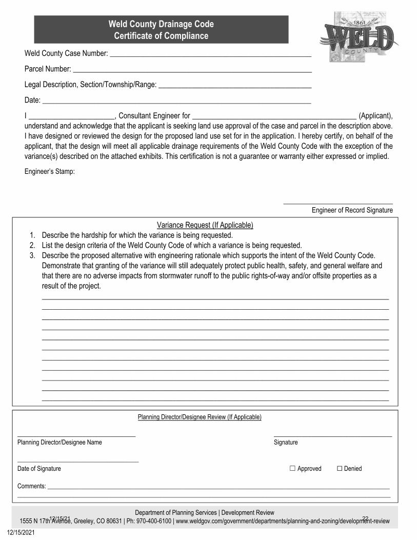
Weld County Drainage CodeCertificate of Compliance
Department of | Development Review 1 , Greeley, CO 80631 | Ph: 970- | www.weldgov.com/ departments/p /development review
/ /20
Weld County Case Number: ______________________________________________________
Parcel Number: ________________________________________________________________
Legal Description, Section/Township/Range: _________________________________________
Date: ________________________________________________________________________
I _______________________, Consultant Engineer for ____________________________________________ (Applicant), understand and acknowledge that the applicant is seeking land use approval of the case and parcel in the description above. I have designed or reviewed the design for the proposed land use set for in the application. I hereby certify, on behalf of theapplicant, that the design will meet all applicable drainage requirements of the Weld County Code with the exception of the variance(s) described on the attached exhibits. This certification is not a guarantee or warranty either expressed or implied.
Engineer’s Stamp:
________________________________ Engineer of Record Signature
P Director/Designee Review (If Applicable)
______________________________________ Signature
______________________________________ Director/Designee Name
_______________________________________Date of Signature Approved Denied
Comments: ______________________________________________________________________________________________________________ ________________________________________________________________________________________________________________________
Variance Request (If Applicable) 1. Describe the hardship for which the variance is being requested.2. List the design criteria of the Weld County Code of which a variance is being requested.3. Describe the proposed alternative with engineering rationale which supports the intent of the Weld County Code.
Demonstrate that granting of the variance will still adequately protect public health, safety, and general welfare andthat there are no adverse impacts from stormwater runoff to the public rights-of-way and/or offsite properties as aresult of the project._______________________________________________________________________________________________________________________________________________________________________________________________________________________________________________________________________________________________________________________________________________________________________________________________________________________________________________________________________________________________________________________________________________________________________________________________________________________________________________________________________________________________________________________________________________________________________________________________________________________________________________________________________________________________________________________________________________________________________________________________________________________________________________________________
12/15/21 22

USE BY SPECIAL REVIEW (USR)
PUBLIC WORKS TRAFFIC REQUIREMENTS
TRAFFIC INFORMATION
PUBLIC WORKS COMPLETENESS REVIEW TRAFFIC IMPACT ANALYSIS
Purpose and Overview
A Traffic Impact Study (TIS) is required to analyze the effects of a proposed development or other land use action on the transportation system in order to determine if adequate public facilities exist to serve the proposed development, and to clearly identify any improvements required to mitigate the impacts on the transportation system.
Traffic Impact Study Area
Traffic impacts shall be analyzed within the traffic impact area. The determination of a traffic impact area is done on a case-by-case basis; however, at a minimum the limits of the study should include:
1. Internal roads. 2. Adjacent roads. 3. Access locations and/or new intersections. 4. Off-site roads to the nearest paved County collector or arterial road or state highway. 5. Off-site roads where traffic from the proposed development or land use action will account for at least 20%
of the average daily traffic upon build-out. 6. Off-site intersections where traffic from the proposed development or land use action:
a. Contributes a 10% impact of the peak hour traffic on any approach leg of an intersection where the intersection is operating at a level of service (LOS) C or better upon build-out.
b. Contributes a 5% impact of the peak hour traffic on any approach leg of an intersection where the intersection is operating at a LOS D or worse upon build-out.
c. Impacts a specific turning movement that currently does not have an auxiliary turn lane by at least 50% of the peak hour volume warrant for an auxiliary turn.
Preliminary Traffic Impact Analysis – To be submitted with every Application
A preliminary traffic impact analysis shall be submitted with the project application for the application to be considered complete. The intent of the analysis is to determine the project’s cumulative development impacts, appropriate project mitigation and improvements necessary to offset a specific project’s impacts. This analysis shall include the following information:
Traffic Narrative:
1. Describe how many roundtrips/day are expected for each vehicle type: Passenger Cars/Pickups, Tandem Trucks, Semi-Truck/Trailer/RV (Roundtrip = One (1) trip in and One (1) trip out of site).
2. Describe the expected travel routes or haul routes for site traffic. 3. Describe the travel distribution along the routes (e.g. 50% of traffic will come from the north, 20% from the
south, 30% from the east, etc.). 4. Describe the time of day that you expect the highest traffic volumes. Public Works will review the Traffic Narrative and advise the applicant if more information or an engineered traffic impact study is required.
12/15/21 23

USE BY SPECIAL REVIEW (USR) PUBLIC WORKS TRAFFIC/GENERAL REQUIREMENTS CONTINUED
Traffic Impact Study (TIS):
A full TIS is required for any proposed development or land use zoned Commercial or Industrial, any residential subdivision greater than nine (9) lots, or when determined necessary by the Engineer. The TIS should address impacts to on-site and off-site roadways and highways within the County and shall be prepared, stamped, and signed by a professional engineer licensed in the State of Colorado. The TIS shall include, at a minimum, the following information:
1. Describe the traffic impact area, including at a minimum those elements described in the traffic impact study area section of this document.
2. A location map showing the development site, the boundaries of the traffic impact area, and all roads, intersections, bridges or other roadway structures in the traffic impact area.
3. Define the following study horizons for the Full Traffic Impact Study: the existing (current), short range, and long-range horizons. a. Existing Horizon: The intent is to establish a baseline traffic condition. b. Short Range Horizon: The intent is to evaluate the immediate impacts of the project on the transportation
system. The short-term horizon year is defined as the point of full buildout of the proposed development or land use action. If the project is proposed to occur over multiple phases, the impacts shall be analyzed at the point of full buildout of each phase. In no case shall the short-range horizon exceed five (5) years.
c. Long Range Horizon: The intent is to evaluate the impacts of the fully developed project in the context of regional transportation planning efforts. The long-term impacts are analyzed as of the end of the current Regional Transportation Plan 20-year planning horizon.
4. Identify the existing, approved, and proposed land uses within the traffic impact area. 5. Describe existing traffic conditions within the traffic impact area, including average daily traffic volumes for
roadways and a.m. and p.m. peak hour levels of service for intersections. 6. For short-range traffic projections, provide references, calculations and data sources for all trip generation
estimates. The trip generation results shall be shown in a table with the following information: a. Land Use. b. Unit of Measurement (for example, per dwelling unit, per 1000 s.f., etc.). c. Total number of units. d. Trip generation rates per unit for average daily traffic and peak hour volumes. e. Total number of trips generated for average daily traffic and a.m. and p.m. peak hours.
7. Short-range and long-range traffic projections must also include forecasts for the growth in background traffic. 8. Provide trip distribution estimates for the roads and intersections in the traffic impact area. 9. Present the volumes for short-range and long-range traffic including the projected traffic for the proposed
development or land use action for the a.m. and p.m. peak hour and average daily conditions. These volumes must include turn movements at intersection as well as volumes for roads in the traffic impact area.
10. Analyze the adequacy of the transportation system to handle the projected traffic for short- range and long-range planning years. Key elements in this analysis should include: a. Generalized daily traffic volume level of service for roadways. b. Intersection levels of service for a.m. and p.m. peak hours. c. The appropriateness of access locations and if necessary, a traffic signal warrant analysis. d. The need for auxiliary lanes (turn lanes, deceleration and acceleration lanes), including explanations of
how acceleration/deceleration lengths, storage lengths, and taper lengths were determined. e. Sight distances.
12/15/21 24

USE BY SPECIAL REVIEW (USR) PUBLIC WORKS TRAFFIC/GENERAL REQUIREMENTS CONTINUED
11. Provide a summary of conclusions and recommendations from the Full Traffic Impact Study, including at least the following items: a. A summary listing of traffic impacts from the proposed development on existing and proposed roads and
intersections within the traffic impact area. b. A summary listing of the improvements needed to assure adequate service and safety levels on the
roadway system affected by the proposed development. Identify and describe each proposed improvement, how and when it will be funded, and expected completion dates.
12. Any reasonable additional information deemed necessary for review – special considerations. Public Works will review the TIS and advise the applicant if more information is needed or provide technical comments on the submittal.
ACCESS INFORMATION
Tips for Selecting Your Access on a Weld County Road (not required for a complete application)
An Access Permit is required for access onto Weld County maintained roadways. (Weld County Code, Section 8-14-40)
The location of an access can negatively impact public safety and traffic movement efficiency. Access locations shall comply with the spacing criteria for the road’s functional classification. Accesses
on both sides of the road should be considered when determining access spacing. (Weld County Code, Section 8-14-30.I)
Information about the Weld County Functional Classification Map can be found here: https://www.weldgov.com/Government/Departments/Public-Works/Transportation-Planning/2045-Transportation-Plan
Accesses should not be located within a horizontal curve if possible. Accesses should not be located where it is difficult to see oncoming traffic. Select County roads have “Access Control Plans” that have special requirements that you should be aware
of. Please check to see if your project’s access location is impacted by an Access Control Plan here: https://www.weldgov.com/Government/Departments/Public-Works/Transportation-Planning/Access-Control-Plans
We strongly encourage you to discuss your access with Public Works prior to laying out your site plan to ensure the approved accesses are compatible with your layout.
MS4 INFORMATION (This section applies if the site is in an MS4 area.) Some Weld County parcels are located in Municipal Separate Storm Sewer System (MS4) areas that have special requirements. To learn more about MS4 and to find out if your parcel is in the MS4 go here:
https://www.weldgov.com/Government/Departments/Public-Works/Stormwater
If the site is located within a Weld County Municipal Separate Storm Sewer System (MS4) area special requirements apply as specified in Chapter 8, Article IX, of the Weld County Code. A preliminary drainage report with water quality is required for application to be considered complete.
12/15/21 25

IMPORTANT INFORMATION TO KNOW (not required for a complete application)
Right-of-way Use Permit. Per Weld County Code, Section 8-13-30.B, a Weld County Right- of-way Use Permit is required for any project that will be occupying, constructing or excavating facilities within, and/or encroaching upon, any county rights-of-way or easement. Right-of-way Use Permit instructions and application can be found at:
https://www.weldgov.com/Government/Departments/Public-Works/Permits
Overlapping Easements. Weld County will not replace overlapping easements located within existing right-of-way or pay to relocate existing utilities within the county right-of-way.
Tracking Control. Per Weld County Code, Section 8-14-50.D, your project may require permanent or
temporary tracking control to prevent mud or debris from being tracked onto a county road. For information about tracking control go here:
https://library.municode.com/co/weld_county/codes/charter_and_county_code?nodeId=CH8PUWO_ARTXIVROACPO_S8-14-50PEHOGERE
Improvements and Road Maintenance Agreement. Public Works may require an Improvements Agreement for one or all the following reasons: Off-site public improvements Road Maintenance Agreement Construction Maintenance Agreement Access Improvements Agreement On-site improvements for subdivisions/PUDs
An Improvements and Road Maintenance Agreement will detail the approved haul route(s), outline when offsite improvements will be triggered, and include a maintenance agreement for the haul routes. Possible mitigations included in the road maintenance agreement may include, but are not limited to: dust control, specified haul routes, damage repairs, and future improvement triggers. An example agreement is available at: https://www.weldgov.com/files/sharedassets/public/departments/public-works/documents/usr-spr-permits-improvements-agreement-template.pdf
Grading Permit. Per Weld County Code, Section 8-12-30.B, a Weld County Grading Permit will be required
if disturbing more than one (1) acre unless your project qualifies for a grading exemption. To learn more about grading permits or to see if your project qualifies for an exemption go here: https://library.municode.com/co/weld_county/codes/charter_and_county_code?nodeId=CH8PUWO_ARTXIIGRPEPO
Construction Stormwater Permit. A Construction Stormwater Permit is also required with the State for disturbing more than one (1) acre. Contact: Colorado Department of Public Health and Environment, Water Quality Control Division, Permit Support Staff at: 303-692-3517.
CONTACT LIST Access Permits: Tiffnee Lamb [email protected] (970) 400-3718 Improvements Agreements: Jazmyn Trujillo-Martinez [email protected] (970) 400-3711 Right-of-Way Permits: Amy Mutchie [email protected] (970) 400-3764 MS4 Requirements: Lyndsay Holbrook [email protected] (970) 400-3788 Development Review (Engineering):
Mike McRoberts [email protected] (970) 400-3798 Melissa King [email protected] (970) 400-3762
12/15/21 26