planning committee 15 august 2019
TRANSCRIPT

Birmingham City Council
Planning Committee 15 August 2019 I submit for your consideration the attached reports for the North West team. Recommendation Report No. Application No / Location / Proposal Determine 9 2019/02190/PA
144 Hamstead Road Handsworth Birmingham B20 2QR Retention of change of use from dental surgery (Use Class D1) to 1 no. self-contained flat (Use Class C3) and 8-bed HMO (Sui Generis)
Determine 10 2019/03129/PA
146 Hamstead Road Handsworth Birmingham B20 2QR Change of use from dental surgery (Use Class D1) to a 14-bed House in Multiple Occupation (HMO) (Sui Generis)
Approve – Conditions 11 2019/02810/PA
111 Hagley Road Edgbaston Birmingham B16 8LB Reserved Matters application seeking approval for Landscaping, pursuant to outline planning permission 2017/00663/PA in relation to Building 1 for an 8-storey office building with a ground floor retail unit (Use Classes A1-A4) and an under croft/basement car park
Page 1 of 3 Director, Inclusive Growth

Approve – Conditions 12 2019/03965/PA
8 Epwell Road Kingstanding Birmingham B44 8DD Change of use from residential dwelling (Use Class C3) to three bed respite care home for adults (Use Class C2)
Approve – Conditions 13 2019/03367/PA
Land at Perry Barr Reservoir Rough Road Kingstanding Birmingham B44 0UT Installation of a radio base station comprising the removal of the existing 15m temporary Vodafone lattice tower supporting 6 no. antennas and the installation of a replacement permanent 20m lattice tower supporting 12 no. antennas, 6 no. transmission dishes and ancillary development thereto including a GPS module and 2.1m fence
Prior Approval Required 14 2019/06062/PA Approve – Conditions
Birmingham Alexander Stadium Walsall Road Perry Barr Birmingham B42 2LR Application for Prior Notification for the demolition of 3 no. athletic stadium stands
Page 2 of 3 Director, Inclusive Growth

Approve - subject to 15 2019/00108/PA 106 Legal Agreement
Peddimore Land north of Minworth, east of A38 and west of Wiggins Hill Road Sutton Coldfield Birmingham B76 Hybrid planning application comprising: Outline application with all matters reserved for an employment park comprising B1b, B1c, B2 and/or B8 uses, including ancillary offices (B1a), gatehouses and security facilities, service yards and HGV parking, plant, vehicular and cycle parking, landscaping, pedestrian and cycle infrastructure, green and blue infrastructure, ancillary business and community facilities (D1/D2/B1a/A3/Sui Generis) including a multi-purpose hub building and associated development. Full planning application for a new roundabout access from the A38, construction access and compound area, internal spine road, site gatehouse, primary substation and tower, engineering operations including foul pumping station, acoustic fencing, earthworks (including creation of development plot plateaus), pedestrian and cycle infrastructure and structural landscaping including drainage infrastructure and development platform within Peddimore Brook corridor for ancillary business and community facilities
Page 3 of 3 Director, Inclusive Growth

Page 1 of 9
Committee Date: 15/08/2019 Application Number: 2019/02190/PA
Accepted: 25/04/2019 Application Type: Full Planning
Target Date: 01/08/2019
Ward: Birchfield
144 Hamstead Road, Handsworth, Birmingham, B20 2QR
Retention of change of use from dental surgery (Use Class D1) to 1 no. self-contained flat (Use Class C3) and 8-bed HMO (Sui Generis) Recommendation Determine Report Back Members will recall that this application was presented to Planning Committee on 1st August 2019 and deferred, minded to refuse, on the grounds of lack of outdoor amenity space, impact on crime and concentration of HMOs in the locality. Members are reminded that any reasons for refusal must be made in accordance with the Development Plan unless material considerations indicate otherwise. With regards to the concentration of HMOs in the locality, this matter and the impact of the proposal on the character of the area is covered in detail at paragraphs 6.7-6.9 of the officer’s original report. This identifies that along a 260m stretch of Hamstead there is only 1 property which has a HMO Licence. Whilst it is recognised that there might be other HMOs that do not require a licence or planning permission, this evaluation is based on the data that is available to officers. The provision of 3 HMOs (the existing HMO and proposals at nos. 144 and 146) along this stretch of Hamstead Road is not considered to represent an unacceptable overconcentration of such accommodation that would adversely impact on the residential character of the area, residential amenity, community cohesion and housing mix. Members’ attention is also drawn to a recently allowed appeal for the change of use from a Childrens Day Nursery to a 9 room HMO at 252 Short Heath Road where the appellant’s applicant for costs was also allowed. In considering the impact on the living conditions of neighbouring residents, the Inspector’s decision identifies that reference had been made to there being other HMOs in the area, though the Inspector could only identify on the site visit 1 other property being occupied as a HMO in the vicinity of the appeal premises. The inspector concluded that on the evidence available that there is no undue concentration of HMOs and the proposal would not adversely affect the area’s residential character. In light of the evidence available with regard to the current application site, it is officers’ view that a reason for refusal on this ground would not be defendable. With regard to impact on crime and lack of outdoor amenity space, which have also been covered in the original report, officers consider that the original recommendation to grant planning consent with conditions is appropriate; however if Members remain minded to refuse the application then the following reasons for refusal are suggested:

Page 2 of 9
• The development does not provide private amenity space within the site and as such constitutes a poor quality living environment for the occupants. The proposal is therefore contrary to the NPPF, Policies PG3 and TP27 of the Birmingham Development Plan 2017, Saved Policies 8.23-8.25 of the Birmingham Unitary Development Plan 2005 and Specific Needs Residential Uses SPG.
• The development would result in an increase in crime and/or an increase in the fear
of crime that would undermine the quality of life of local residents. The proposal is therefore contrary to the NPPF and Policy PG3 of the Birmingham Development Plan 2017.
1. Proposal 1.1. Consent is sought for the retention of a change of use from dental surgery (Use
Class D1) to 1 no. 2 bedroom self-contained flat (Use Class C3) and 8-bed HMO (Sui Generis) at 144 Hamstead Road, Handsworth.
1.2. The internal layout of the proposal is as follows:
• Ground floor: 1 x 2 bed self-contained flat comprising kitchen, bathroom, lounge and bedroom with gross internal area of 59sqm.
- 2 x HMO bedrooms with room sizes ranging between 12.3 to 16.1sqm, communal lounge (27sqm) and 2 bathrooms.
• First floor: lounge (10.3sqm), kitchen (15.6sqm), 2 x HMO bedrooms with room sizes of ranging from 10.1sqm to 18.5sqm. Bedroom 3 is ensuite and a separate bathroom.
• Second floor: 4 x HMO bedrooms ranging between 9.6sqm and 18.3sqm and a separate bathroom.
1.3 Two parking spaces will be provided to the front and a further four spaces within the
rear courtyard. 1.4 The previous planning proposal was refused on the basis of its unacceptable internal
layout and amenity for future occupiers of the proposed development (2018/04002/PA).
1.5 The application has been submitted in conjunction with the adjacent property no.146
(ref: 2019/03129/PA) for a change of use from dental surgery to a 14 bedroom HMO, which can be found elsewhere on this agenda.
1.6 Link to Documents 2. Site & Surroundings 2.1. The application site comprises of a three storey property with link at first floor to No.
146 Hamstead Road. The premise is a former dental/medical treatment centre (Use Class D1). The application site is located within a predominantly residential area and many of the large semi-detached and detached houses along this frontage have been converted to flats.
2.2. Properties are reminiscent of substantially sized detached and semi-detached Victorian properties which are setback from the highway with shallow boundary walls along the stretch of the application site. On the opposite side of the road there is Welford Primary School and further residential dwellings mainly made up groups of

Page 3 of 9
post-war terraces. There is a mixture of residential through family occupied dwellings as well properties which have been converted into flats.
2.3. Site Location & Street View 3. Planning History 3.1. 2018/04002/PA – Change of use from dental surgery (Use Class D1) to 2 no. self-
contained flats (Use Class C3) and 8 bedroom HMO (Sui Generis) – Refused. 3.2 28/01/2009 - 2008/06549/PA - Installation of disabled access ramp at rear -
Approved subject to conditions. 3.3. 05/07/2007 - 2007/02782/PA – Display of 1 no. double sided non illuminated
freestanding totem sign APPROVE: Display of externally illuminated signage and banner to front – Part approved/refused.
3.4 12/07/2001 - 2001/01231/PA - Change of use of part of premises from school to five
flats, alterations and extensions at side and rear to form car port, conservatory and balcony area – Approved with conditions.
3.5 1999/03417/PA - Change of use to residential care home for children with learning
disorders – Approved 3.6 28/06/1973 – 35695001 - Extension to preparatory school cloakroom & storage
Approved. 3.7 10/08/1972 – 35695000 - Change of use to school annexe with dining room
Approved. 3.8 2018/1019/ENF - Alleged unauthorised change of use – current case. 4. Consultation/PP Responses 4.1. Transportation Development – No objections, subject to a condition requiring secure
and covered cycle storage.
4.2. Regulatory Services – No objections, subject to a condition for noise insulation scheme.
4.3. Severn Trent – No objections.
4.4. West Midlands Police – Objection – the police have stated concerns on the crime figures for the location, the management of the HMO property and the intended clientele. They have also raised apprehensions regarding the security measures onsite in terms of CCTV and the location and proximity to a primary school.
4.5. Neighbouring properties, residents groups and Councillors consulted with site notice
posted. 4.6. 7 x Neighbour objections (in summary):
• Impact on layout/outlook and amenity. • Worsen existing high crime rate and levels of anti-social behaviour. • Increase in noise and disturbance

Page 4 of 9
• Illegal and unregulated HMOs and hostels in the vicinity. • Mismanaged HMOs. • Over concentration of HMOs and within an Area of Restraint.
5. Policy Context 5.1. National Planning Policy Framework (2018)
National Planning Practice Guidance (NPPG)
5.2. The following local policies are applicable: • Birmingham Development Plan (2017) • Birmingham UDP (saved policies) (2005) • Places for Living (adopted SPG 2001) • Specific Needs Residential Uses SPG. • Area of Restraint Handsworth, Sandwell and Soho.
6. Planning Considerations 6.1. The development has been assessed against the objectives of the policies as set
out above.
Principle of Development: 6.2. The NPPF has the golden thread of the presumption in favour of sustainable
development. It has a clear need to significantly boost housing supply and offer a wide choice of quality homes.
6.3. The Birmingham Development Plan builds upon the principles of the National Planning Policy Framework and is clear that Birmingham is a growth point and will need new employment and housing opportunities to support these aspirations. Whilst the plan contains no policies directly relating to HMO uses, policy TP27 relates to sustainable neighbourhoods. It requires development to have a wide choice of housing sizes, types and tenures to ensure a balanced community for all age groups.
6.4. The Birmingham UDP plan has guidance relating specifically to HMOs in ‘saved’
policies 8.23 to 8.25. These set out the criteria to assess proposals including the effect on amenities, size and character of the property. Account will be taken of the cumulative effect of such uses on the residential character and appearance of the area.
6.5. The Specific Needs Residential Uses SPG is clear that the nature of the type of
people to occupy the premises is not a material planning consideration, and that HMO accommodation has a role to play in providing housing for certain groups in society. The SPG guidelines for internal standards for people having a bedroom and shared living rooms and kitchen are 6.5sqm for a single bedroom and 12.5sqm for a double bedroom.
6.6. The application site is located in the Handsworth Area of Restraint which seeks to
avoid over-concentration of non-family dwelling houses within particular road frontages. It is important to note that the loss of a single family home has long been established within this large property which has last been in use as a dental/medical treatment centre and it is proposed to convert the existing property into a 1 x 2 bedroom self-contained flat and an 8-bedroom sui generis HMO. The proposal is sustainably located in respect of proximity to facilities and public transport and as

Page 5 of 9
such the principle of development is acceptable subject to other material planning considerations.
Impact on the Character of the Area:
6.7. It is noted that within this frontage of Hamstead Road between Radnor Road and Gibson Road, which measures some 261 meters, a number of properties have been converted into self-contained flats and commercial uses. As previously stated, the proposed development would not result in the loss of a further single family dwelling due to the previous D1 use. In terms of the building typologies in the area, there is a mixture of large villa style dwellings which have been converted into flats and commercial units as demonstrated with the application site. The post-war terraced dwellings remain as C3 residential use and all of which contribute to the mixed character of the vicinity.
6.8. According to a search of the address points, the following conversions have already
taken place along Hampstead Road between Radnor Road and Gibson Road:
• 11 properties converted to self-contained flats, equating to 26.2% of the 42 properties. There are also 4 commercial properties including offices and a training therapy centre within this frontage between Radnor Road and Gibson Road on both sides of the road within the 261 meter stretch.
• Only no.166A registered as a HMO on the Council’s public register within this particular frontage.
6.9 As such it is considered that the principle of the proposed use of this property as a
large 8-bedroom HMO including 1 x 2 bedroom self-contained flat would have a neutral impact on the residential character of the road and surrounding area as the existing property is non-domestic use.
Residential Amenity:
6.10 In terms of the internal layout, the property would provide shared facilities including a lounges and kitchens. Similar to the previous application refusals, there would be individual bathrooms on all three floors and that the bedroom sizes are similar acceptable in that the bedroom sizes of the HMO would be between 9.6sqm and 18.5sqm and that this is considered to be acceptable. The previous submission noted that the HMO bedrooms, especially on the 2nd floor had a poor outlook directly onto flank wall of the neighbouring property no.142 Hampstead Road, which was considered unacceptable. In order to address this, the revised plans show that bedroom 7 and 8 would have new windows which would improve the outlook for future occupiers.
6.11 The ‘Places for Living’ SPG requires 30sqm per flat and there is no guideline for
outdoor amenity space in relation to HMOs. There appears to be hard surfaced outdoor space to the rear which is to be mainly used as a car park for 4 cars, however it is considered on balance that there would be satisfactory space for dealing with washing and laundry for future occupiers. The site is located within the vicinity of Handsworth Park which is a distance of some 580 meters away and is within 10 minute walking distance which on balance is not considered to represent a reason for refusal for this scheme.
6.12 The Nationally Described Space Standards requires an internal floor area 50sqm for
a 1 bedroom 2 person flat and 2 bedroom 3 person flats should meet a standard of 61sqm. The previous 2 x 1-bed bedroom studio flats have been amalgamated into a single 1 x 2 bedroom flat in this revised submission, with a rear facing lounge, with side facing bedroom windows which addresses the concerns raised in the previous

Page 6 of 9
submission. The proposed flat will have an internal gross floor area of 59sqm whilst it is marginally short of the required standard; it is considered this alone would not warrant a refusal for the application.
6.13 The proposed HMO and flat will make use of the existing footprint and will not be
extended beyond or behind the existing building envelope. The distance from the rear windows of the flat to the plot boundary measures some 17.8meters and a back-to-back distance with the property on Wye Cliff Road measures over 40 meters away and as such it is not considered that concerns of loss of privacy to other properties amenity spaces can be substantiated.
Noise Impacts:
6.14 Regulatory Services have raised no objections, subject to a condition for the provision of acoustic double glazing to habitable rooms. As such, it is considered that subject to the safeguarding condition for a noise insulation scheme; the proposal would not have a significant adverse impact on the amenities of future occupiers in terms of noise and disturbance. It is considered that the self-contained flat and a 8-bed HMO is unlikely to affect the amenities of the existing neighbouring residential occupiers in terms of general noise and disturbance within the context of the previous use.
Highway Safety:
6.15 Transportation Development has raised no objections, subject to a conditions relating to secure cycle storage. Parking provision to the front of the property is proposed for two vehicles and a further four parking spaces within the rear courtyard to be accessed within a shared central driveway with no.146. It is considered that the application site is located within a sustainable location with accessible transport networks. Whilst there is no cycle storage facility is shown on the submitted plans, it is considered that there would be adequate space within the site for this to be accommodated. As such, it is considered that the proposed use is unlikely to increase parking demand significantly and there would be no adverse impact on highway safety.
Crime 6.16. West Midlands Police object and raise the same comments as the previously refused
scheme regarding the intended clientele for the site and how people are referred to the accommodation and managed and whether residents could pose a threat to the local community. In the last 6 months, figures provided by the police have been provided which demonstrate this area has suffered 1,971 recorded crimes. By those standards it is accepted as being significantly high number of offences. Of these offences, 665 (33.7 % of all of the crime) were of a violent nature and 165 (8.3 %) were classified as burglary offences. Whilst these figures give an indication as to the nature of offending in this area, it is important to reiterate that the specific needs residential uses SPG is clear that the nature of the type of people to occupy the premises is not a material planning consideration, and that HMO accommodation has a role to play in providing housing for certain groups in society. There is no evidence that occupiers of HMOs are inherently more likely to participate in crime or anti-social behaviour.
6.17 Further comments from the Police pertain to matters regarding the proposed internal
layout of rooms and postal delivery proposals. They recommend that suitable CCTV systems are installed, lighting scheme and a suitable access control system is installed.
Page 7 of 9
6.18 Objections have been raised by neighbours with regards to the management of HMOs and this is considered to be outside of the control of planning legislation. To obtain a license under separate Housing Legislation, the Council (Private Rented Services) must be satisfied, amongst other things that proper management standards are in place. The Council records show that an application for a HMO licence has been made at the application premises.
Other Matters:
6.19. Severn Trent raises no objections and a drainage condition is not required. 6.20 Refuse storage could be appropriately sited within the curtilage of the application site
boundary and details are covered by condition. The refuse storage to the front of the proposal would need to be positioned to the rear of the property.
7. Conclusion 7.1. The application site is located in the Handsworth Area of Restraint which seeks to
avoid over-concentration of non-family dwelling houses within particular road frontages. The loss of a single family home has long been established within this large property which has last been in use as a dental/medical treatment centre.
7.2. The character of the area is mixed consisting of Victorian villa style housing set in spacious plots and of which many have been mainly converted into self-contained flats and a limited number of commercial uses and smaller post-war terrace single family housing. The Council’s public register identifies only 1 registered HMO along this particular stretch of Hamstead Road.
7.3. The amended scheme has addressed previous reasons for refusal and there are no
planning grounds to refuse this application. 8. Recommendation 8.1. Approve subject to conditions 1 Requires the submission of a scheme for Noise Insulation
2 Requires the provision of cycle parking prior to occupation
3 Requires the submission of details of refuse storage
4 Requires the submission of a CCTV scheme
5 Requires the submission of a lighting scheme
6 Restricts the number of occupants to a maximum of 8 persons
7 Requires the scheme to be in accordance with the listed approved plans Case Officer: Omar Sharif

Page 8 of 9
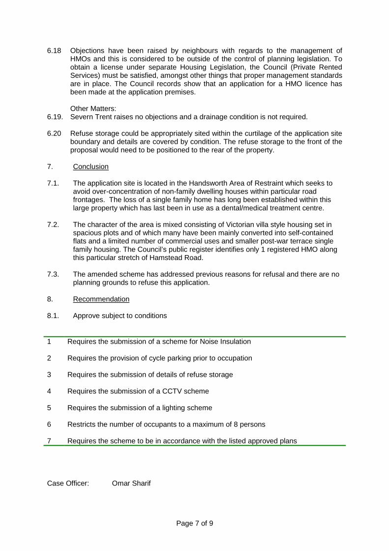
Photo(s)
Figure 1: View of Application Site

Page 9 of 9
Location Plan
This map is reproduced from the Ordnance Survey Material with the permission of Ordnance Survey on behalf of the Controller of Her Majesty's Stationery Office © Crown Copyright. Unauthorised reproduction infringes Crown Copyright and may lead to prosecution or civil proceedings. Birmingham City Council. Licence No.100021326, 2010

Page 1 of 8
Committee Date: 15/08/2019 Application Number: 2019/03129/PA
Accepted: 30/04/2019 Application Type: Full Planning
Target Date: 01/08/2019
Ward: Birchfield
146 Hamstead Road, Handsworth, Birmingham, B20 2QR
Change of use from dental surgery (Use Class D1) to a 14-bed House in Multiple Occupation (HMO) (Sui Generis) Recommendation Determine Report Back Members will recall that this application was presented to Planning Committee on 1st August 2019 and deferred, minded to refuse, on the grounds of lack of outdoor amenity space, impact on crime and concentration of HMOs in the locality. Members also referenced that the impact of this premises would be greater, due to its size, that the adjoining property (no. 144 ref: 2019/02190/PA). Members are reminded that any reasons for refusal must be made in accordance with the Development Plan unless material considerations indicate otherwise. With regards to the concentration of HMOs in the locality, this matter and the impact of the proposal on the character of the area is covered in detail at paragraphs 6.7-6.9 of the officer’s original report. This identifies that along a 260m stretch of Hamstead there is only 1 property which has a HMO Licence. Whilst it is recognised that there might be other HMOs that do not require a licence or planning permission, this evaluation is based on the data that is available to officers. The provision of 3 HMOs (the existing HMO and proposals at nos. 144 and 146) along this stretch of Hamstead Road is not considered to represent an unacceptable overconcentration of such accommodation that would adversely impact on the residential character of the area, residential amenity, community cohesion and housing mix. Members’ attention is also drawn to a recently allowed appeal for the change of use from a Childrens Day Nursery to a 9 room HMO at 252 Short Heath Road where the appellant’s applicant for costs was also allowed. In considering the impact on the living conditions of neighbouring residents, the Inspector’s decision identifies that reference had been made to there being other HMOs in the area, though the Inspector could only identify on the site visit 1 other property being occupied as a HMO in the vicinity of the appeal premises. The inspector concluded that on the evidence available that there is no undue concentration of HMOs and the proposal would not adversely affect the area’s residential character. In light of the evidence available with regard to the current application site, it is officers’ view that a reason for refusal on this ground would not be defendable. With regard to impact on crime and lack of outdoor amenity space, which have also been covered in the original report, officers consider that the original recommendation to grant

Page 2 of 8
planning consent with conditions is appropriate; however if Members remain minded to refuse the application then the following reasons for refusal are suggested:
• The development does not provide private amenity space within the site and as such constitutes a poor quality living environment for the occupants. The proposal is therefore contrary to the NPPF, Policies PG3 and TP27 of the Birmingham Development Plan 2017, Saved Policies 8.23-8.25 of the Birmingham Unitary Development Plan 2005 and Specific Needs Residential Uses SPG.
• The development would result in an increase in crime and/or an increase in the fear
of crime that would undermine the quality of life of local residents. The proposal is therefore contrary to the NPPF and Policy PG3 of the Birmingham Development Plan 2017.
1. Proposal 1.1. Consent is sought for change of use from dental surgery (Use Class D1) to a 14-bed
HMO (Sui Generis) at 146 Hamstead Road, Handsworth, B20. 1.2. The internal layout of the proposal is as follows:
• Ground floor: 6 x HMO bedrooms (ranging between 9.4sqm - 22sqm with
ensuites, and lounge (10sqm), kitchen (6.5sqm) as well as a store. • First floor: 4 x HMO bedrooms (ranging between 11sqm - 19sqm) with
ensuites and with lounge (14.6sqm) and kitchen (6.8sqm). • Second floor: 4 x HMO bedrooms (ranging between 13sqm and 20sqm) with
ensuites with lounge (13.9sqm) and kitchen (6.8sqm). 1.3 The development contains parking spaces to the front for three vehicles and a further
eleven spaces in the rear parking court which is accessed between no.144 and no.146 as a shared access drive off Hamstead Road.
1.4 The application has been submitted in conjunction with the adjacent property no.144
(ref: 2019/02190/PA) for a change of use from dental surgery to a 8 bedroom HMO and 1 flat, which can be found elsewhere on this agenda.
1.6 Link to Documents 2. Site & Surroundings 2.1. The application site comprises of a two storey property with rooms in the roof. The
property shares a link at the first floor to No. 144 Hamstead Road. The premise is a former dental/medical treatment centre (Use Class D1). The application site is located within a predominantly residential area and many of the large semi-detached and detached houses along this frontage have been converted to flats.
2.2 Properties are reminiscent of substantially sized detached and semi-detached Victorian properties which are setback from the highway with shallow boundary walls along the stretch of the application site. On the opposite side of the road there is Welford Primary School and further residential dwellings mainly made up groups of post-war terraces. There is a mixture of residential through family occupied dwellings as well properties which have been converted into flats.
2.3 Site Location & Street View

Page 3 of 8
3. Planning History 3.1. 2018/04157/PA – Change of use from dental surgery (Use Class D1) to 14 bedroom
HMO (Sui Generis) – Withdrawn 4. Consultation/PP Responses 4.1. Transportation Development – No objections, subject to a condition requiring secure
and covered cycle storage and parking to be marked out clearly.
4.2. Regulatory Services – No objections, subject to a condition for a noise insulation scheme.
4.3. West Midlands Police – Objection – the police have stated concerns on the crime
figures for the location, the management of the HMO property and the intended clientele. They have also raised apprehensions regarding the security measures onsite in terms of CCTV and the location and proximity to a primary school.
4.4. Neighbouring properties,, residents groups and Councillors consulted with site
notice posted. 4.5. 8 x Neighbour objections (in summary):
• Impact on layout/outlook and amenity. • Worsen existing high crime rate and levels of anti-social behaviour. • Increase in noise and disturbance • Illegal and unregulated HMOs and hostels in the vicinity. • Mismanaged HMOs. • Over concentration of HMOs and within an Area of Restraint.
5. Policy Context 5.1. National Planning Policy Framework (2019)
National Planning Practice Guidance (NPPG)
5.2. The following local policies are applicable: • Birmingham Development Plan (2017) • Birmingham UDP (saved policies) (2005) • Places for Living (adopted SPG 2001) • Specific Needs Residential Uses SPG. • Area of Restraint Handsworth, Sandwell and Soho.
6. Planning Considerations 6.1. The development has been assessed against the objectives of the policies as set
out above.
Principle of Development: 6.2. The NPPF has the golden thread of the presumption in favour of sustainable
development. It has a clear need to significantly boost housing supply and offer a wide choice of quality homes.
6.3. The Birmingham Development Plan builds upon the principles of the National Planning Policy Framework and is clear that Birmingham is a growth point and will

Page 4 of 8
need new employment and housing opportunities to support these aspirations. Whilst the plan contains no policies directly relating to HMO uses, policy TP27 relates to sustainable neighbourhoods. It requires development to have a wide choice of housing sizes, types and tenures to ensure a balanced community for all age groups.
6.4. The Birmingham UDP plan has guidance relating specifically to HMOs in ‘saved’
policies 8.23 to 8.25. These set out the criteria to assess proposals including the effect on amenities, size and character of the property. Account will be taken of the cumulative effect of such uses on the residential character and appearance of the area.
6.5 The Specific Needs Residential Uses SPG is clear that the nature of the type of
people to occupy the premises is not a material planning consideration, and that HMO accommodation has a role to play in providing housing for certain groups in society. The SPG guidelines for internal standards for people having a bedroom and shared living rooms and kitchen are 6.5sqm for a single bedroom and 12.5sqm for a double bedroom.
6.6 The application site is located in the Handsworth Area of Restraint which seeks to
avoid over-concentration of non-family dwelling house within particular road frontages. It is important to note that this large property which has recently been in use as a dental/medical treatment centre and a loss of a single family dwelling is long established. The proposal is sustainably located in respect of proximity to facilities and public transport and as such the principle of development is acceptable subject to other material planning considerations. Impact on the Character of the Area:
6.7 It is noted that within this frontage of Hamstead Road between the stretch of Radnor Road and Gibson Road, which measures some 261 meters, a number of properties have been converted into self-contained flats and commercial uses including a health shop and legal services practice. As previously stated, the proposed development would not result in the loss of a further single family dwelling due to the existing D1 use. In terms of the building typologies in the area, there is a mixture of large villa style dwellings which have been converted into flats and commercial units as demonstrated with the application site. The post-war terraced dwellings appear to remain as C3 residential use.
6.8 According to a search of the address points, the following conversions have already taken place along Hampstead Road between Radnor Road and Gibson Road:
• 11 properties converted to self-contained flats, equating to 26.2% of the 42
properties. There are also 4 commercial properties including offices and a training therapy centre within this frontage between Radnor Road and Gibson Road on both sides of the road within the 261 metre stretch.
• Only no.166A is registered as a HMO on the Council’s public register within this particular frontage.
6.9 As such it is considered that the principle of the proposed use of this property as a
large 14-bedroom would have a neutral impact on the residential character of the road and surrounding area as the existing property is non-domestic use.
Residential Amenity:
6.10 In terms of the internal layout, the property would provide shared facilities including a lounge and kitchen spread throughout the different floors. Whilst there are concerns

Page 5 of 8
on outlook and overlooking, no windows overlook into neighbouring properties which could be considered harmful. In order to address this concern on the second floor, the applicant has revised the floor plans/elevations with the introduction of velux windows to ensure the satisfactory internal amenity is maintained.
6.11 Whilst there is no guideline for HMO’s in the Council’s Places for Living SPD for
amenity space, the hard surfaced space to the rear is intended to provide 11 spaces and it is considered the residual space for amenity is acceptable for washing/laundry facilities. However, the site is located within the vicinity of Handsworth Park which is a distance of some 580 meters away and is within 10 minute walking distance which on balance is not considered to represent a reason for refusal for this scheme.
Noise Impacts:
6.12 Regulatory Services have raised no objections subject to the safeguarding condition for a noise insulation scheme. It is considered that subject to the safeguarding condition for a noise insulation scheme; the proposal would not have a significant adverse impact on the amenities of future occupiers in terms of noise and disturbance. It is considered that a 14-bed HMO is unlikely to affect the amenities of the existing neighbouring residential occupiers in terms of general noise and disturbance within the context of the previous use.
Highway Safety:
6.13 Transportation Development has raised no objections, subject to a conditions relating to secure cycle storage. Parking provision to the rear is provided for 3 vehicles to the front and 11 spaces to the rear garden/courtyard area, the application site is located within a sustainable location with accessible transport networks. It is considered that the application site is located within a sustainable location with accessible transport networks. Whilst there is no cycle storage facility is shown on the submitted plans, it is considered that there would be adequate space within the site for this to be accommodated. As such, it is considered that the proposed use is unlikely to increase parking demand significantly and there would be no adverse impact on highway safety.
Crime 6.14 West Midlands Police object and raise the same comments as the previously refused
scheme regarding the intended clientele for the site and how people are referred to the accommodation and managed and whether residents could pose a threat to the local community. In the last 6 months, figures provided by the police have been provided which demonstrate this area has suffered 1,971 recorded crimes. By those standards it is accepted as being significantly high number of offences. Of these offences, 665 (33.7 % of all of the crime) were of a violent nature and 165 (8.3 %) were classified as burglary offences. Whilst these figures give an indication as to the nature of offending in this area, it is important to reiterate that the specific needs residential uses SPG is clear that the nature of the type of people to occupy the premises is not a material planning consideration, and that HMO accommodation has a role to play in providing housing for certain groups in society. There is no evidence that occupiers of HMOs are inherently more likely to participate in crime or anti-social behaviour.
6.15 Further comments from the Police pertain to matters regarding the proposed internal
layout of rooms and postal delivery proposals. They recommend that suitable CCTV systems are installed, lighting scheme and a suitable access control system is installed.

Page 6 of 8
6.16 Objections have been raised by neighbours with regards to the management of HMOs and this is considered to be outside of the control of planning legislation. To obtain a license under separate Housing Legislation, the Council (Private Rented Services) must be satisfied, amongst other things that proper management standards are in place. The Council records show that an application for a HMO licence has been made at the application premises.
Other Matters:
6.17 Severn Trent raises no objections and a drainage condition is not required. 6.18 Refuse storage could be appropriately sited within the curtilage of the application site
boundary and details are covered by condition. The refuse storage to the front of the proposal would need to be positioned to the rear of the property.
7. Conclusion 7.1. The application site is located in the Handsworth Area of Restraint which seeks to
avoid over-concentration of non-family dwelling houses within particular road frontages. The loss of a single family home has long been established within this large property which has last been in use as a dental/medical treatment centre.
7.2. The character of the area is mixed consisting of Victorian villa style housing set in spacious plots and of which many have been mainly converted into self-contained flats and a limited number of commercial uses and smaller post-war terrace single family housing. The Council’s public register identifies only 1 registered HMO along this particular stretch of Hamstead Road.
7.3. There are no planning grounds to refuse this application. 8. Recommendation 8.1. Approve subject to conditions 1 Requires the submission of a scheme for Noise Insulation
2 Requires the provision of cycle parking prior to occupation
3 Requires the submission of details of refuse storage
4 Requires the submission of a lighting scheme
5 Requires the submission of a CCTV scheme
6 Restricts the number of occupants to a maximum of 14 persons
7 Requires the scheme to be in accordance with the listed approved plans
8 Implement within 3 years (Full) Case Officer: Omar Sharif

Page 7 of 8
Photo(s)
Figure 1: View of the Application Site

Page 8 of 8
Location Plan
This map is reproduced from the Ordnance Survey Material with the permission of Ordnance Survey on behalf of the Controller of Her Majesty's Stationery Office © Crown Copyright. Unauthorised reproduction infringes Crown Copyright and may lead to prosecution or civil proceedings. Birmingham City Council. Licence No.100021326, 2010

Page 1 of 8
Committee Date: 15/08/2019 Application Number: 2019/02810/PA
Accepted: 02/04/2019 Application Type: Reserved Matters Development Target Date: 16/08/2019
Ward: Ladywood
111 Hagley Road, Edgbaston, Birmingham, B16 8LB
Reserved Matters application seeking approval for Landscaping, pursuant to outline planning permission 2017/00663/PA in relation to Building 1 for an 8-storey office building with a ground floor retail unit (Use Classes A1-A4) and an under croft/basement car park Recommendation Approve subject to Conditions 1. Proposal
1.1. This application is a reserved matters submission, relating to the first phase of the
redevelopment of the former Edgbaston House/3 Duchess Place site, on Duchess Road, Edgbaston. Outline consent for the redevelopment of the site was approved on 23rd November, 2017 (Planning reference: 2017/00663/PA). This application sought consent for the erection of new office, professional services and retail accommodation, alongside the erection of a hotel, residential apartments and new car parking facilities on site; alongside areas of open space and car parking provision. The outline application was granted approval, subject to conditions, with all matters reserved.
1.2. The outline submission included a series of parameter plans, which established a number of principles for the proposed development, including; land use, densities and the proposed scale and massing of the development. The submission also detailed an illustrative Masterplan, for the wider sites redevelopment, referred to as “New Garden Square”.
1.3. Following on from this permission, an application for Reserved Matters was submitted and approved by the Council in March, 2019. This gained consent for: “Reserved Matters application seeking approval of access, appearance, layout and scale pursuant to outline planning permission 2017/00663/PA in relation to Building 1 for an 8-storey office building with a ground floor retail unit (Use Classes A1-A4) and an undercroft/basement car park”. The only remaining item for reserved matters was Landscaping; the current application seeks consent for this.
1.4. The proposed areas of landscaping are situated around the formally approved,
NGS1 office building (Application reference: 2018/10194/PA) and would be sited to the north of this, fronting onto Duchess Road, to the buildings east and to its south, fronting onto Hagley Road. This whole area would be designated as public realm within the wider “New Garden Square” development.
1.5. The proposed areas of landscaping provision can therefore effectively be
categorised into three distinctive areas:

Page 2 of 8
o Duchess Road: This area comprises the public realm space sited to the north of NGS1. This area will front onto Duchess Road and will feature large mature trees, many of which are existing and are proposed to be retained and further strengthened as part of the proposals.
o Hagley Road entrance: This space sits to the southernmost end of the site, to
the south of NGS1. This would front onto Hagley Road and would create an entrance into the wider New Garden Square development. This space is proposed to feature a pubic entrance and square, with hard and soft resurfacing, to include a pick-up/drop-off point, alongside further areas of landscaping and public realm.
o Café Courts: This space is to be sited to the east of NGS1 and to the west NGS2
(yet to gain reserved matters approval) and is detailed to provide landscaped areas for seating, as well as hardstanding for a high quality public realm.
1.6. The application has been supported by:
• A landscape and public realm strategy plan; • A planning design and access statement; • A cover letter; • A scaled landscaping plan; • An illustrative Master plan; and a • A public realm site plan.
1.7. Full details of the proposed hard and soft landscaping provision have not been
submitted at this stage, as these are to be secured through conditions, attached to the original outline consent (Planning reference: 2017/00663/PA).
1.8. Link to Documents 2. Site & Surroundings 2.1. The New Garden Square site, of which the application site forms part of, is bounded
by the A456 (Hagley Road) to the south and Duchess Road and Beaufort Road to the north. Duchess/Beaufort Road feature two and three storey terraced housing, alongside a pay and display car park. The eastern boundary of the site is formed by Cobalt Square, (a 17-storey office building), and the rear elevations of two storey commercial properties on Francis Road (Grade II Listed). The sites western boundary adjoins Plough and Harrow Public House, which are also Grade II Listed. The surrounding land uses remain of a mixed form and vary from office, residential, retail, education and leisure uses.
2.2. The application site itself, comprises part of the site of the former Edgbaston House building (also known as 3 Duchess Place and an associated multi-deck car park). These have now substantially been demolished (Prior approval reference: 2016/08603/PA). The site area also includes the land to the rear of these buildings, fronting onto Hagley Road, currently featuring 111 Hagley Road, a low rise commercial building.
2.3. Site Location Plan 3. Planning History

Page 3 of 8
3.1. 14/03/19 - 2018/10194/PA - Reserved Matters application seeking approval of access, appearance, layout and scale pursuant to outline planning permission 2017/00663/PA in relation to Building 1 for an 8-storey office building with a ground floor retail unit (Use Classes A1-A4) and an undercroft/basement car park. Approved.
3.2. 28/11/17 - 2017/00663/PA. Outline planning application (all matters reserved) for site clearance and demolition of all structures and buildings (save for listed buildings and directly attached extensions) and commercial-led mixed use redevelopment providing up to 57,500sqm (GIA) of Office/Research & Development space (Use Class B1a and B1b), up to 2,400sqm (GIA) of retail (Use Class A1), Professional and Financial Services (Use Class A2), Restaurants and Cafes (Use Class A3), Drinking Establishments (Use Class A4), a hotel of up to 100 bedrooms (Use Class C1), up to 400 new residential apartments units (Use Class C3), up to 900 new car parking spaces through the creation of a new multi-storey car park and other car parking areas, alterations to the site access arrangements for Hagley Road and Duchess Road and strategic landscaping. Approved.
4. Consultation/PP Responses 4.1. Regulatory Services – No objections.
4.2. Historic England – No objections.
4.3. Birmingham Civic Society – Support and it will enhance the locality.
4.4. Midlands Metro – No objections.
4.5. Transportation – Raise no objections to the development proposals.
4.6. West Midlands Police – No objection in principle, however have advised that a
Vehicle Mitigation Scheme be incorporated within the wider Landscape proposals and have made a number of other comments in relation to security and surveillance on site.
4.7. West Midlands Fire Services – No objection. 4.8. Press and site notices erected. MP, Ladywood and Edgbaston ward members,
residents associations and neighbouring occupiers/residents notified, of the proposals.
4.9. No letters of objection have been received in response to the development
proposals. 5. Policy Context 5.1. Birmingham Development Plan (BDP) 2017, Birmingham Unitary Development Plan
2005 (saved policies), Places for All (SPG), Car Parking Guidelines SPD, NPPF. 6. Planning Considerations 6.1. The planning considerations in this case include:

Page 4 of 8
• The appropriateness of the proposed Landscaping provision and Public Realm works.
6.2. High quality urban design is a key policy in the BDP and the NPPF, as are the
impact of developments on heritage assets. In addition, there is a statutory duty in section 66 of the Planning (Listed Buildings and Conservation Areas) Act 1990 to have special regard to the desirability of preserving listed buildings or their settings or any features of special architectural or historic interest which they possess.
6.3. Policy PG3 relates to place making. This sets out that all new developments will be
expected to demonstrate high design quality, contributing to a strong sense of place. They should respond to site conditions and the local context, including heritage assets and appropriate use of innovation in design.
6.4. Policy TP12 sets out the policy on the historic environment. This states that great
weight will be given to the conservation of the City’s heritage assets, with development proposals determined in accordance with national policy.
6.5. Landscaping:
6.6. The proposed landscaping provision is proposed in three distinctive areas. The first of which, would be sited to the north of the site, fronting onto Duchess Road, to the north of Building No. NGS1. The landscape proposals for this space comprise a large number of trees, many of which are existing, alongside shrubs and herbaceous planting, further details of which are to be secured by way of condition. This space will further feature grasscrete and concrete paving to form walkways and access paths into and out of the building, alongside the wider site. This approach is considered acceptable.
6.7. A similar approach is proposed to the east of Building No. NGS1. This space would
however be surfaced with natural stone paving and would feature timber seating pockets, with soft landscaping buffers behind. Raised concrete tables are further proposed to the front of these seating areas, allowing for future public use. This space would also feature new trees and other forms of soft planting, further details of which are again to be secured by way of condition.
6.8. The largest area would be sited to the south of Building No. NGS1 and would front
onto Hagley Road. This space would act as a formal entrance point into the wider New Garden Square Development and would comprise a mixture of hard and soft landscaping provision, as well as a public square and a “Pick-up and Drop-off” point. This would be erected from a mixture of granite paving for the main Public Square, and natural stone paving for the “Pick-up and Drop-off” point. Large levels of soft landscaping, comprising a mixture of shrubs and trees are also proposed, alongside timber seating, raised concrete tables and movable seating, for future outdoor use. Tree pits are also proposed, with flower beds allowing for rainwater collection and a softer entrance into the site as a whole. Full details of plant and tree types, as well as planting schedules would be secured by way of condition.
6.9. It is therefore considered, in principle, the landscape strategy for this phase of the
New Garden Square development would be acceptable. High quality public realm works are proposed, with a large pallet of materials proposed, to create a highly attractive and well-designed public space. Full details of these however will be required and are to be secured through conditions attached to the original outline consent. These are to be discharged at every phase of the development which receives reserved matters consent. It is therefore considered, subject to these

Page 5 of 8
details, the proposals would be acceptable and in line with policy PG3 from the BDP and the relevant sections of the NPPF.
6.10. Impact upon neighbouring Listed Buildings:
6.11. The NPPF states that when considering the impact of a proposed development on
the significance of a designated heritage asset, great weight should be given to the assets conservation. The more important the asset, the greater the weight should be. As heritage assets are irreplaceable, any harm or loss should require clear and convincing justification.
6.12. The application site is situated within the vicinity of a number of Listed Buildings.
These include the rear elevations of two storey commercial properties on Francis Road (Grade II Listed) and Plough and Harrow Public House to the sites west, (Grade II Listed).
6.13. This application follows a former approval for planning consent on site, planning
reference: 2017/00663/PA. During the course of this application, matters relating to conservation and the impact of the development upon the setting of the sites neighbouring Listed Buildings was considered in full and afforded substantial weight, during the decision making process. It was however considered that, when paying special regard to the desirability of preserving these neighbouring Listed Buildings and their setting, the development proposals were found to be in compliance with policies PG3 and TP12 of the BDP and the relevant sections of the NPPF.
6.14. The current proposals do not deviate from this former outline consent on site. The
proposed landscaping provision follows the parameters as detailed within the submission of the former outline planning consent and as such, it is considered that the development proposals would not impact upon the setting of these neighbouring designated heritage assets and as such would be in compliance with Local and National Planning Policy.
6.15. Amenity Considerations:
6.16. The guidance contained in the BDP, Places for Living and the NPPF refers to
providing high quality development, and to ensure an appropriate relationship with neighbouring properties.
6.17. This application for reserved matters solely relates to the landscaping provision
around the NGS1 office building. During the course of the outline planning application, matters of amenity were discussed and assessed at length and it was considered that although the development of the site as a whole would arise to some harm upon the amenity of existing adjoining residential occupiers on Duchess Road, on balance, this was not considered to be so significant, to justify the refusal of the wider scheme.
6.18. As discussed above, the current proposals remain in line with this former outline
approval on site and only relate to landscaping and as such are not considered to result in any new undue harm to the amenity of neighbouring residents, above and beyond the former outline approval on site.
6.19. Other matters: 6.20. The applicants have confirmed that they are continuing dialogue with West Midlands
Police and have noted their concerns with respect to boosting security and

Page 6 of 8
surveillance on site. The applicants have also stated that they intend to work with the Police to introduce a form of Vehicle Mitigation, within the detailed landscaping plan, by which the current concerns would be overcome. I am thereby satisfied that the current approval would not undermine the concerns raised by West Midlands Police and that such matters would be resolved at the conditions discharge stage of the application, whereby the finer details of the landscaping works would be agreed by the Council and West Midlands Police.
7. Conclusion 7.1. The principle of development for the proposed landscaping and public realm works,
as currently proposed, was established through the determination of an outline application for the wider New Garden Square site. The current proposals relating to Landscaping, in respect of the first phase of the development, for this site are found to be in accordance with the parameters established at the outline stage and are considered acceptable.
7.2. The development proposes a high quality, innovative and contemporary public realm and it is considered that this would sit comfortably within its surroundings. The development proposals are further considered not to have any undue impact upon the existing occupiers of neighbouring dwellings or upon the wider highway network, and would provide an attractive and high quality working environment.
7.3. In the light of the above, the proposals are considered to be in accordance with both Local and National Planning Policy and are recommended for approval.
8. Recommendation 8.1. Approve with conditions: 1 Requires the scheme to be in accordance with the listed approved plans Case Officer: Idris Gulfraz

Page 7 of 8
Photo(s)
Photo 1 – View of the application site from Duchess Road to its north
Photo 2 – View of Duchess Road from application site – to the sites north-east

Page 8 of 8
Location Plan
This map is reproduced from the Ordnance Survey Material with the permission of Ordnance Survey on behalf of the Controller of Her Majesty's Stationery Office © Crown Copyright. Unauthorised reproduction infringes Crown Copyright and may lead to prosecution or civil proceedings. Birmingham City Council. Licence No.100021326, 2010

Page 1 of 7
Committee Date: 15/08/2019 Application Number: 2019/03965/PA
Accepted: 15/05/2019 Application Type: Full Planning
Target Date: 16/08/2019
Ward: Kingstanding
8 Epwell Road, Kingstanding, Birmingham, B44 8DD
Change of use from residential dwelling (Use Class C3) to three bed respite care home for adults (Use Class C2) Recommendation Approve subject to Conditions 1. Proposal
1.1. Permission is sought for a change of use from residential dwelling (Use Class C3) to three bed respite care home for adults with learning disabilities (Use Class C2).
1.2. It is proposed that the residents of the respite care home facility would use three bedrooms and the fourth one would be a small office/restroom for staff.
1.3. The residents, whose age would range between 18 and 60 would stay at the property for a week and some a few weeks supervised by 3 to 5 specially trained staff members, depending on depending on need of the residents. The facility would operate 24/7 all year around.
1.4. The residents would be expected to live within the care property in a family type setting and get involved in household activities such as cooking, cleaning and gardening as part of their development. During the day the residents would go out on visits or attend one of the local training venues between 9am and 5pm. In the evening, the residents would either remain in the property or go out on social events.
1.5. The application site would accommodate at least 3 off-street parking spaces and some cycling spaces within its boundary line.
1.6. The residents of the respite care home would use the gardens where they will be also supervised.
1.7. Link to Documents 2. Site & Surroundings 2.1. The site is located off Epwell Road (Unclassified Road) between the rear of 202
College Road and 10 Epwell Road and accessible via an existing private road to the rear of properties fronting Epwell Road. The access is gated and there are double metal gates positioned approximately 12m in to the drive with residents having keys to access garages to the rear of College Road and the application site.
2.2. The application site includes a detached bungalow, which is centrally located with a triangle-shaped plot of land. There is a flat-roofed garage projecting to the east of the property with paved access link leading to the garage and soft landscape

Page 2 of 7
immediately to the front and side of the property. The rear of the property benefits from a conservatory and the rear garden is largely paved. The site is screened by a 2m high brick wall from the road and 2m high wooden fence from the rear gardens to properties on Epwell Road.
2.3. The nearest property to the west is No. 10 Epwell Road, which is also a bungalow in design and appearance similar to the application property. The property is screened behind close-boarded boundary fence measuring about 1.8m in height.
2.4. The site is within easy walking distance to fair public transport available from College Road (A453).
2.5. Site & Surroundings 3. Planning History 3.1. 25391002 – Construction of two detached bungalows – approved on 13/6/1968 4. Consultation/PP Responses 4.1. Site notices erected. Ward members and neighbouring occupiers notified. 4.2. 9 individual representations and a petition containing 16 signatures largely from the
surrounding neighbouring properties received. The concerns have been raised in relation to the following:
• Change of use from dwelling to a commercial use; • Parking and traffic • Loss of privacy • Noise • Devaluation of properties • Security of access road/gate and adjoining properties
4.3. Transport Development – no objection, subject to the following conditions:
• Number of bed spaces to be limited to maximum of 3; • Secure and covered cycle parking to be provided at appropriate location
4.4. Regulatory Services – no objection. 4.5. West Midlands Police – no objection but advised that the development should be
undertaken in accordance with Secured by Design guidance. 5. Policy Context 5.1. Birmingham Development Plan 2017, Adopted UDP 2005 (saved policies), Car
Parking Guidelines SPD, Specific Needs Residential Accommodation SPG, National Planning Policy Framework (updated in February 2019).
6. Planning Considerations 6.1. Having given careful consideration to the application and supporting information,
consultation responses received and representation received, the relevant

Page 3 of 7
development plan and documents and the other material consideration referred to above, the key issues are considered to be: • Principle of the development • Loss of family dwelling • Residential amenities • Parking • Other matters
Principle of the development
6.3. NPPF recognises that the Planning System plays an important role in tackling social
interaction, creating healthy and inclusive communities. The NPPF advises that the Local Planning Authorities need to deliver a wide choice of homes and create inclusive communities.
6.4. Policy Specific Needs for Residential Uses SPG and saved Policy 8.29 of the
adopted UDP advises that residential care homes in small detached or large semi-detached or terrace houses will not be acceptable unless adjoining occupiers can be safeguarded against loss of amenity due to, for example, undue noise or disturbance. The guidelines further state that proposals should not prejudice the safety and free flow of traffic in the adjoining highway and that adequate outdoor amenity space should be provided. Policy TP35 of the Birmingham Development Plan (BDP) 2017 regards the maintaining and protecting of the existing housing stock.
6.5. In this case, the application site is located in the middle of residential area and there
are no other facilities of similar nature in the vicinity. The respite care residents would be expected to live in a family type setting. There will be a maximum of 3 individuals requiring care with up to a maximum of 5 carers on the premises at any one time within the bungalow. This type of use together with the number of residents/careers is considered similar to that, which would be expected within a four bedroom property of this size. The change of use should not result in significant intensification from that of a C3 dwelling house. The only difference is that the occupiers (staff and residents) do not form and live as a single household. It is not considered that the amount of comings and goings from the site would be markedly different to that of a typical single family dwelling house. Consequently, I have no objection in principle to the conversion of the property to a small residential care home.
Loss of family dwelling
6.6. Policy TP35 of the Birmingham Development Plan (BDP) 2017 seeks to maintain and
protect the existing housing stock, advising that the loss of housing in good condition to other uses would normally be resisted unless there is an identified social need for the proposed use. Whilst the loss of a house suitable for single family occupation is regrettable, there is a clear social need associated with the proposed respite care home for adults with learning disabilities. Consequently, I do not consider it justifiable to warrant the refusal of the proposal on the grounds of the loss of a family dwelling.
Residential amenity
6.7. The property appears to be in good condition and adheres to spacing standard guidance. There are no physical internal or external alterations proposed to the property. All of the bedrooms sizes would comply with guidelines as set out within

Page 4 of 7
the Nationally Described Spacing Standards for bedroom sizes, which advocated 7.5sqm for a single bedroom and 11.5sqm for a double bedroom. The rear private amenity area exceeds the SPG Specific Needs for Residential Uses minimum guidance of 16 sq. metres per resident.
6.8. A number of local residents have raised concerns that the residents may cause noise and general disturbance through loss of privacy. However, the proposal is small-scale and suitable for the size of the property. Comings and goings and associated noise and disturbance would not be dissimilar to the occupation by a family and does not represent grounds for refusal.
6.9. Regulatory Services have assessed the proposal and raise no objections on amenity
grounds. Subject to the above recommended condition, I concur with this view.
Parking 6.10. A number of local residents have raised issues with regards to parking and suitability
of the access for the proposed use as it will require a greater need for parking provision than a dwelling use.
6.11. The applicant has clarified that the vehicular access road is not adopted or owned by the property; however there is a right of way off Epwell Road with double metal gates positioned approximately 12m into the drive, providing the access to the bungalow and the rear garages to other properties. The residents of the respite care are not independent and will not have keys, but the staff will. In the same way, any of the residents with rear garages can lock and open the gates along with the applicant as needed.
6.12. Transportation Development have assessed the proposal and raise no objection as parking demand from the proposed number of residents and staff would not be expected to alter to a significant degree over that which could be expected from the use as a residential dwelling. There will be at least three parking spaces and some cycling storage provided. The Transport Development has requested a condition requiring provision of a covered cycle parking and restricting the number of bed spaces to be limited to maximum of 3. I concur with these views and conditions.
Other matters
6.13. Some of the objections made reference to the fact that the use of the building would
be a commercial use. However the nature of the proposed is primarily residential and is considered to be appropriate in a residential location.
6.14. The petition and objections relating to the devaluation of properties are not material
planning considerations and therefore cannot be considered as part of the application.
6.15. Concerns regarding security and the access gates are noted but, like the current arrangement, is a civil matter between those with access.
7. Conclusion
7.1. This application is recommended for approval as a proposed respite care for adults
with learning disabilities is considered to be acceptable in the residential area and complies with the objectives of the policies that have been set out above.

Page 5 of 7
8. Recommendation 8.1. Approve with conditions. 1 Requires the scheme to be in accordance with the listed approved plans
2 Requires the provision of cycle parking prior to occupation
3 Limits the number of people living in care and carers at the property.
4 Prevents the use from changing within the use class
5 Implement within 3 years (Full) Case Officer: Alfia Cox

Page 6 of 7
Photo(s)
Figure 1: View from the site access
Figure 2: View of the property frontage

Page 7 of 7
Location Plan
This map is reproduced from the Ordnance Survey Material with the permission of Ordnance Survey on behalf of the Controller of Her Majesty's Stationery Office © Crown Copyright. Unauthorised reproduction infringes Crown Copyright and may lead to prosecution or civil proceedings. Birmingham City Council. Licence No.100021326, 2010

Page 1 of 9
Committee Date: 15/08/2019 Application Number: 2019/03367/PA
Accepted: 16/04/2019 Application Type: Telecommunications Full PA Target Date: 19/07/2019
Ward: Kingstanding
Land at Perry Barr Reservoir, Rough Road, Kingstanding, Birmingham, B44 0UT
Installation of a radio base station comprising the removal of the existing 15m temporary Vodafone lattice tower supporting 6 no. antennas and the installation of a replacement permanent 20m lattice tower supporting 12 no. antennas, 6 no. transmission dishes and ancillary development thereto including a GPS module and 2.1m fence Recommendation Approve subject to Conditions 1. Proposal 1.1. The applicant proposes the installation of a radio base station comprising the
removal of the existing 15m temporary Vodafone lattice tower supporting 6 no. antennas and the installation of a replacement permanent 20m lattice tower supporting 12 no. antennas, 6 no. transmission dishes and ancillary development including a GPS module and 2.1m fence. 3no. antennas would be fixed to the top of the tower, creating a total height in the region of 22.9m. The submitted drawings show that one temporary tower operated by Three and EE (MBNL) and another temporary tower operated by Airwave (which provides a service for the emergency services and public safety organisations who communicate using the Airwave network) in close proximity to the site would also be removed if this application is approved allowing those organisations to place their telecom equipment on the proposed mast.
1.2. The existing 15 metre high temporary lattice tower has been erected using powers available to mobile operators without having to attain planning permission.
1.3. A building on the land at Perry Barr Reservoir previously supported the telecommunications equipment for 5 telecom operators:- Vodafone, Telefonica, EE, 3 and Airwave. However, all operators were served with a notice to quit as the site provider needed to demolish the building on which they were all situated. This led to three temporary emergency masts being erected approximately a year ago on land near to the former building.
1.4. Vodafone Ltd and Telefonica UK Ltd have entered into an agreement pursuant to which the two companies jointly operate and manage a single network grid across the UK under the name of Cornerstone. The agreement allows the organisations to pool their basic network infrastructure, while running two, independent, nationwide networks allowing consumer choice. MBNL is a 50/50 owned joint venture between Three and EE, working together by sharing aspects of their mobile networks.

Page 2 of 9
1.5. The Airwave network is dedicated for use by the emergency services and public safety agencies. A permanent site in this location would assist the operators to meet their license obligations and ensure emergency services network is accessible whenever and wherever it is required in this area of the City.
1.6. The proposed installation will be owned and operated by Cornerstone and Vodafone Limited and would provide 2G, 3G and 4G service provision for Telefonica as well due to their joint agreement. MBNL and Airwave will also able to share this installation as part of a specific agreement at this site between the operators.
1.7. The applicant has confirmed all three temporary masts will be removed if this
application is approved. Furthermore, the applicant has removed from this proposal a proposed new 3 metre wide vehicle access gates that was proposed to be installed in the existing fence line that runs along the side road that comes off the main part of Rough Road (next to which number 146 Rough Road is situated).
1.8. Link to Documents 2. Site & Surroundings 2.1. The application site forms a small section of Perry Barr reservoir. To the south west,
north west, north east and across Rough Road to the south are residential dwellings.
2.2. Site location 3. Planning History 3.1. The history below covers applications within the Perry Barr Reservoir perimeter not
just that part of the reservoir that forms the current application site.
3.2. 16.04.2018- 2018/02701/PA- Telecoms Licence Advisory for the temporary installation of 15m lattice tower with 6 no. antennas (Telecoms license advisory)- seen and noted by Authority.
3.3. 07.04.2014- 2014/02114/PA- Telecomms Licence application for the installation of a SAMO cabinet and mast head amplifier (Telecoms license advisory)- seen and noted by Authority.
3.4. 27.02.2004- 2004/08333/PA- Installation of 3 antennae (Telecoms license advisory)- seen and noted by Authority.
3.5. 09.10.2002- 2002/06917/PA- Installation of 3 cross-polar antennae and 1 equipment cabinet (Telecoms license advisory)- seen and noted by Authority.
3.6. 27.06.2002- 2002/02355/PA- Installation of replacement telecommunications equipment housing with ancillary works- No prior approval required.
3.7. 27.05.2002- 2002/06804/PA- Installation of telecommunications equipment (Telecoms License advisory)- seen and noted by Authority.
3.8. 10.05.2002- 2002/06789/PA- Replacement of 3 antennae with 3 similar antennae and 2 new ones (Telecoms License advisory)- seen and noted by Authority.
3.9. 30.10.2001- 2001/06684/PA- Replacement of 6 antennae with 6 new antennae (Telecoms license advisory)- seen and noted by Authority.

Page 3 of 9
3.10. 20.07.2001- 2001/03317/PA- Installation of replacement telecommunications
equipment cabin, and installation of 6 antennae and up to 4 dish antennae and associated works- refused.
3.11. 22.01.2001- 2000/05894/PA- Installation of telecommunications equipment- Refused.
3.12. 11.03.1999- 1999/00918/PA- Installation of antennae and equipment cabin- No prior approval required.
3.13. 30.07.1998- 1998/03010/PA- Erection of telecommunications equipment- No prior approval required.
3.14. 02.02.1995- 1994/05054/PA- Erection of radio equipment building and ancillary development for telecom securicor cellular radio ltd - No prior approval required.
4. Consultation/PP Responses 4.1. Surrounding occupiers, local neighbourhood forum, SCRAM, local councillors for
Erdington, Perry Common, Kingstanding and Sutton Vessey, as well as local MP’s for Erdington and Sutton Coldfield and school within 200 metres notified as well as site notice displayed- 13 responses received which object and or raise concerns about the proposal, of these 13 two are from one person (who also includes a letter of objection attached to one of their emails) the responses also include one from Honorary Alderman Hugh McCallion. The objections/concerns can be summarised as follows:-
• the temporary structures in place are an eyesore now and the proposed
replacement structure will be an eyesore and visually out of keeping with the area.
• will affect property prices • Will affect health and safety of residents, trees and natural wildlife through
factors such as radiation coming from the proposal. • no comments were sought from residents regarding the proposed temporary
structures. • Loss of privacy to residential dwellings when maintenance works occur. • Object to the new gates (now removed from proposal) that would have been
installed on the side road due to impact on parking, vehicle movements and ability of residents to load/unload their private vehicles.
• Is it not possible to place the temporary structures elsewhere? • Construction works will cause excessive noise and disruption to residents. • Telecom towers kill birds when they collide with them • Existing temporary towers are affecting the health of a nearby resident. • believed the aeriels would be put back on the pump house (their original
location) once that was strengthened. • the aeriels in their original position were well screened and not visible from
George Frederick Road. • All work on site has finished so expecting the aerials to be put back to where
they were previously. • concerns about radiation and associated impact on human health. • concerns are made greater by the proposal. • the position is too close to residential properties and constitute a health hazard. • the proposed structure will be substantially taller than the existing.

Page 4 of 9
• the construction and future maintenance of the structure will affect traffic and make the local communities lives difficult.
• would like the temporary structures removed.
4.2. Transportation Development- no objection.
4.3. Severn Trent- no objection. 5. Policy Context 5.1. BDP (2017), Saved UDP policies, Telecommunications development: mobile phone
infrastructure SPD and the NPPF. 6. Planning Considerations 6.1. The proposed development has been assessed in light of the following issues:-
6.2. Policy- NPPF: Paragraphs 112-116 of the National Planning Policy Framework
(NPPF) (2019) provides guidance on supporting high quality communications. Paragraph 112 recognises advanced, high quality and reliable communications infrastructure is essential for economic growth and social well-being and that planning policies and decisions should support the expansion of electronic communications networks, including next generation mobile technology (such as 5G).
6.3. Part 113 advises that number of radio and electronic communication masts, and the sites for such installations, should be kept to a minimum consistent with the needs of consumers, the efficient operation of the network and providing reasonable capacity for the future expansion. Use of existing masts, buildings and other structures for new electronic communications capability (including wireless) should be encouraged. Where new sites are required (such as for new 5G networks, or for connected transport and smart city applications), equipment should be sympathetically designed and camouflaged where appropriate.
6.4. Part 115 states that applications for electronic communications development (including applications for prior approval under the General Permitted Development Order) should be supported by the necessary evidence to justify the proposed development. This should include:- (a) the outcome of consultations with organisations with an interest in the proposed development (b) for an addition to an existing mast or base station, a statement that self certifies that the cumulative exposure, when operational, will not exceed International Commission guidelines on non-ionising radiation protection, or (c) for a new mast or base station, evidence that he applicant has explored the possibility of erecting antennas on an existing building, mast or other structure and a statement that self-certifies that, when operational, International Commission guidelines will be met.
6.5. Part 116 states that ‘Local planning authorities must determine applications on planning grounds only. They should not seek to prevent competition between different operators, question the need for an electronic communication system, or set health safeguards different from the International Commission guidelines for public exposure’.
6.6. BDP: Policy PG3 (Place making) of the BDP advises that all new development will be expected to demonstrate high design quality, contributing to a strong sense of place, with new development reinforcing or creating a positive sense of place and

Page 5 of 9
local distinctiveness. The policy continues by stating that new development should ensure that private external spaces, streets and public spaces are attractive, functional and inclusive. Policy TP46 (Connectivity) of the BDP recognises that technology developments and access to digital services such as the internet are critical to Birmingham's economic, environmental and social development.
6.7. UDP and SPD: The Telecommunications Policy (Paragraphs. 8.55-8.55C) in the Birmingham UDP (2005) and the Telecommunications Development SPD state that a modern and comprehensive telecommunications system is an essential element in the life of the local community and the economy of the City but that in assessing applications for telecommunications equipment, account will be taken of the impact of radio masts, antennae and ancillary structures on existing landscape features, buildings and the outlook from neighbouring properties. In respect of ground-based masts, the Council’s SPD states that they should make the most of existing screening or backdrop to buildings and avoid open locations, that they should be mitigated by landscaping and planting, that street locations will be discouraged but where they are the only option they should appear as an unobtrusive addition, and where possible sites should have a backdrop of trees to reduce visual contrast.
6.8. Part 4 of the SPD Telecommunications development: mobile phone infrastructure sets out that within the City there are locations such as residential areas where the council will encourage operators to avoid locating telecommunication infrastructure unless there are no reasonable alternatives. It follows by stating that predominantly residential areas can be very sensitive from the point of view of residents who may perceive the installation of telecommunications equipment to be a significant visual intrusion if they are close to and visible from within their homes or from their gardens. Accordingly, residential areas should be avoided, particularly locations immediately in front of habitable room windows wherever possible, in favour of less sensitive locations. Where applications are submitted in such areas, the City Council will require them to be accompanied by evidence confirming that no reasonable alternatives exist. In all cases, equipment should be designed to minimise its impact on the visual amenity of the area. I make reference to this policy, as the application site is set in a residential area, and therefore, the site location is considered sensitive in respect of this policy and therefore, I consider it is reasonable to use this policy to assess the application against.
6.9. Regarding alternative site consideration- Section C of part 115 of the NPPF states ‘for a new mast or base station, evidence (would be required) that the applicant has explored the possibility of erecting antennas on an existing building, mast or other structure’. Additional information has been provided during the duration of the application that seeks to demonstrate the applicant has carried out a search of alternative sites for the development. This alternative site search has covered 19 other sites and includes consideration of street works, roof top and greenfield sites. Having reviewed the submitted information, I consider it represents a search of an appropriate geographic area and format for the development, that demonstrates the lack of alternative sites for the development.
6.10. Visual impact- I acknowledge the proposal would see the removal of three existing temporary masts which are set a circa height of approx. 15 metres. However, these only have temporary authorisation and should not be used in the consideration of a fall back if this proposal is not approved.
6.11. Therefore, we must focus on the visual impact of this proposal to introduce a taller 20 metre high telecommunications mast into a location where, other than the

Page 6 of 9
temporary masts that have been erected, the general built environment near to the proposal is relatively low in height. I have evaluated the prospective visual impact of the proposal, and I acknowledge it would appear bulkier than the existing temporary masts. I also acknowledge that it would not be readily assimilated into view as it would rise considerably into the skyline and appear as an isolated obtrusive feature in the street scene by reason its height, mass, design and positioning. The mast would appear as a dominant feature out of keeping with the surrounding and whose visual impact would be visible from a distance including from surrounding roads and dwellings.
6.12. Other factors- In arriving at conclusion on matters with regard to developments, planners are required to have due regard to all material considerations. I therefore acknowledge the mast would from a visual perspective appear harmful in the street scene, and as a result I have sought clarification on the potential repositioning of the mast further back into the reservoir site and also the use of an alternative design.
6.13. With regard to the idea of seeking to relocate the mast further back into the reservoir
site, the agent has clarified that due to land stability issues with regard to the area next to the reservoir (including hardsurfacing vehicle parking and turning area), the location of underground service features in that location and the need to retain the hard surface to accommodate parking for servicing of the reservoir and telecom equipment, land further into the reservoir site would not be possible to accommodate the structure.
6.14. With regard to the why the particular design and scale of the mast has been chosen
rather than something that may be more sympathetic and lower, the agent has confirmed that the design chosen reflects the best engineering solution to accommodate the telecoms equipment and to also resist wind load. The height has been chosen to ensure the transmission of signals over the required area.
6.15. In addition to the above, the applicant has provided during the duration of this
application details of telecom coverage plots that the development fills. I have reviewed this information and concur that from a telecom service delivery perspective for commercial service operators the loss of the site would hamper the delivery of their services to the detriment of customers.
6.16. Taking the above material considerations into account in relation to this proposed
development, whilst I acknowledge the adverse visual impact of the mast in this setting, I consider that the lack of alternative locations, provision for 5 operators and the significant weight given to the need to provide high quality and reliable communication infrastructure, marginally outweighs the adverse visual impact.
6.17. Highway impact- Transportation Development raise no objection. I concur with this view. I note the concerns about the potential impact of installing the development and maintenance thereafter on traffic movements, safety, parking and the ability of residents to load and unload their private vehicles on the side road. These comments largely stem from the original request by the applicant to install new 3 m wide vehicle access gates along a side part of Rough Road adjacent to no. 146. Members are reminded that this feature has been removed from the proposal during the duration of its assessment. Vehicle service access will continue from the existing access on Rough Road, and I therefore do not consider the installation of the new mast would cause unreasonable impact on the highway network or during its subsequent maintenance.

Page 7 of 9
6.18. Health- The applicant has provided confirmation that the development would be ICNIRP compliant and hence matters regarding potential impact on health cannot be taken into account in the determination of this application.
6.19. The proposed development does not attract a CIL contribution. 7. Conclusion 7.1. Applying the planning balance exercise, this is a finely balanced recommendation. It
is recognised that the proposal will have a significant impact on visual amenity. However the applicant has demonstrated that no suitable alternative sites are available to provide the necessary coverage the installation would provide for 5 operators and significant weight is given in national and local policy to the provision of high quality and reliable communication infrastructure. As such, and on balance, a recommendation to approve is made.
8. Recommendation 8.1. That the application is approved subject to conditions. 1 Requires the scheme to be in accordance with the listed approved plans
2 Implement within 3 years (Full) Case Officer: Wahid Gul

Page 8 of 9
Photo(s)
Photo 1 - View of existing temporary masts from Rough Road
Photo 2 – photomontage showing the proposed installation from the junction of Hartley Road and Rough Road

Page 9 of 9
Location Plan
This map is reproduced from the Ordnance Survey Material with the permission of Ordnance Survey on behalf of the Controller of Her Majesty's Stationery Office © Crown Copyright. Unauthorised reproduction infringes Crown Copyright and may lead to prosecution or civil proceedings. Birmingham City Council. Licence No.100021326, 2010

Page 1 of 5
Committee Date: 15/08/2019 Application Number: 2019/06062/PA
Accepted: 25/07/2019 Application Type: Demolition Determination
Target Date: 22/08/2019
Ward: Perry Barr
Birmingham Alexander Stadium, Walsall Road, Perry Barr, Birmingham, B42 2LR
Application for Prior Notification for the demolition of 3 no. athletic stadium stands Recommendation Prior Approval Required and to Approve with Conditions 1. Proposal 1.1. The application, made under Schedule 2, Part 11 of the Town and Country Planning
(General Permitted Development) (England) Order 2015, is to determine whether the City Council requires the prior approval of the method of demolition, or site remediation following demolition of 3 of the existing 4 stands.
1.2. The stands to the western side of the existing track known as the Main Stand, the Knowles Stand and the Nelson Stand would be demolished. The existing stand to the east would be retained. The works are required in preparation of the sites redevelopment as an improved athletics venue in conjunction with the City’s hosting of the Commonwealth Games 2022.
1.3. The GMAC and HPA venues to the west and the athletics track would be available
for use throughout the demolition period.
1.4. Link to Documents 2. Site & Surroundings 2.1. The site is an existing athletics stadium with running track, car parks and associated
buildings and spectator stands. The stadium does not front any main roads and is effectively behind/to the north of Perry Park, Walsall Road Allotments, a cemetery and an industrial park. Perry Reservoir is to the east and to the north is the Tame Valley canal with residential properties beyond.
Site location
3. Planning History 3.1. Various applications associated with existing use as an athletic stadium, however
nothing relevant to this application. 4. Consultation/PP Responses

Page 2 of 5
4.1. Regulatory Services – comments to be reported verbally to your Committee.
4.2. Transportation Development – comments to be reported verbally to your Committee. 4.3. Local residents associations and Councillors were notified. Site notices were
displayed by the applicant. No comments received to date. 5. Policy Context 5.1. General Permitted Development Order 2015 (the GPDO). 6. Planning Considerations 6.1. Schedule 2, Part 11 of the GPDO 2015 states that any building operation consisting
of the demolition of a building is permitted development subject to a number of criteria, including the submission of a prior notification application in order to give local planning authorities the opportunity to assess the details of demolition and site restoration only.
6.2. However, the legislation also requires that the Local Planning Authority determine such applications within 28 days unless the applicant agrees an extension of time. The applicant is not prepared to agree an extension of time and the report therefore needs to be prepared in advance of the consultation period expiring. Consequently there is limited information, including consultee responses, to report and your Committee will be updated verbally.
6.3. Notwithstanding this I can confirm that the Knowles Stand, Main Stand and Nelson
Stand (to the west of the site) are to be demolished along with all associated structures in readiness of the site being redeveloped to accommodate an improved athletic track and stand. The stands are of no particular architectural merit and I raise no objection in principle to their demolition.
6.4. Further, the supporting information identifies expected method of demolition, site management, site operation (including hours of operation), removal of materials, reclamation works and restoration works. The site is large and all works would be contained within the site area, including contactors parking. However I await comments from Regulatory Services and Transportation as to whether there is need for additional information which could be secured by condition.
6.5. The trees, with the exception of a small group immediately adjacent the Nelson Stand, are shown to be retained. An ecology report has also been submitted in support of the application and I await comments on the acceptability of this.
6.6. The site will be secured with timber hoarding, but specific details of appearance and
height are not currently available and if not forthcoming need to be conditioned. Further, whilst the site is due to be redeveloped there is currently no planning permission for its redevelopment and it would not be appropriate to secure the site with the hoarding indefinitely. Consequently I recommend a condition to remove the hoarding within 12 months of completion of demolition.
7. Conclusion 7.1. Proposal would result in the demolition of part of the existing Alexander Athletics
Stadium in preparation for the sites redevelopment and use as a venue during Commonwealth Games 2022. I therefore raise no objection in principle however

Page 3 of 5
given the time constraints associated with the determination of this application, the lack of information, including consultee responses, at time of the preparation of the report and the need for conditions to safeguard the long term appearance of the site conditions are recommended. As such prior approval is required and granted.
8. Recommendation 8.1. Prior Approval Required and to Approve with Conditions 1 Requires hoarding details
2 Requires hoarding removal Case Officer: Joanne Todd

Page 4 of 5
Photo(s)
Photo 1 – Main Stand
Photo 2 – Nelson Stand

Page 5 of 5
Location Plan
This map is reproduced from the Ordnance Survey Material with the permission of Ordnance Survey on behalf of the Controller of Her Majesty's Stationery Office © Crown Copyright. Unauthorised reproduction infringes Crown Copyright and may lead to prosecution or civil proceedings. Birmingham City Council. Licence No.100021326, 2010

Page 1 of 60
Committee Date: 15/08/2019 Application Number: 2019/00108/PA
Accepted: 04/01/2019 Application Type: Outline
Target Date: 24/05/2019
Ward: Sutton Walmley & Minworth
Peddimore, Land north of Minworth, east of A38 and west of Wiggins Hill Road, Sutton Coldfield, Birmingham, B76
Hybrid planning application comprising: Outline application with all matters reserved for an employment park comprising B1b, B1c, B2 and/or B8 uses, including ancillary offices (B1a), gatehouses and security facilities, service yards and HGV parking, plant, vehicular and cycle parking, landscaping, pedestrian and cycle infrastructure, green and blue infrastructure, ancillary business and community facilities (D1/D2/B1a/A3/Sui Generis) including a multi-purpose hub building and associated development. Full planning application for a new roundabout access from the A38, construction access and compound area, internal spine road, site gatehouse, primary substation and tower, engineering operations including foul pumping station, acoustic fencing, earthworks (including creation of development plot plateaus), pedestrian and cycle infrastructure and structural landscaping including drainage infrastructure and development platform within Peddimore Brook corridor for ancillary business and community facilities Recommendation Approve Subject to a Section 106 Legal Agreement 1. Proposal 1.1. The application is submitted as a hybrid application with part of the proposal detailed
in full and part as outline.
1.2. The full part of the application includes the details of the access, spine road and foot/cycle bridge over the A38; the landscaped buffer zone around the site with pedestrian and cycle paths, including a bridleway on the eastern section, and sections of acoustic fencing; the cut and fill of the development plots to create level plateaus and works to Peddimore Brook. In addition, full details are provided of the main site gatehouse, the electricity substation and foul pumping station.
1.3. The outline elements are the four future development zones. The three plots for the
future industrial buildings, zone 1A with a total area of 20.25ha, 1B at 7.87ha and zone 2 at 24.64ha and the “hub” plot at 1.08ha. In total the plots are 53.84ha. The layout, scale, appearance and landscaping of these zones are reserved for later approval through Reserved Matters applications. However, maximum heights are set at this hybrid application stage and a Reserved Matters Design Guide has been written which will be used to advise the future applications. Indicative layout plans

Page 2 of 60
have also been provided which show two potential layouts for the future development of the site.
1.4. The proposed development zones can be summarised using the following table:
Zone Use Class Gross Internal
Area (m2) Finished Floor Level (m AOD)
Max height (m from floor level)
Hub B1a, D1, D2, A3, Sui Generis ancillary to the industrial uses
700 89.45-90.70 18
1A B1b, B1c, B2, B8, B1a (ancillary)
128,061 (1A and 1B)
89.26-90.51 23.5
1B B1b, B1c, B2, B8, B1a (ancillary)
89.35-90.60 19.5
2 B1b, B1c, B2, B8, B1a (ancillary)
118,800 84.5-89.82 23.5
Substation Sui Generis N/A 90.65-91.15 5 (plus 23.5m pylon)
Gatehouse Sui Generis 155 89.45-90.70 5
Total 247,716
1.5. Prior to submitting this application the development was screened and scoped
against the Town and Country Planning (Environmental Impact Assessment) Regulations 2017. Schedule 2, 10a “industrial estate development projects” requires consideration of the need for an Environmental Statement (ES) for sites over 0.5 hectares. It was determined that due to the size of the site and the potential likely significant effects the planning application should be submitted with an Environmental Statement (ES). The submitted ES includes chapters assessing traffic and transport, air quality, noise and vibration, biodiversity, landscape and visual, built heritage, archaeology, lighting, flooding and hydrology, ground conditions and contamination, soils and agricultural land, climate change, socio-economics and human health and a cumulative effects assessment. Appendices provide further detail and a summary is included within the full ES and a separate non-technical summary has been provided.
1.6. The cumulative impact chapter of the ES has assessed projects under construction,
development with consent and development where an application has been submitted. This is in accordance with the requirements of the 2017 EIA Regulations. As such the cumulative impact chapter has not considered Langley as it does not fall within any of the above categories, furthermore there is currently insufficient information on the effects of Langley to enable the applicant to properly assess the cumulative impact. The submission of the Langley application will be expected to cumulatively assess both schemes as Peddimore is a current application and may have been granted permission by the time Langley is submitted. However,

Page 3 of 60
members should be reassured that the potential traffic impacts have been considered in-combination with both Peddimore and Langley, based on the predicted development in the BDP and the existing modelling information which informed the BDP. This information is provided within the Transport Assessment. Furthermore, the Strategic Environmental Appraisal undertaken as part of the BDP assessed cumulative impact at a strategic level.
1.7. In addition to the Environmental Statement and appendices the application has been
submitted with the following documents: Planning Statement, Economic Impact Assessment, Social Value Study, Sustainability and Carbon Reduction Strategy, CIL Form, Design and Access Statement, Heritage Statement, Reserved Matters Design Guide, Transport Assessment, Framework Travel Plan, Site Access Strategy Report, Sustainable Transport Strategy, Foul Sewage and Utilities Statement, Sustainable Drainage Statement, Flood Risk Assessment, Water Framework Directive information, Geo-Environmental Assessment (phase 1 and 2), Geotechnical Assessment Report, Watercourse Survey, Landscape and Green Infrastructure Strategy, 20 Year Landscape Management Plan, Tree Survey, Arboricultural Impact Assessment, Minerals Assessment, Statement of Community Engagement, Framework Ecological Mitigation Strategy, Local Wildlife Site Assessment, External Lighting Assessment Report, Construction Environmental Management Plan (CEMP).
1.8. A useful “contents page” has also been provided which lists the above documents and details which of the submitted plans are for approval as part of this hybrid application and which are submitted for information purposes only. Several the documents have also been updated during the consideration of the application and this is clearly shown on the updated “contents page”.
1.9. The submitted Statement of Community Engagement sets out the public and stakeholder consultation carried out prior to submission. An extensive consultation exercise was carried out by the developer as part of pre-application discussions. This included 8 public consultation events across Sutton Coldfield, Minworth, Castle Vale and Curdworth on various days and times; press releases and adverts in the local press; presentations/ briefings with MPs, members, Royal Sutton Coldfield Town Council, community groups and the Langley Consortium; meetings with neighbouring residents and the distribution of flyers to approximately 27,000 addresses within an area running from the M6 Toll to the east, the A453 to the north, the A5127 to the west, and the A452 and M6 to the south. The SCI also provides details of the website with a 360 degree virtual tour and interactive transport mapping tool set up and the various response mechanisms provided by IM Properties.
1.10. Members should be aware that the application site is owned by Birmingham City
Council. However, this should not affect the decision making process, the members of the Planning Committee are making a decision as a Planning Committee not as a land owner. Members need to consider the application as they would any other against the adopted Development Plan and other material considerations. Ownership is not material to the planning decision.
1.11. Link to Documents

Page 4 of 60
2. Site & Surroundings 2.1. The application site has a total area of 65.13 hectares and is part of the total 71
hectares of the allocated site in the BDP. Currently the land is arable fields which gently fall from north and east. Wishaw Lane, Peddimore Lane and a public right of way cross the site and there are existing hedges and Peddimore Brook within the site.
2.2. It lies on the north east edge of Birmingham and is enclosed by the A38 on the west, housing at Minworth and the Birmingham and Fazeley Canal to the south, Wiggins Hill Road to the east and Peddimore Hall and Barns and agricultural fields to the north. On the opposite side of the A38 is the land allocated as Langley Sustainable Urban Extension. There are 8 Grade II listed buildings, 1 Scheduled Ancient Monument (SAM) and 3 local non-designated heritage assets in the immediate area surrounding the site.
2.3. The site lies approximately 11km north-east of the city centre, close to the M42 and
M6 Toll. Also in the north west of Birmingham are the existing Minworth Trading Park, Midpoint Park and Minworth Severn Trent Treatment Works. Outside of Birmingham there are other employment parks and industrial estates nearby.
2.4. Site Location 3. Planning History 3.1. 1996/02128/PA – Development of land for erection of a micro-electronics fabrication
plant, including provision of new access road from A38 - called in by Secretary of State 7th August 1997 (application “A”)
3.2. 1996/03388/PA – Development of land for B1 and B2 use, plus ancillary storage, car parking, landscaping and new access for a single user - called in by Secretary of State 7th August 1997 (application “B”)
3.3. Both above applications were called in by the Secretary of State (SoS) for determination given the scale of the proposals and the sites designation as Green Belt. The Inspector recommended refusal of both applications, however the SoS accepted the recommendation of refusal for application B but granted planning permission for application A.
3.4. The SoS concluded that both applications would constitute inappropriate
development in the Green Belt but that very special circumstances existed to outweigh the harm. The urgent need for major investment; the lack of readily available alternative sites outside the Green Belt and the economic benefits were noted as the very special circumstances.
3.5. Application A was approved over application B as it was within a single ownership
(the Council) and for a specific occupier. The permission was granted in August 1997 and extended in November 2000. The consent was not implemented and has now lapsed.

Page 5 of 60
4. Consultation/PP Responses 4.1. Highways England – No objections subject to conditions relating to M42 junction 9
and M6 junction 5 improvement works. A series of models have been involved in the traffic analysis of the Peddimore development. The use of the Travel Demand Model (developed by PJA) has been accepted in principle to provide a reasonable estimation of traffic associated with the development. The Sutton Coldfield Traffic Model (SCTM) has subsequently been used to consider the assignment of traffic which we have considered and accepted with regards traffic flows to the affected M6 and M42 motorway junctions. Junction assessment has been undertaken for both M6 Junction 5 and M42 junction 9 utilising differently methodologies (LinSig and PARAMICS respectively) in accordance with the different needs of these locations. This modelling has been subject to our detailed review and consideration. Following this engagement in considering the technical detail of the assessment it is evident that improvements are required to both junctions to accommodate the development traffic arising from Peddimore. Improvement schemes are identified through the Transport Assessment for both locations and these have been subject to our further scrutiny with regards their suitability to accord with the requirements of DfT Circular 02/2013 Strategic road network and the delivery of sustainable development. Following receipt of the revised Transport Position Statement confirmed that the M6 J5 mitigation scheme has been agreed but further modelling will be required in support of any future planning application for Langley. Are content that the scenarios accord with DFT requirements and that a monitor and manage strategy is appropriate in principle. The mitigation for M42 J9 is also agreed in principle and a Road Safety Audit has been carried out. Agree a financial contribution is appropriate such that mitigation may be achieved through delivery of either the approved scheme or via contribution towards a comprehensive improvement scheme. Consultation with HE will be required should an alternative scheme be promoted and, as detailed in our formal response, the trigger point for the scheme will need to be agreed. A planning condition has been recommended by us in this regard. In summary advise that the principles set out in the Transport Position Statement are generally in accordance with their response and advice with regards to Peddimore. It will however remain to be proven whether the proposed mitigation at M5 junction 6 will be suitable to accommodate both Peddimore and Langley developments. This is a matter however in our view, that can be confirmed in the ordinary course of development of the Transport Assessment for the Langley development which should include further modelling of an opening year assessment which includes both Peddimore and Langley in order to confirm this position.
4.2. Transportation – This application is supported by a Transport Assessment, Sustainable Transport Strategy and Framework Travel Plan. The scope of these reports have been discussed/agreed with Birmingham City Council (BCC), Warwickshire County Council (WCC) and Highways England. Following the submission of the planning application, further work has been undertaken in conjunction with the highway authorities to agree the transport mitigation required for the development proposals.

Page 6 of 60
Access Roundabout and Bridge: The Peddimore development and the Langley Sustainable Urban Extension (SUE) will be served by a signal controlled roundabout. A footway/cycleway bridge will also be provided across the A38. These will be delivered by IM Properties through a s278 (Highways Act) agreement. IM Properties will also be responsible for paying a commuted sum to BCC for the future maintenance of the new infrastructure. The technical design of the junction (and bridge) has been approved in principle by BCC (drawing ref: PED-BWB-HML-01-DR-C-0101 S4 P7. A Green Travel District (GTD): will be created, with the objective to ensure that s106 contributions secured from the Peddimore and Langley development proposals will be invested in schemes that provide maximum long-term benefit to all those travelling within the GTD. It is expected that the GTD will include Peddimore, Langley (and the existing areas of Sutton Coldfield, Walmley and Minworth). In order to ensure that the GTD is operational prior to first occupation, a financial contribution of £160,000 will be paid upon commencement of the first commercial building within Peddimore.
Walking and Cycling: Peddimore will connect to and enhance the existing pedestrian and cycleway network. In order to avoid piecemeal delivery (and to ensure achievement of comprehensive infrastructure) it has been agreed that the Peddimore development will make a contribution towards walking and cycling schemes, to be delivered by BCC. It is noted that Warwickshire County Council have requested a contribution towards upgrading of the canal towpath between Wiggins Hill Road and Curdworth. The pedestrian/cycle bridge over the A38 and the link between the bridge and Walmley Ash Lane will be delivered through a s278 (Highway Act) agreement. A cycle route from Peddimore to Walmley, Wylde Green and Chester Road Railway Station will also be provided. Public Transport: Further to the BDP evidence base, the public transport strategy aims to ensure that Peddimore will be directly served by enhanced public transport provision (including shelters with seating, high-level bus boarding kerbs and real time service provision) and will include connections to the proposed “Sprint” network, Birmingham City Centre and key locations). Options include: - Extension/diversion of existing bus services.( A subsidy to extend service 67 to
the site or support a new SPRINT service) - Shuttlebus - “on-demand” mini-bus service (demand responsive bus service for employees). - Bus priority on the A38 at Castle Vale A working group (BCC, TfWM, Peddimore and Langley) aim to further develop the public transport strategy and identify a comprehensive, phased and flexible public transport solution to serve Peddimore, the Langley SUE and the surrounding areas. The Birmingham Eastern Fringe Bus Study has identified that the Peddimore development should provide (the capital cost towards): - A new bus service linking Peddimore to Castle Vale and Birmingham City Centre
(either as an extension of an existing service, (e.g. route 67) or a new stand-alone service.
- Establish a “Demand Responsive Service” for the Peddimore and Langley area – with potential to link to Coleshill Parkway station and nearby villages.

Page 7 of 60
An initial contribution towards public transport provision (at the implementation of the first Reserved Matters planning application) is required in order to ensure that a bus service is available from first occupation. A contribution towards infrastructure improvements in order to support the reliable operation of the new/enhanced bus services and also to facilitate the introduction of the Sprint service provision. This element is anticipated to include: - The introduction of a bus gate from Kingsbury Road to Park Lane, Castle Vale. - The provision of bus activation at the Penns Lane signal junction - A contribution towards the capital cost of bus priority measures along the A38
Tyburn Road. Highway Improvements: The submitted planning application (and associated Transport Assessment) has been reviewed. Following discussion/ review by BCC (and TfWM) and a further assessment of traffic survey data (including validation of baseline flows) and future year assessments (site observations) the base junction modelling was refined to better reflect observed traffic conditions. The 2031 future year models were also amended to reflect minor changes to the traffic flow outputs from the Sutton Coldfield Traffic Model. Based on this refined junction modelling, highway improvement schemes to mitigate the impact of both Peddimore and Langley SUE traffic have been assessed at the following junctions: - Kingsbury Road/Water Orton Lane/Minworth Parkway - Spitfire Island - Tyburn Road/Eachelhurst Road - Tyburn House Island - Eachelhurst Road/Penns Lane - Chester Road/Kings Road/Jockey Road - Chester Road/Sutton Road - M42 Junction 9 - M6 Junction 5
Preliminary junction layouts/assessments (including options appraisal) for all improvements have been reviewed. The options will require Traffic Regulations Orders (TRO) and BCC will need to consult existing road users to assess the potential implications on their travel patterns and to identify a preferred scheme. Scheme implementation costs have been reviewed/agreed with BCC based on itemised budgets reflecting potential delivery risks and including commuted sums where applicable. Scheme costs have been apportioned in accordance with the methodology referred to within the BDP. It has been agreed that the Peddimore development will provide a financial contribution (s106) to BCC towards the implementation of these schemes. The contributions would be used by BCC to implement the schemes in accordance with the framework “Monitor and Manage” strategy. A “Monitor and Manage” Strategy has been proposed to provide BCC with flexibility in the use of the s106 contributions, with the objective being to ensure that the implemented mitigation provides best value and least disruption to all those road users in the area. Such a mechanism would allow financial contributions to be spent on schemes that mitigate the actual, rather than predicted impact of the Peddimore

Page 8 of 60
development. Thereby, better reflecting the long-term nature of the strategic site and the potential changes in baseline transport conditions. Payments will be scheduled within the s106 to ensure that the required mitigation funding can be implemented when it is required. The “Monitor and Manage” strategy will include the full study area assessed in the Transport Assessment and not just the junctions where improvements have been identified. As such, junctions which are located close to the Peddimore site, which could be sensitive to changes in the network operation as well as different route choices from the Peddimore employee traffic have been included. The following table identifies the junctions included in the “Monitor and Manage” strategy, where improvement schemes could be implemented. Other junctions would be included in the strategy if they are adversely affected by the Peddimore development traffic. The timing of payments is suggested as follows: - Payment 1 – made on approval of the first RM application (this will be for the
demand responsive bus service and highways) - Payment 2 – made on approval of the first RM application to exceed a
cumulative build out of greater than 45,000sqm (this will be for the SPRINT, cycle route, and highways)
- Payment 3 – made on a rate basis for highways.
4.3. Transport for West Midlands (TfWM) – Initial response - fully supportive of the development, however due to the size and location of the site the impacts on the surrounding Key Route Network and provision for public transport require further exploration in full partnership and collaboration with BCC. Further response to be provided end of March 2019.
4.4. Historic England – No objection to the application on heritage grounds. The
proposal has no direct physical impact on the scheduled monument. However the scale of the proposed development does have a harmful impact on the contribution made by the setting of the monument to its significance. This harm occurs due to a loss of the wider rural setting that the monument current benefits from, particularly to the south and southeast where the development and its associated landscaping will foreshorten the current open views and change its character. In addition, some of the long distant views of Peddimore Hall and its moated site like those identified above will be lost or degraded. The proposed development will occupy much of the area of the shallow bowl and therefore the appreciation of the wider landscape setting of the monument will be lessened. In conclusion there is a degree of harm to the significance of the scheduled monument derived from its setting. The degree of harm is regarded as moderate and within the less than substantial scale. Recommend planting mature trees to further reduce the impact during years 1-20. Any remaining harm should be weighed against the public benefits of the proposal (NPPF 196).
4.5. Environment Agency – Following receipt of the revised FRA remove their objection. No objection subject to conditions to require the development to be carried out in accordance with the revised FRA, the realignment of the brook and the plateaus to be in accordance with the submitted details and additional information regarding the ecological benefits and management of the brook and strategic landscaping.
4.6. Severn Trent Water – No objections to the proposals subject to the inclusion of a
condition to require drainage details. Severn Trent Water advise that there is a public sewer located within this site.

Page 9 of 60
4.7. Lead Local Flood Authority – Withdraws its objection following receipt of the
additional information on flood risk and surface water management and a review of the fluvial flood risk modelling. The revised information complies with policies TP6 and TP7 and demonstrates that the site could provide significant water quality and biodiversity enhancements through the enhancement of the Peddimore Brook (which is classified as an ordinary watercourse). Recommends conditions and informatives.
4.8. Canal and River Trust – Not objecting to the principle of developing the site but keen
to ensure that the change in character of this stretch of the canal from rural to screened urban development is well conceived and achieved to prevent intrusive urban forms from intruding on canal corridor users. Also keen to ensure connectivity between the site and the canal. Requested further information on landscaping as viewed from the canal and flood risk matters. Recommended different species mix of planting along the canal side bund; lighting not to impact canal corridor; an additional bike centre near the canal should be provided; S106 funding for upgrading the canal towpath, connection to the towpath and wayfinding; and informatives regarding working near the canal.
4.9. Inland Waterways – The Birmingham & Fazeley Canal is historic environment and the basis for the SLINC and wildlife corridor. The canal is on embankment which gives canal users a clear elevated view to the north across nearly all the site. The loss of this part of the rural canal environment, will have a profound impact on the canal and its recreational amenity and tourism value, diminishing the attractiveness of canal holidays over a wide area and adversely impacting on the visitor economy of the whole region. It is therefore most important that the development is designed to minimise these adverse impacts by limiting the size and height of the industrial units nearest to the canal, setting them back behind a broad landscaping buffer, and providing substantial bunding and planting to help screen views of the buildings and provide some reduction of the noise of associated vehicle movements. Overall, the application fails to show any proper appreciation of the recreational and tourism use and value of the canal. IWA therefore considers that this application should not be approved in its current form, and that the applicants should be required to amend their plans to:
• exclude any development of the southern part of Zone 2 nearest the canal unless and until adequate mounding and landscaped planting is provided to the south-west;
• amend the proposed earthworks and plateau levels to avoid raising the ground level of the southern part of Zone 2 nearest the canal;
• reduce the height of the proposed unit nearest the canal and increase the height of the mounding along the southern boundary with the canal to improve the screening.
As the earthworks and plateau levels, and the structural landscaping, are included in the Full part of this Hybrid application, it is most important to address these issues at this stage.

Page 10 of 60
4.10. Regulatory Services – The relevant assessments submitted by the applicant (noise, air, light and contaminated land) have been reviewed and Regulatory Services consider they are sufficient to cover the concerns of the outline application. However we suggest a number of conditions to ensure that the development is so designed and operated so as not to compromise further environmental impacts. The site is a greenfield site so any activity is going to have some affect, we advise to ensure this is kept to a minimum that this is done at a design stage. Building size, location and orientation will considerably affect the extent of which the scheme affects the various environmental impacts.
4.11. Natural England – No comments to make on this application. Not assessed this application for impacts on protected species or ancient woodland (referred Council to standing advice). The lack of comment from Natural England does not imply that there are no impacts on the natural environment, but only that the application is not likely to result in significant impacts on statutory designated nature conservation sites or landscapes. It is for the local planning authority to determine whether or not this application is consistent with national and local policies on the natural environment. Other bodies and individuals may be able to provide information and advice on the environmental value of this site and the impacts of the proposal to assist the decision making process. We advise LPAs to obtain specialist ecological or other environmental advice when determining the environmental impacts of development.
4.12. Wildlife Trust for Birmingham – Supports the incorporation of green and blue
ecological opportunities within the site design while retaining and enhancing existing habitat, where possible. As such we have no objection in principle to the proposal. Following submission of a revised Wildlife Sites Assessment confirmed the revised report has now been reassessed and clarification of the identified statement has been completed. In terms of the PSIs determined to be of SLINC status, we would agree that much of the habitat covered by the PSI designation would meet the criteria of a SLINC for reasons such as connectivity, native species and species diversity and structure. However, I would question whether the ornamental leylandii hedgerows could be designated. I would recommend a revision to the current designation to include only the native hedgerows, identified as PSI, and the brook onsite.
4.13. West Midlands Fire Service – Suitable water supplies for firefighting should be
provided and suitable carriageway widths and turning heads provided. 4.14. Employment Access Team – Requested construction employment obligations to be
included within the consent, either through the S106 or conditions, to provide £60 per £1m spend on the construction of the site.
4.15. Leisure Services – No objections. Any public open space generated as part of the
scheme would need to be laid out in accordance with BCC amenity standards and BCC would not take on its management /maintenance post completion so the applicant would have to set up their own management arrangements going forward. We note from the plans that there is a direct interface between proposed POS amenity space and the existing Hurst Green Road POS site managed by BCC Leisure. Details would be required of the proposed boundary with this existing piece of POS land and any likely implications on the site during construction of the scheme. Any implications arising from the construction process including any access restrictions would also need to be established for the adjacent Wishaw Lane Playing

Page 11 of 60
Fields. This site, to which improvements are currently being carried out, is also owned by BCC and is the subject of a lease to a local Sports Club.
4.16. Site notice displayed and Press notice published. Ward Members, the MP, residents associations and surrounding residential properties notified. 21 letters of objection have been received raising the following points:
• Loss of greenfield site/ Green Belt • Loss of productive agricultural land • Land should be protected and provide community recreation space for
Langley development • Release of Green Belt for warehouses and transport hubs is not exceptional
circumstances • Sufficient brownfield sites available and existing industrial units empty • Additional new development at Hams Hall and Wolverhampton • No need for additional industrial units • Proposals being rushed through “on the cheap” • Increase in traffic, at least 100% • Highways not sufficient, locally and M46/ M6 • Cumulative impact with Langley needs to be considered and addressed • Traffic assessment not considered impact on Walmley Ash, Eachelhurst and
Tyburn roads, Webster Way, Thimble End Road, Springfield Road, Lindridge Road
• Needs to provide a direct link to the motorway • Will result in gridlock and highway safety implications • Closure of Wishaw Lane not acceptable as used by local residents and
farmers and will result in more traffic on the main roads • ‘At grade’ junction will not work and is proposed to save cost. Other ‘at grade’
junctions have since been removed or cause significant congestion • Sufficient out of hours parking required for HGVs and signage needed to
prevent parking on nearby roads • Separate access should be provided to existing properties on Peddimore
Lane so as not to require the residents to drive on a private road through an industrial estate
• No pavement on Walmley Ash Lane • Additional flooding on roads which already flood • No direct train from Sutton Coldfield to Birmingham International or Solihull • Missed opportunity to create a new stop on the train line (at Minworth) to
access the city centre and wider area • Need to continue/ expand free parking at train stations, create more regular
service, provide shuttle bus or reduced ticket prices to encourage train travel • Bus services not sufficient • Sprint is not appropriate/ will not work • Lack of parking for recreation use • Walking, cycling and horse-riding routes should be created through the site • Increase in noise, pollution, light and glare from buildings • Noise assessment submitted contains errors and is not compliant with
standard methodology • Temporary construction compound will impact on amenity and ecology • Impact on one of the listed buildings is not correct as the submitted Heritage
Assessment is incorrect • Need to protect the rural setting of the SAM, Peddimore Hall and the rural
setting of heritage assets • Sutton Coldfield and Peddimore Hall have links to Shakespeare

Page 12 of 60
• Vibration and noise may damage listed buildings • Change to character and setting of listed buildings, and potential work
required to the listed buildings, may render them unsuitable to remain listed • Site should not operate 24 hours a day, should be restricted to normal
working hours • Additional flooding • Impact on eco system and existing wildlife • Additional crime, anti-social behaviour and dog mess • Use of land for recreation could result in anti-social behaviour, noise and litter • White roofs will stand out in the landscape, buildings should be dark grey to
all surfaces to help them blend into the landscape • Loss of views of farmland and value of properties • BCC owns the land and will determine the planning application which is a
conflict of interest • BCC should compensate the residents
4.17. One letter has been received commenting that they would not choose to live in an
industrial area but accept that if there is no alternative that IM Properties will do their best in terms of landscaping, minimising impact on the community and environment, ensuring occupiers are found and that the development will provide opportunities for manufacturing.
4.18. One letter has been received commending the proposals to make the site attractive to wildlife and people: creating walkways, cycleways, planting trees and improving the Brook. However, also raised concerns about connectivity, public transport considerations, increase in traffic and impact of construction works.
4.19. Royal Sutton Coldfield Town Council – Provided the following comments: - Welcome the proposed diverse range of the ancillary supporting facilities, would
like clarification on when these will be provided during the course of development and that they will be generally available to visitors to the site.
- Concerned to ensure there is appropriate parking provision for HGVs. - Remain concerned over the adequacy of the proposed new at grade junction to
service both this and the Langley developments and requests that further consideration be given to a grade separated junction in this location.
- Also concerned to ensure that BCC bring forward a programme of works to utilise the financial contributions secured for necessary wider mitigations measures on the existing highway network at the earliest opportunity having regard also to the proposed development at Langley.
- Concerned to ensure that public transport proposal is followed through and appropriate conditions/ safeguards are incorporated within any consent granted to ensure the timely provision of adequate public transport.
- Would like to see further designs to ensure there is drop-by bays for bus to safely pull in for passengers that won’t disrupt the flow of traffic.
- Concerned about the noise and air quality impacts identified and would wish to see more stringent mitigation measures implemented at noise sensitive boundaries and close monitoring of NO2 levels in the three locations identified.
- Disappointed to note the impact on heritage assets and asked if more could be done to reduce these affects.
- Request that any loss of established trees is kept to a minimum and welcomes and encourages the planting of more trees.
- Also received resident representations and whilst they welcome mitigation measures they do encourage further bat boxes and appropriate lighting.

Page 13 of 60
- Raised concerns that 10 years may not be a long enough period for submission of reserved matters and that over this length of time various elements of baseline information my need to be updated and future applications should be considered on the basis of information current at the time.
4.20. An objection has also been received from a large employer in the area generally
supportive of the Peddimore hybrid application however raising concern about the estimated future impacts on the local highway network and the subsequent challenges to the operation of their business. The proposed development at Peddimore needs to ensure that there will be no adverse impact on adjacent existing traffic and highways and the application lacks detail in respect of the highway mitigation measures to be delivered. The Peddimore development could impact on supply chain, product dispatch and employee access. Following submission of the revised Transport Position Statement from the applicant this same employer continues to raise concerns about the location, delivery and scale of the highway mitigation measures and the potential for other funding not becoming available in a timely manner to mitigate the impact which then may cause disruption to their business operations. Specific concern is raised about Tyburn Island junction and the principle of monitor and manage meaning that improvements will only occur once traffic conditions deteriorate further. Recommend junction improvements, including M6 J5, prior to occupation of Peddimore and Langley.
4.21. Warwickshire County Council – Responded as Warwickshire Highway Authority – no objection subject to conditions and S106. Has reviewed all of the submitted information and the modelling. Advise that the improvement identified for M42 Junction 9 will enable more traffic to access the strategic road network. This results in routes to M42 Jct 9 becoming more attractive as a route choice and so more traffic uses the A446 Lichfield Road approaches. Without suitable mitigation the modelling forecasts that there will be an adverse impact on the local highway network on the A446 serving Hams Hall and the A446 to Bassetts Pole. Mitigation has been proposed and considered by WCC which will require further modelling to be secured by condition. Also request a s106 contribution of £20,000 towards the wider A446 study that BCC and WCC have identified as being necessary given the scale of development in the area that will place demands on the network for construction traffic and operational traffic. The same contribution would be requested from the Langley SUE development. A condition is requested for a HGV Routing Strategy to identify the routes that can be used by HGVs and that can be promoted as part of the lease arrangements for occupiers. A bond of £50,000 is also requested such that the monies could be called upon by the Highway Authority if the developer/occupiers fail to address the unforeseen issues. A contribution is requested towards improving the tow path for cycle use (approx. £210,000) and on-road cycle routes and conditions are recommended to require the submission of a Construction Management Plan, HGV Routing Strategy, Highway Improvement Phasing Plan/ Timetable, modelling of affected sections of the A446, safety audits, travel plans and the provision of a Travel Plan Coordinator (for longer than 5 years).
4.22. North Warwickshire Borough Council – Following initial objection and a subsequent meeting removed their objection subject to both the Warwickshire County Council as Highway Authority and Highways England confirming that they have no objections. Additionally the Board wished to continue to emphasise its concerns that there

Page 14 of 60
should be sufficient HGV parking space provided on-site, so that the potential for on-street lorry parking is removed as far as is possible and that the possibility of off-site mitigation works at The White Horse crossroads in Curdworth continue to be pursued.
4.23. Sutton Coldfield Civic Society – Raised 2 concerns: 1) all access is from the A38 by a new roundabout however a second access should be provided at the eastern end feeding into Kingsbury Road (also questioned the level of traffic predicted on Kingsbury Road); and 2) not clear as to why the eastern boundary of the application is shown as including substantial green amenity space suggesting future expansion of the development.
4.24. Sutton Coldfield Group and Warwickshire Area Ramblers – Support the application. Is satisfied that the interests of the Ramblers have been taken into account with the linking of existing public rights of way to the proposed pedestrian and cycle infrastructure and the new pedestrian link to be provided over the A38 from the application site to the proposed new major housing development at Langley.
4.25. Sutton Coldfield Chamber of Commerce and Greater Birmingham Chamber of
Commerce have both written in support of the application on the basis of new jobs, economic benefit and community benefit.
5. Policy Context 5.1. The local and national policy context are as follows:
- Birmingham Development Plan (BDP) 2017 - Birmingham Unitary Development Plan (UDP) 2005 saved policies - Peddimore SPD 2019 - Langley SPD 2019 - Nature Conservation SPD 1997 - Places for All SPG 2001 - Archaeology Strategy SPG 2004 - Access for People with Disabilities SPD 2006 - Lighting Places SPD 2008 - Car Parking Guidelines SPD 2012 - National Planning Policy Framework (NPPF) 2019.
6. Planning Considerations 6.1 Policy context and principle of development
6.1.1 The National Planning Policy Framework (NPPF) emphasises that planning law
requires applications for planning permission to be determined in accordance with the development plan, unless material considerations indicate otherwise.
6.1.2 The application site forms the majority of the land allocated within the BDP as Peddimore and also a part of the site allocated as Langley. The land for both developments was released from the Green Belt as part of the BDP process with Peddimore released to deliver 71 hectares of best quality employment land. The 71ha is identified as “developable area” in the BDP with a wider area allocated for landscaped buffer. During the BDP examination the Inspector noted that Peddimore was required, as soon as possible, given the urgent shortage of high quality employment land.

Page 15 of 60
6.1.3 The part of the site which is within the Langley allocation is intended to enable the
creation of the new access roundabout and provide the construction compound during the first phase of the development.
6.1.4 Paragraph 3.13 of the BDP states that Peddimore will provide the City with the much needed employment land of the right size and type for major investors. PG1 notes the wider proposals for employment development and specifically names Peddimore as an employment site.
6.1.5 Policy GA6 of the BDP is the specific policy for Peddimore. This policy advises that Peddimore will provide 71 hectares of new employment land for B1b (research and development), B1c (light industrial), B2 (general industrial) and B8 (storage and distribution) uses; with B1a (office) and other ancillary uses.
6.1.6 GA6 contains a number of criteria and principles which the development of this site must comply. The main point is that 40ha of the site should be safeguarded for B1c and/ or B2 uses. In addition the development will need to ensure: • High quality design in a landscaped setting including a landscaped buffer; • Development not to be outside the allocated developable area; • Building heights close to northern and eastern edges should be controlled to limit
visual impact; • Access improvements including a new junction on the A38, new bus connections,
a network of pedestrian and cycle routes and a travel plan and freight management plan;
• Ecological enhancements including Peddimore Brook and reinstatement of hedgerows;
• Protection of heritage assets including archaeological features and the character and setting of heritage assets in the area (listed buildings and the canal).
6.1.7 The policy advises that a Supplementary Planning Document (SPD) will be prepared
before development commences. The SPD will provide more advice on design, access and phasing and ensure comprehensive development with Langley SUE. The SPD has been through the draft stages and was formally adopted by the Council on 16 April 2019.
6.1.8 The supporting text of GA6 advises that there is currently a significant shortfall of high quality employment land and a shortage of suitable brownfield sites which justified the release of this land from the Green Belt. The application site is no longer within the Green Belt, the alterations to the extent of the Green Belt were carried out as part of the BPD, as such there is no requirement for any further justification regarding Green Belt policies.
6.1.9 GA5 is the specific policy for Langley Sustainable Urban Extension (SUE). It is
relevant to the application for Peddimore as, firstly the application site includes part of the Langley allocation, and secondly there is a requirement to provide pedestrian and cycle links between the two sites and an acknowledgement that improvements will be required to increase the capacity of the local road network to provide for both sites. The two sites are to be developed comprehensively.
6.1.10 TP19 of the BDP sets a presumption in favour of retaining core employment areas
and the Peddimore allocation is identified as a core employment area on the policies map within the BDP. Other relevant BDP policies are: PG3 – Place making; TP1 – Reducing the City’s carbon footprint; TP2 – Adapting to climate change; TP3 –

Page 16 of 60
sustainable construction; TP4 – Low and zero carbon energy generation; TP5 – Low carbon economy; TP6 – Management of flood risk and water resources; TP7 – Green infrastructure network; TP8 – Biodiversity and geodiversity; TP9 – Open space, playing fields and allotments; TP12 – Historic environment; TP16 – Minerals; TP17 – Portfolio of employment land and premises; TP26 – Local employment; TP38 – A sustainable transport network; TP39 – Walking; TP40 – Cycling; TP41 – Public transport; TP42 – Freight; TP43 – Low emission vehicles; TP44 – Traffic and congestion management; TP45 – Accessibility standards for new development; TP46 – Digital communications; and TP47 – Developer contributions.
6.1.11 The design paragraphs of the saved UDP are also still current policy and relevant to
the elements of the application which are submitted in detail and the principles to be set out in the design brief for the outline elements.
6.1.12 The Peddimore Supplementary Planning Document (SPD) provides further
development principles beyond those set out in the BDP. These are: • Connectivity – requiring the development to provide for sustainable travel,
promoting walking, cycling and public transport, a new junction on the A38 and improvements to the local road network.
• Design – requiring the development to have a strong design-led approach, create a high quality place which integrates into the landscape, limits the employment uses to be within the developable area but accepts that enabling works can be outside the developable area; and
• Sustainability – requiring the development to deliver multi-functional green infrastructure, enhance landscape and ecological assets, increase biodiversity and habitat and deliver buildings of high sustainable standards.
6.1.13 The revised NPPF (2019) continues to set a presumption in favour of sustainable
development (para 11) and promotes development which creates the conditions in which businesses can invest, expand and adapt (para 80) whilst also protecting heritage assets from substantial harm (para 196).
6.1.14 The development of this site will result in the loss of agricultural land. This was assessed as part of the BDP allocation of the site. However, as required by paragraph 170 of the NPPF the applicant has also considered the impact on “Best and Most Versatile” (BMV) agricultural land within the submitted Environmental Statement. It is acknowledged that the development will result in the loss of Grade 2 and 3a BMV. The site is made up of 23% grade 2, 55% grade 3a and 19% grade 3b land. However, the site is also allocated for industrial development; not all the land will be built on; and the soil will be used to create landscaped buffers. I consider the loss of BMV, albeit direct, permanent and adverse, to be outweighed by the allocation and wider benefits of the proposal.
6.1.15 In addition to consideration of loss of BMV section 17 of the NPPF, and the final paragraph of BDP Policy GA6, requires consideration of the potential minerals within the site and the impact of the loss of access to the minerals. If minerals are found to be present in viable, workable quantities they should be exploited. The submitted minerals assessment identifies sand and gravel on the southern boundary of which approximately half is outside the developable area and therefore could still be extracted. Overall there are low quantities of sand and gravel, sufficient quantities of clay but the lack of consistency would mean that it would not be economically viable to extract due to cost of extraction and transportation.

Page 17 of 60
6.1.16 Several objectors have also questioned the need for this development on the basis that there are brownfield sites available, empty industrial units in and around Birmingham and other industrial/ employment developments under construction or with consent. These points are noted. However, as noted above, as part of the BDP, and to justify removing this land from the Green Belt, the Council undertook an extensive appraisal of brownfield sites and employment sites against future employment needs. The Council is required by National Policy to assess the need for employment land and plan for it appropriately. The BDP assessment clearly showed that there were insufficient high quality sites available and therefore this land was both released from the Green Belt and allocated for this use.
6.1.17 The principle of developing this site for employment uses has been accepted by the allocation of the site within the BDP. This current application will deliver 65.13ha of the allocated 71ha employment land, as such 89% of the BDP allocation. The remainder of the developable area is in third party ownership and may come forward as part of a later application. The current application will facilitate the comprehensive development of the whole of the allocation, and the delivery of the access to Langley allocation, as required by the SPD.
6.1.18 The proposed uses will enable the wider site to deliver the 40ha of B1c and B2 uses required. However, the delivery of the 40ha required by the BDP and SPD has to be taken as 40ha of the allocated 71ha. As will be detailed within this report, the current application and any future applications on the STW land would also be required to provide infrastructure and landscaping. Providing 40ha of the total 71ha is B1c or B2 uses the development of the wider site would comply with this part of the policy. A condition is recommended to deal with this matter and require the relevant proportion of the development plots to be B1c or B2 uses.
6.1.19 The key issues are: - Access, traffic and highway impacts - Strategic landscaping and visual impact - Impact on amenities of residential properties - Impact on setting of heritage assets and archaeology - Flood risk, drainage strategy other utilities and contamination - Sustainable credentials and social benefits - Details of gatehouse, substation and pumping station - Details reserved for later approval - Length of permission
6.2 Access, traffic and highway impacts
6.2.1 The following section has been split into subsections to consider the sub-issues around access, traffic and highways. These sections are considered against the BDP, SPD, NPPF and Circular 02/13 “Strategic road network and the delivery of sustainable development” which places an emphasis on the role of sustainable travel and travel planning to manage impact.
6.2.2 The local policies include the BDP policies GA5, GA6 which are supported by the following document - Birmingham Connected 2014, the West Midlands Strategic Transport Plan – Movement for Growth. The Peddimore and Langley SPDs and Car Parking Guidelines SPD are also relevant.
6.2.3 The Peddimore SPD requires the consideration of the use of autonomous vehicles. In response the agent has commented that this technology is developing and is not

Page 18 of 60
at a point where it can be relied upon or used regularly. They have confirmed that the layout of the site would not prevent future use of autonomous vehicles and I consider that, at this time, this is as much as can be achieved.
Access, road layout, access to properties to the north, stopping up of existing roads, emergency access routes 6.2.4 Phase 1 of the proposed development is the construction of a new, at grade, four
arm, signalised island on the A38 to provide access into this site and Langley; the proposed spine road within the site; and installation of services within the road. All four arms of the island will be signal controlled and the north and south bound approaches and the island itself will all be 3 lanes wide. The new island will be approximately 400m north of the existing Minworth island and has been designed to accommodate existing traffic and new traffic from both Peddimore and Langley developments, the swept path of a 16.5T articulated HGV and the Sprint buses and designed in accordance with the requirements of Design Manual for Roads and Bridges Vol 6.
6.2.5 Objectors and the Town Council have raised concerns about the proposed island junction and, as noted by members at the March committee meeting, the access to the properties to the north of the site. The proposal to serve the site by a roundabout has been through extensive testing to ensure that the most appropriate form of junction is provided. The roundabout needs to provide for traffic from the two new developments either side and not have a significant adverse effect on existing traffic flows. I acknowledge that the introduction of a new roundabout on the A38 will change traffic flows on this road, however the change would not be severe and the sites are both allocated in the development plan and need to be delivered.
6.2.6 The proposed roundabout, as noted above, does provide access for Langley
Sustainable Urban Extension. The roundabout will be delivered by IM Properties without any funding required by the developers of Langley at delivery stage. It will provide an access spur up to the edge of the land allocated for Langley and as such I consider it will enable comprehensive development of both sites as required by the BDP and SPD for both sites.
6.2.7 The road proposed within the development will be wide enough to accommodate
HGVs travelling in each direction and Sprint buses. Beyond the initial section off the new roundabout the road is not intended to be adopted. The spine road within the site will be 7.3m wide, kerbed, with 2m grass verge and 3m shared footway/ cycleway. Within the site second tier roads will be 7.3m wide with kerbs and 3.5m wide shared foot/cycleway. A 20mph advisory speed limit is proposed.
6.2.8 Access to the properties to the north of the site, Peddimore Hall, Barns and the two
cottages immediately to the north of the Hub plot, will be provided through the first part of the spine road. I note members concerns at the March committee meeting that this access was not acceptable, and this issue has also been raised by residents. However, there is no other means of providing access to these properties. The site levels and roundabout alignment would not enable either a fifth arm on the roundabout or an access road around the back of the Hub plot. However, to reassure members and the residents of these properties, the developer has provided additional images which show that the first section of the spine road into the site will be provided with banked landscaping either side. The buildings will be set back and the access to these properties, and the Hub plot, splits off from the spine road before the site gatehouse and gate. In addition IM Properties are discussing options for signage, gates and surface treatment with the occupiers of

Page 19 of 60
these properties to ensure that, after the Hub plot, the access to the properties is clearly not a public vehicular route.
6.2.9 A temporary construction compound is to be created to the west of the A38 whilst
the island is built. This is within the Langley allocation and is acknowledged within the Langley SPD as likely to form part of the Peddimore application, separate to the rest of the Langley site. The construction compound will require temporary access off Walmley Ash Road. Within the ES estimated traffic movement figures are provided for the construction of the island. This is predicted to take approximately 4 weeks and will result in 38 HGV movements using the temporary access points. Once the new island is completed most of the traffic to the construction compound and Peddimore will be accessed from the island with the temporary Walmley Ash Road access points only used in exceptional circumstances.
6.2.10 The ES also estimates traffic movement figures for the construction of the whole
development. It is estimated that construction will take approximately 7 years and that over that period there will be approximately 24,800 HGV movements. However, this is an estimate based on current market trends and the build out period may be shorter or longer depending on interest and sales. Therefore 28 two-way vehicle movements per day. Add to this approximately 168 two-way light vehicle movements per day. A Construction and Environmental Management Plan (CEMP) has been written and can be conditioned to limit the disruption of construction traffic. The CEMP includes controls for construction parking, deliveries to be outside peak hours, HGV movements to avoid unsociable hours, installation of wheel washing facilities and the provision for monitoring and reviewing the CEMP.
6.2.11 Wishaw Lane and Peddimore Lane will need to be stopped up in order to deliver the
Peddimore Growth Area allocated in the Birmingham Development Plan (Policy GA6). The proposed development requires the stopping up of both Peddimore Lane and Wishaw Lane as they currently extend across proposed structural landscaping and across Development Zones where plateaus will be created during construction. This is being dealt with through a Section 247 (S247) application to the Secretary of State (SoS). Peddimore Lane is to be stopped up and a new access road provided for the residential properties and land currently served by Peddimore Lane. The new route will be through the site to the new roundabout (for vehicles) and around the front of the Hub site and over the footbridge (for pedestrians and cyclists). No alternatives are proposed to replace the closure of Wishaw Lane to vehicles. The submitted details advise that an existing alternative route is available from Minworth to Over Green via Wiggins Hill Road.
6.2.12 It is understood that a number of objections to the S247 stopping up were received by the SoS during the consultation period. It is the responsibility of the applicant to respond to these objections and the responsibility of the SoS to consider whether the objections are valid or justify consideration of the stopping up at a hearing. A further verbal update will be provided to members at the meeting.
6.2.13 Emergency access is to be provided from both ends of what would remain of
Wishaw Lane. A single vehicular access is not unusual for an employment park and most emergency vehicles will use the new roundabout access. However, gates are proposed on the edge of the site where the internal roads meet the ends of Wishaw Lane to enable emergency vehicles to be able to use Wishaw Lane. If the A38, or the new roundabout, is fully closed emergency vehicles will be able to use Wishaw Lane. Other vehicles will need to wait on site until the access is open. However, the design assessments of the roundabout have been carried out to ensure a safe access is created, as such any closures would be likely to be for a short period of

Page 20 of 60
time, could be controlled partial closure and furthermore pedestrian and cycle access is still available.
6.2.14 The comments of my Transportation Officer are provided in full at 4.2 above. With
regard to the access roundabout and bridge the Officer has no objection and confirmed that the technical design of the junction and bridge have been approved in principle.
Wider highway implications, capacity and safety 6.2.15 The A38 connects to the local highway network and to the M42 and M6 Toll. The
impact of the development has been assessed within the Transport Assessment (TA) and the ES. The TA has also included potential traffic from the remainder of the Peddimore allocated land and the Langley development to ensure cumulative impact has been considered.
6.2.16 The reports advise that the Sutton Coldfield Transport Model, Saturn model and traffic surveys were used to understand which junctions are likely to be adversely affected by the development. The use of the Saturn model was agreed during pre-application work with Birmingham City Council, Transport for West Midlands, Warwickshire County Council and Highways England. The starting point is the evidence base for the BDP which detailed the infrastructure (highways, public transport, walking, cycling) required to justify the removal of the site from the green belt. The modelling done shows traffic data without the development; with the development; and with both Peddimore and Langley. The TA and ES predict the likely increase in traffic on all the assessed junctions.
6.2.17 The assessment has been done on the basis that the uses are B1c, B2 and B8 and
provides the BDP floorspace requirement. The assessment uses surveys, industry standard growth information, and takes into account the proposed and planned residential and employment development in the area, including Langley. As such I consider that the assessments have been carried out on an appropriate basis considering all the planned developed in the area and enabling a comprehensive consideration of traffic impact.
6.2.18 Post construction the predicted traffic movements from Peddimore would equate to
approximately 1,056 vehicles in the am peak hour and 931 vehicles in the pm peak hour. Of those movements 101 in the am peak and 52 in the pm peak would be HGVs. Within the TA the applicant’s Highway Consultant has set out diagrams showing the predicted direction of travel for HGV and non-HGV traffic in both the am and pm peak. Although this has been queried by residents and the Civic Society my Transportation Officer has advised that the scope of the reports were agreed with BCC, WCC and Highways England.
6.2.19 The following 4 paragraphs of the report summarise the junction assessments within
the TA.
6.2.20 Minworth Island has recently been improved with partial signalisation, it currently operates within capacity and will continue to do so with both developments. The TA advises that there may be an increase in congestion and therefore shows how the island could be further improved but advises that this work should only be carried out if required. The development will also result in some impact on the Kingsbury Road/ Water Orton Lane/ Minworth Parkway junction and the TA suggests two options to improve this junction. Further assessment and monitoring of the impact is required. Tyburn House Island is currently over capacity and the Council have already done work to consider options for improving this island. Spitfire Island

Page 21 of 60
operates within capacity and will continue to do so with both Peddimore and Langley built out.
6.2.21 Walmley Ash Road/ Asda and Walmley Ash Road/ Webster Way junctions will not
be impacted and will continue to operate within capacity, however it is proposed that these junctions be monitored to enable improvements if required. Eachelhurst Road/ Walmley Ash Road/ Penns Lane junction will be altered with the introduction of Sprint. Langley and Peddimore will have an impact on this junction but there are limited opportunities for further physical improvements to be carried out. Chester Road/ Sutton Road junction will also be affected and mitigation options are shown to extend the length of the right turn lane.
6.2.22 Tyburn Road/ Eachelhurst Road will operate just over capacity when both
developments are completed and as such improvements are not considered to be necessary. The improvements proposed at Tyburn House Island would have a positive impact on this junction. Monitoring is recommended to allow for future improvement work if required. Chester Road/ Kings Road/ Jockeys Road junction will see an increase in traffic, however the junction is physically constrained and there are limited opportunities for improvements. The suggestion for this junction is to change the traffic light system from one that assesses all approaches to one where the lights assess each approach, including pedestrians. This allows better flow management and therefore should improve capacity at the junction. Chester Road/ College Road is also recommended for mitigation work to extend the length of the right turn lane.
6.2.23 Junction 5 of the M6 currently has capacity though the assessment shows that it will not by 2021, even without Peddimore and Langley. Both developments will add traffic to this junction and therefore mitigation should be carried out. Options are being considered with Highways England and Warwickshire County Council. Junction 9 of the M42 is predicted to have an increase in traffic and an increase in delays. However, improvements to the other junctions noted above should reduce the impact on this junction and improvements to lane markings and a 2 lane exit to the M42 northbound on-slip would also reduce the impact.
6.2.24 The applicant is also discussing the potential for a discount on the M6 Toll road to encourage greater use of the toll road. This is not guaranteed but is a potential for further reductions in traffic movements, especially on the M6 and Kingsbury Road.

Page 22 of 60
6.2.25 In summary:
6.2.26 In the wider area the scheme will increase traffic on the wider highway network however the TA considers that the impact of traffic which can be directly attributed to the development will be less than severe. North Warwickshire Borough Council initially raised concerns about the impact on roads within their borough. A meeting was held with members from NWBC, the agent and consultant where the details of the assessment work and proposed schemes were presented to the members. Following the meeting NWBC have removed their objection, subject to Warwickshire County Council and Highways England not objecting.
6.2.27 Warwickshire County Council also raised concerns that the improvements proposed to the M42 junction would increase traffic flows on the roads leading to the junction and that this would be a subsequent impact of the development. I acknowledge that improvements to this junction may improve flows in the surrounding highway network, however there is no evidence of this being traffic from the proposed development. It is a wider highway impact which needs to be resolved by Warwickshire County Council as part of their highway improvement works.
6.2.28 I also note members comments at the March committee meeting that the development will draw people form the surrounding area and I accept that this is

Page 23 of 60
likely. However, the main impact of the development will be on the immediate road network where the majority of the traffic movements will pass. The traffic will thereafter be spread across the surrounding area and there is no evidence of a severe adverse impact resulting from the development of this site.
6.2.29 Several objections have been received raising traffic capacity issues; the information submitted with the application not being appropriate or sufficient; and the overall impact of the development on the local highway network. These concerns are noted, however the new development only needs to mitigate the impact of the development. It is not reasonable or appropriate to expect a development to resolve any existing problems on the highway network. Langley will also be required to do an assessment as part of their planning submission and further mitigation and financial contributions are likely.
6.2.30 The assessment has been carried out on a worst case scenario assuming that the proposed Framework Travel Plan, Green Travel District and enhancements to pedestrian and cycle routes do not alter traffic levels or car use. These are all intended to support a modal shift away from the private car which would hopefully result in a reduction in movements below the predictions. The assessment has also been based on the BDP figures for both Peddimore and Langley and as such is accepted by officers to be a worst case scenario.
6.2.31 It should also be noted that the assessments carried out in support of this application have been based on B1c (light industrial), B2 (general industrial) and B8 (storage and distribution) uses as these uses have higher traffic impacts than B1b uses. The agent suggests that a condition could be included on any consent to require further assessments to be carried out should an end user propose a B1b (research and development) use.
6.2.32 Overall the development will add traffic onto the highway network but it will also provide a financial contribution, to be secured through a S106, to allow improvement works to be carried out to the junctions and at a time when the Council consider the works are required. The figure for the financial contribution has been based on the Infrastructure Delivery Plan (IDP) for the BDP. A number of the required schemes in the IDP have been delivered or will be delivered by other mechanisms and therefore these have not been included, however the costs have also been increased to reflect current costs. The financial contribution has been calculated using the Saturn model information, Travel Demand Model and full costings for the indicative junction improvements required as a result of both the Peddimore and Langley developments.
6.2.33 Mark Nettleton from PJA, on behalf of the Council, has undertaken significant of work to establish what is required and also to provide details of reasonable apportionment of the costs to be paid from Peddimore, Langley and also the Council. In total the cost of all of the works, including the motorway junctions identified by Highways England, the A38 roundabout and footbridge, pedestrian and cycle improvements and public transport improvements for the whole of the Peddimore allocation is £16.8m. For Langley the cost apportionment is £32m. These would be the costs to the developer if all of the works were to be paid for and thereafter carried out by BCC.
6.2.34 The cost to the current applicant is a proportion of the overall cost based on the predicted traffic movements from each development on each junction. In some instances Peddimore will pay a higher proportion than Langley and some the other way around.

Page 24 of 60
6.2.35 However, as noted above, IM Properties are to provide the A38 roundabout in full and the bridge over the A38. They are also providing a bus gate and a cycle route to Chester Road train station. All of these works equate to approximately £11m. This therefore needs to be discounted from the contribution required and the final financial contribution to public transport and highway infrastructure (including motorway junctions) required in relation to the current application is £3.8m. This figure has been discussed and agreed between Officers and the applicant.
6.2.36 The remainder of the contribution up to the £16.8m is approximately £1.8m which will be required from the other land owners of the Peddimore allocated site as and when they come forward for planning permission.
6.2.37 A monitor and manage note and a draft S106 has been written by the applicant’s consultant and has been revised during the consideration of the application. An updated Transport Position Statement was submitted and published to the Council website mid-July. The monitor and manage process of implementation, with the Council carrying out the work when required, should also reduce the potential for works to be carried out to a junction to mitigate the impact of Peddimore and at a later date for more works to have to be carried out to mitigate Langley. However, it should also be noted that not all the improvements will be carried out as a result of Peddimore. This development will pay for some improvements and others will need to be carried out once Langley is underway.
6.2.38 My Transportation Officer, as detailed at 4.2 above, has confirmed that the monitor and manage strategy is an appropriate means of securing the junction improvements, cycle and pedestrian improvements and public transport improvements required to mitigate the impact of the development on the local highway network and the motorway junctions. Both Warwickshire County Council as neighbouring highway authority and Highways England as the relevant authority for the motorways have also agreed to this process. This will be secured through the S106.
6.2.39 It is proposed that a single figure be quoted within the S106 which is the total payable for this application, as a proportion of the overall cost of the junction works. The funds will be paid over an agreed timetable. The monitor and manage process is not intended to allow the developer to get away with not paying the contribution, it is intended to ensure that mitigation is implemented at the right time to mitigate the actual impact rather than a predicted impact and ensure that the works carried out provide best value. This process will also allow the Council to take account of any other changes in policy, traffic flow or travel patterns. The S106 will also require the developer and Green Travel District Group to carry out regular surveys during the build out of the site.
Changes to public rights of way, pedestrian routes and cycle routes 6.2.40 In addition to stopping up of Wishaw Lane and Peddimore Lane as public highways
the development will require the stopping up of the whole of PROW 2086 within the red line boundary, and its subsequent diversion along a new route. The new route is intended to be an enhancement in that it will connect two existing rights of way, connect into the wider permissive path around the proposed development and also be upgraded to a bridleway. An application has been submitted under Section 257 of the Town and Country Planning Act 1990 to deal with this and members may recall agreeing the drafting and publication of this order at the meeting on the 20th June. The consultation has been carried out and will have ended before this report is considered. A verbal update will be provided to members, but this will not negate the

Page 25 of 60
need for a further report to be brought to members as per the resolution of the 20th June.
6.2.41 The proposed bridge across the A38 will be for pedestrians and cyclists and, due to the A38 sitting in a cutting, will provide surface level connection between Peddimore and Langley. The bridge will be 4m wide and will be constructed off-site and then installed overnight. The clearance under the bridge will be approximately 5.7m and therefore will not impact on traffic flow on the A38. The submitted information confirms that the bridge will be installed prior to the first occupation of any of the units on the site so that it is available for use by employees on the site. this work will be done as S278 works. Around the site, in the strategic landscaped area, a 4km walking and cycling route is to be provided as a permissive path. Within the developable area pedestrians and cyclist will be provided for separate to the spine road on footways.
6.2.42 The applicant has carried out surveys of the use of the PROW and considered pedestrian delay, pedestrian amenity and fear of intimidation. The surveys were done by taking video footage over 6 days. The result of the survey showed no pedestrians using the PROW across the site. As such the suggestion is that the PROW is not frequently used. However, these are formal PROWs and as such need to be diverted and provided for. The infrequency of the use, however, does give less concern about the proposals for diversion being on different routes. The support of the local Ramblers association and the Local Access Forum should be given weight in considering the impact of diversion of the PROW.
6.2.43 In addition to on site footpaths and cycleways the development will provide
enhancements, through S278 agreement, to pedestrian and cycle access in the immediate area and, through S106, funding to enhancements in the wider area. This could include funding for improvements to the canal towpath network as requested by Warwickshire County Council, CRT and Inland Waterways.
Travel plan and public transport 6.2.44 A Framework Travel Plan (FTP) has been provided with this application which sets
principles to encourage travel by sustainable modes. The principles propose the use of bike share schemes, car clubs, electric charging points for cars and bikes, on site public transport infrastructure and others. The FTP also provides details of monitoring and regular review processes and advises that a Travel Plan Co-ordinator will be appointed for the whole of the site. The proposed pedestrian and cycle improvements and connectivity is also part of the FTP though much of this is detailed as part of the current application. Future occupiers of the units will need to submit user specific travel plans and this can be controlled through a condition. The user specific travel plans will need to include details of freight management and staff parking and also provide Travel Plan Co-ordinators for each occupier who will also work as part of a site wide group.
6.2.45 Through the use of travel plans information packs and boards will be provided; shift patterns monitored and managed between occupants; monitoring carried out, including annual traffic surveys to identify travel patterns, use of cycle parking, demand for car club parking and take up of bike share and hire schemes. The annual monitoring will also consider comments from staff, the site wide co-ordinators group and assess whether the development is on track to meet the sustainable travel targets.
6.2.46 As part of improving sustainability for the site the application also proposes the commencement of a Green Travel District (GTD) in the area. It is intended that this

Page 26 of 60
will cover Peddimore, Langley, Minworth, Walmley and Sutton Coldfield with an aim of creating an environment where people are put before cars; where it is safe to walk, cycle and use public transport; which has less congestion, pollution and accidents; and results in healthier, safer and more productive communities. The GTD will be used to provide off-site enhancements to footpaths, cycleways, the canal towpath and to provide an extension of schemes within the site such as bike share, electric charging, car club parking and cycle parking. The aim is for this to reduce car use by 10% with targets set for 6 months and 12 months from occupation. The GTD is to be part of the S106 package and the start of it will be funded by the Peddimore development.
6.2.47 The financial contribution will pay for the setting up of the GTD and for a director for the GTD. The objectives of the GTD will be set collaboratively with the key stakeholders which will include local community groups, Langley, local business groups and the travel plan co-ordinators of the businesses within the site. There are examples of existing GTDs in Birmingham with the first at Selly Oak, others are within the city centre and Castle Vale.
6.2.48 As part of the S106 package the applicant is also proposing to pay a financial contribution towards “Nextbike” or a similar bike share scheme. The bikes will be provided by the scheme supplier but it is intended that they would be in locations in the GTD which would assist in providing sustainable travel options. Locations such as the Sprint stops and train stations would allow employees to travel by bus/ train and bike.
6.2.49 Housing within Minworth and Langley would be within 2km of the site and therefore within the maximum walking distance. A 5km cycling distance encompasses the whole of Minworth, Langley and as far as Water Orton train station, the canal towpath and cycle route 534 (Castle Vale to Sutton Coldfield).
6.2.50 The intention of the pedestrian and cycle improvements, the bike hire, and travel plans is to reduce the dependency on the private car. It is highly likely that the majority of movements will still be by car, however the plans are seeking to enable alternative modes of travel. Car and HGV parking will need to be provided within each plot and the capacity of this will need to be considered as part of the later reserved matters applications once design and layout is submitted. The Reserved Matters Design Guide sets some principles for the future development of the site but the detail is not provided at this time. The schemes will need to comply with the parking SPD in force at the time of the reserved matters application.
6.2.51 Car parking will need to provide for staff, visitors, EV charging points and allocated disabled parking. HGV parking will need to provide for dwell time, rest periods and early arrivals. Conditions are recommended to ensure that enough parking is provided to reduce the risk of parking on either the estate roads or within the wider area.
6.2.52 With regard to public transport the submitted Planning Statement advises that there are local busses serving the neighbouring residential estates and the site is also on the proposed route for the Sprint bus. The nearest bus stop is on Lindridge Drive, 800m walk from the centre of the site or 450m from the edge. Other bus stops, which provide a service to the city centre and Birmingham International Airport are 700m from the edge of the site. As part of the sustainability enhancements the developer is considering options including extending/ diverting existing services and/ or provision of a shuttle bus to nearby key locations (Asda, train stations, Sprint stops, Langley) as required by the SPD. The distance to the nearest existing bus

Page 27 of 60
stop from the furthest points of the Peddimore development would be beyond what would be reasonable walking distance for a daily commute. Bus stops and real time travel information will need to be provided as part of the development of the site and can be conditioned to be provided at an appropriate time. I note the comments of the Town Council requesting lay-bys for the bus stops, however this is contrary to Council practice. Lay-bys for bus stops are resisted as they cause delays to the bus service pulling in and out of the lay-by. Stopping on the highway does cause some delay to non-bus traffic, however this is short term and also helps to manage traffic flow and speeds.
6.2.53 I acknowledge the concern of members and residents about the delay in Sprint provision. The development of this site needs to be carried out so as not to rely on Sprint whilst also providing for the possibility of Sprint in the future. It is essential that public transport is provided to the site from the first occupation of the first unit to ensure that habits are developed, the shift patterns of occupiers of the units will also need to be taken into account when determining bus service.
6.2.54 My Transportation Officer has confirmed that the proposed bus improvements are acceptable in principle and take account of the Birmingham Eastern Fringe Bus Study and have been discussed with TfWM.
6.2.55 Ultimately how this is achieved will be for the developer, Council and bus operators to determine after the determination of this application. However, the current proposal is for part of the financial contribution to be paid for “transport matters” to be used by the Council to provide an on-demand bus service. This will be a bus service based at or near the development which provides a service on demand and links to Coleshill Parkway station, nearby residential areas and other bus services. The S106 as drafted includes this provision and also a fallback position for the developer to provide a replacement bus service to meet the needs of the development if the Council on-demand bus service is not provided. The contribution is to be paid on implementation of the first reserved matters to ensure that the bus service can be available prior to first occupation.
6.3 Strategic landscaping and visual impact
6.3.1 The applicant, in line with the requirements of the BDP and SPD, are setting
themselves a high target in aiming for the development to set new standards for commercial development, to be a ‘best in class’ employment park, integrated with the community. A Planning Statement, Design and Access Statement, Reserved Matters Design Guide and the Landscape and Visual Impact Assessment (LVIA) have all been submitted to support the proposed development and are all relevant to this section of the report. National and local policies both promote high quality development with poor design justifiable as a reason to refuse an application. The development of this site will result in a substantial change to the existing landscape. The BDP and SPD both require the development to be within a landscaped setting. However, it should also be accepted that the allocation of the site is for industrial units which, due to user requirements, are generally large buildings with limited detailing.
6.3.2 The Landscape and Visual chapter of the ES and relevant appendices detail the Landscape and Visual Impact Assessment (LVIA) carried out. The work included identifying a Zone of Theoretical Visibility (ZTV) and assessed the existing topography and features. The conclusion of the early stages was that the development will be screened from the north, east and west but visible from the

Page 28 of 60
south. This visibility will, however, be restricted by built structures and vegetation. As the site is on the edge of the urban area it will be seen, in a number of views, with a built-up backdrop. The LVIA also noted that the development will not be visible beyond 3km from the site.
6.3.3 Maps of the ZTV, viewpoints and character area designations are shown within the LVIA appendices. Photographs of views as existing and photomontages of year 1, year 10 and year 20 views are also provided. These photomontages formed part of the Issues Report considered by members in March and are also appended to this report for information.
6.3.4 21 viewpoints were considered with 11 further viewpoints discounted as they were sufficiently represented by one or more of the 21. Sensitive visual receptors include local properties, public rights of way (PROW), the canal, golf course and motorists. The sensitivity of the land use is considered to be medium. The magnitude of change is considered to be large due to the change from open pastoral land to a number of Development Zones. Therefore, there is likely to be a direct, permanent, adverse effect which is considered to be major.
6.3.5 The ES states that “The sensitivity of residential properties in most cases is considered to be high” (where there are direct views from the ground floor). Of the seven views assessed, the magnitude of change is considered to be medium at six views and small at one. Therefore, there is likely to be direct, permanent, adverse residual effects which is considered to be moderate to all seven selected residential properties. The sensitivity of community facilities (golf course) is considered to be medium. The magnitude of change is considered to be small. Therefore, there is likely to be direct, permanent, adverse residual effect which is considered to be minor.
6.3.6 The sensitivity of public rights of way (including canal towpaths) is considered to be medium. Of the five views assessed, the magnitude of change is considered to be medium in three instances and small in two. Therefore, there is likely to be direct, permanent, adverse residual effects which are considered to be moderate in three instances and minor in two. The sensitivity of motorists is considered to be low. Of the eight views assessed, the magnitude of change is considered to be medium in two instances and small in six. Therefore, there is likely to be a direct, permanent, adverse residual effect which is considered to be minor in four and negligible in four.
6.3.7 Overall the significance of the effect at year 1 is ‘major adverse’ for 4 viewpoints,
‘moderate to major adverse’ for 8, ‘moderate adverse’ for 1, ‘minor to moderate’ for 2 and ‘minor’ for 6. The magnitude of change at year 1 is ‘large’ for 13 viewpoints and ‘medium’ for 8.
6.3.8 At year 20 this changes to 11 viewpoints with a ‘medium’ magnitude of change and 10 with a ‘small’ magnitude of change. The residual effect at year 20 is ‘moderate adverse’ for 10 viewpoints, ‘minor adverse’ for 7 and ‘negligible’ for 4. The ES acknowledges that the change from arable fields to built form is major adverse, significant and permanent. However, the residual effect is considered to be minimal due to screen planting and limited to views of the buildings in gaps or above planting.
6.3.9 Mitigation is proposed including filling in gaps in boundary planting, the construction of landscaped bunds, forestry planting, reinstatement of field pattern hedges and integrated acoustic fencing in the landscaping. The bunds are to be provided with maximum gradients of 1 in 3, undulating ridgelines and changes in width and form to make them as natural as possible and ensure the planting can establish. The edges

Page 29 of 60
of the site will be planted with native woodland and block planting with a mix of understorey shrubs and trees. A range of tree sizes and species are to be planted to ensure the best possible screening as early as achievable. This will include some planting of semi-mature trees as suggested by members at the March committee meeting. Overall approximately 40ha of green and blue infrastructure is to be created. Circa 695 new specimen trees, 130,800 sqm of native forestry and 4,200m of hedgerow and 269,000 sqm of species rich grassland and wildflower areas are to be planted. The landscaping will be managed to ensure longevity and screening.
6.3.10 Full details of the proposed landscaping around the site and through the realigned brook corridor have been submitted with this application. The above is a very brief summary outlining the overall proposals. Detailed plans and information is available on the Council website. The overall aim is for the landscaping around the site to soften the visual impact of the development with large amounts of tree planting, hedges and bunds but designed and planted in a natural form so as not to cause a visual impact in themselves. The strategic landscaping and bunds are to be created as the first part of the development of the site so as to maximise the screening potential and reduce visual impact as much as possible.
6.3.11 Peddimore Brook is to be retained and enhanced to provide an amenity area for employees and the wider community and an ecological habitat. The brook will have footpaths, bridges, seating areas, event spaces and two small ancillary buildings suitable for cafes or similar uses which will provide the social space and the significant green corridor required by the Peddimore SPD. The detail of the two buildings is reserved for later approval. However, the detail of all other works to the brook are shown on the submitted plans. The Town Council have queried when these facilities would be provided and whether they would be available for visitors. To confirm the applicant has advised that these units are to be provided during the development of zones 1a and 1b and that they will be available for members of the public and site employees.
6.3.12 This application also details the landscaping of the spine road to include trees, hedges and grassed areas of 4m wide. Landscaping within the development zones/ plots is reserved for later approval. The land to the west of the developable area, shown within the red edge of the current application site, is owned by the Council. Hedges are proposed within this land so as to break up longer distance views of the development and reinstate field boundaries as required by the SPD. Due to ecological impacts, detailed later in the report, the remainder of these fields will be planted with wildflower mix and the PROW crossing the land will be fenced with post and wire fences and the land either side will be kept as ecological habitat with no public access and not farmed.
6.3.13 A 20 year landscape management plan is proposed to manage the strategic landscaping and brook corridor. The management plan will retain existing mature trees, improve biodiversity and introduce new planting. Detailed management proposals are provided for each area of the landscaping: woodland, hedgerows, trees, vegetation, amenity grassland, wildflower meadow, ornamental planting, ponds, swales and woodland path. This path around the site, within the strategic landscaping, is predominately a permissive footpath/ cycle route. The path is proposed to be finished with bound gravel and timber edging, there will be seating areas and bins around the path but it is intended to be semi-rural in character.
6.3.14 The area will be managed for the first 20 years of the site in accordance with the landscape management plan. After that time the strategic landscaping and permissive path will need to be maintained as part of the overall management of the

Page 30 of 60
site. A management company is likely to be set up on site which will be responsible for this management along with management of traffic, security and co-ordinating the on-site businesses.
6.3.15 The concerns of members at the March committee meeting regarding the visual impact of the proposed industrial units within the landscape reflect the discussions held between officers and the applicant at pre-app and during the consideration of the application. The scheme is intended to be landscape led and the reduction of the impact on the character of the area, as detailed in the LVIA, is based on the strategic landscaping of the site being sufficient and done at an early stage. A mix of planting species, age and size is proposed and this is commended. The agent has confirmed that trees along the spine road are to be of an age or size to achieve 6-7m tall at year 1 of the development. Along with ensuring the bunds and landscaping around the site is the first phase of the development this will ensure that the maximum possible screening is provided as early as possible. A condition is recommended to ensure this and to require replanting during the development stage. The management of the landscaping will also ensure it secures the SPD and BDP aim of a high quality site within a landscaped setting.
6.3.16 As noted later in the report, sections of acoustic fencing are required on the northern boundary of the site. Options for the position and height of this fencing have been considered by the agent and Officers. The option which will have the best noise mitigating properties is to site the fence on the top of the bunds. The fence will need to be a constant of 93.5m AOD and as such will vary between 0.9m and 2.75m high depending on the height of the bund it is sitting on top of. Landscaping to both sides of the fence will reduce the visual impact of the fence in the long term whilst not reducing its noise mitigating properties.
6.3.17 The cut and fill proposals, which form part of the full details submitted, show that the site will utilise all the material to create level plateaus for development and landscaped bunds around the site. No material will be imported or exported. The scheme will utilise the best quality soils for the landscaped areas to make best use of soil resources as required by GA6. The existing ground levels range from the highest points at the eastern and western edges at 92-106m AOD falling to the centre of the site at 84-88m AOD. The finished floor levels (FFL) of the buildings are indicated on the proposed plan as being 84.5m to 91.15m AOD with maximum roof heights of 23.5m above FFL. The plateau levels will be from 88.07m AOD to 89.45m AOD. The site cut will be approximately 6m adjacent to the indicative location of unit A and 1m at unit B with fill levels being 2m to 4m adjacent to units E and F. To the east of the brook the fill will be approximately 3m and the cut to the east of unit M will be 3m. The information submitted with the application advises that retaining features may be required where the cut depths are greater than 5m (west and north west of site) where the options for land forming would be constrained by land ownership. The RMDG advises that retaining features should be avoided as far as possible by use of engineered earthwork embankments. Where unavoidable they are to be designed to mitigate visual impact.
6.3.18 The position of the plots, not the units within the plots, has been defined by the location of the access onto the A38 and the spine road through the site. The applicant has carried out an appraisal of layout options based on experience of similar developments. Two indicative layouts have been submitted with the application which show the potential for a variety of sized units to be built within Peddimore. These two plans are for indicative purposes only to show how the site could be developed. The final layout, appearance and landscaping of the plots is

Page 31 of 60
reserved for later approval but will be subject to the parameters which are to be approved as part of this application.
6.3.19 Public art is proposed within the site and the strategic landscaping areas. A draft art strategy was submitted with the application and an updated Public Art Strategy has been submitted during the consideration of the application. The aim of the public art within the site is for people to “see, do and be more through visual, digital and performing arts”. Through the public art users and visitors should be able to “enjoy the environment and wildlife, watch live music, performances and events; use the site for walking, cycling, riding and be more connected, involved, active, happy and engaged”. The installation of art within the site should encourage greater use of the outdoor spaces whilst also providing opportunities for artists, art events and community events. The provision of art can be controlled through an appropriately worded condition to ensure that the art strategy is followed, maintained and reviewed. It is intended that the art be delivered through partnerships with local community groups, organisations and schools. Both permanent and temporary art works/ events are to be provided.
6.3.20 At this time the details of the public art are not provided. Art pieces will need to be provided in accordance with the submitted Public Art Strategy and this will be a condition on the consent. The Council will be seeking to ensure that the public art meets the requirements of the Peddimore SPD in enhancing the gateway to the site from the A38.
6.3.21 The Council Cultural Officer has reviewed both documents and advised that the documents set a good community-led, co-design, approach which builds on their pre-application consultation. However, it is not clear how the art will integrate with the rest of the built environment planned, how the artists will work with other design consultants, who the artists are likely to be (local, national, new or experienced), the timing of the provision of public art, how long it will be on site or maintenance. The long term management and programming of the spaces and art, including revenue streams, needs to be considered. The Cultural Officer does not consider that this is a reason to withhold consent at this time and recommends further information is provided through an appropriately worded condition. Public art will evolve through the development process, it is not possible to determine the full details of art at this time and as such a condition is considered reasonable.
6.3.22 Off-site planting is also proposed on the southern and western edges of Wishaw Lane playing fields. Planting was also initially proposed along the eastern boundary however this has been deleted due to the new layout of the playing fields and an electricity cable to serve the new facilities at Wishaw Lane. The applicant suggests that this enhancement can be done through a financial contribution paid to the Council to provide the planting. This is proposed to reduce the visual impact from the canal and the properties backing onto the playing fields. Planting adjacent to the gardens will give additional screening to the long distance planting within the site. Both my Landscape and Design Officers have advised that this planting will be beneficial and will reduce the visual impact and as such I recommend that it is secured through the S106. The contribution has been calculated to be £66,200 which is based on the submitted plans and will provide for the proposed planting, 12 months of maintenance and all fees for this work.
6.3.23 Overall the LVIA accepts that developing the site will cause a direct, permanent, adverse effect which is considered to be major. The ES acknowledges that the change from arable fields to built form is major adverse, significant and permanent. However, the agent considers that the Landscape and Green Infrastructure Strategy

Page 32 of 60
and the Reserved Matters Design Guide will ensure that the development of the site will be of a high quality and within a landscaped setting as required by policy and will mitigate the impact identified in the LVIA. It has been designed to integrate with the surrounding landscape, provide significant green and blue infrastructure, significant new planting, landscaped buffers to screen the development and enhance Peddimore Brook to create an attractive working and recreational environment. The allocation of the site in the BDP accepts the use and accepts that the visual appearance of the site will change.
6.3.24 As can be seen at 4.10 of this report the Canal and River Trust (CRT) do not object to the principle of the development but are keen to ensure that the site is well screened to prevent intrusive urbanisation of the canal corridor yet also ensure that the footpaths around the site are connected to the canal towpath. CRT have recommended conditions and informatives which I consider are encompassed within standard conditions recommended by a number of consultees. They have also requested a financial contribution to upgrading the canal towpath, connection to the towpath and wayfinding. I do not consider that a financial contribution is relevant or necessary and as such would not meet the tests within the NPPF and CIL Regulation 122. Any upgrading to the towpath, connectivity or signage should be funded through the Green Travel District and requests for the contribution be put forward for consideration by the group.
6.3.25 At 4.11 Inland Waterways response is detailed in full. They have a number of concerns, principally the views of the development from the canal towpath and boat users and the impact on the SLINC. Inland Waterways are concerned that the development will adversely affect the tourism and recreation value of the canal noting that boaters often moor up overnight on this section of canal. They have requested that the buildings nearest to the canal are reduced in height and set back behind a landscaped bund. Concerns are raised about the gap in the landscaping and the increase in the plateau levels, which is associated with the Severn Trent Land not forming part of the current application.
6.3.26 Local objections have been received raising concerns about the visual impact of the development. Although the majority of comments are objecting or raising concerns one representation has noted that the developer is doing as much as possible to reduce the impact of the development and one has commended the application for the level of landscaping.
6.3.27 Officers have been involved in early discussions and influenced the submitted LVIA and other supporting documents. The viewpoints and level of detail were considered and agreed prior to submission. The final submission shows that the scheme will have an impact, I accept that there will be a permanent effect from building new industrial units on agricultural land. However, the site was taken out of the Green Belt for this specific purpose. The strategic landscaping and groundworks proposed to create level plateaus and bunds will reduce the visual impact of the development. The final details of the appearance of the buildings will also help reduce the impact. I acknowledge that the buildings are still likely to be seen but they will become part of the edge of the urban area.
6.3.28 In conclusion the scheme as submitted is considered to comply with the requirements of the BDP, SPD and NPPF in creating a landscape led development. The future reserved matters applications will be guided by the Reserved Matters Design Guide and the continual aim will be for a high quality development within a landscaped setting.

Page 33 of 60
6.4 Impact on amenities of residential properties
6.4.1 As noted above the site is on the edge of the urban area, however there are residential properties close to the site and the development will have the potential to impact on amenity through air quality, noise, vibration and lighting. Objections have been received from residents on these matters and also on the proposal for the site to operate 24 hours a day. Each of the issues is taken separately below with an overall conclusion at the end of this section. All the assessments carried out by the applicant have been based on 24 hour use and Regulatory Services Officers have accepted this principle. Members should also note that restricting the hours of operation (post construction) on the site would restrict the potential for businesses to be able to operate. Restrictive hours would likely make the site unattractive to inward investment and this site has been allocated as Birmingham’s strategic employment growth area. As such I consider it would be unreasonable to restrict the operation of the site and strongly advise against it. Construction hours will be restricted to reduce the impact but post construction the operators of the employment units should be able to operate 24 hours.
Air Quality 6.4.2 An air quality assessment has been carried out as part of the ES which identifies
sensitive receptors as nearby residential properties and schools on the routes where there will be changes in traffic flows. The site is within the Birmingham wide Air Quality Management Area (AQMA).
6.4.3 During construction any dust and particulates can be mitigated and construction traffic will not result in exceedances of NOx or NO2 thresholds. As such air quality during construction is not considered to be detrimental.
6.4.4 The main issue will be the potential impact of NO2 and particulates during the operational phase. Monitoring of NO2 has been carried out over a 3 month period. 33 potential receptors have been identified. The assessment predicts the increase in pollutants without the development to establish a baseline and predicts the pollution levels at opening (2021). The assessment comments that although the site will not be complete until 2027, and as such not have full traffic flows until that time, the predicted changes to vehicle technology will result in positive changes to pollutant emissions by 2027.
6.4.5 At 2021 the change between predicted NO2 pollution without and with development at all receptor locations varies between 2.6 and 0.1. The impact is ‘negligible’ at 23 receptors, ‘minor adverse’ at 7 receptors, ‘moderate adverse’ at 2 receptors and ‘major adverse’ at 1 receptor. However, it should also be noted that 2 of the receptors with moderate and minor adverse impacts are predicted to exceed NO2 thresholds without the development. All other pollutants, PM10 and PM2.5, have negligible impact.
6.4.6 The Council Regulatory Services Officer initially raised concerns that the NO2 exceedances would be unacceptable and that the mitigation proposed was not sufficiently justified or costed. The damage cost of the emissions was calculated to be £2.86m but the mitigation had not been costed. Following this concern the applicant’s consultant has submitted additional information. The details provided include the proposed mitigation and the estimated costs. The mitigation includes the footbridge over the A38 at a cost of £2.6m, the Green Travel District, off-site pedestrian and cycle improvements/ contribution and bus contribution. The total value of the mitigation committed within this application is in the region of £6.7m. As such the information shows that the calculated emissions costs will be more than

Page 34 of 60
offset by the proposed mitigation measures. Following receipt of this additional information my Regulatory Services advisor has confirmed that that mitigation to be delivered does outweigh the cost damage.
Noise 6.4.7 In assessing noise impact the agent has quoted NPPF, NPPG, Noise Policy
Statement for England, British Standards for assessing noise impact, World Health Organisation (WHO) Guidelines and Birmingham City Council Planning Consultation Guidance note on noise and vibration. A full noise survey has been carried out and noise has also been considered within the ES.
6.4.8 Baseline noise surveys around the site have shown that, due to the proximity of the A38 and Minworth Island, the background noise is dominated by road traffic noise. The north and northeast of the site are quieter as they are further from the A38 but regular aircraft noise was noted. Background noise levels range from 35 to 49 LA90dB during the day and 34 to 43 LA90db at night.
6.4.9 Without the development the noise is likely to remain similar to existing, dominated by road noise. As with visual impact a number of sensitive receptors have been identified. For noise these are existing and proposed houses, the hotel to the south of the site, the canal and moorings. 21 locations were identified. The properties are those in Over Green (320m north), Minworth to the south, Peddimore Hall (410m north), properties on Wiggins Hill Road (adjacent to the eastern boundary), properties adjacent to Kingsbury Business Park (100m south), The Bungalow and Forge Farm (adjacent to the southern boundary), Yew Tree Cottages (80m away, on the west of the A38), 2 properties on Peddimore Lane (adjacent to the northern boundary).
6.4.10 The noise assessment acknowledges that the 65dB criteria, set within Birmingham City Council Planning Practice Guidance: Noise, will be exceeded at a number of locations during construction of the site, when works are close to the site boundaries. However, these incidences are expected to be short, eg 1 or 2 days, and thereafter the work will move further from the receptor. The noise assessment therefore recommends phasing the development to minimise the period of disruption; set working hours; controlling off-site parking and traffic management; screening; and use of ‘silenced’ plant and equipment.
6.4.11 Assessment of the noise post construction, during the operation of the units on site, has been predicted using the proposed masterplan, traffic flows from the TA and indicative building materials. Traffic will be the dominant noise source from the site. The background and predicted noise levels have been compared and the differences range from +13 to -5 during the day and +14 to -5 during the night. 10dB or more is considered to be a large magnitude of change and as such the predicted impact on the properties immediately adjacent to the site could be adversely affected.
6.4.12 The landscaped bunds are intended to provide visual mitigation and also assist with noise mitigation. Acoustic fencing is also proposed on part of the northern boundary to reduce the impact on the 2 properties on Peddimore Lane noted above. Plot layout can also reduce the impact by screening plant and HGV movements. As such noise will need to be considered further as part of each reserved matters application. If the development is built as indicated on the masterplan the mitigation could reduce noise to no more than 7dB above background and, in some instances, to less than background level. As such the noise levels, even at the two properties immediately to the north, would not be significantly adverse.
Page 35 of 60
6.4.13 In the wider area the noise impact will be from additional traffic. Based on the traffic flows in the TA and TS daytime noise on the local highway network is predicted to increase less than 1dB on all roads except the A38. Night-time noise increase would be less than 2dB on all roads except the A38. Noise on the A38 would increase by approximately 3.5dB however there are no sensitive receptors directly overlooking the A38.
6.4.14 Following the receipt of an objection from a local resident, which included an independent noise assessment, and initial comments from Regulatory Services Officers, the applicant’s consultant has submitted additional noise information. Concern was raised by the resident that the noise assessment has not considered traffic noise on Wiggins Hill Road, however traffic from the development is not expected to use Wiggins Hill Road and as such it would not cause any additional traffic noise.
6.4.15 Post construction, noise from individual sources may be intermittent and, if they were heard as a single noise event, could be noticeable. However, once more than one unit is occupied the noise from the site is unlikely to intermittent events. The noise assessment has predicted the cumulative noise to be no greater than 10dB above base level and less than a level which could be considered to be significantly adverse.
6.4.16 My Regulatory Services Officer has confirmed that the details submitted are sufficient for the consideration of the outline, and the matters detailed in full. However, conditions are recommended to require further noise assessments for the future plots to ensure that the end built development does not cause unacceptable noise impact and to ensure that sufficient mitigation is provided.
Vibration 6.4.17 The ES chapter on Noise and Vibration advises that, in the opinion of the consultant,
vibration post construction, from HGVs on roads or operational activities is unlikely to be significant and as such it was not considered any further. The ES does assess vibration during construction, under the same British Standards and policies as the noise assessment.
6.4.18 During construction the impact from vibration has been assessed as less significant than it is for noise. This is because the majority of construction works generating significant levels of vibration will be of relatively short duration. Furthermore, engineering works undertaken at least 25m from a sensitive receptor are unlikely to generate vibration levels of 1mm/s or more and therefore would be unlikely to cause an adverse impact.
6.4.19 The assessment acknowledges that some construction works may generate perceptible levels of vibration at off-site receptors when they occur close to the boundaries of the site. There are 5 properties and the canal within 10m to 20m of the site and the assessment notes that, when works are close to the boundary, the vibration levels could be in the region of 1 to 3mm/s. As such a direct, temporary, adverse effect may be caused. Restricting the construction hours by condition and the developer’s agreement to working inwards from the site boundaries will reduce the impact of vibration but it may still be felt. There are, however, no other forms of mitigation available. The impact will only be short term and any damage caused will need to be rectified by the developer as it would for any other development.
6.4.20 As with noise my Regulatory Services Officer has confirmed that the information submitted for vibration is acceptable for the current application and recommended

Page 36 of 60
conditions. Overall the development and post development use will alter the current noise and vibration conditions from an agricultural field to industrial park however, subject to the recommended conditions, the impact is not considered to be unacceptable and the scheme is capable of complying with the relevant policies in the BDP and NPPF.
Lighting 6.4.21 The impact of lighting on the nearby residential properties has also been considered.
Luminaire intensity levels have been predicted and it is accepted that the site is currently predominately dark with no artificial light sources. However, the site lies in close proximity to urban areas which are well lit.
6.4.22 During construction it is proposed to ensure that lighting is directed into the site, turned off when not needed and screened to minimise light intrusion on ecological habitats and sensitive receptors.
6.4.23 The main impact will be post construction and as such will need to be designed as part of the reserved matters applications. In general the development will be set back from the boundaries with the strategic landscaped bunds in between the plots and sensitive receptors. As such, although the employment uses are expected to operate 24 hours a day and therefore lighting will be required, the impact will be minimal and it is unlikely that light intrusion, sky glow or glare would be substantial. I consider a scheme can be designed to ensure that lighting is not significant and minimises impact on both residents and ecology and therefore would comply with the policy requirements, including the Peddimore SPD.
6.5 Impact on setting of heritage assets and archaeology
6.5.1 There are a number of listed buildings, locally listed structures and a scheduled ancient monument (SAM) within 2km of the site. The submitted documents note the requirements of Section 66 of the Planning (Listed Buildings and Conservation Areas) Act 1990 and the requirements of the NPPF, BDP and other guidance. The Heritage Statement advises that there are no designated heritage assets within the site and therefore the effects of the development on heritage assets will be indirect. There is the potential to affect the significance of a heritage asset through change to its setting.
6.5.2 The setting of heritage assets is defined in the Glossary of the NPPF as: “The surroundings in which a heritage asset is experienced. Its extent is not fixed and may change as the asset and its surroundings evolve. Elements of a setting may make a positive or negative contribution to the significance of an asset, may affect the ability to appreciate that significance or may be neutral.”
6.5.3 Historic England Good Practice Advice Note 3: The Setting of Heritage Assets (2015) advises “setting is not a heritage asset, nor a heritage designation, rather its importance lies in what it contributes to the significance of the relevant heritage asset itself”. National Planning Practice Guidance paragraph 013 provides further advice “The extent and importance of setting is often expressed by reference to visual considerations. Although views of or from an asset will play an important part, the way in which we experience an asset in its setting is also influenced by other environmental factors … and by our understanding of the historic relationship between places”. The 2017 revision of this guidance note has also been used to consider the impact on setting. The revised guidance clarifies that there is a

Page 37 of 60
distinction between views that contribute to significance and views that are valued for landscape character or visual amenity.
6.5.4 Paragraph 194 of the NPPF states that “Any harm to, or loss of, the significance of a designated heritage asset (from its alteration or destruction, or from development within its setting), should require clear and convincing justification.” This paragraph thereafter details substantial harm should only be allowed in exceptional circumstances. Paragraph 193 advises of the consideration of less than substantial harm “Where a development proposal will lead to less than substantial harm to the significance of a designated heritage asset, this harm should be weighed against the public benefits of the proposal including, where appropriate, securing its optimum viable use”.
6.5.5 Policies TP12 and GA6 of the BDP continues the policy within the NPPF reiterating the importance of heritage assets, both designated and non-designated. TP12 also specifically notes the importance of the canal as a heritage asset. The Peddimore SPD also requires the design of the development to protect and enhance archaeological features and the character and setting of heritage assets.
6.5.6 In the immediate area around the site are 8 Grade II listed buildings – Peddimore Hall, The Old Barn, Wiggins Hill Farmhouse, Quaker Cottage, Forge Farmhouse, Old Barn Cottage, Dovecote and Stable at Wiggins Hill Farm and Fox Hollies; 1 Scheduled Ancient Monument (SAM) – Peddimore Hall Moat; and 3 local non-designated heritage assets – the canal, Wiggins Hill Bridge and the farm buildings adjacent to Peddimore Hall. The submitted Heritage Statement details each of these assets, their physical surrounding, experience and the contribution of the site to their setting.
6.5.7 The statement acknowledges that the site contributes to the significance of the setting of the Moated Site at Peddimore Hall (SAM), Peddimore Hall, Wiggins Hill Farmhouse, The Old Barn, Old Barn Cottage, Forge Farmhouse and the Dovecote and Stable. The impact on the significance has been assessed on a worst case scenario of maximum height and scale for each development zone. The mitigation of the visual impact is also proposed to mitigate the heritage impact and, although the development will alter the landscape and therefore the setting of the heritage assets, the statement advises that the effect on the significance of the setting of all of the heritage assets will be less than substantial.
6.5.8 The submitted reports also acknowledge the scheme will result in harm to the SAM but considers that the level of harm is minimised by the proposed landscaping and bunds. Furthermore, the significance of the SAM is archaeological and as such the harm is less than substantial. Overall the impact on heritage assets is indirect but permanent and considered by the applicant’s consultant to be moderate to minor.
6.5.9 With regard to the canal the statement accepts that the development will also alter the character surrounding this part of the canal. However, the applicant’s consultant considers that the canal is varied and this section is already edge of conurbation. Furthermore, they consider the development proposed will not alter the ability to appreciate the historic and functional aspect of the canal.
6.5.10 Members should also take into account that the historic landscape and setting of the assets has previously been altered. The fields would have been much smaller, they were amalgamated in the 20th century, modern farming methods have influenced the landscape and the construction of the A38 in the 1970s, the golf course and housing to the south have all altered the landscape.

Page 38 of 60
6.5.11 In conclusion the agent’s view is that the development will cause less than
substantial harm to Peddimore Moated Site (SAM), Peddimore Hall (grade II), The Old Barn (grade II), Old Barn Cottage (grade II), Wiggins Hill Farmhouse (grade II), Dovecot and Stable at Wiggins Hill Farm (grade II), Forge Farmhouse (grade II), and Farm buildings adjacent to Peddimore Hall (non-designated asset) and that this is outweighed by the public, ecological, social and economic benefits detailed within this report.
6.5.12 Historic England consider that the development will cause a moderate degree of harm to the significance of the SAM. They acknowledge that there is no direct physical impact but that there is a harmful impact on the contribution made by the setting of the monument to its significance from the loss of the rural setting in both the short and long distance views. However, they have stated that they consider that the harm is within the less than substantial scale.
6.5.13 Historic England’s initial response requested winter views from the SAM which were submitted and sent to Historic England. As noted at 4.6 above Historic England have since confirmed they have no objection to the application on heritage grounds. There is a degree of harm to the significance of the scheduled monument derived from its setting which is regarded as moderate and within the less than substantial scale which should be weighed against the public benefits of the proposal.
6.5.14 Inland Waterways have also specifically commented on heritage impact noting that the canal at this section is on an embankment (not in a cutting) and is experienced by boaters, people fishing and users of the towpath. This query relates back to their concerns about visual impact, considered above and the visual impact of the development has been assessed using the LVIA, not the heritage assessment. Inland Waterways are not specifically objecting on heritage grounds. Their objection is on the impact on amenity and recreational use of the canal.
6.5.15 One objector has questioned the submitted heritage statement advising that one the of assessments is incorrect. Concerns have also been raised regarding the change to the character and setting of the listed buildings and that noise and vibration may affect structural stability. This latter issue is considered in the amenity section above. Once the development is complete the noise and vibration from the site is unlikely to cause damage. The traffic assessments do not predict HGVs to be passing the listed buildings and the noise and vibrations from operations on the site will be limited and mitigated. During construction the developer will have to take due consideration of the potential impact, however any damage is a civil matter.
6.5.16 In response to the first issue, the error within the Heritage Assessment, the applicant’s Heritage Consultant has acknowledged that the Heritage Statement does not refer to the potential Cruck frame (the internal timber roof construction of the building) or the age of the rear section of the building. However, it is their opinion that, having reviewed the assessment, and, bearing in mind this additional information, it is not considered that it would have any further implications for the assessment. Therefore, the conclusions in terms of the impact on the specific property would not change. The Heritage Assessment considers the impact on this listed building to be the loss of the visual relationship with the wider rural landscape eroding the setting. As such the new information about the age of the building does not change the assessment of the impact on its significance.
6.5.17 The Council Conservation Officer has also advised that the development will cause harm to the significance of the SAM and several listed buildings (Peddimore Hall,

Page 39 of 60
The Old Barn, Old Barn Cottage, Wiggins Hill Farmhouse, Dovecot and Stable at Wiggins Hill Farm, Forge Farmhouse) and Farm buildings adjacent to Peddimore Hall (non-designated asset) but accepts that the harm is not substantial. The officer considers that the bunds and planting will go a long way to mitigate the harm, but that harm is not totally avoided due to the scale of the development and the bunds may themselves cause some harm. Concern is also raised that the harm will be more severe in the short term, ie up to 10 years from planting, whilst the landscaping matures. However, in conclusion the Conservation Officer considers that the development will result in a less than substantial harm to the significance of the heritage assets and that this will need to be balanced against the public benefits of the scheme.
6.5.18 Taking all of the consultee comments into account I agree with the Conservation Officer that the harm to the significance of the heritage assets, including the SAM, listed buildings and non-designated assets, is less than substantial and that this harm should therefore be considered as part of the planning balance. As noted elsewhere within this report the scheme provides significant public, social and economic benefits to the area and Birmingham as a whole which I consider outweighs the less than substantial harm to the heritage assets.
6.5.19 Previous surveys within the site have also identified potential archaeological remains. Archaeology may be affected during construction of the site due to changes in ground level and removal of surface landscape features. A desktop study has been carried out and supplemented with geophysical information and aerial photographs. There is evidence of burnt mounds, artefacts, a Cold War bunker and woodland within the site though no evidence has been found of domestic use. Wishaw Lane is also identified as a route of at least medieval date forming a historic route from Minworth to Bulls Lane and the applicant’s archaeologist predicts prehistoric archaeological feature and medieval field boundaries. The surveys note a Lynchet (a historic ploughing ridge or ledge) on the northern boundary which will be preserved as part of the strategic landscaping around the site.
6.5.20 It is recognised that agricultural ploughing of the land will have caused some damage. However, the work proposed will be more intrusive and result in digging lower than ploughed, up to 6m below current ground level in some areas. As such any archaeological remains within the developable areas will be lost. A programme of excavation and recording is therefore required and a condition can be used to ensure this.
6.5.21 My specialist officer agrees with the applicant’s conclusion advising that there is potential impact on archaeology through the construction of the bunds, plateaus and infrastructure. However, the archaeological remains are likely to be dispersed and low-density. Conditions are therefore recommended to require additional survey work; construction work to be carried out under archaeological supervision; and analysis and recording.
6.6 Effect on ecology, trees and biodiversity
6.6.1 Policy TP8 of the BPD seeks to protect designated wildlife sites and habitats and, where undesignated, requires development to support the enhancement of the natural environment with biodiversity enhancements of a nature and scale appropriate to the development proposed. The Peddimore SPD notes that existing ecological assets should be protected, where possible; supports the use of the green infrastructure for ecological enhancements and the creation of ecological corridors;

Page 40 of 60
and sets the target for the development to show an overall net gain for biodiversity. Paragraph 170 of the NPPF requires development to minimise impact on, and provide net gains for, biodiversity and establish ecological networks.
6.6.2 Policy TP28 of the BDP resists developments which directly or indirectly cause harm to SLINCs unless the benefits of the proposal outweigh the need to safeguard the site and where damage is minimised and mitigated.
6.6.3 A full set of ecological surveys have been carried out for the site and an assessment of the local wildlife sites has also been submitted. The reports advise of the ecological important sites in the area noting 30 Potential Sites of Importance (PSI), 4 Sites of Importance for Nature Conservation (SINC), 10 Sites of Local Importance for Nature Conservation (SLINC), 1 Ancient Semi-natural Woodland, 1 Local Nature Reserve - Plantsbrook Reservoir, 4 Potential Local Wildlife Sites (PLWS), 6 Ecosites, 2 Local Wildlife Sites (LWS) and 1 Site of Special Scientific Interest (SSSI) - Whiteacre Heath, which is 3.8km to the east of the site. Of the 30 PSIs two are within or part of the application site – the A38 Corridor and Peddimore Brook Corridor.
6.6.4 The sites in the immediate surrounding area and within the site will be affected in the short term but the assessment considers that the impact will be mitigated once the new connecting corridors within the development are created. Sites in the wider area will not be affected.
6.6.5 Habitats identified within and around the site are hedgerow, plantation woodland, running water, scattered trees and arable grassland. The hedges, ditches and scattered trees within and adjoining the site are valuable wildlife corridors. A revised Local Wildlife Site Assessment has also been submitted which reconsidered the features within the site and acknowledges that the hedgerows within the site qualify for SLINC status.
6.6.6 The existing habitats within the developable areas will be lost. However new habitats will be created in the landscaped buffer, realigned Peddimore Brook and the retained fields to the east of the site. The new habitats created will be suitable for all species currently using the site and, in the agent’s opinion, result in net gain to biodiversity habitat. The applicant’s consultant considers that the proposed green and blue infrastructure will mitigate the impact on the loss of the SLINC status hedges within the site.
6.6.7 The submitted ecology surveys note the potential for bats, badgers, otter, water vole, hare, hedgehog, harvest mouse, common shrew, great crested newt and nesting birds. The potential impact on bats is to be managed and mitigated through the provision of bat boxes and appropriate lighting. Additional surveys have also been submitted of the three trees, which have high suitability for roosting bats, and which are to be removed. The results of all of the survey work required has confirmed that there are no bat roosts. Conditions are recommended to ensure work and the development does not have an impact on foraging bats but no further survey work is required.
6.6.8 The badger survey (which is sensitive information under ecology legislation) notes that there are no badger setts on site but that there is a sett nearby and therefore recommends safeguarding measures during construction work. The impact on otter, water vole, hare, hedgehog, harvest mouse, common shrew and great crested newt populations will be minimal and mitigated through the provision of improved habitat around the site and through the realigned brook. Impact on nesting birds, with the

Page 41 of 60
exception of farmland birds, can be mitigated through the provision of nest boxes in suitable locations around the site.
6.6.9 The main impact will be on the loss of the arable fields to farmland birds. A separate wintering bird survey has been carried out using both desk-top information and 4 on-site surveys. Bird species recorded were dunnock, grey partridge, house sparrow, linnet, reed bunting, skylark, song thrush, starling, fieldfare, mistle thrush, redwing, black-headed gull, common snipe, kestrel, meadow pipet and stock dove. A number of these species use the site for foraging and feeding, however there are some ground nesting species, such as skylark, which will be affected through the loss of the farmland. The legislative protection for birds is protection of nesting. The applicant’s consultant, at the time of the submission of the survey, considered that suitable alternative farmland exists around the site and therefore the populations will not be detrimentally affected.
6.6.10 However, my Ecologist advised that this is not sufficient and initially objected to the proposal. The displacement of the farmland birds from this site will have an impact on existing populations on the surrounding farmland. As such further mitigation was requested from the applicant in the form of alternative land which could be designated as farmland bird habitat and taken out of active agricultural use. The fields to the east of the “developable area” identified in the BDP are within the application site and Council ownership. These fields are to be provided with additional landscaping to secure visual impact reductions. They were initially going to be sub-let for either farming or recreation use (such as horses) however these fields now need to be retained for ecology, specifically farmland bird nesting territories and will enable the provision of 3 territories. Public access to this land will be restricted, especially during spring and summer.
6.6.11 The existing application site contains 7 territories and as such IM Properties have also identified land within their ownership that is within 3km of Peddimore which may be capable of being used for additional territories. An assessment by the applicant’s ecologist has confirmed that this land is suitable for this use, there was evidence of existing skylark territories, but that there is also capacity for provision of additional, and protected, territories. This off-site area can secure the remaining 4 territories required to mitigate the loss of the territories within the application site.
6.6.12 A Skylark Mitigation Strategy has been drafted which sets out principles for the provision of this off-site mitigation land. A more detailed mitigation strategy will be required with updated surveys, delivery timings and annual management of the off-site mitigation. Officers recommend that this is included within the heads of terms of the S106 (as detailed in section 8 below) as the off-site land is not part of the current application and therefore cannot be secured by condition. The off-site skylark plots will need to be provided prior to the first breeding season following commencement of the development to ensure that the skylarks and other farmland birds are not adversely affected by the development.
6.6.13 The agent considers that, overall, the ecological harm from the development is
outweighed by benefits provided in creation of improved habitats Peddimore Brook and significant planting.
6.6.14 Local objections have raised concerns about the impact of developing the site on ecology and this is acknowledged. However, as with the majority of the impacts of this development some ecological impact is unavoidable as the site is currently agricultural fields and will become development. The key is to ensure that the impact is mitigated or compensated as required by policy and the NPPF.
Page 42 of 60
6.6.15 My Ecologist has confirmed that the proposed green and blue infrastructure will
provide ecological benefits and connecting corridors for all of the species recorded within the surveys and that the off-site farmland bird territories will mitigate the loss of the habitat within the site. As such, subject to appropriate conditions and securing the off-site mitigation through the S106 agreement, the scheme complies with National and local policies in this regard.
6.6.16 I note that the Environment Agency have requested changes to the design of the brook corridor which my Ecologist advised would be beneficial to ecology. In response the agent has advised that the brook has been designed to provide ecological benefits but also ensure that flood risk is minimised. The brook corridor exceeds 16m in width and therefore provides the EA’s recommended 8m wide buffer zone and the landscape management plan has been submitted with the current application.
6.6.17 For the construction period the development will be carried out in accordance with a Construction Environmental Management Plan (CEMP) to minimise the impact of construction on ecology. During the construction works an Ecological Manager and Ecological Clerk of Works will be employed to ensure that the development is carried out appropriately. This will include site inductions for staff, method statements for work, ecological permits and certificates where required, recording and monitoring of work and impact. In addition appropriate fencing, storage of materials, pollution prevention, lighting and tree/ hedge protection will all be carried out where required. The work will be timed around bat activity and outside of bird nesting and newt migration times.
6.6.18 A Tree Survey and Arboricultural Impact Assessment have been carried out. The tree survey notes that the majority of the trees are on the perimeter of the fields. A number of Oaks on Wishaw Lane have suffered physical damage which the surveyor suggests is due to car collisions and arable cultivation. The trees on the A38 embankment are covered by a Tree Preservation Order.
6.6.19 In total 48 trees, 18 groups and 1 wood have been surveyed. Species include Lime, Sycamore, Leyland Cypress, Oak, Hornbeam, Blackthorn, Hawthorn, Ash, Maple, Blue Cedar, Rowan and Horse Chestnut. The most prevalent is Oak with 28 trees recorded. A condition survey of the individual and groups of trees has been provided showing 27 category B trees, 37 category C, and 3 category U. The 3 category U trees are to be removed due to their current condition (dead or structurally dangerous).
6.6.20 The arboricultural impact assessment has superimposed the developable areas layout onto the tree survey and the site has been designed to retain as many trees as possible whilst also creating usable plots. The development of the site will require the removal of 30 individual trees and 13 groups of trees of which 12 are category B and 31 category C. Most are located on the embankments of the A38 and need to be removed to enable the new roundabout and realignment of the A38 to be carried out.
6.6.21 To mitigate the loss, and to mitigate the visual, ecological and amenity impacts, extensive tree planting is proposed. Circa 695 new specimen trees and 130,800 sqm of native forestry are to be planted and as such the development will result in a substantial net gain in trees. The new planting will be around the edges of the site and along the corridor of the realigned Peddimore brook. Root protection areas and fencing is proposed for all retained trees and the Tree Officer has recommended

Page 43 of 60
conditions to secure this and other protection measures. As noted elsewhere in this report the strategic landscaping proposals are detailed in full within this application. The details include planting species, size and density and show that a range of sizes and ages are to be planted and that species are to be native and appropriate for the form of landscaping to be created.
6.6.22 My Tree Officer has advised that the site is not one with a strong population of trees. Some appear to be line hedges and lanes typical of grade 3 agricultural land. A history of farming has deleted trees. The aim should be to retain the trees that do remain and avoid compromising them spatially or designing visibility splays or accesses in proximity to such trees. New tree planting should be more than simply a buffer. The Tree Officer notes the intention to screen the development with trees and advises that the tree belt should be as deep as possible and be 'graded' to avoid an edge effect. Tree planting should reflect the landscape typology and the scale of the buildings, with perhaps an element of pioneer species for quick growth, which will lend an air of maturity to the site, but with an intention to thin these for the benefit of climax trees later on. Properly planned, the wooded areas will deliver a range of different benefits to the site.
6.7 Flood risk, drainage strategy, other utilities and contamination
6.7.1 The application is submitted with a Flood Risk Assessment (FRA), hydraulic modelling information, sustainable drainage statement and water framework directive assessment. The reports consider the impact of the diversion of Peddimore Brook and of developing the site. The FRA identifies that the site is at risk of fluvial (river) flooding but the site is wholly within flood zone 1. A revised FRA and additional supporting information have been submitted during the consideration of the application following an objection from the Environment Agency and a request for further information from the LLFA.
6.7.2 Peddimore Brook flows into the River Tame approximately 1.2km downstream of the site. The proposal is to realign the brook to a more natural valley line with a 300mm wide, low flow, channel and 4m wide functional flood plain to accommodate the 1 in 100 year + climate change flood event. The work also proposes to remove approximately 178m of culverted sections to remove the current flooding and improve flow and increase capacity. Two new culverted sections will be constructed to provide for the spine road and an access over the brook into zone 1.
6.7.3 The FRA notes that there will be an increase in water level upstream which is as a result of the introduction of a wetland area and the proposed culverts for the road crossings. The applicant’s consultant has confirmed that the increase will be within the existing channel. This increase is a small adverse effect which should be balanced against the significant benefit to downstream flood extent and the environmental benefits of the realigned brook.
6.7.4 The submitted sustainable drainage statement advises that, it is the applicant’s opinion, that the development will comply with the policies regarding surface water; limit the run off rates to greenfield rate; not increase flood risk off site; and provide attenuation.
6.7.5 The Environment Agency initially objected as the submitted FRA did not comply with the requirements for site-specific flood risk assessments set out in the planning practice guidance as it did not include the right detail in the flood risk model.

Page 44 of 60
However, following receipt of a revised FRA and a technical model review by the EA they have since removed their objection, as detailed in section 4 above.
6.7.6 The works proposed to realign the brook and create additional volume in the channel and wetland area will result in reduced flow downstream. As such the works will not increase flood risk downstream and will result in betterment above the existing situation. The EA’s proposed condition requiring the development to be carried out in accordance with the revised FRA, plateau plans and brook corridor plans is appropriate and recommended to members.
6.7.7 The Council Lead Local Flood Authority (LLFA) have also removed their initial objection following review of the revised FRA, the flood modelling and the EA response. The LLFA have advised that the submitted information demonstrates that the proposed development could comply with policies TP6 and TP7. Furthermore, the revised information demonstrates that the site could provide significant water quality and biodiversity enhancements through the enhancement of the brook corridor (which is classified as an ordinary watercourse). The LLFA have recommended conditions.
6.7.8 With regard to other services the area is served by existing electricity, gas, foul drainage, clean water and telecoms utilities. The applicant has advised that their discussions with electricity and gas operators have confirmed that there is sufficient capacity in the network but that the site will need a primary substation for electricity and the existing high voltage route will need to be diverted into the site. With regard to clean water Severn Trent Water have advised the applicant that there is insufficient supply but that this can be resolved through the upgrading of an existing mains pipe.
6.7.9 The existing sewer and high pressure oil pipeline can remain in-situ as they are sufficient distance from the indicative footprint of the built development. Both foul and surface water mains are available on the southern edge of the site. The development will connect to the mains with any improvement works required paid for by the developer and 2 pumping stations are to be provided within the strategic landscaping areas to enable connection.
6.7.10 Surface water is proposed to be discharged to Peddimore Brook at a similar rate to the current rate (green field rate). The development will substantially increase the impermeable areas changing agricultural fields to developed plots. However, surface water can be managed, restricted and attenuated using surface water storage. Finished floor levels will be 600mm above 1 in 100 year flood event and 150mm above adjacent ground levels to ensure that the buildings do not flood. The current application sets the principles and provides the realigned brook however each reserved matters application will also need to be submitted with surface water drainage details to ensure that each plot mitigates its own impact.
6.7.11 No objections have been received to the proposed development on the grounds of utilities. It will be for the developer of the site to obtain the relevant consents from the utility providers at an appropriate cost. This is outside of the planning process. However it is clear from the submitted information that connections can be made and that the development can be serviced with utilities.
6.7.12 As detailed in the ES chapter on Ground Conditions and the full Geo-environmental
and Geo-technical reports there was no evidence of contamination or ground gasses found during investigation work. Full desk top investigations were carried out and trial pits, trenches and boreholes taken on site with soil samples and soakaway test

Page 45 of 60
done. There is the potential for unexpected contamination during construction and as such a condition is recommended. The geo-technical report also recommends soft spots are removed and replaced with suitable fill, dewatering and ground water controls may be required and plot specific design reports should be carried out for each reserved matters application. This can also be controlled by condition.
6.8 Sustainable credentials and social benefits
6.8.1 Paragraph 7 of the NPPF advises that Local Planning Authorities have the option to set technical requirements exceeding the minimum requirement of Building Regulations. The BDP sets these targets within TP1, TP2, TP3 and TP4 and, specifically for Peddimore, GA6. The Peddimore SPD also sets sustainable targets for the development. The applicant has also referenced the UK Sustainable Development Strategy 2005, Climate Change Act 2008, Carbon Budget Order 2016 and UK Carbon Plan 2011 within the submitted documents.
6.8.2 The ES Sustainability chapter provides further information and confirms that the development will aim for BREEAM excellent standards. This is a significant financial and technical commitment. The agent notes that there are only 265 certified BREEAM excellent industrial buildings across the whole of the UK. The submitted information confirms that excellent can be achieved in the proposed development.
6.8.3 This chapter also includes a predicted Embodied Carbon assessment for building A. This is an assessment of the carbon emissions produced during construction and shows a CO2 e/m2 of 504kg. The assessment acknowledges that concrete is the biggest contributor to carbon but advises that carbon can be reduced by 10% through use of measures such as using recycled steel, durable and low maintenance materials, locally sourced materials (reducing transport costs and carbon) and specifying materials with lower carbon intensities.
6.8.4 A Carbon Reduction Strategy has been submitted which seeks to reduce carbon, water use and electricity use. The development is aiming for a 35% reduction in carbon emissions above the requirements of Building Regulations; 25% reduction in electricity use; thermally efficient buildings, and the use of low carbon/ renewable technologies such as solar panels, smart grid systems, electric vehicle charging and rainwater harvesting. Rooflights to provide natural light; improving air tightness of office spaces; automatic LED lights; air source heat pumps; and energy monitoring systems can also reduce carbon.
6.8.5 Smart grid systems incorporate solar PV and battery storage to provide on site energy generation and reduced carbon emissions. Energy generated during the day can be used on site or stored in the battery systems for use overnight, or exported to the grid at peak demand times. This system provides occupiers with a degree of energy resilience, reducing operational costs and helps balance an evolving smart electricity system.
6.8.6 The Carbon Reduction Strategy sets targets for the development which go beyond the requirement of policy and seeks to set new high standards for employment parks in the Midlands. This is a continuation of IM Properties aim for the site to be ‘best in class’.
6.8.7 Consideration has been given to the use of District Heating and Combined Heat and Power (CHP) systems, including connecting to the existing CHP at Minworth Sewage Works. The agent has advised that, with the exception of the office spaces, the

Page 46 of 60
buildings are not likely to be heated and as such there is insufficient heat demand to justify either district heating or CHP. Both systems are also cost prohibitive for phase 1 of the development and other alternative technologies may be available by phase 2. National de-carbonisation targets and schemes will also reduce carbon from main electricity below that of CHP systems within the next 5 years. As such neither CHP nor district heating have been proposed.
6.8.8 At the time members considered the issues report for this site the Chair of the Planning Committee queried the de-carbonisation of the national grid. The agent has submitted a response which advises that there have been significant changes to UK energy generation infrastructure, including decommissioning of coal fired power stations and the increase in renewable energy generation. In 2018 approximately 33% of power used in the UK was generated from renewable technologies. This has therefore significantly reduced carbon from the grid. In addition the Government has recently published a report on climate change with a renewed focus on reducing emissions and carbon.
6.8.9 As such the gas required to operate a CHP system was previously a low-carbon source of fuel than grid electricity. As the carbon content of grid electricity has reduced this has resulted in CHP no longer providing significant carbon savings.
6.8.10 In addition to specifically responding to the Chair’s question the agent has also confirmed that the proposed carbon reduction strategy will provide a better carbon saving than the use of CHP for the reasons given at 6.8.5.
6.8.11 The carbon reduction strategy will need to be reviewed for each future reserved matters application to ensure that carbon reduction is achieved and a suitably worded condition is recommended. This will also give the Council opportunity to further consider district heating and CHP depending on the end user (if known) and ensure that the buildings achieve both BREEAM excellent and Energy Performance Certificate (EPC) A rating.
6.8.12 Overall the commitment to BREEAM excellent meets the requirements of the adopted policies. Sufficient evidence and justification have been submitted to prove that neither District Heating nor CHP would be appropriate for this development and other carbon reduction processes and procedures are proposed.
6.8.13 The development proposed within this application, once completed, could provide
5,755 direct (gross) full time equivalent (FTE) jobs. Adding in indirect/ induced jobs could result in the creation of a total 6,380 net additional jobs. A range of occupations will be created. The site is intended to operate 24 hours and day/ 365 days a year. During construction the job creation will be approximately 200 FTE of which 135 are direct and 65 indirect. More jobs will be created once the remainder of the allocated site is built out and as such will be closer to the predicted employment creation in the BDP of 6,500 direct and 3,000 indirect FTE.
6.8.14 The construction of the whole of the development is estimated to run from 2019 to 2027 and provide £250 million construction expenditure. Post construction the agent considers that the development could deliver £287 million, net, GVA per year. Of which £120 million is estimated to contribute to the Birmingham economy. Using evidence from other employment sites operated by IM Properties the submitted documentation suggests approximately 75% of jobs, post construction, will be likely to be filled by people from Birmingham, North Warwickshire, Sandwell, Solihull and Tamworth (of which 50% would be from Birmingham).

Page 47 of 60
6.8.15 In addition to the sustainability aims of the development the applicant is also putting forward a number of social value commitments including 78 weeks of employment per £1m construction spend; 50% of the construction spend to be within 30 miles and with SMEs; supporting people to return to work; a financial contribution to Building Birmingham Scholarships; voluntary hours; a community fund and charity donations of £520,000; support for local schools through mentoring, CV skills, project/ built environment related activities.
6.8.16 The biggest social value commitments are to buy local and job creation. By buying local during construction the spending is retained in the local economy and this also reduces the distance and therefore carbon emissions of the products. The job creation commitment includes jobs for people long term unemployed, rehabilitating, young offenders, not in employment and with disabilities. The statement also notes the social benefits of the design such as the open space, cycleways etc. The commitments from IM Properties are in line with the Council’s targets and priorities around social value, tackling inequality and deprivation. IM have also signed up to Birmingham Business Charter for Social Responsibility.
6.8.17 The application has also been submitted with a Statement of Community
Engagement which sets out the public and stakeholder consultation carried out prior to submission and the developer’s proposals for continued engagement. In addition to the Green Travel District, which will likely involve a number of local community and business interests, the site will have a management team which will be responsible for on-site management of the shared spaces and also for community liaison. These matters, with the exception of the Green Travel District, are all benefits of the development but are not considered to be material planning considerations or determinative in the decision on the current application. These commitments from IM Properties are above and beyond the planning policy requirements and as such are not covered by conditions or S106.
6.9 Details of gatehouse, substation and pumping station
6.9.1 The main gatehouse building, on the proposed spine road, is submitted for approval. It is a single storey building providing a control room, meeting room, office, WC and small kitchen. The building is laid out with the control room overlooking the estate road. Materials are detailed in this submission and proposed as: 2 shades of grey cladding to match the proposed larger buildings; timber cladding to soften the appearance, relate to the landscaped backing and provide human scale; and a green roof. This roof is proposed for this building as it is of a smaller scale and lower height and as such maintenance of the roof will be possible and the weight can be accommodated on the structure. The gatehouse roof may also be viewable from one or more of the office spaces connected to the industrial buildings.
6.9.2 A small car park area is proposed to the rear of the building, a pull-in bay in front of the building and a barrier is proposed across the spine road. The submitted information advises that the barrier will remain open for the majority of the time and should only need to be closed occasionally. The operation of this barrier and gatehouse will be a site management issue as the site will remain privately owned and operated. Members should note that the barrier is approximately 210m from the roundabout so even if the barrier is closed there is space within the estate road to accommodate a number of HGVs before the A38 and space to turn into the road serving the properties to the north.

Page 48 of 60
6.9.3 A new electricity substation is proposed in the northeast corner of the application site. It is situated outside the developable area. However, this is acceptable as the substation is supporting infrastructure and to locate it within the developable area would reduce the land available for employment development. The Peddimore SPD advises that enabling works, including utility requirements, infrastructure and landscaping, can fall outside the developable area. The substation is considered to be within the remit of this part of the SPD. The details show that the substation is predominately low lying structures but with a 23.5m high pylon to take the cable from the existing overhead line into the site and a 15m high communications mast to enable communication between the electricity provider and the substation. The substation is just off the line of the existing line and, as landscaping is proposed around the substation, the new structures will be no more visually intrusive in the landscape.
6.9.4 A small foul pumping station is also proposed off the southern end of the spine road, near to Hurst Green Farm. During the consideration of the application the on-going discussions with the utility providers has also meant the addition of a small pumping station a lighting substation on the northern edge of the main spine road. Both will be formed of small above ground structures enclosed in fencing and landscaping. I recommend that a condition is imposed to require the details of the structures and fencing to ensure that these are appropriate for their location and do not detract from the wider landscape led design approach.
6.10 Details reserved for later approval
6.10.1 As detailed in section 1 above the layout, scale, appearance and landscaping of the
development zones is reserved for later approval. Two indicative plans have been provided to show how these zones could be developed but neither are for approval. The maximum height of 23.5m for zones 1A and 2, 19.5m for zone 1B and 18m for the hub zone are submitted for approval. As too are the principles set out in the Reserved Matters Design Guide (RMDG).
6.10.2 The RMDG seeks to set a framework for the design of all the future on-plot developments. It sets long-term commitments to high quality and cohesive design across the site using design principles, objectives and guidance for buildings, infrastructure and landscape design. It also includes a set of illustrative design options. The applicant expects that the compliance with the RMDG will be conditioned.
6.10.3 The document set 6 key design principles, or “big moves”, these are: • Creating a sense of place and identity for Peddimore through developing a
common architectural language and orientating buildings to provide legible wayfinding around the site.
• Ensuring that prominent buildings are distinctive, including offices which relate to human scale and operational requirements, whilst minimising the wider visual impact of large warehouse elements through use of ground levels, breaking up facades and screening service yards
• Providing safe and convenient access for all users of the site including employees, suppliers or distributors, visitors and the local community, ensuring good connections beyond the site
• Maintaining a strong landscape setting which creates views and legible routes to and from buildings, connects with the surrounding landscape, and further enhances biodiversity

Page 49 of 60
• Designing in sustainability from the start across all aspects from building, infrastructure and landscape design, whilst allowing for adaption and later enhancement to meet occupier requirements.
6.10.4 The document covers the current hybrid application site and therefore not the whole
of the allocation. However, officers and members can use this document as a reference point for the remainder of the allocation and any full planning applications submitted. It has been submitted following numerous discussions and reviews with my officers and reference to best practice case studies. It is a design guide rather than a design code and seeks to guide the future reserved matters applications.
6.10.5 The RMDG notes that the site needs to be designed to enable wayfinding and clear reference points. Buildings should front spine roads. Plots should provide pedestrian and cycle routes as well as providing for vehicle movements, service yards should be screened and car parks provided with natural surveillance.
6.10.6 The submitted D&A details the evolution of the scheme through the pre-application discussions and confirms that the development has been designed around the site constraints, visual impact analysis, noise surveys etc. The elevations of the buildings have been designed in discussion with officers. The proposal to band the colour from dark grey at the lower levels to lighter grey at the higher levels is intended to reduce the visual impact of the buildings. The colour banding has been chosen as this was considered to be the most successful solution in the landscape. Roof top plant is to be screened.
6.10.7 Office elements are to be more prominent, distinctive, with added interest using architectural detail and materials and significant amounts of glazing. Entrances should be easy to find and not screened. The use of rain screen cladding, brise soleil and louvres, which will also provide solar shading on southern elevations, will provide texture, contrast and interest. The offices will have similar coloured materials but with different finishes, laid in different forms and patterns and with large elements of glazing to create interest and human scale.
6.10.8 2.4m high paladin fencing is likely around each plot and CCTV systems will be required. Both will need to be detailed within the reserved matters applications. Signage is also reserved for later approval and the RMDG advises that this should be standardised across the site. High level signage visible form middle and long views outside the site should be avoided, unless there are site quality or operational reasons but will need to be considered as part of the reserved matters or advertisement consent applications.
6.10.9 On-plot landscaping will need to enhance the appearance of the site and buildings, soften the built form and provide a buffer between plots. Landscaping should be focused around car parking to help enclose and divide areas but not screen offices. The RMDG also provides guidance on the planting of trees within hard surfaced areas to ensure longevity. Grassed areas close to building entrances and verges are to be turfed for instant effect. Other, less prominent, areas should be wildflower mix for ecological benefits. However, the RMDG also notes that the on-plot landscaping is an opportunity for more ornamental planting than around the outside of the site.
6.10.10 Car parking, and HGV parking, are to be provided to BCC standards at the time of the submission of the reserved matters application. Principles are set to provide car parking to the front of buildings, adjacent to and overlooked by the office spaces. HGV parking and service areas are to the rear, screened by the buildings and with enough space for manoeuvring. The car parking areas are to be tarmac with

Page 50 of 60
blockwork and identifiable paths to entrances. Large areas of car parking are to be broken up with planting and all parking areas are to be serviced with drainage. Paths within plots are to provide access and connect to site wide paths, as noted by members at the March meeting the paths should be functional.
6.10.11 The RMDG has been considered by the Birmingham Design and Conservation Review Panel (DRP) twice. The minutes of the first meeting note that the members of the panel responded positively to the landscape led approach, the general plot arrangement and the retention of Peddimore Brook. The position of the “hub” was queried with the advice given that this would be more accessible to all users if it was centrally located. Furthermore, the hub building should provide shared welfare facilities, a means to network and make the most of natural amenity space. The external appearance of the buildings was also challenged and it was suggested that the brook corridor have less vegetation and the buildings have sections of glazing to provide views from the working environment to the brook.
6.10.12 Following the December DRP meeting, and prior to submitting the application, the agent reviewed the RMDG. DRP reviewed the document a second time in February 2019 and noted that some of their previous comments had been addressed but continued to advise that the “hub” should be centrally located and that the separation of pedestrian and cycle routes was not resolved. In terms of the design of the buildings DRP consider that the RMDG was underwhelming and that a clear language of design, colours and materials need to be specified as part of a design code. DRP consider that the massing of the blocks needed to be broken up and that the design should be that of a good office building with a good relationship with outdoor space. The Panel had emphasised that the building designs need to be interesting and integrate with their landscape given the context of the development.
6.10.13 In response to DRP’s latest comments the agent has made further revisions to the RMDG and provided a written response. The agent considers that the examples in the RMDG are of high quality design for industrial developments; that the RMDG only seeks to set a guide for future reserved matters applications rather than set a “design code”; that the colour banding and principles for the office elements do break up the massing of the block; and that the office elements will also provide interest and high quality design.
6.10.14 Members of Planning Committee also commented on the design at the March meeting raising concerns with the proposal to be big grey boxes referencing other large industrial units across the Country. A suggestion was made that the developer should consider green walls to reduce visual impact and provide ecological benefit.
6.10.15 The design has been amended, although I accept only with minor changes. However, members should note that these buildings are large industrial units. The addition of windows would affect the usability of the internal space. The addition of functionless features would add cost and, although this would add interest to the building, the impact would be a reduction in spending on either the environmental benefits of the development or the landscaping of the site. To design these buildings as anything other than large industrial units would result in buildings that are either not fit for purpose or prohibitively costly to build.
6.10.16 Regarding the suggestion for green walls the agent has advised that maintaining green walls requires significant resource and large amounts of water which has implications for sustainability. The landscape design has instead focussed on significant forestry planting to soften and screen views towards the buildings. Notwithstanding this, green walls/fencing have been incorporated at sensitive

Page 51 of 60
boundaries of the site and at other locations will be considered on their merits subject to a range of practical, technical and commercial considerations.
6.10.17 I consider that the RMDG, as amended, is acceptable and sets appropriate principles for the future development of the site. The City Design Officer has been party to the discussions both before and during the application, the City Design Manager has also reviewed the proposed designs and I agree with my officers that the RMDG is the correct approach. The future reserved matters applications will need to comply with the RMDG and officers will have a further opportunity to ensure that the design and materials are right for the site and not result in unacceptable visual harm.
6.11 Length of permission
6.11.1 As noted in the issues report presented to members in March the applicant had, at the time, requested the outline element of this application be granted with 10 years in which to submit reserved matters. The full part of the scheme will need to be commenced within 3 years as is the standard within the legislation.
6.11.2 This part of the issues report resulted in several members raising concerns. The general opinion was that 10 years was too long. Comment was made that the committee members and policies may have changed in that time period and that the developer should be required to submit applications at a time when they are ready to develop each plot.
6.11.3 The standard for outline consent is for submission of reserved matters within 3 years
and commencement within 2 years of the submission of reserved matters. The legislation does allow Local Planning Authorities to give longer periods of time to submit and the National Planning Guidance advises that clear justification is required.
6.11.4 Initially the applicant had requested a 12 year outline consent to align with the plan period in the BDP. Negotiations with officers resulted in the time period reducing to 10 years which the applicant considers is the approximate build out time for this strategic project. The time needs to be sufficient for the reserved matters applications to be submitted, considered and approved and for discharge of condition applications to be submitted and determined all before work on that specific unit begins.
6.11.5 I acknowledge that 10 years is a long period of time. However, it is proportionate to the scale of the development. If granted in May 2019 this would give the developers until May 2029 to submit the applications and a further 2 years to commence work.
6.11.6 Peddimore is one of the most significant growth projects for Birmingham which the agent advises is the most significant employment park development in the UK. The BDP plan period runs until 2031 and as such the Council may be in a process of reviewing the BDP by 2029 but the plan will not have expired. The BDP supporting Site Delivery Plan (2013) assumed that the site would be developed over the first 10 years of the plan period.
6.11.7 Membership of the planning committee may have changed, but this is not a determinative factor. Members are duty bound, as are planning officers, to make a decision based on adopted policy, not on personal or political preferences. National policy may have changed but it is not possible to predict how this will affect the

Page 52 of 60
proposal. The last major changes to national policy continued to promote employment and economic growth.
6.11.8 I also consider that piecemeal development of this site would be harmful to the overall approach to the landscape led design. Each reserved matters application will still need to be submitted with a suite of supporting documents to show that the design is appropriate; the development meets the highest possible sustainable criteria; and that there is no detrimental impact on traffic or ecology. Furthermore, the current developer is putting in significant amounts of earthworks and landscaping around the site, once this is completed the allocated land will be enclosed with bunds and landscaping.
6.11.9 The agent has also noted other recent employment park consents: Blythe Valle and Nottingham 26, and non-employment consents: Port Loop, Paradise, Arena Central, which have at least 10 year permissions. Furthermore, the agent has advised that, in their experience, businesses will choose a site which has outline consent, and therefore greater certainty, over sites with no consent and shortening the consent may result in loss of inward investment to Birmingham.
6.11.10 For the reasons given above I do not consider it would be reasonable to shorten the outline consent to the standard time period. However, an alternative would be to require the first reserved matters application to be submitted within 2 years of the date of the current consent for all other reserved matters to be submitted within 10 years. This would give 10 years in total but would require the first part to be developed within 4 years. Members should also note that the land is mostly Council owned and it is not in the Council’s interest to see this site sitting undeveloped for a long period of time. However, conversely, it is not in the Council’s interest as either planning authority or land owner to have to require further full Environmental Statements and either outline, or full, planning applications for a site which is allocated for this use.
7. Conclusion 7.1. The proposed development provides a significant proportion of the employment land
allocated by policy GA6 of the BDP and the Peddimore SPD whilst also providing environmental, social and economic benefits. The benefits outweigh the less than substantial harm to the heritage assets, the landscape and residential amenity.
7.2. Traffic impacts and air quality impacts can be mitigated and positive benefits to pedestrians, cyclists and public transport is proposed as part of the scheme. Overall ecological net gain is achieved and the impact on farmland birds is to be mitigated off-site. Net gain is also achieved in tree cover and landscaping and the development will not result in any greater flood risk.
7.3. The current hybrid application sets the framework for a high quality development as required by the BDP and SPD; is appropriate in terms of design and detailing of the matters submitted in full; and sets appropriate principles for the future reserved matters applications.
7.4. For the reasons given within this report and above, based on the information provided within the Environmental Statement the Council consider that there are no significant effects resulting from the development.

Page 53 of 60
7.5. As such approval, subject to suitable safeguarding conditions and a legal agreement, is recommended.
8. Recommendation 8.1. That consideration of application 2019/00108/PA be deferred pending the
completion of a Section 106 legal agreement to secure the following: i) A financial contribution of £160,000 to finance the appointment of a Green
Travel District Director, the setting up of a Green Travel District and the operation of the Green Travel District for a minimum period of five years.
ii) A financial contribution of £3,854,106 (three million, eight hundred and fifty four thousand, on hundred and six pounds), indexed linked, towards:
Walking and Cycling Measures; Highway Improvement Works; and Public Transport Services (Including a demand responsive bus service, which comprises a mobile phone app, back office systems and support, high quality passenger service vehicles and an operating subsidy for three years).
Also £20,000 (twenty thousand pounds), index linked, towards the A446 transport corridor study (relating to wider highway works to support regional economic growth). To mitigate the impact of the development as agreed with the Council, based on advice from the GTD using outputs from the Monitor and Manage Programme, to be paid in instalments as follows: a. an instalment of the Transport Contribution of £700,000 (seven hundred
thousand pounds) index linked and £20,000 (twenty thousand pounds) index linked, towards the A446 transport corridor study
b. an instalment of the Transport Contribution of £3,154,106 (three million, one hundred and fifty four thousand, one hundred and six pounds) index linked
iii) Monitoring and surveys of the highway junctions identified at risk of impact to
inform the monitor and manage process to an agreed timetable. To include use of ANPR surveys, automatic traffic counter surveys and junction turning counts and queue surveys of the following junctions:
• Kingsbury Road/Water Orton Lane • Kingsbury Road/Minworth Parkway • M6 Junction 5 • Tyburn House Island • Spitfire Island • Chester Road/Sutton Road • Tyburn Road/Eachelhurst Road • Chester Road/Kings Road/Jockey Road • Eachelhurst Road/Walmley Ash Road/ Penns Lane • Minworth Island • Walmley Ash Road/Asda access • Walmley Ash Road/Webster Way • Chester Road/College Road. • Tyburn Road/Eachelhurst Road
iv) The provision of a site Travel Plan Co-ordinator and the carrying out of
Annual Travel Plan Surveys
Page 54 of 60
v) A financial contribution of £66,200 to be used to fund additional landscaping within Wishaw Lane Playing Fields to be paid prior to above grounds works commencing
vi) The provision of, and on-going maintenance of, the permissive path within the
strategic landscaping, the re-provision of PROW 2086 and the extension of PROW 1131 prior to occupation of any commercial unit
vii) The submission of a Farmland Bird Mitigation Strategy to be submitted in
accordance with the Outline Skylark Mitigation Strategy to provide for off-site ecological enhancements and mitigation prior to the first breeding season following implementation of the hybrid consent. The strategy is to include additional surveys, delivery timings and annual management of the off-site mitigation.
viii) The establishment of a Management Company who will take on responsibility of the ongoing obligations within the S106
ix) A financial contribution of £10,000 for the administration and monitoring of this deed to be paid upon completion of the legal agreement.
8.2. In the absence of a planning obligation being completed to the satisfaction of the
Local Planning Authority by 12th September 2019, planning permission be refused for the following reason: i) In the absence of a legal agreement to secure a financial contribution
towards highway junction improvements, public transport, walking and cycling and the Green Travel District and the annual monitoring of the traffic impact until the complete occupation of the site the proposal conflicts with Policies PG3, GA6, TP38, TP39, TP40, TP41 and TP44 of the Birmingham Development Plan and the National Planning Policy Framework.
ii) In the absence of a legal agreement to secure an offsite contribution towards
the provision landscaping within Wishaw Lane Playing Fields the proposal will have a significant adverse visual impact and as such conflicts with Policies PG3 and GA6 of the Birmingham Development Plan and the National Planning Policy Framework.
iii) In the absence of a legal agreement to secure a commitment for the
provision of the permissive path around the site the proposal conflicts with Policies PG3 and GA6 of the Birmingham Development Plan and the National Planning Policy Framework.
iv) In the absence of a legal agreement to secure a commitment for off-site mitigation of the impact of the development on farmland birds the proposal conflicts with Policies TP8, TP28 and GA6 of the Birmingham Development Plan and the National Planning Policy Framework.
v) In the absence of a legal agreement to secure the provision of diverted Public Rights of Way the proposal conflicts with Policies PG3 and GA6 of the Birmingham Development Plan and the National Planning Policy Framework.
8.3. That the City Solicitor be authorised to prepare, complete and seal an appropriate
agreement under Section 106 of the Town and Country Planning Act.

Page 55 of 60
8.4. That in the event of the planning obligation being completed to the satisfaction of the Local Planning Authority by the 12th September 2019 favourable consideration is given to this application, subject to the conditions listed below.
8.5. That no objection be raised to the stopping-up of Peddimore Lane and Wishaw Lane
and that the Department for Transport (DFT) be requested to make an Order in accordance with the provisions of Section 247 of the Town and Country Planning Act 1990.
8.6. That the City Solicitor be authorised to make an Order in accordance with the
provisions of Section 257 of the Town and Country Planning Act 1990. 1 Implement within 3 years (Full).
2 Requirement to enter into a legal agreement.
3 Requires the scheme to be in accordance with the listed approved plans.
4 Limit construction and earthwork hours to 07:00 to 19:00 Mon to Fri and 08:00 to
13:00 Sat, except highway works.
5 Archaeology written scheme of investigation.
6 Employment minimum of 60 person weeks per £1m for new entrants.
7 Requires stopping up order for Peddimore Lane and provision of access.
8 Requires stopping up of Wishaw Lane.
9 Requires PROW stopping up.
10 A38 access to be provided prior to any above ground work on site.
11 A38 access and bridge to be provided prior to occupation.
12 Bunds and strategic landscaping to be commenced within the first planting season following commencement and completed within the first planting season following first occupation.
13 Work to be carried out in accordance with ecology surveys and reports.
14 Requires the prior submission of details of bird/bat boxes.
15 Requirements within pre-defined tree protection areas
16 Requires tree pruning protection
17 Work to be in accordance with FRA.
18 Drainage method statement for Peddimore Brook works.
19 Realignment of Peddimore Brook.

Page 56 of 60
20 Earthworks and levels to be as detail on plans.
21 Surface water management scheme as shown on plans.
22 Foul drainage scheme as shown on plans.
23 Requires the prior submission of unexpected contamination details if found on a phased basis
24 Requires the submission of details of materials for gatehouse.
25 Requires the submission of details of green/brown roofs for gatehouse.
26 Requires the submission of detail of materials for pumping stations etc.
27 Spine road lighting as per details.
28 Public art.
29 Internal spine road to be completed prior to first occupation of industrial unit.
30 Closure of temporary accesses on completion of the roundabout.
31 Landscape management in accordance with 20 landscape management plan.
32 Time limit for Reserved Matters - first submission to be within 2 years and all reserved matters to be within 10 years.
33 Requires completion of S106 prior to work on plots.
34 Requires completion of S106 prior to occupation of any plot.
35 Limits the maximum gross floorspace of the units.
36 Limits the use of whole of zone 2 and minimum of 5.09ha of zone 1 to to B1c/ B2.
37 Requires the submission of reserved matter details following an outline approval.
38 Requires trigger points for works to M42 J9 and M6 J5.
39 Requires works to M42 J9 and M6 J5 to be in accordance with details and timetable.
40 Requires further traffic surveys for B1b uses.
41 Requires updated sustainability and carbon reduction targets with each RM application.
42 Requires the prior submission of a construction ecological mitigation plan on a phased basis.
43 Requires the submission of a scheme for ecological/ biodiversity/ enhancement measures on a phased basis.
44 Requires further ecology surveys if a two year period lapses between work and

Page 57 of 60
application.
45 Foul and surface water drainage details for plots to be submitted.
46 Ground conditions details for plots to be submitted.
47 Requires the prior submission of unexpected contamination details if found on a phased basis
48 Requires the submission of a lighting scheme in a phased manner.
49 Requires noise impact assessment for plots
50 Requires the prior submission of level details.
51 Reserved matters submissions to comply with submitted parameters plan.
52 Reserved matters submissions to comply with submitted RMDG.
53 Limits construction hours 07:00 to 19:00 Monday to Friday; 08:00 to 13:00 on Saturday; and no working on Sundays or Bank Holidays.
54 Minimum of 60 person weeks per £1m for new entrants.
55 Car parking for plots (inc 10% EV).
56 HGV parking details.
57 Cycle parking/ storage.
58 Requires the submission of a commercial travel plan.
59 Bus stops on site.
60 Details of stack, vent or extract system to be submitted.
61 20mph advisory speed limit Case Officer: Karen Townend

Page 58 of 60
Photo(s)
Aerial photograph

Page 59 of 60
Current view from current road bridge over A38
Current view from Wiggins Hill Road Bridge
Current view from Wishaw Lane
Current view from PROW 2086 (off Wiggins Hill Road)

Page 60 of 60
Location Plan
This map is reproduced from the Ordnance Survey Material with the permission of Ordnance Survey on behalf of the Controller of Her Majesty's Stationery Office © Crown Copyright. Unauthorised reproduction infringes Crown Copyright and may lead to prosecution or civil proceedings. Birmingham City Council. Licence No.100021326, 2010

Birmingham City Council
Planning Committee 15 August 2019 I submit for your consideration the attached reports for the City Centre team. Recommendation Report No. Application No / Location / Proposal Approve – subject to 16 2018/06374/PA 106 Legal Agreement
48-52 Princip Street Birmingham B4 6LN Demolition of existing building and erection of 3/4 storey building for 26 apartments (Use Class C3) and ground floor commercial space (Use Classes A2 and B1a)
Approve – subject to 17 2019/02975/PA 106 Legal Agreement
Land Fronting Bristol Street, Belgrave Middleway, St Luke's Road, Sherlock Street, Hope Street, Vere Street, Mowbray Street, Spooner Croft And Gooch Street Birmingham B5 7AY Minor material amendment to approval 2017/10448/PA to allow changes to approved plans for apartment blocks A1-A6 to include change in unit sizes, reduction in height to blocks A3, A4 & A5 by one storey each. Amendments to the external elevations and increase in car and cycle parking and amenity space and reduction in building footprints
Determine 18 2018/00484/PA
Old Union Mill 17-23 Grosvenor Street West Ladywood Birmingham B16 8HW Proposed two storey extension to rear of original building to facilitate refurbishment to provide office floorspace (Use Class B1a), two new residential blocks within rear courtyard rising to 3 and 4 storeys to provide 13 apartments (5 x 1-bed, 7 x 2-bed, 1 x 3-bed), re-levelling and landscaping to form parking courtyard and communal gardens
Page 1 of 1 Director, Inclusive Growth

Page 1 of 14
Committee Date: 15/08/2019 Application Number: 2018/06374/PA
Accepted: 10/08/2018 Application Type: Full Planning
Target Date: 30/09/2019
Ward: Newtown
48-52 Princip Street, Birmingham, B4 6LN
Demolition of existing building and erection of 3/4 storey building for 26 apartments (Use Class C3) and ground floor commercial space (Use Classes A2 and B1a) Recommendation Approve Subject to a Section 106 Legal Agreement 1. Proposal 1.1 The application relates to a site within the Gun Quarter currently occupied by a
warehouse with associated offices and a parking/delivery yard fronting Princip Street. It is proposed to demolish the existing building and to erect a predominantly 4 storey development across the site which would provide 26 apartments with a ground floor commercial unit fronting Princip Street.
1.2 The proposed building comprises of a main block which would occupy the site
frontage together with a centrally located wing that extends back into the plot which widens in width towards the rear boundary. The rear wing and main frontage section of the building would be 4 storeys high but a lower 3 storey section is proposed on part of the site frontage adjoining an existing 3 storey residential development known as the Comet Works. The proposals have been amended scheme since originally submitted and were for 29 apartments including a five storey wing to the rear.
1.3 The proposed building would be constructed from red/brown brickwork with interest
provided by the inclusion of recessed vertical stack bonded brickwork above the windows and for a soldier course. The wing at the rear includes recessed balconies and the use of the elements of zinc cladding. The building would have a flat roof with a brick parapet detail. It is proposed to use the roof space to accommodate ecological planting/features to enhance the biodiversity of the site.
1.4 The development would provide a ground floor commercial unit of 223 square metres for A1 Retail/B1a office use and 26 apartments comprising 10 x 1 bed units (38%) and 16 x 2 bed units (62%). All the units would exceed the minimum nationally described space standards with all the 1 bed units being suitable for 2 persons and ranging in size from 55-65 square metres and the 2 bed units being suitable for 4 persons with floor areas of between 75-86 square metres. It is intended that the apartments would all be for sale. The original financial appraisal concluded that the development could not offer any on site affordable dwellings, low cost sale units or any off site contributions. Since then a contribution towards off- site affordable housing has been negotiated.

Page 2 of 14
1.5 The development would provide no on site car parking but 100% cycle storage provision has been made. Servicing and deliveries to the commercial unit would take place from the Princip Street frontage. The layout proposed shows the areas surrounding the rear wing laid out to provide private garden areas for the ground floor apartments together with a shared landscaped communal garden. The site boundary with the neighbouring Comet Works would be enclosed with a 2.4 metre high brick wall.
1.6 The site has an area of 0.11 ha giving a density of 472 dwellings per ha. The
application is supported by a Design and Access Statement, Heritage Statement, Transport Statement/Travel Plan, Ground Investigation, Noise Assessment, SUDs Assessment, Planning Statement and Viability Assessment.
1.7 Link to Documents 2 Site & Surroundings 2.1 The site is occupied by a large steel framed double span warehouse used by a
wholesale business with an associated two storey office block fronting Princip Street. The eastern section of the site is laid out as hardstanding for deliveries and car parking. The existing buildings form the boundary between the site and the Comet Works at No's 44-47 Princip Street which comprises of a range of two and three storey former engineering workshops which were restored, converted and extended to provide 20 apartments in 2017. These adjacent buildings include a listed and locally listed buildings fronting Princip Street, 2 storey shopping wings attached to the rear of the listed building, a former detached 2 storey mill and a new 3 storey block at the rear of the plot.
2.2. The surrounding area has a mix of uses including fashion wholesalers, warehousing,
a hostel and range of industrial and commercial premises. The industrial buildings on the east side of the site boundary are currently vacant. To the rear of the site is a locally listed building known as Gunsmiths House which fronts Price Street together with other 2 storey light industrial units. Part of this site, at 51-61 Price Street, is the subject of a recent application under reference 2019/03186/PA for its redevelopment for a scheme of 69 dwellings.
2.3 Site Location 3 Planning History 3.1 26/12/12 - 2012/05538/PA – Outline planning application refused for the demolition of
existing warehouse and development of a 4-7 storey building to provide 108 student bed spaces.
3.2 23/3/98 – 1997/04820/PA - Planning permission granted for demolition of existing
workshop, erection of new warehouse, ancillary offices and provision of car park/service area.
4. Consultation/PP Responses 4.1 Transportation – No objections subject to conditions requiring a construction
management plan, cycle storage and a Section S278/TRO to cover reinstatement of redundant footway crossings. Comment that the site is in a highly accessible location with good links by public transport, walking and cycling to developments and facilities within the city centre. On street parking is strictly enforced within the area. Consider

Page 3 of 14
that the development proposal is not likely to have any demonstrable detrimental impact on highway safety and free flow of the adjacent highway network.
4.2 Lead Local Flood Authority – No objection subject to conditions requiring a detailed
sustainable drainage scheme and an operation and maintenance plan. 4.3 Leisure Services - No objections to this application but as the scheme is for over 20
dwellings an off-site contribution of £61,100 is requested to be spent on the provision, improvement and/or biodiversity enhancement of public open space, and the maintenance thereof at St Georges Park, Tower Street Recreation Ground and Newtown POS all within the Newtown Ward.
4.4 Regulatory Services - Recommend conditions for a site investigation and validation
scheme, construction management plan, insulation scheme between ground floor commercial and upper floor residential accommodation. Have some concerns about the impact of noise from nearby commercial/industrial sources on future residents but as they note the general redevelopment taking place in the area for residential use conclude it would be possible to design a scheme that mitigates the noise impact. Further conditions are requested restricting the use of the commercial unit to B1/A1, requiring a restriction on noise levels for plant and machinery, a noise and vibration assessment, noise insulation scheme, hours of operation of the commercial use and controlling delivery times.
4.5 West Midlands Police – Have requested conditions for the installation of robust and
suitable access controls, a lighting scheme to ensure all communal areas and external amenity spaces are adequately lit, that CCTV be installed to cover entrance and exit points and communal space and that the work meets 'Secured by Design' standards for the residential and commercial unit.
4.6 West Midlands Fire Service – Comment that water supplies for firefighting should be
provided in accordance with national guidance and there should be vehicle access for a pump appliance to within 45 metres of all points within each dwelling.
4.7 Local Councillors, residents associations and neighbouring properties have been
notified of the proposal. Press and site notices displayed. In relation to the original proposals 10 letters of objection have been received on the following grounds:- • The development at 4/5 storeys is significantly higher than the existing 2 storey
buildings and would be imposing and out of character for the street which is low rise and uniquely industrial.
• There would be a massive impact on light to the Mill House within the Comet Works
• Currently no properties over-look the Comet Works or intrude on privacy. • The development would dominate the historic Comet Works buildings • The quality of the Princip Street elevation is mundane, and would not form an
asset to this former gun making quarter or provide a "nod" to its traditional use. • The individual flats appear cramped, and there is little private space. • There is no car parking provision, causing pressure on the limited on street
parking available. • The development would impede light to the Comet Work apartments, a number of
which already have a limited light and rely on sky lights, thereby adversely affecting the outlook and quality of life for occupants.
• The development is too dense for the given space detrimental to a high quality regeneration effort for the vicinity.

Page 4 of 14
• The amenity areas and garden terraces in the Comet Works development will be overlooked and it is not clear what the plans are for the shared boundaries.
• Construction noise and associated dirt for a lengthy period would be detrimental to quality of living for neighbours.
• Concern that the development is not financially sound and would not be completed.
• Loss of property values
Several of the letters also comment that the loss of the existing building and redevelopment has the potential to enhance the existing streetscape and that a smaller scheme of a higher quality could be supported.
4.8 A further 5 letters have been received in respect of the amended plans which
removed the fifth floor and located the rear wing further from the boundary with the Comet Works. The letters include the following comments:- • The development will still have a considerable impact on the Comet Works • The shadow analysis shows neighbouring properties will be frequently placed into
shadow by the presence of the development significantly reducing the amount of light particularly as some apartments only have windows on one elevation.
• There would still be a loss of privacy and overlooking of neighbouring apartments. • The existing 2 storey building on the boundary would be replaced with a 4 storey
one with windows and balconies overlooking the Comet Works • Parking in the area is very limited so will be virtually impossible for existing and
new residents. 5.0 Policy Context 5.1 Birmingham Unitary Development Plan (Saved Policies) 2005, Birmingham
Development Plan 2017, Big City Plan, Places for Living SPG; Car Parking Guidelines SPD; Public Open Space in New Residential Development SPD; Loss of Industrial Land to Alternative Uses SPD, City Centre Canal Corridor Development Framework 2002, Affordable Housing SPG 2001 and National Planning Policy Framework 2019.
6. Planning Considerations 6.1 Land Use Policy 6.2 Local Planning Authorities must determine planning applications in accordance with
the Statutory Development Plan, unless material considerations indicate otherwise. The Birmingham Development Plan (BDP) sets out a number of objectives for the City until 2031 including the need to make provision for a significant increase in population. Policy PG1 quantifies this as the provision of 51,000 additional homes within the built up area of the City which should demonstrate high design quality, a strong sense of place, local distinctiveness and that creates a safe and attractive environments. Policy GA1 promotes the City Centre as the focus for a growing population and states that residential development will be continued to be supported where it provides well designed high quality environments. The majority of new housing is expected to be delivered on brown field sites within the existing urban area.
6.3 The Birmingham Development Plan (BDP) identifies the application site as being
within the City Centre Growth Area where the focus will primarily be upon re-using existing urban land through regeneration, renewal and development. Policy GA1.3

Page 5 of 14
relating to the Quarters surrounding the city centre core states that development must support and strengthen the distinctive characteristics, communities and environmental assets of each area. The site is within the Gun Quarter where the aim is to maintain the area’s important employment role but also to complement this with a mix of uses around the canal and improved connections to neighbouring areas.
6.4 The historic part of the Gun Quarter including the application site is covered by the
City Centre Canal Corridor Development Framework which was prepared in 2002. It seeks to realise the full potential of the canal corridor as a focus for regeneration and positive development. It notes that there are sections of the canal within the Gun Quarter where there is a poor mix of uses, design and layout of buildings which discourage the full potential of the network and the framework seeks to remedy this position. It notes the Gun Quarter retains much of its fine urban grain with many small workshops and states that these represent an important opportunity, should existing operations cease, to introduce new uses which could include new housing, which respects the historic street pattern and enhances the environmental quality of the area.
6.5 The redevelopment of the site therefore offers an opportunity to contribute to the
transformation of this part of the city and deliver additional housing on a brown field site close to the City Centre core. This process is already underway in Princip Street where the former Comet Works has been converted to apartments and planning permission has recently been granted for No's 37-38 Princip Street to be converted to residential units. Further along Princip Street adjacent to the A34 there is a current planning application, 2018/10285/PA, for a further apartment scheme and the land at the rear of the site in Price Street is also proposed for housing redevelopment under a further current application, 2019/03186/PA.
6.6 The site is currently being used for storage by a company that imports/exports
luggage and travel accessories. Policy TP20 of the BDP relating to the protection of employment land therefore needs to be considered and it states that as employment land and premises are a valuable resource to the Birmingham economy they will be protected. More guidance regarding the loss of employment land is set out in the “Loss of Industrial Land to Alternative Uses” SPD 2006 which sets out the information required to justify the loss of industrial land, but also states that within the City Centre it is recognised that a more flexible approach towards change of use from industrial to residential is required to support regeneration initiatives. Proposals involving the loss of industrial land may therefore be supported, where they lie in areas which have been identified in other planning policy documents approved by Birmingham City Council, as having potential for alternative uses.
6.7 The site is converted by the Canal Corridor Development Framework which
encourages a wider mix of uses in the Princip Street area and the BDP also promotes the City Centre as the focus for new residential development. The Big City Plan also identifies the Gun Quarter as an area of opportunity with its central focus as a location for employment generating activities, but also with a greater mix of uses utilising its strong street grid pattern and remaining historic character. The site is therefore considered to be suitable for residential development and would provide an opportunity to regenerate this underused brown field site and add to the mix of uses in the area. The previous application for student accommodation on the site was refused planning permission in 2012 partly on the grounds that the proposal would result in the loss of good industrial land but since then the BDP has been adopted which supports more housing within the city centre core. Other sites in the immediate area are also being redeveloped for housing.

Page 6 of 14
6.8 Demolition 6.9 The redevelopment of the application site will require the demolition of the existing
warehouse and offices. Historic mapping suggest that a pressworks and court houses occupied the site in the 19th Century since but were largely rebuilt in the 1990’s to accommodate a warehouse and associated offices. The main frontage to Princip Street is of a poor architectural quality with a rendered façade, replacement windows and large adverts and the rear warehouse is of a modern construction. There is also a gap in the built form where a delivery yard and car park have been formed. The building is not in a conservation area, locally or statutorily listed and although the City Design Manager has commented that whilst it is possible that beneath the render and sheet roofing some of the 19th century building survives, due to its condition, its loss is not resisted. No objection is therefore raised to its demolition.
6.10 Design and Layout 6.11 Policy PG3 of the BDP states that all new development will be expected to be
designed to the highest possible standards which reinforces or creates a positive sense of place and safe and attractive environments. Policy TP27 also has similar wording and seeks high design quality. The revised NPPF in Para 124 states that good design is a key aspect of sustainable development and creates better places to live and work. Planning decisions should ensure that developments are visually attractive as a result of good architecture, layout and are sympathetic to local character including the surrounding built environment.
6.12 The application has been amended since originally submitted to remove a fifth floor
from the rear wing and to move it further from the site boundary with The Comet Works. The plans also now show a new 2.4 metre high wall along the boundary which would replace the existing building as well as minor alterations to relocate the bike and bin storage areas. The changes have reduced the number of apartments proposed from 29 to 26.
6.13 Although the proposed building has been reduced in height to predominantly 4
storeys, objections have still be raised by neighbours that the development is too high in comparison with neighbouring buildings which are 2 and 3 storeys high. On the Princip Street frontage the proposed building would be 3 storeys high immediately abutting the Comet Works but elsewhere the development would be 4 storeys. As however the development uses a flat roof it would be of a similar height to the listed building at 47 Princip Street and other buildings in the immediate area which have a varied roof line including some of comparable heights. The buildings on the Comet Works are generally the equilivant of 3 stories high and although the 4 storey building would be higher it is not considered it would be unduly dominant or out of keeping with its surroundings or the general street scene.
6.14 The rear wing has been amended from 5 to 4 storeys and although it would be about
a storey taller than neighbouring development on the Comet Works site it replaces the existing warehouse building which is located right on the existing boundary line. The warehouse has a height of about 6.5 metres to eaves level and about 8 metres to the ridge compared to the 13 metre height of the proposed building however it would be set back further from the boundary by about 9 -10 metres apart from the end section of the wing which is closer and between 2 – 3 metres from the boundary. As the new building is generally located away from the boundary and replaces a high warehouse wall it is considered the additional height can be satisfactorily accommodated.

Page 7 of 14
6.15 In terms of the design the development includes a ground floor commercial unit which
is welcomed as it would provide an active frontage to Princip Street and give natural surveillance to the area. It also assists in the design by proving large floor to ceiling windows facing the street. The materials proposed are predominantly of red/brown brickwork with the use of different bonds and recessed brickwork to give variety with elements of zinc used on the courtyard elevations. The wing at the rear would be laid out to provide the appearance of a series of individual blocks arranged around a shared landscaped courtyard space and private amenity areas in order to provide the apartments with an attractive aspect and light.
6.16 Several local residents comment that the quality of the Princip Street elevation is
mundane, too dense and detrimental to a high quality regeneration effort for the vicinity. The Conservation Officer however comments that design, whilst contemporary, has a simple but interesting form and design quality enhanced through brick detailing. She notes the top storey to the Princip Street elevation has now been re-designed to be consistent with the rest of the building which gives a more honest approach and an improvement on the previously proposed zinc cladded third floor. The proposal also makes better overall use of the site and has taken some account of the historic layout referenced through the plan form of the development and this is considered to be an enhancement. Site security has also been improved as requested by West Midlands Police by widening the entrance and adding further glazing to the side of the commercial unit. Conditions are recommended to require CCTV and a lighting scheme.
6.17 Dwelling Mix and Residential Amenity 6.18 BDP policy TP30 states that proposals for new housing should deliver a range of
dwellings to meet local needs and support the creation of mixed, balanced and sustainable neighbourhood and seeks high density schemes in the city centre. The overall mix would provide 10 x 1 bed units (38%) units and 16 x 2 bed units (62%) which, with the emphasis on 2 bed properties, which is considered to be acceptable. The dwellings sizes all exceed the nationally described space standards with the 1 bed ranging in size from 55-65 square metres and the 2 bed units being 75-86 square metres. A number of the dwellings at ground floor level would have a private garden space and others on the upper levels would have balconies. There would also be a communal courtyard space of approximately 170 square metres. It is therefore considered the layout would provide suitable apartments sizes and amenity space and that the layout is not too dense as suggested by neighbours.
6.19 Regulatory Services have expressed some concerns about the impact of noise from
nearby commercial/industrial sources on future residents but they note the general redevelopment taking place in the area for residential use. They request conditions to mitigate the noise impact from any neighbouring uses and from use of the commercial which are recommended.
6.20 Impact on neighbouring development 6.21 Objections have been received from a number of occupiers of the Comet Works on
the grounds that the development would have any adverse impact on their properties due to loss of light and privacy. They comment that although the existing warehouse is on the shared boundary it is lower and has no windows overlooking the shared boundary whereas the new building has a number of windows and balconies looking over the Comet Works.

Page 8 of 14
6.22 It is considered that the removal of the existing warehouse and its replacement with a lower 2.4 metre high wall along the shared boundary will improve light levels to several properties within the Comet Works site as well as removing a commercial use from the site which could be noisy. The central part of the rear wing is located approximately 9-10 metres from the boundary and about 13 metres from windows in Mill House. Although there would be several balconies and windows on the new building the proposed boundary wall would provide some screening particularly between private courtyard areas. The end section of the proposed wing is closer to the boundary and would be within 2 metres of an apartment within Mill House. However the apartment has light available from windows at the rear as well as on the side elevation and currently the existing building on the site limits light available to these windows. The side wall of the new building would also be blank with no directly overlooking of the boundary. It would be possible to gain an oblique view of neighbouring properties from upper floors bedroom windows but it is not considered to be so severe as to be unacceptable.
6.23 Impact on Heritage Assets 6.24 Consideration also needs to be given to the impact of the development on the setting
of adjacent listed and locally listed buildings in the vicinity of the site which include no's 37-38 and 47 Princip Street, listed Grade II and No. 45 Princip Street which is locally listed building Grade C. Any decisions where listed buildings and their settings are a factor are required to address the statutory considerations of the Planning (Listed Buildings and Conservation Areas) Act 1990) as well as the relevant policies in the development plan and the National Planning Policy Framework. The statutory test requires special regard to be had to the desirability of preserving the building or its setting or any features of special architectural or historic interest it possesses. Policy TP12 of the BDP states that great weight will be given to the conservation of the City’s heritage assets and that development affecting a designated or non-designated heritage asset or its setting, will be expected to make a positive contribution to its character, appearance and significance. The NPPF requires these assets to be conserved in a manner appropriate to their significance and clarifies setting as contributing to the significance of heritage assets, and how it can enable that significance to be appreciated.
6.25 A Heritage Statement has been submitted with the application that concludes that the
impact of the development would be an improvement as the development would result in the demolition of existing poor quality frontage buildings and rear warehousing which have a negative effect on the Listed Buildings and immediate context. It considers other benefits are that the proposed new building responds to the immediate historic context by way of scale, design and materials, would provide a more compatible uses with the Comet Works which is now in residential use, would bring further investment to the area and a new active commercial frontage.
6.26 The Conservation Officer comments that whilst the existing building on the
application site does not necessarily cause harm to the setting of the nearby heritage assets, due to the modest height, the rear the building which is largely a massed industrial shed offers little. The car park is also another gap site in what was once a tight, back of pavement building line. She considers the amended plans show a replacement building which better addresses the scale of the established historic buildings with a building height of 3 storeys to the street adjacent to the Comet Works which increases to 4 storeys moving away from the historic buildings and to the rear of the building which is set back thereby minimising the level of harm. The proposed layout has also taken references from the historic plan form of the site. Overall she concludes the development, if executed well, offers an enhancement to the historic

Page 9 of 14
character of the Gun Quarter, to the setting of the nearby heritage assets and provide a positive contribution to the wider townscape.
6.27 Transportation Issues 6.28 The development does not provide any on street car parking but would provide 100%
cycle parking. Although local residents express concern about the lack on car parking and comment that on street parking is very limited Transportation raise no objections to a car free development as proposed. They comment that the site is in a highly accessible by public transport, walking and cycling, particularly in respect of the city centre where services are readily available and on street parking in the area is strictly enforced. They consider that the development proposal is not likely to have any demonstrable detrimental impact on highway safety and free flow of the adjacent highway network. No objection is therefore raised to the development on highway grounds subject to suitable conditions being imposed to require a construction management plan, cycle storage and a Section S278/TRO as is recommended.
6.29 Other Matters 6.30 Residents have also raised issues regarding disturbance during the construction
period, loss of property values and concern that the development is not financially sound and would not be completed. These are not considered to be matters that would warrant refusal of the application. Impact on property values cannot be given weight and any issues arising from the construction of the development would be short lived and Regulatory Services can enforce any issues regarding undue noise and disturbance. The applicant’s viability appraisal has been scrutinised by the Councils consultants and they consider the development would be deliverable.
6.31 CIL and Section 106 Obligations 6.32 The proposed development does not attract a CIL contribution but given the number of
proposed apartments the City Councils policies for Affordable Housing and Public Open Space in New Residential Development apply. The NPPF also states that at least 10% of homes should be available for affordable home ownership. The applicant has submitted a viability statement which concludes that the development is not able to meet in full the affordable housing or off-site public open space requirements. This has been independently assessed by the City Council’s consultants and a contribution of £214,000 has been negotiated which represents a 20% discount on 1 x 1 bed and 3 x 2 bed market units, a 15.4% provision.
6.33 Although the preference would normally be for on-site affordable and/or low cost
market dwellings the nature and size of the proposed unit’s means that they are likely to command a relatively high price of around £166,000 for the one bed type and £225,000 - £235,000 for the two bed type. Even with a 20% discount they are unlikely to be affordable to those on lower incomes. In the circumstances it is considered that more affordable homes could be delivered by the £214,000 being used by a housing association such as BMHT. This is considered to be a fair and justifiable in these circumstances and to meet the necessity tests set out in the CIL regulations.
6.34 Requests have also been received for financial contributions towards off site public
open space/public realm. The viability appraisal however shows that the development would not be viable if these additional contributions are paid and it is considered the priority is to provide a contribution towards off site affordable housing provision.

Page 10 of 14
7. Conclusion 7.1. The BDP encourages residential development in the City Centre where it provides
well-designed high quality living environments and the City Centre Canal corridor development framework SPD identifies this part of the gun quarter as a focus for regeneration and improvements. The proposed development would assist in this regeneration and provide further sustainable housing in the city centre as well as improving the character and appearance of the site.
7.2. The design, layout and buildings heights proposed are acceptable and it is not
considered that they would be any unacceptable loss of amenity to neighbouring properties. The impacts on the heritage assets in the vicinity of the site would be beneficial by replacing the existing buildings with those of a more appropriate form and appearance. It is therefore considered that the application is acceptable subject to securing the off-site contributions via legal agreements as below:-.
8. Recommendation 8.1. That consideration of application 2018/06374/PA be deferred pending the completion
of a Section 106 legal agreement to secure:
a) A financial contribution of £214,000 (index linked from the date of this resolution) toward off site affordable housing to be paid prior to first occupation; b) Payment of a monitoring and administration fee associated with the legal agreement of 3.5% of the affordable housing subject to a maximum of £10,000.
8.2. In the absence of a suitable legal agreement being completed to the satisfaction of
the Local Planning Authority by the 30 September 2019, planning permission be refused for the following reason:
1. In the absence of a legal agreement to secure a financial contribution towards affordable housing, the proposal conflicts with Policy TP31 Affordable Housing of the Birmingham Development Plan 2017, the Affordable Housing SPG and the NPPF.
8.3 That the City Solicitor be authorised to prepare, seal and complete the appropriate
legal agreement. 8.4. That in the event of an appropriate legal agreement being completed to the
satisfaction of the Local Planning Authority by the 30 September 2019, planning permission for application 2018/06374/PA be APPROVED, subject to the conditions listed below:-
1 Requires the prior submission of a contamination remediation scheme
2 Requires the submission of a contaminated land verification report
3 Requires the prior submission of a sustainable drainage scheme
4 Requires the submission prior to occupation of the properties of a Sustainable
Drainage Drainage Operation and Maintenance Plan
5 Limits the use and hours of operation of the commercial unit to 08.00 - 20.00 Monday to Saturday

Page 11 of 14
6 Limits delivery time of goods to 08.00 - 20.00 hours Mondays - Saturdays
7 Requires the submission of sample materials
8 Requires the submission of sample brickwork
9 Requires the submission of a scheme for ecological enhancement measures
10 Requires the submission of hard and/or soft landscape details
11 Requires the submission of architectural details of windows.doors, gates, rainwater goods and balconies.
12 Requires the submission of boundary treatment details
13 Limits the noise levels for Plant and Machinery
14 Requires the prior submission of noise insulation (variable)
15 Requires a Noise and Vibration Assessment
16 Requires the prior submission of a demolition and construction method statement/management plan
17 Requires the submission of a CCTV scheme
18 Requires the submission of a lighting scheme.
19 Requires the submission and completion of works for the S278/TRO Agreement
20 Requires the provision of cycle parking prior to occupation
21 No obstruction, displays or signage fitted to the commercial unit.
22 Removes PD rights for installation on any roof top plant or equipment
23 Requires the scheme to be in accordance with the listed approved plans
24 Implement within 3 years (Full) Case Officer: Lesley Sheldrake

Page 12 of 14
Photo(s)
Figure 1: Aerial view of application site showing existing building (with white roof) and yard
Figure 2: View of existing building with white rendered facade and Comet Works to the right.

Page 13 of 14
Figure 3: View of existing site entrance and Yard
Figure 4: View of existing building in relation to Mill House at the Comet Works

Page 14 of 14
Location Plan
This map is reproduced from the Ordnance Survey Material with the permission of Ordnance Survey on behalf of the Controller of Her Majesty's Stationery Office © Crown Copyright. Unauthorised reproduction infringes Crown Copyright and may lead to prosecution or civil proceedings. Birmingham City Council. Licence No.100021326, 2010
Page 1 of 12
Committee Date: 15/08/2019 Application Number: 2019/02975/PA
Accepted: 26/04/2019 Application Type: Minor Material Amendment Target Date: 26/07/2019
Ward: Bordesley & Highgate
Land Fronting Bristol Street, Belgrave Middleway, St Luke's Road, Sherlock Street, Hope Street,, Vere Street, Mowbray Street,, Spooner Croft And Gooch Street, Birmingham, B5 7AY
Minor material amendment to approval 2017/10448/PA to allow changes to approved plans for apartment blocks A1-A6 to include change in unit sizes and reduction in height to blocks A3, A4 & A5 by one storey each. Associated amendments to the external elevations and layout including provision of additional communal amenity space and reduction in building footprints Recommendation Approve Subject to a Section 106 Legal Agreement 1. Proposal 1.1 This application seeks amendments to a group of 6 apartment buildings that were
approved as part of a wider redevelopment scheme of an 8.7ha site fronting Bristol Street and Belgrave Middleway under reference 2017/10448/PA. The approved plans provide a mix of 778 apartments and houses, including 78 affordable homes, ranging in height from 2 – 15 storeys. The development also provides a ground floor commercial unit fronting Bristol Street, associated car parking and areas of public open space including a new neighbourhood park and landscaped square. Construction work has commenced on the eastern half of the site but the applicants wish to re-plan the corner plot at the junction of Belgrave Middleway and Bristol Street where planning permission has been granted for a group of apartment buildings (Blocks A1 – A6), with heights between 4 and 15 storeys. As approved these provide 278 one and two bed apartments, a retail unit, resident’s gym, communal lounge, basement areas for car and cycle parking, plant and storage with a landscaped deck above. No changes are proposed to the remainder of the scheme which would remain as approved.
1.2 The changes it is proposed to make to Blocks A1-A6 are to enable them to meet the
requirements for a private rented sector (PRS) scheme rather than private sale as originally designed. Although the number of apartments would remain the same at 278 units comprising 79 x 1 bed and 199 x 2 bed apartments the sizes would be reduced which has an impact on the mix, layout, height and design of the development as follows:-
1.3 Dwelling Mix/Sizes
• New proposal – 57 x 1 bed one person units with floor areas of 39-44 sq.m, 22
x 1 bed two person units with floor areas of 50-51.4 sq.m and 190 x 2 bed three person units with floor areas of 61.2 – 65.7 sq.m and 9 x 4 person units with floor areas of 71-72 sq.m.

Page 2 of 12
• Approved plans - 79 x 1 Bed two person units with minimum floor areas of 50
sq.m, 82 x 2 Bed three person units with minimum floor area of 61sq.m and 117 x 2 bed four person units with minimum floor area of 70 sq.m.
The number of persons are based on the Nationally Described Spaces Standards
2016, which set out minimum areas for 1bed 1person of 39 sq.m, 1 bed 2 person of 50 sq.m, 2 bed 3 person of 61sq.m and 2 bed 4 person of 70 sq.m.
1.4 Layout
• Reduction in the footprint of the buildings by between 0.5 – 2 metres • Redesign of the ground floor layout to provide two further communal lounges,
reduction in number of entrance lobbies from 4 to 3, provision of a resident’s storage area, increase in the number of cycle spaces but removal of the cycle workshop area and provision of 1 further parking space.
• Re-design of the upper floors to remove resident’s private terraces and balconies (apart from floors 13 and 14 on the tower), provision of a further resident’s lounge and increased in size of shared roof gardens.
• Provision of 3,115 sq.m of internal and external amenity space compared to the approved plans which provided 3,910 sq.m
1.5 Heights
• Removal of a floor of accommodation from each of the two approved 7 storey
blocks (A3 and A4) and removal of a further floor of accommodation from the approved 6 storey block (A 5). Storey heights would be 150mm higher than approved due to method of construction. The building heights would now range 4-6 storeys for the lower wings with the tower remaining at 15 storeys
1.6 Design
• The approved balconies and terraces would be replaced with additional reveal depths of 450mm (2 bricks) back from external brick face on living room windows and 325mm (1.5 bricks) back from external brick face to bedrooms on all road facing facades.
• On other windows, where reveals were approved, they would be increased in depth to 450mm (2 bricks)
• Other elements of the approved design, such as the projecting metal window reveals, would be retained including the consented materials pallet.
1.7 The other 500 houses and apartments are proposed to be developed in accordance
with the original approval which provides a mix of apartments and houses, as well as significant amount of public open space. 78 of the approved dwellings are to provide affordable homes across the wider site and have been secured via a Section 106 Agreement. These would be retained in this new application.
1.8 Link to Documents 2. Site & Surroundings 2.1 The wider application site of 8.7 ha is bordered by Bristol Street (A38) to the west
and Belgrave Middleway (A45400) to the south and also encompasses parts of Vere Street, Hope Street, Spooner Croft, Lawford Grove, Berrington Walk and Sherlock Street which crosses through the centre of the site. Most of the western

Page 3 of 12
half of the site was the former home of Matthew Boulton College and St Luke’s Church and the eastern half of the site was occupied by a number of tower blocks, maisonettes, a children’s nursery and The Highgate Centre which formed part of the St Luke’s Estate. All the buildings that previously occupied the site have been demolished and removed but the original estate roads have been retained along with some of the original 2 and 3 storey houses. Running through the centre of the site from east to west was a substantial area of public open space, now fenced off and largely cleared apart from a number of well-established trees.
2.2 Construction work has commenced with new houses and apartments being
developed on the eastern half of the site between Sherlock Street and St Luke’s Road. The western half of the site is being largely used as the site compound and delivery area.
2.3 The part of the site where amendments to the scheme are proposed lies at the
junction of Bristol Street and Belgrave Middleway and was partly occupied by St Luke’s Church. The site frontages have recently been upgraded to provide a new cycle lane and signalised at grade crossing of Bristol Street replacing the previous subway.
2.4 Opposite this part of the site and fronting Bristol Street lies the Park Central
development where a group of 10 and 11 storey high apartment blocks with two ground floor retail units have recently been completed. On the opposite side of Belgrave Middleway/Bristol Street junction is an 18 storey high student accommodation block known as Belgrave View.
2.5 Site Location 3 Planning History
3.1 14/3/18 – 2017/10448/PA – Planning permission granted for the demolition of existing buildings (St Luke's Church & The Highgate Centre) and redevelopment of site to provide 778 one, two and three bedroom houses and apartments with ground floor retail unit for A1/A2/A3/A4 use, with associated internal access roads, parking, open space, infrastructure and alterations to footpaths subject to a Section 106 Agreement to secure 78 affordable dwellings.
3.2 2017/01721/PA - Demolition of existing buildings (St Luke's Church and the
Highgate Centre) and redevelopment of site to provide 772, one, two and three bed houses and apartments with associated internal access roads, parking, open space, associated infrastructure services and alterations to footpath. Application withdrawn November 2017
4 Consultation/PP Responses 4.1 Transportation - No objection. Comment that the alterations are minor in nature with
no significant transportation impacts. 4.2 Regulatory Services – No objection provided that the conditions attached to
2017/10448/PA will also apply to this development.
4.3 Environment Agency – No objection
4.4 West Midlands Police – Refer to their previous comments in respect of application 2017/10448/PA which were that the dwellings should be built to Secured by Design

Page 4 of 12
standards, gates should be provided to communal alleyways, rear garden areas and communal parking areas, requests a lighting plan for the site, secure boundary treatments are required, recommends CCTV to cover parking areas and within apartment blocks and request management arrangements for the refuse areas.
4.5 West Midlands Fire Service – Comments that the apartments within the tower
should have a sprinkler system, firefighting shafts, access for fire appliances provided within 45m of each dwelling and within 18m of each fire main inlet connection point.
4.6 Ward Councillors, MP, residents associations, local residents and businesses
notified of the application and site/press notices displayed. No comments received. 5 Policy Context 5.1 Birmingham Development Plan 2017, Birmingham Unitary Development Plan 2005
saved policies, Bristol Street and St Luke’s Development Framework 2013; Places for Living SPG; Car Parking Guidelines SPD; Public Open Space in new Residential Development SPD; Affordable Housing SPG, Nationally Described Spaces Standards 2016 and the National Planning Policy Framework 2019.
6 Planning Considerations 6.1 The redevelopment of the Bristol Street/St Luke’s site has commenced on site and
as is proposed to be delivered in phases over a number of years. The amendments proposed in this application only affect part of the approved scheme and most of the layout and unit numbers, as agreed under application 2017/10448/PA, would still be delivered as currently approved.
6.2 In support of the amendments to apartment Blocks A1 – A6 the agent has advised
that the changes are necessary to meet the requirements of the private rented sector (PRS) rather than private sale. The current developer is working in partnership with an experienced PRS developer to ensure this important part of the site can be delivered. He points out that the amendments to the consented scheme are limited and would maintain the key important features of the current scheme. The number of units is the same and although the scale of the proposed buildings is reduced, they fall entirely within the envelope of the approval. The specific requirements of the PRS ‘model’ meant that there is an increase in shared internal and external shared amenity space which aims to encourage social interaction and community development. The unit mix has however been adjusted to reflect the different demand for PRS rather than private residential market.
6.3 There has been no major change in policy affecting the site since planning
permission was previously granted. There have been a number of recent changes to the NPPF which give more emphasis to housing delivery and design and seek to ensure new houses are of a consistent and high quality standard. These changes however are not considered to have a significant impact on these proposed amendments. The main issues are considered to be whether the changes to Blocks A1 – A6 are acceptable in terms of the unit sizes, layout, heights and design as amendments to the approved plans.

Page 5 of 12
6.4 Unit Sizes 6.5 Although the number of dwellings on the part of the site, the subject of the
amendments, is the same at 278 units as is the proportion of one and two bed units, the size of the individual apartments now proposed is significantly smaller. As currently approved there is a range of apartment sizes suitable for occupation by 2 – 4 persons using the Nationally Described Space Standards. None of the approved apartments are below 50 sq.m and therefore all the one bed units would be suitable for 2 people. Of the 199 x 2 bed units currently approved 82 have a minimum floor area of a least 61 sq.m suitable for 3 person occupation and 117 are suitable for occupation by 4 persons with minimum floor areas of at least 70 sq.m.
6.6 The size of the amended units would meet the nationally described space standards
but are at or just above the minimum size. As proposed there would now be 57 x 1 bed one person apartments with floor areas of 39-44 sq.m, 22 x 1 bed 2 person apartments of 50-51.4 sq.m and 190 x 2 bed 3 person units of 61.2 – 65.7 sq.m and 9 x 2 bed 4 person apartments of 71-72 sq.m. Previously many of the apartments also had private balconies or terraces which have now been removed.
6.7 Concerns about the apartment sizes for this development were previously raised by
the planning committee when an issues report was considered in respect of application 2017/01721/PA at the meeting on 27 April 2017. To address criticism regarding the small size of the original dwelling sizes, changes were made and included within application 2017/10448/PA which provided less small one and two bed apartments. 70% of the 1 bed apartments which were originally between 44 – 47.4 sq.m in size were increased to at least 50 sq.m and 117 larger 2 bed units at least 70 sq.m in size, were included as the result of extensive negotiations.
6.8 In support of the changes to the unit’s sizes the agent has advised scheme is now to
serve a different market to the previous design of the block and critically, this change reflects the fact that the developer cannot make the original design for the scheme viable. He advises that there are strict size criteria for PRS developments which are driven by a specific need for rental properties and all units meet the national prescribed space standards and therefore of a suitable size. He also comments that the Council have accepted this approach on other PRS schemes approved in the City.
6.9 The table below sets out details of the application proposals compared to other PRS
developments that have been approved.

Page 6 of 12
6.10 When compared with other PRS that have been approved in the city it will be seen
that the proposed one bed apartments, although small, are similar to the sizes approved on other developments. Several other schemes have also included studios which are at or below minimum the Nationally Described Space Standards. It is therefore considered that the size of the one bed units which includes 22 larger one bed units is acceptable and comparable with other developments particularly as the percentage of 1 bed units at 28% is lower than most other approved schemes.
6.11 The other difference in comparison with other approved PRS schemes is that most of
the 199 x 2 bed units proposed are on the small size at 61.2 – 65.7 sq.m and there are only 9 larger four person 2 bed apartments. Most of the other approved PRS schemes have a wider range of dwelling sizes and include a number of 3 bed units. The 9 larger 2 bed apartments now proposed are the result of negotiations whereby the applicant was asked to include some bigger units to provide a better mix. In their response they advise that the 72% 2 bed units proposed is a greater percentage than on other PRS schemes and the application proposals also form part of the larger scheme which includes 30 x 2 (4%) bed houses and 149 x 3 (19%) bed houses so there is a wider mix across the site as a whole. This also includes 78 on site affordable dwellings.
6.12 Unit sizes on PRS schemes also tend to be smaller than for market sale
developments as they also provide a range of communal facilities for residents. In this case there would be 4 residents’ lounges, gym, storage area and roof gardens.

Page 7 of 12
The amended layout would provide a total of 3,115 sq.m of internal and external amenity space and although this is a reduction compared to the approved plans due to the loss of private terraces and balconies it would still equate to about 11.2 square metres per dwellings. The wider development is also delivering approximately 2.6 ha of public open space on site including a central east – west green link, the new landscaped square to the east of blocks A4-A6 open and a new neighbourhood park. Therefore although the reduction in unit size is regretted it is considered that the amendments to the apartment layouts can be supported.
6.13 Layout 6.14 The changes to the other aspects of the layout such as the slight reduction in the
footprint of the building, provision of two further communal lounges, reduction in number of entrances and inclusion of a resident’s storage area are small adjustments which are considered to be acceptable. The loss of the private individual balconies/terraces has a greater impact on the design which is discussed further below but the provision of additional internal and external shared amenity areas would partly compensate for the loss of these spaces and new areas of public open space also adjoin the buildings.
6.15 Heights 6.16 The proposed removal of a floor of accommodation from the three of the lower
blocks (A3, A4 and A5) is considered to be acceptable as the element tower remains at 15 storeys. This change would accentuate the height of the taller tower element of the building creating more of a focal point at the Bristol Street/Belgrave Middleway junction.
6.17 Design 6.18 Most of the previously approved design features for blocks A1 – A6 have retained in
that they would still have active ground floor uses with the car parking rearranged to avoid ventilation grills at street level. A framed or grid language is still proposed to create and elegant façade to the city blocks including the use of projecting brick and deep revels. However the balconies which were approved to add interest would be replaced with additional reveal depths of 2 bricks back from external brick face on living room windows and 1.5 bricks back from external brick face to bedrooms on all road facing facades. Projecting metal window reveals are also retained which stand proud of the external brick face by 100mm as in the consented scheme. This modelled of the facades would still ensure that the development results in a high quality schemes appropriate for this important corner plot. The consented materials pallet would also be retained.
6.19 Other Matters 6.20 The previous planning permission was subject to a Section 106 Agreement to
secure the 10% on site affordable housing comprising 11 x I bed apartments for rent, 20 x 2 bed apartments for rent, 12 x 1 bed apartments for shared ownership, 8 x 2 bed apartments for shared ownership, 6 x 3 bed houses for shared ownership and a further 21 low cost dwellings across the site together with a monitoring and administration fee. Although none of these would be provided within Blocks A1 – A6 this application relates to the entire site and a Deed of Variation will therefore be required to tie in this new application to the existing agreement.

Page 8 of 12
6.21 The matters raised by consultees are covered by the original planning conditions which are recommended again.
7 Conclusion 7.1 The proposed amendments to Blocks A1 – A6 are designed to ensure that a viable
housing scheme can be delivered on this part of the redevelopment site which is to provide a high quality, sustainable, mixed-use development and new residential neighbourhood over the next few years. The changes proposed would still ensure that the buildings proposed on this important corner plot are of a suitable design and layout. Although the changes to the mix to provide more smaller apartments is regretted there would still be a suitable mix of accommodation across the wider site and the including family sized dwellings and the unit sizes are comparable with those approved on other PRS developments. It is considered that the application is acceptable subject to the Deed of Variation to ensure the 78 on site affordable dwellings are provided and the conditions previously agreed.
8 Recommendation 8.1 That consideration of application 2019/02975/PA be deferred pending the
completion of a Deed of Variation to the existing Section 106 Legal agreement to ensure the following is secured:
a) The 10% on site affordable housing comprising 11 x I bed apartments for rent,
20 x 2 bed apartments for rent, 12 x 1 bed apartments for shared ownership, 8 x 2 bed apartments for shared ownership, 6 x 3 bed houses for shared ownership and a further 21 low cost dwellings across the site.
b) Payment of a monitoring and administration fee associated with the legal
agreement of £1,500. 8.2 In the absence of a suitable legal agreement being completed to the satisfaction of
the Local Planning Authority on or before 30 September 2019, planning permission be refused for the following reason: 1. In the absence of a legal agreement to secure a financial contribution towards affordable housing, the proposal conflicts with Policy TP31 Affordable Housing of the Birmingham Development Plan 2017, the Affordable Housing SPG and the NPPF.
8.3 That the City Solicitor be authorised to prepare, seal and complete the appropriate
legal agreement. 8.4 That in the event of an appropriate legal agreement being completed to the
satisfaction of the Local Planning Authority on or before the 30 September 2019, favourable consideration be given to this application, subject to the conditions listed below:-
1 Requires the prior submission of a phasing plan
2 Requires the prior submission of a construction method statement and management
plan on a phased basis

Page 9 of 12
3 Requires the prior submission of contamination remediation scheme on a phased basis
4 Requires the prior submission of a contaminated land verification report
5 Arboricultural Method Statement - Submission Required
6 Requires the implementation of tree protection
7 Requires the prior submission of investigation for archaeological observation and recording
8 Requires the prior submission of a method statement for the removal of invasive weeds
9 Requires the prior submission of a sustainable drainage scheme
10 Requires the submission prior to occupation of the properties of a Sustainable Drainage Assessment and Sustainable Drainage Operation and Maintenance Plan
11 Requires the prior submission of sample brickwork on a phased basis
12 Requires the prior submission of window frame details on a phased basis
13 Requires the prior submission of roof materials on a phased basis
14 Requires the submission of details of balconies on a phased basis
15 Requires the prior submission of details of external gates, louvres, metal panels and any roof top plant and machinery on a phases basis.
16 Requires the prior submission of hard and/or soft landscape details on a phased basis
17 Requires the prior submission of hard surfacing materials on a phased basis
18 Requires the prior submission of boundary treatment details in a phased manner
19 Requires the prior submission of a landscape management plan on a phased basis
20 Requires the prior submission of a scheme for ecological and biodiversity enhancement measures on a phased basis
21 Requires the prior submission of a lighting scheme in a phased manner
22 Requires the prior submission and completion of works for the S278/TRO Agreement
23 Requires the parking area to be laid out prior to use
24 Requires the provision of cycle parking prior to occupation
25 Requires pedestrian visibility splays to be provided
26 Requires the prior submission of a residential travel plan

Page 10 of 12
27 Requires the prior submission of noise insulation (variable)
28 Requires the implementation of the noise protection and ventilation measures
29 Shop Front Design
30 Limits the hours of use of the commerical unit to 7am -11pm Monday - Saturday and 8am - 11pm Sundays.
31 Limits delivery time of goods to or from the the commerical unit to 7am -11pm Monday - Saturday and 8am - 11pm Sundays.
32 Requires the prior submission of extraction and odour control details
33 Removes PD rights for extensions
34 Requires the ground floor glazing to the commercial use and communal facilities to be clear and not obstructed.
35 Requires the prior submission of a construction employment plan.
36 Limits the noise levels for Plant and Machinery
37 Secures noise and vibration levels for habitable rooms
38 Limits the entertainment noise level
39 Requires an air quality assessment and monitoring
40 Requires the scheme to be in accordance with the listed approved plans Case Officer: Lesley Sheldrake

Page 11 of 12
Photo(s)
Figure 1: View of area where blocks A1 – A6 are proposed to be developed
Figure 2: Wider view of development site looking towards Bristol Street/Belgrave Middleway

Page 12 of 12
Location Plan
This map is reproduced from the Ordnance Survey Material with the permission of Ordnance Survey on behalf of the Controller of Her Majesty's Stationery Office © Crown Copyright. Unauthorised reproduction infringes Crown Copyright and may lead to prosecution or civil proceedings. Birmingham City Council. Licence No.100021326, 2010

Page 1 of 23
Committee Date: 15/08/2019 Application Number: 2018/00484/PA
Accepted: 22/01/2018 Application Type: Full Planning
Target Date: 18/02/2019
Ward: Ladywood
Old Union Mill, 17-23 Grosvenor Street West, Ladywood, Birmingham, B16 8HW
Proposed two storey extension to rear of original building to facilitate refurbishment to provide office floorspace (Use Class B1a), two new residential blocks within rear courtyard rising to 3 and 4 storeys to provide 13 apartments (5 x 1-bed, 7 x 2-bed, 1 x 3-bed), re-levelling and landscaping to form parking courtyard and communal gardens Recommendation Determine
Report Back
Members will recall that this application was the subject of a Committee site visit on 11th July 2019 and it was thereafter presented to Planning Committee on 18th July 2019. At that Committee Members deferred the application, minded to refuse planning permission on the grounds of over development of the site resulting in loss of light and privacy to neighbours living at Sherborne Lofts. On this basis the following reason for refusal is advised:
The proposals are considered to comprise over development of the site that, particularly due to the height of the two blocks and their siting, would result in a significant loss of amenity to the existing occupiers of Sherborne Lofts by virtue of loss of light and privacy. As such the proposed development is considered to be contrary to Policy 3.14C of the Birmingham Unitary Development Plan 2005 (Saved Policies), Policy PG3 of the Birmingham Development Plan, the Places for Living SPG, Policy DM2 of the Development Management in Birmingham DPD Preferred Options Document (2019), and the Revised National Planning Policy Framework.
1 Proposal
1.1 The application seeks consent to carry out alterations to convert the existing listed building and construct two new blocks of residential apartments within the rear courtyard.
1.2 In more detail the first part of the proposals seek consent to part demolish part extend the existing frontage building facing Grosvenor Street West. This listed building would then be converted to offer five office units (Use Class B1a) ranging from 65sqm to 161sqm net indoor area (NIA). The proposed extension comprises a two storey addition to the rear measuring approximately 10.1m by 6.0m that would provide an external core and access to two of the five office units. The courtyard elevation would be constructed in a light weight contemporary modern glazed

Page 2 of 23
structure to contrast with the original red brick listed building. Access to the remaining three office units would be via existing doorways to the rear of the building. The renovation of the building would also include the demolition of an early 20th century extension to the original building together with repairs to the fabric, including the entrance archway and internal alterations to bring the building back into use. A separate listed building application for internal and external works has also been submitted and is reported on this agenda (2018/00505/PA).
1.3 Secondly it is proposed to demolish the existing modern two storey ‘L’ shaped building within the rear courtyard to provide two residential blocks that would align the west and east boundaries of the site. The blocks would fill the depth of the courtyard to provide 13 apartments; 1 x 3 bed, 7 x 2 bed and 5 x 1 bed ranging in area from 70sqm to 237sqm NIA.
1.4 The proposed west block sited closest to the Dakota Apartments and Sherborne Lofts would reach a total of 3 storeys. The proposed east block close to the common boundary with an existing electricity substation would reach four storeys in height. The facades of the two new residential blocks would primarily have a brick finish combined with metal cladding and brick detailing to the front elevations to provide some discrete interest. Elements of the materials to the apartments are echoed in the proposed extension to the listed building to create a visual link between the two parts of the scheme.
1.5 Pedestrian and vehicular access would be obtained via the arched opening within the listed building from Grosvenor Street West to the re-levelled and re-designed courtyard providing 16 parking spaces.
1.6 The proposed layout would also present an area of private amenity space at the end of the courtyard measuring approximately 11.4m by 7.6m where residents would be able to access views across the canal.
1.7 Link to Documents
2 Site & Surroundings
2.1 The layout of the existing site presents a two storey listed building to the front facing Grosvenor Street West and a two storey L shaped modern workshop building within the rear courtyard that was constructed in the 1990’s. The Grade II listed building, formerly known as the New Union Mill was constructed in 1813 with buildings arranged around three sides of the rear courtyard; only the south east range, or frontage building facing Grosvenor Street West that accommodates a gated central archway providing access to the courtyard remains. It is proposed to demolish the modern two storey workshop block and it is understood that both of the existing buildings have been vacant for in excess of 15 years.
2.2 The application site lies within a largely residential part of the City Centre. The Dakota apartments, which also front onto Grosvenor Street West, adjoin the site to the south west. Part of the rear boundary has a common boundary to Sherborne Lofts, a four storey apartment block and part to the Birmingham Canal and towpath which lies at more than 2.5m lower than the application site. To the north east of the site is a substation that is located at the corner of Grosvenor Street West and Sheepcote Street and reaches a height of approximately 4 storeys.
2.3 Link to Site Location

Page 3 of 23
3. Planning History
3.1 2018/00505/PA Listed Building Consent for demolition of 20th century extension to rear, internal and external alterations to existing building including two storey extension to provide additional access to the rear; replacement archway at front elevation (all works associated with refurbishment to provide office floorspace) (Awaiting determination)
3.2 2017/03387/PA - Proposed two storey extension to rear of original building to facilitate refurbishment to provide office floorspace; two new residential blocks within rear courtyard rising to 3 and 4 storeys to accommodate 13 apartments (6 x 1 bed, 6 x 2 bed and 1 x 3 bed); re-levelling and landscaping to form parking courtyard and communal gardens. Withdrawn
3.3 2017/03515/PA - Listed Building Consent for demolition of 20th century extension to rear, internal and external alterations to existing building and proposed two storey extension to provide additional access to the building to the rear (all works associated with refurbishment to provide office floorspace). Withdrawn
3.4 2017/02644/PA - Listed Building Consent for replacement archway at front elevation. Approved 18/05/2017 12 month consent for implementation. (Expired)
3.5 2017/00632/PA - Application for Prior Notification of proposed demolition of rear workshops. Accepted as needing prior approval from the Council and that permission be granted. 06/03/2017
3.6 2006/06914/PA - Demolition of workshops, conversion of existing buildings into apartments and offices, construction of town houses (of 1, 2, 3 and 4 storeys) with associated parking & external works. Approved 19/02/2007
3.7 2006/06918/PA - Listed building consent application for demolition of workshops, conversion of existing buildings into apartments and offices, construction of new town houses with associated parking and external works. Approved 19/02/2007
3.8 2002/05934/PA and 2002/05934/PA. - Planning and listed building consent for demolition of workshops, conversion of existing building into apartments and offices. Approved 11/03/2004
3.9 1992/03666/PA and 1992/04402/PA - Planning and listed building consent granted for demolition of existing sheds and provision of landscaped and car parking areas. Approved 29/04/93
3 Consultation/PP Responses
4.1 Transportation - No objection subject to the following conditions: • All works to remain within the private landownership; no works to infringe out
onto the highway; • All vehicle parking to be designed in accordance with Manual for Streets and to
be formally marked out on the ground; and • Secure cycle storage to be provided
4.2 Local Lead Flood Authority (LLFA) - Given the information provided the LLFA are content with the proposals and recommend standard conditions to require the submission and implementation of a sustainable drainage scheme.
Page 4 of 23
4.3 Canal & River Trust (CRT) – The existing and proposed buildings are located close to the offside retaining wall of the canal basin. The proposed development is likely to include demolition operations, foundation removal/construction, earthmoving, excavations or other construction works which could, through increasing load and/or vibration, adversely affect the stability of the retaining wall and therefore the structural integrity of the adjacent canal. The responsibility for securing a safe development rests with the developer and the planning system is the appropriate method for dealing with this matter, because Building Regulations do not cover structural issues beyond the site area.
4.4 We appreciate that the issue of land stability can be complex and often also involves other regimes such as Building Regulations and legislation such as the Party Wall Act 1996. However, the NPPF is clear that planning decisions should ensure that new development is appropriate for its location in the context of avoiding unacceptable risks from land instability and being satisfied that a site is suitable for its new use, taking account of ground conditions and land instability. We therefore consider that the potential effect of this application proposal on the structural integrity of the canal should be considered as part of the decision-making process. We therefore consider that the submission of a Method Statement for all demolition and construction operations should be secured either prior to the approval of planning permission, or by pre-commencement condition.
4.5 Furthermore, a condition is required to ensure appropriate “clear stem” tree species are chosen adjacent to the retaining wall. The incorrect species choice could have structural implications for the retaining wall arising from root growth etc.
4.6 The Oozells Street Loop is a basin with various mooring sites, many of which are residential. To heat and power the narrow boats engines may be run or wood burning stoves used. The relationship between these moorings and future occupiers of the apartments should be taken into account, particularly those apartments with balconies overlooking the canal.
4.7 Although it is positive that the proposal provides views to the basin from the amenity space, the drawing details are unclear on the exact form of the proposed boundary treatment. The Design and Access Statement suggests that there would be views from the amenity space down to the canal via a lowered boundary wall with railings. This would promote visual surveillance and encourage use of the waterways as a public amenity, a place of wellbeing within the urban environment and a sustainable safe vehicle free route through the City. The quality of the detailing of the northern boundary is important to the character and amenity of the locality. The proposal involves works to the existing wall, but no assessment of this wall is provided within the application. Further detail is required upon the existing wall, along with a schedule of the works proposed so that the impact upon the character of the area can be assessed. The wall may have historic value, connected to the listed Old Union Mill, in which case a repairs schedule and plan for the extent of the alterations proposed to this wall should be resolved prior to development taking place.
4.8 For this reason, the Trust requests the consideration of the detail and long-term maintenance of the canal boundary wall and railings. Such details should be secured either prior to the approval of planning permission, or by pre-commencement condition. We note that the revised documentation upon which re-consultation has occurred does not include information to deal with this matter.
4.9 Regulatory Services - No objections subject to conditions to: • Restrict cumulative noise from all plant and machinery;

Page 5 of 23
• Require until a scheme of noise insulation between the commercial and residential premises;
• Require a scheme of noise insulation for all windows, any other glazed areas and external doors to habitable rooms on the North West Façade (overlooking the canal) of the residential part of the development;
• Provide no fewer than one charging point for electric vehicles at each residential unit with dedicated parking; and
• Require a site assessment to determine if any land contamination remedial measures are necessary.
4.10 Education School Places – No comments or objections
4.11 West Midlands Fire Service - No objections, subject to access for a pump appliance to within 45m of all points within each dwelling. Water supplies for firefighting should be in accordance with National Guidance Document on the Provision for Fire Fighting published by Local Government Association and WaterUK. The approval of Building Control will be required with regard to Part B of the Building Regulations 2010.
4.12 Severn Trent Water - No objections to the proposals subject to the inclusion of a condition to require submission and agreement of drainage plans for the disposal of foul and surface water flows.
4.13 Heart of England Foundation Trust (HEFT) - Based on HEFT 2016/17 National Reference Cost Submission formula a contribution of is £378.00 is requested to be used directly to provide additional services and capacity to meet patient demand.
4.14 Historic England – We do not wish to offer any comments and suggest that you seek the views of your specialist conservation and archaeological advisers, as relevant.
4.15 Civic Society – The following comments were received in respect of the previous application that was withdrawn but of a similar scale and design. • The general principles of the development are acceptable in terms of use,
amount, scale and massing; • It was felt that the poor quality of the visuals do not do the overall designs justice; • The appearance of the proposed buildings are too elaborate/over-worked and
dominate the existing buildings. The elevational treatment to the proposed buildings should be more subservient;
• The proposed materials are out of character and detract from the well-articulated facades of the original buildings;
• The level of detail shown in the landscape proposals is very good and would create a positive space for residents that is not dominated by cars;
• The opening up of views to the canal is welcomed; and • Due to the concerns raised regarding the appearance of the proposed buildings,
the current proposals cannot be supported. However we feel these concerns could be resolved with some minor revisions to the materials.
4.16 No comments have been received from Birmingham Public Health, local residents groups, local councillors, the MP, National Grid and Western Power.
4.17 A site notice and press notice have been posted and neighbours notified. Twenty six letters have been received from 12 neighbours raising the following concerns:
• Some changes have finally been made to take away the most egregious element of the design - roof terraces adjacent to existing residents, but there are still major issues regarding the proximity and height of the new development. Four storeys so

Page 6 of 23
close to Sherborne Lofts will have a huge impact in terms of privacy, noise and light issues.
• The 4 storey building which face Sherborne Lofts is too close and too high. It is 13-14m away corner to corner of the terraces of both buildings against a planning guideline of 27m. This is unacceptably close.
• The 4 storey building will mean a loss of amenity for all of the Lofts (16 in number) facing the canal (north facing), in terms of noise pollution, loss of light, loss of privacy and will curtail the use of balconies.
• All proposed windows and balconies of the 4th floor of the east block will look directly into our living areas. We are being given a fait accompli as existing residents. Both parties will be able to hear each other’s conversations.
• The impact on the Lofts below the top floor is devastating as the new development blocks out their natural light completely, and in one case this is the only window for that apartment.
• There is nowhere else in Birmingham where a new building has been put so close to an existing residential building or where the amenities of the inhabitants of the existing building have been so grossly affected.
• Sherborne Lofts is a feature building in the area and is in real danger of being overwhelmed and hemmed in by the height and the extending footprint of this modern development. We feel the height and footprint should be restricted to preserve the balance and look of the area.
• We can see that a light report was produced, but this was merely a desktop survey, which does not take into account the unique layout of the Lofts and didn’t recognise that it was impacting living areas as well as bedrooms. We have not seen any evidence of a noise pollution report being carried out. We believe that a full professional onsite review should be carried out, and this should be a planning condition.
• The sunlight report concluding that only one bedroom window to Loft 210 would be adversely affected by the building of Old Union One and Two is incorrect, and the report identifies rooms to this existing apartment incorrectly. To have a building so close will cause this apartment to lose any sunlight from noon onwards which, particularly in the winter months, will be devastating to the general amenity of the loft and the owner’s living conditions.
• Obvious noise pollution, loss of privacy and loss of amenity that will come simply with a large building positioned 22cm away from another. Any external conversations in either building will be heard by all and sundry.
• The mass and design of the proposed development is not in keeping with that found on the entrance from Sheepcote Street onto Grosvenor Street West either. Directly opposite the existing façade of the Old Union Mill are rows of two storey terrace houses with small front gardens to the front. A modern four storey extension to the rear of Old Union Mill does bear any resemblance to what is already in place.
• The modern design and palette of building materials proposed in the Old Union Mill development does not in any way tie in or complement Sherborne Lofts and the

Page 7 of 23
historical nature of the warehouse buildings. We would ask that it is a planning condition that the developer also uses a brickwork matching that of the Old Union Mill façade and Sherborne Lofts to make a seamless palette of materials across all sites.
• Sherborne Lofts is an iconic building which was at the forefront of the modern Birmingham revolution that seeks to preserve and renew existing historical buildings. At the very least the building deserves respect.
• It is a shame that the proposed developments are not more in keeping with the look of the Old Mill.
• It is important to get some assurances as to the quality and style of the materials to be used in the development.
• The look and feel of the overall development is strange. The council is rightly at pains to preserve the façade of the Old Union Mill, yet the two new buildings are in complete contrast both in size and style to the protected building.
• When the proposals were initially discussed it was agreed that the proposed buildings would be no higher than 3 stories on both the new blocks. This was the basis of previous planning approvals and I made it very clear that we would work with the developer on the understanding the new buildings were 3 storeys or lower.
• The 3 storey building which abuts Sherborne Lofts is too close, and possibly too high. It is 225mm away at one end, and 560mm at the other end. There is the potential for serious structural damage to Sherborne Lofts - the developers will be digging deep foundations right next to an established building which was built 80 years ago in 1938 - it is likely they will be drilling through the foundations of the Sherborne Lofts building itself. If there is any damage caused, there will be no way of fixing it as the new building is so close, and there will be no room in which to work. We must have evidence that no damage will be caused before this development can be sanctioned, and we would want that to be a planning condition.
• Maintenance of the Sherborne Lofts building will be impossible due to the proximity of the new building. It is not possible for a human to get into the gap between the buildings, which means all of the brickwork, pipe work, rendering and signage on one side of the building will be inaccessible. The same will of course be true for the side of the new building. We must introduce a working gap of at least 3 metres to allow for ongoing maintenance of both Sherborne Lofts and Old Union Mill along with a working agreement for either side to have access to the gap for ongoing maintenance. Again, this must be set as a condition in the planning application.
• Amongst local city centre residents and workers Sherborne Lofts has become a feature building and one that is regularly used on marketing photographs promoting Birmingham’s historical and cultural heritage; to then compromise the building by allowing a new build to abut the eastern boundary wall of Sherborne Lofts is not sympathetic and certainly not forward thinking.
• As the gap is so minimal between the end facades and Sherborne Lofts and the canal towpath wall it may mean that scaffold would over sail and scaffold footings would need to be dropped onto the below towpath. This towpath is owned by the Canal and River Trust (CRT) and is open to the public so it could be a considerable issue getting permissions from the CRT to access the end facades from the towpath.

Page 8 of 23
• It is a condition of the lease to Sherborne Lofts that a complete exterior refurbishment must be undertaken every five years and I fail to see how we can honour this if the new blocks come close to our Sherborne Lofts or even abut our building
• Due to piling close to our wall associated with the ongoing Crest Nicholson development at Sherborne Street we have had to ask for 24-hour monitoring of the wall with high tech sensors fitted to the wall, we have had to have the wall braced by scaffold and weighted down and all vehicles and pedestrians moved from the area. This has been a significant upheaval for Sherborne Lofts residents but talking to the developer it will have cost them a significant amount of money in the region of £7000 per day for the duration of the piling expected to take five weeks. I fail to see how the owner of Old Union Mill will be able to offer the same protection to our wall and the canal wall.
• This building looks from the drawing as if it will come up to a level 1.45m below the parapet of the Sherborne Lofts terrace parapet, though I am not yet convinced as the architects are being very coy about providing the levels. The height of this building verses Sherborne Lofts is critical, and must be confirmed as part of the planning submission. It would be helpful if the fixed floor levels and parapet wall heights could be defined by the developers and become 'planning conditions' to give some teeth in terms of policing the build, and ensuring the height is as presented in the drawings.
• The security of Sherborne Lofts is seriously compromised by anyone who gains access to the new building roof. At only 4ft higher and a 1ft gap, it is a simple step over to the terraces of the Lofts and easy entry to all other Lofts as a result.
• We have suffered a breach of security in the past when scaffold was erected around the building during a refurbishment where the height and proximity of the scaffold to Sherborne Lofts allowed someone to climb up the scaffold and gain entry to balconies.
• The entrance archway height is a concern for not only emergency vehicles being able to get in and out of the site quickly and easily but also for vehicles such as dry riser testing vehicles who will need access into the site for six monthly testing.
• Birmingham City Centre is becoming saturated with new builds of 1-2 bedroom modern apartments, notably just around this area, with the buyers seemingly private investors
• There is a good opportunity to develop something different such as mews houses, town houses or live work units which would be in keeping with and enhance the listed facade.
• The proposals will devalue all of our properties.
• The drawings submitted contain a number of inaccuracies and omissions. There are errors in the scales provided which are misleading
• There is no analysis of the way in which the west block will abut Sherborne Lofts; one drawing even shows it overlapping the building; others show it adjacent or connecting
• No noise study has been carried out by the developers to address noise of occupiers living in the existing and proposed apartments.

Page 9 of 23
• We have concerns over the noise that will be created in the short term from construction and in the long term from new residents and office workers coming and going from Old Union Mill development
• Nearby dentists and GP practises are working at capacity and so where are the additional resources coming from to accommodate additional residents?
• Together with other developments in the immediate area there will be great strain placed on the general infrastructure. Traffic flow along Grosvenor Street West, Sherborne Street, Ryland Street is already difficult particularly Morville Street which is sometimes gridlocked
• Concern by elderly resident and disabled badge holder that the road will be very busy and family members will be unable to park.
• Request a CAD to see a 3D version of what the development may look like if approved? Have commissioned a 3D scan of the exterior of Sherborne Lofts and some of the interiors as well which could be shared with the developer to produce a scheme both parties are happy with.
• The titles and drawing scales on some of plans have caused confusion. It would seem to the residents that the information that has been provided is very misleading with some believing that incorrect scales and poor quality information has been deliberately provided to create difficulty and confusion for the lay residents.
• The density of accommodation is now too great and needs to be reduced to avoid the well known problems of overcrowding and development.
• A neighbour has written to all members of the planning committee requesting that a site visit is undertaken.
• Places for Living recommends a distance of 27.5m between buildings of 3 storeys or above, there is only 13m proposed and it is compounded by large areas of glazing to the existing and proposed buildings with no regard to privacy or amenity to current residents.
• A 30cm gap to Sherborne Lofts causes us grave concerns for security as people will be able to climb or jump between buildings easily;
• Why is the potential for structural damage to Sherborne lofts as a result of digging foundations and providing inadequate access for maintenance purposes not part of the planning process? What is the process to address these issues?
• The separation distances given in the Committee report are misleading. The simple fact is that the distance from the edge of the Sherborne Lofts 4th floor balcony to the edge of the new east block balcony is 13.4m as per the officially submitted drawing. Varying the distance depending on how far back from the edge a person stands is simply muddying the waters.
• The 13.4m between the balconies would be increased to 17m.
• Where are the other examples in Birmingham where the distance of a new build block is as close (front to front) to an existing residential building as in this case?

Page 10 of 23
• The required separation distance in London is no less than 22mm. Therefore why does Birmingham need to flaunt its own guidelines so heavily?
Comments received since the date of the last Committee meeting.
• Members at the last committee thought it would be a matter of good practice to have a meeting with the Council’s specialist design team to try to develop a better design which would not compromise the long term maintenance of the existing and proposed buildings.
• The separation distances were played down at the committee meeting by officers saying that the guidelines referred to balconies overlooking gardens and living area in suburbia. The reality is that this situation her is far worse. The new residents will be looking directly into our living space at 13 – 15m. This is lounge staring at lounge.
5. Policy Context
5.1 Birmingham Development Plan 2017, Birmingham Unitary Development Plan (saved policies), Places for Living (SPG), Places for All (SPG), Car Parking Guidelines (SPD), Public Open Space in New Residential Developments (SPD), Regeneration Through Conservation (SPG) and the Revised NPPF.
6. Planning Considerations
Principle of the proposed residential and office uses
6.1 The application site is located within the Westside and Ladywood Quarter within the City Centre Growth Area as defined by Policy GA1.1 of the BDP. The Policy supports residential development where it provides well designed, high quality living environments. Policy GA1.3 advises that the Westside and Ladywood Quarter should combine a visitor, cultural, commercial and residential offer.
6.2 The above policies are against the backdrop of Policy PG1. This strategic policy outlines that over the plan period from 2011 to 2031 there is a need for 51,100 additional homes and a minimum of 745,000sqm of office floorspace. Policy T28 also promotes new residential development at locations that create a sustainable pattern of development, with the reasoned justification explaining that the City Council expects that a minimum of 80% of new homes will be built on previously developed land.
6.3 It is therefore considered that the principle of residential development at this location would be acceptable, however more detailed matters of design and impact upon residential amenity are considered later in the report.
Proposed Design and Impact upon Heritage Assets
6.4 According to the revised NPPF development should be designed to be visually attractive additions to the overall quality of an area. Saved Policy 3.14 of the BDP (2005) reiterates the need for a high standard of design with regard given to, amongst other matters, the character of the area, scale and massing and views.
6.5 The new built development comprises a two storey flat roof extension to the rear of the listed building to provide an access core to two of the five office units. It is proposed to be clad in high quality contemporary material, primarily glass and

Page 11 of 23
anodised metallic cladding to give the extension a distinct and separate character to the listed building, and this is considered to be the correct approach.
6.6 Two new residential blocks at 4 and 3 storeys are proposed behind the listed building. The siting of the new blocks around a central courtyard is considered to be appropriate, maintaining a sense of space to the rear part of the site and providing natural surveillance of the parking and amenity space. The position of the four storey east block, with balconies to the end gable would result in the development overlooking the canal which is welcomed. The east block would also have balconies facing the central courtyard. The boundary wall to the canal is to be retained with railings atop. The three storey west block would similarly address the courtyard with balconies at all levels. Both new blocks would have a contemporary character with flat roofs and evenly spaced floor to ceiling windows. Anodised metal cladding is proposed to the top storey of the new blocks, together with the exterior of the stair cores to provide a common element to the new floorspace. The chosen materials are again considered to be appropriate to provide clean, simple elevations that would not significantly detract from the listed building.
6.7 Recognising that the proposed new residential and office extension would be either attached to or positioned closed to a listed building, and acknowledging that Oozell Street Loop Canal is on the Historic Environment Record (HER) it is also necessary to consider the impact upon the setting of these historic assets, in accordance with the NPPF and Policy TP12 of the BDP. This Policy gives great weight to heritage assets but encourages innovative designs that retain the significance of a heritage asset and integrates it into new development. Furthermore sections 16(2) and 66(1) of the 1990 Planning (Listed Buildings and Conservation Areas) Act requires that special regard be given to the desirability of preserving the setting of the listed building.
6.8 The setting of a heritage asset is described as the surroundings in which it sits. It is not fixed and is often expressed by reference to views of or from an historic asset. Whilst it is acknowledged that the new development would have an impact upon the setting of the listed building and the canal the impact is such that there would be minimal harm to their significance, which would still be able to be appreciated. Furthermore the proposed layout would reflect that of the original Flour Mill site reinstating more of an enclosed courtyard and an improved relationship with the canal.
6.9 A neighbour has commented that the new residential block would be taller than the listed building facing Grosvenor Street West. Whilst this would be true the plans submitted include views from five different positions along the street to demonstrate that, due to the taller buildings to either side, namely the Dakota apartments and electricity substation, the proposed residential blocks would not be visible from the street.
6.10 Since the date of the last Committee meeting and the receipt of the Heritage Report the City Design Manager / Conservation Officer has re-visited the application site though to give more particular consideration to the proposed works to the archway. With respect to the proposed scale of the new build the Conservation Officer acknowledges that the west block would be half a storey higher than the listed building which is acceptable on two grounds. Firstly, the additional scale would step the development up to the much large building to the rear, known as Sherborne Lofts, thereby delivering a gentler setting to the listed building by stepping up the townscape around it. Secondly, architecturally the building uses a brick elevation that terminates in line with the eaves of the listed building, helping relate the scale to

Page 12 of 23
the historic structure. The proposed east block would be taller, but is separated by a proposed neutral link block and again it would step up to the adjacent neighbour, a substantial substation that towers over the listed building. The east block would therefore partly screen this building, but mainly soften the change in scale between the two buildings.
6.11 Paragraph 196 of the NPPF establishes the tests by which a development that results in ‘less than substantial harm’ should be undertaken. Such harm must be weighed against public benefits. In this case the new build is considered to cause limited less than substantial harm and this harm is offset by the following public benefits;
o overall repair and restoration of the listed building securing its long term future;
o the provision of new commercial office floorspace; o the development of a prominent, long vacant, brownfield canalside site for
an appropriate mix of uses; o additional community safety as a result of overlooking the canal and street
frontages; o improving the general outlook and character of the area; and o construction and longer term employment relating to the site.
6.12 It is considered that whilst the proposed design and materials of the new buildings would contrast with that of the listed building they are appropriate because they would be distinct from the original structure. Furthermore the impact of the proposed development upon the setting of the heritage assets and their significance, taking into account the Heritage England good practice advice would be acceptable. It is also considered that the proposed design and materials would sit well within the context of the design of Sherborne Lofts to the rear. Notwithstanding this comment it is also necessary to consider the impact upon the amenity enjoyed by existing occupiers, and this matter is addressed below.
6.13 Separately an Archaeological Assessment has been submitted stating that the ground level within the courtyard appears to have been lowered when the modern warehouse block was constructed, and this may have truncated any surviving remains associated with the original use of the site as a mill. However the Assessment also acknowledges that it remains unclear as to whether the warehouse range along the north eastern side of the site was cellared and it may be appropriate to undertake a watching brief. A condition to this effect is attached.
Impact upon the Amenity of Existing Residential Occupiers
6.14 Policy PG3 expects new development to demonstrate high design quality, whilst saved Policy 3.14 states that development should have regard to the development guidelines set out in the Places for Living SPG.
6.15 The proposed layout shows a three storey block (the west block) close to existing residential developments. The Dakota Apartments face Grosvenor Street West towards the front of the site whilst Sherborne Lofts are sited to rear. Both share a common boundary to the application site. The latter would also face the front elevation of the proposed four storey block (the east block).
6.16 The design and siting of the proposed blocks have gone through various iterations however the most recent amendments show a scheme more closely aligned to the development approved in 2007. Application reference 2006/06914/PA approved a part single, part two and part three storey west block and a four storey east block.

Page 13 of 23
6.17 In the current plans the mass of the three storey element of the west block has been cut back at either end closest to the Dakota apartments and Sherborne Lofts and the previously proposed external terraces have been removed. This is in an attempt to increase outlook and sunlight to the existing occupiers and to reduce overlooking between the previously proposed west block terrace and the balcony serving the fourth floor to Sherborne Lofts.
6.18 Neighbours have raised concern with respect to the scale of the proposed blocks, first specifically with respect to the impact of the four storey east block upon the privacy of Sherborne Lofts and the windows facing the canal to this development. As highlighted by neighbours the Places for Living SPG guideline for separation distances between facing windows is 27.5m for 3 storeys and above. The drawings submitted indicate that the distance between the closest full height windows of the east block and the windows to the front of Sherborne Lofts is approximately 16.8m (a) on the lower floors and 19.3m (b) on the top or fourth floor where they are recessed behind a balcony. It would also be approximately 16m (c) between the east block window and the edge of the balcony to Sherborne Lofts. These dimensions are illustrated on the diagram below.

Page 14 of 23
6.19 To clarify, this distance has been measured from the closest full height windows to the east block not the closest windows which are high level; designed as such to prevent overlooking.
6.20 Meanwhile the distance between the edge of the 4th floor balcony of Sherborne Lofts and the edge of the balcony to the new east block is approximately 13.7m (d), however there is a privacy screen to the edge of the proposed east block to restrict overlooking.

Page 15 of 23
6.21 It is acknowledged that these distances fall short of the 27.5m standard, however the Places for Living SPG, approved in 2001 is guidance rather than a statutory requirement and should not be applied as a blanket set distance across all development. As in 2007, when the previous application was approved, there should be a consideration of design and context.
6.22 In this case the balconies to the gable end of the proposed east block overlooking the canal have been in filled with fret brickwork to the lower floors and a frosted glass privacy screen to the fourth floor to significantly reduce overlooking between these apartments and Sherborne Lofts. Next, as referenced above the closest windows to the east block are high level to significantly reduce overlooking, whilst the north facing affected windows to Sherborne Lofts are sited at an angle to the proposed windows rather than directly opposite.
6.23 Furthermore the proposed distances between windows would reflect the separation between other buildings in the vicinity and a City Centre context where high density living accommodation continues to replace previous industrial sites and premises. Policy TP30 expects densities of at least 100 dwellings per hectare and in this case, excluding the listed building, the proposals would deliver an estimated 108 dwellings per hectare. It should be acknowledged that the approved scheme in 2007 showed the previous east block was also four storeys in height and closer, at approximately 5.1m to Sherborne Lofts, although it presented a blank gable end rather than habitable windows.
6.24 Reference is made to other developments in the area. The redevelopment of Sherborne Wharf, to the west of Sherborne Lofts shows a windowed elevation facing Sherborne Mill (also known as Jupiter 1) at a distance of between 14m to 16.6m across the canal inlet (reference 2017/08095/PA). Secondly, whilst at a lower scale of two storey to two storey, the redevelopment of the former Council depot at Sherborne Street permitted a separation distance of 11m across the Sherborne Gate and a distance of between 14m to 16m window to window across Sherborne Street (reference 2016/10683/PA).
6.25 Sherborne Lofts also has windows to habitable rooms on its side elevation facing the west block where the separation distance between the two buildings has been

Page 16 of 23
increased following the receipt of amended plans last month. The proposed west block would be positioned at a right angle but close to existing habitable windows on the second and third floors. However the scale and design of the west block has been amended so that the siting of the tallest parts of the block align more closely to the scheme approved in 2007 to reduce the impact on Sherborne lofts. A single storey element would be closest to the affected windows the height of which would be lower than the existing brick wall that aligns the common boundary. Meanwhile the second and third storey element of the west block have been pushed further away from the affected side facing windows to provide a separation distance between the edge of these windows and the rear elevation of the west block to approximately 6.3m and approximately 7.7m from the midpoint of the windows facing the proposed rear elevation.
6.26 The west block would also be positioned close to the rear facing habitable windows of the Dakota apartments. Again the plans have been amended by removing an external terrace overlooking these neighbours and by pushing the highest part of west block further away from the affected windows to give neighbours better outlook.
6.27 It is acknowledged that the proposed west block would have an overall height approximately 1.8m taller that the equivalent block approved in 2007, however as a result of the latest amended plans it is considered that the impact upon outlook and loss of sunlight would be acceptable. Notably a Daylight and Sunlight Study has been submitted to accompany the application. It reports the findings of the Study carried out in accordance with the recommendations of the Building Research Establishment (BRE) based on four different tests. The Study concludes that only one bedroom window within Sherborne Lofts would fail to comply with BRE guidelines, and these results refer to the original rather than the latest amended scheme.
6.28 The concern with regards to loss of privacy, sunlight and outlook to the existing occupiers has been considered, however further to the amended plans and for the reasons given above it is considered that the losses would not be so significantly adverse to as warrant refusal.
Apartment Size and Mix
6.29 All of the proposed 14 apartments would meet national space standards comfortably, and with a dominance of two bedroom units it is considered that the mix is appropriate to this City Centre location in accordance with Policy TP30 of the BDP.
Transportation
6.30 According to the Car Parking SPD the proposed mixed use development would require a maximum of 32 parking spaces. Only a total of 16 spaces are proposed however the guidelines provide maximum rather than minimum standards and the site benefits from excellent transport links that would be likely to result in the office workers and potential residential occupiers making trips by alternative sustainable modes of transport. Whilst neighbours have raised concerns at the lacking of parking and traffic congestion Transportation officers advise no objections subject to conditions to require the formal marking out of the parking spaces and to require cycle storage. These conditions are attached. The last condition suggested would require all works to remain within the private landownership with no works to infringe onto the public highway. Such a restriction is governed by other legislation and therefore this condition is considered not to be necessary.

Page 17 of 23
Drainage
6.31 The submitted drainage strategy proposes a surface water system based on sustainable drainage principles including the use of permeable paving and below ground geocellular storage, bio-retention tree pits and rain water harvesting. Such a sustainable strategy has raised no objections from the LLFA subject to conditions to require firstly further details to be agreed and secondly to ensure that the agreed details are implemented.
6.32 It is proposed to discharge foul water from the new development utilising an existing foul water connection within the site which discharges into Grosvenor Street West. Severn Trent Water have raised no objections subject to a condition to require further details.
6.33 The site is located within flood zone 1, and therefore it is considered that there would be no flooding implications.
Ecology
6.34 The Birmingham Canal is a wildlife corridor and a designated Site of Local Importance for Nature Conservation (SLINC). An Ecological Impact Assessment including a Phase 1 Habitat Survey and protected species assessment has been submitted. The Assessment reports that habitats noted within the site are areas of hardstanding and scrub, buildings and walls and that all of these have low intrinsic ecological value. All of the existing buildings have also been surveyed for potential roost sites and signs of bats although none have been found. A condition is proposed to require details of enhancements, in accordance with Policy TP8 and a lighting condition to ensure that there would be no harm to a potential foraging area for bats.
Noise Impact
6.35 An acoustics report has been submitted to set out the noise emissions that would affect the residential element of the scheme, including noise from the adjacent substation. The report concludes that the noise levels affecting the site are considered not to be high and therefore potentially the proposed apartments would be suitable for natural ventilation. Regulatory Services have raised no objections subject to conditions to restrict cumulative noise from plant and machinery and to require a scheme of noise insulation for windows overlooking the canal. This would mitigate against the concerns raise by the CRT regarding noise from narrowboats on the canal.
6.36 Another suggested condition to require a scheme of noise insulation between the commercial and residential premises is not considered to be necessary as the commercial use would be located in a physically separate building.
6.37 Neighbours have raised issues of noise pollution during the construction phase and resulting from future occupiers within the apartments. In response the former would last for a temporary period where nuisance is restricted by legislation enforced by Regulatory Services. The latter is considered has been mitigated by the removal of the external terraces to the west block. The noise between existing and proposed private amenity space is considered would not be so significant as to warrant refusal.
Other

Page 18 of 23
6.38 Regulatory Services have suggested conditions to require no fewer than one charging point for electric vehicles at each residential unit with dedicated parking. With no dedicated parking a condition is attached to require a minimum of one vehicle charging point within the scheme. A further condition is suggested to require a land contamination report with remedial measures if required. As no land contamination report has been submitted this is considered to be reasonable.
6.39 The CRT have requested a method statement for all demolition and construction operations to protect the integrity of the canal wall and to require a schedule of works and repairs also to the canal wall. Two conditions to this effect have been attached. The CRT also want details of a long term maintenance plan for the canal wall however it is considered that this should be an agreement between the two land owners as monitoring the compliance with such a condition would not be easily achievable. Another suggestion to require clear stem trees is not considered to be necessary as these are already indicated on the proposed landscaping plan.
6.40 Neighbours have also raised concern regarding the potential for structural damage to Sherborne Lofts as a result of digging foundations, lack of separation between the proposed west block and Sherborne Lofts providing inadequate access for maintenance purposes, scaffolding oversailing the canal towpath and devaluation of property. At the Planning Committee meeting of 14th February Members queried whether the applicant had considered moving the proposed west block further away from Sherborne Lofts to enable easier maintenance of the existing and proposed developments. In response amended plans have since been received re-siting the west block to between 600mmm and 900mm from the side elevation to Sherborne Lofts. The agent has advised that this would allow sufficient separation to construct scaffold between the buildings in accordance with National Access and Scaffolding Confederation guideline. Again however it is reiterated that matters of property damage and maintenance are civil matters are not material planning considerations, these issues are for the land owner and relevant parties to resolve independently of the planning process, via private legal action if necessary.
6.41 In respect of other concerns raised by neighbours the agent has advised that there would be no emergency access via the archway from Grosvenor Street West as at present. The strategy that has agreed with Building Control and the local fire service is that a fire tender would be able to pull up at the street frontage and connect onto a dry riser inlet just inside the development, which would feed into each apartment block, ensuring access to a pump appliance with 45m of each dwelling. A drawing has been submitted to illustrate the proposed strategy.
6.42 Another neighbour has raised concern at the pressure upon local dentists and GP’s whilst the Heart of England Foundation Trust (HEFT) has requested a Section 106 contribution of £378.00 to provide additional services and capacity to meet patient demand. However, it is considered that the request for a contribution would not meet the tests for such Section 106 contributions in particular the necessity test (Regulation 122.(2)(a) necessary to make the development acceptable in planning terms). The interval from approval to occupation of the proposed development, along with published information (such as the BDP and SHLAA) gives sufficient information to plan for population growth. Discussions with the relevant Trust are continuing on this matter in order to understand more fully their planned investments in the City and how best to be able to support that.
6.43 Finally the plans indicate a bin store within the rear listed building. This would serve both the residential apartments and the proposed offices, and the agent has

Page 19 of 23
confirmed that, having checked with refuse officers, it is of a sufficient size to meet requirements.
7. Conclusion
7.1 The principle of residential development on this previously developed site within the City Centre is acceptable. The proposed layout and design of the development together with the impact upon heritage assets is considered to be appropriate. The concerns of neighbours have been considered however the impact upon their amenity is considered not to be so adverse as to warrant refusal.
8. Recommendation
8.1 Recommend approval subject to conditions.
1 Implement within 3 years (Full)
2 Requires the scheme to be in accordance with the listed approved plans
3 Listed Building to be Restored Prior to Occupation of 10th residential apartment
4 Prior Submission of Method Statement for the demolition of the existing building and
the construction of the new development
5 Prior Submission of Method Statement and Repairs Schedule for the canal boundary wall
6 Requires the prior submission of a contamination remediation scheme
7 Requires the prior submission of a sustainable drainage scheme
8 Requires the prior submission of a programme of archaeological work
9 Details of Materials
10 Retention of High Level Windows to East Block Facing Courtyard
11 Implementation and Retention of Privacy screens to balconies overlooking canal on east block
12 Implementation of parking & marking out of parking bays prior to occupation
13 Secure cycle storage to be provided
14 Implementation of Approved Landscaping Scheme
15 Noise Levels for Plant and Machinery
16 Requires the submission a Noise Insulation Scheme to establish residential acoustic protection
17 Requires the provision of a vehicle charging point.

Page 20 of 23
18 Requires the submission of a contaminated land verification report
19 Requires the prior submission of a Sustainable Drainage Operation and Maintenance Plan
20 In accordance with Levels Plan
21 Lighting Strategy Case Officer: Julia Summerfield

Page 21 of 23
Photo(s)
Grosvenor Street West
Sherborne Lofts to rear

Page 22 of 23
Taken from Footbridge over Canal to Rear

Page 23 of 23
Location Plan
This map is reproduced from the Ordnance Survey Material with the permission of Ordnance Survey on behalf of the Controller of Her Majesty's Stationery Office © Crown Copyright. Unauthorised reproduction infringes Crown Copyright and may lead to prosecution or civil proceedings. Birmingham City Council. Licence No.100021326, 2010
El Sub Sta
118
33
143.
3m
2 to 4
Old UnionMill
Tow Path
6 to 17
El Sub
Sta
ApartmentsDakota 29
Sherborne Wharf
8
14
6
Sherborne Lofts
e Wharf
BR
UN
SW
Hotel
SM
1
BRUNSW
ICK
STREE
T
Tow
Pat
h
13
12
Elgar House
Multistorey Car Park
46
47
The Crescent
LB
El S
ub S
ta
143.9m
Theatre
201
to 2
04
192
194
to 1
99
193
186
189
to 1
91
185
184
E STREET
116 to 146
78 to 115
183
1 to 11
187
147 to 182
1 to
28
Birmingham
FB 29 to
77
Canal
Liberty Place
24
22
5
145.7m
Works
55 to 58
SHERBORNE STREET
34
1 to 15
65 to
67
Place
Grosvenor
PH
57
FB
146.3m
Language CentreBrasshouse
7
5
Posts
20
9
ESSINGTON S
TREET
Hotel
1

Birmingham City Council
Planning Committee 15 August 2019 I submit for your consideration the attached reports for the South team. Recommendation Report No. Application No / Location / Proposal
Approve – Conditions 19 2019/04037/PA
Colmers School and Sports College Bristol Road South Longbridge Birmingham B45 9NY
Demolition of existing west block, erection of 3 storey teaching block on existing car park fronting Bristol Road South, erection of single storey lobby extension, provision of new electricity sub-station fronting Bristol Road South, creation of new car park at rear, associated external works and increase in number of pupils from 1170 to 1245
Approve – Conditions 20 2019/03683/PA
296 Bristol Road Edgbaston Birmingham B5 7SN
Change of use from dwelling house (Use Class C3) to children's care home (Use Class C2)
Approve – Conditions 21 2019/04155/PA
PrintXpress 1217-1219 Stratford Road Hall Green Birmingham B28 9AD
Erection of first floor extension over existing units at rear
Page 1 of 2 Director, Inclusive Growth

Approve – Conditions 22 2018/09301/PA
Land on corner of The Fordrough and Houldey Road Longbridge Birmingham B31
Erection of 9 no. residential dwellings`
Approve – Conditions 23 2019/04765/PA
168 May Lane Kings Heath Birmingham B14 4AG
Erection of single and two storey side and rear extensions
Approve – Conditions 24 2019/05179/PA
42 Stonerwood Avenue Birmingham B28 0AY
Erection of two and single storey rear and two storey side and single storey front.
` Page 2 of 2 Director, Inclusive Growth

Page 1 of 15
Committee Date: 15/08/2019 Application Number: 2019/04037/PA
Accepted: 22/05/2019 Application Type: Full Planning
Target Date: 21/08/2019
Ward: Rubery & Rednal
Colmers School and Sports College, Bristol Road South, Longbridge, Birmingham, B45 9NY
Demolition of existing west block, erection of 3 storey teaching block on existing car park fronting Bristol Road South, erection of single storey lobby extension, provision of new electricity sub-station fronting Bristol Road South, creation of new car park at rear, associated external works and increase in number of pupils from 1170 to 1245 Recommendation Approve subject to Conditions 1. Proposal 1.1. Planning permission is sought for:
a) Demolition of the existing west block of 3040sq.m (gross internal) floor space removing a number of classrooms, store rooms, hall and bathrooms.
b) Erection of a three storey teaching block of 2,366sq.m (gross internal) located to the front of the existing west block and on existing school car parking.
c) Erection of a single storey lobby extension and plant room located on part of the existing west block that it not proposed for demolition.
d) Provision of a new electricity substation fronting Bristol Road South adjacent to the Fordrough pedestrian walkway.
e) A new car park area located to the rear of the new teaching block following demolition of the existing west block; and
f) An increase in pupil numbers by 75 pupils from 1170 to 1245. 1.2. The proposed three storey teaching block would measure approximately 17.7m in
depth, 53.9m in width and 11.7m in height. A small roof plant room above stair core 2 would add a further 2.5m in height. The roof level would also be bordered by guard railing of approximately 2m in height. The teaching block would comprise the following:
• Ground floor – 2 stair cores, 2 sets of toilets (9 in each), 2 general teaching rooms, drama studio, fitness studio, 2 music rooms with associated practice rooms, 5 offices, reprographics room, store rooms, plant rooms, lift and disabled toilet.
• First Floor – 2 ICT classrooms, general teaching classroom, graphics classroom and 3 art classrooms with associated store rooms, lift and 4 offices.
• Second Floor – 10 general teaching classrooms, ICT classroom, ICT office, lift, disabled toilet and a server room.

Page 2 of 15
1.3. The proposed single storey lobby extension would measure 4.47m in depth, 10.6m
in width and 3.2m in height with a flat roof. It would provide new male and female toilet facilities to the part of the block that remains following demolition as this would become a separate freestanding teaching block. The proposed new plant room would measure 5.9m in width, 3.2m in depth and 3.2m in height. Both the plant room and lobby would be rendered.
1.4. A new electricity sub-station would be provided fronting Bristol Road South. No details of this have been submitted however, it is likely to measure 3.2m by 2.7m.
1.5. It is proposed that the design of the new block stands apart from the design and
appearance of the existing school buildings. The block would sit on a plinth of red/orange bricks which would extend to top of ground floor window level. On the long elevations, above the plinth, a light grey through colour render is proposed. At the western end, the brickwork would be extended higher to fully clad the projecting drama studio box whilst at the eastern end; it would wrap around the eastern stair tower. Dark grey rendered panels would be used between window modules.
1.6. 69 car parking spaces currently exist on this part of the school site. The proposal
would retain 69 spaces following completion of the demolition and new build. The 69 spaces would include 7 disabled spaces.
1.7. The development would result in the loss of a Category ‘C’ Rowan tree and two
Category ‘U’ trees comprising a Lime tree and a Pear tree. Further trees (T9 and T12) may also be removed due to their condition.
1.8. The application is supported by a Design and Access Statement; Energy Statement; Geo-Environmental Report; Construction Environmental Management Plan; Explosive Ordnance Threat Assessment; Flood Risk Assessment; Arboricultural Survey; Preliminary Ecological Appraisal and Bat Survey; Planning Statement; Acoustic Design Report; Travel Plan and a Drainage and Sustainable Drainage Strategy.

Page 3 of 15
1.9. Amended plans have been received which have altered the proposed brick from a blue/grey to red/orange.
1.10. Site area: 2.2Ha.
1.11. Link to Documents 2. Site & Surroundings 2.1. Colmers School and Sixth Form College is a secondary school that was originally
built in the 1940s. It has developed over the years and now comprises 8 main blocks. A sixth form college was introduced to the site in 2013. The blocks are titled EFAA through to EFAH. The block EFAG is proposed for demolition and the new lobby extension would be to block EFAH.
2.2. The school site sits within a mixed residential and commercial area bounded to the
west by the Church of God of Prophecy and Morrisons Supermarket; to the north by Colmers Farm Primary School and allotments; the east by residential properties off Belton Grove and to the south, the Bristol Road South (A38) with residential development beyond.
2.3. The school site comprises 2.22ha and is very constrained. The existing school
buildings occupy the majority of the site together with parking, hard play areas (including a MUGA and tarmac playground) and limited areas of green space. In addition, the school has access to a playing field located off Belton Grove.
2.4. The West block, proposed for demolition, lies on the western side of the site and
comprises a two storey brick building (with a 3 storey tower) laid out in an L-shape with its longest elevation facing the car park and the A38. At its western end it abuts the gym (EFAH) which is to be retained. The staff parking and parent drop off/pick up lies to the front of the building.

Page 4 of 15
2.5. Vehicular access to the site comprises an ‘in and out’ arrangement with the entry point at the western edge of the site abutting Bristol Road South and an exit further to the east. The access point serves the main staff parking area and drop-off/pick up for the students. There is an additional vehicular access point situated off Belton Grove which provides access to visitor and disabled parking (27 spaces). Pedestrian access into the site is available alongside the vehicular entry/exit points off Bristol Road South; in the middle of the site in between the West Block and the Sixth Form building (EFAB); off Belton Grove and off Leybrook Road.
2.6. Site Location
3. Planning History 3.1. 11 April 1995. 1995/00783/PA. Planning permission granted for the provision of
additional window openings and alteration of existing windows to west hall. 3.2. 17 May 1996. 1996/01143/PA. Planning permission granted for the erection of single
storey building to provide two classrooms and store/office. 3.3. 13 June 1997. 1997/00927/PA. Planning permission granted for the erection of
canteen extension. 3.4. 15 December 1997. 1997/04163/PA. Planning permission granted for the erection of
ground floor block between west block and adjacent building.
3.5. 19 July 2004. 2004/03304/PA. Planning permission granted for an extension to the school to form new fitness room.
3.6. 28 June 2005. 2005/03466/PA. Planning permission granted for the erection of
single storey porch entrance. 3.7. 09 June 2008. 2008/02072/PA. Planning permission granted for the erection of
single storey classroom extension. 3.8. 24 June 2009. 2009/01749/PA. Planning permission granted for the erection of
single storey extension.
3.9. 5 June 2013. 2013/02259/PA. Planning permission granted for the erection of extension to provide multi-use group area.
4. Consultation/PP Responses 4.1. Local residents, Ward Councillor, MP and Resident Associations notified. One letter
of objection received from a resident opposite the application site. The objection is based on the following issues:
• Impact of living opposite a large building site; • Noise and air pollution; • Parking issues – parents and loss of car parking; • Increase in pupil numbers is not necessary or required; • Overlooking and loss of privacy from prominent position of the building; • Other options exist for the development proposals.
4.2. West Midlands Fire Service – No objection.

Page 5 of 15
4.3. Regulatory Services – Awaiting comments.
4.4. Severn Trent Water – No objection.
4.5. Environment Agency – No objection.
4.6. West Midlands Police – No objection subject to a condition relating to cycle storage.
4.7. Lead Local Flood Authority – No objection. To ensure that the new development is
resilient to surface water flooding; finished floor levels should be a minimum of 150mm above ground levels.
4.8. Transportation – No objection subject to safeguarding conditions relating to a S278
agreement required for the widened access onto the A38 Bristol Road South, the closure and reinstatement of the second access onto the A38, the relocation of pedestrian guard railings and provision of new guard railings to close gap where second access is at the present and review to the Traffic Regulation orders and incorporate amendments if required; secure covered cycle storage; Demolition/Construction Management Plans and the provision of an electric vehicle charge point.
4.9. Education - The development is part of the Priority Schools Building Programme and
therefore no objection is raised. The increase in pupil numbers is also in coordination with the Local Education Authority requirements to meet needs locally.
5. Policy Context 5.1. Birmingham BDP, Saved Policies of the Birmingham UDP, NPPF, NPPG, Places for
All SPD, Car Parking Guidelines SPD. 6. Planning Considerations
Principle
6.1. Policy TP36 of the BDP covers education and states that “proposals for the upgrading and expansion of existing schools and development of new schools in locations where additional provision is required will be supported”. The policy goes on to state that support is subject to meeting four criteria whereby new educational facilities should
• “have safe access by cycle and walking as well as by car and incorporate a school travel plan;
• Have safe drop-off and pick-up provision; • Provide outdoor facilities for sport and recreation; and • Avoid conflict with adjoining uses.”
6.2. Paragraph 94 of the NPPF states that “it is important that a sufficient choice of
school places is available to meet the needs of existing and new communities. Local planning authorities should take a proactive, positive and collaborative approach to meeting this requirement, and to development that will widen choice in education. They should: a) give great weight to the need to create, expand or alter schools through the preparation of plans and decisions on applications; and

Page 6 of 15
b) work with schools promoters, delivery partners and statutory bodies to identify and resolve key planning issues before applications are submitted.”
6.3. The West Block, proposed for demolition, is in a poor state of repair having had no
major work undertaken on it since it was originally constructed, and it is no longer fit for purpose. A structural survey revealed the following shortcomings:
• the structural steel frame has corroded causing brickwork to distort and crack; • the parapet is deteriorating, and cracks have appeared causing safety issues; • all external and internal windows and doors are in poor condition and require
replacing whilst some windows are not operational due to their condition; • the roof insulation and covering have recently been replaced but the condition
of the structure below is unknown, and the covering will not meet the 15-year condition requirement; and
• the construction of the building is likely to contain asbestos that would need to be removed or controlled before any of the works are to be carried out.
6.4. In 2014 an application was submitted by the school to be part of the Priority School Building Programme 2 (PSPB2) proposing the demolition of the West Block. The bid was successful and funds from both the Education and Skills Funding Agency (EFSA) and Birmingham City Council were secured to provide a replacement teaching block.
6.5. The application seeks planning permission for the upgrading and expansion of the existing school as part of the Priority Schools Building Programme through the provision of a new three storey teaching block and increase in pupil numbers by 75 from 1170 to 1245. The principle of the provision of the new facilities and subsequent demolition of the existing west block is acceptable and in accordance with policy.
6.6. The existing West Block provides accommodation specifically for years 7 and 8 as
the building provides a transition from the familiar junior school environment into the large and busy secondary school environment. As such, the accommodation acts as a ‘school within a school’ and is known as ‘The Bridge’. However, the West Block provides other functions as well, including the delivery of bespoke academic interventions in numeracy, speaking and listening and is therefore also accessed by other year groups in the school. In addition, the building is also available for community use and hire. In functional terms, the new building would replicate the educational, pastoral and administration functions provided within the existing West Block. In addition, the building would perform an new role as the main entrance to the school, providing the reception and administration hub which is currently is located in the EFAA.
6.7. I note that the objector has stated that the increase in pupil numbers is not required
however Education has identified that the increase in places by 75 pupils is a necessity and is in accordance with the Local Education Authority’s requirements.
6.8. The school provides education for pupils aged 11 to 19 years of age. The school
currently has a number on roll (NOR) figure of 1091 (Jan 18) and a capacity of 1170 pupils. The City Council’s demographic projections show an increase in secondary student numbers in forthcoming years and to ensure provision of sufficient educational places, the Council has agreed to contribute to the proposed development to facilitate an increase in pupil numbers by a total of 75 pupils (15 pupils per year group for pupils in years 7-11). The planned capacity at the school would therefore be 1245 pupils. The increase in pupil numbers would require an

Page 7 of 15
additional 2 FTE members of staff providing a total of 150 staff (118 FTE). As such, I consider that the increase in pupil numbers is also acceptable. Design, Scale and Impact on Residential Amenity
6.9. Policy PG3 of the BDP seeks to create a positive sense of place with design that responds to site conditions, local context, creates safe environments, provides attractive environments; make sustainable design integral, and supports the creation of sustainable neighbourhoods. Furthermore, Policy 3.14, of the UDP (saved Policies), states that a high standard of design is essential to the continued improvement of Birmingham as a desirable place to live, work and visit. Paragraph 124 of the NPPF states that “Good design is a key aspect of sustainable development, creates better places in which to live and work and helps make development acceptable to communities.” Places for All (SPD) sets out design principles to promote good design and highlights the importance of design in achieving places that are successful and sustainable in social, economic and environmental terms. The design principles contained within the policy states that development should reinforce and build on local characteristics that are considered positive and expresses that care should be taken not to detrimentally affect positive townscape and landscape.
6.10. Planning permission is sought for the demolition of the existing west block and the erection of a three storey teaching block located to the front of the existing west block and on existing school car parking along with the erection of a single storey lobby extension and plant room located on part of the existing west block that it not proposed for demolition.
6.11. Two options for the proposed development were considered by the Priority Schools
Building Programme and pre-application consultation was undertaken on both options. The two options were to position the block on the existing MUGA to the north of EFAG against the boundary with the primary school or to locate the block in the car parking area to the south of EFAG (subject to this application). The first option was considered as not being suitable due to its unacceptable impact on the adjacent primary school along with access for construction.
6.12. It is proposed that the design of the new block stands apart from the design and
appearance of the existing school buildings. The block would sit on a plinth of red/orange bricks which would extend to top of ground floor window level. On the long elevations, above the plinth, a light grey through colour render is proposed. At the western end, the brickwork would be extended higher to fully clad the projecting drama studio box whilst at the eastern end; it would wrap around the eastern stair tower. Dark grey rendered panels would be used between window modules.
6.13. My City Design Officer has reviewed the proposals and considers that the building
layout is acceptable, functional and created to be flexible should there be future expansion. As such, the resulting proposal would be a simple and uncomplicated block which has a logical layout. The mass, scale and height are considered acceptable given its visible location and local context and they consider that the architectural approach is of a contemporary style with a warm and neutral palette of colours selected. There would be a legible street frontage as the entrance is secure and under full control, has good visibility from the street. I concur with their approach and consider that the design, scale, mass and height are acceptable and appropriate for the context.

Page 8 of 15
6.14. Originally, a blue/grey brick was being proposed with light grey render. My City Design Officer considered that a more traditional English red brick, which is the predominant colour brick in the local context, would be more appropriate. Amended plans have subsequently been submitted which alter the proposed brick to a more traditional red/orange brick.
6.15. As such, I consider that the red brick and grey render proposed, would continue the
proposed ethos of the scheme design which was to stand out from its surroundings and the other school buildings so as to announce its presence and the school’s modern new form. I consider that the design and materials accomplishes this without negatively impacting on the adjacent local context.
6.16. I note the objection from a local resident on the opposite side of Bristol Road South
to the proposed school building on the grounds of overlooking and loss of privacy. As the proposed building would be three storeys tall and 11.7m in height, a minimum separation distance of 27.5m would be required. Bristol Road South is a dual carriageway with a large 13.5m wide central reservation. The separation distance from the proposed school building to the front of residential properties on the opposite side of Bristol Road South would be in excess of 45m. As such, I consider that there would be no impact on overlooking or privacy to residential properties.
Highway and Transportation Issues
6.17. The submitted transport assessment identifies that the existing school has 1,170
pupils and 116 full time equivalent staff (150 in total) and operates from 8am with a breakfast club to 4.30pm with an after school club. The main access to the school is from the A38 Bristol Road South with a secondary access on Belton Grove. 96 car parking spaces are provided across the whole school site, with three available for blue badge holders. Three mini bus parking areas are located in the south west area of the car park. The assessment identifies that due to the existing dual carriageway road layout, it is not possible to exit directly westbound from the school and that vehicles therefore need to turn at an opening in the central reservation opposite Belton Grove to travel eastbound. The A38 Bristol Road South routes in an east-west direction connecting onto the B4120 via a three-arm roundabout to the east and a signalised junction with Ashill Road to the west. Belton Grove to the east of the site provides access to Leybrook Road, residential properties and the school playing fields. In turn, Leybrook Road provides access to the allotments, Colmers Junior and Infant Schools and Rubery Nursery School. To the west of the site is park Way which provides access to a number of leisure and food facilities including gym, cinema, bingo hall, restaurants and Morrisons Supermarket.
6.18. The Assessment establishes that the site is accessible by both walking and cycling and there are three pedestrian crossing points within the vicinity of the school (including one immediately outside). The site is also accessible by public transport with bus stops being located on either side of the Bristol Road South. Two bus stops are located adjacent to the school and provide eastbound services. These include numbers 49, 63, 144 and 145 providing services to Solihull-Northfield; Birmingham-Frankley; Birmingham-Worcester and Rubery-Droitwich respectively.
6.19. A staff and student travel survey was undertaken in support of the planning
application. This identifies that 76% of the students walk to school whilst only 10% of the staff walk and 14.8% of the students travel by car with 74.7% of the staff travelling by car.

Page 9 of 15
6.20. The school is located within Area 3 as identified within the Car Parking Guidelines SPD. As such, car parking provision is based on 1 space per 2 staff and 1 space per 15 students. At present, this would require 75 spaces for staff and 4 spaces for students with a total of 79 spaces. A total of 96 spaces exist across the whole school site, of which 69 are provided in the south west corner. These 69 spaces would be lost for the development of the proposed teaching block but would be replaced following the demolition of the existing teaching block.
6.21. The Transport Assessment acknowledges the proposed 75 pupil increase over the 4
years and assesses the impact of the extra pupil numbers. The daily two-way trip generation associated with the 75 pupil increase based on the modal share already identified would see an extra 57 pupils walk, 6 travel by bus and 22 travel by car. The extra 22 two-way vehicle trips during both the morning and afternoon are not considered to have a detrimental impact on the road network.
6.22. Access and parking during construction will require careful management as the site
is very constrained. It is proposed that construction traffic would utilise the existing access off the Bristol Road South. The existing staff parking and drop-off area would be closed during construction. Parents will be advised that school drop off would occur on the Astro Turf at the back of the school or Morrisons. The school is liaising with neighbouring business regarding staff parking during the school day with provision for 70 spaces split between the Astro Turf, Hollywood Bowl and the Premier Inn.
6.23. Transportation agree that the additional 22 two-way vehicle trips during the morning
and 22 two-way vehicle trips during the afternoon would have a limited impact and are not expected to have a detrimental impact on the surrounding road network. Regarding car parking provision, the school will retain the current 69 spaces. The site as a whole exceeds the current parking guidance level of 79 spaces with it having an overall total of 96 spaces.
6.24. They advise that reference was made to the relocation of the signal controlled
crossing due to the school closing access off to the rear of the site resulting in pedestrians taking their chances elsewhere on Bristol Road South. Whilst mention was made that there had been a petition for it to be relocated (in relation to a development on the former Longbridge works) there was only one neighbour response on this application which referred to the usual issues around a school day with no reference to the crossing. Therefore, they assume that it is not as significant an issue as it may have been before. No conditions are required in relation to the submitted travel plan however, within the travel plan it is stated that the school has made an active decision not to promote cycling to its students and staff due to its location on Bristol Road South. This being the case the school does not provide parking facilities for cyclists. However, the Action Plan identifies the Promote Cycle to Work Scheme for staff and offer Bikeability Training to staff and pupils. This being the case the school will need to at least provide secure covered cycle storage.
6.25. I concur with the views expressed by Transportation and the relevant safeguarding conditions requested are recommended below.
Drainage and Flood Risk
6.26. Policy TP6 of the BDP covers management of flood risk and water resources and identifies that development proposals should demonstrate that the disposal of surface water from the site would not exacerbate existing flooding and that exceedance flows will be managed.

Page 10 of 15
6.27. The application is supported by a Flood Risk Assessment and a Drainage and
Sustainable Drainage Strategy. These supporting statements identify that the site is located within Flood Zone 1 and is not at risk of river or tidal flooding. The Assessment identifies that the site is generally at very low risk of surface water flooding however there is a small area at low risk on the eastern border of the site, where the school buildings meet the car park. Detailed mapping illustrates that surface water depths in this area remain below 300mm during the low risk event.
6.28. Foul water flows from the site are proposed to drain to the foul water sewer located
at the pedestrian entrance to the school on Bristol Road South whilst surface water flows are proposed to drain to the existing surface water sewer located at the eastern corner of the site on Belton Grove.
6.29. Severn Trent Water and the LLFA have raised no objection to the proposed
development. Sufficient information has been submitted to illustrate that surface water is to discharge at 5 litres/second into the sites existing drainage run and foul sewage is to discharge to the public foul sewer. As such, neither Severn Trent Water or the LLFA have requested safeguarding conditions relating to drainage. Ecology
6.30. The application is supported by an Arboricultural Assessment, Bat Survey and a
Preliminary Ecological Appraisal. Policy TP8, of the BDP, states that “development which directly or indirectly causes harm to…species which are legally protected, in decline or rare within Birmingham or which are identified as national or local priorities will only be permitted if it has been clearly demonstrated that; there is a strategic need that outweighs the need to safeguard, the damage is minimised and mitigation put in place, or where appropriate compensation is secured”.
6.31. The ecological reports and survey identify that the site is not subject to any statutory or non-statutory nature conservation designations and aside from the school buildings; comprises hardstanding, areas of amenity grassland, scattered trees and scrub. One on the buildings on site was considered as having potential to support a bat roost however; the building in question would not be impacted by the development proposals. Two trees were also considered to have potential for roosting bats and these are proposed to be retained and would not be affected by the development. The assessment identifies that the whole site is suitable to support nesting birds, badgers, reptiles and hedgehogs although none were found on site. Cotoneaster, an invasive weed, has however been found on the development site.
6.32. The City Ecologist has reviewed the application and raises no objection to the
demolition proposals as the bat and bird nesting potential is considered negligible. The potential to enhance the site ecology can be increased and the submission of an ecological enhancement strategy is recommended. With regards to the invasive weed, its locations is where vegetation is being retained along with trees so it should be located behind the required tree protection fencing and as such its removal is not required nor is a condition seeking its removal. I concur with the City Ecologist and the relevant ecological enhancement condition is recommended below. Trees
6.33. An arboricutural assessment submitted in support of the application has surveyed 55 individual trees comprising a mix of Sycamore, Birch, Rowan, Lime, Horse Chestnut, Oak, Field Maple, Whitebeam and fruit trees along with 6 groups of trees. The 6

Page 11 of 15
groups comprised 4 Category ‘B’ groups and 2 Category ‘C’ groups. Of the 55 individual trees, 38 were Category ‘B’, 15 were Category ‘C’ and 2 were Category ‘U’.
6.34. The assessment concludes that the construction of the new teaching block would directly conflict with the position of the low quality, Category ‘C’ T8 Rowan Tree and therefore its removal would be necessary. The southern elevation of the proposed building would also be located in close proximity to the root protection areas of trees T9 – T12 (inclusive). In order to avoid damage to the trees, the assessment recommends that the foundations within this area are dug by hand. It should be noted however that trees T9 and T12 have significant trunk decay and may need to be felled based on condition.
6.35. As such, the development would result in the loss of a Category ‘C’ Rowan tree and
two Category ‘U’ trees comprising a Lime tree and a Pear tree. Further trees (T9 and T12) may also be removed due to their condition.
6.36. My Arboricultural Officer, whilst raising no objections to the proposed development
considers that the proposal to install new tarmac and re- tarmac within the root protection areas of trees T1- 4 (Sycamore – Category ‘B’ and ‘C’) and G7 (mixed group Category ‘C’) could harm the trees as removal of existing surfaces and relaying has the potential to impact on the roots either by direct damage or changes in level. This area should ideally be a no dig system but as a minimum a permeable surface. The same applies to some extent for trees T13 – 16 (Oak and Whitebeam Category ‘B’ and ‘C’) and T9 -11 (Lime and Sycamore Category ‘U’ and ‘B’). Safeguarding conditions are recommended regarding no-dig systems and the requirement for the submission of an Arboricultural Method Statement. I concur with the comments made by Arboricultural Officer and the relevant conditions are recommended below.
Other Issues
6.37. I note the issues raised by the objector relating to impact on residential amenity through noise, air pollution and impact of living adjacent to a large building site. Whilst Regulatory Services have not commented on the application, I consider that these issues relate to a short term impact rather than long term and as such, relate to any development proposal adjacent to existing residential dwellings. Construction management will be key in the protection of residential amenity and the application is supported by a construction phase management plan which identifies that the site development would be undertaken in accordance with the Control of Pollution Act 1974. The applicant has also advised that consideration has been given to the proposed phasing to ensure as little disruption as possible. As such, the proposed phasing would be as follows: • Phase 1 – the construction of the new teaching block (Summer 2019) • Phase 2 – demolition of the West Block (Summer 2020), works to the gym and
providing new car park (Spring 2021). 6.38. West Midlands Police, whilst raising no objection to the proposal, raised a number of
issues all of which are covered by other legislation including Building Regulations and OFSTED requirements. As such, their concerns and questions are not relevant to a planning determination. With regards to cycle provision and car parking, this has been addressed elsewhere in this report and relevant safeguarding conditions are recommended below.
Page 12 of 15
6.39. Policy TP3 on Sustainable Construction identifies that new development should be designed and constructed to maximise energy efficiency; conserve water and reduce flood risk, minimise waste and maximise recycling, be flexible and adaptable and incorporate measures to enhance biodiversity. The submitted supporting Energy Statement identifies the following:
• The building envelope is designed to perform better than the minimum Building Regulations standards. This will include improved U values for walls, floor, roof and glazing.
• Building glazing will have appropriate sun reflecting properties (G value) to limit solar gains.
• Building air permeability will be limited to 5m3/hr/m2 @ 50Pa. • Natural daylighting will improve occupational comfort and reduce artificial
lighting. • Internal electrical lighting will be provided using dimmable LED driver
technology. • A fully addressable lighting control system will be installed to include daylight
linked presence and absence detection throughout all areas except plant spaces.
• Lighting and power sources will be separately metered. • External lighting will be provided using LED driver technology to reduce night
time pollution in line with ILE Guidance Notes for the Reduction of Obtrusive Light and CIBSE Lighting Guides. The scheme will be controlled via a time clock/photocell arrangement.
• Wherever possible natural ventilation will be employed in favour of mechanical ventilation. Where this is not possible, hybrid mechanical air mixing units with low energy fans will be used in north facing classrooms or HRU mechanical ventilation in south facing classrooms.
• Mechanical ventilation systems will be complete with heat recovery sections. • LTHW heating will be provided using high efficiency condensing boilers. • Wherever possible pumps and fans will be provided with inverter speed
control to minimise operating energy costs. I consider that the proposed development complies with the requirements of TP3.
7. Conclusion 7.1. The proposed demolition of the west block and its re-build with the accompanying
increase in pupils from 1170 to 1245; would be in accordance with the requirements of the BDP and the NPPF policies. The design of the proposed school buildings would sit comfortably with the surrounding mixed residential and commercial area and its scale, siting and design would not have an unacceptable impact on the adjacent neighbours, nor the character and appearance of the surrounding area. No highway concerns have been raised and car parking provision is to remain as existing; following construction and demolition.
7.2. The proposed development would accord with all relevant BDP Policies in relation to design; trees, ecology and landscaping; drainage and highway issues.
7.3. I note that the NPPF includes the presumption in favour of sustainable development and this is identified as having three stems of economic, social and environmental. As the proposal would continue to provide economic and social benefits; would provide new modern teaching facilities, would provide local employment during construction and does not have an environmental impact that could be regarded as significant; I consider the proposal to be sustainable development and on this basis, should be approved.

Page 13 of 15
8. Recommendation 8.1. That planning permission is granted subject to the conditions listed below. 1 Requires the scheme to be in accordance with the listed approved plans
2 Requires the submission of unexpected contamination details if found
3 Sets the level of the finished floor levels
4 Requires the submission of a scheme for ecological/biodiversity/enhancement
measures
5 Limits the noise levels for Plant and Machinery
6 Requires the submission of hard and/or soft landscape details
7 Requires the submission of boundary treatment details
8 Requires the prior submission of a construction method statement/management plan
9 Requires the submission of sample materials
10 Requires the submission of sub-station details
11 Requires the parking area to be laid out prior to use
12 Requires the submission of cycle storage details
13 Requires the submission and completion of works for the S278/TRO Agreement
14 Requires the provision of a vehicle charging point
15 Arboricultural Method Statement - Submission Required
16 Requires the implementation of tree protection
17 No-Dig Specification required
18 Implement within 3 years (Full) Case Officer: Pam Brennan

Page 14 of 15
Photo(s)
Photograph 1 – Southern boundary of school with existing pedestrian crossing
Photograph 2: Proposed development site and block to be demolished

Page 15 of 15
Location Plan
This map is reproduced from the Ordnance Survey Material with the permission of Ordnance Survey on behalf of the Controller of Her Majesty's Stationery Office © Crown Copyright. Unauthorised reproduction infringes Crown Copyright and may lead to prosecution or civil proceedings. Birmingham City Council. Licence No.100021326, 2010

Page 1 of 9
Committee Date: 15/08/2019 Application Number: 2019/03683/PA
Accepted: 09/05/2019 Application Type: Full Planning
Target Date: 15/08/2019
Ward: Edgbaston
296 Bristol Road, Edgbaston, Birmingham, B5 7SN
Change of use from dwelling house (Use Class C3) to children's care home (Use Class C2) Recommendation Approve subject to Conditions 1. Proposal 1.1. This planning application relates to the proposed change of use from residential
(Use Class C3) to children's care home (Use Class C2) at 296 Bristol Road.
1.2. The care home would accommodate 5 no. children between the ages of 8-16 who are in the care system because of safeguarding issues. Each resident would have their own room with an en-suite and would be supported by 24 hour care from professional staff. Each resident would have an individual Care Plan and no equipment would be required to look after residents. A minimum of 2 no. staff members will always be available at any given time but this number could rise to a 1:1 ratio during waking hours if required to meet the needs of residents. 2 no. staff would always be present during sleeping hours to address any needs.
1.3. It is expected that residents would be in full time mainstream education or college depending on age. Residents would be transported to education facilities depending on their needs, likely by either a Local Authority appointed vehicle or other form of transport. It is expected that these transportations would comprise of a pick-up and drop-off arrangement.
1.4. Outside of school time, the premises would be expected to operate as any other family home with children with typical indoor and outdoor activities taking place (i.e. games, crafts and daytrips).
1.5. With regards to visitors to the premises, it is understood that these would comprise staff members, workmen / tradespeople, social workers, family members and healthcare professionals. Such visitors would be pre-arranged to ensure that sufficient capacity at the premises is available to the visitors.
1.6. No internal or external alterations to the application site are proposed as part of the change of use.
1.7. The application site does benefit from having available off-street car parking
provision for a total of 4 no. cars. This on-site provision consists of a two-bay detached garage at the rear of the site and two off-road spaces on hardstanding directly to the side of the property. All other parking activity associated with the sites

Page 2 of 9
existing and proposed operations would therefore need to be accommodated on the local network.
1.8. Link to Documents 2. Site & Surroundings 2.1. The application site relates to a two storey detached property occupying a corner
plot adjacent to the junction of Bristol Road and Eastern Road. The property has sizable gardens to the front and rear, and a detached garage accessed from Eastern Road.
2.2. The application property sits in a predominantly residential area comprising two-storey detached dwellings. However, on the opposite side of Bristol Road to the application site are playing fields that form part of King Edward VI High School. There are also King Edward VI High School playing fields directly on the opposite side of Eastern Road.
2.3. Site Location Plan 3. Planning History
3.1. 13/05/2005 - 2005/01885/PA - Erection of 5 bed detached dwelling with garage – Refused - The proposal would detract from the character, appearance and visual amenity of the area and would therefore be contrary to policies.
3.2. 02/02/2012 - 2011/07694/PA - Certificate of Lawfulness for the proposed erection of rear dormer roof extension - Section 191 / 192 Permission not Required.
3.3. 14/01/2019 – 2018/07774/PA – Demolition of existing garage, erection of dwellinghouse with associated parking and extension to existing footway crossing– Refused – (1) the position, scale, massing, form and plot size would adversely affect the character of the existing residential area; (2) the proposed dwelling does not provide an adequate separation distance to the rear/side boundaries of neighbouring residential properties and would lead to a loss of privacy; and (3) the site falls within Flood Zone 2 and the applicant has failed to demonstrate that the site would be safe from flooding or that a sequentially preferable site is not available.
4. Consultation/PP Responses 4.1. Site and press notice posted. Neighbours, local residents groups and local
councillors consulted. A total of 9 objections received during the public consultation period. To summarise, the cited grounds for objection are as follows:
• The site is on the corner of a main dual carriageway, A38, in a residential area so is not conducive to providing a safe and secure environment for a children's care home.
• Adverse impact on the character and appearance of the area. • This is an inappropriate location and unsuitable property for what is an
admirable cause. There is a need for children's care homes in all cities, but these need to be carefully constructed, planned and managed.

Page 3 of 9
• There is much demand these days for large homes for extended families, so there is no need to change the property status from residential.
• Parking is also a big problem in suburbs of Birmingham at present, and even though we have limited parking in Eastern Road, we are concerned that there is insufficient parking available for staffing requirements.
• Loss of neighbouring amenity and privacy. • Such an intense occupation of this site is harmful. 5 children plus staff
presents a risk that the amenity of adjacent houses will be impacted. • Noise and disturbance problems. • Fear of crime and perception of crime. • Character of residents. • The property is not a large residential house within grounds as normally
expected for children’s accommodation. The garden is relatively small and close to a very busy main road. There is no children’s play space or park within easy walking distance.
• It is not appropriate to have children with special challenges living in a house on a busy main road, with a small back garden and no play space within easy walking distance.
4.2. Environment Agency – “We have reviewed the above application and the actual proposal is in Flood Zone 1. Therefore it does not fall into our statutory remit so we have no comments to make.”
4.3. Regulatory Services – None received.
4.4. Transportation Development – No objections.
4.5. West Midlands Police – No objections but recommend any grant of planning permission include conditions for the following:
• Controlled access;
• Glazing to doors and windows be laminated to British Standard LPS1270;
• CCTV be installed at the entrance/egress and any communal areas;
• Alarm installed (with door/window sensors) linked to an alarm receiving centre; and
• Anti-barricade hinges be affixed to all doors. 5. Policy Context 5.1. The following national policies are applicable:
• NPPF: National Planning Policy Framework (2019)
5.2. The following local policies are applicable:
• Birmingham Development Plan (BDP) 2017 • Birmingham Unitary Development Plan 2005 (Saved Policies) • Places For Living SPG 2001 • Mature Suburbs SPD 2008

Page 4 of 9
• Specific Residential Needs SPG 2001 • Car Parking Guidelines SPD 2012
6. Planning Considerations 6.1. Principle of Change of Use – The NPPF confirms there is a presumption in favour
of sustainable development. Paragraph 8 of the NPPF identifies that in achieving sustainable development the planning system has three interdependent overarching objectives, namely, economic, social and environmental. These objectives state that planning should (amongst other things) “support strong, vibrant and healthy communities, by ensuring that a sufficient number and range of homes can be provided to meet the needs of present and future generations; and by fostering a well-designed and safe built environment, with accessible services and open spaces that reflect current and future needs and support communities’ health, social and cultural well-being”.
6.2. Specific Needs Residential Uses SPG and saved paragraphs 8.28 and 8.29 of the adopted UDP apply to residential care homes as defined by Class C2 (Residential Institutions). The SPG and policy 8.29 of the adopted UDP state that proposals should not cause demonstrable harm to the residential amenity of occupiers of nearby properties by reason of noise and disturbance nuisance. Residential care homes are normally most appropriately located in large detached properties set in their own grounds. Furthermore, they state that in areas which already contain premises in similar use, and/or houses in multiple paying occupation and/or properties converted into self-contained flats, account will be taken of the cumulative effect of such uses upon the residential character and appearance of the area. Finally, proposals should not prejudice the safety and free flow of traffic in the adjoining highways and adequate outdoor amenity space (minimum 16sq. metres of space per resident) should be provided to ensure a satisfactory living environment for residents.
6.3. The application site is located within a residential area with good accessibility to
local shops and services including public transport. Young people living at the care home would benefit from local services and have the opportunity to participate in community, leisure, sporting or cultural activities. This would allow the young people to feel part of a residential community, which would support social inclusion.
6.4. The application site is a two storey detached dwellinghouse. Specific Needs Residential Uses SPG and policy 8.29 of the adopted UDP 2005, suggests that detached properties are the most appropriate for residential care home uses. Therefore, I am satisfied that this proposal complies with policy in this regard.
6.5. The area immediately surrounding the application site relates to residential use in
the form of family dwellings. It is acknowledged that a number of objection comments have been received during the public consultation on this application alluding to there being much demand for large family homes so changing the use of a dwellinghouse to a care home should be refused. However, whilst the application proposals would result in the loss of a family dwellinghouse, I do not consider that the proposals would have an unacceptable cumulative impact on the character of the area or would adversely impact or change the character of the area, particularly as I am of the view that the application site would primarily operate as though it were a family home with a maximum of five children resident.

Page 5 of 9
6.6. The rear garden at 296 Bristol Road amounts to approximately 310 sq. m of utilisable space for play and recreation, which exceeds the 80 sq. m required by saved policy 8.29 of the Birmingham UDP (16 sq. m per child).
6.7. I consider the application site is a suitable location for a small young person’s care
home in principle, subject to the following site specific considerations.
6.8. Impact on Residential Amenity – A number of local residents have raised concerns in terms of potential noise and disturbance generated by the proposed change of use. Email correspondence received from the applicant during the course of assessing this application has expanded upon the operational activities of the proposed children’s care home. It asserts that the proposed care home would primarily have the appearance and function of a family home with five children accommodated between the ages of 8 and 16. I concur that the proposed change of use would be unlikely to generate noise and disturbance beyond that of a large family home. The application site has the benefit of being a detached house on a large corner plot that is largely secluded by perimeter fencing and mature trees and vegetation, which would further mitigate any instances of noise and disturbance.
6.9. No external alterations or extensions are proposed. I am satisfied that the
application proposals would not have an adverse impact on the outlook and privacy of neighbours to the site.
6.10. I consider it reasonable and necessary to impose a condition to limit the number and
age of residents in the interests of defining the permission and protecting neighbouring residential amenity.
6.11. Impact on Highway Safety – The application site does benefit from having
available off-street car parking provision for a total of 4 no. cars. This on-site provision consists of a two-bay detached garage at the rear of the site and two off-road spaces on hardstanding directly to the side of the property. All other parking activity associated with the sites existing and proposed operations would therefore need to be accommodated on the local network.
6.12. Transportation Development has been consulted on the application proposals and
raised no objections. Transportation have noted that “Regulated on street parking is available in area although typically busy. Bus services are available on Bristol Road. Cycle storage could be made available in the garage or a shed in the back garden.
6.13. I note objections received from local residents with regards to existing car parking
demand within the area and concerns about the proximity of Bristol Road from the application site. However, whilst I acknowledge that there is existing parking demand and some instances of congestion, the fallback position of the application site being retained as a residential dwellinghouse must be afforded due weight. It is not considered that the proposed change of use of the building to a children’s care home would have an unacceptable impact on highway safety. On this basis, I am satisfied that the proposals would have an acceptable impact on highway safety.
6.14. Other Matters – It is noted that objections from local residents raise concerns with
regards to the perception of crime and the fear of crime associated with the application proposals. West Midlands Police have been consulted on the application proposals and raise no objections to the proposed change of use. Alongside the recommended condition to limit the number of residents and for the premises to be staffed 24 hours a day, I am satisfied that the proposals would be unlikely to generate a fear of crime that would be realised and unmanaged.

Page 6 of 9
6.15. Concerns are raised in terms of the “character” of the prospective residents with
certain assumptions made by objectors to the application. The recommended condition to ensure that staff members are present at the premises at all times should alleviate these concerns. Notwithstanding this, the character of the prospective residents would not form a material planning consideration.
6.16. The application site shows up on some council records ass being located within
Flood Zone Area 2, which would suggest a medium risk of future flooding at the site. However, the Environment Agency was consulted on the application and confirmed that the proposal is in Flood Zone 1, which suggests a low risk of future flooding at the site. Therefore, the Environment Agency had no comments to make on the application and I am satisfied that there is no flood risk arising from the site or proposal that would justify refusal of the application on these grounds.
7. Conclusion 7.1. The application proposals relate to the proposed change of use from residential
dwellinghouse (use class C3) to a residential care home for young people (use class C2). The proposals are unlikely to generate noise and disturbance or highway movements which would have an adverse impact on neighbouring residential amenity or highway safety.
7.2. The proposals are considered to be acceptable in principle. For the reasons set out
above, I recommend that the application should be approved subject to conditions. 8. Recommendation 8.1. Approve subject to conditions: 1 Implement within 3 years (Full)
2 Requires the scheme to be in accordance with the listed approved plans
3 Prevents the use from changing within the use class
4 Limit the number of residents at the premises to 5 children aged 8-16
5 Staff to be located on site at all times
6 Removal of existing fence partitioning rear garden
7 Retain the entire site as a single planning unit Case Officer: Richard Bergmann

Page 7 of 9
Photo(s)
Photo 1. View towards application site from Bristol Road and Eastern Road junction
Photo 2. View towards detached garage block at rear of application site
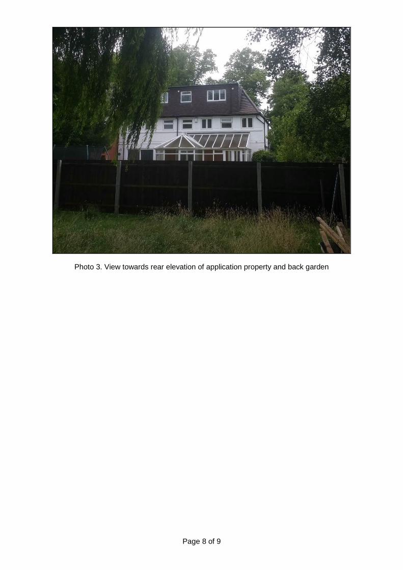
Page 8 of 9
Photo 3. View towards rear elevation of application property and back garden

Page 9 of 9
Location Plan
This map is reproduced from the Ordnance Survey Material with the permission of Ordnance Survey on behalf of the Controller of Her Majesty's Stationery Office © Crown Copyright. Unauthorised reproduction infringes Crown Copyright and may lead to prosecution or civil proceedings. Birmingham City Council. Licence No.100021326, 2010

Page 1 of 6
Committee Date: 15/08/2019 Application Number: 2019/04155/PA
Accepted: 21/05/2019 Application Type: Full Planning
Target Date: 16/07/2019
Ward: Hall Green North
PrintXpress, 1217-1219 Stratford Road, Hall Green, Birmingham, B28 9AD
Erection of first floor extension over existing units at rear Recommendation Approve subject to Conditions 1. Proposal 1.1. Link to Documents
1.2. The application proposes a first floor extension over the existing single storey
commercial unit to the rear of 1217-1219 Stratford Road, Hall Green. The unit is currently in use for e-cigarette manufacturing, associated storage and as a small gym. 294sqm of additional storage floorspace would be created by the proposal which would now all be used in association with the ground floor manufacturing use only.
1.3. The extension would utilise matching roof and brick wall materials, with a flat roof
design as per the current building. Windows would be provided in the front (eastern) and (northern) side elevations, and the rear (western) and (southern) side elevations facing respectively towards South Birmingham College and residential properties in Cambrai Drive would remain blank. The extension would be inset from the side boundary with Cambrai Drive properties.
1.4. No additional parking would be created by the proposal. 2. Site & Surroundings 2.1. Site Location Plan
2.2. The application site relates to an established warehouse unit located in a backland
position to the rear of 1217-1219 Stratford Road within an irregularly-shaped area of gated land.
2.3. No.1217-1219 Stratford Road is a commercial premises that has been in use as a printing and sign writers (Use Class B1c) and has been previously been extended at ground floor level. To the south of the site is Hall Green Library and residential gardens to the rear of 7, 9, and 11 Cambrai Drive, with South Birmingham College and car park to the west of the site. The site falls outside the boundary of The Parade, Hall Green Neighbourhood Centre.

Page 2 of 6
2.4. There is an existing vehicle access and service area located to the front of the premises which accesses onto the Stratford Road service road to the east.
2.5. The ground floor gym is currently operating without the benefit of planning consent
and has been referred to Planning Enforcement for investigation. 3. Planning History 3.1. 10/9/59 – 08297005 – Construction of warehouse building – approved
3.2. 10/11/15 – 2015/07929/PA – Erection of single storey extension – approved with
conditions
3.3. 5/6/19 – 2018/1529/ENF - Alleged works are not in accordance with approved plans attached to 2015/07929/PA – case closed
4. Consultation/PP Responses 4.1. Regulatory Services – no objections
4.2. Transportation – no objections 4.3. Neighbouring occupiers, Ward Members and Neighbourhood Watch group notified
with seven objections received on the following grounds:-
- Loss of privacy and overlooking, from windows or CCTV - Loss of light to current property and future extension, and adverse effect on plant
growth in rear garden(s) - Doubts at use for storage space (previous spaces have already been rented out
which were supposed to be used for storage space) - Poor design and appearance, and impact on image of the area - The site is not currently vacant but leased - Parking issues (existing vehicles block the entrance and this will make matters
worse, added pressure on frontage parking, and danger to children from increased traffic)
- Tree Report is only preliminary - If Trees are cut or damaged then there is a risk to protected species.
5. Policy Context 5.1. NPPF, UDP Saved Policies 2005, Birmingham Development Plan (2017), Places for
All SPG, Places for Living SPD, 45 Degree Code SPG, and, Car Parking Guidelines SPD.
6. Planning Considerations 6.1. The main issues for consideration are the principle of the use, design and
appearance, impact on nearby residential amenity, matters of highway safety and tree issues.

Page 3 of 6
6.2. In term of planning policy, good design is a key aspect of sustainable development (NPPF paragraph 56) and one of the 12 key principles that underpin decision-taking is ‘always seek to secure high quality design and a good standard of amenity for all existing and future occupants of land and buildings’ (NPPF paragraph 17). The environment strategy of the UDP saved policies is based on the need to protect what is good in the City’s environment, and to improve what is less good (paragraph 3.8). Furthermore, BDP policy PG3 seeks high quality design, TP8 relates to Green Infrastructure including trees, and TP44 seeks to promote the efficient, effective and safe use of the existing transport network.
6.3. Principle of Use
The application proposes additional storage floorspace to an existing commercial unit. Whilst not within the Neighbourhood Centre it lies to the rear of a commercial parade, between the large Telephone Exchange building and South Birmingham College. The parade also contains other retail, commercial and community uses and as such the principle of ancillary storage to the rear is acceptable in principle. Ancillary storage use can be maintained by planning condition.
6.4. Design and Appearance
The proposed extension would be located to the rear of the properties fronting the Stratford Road and would not be visible from the main road frontage. The extension would be consistent with the materials and utilitarian character and appearance of the existing premises and adjacent extensions and outbuildings within the locality. As such, the extension by virtue of its location and appearance would have no detrimental impact on the visual amenity of the surrounding area.
6.5. Residential Amenity The proposed extension would be visible from adjacent residential properties to the south along Cambrai Drive and from the College building to the rear. However it is flat roofed and no windows would be present within the adjacent elevations to give rise to overlooking or loss of privacy issues. Insertion of additional windows at a later date can be controlled by a restrictive planning condition. The proposal does not extend up the side boundary of Cambria Drive properties, giving it an appropriate set back from the end of their rear gardens. The College building is also acceptably separated by its internal access road and adjacent landscaped areas. As such, the proposed extension would have no further impact on the surrounding residential amenities in terms of its siting, scale and massing. Objections in terms of use and intensification of activity are noted, but the site lies to the rear of an established commercial parade and is it itself in commercial use. The additional floor area can be conditioned to ancillary storage use in the interests of residential amenity and on this basis additional traffic generation should not be of a scale to warrant an amenity-based refusal.
6.6. Highway Safety No additional car parking is proposed but the site is already in commercial use and the application proposes ancillary storage. Transportation raise no objections and the proposal is therefore considered acceptable from a highway safety perspective.
6.7. Trees

Page 4 of 6
The Tree Officer advises the trees are described in the submitted Arboricultural Method Statement. They are self-set boundary sycamores at the rear of the workshops and hard standing and some have regrown from previous felling. T1 and G3 are third party trees within the property of South Birmingham College. There is no existing statutory tree protection within or adjacent to the site. Accordingly no objections are raised to the proposal on tree protection grounds. Advice in relation to any tree works avoiding the bird nesting season can be provided to the applicant.
7. Conclusion 7.1. The proposed extension is of acceptable design and appearance in the context of
the existing building and will not give rise to adverse streetscene or neighbour impact implications given its setback position, in-setting from the southern boundary and absence of material overlooking windows. Added levels of activity and intensification arising from additional storage at the premises are not considered to be so significant as to constitute a reason for refusal, and no objections are raised on highway safety or tree protection grounds.
8. Recommendation 8.1. Approve subject to conditions. 1 Requires the scheme to be in accordance with the listed approved plans
2 Requires that the materials used match the main building
3 Removes PD rights for new windows
4 Requires that the approved scheme is incidental to the main ground floor
manufacturing use
5 Implement within 3 years (Full) Case Officer: Tracy Humphreys

Page 5 of 6
Photo(s)
Fig 1. View looking towards Cambrai Drive
Fig 2. View of the frontage with South Birmingham College behind

Page 6 of 6
Location Plan
This map is reproduced from the Ordnance Survey Material with the permission of Ordnance Survey on behalf of the Controller of Her Majesty's Stationery Office © Crown Copyright. Unauthorised reproduction infringes Crown Copyright and may lead to prosecution or civil proceedings. Birmingham City Council. Licence No.100021326, 2010

Page 1 of 11
Committee Date: 15/08/2019 Application Number: 2018/09301/PA
Accepted: 16/11/2018 Application Type: Full Planning
Target Date: 11/01/2019
Ward: Longbridge & West Heath
Land on corner of The Fordrough and Houldey Road, Longbridge, Birmingham, B31
Erection of 9 no. residential dwellings Recommendation Approve subject to Conditions 1. Proposal 1.1. Planning permission is sought for the erection of 9no. residential dwellings at the
land on the northern corner of The Fordrough and Houldey Road in Longbridge. This application has been submitted by Birmingham Municipal Housing Trust (BMHT) and all dwellings are proposed for affordable rent.
1.2. Plots 1-6 consist of three pairs of semi-detached properties (‘The Walmley’) facing The Fordrough. These properties would be 2 storey, 2 bedroom, 4 person properties with a living room, kitchen/dining area, utility, WC and store at ground floor and 2 bedrooms, a bathroom and store at first floor. Each property would have a long narrow garden to the rear.
1.3. Plots 7 and 8 consist of two splayed properties on the corner of the site. The 2
storey, 2 bedroom, 4 person properties would have a living room, kitchen/dining area, WC and store at ground floor and 2 bedrooms, a bathroom and store at first floor. The corner position of the properties means both units would have a triangular garden to the rear.
1.4. Plot 9 would be a detached property (‘The Northfield’) facing Houldey Road. The 2
storey, 4 bedroom, 7 person property would have a living room, dining room, kitchen, two stores and WC at ground floor and 4 bedrooms, a bathroom and store at first floor. The garden to the rear would border the side boundary of the garden of Plot No. 6.
1.5. All properties would have a gable-end roof design. Plots 1-8 would have one parking
space to the front whilst Plot 9 would have two spaces to the side. There would be planting and vegetation to the front and rear of the properties, whilst Category C trees T3, T10 and T11 (Common Ash) and hedge G5 (Lilac; Elder; Sycamore; Common Ash; Mock Orange; Butterfly Bush) would be removed.
1.6. Amended plans were submitted to ensure the properties comply with space
standards and numerical guidelines and to address concerns raised by consultees relating to landscaping and boundary treatments. The application was originally registered as ‘Demolition of existing buildings and erection of 9 no. residential dwellings’ however as an application for prior notification for demolition was determined as requiring prior approval and to approve with conditions by Planning

Page 2 of 11
Committee in January 2019, the demolition element was removed from the description of development.
1.7. Link to Documents 2. Site & Surroundings 2.1. The application site relates to a 3 storey block of units on the northern corner of The
Fordrough and Houldey Road, West Heath. The buildings are in an ‘L’ shape with a yard area to the side/rear which is access from Houldey Road. The premises have a flat roof design and comprise commercial units at ground floor level with residential flats above. Land levels fall from east to west with adjacent property No. 92A The Fordrough lying on higher land than No. 28 The Fordrough.
2.2. There is a sub-station within the site, close to the boundary with adjacent properties No. 21-23 Houldey Road, with a hedge along this boundary. There are two groups of hedges and three trees within the site, three trees on the north-east boundary and one large street tree to the front of the site on The Fordrough.
2.3. The street scene is generally varied; on the opposite site of Houldey Road are residential dwellings similar to those proposed whilst the wider area is characterised by a mixture of houses, bungalows, flats and maisonettes
2.4. The site lies in West Heath, with West Heath Local Centre and Primary Shopping Area lying approximately 220m to the south west of the site, along Alvechurch Road and Redhill Road.
2.5. Site Location Plan 3. Relevant Planning History 3.1. 03/01/2019 - 2018/09461/PA - Application for prior notification for the proposed
demolition of existing three storey building - Accepted as needing prior approval from the Council and that permission be granted
4. Consultation/PP Responses 4.1. Regulatory Services - No objection subject to a condition limiting the noise level of
the substation; contamination remediation scheme and contaminated land verification report conditions.
4.2. Severn Trent Water - No objection subject to drainage condition
4.3. Transportation Development - No objection subject to a condition for visibility splays
4.4. West Midlands Police - No objection
4.5. Neighbouring residents, residents associations, Ward Councillors and the Constituency MP have been consulted and a site notice has been displayed. No responses have been received.

Page 3 of 11
5. Policy Context 5.1. Relevant Local Planning Policy:
• Birmingham Development Plan (BDP) 2017 • Birmingham Unitary Development Plan (UDP) Saved Policies 2005 • Places for Living SPG 2001 • Mature Suburbs SPD 2008 • 45 Degree Code
5.2. Relevant National Planning Policy:
• National Planning Policy Framework (NPPF) 2019 6. Planning Considerations 6.1. This application has been assessed against the objectives of the policies set out
above.
6.2. The planning considerations important in the determination of this application are the principle of development and the potential impact of the proposal on the residential amenity of existing and future residents, visual amenity, trees, ecology, highway safety and parking and drainage.
Policy and Principle of Development
6.3. The National Planning Policy Framework (NPPF) has a presumption in favour of
sustainable development. It supports strong, vibrant and healthy communities by ensuring that a sufficient number and range of homes can be provided by fostering a well-designed and safe built environment. Paragraph 68 states that small and medium sized sites can make an important contribution to meeting local housing requirements.
6.4. Policy PG3 of the BDP states that all new development will be expected to
demonstrate high design quality, contributing to a strong sense of place. New development should reinforce local distinctiveness, with design that responds to site conditions and the local area context, including heritage assets and appropriate use of innovation in design. Policy 3.14 of the saved UDP policies echoes this, stating that a high standard of design is essential to the continued improvement of Birmingham as a desirable place to live, work and visit.
6.5. Policy TP27 of the BDP explains that new housing in Birmingham is expected to
contribute to making sustainable places by offering: a wide choice of housing sizes, types and tenures; access to facilities such as shops, schools, leisure and work opportunities within easy reach; convenient options to travel by foot, bicycle and public transport; a strong sense of place with high design quality; environmental sustainability and climate proofing through measures that save energy, water and non-renewable resources and the use of green infrastructure; attractive, safe and multifunctional public spaces for social activities, recreation and wildlife; and effective long-term management of buildings, public spaces, waste facilities and other infrastructure.
6.6. With respect to the location of new housing, Policy TP28 of the BDP explains that
proposals for new residential development should be located in low flood risk zones; be adequately serviced by existing or new infrastructure which should be in place

Page 4 of 11
before the new housing is provided; be accessible to jobs, shops and services by modes of transport other than the car; be capable of land remediation; be sympathetic to historic, cultural or natural assets; and not conflict with any other specific policies in the BDP.
6.7. The application site is located within an established residential area, in a low flood
risk zone (Flood Zone 1), is well served by existing infrastructure and services are accessible from the site. I therefore consider that the principle of residential development in this location is appropriate and acceptable.
Residential Amenity
6.8. Although not yet adopted by the Local Planning Authority, the Technical Housing
Standards provide a useful guide for minimum floor areas of residential dwellings. It requires 2 storey, 2 bedroom, 4 person properties (Plots 1-8) to have a GIA of 79sqm and 2 storey, 4 bedroom, 7 person properties (Plot 9) to have a GIA of 115sqm. Double bedrooms should achieve 11.5sqm and single bedrooms 7.5sqm. ‘Places for Living’ requires garden sizes of 70sqm for family accommodation and 52sqm for 2 bedroom houses, in addition to providing numerical guidelines and separation distances between properties.
6.9. Following the amendments made to the proposal, all 9 dwellings would achieve the required GIA, bedroom sizes and garden sizes. Plots 7 and 8 would achieve garden sizes of 53.3sqm and 54.9sqm respectively. Whilst these gardens achieve the required space for 2 bedroom properties, they do not achieve the 70sqm required for general family house. Therefore, in accordance with ‘Places for Living’, a condition is recommended for permitted development rights for new extensions and outbuildings to be removed from these properties, to prevent the amenity space from being reduced further.
6.10. Plot 6 would technically breach the 45 Degree Code to the rear kitchen/dining room
window of Plot 7, however there is an additional source of light to this room at the front, therefore I do not consider that this breach would cause an unacceptable loss of light to this room. The remainder of the proposal would comply with the 45 Degree Code and the numerical guidelines contained within ‘Places for Living’. The triangular gardens of Plots 7 and 8 mean that one of the rear elevations of the splayed properties would not achieve 10m from the boundary. No windows are proposed at first floor on these elevations, however to prevent any potential future overlooking, a condition is recommended to remove permitted development rights for new windows and dormer windows from these two properties. Similarly, as the garden of Plot 9 is less than 15m, permitted development rights for dormer windows are recommended to be removed. I therefore consider that the proposed development would have an acceptable impact on the residential amenity of existing and future occupiers of the site and neighbouring properties. Visual Amenity and Landscaping
6.11. The City’s Urban Designer has been consulted on this application. They made
reference to irregular building lines and a staggered layout not conforming to the street scene, awkward corner plots and gardens and compliance with space standards. A suggested alternative site layout was also provided.
6.12. I acknowledge the points raised and layout amendments were requested, however there is a residential development on the opposite corner of The Fordrough and Houldey Road which was approved subject to conditions in 2002 (2001/05604/PA)

Page 5 of 11
with splayed properties on the corner. Given the strong similarities between this development and the proposal, I do not consider that the proposed layout would have a detrimental impact on the character and appearance of the setting. The building line is staggered on The Fordrough with the three pairs of semi-detached properties each stepped forward of one another which I consider is acceptable.
6.13. The Design and Access Statement describes the proposed appearance and
materials: red multi bricks with grey tile bricks on the gables of the two splayed units and grey UPVC windows. Whilst these details have been provided alongside sketches, and I consider the principle acceptable, a sample material condition is recommended to view the exact materials proposed.
6.14. The amended plans received altered the proposed boundary treatment at the front
of the properties from vertical railings to horizontal estate railings for visibility reasons. The City’s Landscape Officer objected to the horizontal estate railings stating that the existing mix of boundary treatments around the site would be worsened by another boundary type being introduced. The properties on the opposite corner of The Fordrough and Houldey Road have vertical bar railings and the Landscape Officer considers that providing vertical instead of horizontal railings would strengthen local character and create a better sense of place, in accordance with PG3 of the BDP. The concerns about the visual impact of horizontal estate railings were raised with the applicant and as such, Transportation Development and Highways Delivery Officers have been consulted. Both concluded that the 900mm vertical railings would not impact upon visibility. Amendments were therefore made to the plans to re-introduce the vertical railings, as originally proposed. Other boundary treatments are proposed including wood composite fencing, metal gates and timber close boarded fence.
6.15. A landscaping plan has been provided detailing the proposed planting to the front
and rear of the properties. The Landscape Officer considers that a greater tree variety is needed with regards to amenity, resilience and bio-diversity and that native shrub planting is unwise and optimistic in the location proposed, with robust ornamental species more favourable. Surfacing details are also required. Due to the requirement for different planting and surface detail, a condition is recommended requiring the submission of hard and soft landscaping details.
Parking, Highway Safety and Transportation
6.16. Transportation Development have been consulted, raising no objection subject to
conditions for the footway crossings to be constructed to City specification at the applicants expense and for pedestrian visibility splays of 3.3m x 3.3m x 600mm to be incorporated into the accesses. The former is a transportation matter and therefore is not recommended to be attached as a condition to this planning application; however the visibility splay condition is recommended to be attached. Highways have confirmed that the proposed boundary treatment would allow the above visibility splays to be achieved.
6.17. The application proposes 1 parking space at the two bedroom properties and 2 spaces at the four bedroom property and Transportation Development note that beyond the site parking on street is unrestricted and there are buses running within reasonable walking distance throughout the day. They also consider that parking and traffic demand associated with 9 proposed dwellings would be reduced compared to the previous situation of 10 commercial uses and 10 flats. A Highways street tree was originally proposed to be removed however the amended plans have shown it to be retained. Transportation Development were re-consulted upon the

Page 6 of 11
receipt of amended plans and confirmed they had no further comments to make, with the requested conditions still required. I concur with the views of Transportation and consider that the proposal would not have a detrimental impact upon parking or highway safety.
Trees and Ecology
6.18. Arboricultural and Ecological surveys have been submitted and the City’s Tree and
Ecology Officer has been consulted on the application.
6.19. The Ecological survey was undertaken to assess the ecological value of the site and as part of this, a preliminary roost assessment for bats was also undertaken. The conclusions of these surveys found that the site was considered as having negligible value for bats but did have some value for birds. The City’s Ecologist considers that the provision of garden trees and shrubs shown in the landscaping plan will go some way to offsetting the loss of trees and shrubs currently within the site but the loss of nesting places has not been factored in. As a compensatory feature, the use of bird boxes (1 per dwelling) would potentially provide some biodiversity net gain. I concur with the views of the City Ecologist and as such, a condition is recommended below for the provision of bird boxes.
6.20. The Arboricultural Survey revealed that the 9 trees and 2 groups of trees on and
surrounding the site are all Category C. The application proposes to remove trees T3, T10 and T11 (Common Ash) and the hedge G5 (Lilac; Elder; Sycamore; Common Ash; Mock Orange; Butterfly Bush) at the boundary of No. 21-23 Houldey Road which the City’s Trees Officer has not objected to. The City owned street tree (T2) (Whitebeam) to the front of the site was proposed to be removed. Under the City’s new tree policies where BCC owned tree assets are proposed for removal, the asset must be valued using the Capital Asset Valuation of Amenity Trees (CAVAT) process, and either public realm tree planting to that value must be provided or the sum given to BCC in lieu of its loss for tree planting elsewhere. Tree T2 has been assessed and is valued at £11,687. The Tree Officer objected to the removal of this tree until an agreement was made to either retain it or compensate for its loss. The amended plans submitted show Tree T2 to be retained. The Tree Officer therefore requires suitable protection measures to be put in place to protect this tree from damage, and notes that if damage does occur then BCC can re-coup the loss in value of the tree based on the figure above. A condition is therefore recommended for tree protection around this BCC owned street tree.
Drainage
6.21. Severn Trent Water (STW) raise no objection subject to the inclusion of a condition
requiring drainage plans for the disposal of foul and surface water flows to be submitted prior to development commencing. I concur and the relevant condition is recommended below.
Other Matters
6.22. Regulatory Services raise no objection to the proposal subject to conditions. With
regard to noise matters, Regulatory Services acknowledge that the site is surrounded by existing residential housing so few noise impacts are presented and road traffic noise would be sufficiently attenuated by standard thermal double glazing. However, they note that the electricity sub-station is located within the application boundary and recommend a condition limiting the noise levels of the unit is attached. A condition was also requested for the provision of vehicle charging

Page 7 of 11
points at each unit. If future occupiers of the properties wish to install a charging point a later date then I consider that this is likely to be acceptable, however I do not consider it would be appropriate to condition their installation.
6.23. A Phase II Site Appraisal has been submitted with the application however an earlier Phase I Site Appraisal has not been included. Regulatory Services therefore recommend that contamination remediation scheme and contaminated land verification report conditions are attached. I concur and the relevant conditions are recommended below.
6.24. West Midland Police have commented on the application, noting that they believe
the development will be seeking Secured By Design accreditation. They consider that with a slight amendment to the boundary treatment to the rear gardens and sub-station, SBD could be achieved.
6.25. The proposal would not attract a CIL contribution.
7. Conclusion 7.1. The proposed development would not cause harm to residential amenity, visual
amenity, trees, ecology, highway safety and parking, or drainage, and is therefore considered acceptable. The proposal would constitute sustainable development and accords with local and national planning policy. With the attachment of the conditions outlined above, I recommend that planning permission is approved.
8. Recommendation 8.1. Approve subject to conditions. 1 Requires the scheme to be in accordance with the listed approved plans
2 Requires the submission of sample materials
3 Removes PD rights for new windows on Plots 7 and 8 and dormer windows on Plots
7, 8 and 9
4 Removes PD rights for extensions on Plots 7 and 8
5 Requires the submission of hard and soft landscape details
6 Requires the prior submission of details of bird boxes
7 Arboricultural Method Statement - Submission Required
8 Requires the submission of drainage plans for the disposal of foul and surface water flows
9 Limits the noise levels for Plant and Machinery
10 Requires the prior submission of a contamination remediation scheme

Page 8 of 11
11 Requires the submission of a contaminated land verification report
12 Requires pedestrian visibility splays to be provided
13 Implement within 3 years (Full) Case Officer: Caroline Featherston

Page 9 of 11
Photo(s)
Photograph 1: Application site fronting The Fordrough
Photograph 2: Application site fronting Houldey Road

Page 10 of 11
Photograph 3: Application site front the corner of The Fordrough and Houldey Road

Page 11 of 11
Location Plan
This map is reproduced from the Ordnance Survey Material with the permission of Ordnance Survey on behalf of the Controller of Her Majesty's Stationery Office © Crown Copyright. Unauthorised reproduction infringes Crown Copyright and may lead to prosecution or civil proceedings. Birmingham City Council. Licence No.100021326, 2010

Page 1 of 5
Committee Date: 15/08/2019 Application Number: 2019/04765/PA
Accepted: 12/06/2019 Application Type: Householder
Target Date: 16/08/2019
Ward: Billesley
168 May Lane, Kings Heath, Birmingham, B14 4AG
Erection of single and two storey side and rear extensions Recommendation Approve subject to Conditions 1. Proposal
1.1. Planning consent is sought for the erection of single and two storey side and rear
extensions
1.2. The two storey side extension would provide a lounge, and study at ground floor level, and 2 nos. bedrooms with en-suite bathrooms at first floor level. The single storey rear extension would provide an enlarged kitchen with dining and seating area. The existing outhouse/ lean-to to the rear/ side would be replaced with a single storey extension that would accommodate a utility, and WC.
1.3. An employee of Birmingham City Council has an interest in the property.
Link to Documents 2. Site & Surroundings 2.1. This application relates to a traditional detached property located within a residential
area. The application property has brick elevations with a hipped roof over. To the side there is an integral garage with a lean-to style extension (approximately 2.35m in height) built up to the boundary fence with No.166 May Lane. No.166 is a similar scale detached property which is set forward of the application property. The application site benefits from extensive side and rear gardens which contain mature landscaping.
Site Location Plan 3. Planning History 3.1. 2010/04737/PA - Erection of a two storey side and single storey side and rear
extension - withdrawn by agent - 26/10/2010
3.2. 2011/00627/PA - Erection of a two storey side and single storey side and rear extension – Approved subject to conditions - 29/03/2011
4. Consultation/PP Responses

Page 2 of 5
4.1. Adjoining residents, consultees, and local ward councillors notified. One response was received from Allotment Services with no objection. One response was received from a neighbour raising the following issues:
• Inaccurate plans • Concerns regarding side extension adjacent to the shared boundary • Proposal affecting access • Maintenance of property
5. Policy Context 5.1. Local Planning Policy:
• Birmingham Development Plan (BDP) 2017 • Birmingham Unitary Development Plan (UDP) Saved Policies 2005 • Places for Living SPG 2001 • Extending Your Home SPD 2007 • 45 Degree Code
5.2. National Planning Policy:
• National Planning Policy Framework (NPPF) 2019 6. Planning Considerations 6.1. The application has been assessed against the objectives of the policies as set out
above and the principal matters for consideration are the scale, design and siting of the proposed extensions and the impact upon the architectural appearance of the property, the general street scene and neighbour amenity.
6.2. The plans have been amended to set the single storey side extension off the boundary with no.166 May Lane and reduce its footprint. The front facing element of the proposed side extension at the existing side passage that would have accommodated part of the proposed W.C. has also been removed.
6.3. The proposal breaches the 45 degree code when measured from the rear lounge window of No.166. However, I note that the proposed extension would replace an existing lean to, and would be of a similar height and scale with a flat roof design. As such, I do not consider that the proposal would cause any further detriment than the existing situation.
6.4. Due to the existence of an access road between the application site and
neighbouring property No. 178 the rear extension would have no amenity impact on the occupiers of this property. The proposal complies with the numerical guidelines contained within ‘Places for Living’ and ‘Extending your Home’.
6.5. The scale, mass and design of the proposal are acceptable and in keeping with the
character and appearance of the application property. I note that the two storey side extension would be set back from the principal elevation of the property; its roof would be set down from the main roof, and would cause no detriment to the general street scene. The proposal complies with the principles contained within the design guide ‘Extending your Home’.

Page 3 of 5
6.6. Concerns have been raised over accuracy of the plans and also the ability of the adjoining occupier to maintain his property. The amended plans correctly show the layout of the property in relation to its neighbour. As the side extension is set further from the boundary than the existing lean-to extension it has less of an impact on the occupiers of the adjoining property, No. 166.
7. Conclusion
7.1. Subject to conditions, this application is recommended for approval as the proposal
complies with the objectives of the policies as set out above. 8. Recommendation 8.1. Approve subject to conditions
1 Requires the scheme to be in accordance with the listed approved plans
2 Requires that the materials used match the main building
3 Implement within 3 years (Full) Case Officer: Abbas Sabir

Page 4 of 5
Photo(s)
Figure 1 - Front and Side Elevation
Figure 2 – Main Rear Elevation with no.166 May Lane to the Left Hand Side

Page 5 of 5
Location Plan
This map is reproduced from the Ordnance Survey Material with the permission of Ordnance Survey on behalf of the Controller of Her Majesty's Stationery Office © Crown Copyright. Unauthorised reproduction infringes Crown Copyright and may lead to prosecution or civil proceedings. Birmingham City Council. Licence No.100021326, 2010
41
15316
0
154
178
168
ElSub Sta

Page 1 of 6
` Committee Date: 15/08/2019 Application Number: 2019/05179/PA
Accepted: 20/06/2019 Application Type: Householder
Target Date: 15/08/2019
Ward: Hall Green North
42 Stonerwood Avenue, Birmingham, B28 0AY
Erection of two and single storey rear and two storey side and single storey front. Recommendation Approve subject to Conditions 1. Proposal
1.1. Planning consent is sought for the erection of two and single storey rear and two
storey side and single storey front extension.
1.2. The two storey side extension and rear extension would create a study, wetroom, and kitchen at ground floor level, and would provide a bathroom, enlarged landing area, and bedroom at first floor level. The single storey rear extension would create a reception area. The forward extension would create an enlarged entrance hall. An additional en-suite bedroom would be accommodated at loft level which the rear dormer would be part of.
1.3. This application follows a withdrawn application 2018/08671/PA. The previous
application was withdrawn due to the case officer’s recommendation that the hip-to-gable, rear dormer, and front rooflights granted under the certificate of lawfulness 2016/06211/PA be implemented and substantially built first. The site visit conducted on 15th July, 2019 indicated that the front rooflights had been installed, and the hip-to-gable, and rear dormer had been substantially built with hanging tiles installed to the north (side) elevation of the rear dormer.
1.4. The applicant is an employee of Birmingham City Council.
1.5. Link to Documents 2. Site & Surroundings 2.1. The application site comprised of a traditional styled semi-detached property
formerly having a hipped roof, and at present a gable roof as a result of the hip-to-gable extension. The property is located within a residential street of similar styled properties. The property has an existing single storey garage and utility which projects along the boundary with the neighbouring dwelling No.40. The property has a large rear garden which is defined by low level wall and 1.8m high hedge to No.40, and 2m high fencing to No.44. The extreme rear boundary of the garden is defined by mature trees and vegetation.

Page 2 of 6
2.2. No.40 is a similar styled semi that is set down approx. 500mm from the application dwelling. This property has a similar covered access to the side. The nearest window sources light to a kitchen.
2.3. No.44 is the adjoining semi-detached which has been extended with a single storey rear extension that projects along the boundary with the application site.
2.4. Hall Green railway line runs at the bottom of the rear garden.
2.5. The application property sits in a residential area surrounded by properties of a
similar style and design; many of which have previously extended.
Site Location Map 3. Planning History 3.1. 02/01/2019 - 2018/08671/PA - Erection of two and single storey rear and two storey
side and single storey front. Installation of dormer window to the rear – Withdrawn 3.2. 16/9/2016 - 2016/06211/PA - Application for a Certificate of Lawfulness for the
proposed installation of rear dormer and hip to gable conversion and two rooflights - Section 191 / 192 Permission not Required
3.3. 25/2/2013 - 2013/00069/PA - Erection of two storey side extension, single storey
front and rear extension, detached outbuilding to rear and enlargement of dormer window to rear – Approved subject to conditions.
3.4. No. 40 Stonerwood Avenue: 18/06/2019 - 2019/02773/PA - Erection of single storey
side and rear extension. – Approved subject to conditions 4. Consultation/PP Responses 4.1. Adjoining residents, local ward councillors, and Network Rail notified. One response
received from Network Rail raising no issues. 5. Policy Context 5.1. Local Planning Policy:
• Birmingham Development Plan (BDP) 2017 • Birmingham Unitary Development Plan (UDP) Saved Policies 2005 • Places for Living SPG 2001 • Extending Your Home SPD 2007 • 45 Degree Code
5.2. National Planning Policy:
• National Planning Policy Framework (NPPF) 2019 6. Planning Considerations 6.1. The application has been assessed against the policies outlined above. The
principal matters for consideration are the impact on the appearance of the property, the visual amenity of the street, and the amenities of neighbouring occupiers.

Page 3 of 6
6.2. The proposed rear extensions have been reduced in depth by approximately 1m from the previously withdrawn application. The nearest habitable room window at the rear of no. 40 Stonerwood Avenue serves the kitchen with a secondary window located to the side elevation. The two storey rear extension would be partially obscured from this window by the rear projecting single storey utility room at no.40. Considering that this kitchen window is located at a distance of approximately 6m using the 45 Degree Code line to the proposed rear extension, there are insufficient reasons to warrant a refusal of this application.
6.3. Although the roof of the two storey side extension would be pitched, it was designed
for practical reasons so as to continue the pitch of the two storey rear extension. ‘Extending Your Home’ SPD states that extension’s roofs should match the roofs of the main house. This roof would be significantly lower than the existing gable roof. On balance given that there are other extensions on properties which have had non-matching roofs, such as those at nos. 25 and 27 Stonerwood Avenue opposite, this roof would not overwhelm the property, and be a subordinate in appearance.
6.4. The revised proposal would now have a limited impact on the architectural
appearance of the property and the visual amenity of the surrounding area. As such, the development complies with the design principles contained within the design guide ‘Extending Your Home’ which states that extensions should be designed to look less important to the existing building so as not to dominate the appearance of the whole house. Whilst the roof is not ideal in design terms, I do not consider it sufficient to warrant a refusal of this application.
6.5. The proposal would comply the distance separation guidelines as outlined within
‘Places for Living’ and ‘Extending Your Home’. 6.6. The proposed development does not attract a CIL contribution.
7. Conclusion 7.1. Subject to conditions, this application is recommended for approval as the proposal
complies with the objectives of the policies as set out above. 8. Recommendation 8.1. Approve subject to relevant conditions: 1 Requires the scheme to be in accordance with the listed approved plans
2 Requires that the materials used match the main building
3 Requires obscure glazing for specific areas of the approved building
4 Implement within 3 years (Full) Case Officer: Abbas Sabir

Page 4 of 6
Photo(s)
Figure 1 – Front Elevation with no.44 to Right Hand Side, and no.40 to Left Hand Side
Figure 2 – Main Rear elevation with no.44 to Left Hand Side, and no.40 to Right Hand Side

Page 5 of 6
Figure 3 - Front and Side Elevations showing Rear Dormer

Page 6 of 6
Location Plan
This map is reproduced from the Ordnance Survey Material with the permission of Ordnance Survey on behalf of the Controller of Her Majesty's Stationery Office © Crown Copyright. Unauthorised reproduction infringes Crown Copyright and may lead to prosecution or civil proceedings. Birmingham City Council. Licence No.100021326, 2010