performance of the geometric-historic method for ... · performance of the geometric–historic...
TRANSCRIPT
Performance of the Geometric–Historic Method for Estimating Land Subsidence in Urban Areas of Indonesia, (6917) Hasanuddin Z. Abidin, Heri Andreas, Irwan Gumilar and Bambang D. Yuwono (Indonesia) FIG Congress 2014 Engaging the Challenges - Enhancing the Relevance Kuala Lumpur, Malaysia 16 – 21 June 2014
1/12
Performance of the Geometric-Historic Method for Estimating Land Subsidence in Urban Areas of Indonesia
Hasanuddin Z. ABIDIN, Irwan GUMILAR, Bambang D. YUWONO and
Heri ANDREAS, Indonesia
Key words: Land Subsidence, GPS, InSAR, Geometric-Historic, Indonesia SUMMARY Several large urban areas in Indonesia, i.e. Jakarta, Bandung and Semarang, have experienced land subsidence for at least more than a decade. Land subsidence in these cities has been estimated using several geodetic methods, such as leveling, GPS survey, InSAR, and/or microgravity. The results obtained from these techniques over the period between 1982 and 2011 show that observed subsidence rates in Jakarta are about 1 to 15 cm/year, and can reach up to 20-28 cm/year at certain location and certain period. In Bandung basin, it was found that during the period between 2000 and 2011, several locations have experienced subsidence, with an average rate of about 8 cm/year and can reach up to about 23 cm/year. In Semarang, land subsidences with rates of up to about 19 cm/year were observed during the period of 1999 up to 2011.
In this paper, the geometric-historic method for observing and estimating land subsidence is introduced. This method is based on observation of land subsidence impacts in the field. By measuring the vertical displacement caused by land subsidence effect on the impacted object or structure, combined with historical and interview data, then the subsidence rate can be calculated. This method has been implemented to estimate subsidence rates at several locations in Jakarta, Bandung and Semarang, and the obtained rates have been compared with GPS and InSAR derived subsidence rates. The strength and limitation of this geometric-historic method is also presented and discussed.

Performance of the Geometric–Historic Method for Estimating Land Subsidence in Urban Areas of Indonesia, (6917) Hasanuddin Z. Abidin, Heri Andreas, Irwan Gumilar and Bambang D. Yuwono (Indonesia) FIG Congress 2014 Engaging the Challenges - Enhancing the Relevance Kuala Lumpur, Malaysia 16 – 21 June 2014
2/12
Performance of the Geometric-Historic Method for Estimating Land Subsidence in Urban Areas of Indonesia
Hasanuddin Z. ABIDIN, Irwan GUMILAR, Bambang D. YUWONO and
Heri ANDREAS, Indonesia
1. INTRODUCTION Land subsidence is the downward displacement of the land surface relative to certain reference surface, such as mean sea level (MSL) or reference ellipsoid, or relative to a certain assumed stable point (Abidin et al., 2013a). This hazard phenomena can be caused by natural and/or human activities, such as tectonic activities, underground mining activities, excessive groundwater or oil/gas extraction, natural consolidation of alluvium soil, and load of constructions.
It has been reported that many large urban areas (cities) are affected by this natural-anthropogenic hazard, such as Bangkok (Phien-wej et al., 2006), Taipei (Chen et al., 2007), Osaka (Murayama, 1970), Tokyo (Ishii et al., 1970), Shanghai (Chai et al., 2004), Kerman, Iran ( et al., 2010), Houston (Buckley et al., 2003), and Mexico City (Cabral-Cano et al., 2008). In Indonesia, this silent-type hazard have occurred in Jakarta (Abidin et al., 2001; 2008a; 2010a; 2011), Bandung (Abidin et al., 2008b; 2009; 2012a; 2013b), and Semarang (Abidin et al., 2010b; 2012b). Considering significant lowering in observed groundwater levels, several other cities in Indonesia are also predicted to experience land subsidence, such as Surabaya, Denpasar and Medan. However, systematic geodetic observations are required to verifiy that prediction.
The impacts of land subsidence in urban areas are quite numerous and the resulting losses cannot be under estimated (see Figure 1). Cracking of buildings and infrastructure, and wider expansion of coastal and inland flooding areas, are the common impacts than can be seen in the field. Besides affecting land surface and infrastructure, land subsidence will also deteriorate the quality of living environment and life (e.g. health and sanitation condition) in the affected areas. Development and maintenance costs of infrastructures in land subsidence affected areas will usually be higher than the normal situation. Social and environmental costs due to direct and indirect impacts of land subsidence are usually significant.
In general, information related to characteristics of land subsidence is important for urban planning and development activities, environmental management, and risk assessment efforts. Therefore, systematic and continuous monitoring of land subsidence in urban areas is obviously needed and critical to the welfare of the peoples.
Land subsidence magnitudes and rates can be estimated using several geodetic measurement techniques, such as Leveling surveys, GPS (Global Positioning System) surveys, INSAR (Interferometric Synthetic Aperture Radar), and microgravity surveys. With sufficient data and information, the temporal and spatial variations of land subsidence in certain area can also be studied. Typical strength and limitation of those geodetic methods (i.e. Leveling surveys, GPS surveys, InSAR, and Microgravity surveys) in deriving land subsidence characteristics in urban area are given in Table 1.

Performance of the Geometric–Historic Method for Estimating Land Subsidence in Urban Areas of Indonesia, (6917) Hasanuddin Z. Abidin, Heri Andreas, Irwan Gumilar and Bambang D. Yuwono (Indonesia) FIG Congress 2014 Engaging the Challenges - Enhancing the Relevance Kuala Lumpur, Malaysia 16 – 21 June 2014
3/12
• Development Cost• Maintenance Cost• Social Cost• Environmental Cost
Direct Effects
Indirect Effects
PrimarySubsidence Phenomena§ Vertical subsidence§ Tilting§ Horizontal strains§ Ground breaks§ Subsurface deformation
Aggravation ofOther Hazards§ Flooding§ Faulting§ Dam failures§ Induced seismicity
Damage, Costs andOther Impacts§ Man-‐made system§ Natural system
Adjustments and theirCosts and Impacts§ Studies§ Subsidence control§ Damage Mitigation
Damage, Costs andOther Impacts§ Man-‐made system§ Natural system
Figure 1. Losses due to land subsidence, after Viets (2010). Table 1. Typical strength and limitation of geodetic method for land subsidence study in urban areas,
from Abidin et al. (2013a)
Leveling surveys GPS surveys InSAR Microgravity LS information point-wise point-wise continuous point-wise
Spatial coverage local local to regional local to regional local
Temporal coverage user dependent user dependent images availability
dependent user dependent
Ground benchmark required required not required required
Data acquisition (survey)
day time and weather dependent
day and night, weather independent
dependent on satellite passes in the region
day and night, weather dependent
Typical limitation
laborious and time consuming
signal obstruction by buildings,
infrastructures and trees
poor image coherence due to land use and
land cover dynamics
requires stringent observation strategy
and quite costly
Typical accuracy level of LS
mm (relative)
mm-cm (relative)
mm-cm (relative)
mm-cm (relative)
In this paper, the geometric-historic method for studying land subsidence, which is not
yet widely used in geodetic community, will be explained and dicussed using the results obtained in urban areas of Indonesia, i.e. Jakarta, Bandung, and Semarang (see Figure 2). These cities are well known for have been experiencing land subsidence for decades.
Performance of the Geometric–Historic Method for Estimating Land Subsidence in Urban Areas of Indonesia, (6917) Hasanuddin Z. Abidin, Heri Andreas, Irwan Gumilar and Bambang D. Yuwono (Indonesia) FIG Congress 2014 Engaging the Challenges - Enhancing the Relevance Kuala Lumpur, Malaysia 16 – 21 June 2014
4/12
Denpasar
Cilegon
Denpasar
Cilegon
Java island
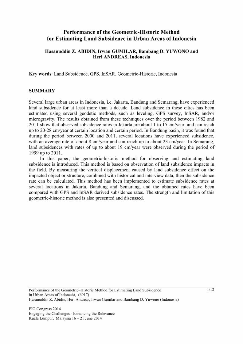
Figure 2. Large cities of Indonesia affected by land subsidence, i.e. Jakarta, Bandung and Semarang.
Information on land subsidence characteristics in Jakarta can be obtained in Abidin et al., (2001, 2008a, 2010a, 2011) and Ng et al. (2012). In general, the observed subsidence rates in Jakarta from leveling surveys, GPS surveys and InSAR technique over the period between 1982 and 2012, are about 1 to 15 cm/year with spatial and temporal variations. In Bandung basin, using GPS surveys and InSAR, it was observed that between 2000 and 2011, several locations in the Bandung basin have experienced land subsidence, with an average rate of about –8 cm/year (Abidin et al. 2008b; 2009; 2012a; Sumantyo et al., 2012). In Semarang, based on results from Levelling surveys, GPS surveys, Microgravity surveys, and InSAR technique, land subsidence with rates of up to about 19 cm/year were observed during the period of 1999 up to 2011 (Sutanta et al., 2005; Marfai and King, 2007; Abidin et al., 2010b; 2012b; Kuehn et al., 2009; Lubis et al., 2011; Supriyadi, 2008, Fukuda et al., 2008).
In this paper, whenever possible the land subsidence characteristics estimated using the geometric-historic method, will be compared with those obtained from other geodetic measurement techniques.
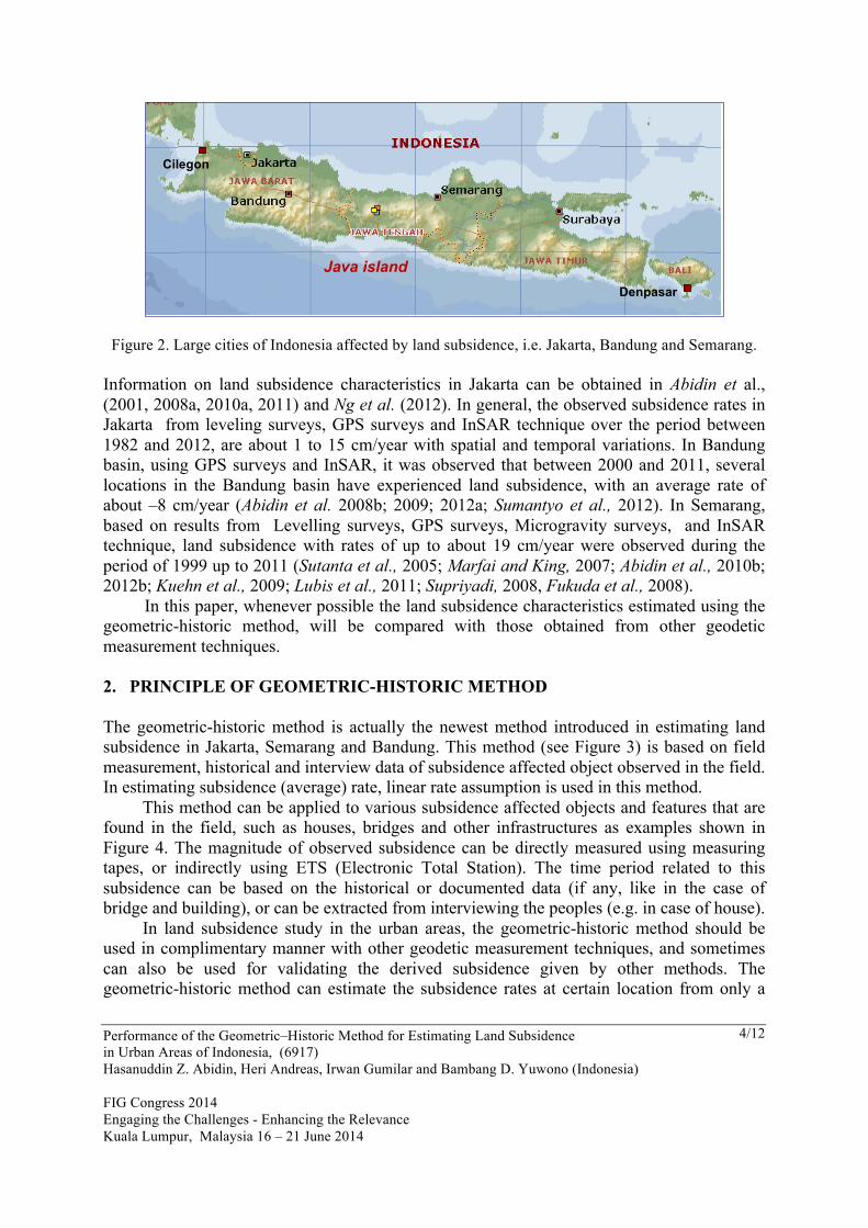
2. PRINCIPLE OF GEOMETRIC-HISTORIC METHOD The geometric-historic method is actually the newest method introduced in estimating land subsidence in Jakarta, Semarang and Bandung. This method (see Figure 3) is based on field measurement, historical and interview data of subsidence affected object observed in the field. In estimating subsidence (average) rate, linear rate assumption is used in this method. This method can be applied to various subsidence affected objects and features that are found in the field, such as houses, bridges and other infrastructures as examples shown in Figure 4. The magnitude of observed subsidence can be directly measured using measuring tapes, or indirectly using ETS (Electronic Total Station). The time period related to this subsidence can be based on the historical or documented data (if any, like in the case of bridge and building), or can be extracted from interviewing the peoples (e.g. in case of house). In land subsidence study in the urban areas, the geometric-historic method should be used in complimentary manner with other geodetic measurement techniques, and sometimes can also be used for validating the derived subsidence given by other methods. The geometric-historic method can estimate the subsidence rates at certain location from only a

Performance of the Geometric–Historic Method for Estimating Land Subsidence in Urban Areas of Indonesia, (6917) Hasanuddin Z. Abidin, Heri Andreas, Irwan Gumilar and Bambang D. Yuwono (Indonesia) FIG Congress 2014 Engaging the Challenges - Enhancing the Relevance Kuala Lumpur, Malaysia 16 – 21 June 2014
5/12
single measurement epoch. Moreover, this method can estimate the subsidence rates at location which are not accessible by other geodetic techniques.
Water level – t1
Water level – t2
Δh
Original floor level
Present road level
Subsidence rate = (Δh) / (t2 – t1)
• Based on field measurement, historical (documented) data and interview.
• Linear rate assumption.• Average rate.
t1
t2
Geometric – Historic Method
Figure 3. Principle of geometric-historic method for land subsidence estimation, for the cases of bridge
and house affected by land subsidence (upper and lower sketches).
Figure 4. Examples of land subsidence affected features in Semarang, Jakarta and Bandung.

Performance of the Geometric–Historic Method for Estimating Land Subsidence in Urban Areas of Indonesia, (6917) Hasanuddin Z. Abidin, Heri Andreas, Irwan Gumilar and Bambang D. Yuwono (Indonesia) FIG Congress 2014 Engaging the Challenges - Enhancing the Relevance Kuala Lumpur, Malaysia 16 – 21 June 2014
6/12
The accuracy of subsidence information derived from geometric-historic will strongly depend on how accurate the vertical displacement and the time period can be estimated from field measurement and historical (documented) and interview data. It requires good field surveyors, which have good geometrical insights into the impacts of land subsidence on various objects and features in the field, and also have good communication skill for interviewing peoples. 3. LAND SUBSIDENCE DERIVED USING GEOMETRIC-HISTORIC METHOD Land subsidence in urban areas of Indonesia (i.e. Jakarta, Bandung and Semarang), has been studied using the geometric-historic method along with other geodetic measurement techniques, such as Leveling surveys, GPS surveys, InSAR and Microgravity surveys. In Semarang, the geometric-historic method has been used to estimate subsidence rates at several observation location as shown in Figure 5. In general, the derived subsidence rates is comparable in accuracy with subsidence rates derived by GPS surveys in nearby locations. The differences in this case are about 1-2 cm/year or less, as shown in Figure 6. Spatial variation of subsidence rates as obtained by this method is depicted in Figure 7.
Figure 5. Implementation of the geometric-historic method for estimating land subsidence rates
at several location in Semarang in 2012, from Yuwono (2013).

Performance of the Geometric–Historic Method for Estimating Land Subsidence in Urban Areas of Indonesia, (6917) Hasanuddin Z. Abidin, Heri Andreas, Irwan Gumilar and Bambang D. Yuwono (Indonesia) FIG Congress 2014 Engaging the Challenges - Enhancing the Relevance Kuala Lumpur, Malaysia 16 – 21 June 2014
7/12
Geometric HistoricGPS Surveys
GH Observation Location
LS ra
tes (cm
/year)
Figure 6. Comparison of land subsidence (LS) rates in Semarang, between those derived by GPS
surveys and the geometric-historic methods; after Yuwono (2013).
B.D. Yuwono (2012)
GH measurement points
Legend :
Subsidence rates : 0 – 3 cm/year3 – 6 cm/year6 – 9 cm/year9 – 13 cm/year
Land Subsidence in Semarangfrom Geometric – Historic (GH) Method (2012)
Figure 7. Land subsidence rates in Semarang in 2012,
as derived from the geometric-historic method, after Yuwono (2013).
In Bandung, the geometric-historic method has also been implemented to estimate land subsidence rates at several locations. In this case, the implementation is focused in the areas which are indicated to have significant subsidence rates from previous GPS surveys and InSAR data processing. The results are shown in Table 2.

Performance of the Geometric–Historic Method for Estimating Land Subsidence in Urban Areas of Indonesia, (6917) Hasanuddin Z. Abidin, Heri Andreas, Irwan Gumilar and Bambang D. Yuwono (Indonesia) FIG Congress 2014 Engaging the Challenges - Enhancing the Relevance Kuala Lumpur, Malaysia 16 – 21 June 2014
8/12
Table 2. Land subsidence rates derived by the Geometric-Historic (GH) method, in comparison with InSAR and GPS surveys derived rates; after Gumilar (2013).
No Latitude Longitude
Subsidence Rates (cm/year) Distance (m) from GPS to GH/InSAR
location GH InSAR GPS Surveys
1 6° 58' 52,63199" S 107° 37' 13,89601" E 4.6 6.5
5.9
246 2 6° 58' 51,43799" S 107° 37' 13,23600" E 4.7 6.2 246 3 6° 58' 48,32401" S 107° 37' 12,01799" E 5.0 6.6 214 4 6° 58' 44,76599" S 107° 37' 11,49001" E 4.7 7.0 156 5 6° 58' 44,01600" S 107° 37' 10,95001" E 3.1 7.0 194 6 6° 58' 24,19201" S 107° 37' 10,77601" E 2.3 7.3 152 7 6° 59' 12,84599" S 107° 37' 57,69601" E 4.1 7.5 179 8 6° 55' 19,44601" S 107° 33' 25,83601" E 10.9 12.7 14.2 251 9 6° 55' 19,57199" S 107° 33' 20,89799" E 7.7 14.4
16.9
532 10 6° 55' 19,69200" S 107° 33' 19,95599" E 9.2 14.8 576 11 6° 55' 19,51201" S 107° 33' 18,45599" E 8.3 15.5 543 12 6° 54' 16,05493" S 107° 32' 02,31197" E 8.3 6.7 568 13 6° 54' 54,92291" S 107° 32' 59,13471" E 7.1 15.5 15.3 544 14 7° 00' 08,62226" S 107° 44' 54,47931" E 5.3 8.5 1.9 146 15 7° 00' 13,95599" S 107° 44' 55,38570" E 4.3 8.1 4.3 58 16 7° 00' 41,21876" S 107° 44' 53,36205" E 5.3 6.9 80 17 7° 01' 06,17634" S 107° 46' 14,93603" E 3.5 1.9 4.4 114 18 6° 58' 40,53552" S 107° 45' 04,70152" E 9.2 5.6 5.1 98 19 6° 57' 53,82708" S 107° 48' 06,86046" E 8 6 3.9 562 20 6° 56' 23,16270" S 107° 41' 24,19705" E 9 7.2
9.2
173 21 6° 56' 31,23591" S 107° 41' 34,66036" E 7.3 8.9 654 22 6° 56' 31,77820" S 107° 41' 30,82202" E 3.7 8.9 643 23 6° 56' 33,48803" S 107° 41' 27,60885" E 8.8 8.9 678 24 6° 56' 36,97421" S 107° 41' 20,92241" E 6.7 8.9 690 25 6° 56' 42,15138" S 107° 41' 20,07286" E 4.3 9.2 632 26 6° 57' 52,64636" S 107° 37' 22,51517" E 11.7 11.8 709 27 6° 58' 08,57401" S 107° 37' 59,94776" E 5 8.4 9.3 15 28 6° 59' 50,29790" S 107° 37' 19,78455" E 5.9 6.2 9.2 125
In general, the subsidence rates derived by three methods shown in Table 2, cannot be compared directly since it has quite different temporal and spatial coverage. In this Table 2, the subsidence rates from GPS surveys are the average GPS-derived subsidence rates from 2000 to 2010, while the subsidence rates from InSAR are the average rates from 2006 to 2010, and the subsidence rates from geometric-historic method are observed in 2012. Moreover, location of GPS stations and the geometric-historic measurements are mostly about several hundred meters apart. The InSAR derived subsidence rates are estimated from the final InSAR deformation image in Bandung basin at the coordinates of geometric-historic measurements. Considering the spatial resolution of InSAR images, and also the accuracy of geometric-historic and InSAR methods, then differences shown in Table 2 can be understood. Moreover, different subsidence rates obtained by the three methods shown in Table 2, in part suggests the existence of local subsidence spectrum of land subsidence phenomena in Bandung basin on top of the regional subsidence spectrum. This local spectrum of subsidence can be caused by different mechanisms of subsidence (Abidin et al. 2008b; 2009; 2012a).
Performance of the Geometric–Historic Method for Estimating Land Subsidence in Urban Areas of Indonesia, (6917) Hasanuddin Z. Abidin, Heri Andreas, Irwan Gumilar and Bambang D. Yuwono (Indonesia) FIG Congress 2014 Engaging the Challenges - Enhancing the Relevance Kuala Lumpur, Malaysia 16 – 21 June 2014
9/12
5. CLOSING REMARKS In general nowadays, land subsidence characteristics in urban areas of Indonesia are estimated mainly using geodetic measurement techniques such as Leveling surveys, GPS surveys, InSAR and Microgravity surveys. Each method has its own strengths and limitations, and therefore should preferably used in complimentary manner. Geometric-historic method which recently being used, has its own strengths. It can estimate the subsidence rates from only a single measurement epoch, and it can be used at location which are not accessible by other geodetic measurement techniques. The measurement cost is also relatively much cheaper than other geodetic technique. However, the geometric-historic method has also potential weaknesses. It has strong subjectivity nature, since the quality of subsidence information derived from geometric-historic will strongly depend on how accurate the vertical displacement and the time period can be estimated from field measurement and historical (documented) and interview data by the field surveyors. Different field surveyor, which has different geometrical insight into the impacts of land subsidence in the field, and has different communication skill in interviewing peoples; can lead to different estimated subsidence rates at the same location. In studying land subsidence in urban areas of Indonesia (i.e. Jakarta, Bandung and Semarang), the geometric-historic method has been implemented together with other geodetic measurement techniques. In the case of Semarang, the differences between subsidence rates derived by the geometric-historic and GPS surveys methods are about 1-2 cm/year or less. In the case of Bandung however, the differences with those derived from GPS Surveys and InSAR results were found to be larger than Semarang case. In future studies, more investigation will be performed to investigate the accuracy of subsidence rates derived by geometric-historic method at various measurement condition. REFERENCES Abidin, H. Z., R. Djaja, D. Darmawan, S. Hadi, A. Akbar, H. Rajiyowiryono, Y. Sudibyo, I. Meilano,
M. A. Kusuma, J. Kahar, C. Subarya (2001). "Land Subsidence of Jakarta (Indonesia) and its Geodetic-Based Monitoring System." Natural Hazards. Journal of the International Society of the Preventation and Mitigation of Natural Hazards, Vol. 23, No. 2/3, March, pp. 365 - 387.
Abidin, H.Z. , H. Andreas, R. Djaja, D. Darmawan and M. Gamal (2008a). “Land subsidence characteristics of Jakarta between 1997 and 2005, as estimated using GPS surveys”, GPS Solutions, Springer Berlin / Heidelberg, Vol. 12, No. 1, pp. 23-32.
Abidin, H.Z., H. Andreas, M. Gamal, A. D. Wirakusumah, D. Darmawan, T. Deguchi, Y. Maruyama (2008b). “Land subsidence characteristics of the Bandung Basin, Indonesia, as estimated from GPS and InSAR”, Journal of Applied Geodesy, September 2008, Vol. 2, No. 3 : Pages 167–177, de Gruyter, DOI : 10.1515/JAG.2008.019.
Abidin HZ, Andreas H, Gumilar I, Wangsaatmaja I, Fukuda Y and Deguchi T (2009) Land Subsidence and Groundwater Extraction in Bandung Basin (Indonesia). In Trends and Sustainability of Groundwater in Highly Stressed Aquifers, IAHS Publication no. 329, ISSN: 0144-7815, pp. 145 – 156
Abidin, H.Z., H. Andreas, M. Gamal, I. Gumilar, M. Napitupulu, Y. Fukuda, T. Deguchi, Y. Maruyama, E. Riawan (2010a). “Land Subsidence Characteristics of the Jakarta Basin

Performance of the Geometric–Historic Method for Estimating Land Subsidence in Urban Areas of Indonesia, (6917) Hasanuddin Z. Abidin, Heri Andreas, Irwan Gumilar and Bambang D. Yuwono (Indonesia) FIG Congress 2014 Engaging the Challenges - Enhancing the Relevance Kuala Lumpur, Malaysia 16 – 21 June 2014
10/12
(Indonesia) and its Relation with Groundwater Extraction and Sea Level Rise”, In Groundwater Response to Changing Climate, IAH Selected Papers on Hydrogeology No. 16, Editors : M. Taniguchi and I.P. Holman, CRC Press, London, ISBN: 978-0-415-54493-1, Chapter 10, pp.113 – 130.
Abidin, H.Z., H. Andreas, I. Gumilar, T.P. Sidiq, M. Gamal, D. Murdohardono, Supriyadi, Y. Fukuda (2010b). “Studying Land Subsidence in Semarang (Indonesia) using Geodetic Methods”, Proceedings of the FIG Congress 2010, FS 4D - Landslide and Subsidence Monitoring II, Sydney, Australia, 11-16 April 2010.
Abidin, H.Z., H. Andreas, I. Gumilar, Y. Fukuda, Y.E. Pohan, T. Deguchi (2011). “Land subsidence of Jakarta (Indonesia) and its relation with urban development”. Natural Hazards, Volume 59, Issue 3, pp. 1753-1771.
Abidin, H.Z., I. Gumilar, H. Andreas, D. Murdohardono, Y. Fukuda (2012a). "On causes and impacts of land subsidence in Bandung Basin, Indonesia", Environmental Earth Sciences, DOI; 10.1007/s12665-012-1848-z.
Abidin, H.Z., H. Andreas, I. Gumilar, T.P. Sidiq and Y. Fukuda (2012b). ”Land subsidence in coastal city of Semarang (Indonesia): characteristics, impacts and causes”, Journal of Geomatics, Natural Hazards and Risk, DOI:10.1080/19475705.2012.692336.
Abidin, H.Z., H. Andreas, I. Gumilar, T.P. Sidiq and Y. Fukuda (2013a). “On the Roles of Geospatial Information for Risk Assessment of Land Subsidence in Urban Areas of Indonesia“ In S. Zlatanova et al. (eds.), Intelligent Systems for Crisis Management, Lecture Notes in Geoinformation and Cartography, DOI: 10.1007/978-3-642-33218-0_19, Springer-Verlag Berlin Heidelberg, pp. 277-288.
Abidin, H.Z., I. Gumilar, H. Andreas, D. Murdohardono, Y. Fukuda (2013b). "On causes and impacts of land subsidence in Bandung Basin, Indonesia", Environmental Earth Sciences, Volume 68, Issue 6, pp 1545-1553.
Buckley, S.M., P.A. Rosen, S. Hensley and B.D. Tapley (2003), “Land subsidence in Houston, Texas, measured by radar interferometry and constrained by extensometers”, Journal of Geophysical Resesearch, Vol. 108(B11), 2542, doi:10.1029/2002JB001848.
Cabral-Cano, E., T.H. Dixon, F. Miralles-Wilhelm, O. Díaz-Molina, O. Sánchez-Zamora, and R. E. Carande (2008), “Space geodetic imaging of rapid ground subsidence in Mexico City”, Geological Society of America Bulletin, Nov., v. 120, p. 1556-1566.
Chai, J.C, S.L. Shen, H.H. Zhu and X.L. Zhang (2004). “Land subsidence due to groundwater drawdown in Shanghai”, Geotechnique, Vol. 54, no. 2, pp. 143-147.
Chen, C.T., J.C. Hu, C.Y. Lu, J.C. Lee, Y.C. Chan (2007), “Thirty-year land elevation change from subsidence to uplift following the termination of groundwater pumping and its geological implications in the Metropolitan Taipei Basin, Northern Taiwan”, Engineering Geology, Vol. 95, pp. 30 – 47.
Fukuda, Y., T. Higashi, S. Miyazaki, T. Hasegawa, S. Yoshii, Y. Fukushima, J. Nishijima, M. Tanigushi, H.Z. Abidin and R.M. Delinom (2008). “Groundwater and Land Subsidence Monitoring in 3 Mega-Cities, Indonesia, by Means of Integrated Geodetic Methods”. Paper presented at the AGU Fall Meeting 2008, San Fransisco, 15-19 December.
Gumilar, I. (2013). “Mapping Land Subsidence Characteristics based on the Integration of GPS and InSAR, and Estimation of Economic Losses due to Land Subsidence (Case Study : Bandung Basin)”, PhD Dissertation, in Indonesian, Department of Geodesy and Geomatics Engineering,

Performance of the Geometric–Historic Method for Estimating Land Subsidence in Urban Areas of Indonesia, (6917) Hasanuddin Z. Abidin, Heri Andreas, Irwan Gumilar and Bambang D. Yuwono (Indonesia) FIG Congress 2014 Engaging the Challenges - Enhancing the Relevance Kuala Lumpur, Malaysia 16 – 21 June 2014
11/12
Institute of Technology Bandung, October, 265 pp.
Ishii, M., F. Kuramochi and T. Endo (1970), “Recent Tendencies of the Land Subsidence in Tokyo”, Publication No. 121 of the Internationa] Association of Hydrological Sciences, Proceedings of the Anaheim Symposium, Dec., pp. 25-34.
Murayama, S (1970), “Land Subsidence in Osaka”, In: Proceedings of The Tokyo Symposium on Land Subsidence, Vol 1, International Association of Scientific Hydrology and UNESCO, September 1969, Tokyo, pp. 105-130, 1970.
Ng, Alex Hay-Man, Linlin Ge, Xiaojing Li, Hasanuddin Z. Abidin, Heri Andreas, and Kui Zhang (2012). “Mapping land subsidence in Jakarta, Indonesia using persistent scatterer interferometry (PSI) technique with ALOS PALSAR”, International Journal of Applied Earth Observation and Geoinformation, Vol. 18, August 2012, Pages 232–242.
Kuehn, F., D. Albiol, G. Cooksley, J. Duro, J. Granda, S. Haas, A. Hoffmann-Rothe and D. Murdohardono (2009). “Detection of land subsidence in Semarang, Indonesia, using stable points network (SPN) technique”. Environmental Earth Sciences, DOI 10.1007/s12665-009-0227-x
Lubis, A.M., T. Sato, N. Tomiyama, N. Isezaki, and T.Yamanokuchi (2011). “Ground subsidence in Semarang-Indonesia investigated by ALOS–PALSAR satellite SAR interferometry”. Journal of Asian Earth Sciences, Vol. 40, No. 5, 30 March, pp. 1079-1088.
Marfai, M.A. and L. King (2007), “Monitoring land subsidence in Semarang, Indonesia”. Environmental Geology, Springer Verlag, Vol. 53, pp. 651–659.
Phien-wej, N., P.H. Giao, and P. Nutalaya (2006), “Land subsidence in Bangkok, Thailand”, Engineering Geology, Vol. 82, Issue 4, 2 February, pp.187–201.
Sumantyo, J.T.S., M. Shimada, P.P. Mathieu and H.Z. Abidin (2012), “Long-Term Consecutive DInSAR for Volume Change Estimation of Land Deformation”, IEEE Transactions on Geoscience and Remote Sensing, Vol. 50, No. 1, pp. 259-270, January 2012
Supriyadi (2008), “Separation of Gravity Anomaly Caused Subsidence and Ground Water Level Lowering of Time Lapse Microgravity Data Using Model Based Filter: Case Study Semarang Aluvial Plain (in Indonesian)”, PhD Dissertation. Institute of Technology Bandung, September, 146 pp.
Sutanta, H., A. Rachman, Sumaryo and Diyono (2005), “Predicting Land Use Affected by Land Subsidence in Semarang Based on Topographic Map of Scale 1:5.000 and Leveling Data”. Proceedings of the Map Asia 2005 Conference (in CDRom), Jakarta, 22-25 August 2005.
VaeziNejad, S.M., M.M. Toufigh, and S.M. Marandi (2011), “Zonation and Prediction of Land Subsidence (Case Study-Kerman, Iran)”, International Journal of Geosciences, 2, 102-110.
Viets, V.F. (2010). “Environmental and Economic Effects of Subsidence”, Publication of Lawrence Berkeley National Laboratory, LBNL Paper LBL-8615, Permalink: http://escholarship.org/ uc/item/1sb4c8vh, 251 pp.
Yuwono, B.D. (2013). “Geospatial Analysis of Cause and Impacts of Land Subsidence in Semarang”, MSc Thesis, in Indonesian, Department of Geodesy and Geomatics Engineering, Institute of Technology Bandung, February, 184 pp.

Performance of the Geometric–Historic Method for Estimating Land Subsidence in Urban Areas of Indonesia, (6917) Hasanuddin Z. Abidin, Heri Andreas, Irwan Gumilar and Bambang D. Yuwono (Indonesia) FIG Congress 2014 Engaging the Challenges - Enhancing the Relevance Kuala Lumpur, Malaysia 16 – 21 June 2014
12/12
BIOGRAPHICAL NOTES Prof. Dr. Hasanuddin Z. Abidin, is a Professor and Head of Geodesy Research Group, Faculty of Earth Science and Technology, Institute of Technology Bandung, Indonesia. He obtained his Insinyur degree from Dept. of Geodetic Engineering, ITB in 1985, and his MSc.Eng and PhD degrees from the Department of Geodesy and Geomatics Engineering (previously Dept. of Surveying Engineering), Univ. of New Brunswick, Canada, in 1989 and 1992 respectively. His academic background is related to the theory and applications of satellite geodesy; and his research works up to the present times includes the following areas, namely : ambiguity resolution of GPS signals; the use of GPS system for geodetic surveying, land surveying, cadastral surveying, and marine applications; use of GPS survey method for monitoring volcano deformation, land subsidence, landslide, and dam deformation; geodetics aspects of the international boundary; use of TLS for 3D structural mapping and deformation study; and integration of GPS and INSAR for deformation study. CONTACTS Prof. Dr. Hasanuddin Z. Abidin Geodesy Research Group Faculty of Earth Science and Technology Institute of Technology Bandung, Jl. Ganesa 10 Bandung INDONESIA Tel. + 62-22-2534286 Fax + 62-22-2500935 Email: [email protected] and [email protected] Web site: http://geodesy.gd.itb.ac.id/hzabidin