part 3 strategic framework - torres strait island region - part 3 - strategic... · torres strait...
TRANSCRIPT

Torres Strait Island Regional Council
Planning SchemePage 11
Part 3: Strategic framework
Part 3 Strategic framework3.1 Preliminary(1) The strategic framework sets the policy direction for the planning scheme and forms the basis for ensuring
appropriate development occurs in the planning scheme area for the life of the planning scheme.
(2) Mapping for the strategic framework is included in Schedule 2, and is presented on maps for each island.
(3) For the purpose of describing the policy direction for the planning scheme, the strategic framework is structured in the following way:
(a) the strategic intent
(b) the themes and elements listed in table 3.1.1 that collectively represent the policy intent of the scheme
(c) the strategic outcomes proposed for development in the planning scheme area for each theme
(4) Although each theme has its own section, the strategic framework in its entirety represents the policy intent for the planning scheme.
Table 3.1.1—Theme and Element Headings in the Strategic Framework
Theme Element
Gogobithiay (land, sea and sky) • Environment and natural resources • Waterways, wetlands and ground water • Land and soil
Natural hazards • Coastal hazards • Flood,bushfire,landslide
Torres Strait people and townships • Health and wellbeing • Economic development and employment• Housing and community expansion • Education and community facilities • Cross border movement
Ailan kastom and cultural heritage • Ailan kastom • Cultural heritage
Getting around • Roads• Air access• Sea access
Town infrastructure • Water and waste water• Waste • Drainage • Electricity • Telecommunications

Torres Strait Island Regional Council
Planning SchemePage 12
3.2 Gogobithiay (Land, Sea and Sky) Editor’s Note –
Gogobithiay (land, sea and sky) is fundamental to the Torres Strait Islander way of life. Gogobithiay cannot be separated into land, sea and sky and it cannot exist without the Torres Strait people. The existence and health of gogobithiay are essential to the community’s health, wellbeing, economy and way of life.
The islands of the Torres Strait were formed through different natural processes and can be grouped into:
• Top Western Islands (Boigu, Dauan and Saibai) Boigu and Saibai were formed by alluvial sedimentary deposits flowing from rivers in Papua New Guinea to the sea. These islands are low lying and mostly composed of mangrove muds and peats. In terms of geology, Dauan is similar to the inner and near western groups of islands.
• Inner and Near Western Islands (Badu, Mabuaig, Kubin, St Pauls and Kirriri) These islands are hilly and steep and composed mainly of granite and volcanic rock. The islands are peaks of the northern most extension of the Great Dividing Range, now separated from the mainland by sea.
• Central Islands (Iama (Yam), Masig (Yorke), Poruma (Coconut) and Warraber (Sue)) These islands are low lying islands of sandy coral cays formed by wave action over platform reefs. Iama has geological characteristics more similar to the inner and neat western group of islands.
• Eastern Islands (Mer (Murray), Ugar (Stephen) and Erub (Darnley) Island) These islands are high volcanic islands with steep vegetated slopes and exposed rock. The soils on these islands are very fertile and good for gardening.
Although there are common characteristics across the islands, gogobithiay of each island and the surrounding seas is unique.
Torres Strait Island Regional Council
Planning SchemePage 13
Part 3: Strategic framework
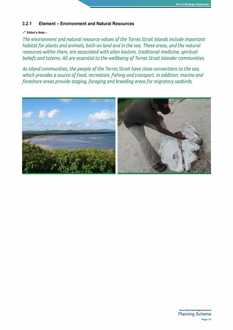
3.2.1 Element – Environment and Natural Resources
Editor’s Note –
The environment and natural resource values of the Torres Strait Islands include important habitat for plants and animals, both on land and in the sea. These areas, and the natural resources within them, are associated with ailan kastom, traditional medicine, spiritual beliefs and totems. All are essential to the wellbeing of Torres Strait Islander communities.
As island communities, the people of the Torres Strait have close connections to the sea, which provides a source of food, recreation, fishing and transport. In addition, marine and foreshore areas provide staging, foraging and breeding areas for migratory seabirds.

Torres Strait Island Regional Council
Planning SchemePage 14
Strategic Outcomes
(1) The environment and natural resources of the Torres Strait Islands continue to support the quality of life and the wellbeing of the Torres Strait Island communities, including both current and future generations.
(2) On all islands, development for urban purposes is contained within the township zone and away from areas of high or moderate environmental value, except where the development:
(a) needstobeseparatedfromwherepeoplelive;or
(b) needstobelocatedinaparticularplaceornearaparticularresourcetobeabletofunction;or
(c) requiresalargeareaoflandthatcannotphysicallyfitwithinthetownshipzone;or
(d) is for the purpose of a utility installation (sewerage treatment plant or water supply infrastructure) or renewableenergyfacility;or
(e) is required to support ailan kastom or traditional practices.
(3) Wherever possible, areas of high environmental value and moderate environmental value are protected to ensure the integrity of natural processes and to maintain or enhance nature conservation, landscape, visual quality,biodiversity,fisheriesresourcesandhabitatvalues.
(4) Development minimises the effects of development on plants and animals and avoids fragmentation of habitat so that animals can move easily to different areas of habitat to access food sources.
(5) The ecological values of marine ecosystems, including coastal waters, dunes and foreshore areas are protected from the impacts of development.
(6) Theuseofcoastalresourcesforhuntingandfishingisundertakeninawaythatmeansitwillbeavailableforconsumption and enjoyment by future generations.
Editor’s Note–Urbanpurposesisusedinthisdocumenttodescribeallofthedefinedactivitygroupsotherthan rural activities in schedule 1.1.1 in this planning scheme. An exception to this is part 4 of the planning schemewhereurbanpurposesisdefinedaspertheadministrativedefinitionsinschedule1.2ofthisplanningscheme.
Editor’s Note – It is important that all land users are aware of their obligations under the Vegetation Management Act (VMA) 1999. The requirements of the VMA Act 1999 continue to apply in addition to any requirementsspecifiedbythisplanningschemefortheprotectionofenvironmentalvalues.

Torres Strait Island Regional Council
Planning SchemePage 15
Part 3: Strategic framework
3.2.2 Element – Waterways and Wetlands
Editor’s Note –
A waterway can be a creek, brook, river or stream and may have a lake, estuary or inlet at its base. Waterways may include floodplain or wetland systems and can be above or below ground. Waterways and wetlands may be permanently, seasonally or intermittently inundated with water, and may be fresh, saline, flowing or static.
The islands of the Torres Strait Island Regional Council are diverse and were formed by different natural processes. Therefore, not all islands have waterways and wetlands. Where waterways and wetlands exist, they provide for important natural processes and habitat. They are an important community resource.
Strategic Outcomes
(1) Waterways,wetlandsandassociatednaturalprocessesareprotectedtomaintainwaterquality,naturalfloodflowsandprotectivefunctionsduringstormtidesaswellasriparianhabitatandlandscapequality.
(2) Water storages for use by island communities are protected from the impacts of development so that the supply and quality of drinking water is not reduced.
(3) Recreationalandcommercialfishingareas,whetherpartoffreshwaterormarineecosystems,areimportantplaceswherelocalpeoplegotorecreateandfish.Upstreamdevelopmentdoesnotresultinrunoffthatimpactson the environmental and habitat qualities of these places.
(4) Recreational opportunities based on waterways and wetlands are provided in a way that does not negatively impactwaterquality,floodflows,riparianhabitatvaluesandlandscapequality.
Editor’s Note – The maps provided in schedule 2 show the locations of all known waterways. It should be noted that other waterways may exist that are not shown on these maps.

Torres Strait Island Regional Council
Planning SchemePage 16
3.2.3 Element – Land and Soil
Editor’s Note –
The land, together with the sea, gives communities life. The communities of the Torres Strait manage their land by working with nature rather than against it.
Strategic Outcomes
(1) Disturbance of soil is minimised and managed so that salinity and rising water tables are not created and erosion,sedimentation,acidificationandwaterqualitydegradationareprevented.

Torres Strait Island Regional Council
Planning SchemePage 17
Part 3: Strategic framework

Torres Strait Island Regional Council
Planning SchemePage 18
3.3 Natural Hazards Editor’s Note –
Natural hazards include bushfire, landslide, flooding, storm tide inundation and erosion. The threats to Torres Strait Island communities caused by these natural hazards differ from island to island.

Torres Strait Island Regional Council
Planning SchemePage 19
Part 3: Strategic framework
3.3.1 Element – Coastal Hazards
Editor’s Note –
The Torres Strait Islands are vulnerable to climate change, tropical cyclones, storms and associated coastal hazards, which are described in this planning scheme as erosion and storm tide inundation.
The impacts of coastal hazards on Torres Strait people and townships are worse in low lying communities and may worsen over time as the global climate changes and sea levels rise. Coastal dunes and vegetation provide protection for many of these communities, allowing for natural processes of coastal change and absorbing the erosive energy of waves.
Strategic Outcomes
(1) Risks to people and property caused by coastal hazards, including erosion, storm tide inundation and the impacts of projected sea level rise, are minimised to the greatest extent possible through the following combination of responses:
(a) Avoiding –
(i) Coastal hazard areas are kept free of essential community infrastructure, community facilities andaccommodationactivities,unlessinvolvingcoastaldependentdevelopment;ortemporaryorreadilyrelocatabledevelopment;ortheupgradeorreplacementofexistingbuildingsorinfrastructure;orahouseordualoccupancyonanexistinglotwithinthetownshipzone;
(ii) New lots are not created within a coastal hazard area unless the purpose of the subdivision is to createalotoveraleaseareaorhousesiteestablishedbeforetheplanningschemewasadopted;orthelotsarewithinadesignatedexpansionareaandtherequirementsof(c)and(d)aremet;
(iii) Development does not worsen the severity or impact to people and property caused by coastal hazards.
(b) Retreating –
(i) When in need of upgrading or replacement, essential community infrastructure, community facilities and accommodation activities within a coastal hazard area are relocated outside of this area, wherever possible.
(c) Accommodating –
(i) Unless coastal dependent or temporary or readily relocatable, development within a coastal hazard area is:
(A) sitedtolessenthepotentialriskoferosionandstormtideinundation;
(B) designedtowithstandtheerosionandstormtideinundationhazard;and
(C) designedtominimisesusceptibilitytoerosionandstormtideinundation;
(ii) Essential community infrastructure is able to function effectively during and immediately after a coastalhazard;
(iii) Community facilities, accommodation activities and coastal dependent development provide for an evacuationroutethatisavailableatalltimes;
(iv) Development involving the manufacture or storage of hazardous materials does not increase risk to public safety or the environment caused by erosion or storm tide inundation.

Torres Strait Island Regional Council
Planning SchemePage 20
(d) Protecting –
(i) To the greatest extent possible, development maintains environmental features and physical characteristics that provide protective functions for existing development against the risk of erosion andstormtideinundation;
(ii) As a last resort, coastal protection works may be considered to protect existing development.
Editor’s Note – It is critical that future development in the Torres Strait takes into account potential risks associated with coastal hazards such as erosion and storm tide inundation, both now and in the future as sea levelsrise.Planningresponseswillvaryfromislandtoislanddependingonthegeomorphologyoftheisland;thelocationofthetownshipandtownshipexpansionareainrelationtocoastalhazards;thenatureandseverityoftherisk;andthedesiresandaspirationsheldbythelocalcommunity.Inmanycases,decisionsabouthowtorespond to coastal hazards will take time for local communities to thoroughly consider and decide.
This planning scheme takes coastal hazards into account using the best available data (at the time of writing). It is anticipated that, over time, the communities of the Torres Strait will continue to discuss these issues and develop an agreed position on the most appropriate responses at the local level. The outcome of these decisions will need to be incorporated into future amendments or revisions to this planning scheme.
While the best available data has been used in this planning scheme, projections about climate change may alter over time. In addition, circumstances may change which means that previous projections about coastal hazards are no longer valid (for example, if a sea wall is constructed to protect a township, calculations about where sea levels may extend to as a consequence of storm tide inundation and sea level rise will not longer be accurate). These circumstances will be taken into account either through development application processes or through planning scheme amendments.
Note – For the purpose of section 13 of the Building Regulations 2006:
(1) landshownasfloodhazardareasandstormtideinundationareaonthemapsinschedule2isdesignatedasthefloodhazardarea;and
(2) thedefinedfloodlevelisdeclaredforeachislandcommunityinthelocalplansprovidedinpart7ofthisplanning scheme.
Editor’s Note – Dwelling houses and dual occupancies are not made assessable in the township zone under section5ofthisplanningscheme.However,buildingworksapprovalwillberequired.Thedeclarationoffloodhazard areas under the planning scheme trigger various requirements under the Building Codes of Australia.
Editor’s Note – Essential community infrastructure is used in this document to describe infrastructure that is critical during and after an emergency and includes land uses such as emergency services, hospitals, health care services, renewable energy facilities, telecommunications facilities, utility installations, substations and majorelectricityinfrastructure(seethelandusedefinitionsinschedule1.1).
This is different to the term community facilities, which is used in this document to describe facilities which provide important social services to the community. Land use examples of community facilities include cemeteries, child care centres, clubs, community care centres, community residences, community uses, crematoriums, detention facilities, educational establishments, emergency services, health care services, hospitals, places if worship, retirement facilities, residential care facilities and rooming accommodation (see the landusedefinitionsinschedule1.1).
Note–CoastaldependentdevelopmentisdefinedintheStatePlanningPolicy.

Torres Strait Island Regional Council
Planning SchemePage 21
Part 3: Strategic framework
3.3.2 Element – Flood, Bushfire and Landslide
Editor’s Note –
In the Torres Strait, flooding can be caused by heavy rainfall or it may come from the sea. Flooding from the sea is referred to as storm tides and is dealt with in section 3.4.1 above. Flooding caused by rainfall is a potential hazard in ten of the fifteen Torres Strait Island Regional Council communities and is dealt with in this section. The affected communities are:
• Inner and near wester group – Badu Island, Kirriri Island, Mabuyag Island, St Pauls (Moa Island) and Kubin (Moa Island);
• Top western group – Dauan Island;
• Eastern group – Ugar Island, Erub Island and Mer Island;
• Central group – Iama Island.
Bushfire may affect all of the Torres Strait Island communities and is largely dependent on the vegetation and slope of the land.
Landslide is a threat in some communities and not in others, depending on topography and vegetation cover. Islands in the inner and near western group tend to be steep and hilly as these islands are peaks of the northern most extension of the Great Dividing Range now separated by sea and therefore may be affected by landslide hazard.
The planning scheme mapping in schedule 2 shows the affected areas.

Torres Strait Island Regional Council
Planning SchemePage 22
Strategic Outcomes
(1) Developmentavoids,minimisesormitigatesriskstopeopleandpropertycausedbyflooding,bushfireandlandslide.
(2) Buildingsarenotlocatedwithinfloodcorridorsalongwaterwaysshownasfloodhazardareasonthelocalplanmaps.
Editor’s Note – The local plan codes in part 7 also contain requirements for new development to avoid waterway corridors.
(3) Withinotherfloodhazardareasaffectinglandinthetownshipzone,developmentissitedanddesignedtominimiseormitigatethefloodingrisk.
(4) Developmentdoesnotworsentheseverityorimpacttopeopleandpropertycausedbyflooding,bushfireandlandslide.
(5) Essentialcommunityinfrastructureisabletofunctioneffectivelyduringandimmediatelyafteraflood,bushfireorlandslide.
Note – For the purpose of section 13 of the Building Regulations 2006:
(1) landshownasfloodhazardareasandstormtideinundationareasonthemapsinschedule2isdesignatedasthefloodhazardarea;and
(2) thedefinedfloodlevelisdeclaredforeachislandcommunityinthelocalplansprovidedinpart7ofthisplanning scheme.
Note–Landshownasbushfirehazardareaonthemapsinschedule2isdesignatedasthebushfireproneareaforthepurposesofsection12oftheBuildingRegulation2006.Thebushfirehazardarea(bushfirepronearea)includes land covered by very high, high and medium hazard areas as well as the buffer area category.

Torres Strait Island Regional Council
Planning SchemePage 23
Part 3: Strategic framework

Torres Strait Island Regional Council
Planning SchemePage 24
3.4 Torres Strait People and Townships Editor’s Note –
The fifteen communities that make up the Torres Strait Island Regional Council area are planning for a strong and resilient future. The key issues and priorities for the people and townships (as reflected in the TSIRC community plan) are:
• Housing – to achieve the provision of adequate, appropriate and affordable housing.
• Economic development and employment - to enhance our region’s wealth, by creating sustainable industries and increasing employment opportunities for our people equivalent to the wider Australian community.
• Health and wellbeing – to enhance both healthy communities and our living environment and to achieve safe, healthy, respectful and progressive communities based on Ailan Kastom.
• Schooling, social services and early childhood – to increase regional education to a national standard; to create strong families and safe, healthy communities that are guided by cultural and traditional lore; and to nurture early learning development and socialisation opportunities that incorporate Indigenous traditional and cultural practices.
(TSIRC Community Plan; 2009-2029)
Torres Strait Island Regional Council
Planning SchemePage 25
Part 3: Strategic framework
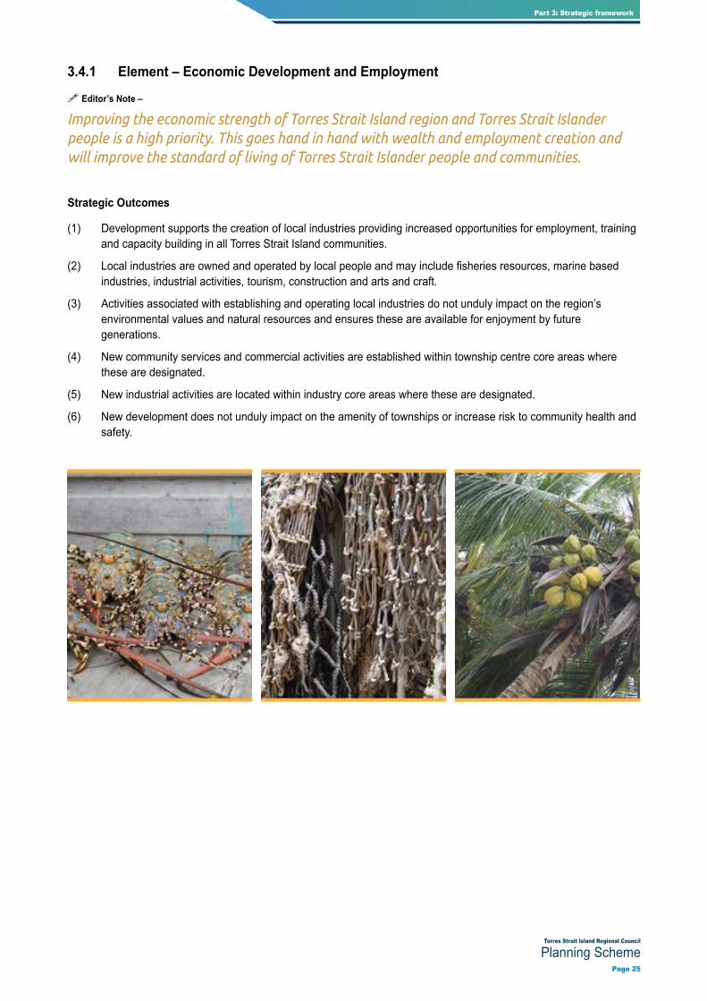
3.4.1 Element – Economic Development and Employment
Editor’s Note –
Improving the economic strength of Torres Strait Island region and Torres Strait Islander people is a high priority. This goes hand in hand with wealth and employment creation and will improve the standard of living of Torres Strait Islander people and communities.
Strategic Outcomes
(1) Development supports the creation of local industries providing increased opportunities for employment, training and capacity building in all Torres Strait Island communities.
(2) Localindustriesareownedandoperatedbylocalpeopleandmayincludefisheriesresources,marinebasedindustries, industrial activities, tourism, construction and arts and craft.
(3) Activities associated with establishing and operating local industries do not unduly impact on the region’s environmental values and natural resources and ensures these are available for enjoyment by future generations.
(4) New community services and commercial activities are established within township centre core areas where these are designated.
(5) New industrial activities are located within industry core areas where these are designated.
(6) New development does not unduly impact on the amenity of townships or increase risk to community health and safety.

Torres Strait Island Regional Council
Planning SchemePage 26
3.4.2 Element – Health and Wellbeing
Editor’s Note –
Health standards and life expectancy of Torres Strait Islanders is lower than the average Australian. This situation needs to be addressed as a matter of priority.
Access to affordable primary health care and preventative health care is important to address this issue, as well as the promotion of active and healthy lifestyles for all Torres Strait Islanders.
Strategic Outcomes
(1) Development is well-designed and encourages participation in community life and the promotion of active and healthy lifestyles.
(2) Communities have access to essential services and infrastructure, including primary health care and preventative health care to support healthy families.
(3) Wherever possible, development supports access to affordable, fresh and healthy food options throughout the Torres Strait region.

Torres Strait Island Regional Council
Planning SchemePage 27
Part 3: Strategic framework
3.4.3 Element – Housing and Community Expansion
Editor’s Note –
Access to appropriate and affordable housing is vital to the health and wellbeing of Torres Strait Islanders. In particular, new housing is necessary to improve living conditions, alleviate issues related to over-crowding and facilitate access to traditional lands by Traditional Owners.
Other development may also be required in the future to support the needs of Torres Strait Island communities. This development is to occur in a way that best serves the communities, while protecting important environmental and community values.
Strategic Outcomes
(1) New development for urban purposes is generally accommodated within the township area, which is framed by undeveloped and natural areas.
(2) Withinthetownshiparea,newdevelopmentfacilitatestheefficientandsustainableuseofinfrastructureincludingwater supply and sewerage infrastructure.
(3) New development contributes to the creation of pleasant, safe and attractive living environments and the health and wellbeing of Torres Strait Islanders.
(4) Housing options are available to individuals and families across the region which:
(a) includeaffordablehomeownershipandrentalopportunities;
(b) reduceovercrowding;
(c) provideamixinthetypeofhousingavailabletomeetcurrentandfuturecommunityneeds;
(d) provideopportunitiesfortraditionalownerstoliveontheirtraditionallands;
(e) areculturallyappropriate;
(f) designed to minimise operational and maintenance costs.
(5) Newaccommodationactivitiesmakeefficientuseofavailableunconstrainedlandwiththetownshiparea.
(6) Development within the township expansion area is well connected to the existing township area and creates a pleasant living environment.
(7) Development is sited and designed to work with local climatic conditions to reduce reliance on energy use for cooling.
(8) Outstations and camping areas are generally located within the environmental management and conservation zone and are an important part of Torres Strait Islander life, helping to keep communities connected to their traditionallands.Outstationsandcampingareasprovideimportantbenefitstolocalcommunitiesincludingrecreational,spiritual,healthandwellbeingbenefits.
(9) New outstations and camping areas occur where damage to areas of high environmental value is minimised.
(10) Outstations and camping areas are generally not connected to town infrastructure.
(11) Possiblefuturehousinginvestigationareashavebeenidentifiedonanumberofislands.Theseareasarenot intended to be utilised for township purposes prior to substantive investigations of constraints (including vulnerability to natural hazards), servicing options and development feasibility, as well as negotiation with traditional owners. Parts or all of these areas may prove to be unsuitable for development as a result. Some represent very long term options that may accommodate relocation of housing and facilities in response to the increased risks associated with sea level rise.

Torres Strait Island Regional Council
Planning SchemePage 28
Editor’s Note–Urbanpurposesisusedinthisdocumenttodescribeallofthedefinedactivitygroupsotherthan rural activities in schedule 1.1.1 in this planning scheme. An exception to this is part 4 of the planning schemewhereurbanpurposesisdefinedaspertheadministrativedefinitionsinschedule1.2ofthisplanningscheme.
Editor’s Note–‘Campingarea’isatermsometimesusedbyTorresStraitIslanderpeopletoreferto‘outstations’,whichisdefinedinschedule1.1ofthisplanningscheme.
Editor’s Note – Applicants should be aware of their obligations under the Disability Discrimination Act 1992 and the Disability (Access to Premises—Building) Standards 2010. The standards have been incorporated into the National Construction Code from 1 May 2011 and, as a result, must be met as part of a building development application.
The standards contain provisions for non-discriminatory access to public buildings for people with a disability and provide a nationally consistent set of provisions that detail what must be done to provide for non-discriminatory access to buildings for people with disability.
Editor’s Note – In undertaking township development in areas affected by natural hazards, regard must also be given to section 3.3 of this strategic framework.

Torres Strait Island Regional Council
Planning SchemePage 29
Part 3: Strategic framework
3.4.4 Element – Education and Community Facilities
Editor’s Note –
It is important that Torres Strait Islanders can access appropriate and effective resources and support services in the region. This must be done in a way that promotes the positive application of traditional and cultural practices to deal with family and community issues, including the role of Elders in providing leadership and resolving disputes.
Schooling and education is of high importance to Torres Strait Islanders, particularly for young people. Educational standards, including numeracy and literacy, must be lifted so that young people can transition into career pathways.
Strategic Outcomes
(1) Educational opportunities are available to young people equivalent to mainland Australia and include cultural teaching and training for school leavers to assist them into career pathways.
(2) Facilities and services responding to local education, health and training needs, including cultural training for school leavers, are maintained and new opportunities to improve or expand these facilities and services are facilitated.
(3) Safe and convenient access to community, sport and recreation facilities are available to meet the needs of the community, including people with special needs, older people, children, low income earners and people with disabilities.

Torres Strait Island Regional Council
Planning SchemePage 30
3.4.5 Element – Cross Border Movement
Editor’s Note –
The Torres Strait Treaty defines the border between Australia and Papua New Guinea (PNG) and provides a framework for the management of the common border area. Management arrangements for commercial fisheries in the zone have also been put in place under the treaty.
As well as defining the maritime boundaries between PNG and Australia, the treaty protects the ways of life of traditional inhabitants in the Torres Strait Protected Zone (the ‘protected zone’). The main reason for the protected zone is so that Torres Strait Islanders and the coastal people of Papua New Guinea (from 13 PNG villages) can carry out their traditional way of life, such as cross border trade, feasting and other customs. Traditional people from both countries may move freely (without passports or visas) for traditional activities in the protected zone.
PAPUA NEW GUINEA
AUSTRALIA
PAPUA NEW GUINEA
AUSTRALIA
GREAT BARRIER REEF MARINE PARK
PROTECTED ZONEPROTECTED ZONE
PROTECTED ZONEPROTECTED ZONE
MoaIsland
BaduIsland
Hawkesbury I
Channel ITravers I
Portlock I
North Possession IBond I
Turnagain I
Gabba I
Pearce Cay
Smith Cay
Dalrymple I
Rennel I
Marsden I
Kabbikane Islet
Aukane IsletLayoak Islet
Bourke Islet
Mimi IsletAureed I
Halfway I
Massig Islet
Keats Islet
YorkeIslands
Campbell I
Stephens I
Nepean I Darnley I
Maer I
Wyer IsletDowar I Murray Is
Underdown I
Parama I
Bramble Cay
East Cay
Don Cay
Anchor Cay
Kodall Islet
Gap Islet
Getullai I
Suarji I
Twin I
East Strait Islet
Saddle I
Sue I
Lowry I
Bet Islet
Sassie I
Zagai I
Dove Islet
Arden I
Roberts Islet
Coconut I
Poll I
Harvey Rks
Peenacar Islet
Mt Ernest I
Yam I
Tudu I
Saibai Island
Bobo I
Daru
Kaumag I
Dauan I
Boigu Island
Mata Kawa I
Aubussi IMoimi I
Kussa IKawa I
TALBOT ISLANDS
Deliverance I
Kerr I
Turu Cay
North I
Talab I Mabuiag IPassage I
Muknab Rk
Ninepin Rk
Wednesday I
Little Adolphus I
Turtle I
Turtle Head I
Dayman I
Mt Adolphus I
Johnson Islet
Nomer Cay
Cay
Cay
Cay
Cay
Cay
Cay
Cay
Cay
Thursday I
Albany I
NewcastleBay
Barn I
Alpha RkHornIsland
Prince of WalesIsland
Entrance I
Cape YorkPeninsula
Woody Wallis I
Crab Is
Red Wallis IsletENDEAVOUR
STRAIT
Goods I
West I
DuncanIs
Booby I
Yule Channel
Banks Channel
Simpson Channel
Vigilant Channel
Yule Entrance
GR
EA
TB
AR
RI
ER
RE
EF
FE
ER
RE
IR
RA
B
TA
ER
G
Tancred Passage
Basilisk Passage
Moon Passage
Hiber
nia
Pass
age
Flin
ders
Entra
nce
Cumberland Passage
Prince of Wales ChannelDayman Channel
Adolphus
Channel
Kenned
yIn
let
LongReef
Wyborn Reef
Kagar Reef
Linda Reef
Seven Reefs
Triangle Reef
Maped Reef
Maped-Au-Kap Reef
Meggi-Wareg Reef
Kai-Wareg Reef
Bet Reef
Kirkcaldie Reef
Tagun Reef
Kibi MeriReef
Big MaryReef
Seo Reef
Emar Reef
Black Rks
Newman Reef
Anui Reef
GariarReef
KaiReef
Beka Reef
Numar Reef
Aldai Reef
Nicholls Reef
Sinclairs Rk
Mourilyan Reef
HastingsReef
Watson Cay
Pinnace Reef
Ibis Reefs
A u s t r a l i a
P a p u a N e w G u i n e a
Wa
rri o
rR
ee
f sW
arri o
rR
ee
f s
Cape York
Meiu Reef
Meggi-MaituineReef
Richardson Reef
DungenessReef
Woiz Reef
KodnasemReef
GurigurReef
Kai-MaituineReef
Gubmarau Reef
Au-Masig Reef
Susur Reef
Wap Reef
Bayag Reef
Dugong I
Ashmore
Reef
AuwamazaReef
Jarai Mari
Bamaga
TorzeBuji
Ber
Sigabaduru
Mabaduan
Masingara
Mawatta
Ture Ture
Katatai Parama
Moibut
Cook Reef
11°00’S 11°00’S
141°15’E
141°15’E
141°30’E
141°30’E
142°00’E
142°00’E
142°30’E
142°30’E
143°00’E
143°00’E
143°30’E
143°30’E
144°00’E 144°30’E
144°00’E 144°30’E
10°30’S10°30’S
10°00’S10°00’S
9°30’S9°30’S
9°00’S9°00’S
MP 02/343.17
Australia's Maritime Zones in the Torres Strait
Seabed & Fisheries Jurisdiction Lines
Seabed Jurisdiction Line
Marine Park Limits
Limit of Coastal Waters (3nm)
Fisheries Jurisdiction Line
Limit of Contiguous Zone (24nm)
Australian Territorial Sea
Australian Internal Waters
Positions are related toAustralian Geodetic Datum (1966)
Projection: Mercator
SCALE 1:300 000 at lat 27°15’S
Not to be Used For Navigation
NOTE: The depiction of the Territorial Sea Baseline (TSB) and the outer limits of Australia’s maritime zones shown on this map are sourced from the AMBIS 2001Version 1.1 product released by Geoscience Australia in October 2001. The TSBand zones are established under theSeas and Submerged Lands Act 1973.
The various jurisdiction lines and protected zone shown on this map areestablished under the Treaty between Australia and the Independent State ofPapua New Guinea. This Treaty entered into force on 15 February 1985.
AMBIS 2001 is a digital representation of the TSB, the outer limits of Australia’smaritime zones and Treaty lines. In the event of an inconsistency between theAMBIS 2001 data and the legislation or Treaty, the legislation or Treaty prevails.
Telephone the NATMAP HOTLINE 1800 800 173for information regardingthis map, other maps, amendments, map cataloguesor your nearest retailer.
Geoscience AustraliaNational Mapping DivisionPO Box 2 Belconnen ACT 2616Telephone: +61 2 6249 9966Email: [email protected]://www.ga.gov.au
EDITION 2
9 3 1 4 2 3 1 2 3 0 0 8 4
Certain material in this product is reproduced under licence bypermission of the Australian Hydrographic Office 1984-2002 with
© Commonwealth of Australia 2002All rights reserved. This information may not be copied,
reproduced, translated, or reduced to any electronic medium or machine readable form, in whole or part, without theprior written consent of both Geoscience Australia and
the Australian Hydrographic Office.
GEOSCIENCEA U S T R A L I A
9 314231 230084

Torres Strait Island Regional Council
Planning SchemePage 31
Part 3: Strategic framework
Strategic Outcomes
(1) The strategic role of the Torres Strait region as a whole, and the islands of Boigu, Saibai and Dauan in particular, is maintained, particularly in relation to:
(a) national border security,
(b) defenceofAustralianterritoryandwaters;and
(c) biosecurity including the early detection of the transmission of pests, weeds and disease into Australia.
(2) Development required to support strategic security functions is facilitated, including:
(a) buildingsforoccupationbyjointagenciesneedingalocalpresenceintheregion;
(b) infrastructure upgrades to improve capacity to deal with the large number of visitors from Papua New Guineaandtheburdenthisplacesontowninfrastructureandcommunityfacilities;
(c) provision of additional or improved health services to respond to the needs of the local community as well as visitors from Papua New Guinea and to take appropriate action if illnesses are transmitted into the region;and
(d) improved transportation and telecommunication between islands and to the mainland to minimise response times in the case of an emergency.

Torres Strait Island Regional Council
Planning SchemePage 32

Torres Strait Island Regional Council
Planning SchemePage 33
Part 3: Strategic framework
3.5 Ailan Kastom and Cultural Heritage Editor’s Note –
There are multiple language and cultural groups across the Torres Strait Island region, each with different identities, cultural practices, customs and histories. Ailan kastom and cultural heritage provide a connection to this history and its preservation is essential to the way forward for the Torres Strait Island communities.

Torres Strait Island Regional Council
Planning SchemePage 34
3.5.1 Element – Ailan Kastom
Editor’s Note –
Ailan Kastom means the body of customs, traditions, observances and beliefs of some or all of the Torres Strait Islanders living in the Torres Strait area and relates to particular persons, areas, objects or relationships. Ailan Kastom is central to community life and it is necessary to ensure communities remain connected to culture and traditions.
Strategic Outcomes
(1) Communities are developed based on Ailan Kastom.
(2) Access to the sea is integral to the Ailan Kastom and is necessary for Torres Strait Islanders to carry out traditional hunting practices and to subsidise the cost of living in the Torres Strait region.
(3) Strong Ailan Kastom are passed on through language, culture and dance.

Torres Strait Island Regional Council
Planning SchemePage 35
Part 3: Strategic framework
3.5.2 Element – Cultural Heritage
Editor’s Note –
In the Torres Strait Island region, there are many different places of cultural heritage importance. Significant areas do not necessarily have markings or other physical evidence. Places of importance may be part of myths or legends (‘story places’).
These places are all irreplaceable sources of information about people’s lives and activities and the historical development of crafts, techniques and art. Cultural heritage provides a source of emotional and aesthetic experiences for many people and local communities benefit from their connection to it. Torres Strait Islander people are the guardians, keepers and knowledge holders of their cultural heritage.
Respecting their sensitive nature, places of Indigenous cultural heritage are not recorded in this planning scheme except in cases where community members requested the information be recorded on the planning scheme maps.
Strategic Outcomes
(1) Placesanditemsofheritagesignificanceforcultural,historicalorarchaeologicalreasonsareprotectedandretainedforthebenefitofcurrentandfuturegenerations.
(2) Development does not threaten the integrity of cultural heritage places and items, including impacts that may result from water run off, soil erosion or soil movement onto nearby sites.
(3) Prior to undertaking new development, consultation is undertaken with council, prescribed body corporates and the community to identify potential cultural heritage places.
Editor’s Note –Placesshownassacredsitesandsignificanttreesonthemapsinschedule2arepotentiallocations of cultural heritage value. Other locations of cultural heritage value will exist that are not shown on themapsandinsomecases,locationsarenotrecordedduetoreasonsofconfidentiality.
It is important that all land users are aware of their obligations under the Torres Strait Islander Cultural Heritage Act 2003. The Act recognises that Torres Strait Islander people are the guardians, keepers and knowledge holdersoftheirculturalheritage.Importantly,theActrecognisesthatsignificantareasdonotnecessarilyhavemarkingsorotherphysicalevidenceindicatingoccupationordenotingitssignificance.Forexample,geographical places of importance may such as places that are part of myths or legends (commonly referred to as‘storyplaces’)aresignificantundertheAct.
The most important part of the Act is the duty of care provisions that require those conducting activities in areasofsignificancetotakeallreasonableandpracticalmeasurestoavoidharmingculturalheritage.
In addition, historical cultural heritage that are not Indigenous in origin are protected under the Queensland Heritage Act 1992. These places are recorded in this planning scheme.

Torres Strait Island Regional Council
Planning SchemePage 36

Torres Strait Island Regional Council
Planning SchemePage 37
Part 3: Strategic framework
3.6 Getting Around Editor’s Note –
Due to the geography of the Torres Strait, safe and efficient access to freight and passenger transport by air and sea that meets the need of the community is a significant issue facing the Torres Strait Islands. It is critical that a quality transport infrastructure and services are available in each community to support the day to day life and intra / inter island movement in the Torres Strait islands.
Editor’s Note – Transport infrastructure is used in this document to describe infrastructure required to move people around. Examples include roads, jetties, barge ramps, airports, helipads and walkways.
Itincludeslandusedefinitionssuchasairservices,transportdepotandlanding(seethelandusedefinitionsinschedule 1.1).

Torres Strait Island Regional Council
Planning SchemePage 38
3.6.1 Element – Roads
Editor’s Note –
Roads are expensive to construct and maintain. Therefore, the layout of new roads is to be planned in an efficient manner and in a way that connects to the existing road network.
Walking is the most common form of travel in all Torres Strait Island communities and roads serve an important function in supporting this mode of travel. People and cars need to be able to share roads safely.
Strategic Outcomes
(1) Theroadnetworkprovidesefficientandsafeconnectionsforpeopletravellingbyfoot,bicycleandvehiclewithinand between the township area and township expansion area and other key destinations.
(2) New roads provide convenient extensions and connections to the existing road network so that it is easy to move around.

Torres Strait Island Regional Council
Planning SchemePage 39
Part 3: Strategic framework
3.6.2 Element – Air Access
Editor’s Note –
Air services, supported by sealed, all-weather airstrips in local communities, are available in all Torres Strait Island communities with the exception of Ugar Island, Dauan Island and Hammond Island, which can be accessed by chartered helicopter flights or boat.
Airstrips and helipads are vital pieces of infrastructure to Torres Strait Island communities. It is important this infrastructure can operate in a safe and efficient manner.
Strategic Outcomes
(1) Developmentthatmayimpactonthesafeandefficientoperationofexistingorfutureairstrips,includingtheapproach and take-off of air craft, does not occur.
(2) Airstrips and helipads are designed to minimise noise, lighting and other disturbances.

Torres Strait Island Regional Council
Planning SchemePage 40
3.6.3 Element – Sea Access
Editor’s Note –
As an island region, transportation by sea supports the daily life, commercial activity and access to food for Torres Strait Islanders. Sea transport includes large freight carriers as well as small dinghies, forming a vital network of freight and passenger transport.
Strategic Outcomes
(1) Development that may negatively impact on existing or future sea transport services and facilities, including freight and passenger services, does not occur.
(2) Bargeramps,fingerpiersandassociatedfacilitiesrequiredtofacilitateseatransportservicesaredesignedto:
(a) minimise noise, lighting and other disturbances to residents and users of surrounding accommodation activitiesandcommunityfacilities;
(b) operateinasafeandefficientmanner;
(c) minimiseimpactstocoastalhabitatsandcoastalprocesses;and
(d) maintain public access to the beach and foreshore areas to the extent possible.

Torres Strait Island Regional Council
Planning SchemePage 41
Part 3: Strategic framework

Torres Strait Island Regional Council
Planning SchemePage 42
3.7 Town Infrastructure Editor’s Note –
Town infrastructure includes such things as electricity, water supply, waste water treatment, waste management, stormwater management and telecommunications.
This infrastructure plays a vital role in the health and wellbeing of Torres Strait communities.
Editor’s Note – Town infrastructure is used in this document to describe infrastructure required to provide a basic range of town services. Examples include water supply, sewage treatment, waste collection and disposal, stormwater management, electricity and telecommunications. It includes land uses such as major electricity infrastructure, renewable energy facilities, sub-stations, telecommunication facilities and utility installation facilities(seethelandusedefinitionsinschedule1.1).
Services provided by town infrastructure may or may not be available within the township zone but typically are not available outside of the township zone. For further information about the existing and planned infrastructure (water supply, sewerage, stormwater, transport, parks and land for community facilities) refer to the local government infrastructure plans (LGIPs) in part 4 of this planning scheme.
AsnotedintheLGIPs,itisdifficulttopredictfuturedemandfortowninfrastructureinTSIRCcommunitiesdue to the way development processes and funding takes place in the region. Therefore, decisions about infrastructure provision are likely to be made on a case by case basis, depending on funding availability and a range of other factors.

Torres Strait Island Regional Council
Planning SchemePage 43
Part 3: Strategic framework
3.7.1 Element – Water and Waste Water
Editor’s Note –
Water supply infrastructure and sewage treatment infrastructure are critical to the health and welling being of Torres Strait communities. This infrastructure is generally expensive to install, maintain and operate, therefore, future development for new residential areas must take into account how it will be connected to essential services.
Strategic Outcomes
(1) Developmentisprovidedwithwaterandwastewaterinfrastructurethatisdesignedtosafelyandefficientlyaccommodate existing and future demands.
(2) Development does not encroach on existing or future water and waste water infrastructure or compromise its operation into the future.
(3) New water and waste water infrastructure is located so as to avoid or minimise negative impacts on communities and the natural environment.
(4) Reuse of waste water occurs where environmental health management systems are implemented and water quality is maintained.
(5) The visual impact of water and waste water infrastructure is minimised.
(6) Future water and waste water infrastructure accommodates climate change risks in relation to water security, infiltrationofseawaterintoseweragesystemsandoperationalsustainability.

Torres Strait Island Regional Council
Planning SchemePage 44
3.7.2 Element – Solid Waste
Editor’s Note –
Due to the remoteness of the Torres Strait Islands and the significant environmental values of the region, waste management is an important issue. If not properly managed, waste facilities can be unsightly, impact on the environment and make townships unpleasant for communities. In addition, the removal of waste (and disused car bodies in particular) can be very expensive.
The TSIRC and the Torres Strait Island communities are working to develop a strategic approach to waste management that will minimise the volume of waste requiring disposal, while maximising the economic value of resources through the reuse, recycling, reprocessing and energy recovery.
Strategic Outcomes
(1) EfficientandeffectivewastemanagementandrecyclingsystemsareavailableacrosstheTorresStraitregiontoreduce waste loads.
(2) Waste facilities are:
(a) located in areas that are stable, free from the impacts of natural hazards and buffered from areas of environmentalvalue;and
(b) located and designed to avoid or minimise negative impacts on the community.
(3) Reliance on local waste facilities for the disposal of construction waste is minimised to the extent possible.
(4) The visual impact of waste facilities is minimised.

Torres Strait Island Regional Council
Planning SchemePage 45
Part 3: Strategic framework
3.7.3 Element – Stormwater Drainage
Editor’s Note –
Communities can be affected by the flow and ponding of storm water on islands that are low lying with poor drainage (such as Boigu and Saibai) as well as islands that are hilly with large catchment areas (such as Badu, Dauan, Erub, Iama, Kirriri, Kubin, Mabuyag, Mer, St Pauls and Ugar).
Run-off can cause problems with water quality by conveying sediments and other contaminants into waterways and the sea, affecting sea grass habitat for dugongs, fish traps and other marine environments. It can also contribute to problems of coastal erosion.
Adequate stormwater drainage infrastructure is essential to manage these issues and is important to the safety of Torres Strait Island communities during heavy rainfall.
Strategic Outcomes
(1) Draininginfrastructureisprovidedinawaythatmaximisestheoperationofroadsduringstormsandfloodingand minimises public safety risks.
(2) Wherever possible, development in the township expansion area incorporates multi-functional recreational and stormwater corridors to reduce the quantity and improve the quality of storm water run-off.
(3) Drainage infrastructure does not result in the worsening of drainage and run-off issues on downstream or adjoining properties.
(4) Design of storm water systems accommodates more intense wet season rainfall associated with climate change.

Torres Strait Island Regional Council
Planning SchemePage 46
3.7.4 Element – Electricity
Editor’s Note –
Many Torres Strait Island communities currently depend on non-renewable and non-environmentally friendly sources of power, such as diesel generators, for electricity. Ergon is the electricity distributor and generator for the region.
TSIRC, the Torres Strait Island communities and Ergon are working towards developing a long term, reliable energy solution in the region, such a wind or solar energy, that is cost effective and does not rely on the burning of fossil fuels.
In the meantime, it is essential that a reliable source of electricity supply is maintained in all Torres Strait Island communities.
Strategic Outcomes
(1) Opportunities to supplement or replace existing diesel energy sources with renewable energy, such as solar and wind, are supported provided that impacts on communities and the environment can be avoided or minimised.
(2) A buffer is provided between existing and future electricity infrastructure and sensitive land uses, such as accommodation activities and community facilities.
(3) The visual impact of electricity infrastructure is minimised.

Torres Strait Island Regional Council
Planning SchemePage 47
Part 3: Strategic framework
3.7.5 Element – Telecommunications
Editor’s Note –
Reliable mobile and internet coverage is essential during times of emergency and extreme weather conditions. It is also required to support the growth of local industries as well as employment, education and training opportunities.
Not all islands currently have telecommunication coverage with only limited coverage available on some of the Torres Strait Islands. This is an issue that needs to be addressed as a matter of priority.
Strategic Outcomes
(1) Telecommunications infrastructure is provided so that mobile and internet coverage is available in existing township areas and township expansion areas.
(2) Telecommunications infrastructure is located so that:
(a) surroundingdevelopmentwillnotimpactonitscurrentandfutureoperations;and
(b) impacts on accommodation activities and community facilities are avoided or minimised.
(3) The visual impact of telecommunications infrastructure is minimised.

Torres Strait Island Regional Council
Planning SchemePage 48