park and trails guide - 2012 san juan islands
DESCRIPTION
i2012062609232584.pdfTRANSCRIPT

Know Your Island Trails p. 4County Parks p. 5Scenic Byway p. 6National Parks Pullout p. 7Local State Parks p. 15Land Bank Preserves p. 18 Marine Parks p. 19
Inside
Check out the green edition onlinesanjuanjournal.com • islandssounder.com
islandsweekly.com
Sa n Juan Islands
Parks & Trails Gu ide 2012 - 2013
Cover photos: Top from left, Turtleback Mountain, Orcas; Swifts Bay, Lopez; South Beach, San Juan. Center, Island views from Turtleback Mountain. Photos: SJC Land Bank, Amanda Leidig, Maria Michealson and contributed photo.
Inside
San Juan County Parks & Trails Guide2
Lopez IslandUpright Head: Upright Head is a hike within easy distance from the ferry landing. Enjoy the 20-acre rugged bluff featuring
towering firs tracing the shoreline and a web of trails that zigzag under evergreens and madrones. That peaceful body of water to the east of the ferry landing is Shoal Bay, and to the north are Harney and Upright Channels, and a sweeping view of Orcas and Shaw Islands.
Odlin County Park: Hikers at the park’s 100-acre forest can enjoy nearly three miles of criss-crossing trails. The mainly flat, traversing trails meander along a steep shoreline bluff looking over Upright Channel to the west and out on to Shaw Island. The park is part of the 140-mile Cascadia Marine Trail system that spans Puget Sound and the Salish Sea.
Hummel Lake: If picnicking and a gentle stroll is your style, consider the 80-acre nature preserve that is the freshwater Hummel Lake. Located close to Lopez Village, it is a convenient location with a car park, boardwalk and fishing dock.
Lopez Hill: Centrally located, Lopez Hill is the island’s tallest peak, at 535 feet, spanning 400 acres. The trail from base to the summit winds through shady slopes, canyons, open meadows and prairie land. The summit will give you views of the Strait of Juan de Fuca and beyond to the south.
Shark Reef: If you are traveling to the south end of the island, make sure not to miss the jewel that is Shark Reef. An easy stroll through the forest takes you out to a rocky stretch of coast land that gives a clear view to Cattle Point on San Juan Island.
Orcas IslandMoran State Park: Hike 30 miles of trails for all different abilities including Mount Constitution, standing at 2,409 feet, it is the
highest point in the San Juans. At the entrance to the road leading to the top of Mount Constitution, near the Cascade Lake recre-ation area, a very large map lists the route, terrain and distance of the majority of the paths and trails. Located on the eastern side of the island, the 5,000-plus-acre park is overflowing with old growth forests, lush alpine meadows, five lakes and one of Washington State Park’s most popular campgrounds located along the shoreline.
Turtleback Mountain: Two trails lead to the top of the second tallest peak in the San Juans, Turtleback Mountain, standing at 1,520 feet. The southern route, though steeper, is more popular, as it provides sweeping views all the way to the summit. At a leisurely pace, you’ll need over an hour to reach the top. The northern trail is more heavily wooded and passes through old-growth forests, wetlands and an open meadow or two.
Obstruction Pass/Killebrew Lake: Obstruction Pass is at the very tip of the southeast side at the entrance to East Sound. The 80-acre state-owned recreation site hosts a dozen spartan camp sites and a rocky beach surrounded by an expansive cove on the waterfront. Hikers can reach the beach with an easy mile-long walk from the parking lot at Trailhead Road, which connects to
Obstruction Pass Road. Killebrew Lake is about five miles east of the ferry landing.
San Juan IslandMount Finlayson/South Beach: Mount Finlayson is more like a hill stand-
ing only 295 feet tall. It is located on the southern tip of the island and is one of the most popular hiking areas for locals and visitors. For a close-up view of the Olympic Mountains, Haro and Juan de Fuca straits, and Vancouver Island take the ridge line trail. On the north side, a trail drops down from the parking lot into a dense forest, past a pair of saltwater lagoons, and climbs to the top of the ridge where the two trails intersect.
Lime Kiln State Park/Lime Kiln Preserve: The state park and the county-owned nature preserve of more than 210 acres of assorted natural habitat host a network of hiking trails stretching from the shoreline to a series of rocky cliffs overlooking Haro Strait and onto Vancouver Island. Other attractions include the historic lighthouse and a killer whale-watch park.
Mount Young: Take a stroll beneath a forested canopy, past an 1860s British Marine cemetery, along open meadows of Garry oaks and then on to a half-mile hike to the summit. The 650-foot summit opens up to a view of the entire south end of the island.
Roche Harbor Highlands/Mitchell Hill: The Highlands, at the north end of the island, have over 10 miles of hiking trails including a 3-mile loop around a large freshwater reservoir, which takes about an hour to circle and leads to Mitch-ell Hill. Mitchell Hill, a 386-acre state recreation site, features a variety of terrain, dense forests and a seasonal stream. You can enjoy the feeling of being lost in the woods, even though you know you’re not.
• www.sanjuanislandtrails.org• www.parks.wa.gov• www.sanjuanco.com/parks• www.sjclandbank.org• www.guidetosanjuans.com
Best 12 for 2012: The dirty dozenThe Parks & Trails Guide is published annually by:The Journal of the San Juan Islands in conjunction with the Islands’ Sounder and Islands’ WeeklyPublishers:Roxanne AngelColleen Smith ArmstrongEditors:Scott RasmussenColleen Smith ArmstrongContributing Writers:Colleen Smith Armstrong, Cali Bagby, Louise Dustrude, Scott Rasmussen, Steve Wehrly and Mike Vouri.Advertising: Roxanne Angel, Howard Schonberger, Colleen Smith Armstrong, Cathi BrewerOffice:Frances Bacon, Gail Anderson-ToombsCreative Artists and Production:Scott Herning, Kathryn Sherman Main Offices / Sales:The Journal ~ 360-378-5696The Sounder ~ 360-376-4500The Weekly ~ 360-468-4242Check out our Green Pages online:www.sanjuanjournal.comwww.islandssounder.comwww.islandsweekly.com
S t a y , R e l a x , E n j o y
• Mitchell Bay Coffee
• Waterfront Cabins• Campground• Marina
• Kayaking Tours• Whale Watching• New cabins for 2012
www.snugresort.com1997 Mitchell Bay Road, Friday Harbor, WA 98250 • 360-378-4762
OnlineHikingresources}

By Scott Rasmussen
Whichever island you’re on, whatever trail you take, you can’t go wrong when the
game plan calls for outdoor recre-ation in the San Juans.
First-time visitors discover very quickly something which islanders and long-time vacationers are well aware: a trip outdoors in the San Juan Islands is like stepping out into a big beautiful park — in your own backyard.
On the surface, the islands may ap-pear to be one continuous wilderness area. Actually, there is quite a patch-work of public agencies and publicly minded civic groups busy not only preserving the islands’ natural habi-tat, but working to enhance what’s already on the ground and create more opportunities for adventure in the outdoors.
Here’s thelineup
On the federal level, the National Parks Service, the U.S. Fish and Wild-life Service and the U.S. Bureau of Land Management all have significant presence in the San Juans. San Juan Island is home to San Juan Island National Historical Park, composed of two major properties, American Camp and English Camp, and total-ing roughly 1,680 acres altogether.
U.S. Fish and Wildlife manages a wildlife refuge consistinig of 83 separate islands, rocks and reefs — nearly 450 acres combined — set
aside to protect colonies of seabirds, bald eagles, harbor seals, and other wildlife, since 1976. Of the 83, all are closed to the public, with exception of Matia and Turn islands.
The BLM manages 1,000 acres in the San Juans, half of which is located on Lopez Island. Those 1,000 acres are being considered for designa-tion as either a National Monument, by presidential proclamation, or as National Conservation Area. Washington State Parks manages 15
parks totaling 5,300 acres in the San Juans. An important point to note for visitors and islanders alike is in 2011 state Parks implemented a parking fee, known as the Discover Pass, to help pay for maintenance of all state parks. The cost is $30 a year, or $10 a day. The pass can be purchased online at the state Parks website, through the state Department of Licensing, or at local outlets selling fishing and hunt-ing licenses (daily fees can be depos-ited on-site.)
The majority of land managed by state Parks is in Moran State Park, on Orcas Island. Moran is consistently one of the most popular of all the state’s parks. Lime Kiln State Park sits on the shoreline of Haro Strait and is known far and wide as one of the best places in the world to watch the killer whales that frequent the waterways of the San Juans.
On Lopez Island, Spencer Spit State Park is a popular campground and jump off point for outdoor recreation. The Washington Department of Natural Resources and Department of Fish and Wildlife maintain a lesser
presence, though are important influ-ences in local resource management, than state Parks.
On the local level, San Juan County Parks and the county Land Bank are big players in the outdoors. County Parks manages 17 different parks, which include three popular water-front campgrounds, and 14 various day-use parks, on Lopez, Orcas and
San Juan islands. The county Land Bank, a publicly
owned and managed land conserva-tion agency — the only one of its kind in Washington state — maintains 20 preserves that together total roughly 3,500 acres and are open to the public for low-impact recreation… here’s the good part… like picnicking and hiking.
Public agencies team up on outdoor leisure
San Juan County Parks & Trails Guide 3
~ Adventures in Fresh Island Dining ~For Reservations, please call
360.378.4878www.ducksoupinn.com
50 Duck Soup Lane off Roche Harbor Road
DUCK SOUP INNDUCK SOUP INNDUCK SOUP INN
San Juan Island’s Favorite Corner Store — Since 1920 —
Prescriptions • Souvenirs • T Shirts & Sweatshirts • Candy • Hallmark Cards & Gifts, Gift Wrap • Art, Office & School Supplies
210 Spring St, Friday Harbor • 378-4421 • Open Mon.–Sat. 9 a.m.–7 p.m.; Sun. 10 a.m.–4 p.m.
Contributed PhotoSouthern resident Orcas ‘porpoising’ along the shoreline.

San Juan County Parks & Trails Guide4
• Local Jams, Sauces, & Wines • Galley Essentials • Rare Ingredients• Picnic Supplies• Tea, Chocolate, & Spices
Provisioners to Discerning Chefs Since 1969
Specialty Foods & Cookware
Open 10am – 5:30pm, Monday – Saturday21 Spring Street, Friday Harbor,
360-378-2251
• Local Jams, Sauces, & Wines • Galley Essentials • Rare Ingredients• Picnic Supplies• Tea, Chocolate, & Spices
Provisioners to Discerning Chefs Since 1969
Specialty Foods & Cookware
Open 10am – 5:30pm, Monday – Saturday21 Spring Street, Friday Harbor,
360-378-2251
• Local Jams, Sauces, & Wines • Galley Essentials • Rare Ingredients• Picnic Supplies• Tea, Chocolate, & Spices
Provisioners to Discerning Chefs Since 1969
Specialty Foods & Cookware
Open 10am – 5:30pm, Monday – Saturday21 Spring Street, Friday Harbor,
360-378-2251
• Local Jams, Sauces, & Wines • Galley Essentials • Rare Ingredients• Picnic Supplies• Tea, Chocolate, & Spices
Provisioners to Discerning Chefs Since 1969
Specialty Foods & Cookware
Open 10am – 5:30pm, Monday – Saturday21 Spring Street, Friday Harbor,
360-378-2251
• Local Jams, Sauces & Wines• Galley Essentials• Tea, Chocolate & Spices
San Juan Island is rich in walk-ing paths through beautiful country, but in 1999 our local
park and recreation district, Island Rec, saw the need for a local trails support group and brought a few vol-unteers together to help create and maintain trails on the island.
Working with existing public agencies the San Juan Island Trails Committee has helped to maintain walking paths – and add new ones from time to time – on land owned by the National Park, the San Juan County Land Bank, the Port of Fri-day Harbor, and others.
As the years went by, the Trails Committee added a dream of con-necting the existing paths, so that walking might increasingly become a means of transportation and not just of recreation.
With the generous cooperation of four public agencies and several private landowners, the first long-distance walking path is coming into being between Friday Harbor and American Camp.
Creating bicycle paths is both more difficult and more expensive, but the
Trails Committee hopes that public opinion is becoming more sup-portive of the idea of bicycle paths – adding to safety for the bicyclists and at the same time helping to reduce aggravation for drivers.
Members of the Trails Com-mittee who ride horses or mountain bikes recently
collaborated with National Park employees to create a wooden puncheon on a muddy trail on the Mitchell Hill portion of English Camp, restoring the surface water there to its formerly pristine quality. Using private land generously made available by Roche Harbor Resort and Saltchuk Corporation (Roche Harbor Highlands), there is long-distance trail riding available for walkers, equestrians and mountain bikers.
The Trails Committee’s website, www.sanjuanislandtrails.org, pro-vides maps of the island’s public trails and a wealth of other information.
The Committee welcomes your participation at our monthly meet-ings, as well as at trail-building work parties from time to time.
The San Juan Island Trails Committee invites everyone to join Know Your Island Walks on the fourth Saturday of every month (through October) at 1 p.m. These are the walks planned for the rest of this year:
• Sat. July 28, 1-4 p.m. Meet Mike Buettell, Roche Harbor resident and volun-teer trail builder, to walk and explore the Briggs Lake Trail in the Roche Harbor Highlands. Meet and park at the intersection of West Valley and Roche Harbor Roads. Length is four miles round trip. Terrain is slight uphill and downhill sec-tions on service roads. Rating is moderate. Dogs on leashes are welcome.• Sat. Aug. 25, 1-4 p.m. Meet Eliza Habegger, San Juan Island County Land Bank steward and walk the King Sisters Preserve trail. Learn about agriculture and the preserve. Farmer Rob Waldron will give a special off-trail talk and tour of the farm operation. Meet and park at 3827 San Juan Valley Road, where the road takes a 90-degree turn to the north. Look for orange cones at the open gate. Length is 1.5 miles round trip. Terrain is wooded path and meadow. Rating is easy. No dogs, please due to presence of livestock.• Sat. Sept. 22, 1-4 p.m. Meet Mike Vouri, historian and chief of interpretation, San Juan Island National Historical Park, to walk Mitchell Hill, the newest piece of our island’s National Park. We will see work done by the Trails Committee and Island Rec in conjunction with the Park and generous volunteers. Meet and park at the English Camp parking lot to carpool. Length is three miles round trip. Terrain is wooded trail. Rating is moderate. Dogs on leashes welcome.• Sat. Oct. 24, 1-4 p.m. Meet Dona Wuthnow, director of county parks, to walk San Juan County Park. Learn about its cultural and natural history highlights, featuring the newly restored Brann Cabin, believed to be the only homestead cabin on the island in its original location on public land. Meet and park at the San Juan County Park office on Westside Road. Length is one mile round trip. Terrain is road and rustic trail. Rating is easy. Dogs on leashes welcome.
San Juan Island Trails Committee: Know Your Island
Photos courtesy of John Dustrude and San Juan Island Trails Committee membersFawn Lilies (top left), Calypso orchids (bottom left) and prairie stars are a few of the wildflowers you may see on a hike in the islands. Stay
on marked trails to avoid trampling these rare local wildflowers. (Right) ‘Know Your Island Walk’ at Beaverton Marsh, June 2011.

San Juan County Parks & Trails Guide 5
STEP BACK IN TIMEand visit several historic structures including a pioneer log cabin and the original 1890’s San Juan County Jail. Located a short distance from the ferry in Friday Harbor
San Juan Historical Museum323 & 405 Price StreetFriday Harbor, WA 98250360.378.3949 • sjmuseum.orghistoricsanjuans.org
Hours: May–September, Wed.–Sat. 10-4, Sun. 1-4 April–October, Sat. 1 – 4 November–March by appointmentTours of the museum can be made at other times and days by appointment.
For 41 Years
has played a vital part in keeping private and public construction as beautiful as
the islands it serves
~ 360.378.4313 ~1165 West Valley Rd. Friday Harbor
fax: 378.2597 • [email protected] Operator: Lawson Quarry
Contract Lic# RI-CH-AL-C998P6
Your Full Service Contractor
INDUSTRIAL • COMMERCIALRESIDENTIAL • PAVING
EXCAVATINGREADY-MIX CONCRETE
FREE ESTIMATES
RICHARD LAWSONCONSTRUCTION, INC.
360.378.3433130 First Street SouthFriday Harbor, WA 98250www.arcticravengallery.com
“Raven Headdress”by Tom Hunt
Arctic RavenGallery
County Parks: beyond compareBy Scott Rasmussen
County parks were made for camping. Except, for the day-use parks, that is, of which there are many. In fact, of the 17 different parks managed by San Juan County Parks, the majority, 14 to be precise, are
day-use only parks. They come in all shapes and sizes, and each offers its own unique setting for outdoor adventure.
With seven in its backyard, Lopez Island is home to the majority of the county’s day-use parks. Agate Beach, Shark Reef Sanctuary and Otis Perkins Park have proven to be several of the more popular ones.
On Orcas Island, Eastsound Village Green and Eastsound Waterfront Park both offer a touch of green space in the island’s cultural and commercial core, Eastsound. The Village Green, with its picturesque band shell, constructed with both acoustics and aesthetics in mind, hosts a variety of concerts, activi-ties and entertainment in the summer season.
On San Juan, Reuben Tarte Memorial Park and Turn Point Park, both located on the waterfront, provide an opportunity for a stroll along the beach and a break from the summer sun. At Eagle Cove, you’ll find a sandy beach, playful waves and relatively warm water. It’s an idle place to build a sand castle, Boogie board or to fly a kite.
Back to the biggies: CampgroundsLopez: Odlin Park, situated on the island’s northwest shore and about a mile south of the ferry landing, has 30 campsites, a boat ramp, a dock and a soft-ball field. The 80-acre park is also a gateway to an extensive network of inland and shoreline hiking trails. The park also has five mooring buoys and its day-use area includes a picnic area with a covered pavilion.
San Juan: Situated on the waterfront on the island’s famed west side, San Juan County Park has 20 campsites, a boat ramp, moorage, and has long been a cherished spot with both kayak and boating fans because of its easy access in and out of the waters of Haro Strait. San Juan County Park is a designated campsite for the Cascadia Marine Trail, which stretches from the northern most point of Puget Sound to its southern tip, as are Odlin and Shaw parks.
Shaw: At 60 acres, Shaw Island County Park is the second-largest county campground, but it features the longest stretch of white sandy beach in the San Juans. Situated along the waterfront of Indian Cove, the park has 12 campsites, 4,610 feet of shoreline, a picnic shelter and a boat ramp that can accommodate smaller, shallow-draft vessels.
For more information about San Juan County’s parks and campgrounds, or to make a reservation, (360) 378-8420, or visit; www.co.san-juan.wa.us/parks/
Contributed PhotoOpen campsites along the shore at Odlin County Park.

San Juan County Parks & Trails Guide6
The San Juan Islands Scenic byway is the route locals recommend to their guests. The byway connects the must-see vistas, trailheads,
farms, parks, and quaint shopping and dining establishments that locals share with their visiting friends and relatives.
A group of historians, naturalists, public land man-agers, business leaders, and farmers worked for three years to get the byway route recognized as a Washing-ton State Scenic and Recreational Highway, the first step to attaining National Scenic byway status. Under the leadership of the San Juan Islands Visitors Bureau, the group adopted a vision to provide access to a unique marine and island experience. They crafted a plan to protect sensitive resources, promote ecolog-ically-sustainable tourism, and preserve the culture and quality of life in the islands.
The San Juan Islands Scenic Byway is the com-munity consensus of the best – and most accom-modating – places on Orcas and San Juan Islands.
The gateway to the byway is the Washington State Ferries (WSF) terminal in Anacortes. The WSF ves-sels follow the ancient canoe trails plied by Coast Salish peoples for thousands of years. Each termi-nal on the ferry route is included on the byway and
here visitors can find information to services and accommodations, trailheads and parks. The byway on San Juan Island and Orcas Island is over scenic county roads, ready to explore by shuttle, bicycle or private vehicle.
At each stop along the byway visitors will find amenities such as comfort stations, interpretive signage, trails information, and, often, enthusiastic local volunteers eager to share their knowledge and love for this special archipelago. Moved by a sense of place, locals spend many summer hours sharing local lore, maintaining trails, and teaching about flora and fauna. When you encounter a local on the beach or trail, chances are you’ll be talking to a graduate of a naturalist training course, a Master Gardener, or a trained Beachwatcher.
New for 2012 is a promotion to encourage visi-tors to come without their cars. The Byway Explor-er Pass, a free companion fare on the local shuttle, lets two people travel the byway for the price of one. Funded in part by the Federal Highway Ad-ministration, this special pilot program runs from Summer Solstice through Labor Day (June 23-Sep-tember 3, 2012). For more information see: www.visitsanjuans.com/scenicbyway.
Meet an islander on the Scenic Byway
To Sidney B.C.
San Juan County Parks & Trails Guide 7
San Juan Island National Historical Park nps.gov/sajh
National Park ServiceU.S. Department of the Interior
One hundred and fifty-one years ago, an American farmer named Lyman Cutlar
shot and killed a Hudson’s Bay Com-pany pig rooting in his San Juan Island potato patch. In so doing, he nearly started a war between the United States and Great Britain. Fortunately, men of vision and moral authority on both sides realized the folly of blood-shed over a 54-square-mile island far from the seats of power—thus the creation of San Juan Island National Historical Park. To learn more about the Pig War, please turn to page 8.
Park foundedto celebrate peace and nature
2012-2013 Guide to American and English Camps
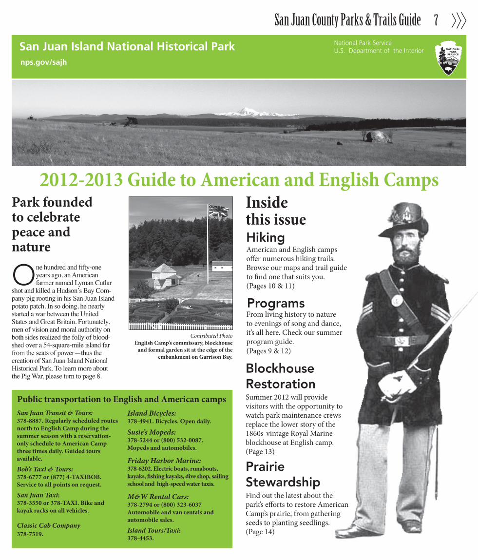
Contributed PhotoEnglish Camp’s commissary, blockhouse
and formal garden sit at the edge of the embankment on Garrison Bay.
Public transportation to English and American camps
American and English camps offer numerous hiking trails. Browse our maps and trail guide to find one that suits you.(Pages 10 & 11)
ProgramsFrom living history to nature to evenings of song and dance, it’s all here. Check our summer program guide.(Pages 9 & 12)
Insidethis issue Hiking
Blockhouse Restoration Summer 2012 will provide visitors with the opportunity to watch park maintenance crews replace the lower story of the 1860s-vintage Royal Marine blockhouse at English camp.(Page 13)
Prairie Stewardship Find out the latest about the park’s efforts to restore American Camp’s prairie, from gathering seeds to planting seedlings.(Page 14)
San Juan Transit & Tours: 378-8887. Regularly scheduled routes north to English Camp during the summer season with a reservation-only schedule to American Camp three times daily. Guided tours available.
Bob’s Taxi & Tours:378-6777 or (877) 4-TAXIBOB.Service to all points on request.
San Juan Taxi: 378-3550 or 378-TAXI. Bike and kayak racks on all vehicles.
Classic Cab Company378-7519.
Island Bicycles:378-4941. Bicycles. Open daily.
Susie’s Mopeds: 378-5244 or (800) 532-0087.Mopeds and automobiles.
Friday Harbor Marine: 378-6202. Electric boats, runabouts, kayaks, fishing kayaks, dive shop, sailing school and high-speed water taxis.
M&W Rental Cars:378-2794 or (800) 323-6037Automobile and van rentals and automobile sales.
Island Tours/Taxi:378-4453.
San Juan County Parks & Trails Guide8
National Park ServiceU.S. Department of the Interior
San Juan Island National Historical Park
This guide is published in cooperation with The Journal of the San Juan Islands. The National Park Service cannot g u a r a n t e e t h e r e l e v a n c e , timeliness or accuracy of the materials provided by the advertisers or other organiza-tions, nor does the NPS endorse other organizations or their views, products or services.
SuperintendentSan Juan Island NHPP.O. Box 429Friday Harbor, WA 98250
Administration(360) 378-2240FAX: (360) 378-2615
Visitor Services(360) 378-2240, ext. 2233
Web sitewww.nps.gov/sajh Follow us on Facebook
The park is administered by the National Park Service, U.S. Department of the Interior.
Cover: A model in Washington, DC 1858, poses in the dress uniform of a sergeant of the Artillery branch of the U.S. Army. The uniform was considered a marked improvement over earlier issues. The hat with ostrich plume, however, left a lot to be desired among some soldiers. A similar uniform is on display at the American Camp visitor center.
Contact Information
SuperintendentLee Taylor
Basic Information
On July 27, 1859, George E. Pickett’s Company D, 9th Infantry, arrived on San
Juan Island with a mission to protect United States citizens from the Brit-ish government on Vancouver Island. The reason? An American settler named Lyman Cutlar had shot a pig belonging to the Hudson’s Bay Com-pany. Everyone overreacted, particu-larly U.S. Department of Oregon commander Brig. Gen. William S. Harney, who had issued Pickett his orders.
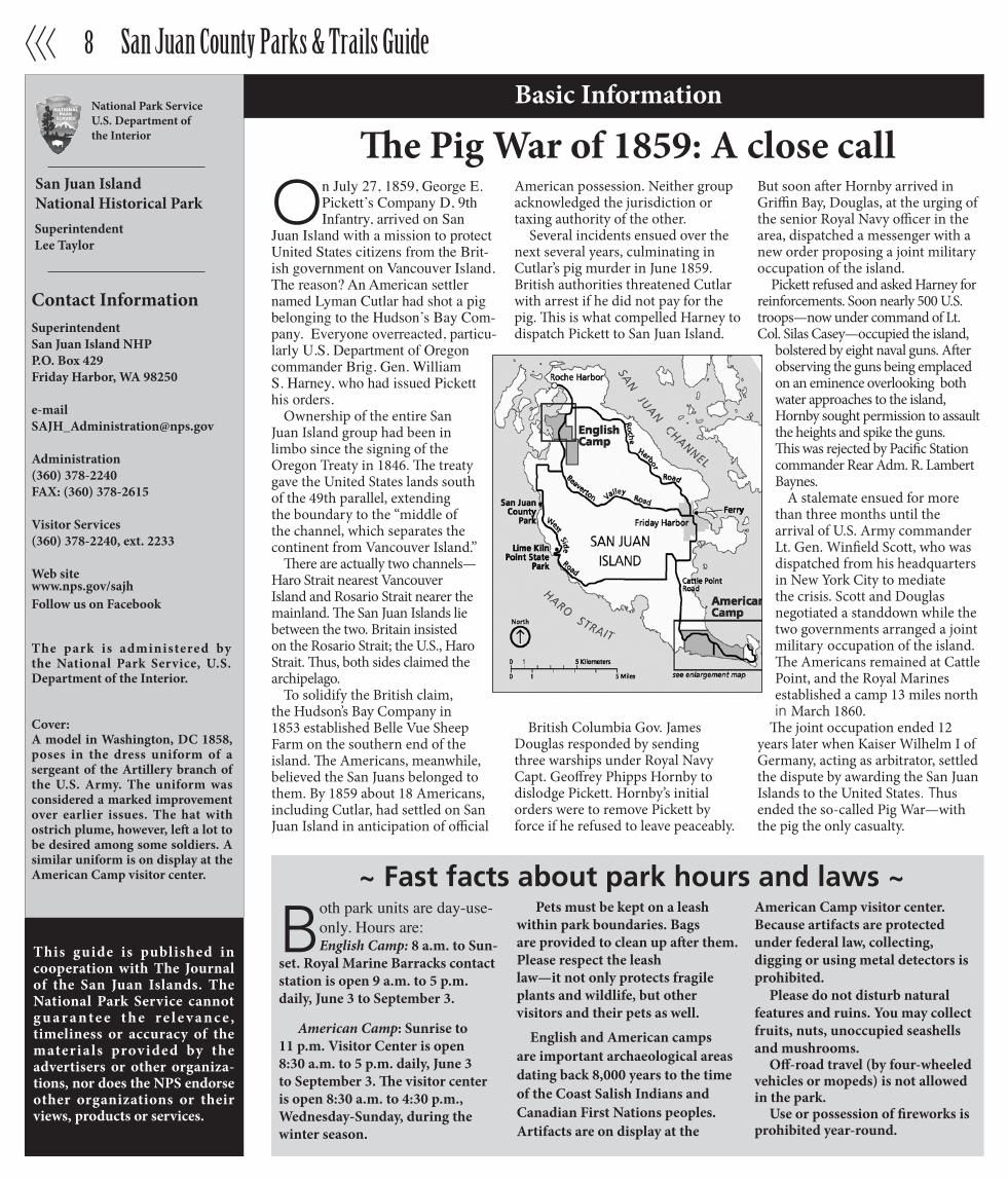
Ownership of the entire San Juan Island group had been in limbo since the signing of the Oregon Treaty in 1846. The treaty gave the United States lands south of the 49th parallel, extending the boundary to the “middle of the channel, which separates the continent from Vancouver Island.”
There are actually two channels—Haro Strait nearest Vancouver Island and Rosario Strait nearer the mainland. The San Juan Islands lie between the two. Britain insisted on the Rosario Strait; the U.S., Haro Strait. Thus, both sides claimed the archipelago.
To solidify the British claim, the Hudson’s Bay Company in 1853 established Belle Vue Sheep Farm on the southern end of the island. The Americans, meanwhile, believed the San Juans belonged to them. By 1859 about 18 Americans, including Cutlar, had settled on San Juan Island in anticipation of official
American possession. Neither group acknowledged the jurisdiction or taxing authority of the other.
Several incidents ensued over the next several years, culminating in Cutlar’s pig murder in June 1859. British authorities threatened Cutlar with arrest if he did not pay for the pig. This is what compelled Harney to dispatch Pickett to San Juan Island.
British Columbia Gov. James Douglas responded by sending three warships under Royal Navy Capt. Geoffrey Phipps Hornby to dislodge Pickett. Hornby’s initial orders were to remove Pickett by force if he refused to leave peaceably.
But soon after Hornby arrived in Griffin Bay, Douglas, at the urging of the senior Royal Navy officer in the area, dispatched a messenger with a new order proposing a joint military occupation of the island.
Pickett refused and asked Harney for reinforcements. Soon nearly 500 U.S. troops—now under command of Lt. Col. Silas Casey—occupied the island,
bolstered by eight naval guns. After observing the guns being emplaced on an eminence overlooking both water approaches to the island, Hornby sought permission to assault the heights and spike the guns. This was rejected by Pacific Station commander Rear Adm. R. Lambert Baynes.
A stalemate ensued for more than three months until the arrival of U.S. Army commander Lt. Gen. Winfield Scott, who was dispatched from his headquarters in New York City to mediate the crisis. Scott and Douglas negotiated a standdown while the two governments arranged a joint military occupation of the island. The Americans remained at Cattle Point, and the Royal Marines established a camp 13 miles north in March 1860.
The joint occupation ended 12 years later when Kaiser Wilhelm I of Germany, acting as arbitrator, settled the dispute by awarding the San Juan Islands to the United States. Thus ended the so-called Pig War—with the pig the only casualty.
Both park units are day-use- only. Hours are:English Camp: 8 a.m. to Sun-
set. Royal Marine Barracks contact station is open 9 a.m. to 5 p.m. daily, June 3 to September 3.
American Camp: Sunrise to 11 p.m. Visitor Center is open 8:30 a.m. to 5 p.m. daily, June 3 to September 3. The visitor center is open 8:30 a.m. to 4:30 p.m., Wednesday-Sunday, during the winter season.
Pets must be kept on a leash within park boundaries. Bags are provided to clean up after them. Please respect the leash law—it not only protects fragile plants and wildlife, but other visitors and their pets as well.
English and American camps are important archaeological areas dating back 8,000 years to the time of the Coast Salish Indians and Canadian First Nations peoples. Artifacts are on display at the
American Camp visitor center. Because artifacts are protected under federal law, collecting, digging or using metal detectors is prohibited.
Please do not disturb natural features and ruins. You may collect fruits, nuts, unoccupied seashells and mushrooms.
Off-road travel (by four-wheeled vehicles or mopeds) is not allowed in the park.
Use or possession of fireworks is prohibited year-round.
~ Fast facts about park hours and laws ~
The Pig War of 1859: A close call
San Juan County Parks & Trails Guide 9
2012 Summer Program Guide: Something for Everyone
Pig War Story Guided Walk — Park rangers and volunteers describe events leading up to and including the Pig War and the peaceful joint occupation of San Juan Island by English and American troops. Saturdays, 11 a.m. to noon, June 9 to September 1, American Camp.
Captain Delacombe’s English Camp Guided Walk — This guided walk starts at the site of the commanding officer’s quarters and descends Officers Hill to the formal garden and the parade ground be-low. Along the way learn how the Royal Marines lived during the 12-year joint occupation. Saturdays, 11a.m. to 12:30 p.m., June 9 to September 1, meets in the English Camp parking area.
Living History: Life during the Joint Military Occupation on San Juan Island — Park rangers and volunteers recreate military and civilian life during the island’s early pioneer period. Activi-ties include blacksmithing, coopering, weaving, needlework and exhibitions of military equipment and skills. Saturdays, noon to 3 p.m., June 2 to September 1, English Camp parade ground.
Wildlife in the San Juan Islands — Puz-zled by an animal or bird? Wolf Hollow Wildlife Rehabilitation Center Education Coordinator Shona Aitken answers ques-tions and uses a variety of media to talk about wildlife in the San Juan Islands. Fridays, 1 to 3 p.m., June 8 to August 31, English Camp barracks.
Field Work with Rangers: Prairie Restoration — The prairie at American Camp is one of the last natural prairies in the region. Join park rangers as they gather native plant seeds, cultivate them in tubes or plant the seedlings in desig-nated plots. In the process you’ll learn about the prairie’s past and discover how you can play a role in its future. Satur-days, 2 to 4 p.m., June 9 to September 1, meets at American Camp visitor center.
Birding in the Park — The forests, prairies and lagoons of American Camp attract a variety of birds throughout the summer, and offer a prime birding and hiking experience. Join park staff in enjoying this wonderful island resource. Fridays, 8 to 10 a.m., June 8 to August 31, meets at American Camp visitor center; or by appointment. Call 360-378-2240, ext. 2228 for details.
A Walk to the Salmon Bank — Ac-company a park ranger or volunteer on this cross-prairie journey to the historic Salmon Bank at South Beach, where springs attracted Indians and Europeans alike. This activity can be strenuous. Sturdy footwear, layered clothing, hats and water are recommended. Thurs-days, 2 to 3:30 p.m., June 7 to August 30, American Camp parking area, or by request. Call 360-378-2240, ext. 2233. Contra Dancing at English Camp — Folk singer Michael Cohen and local folk musicians present an evening of tradi-tional folk tunes and dancing for those wishing a turn on the floor. Cohen has contributed to the Smithsonian Institu-tion’s collection of American folk music. Mondays, 7:30 p.m. to 9 p.m., June 18 to August 20, English Camp barracks.
Young Hill / Royal Marine Cemetery Guided Walk — Serious hikers will enjoy this 2-hour journey, led by Park Historian Mike Vouri up the slope of 650-foot Young Hill, where the sum-mit offers splendid views. See the Royal Marine Cemetery and the Garry oak woodland. Sundays, 2 to 4 p.m., June 10 to September 2, meets at the north end of the English Camp parking area.
Fraser Homestead Guided Walk — Many of today’s island families are descended from U.S. Army soldiers. Join Park Historian Mike Vouri and learn more about how American Camp’s “frontiersmen in blue” played a key role in pioneering Euro-American settlement on San Juan Island. Wednesdays from 2 to 4 p.m., June 6 to August 29, meets at the American Camp visitor center.
All programs are free and open to the public, except where noted. Programs are subject to change without prior no-tice. For program updates, call the park at (360)378-2240, ext. 2233; visit our website at www.nps.gov/sajh or find us on Facebook.
Ancient Visitors: Tracing the Pre-history of San Juan Island Through Archaeology — University of Washing-ton archaeologist, Dr. Julie Stein, traces ancient habitation of San Juan Island in this guided walk on the American Camp prairie. 10 a.m. to noon, Saturday, June 2, South Beach. Meets at Alaska Packer’s Rock at the end of the Salmon Banks Road. Park in the main parking area.
The Birds of American Camp — Come join San Juan Island bird expert and for-mer national park ranger Barbara Jensen for a colorful 90-minute walk through American Camp’s prairies. 7:30 to 10:30 a.m., Sunday, June 3, meets at the American Camp visitor center.
America’s Pastime at American Camp — Join park rangers and volunteers for “gloveless” vintage base ball match conducted by park ranger Doug Halsey. All are welcome. You will be surprised at the other differences, and similarities, to today’s rules. Date, time and venue to be announced. Call (360) 378-2240, ext. 2228 for information.
(Continued on page 12)
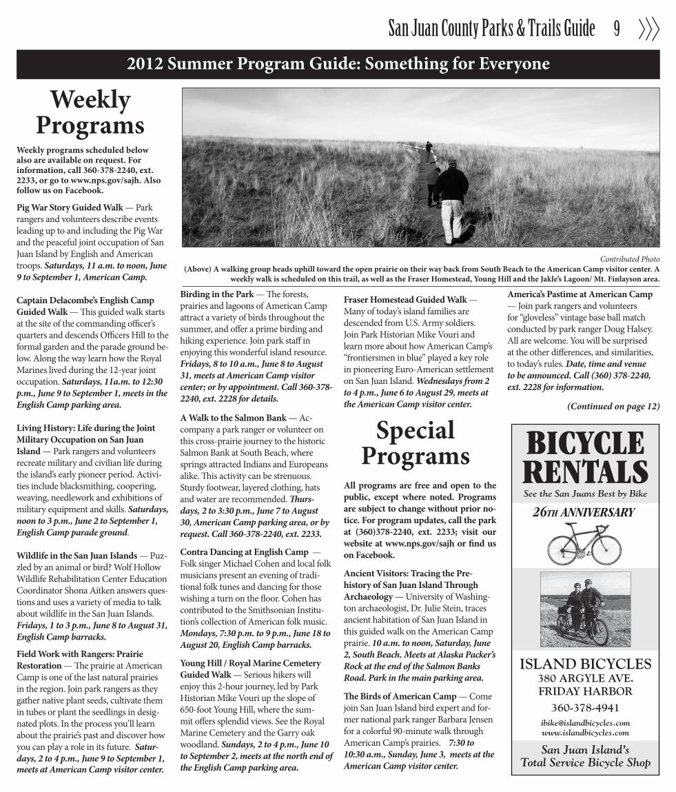
Contributed Photo(Above) A walking group heads uphill toward the open prairie on their way back from South Beach to the American Camp visitor center. A
weekly walk is scheduled on this trail, as well as the Fraser Homestead, Young Hill and the Jakle’s Lagoon/ Mt. Finlayson area.
BICYCLERENTALSSee the San Juans Best by Bike
26TH ANNIVERSARY
ISLAND BICYCLES380 ARGYLE AVE.FRIDAY HARBOR
San Juan Island’sTotal Service Bicycle Shop
WeeklyPrograms
SpecialPrograms
Weekly programs scheduled below also are available on request. For information, call 360-378-2240, ext. 2233, or go to www.nps.gov/sajh. Also follow us on Facebook.

San Juan County Parks & Trails Guide10
Trails and Features of English CampYoung Hill Trail — Hike this fairly steep trail up 650 feet to the top of Young Hill for a panoramic view of the island group’s northwest corner, Vancouver Island and the Gulf Islands. Novice walkers should take care to pace themselves as most of the gain is in the last half mile. An exhibit panel identifying geographic features is mounted on an overlook about two-thirds of the way up the hill. (1.25 mi. from parking area to summit.)
Royal Marine Cemetery — The Royal Marine cemetery is about 50 yards off the Young Hill trail, about a third of the way up. Five Royal Marines are interred, and a memorial stone is in place for two other marines. A stone also commemorates a civilian who was accidentally shot by his brother while hunting.
Bell Point trail — Walk the mile-long, fairly level trail to Bell Point for a view of Westcott Bay. If you like to harvest shellfish, check with the park ranger at the visitor center for information on licensing, locations, daily limits and red tide warnings. (2-mi. loop.)
Self-guided Walk — Relive the Royal Marine era along the trail that starts at the base of the main entrance trail. Pick up a guide in the box next to the bulletin board and follow the numbered posts. When finished, please return it to the box provided at the end of the walk. Or, you can purchase a guide for a $1 donation at the visitor center. (.25-mi. loop.)
English Formal Garden — The flower and herb garden—originally known as the strawberry garden—lies between the officers’ quarters site and the parade ground. The camp’s second commanding officer had it built for his family to remind them of home.
Roche Harbor Trail — Follow in the footsteps of the Royal Marines to Roche Harbor Village. Ask a park ranger or volunteer for directions to the trail connection completed in 2010 in partnership with the San Juan Island Trails Committee and San Juan County Land Bank . (3-mi. one way.)
BUSINESS IN PARADISE...SAN JUAN ISLAND, WASHINGTON
James Paull, OwnerRuthie Paull, President
Serving the San Juans since ‘82
SAN JUAN JEWELS LTDFriday Harbor, Washington
Opened in 1982owners are retiringPhone (360) 378-5877(Serious inquiries only)
Liquidatingentire
collection!50% to 70%
off
25% offon
Mallardwatches
The ONLY jewelry store on San Juan Island
FOR SALEWe’ve got you covered…
For a couch copy, call us at 360.378-5696Green pages, go to www.sanjuanjournal.com
read us on the couch, ferry, boat or trail.

San Juan County Parks & Trails Guide 11
Self-guided History Walk — Relive the Pig War along the trail that starts and finishes in the visitor center parking area. Pick up guides in boxes at the trailhead and follow the numbers. (1.25-mi. loop.)Frazer Homestead Trail — Trace the route of the old Military Road from the Visitor Center north to Rosler Road on this joint project of the park and the San Juan Trails Committee. Highlights include two small prairies and a pine forest. (2.9-mi. round trip.)
Prairie Walks — Primitive tracks crisscross the prairie and trace the bluff from Grandma’s Cove to South Beach and back to the visitor center via the
Redoubt. A great place for viewing Orca whales, the redoubt also offers a regional perspective with views of Mt. Baker, the Olympic and Cascade ranges, Vancouver Island, and on an exceptionally clear day, even Mt. Rainier, 130 miles up Admiralty Inlet. Sweeping views are also plentiful from the Cattle Point and Redoubt roads and Pickett’s Lane. Walkers are advised to use caution as rabbits have excavated warrens throughout the prairie. (2.5-mi. loop.)
Grandma’s Cove — Stroll downhill to one of the finest beaches on the island. Use caution when descending the bluff. (.9-mi. round trip.)
Jakle’s Lagoon Trail — Pick up a self-guided walk booklet, hike along the old roadbed and enjoy the quiet of a Douglas fir, cedar and hemlock canopy. This wooded area shelters deer and many types of birds, and is one of the most popular hiking areas on San Juan Island. (1.5-mi. to the lagoon.) Mt. Finlayson Trail — Hike along the grassy ridge to the top of Mt. Finlayson where you can see Mt. Baker to the east, Mt. Rainier to the southeast, the Olympic Mountains to the south and Vancouver Island, British Columbia to the west. Come back the way you came, or, for a change of scenery, go through
Jakle’s Lagoon. (3-mi. loop.) South Beach Trail— Follow the track of U.S. Army water wagons from the South Beach springs and enjoy the prairies in this trek starting just below the Redoubt. (2-mi. round trip from visitor center.)
Trails and Features American Camp
360-378-4593 open 7 days a weekshop the top • open daily • Friday Harbor, San Juan Island, Washington
Kayaks • Clothing • Accessories • BooksGreat Selection! • Competitive Prices!
Knowledgeable StaffScenic Destination
open 7 days a weekheadquarters for the discerning visitor
Souvenir Shirts & CapsTowels, FlipFlops, Gifts
and much more!DOWNSTAIRS at the corner
of First & Spring
UPSTAIRS OR DOWNSTAIRS
USE OURELEVATOR ON1ST / SPRING
Photo Molly Neeley

San Juan County Parks & Trails Guide12
2012 Summer Program Guide: Something for Everyone
Contributed PhotoCowlitz weaver Judy Bridges demonstrates
her craft at English Camp. (Below),Common Murre
(Continued from page 9)
Northwest Pioneer Folkways Demon-strations — Janet Oakley, author and former education coordinator for the Skagit County Historical Museum in La-Conner, demonstrates pioneer folkways from butter churning to Dutch oven baking and other tasks performed on the frontier. Noon to 3 p.m., Saturday, June 30, English Camp parade ground.
Pickett’s Irish: The Irish in the U.S. Army in the 1850’s — Folk musician Michael Cohen and historian Mike Vouri bring back this popular program that takes a closer look at the Irish in the 19th-century U.S. Army in words and song. 2 to 3:30 p.m., Saturday, July 21, English Camp barracks.
Encampment 2012 and Henry M. Jack-son Centennial Celebration — Park staff, volunteers and re-enactors from throughout the Pacific Northwest and Canada recreate life on San Juan Island at mid-19th century. This year’s activities include black powder demonstrations
with 19th-century weapons. The event also will commemorate the centennial of U.S. Sen. Henry M. “Scoop” Jackson who co-wrote the legislation creating the park. The major highlight of the weekend will be the Candlelight Ball, an evening of dancing and refreshments, scheduled 8 to 10 p.m. on Saturday. All day, Saturday and Sunday, July 28-29, English Camp.
A Weaving Weekend — Weavers from throughout San Juan Island and Wash-ington State will gather for the weekend to demonstrate how European and American Indian techniques melded to create woven objects and clothing unique to the Pacific Northwest. Cowlitz Nation weaver Judy Bridges and Fort Nisqually interpreter and storyteller Karen Haas will show how it was done with all-natural fibers, including wild reeds. The San Juan spinners and weav-ers, as well as islanders Anita Barreca and Roger Ellison, will also participate. All day, Saturday and Sunday, August 4-5, English Campparade ground.
Safe Passage: The U.S. Coast Survey Steamer Active on the West Coast in the 1850s — The Coast Survey Steamer Active not only performed hydrographic surveys on coastal and inland water-ways, but also played a key role in the settlement of the region. Historian Mike Vouri presents this Power Point slide program based on current research. 7 p.m., Saturday, August 11, San Juan Island Library. A Prairie’s Life: A Continuing Dialogue — Join Park Historian Mike Vouri and Integrated Resources Chief Jerald Weaver for the latest prairie restoration information. Weaver and Vouri also will take questions concerning the park’s plans to restore this valuable resource. 7 to 8:30 p.m., Wednesday, August 29, San Juan Island Library.

San Juan County Parks & Trails Guide 13
Park to replace lower story of English Camp blockhouse
Visitors and islanders will have an opportunity this summer to see how log structures were built on
the frontier when San Island National Historical Park maintenance crews replace the lower story of the Royal Marine blockhouse at English Camp.
Historians believe this blockhouse is an exact copy of the fortification brought to San Juan Island from Fort Bellingham by U.S. Army Capt. George Pickett in 1859 when the garrison was shifted en masse during the Pig War crisis. Each has an upper story skewed 45-degrees to repel attacks from all directions.
However, the buildings at both camps were primarily used as guardhouses with the guards occupying the lower floor and the prisoners in narrow cells upstairs. The only difference is that the American Camp blockhouse was fash-ioned from milled lumber.
The upper-story logs (hidden by sid-ing) are authentic, but because of tidal action, the log base was replaced wholly in 1970 and partially (the bottom 10 logs) in 1995. Maintenance crews will notch and assemble the logs for the new lower structure at the north end of the English Camp parade ground, accord-ing to Ken Arzarian, park maintenance foreman. The logs will then be coded and the structure disassembled. The upper story will be raised and supported
by jacks and cribbing while the current lower story is removed log by log.
The new structure will then be re-erected literally from the ground up, uti-lizing the same concrete vault installed by the National Park Service in 1970, Arzarian said.
The English Camp blockhouse was standard U.S. Army design at mid-19th century. Fortifications and bridges were required subjects at West Point, taught by the formidable Prof. Denis Hart Mahan, who also wrote the text. Pickett probably dug through his trunk and pulled out a copy of “A Complete Treatise on Field Fortification” before he started sketching his design when he arrived on Bellingham Bay in August 1856.
He also drew upon the experiences of the settlers on Bellingham Bay who, as with many coastal communities in Washington Territory, had already erected a blockhouse, aptly called “Fort Defiance.” This served as protection from raids by First Nations peoples from today’s British Columbia main-land, Haida Gwaii and southeast Alaska.
Mahan’s book not only drew upon European principles perfected by Vauban (a 17th century French engineer), but also from a frontier fortification tradition that began with Jamestown in 1607. A typical fortifi-cation consisted of a stockade about
eight feet high, with blockhouses at the corners to accommodate flanking fire over cleared fields of fire.
Whether or not a frontier fort was to-tally enclosed depended on the lay of the land, materials at hand and the nature of potential enemies. Save for the basic construction techniques prescribed by Mahan, no two forts were ever alike.
For example, because no massed, surprise attacks were anticipated in Yakama country along the Yakima River, Fort Simcoe, also built in 1856, was not enclosed, but possessed free-standing blockhouses for emergencies. The same went for Fort Steilacoom just south of Tacoma. But taking a note of Fort Defiance, not to mention the hair-raising stories of Native Americans with firearms in 60-man canoes, Pickett elected to enclose Fort Bellingham.
Pickett found an enthusiastic pur-veyor of lumber, advice and labor in Whatcom co-founder, Capt. Henry Roeder, who had milled timber for and helped build Fort Defiance. For Pickett’s blockhouses, he provided “sawn logs, eight inches thick, dovetailed…with port holes cut through them.”
Each blockhouse was 22 feet square on the first floor, with the slightly larger second story set atop the first at a 45 degree angle to allow for flanking fire. Roeder pointed out that the bastions at Fort Bellingham were placed “…on the
opposite corners diagonally… so as to protect the two sides nearest to each. We had steps leading up to them from the inside of the stockade. The bastions were built the same as the blockhouses of square timber.”
Contributed PhotoEnglish Camp’s Royal Marine blockhouse (left) is jacked up, c. 1970, to accommodate fresh logs for a new lower floor shown in foreground. Based on U.S. Army design, the blockhouse
was built to repell attacks from every angle including below the raised and skewered upper floor.
Information Booth
Hotel de Haro
McMillin’s Dining Room
Roche Harbor Market

San Juan County Parks & Trails Guide14
Prairie StewardshipRestoring Balance & Integrity to a Legacy Landscape
“I commenced the buildings on the banks of a rivulet in the centre of a dry elevatedsheep run containing about 1,500 acres of clear prairie land.” − James Douglas, Hudson’s Bay Company
Just as the Hudson’s Bay Company valued San Juan Island’s natu-ral prairies for farming in 1853, so did the settlers that followed.
Native plants gave way to non-native crops and weeds, and native animals, like wolf and elk, were eliminated through hunting. By the 1900s, agriculture, livestock grazing, hunting and fire suppression had decimated most of the native plants and animals on the island.
Today, less than three percent of the historic Puget Sound grasslands remain. The 600 acres of American Camp prairie are protected but not pristine. The park is working to restore prairie’s natural balance by controlling non-native weeds, planting native grasses and wildflowers and using prescribed fire. To learn more about prairie restoration and how you can help, visit nps.gov/sajh or on Facebook.
San Juan County Parks & Trails Guide 15
Friends of Moran
Moran State Park: A briefhistory
(Continued on next page)
COME BOATING AT MORAN STATE PARKKayak, canoe, rowboat and paddle boat rentals
WWW.OUTERISLANDX.COM • 360 376-3711
$5 OFFA 2-hour rental
GREAT FOR FAMILIES& COUPLES!
Kayak, canoe, rowboat and paddle boat rentalsKayak, canoe, rowboat and paddle boat rentalsKayak, canoe, rowboat and paddle boat rentals
Outer Island
Expeditions
We are a nonprofit 501(c)(3) organization. Our mis-sion over the last 17 years
has been and continues to be raising funds and coordinating volunteer ef-forts throughout the year for projects within the 5,252 acre state park. We assist the Moran State Park rangers with trail and campground mainte-nance, clean up and preservation. We also support educational and interpretive programs for visitors of all ages.
We are involved in a lot of projects for the park, but we are also a fund-ing source for timber that needs to be milled in the park, fish hatchery components and, most significantly, the three emergency/courtesy phones in the park. There is no cell service in the park so when phone service was scheduled to be removed, we decided to fund courtesy/emergency tele-phone service in conjunction with Century Link.
We also oversee data collection from the weather station at the sum-mit and operate the web camera that provides spectacular views from the highest point in the San Juan Islands.Some of the projects slated for this year are: Kokanee Fish Hatchery (Moran Creek Hatchery & Exhibit at the Summit Learning Center), Sum-mit Learning Center (Opened May 2012), Summit Gift Shop, Historic Stone Tower Maintenance, Bill Yarlot Fishing Derby (Opened April 2012), Annual Clean Up (April 14th, 2012), Steve Braun Memorial Triathlon (Sept 4, 2012), Educational Outreach (March 2012), Rough Skinned Newt Exhibit (at the Summit Learning Center).
All of our projects support the preservation of Moran State Park, enhance the visitor experience and build an appreciation for state parks. You can learn more about what we do or get involved at www.friendsofmoran.
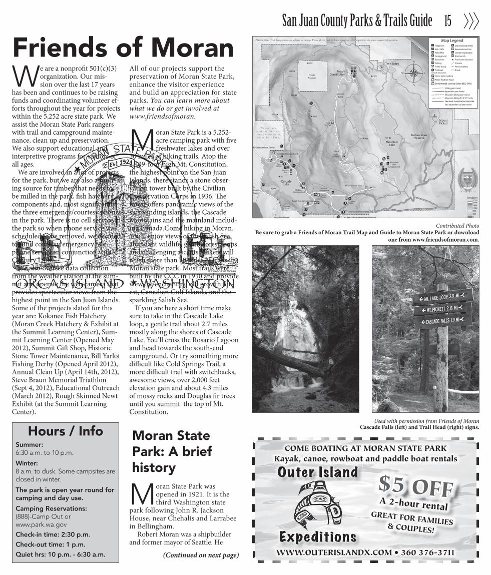
Moran State Park is a 5,252-acre camping park with five freshwater lakes and over
30 miles of hiking trails. Atop the 2,409-foot-high Mt. Constitution, the highest point on the San Juan Islands, there stands a stone obser-vation tower built by the Civilian Conservation Corps in 1936. The tower offers panoramic views of the surrounding islands, the Cascade Mountains and the mainland includ-ing Canada.Come hiking in Moran. You’ll enjoy views of the Salish Sea, abundant wildlife, gentle forest loops and challenging ascents. Hikers will relish more than 38 miles of trails in Moran state park. Most trails were built by the CCC in 1930 and provide views of enchanting old growth for-est, Canadian Gulf Islands, and the sparkling Salish Sea.
If you are here a short time make sure to take in the Cascade Lake loop, a gentle trail about 2.7 miles mostly along the shores of Cascade Lake. You’ll cross the Rosario Lagoon and head towards the south-end campground. Or try something more difficult like Cold Springs Trail, a more difficult trail with switchbacks, awesome views, over 2,000 feet elevation gain and about 4.3 miles of mossy rocks and Douglas fir trees until you summit the top of Mt. Constitution.
Moran State Park was opened in 1921. It is the third Washington state
park following John R. Jackson House, near Chehalis and Larrabee in Bellingham.
Robert Moran was a shipbuilder and former mayor of Seattle. He
Used with permission from Friends of MoranCascade Falls (left) and Trail Head (right) signs.
Contributed PhotoBe sure to grab a Friends of Moran Trail Map and Guide to Moran State Park or download
one from www.friendsofmoran.com.
Hours / InfoSummer: 6:30 a.m. to 10 p.m.
Winter: 8 a.m. to dusk. Some campsites are closed in winter.
The park is open year round for camping and day use.
Camping Reservations:(888)-Camp Out or www.park.wa.gov
Check-in time: 2:30 p.m.
Check-out time: 1 p.m.
Quiet hrs: 10 p.m. - 6:30 a.m.

San Juan County Parks & Trails Guide16
TILE CARPET NATURAL STONE HARD WOOD WINDOW SHADES LAMINATE FLOORS GRANITE COUNTER TOPS
Free design consultation and estimateon site or in our show rooms inFriday Harbor and our new Orcas,Eastsound location at 217 Main St.
360-376-6071217 Main Street,
Eastsound
360-378-607122 Web Street,Friday Harbor
• www.sanjuan-interiors.com •We’re here from start to � nish.
We take pride in the ability to provide quality, cost effective merchandise with
excellent customer care.
Unless there is a burn ban, the San Juan County Fire Marshal allows recreational fires of two feet in diameter at any time of the year. Here are the requirements:• Afiremustbeattendedatalltimes.• Fire must be two fee or less, on bare soil, gravel, below tide- line on the beach or in an approved fire pit.• Flames must not exceed 2 feet.• Burnonlynaturalmaterials.Donotburngarbagesuchas picnic debris. • Have a shovel, charged water hose or a full 5-gallon bucket of water on site while burning.• Besureyourfireiscompletelyoutbeforeyouleavebyusing plenty of water & stirring the coals and embers until all the heat is gone• Residential and commercial burning permits are valid from Oct. 1 thru June 30.• Recreational fires do not require a permit.
For more information, visit www.sjcfiremarshal.org.
The ins and outs of recreational camp fires
Petro San JuanFuels, Lubricants, Welding Supplies
605 Mullis Street, Friday Harbor • 378-5122
Don’t be a fool...replenish your fuel with a Paci� c Pride MembershipDiscount cards good locally or most anywhere else in U.S.Discount cards good locally or most anywhere else in U.S.
moved to Orcas to retire for medical reasons. He donated more than 2,700 acres to the state for a park in 1918. It wasn’t until late 1921 that the state funded the committee known currently as Washington State Parks and Rec-reationCommission,whocouldthenaccepthisgift.By1928RobertMoranhad added another 1,000 plus acres to his original gift. To date the park has expanded to 5,252 acres.
In 1930, the Civilian Conservation corps set about building many of the trails, roads and bridges in the park. They also constructed 21 buildings. The most significant structure is the Stone Tower located at the top of Mt. Consti-tution. Ellsworth Storey was the architect and patterned the tower after 12th century watchtowers of the Caucasus Mountains in southeastern Europe. The tower underwent extensive restoration in 2003-04 and maintenance contin-ues each year funded by the Friends.
(Continued from previous page)
By Scott Rasmussen
While Moran is hard to match in size and in its recreational opportuni-ties, Spencer Spit State Park is a worthy competitor. Located on the northwest side of Lopez Island, Spencer Spit State
Park, is situated between the shores of Swifts Bay and Lopez Sound and about a mile south of the ferry landing. The park features a rocky sandbar, home to a rus-tic clam-shelling shack, that stretches out toward nearby Frost Island like a spear.
The 138-acre park ad campground, with nearly two miles of waterfront, has 42 fully equipped campsites, a dozen of which offer vehicle parking, another 10 more spartan-like sites and a group site that can be reserved two weeks in advance. The park has a total of 16 mooring buoys as well, and remains a top draw among for boaters.
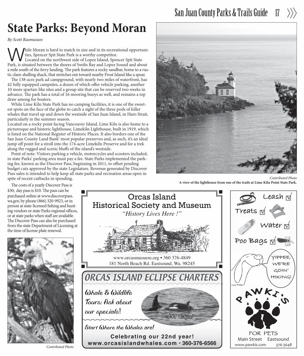
While Lime Kiln State Park has no camping facilities, it is one of the sweet-est spots on the face of the globe to catch a sight of the three pods of killer whales that travel up and down the westside of San Juan Island, in Haro Strait, particularly in the summer season. Located on a rocky point facing Vancouver Island, Lime Kiln is also home to a picturesque and historic lighthouse, Limekiln Lighthouse, built in 1919, which is listed on the National Register of Historic Places. It also borders one of the San Juan County Land Bank’ most popular preserves and, as such, it’s an ideal jump off point for a stroll into the 174-acre Limekiln Preserve and for a trek along the rugged and scenic bluffs of the island’s westside.
Point of note: Visitors parking a vehicle, motorcycles and scooters included, in state Parks’ parking area must pay a fee. State Parks implemented the park-ing fee, known as the Discover Pass, beginning in 2011, to offset pending budget cuts approved by the state Legislature. Revenue generated by Discover Pass sales is intended to help keep all state parks and recreation areas open in spite of recent cutbacks in spending.
The costs of a yearly Discover Pass is $30; day pass is $10. The pass can be purchased online at www.discoverpass.wa.gov, by phone (866) 320-9923, or in person at state-licensed fishing and hunt-ing vendors or state Parks regional offices, or at state parks when staff are available. The Discover Pass can also be purchased from the state Department of Licensing at the time of license plate renewal.
San Juan County Parks & Trails Guide 17
Whale & WildlifeTours: Ask aboutour specials!
Start Where the Whales are!Celebrating our 22nd year!
www.orcasislandwhales.com • 360-376-6566
Start Where the Whales are!
!"#$%&'())'%%%%%*"+'+,-$.///01"/2#+03,4%%%%%%%%%%%5678579:
YIPPEE,WE’RE GOIN’
HIKING!
Leash √
Treats √ Water √
Poo Bags √
Lucy Phillips
Orcas IslandHistorical Society and Museum
“History Lives Here !”
www.orcasmusuem.org • 360 376-4849181 North Beach Rd. Eastsound, Wa. 98245
Contributed PhotoA view of the lighthouse from one of the trails at Lime Kiln Point State Park.
State Parks: Beyond Moran
Contributed Photo
San Juan County Parks & Trails Guide18
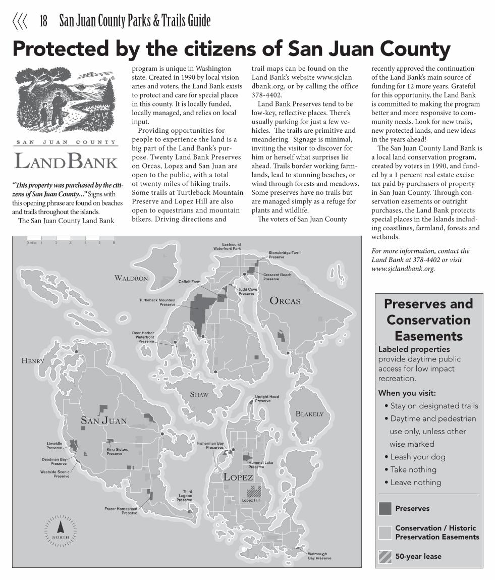
“This property was purchased by the citi-zens of San Juan County…” Signs with this opening phrase are found on beaches and trails throughout the islands.
The San Juan County Land Bank
program is unique in Washington state. Created in 1990 by local vision-aries and voters, the Land Bank exists to protect and care for special places in this county. It is locally funded, locally managed, and relies on local input.
Providing opportunities for people to experience the land is a big part of the Land Bank’s pur-pose. Twenty Land Bank Preserves on Orcas, Lopez and San Juan are open to the public, with a total of twenty miles of hiking trails. Some trails at Turtleback Mountain Preserve and Lopez Hill are also open to equestrians and mountain bikers. Driving directions and
trail maps can be found on the Land Bank’s website www.sjclan-dbank.org, or by calling the office 378-4402.
Land Bank Preserves tend to be low-key, reflective places. There’s usually parking for just a few ve-hicles. The trails are primitive and meandering. Signage is minimal, inviting the visitor to discover for him or herself what surprises lie ahead. Trails border working farm-lands, lead to stunning beaches, or wind through forests and meadows. Some preserves have no trails but are managed simply as a refuge for plants and wildlife.
The voters of San Juan County
recently approved the continuation of the Land Bank’s main source of funding for 12 more years. Grateful for this opportunity, the Land Bank is committed to making the program better and more responsive to com-munity needs. Look for new trails, new protected lands, and new ideas in the years ahead!
The San Juan County Land Bank is a local land conservation program, created by voters in 1990, and fund-ed by a 1 percent real estate excise tax paid by purchasers of property in San Juan County. Through con-servation easements or outright purchases, the Land Bank protects special places in the Islands includ-ing coastlines, farmland, forests and wetlands.
For more information, contact the Land Bank at 378-4402 or visit www.sjclandbank.org.
Protected by the citizens of San Juan County
Preserves andConservation Easements
Labeled properties provide daytime public access for low impact recreation.
When you visit:
• Stay on designated trails
• Daytime and pedestrian
use only, unless other
wise marked
• Leash your dog
• Take nothing
• Leave nothing
Preserves
50-year lease
Conservation / HistoricPreservation Easements

San Juan County Parks & Trails Guide 19
Boat & Kayak Rentals
Powerboats • Sailboats • Kayaks • Cruise-A-HomeHourly, Daily, & Weekly Rates • Water Taxi
Naturalist Guides • Sunset Tours • Picnic SuppliesSail & Power Boat Training • Charts & Guidebooks
www.sjimarine.com • #4 Front Street, Just Below Downriggers Restaurant • www.fridayharbormarine.com
360-378-6202
Washington State Marine Park IslandsBy Mike Close
To experience the true charm of the San Juan Islands, get off the beaten path by getting out on the water and exploring the unique Washington State Marine Park islands which can only be reached by boat or kayak.
Some of the parks have docks and mooring buoys, while others require shore access. Some have campsites, picnic tables, wells, and toilets, while others are primitive or day use only. All of them offer beautiful, winding hiking trails with vistas of the Cascades and Olympic Mountains, tidepools and rocky shorelines full of marine life, wildflowers, bird watching, meadows and forests, diverse wildlife on land and in the water and remarkable beauty. And getting there is half the fun. Rental boats, and rental kayaks, and water taxi services are available in Friday Harbor and on Orcas Island, and if you prefer to hire a naturalist guide or a captain, they can easily be arranged.
Before going on the adventure, read the guide books, charts, tide and cur-rent tables and the weather forecast. The waters around these islands have strong currents and large tides, so be sure to receive training on beach access techniques, mooring buoys, and protocol on the docks. Pack a picnic, bring a blanket and a camera, and set out on a real island adventure.
The following parks can only be accessed by boat or kayak. Washington State Marine Parks include James Island, Jones Island, Posey Island, Stuart Is-land, Sucia Island, Matia Island, Patos Island and Turn Island. Other marine parks include Yellow Island, Clark Island, Doe Island, Freeman Island, Blind Bay Island, Skull Island, Victim Island and Iceberg Island.
— Mike Close is owner/operator of Friday Harbor Marine
Contributed PhotoBecause of their striking plumage and highly active nature , buffleheads are one of the most
widely seen birds around the islands.

$15 DAY PASSES or $5 One-Way
On Orcas & San Juan IslandExplore the Islands with...
[email protected] • www.sanjuantransit.com
Hourly Departures To:Roche Harbor Village
Whale Watch ParkEnglish Camp, Sculpture Park
Alpaca Ranch, VineyardsLavendar Farm & Hiking Trails
378-8887
SCENIC BYWAY EXPLORERTransit, Tours, Charters
HIKE, KAYAK, EXPLORE…BEAUTIFUL SUCIA ISLANDFerries depart every day from Orcas Island
WWW.OUTERISLANDX.COM • 360 376-3711
$10 OFFA Sucia Island
ferry rideBOOK NOW!
WWW.OUTERISLANDX.COM • 360 376-3711
Ferries depart every day from Orcas Island
Outer Island
Expeditions
GUARANTEED WHALE WATCHING TRIPSDeparting daily from Orcas and Lopez Islands
WWW.OUTERISLANDX.COM • 360 376-3711
BUY 1GET 1
Half off a whalewatching trip
Departing daily from Orcas and Lopez IslandsDeparting daily from Orcas and Lopez Islands
Outer Island
Expeditions
More on Marine Parks
There are many islands around Shaw to explore. To the northwest, Jones Island State Park is perfect for camping. With seven mooring buoys and light hikes, Jones Island is popular with power boaters, sailors and kayak-
ers. To the south, Turn Island has primitive campsites, hiking trails and three mooring buoys. It also has good landings for kayakers, but they should be wary of the strong current. If you’re more adventurous, visit Matia, Patos or Sucia Islands. Matia Island State Marine Park has two buoys. According to Waggoner Cruising Guide 2004, your best bet for anchorage is on the westside in Rolfe Cove; be careful of the rocky bottom. Also, since the Island is a National Refuge, access is restricted to the designated five-acre moorage and camping area.
One of the most scenic spots in the area is Patos Island. There are two buoys in the only possible anchorage spot, Active Cove, which is located on the west side of the island. Sucia is the most heavily used marine park in the system, because of its facilities and beauty. It has mooring buoys, dock space and many camping areas and anchorage spots. A dozen outer islands offer campsites, first-come first-serve, and generally fill up fast. Jones and Sucia Islands have group campsites which can be reserved.
Blind Bay Marine Park, on Blind Island between Orcas and Shaw, has four campsites and four mooring buoys. Patos, the northernmost island in San Juan County, has a historic lighthouse built in 1893. Turn Island, near San Juan Island’s Turn Point, is popular with kayakers and is wildlife refuge. Other marine parks with campsites: Clark Island, east of Orcas Island; James Island, west of Decatur Island; and Posey and Stuart Islands, north of San Juan. Potable water is rarely available at the marine parks, so bring your own. For more information, call 360-378-2044 or 360-376-2073, or visit www.parks.wa.gov.
Contributed PhotoKayakers take a break to enjoy the view amongst a sea of bull kelp.
Contributed PhotoSea Lions, cormorants and seagulls share an island on.