ontario ministry of the environment and climate change ... 218246.pdfontario ministry of the...
TRANSCRIPT
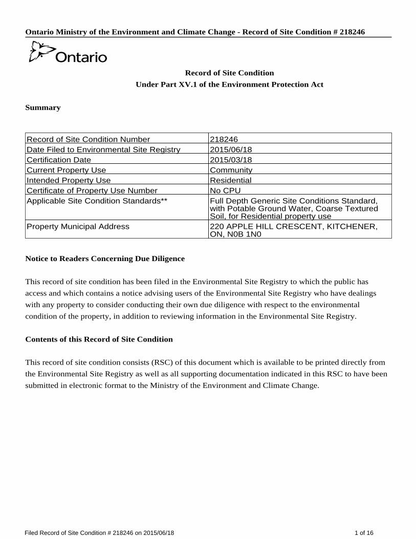
Ontario Ministry of the Environment and Climate Change - Record of Site Condition # 218246
Record of Site Condition
Under Part XV.1 of the Environment Protection Act
Summary
Notice to Readers Concerning Due Diligence
This record of site condition has been filed in the Environmental Site Registry to which the public has
access and which contains a notice advising users of the Environmental Site Registry who have dealings
with any property to consider conducting their own due diligence with respect to the environmental
condition of the property, in addition to reviewing information in the Environmental Site Registry.
Contents of this Record of Site Condition
This record of site condition consists (RSC) of this document which is available to be printed directly from
the Environmental Site Registry as well as all supporting documentation indicated in this RSC to have been
submitted in electronic format to the Ministry of the Environment and Climate Change.
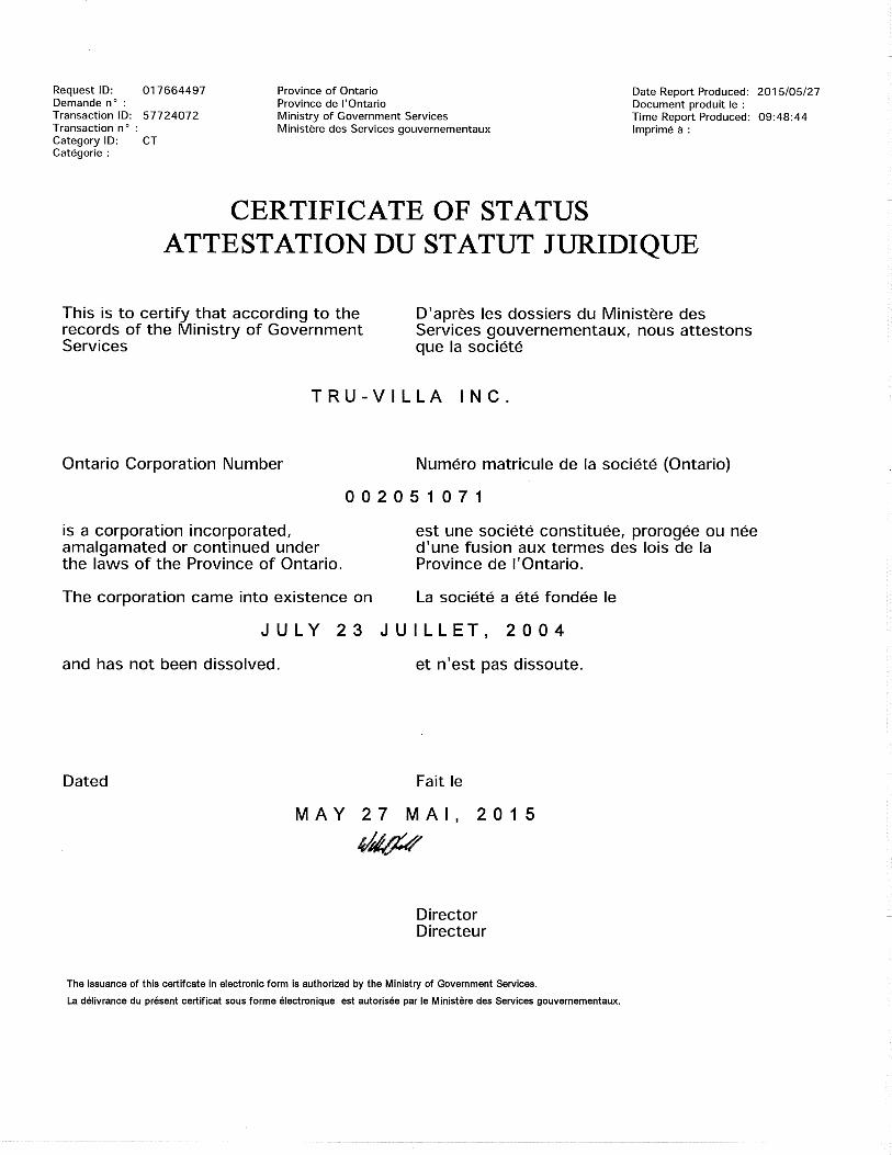
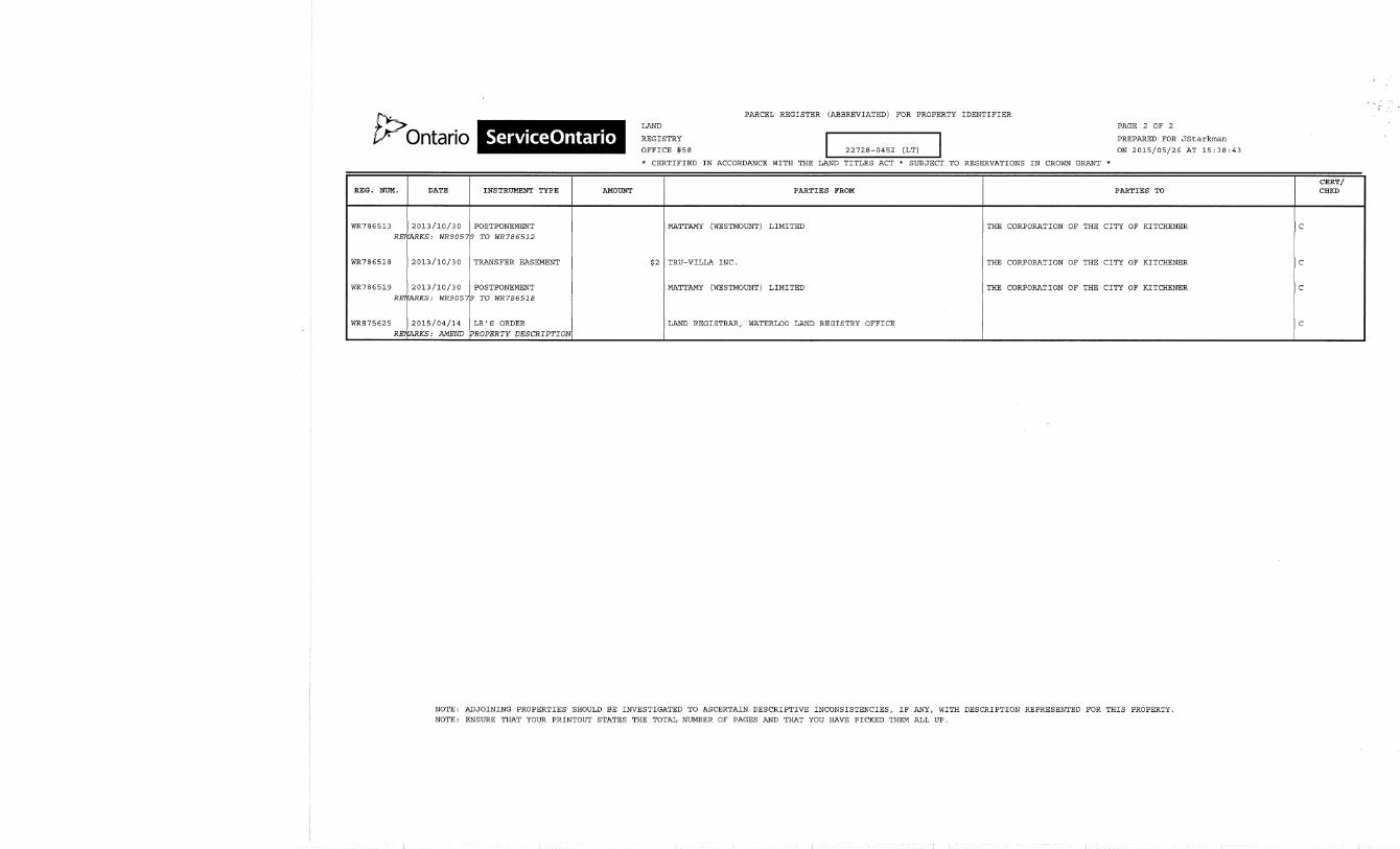
Record of Site Condition Number 218246Date Filed to Environmental Site Registry 2015/06/18Certification Date 2015/03/18Current Property Use CommunityIntended Property Use ResidentialCertificate of Property Use Number No CPUApplicable Site Condition Standards** Full Depth Generic Site Conditions Standard,
with Potable Ground Water, Coarse TexturedSoil, for Residential property use
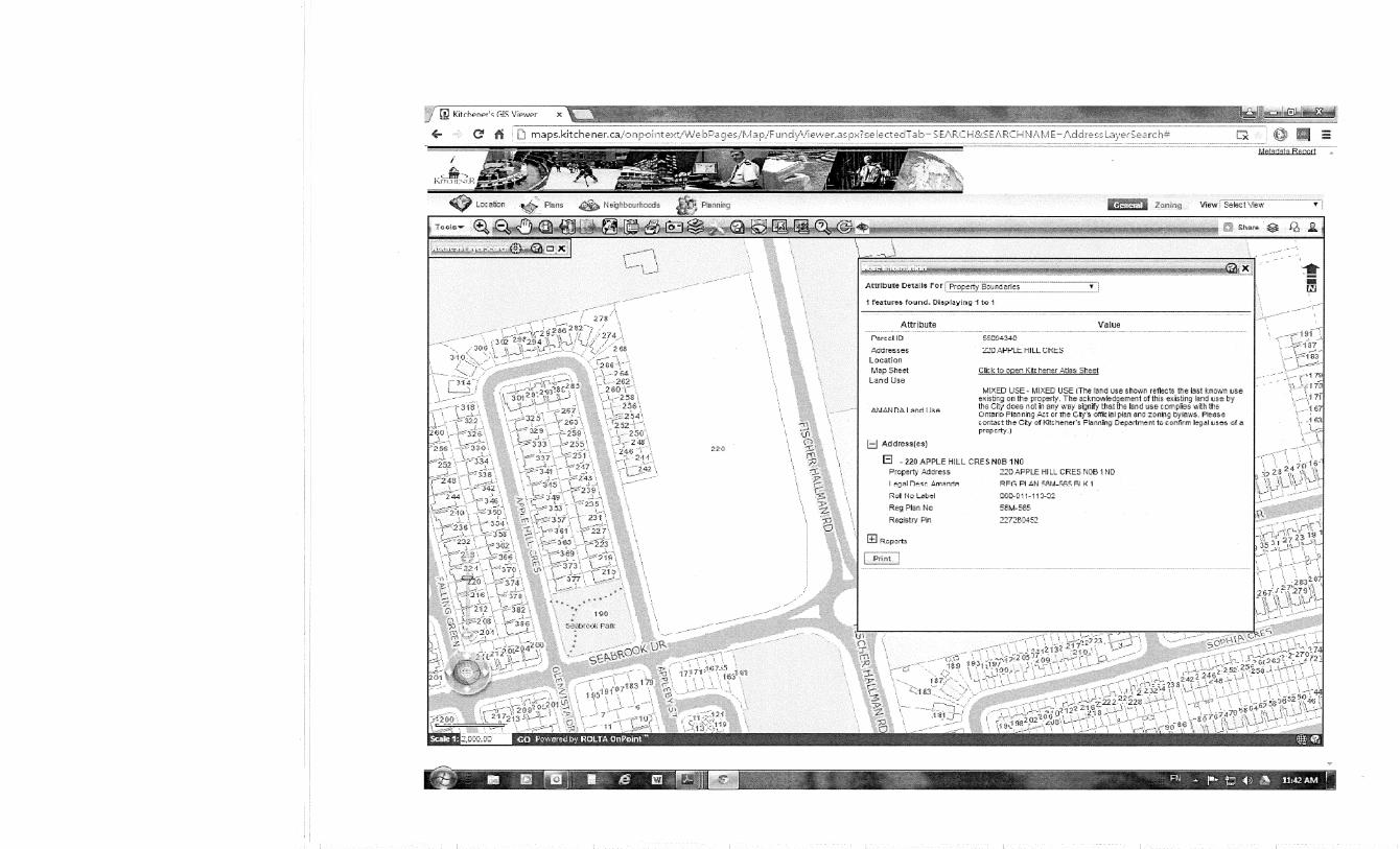
Property Municipal Address 220 APPLE HILL CRESCENT, KITCHENER,ON, N0B 1N0
1 of 16Filed Record of Site Condition # 218246 on 2015/06/18
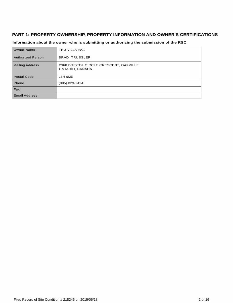
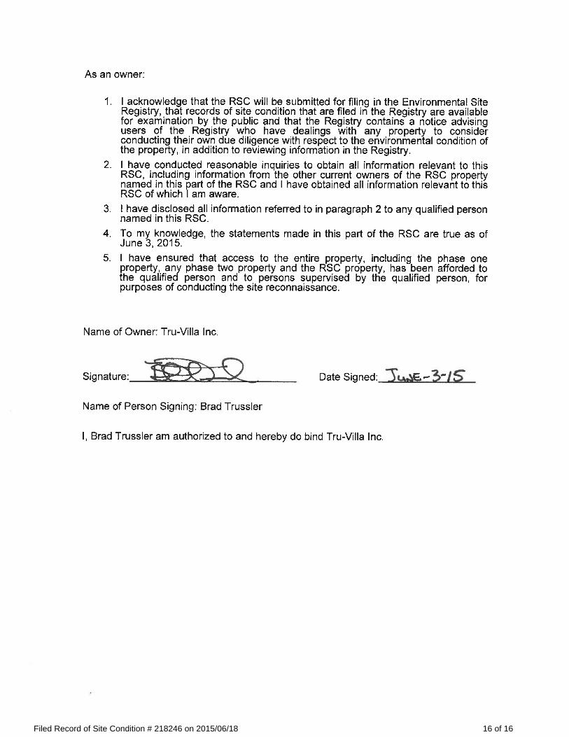
PART 1: PROPERTY OWNERSHIP, PROPERTY INFORMATION AND OWNER'S CERTIFICATIONS
Information about the owner who is submitting or authorizing the submission of the RSC
Owner Name TRU-VILLA INC.
Authorized Person BRAD TRUSSLER
Mailing Address 2360 BRISTOL CIRCLE CRESCENT, OAKVILLEONTARIO, CANADA
Postal Code L6H 6M5
Phone (905) 829-2424
Fax
Email Address
2 of 16Filed Record of Site Condition # 218246 on 2015/06/18
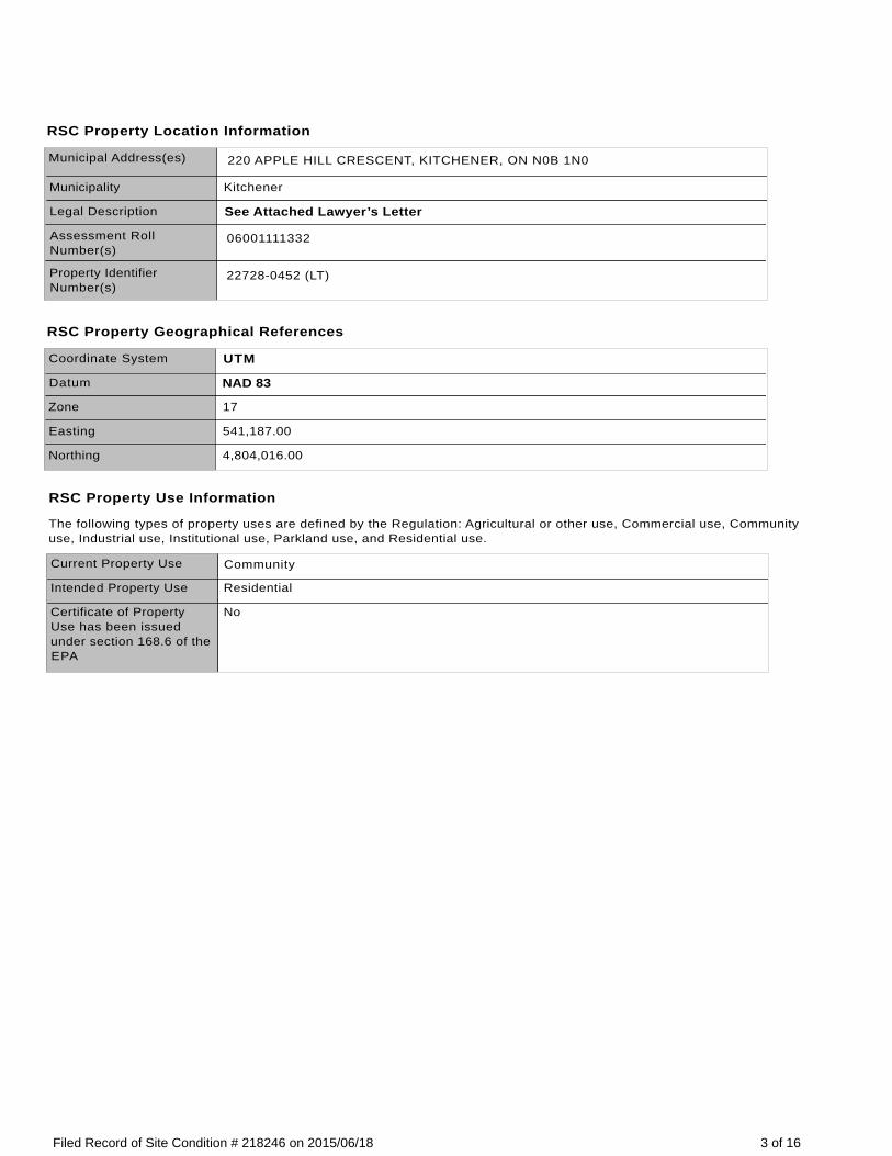
RSC Property Location Information
Municipal Address(es) 220 APPLE HILL CRESCENT, KITCHENER, ON N0B 1N0
Municipality Kitchener
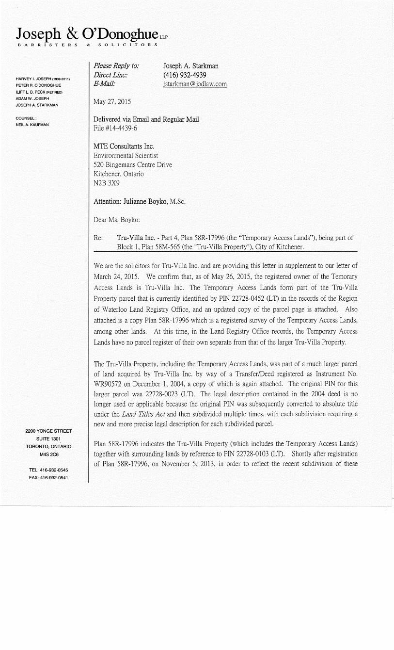
Legal Description See Attached Lawyer’s Letter
Assessment Roll Number(s)
06001111332
Property Identifier Number(s)
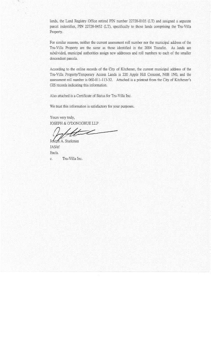
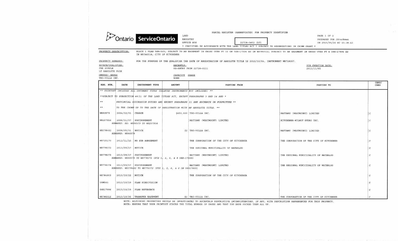
22728-0452 (LT)
RSC Property Geographical References
Coordinate System UTM
Datum NAD 83
Zone 17
Easting 541,187.00
Northing 4,804,016.00
RSC Property Use Information
The following types of property uses are defined by the Regulation: Agricultural or other use, Commercial use, Community use, Industrial use, Institutional use, Parkland use, and Residential use.
Current Property Use Community
Intended Property Use Residential
Certificate of Property Use has been issued under section 168.6 of the EPA
No
3 of 16Filed Record of Site Condition # 218246 on 2015/06/18
Please See the Signed Statements of Property Owner, or Agent, or Receiver at the End of this RSC
The rest of this page has been left intentionally blank
4 of 16Filed Record of Site Condition # 218246 on 2015/06/18
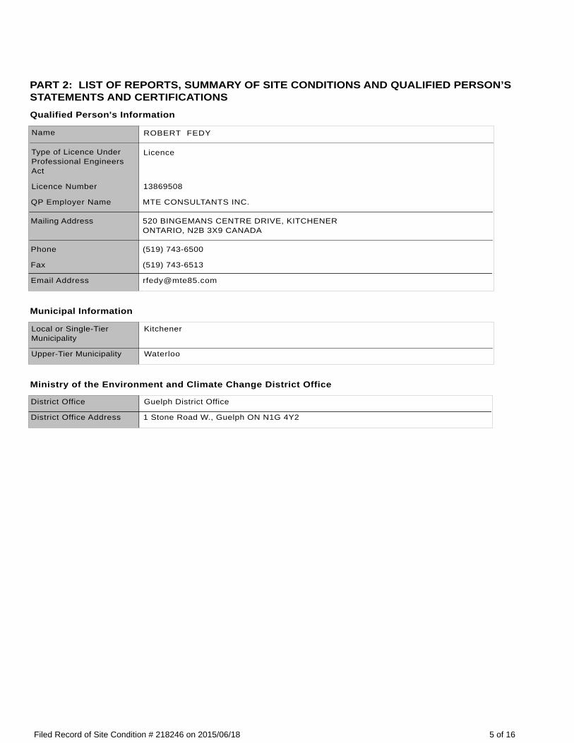
PART 2: LIST OF REPORTS, SUMMARY OF SITE CONDITIONS AND QUALIFIED PERSON’S STATEMENTS AND CERTIFICATIONSQualified Person's Information
Name ROBERT FEDY
Type of Licence Under Professional Engineers Act
Licence
Licence Number 13869508
QP Employer Name MTE CONSULTANTS INC.
Mailing Address 520 BINGEMANS CENTRE DRIVE, KITCHENERONTARIO, N2B 3X9 CANADA
Phone (519) 743-6500
Fax (519) 743-6513
Email Address [email protected]
Municipal Information
Local or Single-Tier Municipality
Kitchener
Upper-Tier Municipality Waterloo
Ministry of the Environment and Climate Change District Office
District Office Guelph District Office
District Office Address 1 Stone Road W., Guelph ON N1G 4Y2
5 of 16Filed Record of Site Condition # 218246 on 2015/06/18
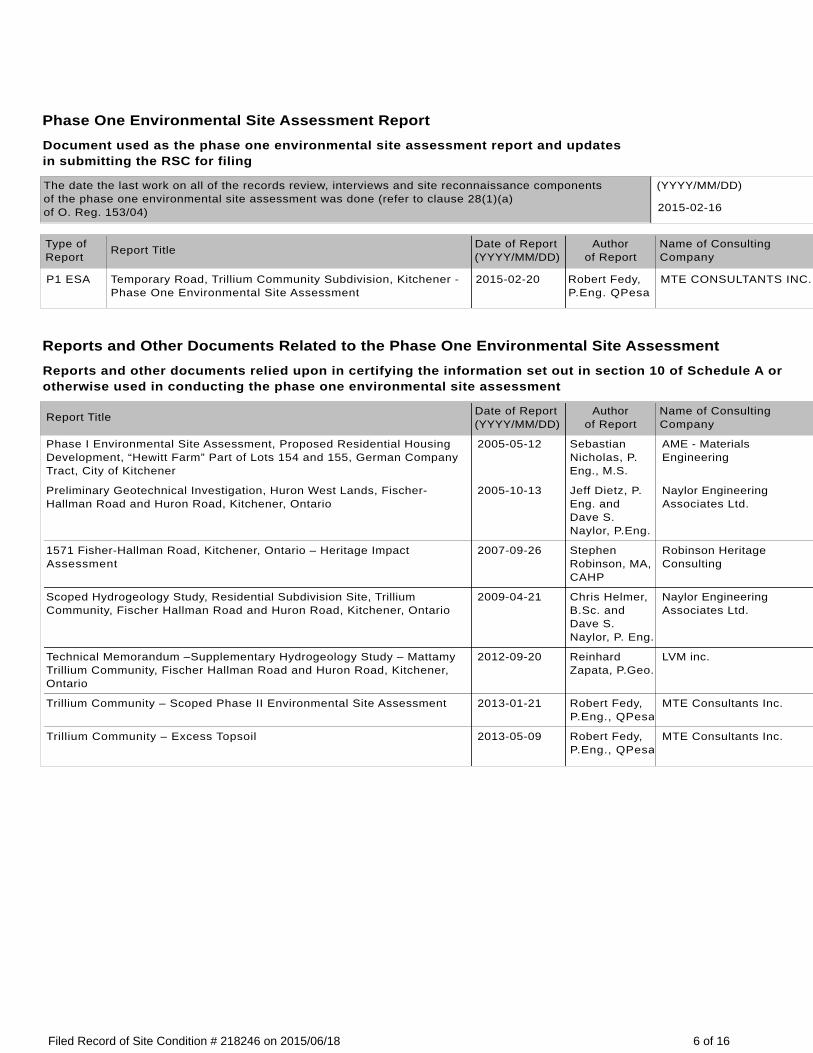
Phase One Environmental Site Assessment ReportDocument used as the phase one environmental site assessment report and updates in submitting the RSC for filing
The date the last work on all of the records review, interviews and site reconnaissance components of the phase one environmental site assessment was done (refer to clause 28(1)(a) of O. Reg. 153/04)
(YYYY/MM/DD)
2015-02-16
Type of Report
Report Title Date of Report (YYYY/MM/DD)
Author of Report
Name of ConsultingCompany
P1 ESA Temporary Road, Trillium Community Subdivision, Kitchener - Phase One Environmental Site Assessment
2015-02-20 Robert Fedy, P.Eng. QPesa
MTE CONSULTANTS INC.
Reports and Other Documents Related to the Phase One Environmental Site AssessmentReports and other documents relied upon in certifying the information set out in section 10 of Schedule A or otherwise used in conducting the phase one environmental site assessment
Report Title Date of Report (YYYY/MM/DD)
Author of Report
Name of ConsultingCompany
Phase I Environmental Site Assessment, Proposed Residential Housing Development, “Hewitt Farm” Part of Lots 154 and 155, German Company Tract, City of Kitchener
2005-05-12 Sebastian Nicholas, P.Eng., M.S.
AME - Materials Engineering
Preliminary Geotechnical Investigation, Huron West Lands, Fischer-Hallman Road and Huron Road, Kitchener, Ontario
2005-10-13 Jeff Dietz, P.Eng. and Dave S. Naylor, P.Eng.
Naylor Engineering Associates Ltd.
1571 Fisher-Hallman Road, Kitchener, Ontario – Heritage Impact Assessment
2007-09-26 Stephen Robinson, MA, CAHP
Robinson Heritage Consulting
Scoped Hydrogeology Study, Residential Subdivision Site, Trillium Community, Fischer Hallman Road and Huron Road, Kitchener, Ontario
2009-04-21 Chris Helmer, B.Sc. and Dave S. Naylor, P. Eng.
Naylor Engineering Associates Ltd.
Technical Memorandum –Supplementary Hydrogeology Study – Mattamy Trillium Community, Fischer Hallman Road and Huron Road, Kitchener, Ontario
2012-09-20 Reinhard Zapata, P.Geo.
LVM inc.
Trillium Community – Scoped Phase II Environmental Site Assessment 2013-01-21 Robert Fedy, P.Eng., QPesa
MTE Consultants Inc.
Trillium Community – Excess Topsoil 2013-05-09 Robert Fedy, P.Eng., QPesa
MTE Consultants Inc.
6 of 16Filed Record of Site Condition # 218246 on 2015/06/18
Phase Two Environmental Site Assessment ReportDocument used as the phase two environmental site assessment report and updates in submitting the RSC for filing
The date the last work on all of the planning of the site investigation and conducting the site investigation components of the phase two environmental site assessment was done (refer to clause 33.5(1)(a) of O. Reg. 153/04)
(YYYY/MM/DD)
2015-03-18
Type of Report
Report Title Date of Report (YYYY/MM/DD)
Author of Report
Name of ConsultingCompany
P2 ESA Temporary Road, Trillium Community Subdivision, Kitchener - Phase Two Environmental Site Assessment
2015-04-15 Robert Fedy, P.ENg., QPesa
MTE CONSULTANTS INC.
Reports and Other Documents Related to the Phase Two Environmental Site AssessmentReports and other documents relied upon in making any certifications in the RSC for the purposes of Part IV of Schedule A or otherwise used in conducting the phase two environmental site assessment
Report Title Date of Report (YYYY/MM/DD).
Author of Report
Name of ConsultingCompany
N/A
7 of 16Filed Record of Site Condition # 218246 on 2015/06/18
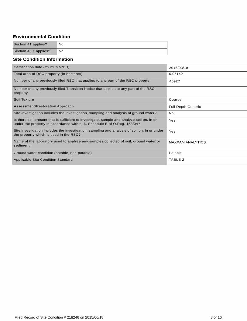
Environmental ConditionSection 41 applies? No
Section 43.1 applies? No
Site Condition InformationCertification date (YYYY/MM/DD) 2015/03/18
Total area of RSC property (in hectares) 0.05142
Number of any previously filed RSC that applies to any part of the RSC property 45927
Number of any previously filed Transition Notice that applies to any part of the RSC property
Soil Texture Coarse
Assessment/Restoration Approach Full Depth Generic
Site investigation includes the investigation, sampling and analysis of ground water? No
Is there soil present that is sufficient to investigate, sample and analyze soil on, in or under the property in accordance with s. 6, Schedule E of O.Reg. 153/04?
Yes
Site investigation includes the investigation, sampling and analysis of soil on, in or under the property which is used in the RSC?
Yes
Name of the laboratory used to analyze any samples collected of soil, ground water or sediment
MAXXAM ANALYTICS
Ground water condition (potable, non-potable) Potable
Applicable Site Condition Standard TABLE 2
8 of 16Filed Record of Site Condition # 218246 on 2015/06/18
Table 1 – Maximum Contaminant Concentrations Compared to Applicable Site Condition Standards
Measured Concentration for Contaminants in Soil
ContaminantName
Maximum Concentration
Applicable Site Condition Standard
Unit of Measure
1 Antimony < 0.2 7.5 µg/g
2 Arsenic 2.9 18 µg/g
3 Selenium < 0.5 2.4 µg/g
4 Barium 61 390 µg/g
5 Beryllium 0.48 4 µg/g
6 Boron (total) 7.9 120 µg/g
7 Cadmium 0.17 1.2 µg/g
8 Chromium Total 16 160 µg/g
9 Cobalt 7.9 22 µg/g
10 Copper 18 140 µg/g
11 Lead 11 120 µg/g
12 Molybdenum < 0.5 6.9 µg/g
13 Nickel 16 100 µg/g
14 Silver < 0.2 20 µg/g
15 Thallium 0.12 1 µg/g
16 Uranium 0.44 23 µg/g
17 Vanadium 24 86 µg/g
18 Zinc 64 340 µg/g
19 Electrical Conductivity 0.28 0.7 mS/cm
20 Sodium Adsorption Ratio 1.5 5
21 Benzene < 0.02 0.21 µg/g
22 Ethylbenzene < 0.02 1.1 µg/g
23 Toluene < 0.02 2.3 µg/g
24 Xylene Mixture < 0.04 3.1 µg/g
25 Petroleum Hydrocarbons F1**** < 10 55 µg/g
26 Petroleum Hydrocarbons F2 < 10 98 µg/g
27 Petroleum Hydrocarbons F3 < 50 300 µg/g
28 Petroleum Hydrocarbons F4 < 50 2800 µg/g
29 Acenaphthene < 0.005 7.9 µg/g
30 Acenaphthylene < 0.005 0.15 µg/g
31 Anthracene < 0.005 0.67 µg/g
32 Benz[a]anthracene < 0.005 0.5 µg/g
33 Benzo[a]pyrene < 0.005 0.3 µg/g
34 Benzo[b]fluoranthene < 0.005 0.78 µg/g
35 Benzo[ghi]perylene < 0.005 6.6 µg/g
...Continued on next page
9 of 16Filed Record of Site Condition # 218246 on 2015/06/18
Table 1 – Maximum Contaminant Concentrations Compared to Applicable Site Condition Standards
Measured Concentration for Contaminants in Soil
Continued from previous page....
ContaminantName
Maximum Concentration
Applicable Site Condition Standard
Unit of Measure
36 Benzo[k]fluoranthene < 0.005 0.78 µg/g
37 Chrysene < 0.005 7 µg/g
38 Dibenz[a h]anthracene < 0.005 0.1 µg/g
39 Fluoranthene < 0.005 0.69 µg/g
40 Fluorene < 0.005 62 µg/g
41 Indeno[1 2 3-cd]pyrene < 0.005 0.38 µg/g
42 Methlynaphthalene, 2-(1-) *** < 0.0071 0.99 µg/g
43 Naphthalene < 0.005 0.6 µg/g
44 Phenanthrene < 0.005 6.2 µg/g
45 Pyrene < 0.005 78 µg/g
46 Aldrin < 0.002 0.05 µg/g
47 Chlordane < 0.002 0.05 µg/g
48 DDD < 0.002 3.3 µg/g
49 DDE < 0.002 0.26 µg/g
50 DDT < 0.002 1.4 µg/g
51 Dieldrin < 0.002 0.05 µg/g
52 Endosulfan < 0.002 0.04 µg/g
53 Endrin < 0.002 0.04 µg/g
54 Heptachlor < 0.002 0.15 µg/g
55 Heptachlor Epoxide < 0.002 0.05 µg/g
56 Hexachlorobenzene < 0.002 0.52 µg/g
57 Hexachlorobutadiene < 0.005 0.012 µg/g
58 Hexachlorocyclohexane Gamma- < 0.002 0.056 µg/g
59 Hexachloroethane < 0.005 0.089 µg/g
60 Methoxychlor < 0.002 0.13 µg/g
10 of 16Filed Record of Site Condition # 218246 on 2015/06/18
Remedial Action and Mitigation
Remediated Soils
Estimated quantities of the soil, if any, originating at and remaining on the RSC property that have been remediated, at a location either on or off the property, to reduce the concentration of contaminants in the soil. Indicate the remediation process or processes used and the estimated amount of soil remediated by each identified process.
Soil Remediation Process Estimated Quantity of Soil (in-ground volume in m³)
Description of Remediation
Description of any action taken to reduce the concentration of contaminants (including soil removals) on, in or under the RSC property.
Soil or Sediment Removed and Not Returned
Estimated quantities of soil or sediment, if any, removed from and not returned to the RSC property.
Estimated Quantity of Soil (in-ground volume in m³)
Estimated Quantity of Sediment (in-ground volume in m³)
Soil Brought to the Property
Estimated quantity of the soil, if any, being brought from another property to and deposited at the RSC property, not including any soil that may have originated at but been remediated off the RSC property and that is identified in section 28 of Schedule A.
Estimated Quantity of Soil Brought to the Property(in-ground volume in m³)
11 of 16Filed Record of Site Condition # 218246 on 2015/06/18
Ground Water Control or Treatment Measures
Ground water control or treatment measures that were required for the RSC property prior to the certification date for the purpose of submitting the RSC for filing.
Ground water control or treatment measures that are required for the RSC property after the certification date.
Estimated volume of ground water, if any, removed from and not returned to the RSC property.
Estimated Volume of Ground Water (in litres)
12 of 16Filed Record of Site Condition # 218246 on 2015/06/18
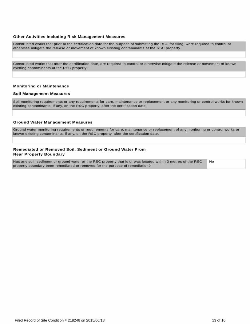
Other Activities Including Risk Management Measures
Constructed works that prior to the certification date for the purpose of submitting the RSC for filing, were required to control or otherwise mitigate the release or movement of known existing contaminants at the RSC property.
Constructed works that after the certification date, are required to control or otherwise mitigate the release or movement of known existing contaminants at the RSC property.
Monitoring or Maintenance
Soil Management Measures
Soil monitoring requirements or any requirements for care, maintenance or replacement or any monitoring or control works for known existing contaminants, if any, on the RSC property, after the certification date.
Ground Water Management Measures
Ground water monitoring requirements or requirements for care, maintenance or replacement of any monitoring or control works or known existing contaminants, if any, on the RSC property, after the certification date.
Remediated or Removed Soil, Sediment or Ground Water From Near Property Boundary
Has any soil, sediment or ground water at the RSC property that is or was located within 3 metres of the RSC property boundary been remediated or removed for the purpose of remediation?
No
13 of 16Filed Record of Site Condition # 218246 on 2015/06/18
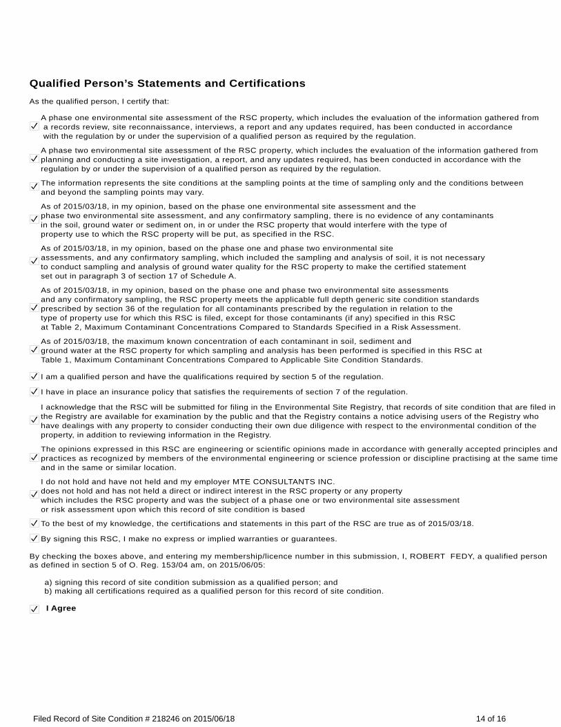
Qualified Person’s Statements and CertificationsAs the qualified person, I certify that:
A phase one environmental site assessment of the RSC property, which includes the evaluation of the information gathered from a records review, site reconnaissance, interviews, a report and any updates required, has been conducted in accordance with the regulation by or under the supervision of a qualified person as required by the regulation.
A phase two environmental site assessment of the RSC property, which includes the evaluation of the information gathered from planning and conducting a site investigation, a report, and any updates required, has been conducted in accordance with the regulation by or under the supervision of a qualified person as required by the regulation.
The information represents the site conditions at the sampling points at the time of sampling only and the conditions between and beyond the sampling points may vary.
As of 2015/03/18, in my opinion, based on the phase one environmental site assessment and the phase two environmental site assessment, and any confirmatory sampling, there is no evidence of any contaminants in the soil, ground water or sediment on, in or under the RSC property that would interfere with the type of property use to which the RSC property will be put, as specified in the RSC.
As of 2015/03/18, in my opinion, based on the phase one and phase two environmental site assessments, and any confirmatory sampling, which included the sampling and analysis of soil, it is not necessary to conduct sampling and analysis of ground water quality for the RSC property to make the certified statement set out in paragraph 3 of section 17 of Schedule A.
As of 2015/03/18, in my opinion, based on the phase one and phase two environmental site assessments and any confirmatory sampling, the RSC property meets the applicable full depth generic site condition standards prescribed by section 36 of the regulation for all contaminants prescribed by the regulation in relation to the type of property use for which this RSC is filed, except for those contaminants (if any) specified in this RSC at Table 2, Maximum Contaminant Concentrations Compared to Standards Specified in a Risk Assessment.
As of 2015/03/18, the maximum known concentration of each contaminant in soil, sediment and ground water at the RSC property for which sampling and analysis has been performed is specified in this RSC at Table 1, Maximum Contaminant Concentrations Compared to Applicable Site Condition Standards.
I am a qualified person and have the qualifications required by section 5 of the regulation.
I have in place an insurance policy that satisfies the requirements of section 7 of the regulation.
I acknowledge that the RSC will be submitted for filing in the Environmental Site Registry, that records of site condition that are filed in the Registry are available for examination by the public and that the Registry contains a notice advising users of the Registry who have dealings with any property to consider conducting their own due diligence with respect to the environmental condition of the property, in addition to reviewing information in the Registry.
The opinions expressed in this RSC are engineering or scientific opinions made in accordance with generally accepted principles and practices as recognized by members of the environmental engineering or science profession or discipline practising at the same time and in the same or similar location.
I do not hold and have not held and my employer MTE CONSULTANTS INC.does not hold and has not held a direct or indirect interest in the RSC property or any property which includes the RSC property and was the subject of a phase one or two environmental site assessmentor risk assessment upon which this record of site condition is based
To the best of my knowledge, the certifications and statements in this part of the RSC are true as of 2015/03/18.
By signing this RSC, I make no express or implied warranties or guarantees.
By checking the boxes above, and entering my membership/licence number in this submission, I, ROBERT FEDY, a qualified person as defined in section 5 of O. Reg. 153/04 am, on 2015/06/05:
a) signing this record of site condition submission as a qualified person; and b) making all certifications required as a qualified person for this record of site condition.
I Agree
14 of 16Filed Record of Site Condition # 218246 on 2015/06/18
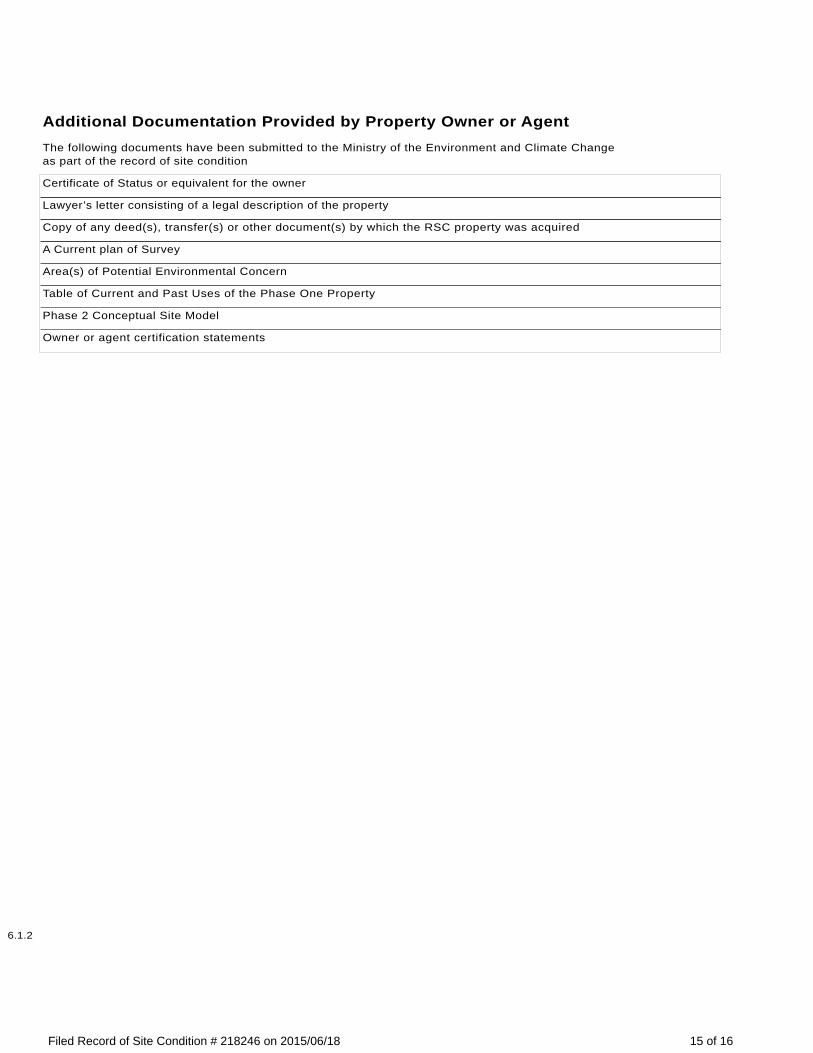
Additional Documentation Provided by Property Owner or AgentThe following documents have been submitted to the Ministry of the Environment and Climate Changeas part of the record of site condition
Certificate of Status or equivalent for the owner
Lawyer’s letter consisting of a legal description of the property
Copy of any deed(s), transfer(s) or other document(s) by which the RSC property was acquired
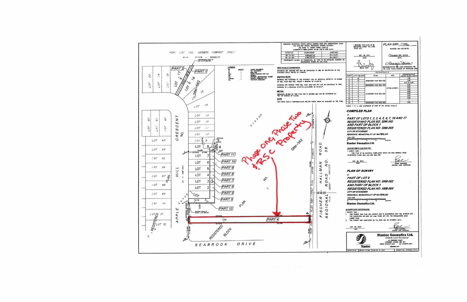
A Current plan of Survey
Area(s) of Potential Environmental Concern
Table of Current and Past Uses of the Phase One Property
Phase 2 Conceptual Site Model
Owner or agent certification statements
6.1.2
15 of 16Filed Record of Site Condition # 218246 on 2015/06/18
16 of 16Filed Record of Site Condition # 218246 on 2015/06/18

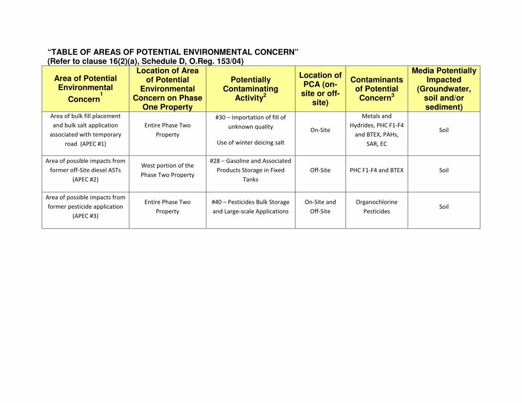
“TABLE OF AREAS OF POTENTIAL ENVIRONMENTAL CONCERN” (Refer to clause 16(2)(a), Schedule D, O.Reg. 153/04)
Area of Potential Environmental
Concern1
Location of Area of Potential
Environmental Concern on Phase
One Property
Potentially Contaminating
Activity2
Location of PCA (on-
site or off-site)
Contaminants of Potential Concern3
Media Potentially Impacted
(Groundwater, soil and/or sediment)
Area of bulk fill placement
and bulk salt application
associated with temporary
road (APEC #1)
Entire Phase Two
Property
#30 – Importation of fill of
unknown quality
Use of winter deicing salt
On-Site
Metals and
Hydrides, PHC F1-F4
and BTEX, PAHs,
SAR, EC
Soil
Area of possible impacts from
former off-Site diesel ASTs
(APEC #2)
West portion of the
Phase Two Property
#28 – Gasoline and Associated
Products Storage in Fixed
Tanks
Off-Site PHC F1-F4 and BTEX Soil
Area of possible impacts from
former pesticide application
(APEC #3)
Entire Phase Two
Property
#40 – Pesticides Bulk Storage
and Large-scale Applications
On-Site and
Off-Site
Organochlorine
Pesticides Soil
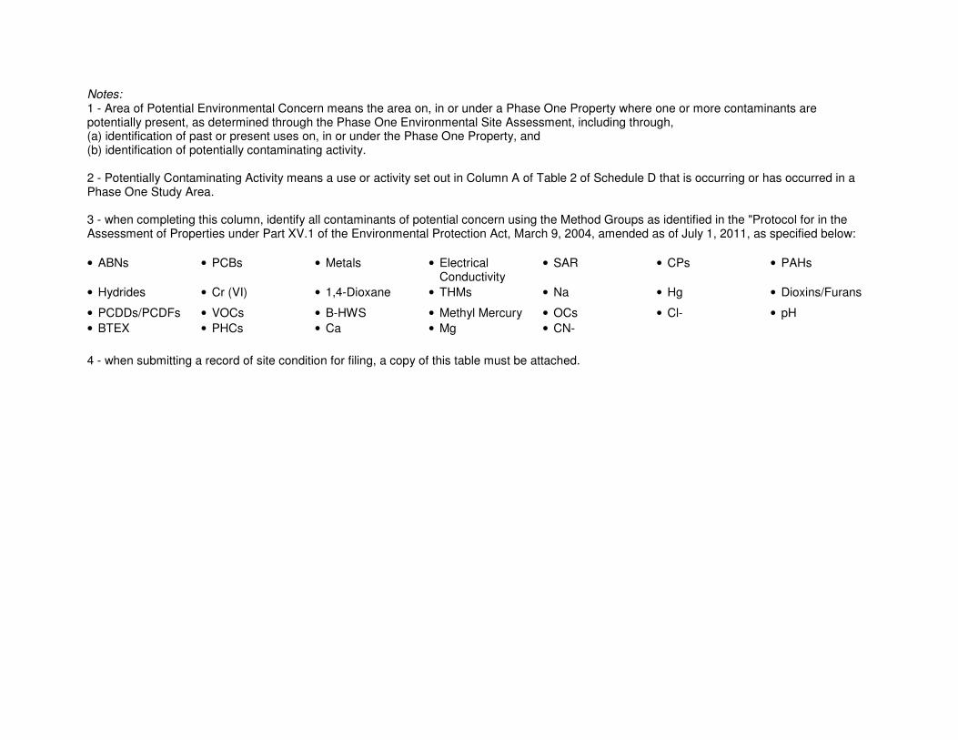
Notes:
1 - Area of Potential Environmental Concern means the area on, in or under a Phase One Property where one or more contaminants are potentially present, as determined through the Phase One Environmental Site Assessment, including through, (a) identification of past or present uses on, in or under the Phase One Property, and (b) identification of potentially contaminating activity. 2 - Potentially Contaminating Activity means a use or activity set out in Column A of Table 2 of Schedule D that is occurring or has occurred in a Phase One Study Area. 3 - when completing this column, identify all contaminants of potential concern using the Method Groups as identified in the "Protocol for in the Assessment of Properties under Part XV.1 of the Environmental Protection Act, March 9, 2004, amended as of July 1, 2011, as specified below:
• ABNs • PCBs • Metals • Electrical Conductivity
• SAR
• CPs • PAHs
• Hydrides • Cr (VI) • 1,4-Dioxane • THMs • Na • Hg • Dioxins/Furans
• PCDDs/PCDFs • VOCs • B-HWS • Methyl Mercury • OCs • Cl- • pH
• BTEX • PHCs • Ca • Mg • CN-
4 - when submitting a record of site condition for filing, a copy of this table must be attached.
SUMMARY OF CURRENT AND PAST USES OF THE RSC PROPERTY – TEMPORARY ROAD, TRILLIUM COMMUNITY SUBDIVISION, KITCHENER, ON
Year Name of Owner Description of Property
Use Property Use
1
Other Observations from Aerial
Photographs,
Fire Insurance Plans, Etc.
1798 – 1801 James Wilson
Agricultural Agricultural
Title Search prepared by Mr. Armand
Simo of Title Search Services. Compiled
on March 31, 2005 for AME – Materials
Engineering for 2005 Phase I ESA.
1798 – 1804 St. John B. Rosseau
1798 – 1805 Richard Beasley
1805 James Erb
1805 – 1833 John Eby
1833 – 1855 Benjamin Eby
1855 – 1861 Francis Amend
1861 – 1881 George Amend
1881 – 1917 George Wanner
1917 – 1995 Austin G. Hewitt
Agricultural Agricultural
The first developed use of the Phase
One Property was mid-1940s when
synthetic pesticides could have been
available commercially in Canada and
could have been applied to agricultural
crops.
This was determined through aerial
photography, Title Search and research
into the development of synthetic
pesticides.
1933 – 1995 Agnes Hewitt
1995 – 2004 Arthur Hewitt and Evelynn
Hewitt
Agricultural Agricultural
Earthworks and grading of the property
commenced in 2012.
Determined through Abbreviated Parcel
Registry and Transfer Deed provided by
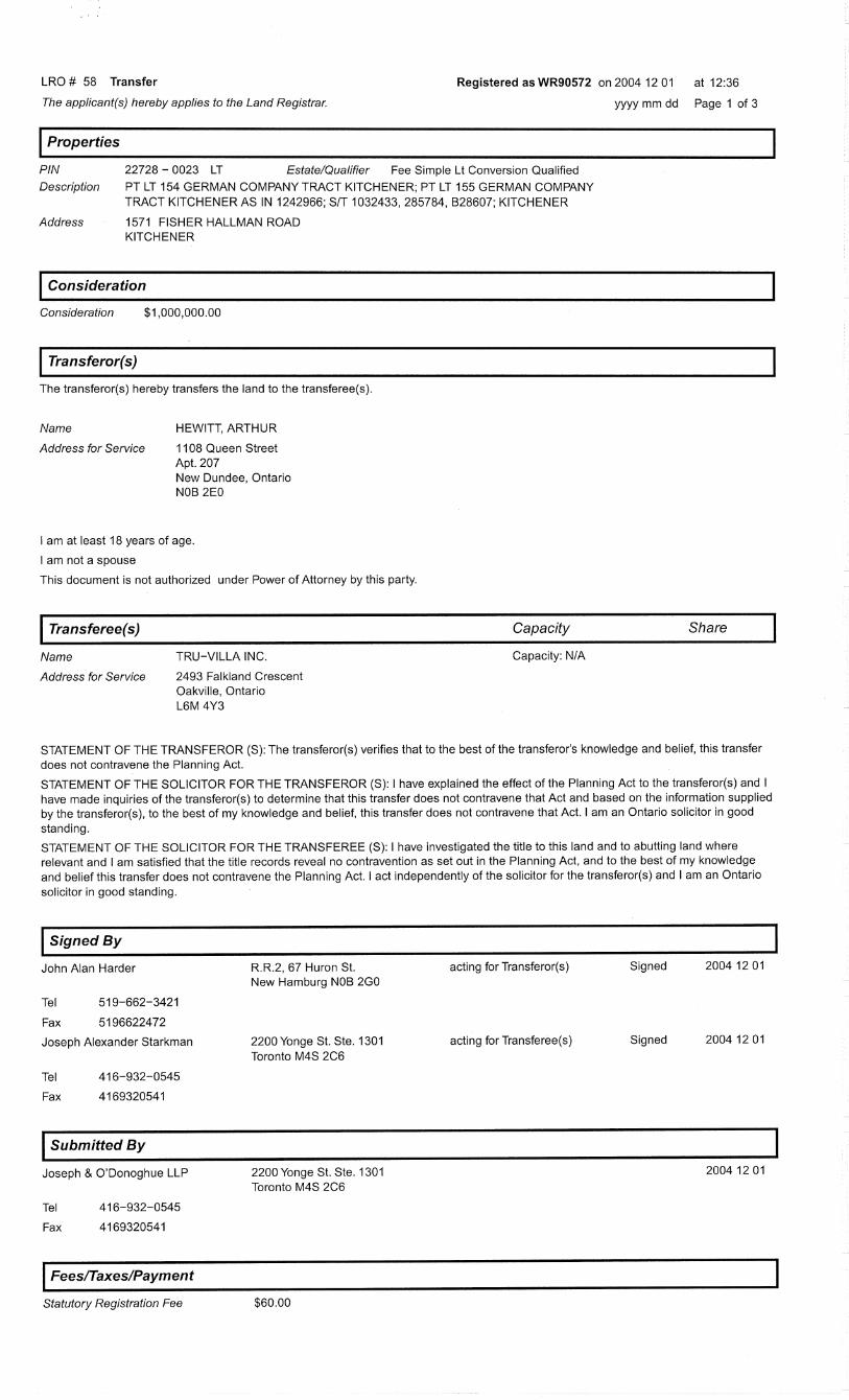
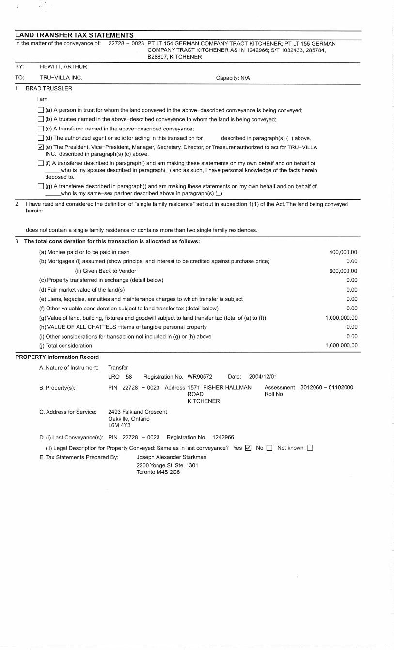
Mr. Jack West, OLS., Title Search, 2004 – 2014 Tru-Villa Inc.
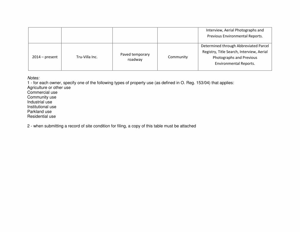
Interview, Aerial Photographs and
Previous Environmental Reports.
2014 – present Tru-Villa Inc. Paved temporary
roadway Community
Determined through Abbreviated Parcel
Registry, Title Search, Interview, Aerial
Photographs and Previous
Environmental Reports.
Notes:
1 - for each owner, specify one of the following types of property use (as defined in O. Reg. 153/04) that applies: Agriculture or other use Commercial use Community use Industrial use Institutional use Parkland use Residential use 2 - when submitting a record of site condition for filing, a copy of this table must be attached
1
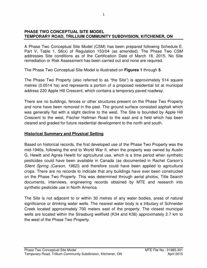
Phase Two Conceptual Site Model MTE File No.: 31985-301 Temporary Road, Trillium Community Subdivision, Kitchener, ON April 2015
PHASE TWO CONCEPTUAL SITE MODEL TEMPORARY ROAD, TRILLIUM COMMUNITY SUBDIVISION, KITCHENER, ON
A Phase Two Conceptual Site Model (CSM) has been prepared following Schedule E, Part V, Table 1, S6(x) of Regulation 153/04 (as amended). The Phase Two CSM addresses Site conditions as of the Certification Date of March 18, 2015. No Site remediation or Risk Assessment has been carried out and none are required. The Phase Two Conceptual Site Model is illustrated on Figures 1 through 5.
The Phase Two Property (also referred to as “the Site”) is approximately 514 square
metres (0.0514 ha) and represents a portion of a proposed residential lot at municipal
address 220 Apple Hill Crescent, which contains a temporary paved roadway.
There are no buildings, fences or other structures present on the Phase Two Property
and none have been removed in the past. The ground surface consisted asphalt which
was generally flat with a slight decline to the west. The Site is bounded by Apple Hill
Crescent to the west, Fischer Hallman Road to the east and a field which has been
cleared and graded for future residential development to the north and south.
Historical Summary and Physical Setting
Based on historical records, the first developed use of the Phase Two Property was the
mid-1940s, following the end to World War II, when the property was owned by Austin
G. Hewitt and Agnes Hewitt for agricultural use, which is a time period when synthetic
pesticides could have been available in Canada (as documented in Rachel Carson’s
Silent Spring (Carson, 1962)) and therefore could have been applied to agricultural
crops. There are no records to indicate that any buildings have ever been constructed
on the Phase Two Property. This was determined through aerial photos, Title Search
documents, interviews, engineering records obtained by MTE and research into
synthetic pesticide use in North America.
The Site is not adjacent to or within 30 metres of any water bodies, areas of natural
significance or drinking water wells. The nearest water body is a tributary of Schneider
Creek located approximately 700 meters east of the property. The closest municipal
wells are located within the Strasburg wellfield (K34 and K36) approximately 2.7 km to
the west of the Phase Two Property.
2
Phase Two Conceptual Site Model MTE File No.: 31985-301 Temporary Road, Trillium Community Subdivision, Kitchener, ON April 2015
MTE reviewed Grand River Conservation Authority (GRCA) online mapping and the
Official Plan of the Region of Waterloo, June 2009, for information regarding important
natural and cultural resources in the Study Area. The following pertinent information for
the Phase Two Property was noted:
• The Phase Two Property is not located within a regulated floodplain;
• There are no Wooded Area located within the Phase Two Study Area;
• There are no heritage features on or within 30 metres of the Phase Two Property;
• There are no wetlands on or within 30 metres of the Phase Two Property; and
• There are no Areas of Natural or Scientific Interest on or within 30 metres of the Phase Two Property.
i. (A) Potentially Contaminating Activities
MTE identified the following potentially contaminating activities (PCAs) at the Phase
Two Property which represent a potential environmental concern:
Potentially Contaminating Activity Basis
30. Importation of fill material of unknown quality
Imported fill associated with the construction of the temporary paved roadway.
40. Pesticides Bulk Storage and Large-Scale Applications
Possible pesticide use associated with historical farming operations.
Road salt for winter deicing of temporary roadway
Temporary roadway was ploughed and maintained during winter.
MTE identified the following potentially contaminating activities within the Phase Two
Study Area, which represent potential environmental concern to the property:
Potentially Contaminating Activity Basis
28. Gasoline and Associated Products Storage in Fixed Tanks
In 2014, two diesel ASTs were located in vicinity to a construction trailer south of the Phase Two Property. Two diesel ASTs associated with the farmstead were located northwest of the Phase Two Property.
40. Pesticides Bulk Storage and Large-Scale Applications
Possible pesticide use associated with historical farming operations.
The QPESA determined that the barn fire in 1955 to the northwest of the Phase Two
Property does not represent an environmental concern since that area has been fully
developed for residential use.
3
Phase Two Conceptual Site Model MTE File No.: 31985-301 Temporary Road, Trillium Community Subdivision, Kitchener, ON April 2015
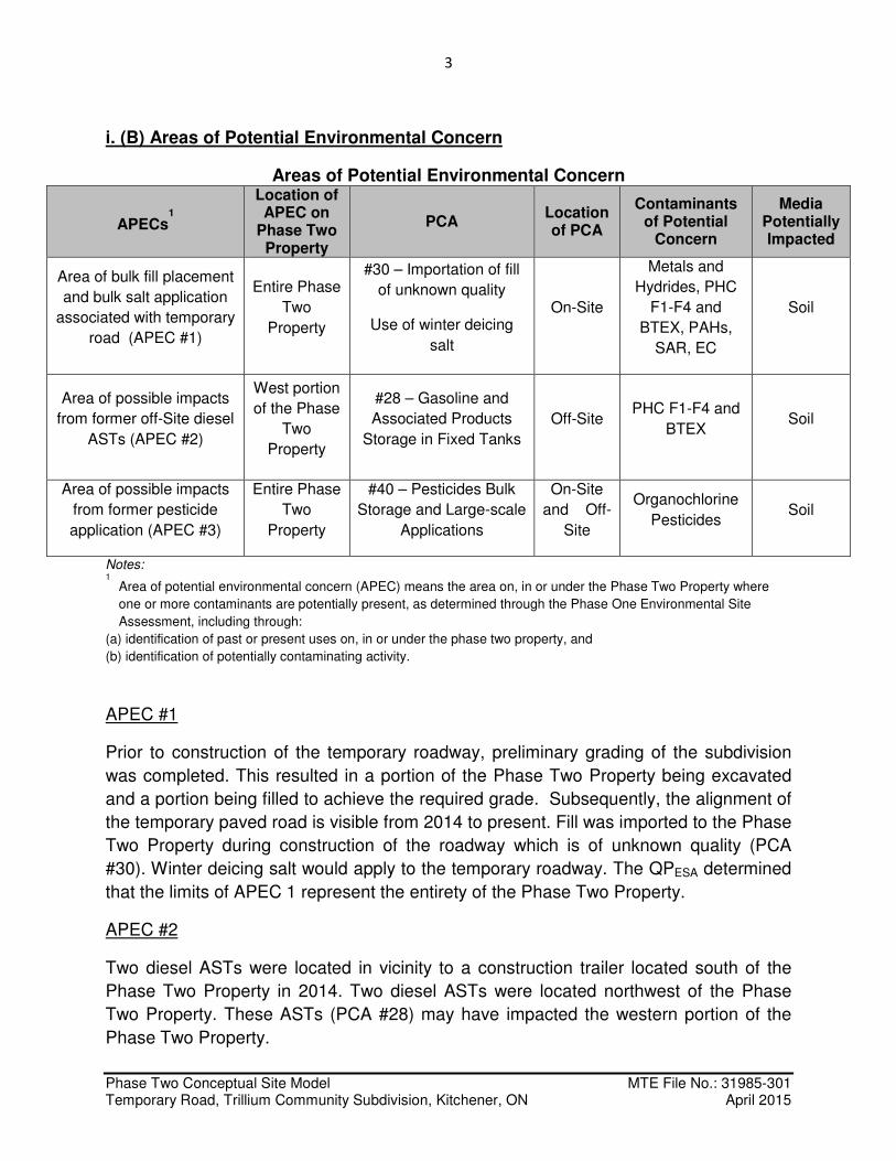
i. (B) Areas of Potential Environmental Concern
Areas of Potential Environmental Concern
APECs1
Location of APEC on
Phase Two Property
PCA Location of PCA
Contaminants of Potential
Concern
Media Potentially Impacted
Area of bulk fill placement
and bulk salt application
associated with temporary
road (APEC #1)
Entire Phase
Two
Property
#30 – Importation of fill
of unknown quality
Use of winter deicing
salt
On-Site
Metals and
Hydrides, PHC
F1-F4 and
BTEX, PAHs,
SAR, EC
Soil
Area of possible impacts
from former off-Site diesel
ASTs (APEC #2)
West portion
of the Phase
Two
Property
#28 – Gasoline and
Associated Products
Storage in Fixed Tanks
Off-Site PHC F1-F4 and
BTEX Soil
Area of possible impacts
from former pesticide
application (APEC #3)
Entire Phase
Two
Property
#40 – Pesticides Bulk
Storage and Large-scale
Applications
On-Site
and Off-
Site
Organochlorine
Pesticides Soil
Notes: 1
Area of potential environmental concern (APEC) means the area on, in or under the Phase Two Property where
one or more contaminants are potentially present, as determined through the Phase One Environmental Site
Assessment, including through:
(a) identification of past or present uses on, in or under the phase two property, and
(b) identification of potentially contaminating activity.
APEC #1
Prior to construction of the temporary roadway, preliminary grading of the subdivision
was completed. This resulted in a portion of the Phase Two Property being excavated
and a portion being filled to achieve the required grade. Subsequently, the alignment of
the temporary paved road is visible from 2014 to present. Fill was imported to the Phase
Two Property during construction of the roadway which is of unknown quality (PCA
#30). Winter deicing salt would apply to the temporary roadway. The QPESA determined
that the limits of APEC 1 represent the entirety of the Phase Two Property.
APEC #2
Two diesel ASTs were located in vicinity to a construction trailer located south of the
Phase Two Property in 2014. Two diesel ASTs were located northwest of the Phase
Two Property. These ASTs (PCA #28) may have impacted the western portion of the
Phase Two Property.
4
Phase Two Conceptual Site Model MTE File No.: 31985-301 Temporary Road, Trillium Community Subdivision, Kitchener, ON April 2015
APEC #3
The Phase Two Property was within a larger farmstead from as early as the mid-1940s
to 2012. Additionally, farmsteads were present at the surrounding properties from as
early as the mid-1940s to 2012. It is possible that organochlorine pesticides (PCA #40)
were applied to the Phase Two Property and adjacent properties during this time and
may have impacted any portion of the Phase Two Property.
During the Phase Two ESA, MTE commissioned the excavation of four (4) test trenches
to examine APECs and COPCs. The investigation was carried out in accordance with
the Sampling and Analysis Plan, and included the collection of soil duplicates.
The following soil samples were submitted for analysis from the Phase Two Property:
• PHC F1-F4 and BTEX (4 soil samples);
• OC Pesticides (2 soil samples);
• PAHs (1 soil sample);
• Metals and Hydrides (5 soil samples, including one duplicate);
• SAR and EC (4 soil samples); and
• Soil pH (3 soil samples)
Laboratory Certificates of Analysis from all soil samples submitted for analysis have
been received by MTE and are included in the Phase Two ESA report. The lab reports
meet the requirements of S.47 (2b) and (3) of Ontario Regulation 153/04 (as amended) and
are authorized for release by the lab managers.
The QA/QC results indicate that field sampling and lab protocols were satisfactory. No
samples have been rejected by the laboratory. No samples have been rejected by the
QPESA. The QPESA is satisfied that the overall objectives of the investigation were met
and that the data set has allowed appropriate decisions to be made regarding the
environmental conditions of the Site.
i. (C) Subsurface Structures and Utilities
No services are currently installed on the Phase Two Property. The presence of buried
utilities (hydro, water and sewers) along Apple Hill Crescent and Seabrook Drive are
unlikely to interact with groundwater based upon review of civil engineering drawings
and the depth to groundwater being greater than 3.7 metres (the maximum depth
explored during the Phase Two ESA investigation).
5
Phase Two Conceptual Site Model MTE File No.: 31985-301 Temporary Road, Trillium Community Subdivision, Kitchener, ON April 2015
ii. (A) Stratigraphy
Soil conditions encountered across the Site during this investigation typically included
engineered sand and gravel fill ranging from 0.45 to 1.2 metres underlain by native
sandy silt and/or silt to the maximum depth explored of 3.7 metres. Bedrock or
saturated conditions were not encountered. There were no noticeable odours or staining
in the soil to the depths explored and no evidence of buried waste, debris or deleterious
material was observed. No aquifers were encountered and none were investigated.
ii. (B) Hydrogeological Characteristics
Groundwater investigation was not completed as part of this Phase Two ESA.
The shallow groundwater flow direction is surmised to be easterly towards a tributary of
Schneider Creek, which is 700 m from the Phase Two Property.
The Strasburg wellfield consisting of production wells K34 and K36 is located
approximately 2.7 km to the west of the Phase Two Property. The Mannheim East
wellfield comprising production wells K21, K25 and K29 is located approximately 2.8
metres to the southeast of the Phase Two Property. The wells within the Strasburg
wellfield are screened at depths ranging from approximately 28 to 50 metres below
ground surface within Deep Overburden Aquifer. This is overlain by an extensive
confining to semi-confining aquitard unit consisting of the Maryhill and Catfish Creek Till
with the Shallow Overburden Aquifer identified at ground surface. The wells within the
Mannheim East wellfield are screened at depths ranging from approximately 30 to 52
metres below ground surface within Aquifer 1. This corresponds to the Shallow
Overburden aquifer and outcrops at various locations and is often separated into upper
and lower Aquifer systems through the presence of a discontinuous fine-grained
aquatard unit. Wells are generally screened below this aquatard unit, just above the
Maryhill Till (Lake Erie Source Protection Committee, 2012).
ii. (C) Approximate Depth to Bedrock
Bedrock was not encountered to the maximum depth of drilling of 3.7 m bgs. Based on
MOE well records for the Phase Two Study Area, the depth to bedrock is greater than
100 m bgs.
6
Phase Two Conceptual Site Model MTE File No.: 31985-301 Temporary Road, Trillium Community Subdivision, Kitchener, ON April 2015
ii. (D) Approximate Depth to Water Table
Groundwater investigation was not completed as part of this Phase Two ESA.
Based on the previous geotechnical and hydrogeological investigations completed for a
larger land holding (inclusive of the Phase Two Property), groundwater in the area of
the Phase Two Property is typically between 5 and 10 metres.
ii. (E) Section 41 or 43.1 of Ontario Regulation 153/04 (as amended)
Investigations of the property have confirmed that more than 2 m of overburden is
present above bedrock; therefore, it is not a shallow soil condition. There are no surface
water bodies on or within 30 m of the property; therefore, it is not in proximity to a water
body. The property is not within 30 m of an area of natural significance and soil pH is
within the acceptable range; therefore, it is not considered to be a “Sensitive Site” under
Ontario Regulation 153/04 (as amended).
The Phase Two Property is not located within a designated Source Water Protection
Area; however groundwater in the Region of Waterloo is used for drinking water
purposes. The current use of the Phase Two Property is community. The proposed
future use of the Phase Two Property is residential. Accordingly, the analytical results
for all soil samples have been compared to Table 2 of the MOE Soil, Groundwater and
Sediment Standards for Use Under Part XV.1 of the Environmental Protection Act, April
15, 2011 for residential use and coarse textured soil. MOE 2011 Standards are based
on updated science and are protective of human health and ecosystems.
ii. (F) Soil Brought to the Phase Two Property
No soil has been brought to the property during the Phase Two ESA.
ii. (G) Proposed Buildings and Other Structures
The Phase Two Property is currently used as a temporary roadway, which is a
community land use. The proposed redevelopment of the Site is anticipated to be a
residential condominium; however no actual building drawings have been prepared at
this time.
7
Phase Two Conceptual Site Model MTE File No.: 31985-301 Temporary Road, Trillium Community Subdivision, Kitchener, ON April 2015
iii-iv. Areas of Impact (Subparagraphs A-I)
The QPESA has determined that there were no parameters measured above the MOE
2011 Table 2 Standards in soil for the samples submitted for analysis. Therefore, the
QPESA has concluded there are no compounds at the Phase Two Property that are
considered Contaminants of Concern (COCs) in soil.
v. Contaminant Release Mechanisms, Transport, Receptors and Exposure
No Contaminants of Concern were identified on the Phase Two Property and
accordingly, no receptors or exposure pathways were considered.
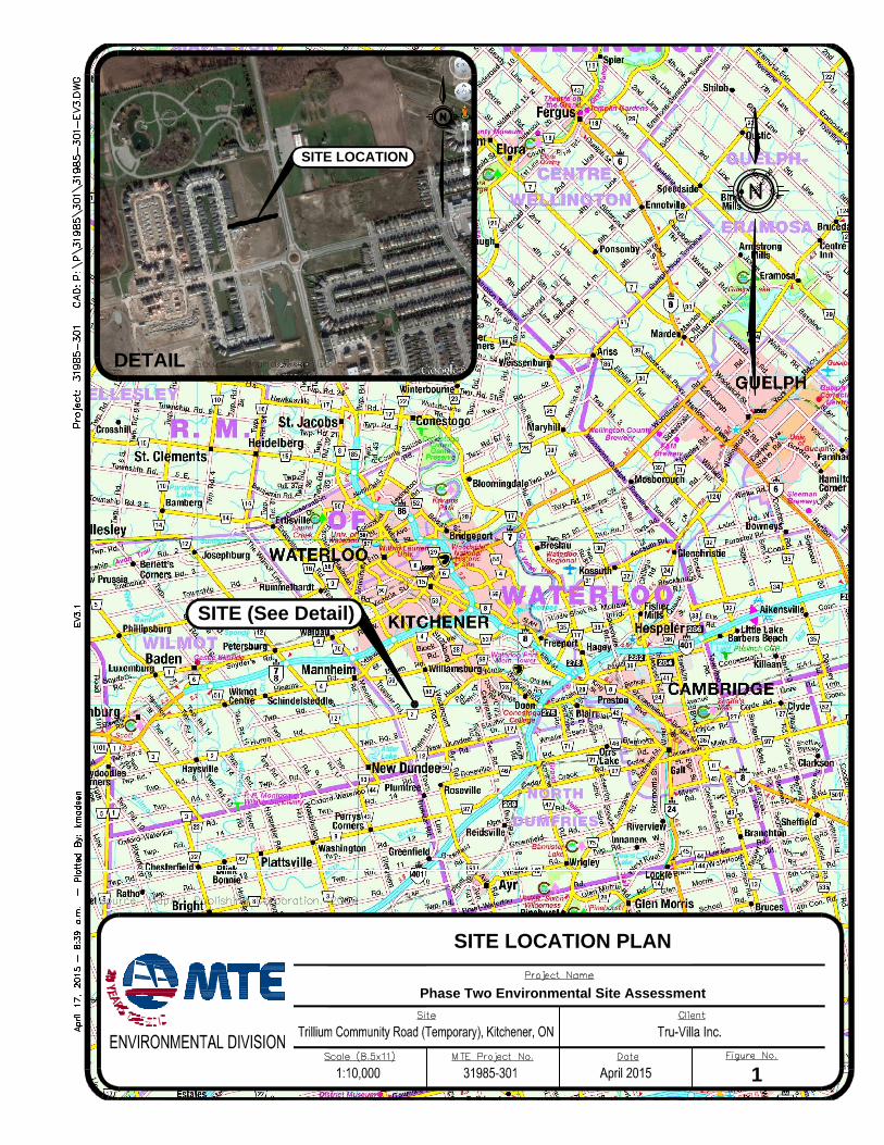
DETAIL
SITE (See Detail)
SITE LOCATION PLAN
Phase Two Environmental Site Assessment
1
SITE LOCATION
Phase Two Environmental Site Assessment
SITE LAYOUT AND FEATURES
2
Paved Temporary Road
Limits of Phase One, Two & RSC Property Boundary
4.0m
126.5m
Residential
Residential
Residential
Sanitary Sewer
Hydro
Water
Utilities
Storm Sewer
Test Trench (MTE 2015)
R
e
s
id
e
n
tia
l
Phase Two Environmental Site Assessment
AREAS OF POTENTIAL ENVIRONMENTAL CONCERN
3
FORMER PESTISIDE APPLICATION
LEGEND
FILL OF UNKNOWN QUALITY & BULKSALT APPLICATION ASSOCIATEDWITH THE TEMPORARY ROADWAYFORMER OFF-SITE DIESEL ASTs
Paved Temporary Road
Limits of Phase One, Two & RSC Property Boundary
4.0m
126.5m
TEST TRENCH (MTE 2015)
Phase Two Environmental Site Assessment
SAMPLING LOCATIONS
4
Paved Temporary Road
Limits of Phase One, Two & RSC Property Boundary
Test Trench (MTE 2015)
LEGEND
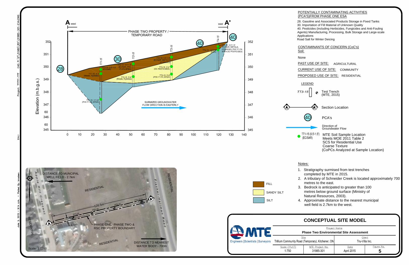
28. Gasoline and Associated Products Storage in Fixed Tanks30. Importation of Fill Material of Unknown Quality40. Pesticides (including Herbicides, Fungicides and Anti-FoulingAgents) Manufacturing, Processing, Bulk Storage and Large-scaleApplicationsRoad Salt for Winter Deicing
Notes:Stratigraphy surmised from test trenchescompleted by MTE in 2015.A tributary of Schneider Creek is located approximately 700metres to the east.Bedrock is anticipated to greater than 100metres below ground surface (Ministry ofNatural Resources, 2003).Approximate distance to the nearest municipalwell field is 2.7km to the west.
Section Location
LEGEND
PCA's40
POTENTIALLY CONTAMINATING ACTIVITIES(PCA'S)FROM PHASE ONE ESA
CONTAMINANTS OF CONCERN (CoC's)Soil:
AGRICULTURALPAST USE OF SITE:
RESIDENTIAL
CURRENT USE OF SITE:
PROPOSED USE OF SITE:
COMMUNITY
SILT
FILL
MTE Soil Sample LocationMeets MOE 2011 Table 2SCS for Residential UseCoarse Texture
None
(CoPCs Analyzed at Sample Location)
Test Trench(MTE, 2015)
1.
2.
3.
4.
CONCEPTUAL SITE MODEL
Phase Two Environmental Site Assessment
5
SANDY SILT
RESID
ENTIAL
RESIDENTIAL
RESID
ENTIAL
4.0m
126.5m
Scale- 1:1250
PHASE ONE, PHASE TWO &RSC PROPERTY BOUNDARY
28
30
4040
Direction of Groundwater Flow
RESIDENTIAL
DISTANCE TO MUNCIPALWELL FIELD - 2.7km
DISTANCE TO NEARESTWATER BODY - 700m