nps soil resources inventory - home | nrcs the soil resources of parks, and to prevent, to the...
TRANSCRIPT

Geologic Resources Division
NPS Soil Resources Inventory Update

Geologic Resources Division
• “The Service will actively seek to understand and preserve the soil resources of parks, and to prevent, to the extent possible, the unnatural erosion, physical removal, or contamination of the soil, or its contamination of other resources”.
• Excerpts from, NPS Management Policies 2001, Part 4.8.2.4 ‐ Soil Resource Management
NPS Soil Resources Management
Geologic Resources Division
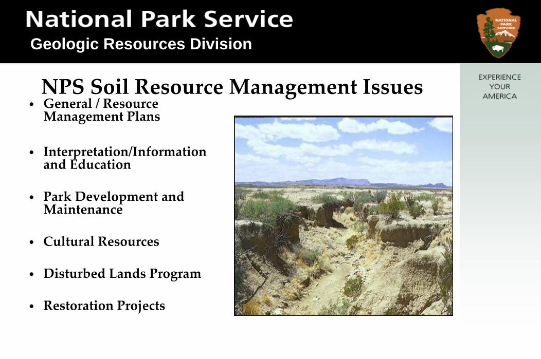
• General / Resource Management Plans
• Interpretation/Information and Education
• Park Development and Maintenance
• Cultural Resources
• Disturbed Lands Program
• Restoration Projects
NPS Soil Resource Management Issues

Geologic Resources Division
• Fire Management Plans/Fuel Reduction Program
• Threatened and Endangered Species
• Wetland Identification and Management
• Exotic/Invasive Plants
• Vital Signs Monitoring
NPS Soil Resource Management Issues

Geologic Resources Division
National Level
Park Acres 84.5 MillionNumber of Parks 270
Acres mapped thru FY07 24.5 Million (29%)Parks mapped thru FY07 140 (52%)
Alaska Acres 54 Million (64%)Alaska Parks 16 (6%)
Mapped = data that can be harvested from SDM
Geologic Resources Division
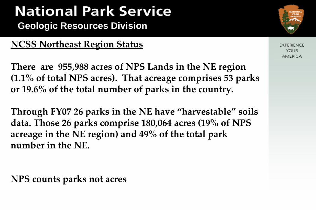
NCSS Northeast Region Status
There are 955,988 acres of NPS Lands in the NE region (1.1% of total NPS acres). That acreage comprises 53 parks or 19.6% of the total number of parks in the country.
Through FY07 26 parks in the NE have “harvestable” soils data. Those 26 parks comprise 180,064 acres (19% of NPS acreage in the NE region) and 49% of the total park number in the NE.
NPS counts parks not acres
Geologic Resources Division
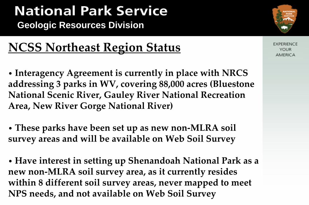
NCSS Northeast Region Status
• Interagency Agreement is currently in place with NRCS addressing 3 parks in WV, covering 88,000 acres (Bluestone National Scenic River, Gauley River National Recreation Area, New River Gorge National River)
• These parks have been set up as new non‐MLRA soil survey areas and will be available on Web Soil Survey
•Have interest in setting up Shenandoah National Park as a new non‐MLRA soil survey area, as it currently resides within 8 different soil survey areas, never mapped to meet NPS needs, and not available on Web Soil Survey

Geologic Resources Division
Opportunities for NPS Partnerships
• Interested in participating with MAPCOAST to pursue mapping of subaqueous soils in many of the NPS units in the NE Region
•NPS has been working with NCSS partners in other projects on our coastal parks to meet management needs
Geologic Resources Division
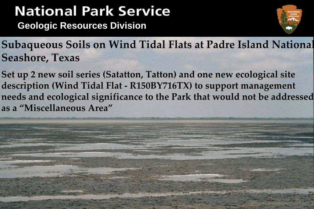
Subaqueous Soils on Wind Tidal Flats at Padre Island NationalSeashore, TexasSet up 2 new soil series (Satatton, Tatton) and one new ecological site description (Wind Tidal Flat ‐ R150BY716TX) to support management needs and ecological significance to the Park that would not be addressed as a “Miscellaneous Area”

Geologic Resources Division
Beaches were investigated and 4 different map units were developed based upon different parent materials ( big shell, little shell, mineral, etc.) as well as potential management issues such as trafficability.

Geologic Resources Division
A landform/soil classification/vegetative/hydrologic classification and characteristics genetic key was developed to not only to familiarize the soil scientists with the soils as they occur across the landscape, but will also be available to all users to help them visualize how these things are changing across a dynamic landscape.

Geologic Resources Division
A corresponding report was also developed from NASIS data to show these geomorphic and ecological relationships.

Geologic Resources Division
Gateway NRA- Sandy Hook Unit
Geologic Resources Division
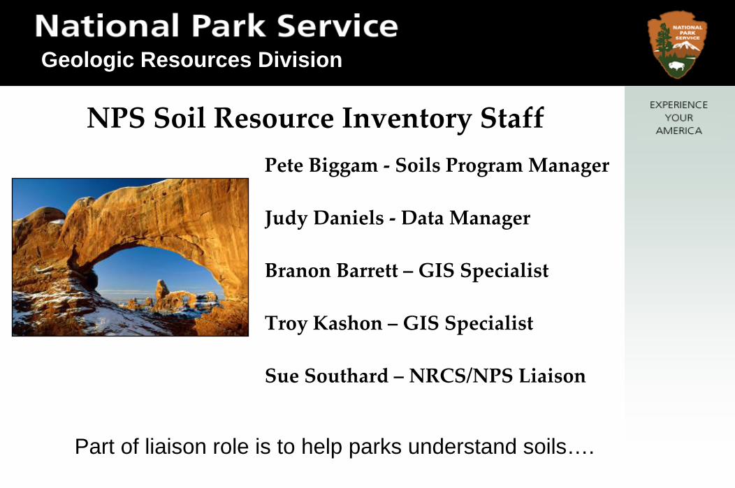
Pete Biggam ‐ Soils Program Manager
Judy Daniels ‐ Data Manager
Branon Barrett – GIS Specialist
Troy Kashon – GIS Specialist
Sue Southard – NRCS/NPS Liaison
NPS Soil Resource Inventory Staff
Part of liaison role is to help parks understand soils….
Geologic Resources Division
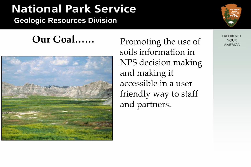
Promoting the use of soils information in NPS decision making and making it accessible in a user friendly way to staff and partners.
Our Goal……

Geologic Resources Division
Geologic Resources Division
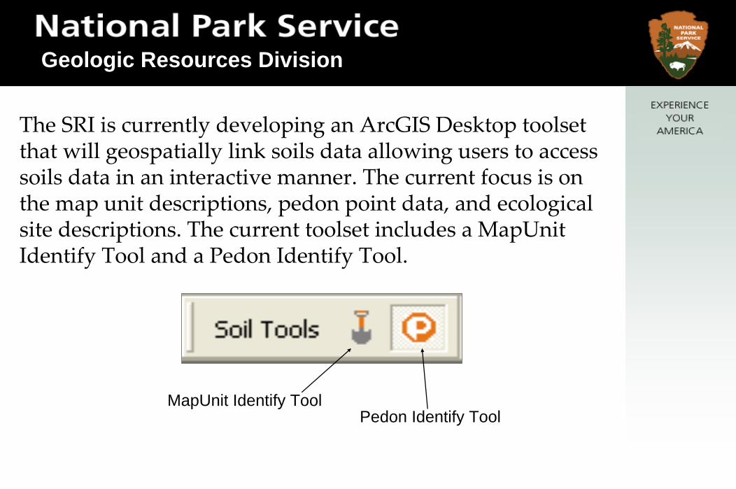
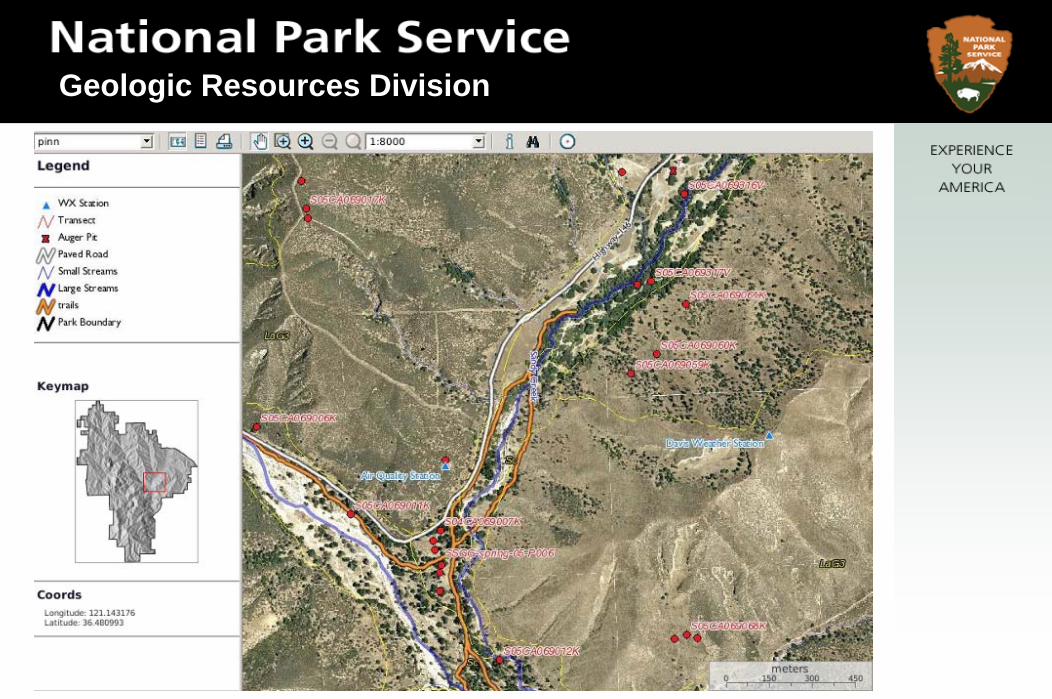
The SRI is currently developing an ArcGIS Desktop toolset that will geospatially link soils data allowing users to access soils data in an interactive manner. The current focus is on the map unit descriptions, pedon point data, and ecological site descriptions. The current toolset includes a MapUnitIdentify Tool and a Pedon Identify Tool.
MapUnit Identify ToolPedon Identify Tool

Geologic Resources Division
The MapUnit Identify Tool can be used on any I&M park that has been completed by the SRI. To use the tool the user simply selects a soils layer in the ArcMap table of contents, clicks a polygon of that layer, and an associated help file containing that map unit’s description is opened.

Geologic Resources Division
From the map unit description, ecological site descriptions can be accessed via a hyperlink in the help file if there is a NRCS approved ESD Report for that map unit.
Geologic Resources Division
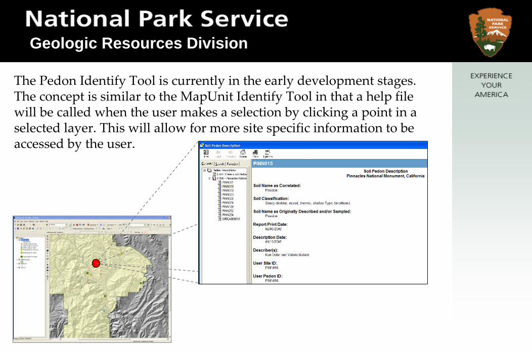
The Pedon Identify Tool is currently in the early development stages. The concept is similar to the MapUnit Identify Tool in that a help file will be called when the user makes a selection by clicking a point in a selected layer. This will allow for more site specific information to be accessed by the user.

Geologic Resources Division
Photo Documenting Map Units
Geologic Resources Division
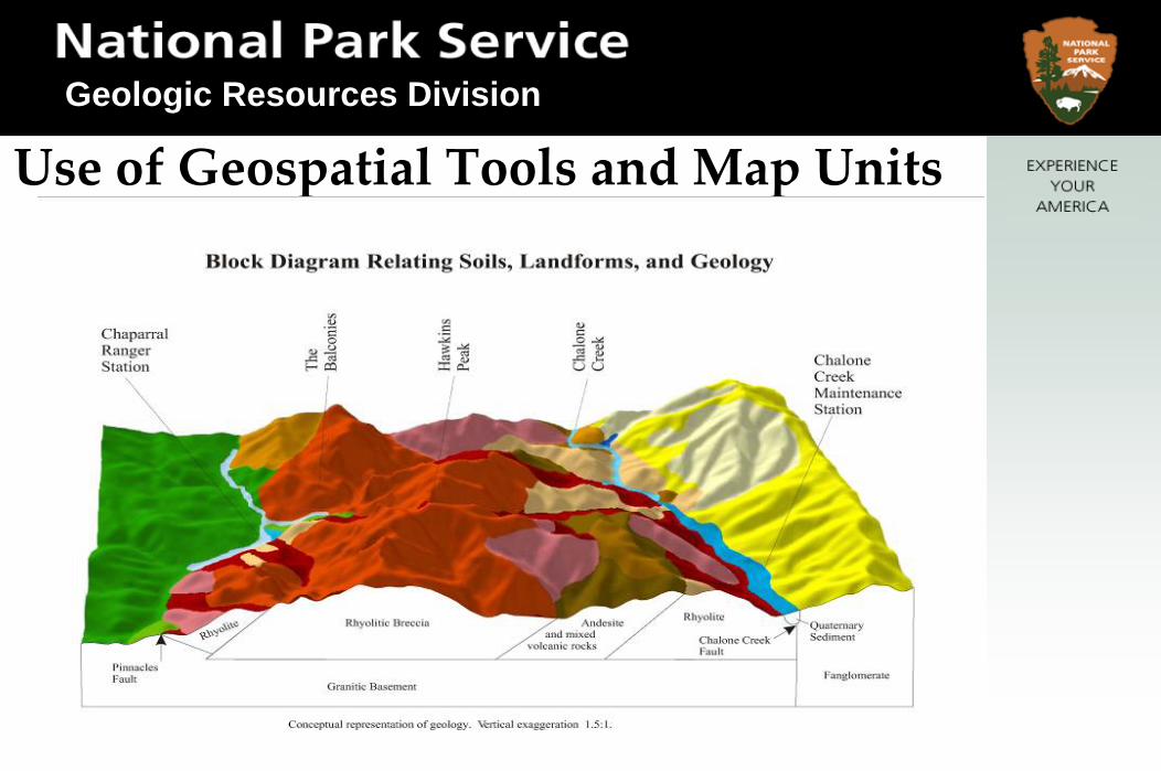
Use of Geospatial Tools and Map Units
Geologic Resources Division
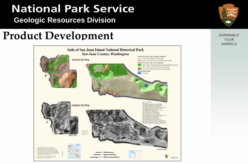
Product Development

Geologic Resources Division
What’s Cool About Our Park Soils?
• Integrating soil science into park educational material
• Emphasis on soils as the dynamic interface between “rock and plant”

Geologic Resources Division
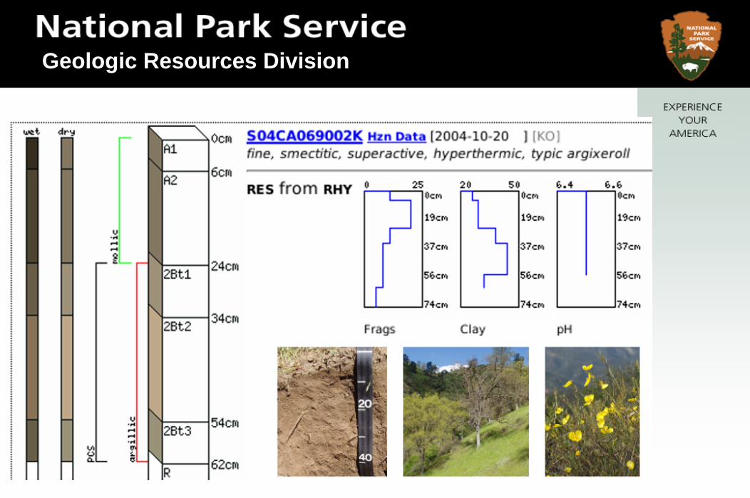
Why is the pedon point data important and how is it useful?
• It allows users access to the pedon data collected in the process of a soil survey on park lands.
• It also educates users to the different types of pedon data that are collected in the process of a soil survey on park lands.
• Used by other disciplines, such as archeologists, ecologists

Geologic Resources Division
What’s Cool About Our Park Soils?Series Type Locations – accurately
populated in NASIS pedon
Special properties – tephra layers, horizons from historic floods, rare plants
Endemic Soils ‐ Unique to park –mapped nowhere else …a park story to tell !
Benchmarks – what an opportunity to preserve a site!
Soil Monoliths – for visitor center display

Geologic Resources Division
Soil Monoliths
Geologic Resources Division

Geologic Resources Division
Geologic Resources Division

Geologic Resources Division
How does NPS SRI Goals fit in withcurrent Soil Survey Division Priorities?
1. Promoting TSS2. Benchmark landscapes3. ESDs and state and transition models

Geologic Resources Division
Any questions?
If no questions, here are historic photos from Rhode Island…

Geologic Resources Division
Narragansett Bay
That Ram Band
On Worden’s Pond
The Narrow River - URI Women’s rowing
That Ram Band