mcdowell creek watershed management plan
TRANSCRIPT
McDowell Creek Watershed Management PlanDavid Kroening, PG, CFM, GC
Charlotte-Mecklenburg Storm Water Services
04/13/2016

McDowell Creek WatershedMcDowell Creek Watershed

MC4

History
• Historically, watershed was agricultural• Government “linearization” of streams in early
1900’s– Malaria Control– More land for agriculture
• Strong development pressure in the past 20 years
• Designated as water supply watershed in the 1980s
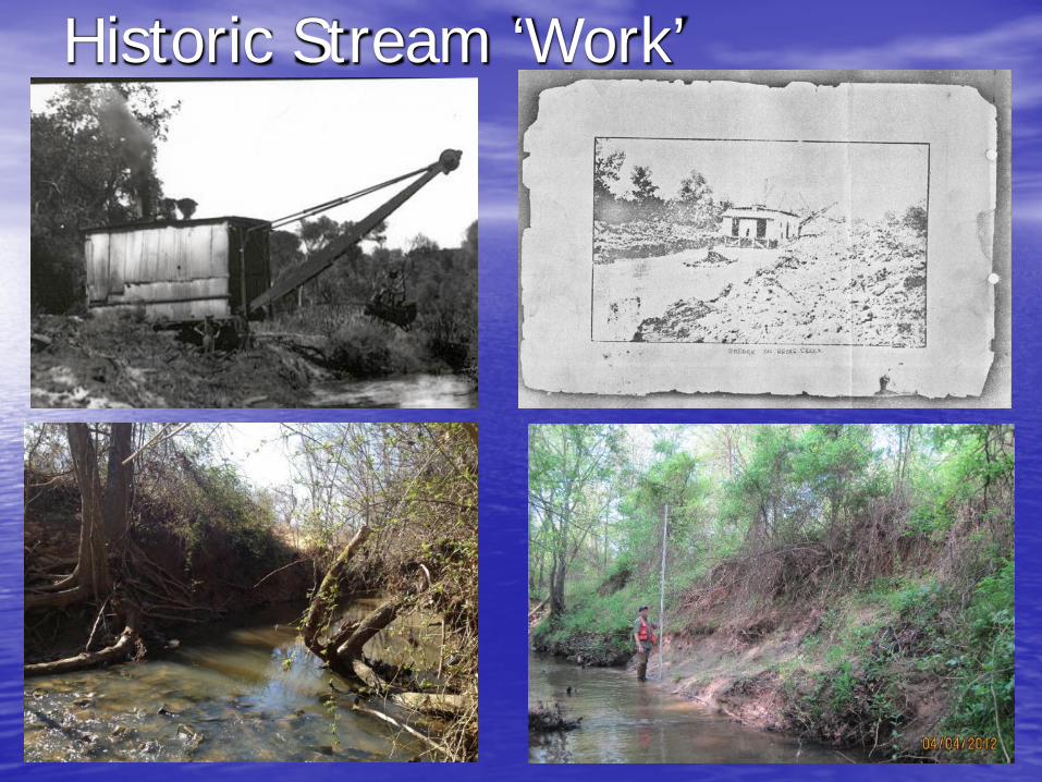
Historic Stream ‘Work’
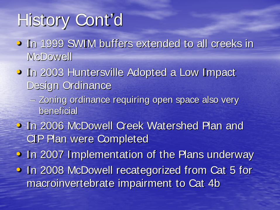
History Cont’d• In 1999 SWIM buffers extended to all creeks in
McDowell• In 2003 Huntersville Adopted a Low Impact
Design Ordinance– Zoning ordinance requiring open space also very
beneficial
• In 2006 McDowell Creek Watershed Plan and CIP Plan were Completed
• In 2007 Implementation of the Plans underway• In 2008 McDowell recategorized from Cat 5 for
macroinvertebrate impairment to Cat 4b

McDowell Creek Cove After 0.75 Inch Rain Event= Increased “Flushing”

What did we know about McDowell before we started?• McDowell Enters Mountain Island just upstream
of Drinking Water Intake– Very ‘muddy’ water entering cove
• 303(d) listed for fish and macroinvertebrateimpairment– Turned out be a factor on future NPDES Ph II permits– We believe habitat loss is the primary stressor
• Sediment– Stream Bank Erosion– Upland runoff
• Increased Flow volume and velocity


• Water Chemistry– Relatively low nutrient levels (at least
upstream of WWTP)• CMU committed to capping nutrient (TP) levels
from WWTP
– Relatively low bacteria levels– High turbidity/TSS/SSC levels during runoff
events
What did we know about McDowell before we started?

Assessment• In-stream Assessment
– Rosgen methodology of stream classification• Stream Corridor
– Analysis of the composition of the near stream environment
• Upland Assessment– Amount of pollution coming of existing developed
areas• TP, TN, TSS and impervious area were used
• TSS used as our indicator/surrogate– 0.3 tons/acre/year in-stream– 0.22 tons/acre/year up-land
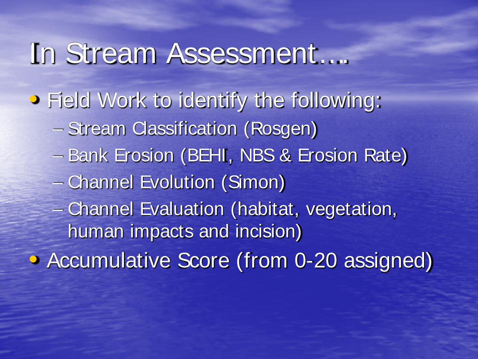
In Stream Assessment….• Field Work to identify the following:
– Stream Classification (Rosgen)– Bank Erosion (BEHI, NBS & Erosion Rate)– Channel Evolution (Simon)– Channel Evaluation (habitat, vegetation,
human impacts and incision)
• Accumulative Score (from 0-20 assigned)
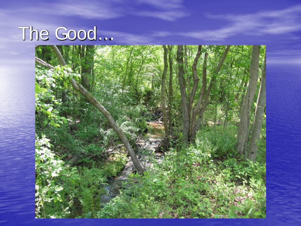
The Good…
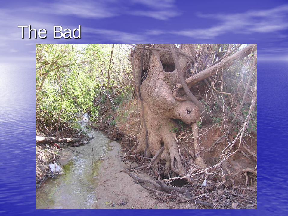
The Bad

The Ugly (aka “Silt Happens”)


Stream Corridor (Floodplain)
• Utilized remotely sensed American Forest’s Tree Canopy data set
• Intersected data set with FEMA floodplain and local buffers
• Un-forested buffers were identified for re-forestation– Public parcels (such as parks) are the low
hanging fruit
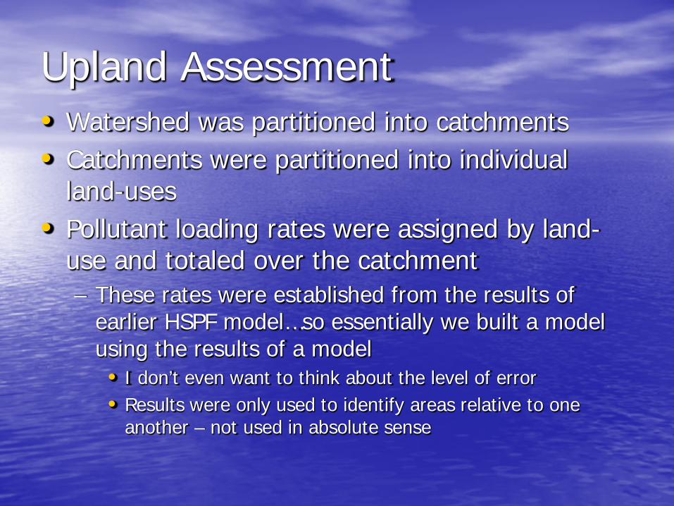
Upland Assessment• Watershed was partitioned into catchments• Catchments were partitioned into individual
land-uses• Pollutant loading rates were assigned by land-
use and totaled over the catchment– These rates were established from the results of
earlier HSPF model…so essentially we built a model using the results of a model• I don’t even want to think about the level of error• Results were only used to identify areas relative to one
another – not used in absolute sense

Load Rates Utilized for Upland Assessment
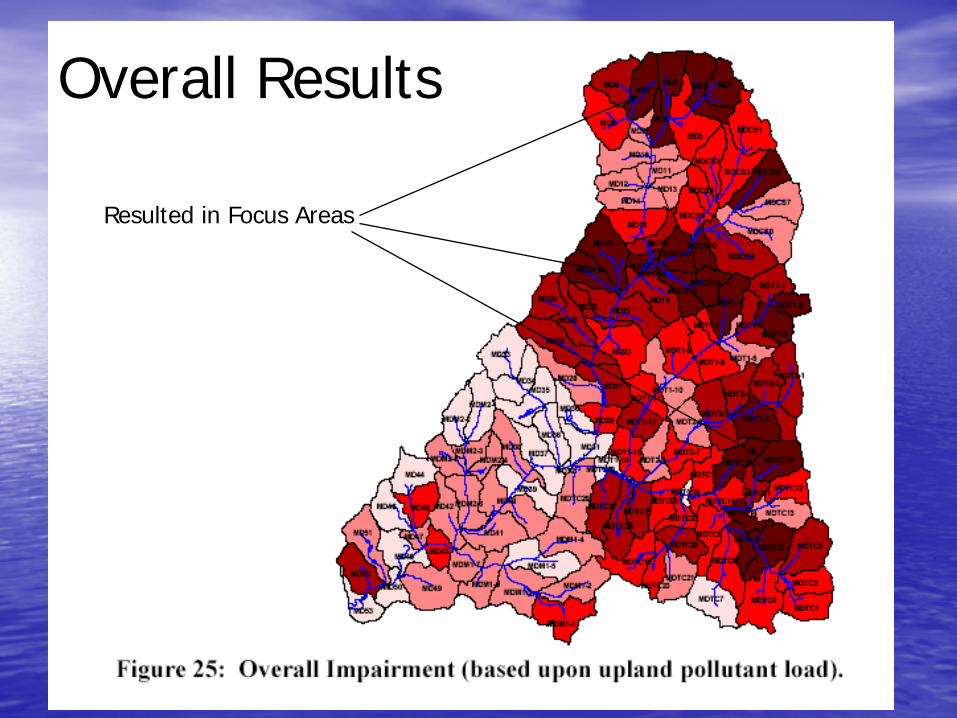
Overall Results
Resulted in Focus Areas

Source Identification from Assessment

Implementation• Obviously, we have a fixed budget and
need the most bang for our buck• Cost analysis was assembled and
normalized to reflect cost on a per pound removed basis
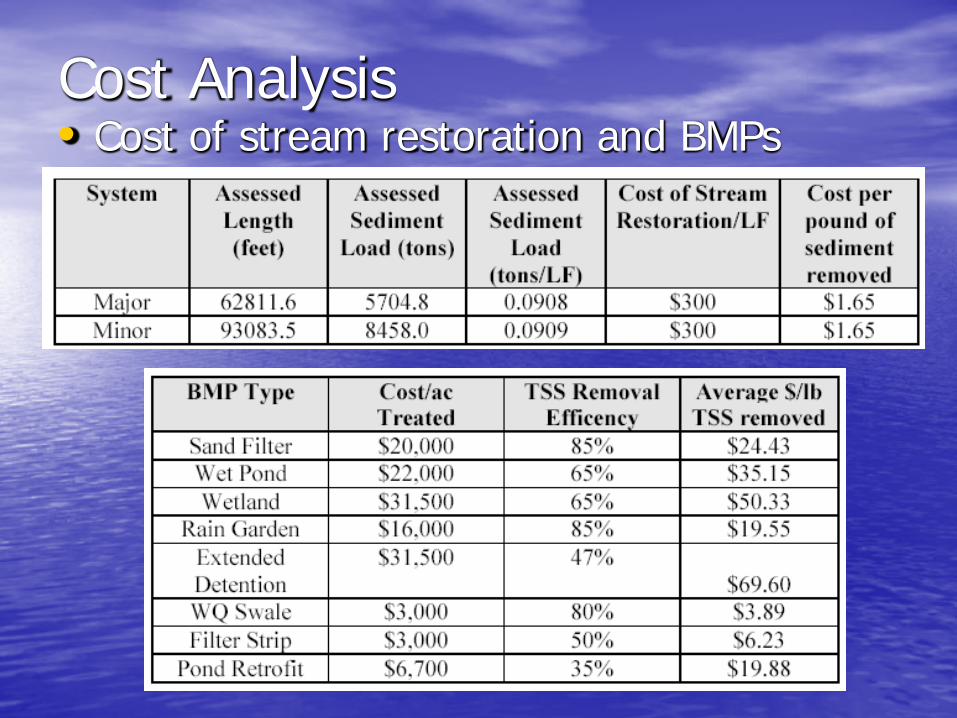
Cost Analysis• Cost of stream restoration and BMPs

Example Stream Restoration Project List

Projects in McDowell,Torrence, Trib1, Trib2,& McDowell
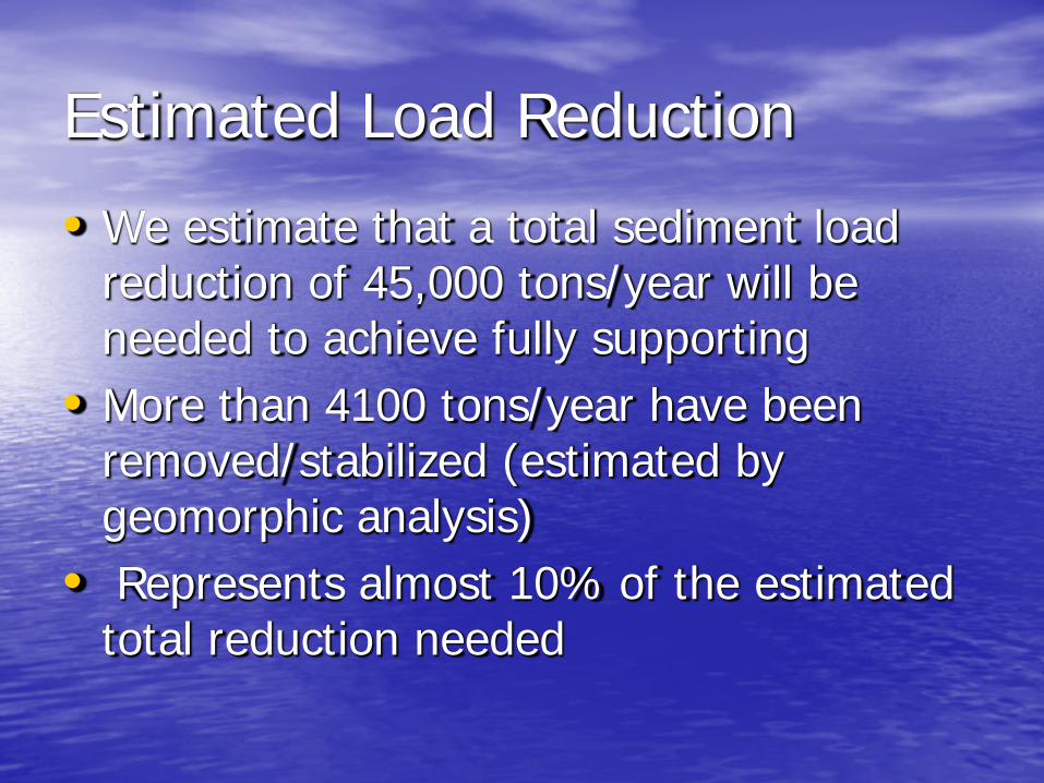
Estimated Load Reduction
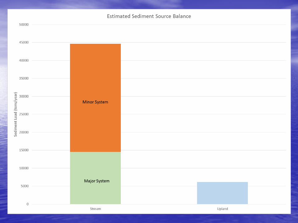
• We estimate that a total sediment load reduction of 45,000 tons/year will be needed to achieve fully supporting
• More than 4100 tons/year have been removed/stabilized (estimated by geomorphic analysis)
• Represents almost 10% of the estimated total reduction needed

Measureable Results?
MC4
Flow and Turbidity at MC4

0
5
10
15
20
25
30
35
40
45
50
0
10
20
30
40
50
60
70
80
10/10/2006 2/22/2008 7/6/2009 11/18/2010 4/1/2012 8/14/2013 12/27/2014
Historical Turbidity Response in McDowell Creek
Turbidity Annual Average USGS Annual Flow Torrence Mainstem & Trib 2 Upper McDowell
Torrence Trib 1 The Park - Phase I North Meck Park MC4 Structure
Bud Henderson Monteith Park

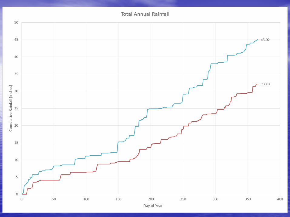
32.07
45.02
0
5
10
15
20
25
30
35
40
45
50
0 50 100 150 200 250 300 350 400
Cum
ulat
ive
Rai
nfal
l (in
ches
)
Day of Year
Total Annual Rainfall


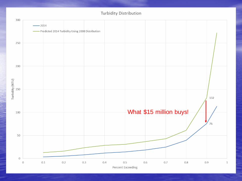
What $15 million buys!
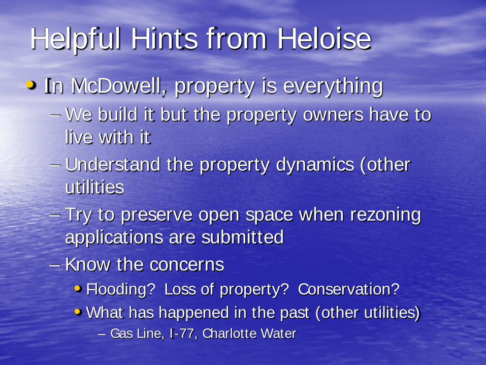
Helpful Hints from Heloise• In McDowell, property is everything
– We build it but the property owners have to live with it
– Understand the property dynamics (other utilities
– Try to preserve open space when rezoning applications are submitted
– Know the concerns• Flooding? Loss of property? Conservation?• What has happened in the past (other utilities)
– Gas Line, I-77, Charlotte Water

Partner whenever you can• Look for partnerships wherever you can
– Charlotte Water– Park and Recreation
• Sometimes stream work and greenways do not mix…
– Private Bankers– Commercial land owners
• They recognize the marketing value of clean water – sometimes they don’t like to admit it
– Conservation minded large landowners– Flood mitigation opportunities

Identify Cheerleaders Early• Who are the people most interested in the
project/watershed?– Who has the most to gain?– Use them as advocates – private parties in
support of the project/program are much more convincing than staff• They can help bring others to the table – then it is
up to you

Develop a Toolkit to ‘Sell’ your projects
• Know your market• Document all projects
– Even less favorable results can be highlighted to show ability to adapt and improve
• Toolkit should include many pre and post project images
• Movies are great!• Game cameras work really well
– Keep tabs on contractors as well
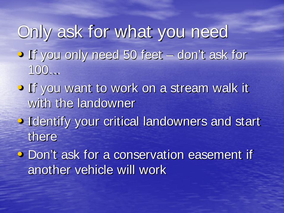
Only ask for what you need• If you only need 50 feet – don’t ask for
100…• If you want to work on a stream walk it
with the landowner• Identify your critical landowners and start
there• Don’t ask for a conservation easement if
another vehicle will work

