mastering 3d challenges - hansviehman
TRANSCRIPT
1 Copyright © 2013, Oracle and/or its affiliates. All rights reserved.
Mastering the Challenges of 3D Data Management
GIS Ireland 2013
Hans Viehmann
Product Manager EMEA
2 Copyright © 2013, Oracle and/or its affiliates. All rights reserved.
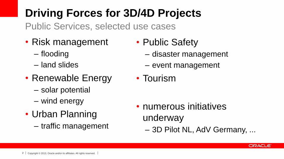
Driving Forces for 3D/4D Projects
• Risk management
– flooding
– land slides
• Renewable Energy
– solar potential
– wind energy
• Urban Planning
– traffic management
Public Services, selected use cases
• Public Safety
– disaster management
– event management
• Tourism
• numerous initiatives
underway
– 3D Pilot NL, AdV Germany, ...
3 Copyright © 2013, Oracle and/or its affiliates. All rights reserved.
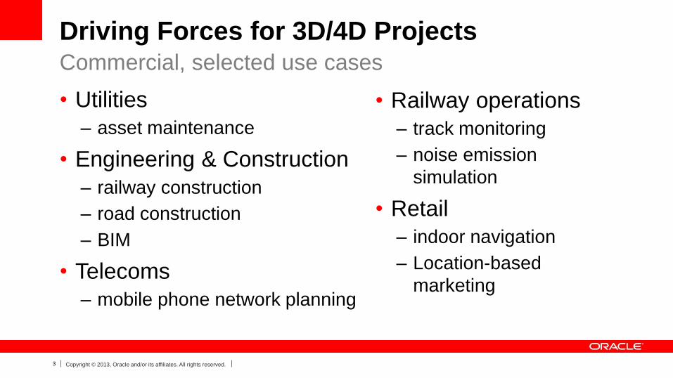
Driving Forces for 3D/4D Projects
• Utilities
– asset maintenance
• Engineering & Construction
– railway construction
– road construction
– BIM
• Telecoms
– mobile phone network planning
Commercial, selected use cases
• Railway operations
– track monitoring
– noise emission
simulation
• Retail
– indoor navigation
– Location-based
marketing
5 Copyright © 2013, Oracle and/or its affiliates. All rights reserved.
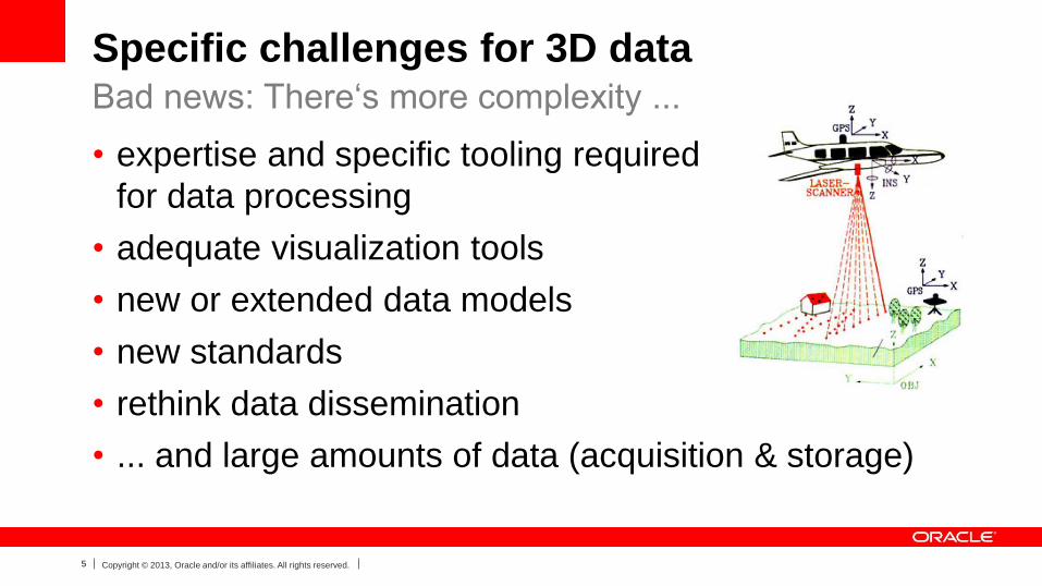
Specific challenges for 3D data
• expertise and specific tooling required
for data processing
• adequate visualization tools
• new or extended data models
• new standards
• rethink data dissemination
• ... and large amounts of data (acquisition & storage)
Bad news: There‘s more complexity ...
6 Copyright © 2013, Oracle and/or its affiliates. All rights reserved.
7 Copyright © 2013, Oracle and/or its affiliates. All rights reserved.
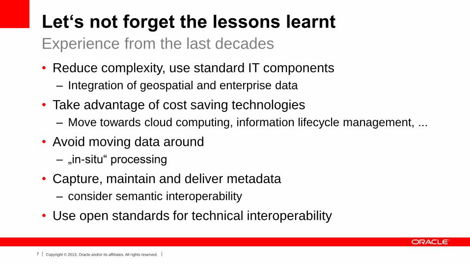
Let‘s not forget the lessons learnt
• Reduce complexity, use standard IT components
– Integration of geospatial and enterprise data
• Take advantage of cost saving technologies
– Move towards cloud computing, information lifecycle management, ...
• Avoid moving data around
– „in-situ“ processing
• Capture, maintain and deliver metadata
– consider semantic interoperability
• Use open standards for technical interoperability
Experience from the last decades
8 Copyright © 2013, Oracle and/or its affiliates. All rights reserved.
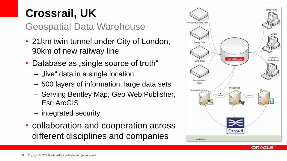
Crossrail, UK
• 21km twin tunnel under City of London,
90km of new railway line
• Database as „single source of truth“
– „live“ data in a single location
– 500 layers of information, large data sets
– Serving Bentley Map, Geo Web Publisher,
Esri ArcGIS
– integrated security
• collaboration and cooperation across
different disciplines and companies
Geospatial Data Warehouse
9 Copyright © 2013, Oracle and/or its affiliates. All rights reserved.
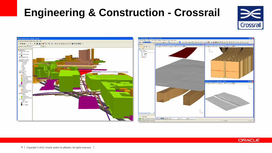
Engineering & Construction - Crossrail
10 Copyright © 2013, Oracle and/or its affiliates. All rights reserved.
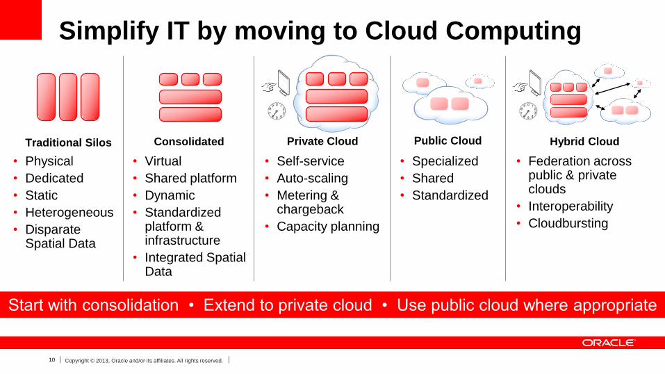
Simplify IT by moving to Cloud Computing
Private Cloud
• Self-service
• Auto-scaling
• Metering & chargeback
• Capacity planning
Public Cloud
• Specialized
• Shared
• Standardized
Hybrid Cloud
• Federation across public & private clouds
• Interoperability
• Cloudbursting
Traditional Silos Consolidated
• Physical
• Dedicated
• Static
• Heterogeneous
• Disparate Spatial Data
• Virtual
• Shared platform
• Dynamic
• Standardizedplatform & infrastructure
• Integrated Spatial Data
Start with consolidation • Extend to private cloud • Use public cloud where appropriate
11 Copyright © 2013, Oracle and/or its affiliates. All rights reserved.
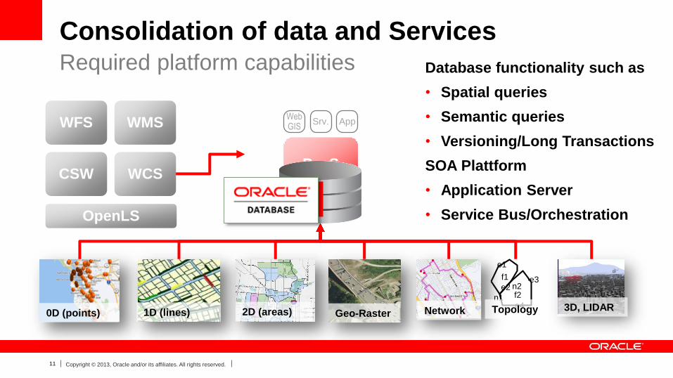
Consolidation of data and Services
Database functionality such as
• Spatial queries
• Semantic queries
• Versioning/Long Transactions
SOA Plattform
• Application Server
• Service Bus/Orchestration
Required platform capabilities
PaaS
WebGIS
Srv. App
f1
f2n1
n2
e1
e2e3
e40D (points) 1D (lines) 2D (areas) Geo-Raster Network Topology 3D, LIDAR
WFS
CSW WCS
WMS
OpenLS
12 Copyright © 2013, Oracle and/or its affiliates. All rights reserved.
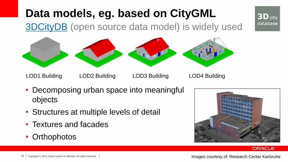
Data models, eg. based on CityGML
• Decomposing urban space into meaningful
objects
• Structures at multiple levels of detail
• Textures and facades
• Orthophotos
3DCityDB (open source data model) is widely used
LOD1 Building LOD2 Building LOD3 Building LOD4 Building
Images courtesy of: Research Center Karlsruhe
13 Copyright © 2013, Oracle and/or its affiliates. All rights reserved.
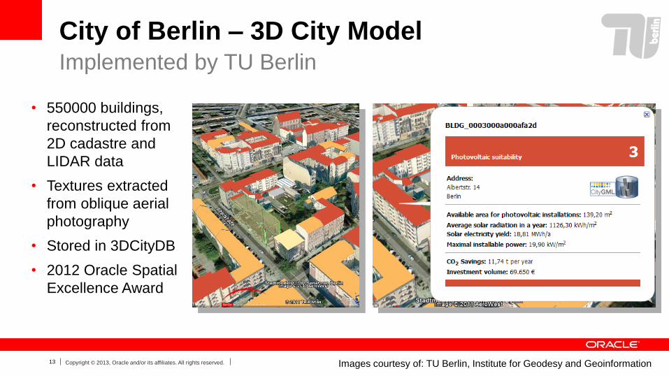
City of Berlin – 3D City Model
• 550000 buildings,
reconstructed from
2D cadastre and
LIDAR data
• Textures extracted
from oblique aerial
photography
• Stored in 3DCityDB
• 2012 Oracle Spatial
Excellence Award
Implemented by TU Berlin
Images courtesy of: TU Berlin, Institute for Geodesy and Geoinformation
14 Copyright © 2013, Oracle and/or its affiliates. All rights reserved.
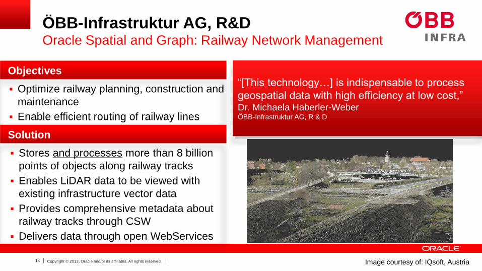
ÖBB-Infrastruktur AG, R&DOracle Spatial and Graph: Railway Network Management
Objectives
Optimize railway planning, construction and
maintenance
Enable efficient routing of railway lines
Solution
Stores and processes more than 8 billion
points of objects along railway tracks
Enables LiDAR data to be viewed with
existing infrastructure vector data
Provides comprehensive metadata about
railway tracks through CSW
Delivers data through open WebServices
“[This technology…] is indispensable to process
geospatial data with high efficiency at low cost,”Dr. Michaela Haberler-WeberÖBB-Infrastruktur AG, R & D
Image courtesy of: IQsoft, Austria
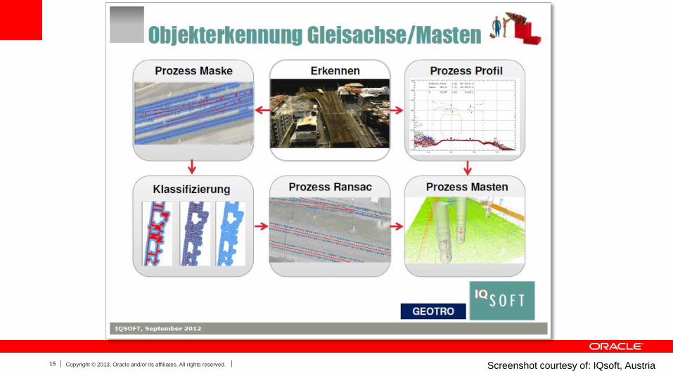
15 Copyright © 2013, Oracle and/or its affiliates. All rights reserved. Screenshot courtesy of: IQsoft, Austria
16 Copyright © 2013, Oracle and/or its affiliates. All rights reserved.
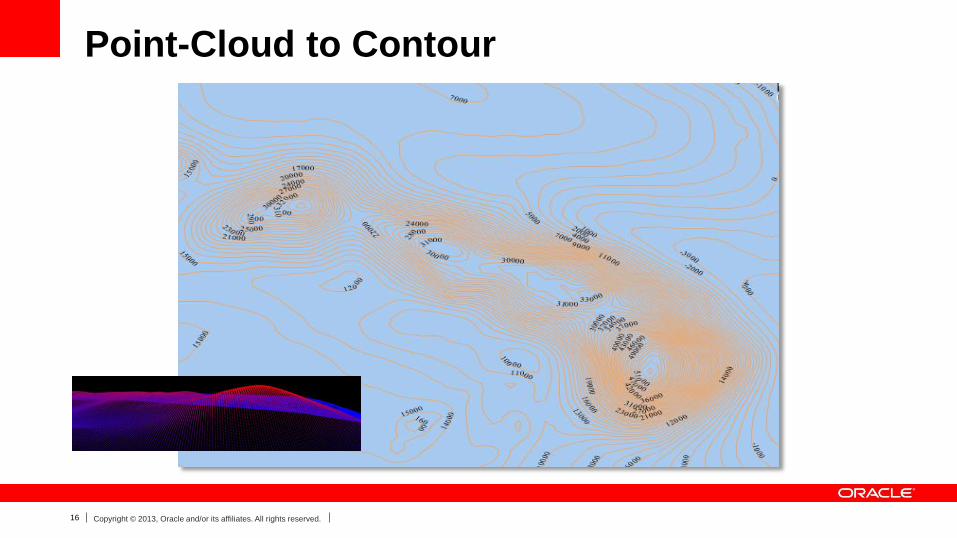
Point-Cloud to Contour
17 Copyright © 2013, Oracle and/or its affiliates. All rights reserved.
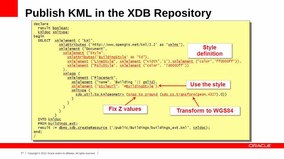
Publish KML in the XDB Repository
18 Copyright © 2013, Oracle and/or its affiliates. All rights reserved.
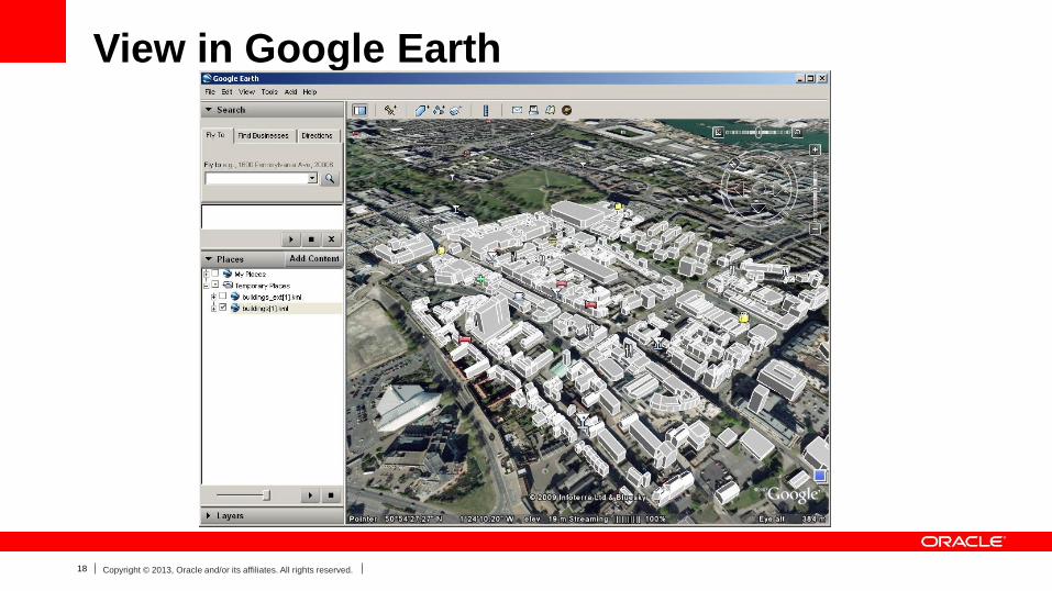
View in Google Earth
19 Copyright © 2013, Oracle and/or its affiliates. All rights reserved.
Summary
• Reduce complexity, use standard IT components
– Integration of geospatial and enterprise data
• Take advantage of cost saving technologies
– Move towards cloud computing, information lifecycle management, ...
• Avoid moving data around
– „in-situ“ processing
• Capture, maintain and deliver metadata
– consider semantic interoperability
• Use open standards for technical interoperability
Managing the Challenges of 3D Data
20 Copyright © 2013, Oracle and/or its affiliates. All rights reserved.
Role of Authoritative Geospatial Information
Providers
• Continue to collect, aggregate, and validate national
geospatial and statistical data, increasingly in 3D/4D
• Produce Authoritative reports and sources of information
• Be the information source in the Cloud
• Establish / adopt standards to enable sharing of this
information
• Opportunity to produce added value analysis and
analytic services
21 Copyright © 2013, Oracle and/or its affiliates. All rights reserved.
22 Copyright © 2013, Oracle and/or its affiliates. All rights reserved.