mars. focus finding evidence of water on another planet. using gis to evaluate likelihood and...
TRANSCRIPT

Inquiry Mapping Activity
Mars

Mapping Activity
FocusFinding evidence of water on another planet. Using GIS to evaluate likelihood and determine best location.
Lesson ObjectivesUnderstand that terrestrial planet surfaces have similar histories.Recognize that satellite data has a lot of detail and purposes. Identify different tools and capabilities of satellite datasets.Use remote sensing to address a scientific question
Lesson OutcomesDescribe how different satellite datasets work.Identify the criteria in picking surfaces that show water flow evidence.Apply these criteria to choose best location.Justify the decisions that have been made.Describe the geological history and processes involved in formation of the landscapeReflect on the value of remote sensing to scientists unable to reach another planet themselves.

Finding the Image

Google Mars


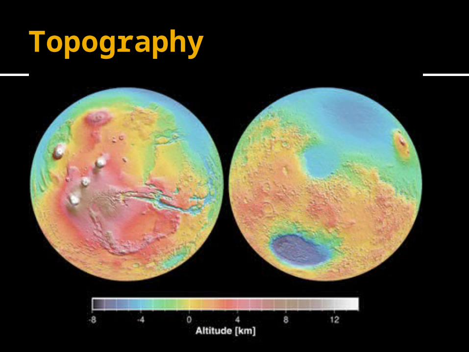
Topography

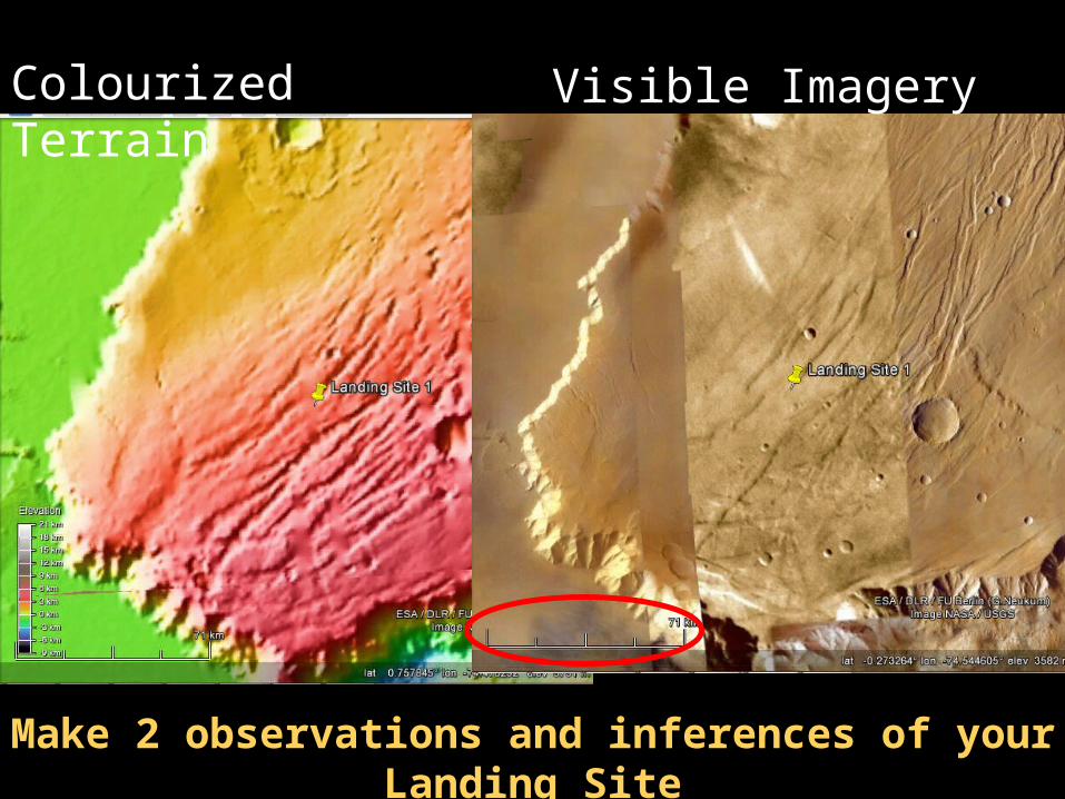
Colourized Terrain Visible Imagery
Make 2 observations and inferences of your Landing Site
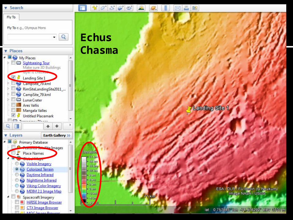
Echus Chasma
Mapping

Draw a Map: Outline areas of different appearance
Legend
Craters
Trough
Gullies
Ridge
Plateau P
Valley floor VF
100 km

Satellite Imagery Search
P15_006876_1820_XN_02N077W


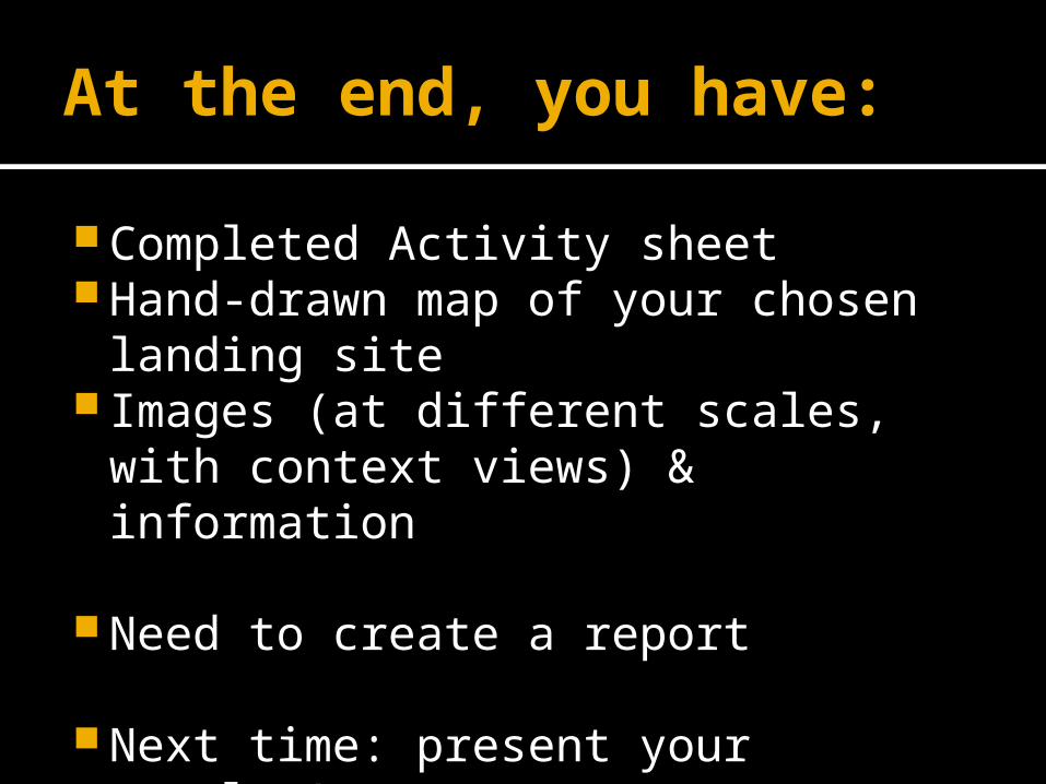
At the end, you have:
Completed Activity sheet Hand-drawn map of your chosen
landing site Images (at different scales, with
context views) & information
Need to create a report
Next time: present your results!

More Information for the Teacher

Data available on Google Mars Global Maps
Visible Imagery Colourized Terrain Daytime Infrared Nightime Infrared Viking Colour Imagery
Spacecraft Imagery HiRISE Images CTX Images MOC Images HRSC Images CRISM Images
Mars Gallery

Materials Required
For drawing map: Paper Pencils (colour/HB) Erasers rulers
For finding data: Google Earth (Mars), Mars Instrument websites

Things to evaluate on
What is required on a map: Title Legend/key (short but concise)▪ symbols
North arrow Scale bar Border Summary of observations