magnetic report on knucklethumb lake property
TRANSCRIPT

42L04NEe083 2.OBOSHKEGAN
010
MAGNETIC REPORT
on
KNUCKLETHUMB LAKE PROPERTY
Stephen N. Roach
November 30, 198k Stephen N. Roach
n o x ~

4aL84NE0083 3.8948 OBOSHKEGAN
Table of Contents
010C
page Introduction...,.... .. ,.............. .... ,...,.,,,,. .,,,, l
Location...... .. . . .... ... .... .... . , ,. ,. .. , ,.. ... ,., , , . ,.. l
Access.. .... . . ., .... .. .. . . .. . ... .. . ,.. . . . , .. . . . .. . ,.,.. . . l
Survey Method,. ,..,.., , .. ..., ...... , . ... . .. . , , , , . , , . , . .., l
Topograohy, Drainage, and Natural Resources......,,.,,... 3
Previous Mineral Exploration....................,....,... 5
General Geology..,...,.,.......,.........,....,.....,..,. 6
Geology of Knucklethumb Lake Property,................... 8
Discussion of Magnetic Data,.,,....,.....,.....,..,,,,,,, 10
Conclusions... ,. .. , , . , , . ... , , . . , , , , . . . . .. , ., . , . , ... . . , , . . 15
Figures
Figure l - Location or Index Map......,....,..,.,,,,...., 2
Tables
Table l - Base Station Readings.......................... 4
Table 2 - Drilling Summary on Property..,,,..,,,,,..,,.,, 7

Introduction
The Knucklethumb Lake property consists of eighteen contiguous
'unpatented claims. The scope of this report concerns itself with
thirteen claims numbered 71^^50 to 718462, inclusive. An addition
al five claims were staked due to favorable results,
The claim holder is Stephen N. Roach residing at P.O. Box 892
( 36 St. Therese Blvd. ), Embrun, Ontario.
Location
The Knucklethumb Lake property is located in Oboshkegan
Township. The claim group is approximately fifty-three kilo
meters north of Jellicoe and seventy-two kilometers northwest of ~"
the town of Geraldton ( Figure l ).
It is bounded by Latitudes 50O 09' 36" and 50O 11' 32" N and
Longitudes 8? 0 32' 25" and 8? Q 34' 56" W,
Access
A lodging road extending north for 100 kilometers from the
Trans-Canada Highway 11 comes within six kilometers of the claim
group. A Canadian National Railway line comes within six kilometers
north of the property ( Figure l ). However, access is restricted
to float-eqipped aircraft that can be chartered from Jellicoe or
Geraldton.
Survey Method
A grid was established as a reference for conducting a mag-
n^tometer survey between August 19, 1984 and August 24, 1984,
The grid was also used in performing geological, lithogeochem-

Albany River
ast. NORTH
Whitewater Lake
Caribou Lake O'sullivan
LakeArmstrongAuden Tashota
fc-^'*-' i-H
f* KNUCKLE-
Lake
^....^ GeraL/on \Lone LacLake Nipigon
Jellicoe Beardmore
Lor.p lake
SchreiJier
THUND BAY
LAKE SUPERIOR
Figure l

ical, and VLF-EM surveys during the summer.
A total of 2Q.3 kilometers of line was cut and chained with
cross-lines established every 100 metars and station spacing at
25 meter intervals. The baseline { BL ) and tieline ( TL/700 N )
trend in an east-west direction with cross-lines being north-
south.
The magnetic survey was conducted using a MF-l fluxgate mag
netometer at a 25 meter station spacing. Half-station readings
were carried out over strongly magnetic and mineralized zones.
The 1000 gamma scale was primarily used on the fluxgate magneto
meter. The operator was always facing south and the instrument
was accurately levelled before a reading was taken. The magnetic
survey was performed by the author.
A number of base station readings were taken in order to
correct for the diurnal variations of the earth's magnetic field,
Base stations ( A ) were establised at BL/300 E, BL/900 E,
BL/1500 E, 3L/300 W, and TL/300 B,and are summarized in Table l,
Base station readings were repeated after an interval T, between
one and two hours. If the repeat reading showed an increase d,
every reading taken during the interval is diminished by the amount
d x t X T where t is the time at which it was taken after the in
itial base station reading.
A total of 1562 readings were taken,
Topography, Drainage, and Natural Resources
The height of "'and averages 330 meters ( 1000 feet ) above
sea-level. Overburden is up to twelve vertical meters in examin-

•oKC
O•H-P
03•P
WO
) O
)
OJ
Os
J-
Oe\j
o
oCM
O)
i-H.-Qgc o-H-P
cd -p
WW
W
Ooc
o
oo
oo
o
wo
o
.1-11-3m
m
pq
po
.

diamond drill records on the property.
por the most part, the watershed is high producing lowlying
and flat spruce and alder bog, and cedar swamp areas ( i.e. north
of BL/500 W and TL/700 E ). Outdraining strums, such es the
Sandberg and Jaz Streams, from these swampy areas are evident.
Also, wet, grassy areas on the northern shoreline of Knuckle-
thrornb Lake is prominent. The Jaz Stream flows intermittently
southward towards Knucklethurnb Lake, The Sandberg Stream flows
northeastward to a branch of the North Onaman River.
Areas of higher relief are to be found in the northeastern
( i.e. Line 1000 and 1100 E ), southeastern ( i.e. Lines 1400
to 1800 E, inclusive), and western ( i.e. Line 1100 and 1200 W ).
parts of the property. These areas have frequent outcrop exposures
and local boulder areas. The outcrop exposures are generally flat
and low-lying with a fairly thick mosp cover or are to be found
on sides of sloping hills. Approximately 5?; to lOfi of the property
is covered by outcrop,
The general tree cover is spruce balsam in flat humocky and/
or grassy ground. There are local areas of alders and cedars.
Areas of higher relief have a mixture of white spruce and spruce
balsam with scattered poplar or aspen trees.
Previous Mineral Exploration
The Knuckleth imb Lake property has undergone extensive
mineral exploration in the early lQ80's.,A joint venture between
Canamax ( i.e. previously Amax Minerals ) and Labrador Mining and
^xoloration ( i.e. previously Hollinger Argus ) in 1979 initiated

extensive exploration activity in the Metcalfe Lake area and -
Oboshkegan Townshic. Part of the explored area is the Knuckle-
thumb claim group. Exploration activity in 1980-81 included
VLF-EM and magnetic surveys and 835 meters of diamond drilling,
Only 463 meters of drilling was performed on the property. A
summary of the drilling is presented in Table 2,
In 19?6, N.W.T, Copper Mines Limited drilled a hole in what
is now claim 71845*4-. The drill hole was to test gold-bearing
quartz veins on surface. The hole intersected unmineralized
chloritic pyroclastic breccia with localized quartz veining.
There is no mention of geochemical analyses.
Prior to the most current exploration on the property, there
is much evidence of exploration activity in the way of trenching.
There appears to be four areas of trenching and are confined to
mineralized zones containing pyrite and/or quartz veins. The
four areas are i 1) Line O to 200 W, just south of the baseline,
2) between Line 600 E and 900 E, just north of the baseline, 3)
in the southeastern area between Line 1500 E and 1800 E, and 4)
between Line 700 E and 800 E, north of the tieline. There is no
evidence of drilling in those four areas other than that which
has been described.
General Geology
The Knucklethunb Lake property underlies an area character
ized ^y a metavolcanic-metasedimentary assemblage forming part
of the Wabigoon Belt in the Superior Province of the Precambrian
Sh : eld.

Table 2
Drill Hole Location Depth (m)
OBOSH 2-2-80 LO/ 46.912 S
OBOSH 2-3-80 LO/50 N
O c: OSH 2-6-81 L 600 E / 96.6220 S
OBOSH 2-7-81 L 1500 E 149.0200 S
OBOSH 2-9-81 LO/525 N
OBOSH 2 - 12 - 81 675 E85 N
79.2
OBOSH 2-4-80 675 E / 33*234 N
OBOSH 2-5-80 675 E / 31.156 N
OBOSH 2-8-81 L 1300 E 92.3f 330 N
OBOSH 2 - 10 - 81 650 E X 73-1105 N
OBOSH 2 - 11 - 81 6?5 E X 30.870 N
61.3
OBOSH 2 - 13 - 81 650 E / 49.770 N
Rock Types
felsic tuff/xtl tuff - carbonate and silicified alteration with pyrite
felsic tuff/tuff bx - local zones of quartz stringers with pyrite
graphitic tuff and seri citic cherty tuff with pyrite and pyrrhotite
mafic debris flows with pyrite - strong chlorite and mica
quartz-sericite schist with quartz stringers 4 pyrite - cherty tuff
felsic tuffs/flows - numerous quartz veins with sericite
felsic tuffs/flows - numerous quartz veins - sericite & chlorite alteration
felsic xtl tuffs/tuffs - numerous quartz stringers - chlorite Se carbonate
felsic xtl tuffs/tuffs - numerous quartz veins - sericite b tourmaline
felsic xtl tuffs/flows - tuff bx - quartz veins with aeticite Se tourmaline
felsic xtl tuffs/flows - tuff bx - quartz veins with chlorite Se pyrite
felsic tuffs with sericite - local chlorite - minor quartz veining with tourmaline

Late Precambrian metavolcanics underlie 65^ of the Metcalfe
Lake area and Oboshkegan Township. A sequence of iron and magne-
sian-rich tholeiitic basalts to ca&c-alkaline rhyolites are re-
presentat^ve of the metavolcanic assemblage in the general area.
Andesitic metavolcanics are rare. Thin metasedimentary and vol
caniclastic units comprise 5^ of "the area and are usually found
at the top of metavolcanic units. The rocks have undergone
greenschist metamorphism.
Early Precambrian granitic rocks comprise 30# of the general
area. Both the metavolcanics and metasediments are intruded by
diabase, lamprophyre, and granitic dykes and sills.
The metavolcanics and metasediments have "been subjected to at
least two periods of deformation with the first one producing
a penetrative regional foliation. The second one produced a cren
ulation cleavage, although there may be other crenulation cleav
ages.
The metavolcanic stratigraphy represents sequences of ash
flows superimposed by folding.
Geology of Knucklethumb Lake Property
The property consists of 9^ felsic to intermediate metavol
canics, 59^ mafic metavolcanics, and 1# metasedimentary rocks.
Thin lamprophyre dykes cross-cut the metavolcanics. A small
granitic intrusion lies to the south of the property,
The felsic to intermediate metavolcanics underlying the
claim group are part of a longer and thicker sequence that extends
26 km and has a maximum thickness of 2,7 km. The felsics attain
8

a maximum thickness of I.? km.on the property. These rocks
are predominantly pyroclastics and are interpreted as ash flows.
The felsic to intermediate metavolcanics have been extensively
altered with the presence of chlorite * carbonate, sericite t
carbonate, quartz 4- sericite, and chlorite * sericite A car
bonate * talc.
Although the mafic metavolcanics constitute 5# of the property
two different mafic units are recognized. The two different mafic
units are: 1) iron-rich tholeiitic basaltic flows ( i.e. pillowed
and massive ) located in the northeastern part of the property, and
2) calc-alkaline basaltic debris flows located in the southeastern
part of the pronerty.
The metasediments have only been recognized in the southeastern
part of the property. These rocks are predominantly laminated
mudstone and siltstone with interbeds of greywacke, arkose, and
sandstone. The lateral extent of the metasediments to the west
is not entirely known. However, drill hole data from 030SH 2 -
6-81 suggests the presence of altered metasediments.
There are two thin units of cherty tuff/chert that are in
terpreted as chemical metasediments. These two units are: 1)
cherty tuff horizon ( exhalite ) that is located in the northern
part of the property and hosts Au-Cu-bearing pyrite mineralization,
and 2) cherty tuff/chert unit that is located in the southeast
ern part of the property and hosts Au-bearing pyrite and arseno
pyrite mineralization.
There are numerous felsic to mafic dyke and sill-like bodies.

Lamprophyres are the most common of the dyke and sill-like
bodies, A granitic intrusion lies to the south of the prop
erty and there is no visible contact with the surrounding felsic
to intermediate metavolcanics. However, the felsic rocks en
countered in OBOSH 2-6-81 are extremely altered with the
presence of chlorite * sericite * carbonate * talc.
Discussion of Magnetic Data
The magnetometer survey was successful in outlining litho-
loelcal units/horizons, structural linaments, and mineralized
zones. These geological features may associate with one another,
and subsequently have a common magnetic association.
The strong magnetic expression in the northeastern and south
eastern parts of the property reflect the mafic metavolcanic
lithological units. This magnetic expression is in marked con
trast to the lower magnetic character of the felsic to intermed
iate metavolcanics. The granitic rocks and metasediments generally
have a lower magnetic susceptibility than the felsics. Geological
contacts are, for the most part, magnetically inferred because
of the paucity of outcrop exposure and the absence of recognizable
lithological contacts.
There are a number of structural linaments that have been
inferred upon examination of the contoured magnetic data. The
interpretation of structural linaments from contoured magnetic
data can be summarized fromi 1) thin, continuous, and highly mag
netic linears or strongly, negative magnetic linears,(~i,e-shears,
fault zones, and dyke swarms ), and 2) discontinuities and/or
10

inflections of lithological units/horizons that may be char
acterized by a prominent magnetic expression ( i.e. fault
zones ).
Contoured magnetic data was successful in suggesting the
presence of sulphide horizons, such as those encountered in
OBOSH 2-6-81. These zones generally have a strong magnetic
attraction and this is due to the presence of magnetic sulphides
such as pyrrhotite and pyrite mineralization in OsOSH 2-6-81.
However, there is the possibilxy that oxide iron formation { i.e.
magnetite/chert ) coincide with these magnetic zones, Magnetite/
chert iron formation commonly occurs in the region, especially
in the mafic metavolcanics.
There are five prominent magnetic expressions or attractions
that reflect the three geological features that have been discuss
ed. These anomalies are i
Anomaly A
This magnetic anomaly is found in the western part of the
property. The magnetic expression increases gradually and lat
erally westward from Line 600 W. This magnetic area is contin
uous and has a fairly wide magnetic 'width 1 .
The highly magnetic nature of this area is represented by strong
ly sheared felsic to intermediate metavolcanics that host very-
fine grained disseminations of M magnetite. These rocks are re-
copnized between Line 1000 W and Line 1200 W. However, the strong
magnetic nature of these rocks do not reflect a more mafic litho
logy.
11

There are numerous, thin, and strongly magnetic linears
within the anomalous area. This is evident on Line 1200 W.
One of these linear zones coincide with strongly sheared and al
tered felsic to intermediate metavolcanics containing weakly
disseminated magnetite. The interpretation and presence of a
shear zone is a likely explanation for other zones of similar
magnetics,in this anomalous area.
Anomaly B
This anomaly is located in the southern part of the property.
The magnetic anomaly coincides with a VLF-EM zone. This continuous
magnetic expression increases laterally westward from Line 1000 E.
The magnetic 'width' is variable. This particular anomaly is
in marked contrast to the lower magnetic susceptibility of the
felsic to intermediate metavolcanics.
Drill hole data from OBOSH 2 - 6 - 81 is the only evidence
of rock types characteristic of this anomaly. Mineralized sections
of pyrrhotite and pyrite in altered graphitic and felsic tuffs and
metasetliments were intersected in OBOSH 2-6-81, The magnetic
anomaly directly coincides with the sulphide sections and graphi
tic tuff horizon in the drill hole. This anomaly definitely re
presents an altered lithological unit ( i.e. metasedimentary )
hosting a pyrrhotite-rich horizon.
Anomaly C
This anomaly is found in the southeastern part of the grid.
This northeasterly trending magnetic expression consists of
12

multiple, thin, and strongly magnetic linear zones.
The strongest magnetic attraction of this anomaly occurs on
Llhfe 1'500 E and coincides with magnetiferous mafic metavolcanics
that host disseminated pyrite. The magnetic attraction diverges
from the VLF-EM zone, and subsequently.from the sulphide zone,
eastward.
This particular anomaly may represent a mafic lithological
unit and/or a fault/shear zone. Both these geological features
may commonly associate with one another in this magnetic anomaly.
The presence of mafic metavolcanics between Line 1600 E and Line
1800 E is equivocal because of the surrounding felsic to inter
mediate metavolcanics and the lack of outcrop exposure in the
anomalous area. It remains to be seen, but this magnetic anomaly
may be similar to Anomaly A f and represent sheared and fractured
felsic to intermediate metavolcanics hosting magnetic sulphides and
oxides.
Anomaly D
This particular anomaly is located in the northeastern part
of the property. There is a strong continuous magnetic attraction
eastward from Line 600 E, The magnetic''width' is fairly wide and
consistent. The magnetic survey was .particularly successful
in outlining the mafic metavolcanic unit.
This high magnetic expression is characteristic of iron-rich
tholeiitic basalts that contain disseminated magnetite. These rocks
contain very high FeO, Fe 20^, and TiOg. A pyritiferous sulphide
zone coincides with a strongly magnetic body which is located
13

between Line 600 E and Line 900 E. The magnetic contours and
profi-les of this magnetic body provide magnetic parameters.
The nearly vertical dinning body ( i.e. dipping steeply to the
south ? ) extends for approximately 300 meters, with an estimated
depth between 12 and 2? meters, length of approximately 220
meters, and a magnetic width between 50 and 120 meters.
The overall anomalous area represents a mafic lithological unit.
The strongly magnetic bodies of the anomalous area may represent
an iron-rich differentiate of the mafics and/or sulphide zones
hosted by sheared and altered mafic metavolcanics*
Anomaly E
This particular negative anomaly has not been fully detail
ed as the anomaly trends through the Canamax-Labmin claim group,
This anomaly is unique due to its strong, continuous negative
magnetism. This anomaly cross-cuts the stratigraphy and may re
present a structural linament, possibly a fault/shear zone.
A thin and magnetic lamprophyre dyke in the felsic to intermed
iate metavolcanics is recognized in the anomalous area. The neg
ative anomaly may represent swarm-like, thin magnetic dykes,oc
cupying a fault/shear zone.
The negative nature of this anomalous area and its spatial re
lationship with other mafic intrusive rocks is not fully under
stood at this time.
There are numerous other magnetic anomalies on the property.
These anomalies are generally smaller in strike length, have a
thinner magnetic 'width 1 , and show a slight to moderate magnetic

attraction,
Conclusions
The magnetic survey was successful in outlining lithological
units/horizons, structural linaments, and mineralized zones,
The high magnetic expression in the southeastern ( i.e.
Anomaly C ) and northeastern ( i.e. Anomaly D ) parts of the
property characterize the mafic lithology. The strongly sheared
felsic to intermediate metavolcanics characterize a strong, con
tinuous magnetic attraction in the western part of the property
( i.e. Anomaly A ). Shears and fault zones commonly associate
with these magnetic expressions,and are characterized by thin,
continuous magnetic linears and discontinuities and/or inflections
of lithological units. Anomaly E is a very good example of a cross
cutting fault/shear zone. The survey was also successful in outlin
ing a number of sulphide horizons that have a strong magnetic
attraction ( i.e. Anomaly B ). These zones are coincidental
to VLF-EM zones.
The correlation between contoured magnetic data and geologi
cal and VLF-EM data is the best way to interpret the magnetic
data. The interpretation of magnetic anomalous areas can be bet
ter understood from known and from the extrapolation of geologi
cal features.
Stephen Roach
15

f. f-
Ministry olNaturalResources
OntarioRe^ur
00027
Report of Work(Geophysical, Geological, Geochemical and Expenditures)
t Fll ^ . ^ A* .*** j*^
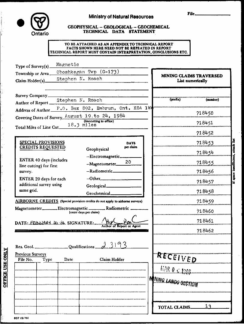
Minir 12L04NEee83 2.8940 OBOSHKEGAN 900Type of Survey(s)
MagneticClaim Holder (t)
Stephen N. Roach
Township or Area
Oboshkegan Twp (G-l?3)Proipector t Licence No.
A 46351Address
P.O. Box 892, Embrun, Ontario KOA lWOSurvey Company j Date of Survey (fr
Ufl PoMr
(from Bi to)
y , .,
Total Miles of line Cut
18.3 milesName end Address of Author (of Geo-Technical report)
Stephen N. Roach P.O. Box 892, Embrun, Ontario KOA lWOCredits Requested per Each Claim in Columns at ri
titfff.
ightSpecial Provisions
For first survey:Enter 40 days. (This includes line cutting)
For each additional survey: using the same grid:
Enter 20 days (for each)
Man Days
Complete reverse side and enter total (s) here
Airborne Credits
Not*: Special provisions credits do not apply to Airborne Surveys.
Geophysical
- Electromagnetic
- Magnetometer
- Radiometric
- Other
Geological
Geochemical
Geophysical
- Electromagnetic
- Magnetometer
- Radiometric
- Other
Geological
Geochemical
Electromagnetic
Magnetometer
Radiometric
Days per Claim
20
Days perClaim
,'
Days per Claim
Mining Claims Traversed (List in numerical sequence)
Expenditures (excludes power stripping)Type Of Work Performed
Performed on Claim(s)
Calculation of Expenditure Days Credits
Total ExpendituresTotal
Days Credits
InstructionsTotal Days Credits may be apportioned at the claim holder choice. Enter number of days credits per claim selected In columns at right.
our13 -fet
Recorded-Holder-o SlBlwt
Certification Verifying Report of Work
Total number of mining claims covered by this report Of work.
Total Day* Cr.|Date Recorded Recorded
1 hereby certify that 1 have a personal and intimate knowledge of the facti set forffh in the Report of Work annexeSriJteleto, having performed the work or witnessed same during and/or after its completion and the annexed report is true.
Name and Postal Address of Person Certifyingstal Address of Person Certifying
Stephen N. Roach P.O. Box 892, Embrun, Ontario KOA 1WO-*nrrTf-'" . J":-f - Date Certified^ Certif (SiOnatureL
1362 (81/9)

Mining Lands Section
Control Sheet
File No
TYPE OF SURVEY r~" :iCAL
GEOLOGICAL
GEOCHEMICAL
EXPENDITURE
MINING LANDS COMMENTS:
Signature of Assessor
vDv Date

March 3, 1986
Mining Recording Office 99 Wellesley Street West Whitney Block Room 25^8, Queen's Park Toronto, Ontario Canada M?A 1W3
Dear Sir/Madam i
Please find enclosed my technical data statement, Also, you
will find two (2) copies of a magnetic report and map on the
Knucklethumb lake property in Oboshkegan Township.
l hope the report meets your requirements, l hope to hear
from yon regarding the approval of the recorded work.
Sincerely,
Stephen Roach
MINING RECORDS OFFICE TORONTO
D E IS 1 1 f tMAR -4 1986
AM
IR O 4 1986
UN0S SECTION
Ontario
Ministry of Natural Resources
GEOPHYSICAL - GEOLOGICAL - GEOCHEMICAL TECHNICAL DATA STATEMENT
File.
TO BE ATTACHED AS AN APPENDIX TO TECHNICAL REPORTFACTS SHOWN HERE NEED NOT BE REPEATED IN REPORT
TECHNICAL REPORT MUST CONTAIN INTERPRETATION, CONCLUSIONS ETC.
Type of Sui Township c Claim Hold
Survey Con Author of ] Address of Covering D
Total Miles
SPECIAL
rvey(s) Magneticr Area Oboshkegan Twp (G-173)rri*\ StephenCI \l) ——————————————————————
ipanyt
*epnrt StephenAnthor P.O. BOX
ates of Surv
of Line Cut
, PROVISICCREDITS REQUES^
N. Roach
N. Roach892, Embrun, Ont. KOA 1W
ey August 19, to 24, 1984
f 18.3
)NJPED
ENTER 40 days (includes line cutting) for first survey.ENTER 20 days for each additional survey using same grid.
(linccutting to office)miles
DAYS,-, L-i per claim Geophysical—Electromagnetic.,.,,,.,.,
20— Magr"'t"m'*tfr. ,,,,,±.:,, . . ,—RaHinm^trir
-OtherOpnlngiral
AIRBORNE CREDITS (Special provision credits do not apply to airborne surveys)
OFFICE USE ONLY
Magnetome
DATE: Ffci
Res. Geol.
ter.
WJftrfH to
Previous SurveysFile No. Type
Electromagi(enter c
St SIHN/
netic , , Radiomntrir ..., ,,, ... , ,lays per claim)
iTiiRF.- - ncfC — iW^ — — "Author of Report or Agent
0 1)^7 Qualifications /X. . , J ' 1 D
Date Claim Holder
ft
MINING CLAIMS TRAVERSED List numerically
(prefix) (number)
718450
718451
718452
718453
7184^4
7184^718456
718457
718458
718459
718460
718461
718462
*vcCif if Vpft
^AR Q v l**?
^^^ luAf
TOTAF, CLAIMS *3
837 (6/79)

GEOPHYSICAL TECHNICAL DATA
GROUND SURVEYS — If more than one survey, specify data for each type of survey
y
Number of Stations_______11?2 stations_____Number of Readings 1562 readings Station interval_________25 meters______Line spacing ______100 metersProfile scale_____________L———^———--—-—————.-—.-—..————.—.-————^—.———.—- Contour interval 1 QO pampas to 500 gamma level j 500 gammas above the 500 gamma
level
Instrument Scintrex MF-1 fluxgate magnetometer____________________j 5 gamrnas- 1000 gamma scale was primarily used
, , d x t f T ( ae explained in the report on page 3 ) correction method _______._________l^^-^^——.—.—...——l______ toOt . , , . . t , ,, v l to 2 hours Station check-m interval (hours).
Base Station location and value BLX300 E - 1121 ^ BLX900 E - 1049 S BLX1500 E - 1121& BLX300 W - 125^4-S TI/300 E - 12006
U
(L
ti
Instrument
Coil configuration Coil separation — Accuracy —————
c* Method: O Fixed transmitter Q Shoot back CH In line CD Parallel line
Frequency-(ipecify V.L.F. nation)
Parameters measured.
Instrument.
Scale constant.Corrections made.
Base station value and location.
Elevation accuracy.
f Instrumenti
Z Method D Time Domain D Frequency Domain. O ————Parameters - On time ___________________________ Frequency —————
04 ^ ^-' time.-Off time__________________________ Range.
— Integration time.Mw1 ^
C zElectrode array — Electrode spacing . Type of electrode

SELF POTENTIAL
Instrument————————————————————————————————————— Range.Survey Method —————————————————————————————————————————————
Corrections made.
RADIOMETRIC Instrument-———Values measured.Energy windows (levels).———.——.——.———————.—.^^—^^^^-^^—-.—..————
Height of instrument___________________________Background Count. Size of detector—————^——^-^——-——-—-————————————-——————Overburden —————-—-——^-—--—-—--—--.^--^^-^^^-—..——...—.—.—.^—-..—
(type, depth - include outcrop map)
OTHERS (SEISMIC, DRILL WELL LOGGING ETC.)
Type of survey——^^—^^————————^——^— Instrument ___________i—————————————Accuracy^^-^————————————————————Parameters measured.
Additional information (for understanding results).
AIRBORNE SURVEYS
Type of survey(s) ———— Instrument(s) ——————
(specify for each type of survey) Accuracy.^^———————————
(specify for each type of survey) Aircraft used—————————.———-———^^^^——.————.—
Sensor altitude.Navigation and flight path recovery method.
Aircraft altitude______________________________Line Sparing Miles flown over total area________________________Over claims only.

GEOCHEMICAL SURVEY - PROCEDURE RECORD
Numbers of claims from which samples taken.
Total Number of Samples. Type of Sample.
(Nature of Material)
Average Sample Weight——————— Method of Collection————————
Soil Horizon Sampled. Horizon Development- Sample Depth———— Terrain————————
Drainage Development——————————— Estimated Range of Overburden Thickness.
ANALYTICAL METHODSValues expressed in: per cent
p. p. m. p. p. b.
D Da
Cu, Pb, Zn,
Others————
Ni, Co, Ag, Mo, As.-(circle)
Field Analysis (-Extraction Method. Analytical Method- Reagents Used——
Field Laboratory AnalysisNo. -———^———-—
SAMPLE PREPARATION(Includes drying, screening, crushing, ashing)
Mesh size of fraction used for analysis.———
Extraction Method. Analytical Method. Reagents Used ——
Commercial Laboratory (. Name of Laboratory_ Extraction Method—— Analytical Method—— Reagents Used —————
.tests)
.tests)
-tests)
GeneraL General.

Ontario
Ministry of Natural Resources
GEOPHYSICAL - GEOLOGICAL - GEOCHEMICAL TECHNICAL DATA STATEMENT
File.
TO BE ATTACHED AS AN APPENDIX TO TECHNICAL REPORTFACTS SHOWN HERE NEED NOT BE REPEATED IN REPORT
TECHNICAL REPORT MUST CONTAIN INTERPRETATION, CONCLUSIONS ETC.
lCd
fai
Type of Survey(s). Township or Area. Claim Holder(s)—
MagneticOboshkegan Twp (G-173)Stephen N. Roach
Stephen N. RbachSurvey Company. Author of Report. Address of A,,thnr P.O. -Box 892. Embrun. Out, KOA 1WCovering Dates of S..rv*y August 19, t o 24. 1984_______
(linecutting to office)18,3 milesTotal Miles of Line Cut.
SPECIAL PROVISIONS CREDITS REQUESTED
ENTER 40 days (includes line cutting) for first survey.ENTER 20 days for each additional survey using same grid.
Geophysical—Electromagnetic.—Magnetometer-——Radiometric———Other.^—^—.
DAYSper claim
20
Geological.Geochemical.
AIRBORNE CREDITS (Special provision crediti do not apply to airborne turveyi)
Magnetometer
DATE:
.Electromagnetic. . Radiometric(enter dayi per claim)
aa -fit* SIGNATURE:.Author of Report or Agent
Res. Geol.. .Qualifications.Previous Surveys
File No. Type Date Claim Holder
MINING CLAIMS TRAVERSED List numerically
(number)
718450718451718452
718456718457
..?i.?S5.?.. 718460
718461718462
TOTAL CLAIMS. 13.
837 (6/79)

GEOPHYSICAL TECHNICAL DATA
GROUND SURVEYS — If more than one survey, specify data for each type of survey
mber of Stations. Station interval ——
11?2 stations
2 5 meter s.Number c .Line spacing
1562100 meters
y
Profile scale -—————————. Contour interval l 00 gammas to 500 gamma level i 500 gammas above the 500 gamma
levelScintrex MF-1 fluxgate magnetometer
- 1000 scale was primarily used2 *i — Scale constant J________________________________________...d x t X T (as" explained in the report on page 3Diurnal correction method.
Base Station check-in interval (hours). l to 2 hoursStation location and value BI/300 E - 1121 t BLX900 E- 1049 S BLX1500 E - 1121S BLX300 W - 125^ S TLX300 E - 1200S
Instrument.Coil
separation
Method: Q Fixed transmitter D Shoot back D In line D Parallel line
(ipecify V.L.F. tution)
Scale constant.made.
Base station value and location
Elevation accuracy.
"*J S
InstrumentMethod O Time Domain Parameters — On time ———
- Off time ___— Delay time ———— Integration time.
Power.array.
Electrode spacing. of electrode
[~l Frequency Domain _ Frequency _____ _ Range_______

o -H m
-co
* ro
^ l
ME
TC
AL
FE
LA
KE
(G
-84
)
•J*,
en
N
o ^ CO H
T? O i 00 po
SU
NI
TP
. (
G-4
80
l A H) li O i
-z. o
O)
D)
s-
to ^ 3
. o O
CD
w CD
i ^
5L^
D
3
Q
(O
(D 3 tn
r
o
C
Z
r~ o m CO
H
I
C
Z
o en
O
D
S D
m 30
to H o
m•u O
t*
O CO -t m O H
O CD O O) 7s m
Q Z
O X
TJ O
Z o x M A
o o x
z,.
o H
m
en
o
ID>
>
m
2 z
"Z
-
Vj- r
(n>
T ?
T)
I. >
W m
"l
09
Z
Z
0?i
^ o
m m
-t
0
Oc 5 8
Z o x
O O
2
Svi m
n
O
x -i CO
H
m
Z
H en c 31 Z o X w
c a
O
CO -c S DO
O
O C/3
T
3 O
G
O O •n O
O O
CO
S o 2: i m
o 5 z
l S
m
m Z
m
5
W C
CD o 3) O O O
c/
s LO H
H3
m
C
H Z
m
en
O
S
o
Z o CT O
(T
^ co m
H
O
o
C a
C
CO
H
r"
tn
r~
H
:u
>O
C
O
O
<
-
—t
33
—t
I*
m
'—
^
en
S
-c
w—
m
-.
co m
5xo
m
2 ^
r-
O
^
co
—r^
en r"
mz m
COco
w
>m
S ^ m
-a
en
0
Om
} '
m
H n
O
X Mx S 30 5
o ^
oD
31
O
C
m
O
m
S
O

N
As
t.
7736
U
7736
15
7883
05
BA
SE
LI
NE
-
9
/
WP
LEGE
ND
CO
NTO
UR
IN
TE
RV
ALS
(G
AM
MA
S)
3000
26
00
2000
1500
1000 500
iOO
300
200
10D O
ALL
R
EA
DIN
&S
A
RE
R
ELA
TIV
ET^
A
ZER
O
LEV
EL
OF
1000
G
AM
MA
S
BA
SE
S
TA
TIO
N
CLA:
M PO
S
SU
RV
EY
P
ER
FOR
ME
D
BY
S
TE
PH
EN
N.
RO
AC
H
R*

7736
U
7736
15
KN
UC
KLE
TH
UM
B
LAK
E
BA
SE
LI
NE
-
S:
/
CO
NTO
UR
IN
TF
RV
ALS
'G
AM
MA
S l
3000
2600
2000
1500
1000 500
300
200
100 o
ALL
R
EA
DIN
GS
A
RE
R
ELA
TIV
E"^
A
ZER
O
LEV
EL
OF
1000
G
AM
MA
S
BA
SE
S
TA
TIO
N
CLA
IM
PO
ST
SU
RV
EY
P
ER
FOR
ME
D
BY
S
TE
PH
EN
N.
RO
AC
H
P*
LO C
AT
I O
N
MA
P
- S
CA
LE .
1 in
r
2m
STE
PH
EN
N.
R
OAC
H
KN
UC
KL
ET
HU
MB
LA
KE
iKL)
MA
GN
ETI
C
SU
RV
EY
OB
OS
HK
EG
AN
TW
P
ON
TA
RIO
SC
AL
E:
1:2
500
SO10
0 M
42
LB
4N
E0
08
3
2.8
94
0
OB
OS
HK
EG
AN
210