magda difranco gis specialist...
TRANSCRIPT

Intro to Clinton Township
Before GIS
Current Needs and Issues
Utilized Technology
Data Sources
Process
Work in Progress Examples
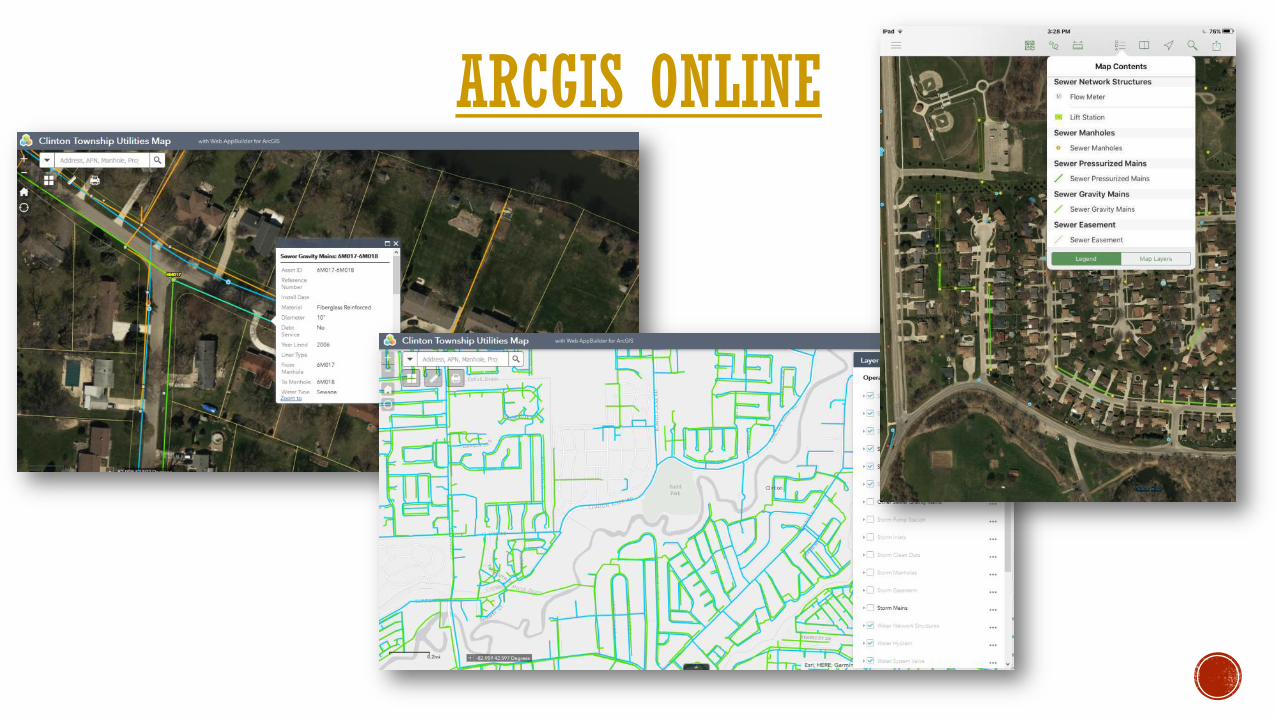
ArcGIS Online
What’s Next
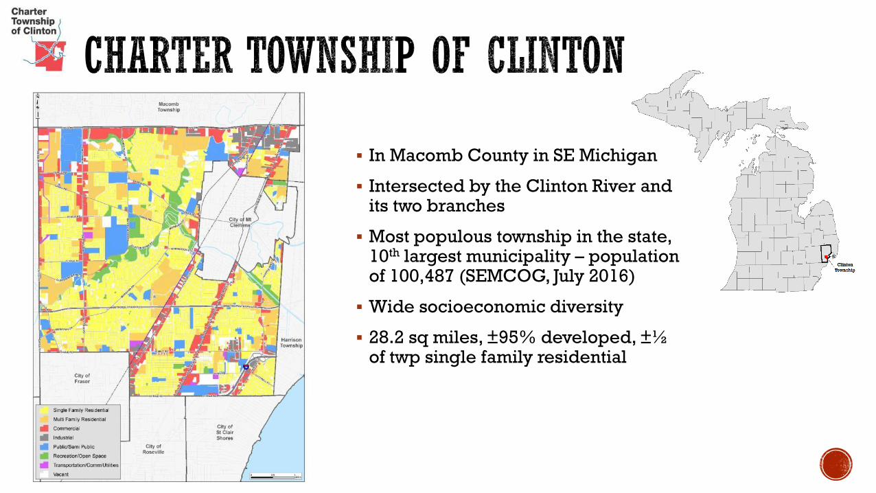
In Macomb County in SE Michigan
Intersected by the Clinton River and its two branches
Most populous township in the state, 10th largest municipality – population of 100,487 (SEMCOG, July 2016)
Wide socioeconomic diversity
28.2 sq miles, ±95% developed, ±½ of twp single family residential

~ 25,000 residential & 2,300 commercial Water & Sewer customers
~350 miles of water mains, 4,600 hydrants, 4,300 valves
~350 miles of sewer mains, 8,500 manholes, 15 pump stations, 6 Interceptor connections
Water sources: Great Lakes Water Authority, City of Mt Clemens
Sewer endpoints: Detroit Water & Sewerage, City of Mt Clemens

CAD-based utility mapping by contractor/township engineer
Large sewer & water maps for debt-service (last updated in 2006)
24x36 quarter section mapsets (last updated in 2010)
Engineering plans (from 1950s to current)
Most scanned but not all, some as builts, some missing altogether
Institutional knowledge

Need accurate & reliable data
Duplicate shapefiles, linework off by 20-50ft or more in some cases, missing or incorrect information
Easy to share and update
Outdated bulky quarter section mapsets with handwritten notes at two different locations, nothing to use in the field
Asset inventory & management
No master list of assets, no unique identifiers for the features, no ability to effectively track completed work
True utility networks
No connectivity or flow, missing manholes, valves & hydrants
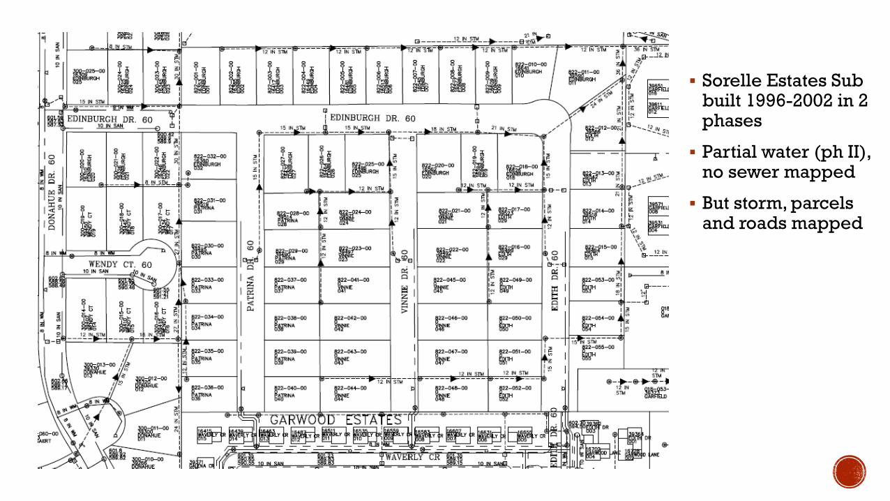
Sorelle Estates Sub built 1996-2002 in 2 phases
Partial water (ph II), no sewer mapped
But storm, parcels and roads mapped
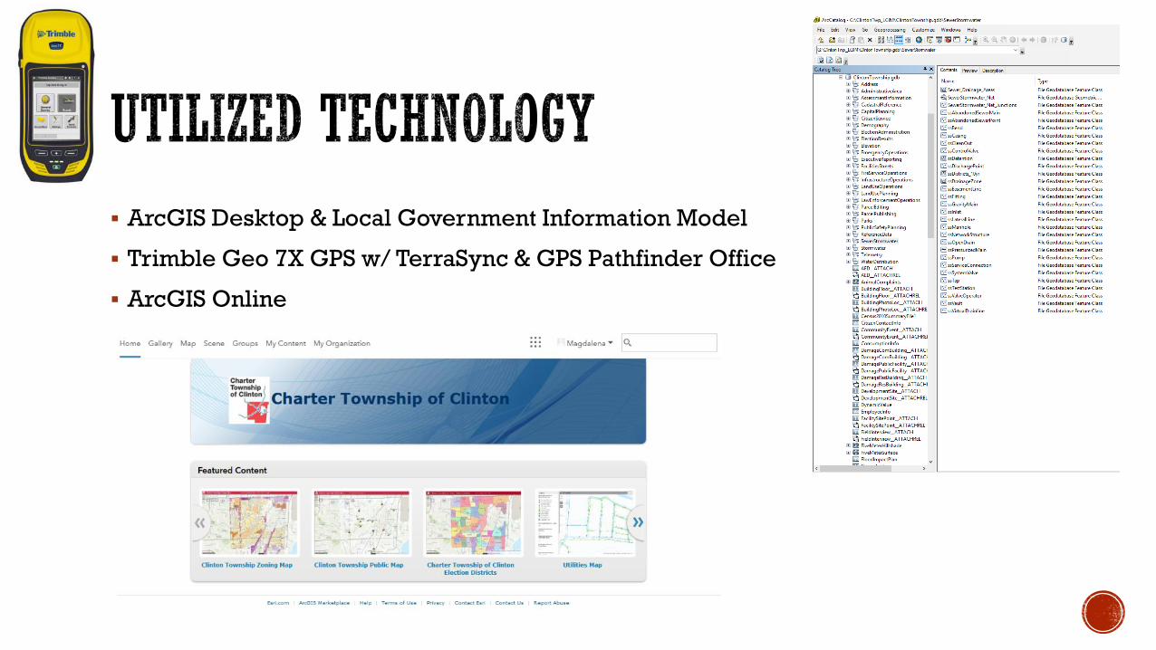
ArcGIS Desktop & Local Government Information Model
Trimble Geo 7X GPS w/ TerraSync & GPS Pathfinder Office
ArcGIS Online

Plans & As-Builts
Engineering plans (from 1950s to current)
CAD as-builts for recent projects
GPS locations
Summer 2016 – over 12,000 features, 1/3 of the township
Summer 2017
Imagery
Spring 2015 Aerial Imagery at 3inch resolution from Macomb County
Google Street View
DPW Staff
Institutional knowledge
Marked up quarter section maps
CCTV cleaning projects
Tap cards

Tap cards
Project files & plans
Georeference plans
Digitize and/or edit features
Update attributes
Upload to ArcGIS Online

Before After

Before After
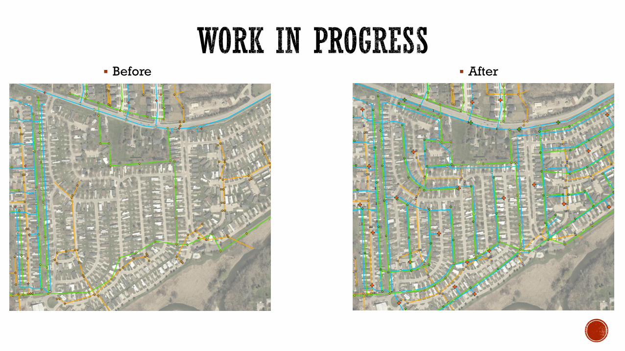
Before After

Before After

Before After


Continue to improve Water, Sewer & Storm Networks
Develop Water & Sewer Master Plans
Incorporate into existing Asset Management
(ERPortal)
ArcGIS Online & Mobile Apps
Capital Project Tracking
Outage Viewer
Hydrant Maintenance Inspection
Manhole Inspections
