location based services - cs.huji.ac.il
TRANSCRIPT

Location Based ServicesLocation Based ServicesApplication ServerApplication Server
&&Spatial AnalysisSpatial Analysis
Erez TheodorouErez [email protected]@cs.huji.ac.il
Presentation adopted for Presentation adopted for Embedded Computing SeminarEmbedded Computing Seminar
Prof. Scott KirkpatrickProf. Scott KirkpatrickFall 2005Fall 2005
Location Based ServicesLocation Based Services
Services designed for personal use.Services designed for personal use.Developed by mobile operatorsDeveloped by mobile operators
Deployed on handheld devices.Deployed on handheld devices.
Services designed for usage in vehicles.Services designed for usage in vehicles.Developed by automobile manufactures.Developed by automobile manufactures.
Deployed often as OEM equipment in the Deployed often as OEM equipment in the vehicle.vehicle.

Location Based ServicesLocation Based ServicesServices designed for use in vehiclesServices designed for use in vehicles
Have large existing customer baseHave large existing customer base
Suppliers are the existing components Suppliers are the existing components suppliers to the Auto manufacturers: suppliers to the Auto manufacturers:
Hardware:Hardware:Bosh (Bosh (blaupunktblaupunkt))
VDOVDO
Application and Service (called Application and Service (called ““telematicstelematics””):):OnStarOnStar
TT--Traffic (Traffic (TegaronTegaron) (now a subsidiary of T) (now a subsidiary of T--Mobile)Mobile)
Location Based ServicesLocation Based ServicesServices designed for use in vehiclesServices designed for use in vehicles
Vehicle Mobile Location Services Value Chain

Location Based ServicesLocation Based ServicesServices designed for personal useServices designed for personal use
Customer base is owned by Mobile Customer base is owned by Mobile operator, or media companies:operator, or media companies:
Yahoo!Yahoo!
AOLAOL
Can be a subsidiary or investment of the Can be a subsidiary or investment of the mobile operator.mobile operator.
Services are provided directly by the Services are provided directly by the mobile portal mobile portal (unlike automotive which is provided by the (unlike automotive which is provided by the
manufacturer)manufacturer)
Location Based ServicesLocation Based ServicesServices designed for personal use.Services designed for personal use.
Personal Mobile Location Services Value Chain

Location Based ServicesLocation Based ServicesSolution Components architectureSolution Components architectureComprised of different technologies Comprised of different technologies integrated by an integrated by an Application ServerApplication Serverwhich provides the framework for the which provides the framework for the solution.solution.Solution components:Solution components:
Mobile Location Based Server Application Mobile Location Based Server Application Deployment EnvironmentDeployment EnvironmentMobile Operator NetworkMobile Operator NetworkMobile Client DevicesMobile Client Devices
Location Based ServicesLocation Based Services
Example of an architecture for a Mobile Location Solution
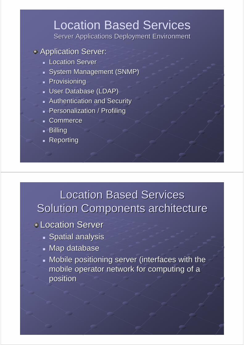
Location Based ServicesServer Applications Deployment EnvironmentServer Applications Deployment Environment
Application Server:Application Server:Location ServerLocation Server
System Management (SNMP)System Management (SNMP)
ProvisioningProvisioning
User Database (LDAP)User Database (LDAP)
Authentication and SecurityAuthentication and Security
Personalization / ProfilingPersonalization / Profiling
CommerceCommerce
BillingBilling
ReportingReporting
Location Based ServicesLocation Based ServicesSolution Components architectureSolution Components architecture
Location ServerLocation ServerSpatial analysisSpatial analysis
Map databaseMap database
Mobile positioning server (interfaces with the Mobile positioning server (interfaces with the mobile operator network for computing of a mobile operator network for computing of a positionposition
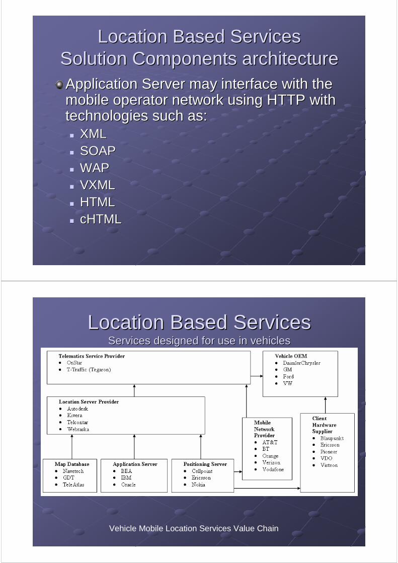
Location Based ServicesLocation Based ServicesSolution Components architectureSolution Components architectureApplication Server may interface with the Application Server may interface with the mobile operator network using HTTP with mobile operator network using HTTP with technologies such as:technologies such as:
XMLXMLSOAPSOAPWAPWAPVXMLVXMLHTMLHTMLcHTMLcHTML
Location Based ServicesLocation Based ServicesServices designed for use in vehiclesServices designed for use in vehicles
Vehicle Mobile Location Services Value Chain
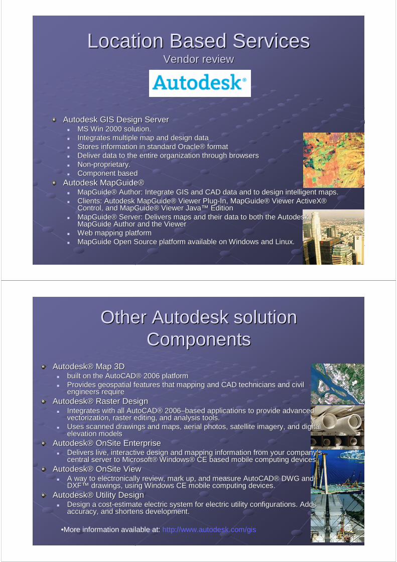
Location Based ServicesLocation Based ServicesVendor reviewVendor review
Autodesk GIS Design ServerAutodesk GIS Design ServerMS Win 2000 solution.MS Win 2000 solution.Integrates multiple map and design dataIntegrates multiple map and design dataStores information in standard OracleStores information in standard Oracle®® formatformatDeliver data to the entire organization through browsers Deliver data to the entire organization through browsers NonNon--proprietary.proprietary.Component basedComponent based
Autodesk Autodesk MapGuideMapGuide®®MapGuideMapGuide®® Author: Integrate GIS and CAD data and to design intelligent maAuthor: Integrate GIS and CAD data and to design intelligent maps. ps. Clients: Autodesk Clients: Autodesk MapGuideMapGuide®® Viewer PlugViewer Plug--In, In, MapGuideMapGuide®® Viewer ActiveXViewer ActiveX®®Control, and Control, and MapGuideMapGuide®® Viewer JavaViewer Java™™ Edition Edition MapGuideMapGuide®® Server: Delivers maps and their data to both the Autodesk Server: Delivers maps and their data to both the Autodesk MapGuideMapGuide Author and the Viewer Author and the Viewer Web mapping platformWeb mapping platformMapGuideMapGuide Open Source platform available on Windows and Linux.Open Source platform available on Windows and Linux.
Other Autodesk solution Other Autodesk solution ComponentsComponents
AutodeskAutodesk®® Map 3DMap 3Dbuilt on the AutoCADbuilt on the AutoCAD®® 2006 platform 2006 platform Provides geospatial features that mapping and CAD technicians anProvides geospatial features that mapping and CAD technicians and civil d civil engineers require engineers require
AutodeskAutodesk®® Raster DesignRaster DesignIntegrates with all AutoCADIntegrates with all AutoCAD®® 20062006––based applications to provide advanced based applications to provide advanced vectorizationvectorization, raster editing, and analysis tools, raster editing, and analysis tools. . Uses scanned drawings and maps, aerial photos, satellite imageryUses scanned drawings and maps, aerial photos, satellite imagery, and digital , and digital elevation modelselevation models
AutodeskAutodesk®® OnSiteOnSite EnterpriseEnterpriseDelivers live, interactive design and mapping information from yDelivers live, interactive design and mapping information from your companyour company’’s s central server to Microsoftcentral server to Microsoft®® WindowsWindows®® CE based mobile computing devices CE based mobile computing devices
AutodeskAutodesk®® OnSiteOnSite ViewViewA way to electronically review, mark up, and measure AutoCADA way to electronically review, mark up, and measure AutoCAD®® DWG and DWG and DXFDXF™™ drawings, using Windows CE mobile computing devices.drawings, using Windows CE mobile computing devices.
AutodeskAutodesk®® Utility DesignUtility DesignDesign a costDesign a cost--estimate electric system for electric utility configurations. Adestimate electric system for electric utility configurations. Adds ds accuracy, and shortens development.accuracy, and shortens development.
•More information available at: http://www.autodesk.com/gis

Location Based ServicesLocation Based ServicesServices designed for use in vehiclesServices designed for use in vehicles
Vendor reviewVendor review
A leading provider of telematics services in the United States. In-vehicle safety, security, and information services use GPS satellite and cellular technology to link the vehicle and driver to the OnStar Center. Advisors offer real-time, personalized help 24/7.
Location Based ServicesLocation Based ServicesServices designed for use in vehiclesServices designed for use in vehicles
Vendor reviewVendor review
World leader in premium-quality digital map data. You'll find NAVTEQ data onboard most in-vehicle navigation systemsNavigation and map coverage in 52 countriesPOITrafficMap voice data

Location Based ServicesLocation Based ServicesVendor reviewVendor review
Worldwide provider of total location-based solutions for in-vehicle, Internet and wireless platforms. Uses premier spatial software platform, patented automated user notification technology and industry partners.Help its customers provide complete, real-time, highly scalable solutions for navigation, mobile safety, security and convenience.
Location Based ServicesLocation Based ServicesVendor reviewVendor review
Drill Down ServerDrill Down Server™™ (DDS)(DDS)Platform for LBSPlatform for LBSAccesses maps and spatial dataAccesses maps and spatial dataApplication can be Application can be deliverddeliverd to Web browsers, to Web browsers, PDAsPDAs, Pocket PCs, and vehicle , Pocket PCs, and vehicle telematicstelematics units.units.Provide information about TrafficProvide information about Traffic
Universal Universal TelematicsTelematics ServerServer™™ (UTS)(UTS)Automated web and telephony service platformAutomated web and telephony service platformCan be customized and branded to customer needs: Enterprise systCan be customized and branded to customer needs: Enterprise systems, GPS, ems, GPS, Wireless, Hardware.Wireless, Hardware.
Rich Map EngineRich Map Engine™™ (RME)(RME)Accesses base map data using Accesses base map data using TelcontarTelcontar’’ss GeoGeo//Spatial Search Keys.Spatial Search Keys.Map RenderingMap RenderingRoutingRoutingPositioningPositioningDynamic customizationDynamic customizationIdeal for applications requiring clientIdeal for applications requiring client--side functionality.side functionality.Used to develop apps on embedded systems as well as pocket PCs.Used to develop apps on embedded systems as well as pocket PCs.

Location Based ServicesLocation Based ServicesVendor reviewVendor review
Has been acquired on Sep 13th 2004 by
Location platform industry-leading fast Kivera location engine™Route planning Map generation Flexible platform that includes customizable applications Private label, branded interface Enterprise-strength scalability Fast, accurate mapping and routing at 400,000 geocodes per CPU per hour.Optimized for static and real-time geocoding, reverse geocoding, point-to-point (phone location, address, point of interest, latitude/longitude) driving directions, map displays, and proximity searches
The Application ServerThe Application Server

The Application ServerThe Application Server
Enables expandabilityEnables expandability
Protection of business logic. (no need to Protection of business logic. (no need to redesign if a component needs to be redesign if a component needs to be replaced) replaced)
Location Based ServicesLocation Based ServicesThe Application ServerThe Application Server
Infrastructure based on industry standards Infrastructure based on industry standards will help insulate any one piece from will help insulate any one piece from problems of the other.problems of the other.
LIF (Location Interoperability Forum)LIF (Location Interoperability Forum)
GML (Geography Markup Language)GML (Geography Markup Language)
Open GIS ConsortiumOpen GIS Consortium

What is an Application Server?What is an Application Server?
Server side framework for deployment of Server side framework for deployment of business logicbusiness logic
Comprised of at least 3 layers:Comprised of at least 3 layers:Business logicBusiness logic
Implements business intelligence, rules and logicImplements business intelligence, rules and logic
PresentationPresentationMethods for delivering the content of the application serverMethods for delivering the content of the application server
Data AccessData AccessIntegration of services to components in the business logicIntegration of services to components in the business logic
Why is an Application Server Why is an Application Server Important?Important?
Intellectual ProtectionIntellectual ProtectionReversed engineering is prevented by hiding the Reversed engineering is prevented by hiding the business processes and algorithms behind the business processes and algorithms behind the presentation layer in the application serverpresentation layer in the application server
ReuseReuseReuse of the business logic is possible. New Reuse of the business logic is possible. New interfaces can be easily incorporated. In larger interfaces can be easily incorporated. In larger projects separation of the business logic from the projects separation of the business logic from the presentation layer is crucial, to avoid maintaining presentation layer is crucial, to avoid maintaining repeated coding which is a result of combining layers repeated coding which is a result of combining layers

Why is an Application Server Why is an Application Server Important?Important?
ManageabilityManageabilityManaging a system based on thin client Managing a system based on thin client application is easier, as most of the "work" is application is easier, as most of the "work" is done by the server, only minimal upgrade is done by the server, only minimal upgrade is needed on the client side needed on the client side
Network SecurityNetwork SecurityUsing secure protocols such as SSL in the Using secure protocols such as SSL in the presentation layer provides industry standard presentation layer provides industry standard well known security.well known security.
Why is an Application Server Why is an Application Server Important?Important?
PerformancePerformanceHigh CPU requirements of technologies used High CPU requirements of technologies used in components such as spatial analysis are in components such as spatial analysis are more cost effective if preformed on a server more cost effective if preformed on a server side whether then on the mobile client's side. side whether then on the mobile client's side.

The Application ServerThe Application Server
Integrating distributed enterprise Integrating distributed enterprise application can be done in several ways.application can be done in several ways.
Typically involves a high speed network Typically involves a high speed network software bus, operated by a transaction software bus, operated by a transaction server (such as BEA Tuxedo).server (such as BEA Tuxedo).
A simplified example can be done by Java A simplified example can be done by Java 2 Enterprise Edition (J2EE)2 Enterprise Edition (J2EE)
J2EE Application ServerJ2EE Application ServerWhy Java on the Server?Why Java on the Server?
Good 3Good 3rdrd Generation LanguageGeneration LanguageSimpler than C++Simpler than C++Can solve large problemsCan solve large problemsProgramming can be much faster than C++Programming can be much faster than C++
Good 4Good 4thth Generation LanguageGeneration LanguageEasy to extend to reusable, high level business abstractions.Easy to extend to reusable, high level business abstractions.Object Oriented (as apposed to 4Object Oriented (as apposed to 4thth generation scripting languages)generation scripting languages)
WidespreadWidespreadLarge developer communityLarge developer communityPortability, multiPortability, multi--platform (OS) environmentplatform (OS) environment
RobustRobustNo direct access to memoryNo direct access to memoryAutomatic garbage collection, reduces memory leaks.Automatic garbage collection, reduces memory leaks.Reduces time to marketReduces time to market

J2EE Application ServerJ2EE Application ServerWhy Java on the Server?Why Java on the Server?
Strong Network SupportStrong Network SupportVery strong supportVery strong supportBusiness object can be passed by valueBusiness object can be passed by valueChange an object representation without breaking remote Change an object representation without breaking remote applicationapplicationLoad functionality with standard byte codeLoad functionality with standard byte codeDistributed garbage collection.Distributed garbage collection.
Component Oriented ComputingComponent Oriented ComputingComponent oriented model, allows data independent of business Component oriented model, allows data independent of business logic, and business logic independent of presentation logiclogic, and business logic independent of presentation logic
FastFastPerformance has improved compared to native compiled 3Performance has improved compared to native compiled 3rdrd
generation languages. Only a small portion of the processing timgeneration languages. Only a small portion of the processing time is e is spent on the business logic. The rest is in the network and the spent on the business logic. The rest is in the network and the DBMS.DBMS.
What is a J2EE Application Server?What is a J2EE Application Server?
The J2EE specification states a set of The J2EE specification states a set of minimum characteristics a J2EE minimum characteristics a J2EE application server must exhibit,application server must exhibit, delivered delivered to your mobile location services to your mobile location services infrastructure before you even begin to infrastructure before you even begin to buildbuild. .

What is a J2EE Application Server?What is a J2EE Application Server?
The J2EE specification minimum The J2EE specification minimum characteristics a J2EE application server characteristics a J2EE application server must exhibitmust exhibit
ConsistencyConsistency
AdoptionAdoption
OpennessOpenness
SpecificationSpecification
What is a J2EE Application Server?What is a J2EE Application Server?
Easy to Develop and can deploy Easy to Develop and can deploy distributed Java Applicationsdistributed Java Applications
Structure and environment to facilitate Structure and environment to facilitate building wellbuilding well--formed applications formed applications
Systems infrastructure and management tools Systems infrastructure and management tools for deploying an enterprise application for deploying an enterprise application

What is a J2EE Application Server?What is a J2EE Application Server?
Scales to Permit Thousands of Scales to Permit Thousands of Cooperative Servers to Be Accessed by Cooperative Servers to Be Accessed by Tens of Thousands of Clients. Provides:Tens of Thousands of Clients. Provides:
Fully multithreadedFully multithreaded
Sparingly consumes network and other Sparingly consumes network and other resourcesresources
No architectural bottlenecks to prevent linear No architectural bottlenecks to prevent linear scalingscaling
What is a J2EE Application Server?What is a J2EE Application Server?
Provides an Integrated Management Provides an Integrated Management Environment for: Environment for:
Comprehensive View of Application Comprehensive View of Application ResourcesResources
Network Resources Network Resources
System ResourcesSystem Resources
Diagnostic Information Diagnostic Information

What is a J2EE Application Server?What is a J2EE Application Server?
Provides Secure Communications, Provides Secure Communications, Including SSL, Access Control Lists, Including SSL, Access Control Lists, HTTP, and IIOP Tunneling to HTTP, and IIOP Tunneling to Communicate Across FirewallsCommunicate Across Firewalls
J2EE Application ServerJ2EE Application ServerArchitectureArchitecture
Divided into at least 3 layers:Divided into at least 3 layers:PresentationPresentation
Business logicBusiness logic
Data accessData access
Can include interfaces for:Can include interfaces for:Systems managementSystems management
ReportingReporting

J2EE Application Server ArchitectureJ2EE Application Server ArchitectureEnterprise JavaBeans (Enterprise JavaBeans (EJBsEJBs))
Because Because EJBsEJBs are based on a component are based on a component model, they operate within a specific model, they operate within a specific environment and its interactions are governed environment and its interactions are governed according to a specific set of rulesaccording to a specific set of rules. . There are three types of There are three types of EJBsEJBs: :
Session beansSession beansimplement a client/server conversation and are typically implement a client/server conversation and are typically found managing business process or workflow found managing business process or workflow
Entity beansEntity beansRepresent persistent business objects such as Represent persistent business objects such as CustomerAccountInformationCustomerAccountInformation
MessageMessage--driven beansdriven beansAllow clients to asynchronously invoke serverAllow clients to asynchronously invoke server--side business side business logic logic
J2EE Application Server ArchitectureJ2EE Application Server ArchitectureEnterprise JavaBeans (Enterprise JavaBeans (EJBsEJBs))
In a mobile location services application, session In a mobile location services application, session beans might include the following: beans might include the following:
PositionUserPositionUser: Attempts to update the user's current : Attempts to update the user's current position position
NotifierNotifier: Sends SMS message : Sends SMS message
GenerateRouteGenerateRoute: Calculates a route between two : Calculates a route between two locations locations
CheckoutCounterCheckoutCounter: Responsible for totaling all the : Responsible for totaling all the items a user put in a user's shopping cart, processing items a user put in a user's shopping cart, processing payment, and sending a message to an inventory payment, and sending a message to an inventory system to ship the items to the user's addresssystem to ship the items to the user's address
J2EE Application Server ArchitectureJ2EE Application Server ArchitectureEnterprise JavaBeans (Enterprise JavaBeans (EJBsEJBs))
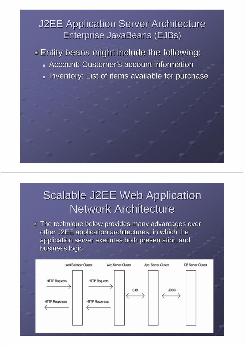
Entity beans might include the following:Entity beans might include the following:Account: Customer's account information Account: Customer's account information
Inventory: List of items available for purchase Inventory: List of items available for purchase
Scalable J2EE Web Application Scalable J2EE Web Application Network ArchitectureNetwork Architecture
The technique below provides many advantages over The technique below provides many advantages over other J2EE application architectures, in which the other J2EE application architectures, in which the application server executes both presentation and application server executes both presentation and business logic business logic

Spatial AnalysisSpatial Analysis
Spatial AnalysisSpatial Analysis
Spatial operations include:Spatial operations include:GeocodingGeocoding ((the process of looking up a position from the process of looking up a position from an addressan address))
Reverse Reverse GeocodingGeocoding ((the process of looking up an the process of looking up an address from a positionaddress from a position))
Routing Routing ((calculating a route between two positionscalculating a route between two positions))
Map rendering Map rendering ((translating an area of map database translating an area of map database into a vector or raster mapinto a vector or raster map))
POI SearchesPOI Searches
RealReal--Time Map Attribute EditorTime Map Attribute Editor

Example Spatial Analysis ServerExample Spatial Analysis Server
Spatial AnalysisSpatial Analysis
A set of software libraries performs search and A set of software libraries performs search and data retrieval operations on a compiled map data retrieval operations on a compiled map database.database.Operations defined earlier require specialized Operations defined earlier require specialized business logic and access the digital map business logic and access the digital map database using the access libraries database using the access libraries An interface is provided to integrate the spatial An interface is provided to integrate the spatial analysis server into your location server analysis server into your location server infrastructure infrastructure Selecting a standards based interface for spatial Selecting a standards based interface for spatial operations, such as GML, provides maximum operations, such as GML, provides maximum extensibility for your system extensibility for your system

Spatial AnalysisSpatial Analysis
Unlike traditional GIS products, spatial Unlike traditional GIS products, spatial analysis software for mobile location analysis software for mobile location services is focused on:services is focused on:
Speed of data retrieval Speed of data retrieval
Supports a high volume of concurrent Supports a high volume of concurrent requests requests
Spatial AnalysisSpatial Analysis
There are 3 primary database structures There are 3 primary database structures used in spatial analysis server software: used in spatial analysis server software:
Hybrid databaseHybrid database
Pure relational databasePure relational database
Pure objectPure object--oriented database. oriented database.

Spatial AnalysisSpatial Analysis
Hybrid databaseHybrid databaseThe underling assumption is that you cannot optimize The underling assumption is that you cannot optimize both the spatial data storage and the attribute data both the spatial data storage and the attribute data storage simultaneously.storage simultaneously.
Spatial data such as coordinates and topological data Spatial data such as coordinates and topological data is stored using a standard fileis stored using a standard file--based approach based approach
Attribute data is stored in relational database tables. Attribute data is stored in relational database tables.
Data and Attributes are linked via a unique identifier Data and Attributes are linked via a unique identifier
Spatial AnalysisSpatial Analysis
Relational databaseRelational databaseStores both the spatial data and the attribute Stores both the spatial data and the attribute data in relational tables, linking them with a data in relational tables, linking them with a standard relational join.standard relational join.
Poorer system performance Poorer system performance Spatial data that is close together is not Spatial data that is close together is not necessarily stored close together in the database. necessarily stored close together in the database.

Spatial AnalysisSpatial Analysis
ObjectObject--Oriented Database Model Oriented Database Model Attempts to deliver speed without sacrificing flexibility Attempts to deliver speed without sacrificing flexibility
Data is organized around the spatial entitiesData is organized around the spatial entitiesThese databases define data as a series of objects that have These databases define data as a series of objects that have similar criteria (object classes).similar criteria (object classes).
Relationships between objects and classes are explicitly Relationships between objects and classes are explicitly defined. defined.
Drawbacks:Drawbacks:No standard query language for objectNo standard query language for object--oriented databases oriented databases
ObjectObject--oriented databases take substantially more skill and oriented databases take substantially more skill and time to design than other databases time to design than other databases
Digital MapsDigital Maps
What Is a Digital Map?What Is a Digital Map?
A digital map attempts to capture the A digital map attempts to capture the underlying geographical phenomena and underlying geographical phenomena and make it available for dynamic retrieval, make it available for dynamic retrieval, spatial analysis, and representation by spatial analysis, and representation by sophisticated software systems. sophisticated software systems.

Digital MapsDigital MapsDigital maps can represent information in 2 basic Digital maps can represent information in 2 basic ways:ways:
1.1. The geographic world is composed of entities that can The geographic world is composed of entities that can be positioned on the map by a geometric coordinate be positioned on the map by a geometric coordinate system and described by attributes and properties. system and described by attributes and properties.
This approach typically uses a vector data model, where This approach typically uses a vector data model, where entities are defined using points, lines, and polygonsentities are defined using points, lines, and polygons
Spatial analysis required in mobile location services (e.g., Spatial analysis required in mobile location services (e.g., routing through a linked network topology; i.e., roads) is well routing through a linked network topology; i.e., roads) is well served by the entity model. served by the entity model.
Is the most common map data model used by spatial analysis Is the most common map data model used by spatial analysis software vendors. software vendors.
Digital MapsDigital MapsVector Representation of Entity Data Model with Attributes for each polygon

Digital MapsDigital MapsVector Representation of Linked Network Topology in Entity Data Model.
Digital MapsDigital Maps
Digital maps can represent information in 2 Digital maps can represent information in 2 basic ways:basic ways:
2.2. Specific attributes (e.g., elevation) vary continuously Specific attributes (e.g., elevation) vary continuously in the map as a mathematical function.in the map as a mathematical function.
Because using simple differentiable numerical function to Because using simple differentiable numerical function to represent large geographical areas can be difficult, it is represent large geographical areas can be difficult, it is common to divide the geographical space into discrete common to divide the geographical space into discrete spatial unitsspatial units. . The result is known as a The result is known as a tessellation, and can , and can be composed of square cells if a raster model is used be composed of square cells if a raster model is used

Digital MapsDigital MapsRaster Tessellation in a Continuous Variation Data Model, One LaRaster Tessellation in a Continuous Variation Data Model, One Layer for Each yer for Each Attribute Attribute
Digital MapsDigital Maps
How Are Digital Maps Created and How Are Digital Maps Created and Maintained? Maintained?
Gathering Source Information Gathering Source Information
Collecting Data From the Field Collecting Data From the Field
Developing Products Developing Products
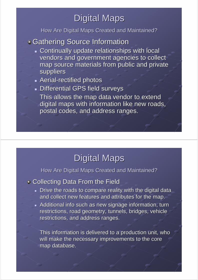
Digital MapsDigital MapsHow Are Digital Maps Created and Maintained?How Are Digital Maps Created and Maintained?
Gathering Source Information Gathering Source Information Continually update relationships with local Continually update relationships with local vendors and government agencies to collect vendors and government agencies to collect map source materials from public and private map source materials from public and private suppliers suppliers AerialAerial--rectified photosrectified photosDifferential GPS field surveysDifferential GPS field surveysThis allows the map data vendor to extend This allows the map data vendor to extend digital maps with information like new roads, digital maps with information like new roads, postal codes, and address ranges. postal codes, and address ranges.
Digital MapsDigital MapsHow Are Digital Maps Created and Maintained?How Are Digital Maps Created and Maintained?
Collecting Data From the Field Collecting Data From the Field Drive the roads to compare reality with the digital data Drive the roads to compare reality with the digital data and collect new features and attributes for the map.and collect new features and attributes for the map.
Additional info such as new signage information, turn Additional info such as new signage information, turn restrictions, road geometry, tunnels, bridges, vehicle restrictions, road geometry, tunnels, bridges, vehicle restrictions, and address ranges. restrictions, and address ranges.
This information is delivered to a production unit, who This information is delivered to a production unit, who will make the necessary improvements to the core will make the necessary improvements to the core map database. map database.

Digital MapsDigital MapsHow Are Digital Maps Created and Maintained?How Are Digital Maps Created and Maintained?
Developing Products Developing Products Map data conversion from source format into various Map data conversion from source format into various product formats optimized for specific applications product formats optimized for specific applications such as:such as:
MultiNetMultiNet GDF, GDF, MultinetMultinet ShapefileShapefile
MapInfoMapInfo
MapBaseMapBase
MapAccessMapAccess
Spatial Data Engine (SDE)Spatial Data Engine (SDE)
Oracle SpatialOracle Spatial
KIWIKIWI
geocodinggeocoding--specific formats, or lighter formats such as those specific formats, or lighter formats such as those for mobile location services. for mobile location services.
Geographical Data Types Geographical Data Types
In the vector data model, geographic data is In the vector data model, geographic data is stored in discrete points, lines, and polygonsstored in discrete points, lines, and polygons..
Points, lines, and polygons are respectively Points, lines, and polygons are respectively zerozero--, one, one--, and two, and two--dimensional static dimensional static representations of realrepresentations of real --world phenomena in world phenomena in terms of simple x, y coordinates terms of simple x, y coordinates

Geographical Data Types Geographical Data Types PointsPoints
Refer to objects that have location and Refer to objects that have location and attribute information not large enough to be attribute information not large enough to be represented as areas represented as areas Points have no dimensionsPoints have no dimensionsRepresentation as a Point or a polygon Representation as a Point or a polygon depends on the level of abstraction and scale depends on the level of abstraction and scale of the map.of the map.Examples of points:Examples of points:
Points of interest Points of interest ((POIsPOIs) ) Parcel Parcel centroidscentroids such as postal codes or such as postal codes or addressesaddresses. .
Geographical Data Types Geographical Data Types Point primitivePoint primitive

Geographical Data Types Geographical Data Types
Nodes Nodes Are a special type of point that represent a Are a special type of point that represent a junction or the endpoint of a line. junction or the endpoint of a line.
Same as points in all other respects Same as points in all other respects
Provide information that includes connectivity Provide information that includes connectivity between lines and information about adjacent between lines and information about adjacent polygons and enclosed islands polygons and enclosed islands
Geographical Data Types Geographical Data Types Line PrimitiveLine Primitive

Geographical Data Types Geographical Data Types PolygonsPolygons
A set of connected lines that form a closed A set of connected lines that form a closed mathematical figure.mathematical figure.
Can have any number of points and can be any Can have any number of points and can be any shape or size shape or size
Ways to represent a polygon include the set of x, y Ways to represent a polygon include the set of x, y coordinates that form its boundary or the area coordinates that form its boundary or the area contained by the boundary. contained by the boundary.
Polygons can have holes, contain other polygons, Polygons can have holes, contain other polygons, and be directly adjacent to other polygons and be directly adjacent to other polygons
Geographical Data Types Geographical Data Types Polygon PrimitivePolygon Primitive

Geographical Data Types Geographical Data Types
Linked Attributes Linked Attributes Each geographic primitive has attached Each geographic primitive has attached information that describes it. In mobile information that describes it. In mobile location services, the most important location services, the most important attributes relate to the road network, such as:attributes relate to the road network, such as:
SpeedSpeed
Street names Street names
Turn restrictionsTurn restrictions
Connectivity. Connectivity.
Geographical Data Types Geographical Data Types Computer Storage of Geographic Data Computer Storage of Geographic Data Structures Structures
Points will have an (x, y) coordinatePoints will have an (x, y) coordinate
A simple line with only two nodes will have two (x, y) A simple line with only two nodes will have two (x, y) coordinates, coordinates,
An arc will have n number of (x, y) coordinates, An arc will have n number of (x, y) coordinates,
A polygon could have either n number of lines or n A polygon could have either n number of lines or n number of points. number of points.

Geographical Data Types Geographical Data Types Computer Storage of Geographic Data Computer Storage of Geographic Data StructuresStructures
To achieve sufficient precision, it is necessary to use To achieve sufficient precision, it is necessary to use a 32a 32--bit or 64bit or 64--bit real data type for each value in the bit real data type for each value in the coordinate pair. coordinate pair.
A point would require 8 or 16 bytes of storage, a line A point would require 8 or 16 bytes of storage, a line requires a minimum of 16 bytes of storage, and a requires a minimum of 16 bytes of storage, and a polygon requires a minimum of 24 bytes. polygon requires a minimum of 24 bytes.
A map databases can contain many millions of spatial A map databases can contain many millions of spatial entities and each can have linked attributes entities and each can have linked attributes -- A map A map database can become very large. database can become very large.
GeocodingGeocoding
The ability to look up an address on a mapThe ability to look up an address on a mapMany problem are due to the fact that :Many problem are due to the fact that :
Address schemes differ significantly by geographic Address schemes differ significantly by geographic regionregion
Differences may require highly complex rule Differences may require highly complex rule systems to analyze the address and good map systems to analyze the address and good map data to make data to make geocodinggeocoding effective.effective.

GeocodingGeocoding
The process of associating an address The process of associating an address with geographic features.with geographic features.
The geographic features are often The geographic features are often represented by a line, such as a street center represented by a line, such as a street center line database. line database.
Typically, each segment of the street center Typically, each segment of the street center line has attributes such as high and low line has attributes such as high and low address range (or left and right address address range (or left and right address range), street range), street name(sname(s), the city, postal code, ), the city, postal code, and many others. and many others.
GeocodingGeocodingStreet address range exampleStreet address range example

GeocodingGeocodingHow does it work?How does it work?FourFour--step process :step process :
1.1. Address is inputted to the Address is inputted to the geocodinggeocoding system system 2.2. Address is then analyzed, parsed, and Address is then analyzed, parsed, and
placed into a standard format placed into a standard format 3.3. A A SoundexSoundex search is done for the city and search is done for the city and
street name and an address range search is street name and an address range search is done for any matches found in the done for any matches found in the soundexsoundexsearch. search.
4.4. A scoring system is used to rank the A scoring system is used to rank the possible matches possible matches
GeocodingGeocodingHow does it work? How does it work? -- continuedcontinued
If a match is found, the geographic coordinate (e.g., If a match is found, the geographic coordinate (e.g., projected latitude and longitude) is returned. projected latitude and longitude) is returned.
If multiple matches are found, they are returned If multiple matches are found, they are returned ranked by the scoring system so the user can select ranked by the scoring system so the user can select the best match. the best match.
If no matches are found, the If no matches are found, the geocodinggeocoding system logs system logs an error and returns an error message. an error and returns an error message.

GeocodingGeocodingAddress InputAddress Input
GeocodingGeocoding systems need a way to receive the systems need a way to receive the address from the user. address from the user.
This might include a Java constructor, an XML This might include a Java constructor, an XML document over HTTP, or a proprietary protocol. document over HTTP, or a proprietary protocol.
Advanced systems allow a near freeAdvanced systems allow a near free--form address form address input, such as one text input for address and street input, such as one text input for address and street name and another text input for city, region, and name and another text input for city, region, and postal code. postal code.
GeocodingGeocodingAddress Input Address Input -- continuedcontinued
The mobile location services application developer The mobile location services application developer does not have to do the complex parsing and error does not have to do the complex parsing and error correction (left to the correction (left to the geocodergeocoder).).
The user inputs the address the same intuitive way he The user inputs the address the same intuitive way he or she might address a letter. or she might address a letter.
Less sophisticated systems require a text input for Less sophisticated systems require a text input for each element. The more discrete inputs required, the each element. The more discrete inputs required, the more unsophisticated the more unsophisticated the geocodergeocoder.. ..

GeocodingGeocodingAddress Standardization Address Standardization
Once the Once the geocodinggeocoding engine has received the engine has received the address, it attempts to parse it and address, it attempts to parse it and standardize it. standardize it.
If the If the geocodergeocoder is region specific (e.g., only is region specific (e.g., only designed to work with U.S. map data) the designed to work with U.S. map data) the standardization is simpler. standardization is simpler.
Address interpretation might appear as Address interpretation might appear as follows :follows :
GeocodingGeocodingAddress Standardization example:Address Standardization example:
Address list before parsing and standardization:Address list before parsing and standardization:1000 Main Street, Suite 1001000 Main Street, Suite 100555 California Avenue555 California Avenue500 South 300 West500 South 300 West1121 3rd Street1121 3rd Street501 Avenue G501 Avenue G15 Jefferson Apt# 115 Jefferson Apt# 1
Address list after parsing and standardization:Address list after parsing and standardization:Address1 Name1 Suffix Direction Address2 Name2Address1 Name1 Suffix Direction Address2 Name200001000 MAIN STREET00001000 MAIN STREET 0000100000010000000555 CALIFORNIA AVENUE00000555 CALIFORNIA AVENUE00000500 300 WEST00000500 300 WEST00001121 300001121 3rdrd STREETSTREET00000501 G00000501 G AVENUEAVENUE00000015 JEFFERSON 000000100000015 JEFFERSON 0000001

GeocodingGeocoding
Perform Perform SoundexSoundex and Address Range and Address Range SearchSearch
GeocodingGeocoding engine attempts to find a match in engine attempts to find a match in the map databasethe map database
If an exact match is not available, the system If an exact match is not available, the system might do a might do a soundexsoundex search to find street search to find street names that are similar so the user may names that are similar so the user may choose the best match choose the best match
GeocodingGeocoding
Perform Perform SoundexSoundex and Address Range and Address Range SearchSearch
A A soundexsoundex index is based on the way a word index is based on the way a word sounds rather than the way a word is spelled.sounds rather than the way a word is spelled.
Each entry in the index is a combination of one Each entry in the index is a combination of one letter and three numbers. letter and three numbers.
The letter is the first letter of the original word. The The letter is the first letter of the original word. The three numbers are the number encoding for the three numbers are the number encoding for the letters of the word letters of the word

GeocodingGeocodingPerform Perform SoundexSoundex and Address Range Searchand Address Range Search
SoundexSoundex Coding GuideCoding Guide1.1. B,F,P,VB,F,P,V2.2. C, G, J, K, Q, S, X, ZC, G, J, K, Q, S, X, Z3.3. D, TD, T4.4. LL5.5. M, NM, N6.6. RR
The letters A, E, I, O, U, H, W, and Y are ignored. Double letteThe letters A, E, I, O, U, H, W, and Y are ignored. Double letters rs are treated as a single letter. Side by side letters that have tare treated as a single letter. Side by side letters that have the he same same soundexsoundex value are treated as a single letter. Words with a value are treated as a single letter. Words with a prefix are coded both with and without the prefix.prefix are coded both with and without the prefix.
More information at More information at http://http://www.nara.gov/genealogy/soundex/soundex.htmlwww.nara.gov/genealogy/soundex/soundex.html. .
GeocodingGeocoding
Perform Perform SoundexSoundex and Address Range and Address Range SearchSearch
SoundexSoundex Encoding ExamplesEncoding ExamplesSMITHSMITH
SS--530 (S, 5 for the M, 3 for the T, 0 added)530 (S, 5 for the M, 3 for the T, 0 added)
SMYTHSMYTHSS--530 (S, 5 for the M, 3 for the T, 0 added)530 (S, 5 for the M, 3 for the T, 0 added)
WASHINGTONWASHINGTONWW--252 (W, 2 for the W, 5 for the N, 2 for the G)252 (W, 2 for the W, 5 for the N, 2 for the G)
JACKSONJACKSON JJ--250 250 (J, 2 for C, K ignored, S ignored, 5 for N, 0 added)(J, 2 for C, K ignored, S ignored, 5 for N, 0 added)

GeocodingGeocoding
Apply Scoring Rules Apply Scoring Rules Now that the Now that the geocodinggeocoding engine has a set of engine has a set of potential results, each result is scored potential results, each result is scored according to certain criteria, which might according to certain criteria, which might include the following:include the following:
Whether the street name was an exact matchWhether the street name was an exact match
Whether the street type matched (Avenue or Street)Whether the street type matched (Avenue or Street)
Whether the direction matched, if the street had a Whether the direction matched, if the street had a directional attribute (e.g., north or southwest)directional attribute (e.g., north or southwest)
Whether the city, zone, or postal code matchesWhether the city, zone, or postal code matches
GeocodingGeocodingWhat Makes What Makes GeocodingGeocoding So Difficult? So Difficult?
Address Cleanup Address Cleanup One of the greatest challenges in providing a highOne of the greatest challenges in providing a high--quality quality geocodergeocoder. Typical problems include the following :. Typical problems include the following :
Numeric street names Numeric street names -- 10 1st Street10 1st Street
Addresses with more than one directional Addresses with more than one directional -- 123 W Main Street 123 W Main Street EastEast
Alphanumeric addresses Alphanumeric addresses -- 100A Mission Street100A Mission Street
Fractional addresses Fractional addresses -- 4545½½ Bee StreetBee Street
Coordinate addresses (Utah) Coordinate addresses (Utah) -- 520 East 400 South520 East 400 South
Addresses with dashes (Hawaii and Queens, NY) Addresses with dashes (Hawaii and Queens, NY) -- 101101--123 123 KaanapaliKaanapali RoadRoad
Street names with numeric components Street names with numeric components -- 1234 10 Mile Road1234 10 Mile Road
Street names that are Street names that are directionalsdirectionals -- South StreetSouth Street
Street names that are suffixes (Brooklyn, NY) Street names that are suffixes (Brooklyn, NY) -- Avenue GAvenue G
Spelled out address numbers Spelled out address numbers -- Two Second StreetTwo Second Street

GeocodingGeocodingWhat Makes What Makes GeocodingGeocoding So Difficult? So Difficult?
Differing Address Standards Differing Address Standards GeocodersGeocoders must be locally adapted, tested, and must be locally adapted, tested, and tuned. tuned.
Language has a significant impact on how Language has a significant impact on how addresses will be input addresses will be input
GeocodingGeocodingWhat Makes What Makes GeocodingGeocoding So Difficult? So Difficult?
SoundexSoundex Mismatches Mismatches Bad matches add processing time and could present Bad matches add processing time and could present the user with unintuitive choices the user with unintuitive choices
There are many proprietary enhancements that There are many proprietary enhancements that could increase its effectiveness in matching an could increase its effectiveness in matching an address address

GeocodingGeocodingWhat Makes What Makes GeocodingGeocoding So Difficult? So Difficult?
Static Map Database and Dynamic Static Map Database and Dynamic Communities Communities
Map database releases are typically done two to Map database releases are typically done two to four times per year four times per year New roads and buildings are constantly being New roads and buildings are constantly being constructed.constructed.Applications that have a central map database and Applications that have a central map database and thin clients have the advantage of being more up to thin clients have the advantage of being more up to date than systems that require map databases on date than systems that require map databases on CD.CD.OffboardOffboard navigation systems that use the mobile navigation systems that use the mobile network to process spatial requests on a remote network to process spatial requests on a remote server are a better option.server are a better option.
GeocodingGeocodingWhat Makes What Makes GeocodingGeocoding So Difficult? So Difficult?
Rural Delivery and Post Office Boxes Rural Delivery and Post Office Boxes Rural delivery and post office boxes present another Rural delivery and post office boxes present another series of complications for series of complications for geocodinggeocoding. .
Depending on the application, the geographical Depending on the application, the geographical position found might not be useful if the physical position found might not be useful if the physical location is required location is required

GeocodingGeocodingWhat Makes What Makes GeocodingGeocoding So Difficult? So Difficult?
Site Address and Billing Address Site Address and Billing Address Ambiguity is possible when a site has both a Ambiguity is possible when a site has both a physical address and a billing address. physical address and a billing address.
Certain applications might need the physical Certain applications might need the physical address, whereas others require the billing address. address, whereas others require the billing address. A method to distinguish the two is necessary A method to distinguish the two is necessary
GeocodingGeocodingWhy Is Why Is GeocodingGeocoding Important to Mobile Location Services? Important to Mobile Location Services?
Significant functionality in mobile location services applicatioSignificant functionality in mobile location services applications ns depends on being able to accurately pinpoint and direct users todepends on being able to accurately pinpoint and direct users tovery specific locations. very specific locations.
Users save time by relying on the intelligent business logic andUsers save time by relying on the intelligent business logic and the the large knowledge bases built into mobile location services systemlarge knowledge bases built into mobile location services systems.s.
However, users have very little patience with systems that direcHowever, users have very little patience with systems that direct t them to the wrong place. them to the wrong place.
For location services applications to be successful, it is cruciFor location services applications to be successful, it is crucial that al that map data be current and that a highmap data be current and that a high--quality quality geocodinggeocoding product is product is used (and properly integrated if necessary). used (and properly integrated if necessary).
Equally important is reverse Equally important is reverse geocodinggeocoding. .

GeocodingGeocodingWhy Is Why Is GeocodingGeocoding Important to Mobile Important to Mobile Location Services? Location Services?
Success in these basic location service Success in these basic location service functions is the cornerstone for success in functions is the cornerstone for success in developing higher level applications such as developing higher level applications such as realreal--time traffic.time traffic.
Reverse Reverse GeocodingGeocodingReverse Reverse geocodinggeocoding is the process of identifying is the process of identifying the nearest road segment in a map database the nearest road segment in a map database given a latitude and longitude pair. given a latitude and longitude pair.
Once the nearest road segment is available it is Once the nearest road segment is available it is possible to process driving or walking direction possible to process driving or walking direction requests or POI lookups. requests or POI lookups.
The operation is specific to a given map The operation is specific to a given map database. Different map databases of the same database. Different map databases of the same area could yield different results area could yield different results

Reverse Reverse GeocodingGeocodingInformation returned by a successful Information returned by a successful reverse reverse geocodegeocode operation might include:operation might include:
How far the nearest road segment is from the How far the nearest road segment is from the point? point?
Where the point is in relation to the road Where the point is in relation to the road segment? segment? (near the beginning of the address range, 15 percent; in the (near the beginning of the address range, 15 percent; in the
middle of the address range, 50 percent, or near the end of the middle of the address range, 50 percent, or near the end of the address range, 85 address range, 85
percent),percent),
Actual road segment vector data and its Actual road segment vector data and its associated attributes associated attributes
Reverse Reverse GeocodingGeocoding

Spatial Analysis Spatial Analysis ––Other operations:Other operations:
RoutingRoutingCalculates the optimum path between an origin and destination, Calculates the optimum path between an origin and destination, subject to certain criteria subject to certain criteria Common routing problems are referred to as shortest path, Common routing problems are referred to as shortest path, traveling salesman, multiple traveling salesman, single depottraveling salesman, multiple traveling salesman, single depot––multiple vehicle, and multiple vehiclemultiple vehicle, and multiple vehicle––multiple depot routing. multiple depot routing.
Map Image GenerationMap Image GenerationRaster Map (digital image often in GIF)Raster Map (digital image often in GIF)Vector Map (required for an application to properly render the mVector Map (required for an application to properly render the map ap using Vector Markup Language (VML) )using Vector Markup Language (VML) )
POI SearchesPOI SearchesName Search ; Around a Point; Along a route; Globally; Within Name Search ; Around a Point; Along a route; Globally; Within city, Region, or postal code; Category search; Phone search.city, Region, or postal code; Category search; Phone search.
RealReal--Time Attribute EditingTime Attribute EditingIn the real world, conditions change constantly (Traffic, closedIn the real world, conditions change constantly (Traffic, closedroads, toll changes etc.) roads, toll changes etc.) A method to make interim updates to the map A method to make interim updates to the map
Links and References Links and References BenBen--NatanNatan, R., and , R., and SassonSasson, O., IBM , O., IBM WebsphereWebsphere Starter Kit, McGraw Hill, 2000.Starter Kit, McGraw Hill, 2000.Bray, T., Paoli, J., and Bray, T., Paoli, J., and SperbergSperberg--McQueen, C.M., Eds., "Extensible Markup Language (XML) 1.0," 2ndMcQueen, C.M., Eds., "Extensible Markup Language (XML) 1.0," 2nd edition, October 2000, W3C Recommendation edition, October 2000, W3C Recommendation http://www.w3.org/TR/2000/REChttp://www.w3.org/TR/2000/REC--xmlxml..BurroughBurrough, P., and McDonnell, R., Principles of Geographical Information , P., and McDonnell, R., Principles of Geographical Information Systems, 2nd edition, Oxford University Press, 1998.Systems, 2nd edition, Oxford University Press, 1998.ChatterjeeChatterjee, A., , A., KaasKaas, H., , H., KumareshKumaresh, T. V., and , T. V., and WojcikWojcik, P., "A Roadmap for , P., "A Roadmap for TelematicsTelematics," McKinsey Quarterly, 2002, Number 2.," McKinsey Quarterly, 2002, Number 2.Cockcroft, A., and Pettit, R., Sun Performance and Tuning: Java Cockcroft, A., and Pettit, R., Sun Performance and Tuning: Java and the Internet, 2nd edition, Prentice Hall, 1999.and the Internet, 2nd edition, Prentice Hall, 1999.de La de La BeujardiBeujardiéérere, J., Ed., "Web Map Service Implementation Specification," Open , J., Ed., "Web Map Service Implementation Specification," Open GIS Consortium Inc., June 2001.GIS Consortium Inc., June 2001.Demers, M., Fundamentals of Geographic Information Systems, WileDemers, M., Fundamentals of Geographic Information Systems, Wiley, 2000.y, 2000.Dorling, D., and Dorling, D., and FairbairnFairbairn, D., Mapping: Ways of Representing the World, Addison, D., Mapping: Ways of Representing the World, Addison--Wesley, 1997.Wesley, 1997.DornanDornan, A., The Essential Guide to Wireless Communications Application, A., The Essential Guide to Wireless Communications Applications, Prentice Hall, 2001.s, Prentice Hall, 2001.Fry, D., "Localization Industry Primer," Location Industry StandFry, D., "Localization Industry Primer," Location Industry Standards Association, May 2001.ards Association, May 2001.Green, J., Green, J., BettiBetti, D., and Davison, J., "Mobile Location Services: Market Strateg, D., and Davison, J., "Mobile Location Services: Market Strategies," White Paper, Ovum, December 2000.ies," White Paper, Ovum, December 2000.Hall, M., and Brown, L., Core Web Programming, Prentice Hall, 20Hall, M., and Brown, L., Core Web Programming, Prentice Hall, 2001.01.JaqoeJaqoe, A., Mobile Location Services: The Definitive Guide, Prentice H, A., Mobile Location Services: The Definitive Guide, Prentice Hall, 2002all, 2002HjelmHjelm, J., Designing Wireless Information Services, Wiley, 2000., J., Designing Wireless Information Services, Wiley, 2000.Hunter, J., and Crawford, W., Java Hunter, J., and Crawford, W., Java ServletServlet Programming, 2nd edition, O'Reilly & Associates, 2001.Programming, 2nd edition, O'Reilly & Associates, 2001.NouvierNouvier, J., "Road Safety and , J., "Road Safety and TelematicsTelematics: How Far Have We Got?," CERTU, 2000.: How Far Have We Got?," CERTU, 2000.RischpaterRischpater, R., Wireless Web Development, , R., Wireless Web Development, ApressApress, 2000., 2000.SavanderSavander, N., "Concrete Building Blocks for Mobile Services," Nokia Netw, N., "Concrete Building Blocks for Mobile Services," Nokia Networks, 2001.orks, 2001.Snell, J., Tidwell, D., and Snell, J., Tidwell, D., and KulchenkoKulchenko, P., Programming Web Services With SOAP, O'Reilly & Associates,, P., Programming Web Services With SOAP, O'Reilly & Associates, 2001.2001.Sun Microsystems, MIDP APIs for Wireless Applications, White papSun Microsystems, MIDP APIs for Wireless Applications, White paper, February 2001.er, February 2001.Thomas, A., Selecting Enterprise JavaBeans Technology, Patricia Thomas, A., Selecting Enterprise JavaBeans Technology, Patricia Seybold Group, 1998.Seybold Group, 1998.UMTS Forum Report No. 11, "Enabling UMTS/Third Generation ServicUMTS Forum Report No. 11, "Enabling UMTS/Third Generation Services and Applications," October 2000.es and Applications," October 2000.VanderMeerVanderMeer, J., "Will Wireless Location, J., "Will Wireless Location--Based Services Pay Off?," Business Based Services Pay Off?," Business GeographicsGeographics, Adams Business Media, 2000., Adams Business Media, 2000.YiYi--Bing, L., and Bing, L., and ChlamtacChlamtac, I., Wireless and Mobile Network Architectures, Wiley, 2001., I., Wireless and Mobile Network Architectures, Wiley, 2001.Zhao, Y., Vehicle Location and Navigation Systems, Zhao, Y., Vehicle Location and Navigation Systems, ArtechArtech House, 1997.House, 1997.http://onstar.comhttp://onstar.comhttp://www.autodesk.com/gishttp://www.autodesk.com/gishttp://www.webopedia.comhttp://www.webopedia.comhttp://www.navteq.comhttp://www.navteq.comhttp://http://www.telncontar.comwww.telncontar.comJ2EE Connector Architecture (JCA)J2EE Connector Architecture (JCA)
Commercial Application Servers: Commercial Application Servers: IBM IBM WebsphereWebsphere Everyplace Server (Everyplace Server (http://http://www.ibm.comwww.ibm.com) ) BEA BEA WeblogicWeblogic Server (Server (http://http://www.bea.comwww.bea.com))Oracle 9iAS (Oracle 9iAS (http://http://www.oracle.comwww.oracle.com))Microsoft Mobile Information Server (Microsoft Mobile Information Server (http://www.microsoft.comhttp://www.microsoft.com))Jakarta Tomcat from Apache (freeware) (Jakarta Tomcat from Apache (freeware) (http://http://www.apache.comwww.apache.com). ).

Thank you for listeningThank you for listeningErez TheodorouErez Theodorou
School of Computer Science and EngineeringSchool of Computer Science and Engineering
[email protected]@cs.huji.ac.il