legal aspects and land surveying university course
TRANSCRIPT
CN | www.CNettleman.net CN | www.CNettleman.net
SEQUENTIAL LAND CONVEYANCES
NETTLEMAN LAND CONSULTANTS, INC.COPYRIGHT 2014
WEEK 8LECTURE 2
CN | www.CNettleman.net
JUNIOR VS SENIOR
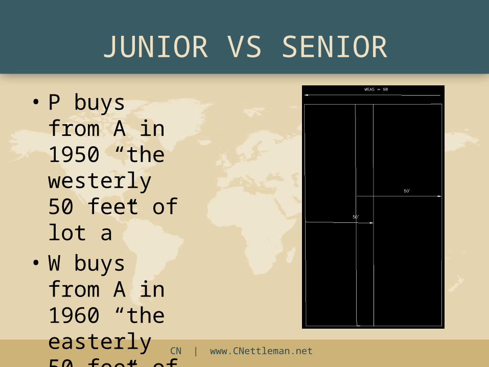
• P buys from A in 1950 “the westerly 50 feet of lot a”
• W buys from A in 1960 “the easterly 50 feet of lot a”
CN | www.CNettleman.net
WHY JUNIOR/SENIOR?
• Deeds are poorly written
• People convey what they don’t own
• Parent parcels contain less land than their owners thought they did
CN | www.CNettleman.net
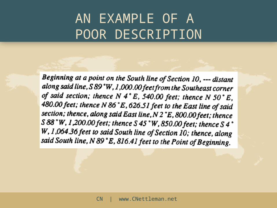
AN EXAMPLE OF A POOR DESCRIPTION

CN | www.CNettleman.net
WHAT CONTROLS IN A DEED?
The Priority of Calls!
CN | www.CNettleman.net
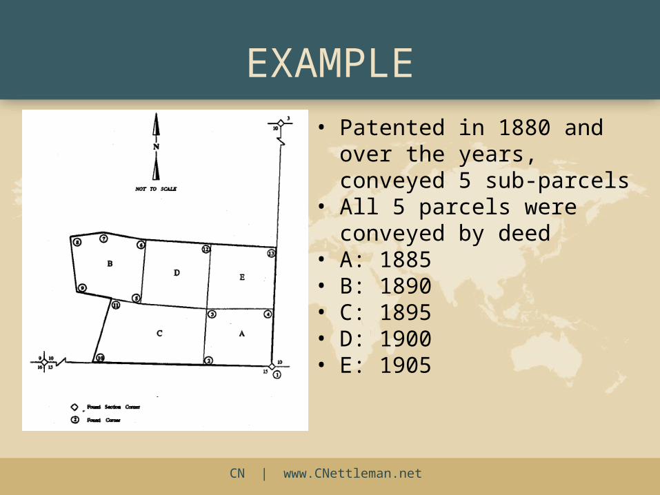
EXAMPLE• Patented in 1880 and over the
years, conveyed 5 sub-parcels• All 5 parcels were conveyed by
deed• A: 1885• B: 1890• C: 1895• D: 1900• E: 1905
CN | www.CNettleman.net
READING A DEED
• “The question is, not what was the intention of the parties, but what is the meaning of the words they have used” Green Bay v. Hewitt
• The land surveyor should re-trace the deeds “as expressed by the evidence of the writings” Brown’s Boundary Control 2nd Ed.
CN | www.CNettleman.net CN | www.CNettleman.net
BOUNDARIES, LAW, AND RELATED PRESUMPTIONS II
WEEK 4LECTURE 2
NETTLEMAN LAND CONSULTANTS, INC.COPYRIGHT 2014
CN | www.CNettleman.net
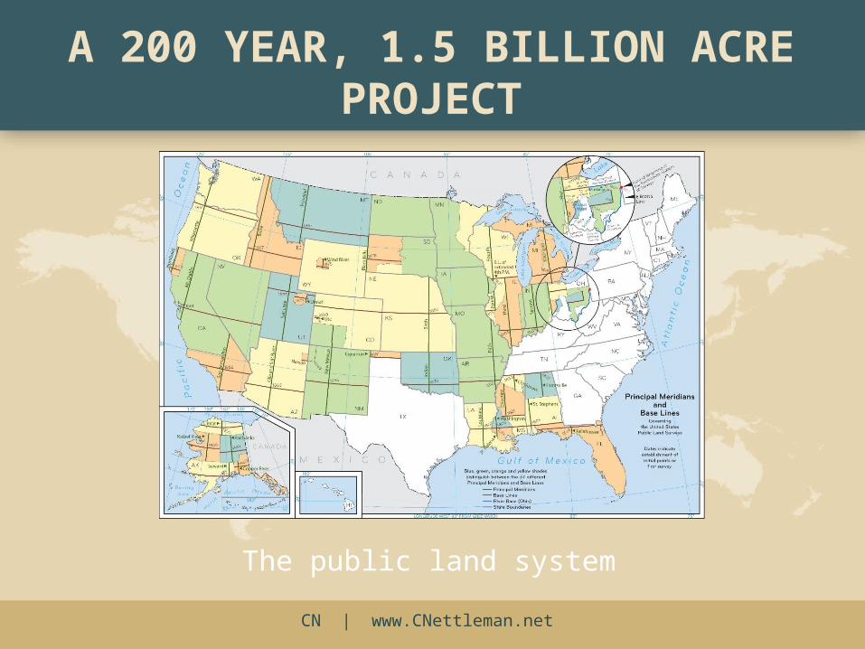
The public land system
A 200 YEAR, 1.5 BILLION ACRE PROJECT
CN | www.CNettleman.net
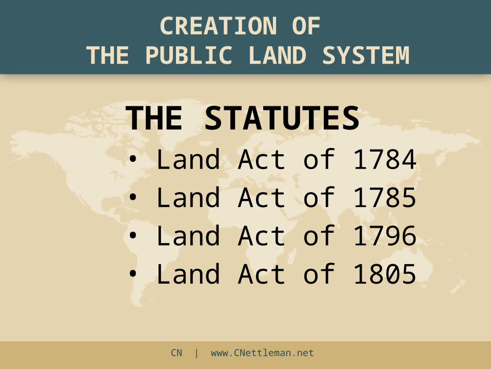
CREATION OF THE PUBLIC LAND SYSTEM
THE STATUTES• Land Act of 1784• Land Act of 1785• Land Act of 1796• Land Act of 1805
CN | www.CNettleman.net
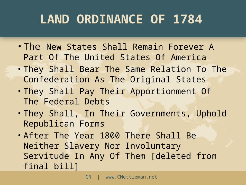
LAND ORDINANCE OF 1784
• The New States Shall Remain Forever A Part Of The United States Of America
• They Shall Bear The Same Relation To The Confederation As The Original States
• They Shall Pay Their Apportionment Of The Federal Debts
• They Shall, In Their Governments, Uphold Republican Forms
• After The Year 1800 There Shall Be Neither Slavery Nor Involuntary Servitude In Any Of Them [deleted from final bill]
CN | www.CNettleman.net
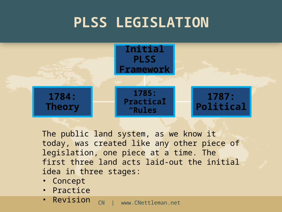
Initial PLSS
Framework
1784: Theory
1785: Practical “Rules”
1787: Political
PLSS LEGISLATION
The public land system, as we know it today, was created like any other piece of legislation, one piece at a time. The first three land acts laid-out the initial idea in three stages: • Concept• Practice• Revision
CN | www.CNettleman.net
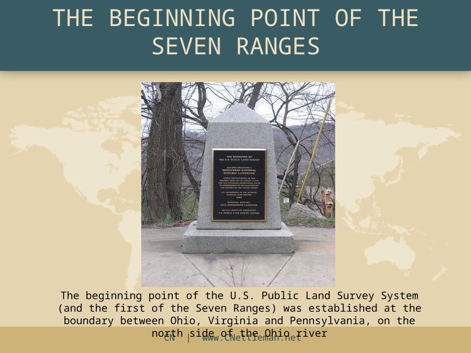
The beginning point of the U.S. Public Land Survey System (and the first of the Seven Ranges) was established at the boundary between Ohio, Virginia and Pennsylvania, on the north side of the Ohio river
THE BEGINNING POINT OF THE SEVEN RANGES
CN | www.CNettleman.net
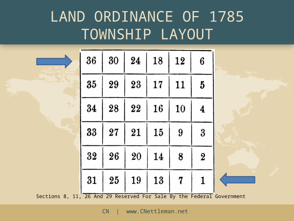
LAND ORDINANCE OF 1785 TOWNSHIP LAYOUT
Sections 8, 11, 26 And 29 Reserved For Sale By the Federal Government
CN | www.CNettleman.net
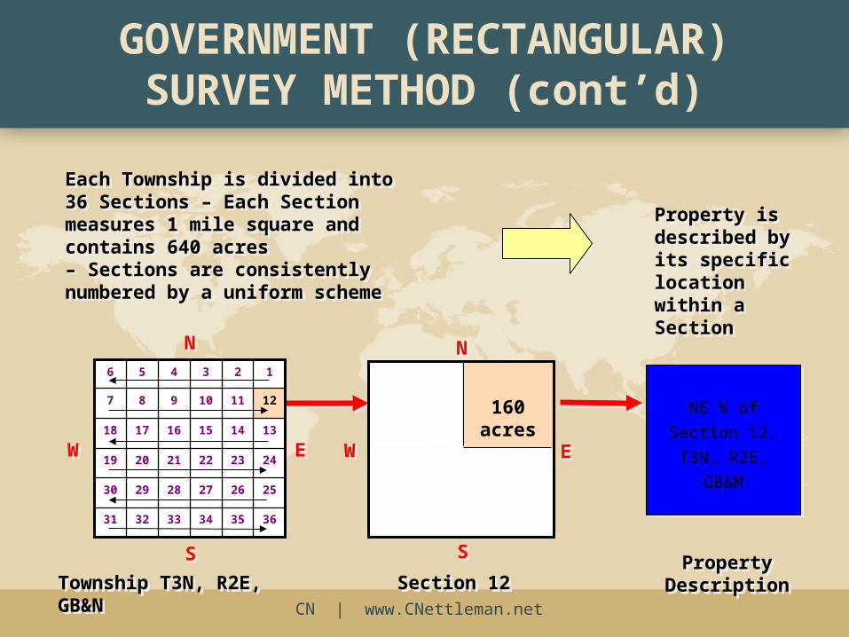
GOVERNMENT (RECTANGULAR) SURVEY METHOD (cont’d)
Each Township is divided into 36 Sections – Each Section measures 1 mile square and contains 640 acres – Sections are consistently numbered by a uniform scheme
Each Township is divided into 36 Sections – Each Section measures 1 mile square and contains 640 acres – Sections are consistently numbered by a uniform scheme
Property is described by its specific location within a Section
Property is described by its specific location within a Section
NE ¼ of Section
12, T3N, R2E,
GB&M
NE ¼ of Section
12, T3N, R2E,
GB&M
PropertyDescriptionProperty
Description
160 acres
Section 12Section 12
WW EE
SS
NN
363534333231
252627282930
242322212019
131415161718
121110987
123456
NN
SS
EEWW
Township T3N, R2E, GB&NTownship T3N, R2E, GB&N