“land use 101” - welcome to nyc.gov | city of new york · land use 101 1. land use &...
TRANSCRIPT
Community Board Training Series
“Land Use 101”
Land Use, Planning & Development UnitOffice of Manhattan Borough President Scott M. Stringer
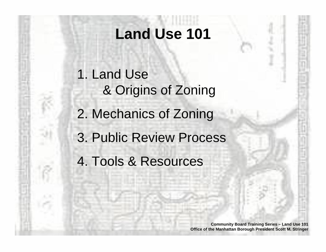
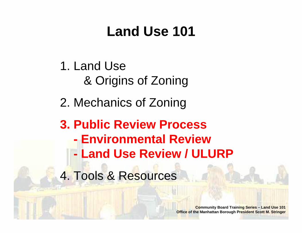
Land Use 101
1. Land Use & Origins of Zoning
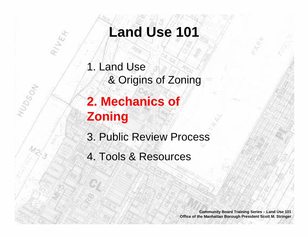
2. Mechanics of Zoning
3. Public Review Process
4. Tools & Resources
Community Board Training Series – Land Use 101Office of the Manhattan Borough President Scott M. Stringer
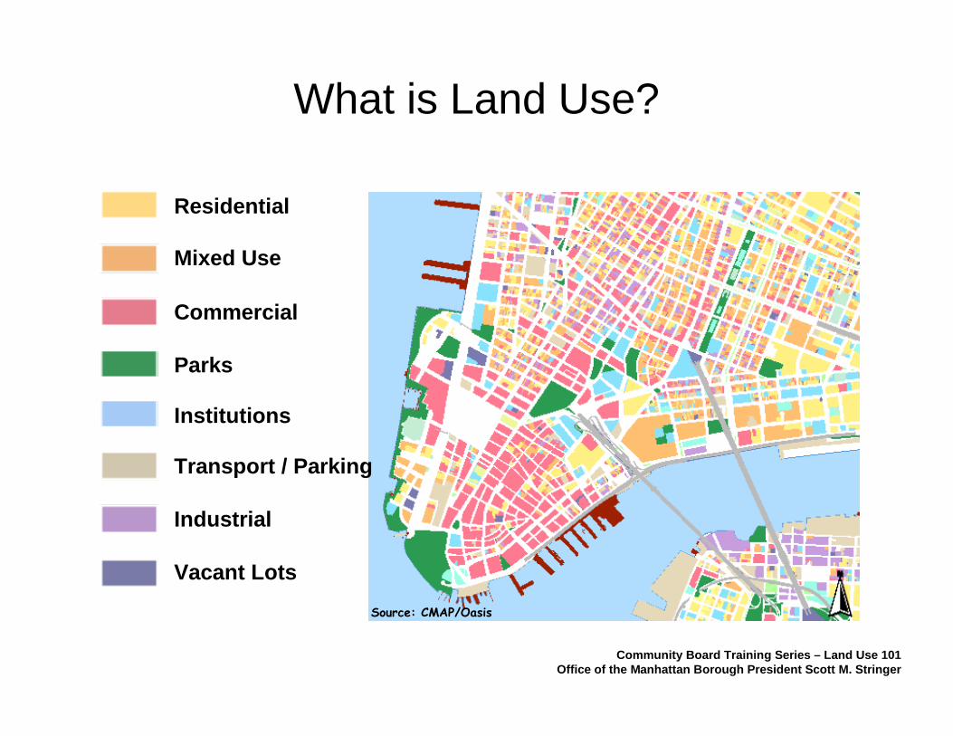
What is Land Use?
Industrial
Commercial
Residential
Parks
Institutions
Mixed Use
Transport / Parking
Vacant Lots
Source: CMAP/Oasis
Community Board Training Series – Land Use 101Office of the Manhattan Borough President Scott M. Stringer
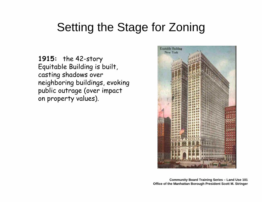
1915: the 42-story Equitable Building is built, casting shadows over neighboring buildings, evoking public outrage (over impact on property values).
Setting the Stage for Zoning
Community Board Training Series – Land Use 101Office of the Manhattan Borough President Scott M. Stringer
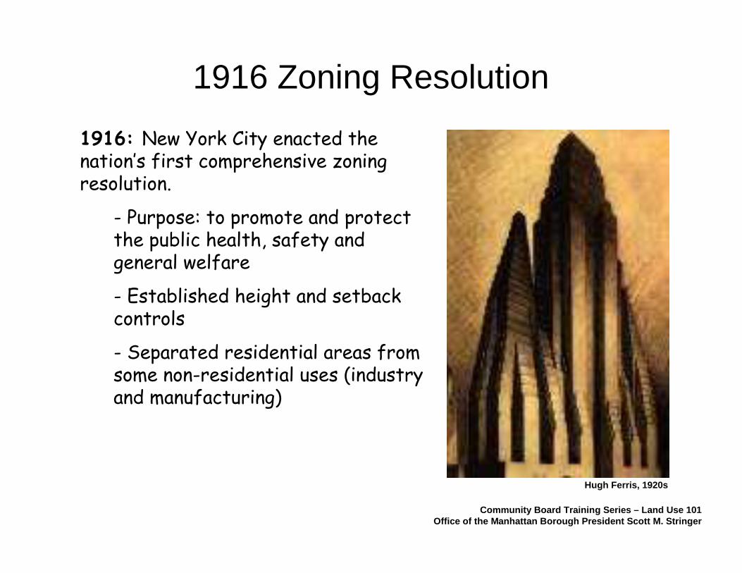
1916: New York City enacted the nation’s first comprehensive zoning resolution.
- Purpose: to promote and protect the public health, safety and general welfare
- Established height and setback controls
- Separated residential areas from some non-residential uses (industry and manufacturing)
Community Board Training Series – Land Use 101Office of the Manhattan Borough President Scott M. Stringer
1916 Zoning Resolution
Hugh Ferris, 1920s

1961 Zoning Resolution
- Established Use Groups to coordinate different uses
- Introduced bulk regulations (and eliminated height limits)
- Incorporated new concepts to reflect new ideas in urban design and urbanism
- Addressed progress of the automobile
Community Board Training Series – Land Use 101Office of the Manhattan Borough President Scott M. Stringer
Tower in the Park, 1920s
1961 Cadillac
“sky exposure plane”
Buffaloes and tennis don’t mix
Land Use 101
1. Land Use & Origins of Zoning
2. Mechanics of Zoning
3. Public Review Process
4. Tools & Resources
Community Board Training Series – Land Use 101Office of the Manhattan Borough President Scott M. Stringer

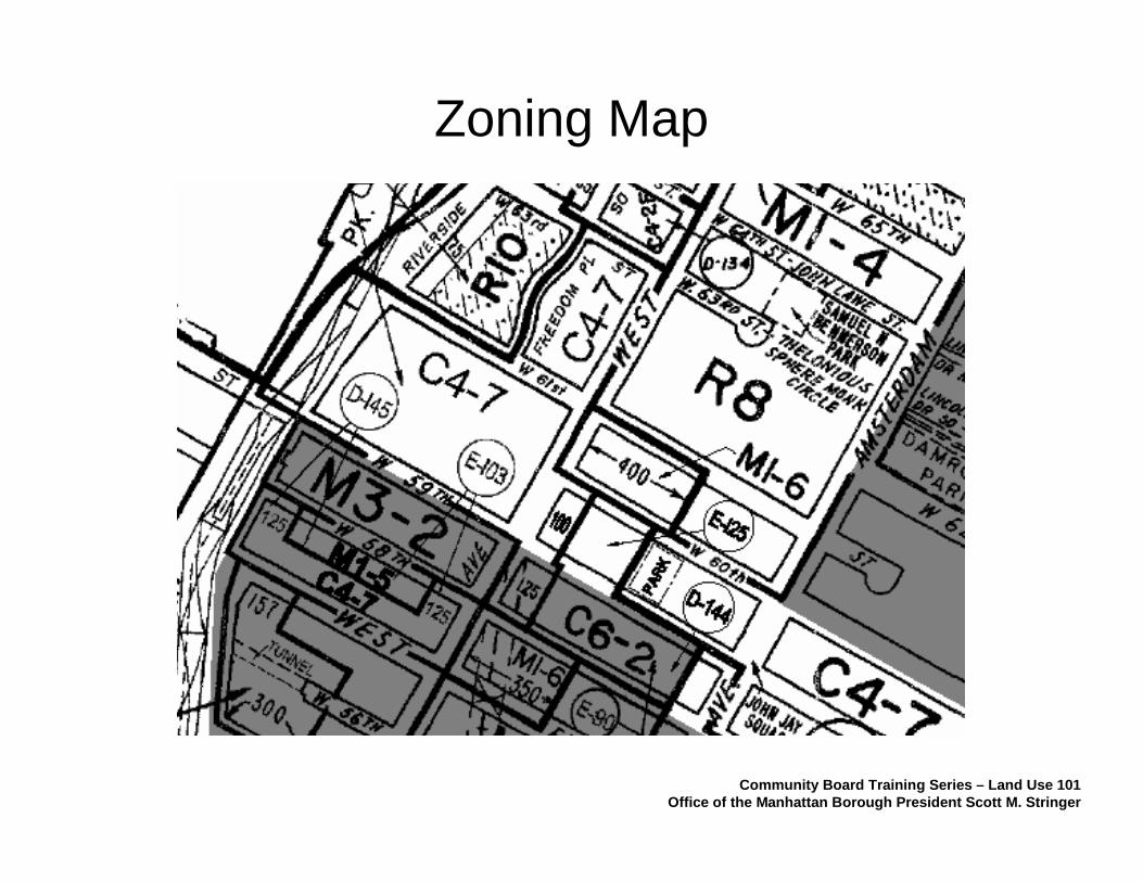
Zoning Map
Community Board Training Series – Land Use 101Office of the Manhattan Borough President Scott M. Stringer
Zoning Map
Community Board Training Series – Land Use 101Office of the Manhattan Borough President Scott M. Stringer

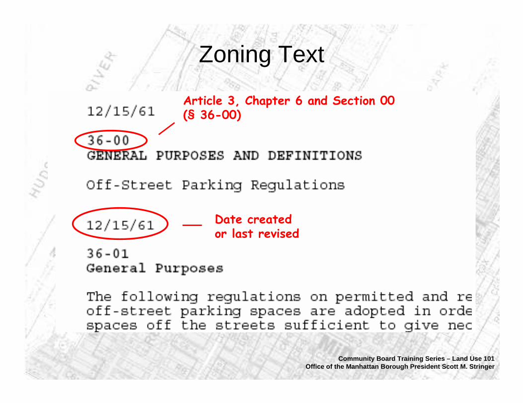
Zoning Text
Community Board Training Series – Land Use 101Office of the Manhattan Borough President Scott M. Stringer
Zoning Text
Date created or last revised
Article 3, Chapter 6 and Section 00 (§ 36-00)
Community Board Training Series – Land Use 101Office of the Manhattan Borough President Scott M. Stringer
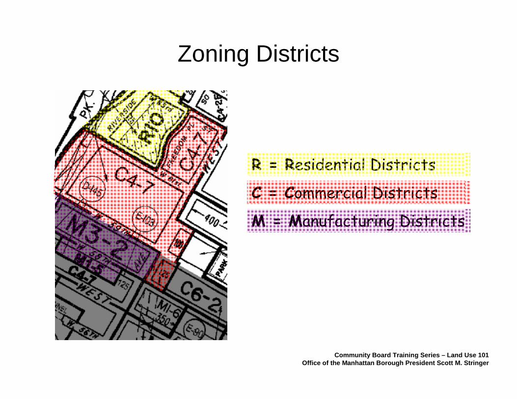
R = Residential Districts
C = Commercial Districts
M = Manufacturing Districts
Zoning Districts
Community Board Training Series – Land Use 101Office of the Manhattan Borough President Scott M. Stringer

How does zoning work?
Each zoning district regulates:
• Types of uses allowed• Density (floor area ratio; FAR)
• Overall density• Density of individual uses
• Number of dwelling units• Amount of open space• Required parking (if any)• Lot coverage• Distance from buildings and lot lines
Some districts regulate other features such as height limits and street walls.
Community Board Training Series – Land Use 101Office of the Manhattan Borough President Scott M. Stringer
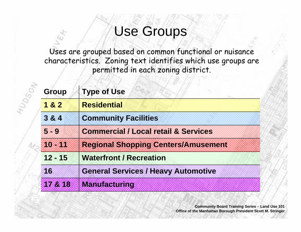
Uses are grouped based on common functional or nuisance characteristics. Zoning text identifies which use groups are
permitted in each zoning district.
Use Groups
Manufacturing17 & 18
General Services / Heavy Automotive16
Waterfront / Recreation12 - 15
Regional Shopping Centers/Amusement10 - 11
Commercial / Local retail & Services5 - 9
Community Facilities3 & 4
Residential1 & 2
Type of UseGroup
Community Board Training Series – Land Use 101Office of the Manhattan Borough President Scott M. Stringer
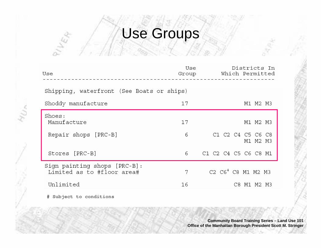
Use Groups
# Subject to conditions
Community Board Training Series – Land Use 101Office of the Manhattan Borough President Scott M. Stringer

FAR Illustrated
Community Board Training Series – Land Use 101Office of the Manhattan Borough President Scott M. Stringer
100% coverage1-story
50% coverage2-stories
25% coverage4-stories
STREET STREET
STREET STREET
STREET STREET
Images from NYC Department of City Planning
Every zoning district has a floor area ratio (FAR). Multiplying the FAR by the lot size will give you the permitted
floor area (size) of a building.
10,000 sf lot x 1.0 FAR = 10,000 sf building10,000 sf lot x 2.0 FAR = 20,000 sf building

C4–4A
Zoning Designations
Community Board Training Series – Land Use 101Office of the Manhattan Borough President Scott M. Stringer
R7-2Medium density apartment house district
Permitted uses: Residential and community facilitiesHeight limit: noneMax FAR: 3.44
General commercial district
Permitted uses: Residential, community facilities,local and large retail, businessservices, hotels and offices
Height limit: 80 feet Max FAR: 4.0
Zoning Tools and Mechanisms
• Incentive zoning
• Transfer of development rights
• Contextual zoning
• Special district
• Overlay districts
Community Board Training Series – Land Use 101Office of the Manhattan Borough President Scott M. Stringer
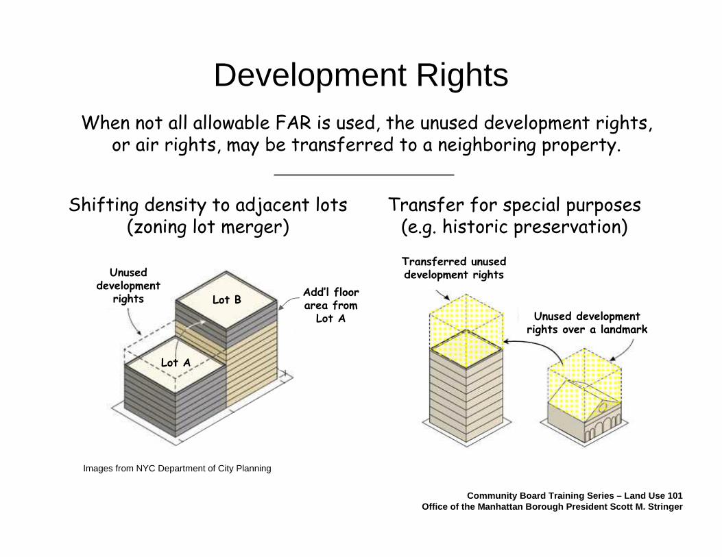
When not all allowable FAR is used, the unused development rights, or air rights, may be transferred to a neighboring property.
Development Rights
Community Board Training Series – Land Use 101Office of the Manhattan Borough President Scott M. Stringer
Shifting density to adjacent lots(zoning lot merger)
Transfer for special purposes (e.g. historic preservation)
Unused development
rights
Transferred unused development rights
Unused development rights over a landmark
Images from NYC Department of City Planning
Lot A
Lot BAdd’l floor area from Lot A

Bonuses allow bigger buildings in exchange for a public benefit
Incentive Zoning
Community Board Training Series – Land Use 101Office of the Manhattan Borough President Scott M. Stringer
Public Plazas Inclusionary Housing
NYC Department of City Planning

“Height Factor” vs. “Contextual”
Community Board Training Series – Land Use 101Office of the Manhattan Borough President Scott M. Stringer
Tower form (no height limit)
Required open space
Height limit
Street wall
Lot line
Contextual Building(also “Quality Housing”)
Height Factor Building
Images from NYC Department of City Planning

Special Districts
West Chelsea/High LineSpecial District
Hudson YardsSpecial District
Community Board Training Series – Land Use 101Office of the Manhattan Borough President Scott M. Stringer
Images from NYC Department of City Planning

Commercial Overlays
Community Board Training Series – Land Use 101Office of the Manhattan Borough President Scott M. Stringer
A commercial overlay is a C1 or C2 district usually mapped within residential neighborhoods to serve local retail needs. FAR is limited to 1.0 or 2.0, usually permitting only ground
floor or second floor commercial uses.
Land Use 101
1. Land Use & Origins of Zoning
2. Mechanics of Zoning
3. Public Review Process- Environmental Review- Land Use Review / ULURP
4. Tools & Resources
Community Board Training Series – Land Use 101Office of the Manhattan Borough President Scott M. Stringer

The 1975 State Environmental Quality Review Act (SEQRA) requires state and local governmental agencies to assess environmental effects of discretionary actions before undertaking, funding or approving such actions.
City Environmental Quality Review (CEQR) are the City rules through which New York City implements SEQRA. The CEQR Technical Manual guides the City’s analysis.
Environmental Review
Community Board Training Series – Land Use 101Office of the Manhattan Borough President Scott M. Stringer

• Waterfront Revitalization Program
• Infrastructure
• Solid Waste & Sanitation Services
• Energy
• Traffic & Parking
• Transit & Pedestrians
• Air Quality
• Noise
• Construction Impacts
• Public Health
Environmental studies estimate “Reasonable Worst-Case Scenario”
impacts on:
Reasonable Worst-Case Scenario
Community Board Training Series – Land Use 101Office of the Manhattan Borough President Scott M. Stringer
• Land Use, Zoning & Public Policy
• Socioeconomic Conditions
• Community Facilities & Services
• Open Space
• Shadows
• Historic Resources
• Urban Design/Visual Resources
• Neighborhood Character
• Natural Resources
• Hazardous Materials
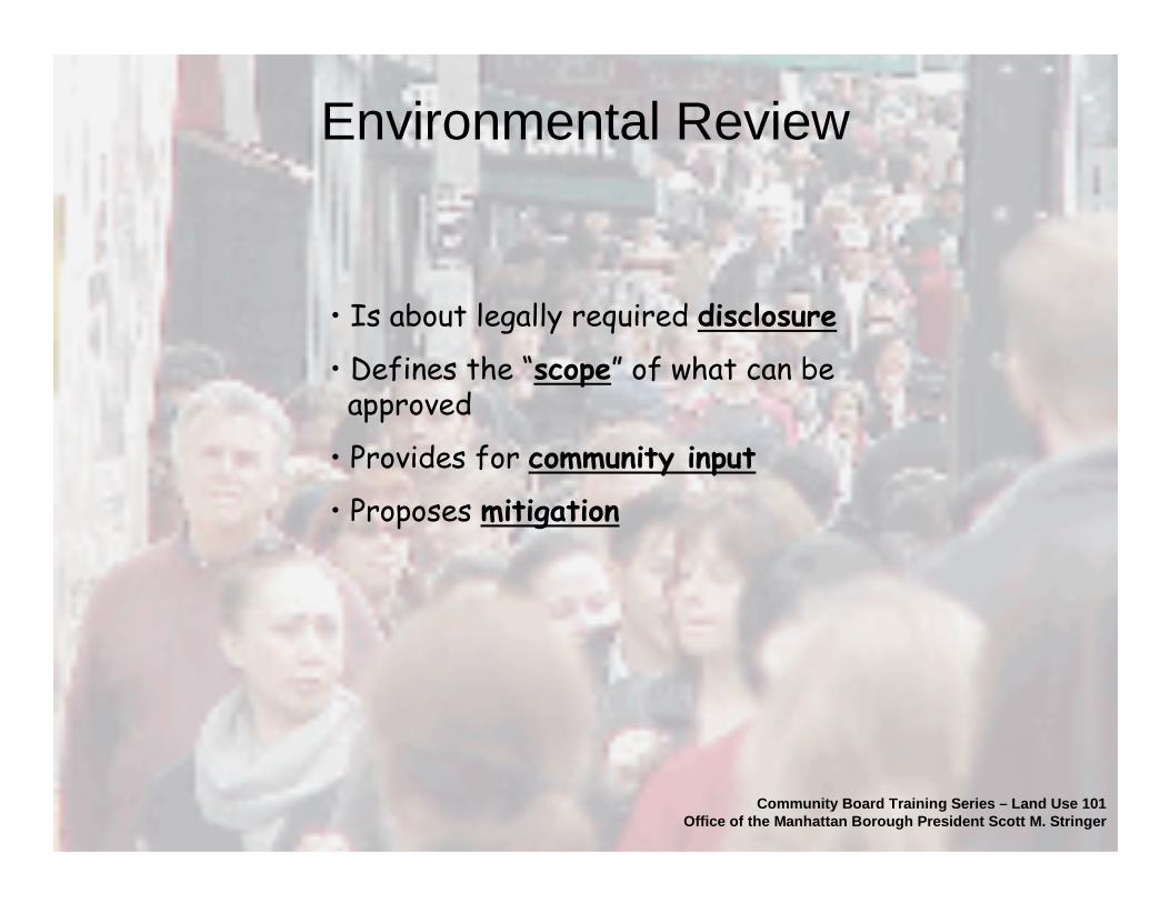
• Is about legally required disclosure
• Defines the “scope” of what can beapproved
• Provides for community input
• Proposes mitigation
Environmental Review
Community Board Training Series – Land Use 101Office of the Manhattan Borough President Scott M. Stringer
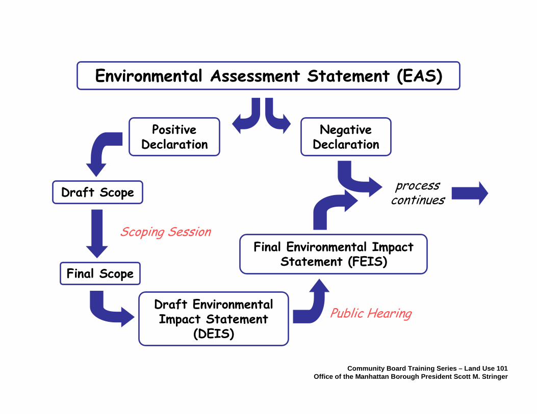
Draft Scope
Public Hearing
Final Scope
Draft Environmental Impact Statement
(DEIS)
Final Environmental Impact Statement (FEIS)
Scoping Session
process continues
Positive Declaration
Negative Declaration
Environmental Assessment Statement (EAS)
Community Board Training Series – Land Use 101Office of the Manhattan Borough President Scott M. Stringer
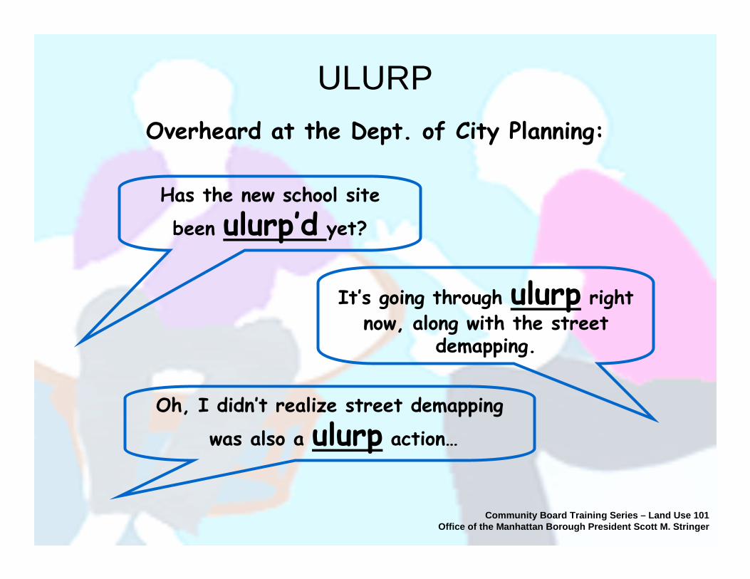
Overheard at the Dept. of City Planning:
Has the new school site
been ulurp’d yet?
It’s going through ulurp right now, along with the street
demapping.
Oh, I didn’t realize street demapping
was also a ulurp action…
ULURP
Community Board Training Series – Land Use 101Office of the Manhattan Borough President Scott M. Stringer

Community Board Training Series – Land Use 101Office of the Manhattan Borough President Scott M. Stringer
• 13 member panel: Mayor appoints 7, one by each BoroughPresident, one by Public Advocate
• Holds regular public meetings and hearings
• Votes on land use issues, subject to city regulation
• Chair of the Commission is also the Director of theDept. of City Planning
City Planning Commission
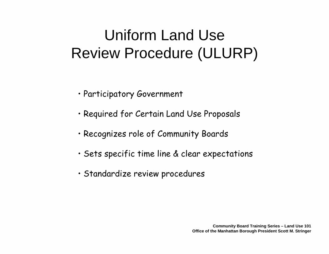
Uniform Land Use Review Procedure (ULURP)
• Participatory Government
• Required for Certain Land Use Proposals
• Recognizes role of Community Boards
• Sets specific time line & clear expectations
• Standardize review procedures
Community Board Training Series – Land Use 101Office of the Manhattan Borough President Scott M. Stringer
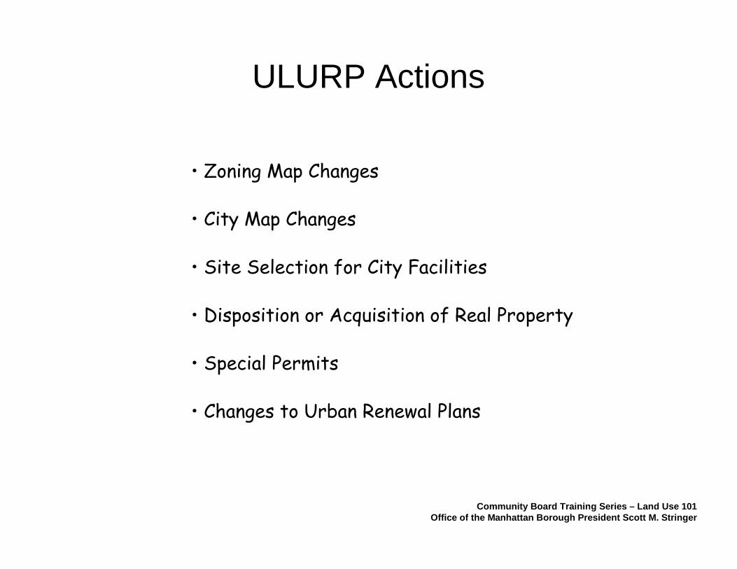
ULURP Actions
• City Map Changes
• Site Selection for City Facilities
• Disposition or Acquisition of Real Property
• Special Permits
• Zoning Map Changes
• Changes to Urban Renewal Plans
Community Board Training Series – Land Use 101Office of the Manhattan Borough President Scott M. Stringer

Steps of ULURP
1.Certification
3.Borough President
4.Planning Commission
5.City Council
2.CommunityBoard
60 days30 days
60 days50 days
TOTAL TIME: Approx. 200-215 days or approximately 7½ months
Notimelimit
• MEETINGS• HEARING• RECOMMEND • CONSULTATIONS
• HEARING (Opt)• RECOMMEND
• REVIEW SESSION• HEARING• VOTE: DIS/APRV
• SOME APPL’S Opt• MEETINGS (Opt)• HEARING (Opt)• VOTE: DIS/APRV
Community Board Training Series – Land Use 101Office of the Manhattan Borough President Scott M. Stringer
The Mayor may veto Commission or City Council decision (+ 5 days)
The City Council may override Mayor’s veto with a 2/3 majority (+ 10 days)

“Non-ULURP” ULURP Actions
• Informal referral to Community Boards
• Public hearings are not required
• Some Special Permits and renewals
• Some Use and Bulk Variances
• Zoning Text Changes
• City Office Space Acquisition
Community Board Training Series – Land Use 101Office of the Manhattan Borough President Scott M. Stringer

Board of Standards & Appeals (BSA) may grant a variance from a provision of the Zoning Resolution provided that each of thesefindings are met:
(a) Uniqueness(e.g. unusual subsurface condition,
oddly-shaped lot, programmatic needs)
(b) Reasonable Return(non-profit institutions are exempt)
(c) Neighborhood Character(consistency of use and size)
(d) Self-Created Hardship(e.g. leaching contaminants from
neighboring properties, conditions of nature, government actions)
(e) Minimal Variance(no more than needed for
reasonable economic return)
Zoning Variances
Community Board Training Series – Land Use 101Office of the Manhattan Borough President Scott M. Stringer
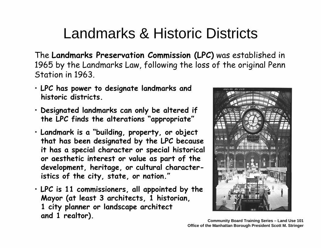
The Landmarks Preservation Commission (LPC) was established in 1965 by the Landmarks Law, following the loss of the original Penn Station in 1963.
• LPC has power to designate landmarks andhistoric districts.
• Designated landmarks can only be altered if the LPC finds the alterations “appropriate”
• Landmark is a “building, property, or objectthat has been designated by the LPC becauseit has a special character or special historicalor aesthetic interest or value as part of thedevelopment, heritage, or cultural character-istics of the city, state, or nation.”
• LPC is 11 commissioners, all appointed by theMayor (at least 3 architects, 1 historian, 1 city planner or landscape architect and 1 realtor).
Landmarks & Historic Districts
Community Board Training Series – Land Use 101Office of the Manhattan Borough President Scott M. Stringer
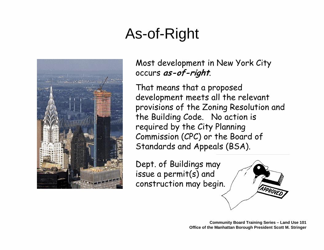
Most development in New York City occurs as-of-right.
That means that a proposed development meets all the relevant provisions of the Zoning Resolution and the Building Code. No action is required by the City Planning Commission (CPC) or the Board of Standards and Appeals (BSA).
As-of-Right
Community Board Training Series – Land Use 101Office of the Manhattan Borough President Scott M. Stringer
Dept. of Buildings may issue a permit(s) and construction may begin.

Land Use 101
1. Land Use & Origins of Zoning
2. Mechanics of Zoning
3. Public Review Process
4. Tools & Resources
Community Board Training Series – Land Use 101Office of the Manhattan Borough President Scott M. Stringer
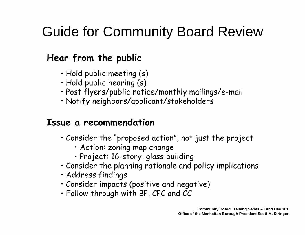
Guide for Community Board Review
Hear from the public
• Hold public meeting (s)• Hold public hearing (s)• Post flyers/public notice/monthly mailings/e-mail• Notify neighbors/applicant/stakeholders
Issue a recommendation
• Consider the “proposed action”, not just the project• Action: zoning map change• Project: 16-story, glass building
• Consider the planning rationale and policy implications• Address findings• Consider impacts (positive and negative)• Follow through with BP, CPC and CC
Community Board Training Series – Land Use 101Office of the Manhattan Borough President Scott M. Stringer
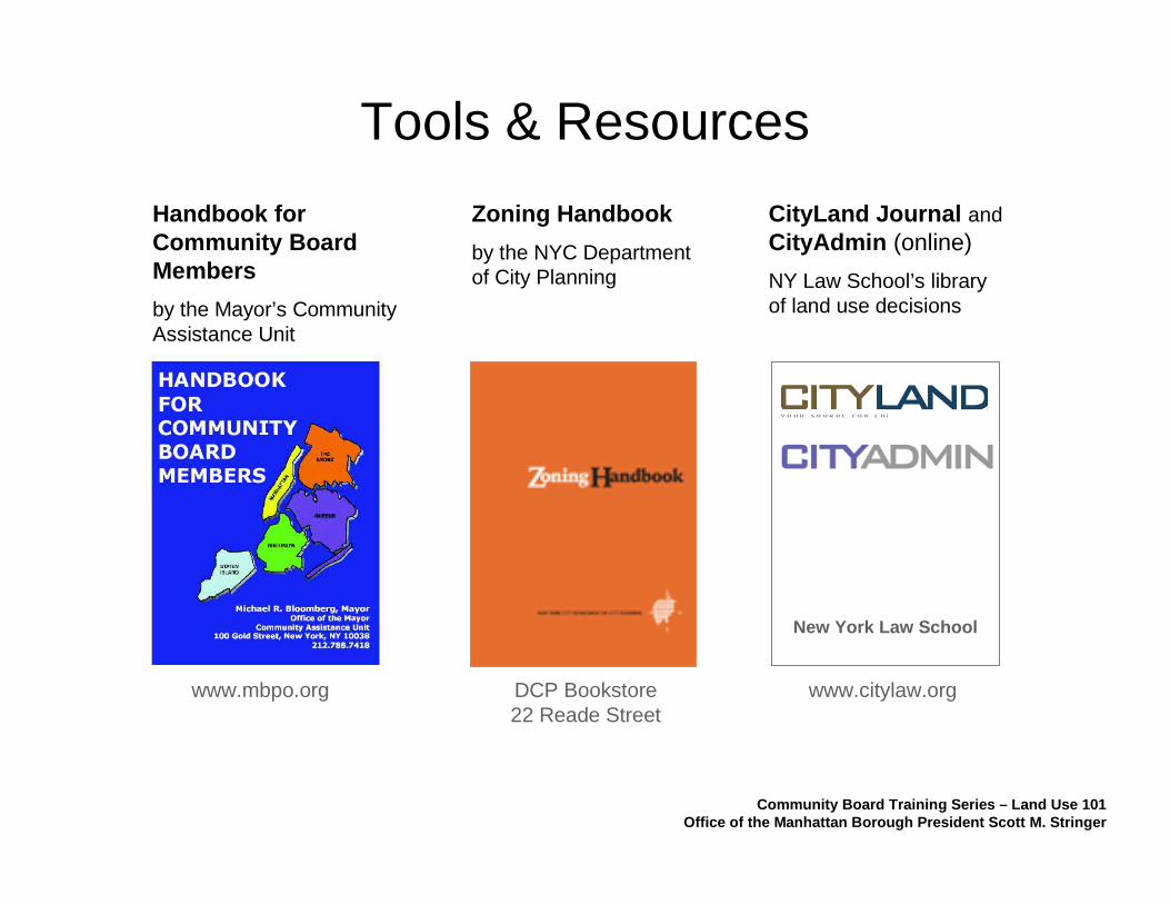
Tools & Resources
New York Law School
Community Board Training Series – Land Use 101Office of the Manhattan Borough President Scott M. Stringer
Zoning Handbook
by the NYC Department of City Planning
Handbook for Community Board Members
by the Mayor’s Community Assistance Unit
CityLand Journal andCityAdmin (online)
NY Law School’s library of land use decisions
www.mbpo.org DCP Bookstore22 Reade Street
www.citylaw.org

Office of Manhattan Borough PresidentScott M. Stringer
COMMUNITY AFFAIRS
SHAAN KAHN, Acting Director
Community Liaisons
JESSICA SILVER CBs 5 & 7
GREGORY BRNEDERCBs 1 & 3
HUNTER JOHANSSONCBs 2 & 4
CULLEN BARRIECBs 6 & 8
Administrative Support
DEBBIE TIMOTHY
LAND USE, PLANNING& DEVELOPMENT
ANTHONY BORELLI, DirectorDAN GOLUB, Deputy Director
Urban Planners
BRIAN COOK, Senior PlannerCBs 7 & 11
JENNIFER HONGCBs 1, 2, 3 & 8
MIKE KENTHistoric Preservation/Landmarks
CBs 4, 5 & 6
PAIMAAN LODHIProject Manager, Take Me to the River
CBs 9, 10 & 12
Administrative Support
JUDY OUTLAW-WALKER
212-669-8300
NORTHERN MANHATTAN OFFICE
SHANIFAH RIEARA, DirectorWENDY GARCIA, Deputy
Director
Community Liaison
WENDY GARCIACBs 11 & 12
LINARA DAVIDSONCBs 9 & 10

Land Use, Zoning & ULURP
Community Board Training Series
“Land Use 101”
Land Use, Planning & Development UnitOffice of Manhattan Borough President Scott M. Stringer