lab 3 celestial coordinates
TRANSCRIPT

7/28/2019 Lab 3 Celestial Coordinates
http://slidepdf.com/reader/full/lab-3-celestial-coordinates 1/12
Celestial Coordinate System
Fall 2007Updated 09/07/2007
Purpose
The purpose of this lab is to familiarize the student with determining sidereal time, both through calculation and observation, and applying this system of time to locating
stars and other objects using the celestial coordinate system.
Introduction
Early in the history of astronomy it became necessary to devise a system for describing the positions of the stars on the celestial sphere. The most obvious system was
one based on the local horizon and named simply the Horizon System. It gives the star’s
position in terms of the observer’s horizon pane, with one coordinate (azimuth) measured in terms of compass directions along this plane. However, this system of coordinates has
disadvantages in that the azimuth and altitude of a star change both with the time of day
and the location of the observer.
It is desirable to have a system of coordinates permanently attached to the celestial
sphere. Such a system is the Celestial Equatorial System (Fig. 1). The polar axis of the
earth is projected outwards, defining the poles of the celestial sphere. The equatorial plane of the earth is projected outward and it defines the celestial equator. The
coordinates of this system are right ascension (analogous to longitude on the earth),
measured along the celestial equator and declination (analogous to latitude), measured north and south from the celestial equator. The coordinates of stars in this system are
constant rather than dependent on the observer’s time of day and place.
Figure 1.
Sidereal time

7/28/2019 Lab 3 Celestial Coordinates
http://slidepdf.com/reader/full/lab-3-celestial-coordinates 2/12
You are already familiar with solar time – you use it every day. The earth makes one
complete revolution in 24 hours, and the sun crosses the observer’s meridian at noon,local mean time.
The sidereal day, however, is 3 minutes, 56 seconds shorter than the solar day.
Sidereal time is based on one rotation of the earth in relation to any star (other than thesun), starting with the star on the observer’s meridian, and returning to the meridian one
earth rotation later. The reason for the star returning to the meridian in less than 24 hours
is that the earth orbits about the sun. The rate of this orbit is 360 degrees/ 365.25 days, or about 1 degree per day. One degree per day is equal to 4 minutes of time and averages
two hours per month. (See Fig.2)
Figure 2
Application to Astronomy
Simply put, the sidereal time is equal to the right ascension of an astronomical objectlined up with the observer’s meridian. The sidereal day begins at 0 hours, a time when the
vernal equinox crosses the celestial meridian. On or about March 21, the sun is located at
the vernal equinox, and will be on the meridian at noon. We can therefore assume that thesidereal time on March 21 is 0h at noon, local mean time. One sidereal hour later, stars
with a right ascension of 1 h will cross the meridian.

7/28/2019 Lab 3 Celestial Coordinates
http://slidepdf.com/reader/full/lab-3-celestial-coordinates 3/12
Sidereal time can be calculated for an observer’s location, using the formulas and table provided with this lab. Once determined, the sidereal time will be used, in
conjunction with the celestial coordinate system, to locate astronomical objects with an
equatorially aligned telescope.
(Fig. 3)
Standard Time Zones
Terminology
Standard Time: is the mean time of a time zone, which is 15 degrees wide. At the central
meridian of a time zone, standard time coincides exactly with mean solar time. Simply,
this means the sun will be on the meridian at noon (or nearly so), as observed from the
central meridian of the time zone. Elsewhere in the time zone, the sun will be no morethan 30 minutes from the meridian.
Local Mean Time: This is the mean solar time applied to your exact location. L.M.T. iscalculated by applying a correction equal to four minutes for each degree you are away
from the central meridian of your time zone. The central meridian for the Eastern Timezone is 75 degrees. Providence is located 71 degrees, 25 minutes longitude. This is about
3 ½ degrees east of the central meridian. (3 ½ degrees times 4 minutes = 14 minutes
times correction) Because we are east of the central meridian, we add this time correctionto standard time. This means that our watches, set to L.M.T., will read 14 minutes later
than Eastern Standard Time.
Local Sidereal Time (L.S.T.): Indicates how much time has passed since the vernal
equinox crossed the observer’s meridian. Sidereal time is also equal to the right ascensionof any star currently on the observer’s meridian. To calculate L.S.T. with an approximate
correction, use this formula: L.S.T.= L.M.T. + G.S.T at 0h next day (see table # 1 ). If the answer is greater than 24 hours, subtract 24 hours for the answer.
For example, if it is 8:00 PM E.S.T. (remember to subtract 1 hour from daylight savings
time) on October 1st, then…

7/28/2019 Lab 3 Celestial Coordinates
http://slidepdf.com/reader/full/lab-3-celestial-coordinates 4/12

7/28/2019 Lab 3 Celestial Coordinates
http://slidepdf.com/reader/full/lab-3-celestial-coordinates 5/12
Equipment needed for this lab
Equatorially mounted telescope, equipped with setting circles.
Accurate time signal http://www.time.gov/timezone.cgi?Eastern/d/-5/java
Accurate watch set to L.S.T.
Star atlas and catalog.
Rotating Star Chart
Procedure ( Indoors):
1) The first thing you need to do is to determine the current sidereal time, and set
your watch to it. Although your watch will run slower than sidereal time, about
10 seconds per hour, it will be accurate enough for the duration of this lab. Refer to table # 1 for G.S.T. at 0h, not for today’s date, but the following day. Use this
time in the formula above. Make sure to calculate the local mean time (LMT)correction for the location you plan to do your observations from. The
coordinates for Providence are given above, and the coordinates for Jerimoth
Hill are 41 50 58N, 071 46 45W. Once you have your watch set to sidereal time,you are ready for the next step.
2) Sidereal time equals the RA of objects currently on the meridian. In this lab, wewill be trying to find objects throughout the sky. To do this, we will need to
determine the angular separation of the object from the meridian, measured in
hours, minutes and seconds. This is called the Hour Angle. 0 hours will define
the meridian, and objects will either east or west of the meridian.
3) To determine the hour angle (HA) of an object, use the following equation:
HA=ST-RA
Let’s say it is December 1st
at 11:00 PM, EST. Using the equation to determine sidereal
time, we come up with ST = 3h 56m.
We want to locate M42, the Orion Nebula. The coordinates for M42 are RA=5h 34m,DEC= 5.4 degrees south.

7/28/2019 Lab 3 Celestial Coordinates
http://slidepdf.com/reader/full/lab-3-celestial-coordinates 6/12
HA=3h 56m – 5h 34m
HA= (-2h 22m)
A negative hour angle means M42 is east of the meridian.
If you were to try to locate M42 later in the evening, say at 6h (L.S.T.), then the equationwould read:
HA= 6h - 5h 34 mHA= 0h 26m
A positive hour angle means M42 is west of the meridian.
(If the answer is greater than 12h, it must be subtracted from 24h to give the answer in negative hour angle.)
Orion on Dec 1st, at 3h LST and 6h LST
(Fig. 4)

7/28/2019 Lab 3 Celestial Coordinates
http://slidepdf.com/reader/full/lab-3-celestial-coordinates 7/12
4) Practice indoors, using “Starry Nights”
Determine the HA for the three objects in the table below, setting the time to 9:00PM thisevening. You will need to calculate the sidereal time.
Object RA Dec ST HA (east/west)
NGC 884 2h 22.6m +57 8mAlberio 19h 30.7m +27 58’M15 21h 30.3m +12 10’
Using “Starry Nights”, select the following in the tool bar:
“View”
-“Alt/Az Guide”
- “Meridian”
“View”
-“Celestial Guides”
- “Equator”- “Grid”
Verify that the calculations you entered in the table above are correct, by locating
the objects in the “Starry Night” program, and noting where the objects are located
on the celestial grid.
Which object most recently crossed the meridian? _______________________________ Which object is currently located in the eastern most part of the sky? ________________
Which object is currently located in the western most part of the sky? ________________
Doing the above exercise should help you to find your way around the sky, which
will be useful for the next, outdoor part of this lab.
Procedure (outdoors):
1) You will need to use a telescope with an equatorial mount, and align the mount
with the celestial pole. Please refer to “Polar Alignment Procedure for Meade
ETX” for directions on properly setting up the Meade telescope. If you are using atelescope that is already aligned to the pole, you may skip this step.
2) You know the current local sidereal time, and the telescope is properly aligned to
the pole. Level the declination axis using a level (your TA will show you how to
do this); set the RA circle to the current sidereal time. 3) To locate an object in the table above, turn the telescope mount in RA to the RA
coordinates of the object sought. Then turn the telescope mount in DEC until the
circle matches the coordinates.4) If the object you are looking for does not appear in the eyepiece, try looking in the
small finder telescope to see if the object is close by – then move the telescope to
center the object in the eyepiece. This might happen if the polar alignment is alittle off.

7/28/2019 Lab 3 Celestial Coordinates
http://slidepdf.com/reader/full/lab-3-celestial-coordinates 8/12
5) Note the appearance of each object in your notebook.
Answer the following questions: (This part will be done indoors, using “Starry
Nights”.)
(Providence is located at 71 degrees, 25 minutes west longitude; 41 degrees, 50 minutes north latitude)
I) From our location on Earth, is it possible to locate an object more than 6 hours east
or west of the meridian? Are there any limitations on how many hours of RA can be
seen if you look in different directions (east, west, north and south)?
II) How many hours of RA, east and west of the meridian could you see from the
earth’s equator, and from the poles?
III) Looking due north, along the meridian, from our location, what is the declination of
the horizon? Looking due south, along the meridian, what would the southern mostdeclination be?
7/28/2019 Lab 3 Celestial Coordinates
http://slidepdf.com/reader/full/lab-3-celestial-coordinates 9/12
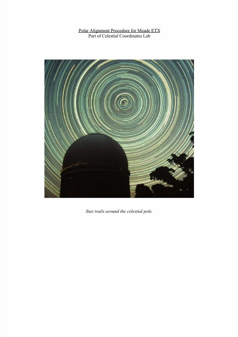
Polar Alignment Procedure for Meade ETX
Part of Celestial Coordinates Lab
Star trails around the celestial pole.

7/28/2019 Lab 3 Celestial Coordinates
http://slidepdf.com/reader/full/lab-3-celestial-coordinates 10/12
1) The ETX telescope is set-up, with telescope mountingroughly pointing north. Note that the optical in the photo
is pointing towards the south.
2) Turn fork arms until the telescope is
pointing south. Check this with a level.
3) Turn RA circle (the moveable dial
located on the drive base of the mount)
until it reads the current local sidereal
time. Example shown is 3h, for January 1at 8pm, EST.

7/28/2019 Lab 3 Celestial Coordinates
http://slidepdf.com/reader/full/lab-3-celestial-coordinates 11/12
4) Rotate mount until the RA circle reads the
coordinates for Polaris: 20h 30m. Turn the
telescope in declination until the setting circle (thesmaller dials located at the top of the fork arms)
reads 89 degrees N.
5) First, try to sight Polaris along the side of
one of the fork arms. Turn the adjustment
screws on the tripod head to align the mountwith Polaris. Once Polaris is close, look
through the eyepiece; continue to turn the
adjustment screws in azimuth and altitudeuntil Polaris is centered in the eyepiece.

7/28/2019 Lab 3 Celestial Coordinates
http://slidepdf.com/reader/full/lab-3-celestial-coordinates 12/12
6) Turn the mount back towards the south,
place a level across the fork arms, and continueto turn the mount until the bubble is level.
7) Turn the RA circle until it reads thecurrent sidereal time. You are ready to
begin finding astronomical objects using
the setting circles on your telescope.
Follow the directions in the “Celestial
Coordinates” lab.