kilclief village plan_final
TRANSCRIPT

A Village Plan for Kilclief
2015
Table of Contents
Section 1. Introduction and Background ............................................... 1
Purpose of Plan ...................................................................................................... 1
Background to the Village Plan ............................................................................... 1
The Village Planning Process ................................................................................. 1
Section 2. Kilclief: The Place and its People ....................................... 2
Location, context and history .................................................................................. 2
Deprivation and Disadvantage ................................................................................ 8
Section 3. What People Said .............................................................. 10
SWOT Analysis ..................................................................................................... 10
Top Priorities ......................................................................................................... 12
Section 4. A Vision and Priorities for Kilclief ....................................... 14
Vision for Kilclief .................................................................................................... 14
1. Roads, Traffic and Transport ............................................................................ 15
2. Environment and Regeneration ........................................................................ 17
3. Community ....................................................................................................... 22
4. Leisure and Tourism ........................................................................................ 24
5. Housing ........................................................................................................... 28
Section 5. Action Plan ........................................................................ 31
Theme 1: Roads, Traffic and Transport ................................................................ 31
Theme 2: Environment and Regeneration ............................................................ 32
Theme 3: Community ............................................................................................ 32
Theme 4: Leisure and Tourism ............................................................................. 33
Theme 5: Housing ................................................................................................. 34
Theme 6: Employment .......................................................................................... 34
Section 6. Conclusion ........................................................................ 35

A Village Plan for Kilclief 1 | P a g e
Section 1. Introduction and Background
Purpose of Plan The Kilclief Village Plan sets out how the community of Kilclief would like to see their
local area develop over the years ahead. The need for a Village Plan for the area
was recognised by Kilclief Residents Association and Down District Council which
acknowledged that the preparation of a Village Plan would give future strategic
direction and focus to the village and would contribute to the sustainability of this
small rural community.
To prepare the village for the new Rural Development Programme 2014 -2020 both
Kilclief Residents Association and Down District Council identified a need for the
development of a Village Plan for the area with Down District Council providing
financial assistance. The Plan has been prepared in consultation with the community
and other stakeholders who have an interest in the future development and
enhancement of the village.
The action plan presented later in this Village Plan sets out a series of actions which,
can be implemented within the short term, 1 – 3 years, the medium term, 3 – 5 years
and the lone term 5 years plus. The implementation of each action will encourage
the community to make a tangible and sustainable contribution economically, socially
and physically to life for all within the rural area.
Background to the Village Plan The purpose for the development of the Village Plan was to:
Assess the current situation with regards to what it is like to live, work and
play within Kilclief and to identify through a range of consultations, areas of
concern that need to be addressed ; and
Identify projects and key priorities for the area that will help address
identified concerns.
The Village Planning Process The overall village planning process was as follows:
Ongoing liaison with Kilclief Residents Association
Residents survey (carried out by Kilclief Residents Association)
Structured consultation with key local stakeholders
Village walk/drive-about
Open, public consultation event, presenting people with maps and photos and seeking their views, opinions, and suggestions
Media coverage of these events
Drafting of proposals
Finalising of village plan document

A Village Plan for Kilclief 2 | P a g e
Section 2. Kilclief: The Place and its People
This section of the plan describes Kilclief in terms of its physical, social and
economic characteristic.
Location, context and history Kilclief is a small townland in Co Down, located along the coast of Strangford Lough
approximately 10 miles east of the town of Downpatrick and approximately 3 miles
south of the village of Strangford. It lies in Down District Council Local Government
District, which as of 1st April 2015 will join with Newry and Mourne Council to form
the new Newry, Mourne & Down District Council which has been established as one
of the 11 new Councils for Northern Ireland.
The area is very rural in nature and as such is quite dispersed with a small cluster of
households forming the centre of the village. The population of the area has grown
steadily over the past ten years with a number of new housing developments
attracting many young families into the area to set up home.
Kilclief’s Landscape Character
The DoE and NI Environment Agency have broken Northern Ireland down into 130
Landscape Character Areas. Kilclief fits within the Ballyquintin and Lecale Coast
Landscape which is described as follows:
Open, exposed and windswept rocky shoreline.
Gently undulating farmland with flat coastal edge.
Vernacular, whitewashed cottages and small clachans.
Patches of gorse scrub and stone walls.
Extensive sheep grazing.
Numerous archaeological remains and strong sense of history.
Uninhibited views of the sea.
The area around Kilclief has a relatively unspoilt landscape, with traditional rural
features including historical features. This tranquil unspoilt character is valuable but
ensures that the landscape is sensitive to change. Much of the area is within the
Strangford Lough and Lecale Coast Area of Outstanding Natural Beauty (AONBs).
The headland of Killard Point is recognised for its nature conservation and earth
science importance by its designation as an Area of Special Scientific Interest
(ASSI). It has an excellent raised beach feature and rare communities of marine
flora. Areas of Special Scientific Interest (ASSI) are areas of land that have been
identified by scientific survey as being of the highest degree of conservation value.
One of the many features of the area is Kilclief Castle which dates back to between
1413 and 1441. It was built to the unique style of Lecale castles and was one of 23

A Village Plan for Kilclief 3 | P a g e
built in Lecale to defend what was the Norman’s last
foothold in Ulster in the face of expansion by the O’Neills
and local Gaelic chiefs.
The Castle is the earliest datable tower-house in County
Down and is often used to date other tower-houses in the
County. The features of the Castle include a
machicolation arch, projecting towers and spiral
staircases. It is thought these unusual features may have
been a blueprint for similar Tower Houses built later at
Ardglass, Strangford and various other sites. The Castle
is in state ownership and as such is managed by the
Northern Ireland Environment Agency (NIEA). It is open
to the public during the summer months and admission is
free.
Near the grounds of the Castle is St Caelan’s Church of Ireland Parish Church and
dates from the late 400’s when the local Ulaid Gaels were converted to Christianity.
The church marks the site of the medieval parish church and also of the early Irish
monastery from ancient Christian times. This Ulaid monastery was sacked in 1002
by Sitric (Sigtrygg II Silkbeard Olafsson), King of the Danes of Dublin. Sitric passed
through the mouth of Strangford Lough with a fleet and plundered Kilclief Church
with considerable loss of life. A further raid by Sitric’s Dublin Viking fleet in 1022
against the Ulaid was destroyed in a naval battle near Kilclief by King Niall
MacEochaid’s (Haughey) Ulaid fleet in which many Norse crews and ships were
taken prisoner.
In 1026 Niall then gathered his forces and left Lecale for a sea-assault on Dublin,
devastating the Viking city. This epic feat was made easier by the death of the
O’Neill high King to whom the Vikings of Dublin were now in vassalage to, and the
failure of the Irish sub-kings to agree on a replacement. Ulaid surnames like Magee
and McCartan are still the most common to be found on the local electoral register,
along with Norman names like Fitzsimons. There is a strong sense of pride in history
in the area. It is believed that people have worshiped at this site for more than 1,500
years up to the present day. The church as it stands today was built in 1839
replacing the old church which was recorded as being in ruins in 1622. A portion of
the wall of the old church still remains.
Kilclief is at the centre of the Lecale Coast which is renowned for its abundance of
beautiful beaches, breathtaking views, coastal walks, abundance of wildlife and
nature reserves.
The community activity within the area is generally focused around the primary
school, the Church and the local GAA club, St Malachy’s which is one of the oldest
clubs in the County. Like GAA clubs in Ards, Kilclief has a strong tradition in Hurley
and Camogie.
A Village Plan for Kilclief 4 | P a g e
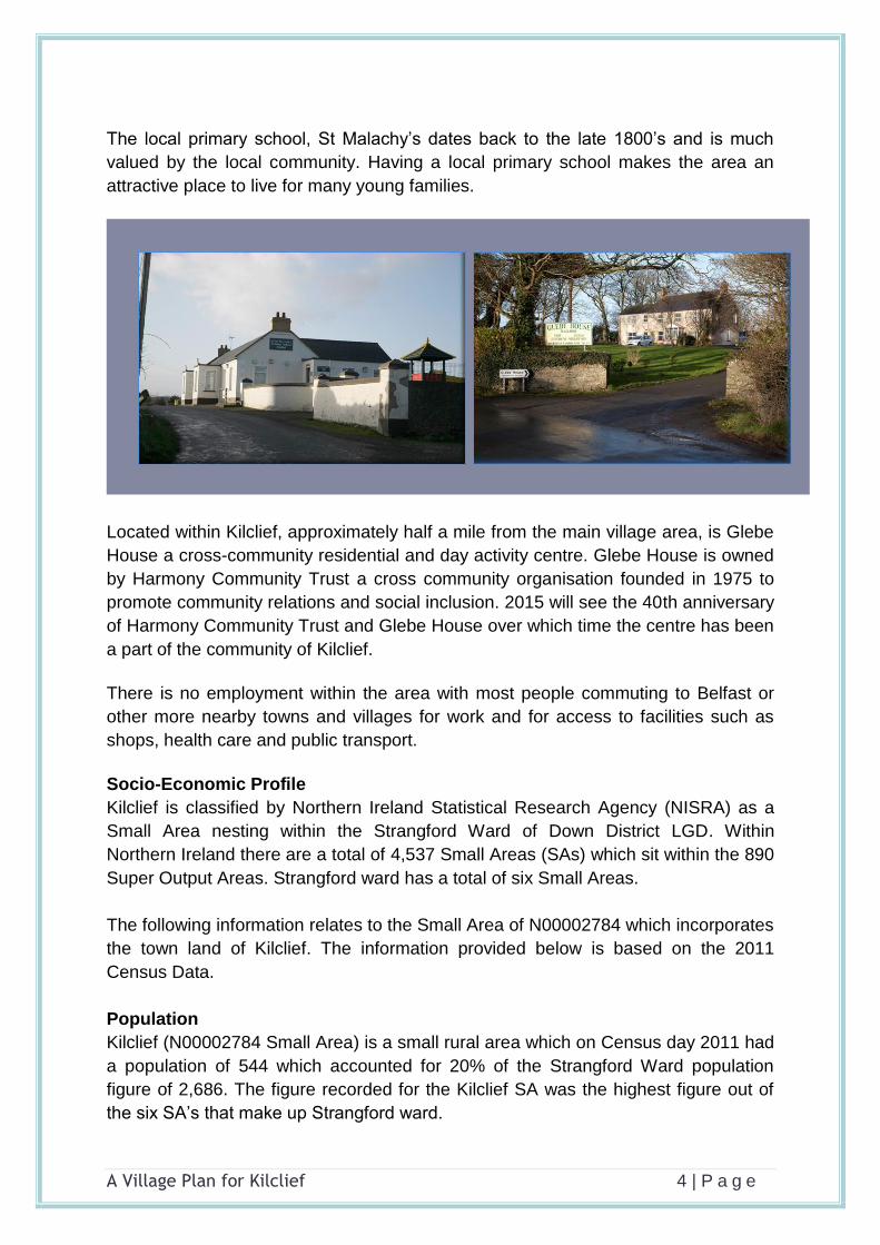
The local primary school, St Malachy’s dates back to the late 1800’s and is much
valued by the local community. Having a local primary school makes the area an
attractive place to live for many young families.
Located within Kilclief, approximately half a mile from the main village area, is Glebe
House a cross-community residential and day activity centre. Glebe House is owned
by Harmony Community Trust a cross community organisation founded in 1975 to
promote community relations and social inclusion. 2015 will see the 40th anniversary
of Harmony Community Trust and Glebe House over which time the centre has been
a part of the community of Kilclief.
There is no employment within the area with most people commuting to Belfast or
other more nearby towns and villages for work and for access to facilities such as
shops, health care and public transport.
Socio-Economic Profile
Kilclief is classified by Northern Ireland Statistical Research Agency (NISRA) as a
Small Area nesting within the Strangford Ward of Down District LGD. Within
Northern Ireland there are a total of 4,537 Small Areas (SAs) which sit within the 890
Super Output Areas. Strangford ward has a total of six Small Areas.
The following information relates to the Small Area of N00002784 which incorporates
the town land of Kilclief. The information provided below is based on the 2011
Census Data.
Population
Kilclief (N00002784 Small Area) is a small rural area which on Census day 2011 had
a population of 544 which accounted for 20% of the Strangford Ward population
figure of 2,686. The figure recorded for the Kilclief SA was the highest figure out of
the six SA’s that make up Strangford ward.
A Village Plan for Kilclief 5 | P a g e
Within the area of Kilclief almost a quarter (24%) of the population were under the
age of 16 compared to 21.5% for the Down LGD 20.9% for Northern Ireland.
The area has a relatively young population with the average age being 35 years compared to 38 for the rest of the Down District and NI. The majority of the population, 33.8% fall into the 16-39 age bracket compared to 31% for Down LGD and NI There is a lower concentration of older people in the area compared to the rest of Down LGD and NI, with 11% of the population being over the age of 65 compared to 15% for both Down LGD and Northern Ireland. Settlement The traditional settlement of Kilclief has predominately developed in a linear form
along BishopsCourt Road.
Within the Ards and Down Area Plan 2010, a development limit was drawn, which
provided limited opportunities for development in line with the existing scale of the
settlement whilst at the same time protecting the settings of the listed Parish Church,
the scheduled archaeological site and Kilclief Castle.
Within the settlement area a few areas of undeveloped land remain.
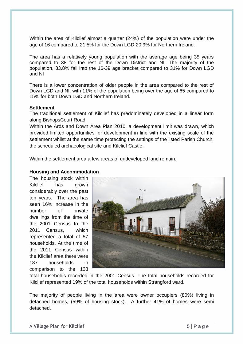
Housing and Accommodation
The housing stock within
Kilclief has grown
considerably over the past
ten years. The area has
seen 16% increase in the
number of private
dwellings from the time of
the 2001 Census to the
2011 Census, which
represented a total of 57
households. At the time of
the 2011 Census within
the Kilclief area there were
187 households in
comparison to the 133
total households recorded in the 2001 Census. The total households recorded for
Kilclief represented 19% of the total households within Strangford ward.
The majority of people living in the area were owner occupiers (80%) living in
detached homes, (59% of housing stock). A further 41% of homes were semi
detached.

A Village Plan for Kilclief 6 | P a g e
Only 18% of all housing stock was rented accommodation, all of which was private
rentals as the area has no social housing.
There were less persons over the age of 65+ living alone within Kilclief compared to
the rest of Down LGD. Less than 10% of households were comprised of a single
person over the age of 65+ compared to 11.3% for Down LGD. However over 11%
of all households within Kilclief comprised of single parents with dependent children
compared to 8.5% of all households in Down LGD.
Traffic and Travel
Kilclief is located three miles south of Strangford village along the A2 towards the village of Ardglass. The area is extremely poorly served by public transport which is reflected in the low
percentage of the working age population that travel to work by public transport at
1.3% compared to 2.7% for Strangford ward and 3.3% for Down LGD. A further 81%
people travelling to work do so by car or van, either driving or as a passenger
compared to 75.6% of Strangford Ward and Down District LDG.
Poor access to public transport is also reflected the greater need for residents to
have access to a car or van, which was recorded at 94% at the 2011 Census.
There are no dedicated cycle paths within the area thus cyclist are required to share
the narrow road space with vehicles. The Route 99 Sustrans National Cycle Network
route passes through the nearby village of Strangford through into Downpatrick but

A Village Plan for Kilclief 7 | P a g e
does not cover the Kilclief area, therefore cyclists who venture onto the roads are
required to share road space with vehicular traffic.
Services such as footpaths, walkways and pedestrian crossings to facilitate
pedestrians are extremely limited. The only pedestrian footpaths are located along
the Bishopscourt Road at Ballycottin and there are no pedestrian crossings within
the area.
There is also no traffic calming measures or speed reduction signs throughout the
entire village area.
Ethnicity, Identity, Language and Religion
The population of the area consists mainly of people belonging to a White ethnic
group who have been brought up in the Catholic religion.
Just slightly less than half of the population state they have an Irish national identity
with a further 43% stating their National Identity to be Northern Irish. Just 16%
indicated they had a British national identity.
Considering the population aged 3 years old and over:
12.26% had some knowledge of Irish;
3.45% had some knowledge of Ulster-Scots; and
0.19% did not have English as their first language.
Health Services
Within the area there are no dedicated health care facilities, the nearest would be in
Strangford 3 miles away which currently has a health centre, a chemist and a
recently opened dentist.
According to the 2011 Census, health and care statistics for Kilclief highlighted that
20% of the population had a limiting long-term illness, health problem or disability.
15% of people within the area noted that they provided unpaid care to family, friends,
neighbours compared to 12.4% for Down LGD.
Qualifications and Education
There is one primary school within the area, St Malachy’s. It is located in a rural
location approximately one mile from the main residential area of Kilclief. Over the
last four years, the enrolment has increased steadily to the current enrolment of 74
with almost all of the children coming from Kilclief and the surrounding rural area.
According to the Department of Education in 2014 23% of the children were entitled
to free school meals. The school has identified 23% of the children as having
difficulties with their learning.
An inspection carried out in 2014 by the Education and Training Inspectorate rated
the quality of education provided by the school as ’Very Good’. The report stated that

A Village Plan for Kilclief 8 | P a g e
‘the school offers children a wide range of extracurricular opportunities which
enhances the quality of the children’s overall learning experiences and contributes
significantly to their personal development’. However the report stated that with the
increasing trend in the school enrolment, the size of the foundation stage classrooms
is affecting the school’s ability to deliver fully the curriculum.
On Census Day 27th March 2011, considering the population aged 16 years old and
over:
23.49% had a degree or higher qualification; while 25% for Down LGD
32.45% had no or low (Level 1*) qualifications. 37% for Down LGD
*Level 1 is 1-4 O Levels/CSE/GCSE (any grades) or equivalent
Employment and Labour
The vast majority of residents travel outside the area for work as opportunities for
employment within Kilclief are extremely limited. Within the area the majority of the
working age population are employed within the Construction sector which accounts
for 16.5% of the working age population. Despite the rural nature of the area just 6%
of the working age population are employed within the Agriculture, forestry and
fishing sector.
The 2011 Census employment statistics highlighted that considering the total
working age population, i.e. those aged 16 to 74 years old:
71.4% were economically active, compared to a figure of 67% for Down LGD
28.6% were economically inactive; compared to 33% for Down LGD
63.40% were in paid employment; and 59% for Down LGD
3.87% were unemployed, against 4.9% for Down LGD
Deprivation and Disadvantage Deprivation Statistics for the area a provided at Output level. The figures used are for
Output Area 95NN220006 which covers the same geographical area as the Small
Area which has been used for other statistics.
The Northern Ireland Multiple Deprivation Measure (NIMDM) 2010 provides
information on four types of deprivation at Output Area level and an overall measure
of multiple deprivation for small areas.
Output Areas (OA) are ordered from most deprived to least deprived on each type of
deprivation and then assigned a rank. The most deprived Output Area is ranked 1,
and as there are 5,022 Output Areas, the least deprived Output Area has a rank of
5,022. The deprivation rankings for 95NN220006 Output Area are given in the table
below.

A Village Plan for Kilclief 9 | P a g e
Rank
Multiple Deprivation Measure (MDM) 1,791
Income Deprivation 1,896
Employment Deprivation 1,884
Proximity to Services 202
Crime and Disorder 2,224
With a rank of 202 under the domain of Proximity to Services, Kilclief is ranked within
the top 5% most deprived Output Areas in Northern Ireland. This highlights the rural
nature of the area indicating that the area is deprived in relation to services such as
GP premises, dentist, pharmacists, post office, food stores and other general services

A Village Plan for Kilclief 10 | P a g e
Section 3. What People Said
The following sections presents a summary of the findings from the residents’
survey, the public consultation meeting, the Focus Group meeting and local
stakeholder meetings regarding the development of the Village Plan.
SWOT Analysis The SWOT analysis below was drawn up from the background research carried out
and the consultations undertaken. Strengths and Weakness are issues that are
internal to Kilclief which can be tackled locally whilst Opportunities and Threats are
external influences which can’t be controlled locally but which need be addressed.
The SWOT analysis through conversation and consultation highlighted the following
issues:
Strengths Weaknesses
Location – located in an area of
Outstanding Natural Beauty, Coast of
Strangford Lough, beautiful beaches,
Nature reserve and Coastal walks;
Strong sense of community
Tourism – significant tourism potential
- Kilclief Castle, Natural assets -
coastal walks and beaches
Recently established Residents
Association with dedicated members
and a strong sense of local identity
Sport – Hurley is a very strong
sporting influence which brings young
people of Kilclief together to learn and
play Gaelic games, however success
of GAA club have now outgrown
current facilities;
The highly successful Ben Dearg
womens camogie club recently
merged with the Kilclief GAA club
putting additional strain on the
already limited facilities.
Low levels of crime
Strong sense of belonging to the
community – strong community
cohesion
Excellent primary School which meets
the needs of the local community –
Public Transport – the area is not served
by any public transport apart for the
Translink dedicated school service that
only operates on school days,
Traffic – speeding on main roads cycling
or walking to Strangford village and GAA
club inhibited by poor road. This also
affects the tourism potential between
Strangford and Ballyhornan on the
Mournes Coastal Route.
The lack of community space which
meets the growing needs of the
community -sporting, health and
wellbeing
No play park for younger children
Lack of up to date informative and
interpretive signage.
Restricted Parking at Beach – not
adequate especially in the summer
months – should be intergrated with
‘Cafferty’s beach to reduce pressure.
Poor access to the two nearest beaches,
Kilclief and Caffertys
Limited use made of the village’s
outstanding heritage and natural assets
Very large numbers of children involved
in Hurley, football and Camogie locally
but severe lack of facilities necessitate

A Village Plan for Kilclief 11 | P a g e
provides a hub for the community.
use of facilities in Ballyhornan and
Strangford villages for Kilclief children
Lack of provision for tourists e.g toilets,
coffee shop
Broadband Connection extremely poor to
non existence in some areas
Derelict buildings
No pedestrian footpaths/walkways
outside Kilclief centre
Lack of Services & Access to Services
Opportunities Threats
Village Plan creating a united voice
for all in the wider rural catchment
area.
Ability to focus on a 5 year plan with
short, medium and long term goals -
creating a new and positive sense of
civic pride in the area.
Continued need and development of
services for all residents of the area.
Need for regular engagement with the
new Council to access help and
information to assist in the future
development of the area.
Lobbying politicians and government
agencies to secure a positive future
for Kilclief.
Opportunity to engage with the
Community Planning process for the
Newry Mourne and Down Council
Opportunity to engage with the
planning of the new Rural
Development Programme.
New housing developments in the
village may attract new people with
families
Opportunity to exploit tourism
potential of the area – Beach, Castle,
Coastal walks
Opportunities to develop holiday
accommodation for the area
Funding opportunities though the new
Lack of facilities for Young People.
Lack of Capacity of new Council and
Funding Structures.
Severe lack of space at local GAA club,
now accomadating both the male codes
and the female codes but with only one
fully developed pitch.
Burn out of Volunteers and Lack of New
Volunteers on Community Development
Organisations.
Less Public Funding available.
Relatively new group and only
community Development group within
the area
Derelict buildings, especially in the
direction of Ballyhornan and the
abandoned Bishopscourt Airdrome and
around Kilclief castle
Lack of affordable housing and social
housing, to meet the growing needs of
the community
New Council covers a much wider area
and village could become isolated
Farming incomes declining and the end
of the single farm payment scheme
dictates that local farmers must diversify
their activities or go out of business.

A Village Plan for Kilclief 12 | P a g e
Rural Development programme and
possibility though PEACE 4
Renewable energy a rich resource in
the area with the best wind in
Northern Ireland and the strongest
tidal currents in the Narrows off Kiclief
leading to exciting new developments
at the nearby Airdrome.
EU support for development of
energy-intesive industries at
Bisopscourt Airdrome in the manner
of Thanet in Kent.
Top Priorities identified were:
Speeding and traffic calming measures
Employment opportunities locally need to be developed – the village is
supportive of development proposals at the old Bishopscourt Airdrome.
Need for a play park for younger children
Better transport links - A community bus
Better broadband and mobile connectivity
Farm income diversification into renewable energy – the Lecale and Ards area
was know in the 1700’s as ‘Little Holland’ on account of having more windmills
in the area than was found in the rest of Ulster.
More police patrol around the Beach re Drugs at the beach area
Flooding – Ardglass Road, Kilclief Road and at beach car park
Need for more affordable housing and social housing
Re-open old walking rights of way
Establish coastal walking path to link up with neighbouring village of
Strangford
More facilities for sport, health and wellbeing
Continued enhancement of the village
Need for a fit for purpose, community facility which would support needs of
the community
Need for an environmental scheme – i.e upgrading of area of land locally
known as the Triangle
Need for footpaths/walkways to link up the area – Church, School, GAA Club,
Beach and to link up to neighbouring village of Strangford. Possibility of
developing a coastal walking path linking up with neighbouring village of
Strangford
Need for consideration to be given to derelict buildings
Need for help for the elderly and disabled
Plan needs to be practical and achievable

A Village Plan for Kilclief 13 | P a g e

A Village Plan for Kilclief 14 | P a g e
Section 4. A Vision and Priorities for Kilclief
This section of the plan sets out a range of priorities, under a number of strategic
themes, that will form an action plan for the future development for Kilclief. The
priorities identified for the area have emerged from the feedback received during the
consultation process undertaken with the local community. Additional information
has also been received from other sources including background statistical
information and consultation undertaken with a range of interested stakeholders,
organisations and individuals. The vision and priorities developed for Kilclief have
been based on information emerging from all these various sources.
Vision for Kilclief
Kilclief will be a welcoming and attractive rural community for both residents
and visitors alike. The area will be a safe place to live which offers
opportunities, activities and facilities to enable residents to enjoy a high
quality of life and will promote and develop the abundance of natural
resources to make it an attractive place to visit.
Through the consultation process a wide range of issues and concerns were raised.
Based on these issues and concerns the main objectives emerging for Kilclief were
as follows:
To re-energise the area so that it is a better place to live and visit and build a greater sense of belonging for all residents;
To develop local employment opportunities in renewable energy, food processing and tourism;
To improve the appearance and image of the area; To take advantage of the area’s natural assets; To address the issue of lack of public transport and road safety; To address the issue of properties which are vacant, and derelict both in the
Kilclief area and at the Bishopscourt Airdrome; To increase links with statutory and non-statutory agencies and with key
stakeholders in order to develop a partnership approach on local issues
From the issues that have emerged the following strategic themes have been
identified that will help achieve the objectives:
1. Roads, traffic and transport;
2. Environment and regeneration;
3. Community;
4. Leisure and Tourism;
5. Housing.
6. Employment

A Village Plan for Kilclief 15 | P a g e
1. Roads, Traffic and Transport
1.1 Speeding and Traffic Calming
There is a great deal of concern regarding the speed of traffic on the three roads
approaching Kilclief especially on the section of these roads as they pass
through the village. The approach roads, Shore Road, Ardglass Road and
Bishopscourt Road all currently have a 60 mph speed limit. Only on a small area
at the centre of the village, Ballycottin, where the street lights are present, does
the 30 mph speed restrictions apply however this is also being ignored by divers.
Speeding through the area has an adverse affect on the quality of life of the
residents and visitors to the area and has consequently led to concerns for the
safety of pedestrians, especially children, as excess and inappropriate speed is
a major contributory factor in road traffic accidents particularly in areas such as
Kilclief were vehicles and pedestrians share the road.
Roads Service have been made aware of the speeding concerns in the area and
the Residents Association are currently liaising with them to agree appropriate
speed control measures in the village and to determine what practical steps
need to be taken to implement these. They are seeking to have a speed limit of
40 mph imposed along the Ardglass Road at the start of the development limits
decreasing to 30 mph at approximately address Nr 15 Ardglass Road which will
continue right through the village past the Castle to at least past St Malachy’s
Park. A 30 mph limit is also being sought for the Shore Road and the
Bishopscourt Road to the end of the development limits.

A Village Plan for Kilclief 16 | P a g e
Research has shown that the implementation of traffic calming measures within
an area can lead to a reduction in traffic speed thus reduce the risk of serious
accidents. The most effective traffic calming schemes are those that incorporate
a variety of measures. There are a number of additional traffic calming measures
that could be adopted within Kilclief which should be investigated, for example,
speed bumps, speed cushions and road markings. During the consultation
concerns were raised regarding the suitability of some measures with very mixed
views towards certain measures especially speed bumps thus further
consideration should be given to the various other options that may be available.
1.2 Public Transport Provision
Concerns were raised during consultation about the inadequacy or lack of public
transport service provision within the Kilclief area.
The only service currently provided for Kilclief is the Ulsterbus 16H which leaves
from Downpatrick and finishes at Kilclief Castle however, this service is primarily
a school service which operates twice a day and only on school days. The
closest other services are from Strangford and Ballyhornan into Downpatrick but
there is no direct service from either of these two villages into Kilclief. On
weekdays a total of 11 buses including three school buses operate on the
Downpatrick –Strangford route and six operate on the Downpatrick –
Ballyhornan route.
Residents of Kilclief and the surrounding rural area do not have any form of
public transport to the nearest village of Strangford where a number of essential
services are provided including a post office, dentist and chemist and shops.
The management of Glebe House have indicated that the lack of public transport
has caused difficulties for them over the years in terms of accessibility especially
for staff members. This has resulted in many young people over the years not
being able to take up placement opportunities that would have provide immense
benefits and skills to the young persons. People coming from outside the local
area to avail of the services offered at Glebe House find transport a real issue.
Glebe House do have their own mini bus which is used extensively for its
residents due to the lack of public transport.
A community survey should be carried out within Kilclief to assess the current
level of demand for public transport in terms of the time and frequency of when
people require transport to be provided (such as early morning, mid morning,
afternoon, late afternoon, early evening, late evening, night, daily, week days,
weekends). The findings of the survey could be used as evidence of need to
lobbying Translink to get the routes of either the Strangford or Ballyhornan buses
expanded to include Kilclief and ensure that future services reflect the public
transport needs of the local community.

A Village Plan for Kilclief 17 | P a g e
1.3 Car Parking
The consultation indicated there to be a high level of concern with regard to the
inadequacy of car parking provision especially along the beach front area which
during the summer months often leads to major congestion. Lack of car park
provision also causes safety issues for pedestrians, especially children, using
the beach and the road leading to the beach as parked cars usually obscure the
view of the road, and children may not see an oncoming vehicle, or indeed they
may not be seen.
The one main car park in the area is at Kilclief beach which is located just across
the road from the Castle so serves both amenities. The number of spaces are
limited and do not meet the demand experienced during the summer months.
Once it rains this car park becomes flooded putting a number of the parking bays
out of use
It is recommended that Kilclief Residents Association meet with Transport NI and
Newry, Mourne and Down Council to discuss the seasonal parking issues within
Kilclief especially at the beach area and to agree appropriate safety measures
that could be implemented. Consideration should be given to road side lay-by
markings which would help the situation as would also road widening on certain
sections of the road where possible.
2. Environment and Regeneration
2.1 Appearance
The overall appearance of Kilclief is very pleasing with most properties well
maintained and kept in relatively good condition. The community has pride in the
overall general appearance of the area and are anxious to keep improving and
Road along by Caffery’s Beach which could have lay-by markings

A Village Plan for Kilclief 18 | P a g e
developing on this by taking advantage of the areas outstanding beauty and
natural assets, especially the beaches and nature reserves and to continue to
build on these important local assets to help promote community pride and
community regeneration.
There are however, a few areas of dereliction that are blight on the landscape.
Derelict sheds are located on an area of land beside the Castle. Unfortunately
these sheds obscure the full view of the Castle on the approach to the village
from both the Ardglass Road and the Shore Road. This area was intended for
development of tourist accommodation units but due to the economic downturn
plans for the development of the site did not materialise and the property has
since fallen into an extremely poor state of dereliction. Another vacant property is
located along the Bishopscourt Road.
First impressions are important for visitors to the area and also for the sense of
pride for residents thus measures need to be put in place to address the issue of
dereliction. First steps should be taken to make contact with the owners of the
properties to ascertain their future plans and to work with them to ensure the
properties are firstly made safe and are cleaned up or restored in a way that will
make them more pleasing to the eye and will not ruin the overall appearance of
the area.
2.2 Litter Bins and Recycling Facilities
There was general dissatisfaction with the number of litter bins within the village
especially around the beach area with the general feeling that the bins that are

A Village Plan for Kilclief 19 | P a g e
provided are not adequate in size nor are they emptied
on a regular enough basis especially during the summer
months when there is more actively around the coastal
and beach areas.
It is also acknowledged that recycling facilities were
good however, the facility is located within the grounds
of the school which is locked in the evenings, weekends
and over the school holidays.
The new Newry Mourne and Down Council need to be
made aware of the issue of litter bins with measures put
in place to ensure the number and capacity of bins provided is adequate and
they are emptied on a regular basis which should see them emptied more often
in the summer months of June, July and August.
There is a need to assess the feasibility of having additional recycling facilities
located in an area that would be more accessible for residents which can be
accessed in the evenings and weekends.
2.3 Environmental Improvements
Concerns were raised during consultation regarding the area of land located at
Sharvins Corner where the Ardglass Road and the Bishopscourt Road meet,
locally known as ‘The Triangle’. This area of land is overgrown and unkempt. Its
location and height of the boundary hedging restricts views for both motorists
and pedestrians. Residents have put forward suggestions for an environmental
Current Recycling facilities at the school

A Village Plan for Kilclief 20 | P a g e
improvement scheme to improve the visual appearance of this area of land.
Suggestions have been made to develop it into a community garden or
community village green with landscaping works, provision of seating and the
erection of a village notice board and replacement of the old bus shelter.
2.4 Pedestrian Foot Paths
The provision of footpaths within the area is extremely limited. Currently
footpaths only exist along the Bishopscourt Road at Ballycottin to the bus shelter
at the Triangle. Pedestrians walking elsewhere within the area have to use the
road which currently has a 60 mph speed limit.
St Malachy’s Park which is located approximately one mile from the centre of the
village is extensively used by local residents including children. There is no
pedestrian path to link the village with the park thus anyone wishing to use the
facilities have to either travel by car or walk along the narrow road side
There is a need to extend pedestrian pathways to link up areas of the village
including the Castle, the beach and along Shore Road to St Malachy’s Park to
ensure the safety of all pedestrians including children and the elderly residents.
2.5 Village Entrance Signs and Way-markers
The only gateway signs into the village are the standard Down District Council
village name signs which the community feel lack individuality and do not portray
the sense of pride and community spirit that exists within the area. It was
suggested that entrance features that convey a feeling of pride in the area and
Area of land that could be developed into community garden

A Village Plan for Kilclief 21 | P a g e
reflect the area’s strong history and heritage be placed on the main approach
roads, one on the Shore Road approaching from Strangford and one on the
Ardglass Road.
As the area is dispersed there is a need to provide way-markers or fingerpost
signs to link the area up and to provide a sense of connectivity between the
different areas of the village.
2.5 Broadband
Broadband availability within the Kilclief area has been described as extremely
poor to non existing. This is a problem that is experienced across many rural
areas within Northern Ireland. Inadequate Broadband and poor mobile
connectivity can disadvantage many rural communities and it is a major problem
for residents and businesses within Kilclief. Having access to modern technology
and connectivity is a necessity for business, education and modern family life.
The problem of delays in the roll out of broadband to rural areas has been
acknowledged by government who have stated they will improve efforts to
influence broadband providers to make sure provision is more effective
particularly in hard to reach rural communities. Local MP Ms Margaret Ritchie
has raised the issue with the Secretary of State who has stated the need to
increase efforts to remedy the delays.
It is vital the local community work along with local MP’s to continue to campaign
and lobby for the upgrade of the service for the rural community.

A Village Plan for Kilclief 22 | P a g e
3. Community
3.1 Community facilities
Some concerns were raised at the consultation about the lack of a community
hall/community centre. It was felt there was a need to have a community facility
that could be used by all members of the community.
There had previously been an AOH hall on the grounds of the school which
served as a community facility and was also used by the school as a school hall
and lunch room but due to a poor state of disrepair the facility was removed in
2000 and has never been replaced. This has left a gap in provision for the school
and the community.
The school is poorly catered for in terms of facilities for lunch or indoor play on
days when the weather is not appropriate for outdoor activity. A Community
facility located on the school premise could serve both the needs of the school
and the needs of the community.
Glebe House, located along the Bishopscourt Road, has a range of facilities that
are available for the community to use. The centre has a recently built multi
functional hall which the community can have access to. This facility should be
utilised more by the community as it would be suitable for a vast array of
community activities. However its distance from the school does not make it a
suitable alternative to meet their identified needs.
From the consultation it was evident there is a desire within the community for a
community hall that would be multifunctional serving needs of a range of
organisations and groups as well as the local school.
Further investigation will be needed to establish availability of land and to
develop a robust business case to justify the provision needed within the village.
3.2 Sport, Health and wellbeing
The main focal point and hub of the community is the Kiclief and Ben Dearg
Gaelic Clubs. These two clubs merged in March of 2015 in line with the GAA’s
policy of promoting women in sport equally with the male GAA codes. The
combined club offers a wide range of sporting activities for the local community
with the main one being Hurling, football and Camogie. The club premises are
located along the Shore Road at St Malachy’s Park and facilities include a grass
pitch and a training pitch, club rooms and changing facilities. As well as being
used by the GAA the facilities available are widely used by the local community
for a range of purposes from mother and toddler groups to Irish Dancing classes.

A Village Plan for Kilclief 23 | P a g e
However due to the growing demands of the club the availability of space for
community use is becoming extremely limited. The Club has witnesses a
substantial level of growth over the past few years and as subsequently has
reached the level where they have outgrown their current facilities.
The success of the club has resulted in them requiring additional facilities in
terms of an additional grass floodlit pitches, changing facilities and indoor
training space all of which will enable the Club to continue to deliver on its
commitment to provide top grade facilities to all its members and to the local
community.
Consultation has shown that local people would like to see the facilities at the
Club extended to meet their commitment to pursue a healthier lifestyle.
3.3 Play Park
Research has shown that play is an important part of a child’s health and
development. Play for a child is about having fun, taking risks and using their
own initiative thus it is important that spaces are created in a range of settings
where children of all ages can enjoy themselves.
The community of Kilclief has recognised the need for the development of a well
structured and designed play park facility within the area that will meet the needs
of children of all ages, from toddlers to teenagers. The addition of such a play
facility will not only meet the developmental and health needs of the children of
the rural area it also has the possibility of becoming a focal point of the
community and can offer opportunities for social interaction for children and the
wider community and help in the development of greater sense of community
spirit.
Potential sites within the village that could accommodate a play facility need to
be identified. The suitability of each site would need to be assessed in terms of a
number of factors including:
Location – overall location within the village in relation to potential users in
terms of accessibility and safety;
Size – is the site large enough to ensure it can adequately accommodate
the required equipment;
Accessibility – is the site easily accessible for both pedestrians and car
users
Parking – as Kilclief is such a rural area a high percentage of users of the
facility will be travelling to it by car so parking will have to be made
available;
Availability of land and cost – can the land be purchased and at what cost

A Village Plan for Kilclief 24 | P a g e
Location in relation to other facilities for example close to the residential
area which would make access easy for children or close to the GAA
facilities or the school where the facility could be shared.
Further investigation will be needed to establish availability of land and to
develop a robust business case to justify the provision needed within the village.
3.4 Youth Activities
There is a lot of concern regarding the lack of facilities for the young people of
the area especially during the summer months. Apart from the sporting activities
available at the GAA club there remains a lack of opportunities for young people
to socialise with their peers. The nearest youth club is located in Strangford and
operates two nights per week with one night for primary school children and the
other night for the older children of the area. Children from Kilclief wishing to
become involved in the youth club have to be driven into Strangford as the
distance is too far and there is not pavement or cycleway and the road too
dangerous for them to walk.
There is an opportunity to explore the possibility of developing youth activities
within the area especially the creation of a summer scheme which would provide
a range of activities for school children during the summer months.
4. Leisure and Tourism
Kilclief is located within Strangford and Lecale area of Outstanding Natural Beauty
(AONB) which is one of Tourism Northern Ireland’s Tourism destinations. The
recently established Mourne Coastal Driving Route runs through the area and the
area also forms part of the Lecale Way and the Ulster Way walking routes.
The area has many unique features which can help to attract visitors including
Kilclief Castle, a number of beautiful beaches, Cloughey Rocks Nature Reserve,
Killard Nature Reserve and unique walking routes. While each asset has the ability
to attract a range of visitors there is a need to capitalise on the tourism potential of
the whole area and to create a visitor package that would encourage visitors to come
to the area to enjoy a wide range of experiences. One such way this could be
achieved would be through the development of a walking trail linking up all the areas
of interest via way markers, maps of the area and tourist promotional material.
Through consultation residents have highlighted a problem with the distinct lack of
facilities such as car parking, toilets and tea/coffee shop, to meet the needs of
visitors who have travelled to the area to enjoy all the above mentioned sights. The
availability of adequate facilities is necessary to make the visitor experience more
enjoyable. Lack of toilet facilities can particularly cause problems especially for those
who have travelled far to enjoy the area.

A Village Plan for Kilclief 25 | P a g e
Suitable sites for location of public toilet facilities needs to be investigated. Some
have suggested for this facility to be located around the back of the Castle which
would allow it to be used by visitors to the beach, nature reserves and coastal walks
at time when the Castle is closed. Any type of proposed facility would need to be
environmentally sensitive. The development of public toilet facilities would require
consultation with Newry Mourne and Down Council, who hold responsibility for the
provision of toilet facilities, and NIEA to assess the feasibility of this proposal and to
discuss issues of management and maintenance of the facility.
As discussed previously in the document car parking is a particular problem
especially at each of the main beaches. Kilclief beach is the only one of the three
main beaches that does have a dedicate car park and picnic area but spaces are
limited and the area floods every time there is rain.
As described in section 1.3 above the lack of car parking facilities causes many
problems not just for visitors but also for locals as during the summer months many
people double park along the roadside causing traffic congestion and also safety
issues for pedestrians.
Consultation needs to begin with Transport NI along with the Council to develop
adequate and acceptable solutions to the ongoing parking problems in the area. A
first step remedy may be to establish a formal lay-by situated along the roadside at
Cafferys beach. This would ensure that cars park in a designated area off the main
carriageway reducing the possibility of congestion whilst also improving safety.
4.1 Kilclief Castle
The Castle, or Tower House, is an important and unique feature of Kilclief dating
back to the 1400’s and is one of the earliest datable tower-houses in Co Down. It
is currently managed by NIEA who during the summer months have a member
of staff present to open the Castle to the public. The year 2013 recorded a total
of 629 visitors to the Castle.
Through new initiatives being proposed NIEA are considering transferring
management of a number of facilities including Kilclief Castle to local community
organisations. These organisations would be tasked with the daily management
of the facilities. There is an opportunity for Strangford Lough and Lecale
Partnership (SLLP) to look at the possibility of assuming this role for Kilclief
Castle in conjunction with the local community. This would fit within their strategy
and action plan, Strangford Lough and Lecale Heritage Management Strategy
2013 – 2018, under Objective 1 Action 1.9 –‘To provide local community
representatives in ..... Kilclief with keys to relevant tower houses and work with
them to develop the local communities sense of ownership and activities’.
While it is an important feature within Kilclief residents feel this in itself as a
standalone attraction does not offer enough to attract visitors to the area. There

A Village Plan for Kilclief 26 | P a g e
is an opportunity to work along with Strangford Lough and Lecale Partnership to
develop a visitor heritage package that would link up all the tower houses within
the local area to encourage more visitors and promote the local built and natural
heritage.
4.2 Beach
Kilclief is located along the coast of Strangford Lough which boasts a number of
beautiful beaches which are extremely popular with locals and visitors especially
during the summer months.
Approaching the village from Strangford the first beach to arrive at is Kilclief
beach which is located adjacent to the Castle. This beach has a dedicated car
park with picnic facilities and is part of the Mourne Coastal Route. Further along
the coast along Shore Road is Cafferys beach. There is no dedicated car parking
facilities at this beach. Cars park along the side of the road which during the
summer months can cause major traffic congestion and pose serious safety
issues. As with Kilclief beach access to this beach is an issue with no formalised
entry route. The third main beach, Mill Quarter Beach is located further along
Shore Road and as with the other beaches parking and access is an issue.
Access to the beach has been raised as a major area of concern throughout the
consultation. Council needs to be aware of this major problem. A proper
formalised safe access path to each of the beaches is required. This will meet
the needs of all users but particularly those of limited mobility, parents with push
chairs and the elderly.
Access Path to Kilclief Beach

A Village Plan for Kilclief 27 | P a g e
4.3 Walks
The area is popular with walkers who come to enjoy the beautiful coastal and
inland walks that are available. The Ulster Way and Lecale Way Walking Routes
pass through Kilclief. The Lecale way begins in the Village of Strangford and
continues inland towards Kilclief. It joins the coast at Kilclief Castle where it then
follows the cost on towards Ballyhornan.
To enhance the walking experience there is an opportunity to develop a coastal
walking/cycle path that will follow the coast, where possible, to link Kilclief up
with neighbouring village of Strangford. As discussed in section 2.4 above, there
are no pedestrian foot paths from the village to St Malachy’s Park which causes
problems especially for the many children that use the facility. Not only would
this coastal path add to the walking experience it will provide for a safe walking
route to St Malachy’s Park and on into Strangford also enabling people from
Strangford to safely access the playing facilities located at the park.
Currently Newry, Mourne and Down District Council have commissioned a
feasibility study in to the development of a coastal walking trail stretching from
Kilkeel to Portavogie. The route will take in the towns and villages along the
south cost which will include the stretch of coast between Kilclief and Strangford.
The findings of this study will highlight the possibilities for the future development
of a coastal path between both villages and should identify what measures need
to be implemented to make this into a reality.
4.4 Nature Reserve
Killard Point Nature Reserve is situated to the south of Strangford Lough, and is
surrounded by fine views of the Mourne Mountains, the Lecale landscape and
the Isle of Man. The area has an abundant array of grassland flowers which
colour the landscape through the
seasons. Many of the plants found in
the area are uncommon or rare in
Ulster. Thousands of orchids flowering
in June produce a display unequalled in
the province.
The 3 kilometre walking circuit features
3 beached and is a popular walking
destination with many people travelling
from all parts of the province to enjoy
the coastal walk. Parking is available in
a lay-bys along the side of the Shore
Road at Mill Quarter Bay.
Cloughy Rocks National Nature Reserve is located along the Shore Road about
approximately 2 miles from Kilclief. It is managed as a Visitor Attraction by

A Village Plan for Kilclief 28 | P a g e
Northern Ireland Environment Agency, (NIEA). At present it is mainly a viewing
point where visitors can stop to easily view Common and Gray seals along with
an array of other types of birds and sea life.
There exists an opportunity to tie in with Strangford Village Plan to develop this
site into a longer stop over point for touring caravans/motor homes that will
encourage more visitors into the area and can be used as a base for them to
explore the surrounding area.
5. Housing
Over the past ten years the number of houses within the area has risen by 16%. This
has mainly been through the development of new private housing estates. All the
homes in the area are privately owned or private rented, there is no social housing.
Local people feel there is a need for further development of both private and social
housing accommodation within the area. Young people setting up home wish to stay
local but because of shortage of housing and affordability they are being forced to
move out of the area.

A Village Plan for Kilclief 29 | P a g e
The map to the right shows the development
limits as set out in the Ards, and Down Area
Plan 2015. Two areas of land have been
identified one that may be suitable for private
housing and one that may be suitable for future
social housing. The area on the map marked in
green, located at the bottom of the
development limit along the Ardglass Road has
been identified by the community as a suitable
site for future social housing development. This
site is within the current development limits of
the area. The area marked in blue at the top
left of the above picture, located on the
Bishopscourt Road has been identified as
suitable for private development, however this
area of land is currently outside of the
development limit.
To fulfil the future housing demands of the
community there is a requirement to ensure sufficient land is made available for
development be it either for private or social housing. The community need to ensure
future development plans for the area reflect the needs of the community thus it is
important the community continue to consult on a regular basis with the planning
department of the new Council to ensure their views and opinions are taken into
consideration.
The Northern Ireland Housing Executive has recently carried out assessment of
need for social housing within the Strangford area which included Kilclief within the
wider Strangford Common Landlord area. An outcome of this assessment is a
scheme for 9 units in the Social Housing Development Programme for Strangford
which is considered to be adequate to address the current housing need for the
area.
However, NIHE have indicated they would be interested in carrying out a latent
demand test in Kilclief at a later date once the Strangford scheme has been
developed with the homes allocated and the waiting list has been settled.
To help the community play an active role in influencing and shaping their area and
to ensure any future proposed new developments fit in with the character of the area
and the local environment, the community should seek the help, advice and support
being offered by Community Places, a voluntary organisation that provides impartial
advice and guidance on planning issues to community groups.

A Village Plan for Kilclief 30 | P a g e
6 Employment
Due to the rural nature of the area employment opportunities are extremely limited.
The majority of residents travel outside of the area for work. Despite the rural area
just 6% of the working age population are employed within the farming sector.
Some exciting developments are taking place however on the nearby Bishopscourt
Airdrome.
The Centre for Microgrids and Energy Storage (CEMES) is a unique community-led
project to promote farm diversification, local employment and looking to the Thanet
Earth ( http://www.thanetearth.com/ ) example of generating employment locally. By
building on the renewable energy capacity area of the area and tapping into the
unique resources represented by some of the strongest tidal energy resources in
Britain and Ireland allied to some of the best and the most consistent wind energy
resource in Northern Ireland.
The concept is founded on the premise that local grid infrastructure is insufficient to
export and manage the amount of local renewable energy available. This was
established via a formal study carried out for the local community and funded by
Down Rural Area Partnership through the Rural Development Programme. There are
72 other similar areas in N Ireland, 300 in Republic of Ireland and thousands of
similar areas that are grid-restricted around Europe. This project therefore has
National and European significance.
This study formed the backdrop of a submission made to the European Union's
'Horizon 2020 programme' that has secured €2.2 M to develop a Compressed Air
Energy Storage Device, which will form an integral part of a decentralised microgrid
strategy for local communities. This funding is part of an EU wide project to probation
innovative solutions and shared learning for local communities in the energy
landscape with a total project value of €15.5 M. Assuming that suitable planning,
infrastructure development and grid connection can be established within the project
timeframe it is planned that this device will be located at the 'Centre for Excellence
Microgrids and in Energy Storage' (CEMES) on the abandoned areas of the old
airdrome.
This creates the possibility that the abandoned airdrome can become a centre for
energy and labour intensive horticultural and agricultural production, utilising both the
developing tidal energy technologies in the Narrow as well as the local wind
resource.

A Village Plan for Kilclief 31 | P a g e
Section 5. Action Plan
This section of the plan identifies the key priorities for the area that have emerged
through the consultation process forming these priorities into a detailed Action Plan.
To enable the Actions to become reality will involve the input from a range of
individuals across the community including private, public and community sectors.
The Action Plan contains a number of themes with a range of key actions detailed
under each theme. It is these identified actions that the community would like to see
implemented within the area over the short, medium and long term. To successfully
implement the Action Plan it is important that potential funding sources are identified
which can be later targeted at the time when the action is to be implemented.
The Action Plan should be considered as a Working Document in that it should be
regularly reviewed and progress monitored thus it is important that one group is
identified to take responsibility for the management of the Action Plan. This
nominated group will assume responsibility of reviewing, monitoring and updating the
plan on a regular basis.
Theme 1: Roads, Traffic and Transport
Actions Why it is an Issue Time-frame
Who Potential Funders
1.1
Liaise with Transport NI for the implementation of speed controls and traffic calming measures
Speeding within the area and on approach roads
Short
Transport NI
Transport NI
1.2
Undertake survey of public transport needs within the area
To assess demands for pubic transport and at what time of day it is mostly required
Short
KRA
-
1.3
Liaise with Translink regarding re-routing of Bus service
Currently no service to meet the needs of the community
Short
Translink
Translink
1.4
Liase with Transport NI and NMDC to assess the demands for increased Car parking facilities along beach front
Current parking facilities not adequate especially during summer months
Short
Transport NI
Transport NI

A Village Plan for Kilclief 32 | P a g e
Theme 2: Environment and Regeneration
Actions Why it is an Issue Time-frame
Who Potential Funders
2.1
Appearance of Village – clean up of derelict buildings
Does not portray a good image of the village
Short
Property owners
N/A
2.2
Additional Litter bins and Recycling facilities
Need more bins at beach Recycling facilities closed during weekend and school holidays
Short
NMD Council
NMD Council
2.3
Environmental Improvements - Development of Triangle area: landscaping, summer seats, flower beds, lighting
Does not portray a good image of the area as overgrown and restricts views. Will provide a focal point for the village
Medium
KRA RDP Council
RDP NIHE
2.4
Develop pedestrian footpaths – from Triangle to Castle and beach
Safety of pedestrians – link up the main assets of the area – beach - Castle
Medium
KRD Council Transport NI
N/A
2.5
Village signage: entrance features at main gateways into the village. Way markings throughout the area i.e fingerposts
Need to Identify and signpost its assets; resources; and facilities
Medium
KRA NM&D Council RDP
RDP
Theme 3: Community
Actions
Why it is an Issue
Time-frame
Who
Potential Funders
3.1
Development of additional Community Hall Facilities
Lack of facilities in the area. School has no indoor play facility No hall at the school
Medium
School KRA
RDP
3.2
Community health and well being centre
Improvement in health and well being of residents
Medium
GAA KRA
RDP

A Village Plan for Kilclief 33 | P a g e
3.3 Enhance and develop facilities at GAA park to meet future demands – to included upgrade/ extension to clubhouse, floodlights, new 3G pitch, additional training pitch
Club have outgrown current facilities, limiting growth of Club
Medium GAA RDP Awards for All Council
3.4
Play Park - Investigate suitable site for children’s Play park and develop facility
Area needs a structured safe play area that will meet needs of various age groups
Short
KRA NM&D Council RDP
RPD Council
3.5
Youth Facilities – develop activities for the youth – development of a summer scheme
Limited activities for young people especially during summer months
Short
KRA
Awards for All
Theme 4: Leisure and Tourism
Actions Why it is an Issue Time- frame
Who Potential Funders
4.1
Beach – improve access to all beaches with particular emphasis on Kilclief beach – liaise with Council to improve access to all beaches
Access currently inappropriate and causes difficulties to those less able
Short
NM&D Council
Council
4.2.1
Coastal walking/cycle path –review the outcomes from the feasibility study currently being undertaken to assess the possibility for the development of a Coastal path linking Kilclief to Strangford
Need to link up both villages, coastal walk that could enhance the visitor experience whilst providing a safe walking route for residents
Short
KRA SCA ORNI NMD Council
RDP NMD Council
4.2.2
Development of Coastal walking/cycle path between Strangford and Kilclief either Coastal or along the road side.
Need to link up both villages, coastal walk that could enhance the visitor experience whilst providing a safe walking route for residents
Long
KRA SCA ORNI NMD Council
RDP NMD Council NITB
4.3
Provision of Tourist facilities – toilets, coffee shop/tea room
There are no such facilities to encourage Visitors coming to the area to stay longer
Medium
KRA Glebe House
RDP Awards for All NMDC

A Village Plan for Kilclief 34 | P a g e
4.5
Development of Kilclief Castle to form part of an extended tourist offering – linking up with other similar Castles/tower houses in the Lecale area to form a wider tourist offering
Castle is not enough to encourage tourist to visit – needs to be part of a larger tourist product
Medium
KRA SLLP
NIEA NMDC RDP
4.6
Development of Cloughy Rocks as an overnight stop off point for camper vans, touring caravans
Encourage more tourist to stay longer in the area
Long
KRA SCA NMD Council
NITB RDP NMDC
Theme 5: Housing
Actions Why it is an Issue Time-frame
Who Potential Funders
5.1
Lobby to have identified land re-zoned for development
To meet the future housing needs of the local community
Short
KRA Council
N/A
5.2
Survey of Social housing needs
To identify requirement and need of social housing within the community
Medium
NIHE
NIHE
5.3
Development of Social housing
To provide affordable housing within the area which will enable young families to stay in the area
Long
NIHE
NIHE
Theme 6: Employment
Actions Why it is an Issue Time-frame
Who Potential Funders
6.1
Deliver a Centre of Excellence for Micro-Grids and Energy Storage at Bishopscourt
To enable the
development and
implementation of
technologies which
will deliver
Government targets
for renewable energy
and will reduce the
cost of the National
Grid
Medium
CEMES
EU Horizon 20/20
6.2
Development of
To encourage the
Long
CEMES
EU
A Village Plan for Kilclief 35 | P a g e
Bishopscourt Airdrome as centre for micro businesses and business start up units
development of rural enterprise and to bring a source of employment to the area
NMD Council Invest NI
Horizon 20/20 Invest NI
Abbreviations
KRA – Kilclief Residents Association; NMDC – Newry, Mourne and Down Council
NIHE – Northern Ireland Housing Executive RPD – Rural Development Programme
SCA – Strangford Development Association ORNI – Outdoor Recreation N Ireland
SLLP – Strangford Lough and Lecale Partnership
CEMES - The Centre for Excellence in Microgrids and Energy Storage Bishopscourt
NITB – Northern Ireland Tourist Board – (now known as Tourism NI)
NIEA – NI Environment Agency
Section 6. Conclusion
This plan seeks to provide a series of practical actions which can be delivered
across the short to longer term by a combination of public, community and private
sector organisations. The actions identified are sensitive to the Kilclief community,
seeking to respect the area’s tradition and character, while building on its natural
assets and resources to contribute to both social and economic renewal.
In bringing the Kilclief Village Plan forward one of the key challenges will be
implementation of each of the identified actions. The group that assumes the future
management of the plan need to fully understand the challenges that will be involved
with its implementation. The community need to be realistic in their understanding
that not everything identified within the action plan can be achieved quickly as
implementing projects will take time and resources. The community also need to be
aware that a reduction in future funding opportunities may have an impact on the
delivery of some of the actions.
Over time and with a lot of commitment as each of the identified actions are
implemented the community of Kilclief will see the benefits of this plan with each of
the actions helping to contribute towards ensuring Kilclief becomes a great place to
live, play and visit.

A Village Plan for Kilclief 36 | P a g e