kent county - maryland department of the environment
TRANSCRIPT

Prioritizing Sites for Wetland Restoration, Mitigation, and Preservation in Maryland. May 18, 2006 - Maryland Department of the Environment
KENT COUNTY....................................................... 2
Background..................................................................................................................... 5 Streams............................................................................................................................ 6 Wetlands ......................................................................................................................... 7 Sensitive Resources ...................................................................................................... 16 Other Relevant Programs.............................................................................................. 17 Watershed Information ................................................................................................. 19
Lower Chester River (02130505) ............................................................................. 19 Langford Creek (02130506) ..................................................................................... 22 Middle Chester River (02130509) ............................................................................ 24 Upper Chester River (02130510).............................................................................. 30 Sassafras River (02130610) ...................................................................................... 38 Stillpond-Fairlee (02130611).................................................................................... 43
1
Prioritizing Sites for Wetland Restoration, Mitigation, and Preservation in Maryland. May 18, 2006 - Maryland Department of the Environment
KENT COUNTY Basin Summary Team and Chesapeake Bay Program. 2004. Maryland Upper Eastern Shore: Final Version for 1985-2002 Data. Tidal Monitoring and Analysis Workgroup. Boward, D. MBSS data results for 1995-1997, 2000-2001. Received 2003. Code of Maryland Regulations (COMAR). 26.08.02.08. Stream Segment Designations. Code of Maryland Regulations (COMAR). 26.23.06.01. Areas Designated as Nontidal Wetlands of Special State Concern. Code of Maryland Regulations (COMAR). 26.23.06.02. Areas Designated as Nontidal Wetlands of Special State Concern Located in the Critical Area. George, J. 2006. Personal Communication. Maryland Department of the Environment. Gregory, A., M. Stover, and K. Yetman. 2005. Upper Chester Stream Corridor Assessment. Maryland Department of the Environment. Watershed Services Unit. Annapolis, MD. Guignet, D. July 7, 2004. personal communication Harrison, J.W. and P. Stango, III. 2003. Shrubland Tidal Wetland Communities of Maryland’s Eastern Shore. Maryland Department of Natural Resources, Maryland Natural Heritage Program. Prepared for: U.S. Environmental Protection Agency. Harrison, J.W. 2001. Herbaceous Tidal Wetland Communities of Maryland’s Eastern Shore: Identification, Assessment and Monitoring. Maryland Department of Natural Resources, Wildlife and Heritage Program. Submitted to U.S. Environmental Protection Agency. Harrison, J.W., P. Stango III, and M.C. Aguirre. 2004. Forested Tidal Wetland Communities of Maryland’s Eastern Shore: identification, assessment, and monitoring. Maryland Department of Natural Resources, Natural Heritage Program, Annapolis, Maryland. Unpublished report submitted to the Environmental Protection Agency. 96 pp. Kent County Department of Planning and Zoning. 2002. Middle Chester River Watershed Restoration Action Strategy. Kent County Planning and Zoning. 1996. Kent County Comprehensive Plan. Kent County. 2005. Draft Kent County Comprehensive Plan. Kent and Queen Anne’s Counties Departments of Planning and Zoning. 2003. The Upper Chester River Watershed Restoration Action Strategy Grant Proposal.
2

Prioritizing Sites for Wetland Restoration, Mitigation, and Preservation in Maryland. May 18, 2006 - Maryland Department of the Environment
Ludwig, J.C., McCarthy, K., Rome, A., and R.W. Tyndall. 1987. Management Plans for Significant Plant and Wildlife Habitat Areas of Maryland’s Eastern Shore: Kent County. Maryland Department of Natural Resources, Natural Heritage Program. Maryland Clean Water Action Plan: Final. 1998. Report on Unified Watershed Assessments, Watershed Prioritization, and Plans for Restoration Action Strategies. Maryland Department of the Environment. Point source discharge data (GIS) Maryland Department of the Environment. 1998. Total Maximum Daily Loads of Nitrogen and Phosphorus for Fairlee Creek. Baltimore, MD. Maryland Department of the Environment. 1999. Total Maximum Daily Loads of Phosphorus and Sediments to Urieville Community Lake, Kent County, MD. Baltimore, MD. Maryland Department of the Environment. 2000-2001. Source Water Assessments (transient water systems, Betterton, Fairlee, Galena, Kennedyville, Rock Hall, Worton, Shore Homes, Edesville, Kent School, Millington Elementary School). Baltimore, MD. Maryland Department of the Environment. 2001a. Total Maximum Daily Loads of Nitrogen and Phosphorus for the Worton Creek Kent County, Maryland. Baltimore, MD. Maryland Department of the Environment. 2001b. Total Maximum Daily Loads of Phosphorus for the Sassafras River Cecil and Kent Counties, Maryland. Baltimore, MD. Maryland Department of the Environment. 2002a. Maryland’s State Wetland Conservation Plan. Baltimore, MD. Maryland Department of the Environment. 2002b. Total Maximum Daily Loads of Nitrogen and Phosphorus for the Still Pond Creek Kent County, Maryland. Baltimore, MD. Maryland Department of the Environment. 2004a. Draft Water Quality Analysis of Fecal Coliform for Eight Basins in Maryland: Assawoman Bay, Sinepuxent Bay, Newport Bay and Chincoteague Bay in Worcester County; Monie Bay in Somerset County; Kent Island Bay in Queen Anne’s County; Rock Creek in Anne Arundel County; and Landford Creek in Kent County. Baltimore, MD. Maryland Department of the Environment. 2004b. 2004 List of Impaired Surface Waters [303(d)List] and Integrated Assessment of Water Quality in Maryland. Baltimore, MD. Maryland Department of Natural Resources. 1984. Threatened and Endangered Plants and Animals of Maryland. Maryland Natural Heritage Program. A.C. Norden, D.C. Forester, and G.H. Fenwick (eds.) 475 pp.
3

Prioritizing Sites for Wetland Restoration, Mitigation, and Preservation in Maryland. May 18, 2006 - Maryland Department of the Environment
Maryland Department of Natural Resources. 1991. Ecological Significance of Nontidal Wetlands of Special State Concern. Maryland Department of Natural Resources. 2000. 2000 Maryland Section 305(b) Water Quality Report. Annapolis, MD. Maryland Department of Natural Resources. 2000-2003. GIS Green Infrastructure data. Maryland Department of Natural Resources. 2002. 2002 Maryland Section 305(b) Water Quality Report. Annapolis, MD. Maryland Department of Natural Resources. 2003. Rural Legacy FY 2003: Applications and State Agency Review. Annapolis, MD. Maryland Department of Planning. 2002. GIS land use data. Maryland Department of State Planning. 1981. Areas of Critical State Concern. Baltimore, MD. Maryland Greenways Commission. 2000. Maryland Atlas of Greenways, Water Trails and Green Infrastructure. Maryland Department of Natural Resources Matthews, E.D. and W.U. Reybold, III. 1966. Soil Survey of Queen Anne’s County, Maryland. U.S. Department of Agriculture. 117 pp. + maps. McCormick J. and H.A. Somes, Jr. 1982. The Coastal Wetlands of Maryland. Jack McCormick and Associates, Inc. Chevy Chase, MD. Prepared for Maryland Department of the Environment. Millard, C.J., Kazyak, P.F., and A.P. Prochaska. 2001. Kent County: Results of the 1994-1997 Maryland Biological Stream Survey: County-Level Assessments. Maryland Department of Natural Resources, Resource Assessment Service. Mitsch, W.J., and J.G. Gosselink (eds). 2000. Wetlands 3rd Edition. John Wiley & Sons, Inc. 920 pp. Pellicano, R. and K.T. Yetman. 2002. Middle Chester River Stream Corridor Assessment Survey. Maryland Department of Natural Resources, Watershed Restoration Division. Annapolis, MD. Peterson, B.J., Wolfheim, W.M., Mulholland, P.J., Webster, J.R., Meyer, J.L., Tank, J.L., Marti, E., Bowden, W.B., Valett, H.M., Hershey, A.E., McDowell, W.H., Dodds, W.K., Hamilton, S.K., Gregory, S., and D.D. Morrall. 2001. Control of Nitrogen Export from Watersheds by Headwater Streams. Science Vol. 292, pp. 96-90.
4

Prioritizing Sites for Wetland Restoration, Mitigation, and Preservation in Maryland. May 18, 2006 - Maryland Department of the Environment
Phillips, P.J. and R.J. Shedlock. 1993. Hydrology and chemistry of groundwater and seasonal ponds in the Atlantic Coastal plain in Delaware, USA. J. Hydrolo., 141:157-178. Primrose, N.L. 2001. Report of Nutrient Synoptic Surveys in the Middle Chester River Watershed, Kent County, Maryland. Maryland Department of Natural Resources, Watershed Restoration Division. Annapolis, MD. Primrose, N.L. 2004. Report of Nutrient Synoptic Surveys in the Upper Chester River Watershed, Kent and Queen Anne’s Counties, Maryland, March 2004 as part of a Watershed Restoration Action Strategy. Maryland Department of Natural Resources, Watershed Services. Annapolis, MD. Shanks, K. 2001. Middle Chester River Watershed Characterization. Maryland Department of Natural Resources, Watershed Services. Annapolis, MD. Shanks, K. 2005. Characterization of the Upper Chester River Watershed in Kent County and Queen Anne’s County, Maryland. Maryland Department of Natural Resources, Watershed Services. Annapolis, MD. Sipple, W.S. 1999. Days Afield: Exploring Wetlands in the Chesapeake Bay Region. Gateway Press, Inc. Baltimore, MD. Sipple, W.S. and W.A. Klockner. 1984. Uncommon Wetlands in the Coastal Plain of Maryland. In Threatened and Endangered Plants and Animals of Maryland. Maryland Department of Natural Resources, Natural Heritage Program. Tiner, R.W. and D.G. Burke. 1995. Wetlands of Maryland. U.S. Fish and Wildlife Service, Ecological Services, Region 5, Hadley, MA and Maryland Department of Natural Resources, Annapolis, MD. Cooperative publication. Vasilas, B. June 15, 2004. personal communication. Walbeck, D. 2005. Regulated wetland impact data for the period between 1991 and 2004. Maryland Department of the Environment. Wetlands and Waterways Program. Baltimore, MD. Weber, T. 2003. Maryland’s Green Infrastructure Assessment. Maryland Department of Natural Resources, Watershed Services Unit. Annapolis, MD. White, E.A., Jr. 1982. Soil Survey of Kent County, Maryland. U.S. Department of Agriculture Soil Conservation Service. Background Based on U.S. Census Bureau data, Kent County had 19,197 people in 2000. Although the growth rate is not predicted to grow too fast, there is steady growth in the County.
5

Prioritizing Sites for Wetland Restoration, Mitigation, and Preservation in Maryland. May 18, 2006 - Maryland Department of the Environment
57% of the County is classified as prime farmland, much higher than the average amount for the rest of Maryland (Kent County, 2005 Draft). The following information is based on the 2005 Draft Comprehensive Plan. One issue in the County includes complaints of noise, odor, and dust caused by existing agricultural practices in areas of new development. Many of the new lots are being built in the countryside. Sand and gravel are the main mineral resources. Kent County land use is largely agriculture (66%) followed by forest (25%), developed land (6%) and wetland (3%) (based on MDP 2002 land use GIS data). Note that wetland acreage estimates based on this land use data may be grossly underestimated. Better wetland estimates, as discussed elsewhere in this document, are based on GIS data from DNR. There is a large amount of soil classified as prime farmland (based on NRCS SSURGO GIS data) in this County. In order to preserve agriculture in the County, wetland restoration/creation should attempt to avoid areas classified as prime farmland. Kent County drains into two different State-designated 6-digit watersheds: Chester River (021305), and Elk River (021306). The 8-digit watersheds within the Kent portion of the Chester River watershed include: Lower Chester River (02130505), Langford Creek (02130506), Middle Chester River (02130509), Upper Chester River (02130510). The 8-digit watersheds within the Kent portion of the Elk River watershed include: Sassafras River (02130610) and Stillpond-Fairlee (02130611). Streams This County is sandwiched between the Sassafras River to the north and the Chester River to the south. These tidal estuaries are navigable almost to the Delaware line. There are few other streams, and these are short. Streams in the northwestern portion of the County are deeply incised and may have steep banks (reaching 20-80 feet high). Along the Chesapeake Bay, between Tolchester and Howell Point, a deep channel is maintained for ocean-bound ships. The following information is from the Maryland Tributary Strategies 2004 document entitled Maryland Upper Eastern Shore: Final Version for 1985-2002 Data. This basin drains Kent County and portions of Talbot, Queen Anne, and Cecil Counties and includes the waterways Miles, Bohemia, Elk, Chester, Sassafras and Northeast Rivers, Eastern, Crab Alley, and Prospect Bays. Land use is dominated by agriculture (58%), forest/wetland (32%), and urban (10%). Roughly 60-70% of the houses are on septic. Of the six major wastewater treatment plants, all either currently have or will have biological nutrient removal by 2005. The major source for nitrogen, phosphorus, and sediments is agriculture (74%, 73%, and 89% respectively). Water quality sampling found nitrogen, phosphorus, and total suspended solids to be good or fair, except in the Upper Chester River which had the worst water quality. In 2001, SAV coverage exceeded the SAV goal at Bohemia, Elk Neck, Sassafras, and Back Creek but was below the SAV goal at
6

Prioritizing Sites for Wetland Restoration, Mitigation, and Preservation in Maryland. May 18, 2006 - Maryland Department of the Environment
Northeast, Chester, and Eastern Bay. The benthic community was the worst at Northeast River, Bohemia River, and Eastern Bay. This document describes BMP implementation success as follows:
BMP implementation for conservation tillage, cover crops, retirement and treatment of highly erodible land, stream protection, and erosion and sediment control are all making good progress toward Tributary Strategy goals. For other BMPs, such as those for animal waste management systems, forested and grassed buffers, and stormwater management measures, progress has been slower, and in some cases, nonexistent.
Wetlands Wetland Classification Wetlands in Kent County are located adjacent to both estuarine and fresh tidal water, along floodplains, and as isolated depressions surrounded by uplands. According to Tiner and Burke (1995), in 1981-1982 there were 15,313 acres of wetlands (2.6% of the State’s total). The wetland types were Estuarine (3,706 acres), Palustrine (11,570 acres), Riverine (19 acres), and Lacustrine (18 acres). Comparisons of this 1981-1982 wetland acreage with historic wetland acreage (based on hydric soils) represents a 51%, or 15,895 acre, loss (MDE, 2002a). The following wetland plant community descriptions are based on Tiner and Burke (1995).
• Estuarine wetlands can be salt or brackish tidal wetlands. Vegetation is largely dependent upon salinity and hydrology, with plant diversity increasing with decreased salinity and decreased flooding. They can be classified into five groups:
o Estuarine intertidal flats are mud or sand shores that are exposed twice a day (at low tide) or less. These areas have sparse macrophytic vegetation.
o Estuarine emergent wetlands have vegetation composition that is strongly influenced by salinity level and duration/frequency of inundation. Brackish marshes are the most common type of Maryland
Estuarine wetland, found along the Chesapeake Bay and tidal rivers. Low brackish marsh is often dominated by smooth cordgrass-tall form and water hemp while the high brackish marsh is often dominated by salt hay grass, salt grass, black needlerush, smooth cordgrass-short form, Olney three-square, switchgrass, common three-square, big cordgrass, common reed, salt marsh bulrush, seaside goldenrod, rose mallow, and narrow-leaved cattail.
Oligohaline marshes are only slightly saline and are located in the upper tidal rivers. Low oligohaline marshes are often dominated by arrow arum, pickerelweed, spatterdock, wild rice, soft-stemmed bulrush, narrow-leaved cattail, water hemp, and common three-square while high oligohaline marshes are often dominated by big
7

Prioritizing Sites for Wetland Restoration, Mitigation, and Preservation in Maryland. May 18, 2006 - Maryland Department of the Environment
cordgrass, common reed, narrow-leaved cattail, wild rice, broad-leaved cattail, and sweet flag.
o Estuarine scrub-shrub swamps are often dominated by high-tide bush and groundsel bush.
o Estuarine forested swamps are often dominated by loblolly pine. Due to sea level rise bringing in more salinity, some of these systems are being converted into salt marshes.
o Estuarine Aquatic beds generally contain submerged aquatic vegetation, including eelgrass and widgeongrass in high salinity areas and widgeongrass and other species in lower salinity areas.
• Palustrine wetlands can be classified into four major groups depending on the dominant vegetation type: forested, scrub-shrub, emergent, and aquatic. These wetlands were described for the Maryland Coastal Plain Province.
o Palustrine forested wetlands are the dominant palustrine wetland type on the Coastal Plain and are located in floodplains, depressions, and drainage divides. They can be classified into four main groups:
• Tidally flooded wetlands are freshwater wetlands that are tidally influenced. Common tree species may include red maple, green ash, black willow and black gum.
• Semipermanently flooded wetlands are nontidal wetlands that are flooded for much of the growing season. These are uncommon in Maryland. Some examples, dominated by bald cypress, are along Battle Creek and the Pocomoke River. Higher elevations may be dominated by red maple, black gum, sweet bay, swamp black gum, fringe tree, ironwood, and swamp cottonwood.
• Seasonally flooded wetlands are nontidal wetlands that are flooded for generally longer than two weeks during the growing season. Some of the more common tree dominants include red maple, sweet gum, pin oak, willow oak, loblolly pine, or swamp chestnut oak. There is often a thick shrub understory. Atlantic white cedar swamps may have been located historically in Wicomico County Kent County (Upper Chester River) (Dill et al., 1987). Few Atlantic white cedar swamps remain in Maryland since most have been converted to hardwood swamp.
• Temporarily flooded wetlands are nontidal wetlands that are flooded the least of the four types, about a week. Seasonally saturated wetlands, wetlands having a high water table during the cooler months, are also included in this category. Some of these areas are managed for loblolly pine harvesting. Other tree dominants include red maple, sweet gum, black gum, willow oak, water oak, basket oak, swamp white oak, southern red oak, sycamore, black willow, American holly, sweet bay.
o Scrub-Shrub wetlands are less common than forested wetlands on the Coastal Plain. They are often dominated by buttonbush (in the wetter systems), silky dogwood, arrowwood, alder and tree saplings.
8

Prioritizing Sites for Wetland Restoration, Mitigation, and Preservation in Maryland. May 18, 2006 - Maryland Department of the Environment
o Emergent wetlands are very diverse in the Coastal Plain region due to the occurrence of both tidal and nontidal wetlands. They can be categorized into several different types:
• Tidal fresh marshes occur along the large coastal waterways, between the brackish marshes and tidal freshwater swamps. It is speculated that in addition to tidal flooding, temporary periods of salt water in these areas may discourage woody succession. These freshwater wetlands are often more diverse than wetlands with higher salinity levels. Vegetative dominance changes seasonally. There is often a distinct vegetative zonation pattern based on elevation. Some common dominance types according to McCormick and Somes (1982) are arrowheads, big cordgrass, bulrushes, bur-marigold, cattails, common reed, giant ragweed, golden club, pickerelweed/arrow arum, purple loosestrife, reed canary grass, rose mallow, and smartweed/rice cutgrass
• Interdunal wet swales have a very high water table, allowing hydrophytic plants to grow adjacent to dunes having xeric plant species. These sites are often dominated by common three-square, salt hay grass, and rabbit-foot grass.
• Semipermanently flooded marshes are often dominated by cattail, spatterdock, arrow arum, water willow, and bur-reeds.
• Seasonally flooded marshes include isolated depressional wetlands called “potholes” or “Delmarva Bays” (mostly in Caroline, Kent, and Queen Anne’s)
• Temporarily flooded wet meadows include areas recently timber harvested that will soon revert back to woody vegetation.
o Aquatic beds include small ponds with vegetation on the bottom and/or surface. These are the wettest of the Palustrine types.
• Riverine wetlands are found within the channel and include nonpersistent vegetation.
• Lacustrine wetlands are associated with deepwater habitat (e.g. freshwater lakes, deep ponds, and reservoirs). They can be classified into lacustrine aquatic beds (wetlands are located in the shallow water) and lacustrine emergent wetlands (wetlands are located along the shoreline).
The document Wetlands of Maryland provides numerous examples of various wetland communities found within each County and complete plant lists for certain wetland types. Tidal wetland acreage was also estimated in The Coastal Wetlands of Maryland (Table 1). Kent County had 3,950 acres of vegetated tidally-influenced wetlands (excluding SAV), mostly fresh and brackish marsh. Freshwater marsh often has higher species richness and species diversity than marsh with higher salinity levels. Freshwater marsh may also have taller plants and there may be less distinct plant zonation than found in brackish or saline marsh. Table 1. Tidal wetland acreage within Kent County based on vegetation type (McCormick and Somes, 1982).
9

Prioritizing Sites for Wetland Restoration, Mitigation, and Preservation in Maryland. May 18, 2006 - Maryland Department of the Environment
Major Vegetation Type Vegetation Type Acreage Swamp rose 0 Smooth alder/Black willow 0 Shrub Swamp (Fresh) Red maple/Ash 354 Bald cypress 0 Red maple/Ash 83 Swamp forest (fresh except
pine, which is often brackish) Loblolly pine 0 Smartweed/Rice cutgrass 26 Spatterdock 17 Pickerelweed/Arrow arum 229 Sweetflag 5 Cattail 636 Rosemallow 54 Wildrice 0 Bulrush 23 Big cordgrass 223
Fresh marsh
Common reed 17 Meadow cordgrass/Spikegrass 706 Marshelder/Groundselbush 524 Needlerush 7 Cattail 192 Rosemallow 34 Switchgrass 52 Threesquare 296 Big cordgrass 13
Brackish High Marsh
Common reed 61 Brackish Low Marsh Smooth cordgrass 398
Meadow cordgrass/Spikegrass 0 Marshelder/Groundselbush 0 Saline High Marsh Needlerush 0 Smooth cordgrass, tall growth form 0 Saline Low Marsh Smooth cordgrass, short growth form 0
Submerged Aquatic Vegetation Submerged aquatic plants 3,791 The 1984 document entitled Uncommon Wetlands in the Coastal Plain of Maryland describes the eastern shore potholes, including some in Kent County, as being uncommon. These wetlands are generally isolated depressions around the MD/DE border. These seasonal ponds are often surrounded by forest. They are ponded in the spring and relatively dry in late summer and fall. Ponded areas may have no vegetation during the wet season but may have herbaceous vegetation during the drier season. Vegetation types include glades, shrub swamp, and forested swamp. Glades are the least common and are dominated by herbaceous vegetation often including a grass (Erianthus giganteus), sedge (Carex walteriana), twig-rush (Cladium mariscoides), smartweeds (Polygonum sp.), and sphagnum moss beneath. The shrub swamps may be dominated by Cephalanthus occidentalis and Decodon verticillatus but may have abundant herbaceous vegetation
10

Prioritizing Sites for Wetland Restoration, Mitigation, and Preservation in Maryland. May 18, 2006 - Maryland Department of the Environment
during certain seasons. The forested swamp may be dominated by Acer rubrum, Liquidambar styraciflua, Quercus palustris, and Q. phellos. Multiple vegetation types may be present at the same site. These sites may act as ecological “islands” being very important habitat for rare species including the Carpender frog. These wetlands are vulnerable to drainage, conversion to agriculture, and clearing of the surrounding buffer. Altering the existing hydrology or hydrological fluctuations would be detrimental to the system. In order to protect some of these important systems, Sipple (1999) recommended acquiring sites “preferably where representative examples of each type occurred in a matrix of upland forest.” Wetland Functions Stormwater and Flood Control Wetlands are often credited with providing natural stormwater and flood control benefits. Inland wetlands adjacent to rivers, streams and creeks hold excess discharge and runoff during periods of increased precipitation such as tropical storms and hurricanes and during periods of rapid snow-melt in mountainous regions. Coastal wetlands also hold excess discharge from inland drainage networks as well as tidal waters during storms. Several factors influence the effectiveness of a wetland in reducing adverse effects of stormwater and floods. Factors include the characteristics of the wetland, local land conditions, and landscape features in the surrounding larger watershed, as well as the type of storm itself. The physical structure of many wetlands, with dense vegetation, fallen trees, topography (hummocks, depressions), and complexity of stream channel systems serve as resistance features to slow flow of surface water from floods and surface runoff, the height of peak floods, and delay the timing of the flood crest. Wetlands are typically in topographically low position, which provides a natural basin for water storage. The depth of the basin and soil characteristics affect the wetland’s storage capacity at surface and subsurface levels. Water is released more slowly from the wetlands, thereby reducing both erosion and damage to property and structures farther downstream. In the surrounding areas, the ability of the land to also reduce runoff may aid the wetland in its flow retention/reduction function. At the landscape level, the position of the wetland in the watershed and the ratio of size of the wetland to the size of the watershed also affect the function. Wetlands higher in the landscape and of large in size in relation to the watershed are most effective. While wetlands retain surface flows that enter the wetlands at a gradual rate, they are considered to be more effective at reducing damages from short duration storms. Also, some water will be removed from the wetland through ground water recharge, soil retention and evapotranspiration. The associated value of this function can be summarized as follows:
a. A decrease in the volume and velocity of flowing water.
11

Prioritizing Sites for Wetland Restoration, Mitigation, and Preservation in Maryland. May 18, 2006 - Maryland Department of the Environment
Value: Helps prevent stream channel and shoreline erosion, and habitat destruction.
b. Deposition and retention of fine sediment. Value: Helps maintain water quality and aquatic ecosystems.
c. Water storage by extending the period of time during which flood waters are released back into the drainage system.
Value: Helps prevent the flooding of homes, property, agricultural lands, and structures such as dams, bridges, and roads.
Groundwater Recharge and Discharge Functions Wetlands facilitate the flow of water between the ground water system and surface water system. Wetlands periodically perform different functions, depending on the gradient of the groundwater table and the topography of the land surface. The relationship of the groundwater table and the land surface dictates which function - groundwater recharge or discharge - a wetland performs. Nearly all of Maryland's wetlands are ground water discharge areas, at least for some portion of the year (Fugro East, Inc., 1995). Variations in the depth of the ground water table, resulting from seasonal changes in climate, dictate which of these functions - discharge or recharge - a wetland will perform at a given time. Values Ground water discharge helps maintain a wetland's water balance and water chemistry. This wetland function is also critical to the formation of hydric soils and the maintenance of ecosystem habitats in different types of wetlands. Ground water recharge is the primary mechanism for aquifer replenishment which ensures future sources of groundwater for commercial and residential use. Studies have been conducted on the groundwater recharge/discharge processes in the isolated seasonal pond wetlands and Delmarva Bays of the type found in this County. Phillips and Shedlock (1993) found that unlike may areas, the ground water table around these wetlands did not mimic surface topography and the flow reversed direction throughout the year. The water table adjacent to and beneath the wetland was higher than in nearby ridges, from August through January, the water table was highest in the ponds and sloped downward into the upland ridges. From February through May, the water table was nearly level. However, during dry periods in this time, the water table was higher in the uplands. By the end of May, the water levels were decreasing and again began to assume the form shown in August-January, with water levels in the pond higher than in the pond margin and surrounding upland. Recharge of the surficial aquifer was believed to occur during this time. Modification of Water Quality
12
Prioritizing Sites for Wetland Restoration, Mitigation, and Preservation in Maryland. May 18, 2006 - Maryland Department of the Environment
Water Quality Improvement Wetlands are valued for their ability to maintain or improve quality of adjacent surface waters. This ability is primarily accomplished by the following processes:
• Nutrient removal, transformation, and retention • Retention of toxic materials • Storage of the sediment transported by runoff or floods.
Hydrophytic vegetation (adapted to live in water) and microbial activity in soils help remove toxic substances and excess nutrients from surface water. Dissolved solids and other constituents may be removed or degraded, such that they become inactive, or incorporated into biomass. This occurs through adsorption and absorption by soil particles, uptake by vegetation and loss to the atmosphere through decomposition and exchange between atmosphere and water.
Nutrient Cycling: Addition, Removal and Transformation Nutrients are carried into wetlands by hydrologic pathways of precipitation, river flooding, tides, and surface and ground water inflows. Outflows of nutrients are controlled primarily by outflow pathways of waters. The inflow and outflow of water and nutrients are important processes that effect wetland productivity. Wetland biological and chemical processes remove suspended and dissolved solids and nutrients from surface and ground water and convert them into other forms, such as plant or animal biomass or gases. Debris and suspended solids (fine sediment or organic matter) may be removed by physical processes, such as filtering and sedimentation. Soil characteristics, landscape position, and hydrology all contribute to the relative ability of a wetland to perform nutrient removal and transformation. Sufficient organic matter must be present for microorganisms in the soil to consume or transform the nutrients. Wetlands are often depressions in the landscape that hold water, transported sediment, and attached or dissolved nutrients for a longer period of time than a sloping area or areas with relatively higher elevations. A longer retention time allows for chemical interactions and plant uptake to occur. Nitrogen undergoes some chemical transformations and may be taken up in soluble form, absorbed by plants through their roots, or consumed by anaerobic microorganisms that convert the nitrogen to organic matter (Mitsch and Gosselink, 2000). Anaerobic microbes may also convert the nitrogen from a nitrate form to nitrogen gas. Phosphorus is often bound to clay particles, and these fine sediments are transported into wetlands by riparian flooding and tidal action. Phosphorus may be stored in a wetland attached to the clay particles, however, phosphorus becomes available for plant uptake in its soluble form after flooding, saturation and anaerobic conditions typical of a wetland occur. Nutrient processes vary seasonally. Cooler temperatures slow microbial activity and plant uptake while higher flows of water transport more materials out of non-isolated wetland systems. The transported organic material is critical for downstream food chain support. Tidal wetlands are highly effective sinks and/or transformers of nutrients, as nutrients are taken up and stored by plants or released as nitrogen gas into the atmosphere. However,
13

Prioritizing Sites for Wetland Restoration, Mitigation, and Preservation in Maryland. May 18, 2006 - Maryland Department of the Environment
the uptake and transformation occurs on a seasonal basis during the growing season. At the end of the growing season, as plants die and decompose, nutrients are released back into the aquatic system. Wetlands are most effective at nutrient transformation and uptake when there are seasonal fluctuations in water levels (Tiner and Burke, 1995). Wetlands that are temporarily flooded (saturated or inundated for brief periods early in the growing season) and those that are permanently inundated would generally be less effective than seasonally wet areas (saturated or inundated for longer periods during the early-mid growing season but are drier by the end of the growing season). Toxics Retention Retention of heavy metals has been reported most often in studies of tidal wetlands, though most wetlands are believed to serve as sinks for heavy metals. Accumulation is primarily in soils, with plants playing a more limited role (Mitsch and Gosselink, 2000). Plants such as cattails, bulrushes, and Phragmites are among the more effective and commonly used plants for uptake of toxic materials such as metals. As is the case for nutrient transformation and sediment retention, soil characteristics, landscape position, vegetation, and hydrology all contribute the relative ability of a wetland to retain toxic materials. The longer the duration that water and transported materials remain in the wetland, the greater the likelihood that the materials will be retained. Many wetlands have been constructed as part of stormwater management facilities to treat surface runoff. Sediment Reduction Wetlands along rivers, streams and coastal areas are important for removing sediment from surface and tidal waters. During large flood events, rivers frequently overtop their banks and water flows through adjacent floodplains and wetlands. Flood waters carry large volumes of suspended sediment, mostly fine sand, silt and clay. Because floodplains and wetlands provide resistance to flow - from dense vegetation, microtopography, and woody debris - the flow of water is slowed and sediment is deposited and stored in these areas. Similarly, coastal marshes and estuaries retain sediment brought in by tides and residual suspended sediment from rivers. Lack of dense vegetation in some floodplains, and narrow width of floodplains, would reduce the ability of wetlands to slow velocities of floodwaters and allow settling of transported sediments. Wildlife Habitat/Biodiversity Wetlands provide important habitat for fish, wildlife, and plant species, including rare species. The County’s Delmarva Bays are noteworthy as an unusual wetland type that often supports rare species. Large contiguous areas of wetland, forest or other relatively undisturbed land are most likely to support sensitive species and diverse, microhabitats. Habitat and biodiversity are threatened not only by direct impacts such as filling, drainage, sediment, and land clearing, but by introduction of exotic and invasive species. Wetlands that are important for habitat and biodiversity often require a relatively
14

Prioritizing Sites for Wetland Restoration, Mitigation, and Preservation in Maryland. May 18, 2006 - Maryland Department of the Environment
undisturbed adjacent buffer to protect the species and habitat from direct and indirect disturbance. Nontidal Wetlands of Special State Concern There are several State-designated Nontidal Wetlands of Special State Concern located in the northern portion of the County. These are described in the section for the individual watersheds. Wetland Restoration Considerations Hydric soils suggest where wetlands are currently or were historically. There is a fair amount of “poorly drained” hydric soil that is not mapped wetlands (based on NRCS SSURGO GIS data and NWI/DNR wetlands). Hydric soils that are not currently wetlands may be good potential sites for wetland restoration. Many of these areas are associated with waterways. Large sections are located in the eastern part of the County (around Millington Management Area and Rte. 301) and in the southwestern part (around Rock Hall, Swan Creek, and Langford Creek). Wetland restoration and preservation may be another useful tool for achieving TMDL requirements. Wetland restoration designed to achieve maximum water quality benefits towards the TMDL should be focused at the head of tide and upstream. The headwater zone of tidal waterbodies tends to be the location of maximum algal concentrations for several reasons. The tidal headwaters are more stagnant because they tend to be shielded from the wind-generated mixing. This zone is also the depositional area of nutrients from the tidal river's primary nontidal stream system. Finally, this area tends to be shallow. As a consequence, the water tends to be slightly warmer, which increases the rate of algae growth. Additionally, less water volume is available to dilute nutrient fluxes from the bottom sediments (George, 2006, pers. comm.). Vegetated stream buffers have the potential to intercept and remove nutrients, sediments, and other pollutants. Peterson et al. (2001) found that the smallest headwater streams, which are often found in association with springs and groundwater discharge wetlands, have the most rapid uptake and transformation of inorganic nitrogen (ammonium and nitrate) in comparison with other surface waters. The authors believed that the large surface to volume ratio in small streams resulted in rapid nitrogen uptake and processing. An excess of discharges to overload these systems would result in nitrogen being transported farther down the drainage systems to rivers and estuaries. Forested stream buffers can also improve down steam biodiversity by contributing organic matter to the food web, providing woody debris which increases diversity of physical habitat, and reducing stream temperature. Headwater streams are thought to be the most beneficial at these processes. Therefore, wetlands adjacent to streams should be high priority for restoration/preservation, with emphasis on headwater stream systems. Wetlands around all tributaries of waterways used for drinking water (COMAR Use P) should also be ranked higher.
15

Prioritizing Sites for Wetland Restoration, Mitigation, and Preservation in Maryland. May 18, 2006 - Maryland Department of the Environment
DNR assessed the development risk for all land within Maryland. Wetlands within areas of high development risk should be higher priority for preservation. In order to maintain water quality of surface water reservoirs, wetlands within the watersheds of surface water reservoirs should be higher priority for preservation. Wetland restoration may be more desirable in land uses that contribute high pollution, currently provide relatively low amounts of biodiversity, and are easy to convert to wetlands. As a general rule, agriculture fits these criteria more than other land use types. Forested land is generally not as high of a pollutant source and it also provides better habitat for plants and wildlife. For these reasons, converting upland forest to wetland may provide fewer benefits than converting agriculture to wetlands. However, projects that have converted artificially drained forest to wetland have resulted in beautiful wetlands with diverse ecology. Additionally, wetlands may be built in urban land use, but they are generally much smaller and sometimes more costly. Urban areas may provide good potential for wetlands designed for storm water management. MDE has designated some areas as Wellhead Protection Areas (WPAs). In some WPAs, the water table is near the surface, with only a few feet of soil to filter any water entering the ground. Excavation of a few feet would significantly reduce the filtering capacity of the soil, allowing the wetland to act as a direct pathway for nutrients and other pollutants to enter the groundwater. Therefore, wetland creation designs within WPAs should consider the impact to groundwater quality. Sensitive Resources Sensitive areas requiring special consideration include (Kent County, 1996; 2005 Draft):
• Streams and their buffers. Much of the tidal shoreline is forested, but according to DNR, 64% of Kent County streams still have inadequate buffers. Reforestation should focus on establishing forested riparian buffers.
• 100-year floodplains. These areas should not be developed. • Habitat
o Threatened and endangered species habitats. o Wildlife habitat for species requiring Chesapeake Bay and associated
habitats. o Other plant and wildlife resources. The Biological Resource Management
Plan will provide an inventory of existing resources as well as a management plan.
• Steep slopes: These areas should not be developed. Forests on steep slopes should be protected.
• Poorly drained soils. Wetlands and forests on these lands should be protected. • Erodible soils. Development should not be on erodible soils, but they should be
considered for reforestation efforts. • Encourage Natural Resource Based Industry. Farming, fishing, hunting, boating.
16

Prioritizing Sites for Wetland Restoration, Mitigation, and Preservation in Maryland. May 18, 2006 - Maryland Department of the Environment
• Agriculture. Protect and support agricultural land and activities. Encourage Best Management Practices, conservation and management plans. Protect large contiguous areas of prime farmland.
• Groundwater. The water supply is mainly from groundwater, with main aquifers being the Aquia, Monmouth, Magothy and Raritan-Patapsco Formations. Water quality and quantity is generally good, with some areas having high amounts of iron. Since some older wells are shallow, they may be especially vulnerable to contamination and over-consumption issues.
• Scenic highways. MD Rte. 213 is a scenic highway. • Greenways
o Natural resource and recreational based tourism. Encourage further development of tourism, including a trail and park system to support active and passive recreation.
o Improve existing public lands. o Greenways adjacent to the Chesapeake Bay.
• Cliffs • Shoreline erosion control. Utilize vegetation or stone rip rap. • Nontidal Wetlands. Increase amount and quality of non-tidal wetlands. A wetland
banking program should be established to reduce the creation of isolated fragmented wetlands. Wetlands should be created adjacent to existing habitat (e.g. along riparian areas).
• Other natural areas. o Protect tidal and nontidal wetlands, and abandoned fields that support
agriculture, forestry, fisheries, and aquaculture o Protect and restore aquatic resources, including SAVs, native oyster
population, and fish passage for anadromous fish. o Preserve and increase forest to provide habitat and maintain water
quality. Larger forests are in the eastern section of the County. Reforestation should try to expand large forest areas and riparian forest.
o Protect the Critical Area o Protect and enhance the Chesapeake Bay, Chester River, Sassafras River
and their tributaries o Ponds o Mineral resources o Restore gaps in green infrastructure. o Control Phragmites and other invasive species.
• Encourage multi-jurisdictional watershed planning. • Dredge material. Encourage beneficial use.
MDE completed source water assessments for several water supplies in this County. For the 62 transient water systems assessed, a few were susceptible to nitrates, microbes, or volatile organic compounds (VOCs). Source water assessments for nontransient water systems are discussed in the individual watersheds. Other Relevant Programs
17

Prioritizing Sites for Wetland Restoration, Mitigation, and Preservation in Maryland. May 18, 2006 - Maryland Department of the Environment
Green Infrastructure and Greenways This County does not have extensive Green Infrastructure. The largest hub is located along the Delaware border and smaller hubs are located throughout the County. Areas within the Green Infrastructure networks that are currently unprotected should be protected. Areas designated as vegetated Green Infrastructure corridors are located throughout the County, mainly being considered “gaps” since they are in agriculture. It is desirable to restore these areas back to natural vegetation, as they can provide a wildlife corridor, a protective buffer, and may be especially important along the waterways. For more detailed information, refer to the individual watershed section. Ecologically Significant Areas DNR designates areas that contain habitat for rare, threatened and endangered species and rare natural community types. These areas are buffered to create the “sensitive species project review areas” GIS layer, intented to assist in assessing environmental impacts and reviewing potential development changes. This layer generally includes designated Natural Heritage Areas, Wetlands of Special State Concern, Colonial Waterbird Colonies, and Habitat Protection Areas. Natural Heritage Areas There are no State-designated Natural Heritage Areas (NHA) located in this County. Rural Legacy Program Land designated as Rural Legacy is located in the watershed Stillpond-Fairlee and Sassafras. For more detailed information on this program, see those individual watershed descriptions. Priority Funding Areas Priority Funding Areas are located throughout the County, with some of the larger ones including Chestertown, Millington, the intersection of 313 and 301, Worton, and Rock Hall. Stakeholders in wetland management may have conflicting goals for wetlands in Priority Funding Areas. Some may advocate preserving wetlands in these areas as greenways, for aesthetics, or as unique communities in a developing area. Other interests may seek flexibility and expedited review of proposals to impact wetlands due to other goals for growth and economic development in a designated area. There may be benefits to protecting and restoring wetlands for water quality in a growth area, particularly as an offset against future or existing TMDLs. Preservation of biodiversity may be more of a challenge due to possible increases in nonpoint source pollution and fragmentation. Stormwater management associated with growth may also reduce certain nonpoint source impacts to wetlands in PFAs. Protected Areas Relatively small parcels of protected land is scattered throughout the County, with the largest including Eastern Neck Island Wildlife Reserve, Millington WMA, and Chesapeake Farms.
18

Prioritizing Sites for Wetland Restoration, Mitigation, and Preservation in Maryland. May 18, 2006 - Maryland Department of the Environment
Some properties are within agricultural easements. Some are permanent and some are shorter-term. There is some controversy about conducting wetland restoration within agricultural easements. Most would agree that it is desirable to preserve good farmland. However, properties within these easements may also contain spots of soil with lower productivity due to wetness. These low productivity spots may be a hassle to the farmer and may be good areas for wetland restoration. First, the property owner may be able to benefit from an additional program for that low productivity area, resulting in the owner getting more money for the land and utilizing the land to its full extent. Since these property owners are already involved in a preservation program, they may be more likely to consider additional programs. Second, since some of these agricultural easements are temporary, after the agricultural easement expires, the land owner may decide to get out of agriculture, and a wetland program could help to preserve some of the land from development. Watershed Information Information on individual State-designated 8-digit watershed basins is as follows. Lower Chester River (02130505) Background The Kent County portion of this watershed has roughly 21,512 land acres (based on MDP 2002 land use GIS data). Over half is agriculture (54%), with smaller amounts of forest (29%), wetland (10%), and developed (7%). Note that wetland acreage estimates based on this land use data may be grossly underestimated. Better wetland estimates, as discussed elsewhere in this document, are based on GIS data from DNR. The largest developed area is Rock Hall. There are extensive freshwater tidal marshes located along meandering portions or on alluvial deposits along the Chester River. The Chester River has excellent wintering and transient concentration areas of black ducks. Some of the regions highest densities of transient and wintering waterfowl are located in the Chester River (Sipple, 1999). Estimates of wetland acreage for the entire watershed, based on DNR mapped wetlands, are as follows:
• Estuarine o Emergent: 2,702 acres o Scrub shrub: 63 acres o Forested: <1 acre o Unconsolidated shore: 211 acres
• Palustrine o Aquatic bed: 2 acres o Emergent: 228 acres o Scrub shrub: 195 acres
19

Prioritizing Sites for Wetland Restoration, Mitigation, and Preservation in Maryland. May 18, 2006 - Maryland Department of the Environment
o Forested: 3,312 acres o Unconsolidated bottom: 487 acres o Farmed: 112 acres
• Total: 7,313 acres MDE tracks all regulated nontidal wetland activity in Maryland, including regulated wetland impacts and gains. Based on data for the time period of January 1, 1991 through December 31, 2004, for this watershed, there has been a slight gain in wetlands (Walbeck, 2005). Basin code Permanent
Impacts (acres)
Permittee Mitigation (acres)
Programmatic Gains (acres)
Other Gains (acres)
Net Change (acres)
02130505 -2.87 1.42 0 2.90 1.45 Code of Maryland Regulations All Maryland stream segments are categorized by Sub-Basin and are given a “designated use” in the Code of Maryland Regulations 26.08.02.08. Stream segments not specifically listed in COMAR are designated Use I, recreation contact and protection of aquatic life. For this watershed, they are designated as follows:
• Piney Creek (above Rte. 50) and Winchester Creek: Use I, water contact recreation and protection of aquatic life.
• All estuarine portions except those listed above: Use II, shellfish harvesting. Water Quality There are a few State-designated wellhead protection areas in this watershed. A large one is in the town of Rock Hall. The water system and associated contaminant susceptibilities are as follows:
• Town of Rock Hall: a few naturally occurring contaminants (generally protected since it is a confined aquifer).
• Edesville: none (generally protected since it is a confined aquifer). • Kent School (northern shore of the Chester River): VOC.
The 1998 Clean Water Action Plan classified this watershed as Category 1, a watershed not meeting clean water and other natural resources goals and therefore needing restoration. Failing indicators include high nutrient concentrations, low SAV abundance, low SAV habitat index, low tidal fish IBI, high historic wetland loss (27,593 acres), and being on the 303(d) List for water quality impairment. An indicator suggesting need for preservation includes having four migratory fish spawning areas. According to the 2002 Maryland Section 305(b) Water Quality Report, tidal Lower Chester River and tributaries fail to support all designated uses (64.2 mi.2) due to bacteria, PCBs, dieldrin, low oxygen, and poor benthic community from nonpoint, failing septic systems, eutrophication, and natural sources (e.g. poor tidal flushing).
20
Prioritizing Sites for Wetland Restoration, Mitigation, and Preservation in Maryland. May 18, 2006 - Maryland Department of the Environment
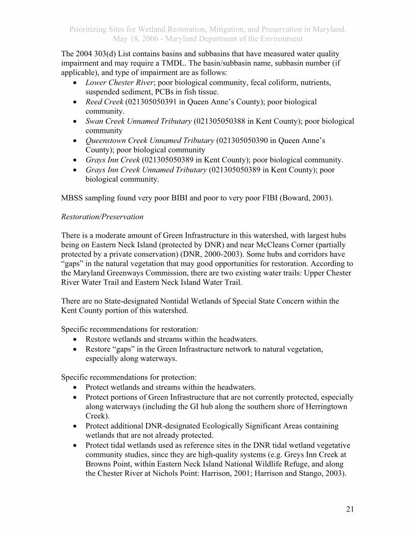
The 2004 303(d) List contains basins and subbasins that have measured water quality impairment and may require a TMDL. The basin/subbasin name, subbasin number (if applicable), and type of impairment are as follows:
• Lower Chester River; poor biological community, fecal coliform, nutrients, suspended sediment, PCBs in fish tissue.
• Reed Creek (021305050391 in Queen Anne’s County); poor biological community.
• Swan Creek Unnamed Tributary (021305050388 in Kent County); poor biological community
• Queenstown Creek Unnamed Tributary (021305050390 in Queen Anne’s County); poor biological community
• Grays Inn Creek (021305050389 in Kent County); poor biological community. • Grays Inn Creek Unnamed Tributary (021305050389 in Kent County); poor
biological community. MBSS sampling found very poor BIBI and poor to very poor FIBI (Boward, 2003). Restoration/Preservation There is a moderate amount of Green Infrastructure in this watershed, with largest hubs being on Eastern Neck Island (protected by DNR) and near McCleans Corner (partially protected by a private conservation) (DNR, 2000-2003). Some hubs and corridors have “gaps” in the natural vegetation that may good opportunities for restoration. According to the Maryland Greenways Commission, there are two existing water trails: Upper Chester River Water Trail and Eastern Neck Island Water Trail. There are no State-designated Nontidal Wetlands of Special State Concern within the Kent County portion of this watershed. Specific recommendations for restoration:
• Restore wetlands and streams within the headwaters. • Restore “gaps” in the Green Infrastructure network to natural vegetation,
especially along waterways. Specific recommendations for protection:
• Protect wetlands and streams within the headwaters. • Protect portions of Green Infrastructure that are not currently protected, especially
along waterways (including the GI hub along the southern shore of Herringtown Creek).
• Protect additional DNR-designated Ecologically Significant Areas containing wetlands that are not already protected.
• Protect tidal wetlands used as reference sites in the DNR tidal wetland vegetative community studies, since they are high-quality systems (e.g. Greys Inn Creek at Browns Point, within Eastern Neck Island National Wildlife Refuge, and along the Chester River at Nichols Point: Harrison, 2001; Harrison and Stango, 2003).
21
Prioritizing Sites for Wetland Restoration, Mitigation, and Preservation in Maryland. May 18, 2006 - Maryland Department of the Environment
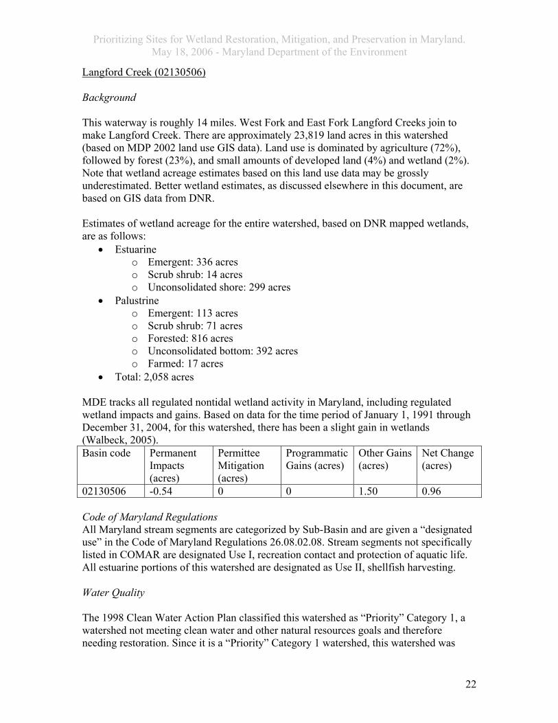
Langford Creek (02130506) Background This waterway is roughly 14 miles. West Fork and East Fork Langford Creeks join to make Langford Creek. There are approximately 23,819 land acres in this watershed (based on MDP 2002 land use GIS data). Land use is dominated by agriculture (72%), followed by forest (23%), and small amounts of developed land (4%) and wetland (2%). Note that wetland acreage estimates based on this land use data may be grossly underestimated. Better wetland estimates, as discussed elsewhere in this document, are based on GIS data from DNR. Estimates of wetland acreage for the entire watershed, based on DNR mapped wetlands, are as follows:
• Estuarine o Emergent: 336 acres o Scrub shrub: 14 acres o Unconsolidated shore: 299 acres
• Palustrine o Emergent: 113 acres o Scrub shrub: 71 acres o Forested: 816 acres o Unconsolidated bottom: 392 acres o Farmed: 17 acres
• Total: 2,058 acres MDE tracks all regulated nontidal wetland activity in Maryland, including regulated wetland impacts and gains. Based on data for the time period of January 1, 1991 through December 31, 2004, for this watershed, there has been a slight gain in wetlands (Walbeck, 2005). Basin code Permanent
Impacts (acres)
Permittee Mitigation (acres)
Programmatic Gains (acres)
Other Gains (acres)
Net Change (acres)
02130506 -0.54 0 0 1.50 0.96 Code of Maryland Regulations All Maryland stream segments are categorized by Sub-Basin and are given a “designated use” in the Code of Maryland Regulations 26.08.02.08. Stream segments not specifically listed in COMAR are designated Use I, recreation contact and protection of aquatic life. All estuarine portions of this watershed are designated as Use II, shellfish harvesting. Water Quality The 1998 Clean Water Action Plan classified this watershed as “Priority” Category 1, a watershed not meeting clean water and other natural resources goals and therefore needing restoration. Since it is a “Priority” Category 1 watershed, this watershed was
22

Prioritizing Sites for Wetland Restoration, Mitigation, and Preservation in Maryland. May 18, 2006 - Maryland Department of the Environment
selected as being one of the most in need of restoration within the next two years since it failed to meet at least half of the goals. It is also classified as a Category 3, a pristine or sensitive watershed in need of protection. Failing indicators include a high modeled phosphorus loading, a low SAV abundance, low SAV habitat index, high percent unforested stream buffer (42%), high soil erodibility (0.30), and being on the 303(d) List for water quality impairment. Indicators of Category 3 include a high imperiled aquatic species indicator and two migratory fish spawning areas. According to the 2002 Maryland Section 305(b) Water Quality Report, the tidal Langford Creek and tidal tributaries fully support all designated uses (5.0 mi.2). A portion of the nontidal wadeable tributaries (West Langford Creek; DNR, 2000) fail to fully support all uses (3.5 mi. fail to support, 17.4 mi. inconclusive) due to a poor benthic community from siltation and stream channelization. The 2004 303(d) List contains basins and subbasins that have measured water quality impairment and may require a TMDL. The basin/subbasin name, subbasin number (if applicable), and type of impairment are as follows:
• Langford Creek; suspended sediments. • West Fork Langford Creek (021305060406 non-tidal); poor biological
community. • West Fork Langford Creek Unnamed Tributary (021305060405 non-tidal); poor
biological community. • East Fork Langford Creek (021305060409); poor biological community. • East Fork Langford Creek Unnamed Tributary (021305060409); poor biological
community. MDE completed the report entitled Water Quality Analysis of Eutrophication for the Tidal Langford Creek, Kent County, Maryland. Information from this document follows. The tidal Langford Creek was on the 303(d) List in 1996 due to nutrients, sediments, and fecal coliform. This report addresses the nutrients aspect only. They determined that this waterbody does not need a TMDL for nutrients, since there was no eutrophication measured. This is a Use II shellfish harvesting area. As such, it is required to maintain a dissolved oxygen level of at least 5.0ug/l unless due to natural causes. All samples had DO >5.0ug/l. The only section having elevated chlorophyll a levels was St. Pauls Millpond (at the upstream reach of West Fork Langford Creek). The remaining areas had good chlorophyll a. A Draft Water Quality Analysis was completed for fecal coliform in Langford Creek. This study found that designated uses related to fecal coliform were being met. Of the one MBSS site, BIBI was very poor and FIBI was poor (Boward, 2003). Restoration/Preservation There is a relatively small amount of Green Infrastructure land, with a few small hubs and corridors (DNR, 2000-2003). Some of these corridors have “gaps” that may be
23

Prioritizing Sites for Wetland Restoration, Mitigation, and Preservation in Maryland. May 18, 2006 - Maryland Department of the Environment
desirable locations for restoration to natural vegetation. According to the Maryland Greenways Commission, there is an existing ecological greenway, Chestertown Greenway, and an existing water trail, Langford Creek Water Trail. As part of an ongoing project to classify the vegetative communities in Maryland, MDNR created the document entitled Shrubland Tidal Wetland Communities of Maryland’s Eastern Shore. In this document, they categorize nine shrubland tidal wetland communities, including some in Kent County. One of the reference sites, the best example of a particular community type, is the Iva frutescens/Spartina cynosuroides (Marsh elder/Big cordgrass). The community is subject to daily or irregular flooding by mesohaline waters. There is one State-designated Nontidal Wetland of Special State Concern within this watershed. Lover’s Lane contains a State Threatened plant species growing in the rich, acidic soil along the banks of a small tributary to the east fork of Langford Creek (DNR, 1991). This site is located within Chester River Yacht and Country Club. Specific recommendations for restoration:
• Restore wetlands and streams within the headwaters. • Restore “gaps” in the Green Infrastructure network to natural vegetation,
especially along waterways. Specific recommendations for protection:
• Protect wetlands and streams within the headwaters. • Protect WSSC and buffers. • Protect portions of Green Infrastructure that are not currently protected, especially
along waterways (e.g. the GI hub on the east side of West Fork Langford Creek). • Protect additional DNR-designated Ecologically Significant Areas containing
wetlands that are not already protected. • Protect tidal wetlands used as reference sites in the DNR tidal wetland vegetative
community studies, since they are high-quality systems (e.g. along the Chester River at Nichols Point: Harrison, 2001; Harrison and Stango, 2003).
Middle Chester River (02130509) Background The Kent County portion of this watershed has roughly 29,589 land acres (based on MDP 2002 land use GIS data). Land use is dominated by agriculture (78%), followed by forest (12%), developed land (8%) and wetlands (2%). Note that wetland acreage estimates based on this land use data may be grossly underestimated. Better wetland estimates, as discussed elsewhere in this document, are based on GIS data from DNR. A large amount of the developed land is focused around Chestertown. There are extensive freshwater tidal marshes located along meandering portions or on alluvial deposits along the Chester River. The Chester River has excellent wintering and
24

Prioritizing Sites for Wetland Restoration, Mitigation, and Preservation in Maryland. May 18, 2006 - Maryland Department of the Environment
transient concentration areas of black ducks. Some of the regions highest densities of transient and wintering waterfowl are located in the Chester River (Sipple, 1999). The watershed contains roughly 37,400 acres of land in Kent and Queen Anne County. Of this, 29,600 acres are in Kent County (Shanks, 2001). For information on the Queen Anne section of the watershed, refer to the section on that County. The majority of water from the Kent County portion of this watershed drains through rural Morgan Creek (22,200 acres) and relatively developed Radcliffe Creek (4,030 acres). The agricultural land is very productive, with 75% of land being classified as prime farmland (Shanks, 2001). Soil erodibility is high. Most forest is associated with wetlands. Estimates of wetland acreage for the entire watershed, based on DNR mapped wetlands, are as follows:
• Estuarine o Emergent: 608 acres o Scrub shrub: 8 acres o Unconsolidated shore: 25 acres
• Palustrine o Aquatic bed: 6 acres o Emergent: 189 acres o Scrub shrub: 160 acres o Forested: 677 acres o Unconsolidated bottom: 393 acres o Unconsolidated shore: 2 acres o Farmed: 18 acres
• Total: 2,085 acres MDE tracks all regulated nontidal wetland activity in Maryland, including regulated wetland impacts and gains. Based on data for the time period of January 1, 1991 through December 31, 2004, for this watershed, there has been a slight gain in wetlands (Walbeck, 2005). Basin code Permanent
Impacts (acres)
Permittee Mitigation (acres)
Programmatic Gains (acres)
Other Gains (acres)
Net Change (acres)
02130509 -0.62 0 0 8.69 8.07 Code of Maryland Regulations All Maryland stream segments are categorized by Sub-Basin and are given a “designated use” in the Code of Maryland Regulations 26.08.02.08. Stream segments not specifically listed in COMAR are designated Use I, recreation contact and protection of aquatic life. For this watershed, they are designated as follows:
• Chester River and tributaries (above Rte. 213): Use I recreation contact and protection of aquatic life.
• All estuarine portions except those listed above: Use II, shellfish harvesting. Water Quality
25

Prioritizing Sites for Wetland Restoration, Mitigation, and Preservation in Maryland. May 18, 2006 - Maryland Department of the Environment
There are a few State-designated wellhead protection areas in this watershed, with the largest one being in Chestertown. The water system and associated contaminant susceptibilities are as follows:
• Kennedyville: none (generally protected since it is a confined aquifer). • Worton: VOC.
The 1998 Clean Water Action Plan classified this watershed as “Priority” Category 1, a watershed not meeting clean water and other natural resources goals and therefore needing restoration. Since it is a “Priority” Category 1 watershed, this watershed was selected as being one of the most in need of restoration within the next two years since it failed to meet at least half of the goals. It is also classified as a Category 3, a pristine or sensitive watershed in need of protection. Failing indicators include a high modeled nitrogen loading, poor SAV abundance, poor SAV habitat index, low non-tidal benthic IBI, high soil erodibility (0.30), and being on the 303(d) List for water quality impairment. Indications for Category 3 include a high imperiled aquatic species indicator, five migratory fish spawning areas, and a high number of wetland-dependent species. According to the 2002 Maryland Section 305(b) Water Quality Report, the tidal Middle Chester River and tidal tributaries fail to support all designated uses due to dieldrin, PCBs, and bacteria from unknown and nonpoint sources. A portion of the nontidal wadeable tributaries (Morgan Creek; DNR, 2000) also did not support all designated uses (19.7 miles fail to support, 28.5 miles were inconclusive) due to a poor benthic community from agricultural runoff and changes in habitat and hydrology (e.g. channelization and unstable stream banks; DNR, 2000). Urieville Community Lake (35.0 acres) also failed to support all designated uses due to nutrients, low DO, excess vegetation, and siltation. These may be the results of agricultural runoff, SOD, and upstream and nonpoint sources. The 2004 303(d) List contains basins and subbasins that have measured water quality impairment and may require a TMDL. The basin/subbasin name, subbasin number (if applicable), and type of impairment are as follows:
• Middle Chester River (tidal); fecal coliform, PCBs in fish tissue, sediments, nutrients.
• Urieville Lake (in Kent County); A TMDL has been completed for nutrients and suspended sediments.
• Morgan Creek Unnamed Tributary (021305090414 non-tidal in Kent County); poor biological community.
• Morgan Creek (021305090415 non-tidal in Kent County); poor biological community.
• Morgan Creek Unnamed Tributary (021305090415 non-tidal tidal in Kent County); poor biological community.
• Chester River Unnamed Tributary (021305090412 non-tidal in Queen Anne’s County); poor biological community.
26

Prioritizing Sites for Wetland Restoration, Mitigation, and Preservation in Maryland. May 18, 2006 - Maryland Department of the Environment
The following information is based on the 1999 MDE document entitled Total Maximum Daily Loads of Phosphorus and Sediments to Urieville Community Lake, Kent County, MD. The 25.6-acre Urieville Lake is owned by the State. It drains into Morgan Creek and then into the Chester River, just east of Chestertown. The drainage area includes 5,200 acres which is dominated by agriculture (80%), followed by forest/herbaceous (18%), and urban (2%). Soils are highly erodible. Violations of the Use I classification include eutrophication, including algae blooms and bad odors reducing recreational use, and low dissolved oxygen (leading to common fish kills). The impoundment is also being filled by sediment and has decreased significantly in size since 1955. There are no point sources and phosphorus and sediment loads are assumed to be mainly from agricultural sources. The TMDL requires an 85% reduction in phosphorus, resulting in an estimated 42% reduction in sediment. Of the two MBSS sites, FIBI was good to fair and BIBI was fair to very poor (Boward, 2003). The following information is based on the documents Middle Chester River Watershed Characterization and Middle Chester River Watershed Restoration Action Strategy developed for the Kent County portion of the middle Chester River watershed in 2001 and 2002. The WRAS focused on the Middle Chester River since it contains rural, suburban, and urban areas. The Radcliffe Creek subwatershed contains the urban/suburban Chestertown and is expected to receive a lot of development. The Morgan Creek subwatershed is mostly agriculture, with a few small villages and industrial zones. The purpose of the plan is to improve water quality in the Chester River so it will be taken off the 303(d) list of impaired waters. Within the Middle Chester River watershed, the plan focuses on the 25-acre Urieville Lake, Morgan Creek, and Radcliffe Creek with a goal to restore these waters to the point where they support and encourage the reestablishment of healthy SAV and other wildlife and fish habitat. Although there was reportedly little background data on water quality in the non-tidal stream segments, Radcliffe Creek (the subwatershed containing Chestertown) had poor water quality, likely due to high nutrient levels. As mentioned previously, Urieville Lake also had high nutrients and sediments. Water quality in the Chester River mainstem is generally poor, having the worst water clarity of all the Bay’s tidal segments during the period between 1992 and 1997. This poor water clarity inhibits SAV growth. The 1998 Maryland Clean Water Action Plan ranked this watershed in the highest 25% for nitrogen levels, based on 138 8-digit Maryland watersheds. Middle Chester River water quality parameters of nitrogen, phosphorus, algae, dissolved oxygen, water clarity, and suspended sediments were ranked by the Upper Eastern Shore Tributary Team as being poor compared to similar Chesapeake Bay tributaries for the period of 1997 through 1999. For the period between 1985 and 1999, phosphorus, algae, and water clarity were improving. Water quality data suggests that at least part of the high nutrient load originates higher in the River (i.e. Upper Chester River). Dissolved oxygen levels
27

Prioritizing Sites for Wetland Restoration, Mitigation, and Preservation in Maryland. May 18, 2006 - Maryland Department of the Environment
dropped below 5.0 mg/L in Radcliffe Creek and Urieville Lake. Chestertown is planning to upgrade the Waste Water Treatment Plant with a Biological Nutrient Removal System. Based on a University of Maryland study, DDT and Dieldrin were present and suspected of contributing to low growth rate in laboratory tests conducted on aquatic organisms. Samples from near Skillet Point (near Chestertown) and near Scott Point (downstream of Radcliffe Creek) found metals to be high enough to possibly impact some organisms. Submerged Aquatic Vegetation was not found in aerial surveys conducted from 1978 to 1999. However, residents say it was abundant there prior to that time. 1995 MBSS fish samples at two sites upstream of Urieville Lake were rated as “fair” and “good.” Urieville Lake itself had poor fish populations since it is eutrophic. The 12-digit watershed Radcliffe Creek and Chester River Direct Drainage were ranked as “moderately high” by DNR for containing rare fish and mussel populations. The two Morgan Creek subwatersheds were ranked as “neutral,” since species presence was not known. There are 24 fish blockages in the Kent County portion of this watershed and four in the Queen Anne portion based on DNR Fish Passage Program database. DNR completed a nutrient synoptic survey for the Middle Chester River Watershed in March/April 2001. Most of the high nitrate concentrations were in the upper Radcliffe Creek and middle Morgan Creek regions, but the highest concentrations were from a sample taken at Lovers Lane. Highest orthophosphate levels were found in upper Radcliffe Creek (with the highest levels at Route 297 near Chinquapin, possibly associated with discharges from a -facility south of Worton) and lower Morgan Creek. In 2001, DNR conducted a stream corridor assessment on 60 stream miles within the Middle Chester River. They identified 42 problems, with most of these being minor to moderate in severity. The most commonly identified problem were barriers to fish migration (24 sites). Although the majority of these were not severe, the two most severe sites were at Urieville Lake and at a USGS gauging station (on Morgan Creek). The next most common problem was stream bank erosion (6 sites or 0.53 miles), which ranged from minor to moderate severity. These were located in the southwestern portion of the watershed, with the most severe being along an unnamed tributary to Morgan Creek. There were some sites with poor stream buffers (5 sites) scattered throughout the watershed. Some of these presented opportunities to reforest and restore wetlands. There were some unusual conditions reported (3 sites), including Urieville Lake and several ponds having excessive amounts of algae. Pipe outfalls (3 sites) and trash (1 site) were also reported. There were no extensively channelized streams, as found in other Eastern Shore areas. Radcliffe and Morgan Creeks were rated as marginal or poor based on stream habitat evaluations. Restoration/Preservation This watershed has no large Green Infrastructure hubs, only a thin hub along Morgan Creek and corridors dominated by agriculture (DNR, 2000-2003). The majority of this land is unprotected. According to the Maryland Greenways Commission, there is an
28
Prioritizing Sites for Wetland Restoration, Mitigation, and Preservation in Maryland. May 18, 2006 - Maryland Department of the Environment
existing ecological greenway (Chestertown Greenway), two existing water trails (Upper Chester River Water Trail and Morgan Creek Water Trail), and a proposed recreational greenway (Chestertown Regional Greenway). The Kent County Comprehensive Plan also discusses the Chestertown-Worton Rail Trail. As part of an ongoing project to classify the vegetative communities in Maryland, DNR created the document entitled Herbaceous Tidal Wetland Communities of Maryland’s Eastern Shore. In this document, they characterized 14 community types, with some being found in this County. A reference site, the best example of a particular community type, Peltandra virginica-Impatiens capensis-Typha angustifolia tidal herbaceous vegetation is located along Morgan Creek (a tributary to the Chester River, northeast of Chestertown). This community type was designated S4, a community type being “secure under present conditions in Maryland.” This site is at risk for invasion by Phragmites. Morgan Creek also supports two additional reference sites. One site is for the tidal shrubland Alnus serrulata-Viburnum recognitum/Impatiens capensis community type along Tuckahoe Creek. These wetland types are daily to irregularly flooded by mesohaline (brackish) waters. A community of Phragmites australis (common reed) is also a reference site on Morgan Creek. The documents Middle Chester River Watershed Characterization and Middle Chester River Watershed Restoration Action Strategy suggest restoring: headwater stream buffers, stream buffers associated with high nutrient or pollutant land use, hydric soils associated with crop land, and stream buffers near wetlands. Wetland restoration opportunities were recommended based on: hydric soils, open land, within 300 feet of other wetlands. Recommendations include:
• Support agriculture and forestry while encouraging best management practices and land preservation.
• Increase riparian buffer and forest acreage. • Encourage subdivision and homeowner conservation. Educate homeowners about
the watershed. Reduce impervious surface and increase open space in subdivision design.
• Improve access to waterways and to Radcliffe Creek trail. • Reduce nutrients from WWTPs. Chestertown is planning to install Biological
Nutrient Removal technology. The other two WWTPs (Kennedysville and Worton-Butlertown) are too small to make it economically feasible.
• Encourage stormwater retrofits. • Encourage boating Best Management Practices. • Improve Urieville Lake water quality. • Encourage stream restoration, wetland restoration, forest buffer plantings, and
improved habitat. Complete Stream Corridor Assessment for Radcliffe and Morgan Creeks. Prioritize stream corridor assessment results. Increase buffers and wetlands around Morgan Creek special concern areas.
• Hire a Chester Riverkeeper. • Continue monitoring. (Chester Testers)
29

Prioritizing Sites for Wetland Restoration, Mitigation, and Preservation in Maryland. May 18, 2006 - Maryland Department of the Environment
A current effort to restore Radcliffe Creek is largely aimed at educating the public, homeowner associations and businesses, with some additional emphasis on wetlands restoration. Wetlands in this Radcliffe Creek subwatershed are impaired from runoff and Phragmites invasion. There is one State-designated Nontidal Wetland of Special State Concern within the Kent County portion of this watershed. Morgan Creek (DNR proposed for deletion from the list) is a diverse relatively undisturbed swamp forest contains a State Rare plant species residing on the banks of the tributary (DNR, 1991). This site is unprotected. Specific recommendations for restoration:
• Restore “gaps” in the Green Infrastructure network to natural vegetation, especially along waterways.
• Restore wetlands designed to provide water quality improvement functions (i.e. reduction of phosphorus and sediment) to Urieville Lake.
• Enhance wetlands impacted by runoff and Phragmites. • The WRAS suggested restoring:
o Stream buffers: in the headwaters associated with high nutrient or pollutant land use near wetlands
o Hydric soils associated with crop land o Increase riparian buffer and forest acreage. o Improve access to waterways and to Radcliffe Creek trail. o Encourage stormwater retrofits. o Encourage stream restoration, wetland restoration, forest buffer plantings,
and improved habitat. Increase buffers and wetlands around Morgan Creek special concern areas.
• Stream restoration in site identified in the Stream Corridor Assessments, including barriers to fish migration, stream bank erosion, poor stream buffers.
Specific recommendations for protection:
• Protect wetlands and streams within the headwaters. • Protect WSSC and buffers. • Protect portions of Green Infrastructure that are not currently protected, especially
along waterways (e.g. along the Chester River and Morgan Creek). • Protect additional DNR-designated Ecologically Significant Areas containing
wetlands that are not already protected. • Protect wetlands that provide water quality improvement functions (i.e. reduction
of phosphorus and sediment) to Urieville Lake. • Protect tidal wetlands used as reference sites in the DNR tidal wetland vegetative
community studies, since they are high-quality systems (e.g. within Morgan Creek: Harrison, 2001; Harrison and Stango, 2003).
Upper Chester River (02130510)
30

Prioritizing Sites for Wetland Restoration, Mitigation, and Preservation in Maryland. May 18, 2006 - Maryland Department of the Environment
Background The Kent County portion of this watershed has approximately 34,578 land acres (based on MDP 2002 land use GIS data). Land use is dominated by agriculture (69%) and forest (29%), with lesser amounts of developed land (2%) and wetland (1%). Note that wetland acreage estimates based on this land use data may be grossly underestimated. Better wetland estimates, as discussed elsewhere in this document, are based on GIS data from DNR. Based on MDP’s Natural Soil Groups, over half of the soils are considered to be prime farmland. Roughly a third of the soil is hydric. Of the 220 stream miles, 67% of the stream buffers were naturally vegetated, 32% of the stream buffers lacked natural vegetation and were in agriculture or barren land use, and <1 of the stream buffers were developed. Of the areas lacking natural stream buffers, many had areas of hydric soils (Shanks, 2005). There are extensive freshwater tidal marshes located along meandering portions or on alluvial deposits along the Chester River. The Chester River has excellent wintering and transient concentration areas of black ducks. Some of the regions highest densities of transient and wintering waterfowl are located in the Chester River (Sipple, 1999). There are several documented anadromous fish spawning areas including the Chester River mainstem to just upstream of Millington, Red Lion Branch, Unicorn Branch, Andover Branch, Mills Branch, an unnamed tributary east of Millington, and an unnamed tributary near Chase Island. For many of these waterways, impoundments have created fish blockages for anadromous fish spawning. Some of these identified blockages include: Cypress Branch / Big Mill Pond, Little Mill Pond, Anover Branch / Jones Lake, unnamed tributary east of Millington / near Peacock Corner, Unicorn Branch / Unicorn Mill Pond, Red Lion Branch / near Rte. 301, Pearl Creek / near Rte. 544. There is a fish consumption advisory due to PCBs, pesticides, and /or methylmercury for channel catfish and white perch from the Chester River, large and smallmouth bass from any waterbody, and bluegill from the impoundments. MBSS sampling rated most sites as good or fair, with some ranked as poor or very poor. There are 6 animal and 28 plant species tracked as sensitive species and 22 ecologically significant areas. The largemouth bass population in the Chester River has declined in the years 2002-2004 (Shanks, 2001). Estimates of wetland acreage for the entire Maryland portion of the watershed, based on DNR mapped wetlands, are as follows:
• Estuarine o Emergent: 407 acres o Unconsolidated shore: <1 acres
• Palustrine o Emergent: 488 acres o Scrub shrub: 281 acres o Forested: 11,319 acres o Unconsolidated bottom: 475 acres
31

Prioritizing Sites for Wetland Restoration, Mitigation, and Preservation in Maryland. May 18, 2006 - Maryland Department of the Environment
o Unconsolidated shore: <1 acres o Farmed: 477 acres
• Total: 13,448 acres MDE tracks all regulated nontidal wetland activity in Maryland, including regulated wetland impacts and gains. Based on data for the time period of January 1, 1991 through December 31, 2004, for this watershed, there has been a slight gain in wetlands (Walbeck, 2005). Basin code Permanent
Impacts (acres)
Permittee Mitigation (acres)
Programmatic Gains (acres)
Other Gains (acres)
Net Change (acres)
02130510 -1.80 0.19 5.70 7.14 11.23 Two programmatic mitigation wetland projects were constructed at Millington Wildlife Management Area in 1995-96 and 2004. Most of the wetlands will be forested. Enhancement of existing Nontidal Wetlands of Special State Concern, including Golts Pond and Andover Flatwoods began in 2003 for the removal of invasive species. This watershed contains several Delmarva bays, brown trout (a rare occurrence on the Eastern Shore), and headwater forested wetlands. Wetlands connected to the Upper Chester River and its tributaries include estuarine vegetated wetlands, mudflats, freshwater tidal wetlands, forested wetlands flooded occasionally by spring tides, and nontidal wetlands. Most nontidal wetlands are associated with streams and floodplains. There are also a high number of nontidal wetlands known as Delmarva Bays, or Carolina Bays on the Delmarva. These wetlands are small depressions of up to nearly 20 acres in size, with a round, elliptical or irregular shape and many are surrounded by a sandy raised rim. While the topography of the watershed is generally level, nontidal wetlands, associated streams, and floodplains are usually found in ravines of varying depths. Soils are often acidic, and become more so when drained. Tidal Wetlands Tidal wetlands in the entire Chester River watershed total approximately 16,204 acres (McCormick and Somes, 1982), comprising 6.2% of the State’s total tidal wetland acreage and ranking sixth among major basins with tidal areas. High brackish marshes are the most common type, dominated by meadow cordgrass and spike rush or shrubby marshelder and groundsel bush. This latter type of community is important habitat for birds, which often nest in the shrubs and feed in the herbaceous marshes. Freshwater (palustrine) wetlands typically have more diverse vegetation than the estuarine marshes, in which diversity is limited to a few species of salt tolerant plants. The three dominant vegetation communities in the freshwater tidal marshes of the Upper Chester are pickerelweed/arrowarum, cattail, and big cordgrass. In the higher freshwater reaches, there are also some areas of tidally influenced red maple forest. Tidal wetlands have deep organic soils, which aid in chemical interactions for nutrient transformation.
32

Prioritizing Sites for Wetland Restoration, Mitigation, and Preservation in Maryland. May 18, 2006 - Maryland Department of the Environment
Tidal wetlands and the Chester River floodplain generally become more narrow and limited in extent in upstream areas. There is a large oxbow that appears to be forming west of Millington with more extensive tidal wetlands. A railroad bridge and embankment and parts of Millington have suffered from flood impacts in the past. The area may be susceptible to additional to flooding problems due to its location near the tidal/nontidal boundary. High tides will back up water flowing downstream from the headwaters and nontidal tributaries, resulting in higher flood peaks. East of Millington, the floodplain and wetland systems along Cypress Branch and Andover Branch are wider than the freshwater tidal reaches due to lower elevations. A Mill Pond is on Cypress Branch. Delmarva Bays Delmarva Bays are most commonly found along the Maryland-Delaware border in Kent, Queen Anne’s, and Caroline Counties. The wetlands are typically isolated from surface water sources and are surrounded by uplands, retaining water from precipitation and high groundwater levels and having seasonally high surface for extended periods. Water is often acidic. However, there is evidence that the Delmarva Bays in close proximity are connected to each other through groundwater flow (Vasilas, 2004 pers comm.). The substrate usually lacks standing water by late summer or fall and is rapidly re-colonized by emergent plants. Dominant vegetation may be emergent, scrub-shrub, forested, or a mixture of these communities. Nontidal wetlands dominated by natural, long-term scrub shrub or emergent communities are unusual in Maryland. Many Delmarva Bays also support threatened or endangered species of herbaceous plants and amphibians, species which require seasonal fluctuations in water levels. Amphibians also require adjacent upland areas for most of their life cycle, and use the wetlands for breeding habitat. Several Delmarva Bays are often found in close proximity and designated as single complexes as designated Nontidal Wetlands of Special State Concern. The location and configuration of the Delmarva Bays limits their capability to provide certain wetland functions. Despite being depressions and located often in headwaters, they generally provide limited flood attenuation and water quality improvement benefits. The flat topography and raised rim around the Bays limit their intake of flood waters or surface runoff. However, as a community type, the wetlands provide exceptional biodiversity and habitat benefits. Many Delmarva Bays have been lost through direct and indirect impacts of drainage. Some drained Delmarva Bays were drained and converted to agricultural land and others suffered encroachment of woody vegetation resulting from drier water regimes. Wetland Function Wetlands are associated with many beneficial functions, including water quality improvement through retention of pollutants, nutrients and sediment, nutrient transformation, attenuation of flood waters, maintenance of stream base flow, shoreline
33
Prioritizing Sites for Wetland Restoration, Mitigation, and Preservation in Maryland. May 18, 2006 - Maryland Department of the Environment
stabilization, and wildlife habitat. The ability to provide these functions varies, and certain wetlands may have limited capacity to perform certain functions. In the Upper Chester watershed, wetlands in the floodplains probably have the capability to provide flood attenuation, but many man-made structures that may be damaged by floods are likely beyond the top of the ravines. Most wetlands adjacent to streams probably provide some discharge to help maintain base flow in streams. Wetlands that are seasonally flooded or wetter in headwaters are more important to maintaining stream base flow than ditched or drier wetlands. Water quality functions, particularly nutrient transformation, are most effectively performed in wetlands with fluctuating water levels and high amounts of organic matter. Microorganisms in the soil transform nutrients such as nitrogen through the action of microorganisms, which uptake and convert the nitrogen to nitrogen gas. Wetlands can also be effective at retaining phosphorus, though seasonally phosphorus may also be released. Wetlands in the Upper Chester that are most likely to be particularly effective at water quality functions are the vegetated tidal wetlands, and wetlands along floodplains with high organic matter. Depressional wetlands that receive groundwater inputs may provide nutrient transformation to a lesser degree. However, wetlands may also discharge nutrients at the end of the growing season when plants are dormant, and sometimes during the spring. Vegetated tidal wetlands are the most effective wetlands for providing natural shoreline protection. Delmarva Bays and Nontidal Wetlands of Special State Concern are exceptionally important for habitat and biodiversity. Code of Maryland Regulations All Maryland stream segments are categorized by Sub-Basin and are given a “designated use” in the Code of Maryland Regulations 26.08.02.08. This watershed is designated Use I, recreation contact and protection of aquatic life. Water Quality There is a State-designated wellhead protection area in this watershed for Millington Elementary School. The water system and associated contaminant susceptibilities are as follows:
• Millington Elementary School: none. The 1998 Clean Water Action Plan classified this watershed as Category 1, a watershed not meeting clean water and other natural resources goals and therefore needing restoration. It is also classified as a Category 3, a pristine or sensitive watershed in need of protection. Failing indicators include high monitored nutrient concentrations, low SAV abundance, low SAV habitat index, high historic wetland loss (36,993 acres), high soil erodibility (0.30), and being on the 303(d) List for water quality impairment. Indicators
34

Prioritizing Sites for Wetland Restoration, Mitigation, and Preservation in Maryland. May 18, 2006 - Maryland Department of the Environment
of Category 3 include a high imperiled aquatic species indicator and five migratory fish spawning areas. According to the 2002 Maryland Section 305(b) Water Quality Report, the tidal Upper Chester River and tidal tributaries fully support all designated uses. A portion of the nontidal wadeable tributaries (Anover Branch; DNR, 2000) do not fully support all designated uses (60.8 mi. support, 17.5 mi. fail to support) due to poor benthic community resulting from siltation, low dissolved oxygen, changes in habitat and changes in hydrology. Unicorn Mill Pond (48.0 acres) fully supports all designated uses. The 2004 303(d) List contains basins and subbasins that have measured water quality impairment and may require a TMDL. The basin/subbasin name, subbasin number (if applicable), and type of impairment are as follows:
• Upper Chester River; fecal coliform, nutrients, suspended sediments. • Anover Branch (021305100425 in Queen Anne’s County); sedimentation. • Millington Wildlife Ponds; methylmercury in fish tissue • Unnamed tributary to Unicorn Branch (021305100422 in Queen Anne’s County);
poor biological community. The Chester River Association found that citizens were concerned about algae blooms, siltation and fish kills, failing septics, pipe outfalls, and insufficient stormwater management. The Chester River mainstem has some eutrophication. DO levels below 5.0 mg/l may occur in warm months (e.g. Foreman Branch). Total nitrogen was elevated and total phosphorus was slightly elevated. Upstream mainstem areas had average chlorophyll a levels greater than 50 mg/l, with some concentrations greater than 100 mg/l. For nontidal streams, based on samples from five streams, Andover Branch had the highest levels of phosphorus, highest BOD, densest algae bloom, and the lowest DO. Red Lion Branch and Unicorn Branch had the highest average total nitrogen, but total nitrogen was also elevated at Cyprus Branch and Andover Branch. There are four permitted point discharges: the wastewater treatment plants for Millington and Sudlerville, Red Bird Egg Farm, and SHA’s Millington Shop contributing point source pollution. Nontidal stream tributaries in Delaware are also contributing to the water quality problems in Maryland (Shanks, 2005). MBSS found BIBI ranging from good to very poor and FIBI was good and very poor. The very poor site was located on Cypress Branch, north of Route 330. A nutrient synoptic survey was completed in 2004 for the Kent and Queen Anne’s portions of the Upper Chester River watershed. Of the 82 subwatersheds sampled, nitrite/nitrate concentrations were excessive in 28, high in 13, and moderately elevated in 26. Most of the elevated concentrations were associated with animal and row crop agriculture in Red Lion Branch, Unicorn Branch, and Chesterville Branch watersheds. Elevated levels in Forman Branch are likely associated with septic systems. Of the 82 subwatersheds sampled, orthophosphate concentrations were excessive in 8, high in 13,
35

Prioritizing Sites for Wetland Restoration, Mitigation, and Preservation in Maryland. May 18, 2006 - Maryland Department of the Environment
and moderately excessive in 27 subwatersheds. Excessive levels are associated with suspended phosphorus-rich sediment in the water column along Red Lion and Andover Branches. Forman, Red Lion, Unicorn, and Chesterville Branches contribute large amounts of nutrients to the Chester River. Nutrient concentrations for this watershed are similar to those from other watersheds. Past macroinvertebrate sampling found best populations in Foreman Branch, Unicorn Branch, and Red Lion Branch. While these subwatersheds had high nutrient concentrations, they also had good habitat scores. The well-drained soils of this watershed promote the movement of nutrients into the groundwater and then the Chester River. Restoration/Preservation A stream corridor assessment was completed for the Kent and Queen Anne Counties portions of the Upper Chester River in 2005 (Gregory et al., 2005). Of the 75 stream miles surveyed, 224 potential environmental problems were identified. Problems included inadequate stream buffers (82 sites), fish barriers (41 sites), stream bank erosion (37 sites), pipe outfalls (28 sites), channel alteration (18 sites), trash dumping (9 sites), unusual conditions (7 sites), in/near stream construction (1 site), exposed pipe (1 site). While more sites were sampled along Red Lion Branch, nearly half of the identified problem sites were located on this waterway. For the inadequate buffers, the most common land use along the stream was agriculture. Livestock were at three of these sites. A moderately-sized Green Infrastructure hub is located along the Delaware border (DNR, 2000-2003) and roughly half is protected by DNR-owned land (Millington WMA). Some areas within this hub and connecting corridors have agricultural “gaps” and may be desirable locations for restoration to natural vegetation. According to the Maryland Greenways Commission, two existing greenways are the ecological and recreational greenway Millington Wildlife Management Area (connecting to Blackbird SF in DE) and Upper Chester Water Trail. A Watershed Restoration Action Strategy is currently being developed for the Upper Chester River. The Chester River also supports a forested tidal wetland community reference community. The site is dominated by Fraxinus profunda-Nyssa biflora/Polygonum arifolium (Pumpkin ash-Swamp blackgum/Winterberry/Halberd-leaved tearthumb. This community type is flooded daily or irregularly by fresh water, with occasional pulses of higher salinity water from spring high tides or low river flow (Harrison et al., 2004). The wetlands are often found between uplands and emergent tidal wetlands, with variable microtopography of hollows and hummocks. There have been at least 14 wetland restoration projects in the watershed from 1998-2003. Restoration has primarily been carried out by private landowners in partnership with Ducks Unlimited, the U.S. Fish and Wildlife Service, and agricultural cost share programs. The total acreage is 1,74.5 acres, most of which was restored as riparian
36

Prioritizing Sites for Wetland Restoration, Mitigation, and Preservation in Maryland. May 18, 2006 - Maryland Department of the Environment
forested wetlands. There were approximately 31 acres established as emergent wetlands for wildlife habitat. There are several State-designated Nontidal Wetland of Special State Concern within the Kent County portion of this watershed.
• Black Bottom Ponds (DNR combined with Millington WMA Ponds). This wetland complex contains four seasonal ponds, also known as Delmarva bays, with six RTE plant species (including a candidate for listing under the U.S. Endangered Species Act). Delmarva bays are fed by groundwater and fill in the wet seasons and dry in the summer. They have become uncommon due to agricultural ditching and draining, but remaining ones often contain RTE species and provide good habitat for amphibians and other wildlife. These particular Delmarva Bays are unusual in that they are naturally dominated by herbaceous species (DNR, 1991). Main threats include changes in hydrology from development, ditching, or draining. Encroachment of the habitat by common herbaceous plants should be monitored. The forested buffer should also be protected. There are some non-native plant species in the two less remote ponds (Ludwig et al., 1987). This site is only partially protected by Millington WMA.
• Cypress Branch Pond. This Delmarva bay is located within a powerline right-of-way and contains a State Endangered amphibian. Delmarva Bays are usually fed by groundwater and fill in the wet seasons and dry in the summer. They have become uncommon due to agricultural ditching and draining, but remaining ones often contain RTE species and provide good habitat for amphibians and other wildlife. Powerline right-of-way maintenance at this site limits woody species growth, allowing herbaceous species to flourish. Surveys conducted during different seasons may reveal additional RTE species (DNR, 1991). This site is protected by Millington WMA.
• Massey Pond. This shallow permanent pond is groundwater fed and fills in the wet seasons and dries in the summer. This type of pond has become uncommon due to agricultural ditching and draining, but remaining ones often contain RTE species and provide good habitat for amphibians and other wildlife. This site contains a population of State Endangered amphibians. Surveys conducted during different seasons may reveal additional RTE species, especially RTE plants (DNR, 1991). This site is protected within Willington WMA.
• Millington WMA Ponds. This wetland contains an undisturbed uncommon shrub swamp and an excavated permanently flooded pond. This site contains three State Endangered plant species, including a candidate for listing under the U.S. Endangered Species Act, and an additional uncommon plant species. Surveys conducted during different seasons may reveal additional RTE species (i.e. rare amphibians). The pond and swamp change seasonally and annually with fluctuating hydrology. This type of undisturbed habitat is becoming relatively uncommon due to the high occurrence of agricultural draining and filling (DNR, 1991). The main threat is alteration of the hydrology. Non-native plant species should be monitored and controlled if necessary. The forested buffer should also be protected (Ludwig et al., 1987). This site is protected by Millington WMA.
37

Prioritizing Sites for Wetland Restoration, Mitigation, and Preservation in Maryland. May 18, 2006 - Maryland Department of the Environment
Specific recommendations for restoration: • Restore “gaps” in the Green Infrastructure network to natural vegetation,
especially along waterways. • Restore wetlands and streams within the headwaters. • Remove fish blockages for anadromous fish spawning including: Cypress Branch
/ Big Mill Pond, Little Mill Pond, Anover Branch / Jones Lake, unnamed tributary east of Millington / near Peacock Corner, Unicorn Branch / Unicorn Mill Pond, Red Lion Branch / near Rte. 301, Pearl Creek / near Rte. 544 (Shanks, 2001).
• Stream restoration based on results from stream corridor assessment, including inadequate stream buffers, fish barriers, stream bank erosion, livestock access to stream.
• Some hydric soils (Bibb) were found suitable for pasture if drained. Conversion of drained pastures may provide an opportunity for restoration. There are likely fewer areas of hydric soils in cropland than in lower Eastern Shore Counties, due to the narrow width of the hydric soils in this watershed. Sites on Portsmouth and Johnston soils may have the greatest potential for providing water quality benefits if restored, or if preserved as existing wetlands, due to high organic matter content and very poor drainage. Portsmouth soils are often found in depressions, while Johnston soils are located along floodplains. Other very poorly or poorly drained soils with high organic matter may also be more likely to provide water quality benefits as restored wetlands over hydric soil areas with lower organic matter content.
• Sites in the Millington vicinity with low elevations, and former wetlands, should be investigated. These sites may provide some additional attenuation of flood waters while protecting the town structures, railroad bridges and embankment.
Specific recommendations for protection:
• Protect wetlands and streams within the headwaters. • Protect the oxbow wetland west of Millington. • Maintain forested floodplain and wetland corridors, particularly around
Millington. • Protect Nontidal Wetlands of Special State Concern and Delmarva Bays. • Protect portions of Green Infrastructure that are not currently protected, especially
along waterways and large GI hubs. • Protect additional DNR-designated Ecologically Significant Areas containing
wetlands that are not already protected. • Protect tidal wetlands used as reference sites in the DNR tidal wetland vegetative
community studies, since they are high-quality systems (e.g. along the Chester River: Harrison, 2001; Harrison and Stango, 2003).
Sassafras River (02130610) Background The Kent County portion of this watershed has 31,112 land acres (based on MDP 2002 land use GIS data). Land use is dominated by agriculture (65%) and forest (27%), with
38

Prioritizing Sites for Wetland Restoration, Mitigation, and Preservation in Maryland. May 18, 2006 - Maryland Department of the Environment
smaller amounts of developed land (6%) and wetlands (1%). Note that wetland acreage estimates based on this land use data may be grossly underestimated. Better wetland estimates, as discussed elsewhere in this document, are based on GIS data from DNR. This river is 20.6 miles from the nontidal headwaters until it drains into the Chesapeake Bay (MDE, 2001b). There are extensive freshwater tidal marshes located along meandering portions or on alluvial deposits along the Sassafras River (Sipple, 1999). Estimates of wetland acreage for the entire Maryland portion of the watershed, based on DNR mapped wetlands, are as follows:
• Estuarine o Emergent: 451 acres o Scrub shrub: 49 acres o Unconsolidated shore: 397 acres
• Palustrine o Aquatic bed: 3 acres o Emergent: 253 acres o Scrub shrub: 244 acres o Forested: 1,047 acres o Unconsolidated bottom: 419 acres o Farmed: <1 acre
• Total: 2,864 acres MDE tracks all regulated nontidal wetland activity in Maryland, including regulated wetland impacts and gains. Based on data for the time period of January 1, 1991 through December 31, 2004, for this watershed, there has been a slight gain in wetlands (Walbeck, 2005). Basin code Permanent
Impacts (acres)
Permittee Mitigation (acres)
Programmatic Gains (acres)
Other Gains (acres)
Net Change (acres)
02130610 -0.33 0 0 0.36 0.03 Code of Maryland Regulations All Maryland stream segments are categorized by Sub-Basin and are given a “designated use” in the Code of Maryland Regulations 26.08.02.08. Stream segments not specifically listed in COMAR are designated Use I, recreation contact and protection of aquatic life. For this watershed, they are designated as follows:
• Sassafras River and tributaries (above Ordinary Point): Use I recreation contact and protection of aquatic life.
• All estuarine portions except those listed above: Use II, shellfish harvesting. Water Quality There are a few State-designated wellhead protection areas in this watershed. The water system and associated contaminant susceptibilities are as follows:
• Town of Betterton: none.
39

Prioritizing Sites for Wetland Restoration, Mitigation, and Preservation in Maryland. May 18, 2006 - Maryland Department of the Environment
• Town of Galena: none (generally protected since withdraws from confined aquifer).
The 1998 Clean Water Action Plan classified this watershed as “Priority” Category 1, a watershed not meeting clean water and other natural resources goals and therefore needing restoration. Since it is a “Priority” Category 1 watershed, this watershed was selected as being one of the most in need of restoration within the next two years since it failed to meet at least half of the goals. Failing indicators include a high monitored nutrient concentrations, high modeled phosphorus loading, poor SAV abundance, poor SAV habitat index, high soil erodibility (0.28), and being on the 303(d) List for water quality impairment. Indications for Category 3 include six migratory fish spawning areas. According to the 2002 Maryland Section 305(b) Water Quality Report, the tidal Sassafras River and tidal tributaries fail to support all designated uses (1.3 mi.2) due to dieldrin, PCBs, high nutrients, and high pH. Sources of these pollutants include eutrophication, natural, and unknown. Water quality results for the nontidal wadeable tributaries were inconclusive (27.7 mi.). The 2004 303(d) List contains basins and subbasins that have measured water quality impairment and may require a TMDL. The basin/subbasin name, subbasin number (if applicable), and type of impairment are as follows:
• Elk River (021306 tidal); PCBs (in fish tissue). • Sassafras River (tidal) sediments, PCBs (in fish tissue). A TMDL has been
completed for nutrients in this waterway. • Woodland Creek Unnamed Tributary (021306100355 non-tidal in Kent County);
poor biological community. • Swantown Creek (021306100357 non-tidal in Kent County); poor biological
community. • Duffy Creek (021306100357 non-tidal in Cecil County); poor biological
community. The following information is summarized from the 2002 MDE document entitled Total Maximum Daily Loads of Phosphorus for Sassafras River, Cecil and Kent Counties, Maryland. The tidal headwater areas have only weak currents leading to high chlorophyll a levels. The shorelines generally have mature riparian buffers. Nutrients are from the following sources: nitrogen – agriculture (71%), atmospheric deposition (13%), urban (11%), forest/herbaceous (3%), and point sources (3%); phosphorus – agriculture (67%), urban (19%), atmospheric deposition (8%), points sources (5%), and forest/herbaceous (<1%). Point sources include Betterton Waste Water Treatment Plant and Galena WWTP. Violations of the Use I waterway criteria include high chlorophyll a (limiting recreation) and predicted nighttime dissolved oxygen levels below 5.0. Water quality samples found that chlorophyll a levels exceeded 50ug/l above 14 miles from the mouth and continued to increase upstream to a maximum of 226ug/l. Dissolved oxygen levels were predicted to drop below 5.0 at night above 15 miles from the mouth of the river. Dissolved inorganic nitrogen is highest near the river’s mouth, likely due to the high levels of chlorophyll a in the upstream sections pulling up nitrogen in those areas. Since
40

Prioritizing Sites for Wetland Restoration, Mitigation, and Preservation in Maryland. May 18, 2006 - Maryland Department of the Environment
dissolved inorganic phosphorus was low, it suggests this system is P-limited during the low flow period. The TMDL requires a reduction in nonpoint source phosphorus loads. Of the two MBSS sites, FIBI was good while BIBI was fair to poor. Restoration/Preservation There is a relatively small amount of Green Infrastructure land, with a few small hubs and corridors. The largest hub is located along the Delaware border (DNR, 2000-2003) and is mostly unprotected. According to the Maryland Greenways Commission, there is a water trail along the Sassafras River. The following information is summarized from the document Rural Legacy FY 2003: Applications and State Agency Review. There is a portion of the Agricultural Security Corridor – Sassafras Rural Legacy Area within the northern part of this County. The sponsors include Eastern Shore Rural Legacy Sponsor Board and Eastern Shore Land Conservancy, Inc. There are 12,310 acres of land in the Kent County portion (based on GIS data), including 1,835 acres protected. The goals include protecting agricultural land and natural resources, including protecting the water quality of the Sassafras River and other waters, and wildlife habitats. The report also includes a list of property owners who are interested in selling an easement and the priority of acquiring these easements. Since the Rural Legacy Program funds are not always adequate enough to support all of these requests, other programs should consider preservation of these sites. Wetland restoration may also be possible on some of these sites. As part of an ongoing project to classify the vegetative communities in Maryland, DNR created the document entitled Shrubland Tidal Wetland Communities of Maryland’s Eastern Shore. In this document, they categorize nine shrubland tidal wetland communities, including some in Kent County. One of the reference sites, the best example of a particular community type, is the Amorpha fruticosa tidal wetland on the Lower Sassafras River. This site is within the Sassafras River Natural Resource Management Area. There are several State-designated Nontidal Wetland of Special State Concern within the Kent County portion of this watershed.
• Brown’s Pond (DNR combined with Golts Pond). This is a seasonal pond that contains three State Endangered species, including an amphibian species and two plant species. Delmarva bays are fed by groundwater and fill in the wet seasons and dry up in the summer. They have become uncommon due to agricultural ditching and draining, but remaining ones often contain RTE species and provide good habitat for amphibians and other wildlife (DNR, 1991). This site is unprotected.
• Golts Pond West. This shallow semi-permanent pond contains a State-Endangered amphibian species and an uncommon plant species. This pond is fed by groundwater and fills in the wet seasons and dries in the summer. This type of pond has become uncommon due to agricultural ditching and draining, but
41

Prioritizing Sites for Wetland Restoration, Mitigation, and Preservation in Maryland. May 18, 2006 - Maryland Department of the Environment
remaining ones often contain RTE species and provide good habitat for amphibians and other wildlife (DNR, 1991). This pond is located in the headwaters of Jacobs Creek and is unprotected.
• Golts Ponds. This area contains two seasonal ponds, also known as Delmarva bays, with three rare or uncommon plant species (including a candidate for listing under the U.S. Endangered Species Act) and a State Endangered amphibian. Delmarva Bays are fed by groundwater and fill in the wet seasons and dry in the summer. They have become uncommon due to agricultural ditching and draining, but remaining ones often contain RTE species and provide good habitat for amphibians and other wildlife (DNR, 1991). The main threat is alteration of hydrology, mainly through drainage. Both ponds have ditches in them which may reduce the water level and allow invasion of more competitive plant species. The southern border of one of the ponds has been cleared and is currently a lawn. This makes the pond more vulnerable to nutrient increases and invasion of non-native competitive plant species. Competitive plants are establishing around the rare species. The drains should be allowed to fill in. Adjacent landowners should be contacted to reduce any negative impact they may impose on the ponds. The rare species should be monitored and non-native or aggressive plants should be removed if they are a threat. The forested buffer should be maintained (Ludwig et al., 1987). This site is unprotected.
• Golts Railway Pond (DNR combined with Golts Pond). This wetland contains a pond with a State Endangered plant species. This plant species is dependent upon the fluctuation of the water depth. Seasonal ponds are usually fed by groundwater and fill in the wet seasons and dry in the summer. They have become uncommon due to agricultural ditching and draining, but remaining ones often contain RTE species and provide good habitat for amphibians and other wildlife. Surveys conducted during different seasons may reveal additional RTE species. Another RTE plant species is located on the upland forest boundary (DNR, 1991). Pond hydrology has been altered due to railroad construction on the south side, so the pond now has standing water through most or all of the year. Further changes in hydrology from ditching, filling, or development should be avoided. If the Millington WMA entrance is widened, the species may disappear. The buffer should also be protected (Ludwig et al., 1987). This site is within the headwaters of Jacobs Creek and is unprotected.
• Lloyd Creek Marshes. This site is unprotected, except a small portion within a MET.
• Turner Creek Neck West. This site is along the shoreline of the Sassafras River, adjacent to Sassafras River NRMA. It is unprotected.
Specific recommendations for restoration:
• Restore wetlands and streams within the headwaters. • Restore “gaps” in the Green Infrastructure network to natural vegetation,
especially along waterways. • Restore wetlands designed to provide water quality improvement functions (e.g.
phosphorus reduction) for the Sassafras River.
42

Prioritizing Sites for Wetland Restoration, Mitigation, and Preservation in Maryland. May 18, 2006 - Maryland Department of the Environment
Specific recommendations for protection: • Protect WSSC and buffers. • Protect wetlands and streams within the headwaters. • Protect portions of Green Infrastructure that are not currently protected, especially
along waterways. • Protect additional DNR-designated Ecologically Significant Areas containing
wetlands that are not already protected. • Protect wetlands that provide water quality improvement functions (e.g.
phosphorus reduction) for the Sassafras River. • Protect land within designated Rural Legacy Area. • Protect tidal wetlands used as reference sites in the DNR tidal wetland vegetative
community studies, since they are high-quality systems (these all appear within already protected land or within designed WSSC: Harrison, 2001; Harrison and Stango, 2003).
Stillpond-Fairlee (02130611) Background This watershed has roughly 37,803 land acres (based on MDP 2002 land use GIS data). Land use is dominated by agriculture (60%) and forest (29%), with smaller amounts of developed land (9%) and wetlands (2%). Note that wetland acreage estimates based on this land use data may be grossly underestimated. Better wetland estimates, as discussed elsewhere in this document, are based on GIS data from DNR. Stillpond Creek is roughly five miles long (MDE, 2002b). Fairlee Creek is also roughly five miles long (from the bay to the headwaters) (MDE, 1998). Swan Point marsh is a diverse, heavily flooded freshwater wetland. It provides good wildlife habitat since the site is spatially heterogeneous, contains standing water, and has high plant diversity (Sipple, 1999). Estimates of wetland acreage for the entire watershed, based on DNR mapped wetlands, are as follows:
• Estuarine o Emergent: 313 acres o Scrub shrub: 9 acres o Unconsolidated shore: 159 acres
• Palustrine o Aquatic bed: 6 acres o Emergent: 208 acres o Scrub shrub: 362 acres o Forested: 1,599 acres o Unconsolidated bottom: 587 acres o Farmed: 1 acre
• Total: 3,243 acres
43

Prioritizing Sites for Wetland Restoration, Mitigation, and Preservation in Maryland. May 18, 2006 - Maryland Department of the Environment
MDE tracks all regulated nontidal wetland activity in Maryland, including regulated wetland impacts and gains. Based on data for the time period of January 1, 1991 through December 31, 2004, for this watershed, there has been a slight gain in wetlands (Walbeck, 2005). Basin code Permanent
Impacts (acres)
Permittee Mitigation (acres)
Programmatic Gains (acres)
Other Gains (acres)
Net Change (acres)
02130611 -0.32 0 0 0.50 0.18 Code of Maryland Regulations All Maryland stream segments are categorized by Sub-Basin and are given a “designated use” in the Code of Maryland Regulations 26.08.02.08. Stream segments not specifically listed in COMAR are designated Use I, recreation contact and protection of aquatic life. For this watershed, they are designated as follows:
• Stillpond Creek and tributaries (above Kinnaird Point), Worton Creek, and Fairlee Creek: Use I recreation contact and protection of aquatic life.
• All estuarine portions except those listed above: Use II, shellfish harvesting.
Water Quality There are a few State-designated wellhead protection areas in this watershed. The water system and associated contaminant susceptibilities are as follows:
• Fairlee: none (generally protected since it is a confined aquifer). • Shore Homes (in Tolechester Beach area): none (generally protected since it is a
confined aquifer). The 1998 Clean Water Action Plan classified this watershed as “Priority” Category 1, a watershed not meeting clean water and other natural resources goals and therefore needing restoration. Since it is a “Priority” Category 1 watershed, this watershed was selected as being one of the most in need of restoration within the next two years since it failed to meet at least half of the goals. Failing indicators include high modeled phosphorus loading, high historic wetland loss (27,678 acres), high soil erodibility (0.32), and being on the 303(d) List for water quality impairment. Indications for Category 3 include four migratory fish spawning areas. According to the 2002 Maryland Section 305(b) Water Quality Report, the tidal Stillpond-Fairlee Creek and tidal tributaries fail to support all uses (4.1 mi.2) due to nutrients from municipal discharge, agricultural runoff, and nonpoint sources. The water quality results for the nontidal wadeable tributaries were inconclusive (37.5 mi.). The 2004 303(d) List contains basins and subbasins that have measured water quality impairment and may require a TMDL. The basin/subbasin name, subbasin number (if applicable), and type of impairment are as follows:
• Stillpond-Fairlee (tidal); suspended sediments. • Big Marsh Unnamed Tributary (021306110352 non-tidal); poor biological
community.
44

Prioritizing Sites for Wetland Restoration, Mitigation, and Preservation in Maryland. May 18, 2006 - Maryland Department of the Environment
• Mill Creek Unnamed Tributary (021306110351 non-tidal); poor biological community.
• Fairlee Creek Unnamed Tributary (021306110349 non-tidal); poor biological community.
The following information is from the 1998 MDE document entitled Total Maximum Daily Loads of Nitrogen and Phosphorus for Fairlee Creek. This watershed is 8,470 acres and consists of mainly agriculture (65%), followed by forest/herbaceous (30%), and urban (5%) (based on 1990 Maryland Department of Planning data). The estuarine portion of the waterway is a designated Use II and the free-flowing portions are designated Use I. This creek had algal blooms and low dissolved oxygen from elevated nutrient levels, resulting in the failure to support these designated uses. These nutrients originate from the following sources: nitrogen – mainly agriculture (88%), followed by forest (7%), urban (3%), and point sources (2%); phosphorus – mainly agriculture (93%), followed by urban (3%), point sources (3%), and forest (1%). Point sources include Fairlee WWTP and Great Oak Landing WWTP. Results of the water quality analysis showed that areas upstream 2.5 miles had high chlorophyll a, areas upstream 2.6 miles had dissolved oxygen < 5.0 ug/l, and the nontidal southeastern tributary (near Fairlee WWTP) had high ammonia and inorganic phosphorus. The following information is from the 2002 MDE document entitled Total Maximum Daily Loads of Nitrogen and Phosphorus for the Still Pond Creek Kent County, Maryland. The Still Pond Creek watershed is 15,018 acres. This waterway is designated Use 1, but chlorophyll a is high and dissolved oxygen likely drops below 5.0mg/l at night. This waterway is narrow at about 0.8 miles upstream, so there is low tidal flushing, resulting in high chlorophyll a levels and sedimentation in this area. The land use is mainly agriculture (56%), followed by forest/herbaceous (27%), water (9%), and urban (8%) (based on 1997 Maryland Department of Planning and 1997 Farm Service Agency Data). There is a large seasonal migratory waterfowl population. Sources of nutrients include the following: nitrogen – agriculture (74%), urban (12%), atmospheric deposition (9%), forest/herbaceous (5%); phosphorus – agriculture (79%), urban (12%), atmospheric deposition (6%), forest/herbaceous (3%). Nutrients may also enter from the Chesapeake Bay. There are no permitted point source discharges. Water samples show Chlorophyll a levels increase going upstream. Although dissolved oxygen was >5.0mg/l, areas with high chlorophyll a will likely have DO <5.0mg/l at night. Dissolved inorganic nitrogen and dissolved inorganic phosphorous are highest near the mouth of the Creek (since chlorophyll a has taken up the nutrients upstream). The TMDLs require a 40% decrease in average annual controllable nonpoint source nitrogen and phosphorus. The following information is based on the 2001 MDE document entitled Total Maximum Daily Loads of Nitrogen and Phosphorus for the Worton Creek Kent County, Maryland. The tributaries include Mill Creek and Tims Creek. The limited tidal flushing through Worton Creek results in a slow-moving depositional headwater area and high chlorophyll a in Upper Mill Creek. A large population of seasonal waterfowl is also present. The watershed is 11,656 acres and is dominated by agriculture (60%), followed by forest/herbaceous (25%), urban (8%), and water (7%) (based on 1997 Maryland
45

Prioritizing Sites for Wetland Restoration, Mitigation, and Preservation in Maryland. May 18, 2006 - Maryland Department of the Environment
Department of Planning and 1997 Farm Service Agency data). The Use I classification is violated due to high chlorophyll a. Nutrient sources include: nitrogen – agriculture (71%), urban (13%), forest/herbaceous (10%), atmospheric deposition (7%); phosphorus – agriculture (69%), forest/herbaceous (14%), urban (13%), and atmospheric deposition (5%). There are no point sources within the watershed. During low flow conditions, there is high chlorophyll a in the upper section. There was one site with dissolved oxygen level <5.0. The TMDL requires a 40% reduction in low flow nonpoint nitrogen and phosphorus and a 35% reduction in average annual controllable nonpoint nitrogen and phosphorus. MBSS found BIBI of fair to very poor and FIBI of fair and very poor. The site ranked very poor was located on an unnamed tributary to Big Marsh (southwest of Betterton). Restoration/Preservation There is a relatively small amount of Green Infrastructure land, with a few small hubs and corridors. Two hubs are located near McCleans Corner (partially protected through private conservation) and near Betterton (not protected) (DNR, 2000-2003). Some of the corridors have “gaps” that may be desirable locations for restoration to natural vegetation. According to the Maryland Greenways Commission, there is a proposed ecological greenway called Still Pond Creek to Fairlee Creek Greenway that follows the Chesapeake Bay. The following information is summarized from the document Rural Legacy FY 2003: Applications and State Agency Review. There is a portion of the Agricultural Security Corridor – Sassafras Rural Legacy Area within the northern part of this County. The sponsors include Eastern Shore Rural Legacy Sponsor Board and Eastern Shore Land Conservancy, Inc. There are 12,310 acres of land in the Kent County portion (based on GIS data), including 1,835 acres protected. The goals include protecting agricultural land and natural resources, including protecting the water quality of the Sassafras River and other waters, and wildlife habitats. The report also includes a list of property owners who are interested in selling an easement and the priority of acquiring these easements. Since the Rural Legacy Program funds are not always adequate enough to support all of these requests, other programs should consider preservation of these sites. Wetland restoration may also be possible at some of these sites. There is one State-designated Nontidal Wetland of Special State Concern within this watershed. Big Marsh (at Howell Point) is a large emergent/scrub marsh contains the only known Maryland population of a certain State-Endangered plant species. This species is vulnerable to changes in hydrology and sedimentation. The adjacent forested buffer should also be maintained to protect water quality and quantity of the site (DNR, 1991). This site is a dense shrub swamp surrounded by young upland forest. This wetland is a good bird nesting site. A portion of the site has been mined for peat, resulting in linear islands of mine waste and open water. This site is susceptible to the normal pressures from development (MDP, 1981). Most of the site is unprotected.
46

Prioritizing Sites for Wetland Restoration, Mitigation, and Preservation in Maryland. May 18, 2006 - Maryland Department of the Environment
47
Specific recommendations for restoration: • Restore “gaps” in the Green Infrastructure network to natural vegetation,
especially along waterways. • Restore wetlands and streams within the headwaters. • Restore wetlands designed to provide water quality improvement functions (e.g.
nitrogen and phosphorus) for Fairlee Creek, Still Pond Creek, and Worton Creek. Specific recommendations for protection:
• Protect WSSC and buffers. • Protect wetlands and streams within the headwaters. • Protect portions of Green Infrastructure that are not currently protected, especially
along waterways. • Protect additional DNR-designated Ecologically Significant Areas containing
wetlands that are not already protected. • Protect land within the designated Rural Legacy Area. • Protect wetlands that provide water quality improvement functions (e.g. nitrogen
and phosphorus) for Fairlee Creek, Still Pond Creek, and Worton Creek.