karibische inseln / caribbean islands -...
TRANSCRIPT

Digitale Landkarten / Digital maps Karibische Inseln / Caribbean Islands

Quality features of GfK GeoMarketing’s digital maps: • Gap- and overlap-free digitalization • Vector-based with infinite zoom capability • Perfect fit with all worldwide maps provided by GfK GeoMarketing • Regular updates and additions • Based on geographic coordinates (WGS84) • Inclusion of English, international or local attributions • Cross-checked with the latest satellite imagery • Perfect fit with GfK GeoMarketing’s market and purchasing power data
Digitale Landkarten von GfK GeoMarketing Die Landkartenedition Karibische Inseln gehört zu einem der umfangreichsten Landkartenarchive mit der weltweit größten Sammlung an digitalen postalischen und administrativen Landkarten. Es bietet Karten für mehr als 240 Länder weltweit, fertig einsatzbereit für GeoMarketing-Softwares, Geografische Informationssysteme (GIS), Internet- und Intranetapplikationen oder Data Warehouse und CRM-Systeme.
Alle Karten werden von Kartographen und Geoinformatikern mit langjähriger Erfahrung in der Kartenproduktion bei uns im Haus manuell digitalisiert. Das hat den Vorteil, dass alle Länder unseren Qualitätskriterien entsprechen, d.h. alle Karten sind lagegenau und geometrisch 100% fehlerfrei, aneinander grenzende Geometrien zeigen weder Überlappungen noch Lücken. Dies gilt nicht nur für die administrativen und postalischen Gebiete, sondern auch für die topografischen Kartenebenen wie z.B. Straßen und Gewässer. Zudem sind die Tabellenspalten der Karten für alle Länder so angelegt, dass beliebig viele Länder direkt zu einer Karte kombiniert werden können.
Die Bezeichnungen der Gebiete sind für viele Länder sowohl in der Landessprache mit den ländertypischen Schriftzeichen als auch in internationaler Schreibweise (ASCII) enthalten.
Digital maps from GfK GeoMarketing The Caribbean Islands Map Edition is part of the world’s most comprehensive digital postal and administrative map collection. GfK GeoMarketing provides maps for more than 240 countries, all of which are ready for incorporation into geomarketing software applications, geographic information systems (GIS), internet applications, data warehouses and CRM systems.
All maps are manually digitized by experienced cartographers and geoinformatics specialists. The resulting high-quality maps are accurate and geometrically 100% error-free, all adjacent geographic areas are free of both gaps and overlaps. This is true not only of the administrative and postcode areas, but also of the topographic map layers, such as those featuring streets and bodies of water. Additionally, the data columns for all of our maps are optimally arranged, allowing you to combine maps from multiple countries within your active workspace.
For many countries, place-name attributions are provided in both the native language (and script) as well as the international format (ASCII).

Southwest
Southcentral
NorthcentralNorthwest
Frederiksted
Sion Farm
West EndNorthside
TutuCharlotte Amalie
Water Island Southside
East EndCruz Bay Central
Co
Puerto Diablo
Machos
Ceiba
Saco
Río Abajo
Duque Daguao
Chupacallos
Quebrada SecaMariana
Naguabo
Húcares
Santiago y Lima
Daguao
Guayacán
Mosquito
Isabel II
Florida
Puerto Real
Puerto Ferro
Llave
Punta Arenas
Playa
Candelero AbajoAguacate
Limones
Juan MartínCalabazas
Yabucoa
TalanteQuebrada Arenas
Camino Nuevo
Calzada
EmajaguaMaunabo
Palo Seco
RíosMamey
Pollos
Jacaboa
Bajo Guardarraya
arín
Apeadero Lizas Tumbao
Matuyas Bajo
Matuyas Alto
Egozcue
Guayabota
Jácanas
Jagual
San Lorenzo
Quemados
Florida
Cerro Gordo
Valenciano Arriba
Cayaguas
Quebrada Honda
Quebrada ArenasTejas
Tejas Tejas
Mariana
Candelero Arriba
Buena Vista
Río Abajo
Cataño
Humacao
Punta Santiago
Antón RuízCollores
ColloresLas Piedras
Mabú
Montones
Ceiba
Ceiba Sur
Ceiba Norte
Boquerón
Quebrada Arenas MambicheRío
Peña Pobre
Río Blanco
Maizales
Cubuy
El Río
CaimitoGurabo Arriba
Gurabo Abajo
Hato Nuevo
Celada
Gurabo
Rincón
Jaguar
Mamey
Mamey
Juncos
Lirios
Valenciano Abajo
Quebrada
Hato
avarro
ZarzalRío Grande
Herreras
Ciénaga Baja
CanóvanasCanóvanas
Torrecilla Alta
Canóvanas
Torrecilla Alta
Loíza
Medianía BajaMedianía Alta
Torrecilla Baja
Sabana Abajo
Martín González
San Antón
Hoyo Mulas
Carolina
Trujillo Bajo
Santa Cruz
Canovanillas
CacaoDos Bocas
brada Infierno
Quebrada Negrito
Quebrada GrandeBarrazas
Masa
Cedro
Lomas
Ciénaga Alta
Hato Puerco
Carruzos
Guzmán Abajo
Jiménez
Mameyes I
Mameyes II
Guzmán Arriba
Río Arriba
NaranjoFlorencio
Demajagua
Quebrada Vueltas
Fajardo
Cabezas
SardineraQuebrada FajardoJuan Martín
Pitahaya
Sabana
Mata de Plátano
Luquillo
Playa Sardinas ICulebra
Flamenco San Isidro
Fraile
Playa Sardinas II
Roosevelt Roads
Ceiba
Aguas Claras
Daguao
Naguabo
Vieques
EsperanzaCandelero Arriba
Comunas
Martorell
Rosa Sánchez
PlayitaYabucoa
El Negro
EmajaguaMaunaboPalo Seco
Lamboglia
Jagual
San Lorenzo
Bajandas Punta Santiago
Antón Ruíz
Las PiedrasLa Fermina
El MangóPueblito del Río
Boquerón
Río BlancoPeña Pobre
Duque
LomasBenítez
Celada
Gurabo
Juncos
Playa FortunaPalmerHato CandalLa Dolores
Canóvanas
Santa Bárbara San Isidro
LoízaViequesSuárez
Campo Rico
Bartolo
Luis M. Cintrón
Ramos
Luquillo
Culebra
Río Grande
15 km
Puerto Rico - Virgin Islands administrative units

00840
00820
00850
00802
00830
00765
00735
00742
00767
00723
00707
0075400791
0079200741
00777
00771
0071800744
00778
00721
00772
982
00981
00986
00984
00988
00983
00987
00976 00985 00729
00745
00740
00738
00773
00775
Roosevelt Roads
Ceiba
Aguas Claras
Daguao
Naguabo
Vieques
EsperanzaCandelero Arriba
Comunas
Martorell
Rosa Sánchez
PlayitaYabucoa
El Negro
EmajaguaMaunaboPalo Seco
Lamboglia
Jagual
San Lorenzo
Bajandas Punta Santiago
Antón Ruíz
Las PiedrasLa Fermina
El MangóPueblito del Río
Boquerón
Río BlancoPeña Pobre
Duque
LomasBenítez
Celada
Gurabo
Juncos
Playa FortunaPalmerHato CandalLa Dolores
Canóvanas
Santa Bárbara San Isidro
LoízaViequesSuárez
Campo Rico
Bartolo
Luis M. Cintrón
Ramos
Luquillo
Culebra
Río Grande
15 km
Puerto Rico - Virgin Islands postal units

Layer‐/Filename Object type* Type No. of objects Off. code** Nat. lang.***
Digital maps of Anguilla
Anguilla districts 2010 admin (level 1) polygon 14
Anguilla roads topogr line 25
Anguilla airports topogr point 1
Anguilla cities topogr point 17
Anguilla hydro areas topogr polygon 10
Available for all formats (RegioGraph, ESRI/shape, MapInfo/tab): 5 layers

Layer‐/Filename Object type* Type No. of objects Off. code** Nat. lang.***
Digital maps of Antigua and Barbuda
Antigua and Barbuda parishes 2010 admin (level 1) polygon 8
Antigua and Barbuda roads topogr line 23
Antigua and Barbuda airports topogr point 1
Antigua and Barbuda cities topogr point 19
Available for all formats (RegioGraph, ESRI/shape, MapInfo/tab): 4 layers

Layer‐/Filename Object type* Type No. of objects Off. code** Nat. lang.***
Digital maps of Aruba
Aruba regions 2010 admin (level 1) polygon 8
Aruba roads topogr line 3
Aruba airports topogr point 1
Aruba cities topogr point 5
Available for all formats (RegioGraph, ESRI/shape, MapInfo/tab): 4 layers

Layer‐/Filename Object type* Type No. of objects Off. code** Nat. lang.***
Digital maps of Bahamas
Bahamas districts 2010 admin (level 1) polygon 32
Bahamas roads topogr line 57
Bahamas airports topogr point 25
Bahamas cities topogr point 27
Bahamas hydro areas topogr polygon 143
Available for all formats (RegioGraph, ESRI/shape, MapInfo/tab): 5 layers

Layer‐/Filename Object type* Type No. of objects Off. code** Nat. lang.***
Digital maps of Barbados
Barbados parishes 2010 admin (level 1) polygon 11
Barbados roads topogr line 20
Barbados airports topogr point 1
Barbados cities topogr point 22
Available for all formats (RegioGraph, ESRI/shape, MapInfo/tab): 4 layers

Layer‐/Filename Object type* Type No. of objects Off. code** Nat. lang.***
Digital maps of British Virgin Islands
British Virgin Islands districts 2010 admin (level 1) polygon 5
British Virgin Islands cities topogr point 4
British Virgin Islands airports topogr point 1
British Virgin Islands hydro areas topogr polygon 4
British Virgin Islands roads topogr line 30
Available for all formats (RegioGraph, ESRI/shape, MapInfo/tab): 5 layers

Layer‐/Filename Object type* Type No. of objects Off. code** Nat. lang.***
Digital maps of Cayman Islands
Cayman Islands districts 2010 admin (level 1) polygon 6
Cayman Islands 1‐digit postcode areas 2010 postal (1‐digit) polygon 3
Cayman Islands cities topogr point 12
Cayman Islands airports topogr point 2
Cayman Islands roads topogr line 9
Available for all formats (RegioGraph, ESRI/shape, MapInfo/tab): 5 layers

Layer‐/Filename Object type* Type No. of objects Off. code** Nat. lang.***
Digital maps of Cuba
Cuba provinces 2010 admin (level 1) polygon 15
Cuba municipalities 2010 admin (level 2) polygon 169
Cuba 3‐digit postcode areas 2010 postal (3‐digit) polygon 155
Cuba highways topogr line 20
Cuba major roads topogr line 28
Available for all formats (RegioGraph, ESRI/shape, MapInfo/tab): 14 layers
Cuba minor roads topogr line 104
Cuba airports topogr point 35
Cuba cities 50,‐100,000 topogr point 26
Cuba cities 20,‐50,000 topogr point 29
Cuba cities 10,‐20,000 topogr point 46
Cuba cities under 10,000 topogr point 2213
Cuba cities over 100 000 topogr point 15Cuba cities over 100,000 topogr point 15
Cuba hydro lines topogr line 19
Cuba hydro areas topogr polygon 100

Layer‐/Filename Object type* Type No. of objects Off. code** Nat. lang.***
Digital maps of Dominica
Dominica parishes 2010 admin (level 1) polygon 10
Dominica roads topogr line 24
Dominica airports topogr point 1
Dominica cities topogr point 24
Dominica hydro lines topogr line 5
Available for all formats (RegioGraph, ESRI/shape, MapInfo/tab): 5 layers

Layer‐/Filename Object type* Type No. of objects Off. code** Nat. lang.***
Digital maps of Dominican Republic
Dominican Republic provinces 2010 admin (level 1) polygon 32
Dominican Republic municipalities 2010 admin (level 2) polygon 154
Dominican Republic 2‐digit postcode areas 2010 postal (2‐digit) polygon 32
Dominican Republic highways topogr line 13
Dominican Republic major roads topogr line 27
Available for all formats (RegioGraph, ESRI/shape, MapInfo/tab): 14 layers
Dominican Republic minor roads topogr line 24
Dominican Republic airports topogr point 11
Dominican Republic cities 50,‐100,000 topogr point 9
Dominican Republic cities 20,‐50,000 topogr point 16
Dominican Republic cities 10,‐20,000 topogr point 30
Dominican Republic cities under 10,000 topogr point 2130
Dominican Republic cities over 100 000 topogr point 9Dominican Republic cities over 100,000 topogr point 9
Dominican Republic hydro lines topogr line 15
Dominican Republic hydro areas topogr polygon 15

Layer‐/Filename Object type* Type No. of objects Off. code** Nat. lang.***
Digital maps of Grenada
Grenada parishes 2010 admin (level 1) polygon 7
Grenada cities topogr point 12
Grenada airports topogr point 1
Grenada hydro lines topogr line 9
Grenada roads topogr line 15
Available for all formats (RegioGraph, ESRI/shape, MapInfo/tab): 5 layers

Layer‐/Filename Object type* Type No. of objects Off. code** Nat. lang.***
Digital maps of Guadeloupe
Guadeloupe districts 2010 admin (level 1) polygon 2
Guadeloupe cantons 2010 admin (level 2) polygon 28
Guadeloupe municipalities 2010 admin (level 3) polygon 32
Guadeloupe 5‐digit postcode areas 2010 postal (5‐digit) polygon 34
Guadeloupe cities 50,‐100,000 topogr point 1
Available for all formats (RegioGraph, ESRI/shape, MapInfo/tab): 12 layers
Guadeloupe cities 20,‐50,000 topogr point 5
Guadeloupe cities 10,‐20,000 topogr point 8
Guadeloupe cities under 10,000 topogr point 18
Guadeloupe airports topogr point 2
Guadeloupe major hydro lines topogr line 4
Guadeloupe major roads topogr line 14
Guadeloupe minor roads topogr line 8Guadeloupe minor roads topogr line 8

Layer‐/Filename Object type* Type No. of objects Off. code** Nat. lang.***
Digital maps of Haiti
Haiti departments 2010 admin (level 1) polygon 10
Haiti districts 2010 admin (level 2) polygon 42
Haiti 2‐digit postcode areas 2010 postal (2‐digit) polygon 41
Haiti cities 50,‐100,000 topogr point 3
Haiti cities 20,‐50,000 topogr point 8
Available for all formats (RegioGraph, ESRI/shape, MapInfo/tab): 14 layers
Haiti cities 10,‐20,000 topogr point 11
Haiti cities under 10,000 topogr point 88
Haiti cities over 100,000 topogr point 6
Haiti airports topogr point 2
Haiti hydro lines topogr line 11
Haiti hydro areas topogr polygon 10
Haiti highways topogr line 3Haiti highways topogr line 3
Haiti major roads topogr line 12
Haiti minor roads topogr line 23

Layer‐/Filename Object type* Type No. of objects Off. code** Nat. lang.***
Digital maps of Jamaica
Jamaica parishes 2010 admin (level 1) polygon 14
Jamaica constituencies 2010 admin (level 2) polygon 60
Jamaica 1‐digit postcode areas 2010 postal (1‐digit) polygon 4
Jamaica 3‐digit postcode areas 2010 postal (3‐digit) polygon 14
Jamaica cities over 100,000 topogr point 3
Available for all formats (RegioGraph, ESRI/shape, MapInfo/tab): 14 layers
Jamaica cities 50,‐100,000 topogr point 1
Jamaica cities 20,‐50,000 topogr point 4
Jamaica cities 10,‐20,000 topogr point 8
Jamaica cities under 10,000 topogr point 87
Jamaica airports topogr point 5
Jamaica hydro lines topogr line 3
Jamaica highways topogr line 1Jamaica highways topogr line 1
Jamaica major roads topogr line 7
Jamaica minor roads topogr line 26

Layer‐/Filename Object type* Type No. of objects Off. code** Nat. lang.***
Digital maps of Martinique
Martinique districts 2010 admin (level 1) polygon 4
Martinique cantons 2010 admin (level 2) polygon 30
Martinique municipalities 2010 admin (level 3) polygon 34
Martinique 5‐digit postcode areas 2010 postal (5‐digit) polygon 30
Martinique cities 50,‐100,000 topogr point 1
Available for all formats (RegioGraph, ESRI/shape, MapInfo/tab): 12 layers
Martinique cities 20,‐50,000 topogr point 3
Martinique cities 10,‐20,000 topogr point 8
Martinique cities under 10,000 topogr point 40
Martinique airports topogr point 1
Martinique major hydro lines topogr line 3
Martinique major roads topogr line 16
Martinique minor roads topogr line 28Martinique minor roads topogr line 28

Layer‐/Filename Object type* Type No. of objects Off. code** Nat. lang.***
Digital maps of Montserrat
Montserrat parishes 2010 admin (level 1) polygon 3
Montserrat cities topogr point 12
Montserrat airports topogr point 1
Montserrat hydro lines topogr line 9
Montserrat roads topogr line 8
Available for all formats (RegioGraph, ESRI/shape, MapInfo/tab): 5 layers

Layer‐/Filename Object type* Type No. of objects Off. code** Nat. lang.***
Digital maps of Netherlands Antilles
Netherlands Antilles islands 2010 admin (level 1) polygon 5
Netherlands Antilles roads topogr line 19
Netherlands Antilles airports topogr point 4
Netherlands Antilles cities topogr point 22
Netherlands Antilles hydro areas topogr polygon 9
Available for all formats (RegioGraph, ESRI/shape, MapInfo/tab): 5 layers

Layer‐/Filename Object type* Type No. of objects Off. code** Nat. lang.***
Digital maps of Puerto Rico
Puerto Rico municipalities 2010 admin (level 1) polygon 78
Puerto Rico submunicipalities 2010 admin (level 2) polygon 901
Puerto Rico 3‐digit postcode areas 2010 postal (3‐digit) polygon 3
Puerto Rico 5‐digit postcode areas 2010 postal (5‐digit) polygon 176
Puerto Rico cities 50,‐100,000 topogr point 3
Available for all formats (RegioGraph, ESRI/shape, MapInfo/tab): 17 layers
Puerto Rico cities 20,‐50,000 topogr point 9
Puerto Rico cities 10,‐20,000 topogr point 14
Puerto Rico cities under 10,000 topogr point 195
Puerto Rico cities over 100,000 topogr point 4
Puerto Rico airports topogr point 12
Puerto Rico major hydro lines topogr line 38
Puerto Rico minor hydro lines topogr line 72Puerto Rico minor hydro lines topogr line 72
Puerto Rico major hydro areas topogr polygon 37
Puerto Rico minor hydro areas topogr polygon 29
Puerto Rico highways topogr line 40
Puerto Rico major roads topogr line 99
Puerto Rico minor roads topogr line 214

Layer‐/Filename Object type* Type No. of objects Off. code** Nat. lang.***
Digital maps of Saint Barthelemy
Saint Barthelemy municipalities 2010 admin (level 1) polygon 1
Saint Barthelemy 5‐digit postcode areas 2010 postal (5‐digit) polygon 1
Saint Barthelemy roads topogr line 9
Saint Barthelemy airports topogr point 1
Saint Barthelemy cities topogr point 20
Available for all formats (RegioGraph, ESRI/shape, MapInfo/tab): 5 layers

Layer‐/Filename Object type* Type No. of objects Off. code** Nat. lang.***
Digital maps of Saint Kitts and Nevis
Saint Kitts and Nevis parishes 2010 admin (level 1) polygon 14
Saint Kitts and Nevis cities topogr point 13
Saint Kitts and Nevis airports topogr point 1
Saint Kitts and Nevis roads topogr line 4
Available for all formats (RegioGraph, ESRI/shape, MapInfo/tab): 4 layers

Layer‐/Filename Object type* Type No. of objects Off. code** Nat. lang.***
Digital maps of Saint Lucia
Saint Lucia districts 2010 admin (level 1) polygon 10
Saint Lucia cities topogr point 11
Saint Lucia airports topogr point 2
Saint Lucia hydro lines topogr line 4
Saint Lucia roads topogr line 7
Available for all formats (RegioGraph, ESRI/shape, MapInfo/tab): 5 layers

Layer‐/Filename Object type* Type No. of objects Off. code** Nat. lang.***
Digital maps of Saint Martin
Saint Martin municipalities 2010 admin (level 1) polygon 1
Saint Martin 5‐digit postcode areas 2010 postal (5‐digit) polygon 1
Saint Martin cities topogr point 6
Saint Martin airports topogr point 1
Saint Martin roads topogr line 2
Available for all formats (RegioGraph, ESRI/shape, MapInfo/tab): 5 layers

Layer‐/Filename Object type* Type No. of objects Off. code** Nat. lang.***
Digital maps of Saint Vincent and Grenadines
Saint Vincent and Grenadines parishes 2010 admin (level 1) polygon 6
Saint Vincent and Grenadines 1‐digit postcode areas 2010 postal (1‐digit) polygon 4
Saint Vincent and Grenadines cities topogr point 22
Saint Vincent and Grenadines airports topogr point 2
Saint Vincent and Grenadines roads topogr line 5
Available for all formats (RegioGraph, ESRI/shape, MapInfo/tab): 5 layers

Layer‐/Filename Object type* Type No. of objects Off. code** Nat. lang.***
Digital maps of Trinidad and Tobago
Trinidad and Tobago municipalities 2010 admin (level 1) polygon 21
Trinidad and Tobago cities 50,‐100,000 topogr point 4
Trinidad and Tobago cities 20,‐50,000 topogr point 2
Trinidad and Tobago cities 10,‐20,000 topogr point 7
Trinidad and Tobago cities under 10,000 topogr point 26
Available for all formats (RegioGraph, ESRI/shape, MapInfo/tab): 11 layers
Trinidad and Tobago airports topogr point 2
Trinidad and Tobago hydro lines topogr line 10
Trinidad and Tobago hydro areas topogr polygon 4
Trinidad and Tobago highways topogr line 8
Trinidad and Tobago major roads topogr line 28
Trinidad and Tobago minor roads topogr line 26

Layer‐/Filename Object type* Type No. of objects Off. code** Nat. lang.***
Digital maps of Turks and Caicos
Turks and Caicos islands 2010 admin (level 1) polygon 13
Turks and Caicos localities 2010 admin (level 2) polygon 45
Turks and Caicos cities topogr point 13
Turks and Caicos airports topogr point 4
Turks and Caicos hydro areas topogr polygon 34
Available for all formats (RegioGraph, ESRI/shape, MapInfo/tab): 6 layers
Turks and Caicos roads topogr line 83

Layer‐/Filename Object type* Type No. of objects Off. code** Nat. lang.***
Digital maps of US Virgin Islands
US Virgin Islands districts 2010 admin (level 1) polygon 3
US Virgin Islands subdistricts 2010 admin (level 2) polygon 20
US Virgin Islands 5‐digit postcode areas 2010 postal (5‐digit) polygon 5
US Virgin Islands cities topogr point 9
US Virgin Islands airports topogr point 2
Available for all formats (RegioGraph, ESRI/shape, MapInfo/tab): 7 layers
US Virgin Islands hydro areas topogr polygon 3
US Virgin Islands roads topogr line 77

Explanation of terms
Object type*:
admin (level 0-5)This layer depicts the administrative and political boundaries of the country in question. Level “0” corresponds to the country as a whole, with an increasing level of detail for each successive level (e.g., 2, 3 and so on).
postal (1-5 digits)This layer depicts the postcode divisions of the country in question. “1” refers to one-digit postcodes, “2” to two-digit postcodes, and so on. The higher the number, the more detailed the depiction of the postcode areas.
topogrThis layer depicts topographic features, such as streets, rail networks, waterbodies, elevation levels, forests, areas of occupation, industrial regions, etc.
TAThis layer is based on Tele Atlas cartography.
ffOff. Code**:
This layer contains labels featuring official regional codes - for example, the official designators of postcodes used by the national postal organization.
Nat. lang.*** :
In addition to ASCII-based labels, this layer contains labels in the language (and associated special characters) of the country in question. For some countries local labels are not properly shown In MapInfo, unless the appropriate font is installed or the system's regional settings have been changed to the country in question.
References
Australian dataset is partially based on ABS data which is used with permission from the Australian Bureau of Statistics <www.abs.gov.au>.Brazilian dataset is partially based on IBGE data which is used with permission from the Instituto Brasileiro de Geografia e Estatística.Democratic Republic of the Congo dataset is partially based on Référentiel Géographique Commun data <www.rgc.cd>Estonian dataset is partially based on Estonian Land Board data 2008.Portuguese dataset is partially based on Instituto Geográfico Português data <www.igeo.pt>.South African dataset is partially based on data of (I) Department of water affairs: <www.dwa.gov.za>, (II) Municipal Demarcation Board:<www.demarcation.org.za>, (III) National Geospatial Information: <www.ngi.gov.za>

Digitale Landkarten für mehr als 240 Länder weltweit
Entdecken Sie das Landkartenangebot von GfK GeoMarketing
Digital maps for more than 240 countries worldwide
Discover GfK GeoMarketing’s collection of digital postcode
and administrative maps

0 1 2 3 4 5 odes
odes
odes
odes
odes
odes
on y
1
EuropeA
dm
in. l
evel
0A
dm
in. l
evel
1A
dm
in. l
evel
2A
dm
in. l
evel
3A
dm
in. l
evel
4A
dm
in. l
evel
51-
digi
t po
stco
2-di
git
post
co3-
digi
t po
stco
4-di
git
post
co5-
digi
t po
stco
6-di
git
post
coTr
ansp
ort
atio
Hyd
rog
rap
hyCi
ty p
oin
tsEl
evat
ion
Albania
Austria
Belarus
Belgiumg
Bosnia-Herzegovina
Bulgaria
Croatia
Cyprus
Czech RepublicDenmark 2
Estonia
FinlandFinland
France
Germany
Greece
Hungary
Iceland
Ireland
Italy
KosovoKosovo
Latvia
Lithuania
Luxembourg
Macedonia
Malta
Moldova
Montenegro
N th l dNetherlands
Norway
Poland
Portugal
Romania1
Serbia
Slovakia
Slovenia
Spain
Sweden
Switzerland
Turkey
Ukraine
United Kingdom1
City points are categorized by number of inhabitants.y p g y1 Romania: for larger cities 4-digit postcode areas ; United Kingdom: postcode sectors3 Denmark includes Faroe Islands and Greenland.
1

0 1 2 3 4 5 odes
odes
odes
odes
odes
odes
on y
2
AsiaA
dm
in. l
evel
0A
dm
in. l
evel
1A
dm
in. l
evel
2A
dm
in. l
evel
3A
dm
in. l
evel
4A
dm
in. l
evel
51-
digi
t po
stco
2-di
git
post
co3-
digi
t po
stco
4-di
git
post
co5-
digi
t po
stco
6-di
git
post
coTr
ansp
ort
atio
Hyd
rog
rap
hyCi
ty p
oin
tsEl
evat
ion
Afghanistan
Armenia
Azerbaijan
Bahrain
Bangladesh
Bhutan
Brunei-Darussalam
Cambodia
China
Georgia
India
IndonesiaIndonesia
Iran
Iraq
Israel
Japan
Jordan
Kazakhstan
Korea North
Korea SouthKorea South
Kuwait
Kyrgyzstan
Laos
Lebanon
Malaysia
Maledives
Mongolia
MMyanmar
Nepal
Oman
Pakistan
Papua New Guinea
Philippines
Qatar
Russian Federation
Saudi Arabia
Singapore
Sri Lanka
Syria
Taiwan
Tajikistan
Thailand
Timor-Leste
Turkmenistan
United Arab Emirates
Uzbekistan
Viet Nam
Yemen
City points are categorized by number of inhabitants.
2

0 1 2 3 4 5 odes
odes
odes
odes
odes
odes
on y
3
AfricaA
dm
in. l
evel
0A
dm
in. l
evel
1A
dm
in. l
evel
2A
dm
in. l
evel
3A
dm
in. l
evel
4A
dm
in. l
evel
51-
digi
t po
stco
2-di
git
post
co3-
digi
t po
stco
4-di
git
post
co5-
digi
t po
stco
6-di
git
post
coTr
ansp
ort
atio
Hyd
rog
rap
hyCi
ty p
oin
tsEl
evat
ion
AlgeriaAngolaBeninBotswanaBurkina FasoBurkina FasoBurundiCameroonCape VerdeCentral African Rep.ChadComorosCongoDemocratic Rep. of CongoDjiboutiDjiboutiEgyptEquatorial-GuineaEritreaEthiopiaGabonGambiaGhanaGuineaGuinea-BissauGuinea-BissauIvory CoastKenyaLesothoLiberiaLibyaMadagascarMalawiMaliMauritaniaMauritaniaMauritiusMayotteMoroccoMozambiqueNamibiaNigerNigeriaReunionRwandaRwandaSao Tome and PrincipeSenegalSeychellesSierra LeoneSomaliaSouth AfricaSudanSwazilandTanzania
City points are categorized by number ofTanzania
TogoTunisiaUgandaWestern SaharaZambiaZimbabwe
number of inhabitants
3

0 1 2 3 4 5 odes
odes
odes
odes
odes
odes
on y
4
AmericaA
dm
in. l
evel
0A
dm
in. l
evel
1A
dm
in. l
evel
2A
dm
in. l
evel
3A
dm
in. l
evel
4A
dm
in. l
evel
51-
digi
t po
stco
2-di
git
post
co3-
digi
t po
stco
4-di
git
post
co5-
digi
t po
stco
6-di
git
post
coTr
ansp
ort
atio
Hyd
rog
rap
hyCi
ty p
oin
tsEl
evat
ion
Anguilla Antigua and Barbuda ArgentinaAruba Bahamas Barbados Belize BermudaBoliviaBrazilBritish Virgin Islands CanadaCayman IslandsCayman Islands Chile Colombia Costa Rica Cuba Dominica Dominican Republic Ecuador El Salvador El Salvador Falkland Islands
1
French Guiana Grenada Guadeloupe Guatemala Guyana Haiti Honduras Jamaica Martinique Mexico Montserrat Netherlands Antilles Nicaragua Panama ParaguayPeruPeru Puerto Rico Saint Barthelemy Saint Kitts and Nevis Saint Lucia Saint Martin St.Vincent & Grenadines South Georgia
1
Suriname
1 Falklands & South Georgia: 7digit postcode
Suriname Trinidad and Tobago Turks and Caicos UruguayUSAVenezuela US Virgin Islands
City points are categorized by number of inhabitants
4

0 1 2 3 4 5 odes
odes
odes
odes
odes
odes
on y
5
AustraliaA
dm
in. l
evel
0A
dm
in. l
evel
1A
dm
in. l
evel
2A
dm
in. l
evel
3A
dm
in. l
evel
4A
dm
in. l
evel
51-
digi
t po
stco
2-di
git
post
co3-
digi
t po
stco
4-di
git
post
co5-
digi
t po
stco
6-di
git
post
coTr
ansp
ort
atio
Hyd
rog
rap
hyCi
ty p
oin
tsEl
evat
ion
Australia
New Zealand
City points are categorized by number of inhabitantsCity points are categorized by number of inhabitants
5
MapMart, GeoMarketing Consulting Herbrigstrasse 21 CH-9011 St. Gallen
Tel. +41 (0)71 223 69 70 www.mapmart.ch [email protected]
Bitte faxen an / Please fax to:
+41 (0)71 223 69 72
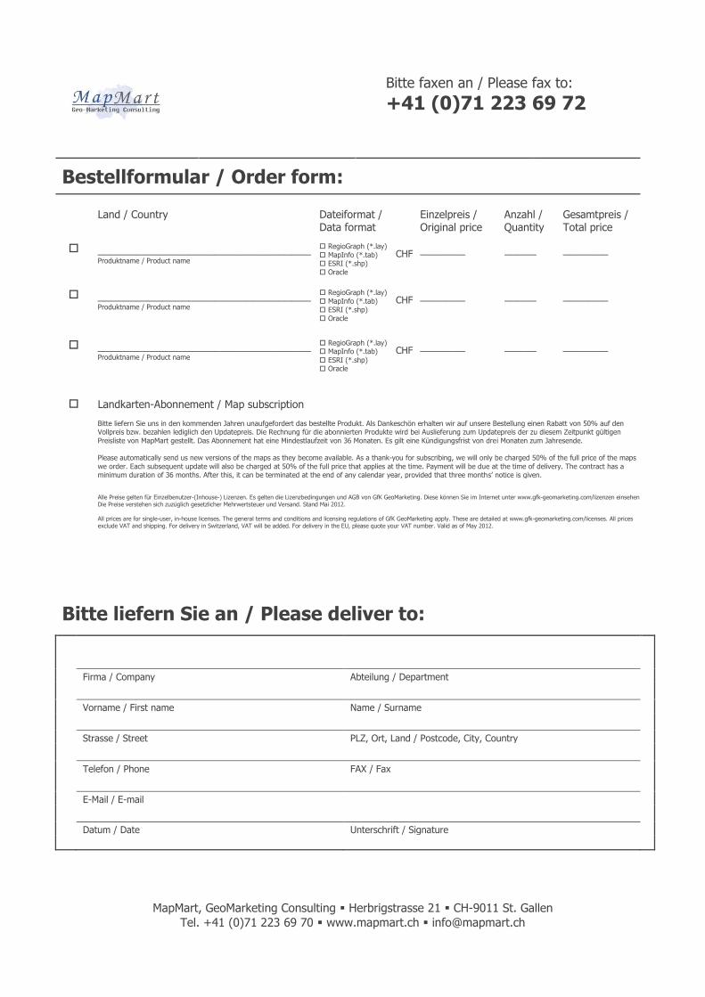
Bestellformular / Order form: Land / Country Dateiformat /
Data format
Einzelpreis / Original price
Anzahl / Quantity
Gesamtpreis / Total price
_________________________________ Produktname / Product name
RegioGraph (*.lay)
MapInfo (*.tab) ESRI (*.shp)
Oracle
CHF _______
_____
_______
_________________________________Produktname / Product name
RegioGraph (*.lay)
MapInfo (*.tab) ESRI (*.shp)
Oracle
CHF _______
_____
_______
_________________________________Produktname / Product name
RegioGraph (*.lay) MapInfo (*.tab)
ESRI (*.shp) Oracle
CHF _______
_____
_______
Landkarten-Abonnement / Map subscription
Bitte liefern Sie uns in den kommenden Jahren unaufgefordert das bestellte Produkt. Als Dankeschön erhalten wir auf unsere Bestellung einen Rabatt von 50% auf den Vollpreis bzw. bezahlen lediglich den Updatepreis. Die Rechnung für die abonnierten Produkte wird bei Auslieferung zum Updatepreis der zu diesem Zeitpunkt gültigen
Preisliste von MapMart gestellt. Das Abonnement hat eine Mindestlaufzeit von 36 Monaten. Es gilt eine Kündigungsfrist von drei Monaten zum Jahresende. Please automatically send us new versions of the maps as they become available. As a thank-you for subscribing, we will only be charged 50% of the full price of the maps
we order. Each subsequent update will also be charged at 50% of the full price that applies at the time. Payment will be due at the time of delivery. The contract has a minimum duration of 36 months. After this, it can be terminated at the end of any calendar year, provided that three months’ notice is given.
Alle Preise gelten für Einzelbenutzer-(Inhouse-) Lizenzen. Es gelten die Lizenzbedingungen und AGB von GfK GeoMarketing. Diese können Sie im Internet unter www.gfk-geomarketing.com/lizenzen einsehen. Die Die Preise verstehen sich zuzüglich gesetzlicher Mehrwertsteuer und Versand. Stand Mai 2012.
All prices are for single-user, in-house licenses. The general terms and conditions and licensing regulations of GfK GeoMarketing apply. These are detailed at www.gfk-geomarketing.com/licenses. All prices exclude VAT and shipping. For delivery in Switzerland, VAT will be added. For delivery in the EU, please quote your VAT number. Valid as of May 2012.
Bitte liefern Sie an / Please deliver to:
Firma / Company Abteilung / Department
Vorname / First name Name / Surname
Strasse / Street PLZ, Ort, Land / Postcode, City, Country
Telefon / Phone FAX / Fax
E-Mail / E-mail
Datum / Date Unterschrift / Signature