jul 31 i9fr - bsee data center · the base o' opera, lona will take place at intercoastal...
TRANSCRIPT

JUL 31 i9frc
;-»cH*\«n <*.'.*%H*rr fx;-.' j r # t i ; r\ (\t*»>anv A Rti< n: Hr . f.. I . 5.ok v , J r .
»«»•••* f l l , l o p l . ' * « " 70009
NMlttP n.
fe*fey*Ht' t* Mtt> U /OP* f £*?t«*i*i<*P, ! f « r * r t op f f t t t l M a v H fC»1*(HJ Ju»y I * , »«'('•, f T t . '«M CCS-'i StrVl, B l« fc Z*>, W««t r.***rnn Art-*. Tti«v !nel»P>* t h - I C t t v f + t e * propr»l*«* U>r P>1»« * ».hrmyh C.
ir» «€C»rd«t«- with y. CfP 250.34, Wl$#4 -ftONftW !3, WW, •Ml©ar l*»ttW
Y'. jr |.l4f C fft.fpl nueftV* 1- »*W5 *nn 8hWlW rpfcr^nct* fn yovf c vmr-if
tim ml e PF*M»Is«rtw«* c©iic«rr»t»g t%ts r«nc r e l y P0*Pt<
prig. Sfd.) A. Oonaki Ciroir
sec: L M M OCS-0 B«W (0P5-3-21 G t t - i - 4 j j /PuhMc I n f o . Capy 00*1
of th r o l m an* rT'. (PUM.1C RECOPnS POOM)
fUT- j1Ur t :9Cw; / /29 /R . Dt i t ! 3 t
*i 935
lh.cc--:' '

FMP OPERATING COMPANY A LlMlTffO P * O T S E R S M I P
McMoran O.i and 0 M Co Managing Ganafa. Pmm*
« " * * -
McMoRan Offshore Exploration Co * Division of McMoRan On i Oat Co
J u l y 26, 198b
Minerals Management Service P. O. Box 7944 Metairie, LA 70010-7944
* --»- IN W.!AJ ,.. , . v
A t t n t Regional Superviaor O f f i c e f o r Rules A Produc t ion
RE
Gentlemen:
Plan of Exploration OCS-G 518 3 West Cameron Block 2 36
Pleaae find the following exhibits enclosed.
1) 2) 3) 4) 5) I ) 7) fi)
5 T f C ! i M
a J k ; U P r i q a n d r i * equipment List of Mud Comuonents Vi c i n i t y Map r e l a t i v e tc the shoreline Well Location Map Shallow Hazard Report Geological Structure Map Schematic Cross Section Air Quality Report Environmental Report
to S ^ J ^ c ^ llZaTiu dSoXiJ}r! w e l i B Cr™ * are proposed at thia tine N ° a d d i t l o M l - ^ f a c e locations
a l l available well data 1 ff / V \ t h a t t i m ° ' W e D U B t o r t V i M a c t i v i t i e s ? , ™ k 0 * de^'™»nation for further d r i l l i n g
• — •• • • • MOO w»>« • • ... « , w a > , rw» itoastatfi
The base o' opera, lona w i l l take place at Intercoastal City, Louisiana. This base is 12 acres in extent and employs twelve (12) persons as base personnel. Approximately 21 of the a c t i v i t y at t h i s base w i l l be applied to the project. In addition, the o f f i c e of McMoRan Offshore Exploration Co. in New Orleans w i l l allow approximately 1.0 person-years to the subject project. No new employees w i l l bt added, and no new f a c i l i t i e s are anticipated to move into the area.
A comprehensive o i l s p i l l contingency {.lan has been submitted to the Minerals Management Service, Regional Supervisor, in accordance with OCS Ordet No. 7. This plan covers equipmer.t, materials and Procedures for prompt response to o i l s p i l l s . In addition, detailed provisions for o i l s p i l l prevention are included in OCS Order No. 2, which includes procedures for d r i l l i n g , setting casing, b*owout prevention and n.ud con t r o l .
McMoRan Offshore Exploration Co. is a member of Clean Gulf Associates, which maintains standby o i l s p i l l containment and cleanup equipment. This equipment includes skimmer systems for inshore and offshore waters, and a u x i l i a r y shallow water and beach cleanup equipment. Personnel to operate tne equipment are located i n Intercoastal City, Louisiana. The fast response system and personnel could be on location i n 8 to 12 hours.
Your e a r l i e s t review and approval would be appreciated.
Yours .yery t r u l y ,
C. E. Dokcy, Jr. X / j S upe r v i so r - Regul a tor pv>\ f f a i r s McMoRan Offshore Exploration Co.
TAB/d]r Enclosures

COASTAL ZONE MANAGEMENT
CONSISTENCY CERTIFICATION
Exploration Type of Plan
Weat Cameron Block 2 36 Area and Block
ors-G 48«*7 Leaae Number
The proposed a c t i v i t i e a described i n d e t a i l i n t h i s plan comply with
Louisiana's approved Coastal Management Proqram(s) and w i l l be
conducted i n a manner consistent with such Program(s). Also, a
Public Notice w i l l be publicized i n the Baton Rouge State Times on
July 31, 1985.
McMoRan Offshore Exploration Co. Designated Agent
Certifying Off
July 26, 1985 Date
i I

»
EXHIBIT I

tWXBXT 1 (2/1) Pitcpimow OF i o V f p w M T
ROTARY
Continentel-Emeco Hod*1 C-3, Type XX 3,000 HP J ^ % ^ ^ ^ i « t W » t 4 J 3 70 OC woUrl r.t.d
•ond rool for 22,190* of •/!«> .andline.
Psr-Hac, Model RC60 auxiliary hydromatic brake.
Continental-tmeco Nodal T-3750. 37-1/2" i.d
r a J i H ; f . i \ T m 9 . ™ "0 OC motor
MUD PUHFS
POv-TR UNITS
DRILL STRING
B.C.F. EQUIPMENT
T-o Contin.ntal-E-.co 1,600 HP F-1600 t r i p l e -each pump powarad by two W.tmghou.. 170 OC motor* rated at 1.000 HP each.
Two EHS 2.200 HP 16-645E1 d i . . . l engine, ..ch powers, twc D79C ar.d one D32K DC g e r . r l t " ,
2.300' 5" o.d., :a.5 lb ft r e r 9 i 2 Grade -X-ICS" d r i l l pipe with 4-H- IP corrections.
J^jr* wiun » 2-13/16- i .d .« , : •
d r i l l tollers with 6-5/.- regular connect J r .
Thro. 13-5 •". 10,000 p.: Cameron ? y ? . s i r ; : .
On. IJ.5/I-, 5.00C p.i Hydnl Typ. CK. or.. Koomey *Mcd.i 2616C-3S elosins ur.it. 16C c capacity with aix outlet, .nd two stations with vsive ror a l l othar operationa.
S^Oo'Sil; USX! " H i n , l d * b-o«o»t preventer. 5.000 pai working pressure for 5" d r i l l pipe.
?S%?c S«, M C d*w 1 6 " W * " r # 9 u U r L H ' •'•"y "op coc* 1O.000 psi working pressure.
-1-

BOIXBXT X (1/1)
t .o . r . EQUIPMENT ICont'd.)
One OMSCO Model 5XH, } • i . d . d r i l l pipo safety v«iv«, 1,000 pai vtorklng praaaura for 5" d r i l l pipo.
Choke Manifold and k i l l aanifold with two a", 3,000 pal working praaaura f u l l openlne. wings, three 10,000 psi H.P, choke wings.
SWACO 2-1/1*" Automatic back preaaure control valve, 10,000 psi working pressure.
4", 5,000 psi working pressure choke l ine .
2", 10,000 psi working pressure k i l l l ine .
DEP PICK AND SUBSTRUCTURE
Continental tmeco Type 20P, 147' dynamic Derrick with 30' base designed for 100 mph wind with f u l l setback and rated at 1,400,000 lba. A.P.X. gross nominal capacity.
•ethleher 40' wide a 46* long x 17.1' high substructure with 500,000 lbs. setback capacity.
DRILLING EQUIPMENT
Cor.tiner.tal-E-sco Model RA-6C-7, 500 tor. crowr block, w th 7.60" Dia. sheaves grooved for 1-H" d r i l l line, complete with sandline, catline, ard tugger line aheaves.
Contmental-Emaco Model RA-60-6, with rubber burpe. 500 tor. travel in; block with €-€:" Dia. ahetvea and "Crowr.-O-Mat i c " aafety shut down device.
Contlr.ertal-E.T.sco gu;dar.ce aysttr.
B . J . Model 5.500, 500 tor hook.
Cortir.ertAl-Ersrc Model L-I5C, HZ tor swivel, w_-_ Kelly s?inner.
King, Model 4SC c i r c u l a t i r c hesi with wire l i r e stripper, 5.OCC pSl.
Two 3-h" x 70' lor.: rotary heses, 5,000 psi worki-pressure.
Handling tools consisting of:
Wire lin« anchor, complete with wire line anubber.
Elevator assemblies for contractor tip l i f t d r i l l collars.
-2-

•wan i (vt) DRILLINC Rally spinner with air surge tank.
On* o.d. a 40" (Hexagonal) Rally.
Two Rally aavar tubs for S-%" contractor furniehed Rally.
Rally aavar tub rubber protactora.
Ona Varco spinning wrench, for 5" d r i l l pipe make-up.
slips for a l l contractor furniahed d r i l l pipe and d r i l l collars.
Two I.R. Xnorrnoll Rand, Modal HUL-40 air hoists located on rig floor.
Fcur S,N. Ingersoll Rand. Model HUL-40 air hoists located on cellar deck.
Pishing tools consisting of:
Fishing tools for pickup of contractor furnished d r i l l pipe and d r i l l collars.
One Demco Model 122 ieeer.der with 2-12" cones driven by Mission Model 5x6R centrifugal pump, 60 HP rated at 100 GPM.
One Demco Mcdel 41C-H desilter with 10-4- ccr.es, driver, by Mission Model SxfcP centrifugal pump, 60 HP rated at 80C GPM.
One Nell CO Mcdel 52:: degasser, driver by Mistier. Model 5x6* centrifugal 6: a? p.—.
Twc ;et mixir.5 hoppers.
Tour Mission Model 5x6P certrifugal perft, powered by 6Q HP A.C. motors.
Three lightnin Model 75-C-2C HP rctary rud asitatcr powered by explosion proof electric rotors.
MUJ EQUIPMENT One Irardt dual tender screen shaker.
CRANES Two Link Belt Model ABS 108B "Searaster" w/70' boor 63,650 lb. net capacity at 15* radiua.
LIVING QUAP7EP5 Sixty man air conditioned quarters with reoreatior room.
3-

«H»XT 1 (S/l)
HELIPORT
COMMUNICATIONS
AIR COMPRESSORS
ADDITIONAL EC/.IP MINT
J4V 1 70* to sccoasnodate s "Sikorsky- S-42 h s l l e o p t s r . *
Ons SSS r s d i o .
Ons 1000 watt linear amplifier for SSS u n i t .
Two VHr radio*.
On* a i r c r a f t radio.
Ona a i r c r a f t homing issson.
Two portable battery operated radioa.
o n 1 ; ? ? ? ! ^ ^ . 1 0 W O M i a e f l y IC lo c a t i o n .
""••f c*i1- Pub^c .ddr*.« system with *pp-cx-im*t*ly 12 *tatior.* on drilling unit. ******
« t % 2 r p ' s t i S t * V € r , , o n M o d t l B " 2 1 2 - 3 C A . 58: SCF.y
^^roTs'i 5 1'^* 0' M o d e l K'25' 21"28 s-r*
sS*i25*pas?iSl:'V*n*0n M ° d e l B ° 2 ' 5 6* 7 3 S C F V B t
One 10.000 l b . Stockiest anchor.
One .r.chor windlass, rat*- 4 n« T? iw
32 FPM with 950 ft i t j f JV l ; 1« ' Two R*d. Mcd*l 3J4:: . a l t water s.-.-.l- - ~ . rat*d at 135: GPM with 111 cf head' --- ---
T w o ^ r i l l water p , r ? B . r . „ t i 4 ?«
JjO^tSbl. wat.r pure,, r.t.d at;: m
^ M , c o Potable watar maker* rated St 792: G?:.
Thr** 400 AMP e l e c t r i c welding u n i t * .
Thr** oxyacetelenc welding u n i t s .
-4-
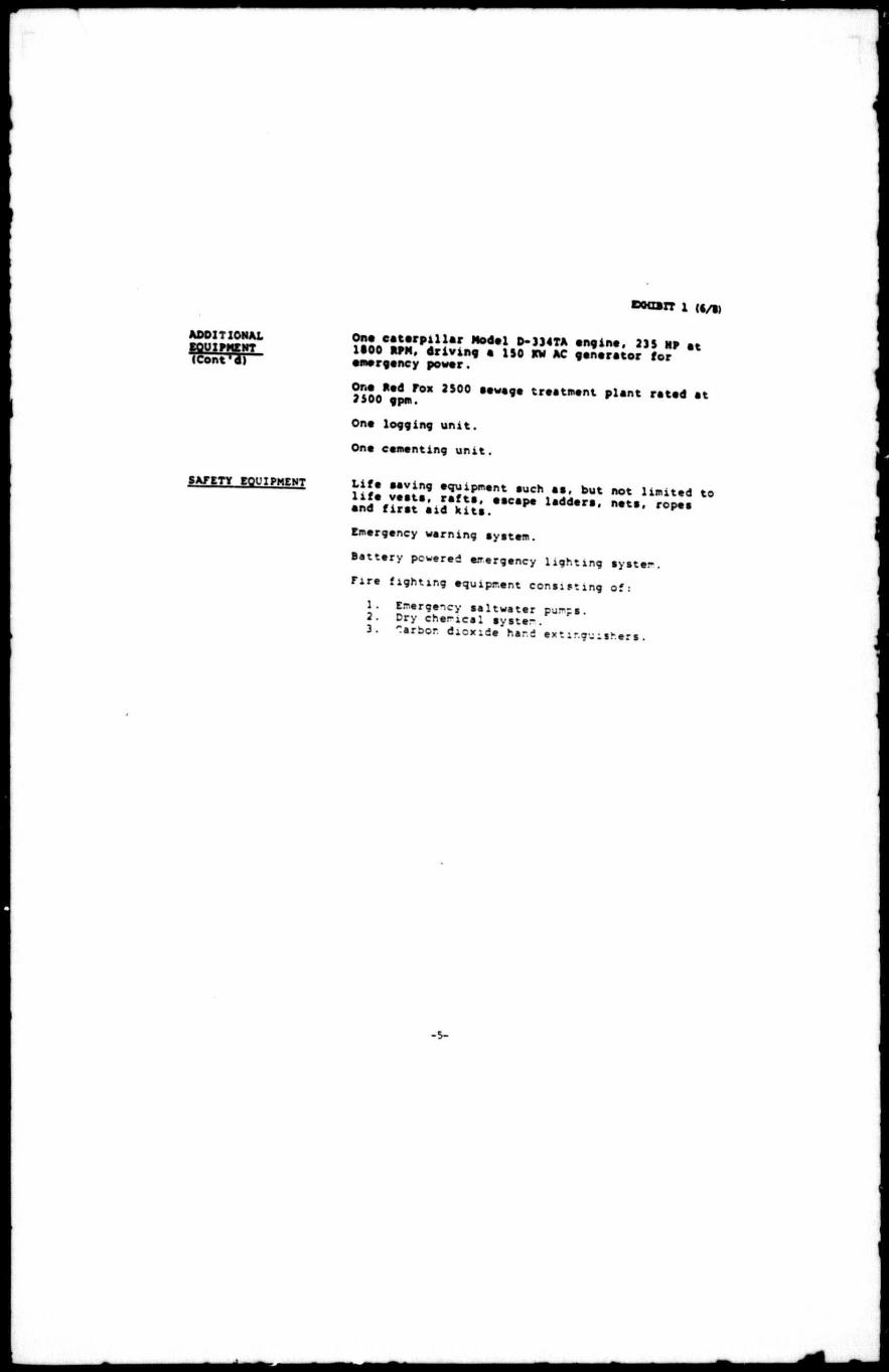
ADDITIONAL EQUIPMENT (Cont'd)
SAFETY EQUIPMENT
? ! S o C . i ! r p i l l a r l t e d * } D - » 4 T A • " • i n e . 23$ MP at 1S00 RPM, d r i v i n g • ISO RW AC generator for emergency power.
J S O O * ; ^ 0 * 2 5 0 0 § # W * 9 * t w * * " * » * FldMt r a t e d a t
One logg ing u n i t .
Ona cementing u n i t .
US vSiiS9 TRUTH , u c h , •! ' b u t n o t to ind'Mr.i'iiS'ilJ:;."^ w i Emergency warning ayatam.
Battery powered emergency lighting Byatem.
Fire fighting equipment consulting of:
1. Emergency saltwater pur-ps. 2. Dry chencal Byste-. 3. Tarbor. dioxide hand extinguishers.
-5-

DWXDJT 1 (7/i)
OPERATING V:HITATIONS
OW BOTTOM OPERATING CONDITIONS (MQN-HUBBICANE)
1. Dttign wave, height - 33 feet.
2. Wind speed - St knots.
3. S t i l l water depth - maximum 250 fast (excludes storm tide) - minimum - 24 feet
4. Storm tide - 1.0 feet.
ON BOTTOM OPERATING CONDITIONS (H'JPP ICANE)
1. Design wave height - 60.0 feet.
2. Wir.d speed" - 100 knota.
3. S t i l l water depth - maximum 200 feet (excludes storr tide) - minimum - 2 4 feet .
4. Storm t i d e - 4.0 feet.

EXHIBIT 1 <%/%)
DIV. 'TER SYSTEM
1) 21
II II hi 11 tl
H y d r i i Cameron Type T " Valvf (Opens when hy d r i i i s c losed!
- J00 P . S . I . D i v e r t e r Moee Pipe (pershsnent) i' 11" • Oeaaovable) >• * i• • - (removable) B u t t e r f l y Valves (Operated manually)

Mud Component• Sage l / i BaaBXT 2
TRADE NAM
IMCO BAP
IMCO MATE
IMCO CEL
IMCO KLAY
IMCO BPISECEL
IMCO HYB
IMCC SH'.'RLIFT
DtCD'XC
IMCO PHOS
t -ST
IMCO 3ET
IMCO FLO
DESCO
IMCO LIG
WEIGHTING AGENTS AND VISCnsTrTes,*
DESCRIPTION
Barite
Calcium Carbonate
Bentonite
Sub-Bentonite
Attapulgite
Beneficiated Bentonite
Asbestos Fibers
Bacterially Produced Polymer
o:sp£RSA:rrs
S od i um. Tetraphcsphate
PRIMARY APPLICATION
For increaaing mud weight up to 20 ppg.
For increaaing weight of oil muds up to 10.1 ppg.
Viscosity and filtration control in water baae Buds.
For use whsn larger particle site is desired for viscssit. and filtration control.
Viscosifier in salt water ru
Quick viscosity m fresh wati upper hole muds with minis chemical treatment.
Viscosifier for fresh or sa-water muds.
Viscosifier and fluid less control additive for lew solids muds.
Thinner fs- flew pH fresr water muds.
Sodium Acid Pyrophosphate
Quebracho Compound
He.-lock Extract
Modified Tar.nm
Mined Lignite
For treating earner.t eor.ta.-i-nation.
Thinner fer fresh water »i lime muds.
thinner for fresh water r and m muds ccrtair.mg sal-. I10.00C to 15,000 ppm:.
Thinner for fresh ar.d salt water muds alkalized for pH control.
Dispersant, emulsifier and supplementary additive fer fluid loss control.
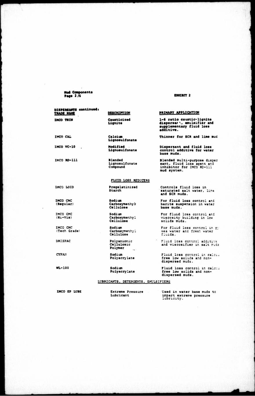
Mud Component• Page 2 / • D0O1IT 2
DISPCRSAHTS continuedi TRADE M
IMCO THIN
IMCO CAL
IMCO VC-10
IMCO RD-111
DESCRIPTION
Ceueticixed Lignite
Calcium Lignosuifonate
Modified Lignoaulfonata
Handed Lignosuifonate Compound
PRIMARY APPLICATION
1-6 ratio cauatic-lignite disperse/ k., emulsifier snd supplementary fluid loss additive.
Thinner for SCR and lime mud
Dispersant and fluid loas control additiva for watar baae muda.
Blended multi-purpose dispe: sent, fluid loss agent ar.i inhibitor for IMCO RD-111 mud aystem.
IMCO LOID
IMCO CMC (Regular)
IMCO CMC (Hi-Via)
IMCC CMC (Tech Grade'
DRI3FAC
CYPAN
WL-100
FLUID LOSS REDUCERS
Pregelatinizad Starch
Sodium Carboxyme thy 2r Cellulose
Sodium Carboxymethyl Cellulose
Sodium Carboxymethyl Cellulose
Polyanior.ic Cellulosic Polymer
Sodium Polyacrylate
Sodium Polyacrylate
Controls fluid loss in saturated aalt water, lime and SCR muds.
For fluid loss control and barite auapension in water baae muda.
For fluid loss control and viscosity building ir. lew solids muds.
For fluid less control it. c; sea water and fresh water fluids.
fluid loss cortrcl Sddittivt and Viscosities in salt ruds
Fluid loss control in ca: free low solids and r.en-dispersed muds.
Fluid loss control in cal free low solids and non-dispersed muds.
LUBRICANTS, DETERGENTS. EMULSIFIERS
IMCO EP LUBE Extreme Pressure Used in water base muds to Lubricant impart extreme pressure
l u b r i c i t y .

EXHIBIT 2
LUBRICAWTS, DETERGENTS, EMULSIflERS continued: TRAD! m m DEICRIPTION
SOLTCX
IMCO MOLECOAT
IMCO MUD OIL
IMCO FAEEPIPE
IMCO ME
IME
IMCO SWS
IMCO LCBRIKLEEN
IMCO SPOT
SUPER DRILL
Processed Hydrocarbons
Watar Dispersible Asphalta
O i l Dispersible Asphalta
O i l Soluble Sur fac tan t s
Detergent
Non-Ionic Emulsifier
•lend of Anionic Surfactants
An Organic Entity Neutralized with Amines
Blend of Fatty Acid Sulfonates 4 Asphaltic Materials
Specially treated gilsonite
PRIMARY APPLICATION
Uaed ln water beae muds to lower down-hole fluid loss and minimize heaving shale.
Lubricant and fluid loss reducer for water baae muds that contain no dieael or crude o i l .
Lubricant and fluid loas reducer for water baae 'lilde that contain dieeel or crude o i l .
Non-weighted fluid for spctti to free differentially stuck pipe.
Used in water base muds ts ai in dropping sand. Emulsifies o i l , reduces torque and minimzes bit-balling.
Emulsifier for surfactant cud
Emulsifier for salt and fres.-watar muds.
Supplies the lubricating properties of oils without environmental pollution.
Invert emulsion which cay be weighted to desired densiv-spotting tc free differentia stuck pipe.
For hcle stabilization, protects water sensitive formation). specifically designed for dispersed d r i l l fluid systems.
Aluminum Stearate
IMCO DEFOAM
DEFOAMERS, FLOCCULANTS, BACTERICIDES
Aluminum Stearate
Sodium Alkyl Ary 1 Sulfonate
Defoamer for lignosuifonate muds.
Defoamer for salt saturated muds.

Hud Componenta
eooBrr 2
DEFOAMZAS , FLOCCULANTS, TRAD! NAME
IMCO FOAMSAN
IMCO PLOC
IMCO PRESERVALOID
IMCO FYBER
IMO WOOL
IMCO PLUG
IMCO PLUG
IMCO PLUG
IMCC MYCA
IMCO MY OA
IMCC FLAKES
IMCO KWIK SEAL
BACTERICIDES continuedi DISCRIPTION
Su-fsce Active Dieperalble Liquid Defoamer
Flocculating Agent
Parafomeldehyde
LOST CIRCULATION MATESTix
Fibrous Material
PRIMARY APPLICATION
A l l purpose defoamer.
Uaed to drop drilled aolida where clear watar is desirabi for a drilling fluid.
Prevents atarch from ferment2 when uaed ln muda of laaa tha aaturation or alkalinity l e n than l.Occ.
OIASEAL M
Fibrous Mineral Wool
Walnut She l l s : (Fine)
(medium)
(Coarse!
Ground Mine: (Fine)
(Coarse)
Cellophane
Combination ef granuiee. flakes and fibrous materiala of varioua sizes in one sack.
Blended high fluid loss soft plugging material
F i l l e r as well as matting material.
Often used in areas where acids ara later employed tc destroy the material.
Most often used to prevent lost circulation.
Used in conjunction with fibers or flakes to recair 1: circulation.
Used where large crevices cr fractures are encountered.
Used for prevention of lest circulation.
Forma a gees aat at face tf well bcre.
Used to regain lest cireultt:
-sad where large crevices sf fractures are encountered.
One sack mix -ure for prepanr soft plugs : severe lost circulation.

Mud Componenta Ssas S h BOtXBXT 2
TRAPS HAMS
IMCO Gtirv
IMCO PT-102
Diammonium Phosphate
IMCO SULF-X
m C I A L T T PP.OPQCTS
DKicmmow ientonite Extender
Non-Ionic Surfactant
Ei lining-Amine
Shala Inhibitor
Specially Blended Zinc Compounds
PRIMARY ARPLICATIOM
Increases yield of bentonite to form very low aolida drilling fluid.
Primary surfactant for formulating surfactant muds. Hay be uaad ln hot ho laa for viscosity stability.
Corrosion Inhibitor.
for us* in specially prepare* D.*» muds.
Per use a- a hydrogen aulfid scavenger in water baae muds
Sodium Chromate
Cauatic Soda
Soda Ash
Sodium Bicarbonate
B a n u r Carbcnate
Gypsum
Lime
Salt
COMMERCIAL CHE:'.I~A.V<
Sodium Chromate
Sodium Hydroxide
Sodium Carbonate
Sodium Bicarbonate
Barium Carbonate
Calcium Sulfate
Calcium Hydroxide
Sodium Chloride
Uaad in water base muds tc prevent high temperature gelation and aa a corrosion inhibitor.
Tor pH control in water base ?-uds.
For treating out calcium sulfate in low pH muds.
For treating out calcium s_l-fate or cement in hi;.-. pE r.z
F*r triatir.c. cut SB I d us sulfate pK should be'abcve 1 for best results.)
Source cf calcium for form.la ting gyp mud*.
Source of calcium, for formula ting lime muds.
For saturated salt muds and reaistlvity control.

Hud Components Pag* «'*> EXHIBIT 2
TRADE NAME
OIL RASE AND INVERT EMULSION SYSTEMS
DESCRIPTION PRIMARY APPLICATION
IMCO KENOL-S and IMCO KEN-X
I n v e r t Emulsion Systsm
IMCO KEN-SUPRE ME
IMCO KEN-PAX
IMCO KENOL-S fD) ar.d IMCO KEN-X Cone.•!IL)
IMCD KEN-GEL and IMCO KEN-X Cone. 12
IMCO KEN-X Cone. #3
IMCO VR
IMCO KEN THIN
IMCO KENOX
Oil Basa Mud
Gelatinous Oil Basa riuid
OIL MUD ADDITIVES
Primary Emulsifier
Viscosifier ar.d Galling Agent
High Temerature Stabilizer
Stabilises Borehole Conditions
Disperssnt
Caleium Oxide
Drilling Fluids uaad where extremely high temperatures are encountered also a dril completion or workover flui applicable where only oil contact with formationa is deeired.
Por drilling water sensitive formations.
A time setting gelatinous c pack for casing recovery an corrosion control.
Primary additives to fcrr stable water-in-oil em.ulsic-
Provides viscosity, weight suspension and filtraticn control.
Improves emulsion under hi?-temperature conditions.
Stabilizes running shale, improves emulsion, weight suspension and fluid less under high temperature conditions.
Oispersar.t fer reducing rheclsgical prrperties'.
Caleium scuree f;r satcri* tion.
a\

r V; . • n ; - - . , : ' - . » . , s , . , ! , . V . t C , ? f i c *.— ;::^:. » J£?«%«r«t.«•.....»"«'« '•KtVw'VVt H , * , V . _„ '
^-r* - • u. -4 - • • - • * • * • * • * * *~ w" •» I*-> . c\,"i , ^i<3zz>: -fTuVi *• •» *• •* • •» •» •« «• * m II ,e "» » », I
?::::>;• fr*». - j "K»'§t* »'•*». 'n*t«"t»*»t »» •• »• « .» -w •-•*••},%»*»»*,«*». M v>>«i w ' **•"•
M M 2 T « « I J.S S.« M* »v' **»••»•
t« t *«I Mi »«c • » i f • « • « • *
. T « M - VM »». »• ••>» »•« « 4 ^ - . . » . " •
VICINITY HAP
I

SCO 'PTVD
'ft ! /
• SCO 9-JO
1*1 U! \
\t
'/
236 CONOCO
OCS-G-5183 $1,207,600
12-31-87
O
1
9t PTVD
L O C • lur f . 1 ? J 0 7 S L T54 r w i
MjM 5 0 0 ' S L 1 0 0 0 ' W L
C • * * « . i r t O ' f t f . r t r r w i
••HI. 5000 F S L ISOO'FWL
MM. D tuff I t t t t t L T t t S S J l e tu i . t t O O ' t t L u o o r w L
I turt. IM« r t i r n rwi I H m t » 0 0 » t « . I tOO'tWL
L O C
LOC
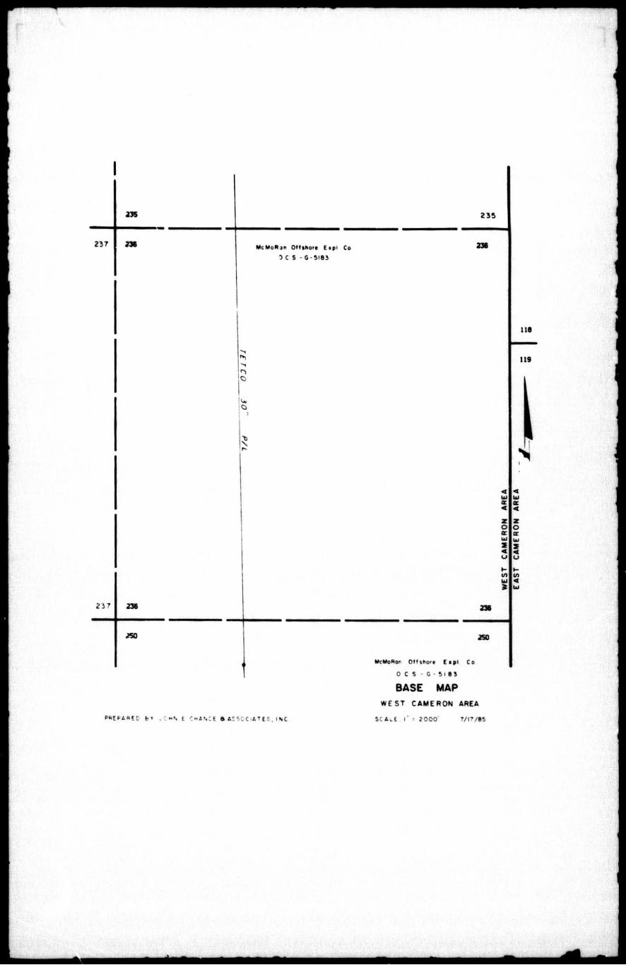
WEST CAMERON 236
WELL LOCATION PLAT
0
«* o Boi tiOl*
JOHN E CH/NCE & ASSOCIATES. INC IVU f V . SEE»»5 • . »NC- S u " V E ' 0 » S
LAFAYETTE LOUISIANA 70« i05
July 25, 1985
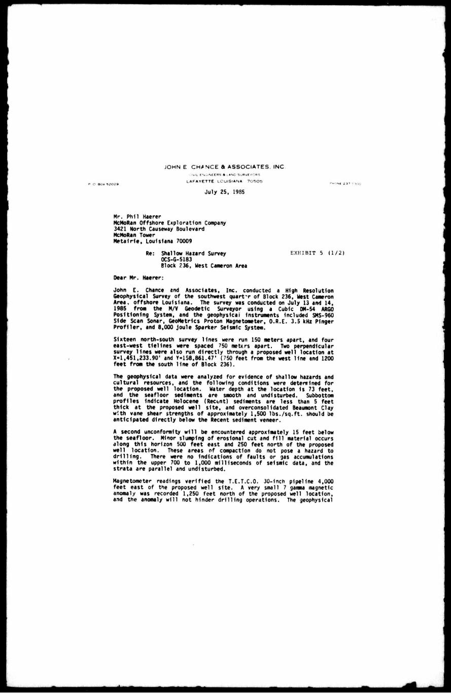
Mr. Phil Haerer McMoRan Offshore Exploration Company 3421 North Causeway Boulevard McMoRan Tower Metai r ie , Louisiana 70009
Re: Shallow Hazard Survey E X H I B I T 5 (1 /2) 0CS-G-5183
Block ?36, West Cameron Area
Dear Mr. Haerer: John E. Chance snd Associates, Inc. conducted a High Resolution Geophysical Survey of the southwest quar tT of Block 236, West Cameron Area, offshore Louisiana. The survey was conducted on July 13 and 14, 1985 froe the M/V Geodetic Surveyor using a Cubic DM.54 ARGO Positioning Systee, and the geophysical Instruments Included SMS-960 Side Scan Sonar, GeoMetrlcs Proton Magnetometer, O.R.E. 3.5 kHz Pinger P ro f i l e r , and 8,000 joule Sparker Seismic System.
Sixteen north-south survey l ines were run 150 meters apart, and four east-west t ie l ines were spaced 750 meters apart. Two perpendicular survey l ines were also run d i rect ly through a proposed well location at X = l ,451,233.90* and Y = 1J8.861.47' (750 feet from the west l ine and 1200 feet from the south l ine of Block 236).
The geophysical data were analyzed for evidence of shallow hazards and cu l tura l resources, and the following conditions were detenrlned for the proposed well locat ion. Hater depth at the location Is 73 feet, and the seafloor sediments are smooth and undisturbed. Subbottom pro f i les Indicate Holocene (Rectnt) sediments are less than 5 feet thick at the proposed well s i te , and overconsolIdated Beaumont Clay with vane shear strengths of approximately 1,500 l bs . / sq . f t . should be anticipated direct ly below the Recent sediment veneer.
A second unconformity w i l l be encountered approximately 15 feet below the seafloor. Minor slumping of erosional cut and f i l l material occurs along th is horizon 500 feet east and 250 feet north of the proposed well locat ion. These areas of compaction do not pose a hazard to d r i l l i n g . There were no Indications of faults or gas accumulations wi th in the upper 700 to 1,000 milliseconds of seismic data, and the strata are parallel and undisturbed.
Magnetometer readings ver i f ied the T.E.T.C.O. 30-Inch pipeline 4,000 feet east of the proposed well s i te . A very small 7 gamma magnetic anomaly was recorded 1,250 feet north of the proposed well location, and the anomaly w i l l not hinder d r i l l i ng operations. The geophysical

EXHIBIT 5 (2/2)
J O H N E C H A N C E ft A S S O C I A T E S . INC
data Indicate that the proposed well site is free of shallow hazards and cultural resources.
Thank you for the opportunity to be of service, and please call i f additional information is needed.
Respectfully,
JOHN E. CHANCE ANO ASSOCIATES, INC.
Robert J. Floyd Assistant Manager Geophysical Division
RJF/wrh
•
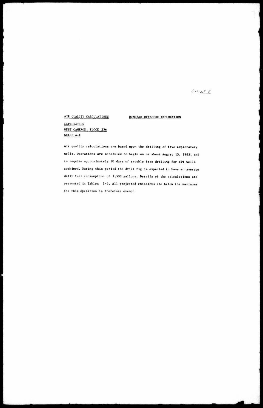
AIR QUALITY CALCULATION'S McMoRan OFFSHORE EXPLORATION
EXPLORATION
WFST CAMERON. BLOCK 236
WELLS A-E
A i r q u a l i t y c a l c u l a t i o n s are baaed upon the d r i l l i n g of f i v e e x p l o r a t o r y
w e l l s . Operations are scheduled to begin on or about August 15, 1985, and
to require approximately 70 days of t roub le f r e e d r i l l i n g f o r a M w e l l s
combined. During t h i s pe r iod the d r i l l r i g i s expected to have an average
d a i l y f u e l consumption of 1,500 g a l l o n s . D e t a i l s of the c a l c u l a t i o n s are
presented i n Tables 1-3. A l l p ro jec ted emissions are below the maximums
and t h i s operat ion i s t he r e fo r e exempt.
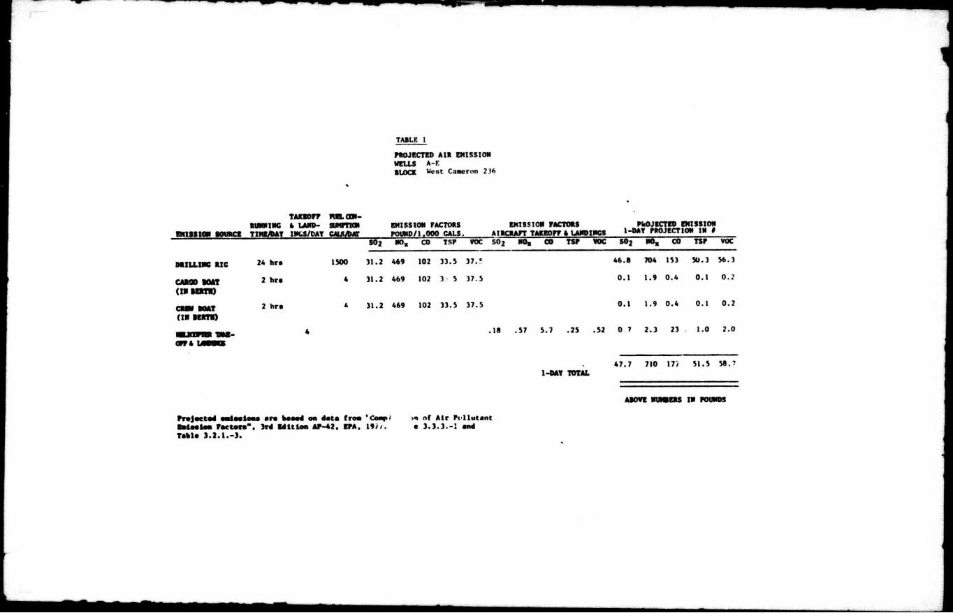
TABLE 1
PROJECTED AIR EMISSION WELLS A-F BLOCK West Caaeron 2 J*»
EMISSION SOURCE
TAKEOFF FltLODX-RUNNtNC a LAND- SUMPTION TIMEJPAT INfcS/DAT CH&Am
EMISSION FACTORS POUND/|.OOP GALS.
EMISSION FACTORS AIRCRAFT TAKEOFF 4 LANDINGS
PROJECTED EMISSION 1-DAY PROJECTION IN #
S02 NO, CO TSP VOC SO 2 NO, CO TSP VOC S 0 2 NO, CO TSP VOC
DRILLINC SIC
CAROO BOAT (IR BERTH)
CRBV BOAT (IH BERTH)
OFF ft
24 hra
2 hra
2 hra
1500
4
31.2 469
31.2 469
102 33.5 3 7 . c
102 3 5 37.5
4 31.2 469 102 33.5 37.5
46.8
0.1
704 153
1.9 0.4
1-DAY TOTAL
50.3 5ft.3
0 .1 o . ;
0.1 1.9 0.4 0.1 0.2
.18 .57 5.7 .2J .52 0 7 2.3 23 1.0 2.0
47.7 710 17> 51.5 58.?
ABOVE NUMBERS IN POUNDS
Projected aedaeieaa ara baaed on data f roa 'Coap' >n nf A i r Pt l lutant la i ee ie* Factor ." , 3rd Edit ion AP-42. SPA. I f ? / . e 3 .3 .3 . -1 and Table 3 . 2 . 1 . - 3 .

TABLE 2
AREA Cameron BLOCK 236 WELLS A-E
PROJECTED EMISSIONS FROM EACH SOURCE
BY AIR POLLUTANT FOR 1 9 8 5
SOURCE AIR POL "1
.UTANT (T/YR)' SOURCE S02 N0X CO TSP VOC
Dr i l l i ng Rig Projected Emissions lb/day 46.8 704 153 50.3 56.3
Transoortatlon--Corgo Boat, Crew Boat, t Hellcooter lb/day
0.9 6.1 23.8 1.2 2.4
SUB-TOTAL lb/day 47.7 710 177 51.5 58.7
Miscellaneous 25X of Sub-Total
11.9 178 44.3 12.9 14.7
TOTAL ln lb/day 59.6 888 221 64.4 73.4
TOTAL In Tons/year 2.1 31.1 7.7 2.3 2.6

TABLE 3
AREA nm cjfjMpjj BLOCK ?ia WELLS ^.g
EXEMPTION CAT CULATION8
for carbon monoxide
for aulfur dioxide. nitrogen oxides, total auapendad particulates, and volatile organic compounds
Statute Miles
CO
SO 2 . NOx, TSP, snd VOC
HIC&VT YEAR
POLLUTANTS "E" ( T / Y R . )
P R O J E C T E D E M I S S I O N S ( T / Y r . )
EXEMPT
8O2 1332 2.1 yes
NOx 1332 31.1 yes
CO 39768 7 7 yes
TSP 1332 2.3 yes
vo-; 1332 2.6 yes
E * The emission exemption amount expressed ln tons par year.
D * The distance of ths facility from ths closest onshore area of s stste expressed in ststute miles.
m
E « 3400 (D 2 / 3)
E • 33.3 D
AO D « _ _ _
E « 3 9 ' 7 6 8
E « 1.332
ENVIRONMENTAL REPORT
EXPLORATION
WEST CAMERON AREA, BLOCK 236
McMoRan OFFSHORE EXPLORATION COMPANY
Metairie, Louisiana
contact person
C. E. Dokev. J r . P. O. Box 6600
Metairie. Louisiana 70009 (504) 831-3731
July 16. 1985
prepared by
MERIDIAN RESEARCH CORPORATION Box 3804
Lafayette. Louisiana 70502-3804

(2) OESCRIPTION OF PROPOSED ACTION
C») TRAVEL HOPE £ ANC ROUTES
McMoRan Offshore Exploration plans t o conduct exploratory d r i l l i n g on West Cameron Bloc* 236. Operations are a n t i c i p a t e d t o begin on or about August 15, 1965. Five wells are expected t o be required t o determine I f hydrocarbons are present In commercially producible quantities. Onshore support w i l l be provided from Intracoastal City. I t is estimated that a crew boat, a supply boat, ana a small helicopter w i l l make a d a l l y round t r i p t o the Block. Access to the Gulf f o r the boats w i l l be via the Fresr. Water Bayou Canal t o the Gulf and then d i r e c t l y t o the Block. A large crew change helicopter Is expected t o make a wee1 ly round t r i p t o the Block. Helicopter t r a f f i c Is normally by the most d i r e c t route, weather and t r a f f i c conditions permitting.
(B) SUPPORT BASE
Onshore support w i l ' be provided from one of the d r i l l i n g muC company beset at Intracoastal City, Louisiana. 7ne operation: p'annea ar~ . v*e>c« TO help n.-»t<»' n t h i a L£te at or near i t s present level of operations. No new positions are l i k e l y t o be created and no expansion of tne physical f a c i l i t i e s 1? 1or«.cen because of the explo-atory d r i l l i n g planned for Block 23f».
(C) NEW SUPPORT FAC IL l T l J ^
No new enrhorf support f a c i l i t i e s such as new land bases. r e f i n e r i e s , storage f a c i l i t i e s , pumping stations, boat docks, helicopter pads, or fu e l i n g f a c l * I t l e s are expected t o be required. Should a commercla. discovery occur, the hydrocarbons would be l i k e l y t o be transported to shore through connections with the nearby offshore pipeline network and processed In the present onshore f a c i l i t i e s . These f a c i l i t i e s are considered f u l l y adequate to process any new hydrocarbons discovered without s i g n i f i c a n t a l t e r a t i o n or expansion or the h i r i n g of new personnel.
(0) NEW TECHNIQUES OR UNUSUAL TECHNOLOGY
No new techniques or unusual technology is expected to be required f o r t h i s operetion.
(E) MAPS Or PROPOSED ACTIVITY
Mars arc IncluOt-a with the POE showing the Block In re l a t i o n t o affected states and the proposed d r i l l s i t e s .
1

(F) TfrAWOW*j Lfifl Or Oil- Or< GAG
The proposed d r i l l i n g Is f o r e x p l o r a t o r y purposes. Should commercial I y valuable d e p o s i t s o f o i l / g a s be found, i t is l i k e l y t h a t the hydrocarbons would be t r a n s p o r t e d t o shore v i a connections w i t h t h e nearby o f f s h o r e p i p e l i n e network and processed In t h e present onshore f a c i l i t i e s .
(3) DESCRIPTION pr THE. AFFECTED ENV1RQN1LNT
(A) PHYSICAL AND ENVIRONMENTAL
( I ) Commercial F i s h i n g
Commercial f i s h i n g o f f the coast o f Louisiana i s centered on t h e harvest o f menhaden, shrimp, u n c l a s s i f i e d i n d u s t r i a l b o t t c m f i s h , and re e f type f i s h e s such as snapper and grouper. L o u i s i a n a u s u a l l y leads tne n a t i o n In t h e tonnage and valu e ,>f the cat h. Tlie f i s h e r i e s extend from the shallow c o a s t a l bays and i n l e t s t o t h e edge o f the c o n t i n e n t a l s h e l f a t a depth of appro*imate Iy 600 f e e t .
Menhaaen are a s c h o o l i n g species found near the coast and g e n e r a l l y are taken In waters of 30 f e e t or le s In O u t n ano w i t h i n 12 tc 15 m i l e s o f shore. M..Jor uses are p«t *oo2, r e r t t H z a r , ana c h l - x c n feed. B<u»,k 2JC He? about 40 n.l les o f f s h o r e w i t h water depths o f epprcx imate I y 45-72 f e f 1 . The p r o j e c t area thus l i e s beyond the seaward edge o* -** nenhaden f 'shery. Due t o t h e water depths, and the distance from s h i r e , no d e t e c t a b l e impacts t o t h i s f i s h e r y * r e a r t i c I p a t e c .
Shrimp a re tcnen i n larg? q u a n t i t i e s from the Inl a n d , coe'.tai , and o f f s h o r e waters t o approximately the 100 foot depth c o n t o u r . Beyond t h i s p o i n t t o the edge o f the c o n t i n e n t a l she I f • at a depth o f about 600 f e e t , the catch i s much s m a l l e r . Trie water depth end di s t a n c e from shore places Block 236 w i t h i n t h e most p r o d u c t i v e p a r t o f the Shrimp f 1 s h e r y .
The L o u i s i a n a shrimp catch u s u a l l y averages between 55,000,000 and 100,000.000 pounds annu a l l y (heads o n ) . The 1983 catch t o t a l e d 77,0o",C00 pounds, a 15 percent drop from the 1982 c a t c h o f 90,530,000 poundsCThe Shrimp Boat", August, 1984). The t o t a l c a t c h d u r i n g any given year Is r e l a t e d t o water t e i t p e r e t u r e s and s a l i n i t i e s d u r i n g t h e s p r i n g In t h e i n l a n d waters. At t h i s time the t o t a l shrimp harvest Is cons i d e r e d t o be a t I t s maximum s u s t a i n a b l e l i m i t . The e x p l o r a t o r y d r i l l i n g planned f o r Block 236 w i l l , f o r t he d u - a t l o n o f the d r i l l i n g , remove about f i v e acres from t h a t po'ent l a My a v a i l a b l e t o shrimpers. The amount o f seabottom removed i s so small i n r e l a t i o n t o t h a t remaining open, t h a t no d e t e c t a b l e impacts t o t h i s f i s h e r y are forseen.
U n c l a s s i f i e d i n d u s t r i a l b o t t o m f l s h represent another
2 S

of the major fisheries. They are harvested by bottom trawls and are used as pet food, f e r t i l i z e r , and In some Instances, for human consumption. The project area lies to tha waat of this fishery. Consequently no impacts are expected to tha catch of unclassified industrial bottomflsh.
The harvest of reef type fishes such as snapper and grouper Is normally concentrated around hard bottom areas known as snapper banks or a r t i f i c i a l reef habitats such as those found around wrecks or the underwater portions of production platforms. None of these conditions are found on Block 236. Shou'd a discovery occur, and a platform be set here, a positive Impact could occur In that the platform would serve as an a r t i f i c i a l reaf and thus enhance the potential for reef type fishes since water depth and conditions are favorable. Thus, no negative Impacts ara forseen and there is the possibility for a positive Impact should a discovery occur.
(2) Shipping
There are no shipping fairways, anchorage areas, or transit zones in or Immediately adjacent to Block 236.
(3) Recreat ion
The primary recreational activity off the Louisiana coast it sport fishing and diving. These a c t i v i t i e s are usually centered around hard bottoms or production platforms in the OCS arras. Recreational Shrimping is normally conducted near shore hy small boats. Since none of tnes»e conditions are found on Block 236 recreational value Is considered to be minimal. If a discovery should occur, end a platform be set here, the distance from suitable shore f a c i l i t i e s such as launch ramps or marinas, woe Id tend to er.hence recreational use of this Block due to the nearness of the Vermilion Bay area.Thus no Impacts are seen to recreational interests from this proposed d r i l l i n g program unless a discovery should occur. In that case tnere could be an enhancement of recreational opportunities due t c the a r t i f i c i a l reef function of production platforms.
<<> CM'twai Rf-SQur-ccs
A cultural resources analysis of the data gathered 'or Block 236 was made by Jack Hudson, Marine Archaeologist. It was noted t.^at th.s Block has been submerged for 8,000-10,000 years. That time is within the period of human occupation of the northern Gulf coast. However, no Indications of prehistoric sites were evident In the data reviewed. No shipwrecks are known In this area and none were evident In the shallow hazard survey. Pipelines and other modern a c t i v i t i e s we»-e evident. Consequently, no conditions

p r o o r ? ' m M C t , ° n S W e r * f o r t h e e x p l o r a t o r y d r i l l i n g
( 5> CCP'OO'Cft. Iv Senslttyg FMt,. r n
<*> Pipelines and Cahles
Two pipelines ore evident on Block 236 On* 1<•. •cross a sm-.l portion of the southwest corner of t h T S l a U T
location of these f a c i l i t i e s and has sited I t ! n r i i M « «
(7) Other Wine el£
There are no known plans at this time for t h . deve.opm.nt of miner.,, other than hydrocVoc^ r ^ g . S !
(8) Q£egn Dumping
Ocean dumping i S prohibit** in this area.

(9) Endangered or Threatened Spedes
The coastal waters o ff Louisiana are u t i l i z e d to some degree by five endangered species of whales, three endangered species of sea turtles, and two threatened species of sea t u r t l e s . The endangered species are the blue whale, sei whale. sperm whale, humpback whale* finback whale, Atlantic ridley turtle, hawksbill turt l e , and leatherback t u r t l e . Threatened species are the loggerhead and green sea t u r t l e s . Of the whale species, the sperm whale la perhaps the most common In the Gulf of Mexico and the blue whale the least common, with only two sightings*of the latter having been repurted. The other th^ee species of whales may be considered uncommon in the Gulf, although the humpback was once hunted commercially in the central Gulf during the l9th. century (Schmldly. 1981). The leatherback tu r t l e Is believed to prefer the deeper oceanic waters while the other species of turtles are considered to be more coastal In nature. The turtles also tend to prefer the more saline waters and are not very common near river mouths or other similar points where fresh water enters the Gulf. Whales likewise prefer the more salty waters and are found most freqjently over the continental slope where the water exceeds SOO feet In depth.
General over exploitation of both turtles and whales for food and other products has been the major cause of their decline. A fe-.. nations s t i l l harvest whales and turtles are taker- in many parts cf the wo '.d. Additionally, turtles ere often ki'led when they become trapped In fishing nets and ere unab'e to surface foi a •. Their nesting grounds are often disturbed and the eggs may be harvested for food. New evidence indicates thit turtles are bdng k i l l e d *h-ough the ingestion of plastic trash, that when floating Ir. tne water, appears to resemble Je!lyflah (a favorite tu'tle food).
Drilling and support vessel a c t i v i t i e s have the potential to cause a minor end limited disturbance to any whales or turtles in the vicinity. However, these creatures are mobile and are likely avoid areas where such ac t i v i t y occurs. To date, no s c i e n t i f i c evidence has been found that would indicate that disturbances related to of I and gas a c t i v i t i e s have been of significance In the decline of whale and turtle populations. Consequent Iy, the exploration d r i l l i n g planned for this area should not have a significant or lasting Impact on turtle or whale populations In the Gulf.
5
(4) UNAVOIDABLE ADVERSE IMPACTS
Gallaway (1981) completed an ex t e n s i v e review o f petroleum r e l a t e d a c t i v i t i e s i n t h e Texas-Louisiana c o n t i n e n t a l s h e l f r e g i o n . P o t e n t i a l negative impacts addressed by him were discharge o f d r i l l c u t t i n g s , d r i l l i n g f l u i d s , o i l s p i l l s , and produced f o r m a t i o n waters.
D r l M c u t t i n g s are small fragments o f t h e f o r m a t i o n cut by the d r i l l b i t and discharged I n t o t he water on a continuous b a s i s d u r i n g the d r i l l i n g of each w e l l . The large r c u t t i n g s t e n d t o move d i r e c t l y towards t h e bottom, and In shallow waters are l i k e l y t o accumulate on the s e a f l o o r In mounds or p i l e s . In deeper waters, or where wave and c u r r e n t a c t i o n a re vigorous, t h e mounds may not develop. Wren a p i l e accumulates, any immobile b e n t h i c organisms trapped beneath I t w i l l smother. Over t i m e , p l a n t s and animals w i l l eolon.se the mound and t h e s e a f l o o r w i l l r e t u r n t o a c o n d i t i o n s i m i l a r t o t h a t i n ex i s t e n c e before d r i l l i n g began.
Large-scale discharge o f d r i l l i n g mud occurs on an average o f 8-10 times d u r i n g t h e d r i l l i n g o f each w e l l . A l s o , as the c u t t i n g ? are discharged, some mud w i l l be e n t r a i n e d on them and w i l l wash f r e e as the c u t t i n g s d r i f t towards the bottom. The clay p a r t i c l e s i n the d r i l l i n g f l u i d t e n d t o f l o c c u l a t e on contact w i t h s a l t water, and along w i t h the f i n e r d r i l l c u t t i n g s , form a t u r b i d plume down-current from t h e d r i l l r i g . When a la r g e - s c a l e r e l e a s e of mud occurs, t h i s plume may reach down-current f o r a d i s t a n c e of up t o 3,200 f e e t b e f o r e I t i s completely d i l u t e d . The t o x i c i t y o f the c u t t i n g s and the d r i l l i n g mud components i s very s l i g h t and t h e r e i s l i t t l e impact on water q u a l i t y . The primary e f f e c t Is a r e d u c t i o n o f l i g h t p e n e t r a t i o n which may reduce primary p r o d u c t i o n by phytop1ankton.
The b r i n y water from t h e f o r m a t i o n being e x p l o i t e d Is t he p r ima ry e f f l u e n t discharged d u r i n g p r o d u c t i o n . Since t h e work planned f o r the p r o j e c t area Is f o r e x p l o r a t i o n , t h e r e should be no discharge o f f o r m a t i o n water except p o s s i b l y f o r a l i m i t e d time d u r i n g t h e t e s t i n g o f a w e l l . These waters u s u a l l y c o n t a i n a high c o n c e n t r a t i o n o f in o r g a n i c s a l t s and low c o n c e n t r a t i o n s o f hydrocarbons and other organic compounds. This water Is s l i g h t l y t o x i c w i t h i n a few yard? o f t h e p o i n t o f dis c h a r g e . Beyond t h i s p o i n t t h e s a l t s and other m i n e r a l s present t e n d t o be broken down by b a c t e r i a and a r e incorporated i n t o t he food c h a i n as n u t r 1 e n t s .
An area o f seabottom o t up t o f i v e acres w i l l be t e m p o r a r i l y removed from t h a t a v a i l a b l e t o bottom t r a w l e r s . The area removed I s so small In r e l a t i o n t o the vast areas remaining open, t h a t no d e t e c t a b l e impacts t o the f i s h catch are forseen. O i l s p i l l s are always a p o s s i b i l i t y . However, good i n d u s t r y s a f e t y p r a c t i c e s combined w i t h s t r i c t
6

adherence t o applicable rules and regulations has gr e a t l y reduced the chances of a damaging s p i l l . In f a c t * at t h i s time, more o i l 1s added to the Gulf of Mexico from the flow of the Mississippi River than from OCS o i l and gas operatIons.
In summary, unavoidable adverse Impacts associated with t h i s exploratory d r i l l i n g are considered t o be minor and temporary. No major or permanent damage t o the marine environment or t o man's use of I t Is forseen.
7

i t ) REFERENCES
Bright, T.J., ano Rezak 1976 "Fishing Banks of the lev, .JUI Shelf", In Bui Ms, H.R., Jr., and A.C Imes, eds. Pu Collooulm on Sjajsjajfj -Grouper Fishery Resources of ln» j , r, Central At lent c Ocean. Texas A h University Sea Grant Coi.«ge, Mississippi-A lat sma Sea Grant Consortium, and Flcrloa Sea G-ant College Program. College Station. Texas; B l l o x l , Mississippi; and GelnesvlIle, F 1or Ida.
Christmas. J.Y., and O.J. Etzold 1977 "The Menhaden r"shery of The Gulf of Mexico. United States: A Regional Management Plan". Gul* Coast Research Lao., Ocean Springs, Mississippi.
— n a i t , R. 1975 A Field Guide to Reptiles and Amphibians of Eastern ana Central North America. Houghton M i f f l i n Company. Boston.
F r i t t s , T.H., and R.P. Reynolds 1961 "Pilot Study of The Marir.w Mammals. Birds, and Turtles In OCS Areas of The Gulf of Mexico", U.S. Fish w i l d l i f e Ser., Office of Bidogicai Services, Washington. O.C. FWS/0BS/-8I/36.
Ga 11away. Benny j. 1961 An Ccosvstem Analysis of Oil and Gas Development on The Texas-Louisiana Continental Shelf. U.S. Fish Wildlife Ser., Office of Biological Services. Washington O.C., FWS/OBS-81111.
Gallaway, Benny j. and GS. Lewoel 1962 The Ecology of Petroleum Platforms In the Northwestern Gulf of Mexico? A Community Profile. Bureau of Land Management and U.S. Fish Wildlife Ser.. Biological Services Program, Washington D.C. FwS/OBS-82-27.
LGL Ecc'ogicel Research Associates. Inc. 983 Ecological Effects of Energy Develoonent or kee f Fish of 'he Flower Garden Banks. Prepared for National Marine F sherles Service, Galveston, Texas
L o w e r y , G . H . , J r .
1974 The Mammals o f Louisiana and i t s Adlacent Wot* s . Lou is iana State U n i v e r s i t y Press, Baton *ouge.
Humphrey, A . J . , J r . , and G.O. C a r l u c c l , Ji . 1978 "Environmental Planning f o r Of fshore O i l and Gas", Volume Vl Regional Status Repor ts . , Part 3: Gu l f Coast Region. The Conservat ion Foundation, Washington, O . C , and U.S. F ish W i l d l i f e S e r . , B i o l o g i c a l Services Program, Fws/OBS-77/61.3.
Schmtdly, David J . 1981 "Marine Mammals o f The Southeastern U.S. Coast and The Gul f o f Mexico". U.S. F ish W i l d l i f e S e r . , O f f i c e o f B i o l o g i c a l Serv ices Washington, O.C. FWS/OBS-80/41.

Sea Grant Col lege 1980 Draft Environmental Impact Statement and fishery Management Plan and Regulatory Analysis and Proposed Regulations, Reef f i s h Resource; of The Gulf of He»ico. Gainesville, Florida.
South Atlantic Fishery Hanagemont Council 1979 Fishery Management Plan for The Atlantic BUI fish, a t White Marlin. Blue Marlin. Saiif.sh. and Spearfish. Miami. Florid**.
Southeast Fisheries Center 1978 Fishery Management Plan for Groundfish (Gulf of Mexico. Prelim, d r a f t . National Marine Fisheries Ser., Miami, Florida.
US Department of Commerce 1980 F inaI invironmental Impact Statement for The Louisiana Coastal Resources Program. O f Ice of Coastal Zone Management. Washington, D.C.
US Department o* Commerce I98C Fishery Statistics of The United States. 1976. NOAA. Statistical Digest #70, Washington. D.C.
US Department of Commerce 1980 Marine Recreational Fishery Statistics Survey. Atlantic and Gu'f Coasts. 1979. NOAA, Current Fishery Statistics, #8063. Washington, D.C.
US Department of The Interior 1982 Qreft Regional Environmental Impact Statement. Gulf of Mexico, linera's Management Service. Metairie, Louisiana.
US Department of The Interior 982 Final Supp'enent to Final EIS. 5 Year Oil and Gas Lease
Sale Schedule. Jan. 8? - Dec. Bt. Minerals Management Service. Metairie, Louisiana.
US Department of The Interior 1983 Draft EIS. Gulf of Mexico. (Lease offerings. Central Gulf Western Gulf, 1984) Minerals Management Ser., Metairie, La.
van Loplk, J.R., K.M. Drummond, and R.E. Condrey 1979 Draft Environmental Impact Statement Fishery Management Plan for The Shrimp Fishery of The Gulf of Mexico. US Waters. Center for Wetlands Resources, Louisiana State University, Baton Rouge.
Ward. C.H.. M.E. Bender, and D.J. Relsh, eds. 1979 The Offshore Fcology Investigation. Effects cf Oil D r i l l i n g and Production in A Coastal Environment. Rice University Studies. Vol. 65. #4. 5. Houston, Texas

(6) STATEMENT
The proposed a c t i v i t y w i l l be carried out and completed with the guarantee of the following Items:
(A) The best and safest techniques w i l l be u t i l i z e d throughout the project. This Includes meeting a l l applicable requirements for equipment types, general project layout, safety systems and equipment and monitoring systems.
(B) A l l operations w i l l be covered by a Minerals Management Service approved o i l s p i l l contingency plan.
(C) A l l applicable Federal, state, and local requirements regarding a i r emission and water quality and discharge for the proposed a c t i v i t i e s , as well as any other permit condition, w i l l be complied with.
10