issn 2277 – 3126 rni no. upeng/2011/37063 100 us$ 10 · 2016-05-18 · issn 2277 – 3126 rni no....
TRANSCRIPT

ISSN 2277 – 3126 RNI NO. UPENG/2011/37063 ` 100 US$ 10
Vol. 2 Issue. 4 Jul – Aug 2012

IS YOUR GIS AT A GRIDLOCK, LIMITED TO A FEW, CONTAINED AND LOCKED AWAY?
Between those working with a heavy and hard-to-use desktop GIS and a static lightweight browser-based GIS exists a large potential user base. GeoMedia® Smart Client makes your organization progressive, engaging individuals and departments to collectively ignite your dynamic GIS. Geographic changes are easily and interactively implemented across an enterprise-wide smart GIS, seamlessly integrating into configurable workflows. Users leverage advanced geospatial functionality via simple-to-use map-based tools, streamlining their processes and honing their expertise to build a smart GIS. Discover the power of geography and build a smarter organization with GeoMedia Smart Client.
www.intergraph.com/geospatial
Intergraph, GeoMedia Smart Client, and the Intergraph logo are registered trademarks of Intergraph Corporation. © 2012 Intergraph Corporation.
DYNAMICALLY JUMPSTART YOUR GIS
Building Permits
Urban Planning
Natural Resource Management
Cadastral Mapping

Chairman MP NarayananPublisher Sanjay KumarManaging Editor Lt Gen AKS Chandele (Retd)Executive Editor Bhanu RekhaProduct Manager Shivani LalAssistant Editors Aditi Bhan, Deepali Roy, Vaibhav AroraSub-Editor Anand KashyapDesigned by Deepak KumarManoj Kumar SinghCirculation Executive Vijay Kumar Singh
Owner, Publisher & Printer Sanjay Kumar Printed at M. P. Printers, B - 220, Phase-II, Noida - 201 301, Gautam Budh Nagar (UP) India Publication Address A - 92, Sector - 52, Gautam Budh Nagar, Noida, India Editor Sanjay Kumar
Price `100, US$ 10
Geospatial Media and Communications Pvt. Ltd.(formerly GIS Development Pvt. Ltd.)A - 145, Sector - 63, Noida, IndiaTel + 91 120 4612500 Fax + 91 120 4612555/666
Geospatial Media and Communications Pvt. Ltd. does not necessarily subscribe to the views expressed in the publication. All views expressed in this issue are those of the contributors. The publication is not responsible for any loss to anyone due to the information provided. Cover image courtesy
http://usarmy.vo.llnwd.net
Insi
de
REGULAR SECTIONS
Editorial................................................ 05
News..................................................... 06
Events................................................... 40
Image Intelligence .......................... 42
Guest Articles
Progressing net-centricity 18With Indian military rapidly developing its capabilities towards becoming a Network-Centric Force, there is a need to accord priority to tri-Service NCW philosophy and accelerate R&D in acquiring critical technologies
Gearing up for next-gen warfare 24Transformation of Indian Army into a networked force is no easy task given the nature of warfare that the Army is involved with
Connecting defence forces 32Open standards enable integration of geospatial technology with other information technologies, thus facilitating interoperability among defence and intelligence organisations
ArticleRedefi ning the power of geoint 16With an aim to take geoint to the next level, NGA, one of the prominent intelligence agencies of the US, releases its strategy for the next fi ve years
ReportGeoint essential for success of NCW 36The sixth annual conference-cum-exhibition, GeoIntelligence Asia 2012was held in New Delhi recently
28
22
Interviews
Dr A. Stewart WalkerProduct DirectorBAE Systems, USA
Bert TiemsChief C2 & Operation ServicesC3 Agency, NATO
GEOI
NTEL
LIGE
NCE
Ju
l – A
ug
2012
3

jan – feb 2011 GEOINTELLIGENCE I 4
I would like to subscribe for (tick as applicable)
1 year (6 bimonthly issues for Rs.600 / US$60)
2 years (12 bimonthly issues for Rs.1200 / US$120)
First name ................................................ Last name ..........................................
Designation .............................................. Organization .......................................
Address ...................................................................................................................
City ............................................................ State ...................................................
Postal code .............................................. Country ................................................
Phone ........................................................ Fax .....................................................
Email ........................................................................................................................
I enclose cheque no .................................drawn on .............................................
dated ..........................................................towards subscription for GEO Intelligence
magazine in favour of Geospatial Media and Communication Pvt. Ltd.
Sign ......................................................... Date ..........................................................
Mail this form with payment to:Geospatial Media and Communication Pvt. Ltd.A-145, Sector - 63, Noida, IndiaTel + 91 120 4612500 Fax + 91 120 4612555 / 666
NEWS • VIEWS • REVIEWS • INTERVIEWS • NEWS • VIEWS • REVIEWS • INTERVIEWS • NEWS • VIEWS • REVIEWS • INTERVIEWS • NEWS • VIEWS• VIEWS • REVIEWS • INTERVIEWS • NEWS • VIEWS • REVIEWS •

GEOI
NTEL
LIGE
NCE
JU
L – A
UG
2012
5
espite the fact that military organisations world over are generally averse to change, warfare has constantly been undergoing transformation, adapting to the prevailing environment. Technology has always played a key role in this transformation process. Earlier, it was the military requirements that led to the developments in technology
and then these found applications in the civil sector, but more recently it is the competition driven commercial organisations whose demands have led to an exponential growth in technology. Large commercial organisations with global footprint, particularly in the fi nancial, retail, logistics and services sectors, have shifted to net-centric operations, enabled by the boom in the information technology. Armed forces too are evolving themselves from ‘platform centric’ to ‘network centric’ warfare, a concept pioneered by the US in the nineties.
Linking or networking entities which are geographically or hierarchically dispersed, enables sharing of information and collaboration, which results in shared battlespace awareness and self synchronisation of a combat force. Stated simply, networking aims at accelerating engagement cycles and operational tempo at all levels of warfi ghting, by ensuring that commanders have the information advantage to remain ahead of their adversaries and use available combat power most effi ciently. The availability of sophisticated
sensors, reliable communications, computing, switching and information storage devices, alongwith the associated software and accurate geospatial data, have provided the necessary infostructure enabling this change. However, technological challenges such as connectivity, spectral effi ciency, mobility, survivability and interoperability do exist. Also, it is not enough that each service is independently networked, as most operations today involve more than one service and in the case of internal security operations, information and platforms need to be shared with other security agencies as well. These challenges are being addressed and technological solutions will be found.
But is technology by itself enough to ensure this transformation? Apart from the technical and organisational changes required for this transformation, there is a need to develop necessary human skills. Successful NCW adoption requires a technologically competent work force with a changed mindset, ready to collaborate, innovate and accept responsibility. Personnel would have to be educated and trained to operate new systems and learn new skills. HR policies may require a relook as specialised assignments would require qualifi ed people with longer tenures.
There is no doubt that networking is a force multiplier and would improve warfi ghting capability immensely, but transformation to net centricity is complex as much as it is essential, and the strategy for change must be properly planned and diligently implemented without delay.
Edit
oria
lespite the fact that military organisations world over are
Transformation in warfare is an ongoing processTransformation in warfare is an ongoing process
Lt Gen AKS Chandele PVSM, AVSM (Retd)Managing Editor

GEOI
NTEL
LIGE
NCE
Ju
l – A
ug
2012
6
EEUURROOPPEEUUUUUUUUUUUUUU PEPEEEEEEEEEEEEEEEEEEEEEEEEPEPEEEEEEEEEEEEEEEEEEEEEEEEEEOOOOROROROROROROOOOOOOOOOOOOOOOO EEEEEEEEEEEUROPE
BAE Systems unveils its research on advanced positioning system
BAE Systems recently unveiled its latest research on advanced positioning system that exploits existing transmissions such as Wi-Fi, TV, radio and mobile phone signals, to calculate the user’s location to within a few metres. Known as Navigation via Signals
of Opportunity (NAVSOP), the new system is able to calculate its position by making use of the hundreds of different signals that are all around. NAVSOP is resistant to hostile interference such as jamming (a particular weakness of GPS) and spoofi ng and where a bogus signal tricks a device into misidentifying its location, said the company. The new system can learn from signals that are initially unidentifi ed to build an ever more accurate and reliable fi x on its location. Also, the signals from GPS jammers can be exploited by the device to aid navigation under certain conditions, the company added.
According to BAE Systems, the infrastructure required to make NAVSOP work is already in place. There is no need to build costly networks of transmitters, and the
Raytheon Company has introduced a new missile defence system architectural analysis tool designed to help identify the best ways to leverage current NATO assets in support of the growing Europe's integrated air and missile defence capabilities.
The analysis tool was built leveraging Raytheon's extensive knowledge and experience across sensors, command and control, and interceptors within the current European
Raytheon reveals new missile defence system architectural analysis capability
Phased Adaptive Approach construct, the company said. "We've conducted a thorough analysis of the US missile defence system assets in Europe, and we understand how to position sensors and interceptors to achieve maximum protection for our allies," said Wes Kremer, Vice President of Air and Missile Defense Systems for Raytheon Missile Systems. "The assets in place today provide Europe with a viable shield of protection, but NATO assets
are needed to make that shield more robust." The analysis tool is fl exible and can incorporate any element or geographical deployment to show the system's effectiveness for various mission scenarios.
"NATO nations have robust, highly sophisticated assets that could be used to strengthen the current shield. In these fi scally challenging times, we must make 'Smart Defence' investments using our limited resources," said Kremer.
Cou
rtes
y: B
AE
Sys
tem
s

GEOI
NTEL
LIGE
NCE
Ju
l – A
ug
2012
7
Codan introduces 3G ALE waveform for high frequency radios
Codan Radio Communications recently announced the availability of third-generation (3G) automatic link establishment (ALE) in Codan's 2110M series HF manpack radio. The waveform, based on the Standard NATO Agreement (STANAG 4538), supports enhanced data throughput and linking performance over noisy HF Skywave channels. Integration of the ALE linking protocol and the data transport mechanism provides effective increased data throughput and shorter linking times in diffi cult HF conditions.
"The 2110M manpack is still the lightest HF manpack available today, and features the longest battery life. It
already offers embedded MIL-STD high speed data, second generation automatic link establishment, frequency hopping, encryption and GPS. The addition of 3G ALE capability makes the best value HF manpack available today even better," said Kevin Kane, President and Executive General Manager, Codan Radio Communications Division.
To fully exploit the capabilities of Codan's 3G ALE waveform, Codan will offer a software applications suite enabling end user benefi ts such as email, messaging and situational awareness, enhanced by the benefi ts of the high performance low-latency waveform, said the company.
hardware behind the system is already commercially available. Another benefi t is that it can be integrated into existing positioning devices to provide superior performance to GPS. A major advantage of the system is its ability to function in places where GPS is unable to reach, such as dense urban areas and deep inside buildings. It is also able to work in the most remote parts of the world such as the Arctic, by picking up signals that include Low-Earth-Orbit satellites and other civilian signals, addedthe company.
James Baker, Managing Director at BAE Systems Advanced Technology Centre, said, “At a time when the need to be innovative and resourceful is more important than ever, this capability represents truly outside-the-box thinking by providing a cost effective system with a wide variety of different applications. This technology is a real game changer when it comes to navigation.”
SELEX Elsag to provide SRT- 270 HF radio communication systems
SELEX Elsag is to provide Boeing Defense, Space and Security with SRT- 270 High-Frequency radio communication systems to equip new CH-47 transport helicopters in the Mark (MK)-6 version, recently purchased by the British Ministry of Defense. The system will feature next-generation ALE (Automatic Link Establishment) capability,
Cou
rtes
y: w
ww
.aus
tral
iand
efen
ce.c
om

NEWSGE
OINT
ELLI
GENC
E Ju
l – A
ug
2012
8
Lockheed Martin has signed a use agreement with the Italian Ministry of Defence (MoD) to provide the Airborne Multi-Intelligence Laboratory (AML) aircraft, three ground intelligence processing systems as well as fl ight crew and maintenance personnel for the plane. This agreement is for one year, with an option to extend to two years.
The AML is a Gulfstream III business jet that Lockheed Martin transformed into a fl ying test bed to expedite the testing and fi elding of C4ISR capabilities.
Under the agreement, the Italian Air Force will use the AML, with its full suite of intelligence computing capabilities that include signals intelligence arrays and electro-optical/ infrared radar, in a live operational environment for the next year. With its open architecture and confi gurable
Lockheed Martin to provide Italy with ISR aircraft
Cou
rtes
y: L
OC
KH
EE
D M
AR
TIN
exterior physical structure, the Italian Air Force can integrate additional C4ISR components (software and hardware) in a matter of hours, rather than days, said the company. This open architecture design also facilitates the integration of the AML with existing sovereign ground architectures while maintaining interoperability during NATO or coalition engagements, the company added.
During the course of the agreement, Lockheed Martin and the Italian Air Force will work together to fi ne tune the overall system requirements as well as hone the operational implementation concepts. The AML aircraft will fl y in support of a wide range of missions to include training, concept of operations development and ISR operations. Lockheed Martin will also maintain the aircraft and AML ground stations.
the international standard which allows rapid and reliable HF radio communications. SELEX Elsag already supplied the previous CH-47 MK-2A version with HF ALE1G avionic systems.
The SRT-270 provides voice/ data
radio communications for avionic applications, across the 2MHz and 30MHz frequency range. It also features high power transmission of up to 200 Watt PEP/ 100 Watt AVG.
The equipment encompasses the
control panel, which provides a user-friendly man-machine interface through an LCD display - compatible with night scopes - to a ‘loop’ antenna, which, combined with the ATU (Antenna Tuning Unit), ensures effective communications on the whole HF range.

GEOI
NTEL
LIGE
NCE
Ju
l – A
ug
2012
9
Cogito C300R remote screening system launched
Suspect Detection Systems Inc., recently launched its new product, Cogito C300R Remote Mass Thermal-based Screening System. The system enables law enforcement to instantly isolate potential terrorists and criminals in a crowd who may be carrying contraband including narcotics, weapons and explosives.
The C300R system is designed for implementation at terminals, airports, border crossings and entrances to sensitive buildings or public areas. The product has been successfully tested at an Israel’s airport under the supervision of local securities agencies as well as at a major railway station in Asia.
"The Cogito C300R adds a critical layer of surveillance to Suspect Detection System's commercial threat detection system," said Gil Boosidan, CEO of Suspect Detection Systems Inc. "Cogito's new remote mass screening system can detect terror suspects in real-time from a distance, prior to initial contact by law enforcement offi cials."
High-Capacity Radio with 400 mbps of bandwidth throughput
Ultra Electronics, TCS, has announced a new version of the Ultra High-Capacity Radio (HCR) capable of 400 mbps of bandwidth throughput. The HCR is a small form-factor and highly ruggedised tactical radio that delivers high bandwidth throughput over long distances using point-to-point microwave wireless technology. The radio's dramatic increase in
AAME IC SAAM ASAMEERIICCASSSMEMEMMMEMEEEEEEEEMEME AAASASASASSSSSSSSSSSSSSSSIIRRRRRIRIIIRRRRIIRIRIRIRIIIICICASSSSSAMERICAS
bandwidth capability over previous generation radios is expected to accelerate the adoption of handheld devices and next-generation applications at the tactical edge, a key trend within many militaries around the world, said the company. The new radio requires fewer assets to deploy and less logistical support than previous generation HCLOS radios, providing users with secure voice, data, video and sensor backhaul communications in diffi cult, hard to reach operating environments.
The HCR incorporates and improves on the best features of Ultra's battle-proven AN/GRC-245 and AN/GRC-512 radios to form a new platform that can perform multiple roles. The single box mast mount radio supports the roles of a High-Capacity Line-of-Sight (HCLOS) radio relay including spectrum effi ciency and long range waveforms as well as a true full-band Electronic Counter Counter Measure (ECCM) radio relay. Therefore, it effectively provides two radio types in a single common platform, enabling each relay vehicle to quickly mix and match each mode to suit battlefi eld conditions, said the company. As a Software-Defi ned Radio (SDR), the HCR's unique architecture facilitates technology insertions
while allowing for interoperability with legacy platforms including the Ultra AN/GRC-245 and AN/GRC-512 radios.
Lockheed Martin selected by DARPA for ALASA programme
Lockheed Martin has been selected by the Defense Advanced Research Projects Agency (DARPA) to receive a Phase I Airborne Launch Assist Space Access (ALASA) programme study contract valued at about USD 6.2 million.
The ALASA programme is a research and development effort maturing technologies to maintain vital satellite capabilities during a crisis. “Our approach uses a tactical aircraft to provide a high energy-state, reusable fi rst stage, enabling launches from bases worldwide to support the US and its allies," said Derek Bye,
General Dynamics completes acquisition of IPWireless
General Dynamics has announced completion of its previously announced purchase of IPW Holdings, Inc., the parent company of IPWireless, Inc. IPWireless has been renamed General Dynamics Broadband and will operate as a subsidiary of General Dynamics C4 Systems. The value of the cash transaction has not been disclosed.
General Dynamics Broadband produces 3G and 4G Long Term Evolution (LTE) wireless broadband network components and user devices for end-to-end systems that enable fi rst responders and other mobile users to access lifesaving data and applications at very high speeds, the company said.

Lockheed Martin ALASA programme manager. "With the connectivity requirements of current and future systems, doing this quickly and affordably is a vital need that must be addressed." Phase I of the ALASA effort spans 18 months. During that time, a team led by Lockheed Martin Skunk Works will defi ne a preliminary system design, culminating with a demonstration system defi nition review. The team includes Alliant Techsystems Operations, LLC, and Defense Propulsion System, LLC.
Sanmina-SCI receives NSA Type 1 certifi cation
Sanmina-SCI Corporation has announced that its defence and aerospace division has received NSA Type 1 certifi cation from the National Security Agency for the Integrated Secure Wireless Intercommunications System (ISWICS). The certifi cate endorses ISWICS as capable of protecting classifi ed and sensitive voice and data to the Top Secret level. ISWICS
is a secure, wireless, handheld intercommunications system that allows aircrew, ground tactical and seaborne personnel the freedom to move easily within, or in close proximity to, their aircraft, vehicle or vessel, while maintaining encrypted secure communications without the restriction of a physical wire tether, said the company. The certifi cation allows ISWICS to be used within the United States Government and for military applications requiring the highest levels of information security.
NSA Type 1 certifi cation is awarded to products that pass a rigorous process of development, testing and verifi cation to ensure compliance with the National Security Agency's stringent standards in safeguarding classifi ed information.
Raytheon to link Navy Multiband Terminal to the polar satellite
Raytheon Company has received a USD 19 million contract to modify
GEOI
NTEL
LIGE
NCE
Ju
l – A
ug
2012
10
the Navy Multiband Terminal (NMT) to link it with the Air Force's Enhanced Polar Satellite (EPS). The link will allow US Navy and Air Force warfi ghters to overcome communications gaps in the remote polar region, said the company.
EPS will provide continuous coverage for secure, jam-resistant, strategic and tactical communications to support peacetime, contingency, homeland defence, humanitarian assistance and wartime missions. "This increased capability will give the Navy more mission fl exibility and signifi cantly increased capacity to provide protected voice, data and video communications supporting strategic and tactical missions," said Scott Whatmough, Vice President of Integrated Communication Systems for Raytheon's Network Centric Systems business.
EPS, using advanced XDR waveforms, will provide much higher data rates and extended high-gain coverage. It will be interoperable
NEWS
General Dynamics C4 Systems and EADS North America have joined forces to deliver cost-effective border protection and security systems that leverage the command, control and communications expertise of General Dynamics and the proven border security solutions and industry leading radar and sensor capabilities of EADS.
"EADS’ border security systems are protecting nations in some of the most challenging parts of the world," said Sean O'Keefe, Chairman and CEO, EADS North America, adding, "Along
General Dynamics and EADS North America join hands
with our partners at General Dynamics, our SPEXER radar and detection systems integration experience will help provide a proven, reliable and cost-effective solution for customers like the US’ Department of Homeland Security."
"This long-term partnership between General Dynamics and EADS will deliver a system that is based on operationally proven capabilities that will become an effective force multiplier for the US Border Patrol. In addition to greater situational awareness overall, border
patrol agents will also have the critical tools needed to rapidly detect, identify and respond to potential threats at the nation's borders," said Chris Marzilli, President of General Dynamics C4 Systems.

GEOI
NTEL
LIGE
NCE
Ju
l – A
ug
2012
11
with next-generation Advanced Extremely High Frequency-compatible sea-based, ground and airborne user terminals, said the company.
ONR sensor and software suite helps track more than 600 suspect boats
A new sensor and software suite sponsored by the Offi ce of Naval Research (ONR) recently returned from West Africa after helping partner nations track and identify target vessels of interest as part of an international maritime security operation. Researchers deployed the system, called ‘Rough Rhino,’ aboard the US aircraft, ships and partner nation ships operating in waters off the coast of Senegal and Cape Verde. Sailors and Coast Guards could access and control the sensors both afl oat and ashore as well as share information in a real-time common operating picture.
“It provides a comprehensive maritime domain awareness picture for dark, gray and light targets - vessels that range from no electronic emissions to those that cooperatively report their name and positions,” said Dr Michael Pollock, ONR’s Division Director for electronics, sensors and networks.
Rough Rhino was responsible for fi nding targets during the recent two-week African Maritime Law Enforcement Partnership (AMLEP) operation. The primary missions are aimed at assisting and building the host nation’s capability to interdict and counter narcotics, human traffi cking and illegal fi shing. AMLEP provided an opportunity to test the prototype Rough Rhino system in an operationally and tactically relevant environment, allowing designers and developers to see fi rsthand where the system needs improvement. The system includes radar, optics, electronic surveillance and integrated software modifi ed and developed by ONR contractors and the
With the help of Lockheed Martin, the US Department of Defense is making major strides in its ongoing initiative to quickly and effi ciently share the vast volume of ISR data available to users with access to the Distributed Common Ground System (DCGS), said the company. The DCGS multi-service execution team offi ce awarded Lockheed Martin a USD 2.6 million contract to upgrade the DCGS Integration Backbone, or DIB, the software infrastructure that allows intelligence sharing between national agencies, coalition partners and military services.
The DCGS integrates and draws intelligence data from various manned and unmanned ISR sensors and systems, then correlates that data into a coherent, easily interpreted picture for the end user. The DIB is
Lockheed Martin to deliver major information sharing capabilities
the software backbone that connects these previously stove-piped ISR systems to enable intelligence sharing through the DCGS family of systems (that is, AF DCGS, DCGS-A).
For the latest version of the DIB, Lockheed Martin developed the Distributed Data Framework (DDF), an enhancement that uses Free and Open Source Software, which reduces integration and lifecycle costs for customers and provides US partners with improved access to DCGS data without having to purchase expensive commercial off-the-shelf software licenses. Capabilities in this upgrade include increased security fi ltering capabilities, an enhanced data ingest framework, and orders of magnitude increases in ingest and query capability.

GEOI
NTEL
LIGE
NCE
Ju
l – A
ug
2012
12
NEWS
Harris Corporation has received a USD 7 million order to supply the US Navy with Falcon III RF-310M-HH multiband handheld software-defi ned radios compatible with Suite B encryption. The Navy is acquiring the RF-310M as part of the tactical radio modernisation effort within Navy Expeditionary Combat Command (NECC). The NECC supports naval expeditionary forces such as explosive ordinance disposal and port security forces.
According to the company, the RF-310M is the fi rst and only tactical radio to be certifi ed by the National Security Agency as compatible with Type-1, Suite B encryption. The Suite B algorithm utilises the commercial advanced encryption standard, allowing it to be classifi ed as a non-cryptographically controlled item. With its programmable encryption technology, Software Communications Architecture and coverage of the entire 30-512 MHz frequency range, the RF-310M-HH addresses interoperability challenges presented in coalition and inter-agency operations, the company added. The RF-310M also hosts the APCO P25 waveform, which provides interoperability with radios used by police and other emergency response organisations.
Naval Research Laboratory. The system was installed on the Naval Research Laboratory’s VXS-1 P-3, USS Simpson and Senegalese ships SNS Poponguine and SNS Djiffere.
AMLEP is a joint mission conducted by the US Africa Command, US Naval Forces Africa, US Coast Guard Atlantic Area and multiple West African navies and coast guards. AMLEP is the operational portion of the Africa Partnership Station (APS) initiative in which African navies employ their professional skill, knowledge and experience to combat crime at sea.
General Dynamics bags US’ tactical communications contract
General Dynamics has been
awarded a contract to support the US Department of Homeland Security’s (DHS) Tactical Communications Equipment and Services (TacCom) programme. The multiple-award, indefi nite delivery, indefi nite quantity contract has a potential value of USD 3 billion to all 30 awardees over fi ve years, if all options are exercised. General Dynamics was one of the fi ve companies selected for each of the defi ned technical categories. Through the TacCom contract, General Dynamics will deliver a full array of tactical communications products, infrastructure and services to DHS and its partner agencies, departments and components. Specifi cally, the company may engineer, design and install communications systems
US Navy selects Falcon III handheld tactical radios
and provide key infrastructure components such as repeaters, routers, towers, generators and shelters. General Dynamics may also manage software upgrades, equipment testing, spectrum analysis and frequency management functions as well as provide operations and maintenance support for mobile radio and base station installations, said the company.
US military uses iTrinegy network emulators
iTrinegy recently announced that its network emulators are being used to ensure IP-based networked applications for military and national government in both the US and UK are fully network-ready before roll out into the fi eld.
iTrinegy claims to have one of the most comprehensive ranges of network emulators in the world, with specialisation in testing of IP over wireless networks (including Radio over IP - RoIP). The network emulators are being used to introduce network impairments such as bandwidth control, latency (delay), jitter, errors and packet loss on demand so that a wide range of real world network conditions can be tested to see how well data application will cope, said the company.
"For military applications, our network emulators are unlikely to completely eliminate the need to conduct vital but expensive fi eld trials, but their use should reduce the need for subsequent re-trials, as many bugs and performance issues would have been spotted and corrected long before in the emulated environment. As a result, it will be possible to save large amounts of time and money and achieve more rapid system deployments," said Frank Puranik, Product Director for iTrinegy.

GEOI
NTEL
LIGE
NCE
Ju
l – A
ug
2012
13
Northrop Grumman Corporation and L-3 MAS recently announced plans to join forces on a variant of the Northrop Grumman-produced Global Hawk high-altitude, long-endurance (HALE) unmanned aircraft system (UAS) for Canada to maintain continuous surveillance of its arctic territories.
Dubbed ‘Polar Hawk,’ the system will be designed to stay aloft for long periods of time in harsh weather conditions over vast expanses of the earth's surface, monitoring land, ice, littoral and open water environment throughout the Arctic.
"Northrop Grumman and L-3 MAS are combining their formidable strengths to provide a surveillance system to meet requirements defi ned in the Canada First Defence Strategy," said Duke Dufresne, Vice President and General Manager for Northrop
Northrop Grumman, L-3 MAS to work together
Cou
rtes
y: N
orth
rop
Gru
mm
an
Grumman's unmanned systems business. "Polar Hawk's operational features are uniquely suited to augment Canada's existing surveillance capabilities and extend its reach to patrol large geographical areas, keeping constant vigil over the nation's vast Arctic region from coast-to-coast in a single mission."
Flying at 60,000 feet, above challenging weather and all commercial air traffi c, Polar Hawk can range over 22,000 kilometres and stay airborne for more than 33 hours, day or night in all weather conditions, said the company.
In addition to its surveillance payloads, Polar Hawk can be equipped with a wide range of instrumentation for conducting science and environmental missions. It can also be deployed to support humanitarian missions.

NEWS
Northrop Grumman to acquire M5 Network Security
Northrop Grumman Corporation announced that it has signed a
The Indian Navy recently announced creation of a new post of Assistant Chief of Naval Staff (Communications, Space and Network-Centric Operations) or ACNS (CSNCO). Rear Admiral Kishan K Pandey is the fi rst to tenant this appointment. The move comes ahead of the planned launch of the country’s fi rst military satellite, a naval communications and surveillance satellite, later this year.
The Navy is said to be taking steps to integrate all combat platforms and terrestrial nodes through state-of-the art communications and space
AASIAASSSISIIISSSSIIAAASIA
AGNI I ballistic missile successfully launched
India successfully test-fi red its indigenously developed nuclear capable ballistic missile, Agni-I recently. The 700 km range surface-to-surface, single-stage missile is powered by solid propellants and comes with a specialised navigation system which ensures that it reaches the target with a high degree of accuracy and precision. The missile weighs 12 tonnes, is
15-metre and can carry payloads up to 1,000 kg. The missile is already in the arsenal of Indian Armed Forces and was launched by the Strategic
systems towards network-centric operations. Also, it is making organisational changes so as to effi ciently manage the transition to seamless network-centric capabilities.
Rear Admiral Pandey is a communications and electronic warfare specialist and has been spearheading various projects related with building the critical net-centric capabilities at the Directorate of Naval Signals from the past fi ve years.
With inputs from
The Times of India
Indian Navy creates new post
AUSTTRALIAAUUUUUUUUU IAIAAAAAAAAAAAAAAAAAAAARRAUSTRALIA
Forces Command as part of training exercise to ensure preparedness.
Brahmos II in next fi ve years
India is likely to develop Brahmos II, the ‘Hypersonic Reusable Cruise Missile,’ in the next fi ve years. Under the Brahmos II programme, a multi-target, anti-ship/anti-land
targets missile travelling at a hypersonic speed of Mach 7 would be developed. A Sivathanu Pillai, CEO and Managing Director, BrahMos Aerospace, is reported to have said that the missile would ‘deliver the warhead, assess the destruction of target, come back and get ready to go again.” The Brahmos-II project would also be a joint venture between India and Russia.
defi nitive agreement to acquire privately held M5 Network Security Pty Ltd, a Canberra, Australia-based provider of cybersecurity and secure mobile communications products and services and advanced analytics to Australian military and intelligence organisations.
The acquisition is subject to the Australian government review.
Terms of the transaction, which is expected to close later this year, were not disclosed. The acquisition is not material to Northrop Grumman's 2012 fi nancial outlook. "This acquisition enhances our ability to provide innovative, agile and proven cybersecurity and communication solutions to Australian customers," said Wes Bush, Northrop Grumman Chairman, CEO and President.GE
OINT
ELLI
GENC
E Ju
l – A
ug
2012
14
Cou
rtes
y: P
IB

GEOI
NTEL
LIGE
NCE
Ju
l – A
ug
2012
15
New president of BAE Systems’ Intelligence and Security sector
DeEtte Gray has joined BAE Systems, Inc. as president of the Intelligence and Security sector. Gray succeeds John Gannon, who retired in June.
Gray joins BAE Systems from
Lockheed Martin Corporation, where she spent 13 years and held a succession of positions supporting the information and national security needs of various federal customers. Most recently, she served as vice president for Lockheed Martin’s Enterprise Information Technology Solutions business. Gray also served as a director of corporate
strategy and as deputy director for the company’s Army and Defense Information Systems Agency unit.
Before moving to the defence sector, Gray worked in information systems for the city of Cape Coral, Florida; Johnston County, North Carolina; and the Wake/Johnston County School System.
INDUSTRY
PEOPLE
Kuthar, Guided Missile destroyer Ranvir and the Aircraft Carrier Viraat. Before taking over as FOC-in-C Western Naval Command, he has served as the Deputy Chief of Naval Staff (DCNS), Commander- in-Chief of A&N Command (CINCAN) and the Chief of Integrated Defence Staff to Chairman, Chiefs of Staff Committee (CISC).
Air Marshal DC Kumaria is new Vice Chief of IAF
Air Marshal DC Kumaria recently took over as the new Vice Chief of the Air Staff (VCAS), Indian Air Force (IAF).
Air Marshal Kumaria has held various important Field and Staff appointments. He has commanded a front-line Jaguar Squadron specialising in maritime strike role and a major fi ghter base, where he was responsible for the operationalisation of air-to-air refuelling on IAF’s fi ghter aircraft. He was the fi rst Assistant Chief of the Air Staff Operations (Space) at Air Headquarters and on elevation to the rank of Air Marshal, was appointed as the fi rst Director General Air (Operations) at Air Headquarters. Before taking over as VCAS, Air Marshal Kumaria held the appointment of Air Offi cer Commanding-in-Chief, Western Air Command.
Gen Bikram Singh takes over as the new Indian Army Chief
Gen Bikram Singh recently took over as the 25th Chief of the Army Staff (COAS) succeeding Gen V K Singh. Commissioned in 1972 in the Sikh Light Infantry, Gen Singh has held several key staff, command and instructional appointments. Prior to taking over as COAS, he was commanding the Kolkata based Eastern Command.
Gen singh will have a tenure of 27 months.
Vice Admiral DK Joshi - the next Indian Naval Chief
The government has appointed Vice Admiral DK Joshi, presently Flag Offi cer Commanding-in-Chief (FOC-in-C) Western Naval Command, as the next Chief of the Naval Staff (CNS). The present CNS Admiral NK Verma retires from service on August 31, 2012.
During his career spanning nearly 38 years, he has served in a variety of command, staff and instructional appointments. Vice Admiral Joshi`s sea command includes Guided Missile Corvette
DEFENCE SERVICES

n an era of fi scal austerity and against a backdrop of increasingly complex challenges, NGA (National Geospatial-Intelligence Agency) must anticipate tomorrow’s threats to position itself for the
future. With this message, Letitia A. Long, Director, NGA, set the tone for the future course of action of the agency in its recently released ‘NGA strategy 2013-2017’.
Identifying geoint (geospatial intelligence) as an important component of intelligence, the strategy lays down the strategic
<< With an aim to take geoint to the next level, NGA, one of the prominent intelligence agencies of the US, releases its strategy for the next fi ve years >>
GEOI
NTEL
LIGE
NCE
Ju
l – A
ug
2012
16
goals and objectives of NGA which will guide it to fulfi l its vision of ‘Putting the power of geoint in your hands.’ The document is fl exible by design and takes into account the agency’s need to be agile in supporting multiple mission areas including support to military and intelligence operations, intelligence analysis, homeland defence, and humanitarian and disaster relief. “We must ensure geoint’s contribution is integrated into the Director of National Intelligence (DNI) sponsored Unifi ed Intelligence Strategies (UIS), and that geoint matures as a key factor in achieving ‘intelligence
integration,’ a key DNI objective for the intelligence community,” said Long in the opening letter of the strategy.
Stressing on the rapid technological changes taking place in the world today, the agency states, “As our adversaries adopt new denial and deception techniques, NGA must use innovative sources, tools, techniques and processes to maintain our strategic advantage.” It wants to ‘take geoint to the next level’ and hopes that the strategy will enable its ‘transition from a product producer to a content and services provider.’
Cour
tesy
: avia
tionw
eek.c
om
NGA

GEOI
NTEL
LIGE
NCE
Ju
l – A
ug
2012
17
Cour
tesy
: avia
tionw
eek.c
om
Following are the goals and the seven strategic objectives outlined by the agency:
Strategic goals
>> Provide online, on-demand access to geoint knowledge
>> Broaden and deepen analytic expertise to produce new value
Strategic objectives
>> Content: The idea is to empower the geoint community, through greatly improved access, to varied content and applications, easy-to-use online services in all security domains and the ability to contribute content to the global geoint knowledge base. It hopes to achieve this objective by creating and making easily accessible and usable geoint content that addresses key intelligence questions and anticipates the entire range of its consumers’ needs. It will also develop and implement standards for geoint content creation, sharing and storage.
>> Open IT environment: The objective is to develop a stable, mission-driven and open IT environment that meets industry standards and allows users to create and consume geoint content anytime on the device of their choice. For this, NGA will deliver a robust, safe, secure and agile data framework and interfaces that foster community sharing of data and application development. It will also leverage and rapidly deploy interoperable collection, processing and exploitation capabilities in multiple security domains.
>> Analytic capabilities: NGA will provide a range of new anticipatory analytic products and services to its customers. For this, the agency will develop new analytic techniques, leverage new technologies and integrate
advanced geospatial sensor data to enable more sophisticated analytic products and services. It will also develop agile learning solutions and analyst qualifi cation and certifi cation standards to enhance the overall standing and expertise of the workforce.
>> Customer Service: The aim is to ensure the geoint content is integrated, managed and exposed to all geoint users in all domains using self, assisted, and full-service delivery models. For this, the agency will lead the identifi cation of new and emerging geoint capabilities for content, products and services in anticipation of future intelligence and operational geoint needs. Further, it will deliver a three-tiered service model supported by online, on-demand technology and analytic experts to ensure customised and responsive access to geoint content.
>> Workforce: To meet the challenge of current missions and maintain the fl exibility to adapt and change to meet future mission needs, NGA will attract, motivate and retain a highly skilled, innovative, and adaptive workforce. It also intends to establish career roadmaps and professional development programmes that ensure the following: defi ne the steps for success, provide opportunities to gain perspective on the full range of NGA activities, and measure performance based on a holistic assessment process.
>> Corporate and functional management: NGA wants to function more effi ciently through real-time transparent insight into expenditures and agility in managing its programme, budget and personnel. It hopes to achieve this objective by strengthening its corporate functions through
an effi cient and consistent set of streamlined business processes, lead advancement in the geoint fi eld and transition research and development and science and technology activities to operations, and improve performance through development and use of metrics.
>> Workplace: NGA wants to be a leader in the federal government by establishing secure, safe, sustainable, collaborative and environmentally friendly sites that are in compliance with all federal, state and local laws, regulations and standards.
Soon after releasing the strategy in which it emphasised the
need to carefully balance investments, resources, risks
and priorities, major changes to NGA’s EnhancedView commercial
imagery programme were announced. The agency is reported
to have decided not to renew the contract with GeoEye for the full
year due to budget constraints. It would also not provide additional
funding for the company’s satellite, GeoEye-2, beyond USD 181 million
provided for in the contract. However, it has decided to renew
its agreement with DigitalGlobe for the option year three which
begins on September 1, 2012 and continues through August 31, 2013.
Both GeoEye and DigitalGlobe won a combined contract in 2010 to
supply images to the agency under its EnhancedView contract. While GeoEye had received an order of USD3.8 billion, DigitalGlobe was
awarded USD3.5 billion. The period of performance for the contracts
was 10 years. The initial period was of one-year, with nine,
one-year options.
GeoEye out, DigitalGlobe in

NCWGE
OINT
ELLI
GENC
E Ju
l – A
ug
2012
18
et-centricity, the enabler to Network-Centric Warfare (NCW), is important to the defence forces. Military
networking is far more challenging than industry networking since the former is heavily dependent on wireless communications with heavy demand for security and requires robust resistance to hostile actions. NCW is information superiority enabled war-fi ghting concept that generates increased combat power by robust networking of sensors, decision makers and shooters. It allows military to evolve a confl uence of weapons, sensors and decision making, all of which ride on information superiority. Net centricity helps achieve holistic integration and synergy since
sharing of information enables a force to optimise the full potential of dominant manoeuvre, precision engagement, full dimensional protection and focussed logistics.
Why the need?Twenty fi rst century threats demand national net centricity, as borders between peace and war as well as external and internal battlefi elds have blurred. Multiple domains of confl ict spectrum are simultaneously in play as asymmetric wars are being waged with impunity. Emerging trends of warfare have greater emphasis on the sub-conventional. Force application throughout the confl ict continuum must be at the locus of engagement with the adversary. National level applications must be in place 365 days and 24x7 even
Progressingnet-centricity
<< With Indian military rapidly developing its capabilitiestowards becoming a Network-Centric force, there is a need to accord priority to tri-service NCW philosophy and accelerate R&D in acquiring critical technologies >>
Cour
tesy
: www
.docs
toc.c
om

during peace since the military continues to be engaged in low intensity operations and homeland security is a continuous affair.
NCW is the linkage of people, systems and platforms to form a self-synchronised, networked force that creates shared battlespace awareness providing information superiority and speed of command. The focal point is the networked force - a combination of various standalone computer systems, weapon platforms and people forming an integrated organisation that communicates speedily. The concept at the highest level constitutes the military’s response to the information age. The themes of NCW that have emerged over the years constitute information superiority, speed of command, self-synchronisation, linking people and platforms, network force and shared battlespace awareness.
The Indian military scenarioIn the 21st century confl ict situations, decisions have to be taken with great swiftness and effi cacy and the entire consultation-decision making process has to be radically telescoped. Confl icts are expected to be short, fast-paced and intense. In both pro-active and reactive roles, early prediction of information would become a key to success. Focus is on attaining access to information which is resident in an information network and its speedy dissemination so that the commander’s intent can be translated into decisive action. NCW allows us to move from an approach based upon the massing of forces to one based upon the massing of effects. This allows us to reduce our battlespace footprint which in turn reduces risk because we avoid presenting the enemy with attractive high value targets. Empowered with knowledge derived from a shared awareness of the battlespace and a shared understanding of the commander’s GE
OINT
ELLI
GENC
E Ju
l – A
ug
2012
19
intent, our forces can display initiative to meet the commander’s intent and be more effective when operating autonomously. NCW permits effective linking among entities in the battlespace. Dispersed and distributed entities can generate synergy and responsibility and work can be dynamically reallocated to adapt to the situation. This would result in increased tempo of operations, increased responsiveness, lower risks and lower costs, increased combat effectiveness, and would enable commanders to cope with telescoped timeframes available for decision making. While national net centricity would be incrementally upgraded, armed forces jointness is an absolute imperative because confl icts cannot be won by a single Service. The requirement is of a top down approach within the military. The term NCW broadly describes the combination of strategies, emerging tactics, techniques, procedures and organisations that a fully or even a partially networked force can employ to create decisive warfi ghting advantage.
In implementation, human behaviour precedes information technology. Being small sized as compared to the Army, our Navy and Air Force have better intra-service net-centricity but we lack inter-services handshake without which we cannot achieve NCW capabilities. Presently, the military does not even have common data structures, symbology and interoperable protocols. True ‘system of systems’ approach is yet to come. Voice, data networks, radio communications are not interoperable to desired degree and
radio sets differ in frequency bands, wave forms and secrecy algorithms. Interoperability is feasible though diffi cult since technologies differ and the process incurs avoidable additional costs. Common data applications are yet to be conceived. There is absence of knowledge management, and a common unifying secrecy algorithm for the Services hasn’t been developed though technological solutions exist. No common enterprise GIS has yet been developed. For effective transformation from platform centric capabilities to network centricity, a phased shift in existing technology of the three Services and horizontal fusion amongst them at laid down hierarchical structure is a must. Cultural change is warranted through aptitude based selection procedures to infl uence values, attitudes and beliefs of future leaders. Warfi ghter must have a thorough understanding of system capabilities and the ability, initiative and innovativeness to employ capabilities for best effects. Although development of automated systems is currently
underway in the Services, managing the actual transition requires both the technological and psychological aspects of change. Cyber capability should include ability to prevent cyber attacks and if these happen, contain them effecting swift recovery. We must make ‘cyber dominance’ an essential component of our war doctrine. It is also vital that operational and tactical networks of the military have high mobility and robust ECCM. A policy for simulation and war-gaming too must be developed.
<< NCW is the linkage of people, systems and platforms to form a self-synchronised, networked force
that creates shared battlespace awareness providing information superiority and speed of command >>

GEOI
NTEL
LIGE
NCE
Ja
n – Fe
b 2012
20
GEOI
NTEL
LIGE
NCE
Ju
l – A
ug
2012
20
Indian ArmyThe Army has been focusing on transforming into NCW capable force through leveraging emerging technologies, which requires alterations in concept of operations, doctrine, organisations, force structure and above all, imbibing the NCW culture in the psyche of the warfi ghter and commanders. The Tactical Command, Control, Communications and Information (Tac C3I) System under development by the Director General Information Systems (DGIS) is the mainstay of net-centricity in the Army, with the Tactical Communication System (TCS) providing requisite communications in the Tactical BattleArea (TBA). Tac C3I will provide state-of-the-art C4I2 connectivity from Corps down to warfi ghters in TBA comprising the Command Information and Decision Support System (CIDSS), Battlefi eld Surveillance System (BSS), Artillery Command, Control and Communications System (ACCCS), Air Defence Control and Reporting System (ADC&RS) and the Battlefi eld Management System (BMS). CIDSS will integrate all the systems. Tac C3I will also integrate
the Electronic Warfare System (EWS) under military operations and the Electronic Intelligence System (ELINT) under military intelligence. The Army Strategic Operational Information Dissemination System (ASTROIDS) under development by DGIS will provide upward connectivity from Corps HQ to Army HQ.
Development CIDSS (sanctioned May 1998) test bed comprising one Corps HQ, one Divisional HQ, three Brigade HQs and nine Infantry battalions was to be completed in Stage 1 of Phase 1, however, only a truncated test bed could be undertaken in phases in absence of TCS and complications in porting of security solutions. Further development of the system for Stage 2 of Phase 1 (equipping and integrating remaining infantry formations and units of the Test Bed Corps) and Phase 2 (extending CIDSS to other arms and services of Test Bed Corps, integration of CIDSS with other components of Tac C3I and equipping one designated Strike Corps) is being undertaken by BEL but is running behind schedule by about four years. In Phase 3,
two Corps will be equipped in one year depending upon the funds available. Equipping the existing 13 Corps in Phase 3 will take about seven years.
BSS was conceived as an automated system with dedicated intra-communication integrating surveillance sensors at Division and Corps level on a customised GIS platform with multi-sensor data fusion undertaken at the Surveillance Centre for providing inputs to the CIDSS. Phase 1 test bed has been completed and operational validation accorded. It was developed on turnkey basis by BEL in collaboration with Centre for Artifi cial Intelligence and Robotics (CAIR). Phase 2 (also by BEL) involves equipping all Corps, after successful completion of ‘proving phase.’ This too is behind schedule by a few years. As per the initial plan, equipping was to commence in 2010 after the ‘proving phase’, however, BEL has been facing problems akin to ACCCS of limited indigenous capacity in applications, design and software customisation though bulk of hardware and technology was imported. Test bed for ‘proving phase’ of Phase 2 should come through this year.
ACCCS was sanctioned in March 2002 for developing a networked solution for automated tactical and technical fi re control by artillery. The orders were placed on BEL post approval as ‘Buy and Make’ project. Tactical computers were procured from Elbit, Israel, for the test bed with ToT provision. Balance hardware was obtained by BEL commercially from indigenous sources or manufactured. Final phase of equipping the Army is underway and should be completed by end of the current year. This is the fi rst operational information system that has been fi elded in the Army. Contract for the AD C&RS was signed in March 2008. The project was based on the Army’s philosophy for AD C&RS. As per initial plan, the fi elding of the test bed was to
Cour
tesy
: www
.bdico
de.co

GEOI
NTEL
LIGE
NCE
Ju
l – A
ug
2012
21
be done in December 2009 but is yet to materialise. Moreover, the initial test bed was planned as an independent test bed and its integration with Indian Air Force’s Air Defence System (also under development) was to be done at a later stage – a mistake recognised and rectifi ed in 2008. An integrated test bed looks likely by the end of this year.
BMS was envisaged to enable faster decision process by commanders with reliable operational information provided in real-time and an ability to quickly close the sensor-to-shooter loop by integrating all surveillance facilitating engagement through CIDSS, exploiting technology for mission accomplishment in the TBA by rapid acquisition, processing and transfer of information, enhanced situational awareness, capability to react to information, sharpen ability to synchronise and direct fi re, plus establish and maintain overwhelming operational tempo. The system customised to specifi c army requirements needs to be fi rst integrated and tested in a controlled environment in a test bed laboratory, after which validation trials would be undertaken in fi eld conditions. After successful validation in fi eld, equipping would begin. BMS would comprise a tactical hand held computer with individual warfi ghter and tactical computers at Battle Group HQ, and combat vehicles enabling generation of common operational picture by integrating inputs from all relevant sources by integrated use of GIS and GPS with a high data rate. Phase I comprising test bed laboratory and fi eld trials is delayed by almost three years. Presently, BMS and F-INSAS are being progressed concurrently though BMS too caters for infantry. The Defence Acquisition Council approved the BMS as ‘Make India’ project in 2011, following which the DG Acquisition ordered an Integrated Project Management Study (IPMT), which is underway and should be completed by the end
of 2012. Thereafter, an Expression of Interest (EOI) would be issued by MoD to PSUs and RURs, likely in early 2013, with a response time of about four months. With nomination of prototype developers, development time (about 12 months) and the Test Bed, Phase 1 is likely to be completed by 2016 or so. Accordingly, Phase 2 (Equipping) will get delayed from initial plan of 2017 to 2021 and Phase 3 (Change management and upgradation of system) from 2022 to 2026. Initial estimate of Rs 350 cr may double and the overall project cost of fi elding the BMS may jump from initial estimate of Rs 23,000 cr to Rs 70-80,000 cr or even more. The private industry should invest heavily into R&D and develop state-of-the-art prototypes since two developers are likely to be chosen.The TCS that had been approved twice in past should have been fi elded into the Army 15 years back. Adverse effects of truncated test beds would lead to avoidable problems coming up at fi elding/ equipping stage that could have been corrected at test bed stage. This also leads to avoidable additional costs that may accrue due to the requirement of upgrades immediately after fi elding these systems.
Way aheadThe government may consider appointing a permanent board charged with ‘National Net Centricity and RMA’ as adjunct to Ministry of IT. MoD should consider separate DPP for ICT systems cutting on present procurement time that is not conducive to state-of-the-art procurement. A level fi eld must
be ensured for private industry participation. The military must accord priority to tri-Service NCW philosophy and follow up road map without waiting for a Chief of Defence Staff (CDS). Integrated tri-Service software must come up simultaneous to the Defence Communication Network. Needless to mention that information security must be ensured under holistic information assurance both at the national and military level.
ConclusionAn NCW capable military also entails that surveillance resources at national level be integrated into networks, which in turn should provide necessary inputs to designated fi repower resources to react in real-time. We should accelerate R&D to acquire critical technology, innovate and absorb the same. We need to create joint organisations to achieve synergy and seamless interoperability, build a robust ICT infrastructure, effectively managing the transformation and increasing technical threshold of users.It is imperative that adequate technological infrastructure be nurtured to meet the hardware, software and joint doctrinal challenges. We need to look at policies for sharing information and establishing priorities and processes for data exchange and engagement of targets. Cyber warfare technology needs to be nurtured to develop an edge against the adversary by denting his networks and downgrading his fi ghting ability.
<< MoD should consider separate DPP for ICT
systems cutting on present procurement time that is
not conducive to state-of-the-art procurement >>
Lt Gen PC Katoch (retd)[email protected]

Interview
systems of NATO. There are a lot of applications in that area. For example, in the military organisation, we consider geo as part of intelligence community (that is, a part of ISR) but we have grouped it in C2 as well. That’s because we think it’s very important that common geo-products are used by C2 staff in support of the command and control of the operation.
When we talk about geospatial, I see it more as a production of geo-data; and geo-intelligence is to use that data in its right form in the C2 processes.
Q. When we talk of acquisition of geospatial products, how tough is the cooperation between the two divisions – ISR and C2, given the fact that this is an area which is very much a part of ISR?
That’s one of the main challenges that we have right now in NATO. We do not carry out acquisition in one go. Instead, we do it capability by capability, that is, acquisition
InIntetervrvieieww
“More interaction“More interaction needed between NATO needed between NATO and geo-community” and geo-community”
Q. Can you tell us about the role of C3 Agency of North Atlantic Treaty Organization (NATO)?
NATO C3 Agency acts as an intermediate between the military and industry in the area of C4ISR (Computers, Command, Control, Intelligence, Surveillance, Reconnaissance) capability development. We translate military operational requirements into clear system, service and information requirements that industry can create solutions for. We do the acquisitions and procurement of those capabilities as well. Once the industry delivers those capabilities to NATO, we are also responsible for implementing them into the military organisation. So we carry out all the processes – right from capturing requirements to tendering and then do actual procurement and acquisition and implementation of solution.
Q. How important is geospatial information in Command and Control (C2)?
I primarily look after the C2 GEOI
NTEL
LIGE
NCE
Ju
l – A
ug
2012
22
<< Right from detailing requirements to acquisition and then implementation of solution in the organisation, NATO C3 Agency is responsible for carrying out all the processes related to building C4ISR capabilities in the organisation. In a tete`-a-tete´ with GeoIntelligence, Bert Tiems, Chief C2 & Operation Services, C3 Agency, NATO, tells us about the challenges facing the agency and the road ahead >>
for maritime C2, ISR, logistics, etc. We acquire capabilities for each of these divisions separately.
We need to understand how to make all these capabilities work together in a way that the end-users and operational commanders are able to support the operations. What we are seeing right now is that the individual acquisitions and the capabilities acquired work quite well inside their own operational area. But we have some challenges like we need to ensure that there is smooth sharing of information between different systems - ISR, geospatial and C2 systems. Integration is a challenge. It is important to provide support to the mission. That’s where we lag behind. We are taking steps in the right direction but we have to catch up.
Q. The agency has of late awarded several contracts in areas like cyber defence, ISR capabilities, etc. Can you tell us about them?
Yes, we have some very big ongoing projects at the moment. If we talk about cyber defence, we have signed a contract to provide the cyber defence solution for NATO. We expect the capabilities to be ready with NATO within this year. So this is going to be a deliverable requirement of 2012.
Q. These contracts, I believe, are in keeping with your vision of providing modern defence

which is able to counter complex security challenges. What kind of threats do you envisage?
Talking about cyber defence, well, the whole new paradigm is that we have to share information and be fl exible as much as possible. The information should be available when you need it. These are very clear operational requirements. But the easier it is to get the information that you need, the more likely is the vulnerability of information falling into the wrong hands. We need to put in place the increased cyber defence measures to have the right protection so that we don’t create security threat based on the availability of data. It is a different paradigm. Earlier, we had no security problems because data was not exchanged but now we are sharing data, and different nations have agreed to put the data on one common network. So now, we have to put the right measures in place to ensure that the data does not fall into the wrong hands.
Q. What do you think about the new technology that we are now talking about –maps as new apps, and cloud emerging as the next big thing?
It’s great. With this new mechanism, there will be additional challenges to information sharing, to put right security mechanism in place without hindering the overall improvement of a capability.
Q. What is NATO’s vision of GIS?
It is very important that GIS grows out of its own very strong operational community – the geo
people. They are a world by itself and are great experts, but I think there’s a room for improvement there. There should be more involvement and integration of people responsible for C2 from J3, J4, J5, etc., with the geo-world. This will help the two better understand each other’s roles, responsibilities and requirements. I think it is important to increase the interaction between people from geo community and their consumers.
Q. What do you think is hindering this interaction? Do you think technology is a problem?
I don’t think technology is a problem. The problem lies with processes, procedures, policies and protocols. Technology is fi ne. We have great technology right now but this may not be always used in the right fashion. Geo-world doesn’t fully understand the requirements from the J3 to J4 or J5, so we need to have more interaction. If there is a better understanding among geo-world about the requirements of the end-users of NATO, the HQ, it would be possible to use NATO core GS in more innovative ways than what it is used today; so there’re some missed opportunities. It is not just industry, but there is also a need for better interaction between NATO geo-people and NATO J3, J4 and J5.
23
BERT TIEMSChief C2 & Operation ServicesC3 Agency, NATO
GEOI
NTEL
LIGE
NCE
Ju
l – A
ug
2012
The interview was held before the merger of NATO C3 Agency into the NATO Communications and Information (NCI) Agency. On July 1, 2012, NATO C3 Agency alongwith the NATO ACCS Management Agency (NACMA), the NATO Communications and Information System Services Agency (NCSA), the ALTBMD Programme and elements of NATO HQ were merged together to form the NCI Agency. The Agency is now NATO’s IT and C4ISR provider including cyber and missile defence, and Bert Tiems is Senior Representative to ISAF, NATO Communications and Information Agency (Chief C2 and Operations Services – CAT4-6)

INDIAN ARMYGE
OINT
ELLI
GENC
E Ju
l – A
ug
2012
24
he Indian Army is in the process of transformation into an agile, lethal, versatile and networked
force to meet the current and emerging threats and challenges across the entire spectrum of confl ict including fourth generation asymmetric and virtual threats.
Technology and transformation
All armies of developed and developing countries in the world are transforming in some way or the other. Technological advancements in all spheres of
war fi ghting activity have been the catalyst to this process. Defense force transformation consists of three components - doctrinal, organisational and technical. In the technological sphere, transformation in the information domain is important because of its contribution to the creation of a truly net centric force that can create decisive military effects in support of a strategy to defend national interests. Network Centric Warfare (NCW), the military embodiment of information age concepts and technologies, is redefi ning the basic source of combat power, enhancing the value of some while devaluing others. Manoeuvre, mass, surprise, fi repower and logistics have for
centuries been basic attributes in the military realm. But in the information age, information is transforming both the concepts of mass and manoeuvre, redefi ning fi repower and greatly simplifying logistics. The massing of forces is being transformed into massing of effects. Manoeuvre is more about correctly positioning forces or being able to have small groups move successfully on a non-linear battlefi eld. The mass previously associated with fi repower is being increasingly replaced by precision.
Transformation in the technological domain requires the ability to acquire battlefi eld transparency, process information, make decisions and distribute
necessitate the integration of all battlefi eld entities from the highest headquarters right down to the forward most fi ghting elements, so as to synergise resources and retain the capability to concentrate maximum force at the point of decision in an acceptable time frame. This integration will apply across the entire spectrum of war fi ghting activities of the fi eld force and in particular to surveillance, intelligence gathering, collation, navigation, targeting and decision making. For achieving this, a robust, scalable and secure army info infrastructure is required. The development philosophy of this infrastructure would consist of three distinct layers - a well developed, robust and resilient physical transport layer; an agile switching layer; and a well-defi ned enterprise wide services layer. These layers would be common for both the strategic as well as the tactical domain. However, the technology applicable to both may be different due to constraints of mobility, bandwidth, line of sight, etc. It is therefore, imperative to use the right technology in the right domain. The transport layer could vary from wireline to wireless technology. The switching layers should be based on fast convergence technology and the services layer should provide a framework for all applications to seamlessly interwork with one another. In fact, we would be transiting from a distributed to a virtualised environment.
Strategic and operationalcommunicationinfrastructure
This infrastructure has to be based on a countrywide, secure, multi-service and multi-protocol converged Next Generation Network (NGN) based on dedicated optical transport. It would be an Adaptive Dense Wavelength Division Multiplexing (DWDM)
25
information over wide areas at high data rates, on the move and across all echelons. These capabilities are the enablers of network-centric warfare. The information age envisages the edge of the battlefi eld being empowered to make decisions based on command intent and self synchronisation derived from high quality shared awareness and collaboration.
Development of infostructure
The Network Centric era will GEOI
NTEL
LIGE
NCE
Ju
l – A
ug
2012
based nation-wide layer, highly resilient IP/ MPLS (Multiprotocol Label Switching) backbone with gigabit optical carrier ethernet transport access. The network would be managed and operated through multiple geographically redundant Network Operation Centers (NOC) and Network Management Centers (NMC). There would be a need of a satellite overlay based on MF-TDMA (Multi-Frequency, Time Division Multiple Access) technology.
Such a system, once established, would cater to futuristic communication requirements at the strategic and operational levels. ASCON (Army Static Switched Communication Network) Phase IV for which the Request for Information (RFI) has been issued, Network for Spectrum (NFS) being executed by the BSNL and the Defence Communication Network (DCN) cater to these futuristic needs of the Army in particular, and the latter two, to the combined requirements of the three services.
Tactical communications
Today there is a differential between the existing (or envisaged) robust backbone network and the communications available to the cutting edge fi eld forces on the fringes. This gap needs to be bridged at the earliest. The Battlefi eld Management System (BMS) and the F-INSAS (Future Infantry Soldier
<< Transformation in the technological domain
requires the ability to acquire battlefi eld transparency, process
information, make decisions and distribute information
over wide areas at high data rates, on the move and
across all echelons >>
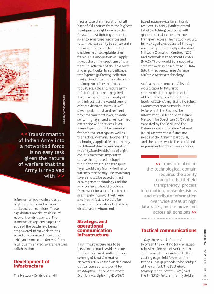
<<Transformation of Indian Army into a networked force
is no easy task given the nature
of warfare that the Army is involved
with >>
Cou
rtes
y: w
ww
.cry
pto
me.
org

GEOI
NTEL
LIGE
NCE
Ju
l – A
ug
2012
26
as a System) programmes are steps in this direction. Apart from soldier systems, there is a need for a cohesive and comprehensive radio philosophy for the Army. This would include entities such as a soldier, platoon, company and battalion level communications. Additionally, communications for higher Headquarters (HQ) such as the brigade, division, corps, strategic radio communications and also communications for the supporting Arms and Services, Armored Fighting Vehicles (AFV), Infantry Combat Vehicles (ICV), airborne and ground-to-air communication have to be included in the overarching philosophy.
Apart from Combat Net Radio (CNR) which is an indispensable component of the war fi ghting machinery, satellite and cellular communications provide a great deal of versatility. The adoption of technologies associated with software defi ned radio, mobile ad-hoc networks; sat-phones and mobile satellite terminals with transponders resident on indigenous satellites; mobile cellular technologies such as LTE, WiMAX, WCDMA, TETRA would be the requirement in the foreseeable future, especially in the tactical domain. Notwithstanding the technologies involved, the fundamental guiding principles behind equipping a soldier remain unchanged, namely, mobility, miniaturisation, bandwidth, Quality of Service (QoS), ease of operation, interoperability, location determination, encryption and scalability.
Tactical Communication System (TCS) for mobile strike formations is another endeavour currently under way. This programme has been categorised as ‘Make’ to promote participation of the Indian industry and has made considerable progress. This system is based largely on broadband radio relay with network nodes, network communication nodes and sectoral
photographs, UAVs, sensors of various types, GPS enabled devices and so on. There would be disparate data sources with multiple and different representation of the same physical objects dictating the need for a robust, accurate and automatic technique to enable full data integration. The information would also have spatial and non-spatial components at different layers to be displayed in a manner to assist decision-making. Data emanating from various sources has to be tagged properly to make access, archiving and discovery simple.
Data inputs from all C4I2SR components to include Battlefi eld Surveillance Systems (BSS), Air Defense Control & Reporting Systems (ADC&R), Artillery
nodes of varied capacity at different echelons would provide the much needed requirements of mobile formations and also assist greatly in indigenisation.
GIS
Geospatial intelligence has revolutionised the way we engage in warfare. The entire ambit of command, control, communication, surveillance, reconnaissance, navigation, targeting, terrain analysis, simulation and logistics and other management functions is contingent on having reliable and accurate GIS. A host of platforms providing geospatial data will abound the battlefi eld to include satellite imagery, aerial

GEOI
NTEL
LIGE
NCE
Ju
l – A
ug
2012
2727
Command and Control Systems (ACCS) et al would be analysed and processed through Command Information and Decision Support Systems (CIDSS) to assist decision making.
Joint operations
For enhancing inter-service synergy, a common communication platform is a pre-requisite. Joint services infrastructure like the NFS and DCN will be the key enablers to usher in the necessary synergy. For joint operations, the availability of a Common Operational Picture (COP) at the tactical, operational and strategic levels is a must. The demand for use of open standards and protocols and a
framework for open integration are aspects being addressed at the inter-service level.
Information security
As we move through the process, it must be remembered that technology is both a catalyst as well as an inhibitor. While we acquire and fi eld newer technologies, where trillions of bytes of data fl ow across the network in seconds, our vulnerabilities have also increased. Security will always remain paramount. Aspects of media bulk encryption, network and application layer security, authorisation and authentication, access control and risk management would all have to be addressed holistically.
Conclusion
In western armies like the US Army or even some of the armies of the NATO countries, there has been a shift in focus post cold war and 9/11 to essentially expeditionary forces, due to emerging asymmetric threats germinating in other countries. In Indian context, the conventional and nuclear threats are consistent and our potential adversaries remain unchanged. Threats of asymmetric warfare are, however, gaining ground. The Indian Armed Forces, therefore, have to possess the capability to fi ght across the entire spectrum of confl ict situations. Those of us who were witness to the Kargil confl ict would recall that it was fought, albeit largely, and where it counted, in the fi rst generation league, in the nature of trench warfare! While this allusion is not intended to detract from our avowed objective of moving towards net-centricity, it should at the same time help to realign our focus to the versatility of operations that the Indian Armed Forces are likely to face.
We today have our forces deployed all across our large border and in the hinterland with sizeable deployment for counter insurgency operations. It is a pan India presence with troops in the border deployed in extremely inhospitable terrain and weather conditions. When we talk of transformation, we must remember this unique character of deployment of our forces and our own threats and challenges.
Lt Gen P Mohapatra (Retd) [email protected]
Cou
rtes
y: h
ttp
://g
reen
reno
vatio
n.fi l
es.w
ord
pre
ss.c
om

Interview
Q. BAE Systems offers a comprehensive range of products to address the requirements of geospatial industry. Can you tell us about them?
BAE Systems is a large global defence and aerospace company and we do offer a range of geospatial products and services. I work at its Geospatial eXploitation Products. We market, develop, sell and support a range of commercial off-the-shelf products – image analysis, geospatial analysis, mapping, photogrammetry, etc.
Talking about our products, our new SOCET GXP product has reached a stage where our SOCET SET customers can transition to SOCET GXP. We have been working on SOCET GXP for almost 10 years. Initially, we concentrated on the demanding tasks of image analysts. However, recently, we have moved on to adding capabilities that would suit the photogrammetrists and the mappers, so that enables them to transition. In addition, we have a new product called GXP Xplorer, which is for cataloguing, search, discovery, processing and report creation. Many users today feel that it takes longer to fi nd data that they want to analyse than to do the actual analysis. Hence, we have developed a product which GE
OINT
ELLI
GENC
E Ju
l – A
ug
2012
28
Dr A. Stewart WalkerProduct Director, BAE Systems, USA
The power ofThe power of extreme analysisextreme analysis<< BAE Systems is promoting GXP Xplorer as a revolutionary data management application that makes it easy to locate, retrieve and share geospatial data across an enterprise. Dr A. Stewart Walker, Product Director, BAE Systems, USA, helps us understand why the company is so excited about the product >>

GXP Xplorer is an off-the-shelf product, catalogues a wide range of fi le types and enables a user to do sophisticated searches. It is server based, which means that it can be accessed from conventional PCs and mobile devices such as iPhones, iPads and Android smartphones
feature extraction where the software can look into a point cloud – it may be from LiDAR or photogrammetry - and extract buildings and trees automatically. GXP Xplorer is an off-the-shelf product, catalogues a wide range of fi le types and enables a user to do sophisticated searches. It is server based, which means that it can be accessed from conventional PCs and mobile devices such as iPhones, iPads and Android smartphones. I would say at the moment, the mobile devices are probably generating the most excitement.
Q. You are also working with the US Army to help soldiers get maps, videos and other information in the battlefi eld. What kind of technology goes into making all this possible, that is, connecting soldiers wherever they are?
The US Army recently procured 50 GXP Xplorer servers to reduce the effort required to search through the enormous holdings of data in various repositories; so that means the combat teams can now use GXP Xplorer to crawl a wide range of data sources and they can catalogue information where it is stored without moving it, and without duplicating it. This is a federated search capability, which means multiple sources can be scanned simultaneously to locate relevant data. Our estimate is that the process could save up to 75 per cent of the time previously required to fi nd data in the legacy systems. The commercial off-the-shelf software, GXP Xplorer, enables the Army to move from their outdated library systems to an interoperable resource.
Q. How do you address the security issue?
We pay the greatest attention to security. We offer our products in two forms - classifi ed and unclassifi ed. The classifi ed form of our products has capabilities for ingesting classifi ed information, perhaps causing classifi ed algorithms to operate on the data. And these capabilities are available to organisations and individuals with the appropriate security credentials. The unclassifi ed GE
OINT
ELLI
GENC
E Ju
l – A
ug
2012
29
catalogues the fi les and enables sophisticated searches to be carried out. Those fi les could be imagery, elevation data, feature data or even unstructured fi les.
Q. You have been credited with having provided a new direction in the development of SOCET GXP and enterprise software products. Your take.
The idea behind SOCET GXP was to develop a single product which can cater to the needs of image analysts, geospatial analysts, photogrammetrists and mappers, so that these customers are able to access the capabilities they require from a single product. SOCET GXP has a single user interface, it is based on the Microsoft Fluent concept, is rather similar on Windows and UNIX. This formula was very successful and liked by image analysts. We now believe that mappers and photogrammetrists can enjoy a similar experience.
We have also put the last pieces of the puzzle in place so that SOCET SET customers can switch over to the SOCET GXP version which is meant for all. The version has some capabilities which I believe are important. It has a sophisticated capability for feature collection and editing including 3D site modelling, it is capable of being able to view the results as a perspective and adds a capability for modelling terrain using triangulated regular networks. Also, there’s an exciting new capability called automatic
Cour
tesy
: BAE
Syste
ms
GXP Xplorer Web interface

versions of the product, on the other hand, are exportable – they are available in various countries throughout the world. We meticulously follow a number of well-defi ned, detailed procedures to ensure that both versions of the product are correctly prepared and correctly distributed. Security does present some special challenges to GXP Xplorer. It is a server-based application, comes with front- and web-access, which means that it has to be subjected to a more rigorous set of certifi cation and accreditation procedures. During the operation of GXP Xplorer, the server security controls protect against unauthorised access at any point of the communication chain. This is in both the versions - classifi ed and the unclassifi ed. So we are using things like Web encryption, certifi cation and authentication techniques to ensure security.
Q. Predictive analysis is emerging as a new tool to deal with threats. BAE Systems too offers a product in this category called Activity-Based Intelligence (ABI) systems. Would you like to brief our readers about it?
I fi nd ABI to be one of the most exciting developments in geospatial intelligence in recent years. Your readers are well aware of the enormous amounts of imagery that are available today without growing constellation of earth-observation satellites. We have both manned and unmanned airborne vehicles capturing quite a remarkable quantity of video. There has also been a trend towards persistent surveillance where some asset is able to dwell for a considerable time over an area of interest, the result is an enormous amount
of data. I think the famous remark made by Lt. Gen. David A. Deptula about ‘swimming in sensors and drowning in data’ is becoming more and more accurate. It is very diffi cult for human beings, in fact, it is impossible to analyse all
this voluminous data. So I think,
what is
30
possible is to try to move from data to activities and look at the activities, for example, it is possible to use software to track people, vehicles, etc. From the imagery, we can see where they are going. On the basis of the information gathered, we can ask questions like ‘is there a pattern, is that pattern unusual in any way, is there a building where a lot of activity is taking place inside or around it, is there anything abnormal,’ and so on? Some of those questions can be answered with relatively simple software, while others need very sophisticated state-of-the-art algorithms. BAE Systems GXP is involved in working in this direction. We believe that both SOCET GXP and GXP Xplorer will be involved in activity based intelligence in the future.
Q. You are also organising a training curriculum to train people in GXP Xplorer v2.0.2 and SOCET GXP v4.0. Can you tell us about it?
Our customers who have upgrade entitlement, that is, maintenance contract on their software, are entitled to free training. We have six training centers around the world, and more are being planned. After installing software, we also offer conventional training. There’s a great deal of new capabilities that both our major releases, GXP Xplorer v2.0.2 and SOCET GXP v4.0. offer, so we re-designed the training to refl ect these changes. The SOCET GXP curriculum, for example, GE
OINT
ELLI
GENC
E Ju
l – A
ug
2012
<< It is very diffi cult for human beings to analyse all the voluminous data.
So, we need to move from data to activities and look
at the activities, for example, it is possible to
use software to track people and vehicles >>

includes a two-day module, which covers the essentials of the product. Then there’s the choice of three-day offerings depending on a customer’s particular interest. For example, there are separate tracks for mapping; image exploitation; photogrammetry and the transition from SOCET SET; and processing of multi-spectral imagery and hyper-spectral imagery.
The GXP Xplorer customers have slightly different needs, so we offer a one-day end-user class and then immediately follow it up with another one-day administrative class. Also, as far as GXP Xplorer is concerned, we have adopted a multi-media approach. We have a number of training videos which are available on our customer portal. In the future, we are looking to build web-content about the product, and this can be accessed from the GXP Xplorer Web interface.
Q. You will soon be organising a roadshow, GXP Roadshow 2012. Can you tell us about it?
For a number of years, we offered various experiences to our customers – we had an annual user conference in the United States and have organised a number of workshops inside the country that we have found were convenient to customers. This year we are having a slightly different formula. We are holding a number of what we might call mini-user conferences in different locations, and collectively we can refer to them as roadshow. In United States, we have planned a number of them - in St. Louis, Missouri, in July; in Washington D.C., in August; and in Tampa, Florida, in autumn. In addition, we are planning two other events, one in Melbourne, Australia, and another in Cambridge, UK. We hope that these conferences will enable us to present the latest features of our products in locations that are convenient to our customers. They provide us a platform where we can hear about the experiences GE
OINT
ELLI
GENC
E Ju
l – A
ug
2012
31
capabilities, and increase our performance. The result is that we get a long list of capabilities. We currently have a module called Visual Coverage Tool which catalogues customers’ holdings. I must mention that we are hoping to replace Visual Coverage Tool by offering higher performance through integration of capabilities of both SOCET GXP and GXP Xplorer.
We have a long list of capabilities that we intend to include in GXP Xplorer, for example, there are many more fi le types that customers expect us to catalogue, more interfaces through repositories that we have to cater to and so on. The list goes on.
One of the things that we are pleased with at the moment, is the way we have been able to integrate with the offerings of partner companies, for example, we have a new connection to Esri ArcGIS for Server Image Extension, we work with Safe Software, TerraGo publisher product, GeoXray from Geosemble Technologies and MarkLogic from MarkLogic Corporation, etc. We feel that by working with these partners we have been able to have a product that brings more to customers. We hope that we will be able to continue that. However, one of the things that we are looking at is a very diffi cult problem of real-time registration of video. We are making some progress with that as well.
of our customers and gather their feedback. This helps us prioritise features for the future.
Q. What is the nature of these mini-conferences? Are they customer-client driven or is it your way of projecting your products and company?
I think it is a mixture of the two. We have found that our customers have reacted very positively to these interactions. These meetings provide them an opportunity to speak to our experts including our software developers, with whom they would not normally be able to meet at other conferences. They feel that we listen to them carefully at these meetings - so it is an information exchange, and also a genuine attempt to collect customers’ reactions and requirements.
Q. Nowadays, customer would want user-friendliness to be built in the product to the extent possible. Any steps taken in that direction?
Yes, indeed. I think when we began work on SOCET GXP, we were aware that the user-interface was becoming quite complex. So when the opportunity came to fuse the product into the Microsoft Fluent environment, we were prepared. We could see the advantages and the fact that it would make the product easier to use. We have also developed user-friendly features in our products which guide an operator, thus eliminating the need to go through the user’s manual or things like that. As far as GXP Xplorer is concerned, we are working to improve the appearance and usability of the user interface.
Q. Anything else that you would like to tell our readers?
We specifi cally deal with the quality of our product. We try to anticipate our customers’ requirements and
<< We currently have a module called Visual Coverage
Tool which catalogues customers’ holdings. We are
hoping to replace the tool by offering higher performance
through integration of capabilities of both SOCET GXP
and GXP Xplorer >>

ince 1994, Defence and Intelligence (D&I) organisations have played an important role in the Open Geospatial Consortium’s
geospatial standards development process. D&I interest in the OGC is a consequence of the fact that almost every aspect of defence and intelligence decision support involves geographic information. Military decisions depend on digital maps, location coordinates from GPS units on vehicles and warfi ghters, and digital imagery from UAVs and satellites. Different types of map data can be combined to create new maps. For example, given elevation, surface geology and hydrology data, geographic information systems can calculate best off-road routes for military vehicles. Time of arrival, visibility, audibility and radio reception over that terrain can also be calculated. Targeting, logistics, aviation, signal intelligence, and human intelligence all depend on location information.
Communicating location information depends on shared standards for software interfaces,
Interoperability
<< Open standards enable integration of geospatial technology with other information technologies, thus facilitating interoperability among defence and intelligence organisations >>
Connectingdefence forces
GEOI
NTEL
LIGE
NCE
Ju
l – A
ug
2012
32
content models, and data encodings. Consensus-derived open standards, such as those from the OGC, have enabled D&I organisations to transition from expensive custom-built solutions that couldn’t connect to other systems without custom interfaces and encodings. Open standards also enable broader competition and they open up markets which brings down the cost and increases innovation. The importance of ‘any system to any system’ communication of location information increases as open standards enable geospatial technologies to integrate with other rapidly advancing information technologies such as smartphones, robots, drones, cloud computing, social networks and sensor webs.
Two of the major D&I organisations committed to open geospatial standards
The NATO C3 Agency supports NATO through the provision of unbiased scientifi c support and common funded acquisition of Consultation, Command, Control,
Communications, Intelligence, Surveillance and Reconnaissance (C4ISR) capabilities. NATO C3’s adoption and implementation of the Core GIS system using open, industry-consensus standards including those of ISO Technical Committee 211 and the Open Geospatial Consortium enables NATO to rapidly mobilise new technologies at reduced cost and risk.
The US Defense Department’s Global Information Grid Enterprise Services (GIG) system depends on open standards. GIG is a very large, high capacity, high-availability; highly secure internet and Web-based global information system for the US and its allies. Department of Defense (DoD) system architects designed the GIG to use open commercial standards including OGC standards, instead of a closed, custom approach because open standards provide lower risk and lower cost interoperability across the broad spectrum of DoD business processes and domains.

Open service interfaces enable cross-community information sharing GEOI
NTEL
LIGE
NCE
Ju
l – A
ug
2012
33
the Defence Geospatial Information Working Group (DGIWG), a multi-national body responsible for geospatial standardisation for the defence organisations of member nations; the US Geospatial Intelligence Standards Working Group (GWG); and the NATO Standardization Agency (responsible for NATO Standardization Agreements or STANAGs). The OGC DIWG is thus an important forum for international standards coordination.
Organisations in many technology and application domains – geospatial semantics, workfl ow, data quality, hydrology, meteorology, security, etc. – share the cost of developing and promoting standards. OGC members recognise and appreciate the fact that cross community interoperability serves communities of many kinds:
user scenarios. Requirements, user scenarios and funding were provided by nine sponsoring organisations. Requirements were addressed by 40 participating technology organisations from 21 countries. The testbed work was divided into activity threads that produced results that would be useful in D&I applications: cross-community interoperability (geosynchronization and geodata bulk transfer); observation fusion (tracking and coverages); and aviation information management.
“Cross Community Interoperability” was an important topic in OWS-8. This involved initialisation of data services (such as those implementing the OGC Web Feature Service (WFS) Interface Standard) in areas where communication is limited or denied. Maintaining and updating data in a cooperative and highly distributed environment, such as a multi-organisation response and recovery effort, was shown to be possible using open standards that combine Geosynchronization with Bulk GeoData Transfer. Semantic mediation techniques were also demonstrated.
Different communities have developed different standards over time, and for this reason a number of DIWG members are also involved in other standards organisations besides the OGC, such as the ISO/TC 211 Geographic information/Geomatics technical committee;
The OGC D&I Domain Working Group
The OGC D&I Domain Working Group (DIWG) is the focus within the OGC for discussions about the D&I community’s business and technical requirements for geospatial interoperability. This working group recommends and provides input into OGC testbed and pilot projects that serve D&I community requirements. Participants in the DIWG typically are involved in the development of a variety of OGC standards of interest to the D&I community.
OGC testbeds, pilot projects and interoperability experiments yield candidate standards and engineering reports that feed into the OGC’s Standards Program Technical Committee working groups. The OGC’s annual OGC Web Services (OWS) testbeds, now in their ninth year with OWS-9, have all addressed D&I geospatial interoperability requirements along with requirements from other domains.
Last year’s OWS-8 Testbed
Last year’s OWS-8 Testbed produced 26 engineering reports (candidate standards and best practices), 43 software components that used one or more of these candidates, and 34 demonstrations conducted live on the network based on
Defence and Intelligence in the OGC Interoperability Program
The OGC Interoperability Program (IP) is a global, hands-on and collaborative prototyping programme that rapidly develops, tests and delivers proven candidate standards. These candidate standards are brought into the OGC’s Standards Program, where they are formalised for public release as OGC standards. IP initiatives include test beds, pilot projects, and interoperability experiments.
Technology user organisations provide requirements and funding for these initiatives to engage technology providers in prototyping and demonstrating candidate standards and best practices.
Since 1998, D&I interoperability requirements have been primary or secondary drivers for many OGC interoperability initiatives.
Planning
Intel
Logistics
Training
HLS
Intelligence
CommunitiesUse Cases
Defence
Civil
City/Country
Private Sector

support for several Single European Sky ATM Research (SESAR) project requirements as well as FAA (US Federal Aviation Administration) Aeronautical Information Management (AIM) and Aircraft Access to SWIM (System Wide Information Management) requirements.
>> Cross-Community Interoperability (CCI): Build on the CCI work accomplished in OWS-8 by increasing interoperability within communities sharing geospatial data, focussing on semantic mediation, query results delivery, data provenance and quality, incorporation of crowd-sourced information and Single Point of Entry Global Gazetteer.
>> Security and Services Interoperability (SSI): Investigate fi ve main activities: Security management, OGC Geography Markup Language (GML) Encoding Standard Application Schema UGAS (UML to GML Application Schema) updates, Web services façade, reference architecture profi ling and bulk data transfer.
>> OWS innovations: Explore topics
GEOI
NTEL
LIGE
NCE
Ju
l – A
ug
2012
34
disciplines and sub-disciplines, professions, domains, sectors, economies, regions, departments and political jurisdictions.
OWS-9
This year’s OWS-9 Testbed Activity builds on the outcomes of prior OGC initiatives and is organised around the following technology ‘threads’ with these goals:
>> Aviation: Develop and demonstrate the use of the Aeronautical Information Exchange Model (AIXM) and the Weather Exchange Model (WXXM) in an OGC Web Services environment, focussing on
that represent new areas of work for the Consortium (such as GPS interoperable message modelling and the packaging of geospatial data and use of OGC services in mobile applications) as well as new approaches to existing technologies to solve new challenges (such as the OGC Web Coverage Service (WCS) work).
>> Compliance & Interoperability Testing & Evaluation (CITE): Develop a suite of capabilities to expand OGC’s compliance programme for the testing, validation and certifi cation of products that implement OGC standard interfaces and encodings. Additional compliance test suites being developed in OWS-9 include: Web Map Service (WMS) 1.3 Interface Standard, Web Feature Service (WFS) 2.0 Interface Standard, Geography Markup Language (GML) 3.2.1 Encoding Standard, OWS Context 1.0 (candidate encoding standard), Sensor Web Enablement (SWE) standards, Web Coverage Service for Earth Observation (WCS-EO) 1.0 Interface Standard, and TEAM (Test, Evaluation,
<< Different communities have developed different standards over time, and
for this reason a number of DIWG members are
also involved in other standards organisations
besides the OGC >>
Below are some of the OGC standards in use by defence and intelligence agencies in the US, UK, Australia, Germany and other countries. In addition to interface and encoding standards, the OGC publishes best practices, discussion papers, white papers and engineering reports.
>> OGC Coordinate Transformation Service Interface Standard. An interface for general positioning, coordinate systems, and coordinate transformations.
>> OGC Web Feature Service Interface Standard. A service interface specifi cation for accepting spatially enabled query requests and responding with GML feature collections.
>> OGC Web Map Service Interface Standard. A widely adopted service interface specifi cation for returning a map image.
>> OGC Styled Layer Descriptor Encoding Standard. An XML encoding specifi cation for associating cartographic symbols with features.
OGC Standards in use
>> OGC Web Coverage Service Interface Standard. A service interface for accepting spatial queries and responding with gridded data that inform the client of values of interest, such as digital elevation models and satellite imagery.
>> OGC Catalog Service Interface Standard. Provides the ability to search on registries of metadata describing resources and discover geospatial data and services.
>> OGC Geography Markup Language Encoding Standard (GML). GML is an XML encoding for the transport and storage of geographic information including both the geometry and properties of geographic features.
>> OGC Sensor Web Enablement (SWE) standards enable developers to make all types of networked sensors, transducers and sensor data repositories discoverable, accessible and useable via the Web or other networks.

And Measurement) engine capabilities.
Current hot topics
In addition to the topics addressed in OWS-9, OGC D&I Domain Working Group members are engaged in other technical standards work in the OGC:
>> Previous GeoSynchronisation
devices, partly through the use of the recently adopted OGC Open GeoSMS Standard. Open GeoSMS enables text messaging, even in low-cost cell phones, to be easily integrated into location service applications such as disaster volunteer support. Developers of Open GeoSMS provide a free, open source software development kit, and
GEOI
NTEL
LIGE
NCE
Ju
l – A
ug
2012
35
lightweight and ‘RESTful’ (using the Representational State Transfer programming model) SWE standards for use in mobile apps, VGI, and machine-to-machine applications.
Standards gaps
While there is an open standards framework, there are still critical interoperability gaps. For example, the level of detail provided in geographic information is not always suffi cient to provide intelligence for operations that go between and inside buildings, operations that require detailed information about building interiors and surfaces and about the close-up details of physical infrastructure such as bridges, airports and ‘pipes and wires.’ The OGC CityGML Encoding Standard for the representation, storage and exchange of virtual 3D city and landscape models meets some requirements, but much work remains - to create building information model (BIM) standards that meet basic needs in defence and intelligence as well as architecture, engineering construction, smart grid, real estate management and fi nance, emergency response, etc. The OGC works actively with other standards organisations to advance vendor-neutral technology standards that will enable the same level of interoperability that is now possible between geospatial information systems of all kinds.
Mark ReichardtPresident and CEO
Open Geospatial Consortium (OGC)
work advanced a candidate ‘GeoSynch’ OGC standard being evaluated by the OGC technical committee. GeoSynch provides an open interface for Web services to deliver current, timely, verifi ed data over the Web in situations where content providers must collaborate with outside entities to collect new data and/or update existing data holdings. A related requirement, also addressed in this candidate standard, is accurate and consistent round-trip transfer of bulk data.
>> The Observation Fusion (Tracking) thread demonstrated, among other things, notifi cation of tracking data using the OASIS WS-Notifi cation specifi cation to track hand-held Android
OGC standards enable fusion of vector data, image data, sensor data and other kinds of location information
the standard is used in various disaster management volunteer communications applications based on Sahana and Ushahidi.
>> OGC Sensor Web Enablement (SWE) standards played an important role in OWS-8. For example, the OGC Sensor Observation Service Interface Standard was shown to be capable of enabling Web access to services that detect objects in full motion video. Objects in one video stream could be identifi ed as the same object captured in another video stream. Some members of the OGC are advancing SWE to provide more comprehensive open standards support for combining full-motion video streams. Others are working to develop
OGC WebServices
(for vectorOperations)
Stered VectorData - GIS Vendor B
Satellite-borneImaging device
AirborneImaging
Device

he sixth edition of annual conference-cum-exhibition, Geointelligence Asia 2012, was held in New
Delhi, India, recently. Prominent defence experts and technocrats from India and abroad attended the conference to discuss the need to build a credible geointelligence infrastructure for defence and internal security. Some of the topics discussed during the two-day event were:
Changing nature of warfare
“Technology is changing the nature of wars,” said Shankar Agrawal, Additional Secretary, Ministry of Defence, Government of India, adding, “Due to advancement
Conference Report
where geoint played an effective role like Op Gerinomo.
Interoperability
Stressing the need to build defence spatial data infrastructure, Lt Gen K Surendra Nath, GOC-in-C, Army Training Command (ARTRAC), said, “There is a need to achieve interoperability among the three services. We need to improve geospatial data and knowledge management capacity.”
“There are too many problems faced by people when there’s no interoperability. Inability to share information, and diffi culty in rapidly mobilising new capabilities are some of the problems,” said Mark Reichardt, President, Open Geospatial Consortium, USA. Talking about the advantages of open standards, he said, “Standards are
GEOI
NTEL
LIGE
NCE
Ju
l – A
ug
2012
36
in IT and migration towards C4ISR (Command, Control, Communications and Computers, Intelligence, Surveillance and Reconnaissance) structures, future wars will be fought on digitised battle zones.” He then explained the importance of geospatial intelligence (geoint) in laying the critical foundation of this warfare, especially in the context of India.
Data sharing
“Lack of a mechanism to share data is a major problem among the agencies involved in counter-insurgency operations. If this problem is resolved, it can improve the capabilities of Forces involved in these operations effectively,” said Lt Gen Anil Chait, GOC-in-C, HQ Central Command, Indian Army. He then presented some examples
renence Report
GeoIntelligence Asia 2012

One can overcome this challenge by processing the data and using metadata based preliminary analysis. He further observed that in today’s world, there is a need to create content that can be used by an end user. Ensuring security of this vital data is also a top priority.
Maritime security
“If we want to prevent the repetition of 26/11 attacks in India, there’s a need to develop solutions for tracking of smaller vessels,”
like parachutes. They work best when they are open.”
Brig AS Nagra (retd), spoke about the importance of seamless collaboration in today’s world. Talking about the impediments in collaborative engagements, he stressed upon the need to develop interoperability capabilities among all the three forces – Indian Army, Indian Air Force and Indian Navy.
Bryn Fosburgh, Sector President, Emerging Economies, Trimble Navigation, USA, raised an interesting point when he said, “Not only data but industries should also be interoperable.”
Multi-intelligence fusion
Derek Ireson, Vice President, Defense & Intelligence Solutions Intergraph, USA, spoke about the need to have multi-intelligence data fusion and described data volume, speed and mobility and social media/ threat as some of the major intelligence challenges before the security agencies.
Big data
Speaking about the importance of data for an effi cient geospatial setup, Dr R Ramachandran, Centre Director, National Technical Research Organisation (NTRO), said that most of the data is unstructured and available in large volumes. Making sense of this data is a challenge.
said SS Yadav, Director Mumbai, Lighthouse and Lightships, Ministry of Shipping, Government of India. He talked about how AIS (Automatic Identifi cation System) is helping track vessels in ocean and spoke in-length about India’s National AIS.
“To augment the Maritime Situational Awareness and Coastal surveillance infrastructure, Centre of Artifi cial Intelligence and Robotics (CAIR) has developed MDA system for Indian Navy. It is also developing Coastal Surveillance and Decision Support System (CSDSS) as part
37
GEOI
NTEL
LIGE
NCE
Ju
l – A
ug
2012

GEOI
NTEL
LIGE
NCE
Ju
l – A
ug
2012
38
of Integrated Coastal Surveillance System (ICSS),” said Vinay Agarwal, Scientist D, CAIR, India. Explaining the role of GIS in these systems, he said, “GIS is a crucial component of any maritime system (MDA and CSDSS) since it enables the user to view the COP, assess the current operational scenario, grasp the situation and quickly act upon it.”
GIS for internal security
“Internal security involves protection of people, infrastructure and economy,” said Richard Sundharam, General Manager – Defence, Esri India, adding, “Data management, planning and analysis, fi eld/ mobile operations and situational awareness are important for internal security.”
Talking about DigitalGlobe’s capability of providing high quality 50-cm satellite imagery to users from its most advanced satellite constellation: World View 2, World View 1 and Quick Bird, V Vasudeva Rao, Technical Sales Manager, DigitalGlobe, India, said, “Such high resolution satellite imagery can play an effective role in border management.”
Challenges
“Defence operational systems cannot be connected on public networks, geospatial data goes beyond imagery and maps and much beyond what’s available in the public domain,” said Col Sunil Mishra, Director – BMS, DGIS, Indian Army. Talking about challenges, he described policy and security
paranoia as major challenges before security establishments. “We are talking about cloud nowadays but we do not have connectivity in combat zones. There’s also a vast disparity in communication infrastructure at HQs and in combat zones,” he said.
M Rajathurai, Technical Manager, Bentley systems, India, said that the modern-day battlefi eld faces new challenges due to evolution of data and technology. Battlefi eld managers therefore look for advanced geospatial technologies
to combat challenges like making latest data available to right people and at the right time.
Narayan Panigarhi, Scientist F, CAIR, India, proposed creation of Indigenous GIS (INDIGIS). “Major challenge in the design of a GIS lies in identifi cation of appropriate algorithms. There are a plethora of well researched algorithms in the fi eld of geodesy, cartography, image processing etc. The challenge is to identify the appropriate algorithm for the spatiotemporal problem
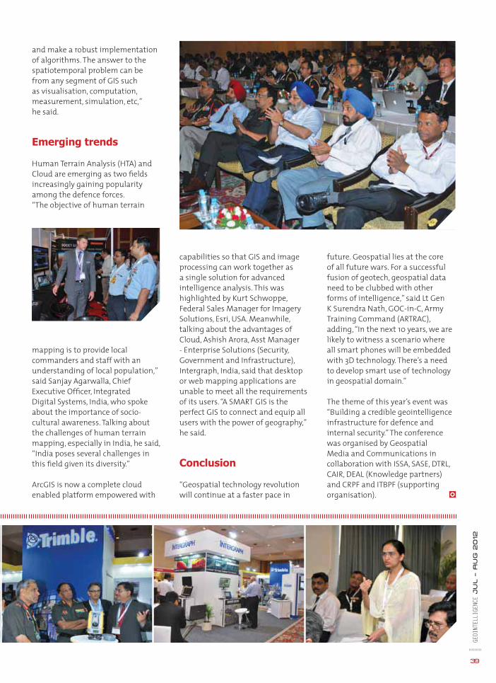
39
GEOI
NTEL
LIGE
NCE
Ju
l – A
ug
2012
capabilities so that GIS and image processing can work together as a single solution for advanced intelligence analysis. This was highlighted by Kurt Schwoppe, Federal Sales Manager for Imagery Solutions, Esri, USA. Meanwhile, talking about the advantages of Cloud, Ashish Arora, Asst Manager - Enterprise Solutions (Security, Government and Infrastructure), Intergraph, India, said that desktop or web mapping applications are unable to meet all the requirements of its users. “A SMART GIS is the perfect GIS to connect and equip all users with the power of geography,” he said.
Conclusion
“Geospatial technology revolution will continue at a faster pace in
and make a robust implementation of algorithms. The answer to the spatiotemporal problem can be from any segment of GIS such as visualisation, computation, measurement, simulation, etc,” he said.
Emerging trends
Human Terrain Analysis (HTA) and Cloud are emerging as two fi elds increasingly gaining popularity among the defence forces. “The objective of human terrain
mapping is to provide local commanders and staff with an understanding of local population,” said Sanjay Agarwalla, Chief Executive Offi cer, Integrated Digital Systems, India, who spoke about the importance of socio-cultural awareness. Talking about the challenges of human terrain mapping, especially in India, he said, “India poses several challenges in this fi eld given its diversity.”
ArcGIS is now a complete cloud enabled platform empowered with
future. Geospatial lies at the core of all future wars. For a successful fusion of geotech, geospatial data need to be clubbed with other forms of intelligence,” said Lt Gen K Surendra Nath, GOC-in-C, Army Training Command (ARTRAC), adding, “In the next 10 years, we are likely to witness a scenario where all smart phones will be embedded with 3D technology. There’s a need to develop smart use of technology in geospatial domain.”
The theme of this year’s event was “Building a credible geointelligence infrastructure for defence and internal security.” The conference was organised by Geospatial Media and Communications in collaboration with ISSA, SASE, DTRL, CAIR, DEAL (Knowledge partners) and CRPF and ITBPF (supporting organisation).

GEOI
NTEL
LIGE
NCE
Ju
l – A
ug
2012
40
JULY
Cyber Defence & Network Security AfricaJuly 16-19Crowne Plaza - The RosebankJohannesburg, South Africawww.cyberdefenceafrica.com
3rd Annual Border Management Summit NorthJuly 23 – 25The W SeattleSeattle, WA, USAwww.bordermanagementsummit.com
Integrated Test and EvaluationJuly 30 - August 1Baltimore, Maryland, USAwww.testingandevaluation.com
Actionable Intelligence Summit: Special Operations EditionJuly 30 - August 1 Washington Marriott Wardman ParkWashington, USAwww.actionableintelsummit.com
AUGUST
AUVSI’s Unmanned Systems North America 2012August 6-9Las Vegas, Nevada,, USAwww.auvsishow.org/auvsi12/public/enter.aspx
Soldier Equipment & Technology Expo & Conference August 6-9
Fort Bragg, North Carolina, USAwww.soldierequipmentexpo.com
GeoIntelligence Latin AmericaAugust 16-17Sul America Convention CentreRio De Janeiro, Brazilhttp://lagf.org/2012/geointelligence/index.htm
Cyber Defense StrategiesAugust 27 – 29New York, USAwww.cyberdefenseconference.com
SEPTEMBER
MSPO 2012September 3-6Kielche, Polandhttp://www.targikielce.pl/index.html?k=mspo_en&s=index
Israel HLS September 11Avenue Conference CenterAirport City, Israelhttp://www.technologies.co.il/beta/en-us/Conference.aspx?Id=49
Military Engineering 2012September 11-12 76 Portland Place, London, UKwww.militaryengineeringevent.com
Soldier Modernisation IndiaSeptember 11-13Sheraton HotelNew Delhi, Indiawww.soldiermodindia.com
Berlin Air ShowSeptember 11-16Berlin ExpoCenter AirportGermanywww.ila-berlin.de/ila2012/home/index_e.cfm
GDI APAC: Geospatial Defence & Intelligence APACSeptember 12-13Bangkok, Thailandwww.geospatialdefenceasia.com
6th Annual Infantry Weapons 2012September 19-20DoubleTree by Hilton Hotel, UKwww.infantryweaponsconf.com
Africa Aerospace & Defence 2012September 19-23City of Tshwane, South Africahttp://www.aadexpo.co.za
Maritime Reconnaissance & Surveillance 2012September 25-27Melia Roma Aurelia AnticaRoma, Italywww.maritimerecon.com
Future Armoured Vehicles September 26-27Crowne PlazaRome, Italyhttp://future-armoured-vehicles.com
OCTOBER
Counter-IED IndiaOctober 3-5 Mumbai, Indiawww.ibcevents.com/events/counter-ied-india
Military Equipment & Technology ExpoOctober 5-6 Washington, USAwww.militaryequipmentexpo.com
Japan Aerospace 2012 October 9-14Nagoya, Japanwww.japanaerospace.jp/english/index.html
9th Global MDA: Coastal Surveillance AsiaOctober 30-31Singapore www.coastalsurveillancemda.com
Events

Image IntelligenceGE
OINT
ELLI
GENC
E Ju
l – A
UG
2012
42
The escalating bloodshed in Syria is threatening to blow into a full-fl edged civil war. There are fears that the uprising, which began in March 2011 and shows no signs of dying down, may also spread to its border countries like Iraq, Turkey or Lebanon, thus further worsening the crisis in the region. Reports of violent crackdown by government are regularly coming from the region. So far, 15,000 people are reported to have lost their lives in the ongoing confl ict. The West, the US and the Arab League have come out strongly against the regime for the atrocities, even imposing sanctions on the country, but the continued support of Russia is preventing the United Nations from imposing sanctions on the country.
Earlier this year, the UN proposed a six-point peace plan for the country. This called for UN-supervised ceasefi re by all parties. Even though Syrian government had agreed to accept the peace plan, the reports of massacres allegedly committed by pro-government forces, speak otherwise.
Image courtesy: DigitalGlobe
The restless Syria
May 25
May 26
Probable burial sites of the victims of a massacre in the Syrian region of Houla
es
rian


www.geospatialworldforum.org
1
2 3 4
5 6
7 8
9 10 11
1213 14 15 16 17 18
119920
2122
23 24 25
22772288
229930
31
272
Monetising Geospatial Value and Practices
Theme
13-16 MAY 201313-16 MAY 2013Beurs - World Trade Center
Rotterdam, The Netherlands
11112222222222222
6666666777777777777777777
8999999999999999999
133333333333333333111111111111111111444444444444444444
11155555555555555555111111111111111111666666666666666666
22