introduction to global positioning system and other geo-technologies lecturer – jun liang office...
TRANSCRIPT

Introduction To Global Introduction To Global Positioning System and Positioning System and other Geo-technologiesother Geo-technologies
Lecturer – Jun LiangLecturer – Jun Liang
Office – 218 SaundersOffice – 218 Saunders

Lecture 1 – Basic ConceptsLecture 1 – Basic Concepts
Location Problem Examples –Location Problem Examples – Point: Point: WhereWhere am I? am I? Tree location; 911 Tree location; 911
calling stations; calling stations; Line: Bike trails; New streets; animal Line: Bike trails; New streets; animal
activities;activities; Polygon: land parcels; buildings; water body; Polygon: land parcels; buildings; water body;
Methods –Methods – Traditional Survey; New technologies – Traditional Survey; New technologies –
Navigation Star.Navigation Star.

NAVSTARNAVSTAR
NAVigation System with Time And NAVigation System with Time And Ranging (Navigation Star”) – A Ranging (Navigation Star”) – A constellation of from 24 to 32 satellites constellation of from 24 to 32 satellites orbiting the Earth, broadcasting data that orbiting the Earth, broadcasting data that allows users on or near the Earth to allows users on or near the Earth to determine their spatial positions. GPS in determine their spatial positions. GPS in USA. Russians – GLONASS.USA. Russians – GLONASS.

Coordinates and ReferencesCoordinates and References
2D – latitude and longitude (actually it is 2D – latitude and longitude (actually it is 3D, since diameter of Earth is not a 3D, since diameter of Earth is not a constant value.)constant value.)
Absolute VS relative coordinatesAbsolute VS relative coordinates References – Sun, Earth, Chapel Hill, References – Sun, Earth, Chapel Hill,
Durham, Saunders Hall, Old Well, Control Durham, Saunders Hall, Old Well, Control points, etc.points, etc.
Recording: 38N, 84.5W; 100 Meters east of Recording: 38N, 84.5W; 100 Meters east of Saunders Hall; 50 Miles West of RaleighSaunders Hall; 50 Miles West of Raleigh

Positions from GPSPositions from GPSAbsolute Positions – could be reset in GPS Absolute Positions – could be reset in GPS receivers.receivers.
Latitude, Longitude => UTMLatitude, Longitude => UTMLatitude, Longitude => SPCLatitude, Longitude => SPC
Advantages of using GPS:Advantages of using GPS: High positioning accuracy, from meters down to the High positioning accuracy, from meters down to the
millimeter levelmillimeter level AvailabilityAvailability Capability of determining velocity and time, to an Capability of determining velocity and time, to an
accuracy commensurate with position.accuracy commensurate with position. Time/VelocityTime/Velocity No inter-station visibilityNo inter-station visibility

Anatomy of the term: “Global Anatomy of the term: “Global Positioning System”Positioning System”
Global: anywhere on Earth, but not:Global: anywhere on Earth, but not: Inside buildingsInside buildings UndergroundUnderground In very heavy tree canopyIn very heavy tree canopy Around strong radio transmissionsAround strong radio transmissions In “urban canyons” amongst tall buildingsIn “urban canyons” amongst tall buildings Near powerful radio transmitter antennasNear powerful radio transmitter antennasOr anywhere else not having a direct view of a Or anywhere else not having a direct view of a
substantial portion of the sky.substantial portion of the sky.

Anatomy of the term: “Global Anatomy of the term: “Global Positioning System” (Cont.)Positioning System” (Cont.)
Positioning –Positioning – Where are you?Where are you? How fast are you moving and in what How fast are you moving and in what
direction?direction? In what direction should you go to get to some In what direction should you go to get to some
other specific locationother specific location How long would it take at your speed to get How long would it take at your speed to get
there?there? Where have you been?Where have you been?

Anatomy of the term: “Global Anatomy of the term: “Global Positioning System” (Cont.)Positioning System” (Cont.)
System: A collection of components with System: A collection of components with connections (links) among them:connections (links) among them: The EarthThe Earth Earth-Circling SatellitesEarth-Circling Satellites Ground-Based StationsGround-Based Stations ReceiversReceivers Receiver ManufacturersReceiver Manufacturers The United States Department of DefenseThe United States Department of Defense UsersUsers


The EarthThe Earth
The mass of the Earth holds the satellites The mass of the Earth holds the satellites in orbit – each satellites is trying to fly by in orbit – each satellites is trying to fly by the Earth at 4KM per second.the Earth at 4KM per second.
The surface of the Earth is studded with The surface of the Earth is studded with little “monuments” – whose coordinates little “monuments” – whose coordinates are known quite accurately, allow us to are known quite accurately, allow us to determine the position of any objects we determine the position of any objects we choose on the surface of the Earth.choose on the surface of the Earth.

Earth-Circling SatellitesEarth-Circling Satellites24-32 solar-powered radio transmitters24-32 solar-powered radio transmitters
Forms a constellations such that several are Forms a constellations such that several are “visible” from any point on Earth at any given “visible” from any point on Earth at any given timetime
First one Feb 22, 1978; Mid-1994 all 24.First one Feb 22, 1978; Mid-1994 all 24.
3/24 are spares3/24 are spares
Block IIR – middle altitude (20,400 Km), below Block IIR – middle altitude (20,400 Km), below geostationary satellites (35,763 Km).geostationary satellites (35,763 Km).


Earth-Circling Satellites (Cont.)Earth-Circling Satellites (Cont.)
NAVSTAR satellitesNAVSTAR satellites
- Neither polar nor equatorial, but slice the Neither polar nor equatorial, but slice the Earth’s latitudes at about 55 degree.Earth’s latitudes at about 55 degree.
- Executing a single revolution every 12 Executing a single revolution every 12 hours.hours.
- There are 6 distinct orbital planes (A, B, C, There are 6 distinct orbital planes (A, B, C, D, E, F) D, E, F)
- There 4 or 5 satellites in each planes.There 4 or 5 satellites in each planes.
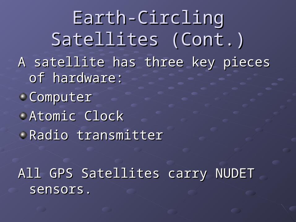
Earth-Circling Satellites (Cont.)Earth-Circling Satellites (Cont.)
A satellite has three key pieces of hardware:A satellite has three key pieces of hardware:
ComputerComputer
Atomic ClockAtomic Clock
Radio transmitterRadio transmitter
All GPS Satellites carry NUDET sensors.All GPS Satellites carry NUDET sensors.

Earth-Circling Satellites (Cont.)Earth-Circling Satellites (Cont.)Speed - 3.87 km/secSpeed - 3.87 km/sec
Weight – 1077 KgWeight – 1077 Kg
Length – 11.6 meterLength – 11.6 meter
Solar panel – 1100 watts (The radio on board Solar panel – 1100 watts (The radio on board uses 40 watts); also has backup battery installed uses 40 watts); also has backup battery installed (solar eclipse)(solar eclipse)
Two Radio channels – L1(1575.42 Mhz) and L2 Two Radio channels – L1(1575.42 Mhz) and L2 (1227.6 MHz)(1227.6 MHz)
Each has 4 atomic clocks. (a billionth of a second)Each has 4 atomic clocks. (a billionth of a second)
Each is worth $65 million and can last 10 years.Each is worth $65 million and can last 10 years.

Ground Based StationsGround Based Stations
GPS Satellites’ tracks are influenced by GPS Satellites’ tracks are influenced by (1)(1) gravitational effects of the moon and sungravitational effects of the moon and sun
(2)(2) Solar windSolar wind
(3)(3) System errorSystem error
Thus both their tracks and innards requires Thus both their tracks and innards requires monitoring.monitoring.
GPS ground stations are used to control GPS GPS ground stations are used to control GPS movements and maintain accurate system movements and maintain accurate system setting (such as removing clock errors.)setting (such as removing clock errors.)

Ground Based Stations (Cont.)Ground Based Stations (Cont.)
There are five ground facility stations:Hawaii, Colorado Springs, Ascension Island, Diego Garcia and Kwajalein.All stations are operated by the US Department of Defense All five stations are Monitor Stations, equipped with GPS receivers to track the satellites. The resultant tracking data is sent to the Master Control Station (MCS).
Ground Based Stations (Cont.)Ground Based Stations (Cont.)
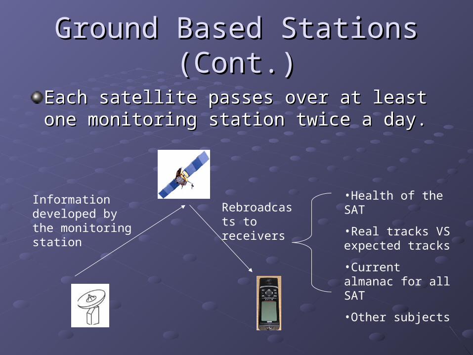
Each satellite passes over at least one Each satellite passes over at least one monitoring station twice a day.monitoring station twice a day.
Information developed by the monitoring station
Rebroadcasts to receivers
•Health of the SAT
•Real tracks VS expected tracks
•Current almanac for all SAT
•Other subjects
Ground Based Stations (Cont.)Ground Based Stations (Cont.)
Almanac – a description of the predicated Almanac – a description of the predicated positions of heavenly bodies. positions of heavenly bodies.
Ephemeris - contains orbital information Ephemeris - contains orbital information that allows the receiver to calculate the that allows the receiver to calculate the position of the satellite.position of the satellite.
Clock information – Coarse Acquisition Clock information – Coarse Acquisition (C/A) code and Precise (P) Code. (C/A) code and Precise (P) Code.

Ground Based Stations (Cont.)Ground Based Stations (Cont.)
Colorado Springs is the MCS, where the tracking data processed in order to compute the satellite ephemerides (or coordinates) and satellite clock error parameters. It is also the station that initiates all operations of the space segment, such as spacecraft maneuvering, signal encryption, satellite clock-keeping, etc.
Three of the stations (Ascension Is., Diego Carcia, and Kwajalein) are Upload Stations through which data is telemetered to the satellites.

ReceiversReceivers
GPS receivers consists ofGPS receivers consists of An antennaAn antenna ElectronicsElectronics A microcomputerA microcomputer Controls (buttons, keys)Controls (buttons, keys) A screenA screen Computer memoryComputer memory RadioRadio Etc.Etc.

Receivers (Cont.)Receivers (Cont.)
GPS units receive two types of data from GPS units receive two types of data from NAVSTAR satellites:NAVSTAR satellites:
AlmanacAlmanac
EphemerisEphemeris
ChannelsChannels
Originally 4-5Originally 4-5
Now most 12- 20Now most 12- 20

Receivers (Cont.)Receivers (Cont.)Garmin
Left – ETREX 12 Channels
Right - GPSMAP60 12 Channels
Trimble
XT, XH handhelds – 12 Channels
MS860™ receiver is a 36-channel L1/L2 RTK GPS receiver

Receivers (Cont.)Receivers (Cont.)
Differential CorrectionsDifferential Corrections
Using the RTCM (Radio Technical Using the RTCM (Radio Technical Commission for Maritime Services) SC-Commission for Maritime Services) SC-104 format input104 format input
Low cost WAAS (Wide Area Augmentation Low cost WAAS (Wide Area Augmentation System) receiverSystem) receiver
From GPS to PC or other devices - using From GPS to PC or other devices - using the NMEA0183 protocol the NMEA0183 protocol

Receivers (Cont.)Receivers (Cont.)
Other protocols – SiRFOther protocols – SiRFSiRF is a brand of microcontroller designed SiRF is a brand of microcontroller designed
to be used with GPS systems.to be used with GPS systems.SiRFstar III – used by Garmin, Tomtom and SiRFstar III – used by Garmin, Tomtom and
Magellan and other GPS manufactures.Magellan and other GPS manufactures. Faster fix timeFaster fix timeHigher signal locking and tracking Higher signal locking and tracking sensitivity sensitivity lower power requirements lower power requirements

Receivers (Cont.)Receivers (Cont.)
Receiver typesReceiver types
Consumer modelsConsumer models
U.S. military/government modelsU.S. military/government models
Mapping/resource modelsMapping/resource models
Survey modelsSurvey models
Commercial transportation modelsCommercial transportation models

Receivers (Cont.)Receivers (Cont.)
Consumer modelsConsumer models
Big three – Garmin (Big three – Garmin (www.garmin.comwww.garmin.com), ), Magellan (Magellan (www.magellangps.comwww.magellangps.com) and ) and Lowrance (Lowrance (www.lowrance.comwww.lowrance.com))
Most are 12-channel parallel receiversMost are 12-channel parallel receivers
Prices are reasonably low – less than Prices are reasonably low – less than $100$100
Location precision is low (15 meter most)Location precision is low (15 meter most)

Receivers (Cont.)Receivers (Cont.)
U.S. military/government modelsU.S. military/government models
Can receive P-code and Y-code (only to Can receive P-code and Y-code (only to the government.)the government.)
Called PLGR (Precision Lightweight GPS Called PLGR (Precision Lightweight GPS Receivers) - http://army-gps.robins.af.mil/Receivers) - http://army-gps.robins.af.mil/
Accuracy – within 4 metersAccuracy – within 4 meters
Light Weight and no need to post Light Weight and no need to post processingprocessing

Receivers (Cont.)Receivers (Cont.)
Mapping/resource modelsMapping/resource models
Data can be input into a GIS applicationData can be input into a GIS application
More precise than consumer models – More precise than consumer models – from submeter to several metersfrom submeter to several meters
More expensive – A Trimble XH handheld More expensive – A Trimble XH handheld costs about $5000, and A XT costs about costs about $5000, and A XT costs about $4000.$4000.
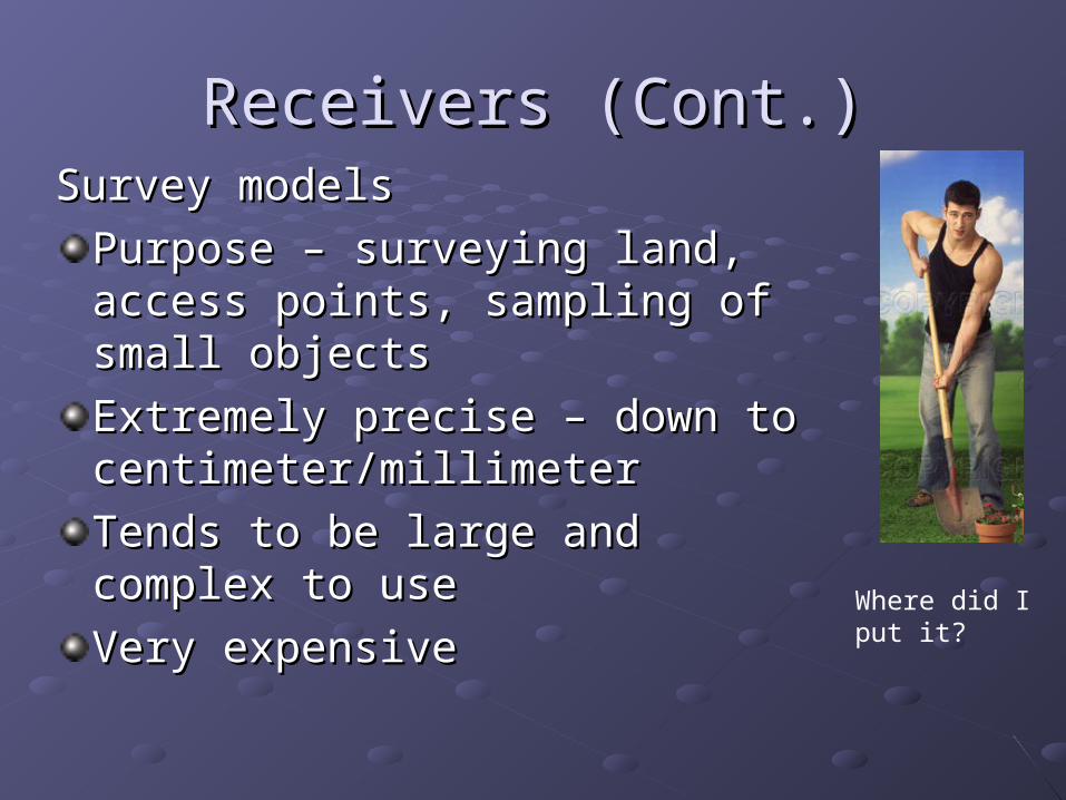
Receivers (Cont.)Receivers (Cont.)Survey modelsSurvey models
Purpose – surveying land, access Purpose – surveying land, access points, sampling of small objectspoints, sampling of small objects
Extremely precise – down to Extremely precise – down to centimeter/millimetercentimeter/millimeter
Tends to be large and complex to Tends to be large and complex to useuse
Very expensiveVery expensiveWhere did I put it?

Receivers (Cont.)Receivers (Cont.)
Commercial transportation modelsCommercial transportation models
These GPS receivers are usually installed in These GPS receivers are usually installed in moving objects (aircraft, ships, cars, moving objects (aircraft, ships, cars, trucks, etc.)trucks, etc.)
Provide navigation supports (Provide navigation supports (where am Iwhere am I type questions; optimizing routes; finding type questions; optimizing routes; finding service facilities etc.)service facilities etc.)
Can send location info to a monitoring Can send location info to a monitoring facility through APRS.facility through APRS.

Manufacturers, DOD and UsersManufacturers, DOD and UsersManufacturers - Manufacturers -
http://gauss.gge.unb.ca/manufact.htmhttp://gauss.gge.unb.ca/manufact.htm
Note: some just manufacture GPS “engine”, Note: some just manufacture GPS “engine”, the other may provide a computer unit.the other may provide a computer unit.
DOD manages GPS satellites and ground DOD manages GPS satellites and ground control units. (SA was turned off by DOD control units. (SA was turned off by DOD on May 2000)on May 2000)
Users – more people than ever are using Users – more people than ever are using GPS, it will become as popular as MP3.GPS, it will become as popular as MP3.

Other positioning systemsOther positioning systems
GalileoGalileo
EU and USA agreed on March 2002 to introduce EU and USA agreed on March 2002 to introduce their own alternative to GPS, called Galileo. their own alternative to GPS, called Galileo.
The first satellite was actually launched on 28 The first satellite was actually launched on 28 December 2005. December 2005.
The receivers will be able to combine the signals The receivers will be able to combine the signals from 30 Galileo and 28 GPS satellites to greatly from 30 Galileo and 28 GPS satellites to greatly increase the accuracy.increase the accuracy.
The System will be working from 2010.The System will be working from 2010.

Other positioning systemsOther positioning systems
GLONASSGLONASS
It is operated for the Russian government.It is operated for the Russian government.
The first test SATs were launched in 1982The first test SATs were launched in 1982
44 were launched by 199144 were launched by 1991
The constellation was not completed until The constellation was not completed until December 1995December 1995
Only eight SATs in operation in April 2002 Only eight SATs in operation in April 2002