intracoastal waterway lake wimico to east bay waterway lake wimico to east bay . ... vessels should...
TRANSCRIPT
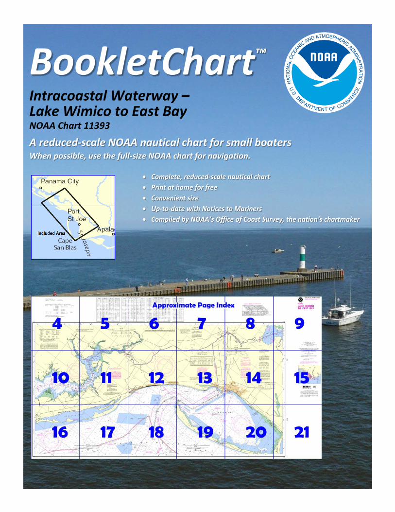
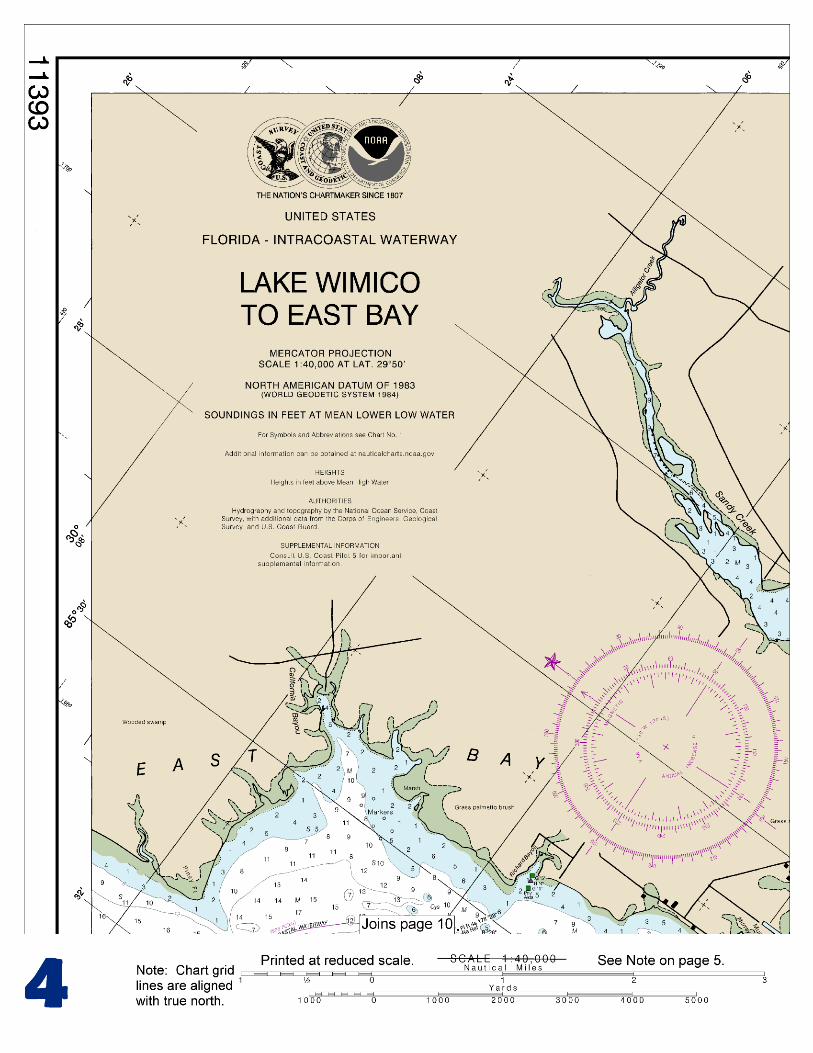
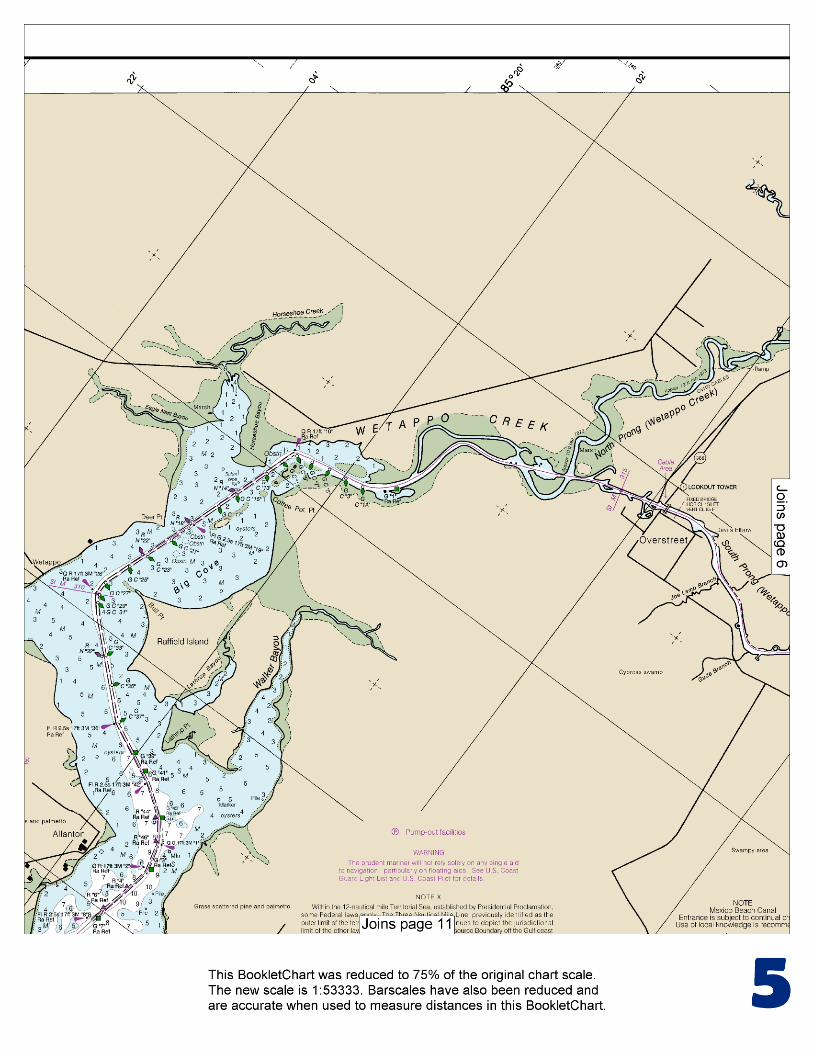
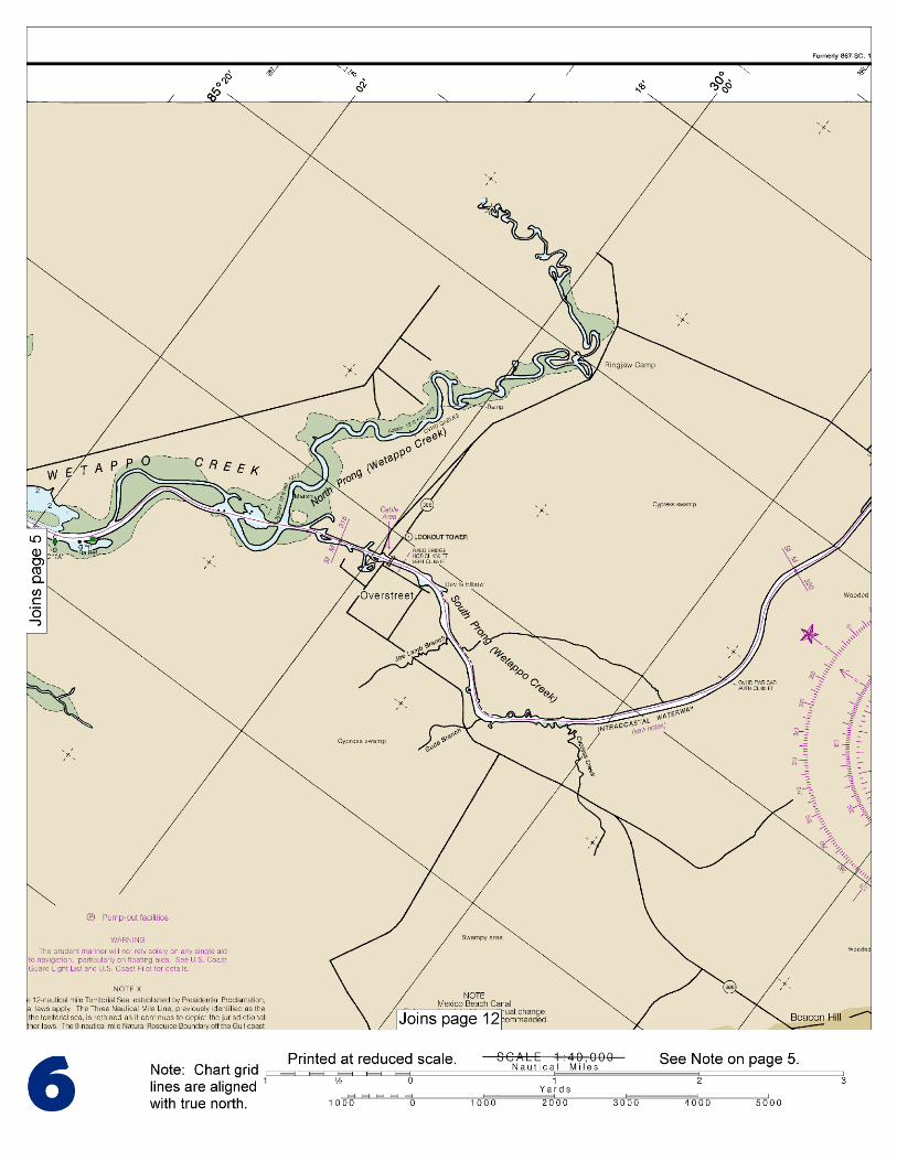
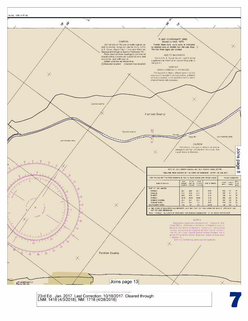
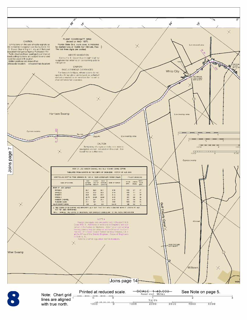
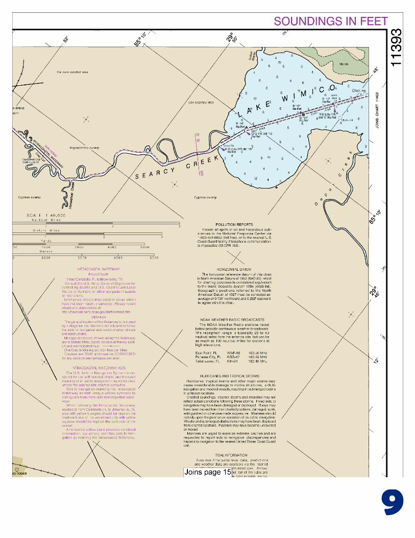
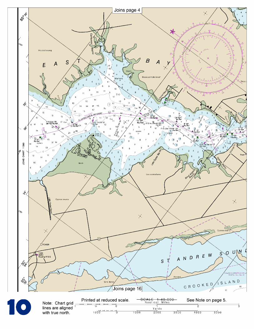
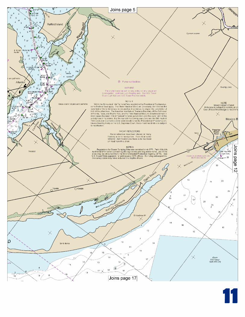
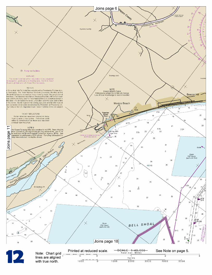
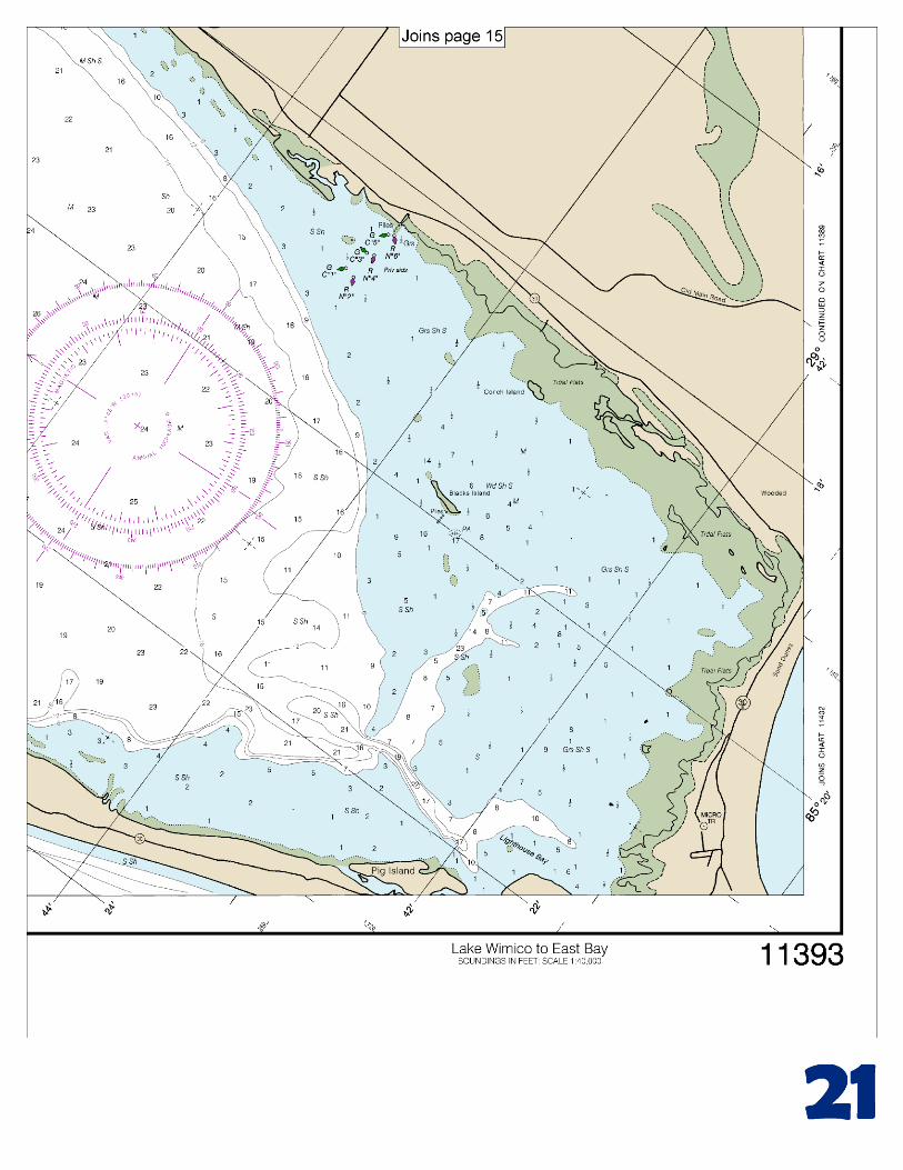
BookletChart™ Intracoastal Waterway – Lake Wimico to East Bay NOAA Chart 11393
A reduced-scale NOAA nautical chart for small boaters When possible, use the full-size NOAA chart for navigation.
2
Published by the National Oceanic and Atmospheric Administration
National Ocean Service Office of Coast Survey
www.NauticalCharts.NOAA.gov 888-990-NOAA
What are Nautical Charts?
Nautical charts are a fundamental tool of marine navigation. They show water depths, obstructions, buoys, other aids to navigation, and much more. The information is shown in a way that promotes safe and efficient navigation. Chart carriage is mandatory on the commercial ships that carry America’s commerce. They are also used on every Navy and Coast Guard ship, fishing and passenger vessels, and are widely carried by recreational boaters.
What is a BookletChart?
This BookletChart is made to help recreational boaters locate themselves on the water. It has been reduced in scale for convenience, but otherwise contains all the information of the full-scale nautical chart. The bar scales have also been reduced, and are accurate when used to measure distances in this BookletChart. See the Note at the bottom of page 5 for the reduction in scale applied to this chart.
Whenever possible, use the official, full scale NOAA nautical chart for navigation. Nautical chart sales agents are listed on the Internet at http://www.NauticalCharts.NOAA.gov.
This BookletChart does NOT fulfill chart carriage requirements for regulated commercial vessels under Titles 33 and 44 of the Code of Federal Regulations.
Notice to Mariners Correction Status
This BookletChart has been updated for chart corrections published in the U.S. Coast Guard Local Notice to Mariners, the National Geospatial Intelligence Agency Weekly Notice to Mariners, and, where applicable, the Canadian Coast Guard Notice to Mariners. Additional chart corrections have been made by NOAA in advance of their publication in a Notice to Mariners. The last Notices to Mariners applied to this chart are listed in the Note at the bottom of page 7. Coast Pilot excerpts are not being corrected.
For latest Coast Pilot excerpt visit the Office of Coast Survey website at http://www.nauticalcharts.noaa.gov/nsd/searchbychart.php?chart=11393
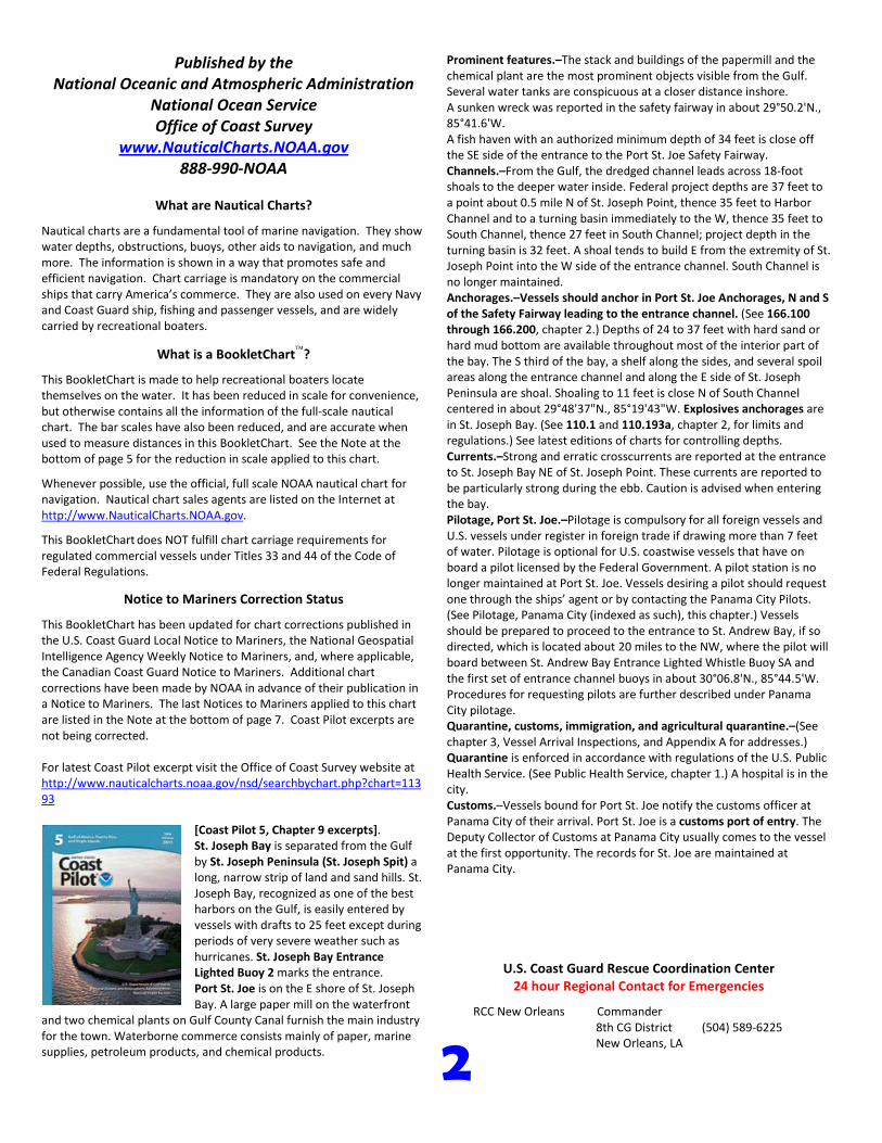
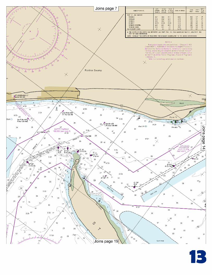
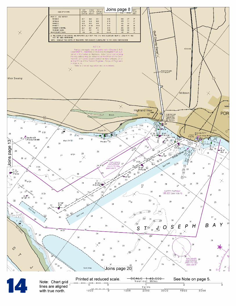
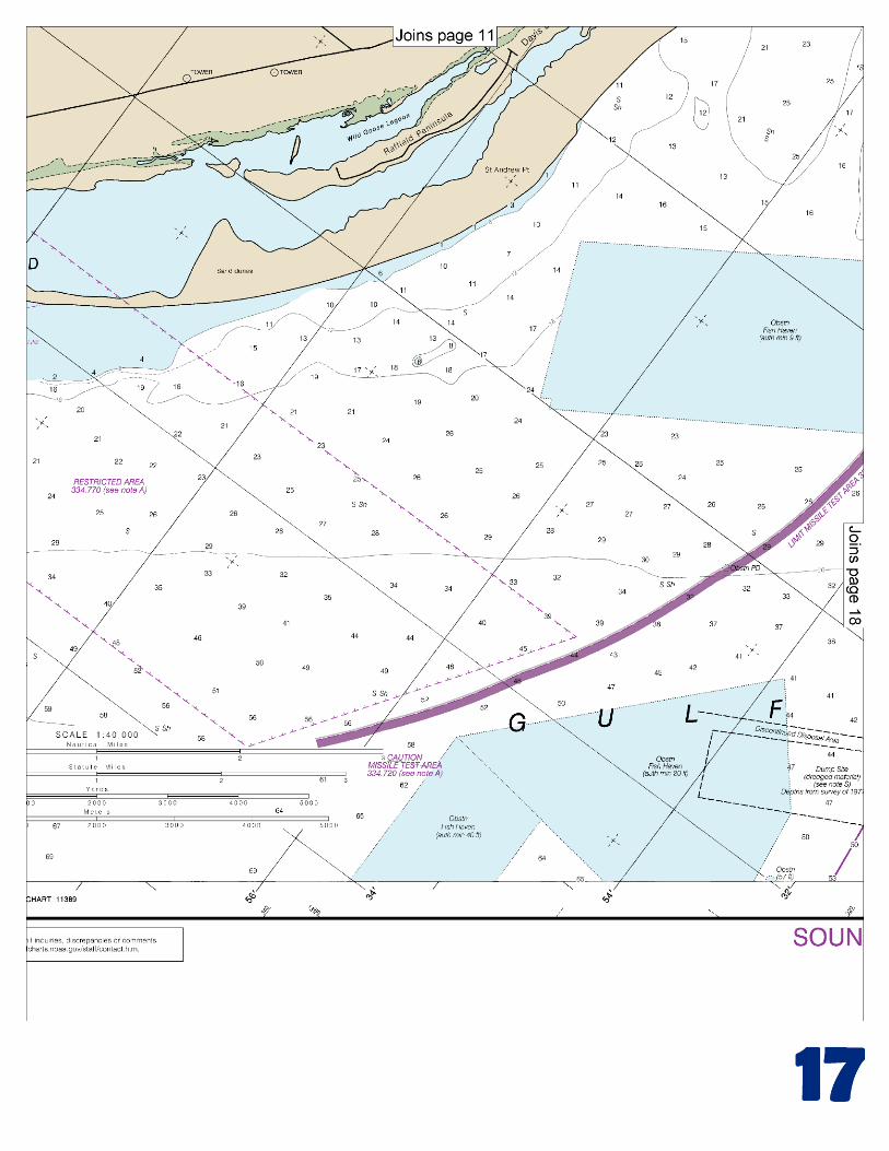
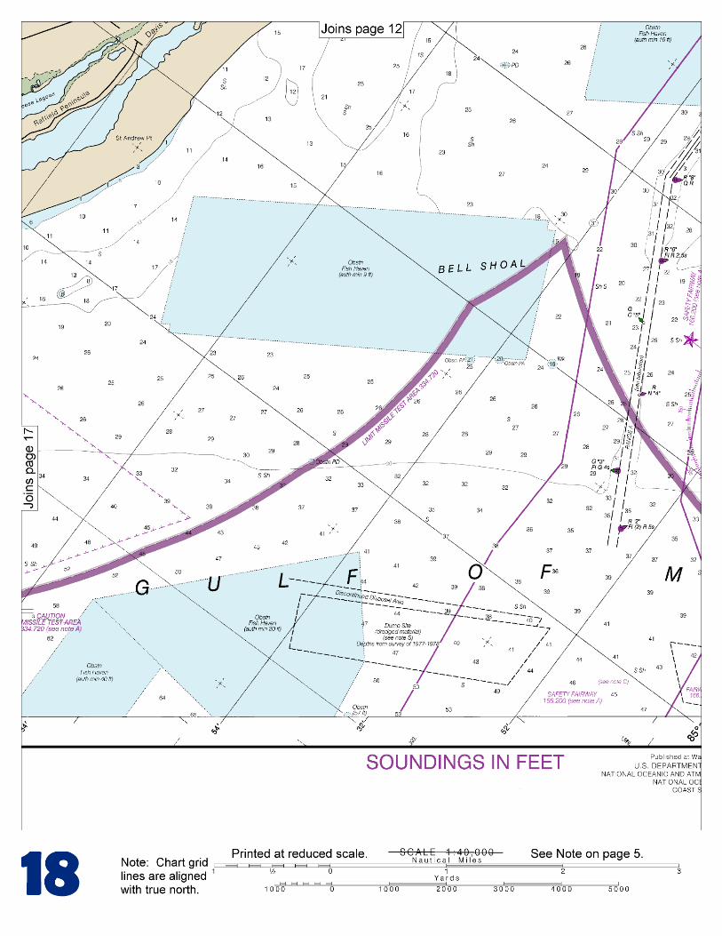
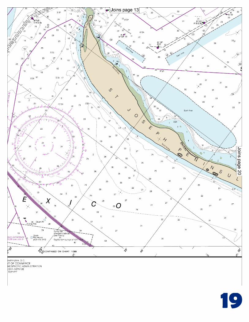
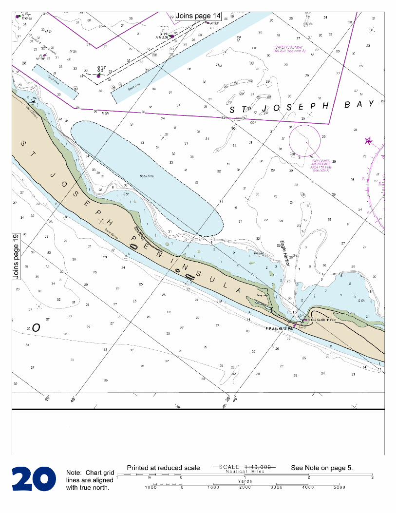
[Coast Pilot 5, Chapter 9 excerpts]. St. Joseph Bay is separated from the Gulf by St. Joseph Peninsula (St. Joseph Spit) a long, narrow strip of land and sand hills. St. Joseph Bay, recognized as one of the best harbors on the Gulf, is easily entered by vessels with drafts to 25 feet except during periods of very severe weather such as hurricanes. St. Joseph Bay Entrance Lighted Buoy 2 marks the entrance. Port St. Joe is on the E shore of St. Joseph Bay. A large paper mill on the waterfront
and two chemical plants on Gulf County Canal furnish the main industry for the town. Waterborne commerce consists mainly of paper, marine supplies, petroleum products, and chemical products.
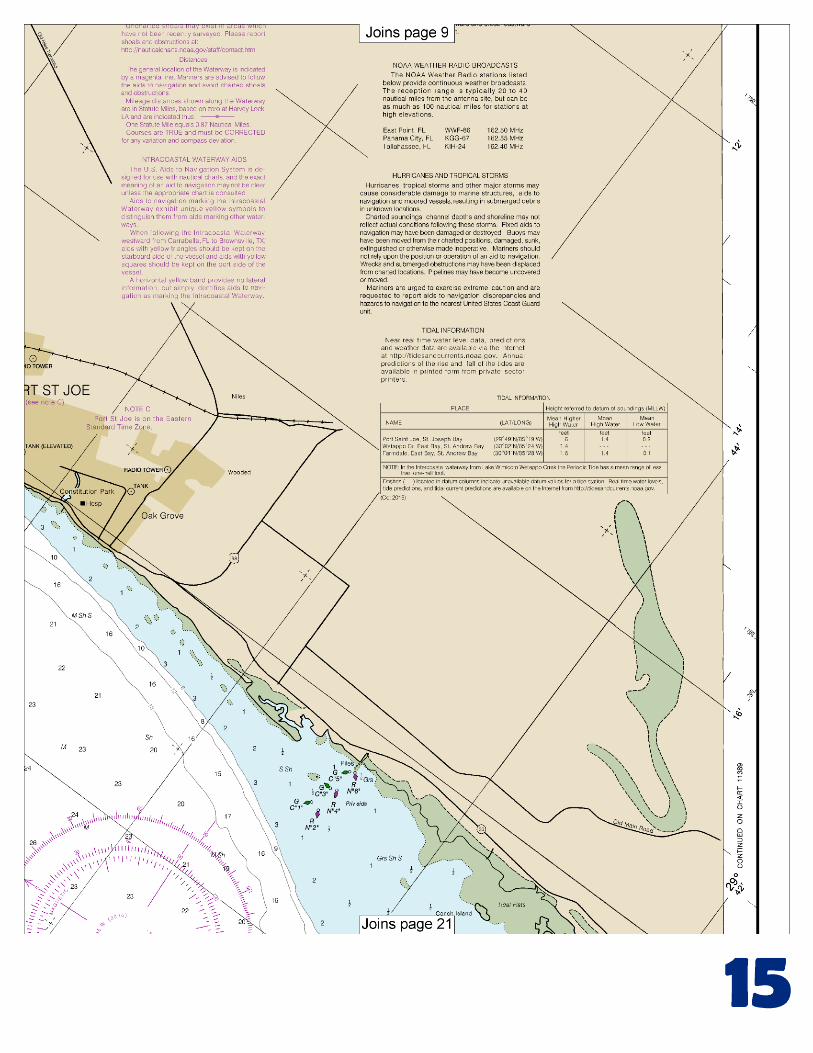
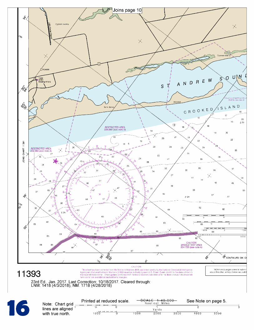
Prominent features.–The stack and buildings of the papermill and the chemical plant are the most prominent objects visible from the Gulf. Several water tanks are conspicuous at a closer distance inshore. A sunken wreck was reported in the safety fairway in about 29°50.2'N., 85°41.6'W. A fish haven with an authorized minimum depth of 34 feet is close off the SE side of the entrance to the Port St. Joe Safety Fairway. Channels.–From the Gulf, the dredged channel leads across 18-foot shoals to the deeper water inside. Federal project depths are 37 feet to a point about 0.5 mile N of St. Joseph Point, thence 35 feet to Harbor Channel and to a turning basin immediately to the W, thence 35 feet to South Channel, thence 27 feet in South Channel; project depth in the turning basin is 32 feet. A shoal tends to build E from the extremity of St. Joseph Point into the W side of the entrance channel. South Channel is no longer maintained. Anchorages.–Vessels should anchor in Port St. Joe Anchorages, N and S of the Safety Fairway leading to the entrance channel. (See 166.100 through 166.200, chapter 2.) Depths of 24 to 37 feet with hard sand or hard mud bottom are available throughout most of the interior part of the bay. The S third of the bay, a shelf along the sides, and several spoil areas along the entrance channel and along the E side of St. Joseph Peninsula are shoal. Shoaling to 11 feet is close N of South Channel centered in about 29°48'37"N., 85°19'43"W. Explosives anchorages are in St. Joseph Bay. (See 110.1 and 110.193a, chapter 2, for limits and regulations.) See latest editions of charts for controlling depths. Currents.–Strong and erratic crosscurrents are reported at the entrance to St. Joseph Bay NE of St. Joseph Point. These currents are reported to be particularly strong during the ebb. Caution is advised when entering the bay. Pilotage, Port St. Joe.–Pilotage is compulsory for all foreign vessels and U.S. vessels under register in foreign trade if drawing more than 7 feet of water. Pilotage is optional for U.S. coastwise vessels that have on board a pilot licensed by the Federal Government. A pilot station is no longer maintained at Port St. Joe. Vessels desiring a pilot should request one through the ships’ agent or by contacting the Panama City Pilots. (See Pilotage, Panama City (indexed as such), this chapter.) Vessels should be prepared to proceed to the entrance to St. Andrew Bay, if so directed, which is located about 20 miles to the NW, where the pilot will board between St. Andrew Bay Entrance Lighted Whistle Buoy SA and the first set of entrance channel buoys in about 30°06.8'N., 85°44.5'W. Procedures for requesting pilots are further described under Panama City pilotage. Quarantine, customs, immigration, and agricultural quarantine.–(See chapter 3, Vessel Arrival Inspections, and Appendix A for addresses.) Quarantine is enforced in accordance with regulations of the U.S. Public Health Service. (See Public Health Service, chapter 1.) A hospital is in the city. Customs.–Vessels bound for Port St. Joe notify the customs officer at Panama City of their arrival. Port St. Joe is a customs port of entry. The Deputy Collector of Customs at Panama City usually comes to the vessel at the first opportunity. The records for St. Joe are maintained at Panama City.
U.S. Coast Guard Rescue Coordination Center 24 hour Regional Contact for Emergencies
RCC New Orleans Commander 8th CG District (504) 589-6225 New Orleans, LA
G
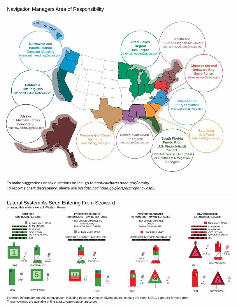
NOAA’s navigation managers serve as ambassadors to the maritime community. They help identify navigational challenges facing professional and recreational mariners, and provide NOAA resources and information for safe navigation. For additional information, please visit nauticalcharts.noaa.gov/service/navmanagers
To make suggestions or ask questions online, go to nauticalcharts.noaa.gov/inquiry. To report a chart discrepancy, please use ocsdata.ncd.noaa.gov/idrs/discrepancy.aspx.
Lateral System As Seen Entering From Seaward on navigable waters except Western Rivers
PORT SIDE
ODD NUMBERED AIDS
GREEN LIGHT ONLY
FLASHING (2)
PREFERRED CHANNEL
NO NUMBERS – MAY BE LETTERED
PREFERRED CHANNEL TO
STARBOARD
TOPMOST BAND GREEN
PREFERRED CHANNEL
NO NUMBERS – MAY BE LETTERED
PREFERRED CHANNEL
TO PORT
TOPMOST BAND RED
STARBOARD SIDE
EVEN NUMBERED AIDS
RED LIGHT ONLY
FLASHING (2)
FLASHING FLASHING
OCCULTING GREEN LIGHT ONLY RED LIGHT ONLY OCCULTING QUICK FLASHING QUICK FLASHING
ISO COMPOSITE GROUP FLASHING (2+1) COMPOSITE GROUP FLASHING (2+1) ISO
"1"
Fl G 6s
G "9"
Fl G 4s
GR "A"
Fl (2+1) G 6s
RG "B"
Fl (2+1) R 6s
"2"
Fl R 6s
8
R "8"
Fl R 4s
LIGHT
G
C "1"
LIGHTED BUOY
G
"5"
GR
"U"
GR
C "S"
RG
N "C"
RG
"G"
LIGHT
6
R
N "6"
LIGHTED BUOY
R
"2
"
CAN DAYBEACON
CAN NUN NUN
DAYBEACON
For more information on aids to navigation, including those on Western Rivers, please consult the latest USCG Light List for your area.
These volumes are available online at http://www.navcen.uscg.gov
Navigation Managers Area of Responsibility
Northeast
Lt. Meghan McGovern
Northwest and
Pacific Islands
Crescent Moegling
Great Lakes Region
Tom Loeper
Chesapeake and
Delaware Bay
Steve Soherr
California
Jeff Ferguson
[email protected] Mid-Atlantic
Lt. Ryan Wartick
Alaska
Lt. Timothy M. Smith
Western Gulf Coast
Alan Bunn
Central Gulf Coast
Tim Osborn
[email protected] South Florida
Puerto Rico
U.S. Virgin Islands
Michael Henderson
Southeast
Kyle Ward
2
2 C U 5
1
VHF Marine Radio channels for use on the waterways:Channel 6 – Inter-ship safety communications.Channel 9 – Communications between boats and ship-to-coast.Channel 13 – Navigation purposes at bridges, locks, and harbors.Channel 16 – Emergency, distress and safety calls to Coast Guard and others, and to initiate calls to other
vessels. Contact the other vessel, agree to another channel, and then switch.Channel 22A – Calls between the Coast Guard and the public. Severe weather warnings, hazards to navigation and safety warnings are broadcast here.Channels 68, 69, 71, 72 and 78A – Recreational boat channels.
Getting and Giving Help — Signal other boaters using visual distress signals (flares, orange flag, lights, arm signals); whistles; horns; and on your VHF radio. You are required by law to help boaters in trouble. Respond to distress signals, but do not endanger yourself.
EMERGENCY INFORMATION
Distress Call Procedures
• Make sure radio is on.• Select Channel 16.• Press/Hold the transmit button.• Clearly say: “MAYDAY, MAYDAY, MAYDAY.”• Also give: Vessel Name and/or Description;Position and/or Location; Nature of Emergency; Number of People on Board.• Release transmit button.• Wait for 10 seconds — If no responseRepeat MAYDAY call.
HAVE ALL PERSONS PUT ON LIFE JACKETS!
This Booklet chart has been designed for duplex printing (printed on front and back of one sheet). If a duplex option is not available on your printer, you may print each sheet and arrange them back-to-back to allow for the proper layout when viewing.
QR
Quick ReferencesNautical chart related products and information - http://www.nauticalcharts.noaa.gov
Interactive chart catalog - http://www.charts.noaa.gov/InteractiveCatalog/nrnc.shtmlReport a chart discrepancy - http://ocsdata.ncd.noaa.gov/idrs/discrepancy.aspx
Chart and chart related inquiries and comments - http://ocsdata.ncd.noaa.gov/idrs/inquiry.aspx?frompage=ContactUs
Chart updates (LNM and NM corrections) - http://www.nauticalcharts.noaa.gov/mcd/updates/LNM_NM.html
Coast Pilot online - http://www.nauticalcharts.noaa.gov/nsd/cpdownload.htm
Tides and Currents - http://tidesandcurrents.noaa.gov
Marine Forecasts - http://www.nws.noaa.gov/om/marine/home.htm
National Data Buoy Center - http://www.ndbc.noaa.gov/
NowCoast web portal for coastal conditions - http://www.nowcoast.noaa.gov/
National Weather Service - http://www.weather.gov/
National Hurrican Center - http://www.nhc.noaa.gov/
Pacific Tsunami Warning Center - http://ptwc.weather.gov/
Contact Us - http://www.nauticalcharts.noaa.gov/staff/contact.htm
NOAA’s Office of Coast Survey The Nation’s Chartmaker
For the latest news from Coast Survey, follow @NOAAcharts
NOAA Weather Radio All Hazards (NWR) is a nationwide network of radio stations broadcasting continuous weather information directly from the nearest National Weather Service office. NWR broadcasts official Weather Service warnings, watches, forecasts and other hazard information 24 hours a day, 7 days a week. http://www.nws.noaa.gov/nwr/