intelec geomatics cgdi target vision and implementation plan vision and implementation strategy...
TRANSCRIPT

Intelec Geomatics
CGDI Target Vision and Implementation Plan
Vision and Implementation Strategy
Presentation
June 14, 2000

CGDI Target Vision and Implementation Plan 2Intelec Geomatics
Agenda
CGDI Vision/GoalsStakeholders InfrastructurePrinciples -Values and Challenges-RisksVision Components
Institutional VisionData VisionService VisionTechnology Vision
Implementation StrategyConclusion

CGDI Target Vision and Implementation Plan 3Intelec Geomatics
Canadian Geospatial Data Infrastructure Vision
To enable timely access to geo-info data holdings and services in support of policy, decision-making and economic development through a co-operative interconnected infrastructure of government, private sector and academia participants.

CGDI Target Vision and Implementation Plan 4Intelec Geomatics
Canadian Geospatial Data Infrastructure Vision
INTERNETAccess - Delivery
Geospatial Users
Geospatial Data and ServiceProviders
APPLICATIONS
Enabling Technologies

CGDI Target Vision and Implementation Plan 5Intelec Geomatics
Canadian Geospatial Data Infrastructure Vision
Guidelines
Accessibility :Anytime, Anywhere, Anybody Anyhowor ATAWABAH (Ottawa…Bah)
Cost-effective (ROI)

CGDI Target Vision and Implementation Plan 6Intelec Geomatics
CGDI Goals
Put Canada’s geographic information on the InternetObjectives:
Build on current investments in DataBuild on current investments in systemsLeverage technology from all sectors Improve accessibility to all users

CGDI Target Vision and Implementation Plan 7Intelec Geomatics
Canadian Geospatial Data Infrastructure Additional goals
As a network of networks, it will be the product of many public and private sector services and partnerships
It should be open and accessible, yet assure sufficient confidentiality and privacy for a variety of usages including the information need of the public
It should be an agent of change It should foster the development of globally
competitive Canadian technologies and services It should have positive measurable economic, social
and environment impacts

CGDI Target Vision and Implementation Plan 8Intelec Geomatics
Agenda
CGDI Vision/GoalsStakeholders InfrastructurePrinciples -Values and Challenges-RisksVision Components
Institutional VisionData VisionService VisionTechnology Vision
Implementation StrategyConclusion

CGDI Target Vision and Implementation Plan 9Intelec Geomatics
Internet
User community
Spatial Data providers/suppliers
data
Clearinghouse
Service providers
$$
Stakeholders

CGDI Target Vision and Implementation Plan 10Intelec Geomatics
Stakeholder Interests
User CommunityNeed access to spatial data that meets their purposes at
minimal cost & inconvenience
Data Providers (suppliers)Need some revenue to support their investment in data
collection
Data ClearinghouseProvide a data sourcing / packaging service (brokers)
Service Providers Provide value added products and spatially enabled
business solutions to the user community

CGDI Target Vision and Implementation Plan 11Intelec Geomatics
Stakeholder Interests
Applications are the key to CGDIApplications provide the benefitsApplications provide the links to corporate data basesApplications provide the links to regional/national
data bases and infrastructuresApplications on the web will be more common and
sometimes be used to replace stand alone GIS

CGDI Target Vision and Implementation PlanIntelec Geomatics
Stakeholders points of view
User Community Data ProvidersService ProvidersApplications DevelopersTechnology Vendors

CGDI Target Vision and Implementation Plan 13Intelec Geomatics
User Community
Mass market potential – private individualsUsing spatial data for routine functions
such as driving, locating services, recreation etc.
Traditional user community is expanded to includeGeneral publicSmall to medium size businessesCorporations and government agencies
Enhanced usage of spatial data for many business functions

CGDI Target Vision and Implementation Plan 14Intelec Geomatics
User Data
Internet
Spatial data providers
Spatial Data
Metadata, Thesaurii
Corporate data
Other data sources
Foundation softwareApplication software
Client community
User Community Point of view

CGDI Target Vision and Implementation Plan 15Intelec Geomatics
Framework Data Spatial Data Products
Metadata catalogue
Metadata standards
Spatial Data Standards
Internet
Client Community
Data Providers Point of view

CGDI Target Vision and Implementation Plan 16Intelec Geomatics
Related Stakeholders
Internet provides the operating vehicle IT community provides the software and hardwareTelcos & related companies provide the pipe Standards organizations provide standards

CGDI Target Vision and Implementation Plan 17Intelec Geomatics
Agenda
CGDI Vision/GoalsStakeholders InfrastructurePrinciples -Values and Challenges-RisksVision Components
Institutional VisionData VisionService VisionTechnology Vision
Implementation StrategyConclusion

CGDI Target Vision and Implementation Plan 18Intelec Geomatics
Information Infrastructure
Information infrastructures are based on:Computing & Communications NetworksAssociated information resourcesRegulations and standards governing use & access
Are embedded, transparent and invisibleEmbedded in other structures, social arrangements and
technologiesTransparent in that people take its reliability for granted Is most visible when it fails
Allows interconnection in standardized ways

CGDI Target Vision and Implementation Plan 19Intelec Geomatics
Spatial Data Infrastructure
The incentives Internet is growing rapidlyNetwork capacity is increasingGPS more accessibleAdditional data such as high resolution imagery, other R/S
products availableLow cost user friendly more powerful Hardware/SoftwareAccess to useful applications expandingWireless communication systems becoming commonplace Increased awareness of spatial data

CGDI Target Vision and Implementation Plan 20Intelec Geomatics
Spatial Data Infrastructure Links
Peer InfrastructuresGlobal, Provincial geospatial infrastructuresBiodiversity, Sustainable Communities, Geological, Marine,
Other countries, etc.
Other infrastructuresexisting ones: transportation, water, sewernew ones: health Infrastructure, Learning, Real Estate,
Schoolnet, Governement Online
Part (perspective) of overall Information Infrastructures

CGDI Target Vision and Implementation Plan 21Intelec Geomatics
Spatial Data Infrastructure Links
Client 1 Client 2 Client 3
Local network
Catalog and data holding
Client 1 Client 2 Client 3
Local network
InternetCEONet
Peer Infrastructures(EMAN, Provincial, FGDC Clearinghouse …)
CGDI Portal
Catalog, data and service holding
Data Producer Data Supplier
Other views

CGDI Target Vision and Implementation Plan 22Intelec Geomatics
Spatial Data Infrastructure Components
Institutional frameworkLegal aspects (IP, Freedom of access, Confidentiality, etc.)Responsibilities, policies, structures, standards
DataExisting repositories, transactional, earth observation
systems, etc.
Services Web GIS, spatially enabled business solutions, traditional
GIS applications, Ecommerce, OLAP
TechnologiesGeomatics, IT, Internet, and telecommunications

CGDI Target Vision and Implementation Plan 23Intelec Geomatics
Agenda
CGDI Vision/GoalsStakeholders InfrastructurePrinciples -Values and Challenges-RisksVision Components
Institutional VisionData VisionService VisionTechnology Vision
Implementation StrategyConclusion

CGDI Target Vision and Implementation Plan 24Intelec Geomatics
Principles and values
EvolutionSustainabilityPreserve culturePreserve rightsEconomic GrowthEnvironment qualitySocial ProgressQuality of life

CGDI Target Vision and Implementation Plan 25Intelec Geomatics
Challenges-risks
InstitutionalCopyrightsLiabilityPrivacyLeadershipManagement framework (concensus)Responsibilities, including public and private sectorsGood understanding of CGDI at all levelsUsers from various sectors (human factors)Agreement regarding standards, semanticsResources

CGDI Target Vision and Implementation Plan 26Intelec Geomatics
Challenges-risks
DataRelevant data availability (the essence of CGDI)Framework data underfunded, restricted, costlyContent priorities are not well definedData Sources unknownData Sources will evolve without CGDI Integration is difficultLegacy data not suitable for technologiesData collection is costly Fees for data distributionToo many standards

CGDI Target Vision and Implementation Plan 27Intelec Geomatics
Access/query dataFind what data exist where
Interactive exploration of dataAutomatic detection of patterns
Advanced analysisCreate new outputs
ServiceDigital Library, Portal
Geo-DLData Infra, DBMS
Geo-DI, Spatial ViewerDBMS, EIS
Spatial ViewerReport-Query Builder
Low-end GIS
OLAP“ Spatial OLAP ”
Statistical Package
Data Mining“ Spatial Data Mining “
High-end GIS
Tec
hn
ical
Com
ple
xity
in
stit
uti
onal
TYPICAL
USER-DRIVEN TOOLS
MA
RK
ET
PE
NE
TR
AT
ION
Challenges-risks
Use pre-built outputs
ServicesSelecting priorities for services Integration with other infrastructuresServices are for high end users

CGDI Target Vision and Implementation Plan 28Intelec Geomatics
Challenges-risks
TechnologyMost technology components will evolve without CGDICGDI should help Canadian geomatics technologies
developmentSpeed is the essenceStandards not following technologiesKey technology developments will be integrated by software
developers

CGDI Target Vision and Implementation Plan 29Intelec Geomatics
Agenda
CGDI Vision/GoalsStakeholders InfrastructurePrinciples -Values and Challenges-RisksVision Components
Institutional VisionData VisionService VisionTechnology Vision
Implementation StrategyConclusion

CGDI Target Vision and Implementation Plan 30Intelec Geomatics
Vision perspective
What is short term, medium term and long termWhere were we in? (looking backward):
1998: Pentium II, Oracle, Object Oriented Development, Web development tools
1995: Pentium 90, Oracle, Internet Email, beginning of Netscape, beginning of Desktop GIS
1990: 486-33, Oracle, Compuserve or AOL for Email, no Web, GIS on minis
CGDI Target Vision and Implementation Plan 31Intelec Geomatics
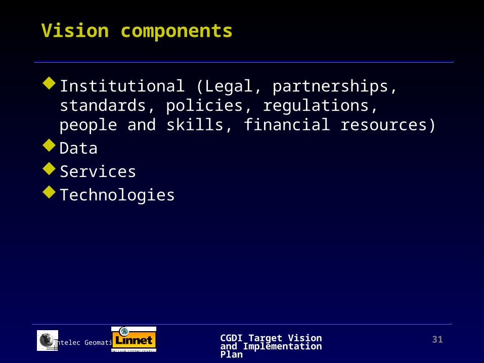
Vision components
Institutional (Legal, partnerships, standards, policies, regulations, people and skills, financial resources)
DataServicesTechnologies

CGDI Target Vision and Implementation Plan 32Intelec Geomatics
Agenda
CGDI Vision/GoalsStakeholders InfrastructurePrinciples -Values and Challenges-RisksVision Components
Institutional VisionData VisionService VisionTechnology Vision
Implementation StrategyConclusion

CGDI Target Vision and Implementation Plan 33Intelec Geomatics
Institutional VisionLegal framework
Short TermNo change to legislationClarification of Copyright issueClarification of Access to information issueClarification of socio-economic value of geospatial data
Medium TermFrom Copyright to Property (legal aspect is corrected)Framework data is free from copyrights and can be re-usedLiability clauses are standardized

CGDI Target Vision and Implementation Plan 34Intelec Geomatics
Institutional VisionPartnerships
Short TermNRCan assumes leadershipGeoConnection Secretariat mandate clarified (more power)NRCan departments adopt common policiesOther Agencies are invited on a voluntary basis (Federal
agencies, Provinces, Territories)Local level is ignored except for showcasePrivate Sector participates as a business opportunityDocumentation of data is fundedRecipes, tools and expertise provided to connect to CGDI

CGDI Target Vision and Implementation Plan 35Intelec Geomatics
Institutional VisionPartnerships
Medium TermStatistics Canada-Elections Canada as framework data for
economic, health and social sectorsRecipes, tools and expertise provided for peer infrastructures
to connect to CGDIProvincial Agencies participate actively Agencies that follow rules get funded (participation in
Clearinghouse)Provincial Agencies (or other) assume leadership for part of
CGDI (framework data)Public Agencies provide data and services (including tools) as
required by their mandate and extent these data and services to all Canadians
Private Sector addresses additional markets

CGDI Target Vision and Implementation Plan 36Intelec Geomatics
Institutional VisionStandards
Data and servicesShort Term
De Facto standards (Windows)American standards (FGDC) Consortium StandardsOpen Source Standards (LINUX)
Medium TermTools for standardsOpen GIS ISO/CT211 ISO/JTC1

CGDI Target Vision and Implementation Plan 37Intelec Geomatics
Institutional VisionPolicies, regulations, resources, etc.
Medium TermCGDI is branded (regognized)Policies of Federal Agencies are similarUser will pay for services not dataPrivate Industry will extend use of CGDI (marketing)Users are spatially aware and do not regognize the
difference between spatial and non spatialSkilled personnel is availableCabinet approves additional fundingCGDI funded based on Canada economic interests (fiscal
incentives based on impact on GNP), in the US IT accounts for 8% of GNP but accounts for 35% of growth

CGDI Target Vision and Implementation Plan 38Intelec Geomatics
Agenda
CGDI Vision/GoalsStakeholders InfrastructurePrinciples -Values and Challenges-RisksVision Components
Institutional Vision
Data VisionService VisionTechnology Vision
Implementation StrategyConclusion
CGDI Target Vision and Implementation Plan 39Intelec Geomatics
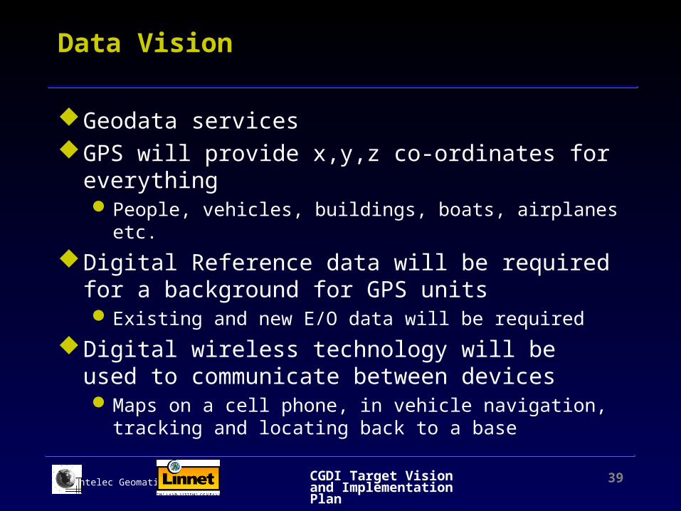
Data Vision
Geodata servicesGPS will provide x,y,z co-ordinates for everything
People, vehicles, buildings, boats, airplanes etc.
Digital Reference data will be required for a background for GPS unitsExisting and new E/O data will be required
Digital wireless technology will be used to communicate between devicesMaps on a cell phone, in vehicle navigation, tracking and
locating back to a base

CGDI Target Vision and Implementation Plan 40Intelec Geomatics
Data Vision
Short TermFramework data identified and prioritizedFramework data enhanced (Data Alignment Layer)Subset of framework data available freeSimplified versions of framework and legacy data provided
in raster formatSome framework data sets integratedSome restructuring of framework and legacy data required
to meet market demandAccess to legacy data (library of data sets through
metadata), in particular all framework data from NRCan

CGDI Target Vision and Implementation Plan 41Intelec Geomatics
Data Vision
Medium TermPriorities on data content and structureFrom data sets to information (continuum of information)Metadata management integrated with information instead of
data sets Information customized Integrated data providedAdditional data sources, in particular satellite imagery Enhanced updatesEnhanced quality and compatibility
CGDI Target Vision and Implementation Plan 42Intelec Geomatics
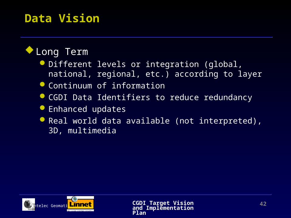
Data Vision
Long TermDifferent levels or integration (global, national, regional, etc.)
according to layer Continuum of informationCGDI Data Identifiers to reduce redundancyEnhanced updatesReal world data available (not interpreted), 3D, multimedia

CGDI Target Vision and Implementation Plan 43Intelec Geomatics
Agenda
CGDI Vision/GoalsStakeholders InfrastructurePrinciples -Values and Challenges-RisksVision Components
Institutional VisionData Vision
Service VisionTechnology Vision
Implementation StrategyConclusion

CGDI Target Vision and Implementation Plan 44Intelec Geomatics
Service Vision
Various levels of interoperability Geo-Processing services
CollectionManagementAccess (discover, browse, evaluate, retrieve)DeliveryUtilisationAgregationOffering garanties on data quality, etc.
Common, shared and specific servicesOptimal usage of CGDI through services and
applications

CGDI Target Vision and Implementation Plan 45Intelec Geomatics
Service Vision
Resource management Marine navigation & charting Business planning &
operations Traffic & transportation Tourism Etc.
Public Safety & Disaster management
Public health Emergency response Property transactions Environmental assessment
Potential Applications

CGDI Target Vision and Implementation Plan 46Intelec Geomatics
Service Vision
Short TermCommon services to discover, browse, access and retrieve
data (ecommerce?)Shared services and tools to connect data and services
Medium TermServices for peer infrastructures and applicationsUser Profiles (portal based services)Better integration with Web servicesNew infrastructure services (data agregation, data conversion,
quality evaluation, etc.)Application specific services (health, marine, etc.)
Long TermApplications integrated to CGDI

CGDI Target Vision and Implementation Plan 47Intelec Geomatics
Agenda
CGDI Vision/GoalsStakeholders InfrastructurePrinciples -Values and Challenges-RisksVision Components
Institutional VisionData VisionService Vision
Technology Vision Implementation StrategyConclusion

CGDI Target Vision and Implementation Plan 48Intelec Geomatics
Technology Vision
3 Tier environment working inDistributed secured network (CA3)Not specific to geospatialWireless Integrated with other delivery mechanisms

CGDI Target Vision and Implementation Plan 49Intelec Geomatics
User Interface
Layer #1
Applications
Data and File Management
Layer #2
Layer #3
Data access : ODBC, JDBC, SQL, OGDi, GDI
Applications Access : COM, CORBA, HTTP
Net
wo
rk-W
eb
(Sec
uri
ty/p
erfo
rman
ce)
Technology VisionComponents

CGDI Target Vision and Implementation Plan 50Intelec Geomatics
Data and File Management
Short TermSpatial data are stored in files and DBMSSpatial data is Web enabled (Image Maps)Symbology is stored in files with geometryFile Format are proprietary
Medium TermData bases maintain spatial data (Oracle SDC, Spatial DB2,
Informix Blades)Web Enabled data ( XML or GML)Data Management Tools are integrated (backup, import,
long transactions, redundancy)Raster Data integrated (orthophotos or satellite imagery)
CGDI Target Vision and Implementation Plan 51Intelec Geomatics
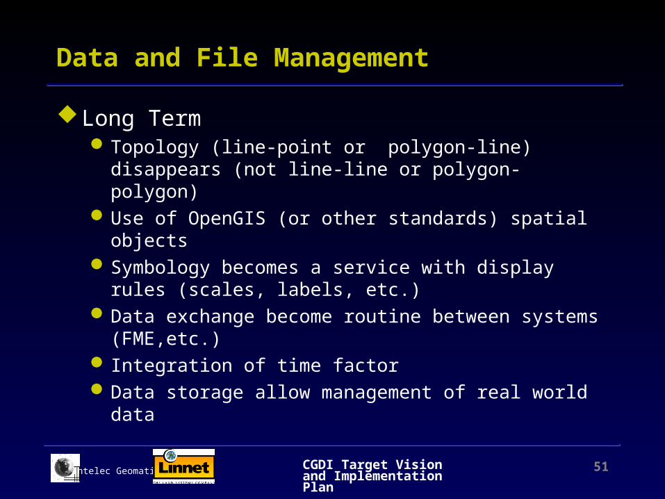
Data and File Management
Long TermTopology (line-point or polygon-line) disappears (not line-
line or polygon-polygon)Use of OpenGIS (or other standards) spatial objectsSymbology becomes a service with display rules (scales,
labels, etc.)Data exchange become routine between systems (FME,etc.) Integration of time factorData storage allow management of real world data

CGDI Target Vision and Implementation Plan 52Intelec Geomatics
Access to Data
Short TermSpatial Data accessed by Operating System (files) and SQL
or ODBC (DBMS)Spatial Data are accessed through hyperlinks
Medium TermSpatial Data are accessed via SQL and its extensions, or via
object oriented interfaces (OGDI, GDI)Use of SQL-MM

CGDI Target Vision and Implementation Plan 53Intelec Geomatics
Applications
Short TermTools and proprietary development languages (Macro)Function calls using proprietary API
Medium TermApplications become services using open API Integration with geospatial data Integration with Internet Integration with mobile peripherals (cell phones, PDA)Object Oriented Development and Software ComponentStandard developement tools (Visual Basic, Visual C++,
JAVA)Applications Servers under Windows

CGDI Target Vision and Implementation Plan 54Intelec Geomatics
Access to applications
Short TermAccess via OSAccess via HTTP
Medium TermXML to exchange data between applicationsApplications/services in COM ou CORBATransactions monitorRedundancy

CGDI Target Vision and Implementation Plan 55Intelec Geomatics
User Interface
Short term Interface Unix, Windows Interface Web
Medium Term Interface with transparent access to the Web Interface for mobile peripherals Integration of geospatial data (generalisation, projections) Integration of geomatics in Office suites
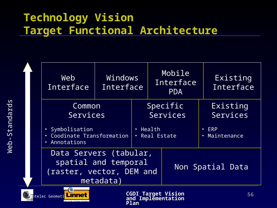
CGDI Target Vision and Implementation Plan 56Intelec Geomatics
Data Servers (tabular, spatial and temporal
(raster, vector, DEM and metadata)
CommonServices
• Symbolisation • Coodinate Transformation• Annotations
Specific Services
• Health • Real Estate
Existing Services
• ERP• Maintenance
Non Spatial Data
WebInterface
Windows Interface
Mobile Interface
PDA
Existing Interface
Web
-Sta
ndar
dsTechnology VisionTarget Functional Architecture

CGDI Target Vision and Implementation Plan 57Intelec Geomatics
Agenda
CGDI Vision/GoalsStakeholders InfrastructurePrinciples -Values and Challenges-RisksVision Components
Institutional VisionData VisionService VisionTechnology Vision
Implementation StrategyConclusion

CGDI Target Vision and Implementation Plan 58Intelec Geomatics
FrameworkData
BasicFunctions and
services
AdvancedFunctions and
services
C O M P L E X I T Y
Increasing TechnologicalComplexity
Increasing InstitutionalComplexity
Requirements to achieve full integration
Evolution of efforts
Filled requirements
Unfulfilled requirements
1996 2000 2010 2002
Implementation StrategyEvolution of efforts to meet requirements
CGDI Target Vision and Implementation Plan 59Intelec Geomatics
Implementation StrategyShort Term (2 years)
Institutional Clarify legal aspectsNRCan assumes leadership and adopt common policies Invite and fund other Agencies to connect to CGDIUse de-facto standards, in particular for metadata and
thesauri (keywords)Educate users, suppliers and politicians about CGDI
DataDefine Framework data and make it freely available Connect legacy data to CGDIRestructure some data sets to meet market requirements

CGDI Target Vision and Implementation Plan 60Intelec Geomatics
Implementation StrategyShort Term (2 years)
ServicesDefine priority for servicesDefine common and shared services (discover, access,
catalogs, etc.)Develop and implement high priority common servicesProvide shared services and toolkits
TechnologyFund technology development for data and services Identify key technology drivers

CGDI Target Vision and Implementation Plan 61Intelec Geomatics
Implementation StrategyMedium Term (5 years)
Institutional Modify legal framework, if necessary Invite Agencies that provide framework data Invite and fund other Agencies to connect to CGDIUse adopted standardsObtain additional funding for CGDI based on economic
benefits
Data Integrate framework dataAdd new data sourcesTransform data sets into data bases

CGDI Target Vision and Implementation Plan 62Intelec Geomatics
Implementation StrategyMedium Term (5 years)
ServicesUpdate priority of services Improve integration with web services (portals, discovery) Implement medium priority common servicesProvide services for Peer infrastructures
TechnologyFund technology development for data and services Identify key technology drivers Upgrade to CA3

CGDI Target Vision and Implementation Plan 63Intelec Geomatics
Implementation StrategyLong Term (10 years)
Institutional Increase partnerships (local levels)
DataAdd new data sourcesTransform data sets into data basesProvide different levels of data integration Implement CGDI identifiers

CGDI Target Vision and Implementation Plan 64Intelec Geomatics
Implementation StrategyLong Term (10 years)
ServicesUpdate priority of services Implement low priority common servicesProvide services for Applications
TechnologyFund technology development for data and services Identify key technology drivers

CGDI Target Vision and Implementation Plan 65Intelec Geomatics
Implications for CGDI
Time is criticalMaintenance costs of infrastructure will increase, in
particular content (data and services) as it is getting built
Success will be measured by benefits deliveredResults Based Management is essential If we do it right, major investments should follow in
five (5) years
CGDI Target Vision and Implementation Plan 66Intelec Geomatics
Conclusion
Will there be a CGDI?Only if we eliminate duplication and overlap (?) If framework data are readily available If there is an appealing level of content If spatial technologies are embedded & transparent If legal framework favours CGDI If institutional framework favours CGDI If the economic benefits are proven If the user-base is expanded
Who will build it?

CGDI Target Vision and Implementation Plan 67Intelec Geomatics
What ’s next?
Conceptual Architecture Implementation PlanFinal Report