instability enhancement of a winter storm 20 november · pdf fileinstability enhancement of a...
TRANSCRIPT

Instability Enhancement of a Winter Storm 20 November 2003
Ron Miller, WFO Spokane WA
Introduction
An often overlooked ingredient in winter storm forecasting is stability. While instability is a major component of warm season forecasting, it is often underestimated or completely ignored in the wintertime. An understanding of the stability and its effect on the large-scale lift is important to a good winter storm forecast. This becomes especially true when determining snow ratios.
Discussion
On the 19th of November 2003, a strong cold front passed through the Pacific Northwest. In its wake the region was under a cold upper trough (Fig 1).
Figure 1. 500mb height, wind and vorticity 20Nov2003 12Z
However, surface temperatures will still fairly mild with daytime readings in the upper 20s and lower 30s. The result was a post frontal atmosphere that was very unstable, with 500mb temperatures around -35 C (Fig 2).

Figure 2. GFS Model Sounding at Spokane 21Nov2003 00Z
A cold air cyclogenesis event took place just off the Washington coast as a minor short wave ejected from the long wave trough. On satellite IR imagery, the minor wave does not look very impressive at 1345Z (Fig 3).
Figure 3. IR Satellite Image 20Nov2003 1345Z
GFS model forecasts showed the accompanying surface low deepening in response to the developing short wave, tracking it across Washington and into northern Idaho and western Montana (Fig 4). The Eta model showed a similar
idea, but with the surface low moving eastward along the Washington/Oregon border.
Figure 4. GFS MSLP and Precipitation Forecast valid 21Nov2003 00Z
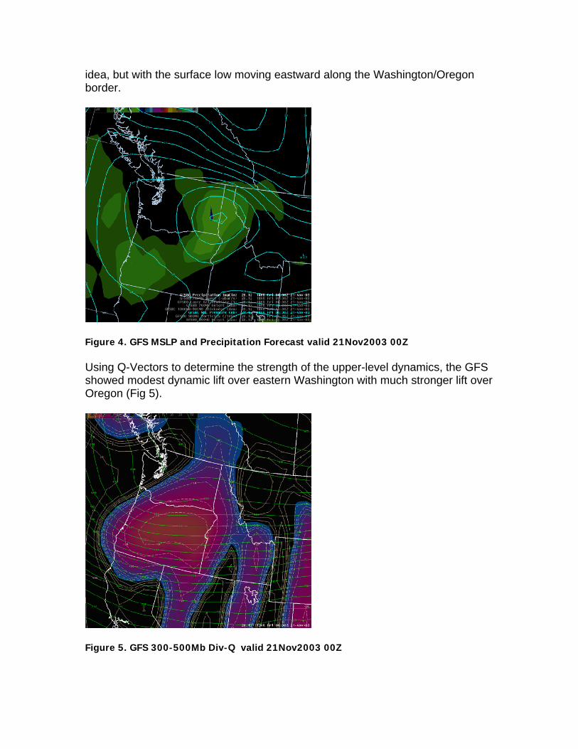
Using Q-Vectors to determine the strength of the upper-level dynamics, the GFS showed modest dynamic lift over eastern Washington with much stronger lift over Oregon (Fig 5).
Figure 5. GFS 300-500Mb Div-Q valid 21Nov2003 00Z

But the low-level convergence (shown by the 850mb level) was very strong (Fig 6). This is a fairly uncommon event for the Inland Northwest as surface lows typically either stay offshore or move onshore in southern British Columbia.
Figure 6. GFS 850mb Convergence valid 21Nov2003 00Z
The key ingredient, though, was the instability. Steep lapse rates, 7.8 degs C/km from 850-500mb, enhanced the synoptic scale lift and resulted in impressive QPF and snow-liquid ratios. The heaviest snowfall was confined to a rather small area (Fig 7). Snow-liquid ratios were generally on the order of 12:1, but in the region of heaviest precipitation the snow-liquid ratios were closer to 20:1. Note that the models, which typically over predict precipitation, significantly under predicted the 0.66” of liquid that was observed.

Figure 7. Snow Totals between 20Nov2003 22Z and 21Nov2003 08Z
Summary
A very unstable post-frontal atmosphere enhanced the snowfall from a minor short wave disturbance. The strong low-level convergence from the developing low coupled with the steep lapse rates produced impressive snowfall rates and amounts. While the event lasted only 6-8 hours, 7-12” of snow was common across the Spokane/Coeur d’Alene metro area.