information technology exchange meeting a new decade in support of science silence is golden…....
TRANSCRIPT
Information Technology Exchange Meeting
A New Decade in Support of Science
Silence is Golden….
This is an atmosphere for learning - so please make EVERY effort to minimize distractions by observing the following rules: Silence cell phones/BlackBerries/SmartPhones. If you must take a call – step out of the room.
Quietly return to your seat when finished. During the presentation, laptops or messaging
devices should only be used in case of emergency.
Thank you!

U.S. Department of the InteriorU.S. Geological Survey
Information Technology Exchange MeetingMay 24 – 28, 2010
A New Decade in Support of Science
Open-source technologies for geospatial web services

Information Technology Exchange Meeting
A New Decade in Support of Science
Ingredients
• Mapserver• http://mapserver.osgeo.org
• PostgreSQL• http://www.postgresql.org
• PostGIS• http://www.postgis.org
• GEOS• http://trac.osgeo.org/geos/
• PROJ• http://trac.osgeo.org/proj/

Information Technology Exchange Meeting
A New Decade in Support of Science
Loading data into PostgreSQL
createdb sgmccreatelang plpgsql sgmcpsql –d sgmc –f postgis.sqlpsql –d sgmc –f spatial_ref_sys.sql
shp2pgsql –s 4326 –I cogeolp cogeolp >cogeolp.sqlpsql –d sgmc –f cogeolp.sql >out 2>err
Information Technology Exchange Meeting
A New Decade in Support of Science
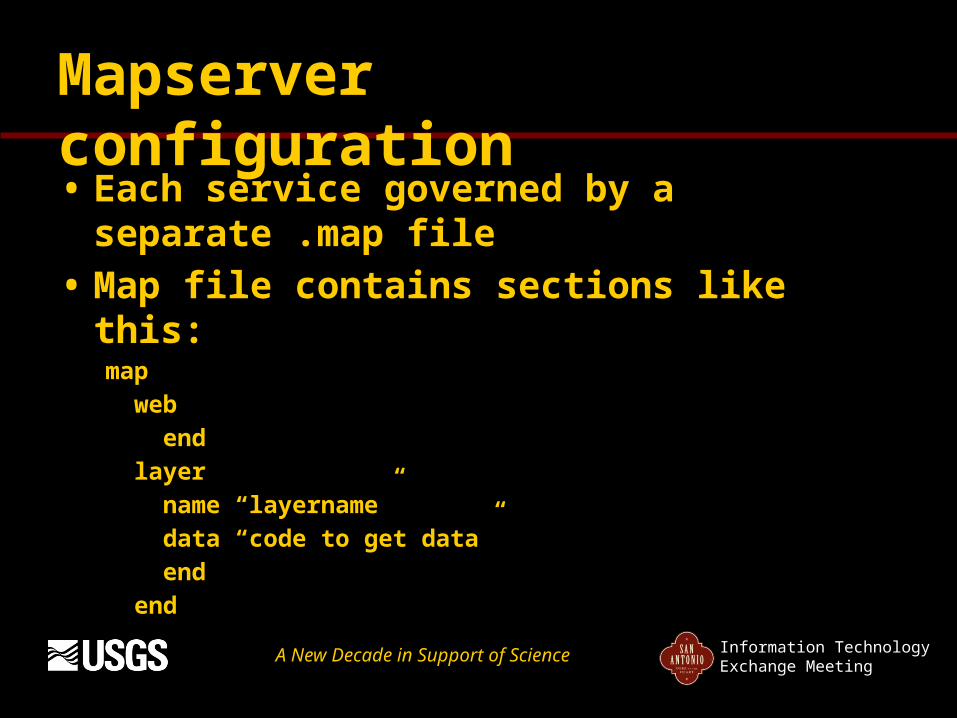
Mapserver configuration
• Each service governed by a separate .map file
• Map file contains sections like this:map web end layer name “layername” data “code to get data” end end

Information Technology Exchange Meeting
A New Decade in Support of Science
OGC WMS and WFS
Mapserver configuration directivesWMS and WFS requests
Query string: service=WMS&request=GetCapabilities&version=1.1.1
Request s:GetCapabilitiesGetMapGetFeatureInfoGetFeaturesDescribeFeatureType
Information Technology Exchange Meeting
A New Decade in Support of Science
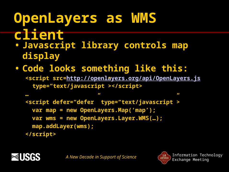
OpenLayers as WMS client
• Javascript library controls map display
• Code looks something like this:<script src=http://openlayers.org/api/OpenLayers.js
type=“text/javascript”></script>…<script defer=“defer” type=“text/javascript”> var map = new OpenLayers.Map(‘map’); var wms = new OpenLayers.Layer.WMS(…); map.addLayer(wms);</script>