india takes a step forward in its national water-grid ... · india takes a step forward in its...
TRANSCRIPT
The
Mas
terb
uild
er |
Oct
ober
201
5 | w
ww
.mas
terb
uild
er.c
o.in
60
India Takes a Step Forward in its National Water-Grid Programme
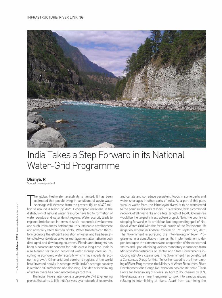
The global freshwater availability is limited. It has been estimated that people living in conditions of acute water shortage will increase from the present figure of 470 mil-
lion to around 3 billion by 2025. Geographic variations in the distribution of natural water resource have led to formation of water surplus and water deficit regions. Water scarcity leads to regional imbalances in terms of socio-economic development and such imbalances detrimental to sustainable development and adversely affect human rights. Water transfers can there-fore promote the efficient allocation of water and has been at-tempted worldwide as a water management alternative in both developed and developing countries. Floods and droughts has been a paramount concern for India over a long time. India is also blamed for having neglected water storage creation, re-sulting in economic water scarcity which may impede its eco-nomic growth. Other arid and semi-arid regions of the world have invested heavily in storage, while India’s storage capacity is a minor 200 m³/person and declining. The idea of interlinking of Indian rivers has been mooted as part of this.
The Indian Rivers Inter-link is a large-scale Civil Engineering project that aims to link India’s rivers by a network of reservoirs
and canals and so reduce persistent floods in some parts and water shortages in other parts of India. As a part of this plan, surplus water from the Himalayan rivers is to be transferred to the peninsular rivers of India. This exercise, with a combined network of 30 river-links and a total length of 14,900 kilometres would be the largest infrastructure project. Now, the country is stepping forward in its ambitious but long pending goal of Na-tional Water Grid with the formal launch of the Pattiseema lift irrigation scheme in Andhra Pradesh on 16th September, 2015. The Government is pursuing the Inter-linking of River Pro-gramme in a consultative manner. Its implementation is de-pendent upon the consensus and cooperation of the concerned states and upon obtaining various mandatory clearances from Ministries/Departments of Centre and State Governments in-cluding statutory clearances. The Government has constituted a Consensus Group for this. To further expedite the Inter-Link-ing of River Programme, the Ministry of Water Resources, River Development and Ganga Rejuvenation has constituted a “Task Force for Interlinking of Rivers” in April 2015, chaired by B.N. Navalawala, an eminent engineer to look into various issues relating to inter-linking of rivers. Apart from examining the
Dhanya. R Special Correspondent
INFRASTRUCTURE: RIVER LINKING

The
Mas
terb
uild
er |
Oct
ober
201
5 | w
ww
.mas
terb
uild
er.c
o.in
64
existing links under National Perspective Plan, the task force would also consider alternative plans in place of infeasible links in the present plan. It would provide guidance on norms of as-sessment of individual projects in respect of economic viability, socio-economic, environmental impacts and preparation of re-settlement plans.
Back Ground for a National Watergrid
Two proposals, put forth earlier in the seventies which at-tracted considerable attention, are National Water Grid by Dr. K. L. Rao and Garland Canal by Captain Dastur. These proposals were not pursued further by the Government as they were not techno-economically feasible. The continued interest shown by various quarters gave impetus to study inter-basin water transfer proposals. The then Ministry of Irrigation (now Water Resources) formulated a National Perspective Plan (NPP) for Water Resources Development in August 1980 envisioning inter basin water transfer in the country. The National Perspective Plan comprises of two components, namely i) Peninsular Rivers De-velopment and ii) Himalayan Rivers Development.
The National Water Development Agency (NWDA) was set up on 17th July 1982 by Indian government as a Society under Societies registration act 1860 under the Ministry of Water Resources to study the feasibility of the links under Peninsu-lar Component of National Perspective Plan. The NWDA is fully funded by Government of India. Subsequently in 1990-91, NWDA Society resolved to take up the studies of Himalayan Component also. Further, on 28th June, 2006 preparation of DPR of link projects and prefeasibility/ feasibility reports of in-tra-basin links as proposed by states were also included in the functions of NWDA Society and modified the functions accord-ingly. The functions of NWDA were further modified to under-take the work of preparation of DPRs of intra-state links also.
Studies by NWDA
NWDA carried out Water Balance Studies of 137 basins/sub-basins and 71 diversion points. It also carried out toposh-eet studies of 74 reservoirs & 37 link alignments. Under the NPP prepared by Ministry of Water Resources, NWDA has al-ready identified 14 links under Himalayan Rivers Component and 16 links under Peninsular Rivers Component for inter ba-sin transfer of water based on field surveys, investigation and detailed studies. Out of these, Feasibility Reports of 14 links under Peninsular Component and 2 links (Indian portion) under Himalayan Component have been prepared.
Supreme Court Judgement regarding Linking of Rivers and Constitution of the Special Committee
The Honourable Supreme Court in the matter of a Writ Floods in Sothern India
Himalayan
Peninsular
Arid region in Rajasthan/ Drought affected village
INFRASTRUCTURE: RIVER LINKING
The
Mas
terb
uild
er |
Oct
ober
201
5 | w
ww
.mas
terb
uild
er.c
o.in
66
Petition on Networking of Rivers delivered a judgment dated 27.2.2012. The Supreme Court has directed that an appropriate body should be created to plan, construct and implement the inter linking of rivers program for the benefit of the nation as a whole. It has also directed the Union of India and particularly the Ministry of Water Resources, to constitute immediately a Committee to be called a “Special Committee for Inter-Linking of Rivers” under the Chairmanship of Honourable Minister for Water Resources”.
Constitution of the Special Committee for the Interlinking of Rivers has been constituted by the Ministry of Water Resources, River Development and Ganga Rejuvenation (MoWR, RD and GR) vide Gazette Notification dated 23.09.2014. The first meeting of the Committee was held on 17.10.2014. The second meeting of the Committee was held on 06.01.2015.
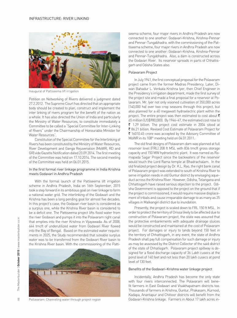
In the first formal river linkage programme in India Krishna meets Godavari in Andhra Pradesh
With the formal launch of the Pattiseema lift irrigation scheme in Andhra Pradesh, India on 16th September, 2015 took a step forward in its ambitious goal on river linkage to form a national water grid. The interlinking of the Godavari and the Krishna has been a long pending goal for almost five decades. In this project’s case, the Godavari river basin is considered as a surplus one, while the Krishna River basin is considered to be a deficit one. The Pattiseema project lifts flood water from the river Godavari and pumps it into the Polavaram right canal that empties into the river Krishna in Vijayawada. As of 2008, 644 tmcft of underutilized water from Godavari River flowed into the Bay of Bengal. Based on the estimated water require-ments in 2025, the Study recommended that sizeable surplus water was to be transferred from the Godavari River basin to the Krishna River basin. With the commissioning of the Patti-
seema scheme, four major rivers in Andhra Pradesh are now connected to one another: Godavari-Krishna, Krishna-Pennar and Pennar-Tungabhadra. with the commissioning of the Pat-tiseema scheme, four major rivers in Andhra Pradesh are now connected to one another: Godavari-Krishna, Krishna-Pennar and Pennar-Tungabhadra. Also, a dam is constructed across the Godavari River. Its reservoir spreads in parts of Chhattis-garh and Odisha States also.
Polavaram Project
In July 1941, the first conceptual proposal for the Polavaram project came from the former Madras Presidency. Later, Di-wan Bahadur L. Venkata Krishna Iyer, then Chief Engineer in the Presidency’s irrigation department, made the first survey of the project site and made a final proposal for a reservoir at Po-lavaram. Mr. Iyer not only visioned cultivation of 350,000 acres (140,000 ha) over two crop seasons through this project, but also planned for a 40 megawatt hydroelectric plant within the project. The entire project was then estimated to cost about ` 65 million (US$980,000). By 1946–47, the estimated cost rose to ` 1.29 billion. The project cost estimate in 2004 stood at ` 86.21 billion. Revised Cost Estimate of Polavaram Project for ̀16010.45 crore was accepted by the Advisory Committee of
MoWR in its 108th meeting held on 04.01.2011.
The old final designs of Polavaram dam was planned at full reservoir level (FRL) 208 ft MSL with 836 tmcft gross storage capacity and 150 MW hydroelectric plant. It was named as Ra-mapada Sagar Project since the backwaters of the reservoir would touch the Lord Rama temple at Bhadrachalam. In the old finalized project design by Dr. K.L. Rao, the right bank canal of Polavaram project was extended to south of Krishna River to serve irrigation needs in old Guntur district by envisaging aque-duct across the Krishna River. However, Odisha, Telangana and Chhattisgarh have raised serious objection to the project. Odi-sha Government is opposed to the project on the ground that if the project is commissioned, it would require massive displace-ment of tribals and cause irreparable damage to as many as 25 villages in Malkangiri district due to inundation.
Presently, the project is scaled down to FRL 150 ft MSL. In order to protect the territory of Orissa likely to be affected due to construction of Polavaram project, the state was assured that the protective embankments with adequate drainage sluices would be constructed and maintained at the cost of Polavaram project. For damages or injury to lands beyond 150 feet in the territory of Chhattisgarh, in any event, the state of Andhra Pradesh shall pay full compensation for such damage or injury as may be assessed by the District Collector of the said district of the state of Chhatisgarh. Polavaram project spillway is de-signed for a flood discharge capacity of 36 Lakh cusecs at the pond level of 140 feet and not less than 20 lakh cusecs at pond level of 130 feet.
Benefits of the Godavari-Krishna water linkage project
Incidentally, Andhra Pradesh has become the only state with four rivers interconnected. The Polavaram will bene-fit farmers in East Godavari and Visakhapatnam districts too. Thousands of farmers in Krishna, Guntur, Prakasam, Kurnool, Kadapa, Anantapur and Chittoor districts will benefit from the Godavari-Krishna linkage. Farmers in About 17 lakh acres in-
Inaugural of Pattiseema lift irrigation
Pollavaram: Channeling water through project region
INFRASTRUCTURE: RIVER LINKING

The
Mas
terb
uild
er |
Oct
ober
201
5 | w
ww
.mas
terb
uild
er.c
o.in
68
cluding 13 lakhs in the Krishna delta will get assured irrigation water for two agricultural crops round the year. Thousands of villages en route will get drinking water supplies.
Benefits from Interlinking of Rivers (ILR)
Flood control, drought mitigation, water for irrigation and Food safety are the main benefits of ILR programme. The im-plementation of National Perspective Plan would give benefits of 35 million hectares of irrigation — 25 million ha from surface waters and 10 million ha by increased use of ground waters. It would also benefit to raise the ultimate irrigation potential from 140 million ha to 175 million ha and generation of 34000 Megawatt of power, apart from the incidental benefits of flood control, navigation, water supply, fisheries, salinity and pollution control etc.
Flood Control and Drought Mitigation
Annual floods, on the average, affect more than 7 million hectare land, 3 million hectare cropped area and 34 million people, mostly in the eastern parts, inflicting annual damage of well over ̀1000 crores. In contrast, recurrent droughts affect 19 percent of the country, 68 percent of the cropped area and 12 percent of the population. The reservoir storages and the ca-nal diversions in the Interlinking of Rivers (ILR) are expected to reduce flood damages by 35 percent and ease drought-prone-ness in semiarid and arid parts, besides making 12 km³ water available for domestic and industrial water supplies in these drought prone districts. The proposed water linking project wa-ter transfers, of 178 km3, will increase utilizable surface water resources by 25%.
Water for irrigation and food security
With an increasing population, demands made by agricul-tural needs are ever increasing in India. Irrigation is a dominant demand sector in India with nearly 83 per cent share in total national water use compared to the world average of 69 per cent. However, to feed the estimated 1.5 to 1.8 billion people in 2050 with 450 million tons of food grains, India needs to in-crease its irrigation potential to 160 million hectares. Hence, strategies like inter-basin water transfer are in demand. The implementation of National Perspective Plan would give bene-fits of 35 million hectares of irrigation, 25 million hectare from surface waters and 10 million hectare by increased use of ground waters, raising the ultimate irrigation potential from 140 million hectare to 175 million hectare and generation of 34000 Megawatt of power, apart from the incidental benefits of flood control, navigation, water supply, fisheries, salinity and pollution control etc. Domestic water needs -The per capita availability of utilizable water has been reduced progressively from 3450 cu-bic meters to 1250 cubic meters from 1951 to 2000 owing to the increasing population. In the next 50 years, it is likely to come down to 760 cubic meters. The proposed Inter-Linking of River (ILR) Scheme will help to provide additional water to meet the domestic water needs.
Critical Apprehension on ILR projects/ Debate Emerged over ILR
Though water transfers address the imbalances in water supply and demand, it has generated controversy and caution throughout the world. Environmental issues like rehabilitation
of the ecosystem, social issues like rehabilitation and resettle-ment of the displaced people and legal issues such as sharing of water have been raised and debated in many Regional Water Transfer (RWT) projects worldwide.
In India, the comprehensive proposal to link Himalayan with the Peninsular Rivers for inter-basin transfer of water is estimated to a huge amount. Land submergence and rehabil-itation packages would be additional to this cost. There are no firm estimates available for running costs of the scheme, such as the cost of power required to lift water. India’s dependence on monsoon is immense and experts point out that rivers gen-erally overflow roughly during the time across the country, so it is questionable why a flooded basin would accept more water from another basin at such a time. According to environmental-ist Vandana Shiva, Inter-Linking of River projects lack hydrolog-ical and ecological soundness and seek to commodify India’s water. Another major problem in planning inter-basin transfers is how to take into account the reasonable needs of the basin states, which will grow over time. Further, given the topography of India and the way links are envisaged, it might totally bypass the core dry land areas of Central and Western India. Along the East coast of India, all peninsular rivers have extensive deltas and damming the rivers for linking will cut down sediment sup-ply and will destroy fragile ecosystems. It can also affect the monsoon system and climate of the sub-continent as rainfall over much of the sub-continent is controlled by a layer of low saline water and a disruption could have an adverse impact.
Summary
Inter-Linking of Rivers in India is one of the most ambitious project ever proposed to address the issues of water scarcity and floods in the country. The proposed water infrastructure project, envisages various links between major rivers in the country and is proposed in two parts with an aim to find a per-manent solution to droughts and floods, and to increase India’s Hydropower capacity. Minister for Water Resources, River De-velopment and Ganga Rejuvenation, constituted a task force to expedite the project. The project will have tremendous impact in many spheres of our country’s future and will forever alter the physical feature of our land and its impact on our ecology and ecosystems will be intense and can never be fully predicted.
Conclusion
Now that the Union Government has given top priority to the project and formed a high-powered task force for speedy and careful implementation of the project, India may or may not implement ILR project as proposed. However, there seems the essentiality of massive water infrastructure investment on a similar or larger scale as the population affected by water-scar-city or inundation could balloon due to population growth. Also, medium term water sector planning needs to be considered envisaging the future water demand in the country.
Source
- http://wrmin.nic.in/forms/list.aspx?lid=380- http://nrlp.iwmi.org/PDocs/DReports/Phase_02/01.%20India’s%20
River%20Linking%20Project%20-%20State%20of%20the%20de-bate-%20Shah%20et%20al.pdf
- http://nwda.gov.in/writereaddata/mainlinkfile/File423.pdf w
INFRASTRUCTURE: RIVER LINKING