imaging alaska john ahlrichs rapideye [email protected] 303 589 3597; +49 3381 8904 501 statewide...
TRANSCRIPT
Imaging Alaska
John AhlrichsRapidEye
[email protected] 589 3597; +49 3381 8904 501
Statewide Digital Mapping InitiativeImagery Workshop

3 clear days: 90% of Alaska

See Structures in True Color
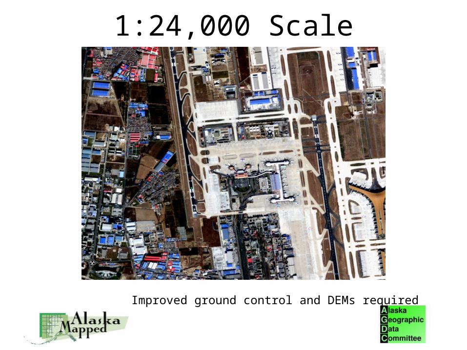
1:24,000 Scale
Improved ground control and DEMs required
RapidEye
Geospatial Information Provider> detecting, understanding and interpreting changes anywhere on earth ...> ... quickly and reliably for our customers around the world> .... that have enterprise level service requirements...> ... supported by our 5 satellites.
Geospatial Data Provider> Supplying data to national scale imaging programs
Private company> No operational limitations

Q1: SensorThere are 5 “identical” satellites in the RapidEye constellation
• Launched Aug 29, 2008• Operational Feb 4, 2009• 7++ year life• 630 km altitude
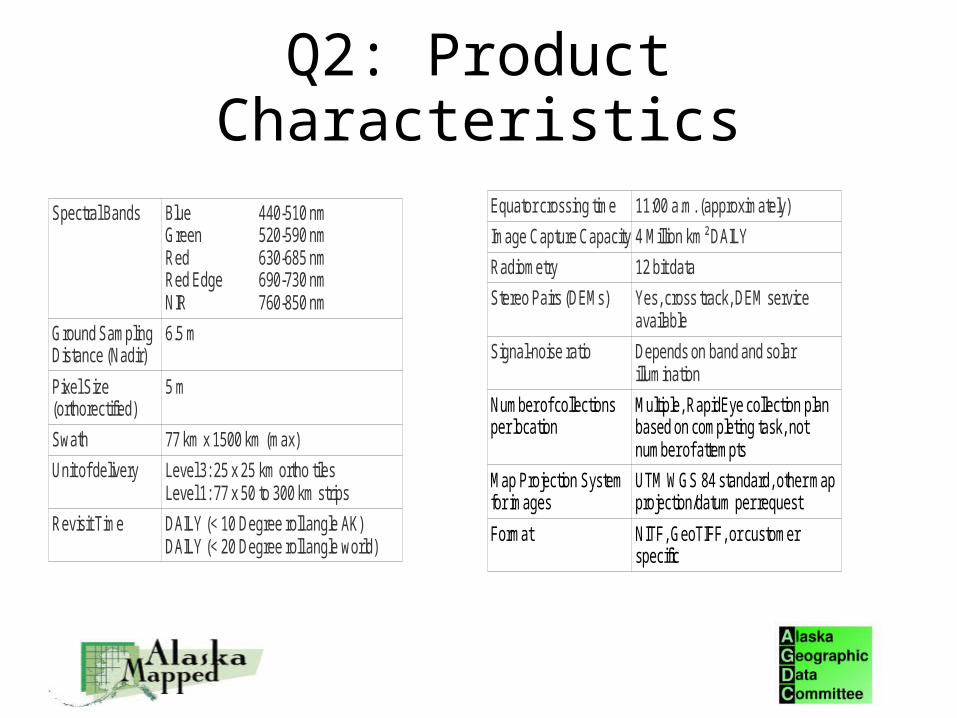
Q2: Product Characteristics
Spectral Bands BlueGreen Red Red Edge NIR
440-510 nm520-590 nm630-685 nm690-730 nm760-850 nm
Ground SamplingDistance (Nadir)
6.5 m
Pixel Size(orthorectified)
5 m
Swath 77 km x 1500 km (max)
Unit of delivery Level 3: 25 x 25 km ortho tiles Level 1: 77 x 50 to 300 km strips
Revisit Time DAILY (< 10 Degree roll angle AK)DAILY (< 20 Degree roll angle world)
Equator crossing time 11:00 a.m. (approximately)
Image Capture Capacity 4 Million km² DAILY
Radiometry 12 bit data
Stereo Pairs (DEMs) Yes, cross track, DEM serviceavailable
Signal-noise ratio Depends on band and solarillumination
Number of collectionsper location
Multiple, RapidEye collection planbased on completing task, notnumber of attempts
Map Projection Systemfor images
UTM WGS 84 standard, other mapprojection/datum per request
Format NITF, GeoTIFF, or customerspecific

Q3: Applications for the Product
• Ortho-imagery for base maps and land cover maps– Important: Imagery for base maps and analysis the same
• Wide area monitoring and change detection– Multi-temporal coverage annually
– Multi-temporal in-season coverage
• RapidEye strength: Reliable, wide area, multi temporal coverage at a compelling (5 m) resolution

Q3: A Statewide, Multi-temporal Data Set:Point of Differentiation
• Homeland security
• Seasonal and multi-year changes in permafrost, coastal erosion
• Accurate assessment of burn areas,
• Before and after images for disaster response
• Monitor changes surrounding remote villages
• Identify new cabins and areas of habitation
• Monitor changes or encroachment to fragile and protected areas
• Monitor changes along roads, pipelines or other linear feathers
• Track disease movement and occurrence in forested lands
• Benchmark status of land before new pipelines,
– More.....
• Put Alaska at the forefront of polar region monitoring and assessment

Q4: Native Horizontal Accuracy
• 250 m RMSE (~530 m CE 95)• RPCs provided in Level 1 header file
– NITF format
– No cost

Q5: Improved Horizontal Accuracy• Design Specs: 6 m RMSE (~13.5m CE95)
– With 2 m RMSE GCPs and DTED 2 DEM
– Exceeds 1:24000 scale requirements
• Initial calibration tests showing 5.1 m RMSE – With GCPs having RMSE >2 m
– No benefit for GCPs < 2 m RMSE
• Better positional accuracy may be possible by others with non automated approach– RapidEye will provide Level 1 data
• Accuracy with Landsat GCPs and SRTM DEMs– 25-50 m RMSE

Q6: Horizontal Control Distribution
• 1 GCP per 1000 sq km– RapidEye's automated ortho-rectifiecation processing works
from a table of GCPs
– Allows for clouds obscuring some GCP points
– Completing GCP database of world
• RapidEye not in the GCP collection business– Would partner with organization having GCPs or RapidEye
can extract them from V. High res imagery (new sensors have this accuracy native). Partnership required.

Q7: DEM Requirement
• DTED Level 2 DEM required for 1:24,000 scale Ortho products

Q8: Ortho Production
• RapidEye ground segment can ortho 2 million sq km of data per day.– Continuous throughput system
• No time delay on delivery
– Uses library of GCPs (See previous slides)
• Option– Purchasing agency receives Level 1 data and does own
ortho-rectification
– No price difference

Q8: Ortho ProductionPoint of Differentiation
• Ortho imagery NOW– ~1:50,000 scale
• Based on existing GCPs (Landsat) and DEM (USGS 15')
• Ortho imagery when better GCPs and DEMs available– 1:24,000 scale
• Based on GCPs 2-4+ m RMSE and DTED 2 DEMs• 1 GCP per 1000 sq km
• RAPIDEYE WILL RE ORTHO ALL DATA WHEN BETTER DEMS AND GCPs AVAILABLE. NO CHARGE– RapidEye retains GCPs and DEMs for future use

Q9: Revisit
• Daily revisit – Alaska at <10 degree look angle– Global at <20 degree look angle
• Look angle (<10 deg) has nominal effect on map accuracy

Q10: Swath Width
• Swath Width: 77 km• Swath Length: max 1500 km
– Length of Alaska (ex Aleutians) can be collected in 1 strip
• Area per swath: 115,000 sq km• Level 1 production interval
– 50-300 km (limit of orbit model)
– Multiple deliveries per 1500 m swath length
• Duty cycle not a factor over Alaska

Q11: Delivery• Single Ground Station: Svalbard, Norway (78 N)
– See every satellite every orbit
• Delivery– Data delivered to RapidEye 2 hours after download
– Std to customer in 72 hours, rush in 12 hours, faster possible
– Centralized collection model has no restrictions; reliable delivery
• Tasking – Tasking order created at 04:00 and 14:00 UTC
– Uploaded late morning and early evening
– No charge for rush orders
– Local cloud forecasting input possible for increased accuracy
• Ground Station yes; Virtual ground station more reasonable
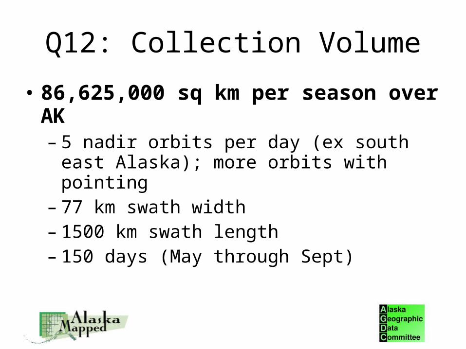
Q12: Collection Volume
• 86,625,000 sq km per season over AK– 5 nadir orbits per day (ex south east Alaska);
more orbits with pointing– 77 km swath width– 1500 km swath length– 150 days (May through Sept)

Q12 Collection Volume Point of Differentiation
• 3 days to cover 90% of Alaska – (clouds not considered)
– (ex Aleutians and south east Alaska)
• 10 days for complete coverage – (clouds not considered)
• Feasibilities show ~24 days for coverage considering clouds
• High probability RapidEye can image Alaska at least once between June and August.– Minimizes snow and sun angle effects
– Multi-temporal collections possible over large areas/state

Q13: Delivered Products• Level 1
– Path oriented, sensor corrected, collected in strips up to 1500 km
– Delivered in 50-300 km by 77 km “processing segments”
– NITF format, RPCs in header
• Level 3– Orthorectifed (accuracy based on GCPs and DEMs)
– Delivered in 25 x 25 tiles (based on global grid)
– Geotiff format, UTM, WGS 84 standard, others at no charge
– Processing options: include atmospheric correction and processing method
• Other– Support data: Unusable data mask, browse images, shape files, Metadata (XML)
– Age: All data fresh (we just launched)
– Repository: Fully flexible, ftp, hosting, hard media.
– RapidEye can also provide mosaics
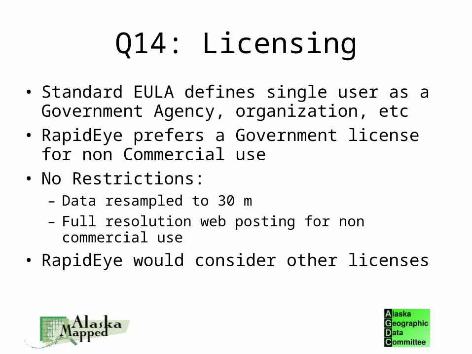
Q14: Licensing
• Standard EULA defines single user as a Government Agency, organization, etc
• RapidEye prefers a Government license for non Commercial use
• No Restrictions:– Data resampled to 30 m
– Full resolution web posting for non commercial use
• RapidEye would consider other licenses
Q15: Pricing
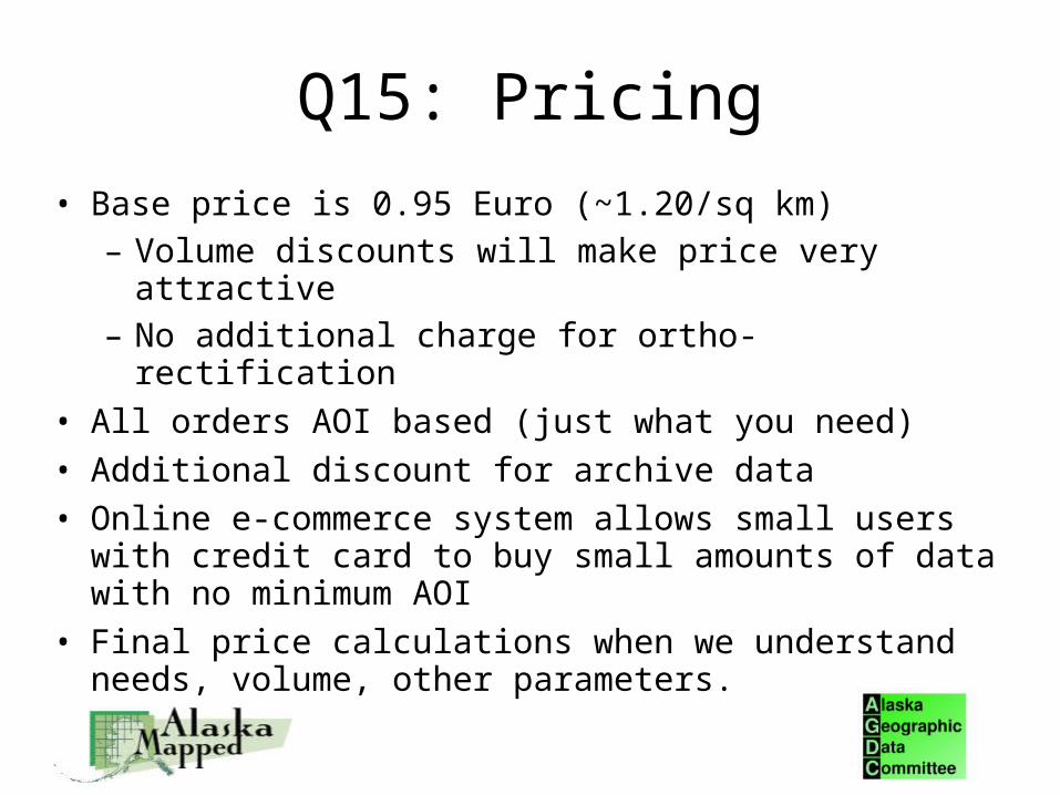
• Base price is 0.95 Euro (~1.20/sq km)– Volume discounts will make price very attractive– No additional charge for ortho-rectification
• All orders AOI based (just what you need)
• Additional discount for archive data
• Online e-commerce system allows small users with credit card to buy small amounts of data with no minimum AOI
• Final price calculations when we understand needs, volume, other parameters.

Summary
• RapidEye can meet requirements• RapidEye will offer an annual imaging program
– Select areas multi-temporal within year)
• RapidEye will re-ortho rectify all data at no charge– When GCPs and DEMs allow meeting 1:24,000 scale
• RapidEye will partner as appropriate • RapidEye ready to start imaging as soon as the snow
is gone

Murray Darling River, AustraliaDecember 4, 2008


Large area, Nadir coverage takes 5.5 daysNorthern latitude and pointing means AK coverage faster
Day 1 Day 2 Day 3
Day 4 Day 5
Min
neso
ta
Iowa
Indiana
Illinois
Wisconsin
AlaskaEx Aleutiansand SE AK
Note: Assumes Cloud Free

Comparisons to 2005 SGDC RFISpecification RapidEye
Coverage Statewide StatewideResolution 5 m orthoed (6.5 m GSD) 6 m
1:25,000Radiometry 12 bit 7 bit or better
Clouds
Leaf on
View angle < 15 degrees
Licensing
Proposed Minimums
Imagery products
Color and Color IR imagery (Blue, Green, Red, NIR, Red
Edge bands)Color and Color
IR imageryMap
Accuracy1:24,000 with appropriate ground
control and DEMs
Multiple revisits available for cloud clipping
<5% with mosaicking
Leaf on/sun angle > 30 degrees
Multiple, statewide revisit opportunities during imaging
window Daily coverage anywhere in state
at <10 degreesArchive imagery
Multiple, statewide coverages possible each season
2 year old data allowed
Flexible, non commercial preferred
Public domain or non commercial