tsunami chile change detection - un-spider.org · rapideye proprietary information 1 tsunami chile...
TRANSCRIPT

RapidEye proprietary information 1
Tsunami Chile Change DetectionA rapid investigation by RapidEye Product Development / RapidEye Brandenburg / March 4th 2010

RapidEye proprietary information 2
Study Objectives
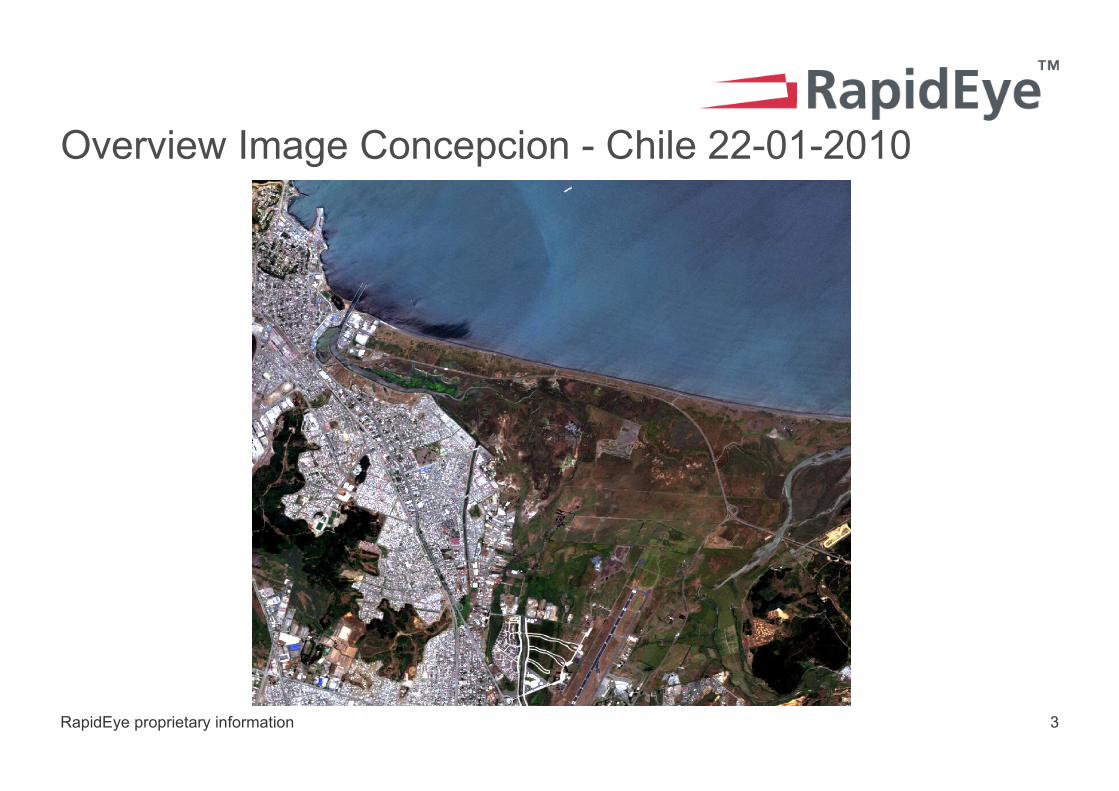
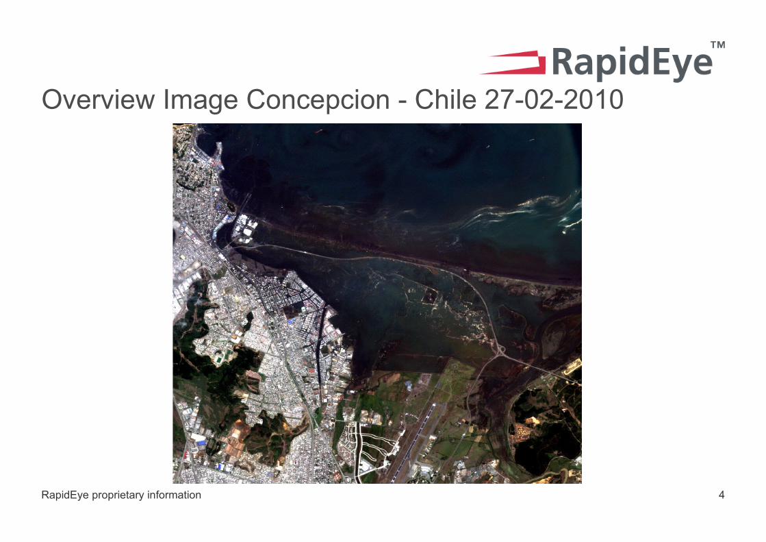
> RapidEye satellites captured images over the city of Concepcion at the end January and one day after the earth quake. To support the humanitarian aid community, RapidEye has analyzed the images to provide early indicators to the changes which occurred in the area.
> The most important findings are shown in the following pages:> Overview natural color before and after the damage> Overview mapping of damaged and affected areas> Small area examples:
> Airport area change to building > Landslide in forested area> Water intrusion into urban areas> Changes to road and buildings> The ocean currents
RapidEye proprietary information 3
Overview Image Concepcion - Chile 22-01-2010
RapidEye proprietary information 4
Overview Image Concepcion - Chile 27-02-2010

RapidEye proprietary information 5
Overview Area Affected

RapidEye proprietary information 6
Close Up Detail - Case #1
> Concepcion Airport region: 2010-01-22

RapidEye proprietary information 7
Close Up Detail - Case #1 – After earthquake
> Concepcion Airport region: 2010-02-27

RapidEye proprietary information 8
Close Up Detail - Case #1 – Affected area
> The image shows changes in the vicinity of the airport.
> Note, the changes of airport buildings.

RapidEye proprietary information 9
Close Up Detail Case #2
> Forested region outside of the city with steep slopes: 2010-01-22

RapidEye proprietary information 10
Close Up Detail - Case #2 – After earthquake
> Forested region outside of the city with steep slopes: 2010-02-27

RapidEye proprietary information 11
Close Up Detail - Case #2 – Affected area
> The dramatic wide spread change to the landscape is likely a landslide. Even the road was changed.

RapidEye proprietary information 12
Close Up Detail Case #3
> Details of the urban area imaged on 2010-01-22

RapidEye proprietary information 13
Close Up Detail - Case #3 – After earthquake
> Details of the urban area imaged on 2010-02-27
> The dark colored water is clearly seen between the urban structures reaching far between the houses.

RapidEye proprietary information 14
Close Up Detail - Case #3 – Affected area
> Changes made visible. The exact impact of those changes need to be assess on the ground. The information is useful to direct ground staff to the right location.
RapidEye proprietary information 15
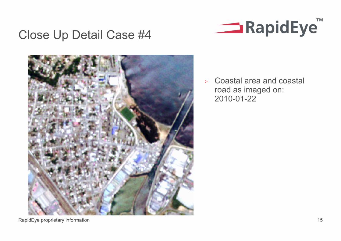
Close Up Detail Case #4
> Coastal area and coastal road as imaged on: 2010-01-22

RapidEye proprietary information 16
Close Up Detail - Case #3 – After earthquake
> After damage.

RapidEye proprietary information 17
Close Up Detail - Case #4 – Affected area
> The road and one large building have clearly been damaged.

RapidEye proprietary information 18
Close Up Detail Case #5 – Ocean before earthquake
> The image shows the ocean on 2010-01-22.
> The red color in this image indicates healthy vegetation.

RapidEye proprietary information 19
Close Up Detail Case #5 – Oceanic disturbances after earthquake
> The image taken a few hours after the earthquake clearly shows the currents within the waterbody.