i~-~ • .. airport layout plan runway rpz area plan & profile sheets, ... the airport layout...
TRANSCRIPT

SECTION 6
AIRPORT LAYOUT PLAN
SUPERIOR AIRPORT MASTER PLAN - 2001
• ! i ~ - ~ • . .

SECTION 6: AIRPORT LAYOUT AND DEVELOPMENT PHA I.
[ , i 8 2 1 SUPERIOR AIRPORT MASTER PLAN- 2001 - , - o
PREPARATION OF THE AIRPORT LAYOUT PLAN (ALP)
The Airport Layout Plan (ALP) is a set of scaled drawings that depict the existing and ultimate proposed airport land and facilities.
All airport development carried out at Federally obligated airports (generally those which have received federal funding assistance grants within the past twenty years) must be done in accordance with an FAA-approved ALP.
A typical ALP drawing set consists of the following elements:
• the Title Sheet, including location and vicinity maps, the airport wind rose and wind data summary, standard Airport Data table, and approval blocks.
• the Airport Layout Drawing, which consists of a graphic depiction of the entire airport illustrating both the existing and ultimate development features.
• the Terminal Area Layout(s), which is a larger scale detail of the airport's terminal area.
the Runway RPZ Area Plan & Profile sheets, consisting of detail drawings of each runway, extended to show the inner approach surfaces of each existing and ultimate runway end. The runways and approaches are depicted in both plan and profile, and any existing or ultimate obstructions to FAR Part 77 airspace are indicated.
• the Airport Airspace Drawing(s), which depicts all of the airport's ultimate FAR Part 77 "imaginary surfaces". Any existing or ultimate obstructions are indicated.
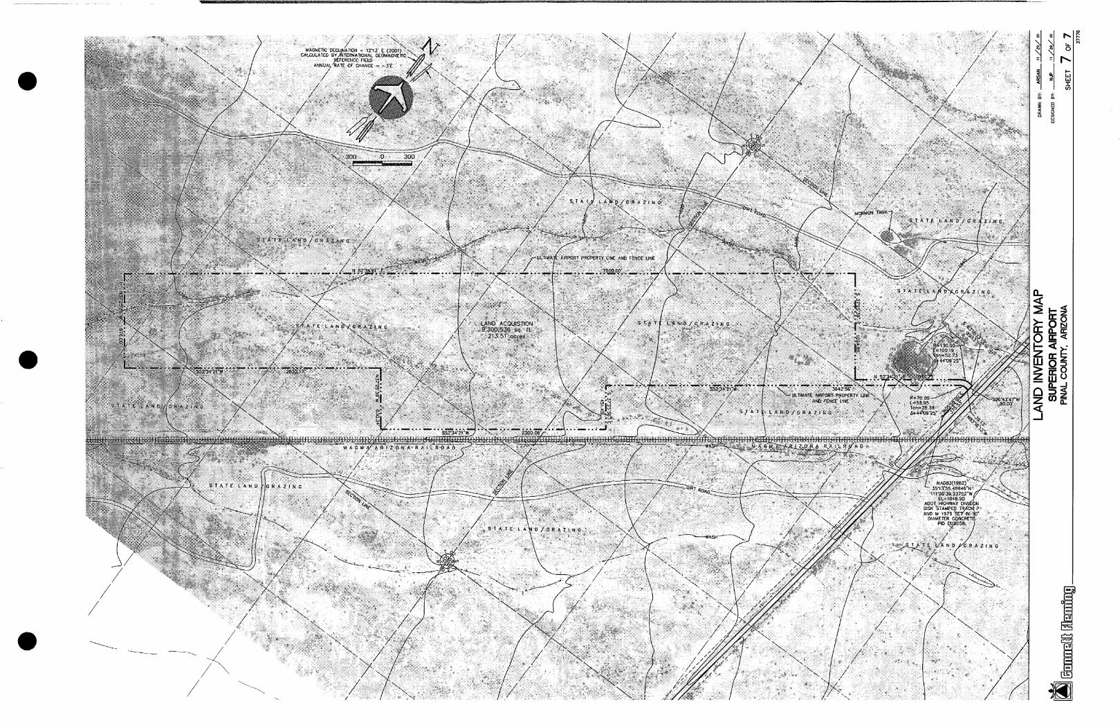
• the Airport Property Map (or "Land Inventory Map"), which depicts the existing airport property along with any planned ultimate land acquisitions.
the Aimort Land Use Drawing, consisting of a map showing the land uses and/or zoning in the area within the airport's traffic pattern area. Existing and recommended ultimate land uses are shown.
May 15, 2001 Superior Airport Page 6-1 Master Plan - 2001

Airport La~/out and Development Phasin~l Plan
The Airport Layout Plan set prepared for the Superior Airport includes all of the above listed elements. The Airport Land Inventory Map also includes specific horizontal and vertical control for the airport property and new runway geometry.
The ALP was prepared based on the selected development alternate, located at "Site # i 1".
The Airport Layout Plan set (8 sheets) is included at the end of this section in reduced format. The full size (24" x 36") FAA-approved drawings are considered the official ALP, and a part of this Master Plan document.
The ALP drawing set was prepared using AutoCad 2000.
DEVIATIONS FROM FAA STANDARDS
For federally funded airports, all existing facilities, as well as future improvements shown on the ALP, must conform to the FAA design standards that existed at the time of plan approval, unless specific waivers are granted.
Because the ALP illustrates a new airport facility, design and layout of all facilities is in accordance with the most current FAA standards.
DEVELOPMENT PHASING PLAN
A general schedule of recommended improvements was presented in Section 3: Facility Requirements. This general development program was broken down into two genera[ development phases, as follows:
" Short Term Recommendations (2005-2010)
• Ukimate Term Recommendations (2011-2025)
In this section, these two general development phases have been further broken down as follows:
• Short Term Recommendations - Initial Airport Development (2005-2008)
• Ultimate Term (Intermediate Range) Development Plan (2009-2015)
• Ultimate Term (Long Range) Development Plan (2016-2025)
Page 6-2 May 15, 2001 Superior Airport Master Plan - 2001
Airport La}/out and Development Phasin~l Plan
Each of the development plan schedules have been broken down into annual projects. This recommended detailed development program is described on the following pages.
Estimated costs for the recommended development are presented in Section 7: Financial Plan. ]
It is assumed that an Environmental Assessment (EA) will be prepared and that a Finding of No Significant Impact (FONSI) will be issued by the year 2005.
Superior Airport SHORT TERM RECOMMENDATIONS - INITIAL AIRPORT DEVELOPMENT
(2OO5-2O08)
2005
2006
2008
Acquire land for airport development.
Implement airport area land use and height limitation zoning.
Prepare engineering and architectural construction plans for initial airport development.
Construct paved 4,500' x 75' runway, marked for visual operations (12,500 pound SWG design).
Provide 1,000' x 250'x 450' Runway Protection Zones (RPZ's)
Construct a full 35' wide parallel taxiway to serve the initial 4,500' long runway, as well as connector taxiways to the apron and runup areas at each runway end.
Construct a paved and lighted aircraft parking apron to accommodate 27 aircraft.
Set aside land area for development of 44 aircraft storage hangars.
Construct an 1,125 square foot Terminal Building, expandable to 1,500 square feet.
Construct a paved automobile parking area able to accommodate 29 cars.
Provide a paved access road to the auto parking area.
Install Medium Intensity Runway Lights (MIRL) on the new 4,500' long runway.
Page 6-3 May 15, 2001 Superior Airport Master Plan - 2001
Airport Layout and Development Phasin~l Plan
Provide retroreflective taxiway edge markers on parallel, connector and runup taxiways.
Install Rotating Beacon.
Install an above-ground package storage and deliver system that provides 100LL aviation fuel, Jet-A and auto fuel.
Construct barbed wire property line fencing.
Construct terminal area chain link security fencing with card controlled gate access to aircraft operations and parking areas.
Install new 3-phase electric service, telephone service, sanitary sewer and water service.
Superior Airport ULTIMATE TERM (INTERMEDIATE RANGE) RECOMMENDATIONS
(2009-2015)
2009
2010
2011
2012
Prepare engineering and architectural plans for hangar development area.
Commission a nonprecision GPS instrument approach.
Provide 1,000' x 500'x 700' Runway Protection Zones (RPZ's)
Construct hangar development area.
Prepare an Airport Master Plan Update.
Prepare engineering plans for taxiway lighting (MITL) and visual aids (PAPI).
Install Precision Approach Path Indicators (PAPI) on both runway ends.
Install Medium Intensity Taxiway Lights (MITL) on all taxiways, including parallel, connector and runup taxiways.
Extend utilities as necessary to accommodate future airport development.
Page 6-4 May 15, 2001 Superior Airport Master Plan - 2001

Airport Layout and Development Phasin~l Plan
2016
2017
2018
2020
2021
2023
2024
Superior Airport ULTIMATE TERM (LONG RANGE) RECOMMENDATIONS
(2016-2025)
Prepare Environmental Assessment for runway extension.
Prepare engineering plans for runway, taxiway and lighting extension, and for pavement preservation.
Crack Seal and Pavement Preservation Seal Coat - all pavement.
Extend runway to an ultimate length of 5,100', marked for nonprecision instrument operations.
Strengthen runway pavement to 60,000 pound SWG design.
Extend the parallel taxiway concurrent with runway extension.
Extend MIRL and MITL concurrent with runway extension to 5,100'.
Prepare engineering plans for aircraft parking apron and auto parking area expansion, and architectural plans for Terminal Building expansion.
Expand the aircraft parking apron to accommodate a total of 38 aircraft.
Construct hangars as dictated by actual demand.
Expand the Terminal Building to 1,500 square feet.
Expand the automobile parking area such that it will accommodate a total of 39 cars.
Expand terminal area security fencing as required to accommodate future airport development.
Extend utilities as necessary to accommodate future airport development.
Prepare an Airport Master Plan Update.
Crack Seal and Pavement Preservation Seal Coat - all pavement
Page 6-5 May 15, 2001 Superior Airport Master Plan - 2001
AIrPOrT
N
+
,2
/ x
2 ,
/
, \
-..[. / " E
0 1 II P Ii A Ir $ U P 11 l l l[ 0 1~
A I II1P 0 111T P IN A~ .CO UNTY, A~XZONA
I UO l AVE c ~II~
~OCATION MAP J \
\
FIELD Apache ;,/)! '~' '? ) (
(FFZ) n__ Junobon j/~.. ~ u ~ R ~ , , m ~ = :~ \ /SAN CAR 0 ~ r ~ ?" ,! I~L~E[@NE.~:S ARi:A <" Miomi_ L I . . . . L S ~ U / I ~'; , "; M'Um'<m.,,'J~ / APACHE
Gold ~.~ ~ " /
WILLIAMS, A 1~'~* Superior/ . . - . ' / ' ~ GATEWAY - ' - j~-- / ~ *---n~ J
(IWA) " ~ ~ ' ~ S U P E R , O R ~c~e.~ / ~ n ~ t ~ NOV ...... \(E=~) ,~771
@ ke lmon
NO SCALE
V ] C ] N I W Y M ~ P
S 4 3 2 1
No.
W I N D D A T A A N A L Y S I S A I R P O R T D A T A UL1NMI¢
m m x ~..=~P~__ (.m._m9 ~ = - ~ o r 0 s ~ m . s - ~ o ~ 0= ' = " )
04 95. 70~ 95.47X 95.39¢ 22 97.80~¢ 97,30Z 97.04X
04/22 COMBINE0 COVERAGE 99.29X 98.58¢ 98,23¢
-- SOURCE OF W1ND COVERAGE DATA- NOAA Not;onol Climatic Center Asheville, N.C.
Phoenix Sky Horbor Internoti~¢l Airport Phoenix, Arizono
87,646 Obsefvo|ions 1982-1991
BY DATE CHANGE
AIRPORT ELEVATION ABOVE MSL
R E V I S I O N S
AIRPORT REFERENCE PO4NT (NAB 83)
AIRPORT AND TERMINAL NAVNOS
lA...~ ~__O_E . . . . . . . . . . I LONGITUDE
MEAN MAX. TEMP. OF HOTTEST MONTH NRPORT REFEREI~I-CE-C-OO'E-[A-'RC'C--~ ARC 8-1l . ~ . ~ - . ~ - ~ , ~ . ~ - . ~ . ~ - ~ , ,,, OE~GN AIRCRAFT
RUNWAY 04 - END AND THRESHOLD LATITUOE LONGITUDE - - - ELEVATION
RUNWAY 22 - END AND THRESHOLD LATITUDE "Co-~-~" ~ 6 r ' ELEVATION
1835 35"13'50.624" N 111"21'O5.882" W {')
NONE BEACON, P#~°~,[REI~
97.2 ° JULY ~t~ ARC 8-11
YES
ULIIMA1E _3~3_~'~ 2 s r .N_..~_ 111.2~9.73~="-~ , - ,
1796 33"t4'05.956" N i ~--O-~E O-3-~--~--ez)--
1835
(t) SOURCE: ARIZONA DEPAR1MENT OF COMMERCE'8 COMMUNITY PROFILE - SUPERIOR ARIZONA DATE0 JUNE 1999.
(2) SOURCE: CALCULATED FROM NGS SURVEY CONTROL POINT PIO 0U2058 TAKEN FROM NGS OATA SHEET (WITHIN S~CTION 29. T. 02S. R, 10 E.. G.& S, R. B. & M.)
J
S U B M I T T F ~ ~ A P P R O V E D NFch old sc~'d~'ef~l" MAYOR
0ore ____, Date
S U B M I T ~ ~ A P P R O V I ' O . . . . . . . . . . . . . . . Rono[d D. Schreler, P.E. ~ Planning Advisory Committee
Dote . . . . Dote , _ _ .
F A A A P P R O V A L
Pcepored by:
OA~ or ORAm~ MAY 18, 2001 SHEET 1 OF 6

c~
8 /
O O _
<
L E G E N D
EXISTING I ULTIMATE I
NA I . . . . . I AIRPORT PROPERTY LINE (FEE OWNERSHIP) ......... NA ....... I . . . . . . . NA" .......... I lEASED AREAs . . . . . . . . . . . . . . . . . . . . . . . . . . . . . . . . . . .
N.A I - - ~ ~ ~ ~ I RuNwAYPAvEMENT EDGES . . . . . . . . . ; ; . , , . . . . . . . . . . . . . . . . . . . . . t 1 . . . . . . . . . . . . Bu ILo iNC : . . . . . . . . . . . . . . . . . . . . . . . . . . . . . . . . . . . . . . . . . . . . . .
. . . . . . . N A I ~A | RUNWAY OBJECT FREE AREA ( o r x )
. . . . . . . . . ~ . . . . . . I . . . . . . . . ~ ~ g z = ~ . . . . . . I'RuNWAY"68SfX~LEFRE'E' ZoN~id~j . . . . . . . . .
. . . . . ' ; ' ~ I ~ n I RUNWAY' PRoEcTIDN ZONE (RPZ)
......... ,, ;; ....... I ............. ¢~ ........... i AiRi~oRY 'REEiiRENCE I~0iNT" (ARP) ...............
. . . . :: I ....... t °:: ':ot EC:EOEMEN,Eoc, RcLE . . . . . . . . . .
. . . . N A N TREES AND BRusH
" " I B I visuAE APPROACH PATH iNoicA~FoR iPAPii . . . . . . . . x . . . . . . . . I . . . . . . . . . . . . . . ' .............. I BARBE0 'Wilde ~-ENCE . . . . . . . . . . . . . . . . . . . . . . . . . . . . . . .
i . . . . . . . . . " ~ . . . . . . . . . . . . . . . . . . . . . . . . . . . . . . . . . . . . . . . CH$!N .~.!NK. sEcuRiTY .F[NC.E . . . . . . . . . . . . . . . . . . . . .
N ̂ RSA RUNWAY SAFETY AREA (RSA)
i i . ~ ~ . . . . . . . . . . ~ . i . . . . . . ~ ~R.~,~I~ i ¢~ .~v~S l l . . . . . . . . . . . . . . . . . . . . . . . . . . . . . . .
......... ~'A. . . . . . . . . . . . . . . . . . . . . . . . 0R5 ... . . . . . . . . . . . flU¢.D!NG. RESTR~CZ~qN. UNES .(BR~') . . . . . . . . . . . . . M~. - - - - RUNWAY THRESHOLD AND EDGE LIGHTING
. . . . . . . . . . . . . . RIGHT OF WAY ', ', ', ',i,',',l, lil ', ',i, ll, i,~ NA RAIL ROAD
SOURCE OF TOPOGRAPHIC DATA:
FLORENCE NE 75 ' U S G S MAP. DATED 1966 (THE U S G S CONTOUR INTERVAL FOR THIS MAP IS 10')
N O T E S
1 ALL LATITUDE/LONGITUDE COORDINATES SHOWN ARE NORTH AMERICAN DATUM OF 1983 (NAD 83)
2 NO DEVIATION FROM STANDARDS EXIST FOR THIS PROPOSED AIRPORT.
FAA APR"OMAL R U N W A Y D A T A T A B L E APPROVE° . . . . . . . . . . . . . . . . . . . . . . . . . IIUHW~Y ~ I(a) SWG = SINGLE WHEEL GEAR
MAYOR EXIt;lING ULTIMATI~ ",%,; p - p * . . n(r:p¢'l Dote DESIGN CATEGORY {ARC} ARC ~- I I (d) J ARC B-II He) i ,~, - eos,o ~,.:-~,
NP Nonprec s on(VOR/GPS) 'RUNWAY DIMEN~IDNS . . . . . . . . . . . . . . . . . . . . - ' . . " 5,i0O" X 7~ = ' '
plonnng Ad.Aso y Carom ee U S E . . . . . . E [ S } -- -- -- ,~,700'X|~0' 1~ k'MnT¢ -- c UOH RSA LENGTH BEYOND RuNw.~f EN0 II . . . . . . . . L - ~ . . . . . . . I . . . . , - ~0 ; . . . . . . I SOURC~ . . . . . . . . . . . . . .
Dote OBJECTFREE AREA (0~A) II . . . . 1 5 7 nn' ~,~,n" I ' . . . . . . IA F . . . . . . . . . . . . . . . . . . . . . . . . . . . . " - - . . . . . . . - % ! ~ % . I NOAA NATIONAL CLIMATIC CENTER l I oBs c,.C REE Z0NE (0KZ) . II - - - ] ~.600.400 . . . . . . . . . . . .
THE CONTENTS OF THIS PLAN DO NOT NECESSARILY REFLECT THE OFFICIAL V~EWS OR RUNWAY LIGHTING . . . . . . . . . . . . . . . . . . . . . H - - . . . . . . . . . . . . . . MIRI~ . . . . . . . . ~'~'~S'~,~I . . . . . POLCY OF THE FAA ACCEPTANCE OF THS DOCUMENT BY THE FAA DOES NOT IN ANY I J~UN~;*~; MARNNG (b) II _ _ ~ { NP OA A S A ON:
. . . . . . . . . . . . . PHOENIX SKY HARBOR INTERNATIO WAY CONSTITUTE A COMMITMENT ON THE PART OF THE UNITED STATES TO PARTICIPATEI I EFFECTI~ GRADIEN~r (~} II . . . . ~ 0.76Z AIRPORT PHOENIX ARIZONA IN ANY DEVELOPMENT DEPICTED HEREIN. NOR DOES IT INDICATE THAT THE PROPOSED II TYPE OF APPROA~" (b~ . . . . . . . . . . . . . . . . . Jl ....... = - = ....... ] . . . . . . . . . . . NP .... . . . . . . n=ccR.^Tln~, : '
R . . . . . . . . . . DEVELOPMENT IS ENVIRONMENTALLY ACCEPTABLE IN ACCORDANCE WITH APPROPRIATE I I ~ ' RdACH $L0P£S . . . . . . . . . . . . . . II L - L / 22=20 i t 4=20:1 PUBLIC LAWS. I I MAXIMUM ELEVATION ABOvE MSI. II . . . . . . : ":" : . . . . . . 1 . . . . 1835 . . . . . . . 87646 OBSERVATIONS 1982-1991
4 I "RUNW~A-YNA-VAI-D'S~.AI~-{)--'VI~.-~ ~[0~ . . . . . . i : : : i - - i : " i - : : " : :1: ' RE!L, pAPI: : : (d} EXISTING CRITICAL AIRCRAFT = I . . . . . . . ] . . . . . . . . . . . . . . L . . . . . . . . . . . . . . . . . . . . . . . . . . . . . . . . . . . . . . . . . . . . . . . . . . . . . . . . . . . . . . . . . . . . . . . . . . . I I I ' . ~ PAh~/ I I I~Al~(3t~h~Y (b] II - - - J ~ = N P / 4mNP R-?F~n KING AIR
3 ttl . . . . . . . . . . . . . . . . . . - . . . . . I I 1 I J ND COVERAGE ~10.S KNOT} (¢) I I - - - ] 9B.~.~x 2 I WIN{)COvEI~AGE (13 Ki~i0Y)'(c) . . . . . . . . . . . . . . . . L £ , . . . . . . . . . . 9B.~BX . . . . . . . (e) ULTIMATE CRITICAL AIRCRAFT =
" i . . . . . . . . . . . . I ~UN@IA ~t ~URFA cE TYPE L "', L BiTUMINU0US FALCON 50 N . I =v I nz, rC I r r . r I TAXIWAY SURFACE TYPE . . . . . . . . . . . . . . . . I I . . . . . . . . . . - ~ . . . . . . . . . . . s i ~u iNudus , . - . ~ . . . . . . H A N ~ . . . . . . . . . . . . . . . . . . . . . . . . . . . . . . . . . . . . . . . . . . . . - . . . . . . . . . . . . .
I I I I MAX ELEVATION ABOVE MSL - - - 18.3~} R E V I S I O N S I
F~
c~=g c2:~
F-~

@
~::~: , ~ = {
" \m},':! 7
0 / : ~ q
UL'nUATE t500 j
~ ./
i
/ /
i /
-4
/ i
/
~ " U ~ / .
ULTIlttA+i~ #JRPO~T ACCE~ ROAD
I
R[$ERVt~D FOR fUTURE DEVELOPMENI
/
• / ~@/~" . . . . ~" t
Fu'rlJI~E MUI+T~DDAL "t~RMINAL
%, < /_ . . . . . . ~_
! " - \
~ °~""~,,>.<~ ,,~ FU'rURE RDAO R.O.W /
J \ \ . . . . . . . . . . . . . . . . . . . . . . . . . . . . . . . . . . . . . . . . ~ . . . . ' • - ~ . . . . J - ' _ _ _ - _ _ _ . . . . . . . . . . .
@ ®~
0 Z
m
nr" UJ I--
(#3
8
r,,--,l r,-,-,1

)
% ", ,] _ /7.Y ,
'.... .i...~.S ~''~ ...... '~ J~ i
_~ , ~ ..,<, ?.)
-.-~ .... ..;-;~---- ........ .~I ca"
.-~-. <" ~-P--" ..... /k ?
C .2
I / v"
¢ ",~. ~ # . . . . Y ~ - - ~ . , . , . - - " . . . . '
, ( . " f I I ....... ~ \"~(~
J iil
( \
\
7
(
/
t \,
~2 ~,.~"
~-,'~ . ~
f, %.
j J
L..
, (
'N
/ /
/
/ / , , , _ ,. /
t / /
A
. f "
/
.A> MAGNETIC DECLINATION = 12"13' E (2001) "~ ~i"
CALCULATED BY INTERNATIONAL GEOMAGNETIC REFERENCE FIELD . ~ , ~ ~
ANNUAL RATE OF CHANGE = -3"E
I000 0 1000 I
f..-
I i
I
z
0
.<
B
i
I I

!° o= t n
0 z
n - n III . J i
LL 0 t r
r r r l r l <I:::
i L ~ i i i i
i I i J i i I I J i i i t I I i I i l I I f I I I I i ~ I I i I I I I I i f I I I i i I i , I TM P
J F J : I J ~ ; I I I d I J t 1 I I I i
I I I r I I I I I i I I i I i i I i i i i I I i I I I i i I
i t i t i t i I i I I I i i I i i I i I I I I I I I I
i I J J i I I I I i I I I I i i
t 1 ~ I I I I I
I i i i I I I i I I
I t I I ~ I I i i i i i I J I i I I J I I I i i i
I
i i
I I i I
I I . L I I I
i ; i i i I I I I
f 1 i
' t ' I ~ I I N O O B ~ S T R J C T I
E X I I $ ~ I N P ~ i uL ' r~U iATI ~ f I I I
t i ~ i ~ i t I ] I I
I F I I I I I I I
t i I i I i I I I I
I I )
. . . . I . . . . . - 7 I I I I
i i i i i k i i i i i i i i i t I f i I I I i 1 J i I I ~ I I 1 J i i i I I
I I l l I i I i I I I f I f i I I I P I I
I I I I I I I I I I I I I I I I I I I ~ l I I I
I I I i I i i I I i ~ I i i I i
i f i I I I i i i I I
] t I t I i I i ; ~ t t t t I I I I I I I
• I I I ~ I I I " " -.L I r F I I I
t ~ t I I I t I I I I " " ~ ~1 I I I I t I i I t
I ~ ~ c . / ~ , , I I I I I I
I " " Y - . " ] i I i I i I 1 x / , . - I ~ I
J C T l l O ~ ' s I T O I ~ ~ ~ ' " ~ . ' - . t I
- I . . . . "1 - I I T "[ ~ / , . , , I I ; I i i i ~ ' ' P . i , i
i t ' i i i , ' " ~ . , ~ , / , ~ J i
I E [X IST IN ; G R O U N D ~ r U L T I M A T E E N T E I ~ L I N E " ' ~ I ~ " ' I I J I i ~ l i ! I ~ i I J I I I I I i I - - I ~_ ~ _ ' , - - - - I I i i t _ - - - - J - - - " - - - - - r - - t I I ~ . - - t . . . . " 1 ~ I i t
- - - - ~ . . . . . . T ' - ~ I t t I ~ t
, L I I I , , , , I
i i , I I i i I i i I I I I I I I I I I I I I I I ~ I I r I I I I I I I I l I ~ I 1 I I I I ~ 1 I i I I I I I I 1 I I I I I p
i i I I I i I i i I i I I I i J i i i I I t I I I P i
i I i P i t 1 i i I i i I I f t I I I i I i I I i I i i i ~ I I I I I I I I
t I ~ , ~ I I i I I I I I t t I ~ ~ I I I I I I I I I = I n = I I I I I I I I
I + ~ i ~, I ' . .~ ~ ~ : ', ', , I I I I I I I I I I I i .,( ' . ' . ' ~z~ l i t I I ; t I
i p I I I i I I J b I I I J I I I L i I i r I t I i i i I i 1 i ~ : I I i i i i i i I J i i i [ I i i i ; i i I i I i i i i i i I i ; I i i i J I I i i i I i t i I I t I I I i I i I i
. _ ~ - ~ - ~ I I I ~ ~ " ' ~ - ' ~ - - " { I l J ~ . . - - . - - " r " " ~ " ~ - I J J I i I
"I . . . . I E I I I i I I I 1 I i ] i I t F I J I ~ I i I I 1 p I I t I I I I
r I I I I I I I I i 1 i I I I 1 ~ I
I I i i i i I i i ~ I I i I q I I J I f i I~ I ~ i I i I
i i I t J i I I i I I I I I I I i
f t J i i ~ ~ I I I I I I I I i I i I f i I t i I I t I I i t
I ~ I I I I f I f I i i i I J i i I I I i I I I I i I i I J J i ~ I I I I i I i 1 I i i i i I I ~ I I I I i I i I i I I I I I t I I I r I
[ - - I . I I ~ I A I ~ E P A ~. ~ M E N T I A T C { N T E R I U N E I I # f I I ! I
I I I I I I i I I t i I I I t I I I t ~ I i ] i F I ; F I ~ I P r i i J ] I i I i i i f t t t i t i t
I I i J - t 9 0 0 - I t i
I f I I
i - -1B60-- I I f
I I -a-,~/i-G- - I I I I
I - 1 8 - 2 . " 0 - - I
1-18oo_ i
I [ i A - 7 8 G - I i I f i
0 >. . <I:
Z :2) r r
.-,{~
r ~ l
r-"-q [ ] [ ]
t o )
~ g
( J
1 2 1
I I i I 1 I I I I I I I I ~ I 1 I I I I I I I I I I I I I I I I I I I I I I I I I I I I
1 I I i I I I I I I I I ~ I 1 I I I I I I
I I I I I I I I I I I I I L I I I I I I
I I I I ~ I I I I I I
i i J 1 I I I r I I I i i I I I I i I I I I i i i i I i ] t I I I i i i i i i ~ i i I i i i i I ~ i i I I I i i i i i
i i I I I ~ I I I I I I I r I I I I I I I I I I
T I I I I I ~ I I I I I I I I I I I I t I I l t I I I I I I I I i i I t r I I I I I I I I I i I ~ I I I
/ I I I I I I I I I i I
I I I ,' , , , , , ,
I I I I I I I , " " ~ / I I I I I i I
i I I I I I I I I I I t I I I I i I I I I I I I ~ I i I I I I I I I I I I I I I I I I I I I I I I I I I I I I I I I I I I I I I I I I I I I I I r I I I I I I I i i I I I i r I I [ I I I I I I I I I I I I I I I I I I I I I I I I I I I I I I I I I I I r I I I i I I I I I I I I t I I
I I I I I I I I
I I I I I I I I I I I I i I I I I I I I I I I I
I I I I I I I I I I I I I I I I I I I I I I I I I I I I J I I I I I I I I I ~ I I I I I I I I I ~ ~ I I I I I ~ I I I ~" I I I I r I I I I 1 1 I I I I I I I I I I~ I I I I I I I I i I ~ I I I I
I I I I I I I I I I 1 I I I i ~ I
II ~ ' l ~
' I I : I i , i I l
i I ~ I I
l i d n a T I l l TII I A T ~ r t~ 'MT~ '~ i N ~ ' ~ ' I
~ r . _ . J . . . . . . . . I - - I _ - - 4 - - - - " - " - ' W - - - - I I
I I I I I I P I
I I I I I i I I I J I r I I I I I I I I I I E r I I I I I I t I I I I i i i I I I i I I I I I I / I I I I I I I I I I I I I I I I I I I I I ] I I J ~ I I I I I ~ I I I I I I t [ I I I I I I ~ I I I I I I ~ I I I I I I I I I
T CENTER~ L NE I I I I I I I I
I I
I J I I i i 1 I
i I I I i i I I I I I I I I i I I I
I I I I I I I I I I I 1 I I t
I I I I I I I I I I I I
I I I I T I 0 I I I
i I I I
I ,c , - , : I ,
I 1 I I I I I I I I I I I I 1 I I I I r I I I I I I I I I I I I I I I I I I I I I I I I I i I I I I I I I i I ~ I I I I I I I i i l i i I i I I I I I I ~ i I i I I I l i i I I ] I i i I i I I I I I I 1 I I I I t i I i i 1 t I I I
I
I I
i 4 g o o - - i Z
I
I I t
3
t I I I I I I I I
r I i I I I I I I I I I I
[ ]
/ /
/
! ; ! :U i i i i ' ~ i i :;ii ii~ :'~
/
\
f CALCU~ ~ED BY/N~RNA TIONAL ( = . . . . . . . .
!ililiiiiiii;; : ................. i ~
. / ! : ~ :~ !iiii!~i,i~i~,~i~i Gi,lii~ ̧ !i ̧qiiiiiiiii!~iii>;~ ?iiiiiiill
/
. j
) : ) ) :
.= £ : : [ : i
)= ;A -N~ D;
/ /,
!
/
t. ~ - . < ~ . , , , ~ . °@-z . . . . . . . . . . ,fd*,, " ~ M . . ~ .
t~ , t , . , L t
/ /
/
.--> ~.
~-/,o .*.. # . \ ~ . s / , ~ i~-:~,\ "-%.
\
• S/ . U~..: i
~ <>-." ::<,:/,°:, ,,
/
- . . j, -"-" .
AND M ')975 '~. DrAME TER Ct
PID DU~.
l==. t J t ~ " r
0.=
- - I
r " - ' )
0=9