hoshikawa keisuke center for integrated area studies kyoto university, japan pnc 2011 annual...
TRANSCRIPT

HOSHIKAWA KeisukeCenter for Integrated Area StudiesKyoto University, Japan
PNC 2011 Annual Conference and Joint Meetings
Thamnop Irrigation and Natural Hydrology in Northeast Thailand
FUKUI HayaoFaculty of AgricultureKhon Kaen University, Thailand
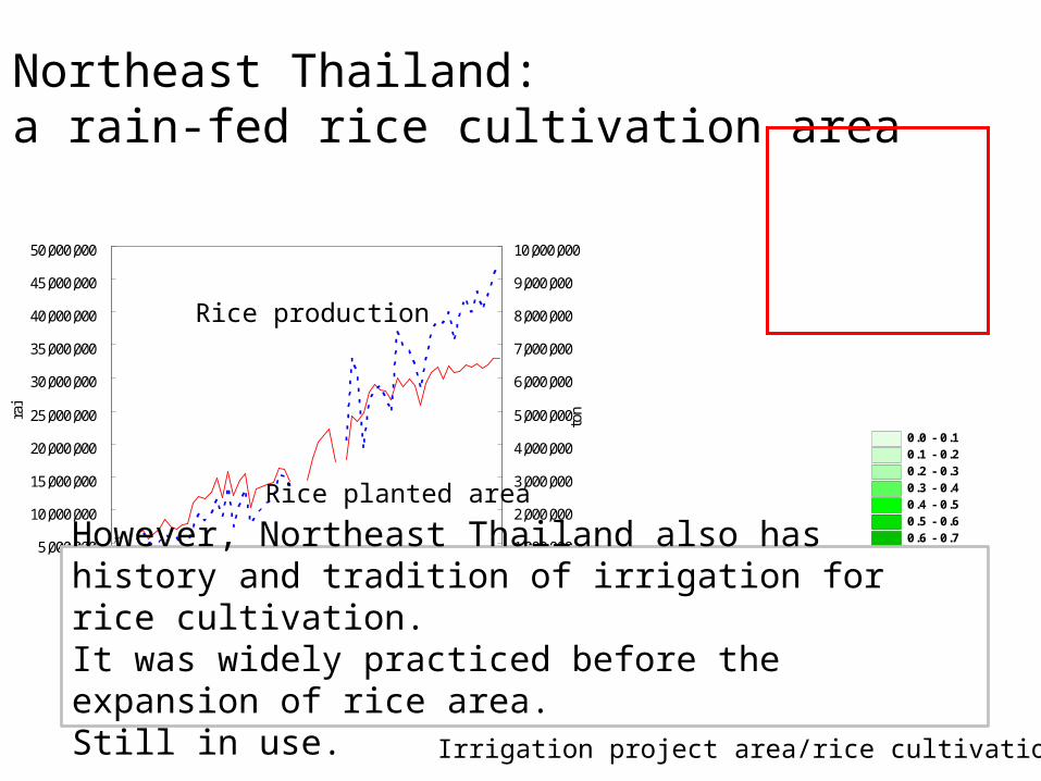
Northeast Thailand:a rain-fed rice cultivation area
Northeastern Region
0
5,000,000
10,000,000
15,000,000
20,000,000
25,000,000
30,000,000
35,000,000
40,000,000
45,000,000
50,000,000
1933 1943 1953 1963 1973 1983 1993
rai
0
1,000,000
2,000,000
3,000,000
4,000,000
5,000,000
6,000,000
7,000,000
8,000,000
9,000,000
10,000,000
ton
0 200km0 200km0 200km
Rice planted area
Rice production
0.0 - 0.10.1 - 0.20.2 - 0.30.3 - 0.40.4 - 0.50.5 - 0.60.6 - 0.70.7 - 0.80.8 - 0.90.9 -
Irrigation project area/rice cultivation area
However, Northeast Thailand also has history and tradition of irrigation for rice cultivation.It was widely practiced before the expansion of rice area.Still in use.
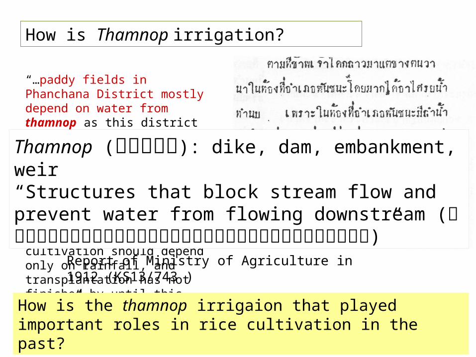
How is Thamnop irrigation?
“…paddy fields in Phanchana District mostly depend on water from thamnop as this district has many streams. Lam Chiang Krai River is one of the most important streams. Some thamnop on it are supplying water to paddy fields. If there are no thamnop in the district, rice cultivation should depend only on rainfall, and transplantation has not finished by until this month…”
Report of Ministry of Agriculture in 1912 (KS13/743 )
How is the thamnop irrigaion that played important roles in rice cultivation in the past?
Thamnop (ทำ��นบ): dike, dam, embankment, weir“Structures that block stream flow and prevent water from flowing downstream (สิ่��งก่�อสิ่ร้��งก่��นลำ��น���ไม่�ใหลำผ่��น)”
Topics
• How is thamnop irrigation?• How does it work?
– Structure and function different from “ordinary” irrigation weirs
• Why thamnop?– Local hydrological environment and thamnop
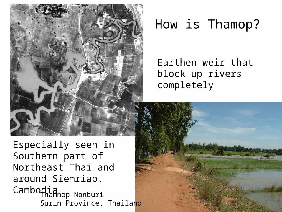
Earthen weir that block up rivers completely
How is Thamop?
Thamnop NonburiSurin Province, Thailand
Especially seen in Southern part of Northeast Thai and around Siemriap, Cambodia
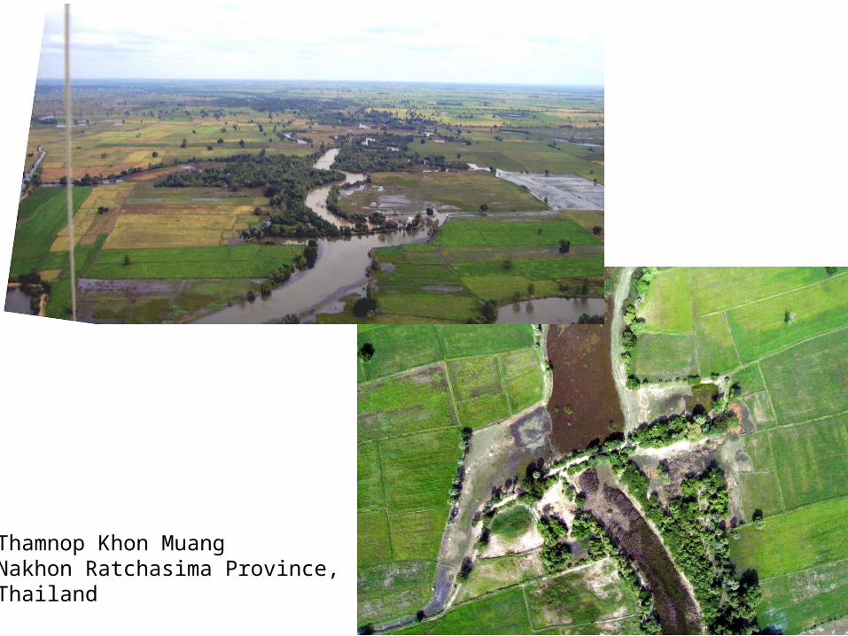
Thamnop Khon MuangNakhon Ratchasima Province,Thailand
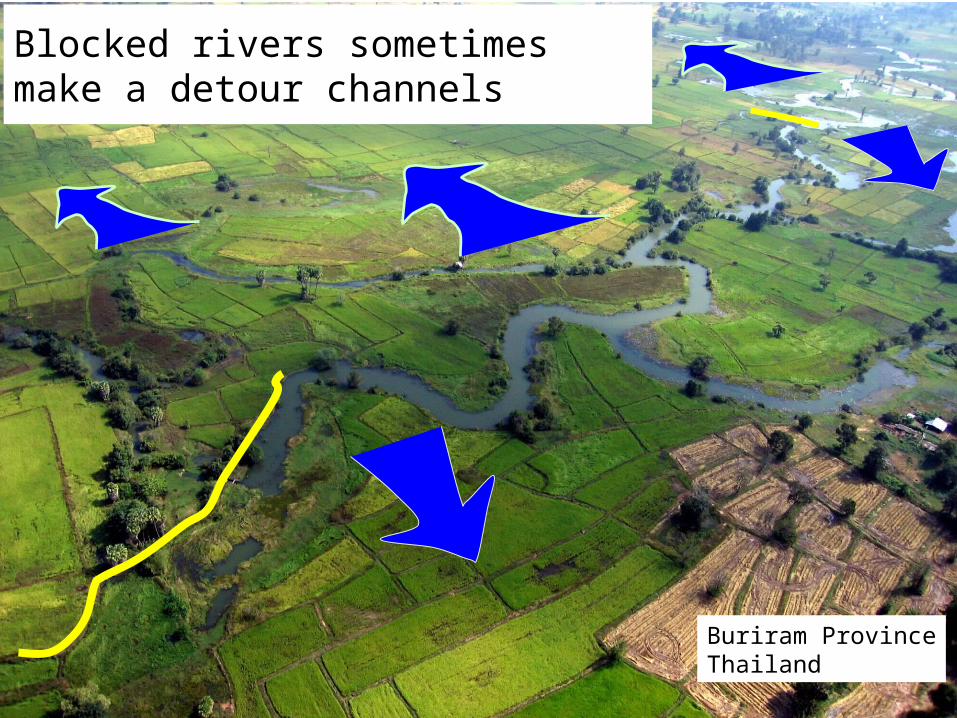
Blocked rivers sometimes make a detour channels
Buriram ProvinceThailand
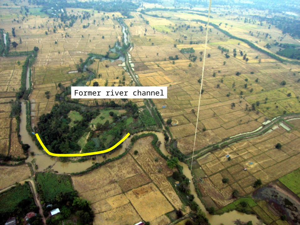
Former river channel
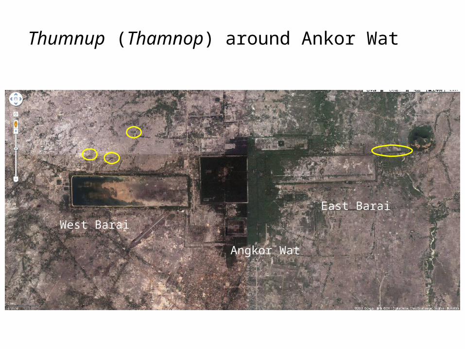
Thumnup (Thamnop) around Ankor Wat
Angkor Wat
West Barai
East Barai
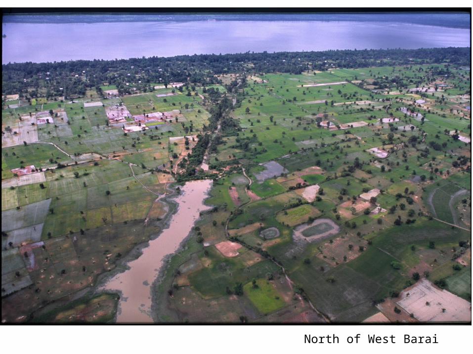
North of West Barai
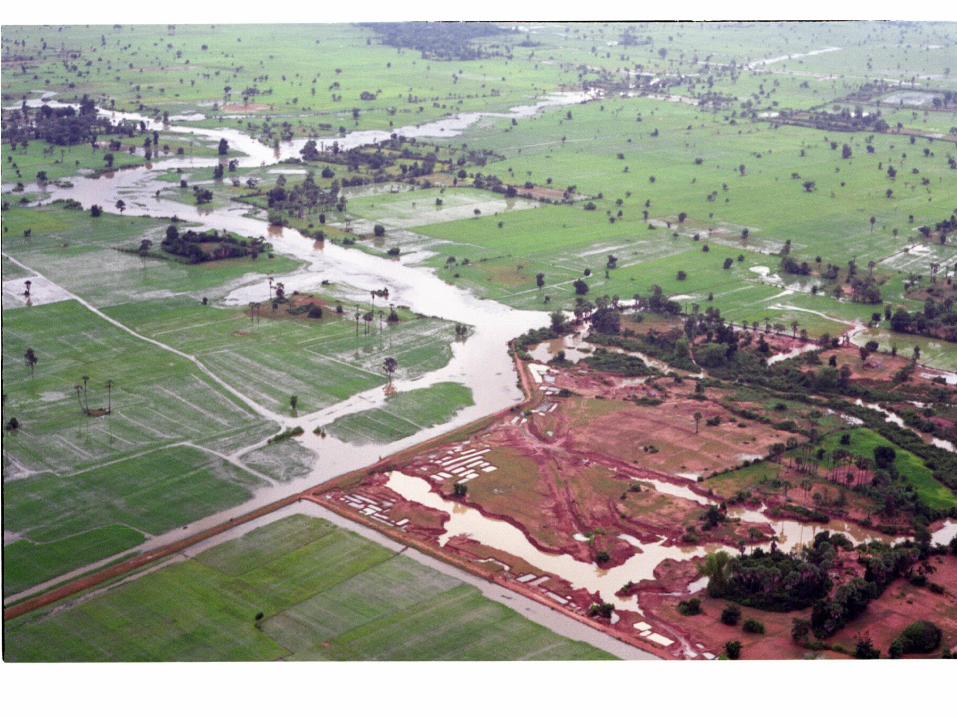

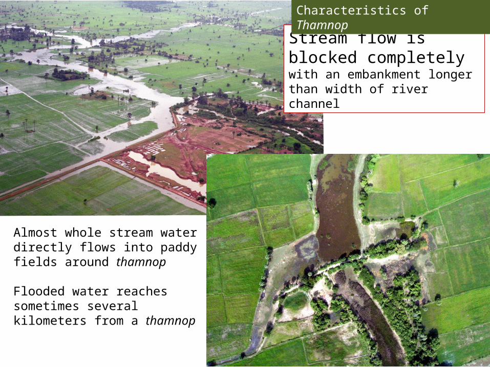
Stream flow is blocked completely with an embankment longer than width of river channel
Characteristics of Thamnop
Almost whole stream water directly flows into paddy fields around thamnop
Flooded water reaches sometimes several kilometers from a thamnop
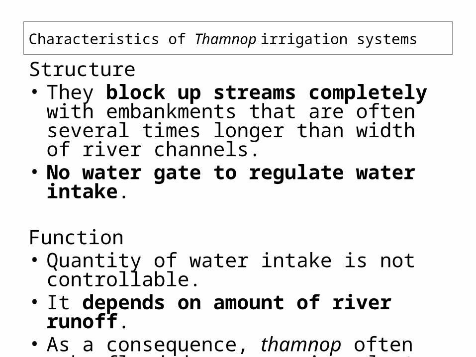
Characteristics of Thamnop irrigation systems
Structure• They block up streams completely with
embankments that are often several times longer than width of river channels.
• No water gate to regulate water intake.
Function• Quantity of water intake is not controllable.• It depends on amount of river runoff.• As a consequence, thamnop often make flood
damage on rice plants.

They sometimes cause flood damage on rice plants.
Characteristics of Thamnop
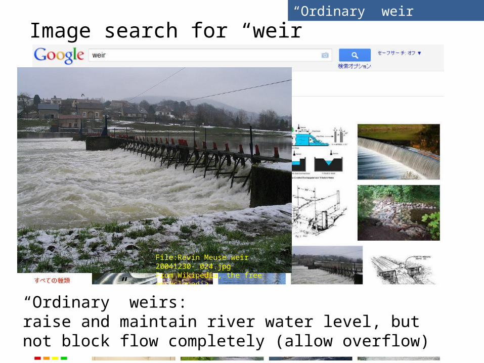
Image search for “weir”
File:Revin Meuse weir 20041230- 024.jpgFrom Wikipedia, the free encyclopedia
“Ordinary” weirs: raise and maintain river water level, but not block flow completely (allow overflow)
“Ordinary” weir
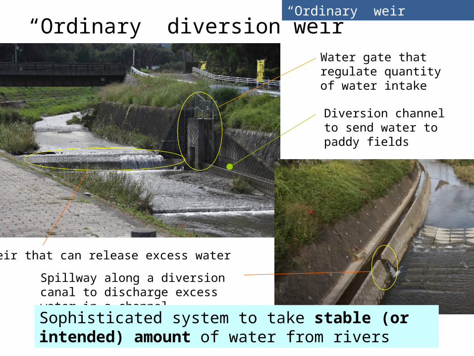
“Ordinary” diversion weir
Weir that can release excess water
Water gate that regulate quantity of water intake
Diversion channel to send water to paddy fields
Spillway along a diversion canal to discharge excess water in a channel
Sophisticated system to take stable (or intended) amount of water from rivers
“Ordinary” weir
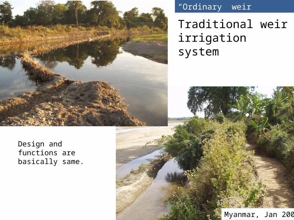
Traditional weir irrigation system
“Ordinary” weir
Myanmar, Jan 2003
Design and functions are basically same.
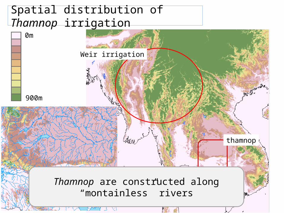
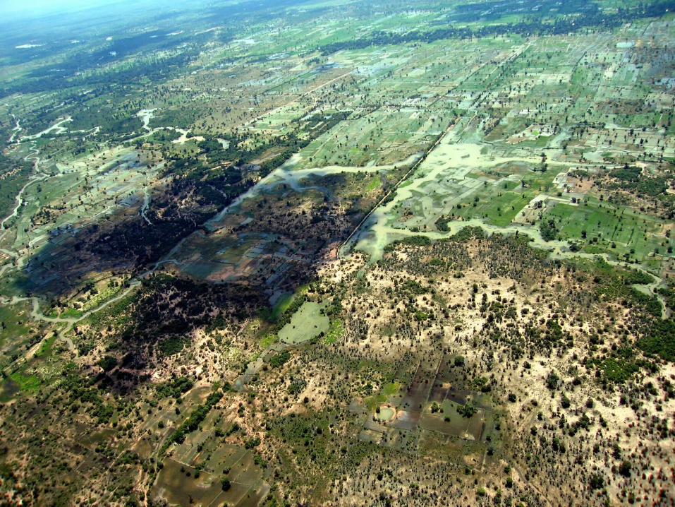
Spatial distribution of Thamnop irrigation
0m
900m
Weir irrigation
thamnop
Thamnop are constructed along “montainless” rivers
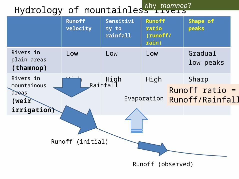
Hydrology of mountainless riversRunoff velocity
Sensitivity to rainfall
Runoff ratio(runoff/rain)
Shape of peaks
Rivers in plain areas(thamnop)
Low Low Low Gradual low peaks
Rivers in mountainous areas(weir irrigation)
High High High Sharp high peaks
Why thamnop?
Evaporation
Runoff (observed)
Rainfall
Runoff (initial)
Runoff ratio =Runoff/Rainfall
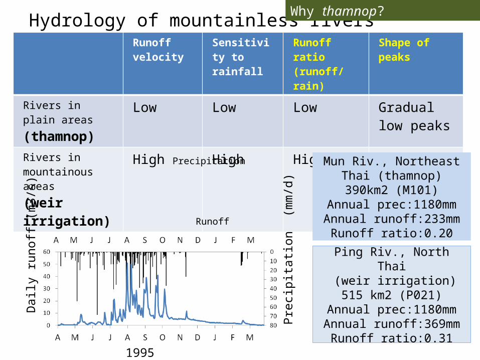
Hydrology of mountainless riversRunoff velocity
Sensitivity to rainfall
Runoff ratio(runoff/rain)
Shape of peaks
Rivers in plain areas(thamnop)
Low Low Low Gradual low peaks
Rivers in mountainous areas(weir irrigation)
High High High Sharp high peaks
Dai
ly ru
noff
(m3/
s)
Prec
ipita
tion
(mm
/d)
1995
Precipitation
Runoff
Mun Riv., Northeast Thai (thamnop)
390km2 (M101)Annual prec:1180mmAnnual runoff:233mm
Runoff ratio:0.20
Ping Riv., North Thai (weir irrigation)515 km2 (P021)
Annual prec:1180mmAnnual runoff:369mm
Runoff ratio:0.31
Why thamnop?
Quick runoff and slow runoffRainfall
Quick runoff (surface runoff)
Slow runoff(subsurface)
Stream
Base runoff
Peak runoff
Rainfall
Runoff
Why thamnop?
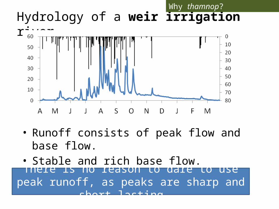
Hydrology of a weir irrigation river
• Runoff consists of peak flow and base flow.• Stable and rich base flow.
There is no reason to dare to use peak runoff, as peaks are sharp and short lasting.
Why thamnop?
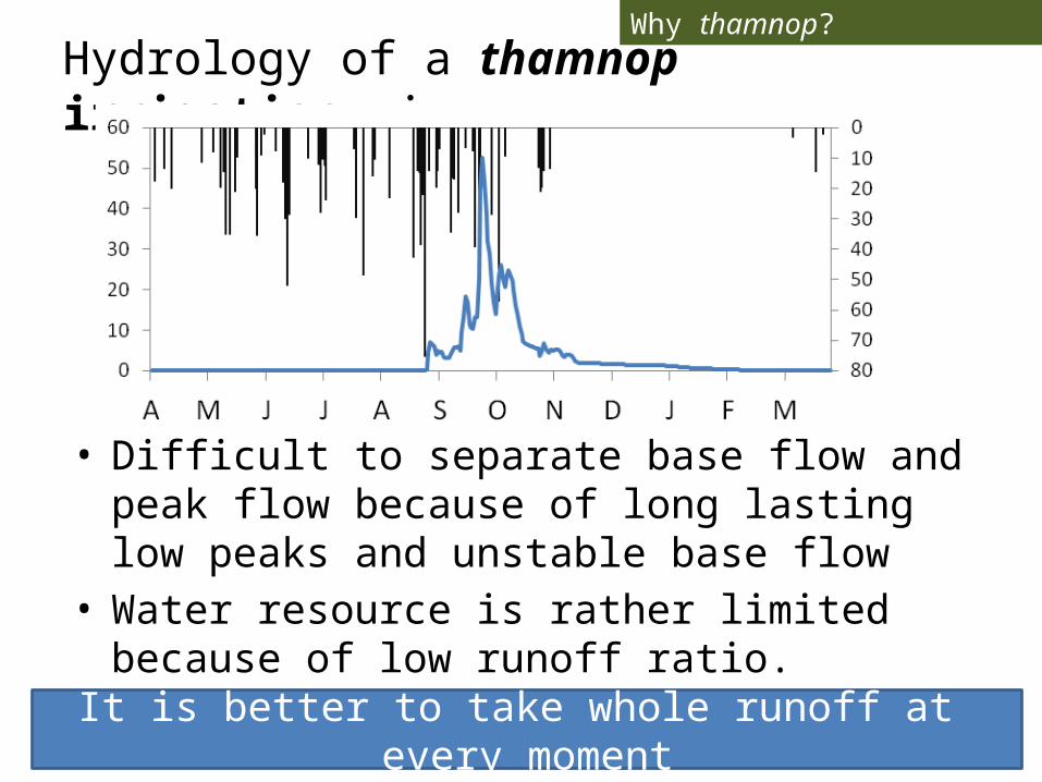
Hydrology of a thamnop irrigation river
• Difficult to separate base flow and peak flow because of long lasting low peaks and unstable base flow
• Water resource is rather limited because of low runoff ratio.
It is better to take whole runoff at every moment
Why thamnop?
Conclusions
• Thamnop irrigation much depends on river runoff.
• This does not mean that thamnop irrigation is less efficient than weir irrigation.
• The thamnop irrigation system is well designed by local people for mountailess rivers.