great lakes kml files 13aug10 - university of wisconsin–madison
TRANSCRIPT
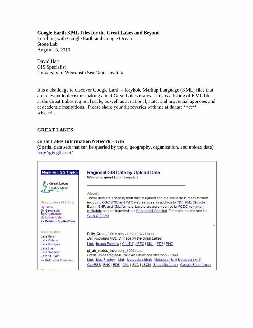
Google Earth KML Files for the Great Lakes and Beyond Teaching with Google Earth and Google Ocean Stone Lab August 13, 2010 David Hart GIS Specialist University of Wisconsin Sea Grant Institute It is a challenge to discover Google Earth – Keyhole Markup Language (KML) files that are relevant to decision-making about Great Lakes issues. This is a listing of KML files at the Great Lakes regional scale, as well as at national, state, and provincial agencies and at academic institutions. Please share your discoveries with me at dahart **at** wisc.edu. GREAT LAKES Great Lakes Information Network – GIS (Spatial data sets that can be queried by topic, geography, organization, and upload date) http://gis.glin.net/

Great Lakes Environmental Research Lab Great Lakes Coastal Forecasting System http://www.glerl.noaa.gov/res/glcfs/ Nowcast Winds Nowcast Waves Nowcast Surface Temperatures Nowcast Currents GLSEA Surface Temps & Ice
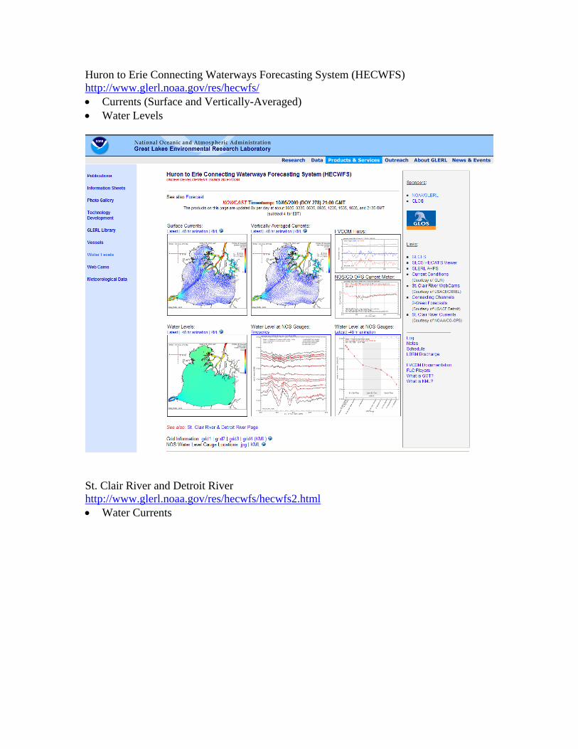
Huron to Erie Connecting Waterways Forecasting System (HECWFS) http://www.glerl.noaa.gov/res/hecwfs/ Currents (Surface and Vertically-Averaged) Water Levels
St. Clair River and Detroit River http://www.glerl.noaa.gov/res/hecwfs/hecwfs2.html Water Currents
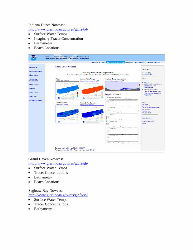
Indiana Dunes Nowcast http://www.glerl.noaa.gov/res/glcfs/bd/ Surface Water Temps Imaginary Tracer Concentration Bathymetry Beach Locations
Grand Haven Nowcast http://www.glerl.noaa.gov/res/glcfs/gh/ Surface Water Temps Tracer Concentrations Bathymetry Beach Locations Saginaw Bay Nowcast http://www.glerl.noaa.gov/res/glcfs/sb/ Surface Water Temps Tracer Concentrations Bathymetry
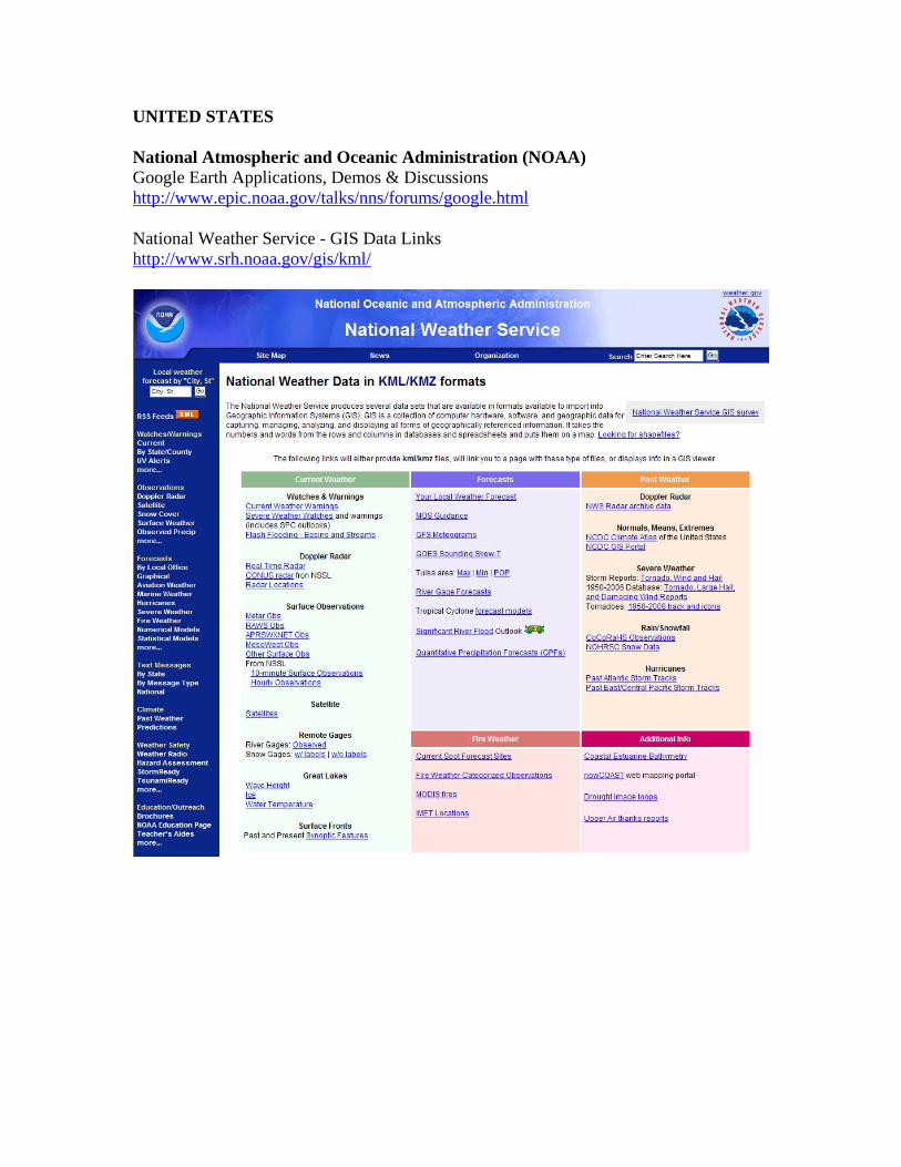
UNITED STATES National Atmospheric and Oceanic Administration (NOAA) Google Earth Applications, Demos & Discussions http://www.epic.noaa.gov/talks/nns/forums/google.html National Weather Service - GIS Data Links http://www.srh.noaa.gov/gis/kml/
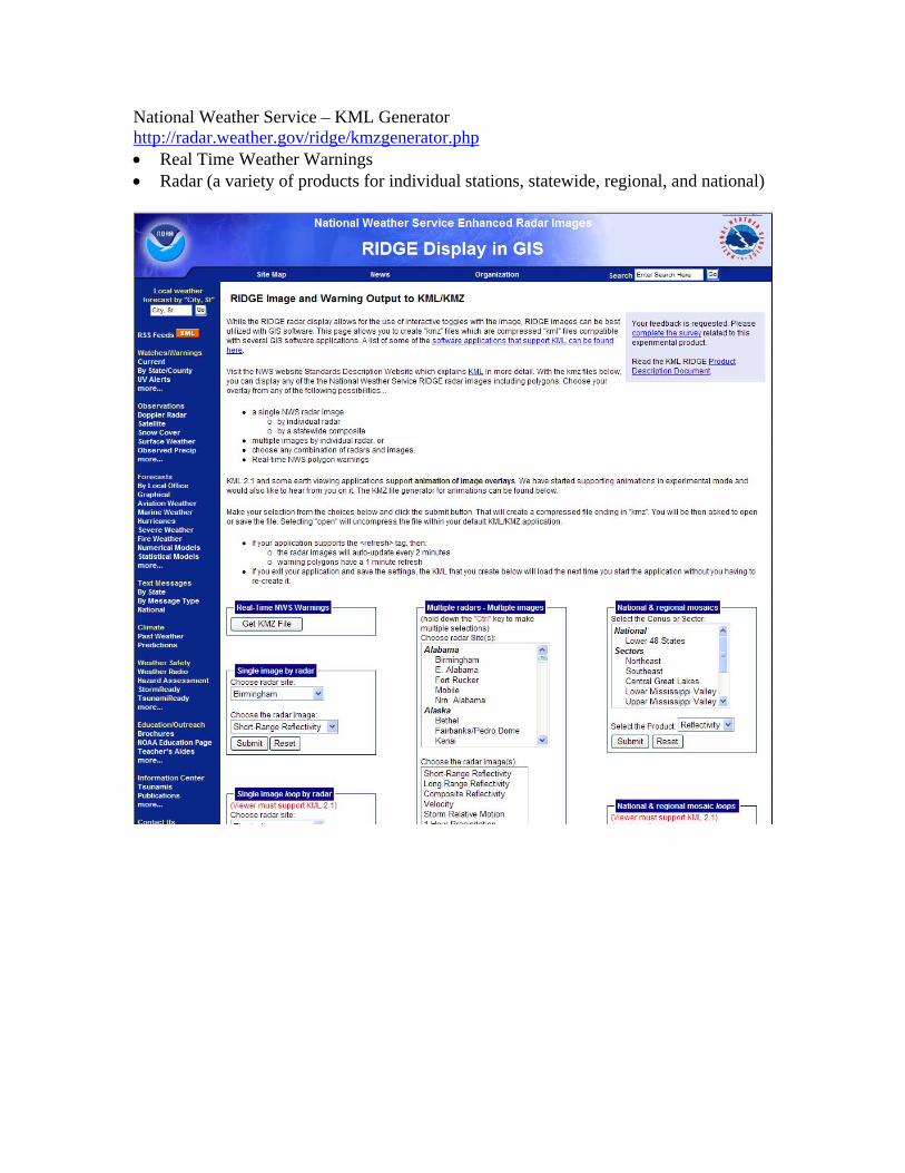
National Weather Service – KML Generator http://radar.weather.gov/ridge/kmzgenerator.php Real Time Weather Warnings Radar (a variety of products for individual stations, statewide, regional, and national)
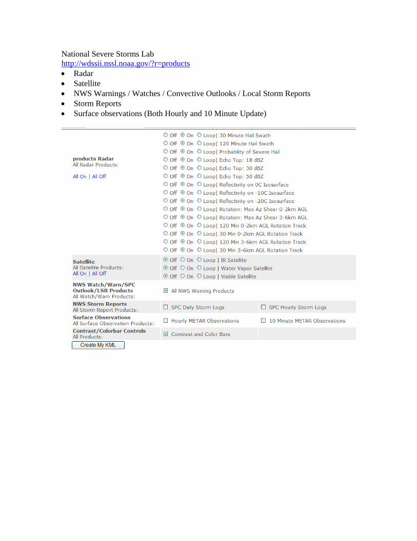
National Severe Storms Lab http://wdssii.nssl.noaa.gov/?r=products Radar Satellite NWS Warnings / Watches / Convective Outlooks / Local Storm Reports Storm Reports Surface observations (Both Hourly and 10 Minute Update)
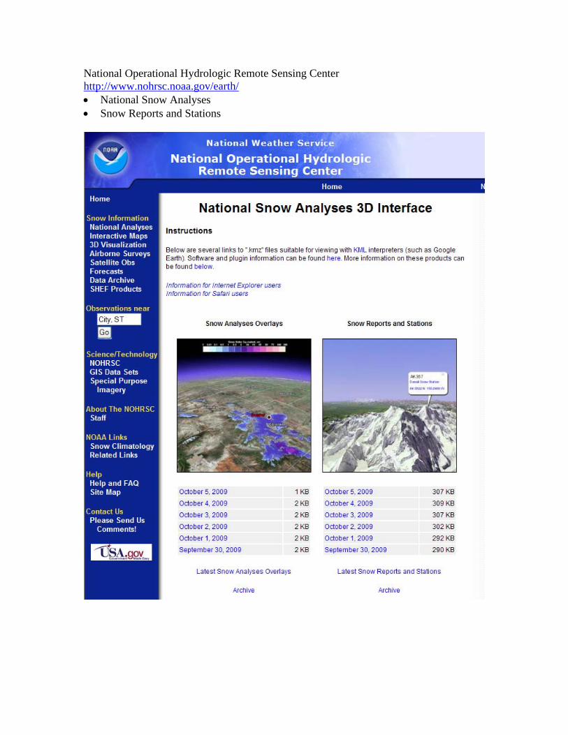
National Operational Hydrologic Remote Sensing Center http://www.nohrsc.noaa.gov/earth/ National Snow Analyses Snow Reports and Stations

National Geophysical Data Center http://www.ngdc.noaa.gov/dmsp/maps.html Defense Meteorological Satellite Program (DMSP) OLS Global Composites Version
2 Defense Meteorological Satellite Program (DMSP) OLS Gas Flare Monitoring Las Vegas High Resolution Lights Nighttime Lights of the World: 2003 Wells National Estuarine Research Reserve
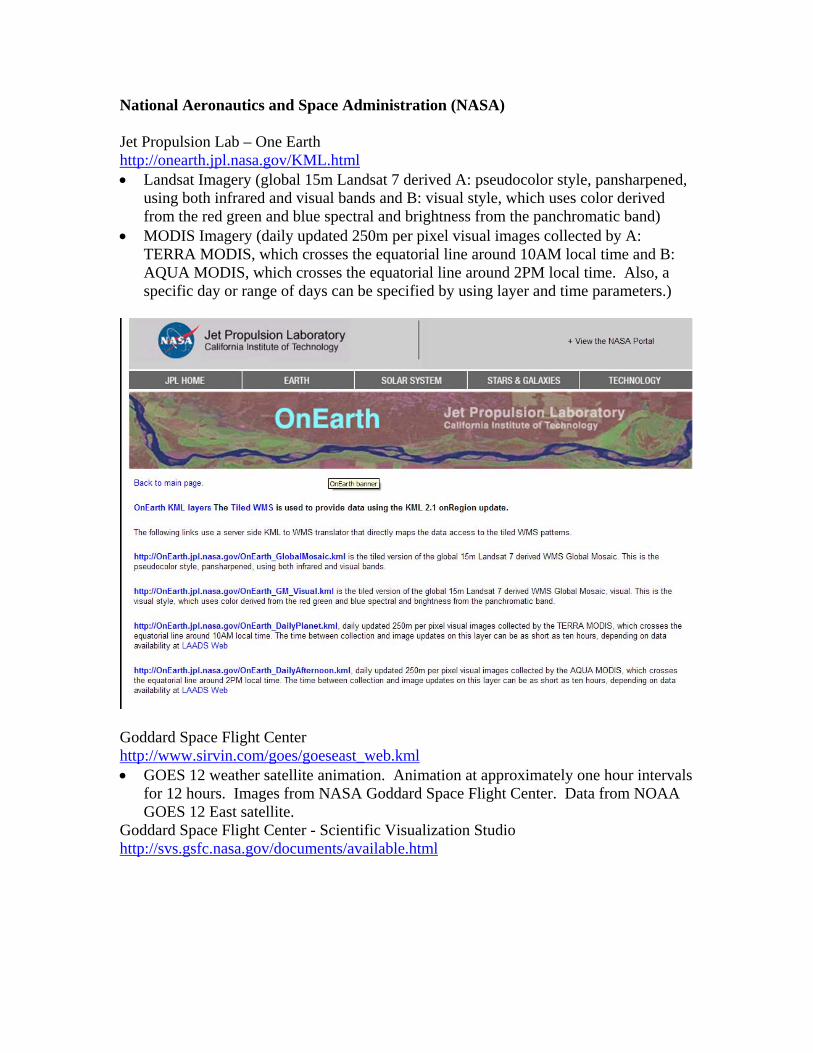
National Aeronautics and Space Administration (NASA) Jet Propulsion Lab – One Earth http://onearth.jpl.nasa.gov/KML.html Landsat Imagery (global 15m Landsat 7 derived A: pseudocolor style, pansharpened,
using both infrared and visual bands and B: visual style, which uses color derived from the red green and blue spectral and brightness from the panchromatic band)
MODIS Imagery (daily updated 250m per pixel visual images collected by A: TERRA MODIS, which crosses the equatorial line around 10AM local time and B: AQUA MODIS, which crosses the equatorial line around 2PM local time. Also, a specific day or range of days can be specified by using layer and time parameters.)
Goddard Space Flight Center http://www.sirvin.com/goes/goeseast_web.kml GOES 12 weather satellite animation. Animation at approximately one hour intervals
for 12 hours. Images from NASA Goddard Space Flight Center. Data from NOAA GOES 12 East satellite.
Goddard Space Flight Center - Scientific Visualization Studio http://svs.gsfc.nasa.gov/documents/available.html

U.S. Geological Survey WaterWatch http://water.usgs.gov/waterwatch/kml.html Real-Time Stream Flow color coded by flow condition (updated hourly) EDNA Derived Watersheds for Major Named Rivers http://edna.usgs.gov/watersheds/kml_index.htm this KML depicts 1992 land cover in the U.S. side of the Great Lakes watershed
(http://edna.usgs.gov/watersheds/sheds/greatlakes/greatlakes.kmz) Historical Orthoimagery http://gisdata.usgs.gov/webappcontent/kml/HistoricOrtho/HistoricOrthoCoverageAreas.kml 2002 Orthophotos for Chicago Latest Earthquakes http://earthquake.usgs.gov/eqcenter/catalogs/
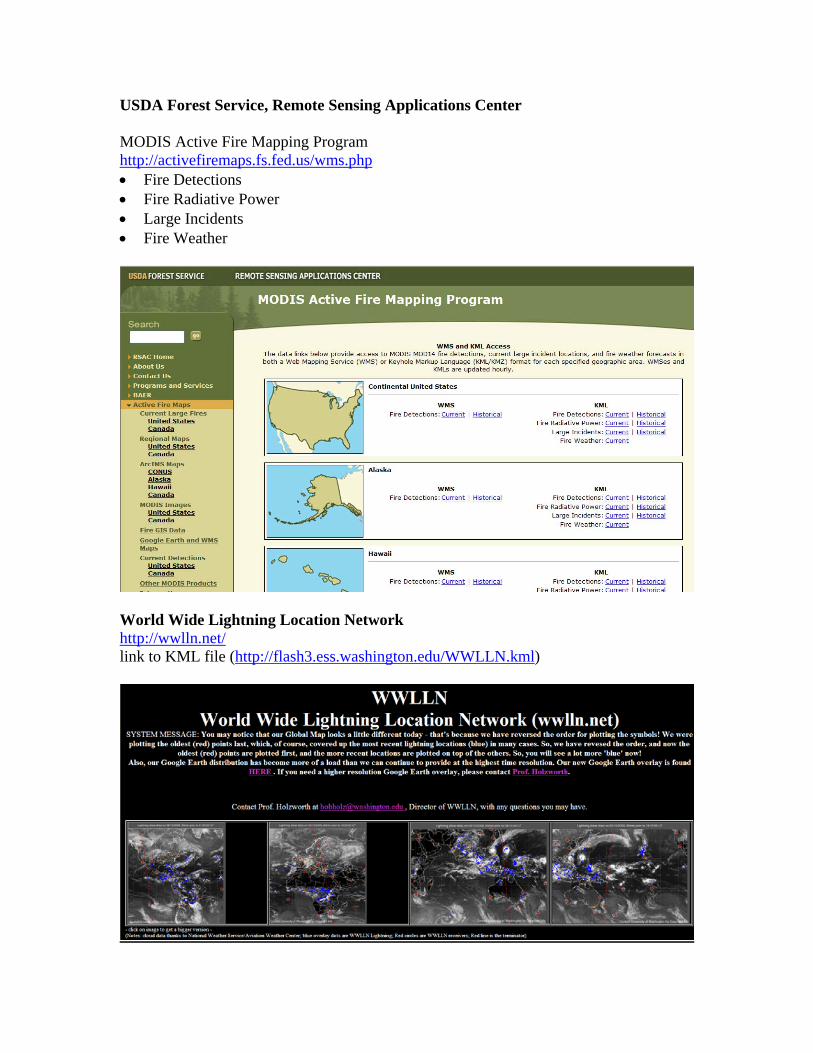
USDA Forest Service, Remote Sensing Applications Center MODIS Active Fire Mapping Program http://activefiremaps.fs.fed.us/wms.php Fire Detections Fire Radiative Power Large Incidents Fire Weather
World Wide Lightning Location Network http://wwlln.net/ link to KML file (http://flash3.ess.washington.edu/WWLLN.kml)
Environmental Protection Agency EPA Geospatial Data Access Project http://www.epa.gov/enviro/html/frs_demo/geospatial_data/region_05.kmz CANADA Environment Canada Weather Radar http://www.methlab.ca/weatherradar02.kmz ILLINOIS Illinois EPA Leaking Underground Storage Tanks http://epadata.epa.state.il.us/LAND/GIS/LUST.kmz NOAA Coastal Services Center Land Cover http://www.csc.noaa.gov/ccap_ge/state_kmz/il.kmz U.S. Geological Survey, Mineral Resources Program Geologic Units of Ilinois http://tin.er.usgs.gov/geology/state/kml/ilgeol.kmz INDIANA U.S. Geological Survey, Mineral Resources Program Geologic Units of Indiana http://tin.er.usgs.gov/geology/state/kml/ingeol.kmz MICHIGAN Michigan Tech Research Institute Using Google Earth for Exploring Atmospheric Observations of Carbon Dioxide for Understanding the North American Carbon Budget http://earth.google.com/gallery/kmz/tyler_erickson.kmz U.S. Geological Survey, Mineral Resources Program Geologic units and structural features in Michigan, with lithology, age, data structure, and format http://tin.er.usgs.gov/geology/state/kml/migeol.kmz
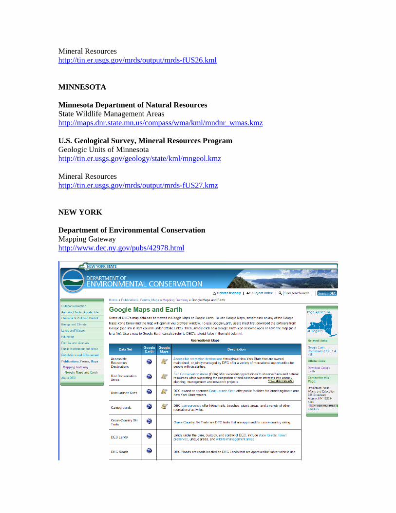
Mineral Resources http://tin.er.usgs.gov/mrds/output/mrds-fUS26.kml MINNESOTA Minnesota Department of Natural Resources State Wildlife Management Areas http://maps.dnr.state.mn.us/compass/wma/kml/mndnr_wmas.kmz U.S. Geological Survey, Mineral Resources Program Geologic Units of Minnesota http://tin.er.usgs.gov/geology/state/kml/mngeol.kmz Mineral Resources http://tin.er.usgs.gov/mrds/output/mrds-fUS27.kmz NEW YORK Department of Environmental Conservation Mapping Gateway http://www.dec.ny.gov/pubs/42978.html
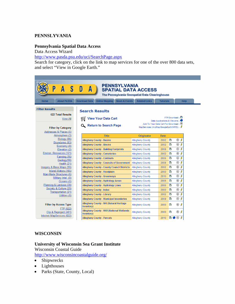
PENNSLYVANIA Pennsylvania Spatial Data Access Data Access Wizard http://www.pasda.psu.edu/uci/SearchPage.aspx Search for category, click on the link to map services for one of the over 800 data sets, and select “View in Google Earth.”
WISCONSIN University of Wisconsin Sea Grant Institute Wisconsin Coastal Guide http://www.wisconsincoastalguide.org/ Shipwrecks Lighthouses Parks (State, County, Local)
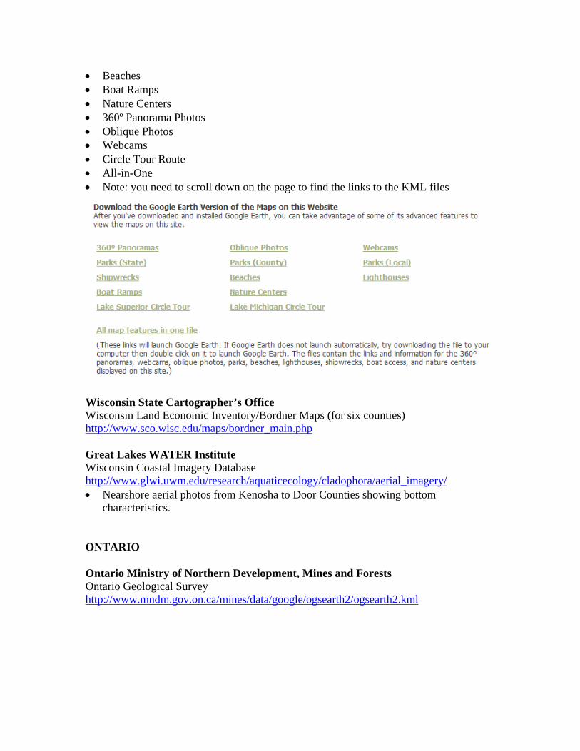
Beaches Boat Ramps Nature Centers 360º Panorama Photos Oblique Photos Webcams Circle Tour Route All-in-One Note: you need to scroll down on the page to find the links to the KML files
Wisconsin State Cartographer’s Office Wisconsin Land Economic Inventory/Bordner Maps (for six counties) http://www.sco.wisc.edu/maps/bordner_main.php Great Lakes WATER Institute Wisconsin Coastal Imagery Database http://www.glwi.uwm.edu/research/aquaticecology/cladophora/aerial_imagery/ Nearshore aerial photos from Kenosha to Door Counties showing bottom
characteristics. ONTARIO Ontario Ministry of Northern Development, Mines and Forests Ontario Geological Survey http://www.mndm.gov.on.ca/mines/data/google/ogsearth2/ogsearth2.kml
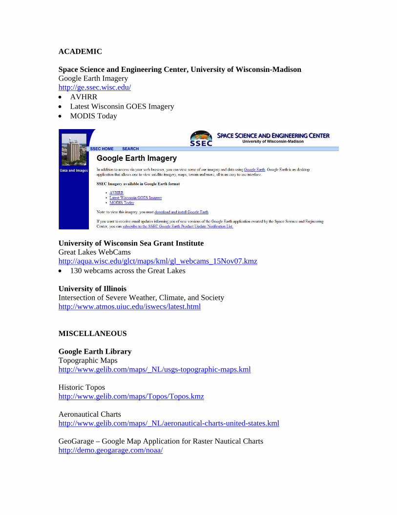
ACADEMIC Space Science and Engineering Center, University of Wisconsin-Madison Google Earth Imagery http://ge.ssec.wisc.edu/ AVHRR Latest Wisconsin GOES Imagery MODIS Today
University of Wisconsin Sea Grant Institute Great Lakes WebCams http://aqua.wisc.edu/glct/maps/kml/gl_webcams_15Nov07.kmz 130 webcams across the Great Lakes University of Illinois Intersection of Severe Weather, Climate, and Society http://www.atmos.uiuc.edu/iswecs/latest.html MISCELLANEOUS Google Earth Library Topographic Maps http://www.gelib.com/maps/_NL/usgs-topographic-maps.kml Historic Topos http://www.gelib.com/maps/Topos/Topos.kmz Aeronautical Charts http://www.gelib.com/maps/_NL/aeronautical-charts-united-states.kml GeoGarage – Google Map Application for Raster Nautical Charts http://demo.geogarage.com/noaa/
EarthNC - Nautical Data for a Digital World http://earthnc.com/ Registration is required for a free online service of raster and vector nautical charts. http://earthnc.com/kml/earthnc-online.kmz Additional Near-Real Time Layers in Google Earth 5.0 Ocean (State of the Ocean >> Ocean Observations includes Great Lakes buoys) Weather (clouds, radar, conditions and forecasts) Traffic (on most interstate highways and some major arterials in large cities) How to add a Web Map Service (WMS) to Google Earth 1. Choose the Add pull-down menu and select Image Overlay 2. Click on the Refresh tab 3. Select the WMS Parameters button 4. Select an existing WMS or select the Add button to type in a new WMS server URL