global monitoring for environment and security (gmes) veck eo... · global monitoring for...
TRANSCRIPT
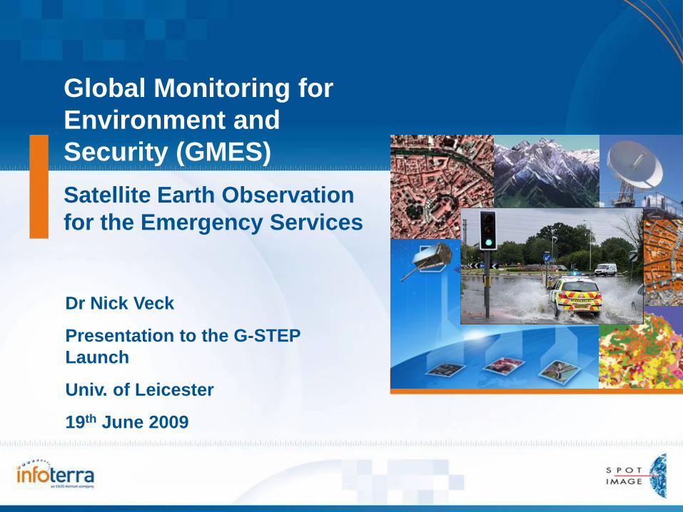
Global Monitoring for
Environment and
Security (GMES)
Satellite Earth Observation
for the Emergency Services
Dr Nick Veck
Presentation to the G-STEP
Launch
Univ. of Leicester
19th June 2009
2Space Task Group
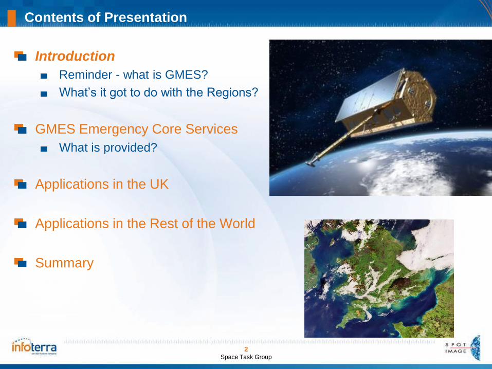
Contents of Presentation
Introduction
Reminder - what is GMES?
What’s it got to do with the Regions?
GMES Emergency Core Services
What is provided?
Applications in the UK
Applications in the Rest of the World
Summary

3Space Task Group
What is GMES?GMES (Global Monitoring for Environment and Security) is aEuropean initiative for the implementation of information services dealing with environment and security.
GMES uses images from Earth observation satellites as well as ground-based information. These data will be coordinated, analysed and prepared to provide services for end-users.
What is GMES?

4Space Task Group
What services will be provided?
The services provided by GMES can be classified into three major categories:
Mapping, including topography or road maps but also land-use and harvest, forestry monitoring, mineral and water resources. This service generally requires exhaustive coverage of the Earth surface, archiving and periodic updating of data.
Support for emergency management in case of natural hazards and particularly for civil protection. This service concentrates on the provision of the latest possible data before intervening.
Forecasting is applied for marine zones, air quality or crop yields. This service systematically provides data on extended areas, permitting prediction and modelling .
The widespread and regular availability of technical data within GMES should allow a more efficient use of the infrastructures and human resources. It will help the creation of new models for security and risk management, as well as better management of land and resources.

5Space Task Group
What Emergency support services will be provided?
Support to Emergencies and Humanitarian Aid
services target three main application domains:
Civil Protection: National Civil Protection Services of
Europe, DG ENV (European CP Unit), and more globally
all risk management actors in Europe at different
territorial scales
Humanitarian Aid: United Nations, DG RELEX, DG
ECHO, NGOs
Security crises: European Council, Member States
It addresses all types of disasters:
natural disasters (floods, fires, landslides, storms,
earthquakes, etc.);
technological accidents;
humanitarian crises (for instance after a severe drought
period); and
civilian-military crises.

6Space Task Group
Update on project start-up and service portfolio:
The GMES Emergency Core Service - SAFER

7PNICC Open Days
The Intervention Cycle & Sustainable Development
EOSatellite- based geographic information is relevant for the entirehumanitarian intervention cycle:
Mitigation
Response
Recovery
Preparedness
It is relevant for both slow-onset and rapid-onset emergencies.

8Space Task Group
SAFER - Basic information (1/2)
Full Title: “Services and Applications For Emergency Response” (SAFER)
Type of project: EC FP7 Integrated Project (shared cost)
Total budget and grant: €40m total budget (EC grant = €27m)
Time period: 2009-2011
Number of partners: 60 (incl. Infoterra and Map Action in the UK)
Overall objective: To Implement and extend the GMES Emergency
Response Core Service (ERCS)
Priorities:
To improve crisis response though preparatory reference mapping and
improving rapid mapping capacity (full scale service from 2008);
To extend ERCS into pre-and post-disaster phases – validate new Risk
and Thematic products (pilot service from 2008 & qualification of some
services into v2 of the core service by 2011).

9Space Task Group
Types of situation:
Meteorological Hazards
Geophysical Hazards
Man-Made Disasters
Humanitarian Disasters
Geographical scope of services:
Europe
RoW (priority for Africa, SE Asia, Central Asia)
Users:
Decision makers (European DGs, national &
regional authorities), implementing partners, field
operators
Civil Protection (MIC, national and regional levels)
Humanitarian Aid (UN agencies, national teams,
Red Cross, NGOs…)
SAFER - Basic information (2/2)

10Space Task Group
SAFER Portfolio: Two main types of products for full-scale delivery
For headquarters,
decision-makers
and in-field
operatives
Reference maps:
- Delivery within 6hr
- Offline production
- Mainly outside
Europe
Assessment maps
- Delivery within 24hr
- Online production
- Europe and RoW)
Full scale
services in
ERCS v0
from 2009
11PNICC Open Days
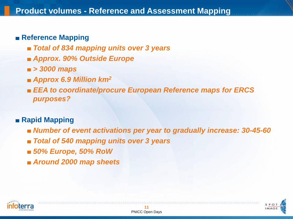
Product volumes - Reference and Assessment Mapping
Reference Mapping
Total of 834 mapping units over 3 years
Approx. 90% Outside Europe
> 3000 maps
Approx 6.9 Million km2
EEA to coordinate/procure European Reference maps for ERCS
purposes?
Rapid Mapping
Number of event activations per year to gradually increase: 30-45-60
Total of 540 mapping units over 3 years
50% Europe, 50% RoW
Around 2000 map sheets

12Space Task Group
How does it work? July 2007 - Satellite image of Tewkesbury

13Space Task Group
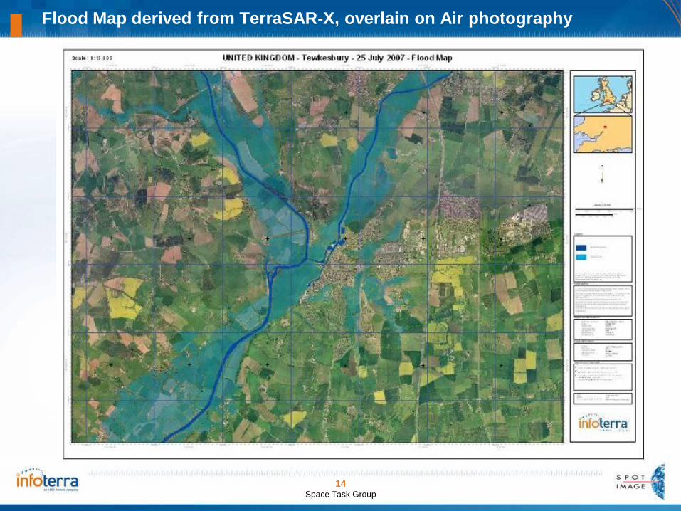
Flood Map derived from TerraSAR-X
Flood Map derived from TerraSAR-X
14Space Task Group
Flood Map derived from TerraSAR-X, overlain on Air photography

15Space Task Group
Tewkesbury Flood Overview
Flood extents
mapped on 25th
July and
superimposed
on national
mapping
OS Licence No: 200016034

16Space Task Group
Abbey
Rugby
Club
Tewkesbury – Abbey and Rugby Club validation against in situ air photography
17Space Task Group
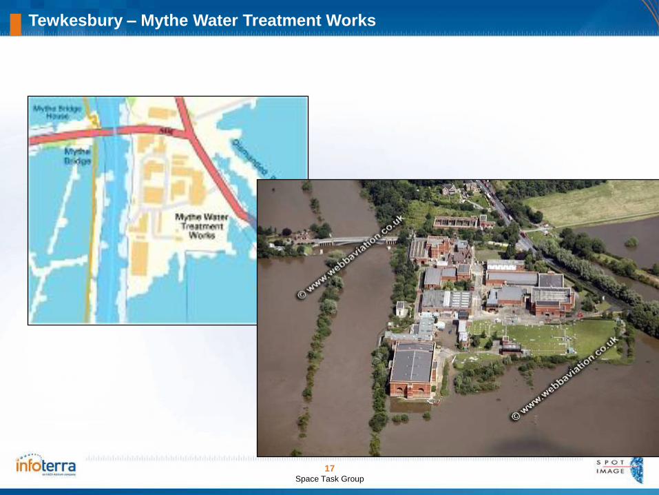
Tewkesbury – Mythe Water Treatment Works
18PNICC Open Days
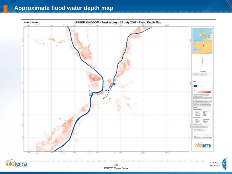
Approximate flood water depth map

19PNICC Open Days
Roads affected by Flooding
Example
highlighting
roads
impacted by
flood waters
OS Licence No: 200016034
20PNICC Open Days
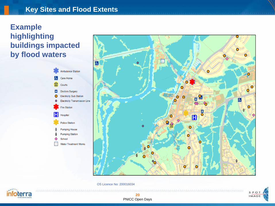
Key Sites and Flood Extents
Example
highlighting
buildings impacted
by flood waters
OS Licence No: 200016034

21PNICC Open Days
Addresses of Buildings Flooded
Extraction of
addresses of
impacted
buildings
OS Licence No: 200016034

22PNICC Open Days
Rural Land Registry Field Parcels Flooded
Example
highlighting
fields
impacted by
flood waters
OS Licence No: 200016034
RLR Rural Payments Agency

23PNICC Open Days
Data in Google Earth

24Space Task Group
Mozambique Flooding – The River Zambesi (Feb - Mar 2007):

1:200k Reference Mapping, used for route planning in Darfur

Mapping of Al Fashir: Guba Clinic (1:2k) and Abu Shoc IDP camp (1:5k)

27Space Task Group
In Summary
GMES will provide rapid response and preparatory
mapping for major emergencies and crises in Europe and
the Rest of the World.
In the UK, flooding is likely to be the primary application of
the satellite maps.
Flood maps, land cover and other geographic information
will be available to support operations anywhere in the
country.
Satellite imagery, land cover and flood layers can be part
of a national spatial data infrastructure.

28Space Task Group
Thank You!
Dr Nick Veck
Chair, UK GMES Emergency Response
Network Group
Infoterra Ltd, Farnborough, UK
Global Monitoring for Environment
and Security (GMES)
Emergency Mapping Services