georesources institute mississippi state university · dod, usda, epa, sba/census, ... gulf coast...
TRANSCRIPT

GeoResources Institute
Mississippi State University
Lori Mann Bruce, Ph.D., Associate Director of Research
David R. Shaw, [email protected]

Mission• To understand Earth's natural and managed
systems and provide comprehensive solutions for socioeconomic and environmental requirements, leading to an improved quality of life.
Vision• To be a world leader in advancing the state-of-
the-art in spatial technologies and resource management.
•
GeoResources Institute - Profile
• Total funding in FY 07 - $28M• 74 active projects funded from NOAA, NASA, USGS,
DoD, USDA, EPA, SBA/Census, USDOE, USFS, USDOT…
• Collaborations– External: over 20 universities nationally, internationally– Internal (MSU): faculty from 22 departments, 6 colleges/units
• Philosophy – Identify expertise needed and find it so as to best address agency/client needs
GeoResources Institute - Profile
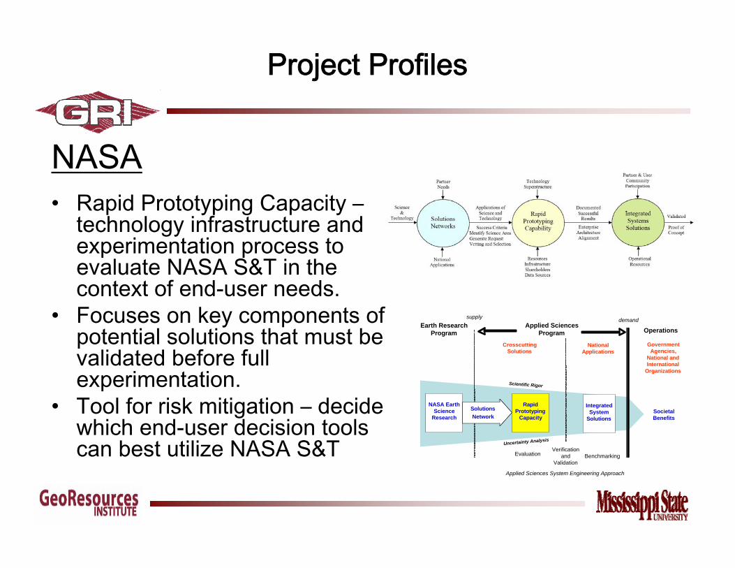
NASA• Rapid Prototyping Capacity –
technology infrastructure and experimentation process to evaluate NASA S&T in the context of end-user needs.
• Focuses on key components of potential solutions that must be validated before full experimentation.
• Tool for risk mitigation – decide which end-user decision tools can best utilize NASA S&T
Project Profiles
CrosscuttingSolutions
NationalApplications
Earth ResearchProgram
Applied SciencesProgram
SocietalBenefits
Evaluation Benchmarking
supply demand
RapidPrototyping
Capacity
Operations
IntegratedSystem
Solutions
Uncertainty Analysis
Scientific Rigor
GovernmentAgencies,
National andInternational
Organizations
NASA EarthScience
ResearchSolutionsNetwork
Verificationand
Validation
Applied Sciences System Engineering Approach
Project Profiles
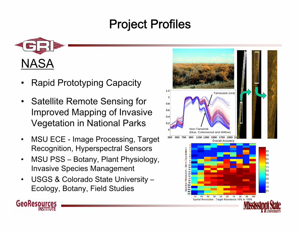
NASA• Rapid Prototyping Capacity
• Satellite Remote Sensing for Improved Mapping of Invasive Vegetation in National Parks
• MSU ECE - Image Processing, Target Recognition, Hyperspectral Sensors
• MSU PSS – Botany, Plant Physiology, Invasive Species Management
• USGS & Colorado State University –Ecology, Botany, Field Studies
350 550 750 950 1150 1350 1550 1750 1950 2150
0
0.2
0.4
0.6
0.8
1
1.2Tamaraisk (red)
Non-Tamarisk (blue, Cottonwood and Willow)
350 550 750 950 1150 1350 1550 1750 1950 2150
0
0.2
0.4
0.6
0.8
1
1.2Tamaraisk (red)
Non-Tamarisk (blue, Cottonwood and Willow)

NASA – Small Satellite• Need for new approach to satellite development, deployment• Academic program – new Ph.D. in small satellite engineering• Research program – aerospace, electrical, systems
engineering, applications• Economic development – new company development• Other agencies now on board
Project Profiles
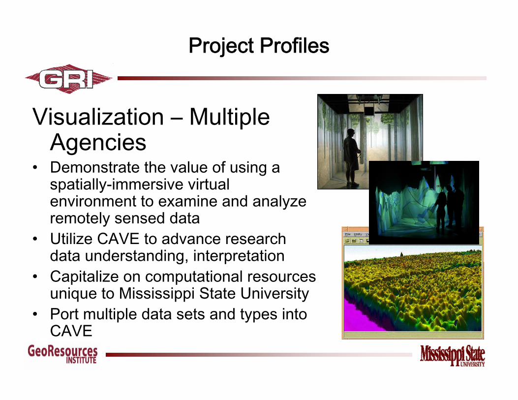
Visualization – Multiple Agencies
• Demonstrate the value of using a spatially-immersive virtual environment to examine and analyze remotely sensed data
• Utilize CAVE to advance research data understanding, interpretation
• Capitalize on computational resources unique to Mississippi State University
• Port multiple data sets and types into CAVE
Project Profiles

USGS• Invasive Species - Develop integrated
management programs that focus on advanced decision support systems
• Incorporate latest technologies with proven current practices
• Build prototype educational programs; execute through academic & extension outlets
• Work with USDA, USFS, DOI, NASA, non-profits, industry for holistic approach
Eurasian Water MilfoilEurasian Water Milfoil
HydrillaHydrilla
Giant SalviniaGiant Salvinia
Project Profiles

US DOT• Lead consortium for R/S technology
demonstration related to environmental impact of transportation infrastructure growth (Mississippi Gulf Coast I-10 corridor; US 49)
• Needs assessments and validation with US DOT• Baseline data needs for US DOT and brokering
data for other consortium members• Education and training
• Specialized training for US DOT • Annual workshop(s)• Congressional Technology Showcase
• Environmental compliance, citizen engagement• Comprehensive planning (especially regarding
evacuation planning)
Project Profiles

NWS and FEMA• Advanced hurricane modeling
• Coupling wave models and atmospheric models
• New wave growth algorithm valid for hurricane speed regimes.
• Analysis of hurricane boundary using Japanese buoy data, U. S. buoy data, and Australia atoll data.
• Development of a hurricane storm surge atlas using the Army Corps of Engineer's ADCIRC model. Replacement of USGS elevation data with IFSAR data.
• Publication of Second Edition of “Natural Disasters: Hurricanes” by Dr. Patrick Fitzpatrick of GRI.
Project Profiles

• Advance the state-of-the-art in remote sensing image analysis and target recognition
• Develop new target recognition algorithms for hyperspectral imagery
• Apply new methods to problem of bio-security– Agricultural food crops– Airborne chemicals– Biological pathogens, e.g. soybean rust
• System verification and validation via extensive field studies, greenhouse studies, experimental data collection and analysis
• Partners: • UIUC, USDA/ARS, DOE
DHS
Project Profiles

• Evaluation of GIS data and procedures from Hurricane Katrina
• Extensive use of GIS in response and recovery efforts
• “Lessons Learned” analysis of procedures, products, activities
• Products: national archive, improved preparedness
• Partners: • DOE, MEMA, NVisions
Project Profiles
DHS

Community Resiliency Planning

A NOAA Cooperative Institute
David Shaw, [email protected]
www.NorthernGulfInstitute.org
Northern Gulf Institute
www.NorthernGulfInstitute.org
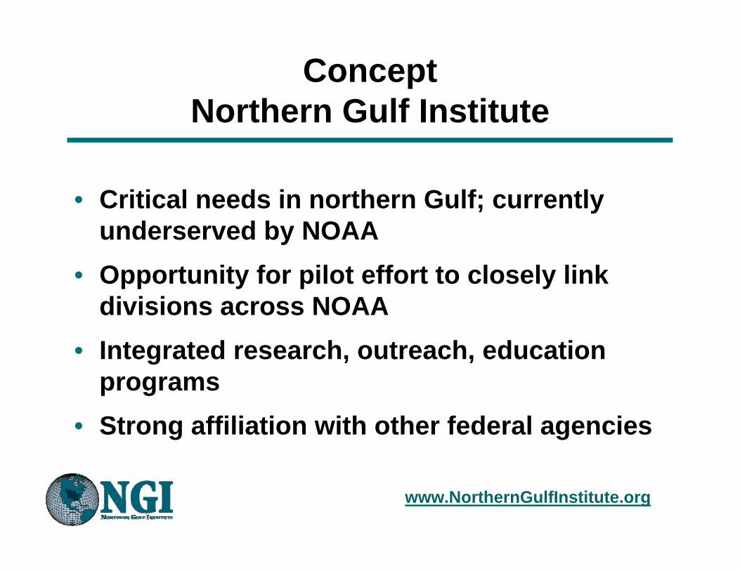
• Critical needs in northern Gulf; currently underserved by NOAA
• Opportunity for pilot effort to closely link divisions across NOAA
• Integrated research, outreach, education programs
• Strong affiliation with other federal agencies
Concept Northern Gulf Institute

www.NorthernGulfInstitute.org
ConceptNorthern Gulf Institute
• Anchored at Stennis Space Center, but regional in scope
• Collaborative with other CIs and NOAA labs• Strong linkages with state, local partner
agencies• Needs-based research, education and
transitional outreach as goals
www.NorthernGulfInstitute.org
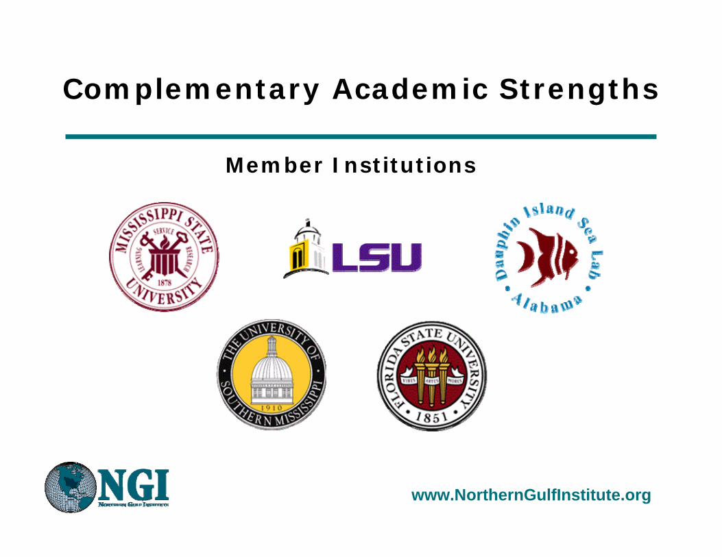
Member Institutions
Complementary Academic Strengths
www.NorthernGulfInstitute.org
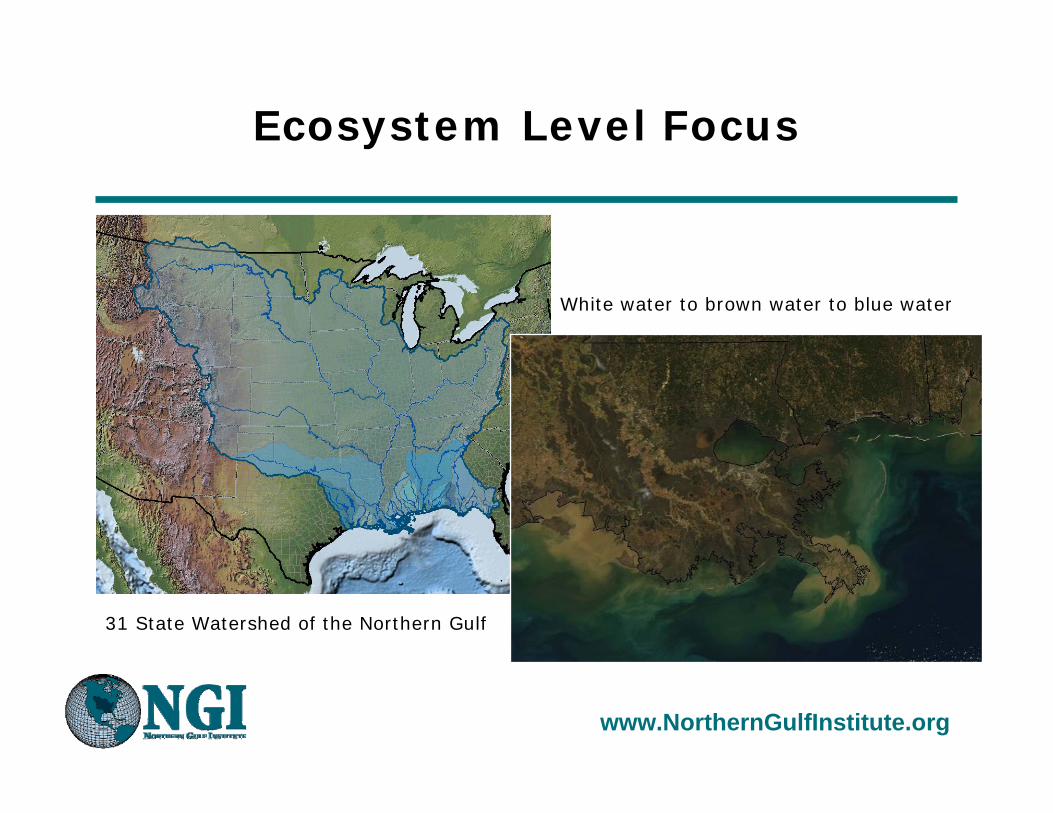
Ecosystem Level Focus
31 State Watershed of the Northern Gulf
White water to brown water to blue water
www.NorthernGulfInstitute.org
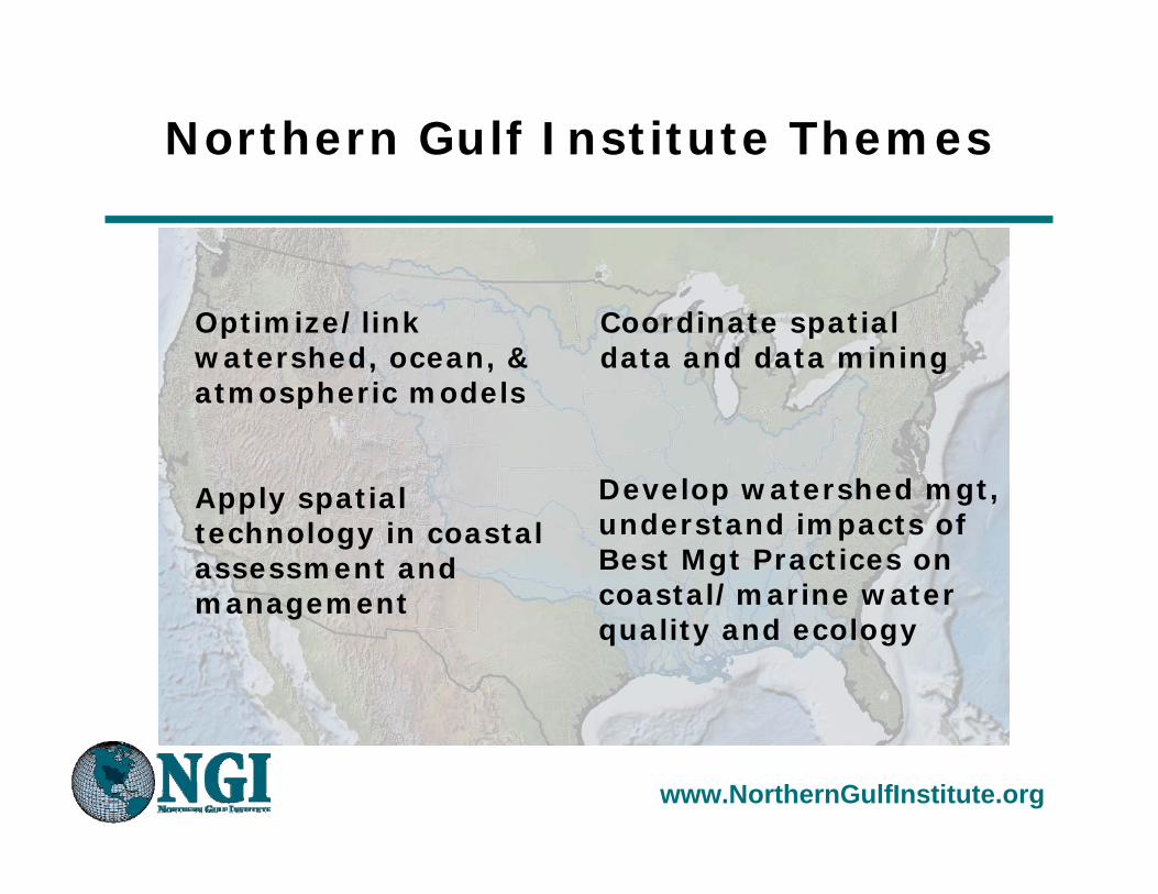
Northern Gulf Institute Themes
Apply spatial technology in coastal assessment and management
Develop watershed mgt, understand impacts of Best Mgt Practices on coastal/marine water quality and ecology
Coordinate spatial data and data mining
Optimize/link watershed, ocean, & atmospheric models

www.NorthernGulfInstitute.org
Developing Collaborations
• Across Disciplines (e.g., high performance computing, visualization, ocean & atmospheric modeling, geospatial technology applications, estuarine biology)
• Across Institutions (e.g., Jackson State University, University of North Carolina/Chapel Hill)
• With NOAA Partners (e.g., OAR, NOS, NCDDC, NESDIS, NDBC, NMFS, NWS)
• With Other Federal Agencies (e.g., NOAA, USGS, USCOE, NASA, NAVY)
• With State Agencies (e.g., MS Dept of Marine Resources, Alabama Dept of Environmental Management)
• With NGOs (e.g., The Nature Conservancy, Coastal States Organization)
www.NorthernGulfInstitute.org
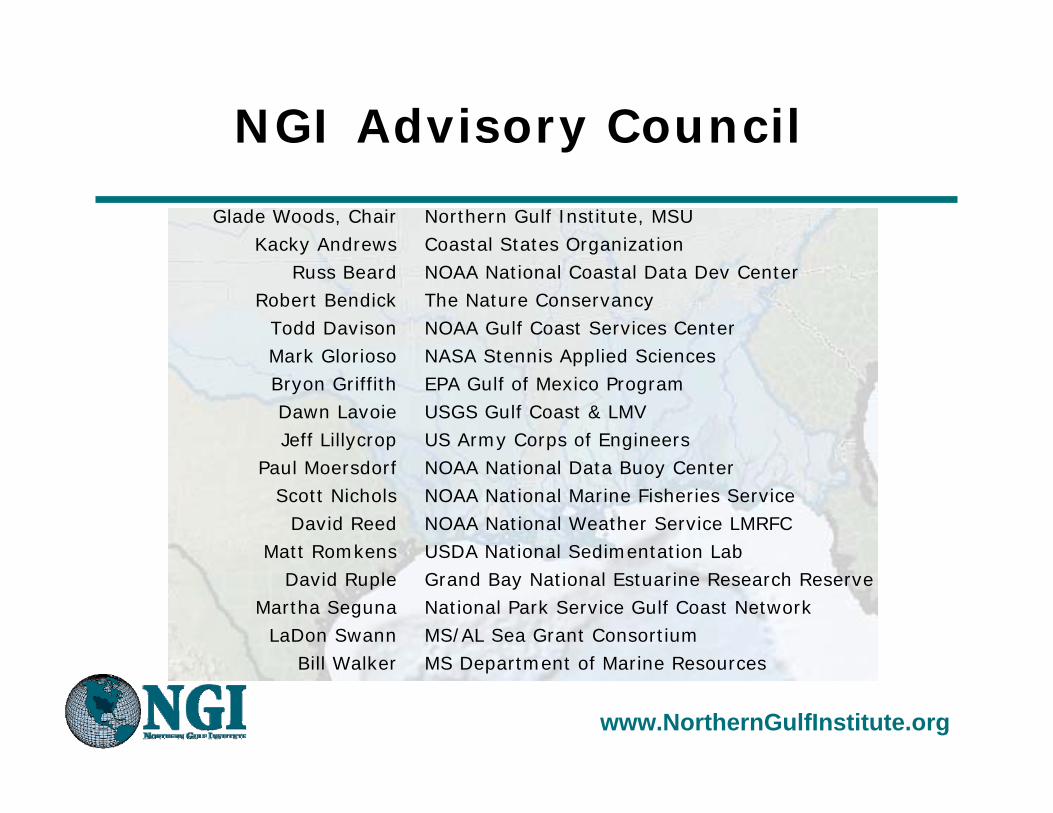
NGI Advisory Council
Glade Woods, ChairKacky Andrews
Russ Beard Robert Bendick
Todd DavisonMark GloriosoBryon GriffithDawn LavoieJeff Lillycrop
Paul MoersdorfScott Nichols
David ReedMatt Romkens
David RupleMartha Seguna
LaDon SwannBill Walker
Northern Gulf Institute, MSUCoastal States OrganizationNOAA National Coastal Data Dev CenterThe Nature ConservancyNOAA Gulf Coast Services CenterNASA Stennis Applied SciencesEPA Gulf of Mexico ProgramUSGS Gulf Coast & LMVUS Army Corps of EngineersNOAA National Data Buoy CenterNOAA National Marine Fisheries ServiceNOAA National Weather Service LMRFCUSDA National Sedimentation LabGrand Bay National Estuarine Research ReserveNational Park Service Gulf Coast NetworkMS/AL Sea Grant ConsortiumMS Department of Marine Resources
www.NorthernGulfInstitute.org
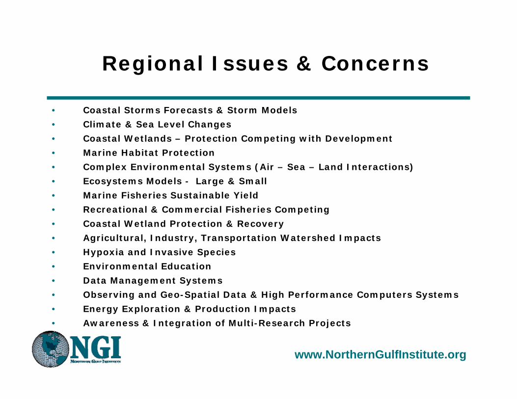
Regional Issues & Concerns
• Coastal Storms Forecasts & Storm Models
• Climate & Sea Level Changes
• Coastal Wetlands – Protection Competing with Development
• Marine Habitat Protection
• Complex Environmental Systems (Air – Sea – Land Interactions)
• Ecosystems Models - Large & Small
• Marine Fisheries Sustainable Yield
• Recreational & Commercial Fisheries Competing
• Coastal Wetland Protection & Recovery
• Agricultural, Industry, Transportation Watershed Impacts
• Hypoxia and Invasive Species
• Environmental Education
• Data Management Systems
• Observing and Geo-Spatial Data & High Performance Computers Systems
• Energy Exploration & Production Impacts
• Awareness & Integration of Multi-Research Projects

www.NorthernGulfInstitute.org
NGI Transitions Results
• Focus on Research-to-Operations as a guiding principle for project development and execution
• Embed a strong element of outreach in all funded activities to build Northern Gulf Stewardship
• Link directly to the regional community through advisory and collaborative activities
West tip of Ship Island, MS June 2007
www.NorthernGulfInstitute.org
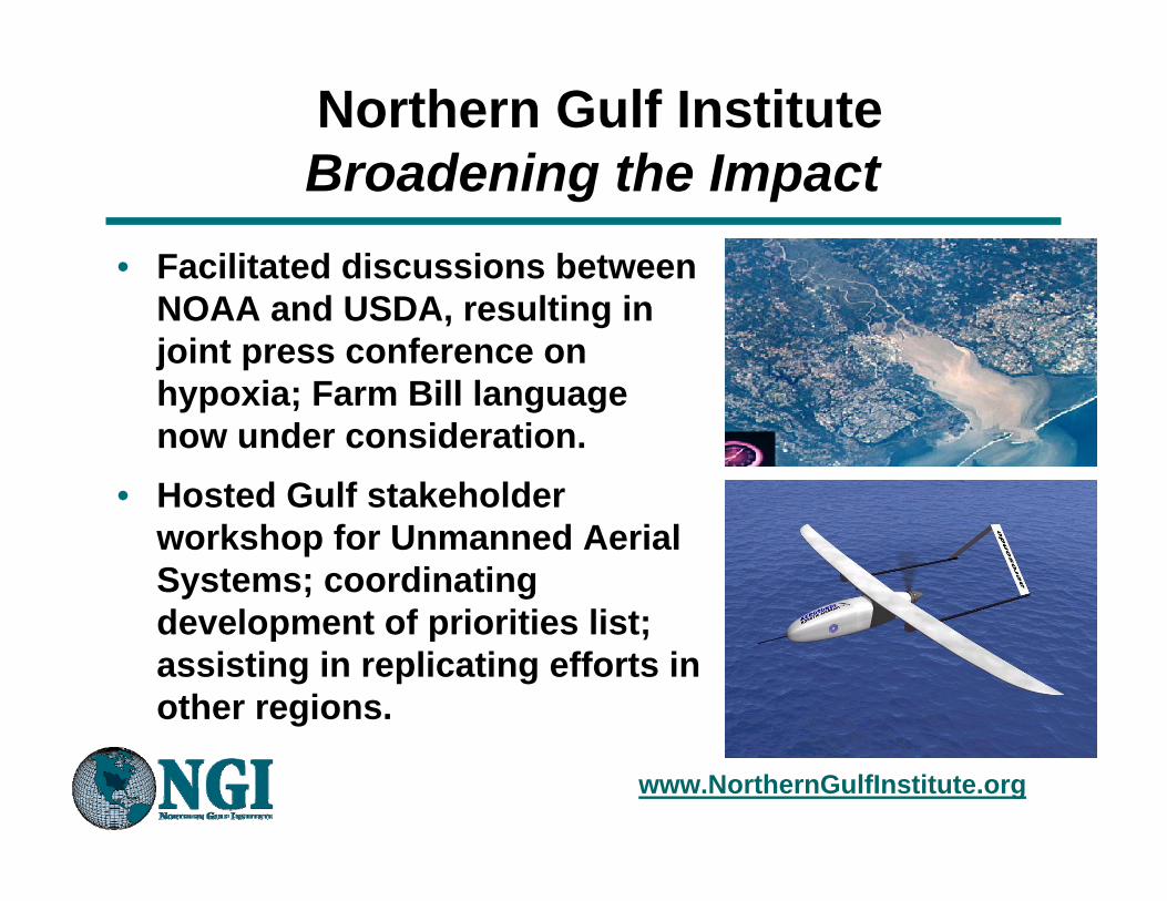
Northern Gulf InstituteBroadening the Impact
• Facilitated discussions between NOAA and USDA, resulting in joint press conference on hypoxia; Farm Bill language now under consideration.
• Hosted Gulf stakeholder workshop for Unmanned Aerial Systems; coordinating development of priorities list; assisting in replicating efforts in other regions.
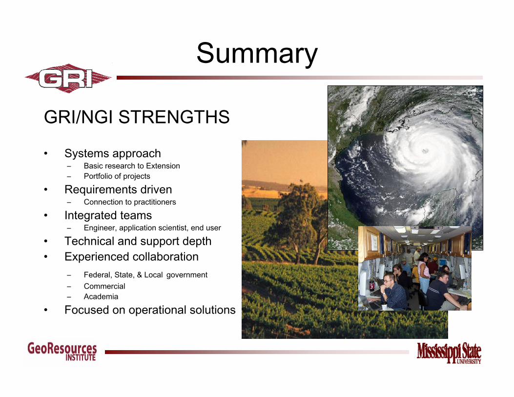
GRI/NGI STRENGTHS
• Systems approach– Basic research to Extension – Portfolio of projects
• Requirements driven– Connection to practitioners
• Integrated teams– Engineer, application scientist, end user
• Technical and support depth• Experienced collaboration
– Federal, State, & Local government– Commercial – Academia
• Focused on operational solutions
Summary