geoint show daily wrap up
DESCRIPTION
The official Show Daily magazine of the GEOINT 2011 Symposium.TRANSCRIPT
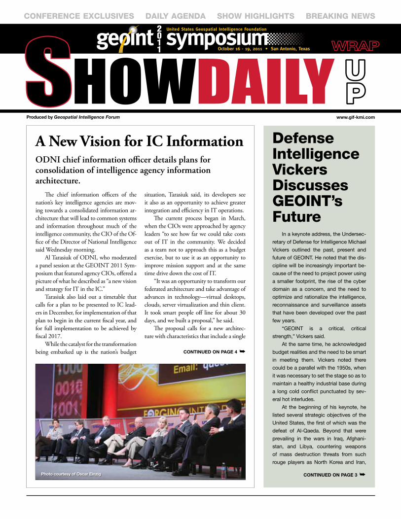
A New Vision for IC InformationODNI chief information officer details plans for consolidation of intelligence agency information architecture.
The chief information officers of the nation’s key intelligence agencies are mov-ing towards a consolidated information ar-chitecture that will lead to common systems and information throughout much of the intelligence community, the CIO of the Of-fice of the Director of National Intelligence said Wednesday morning.
Al Tarasiuk of ODNI, who moderated a panel session at the GEOINT 2011 Sym-posium that featured agency CIOs, offered a picture of what he described as “a new vision and strategy for IT in the IC.”
Tarasiuk also laid out a timetable that calls for a plan to be presented to IC lead-ers in December, for implementation of that plan to begin in the current fiscal year, and for full implementation to be achieved by fiscal 2017.
While the catalyst for the transformation being embarked up is the nation’s budget
situation, Tarasiuk said, its developers see it also as an opportunity to achieve greater integration and efficiency in IT operations.
The current process began in March, when the CIOs were approached by agency leaders “to see how far we could take costs out of IT in the community. We decided as a team not to approach this as a budget exercise, but to use it as an opportunity to improve mission support and at the same time drive down the cost of IT.
“It was an opportunity to transform our federated architecture and take advantage of advances in technology—virtual desktops, clouds, server virtualization and thin client. It took smart people off line for about 30 days, and we built a proposal,” he said.
The proposal calls for a new architec-ture with characteristics that include a single
CONFERENCE EXCLUSIVES DaILy agENDa ShOw hIghLIghtS BREaKINg NEwS
Produced by Geospatial Intelligence Forum www.gif-kmi.com
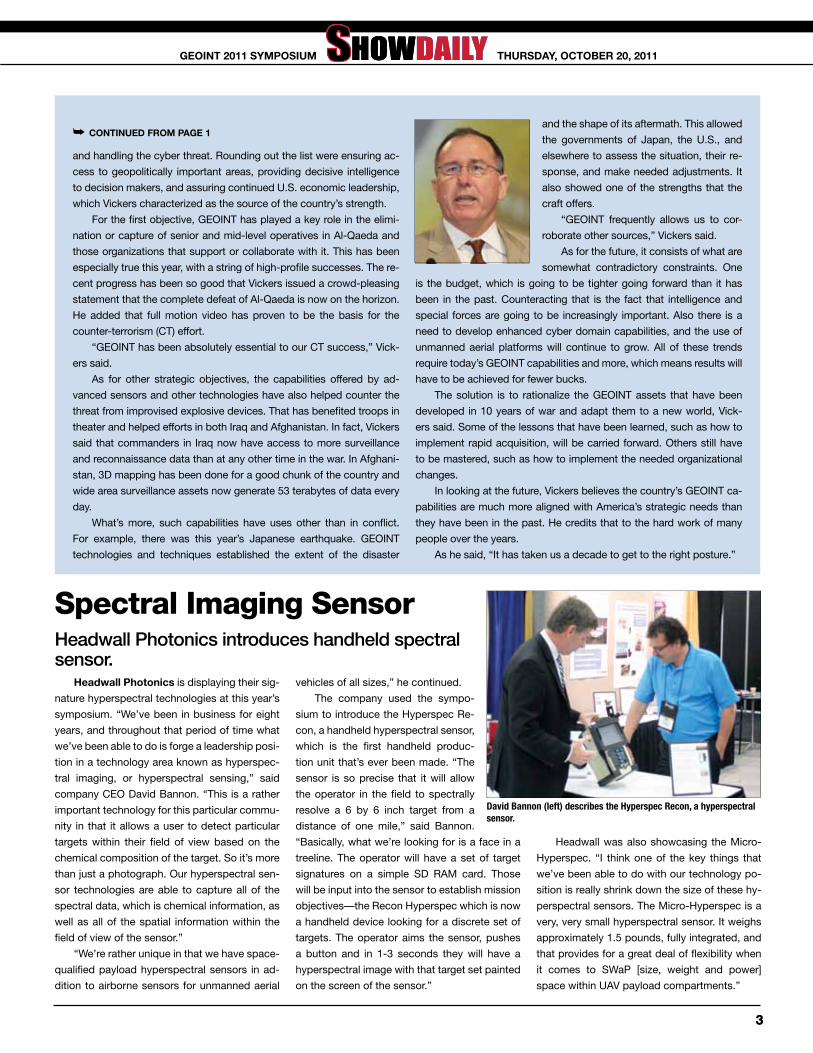
Defense Intelligence Vickers Discusses gEOINt’s Future
In a keynote address, the Undersec-
retary of Defense for Intelligence Michael
Vickers outlined the past, present and
future of GEOINT. He noted that the dis-
cipline will be increasingly important be-
cause of the need to project power using
a smaller footprint, the rise of the cyber
domain as a concern, and the need to
optimize and rationalize the intelligence,
reconnaissance and surveillance assets
that have been developed over the past
few years.
“GEOINT is a critical, critical
strength,” Vickers said.
At the same time, he acknowledged
budget realities and the need to be smart
in meeting them. Vickers noted there
could be a parallel with the 1950s, when
it was necessary to set the stage so as to
maintain a healthy industrial base during
a long cold conflict punctuated by sev-
eral hot interludes.
At the beginning of his keynote, he
listed several strategic objectives of the
United States, the first of which was the
defeat of Al-Qaeda. Beyond that were
prevailing in the wars in Iraq, Afghani-
stan, and Libya, countering weapons
of mass destruction threats from such
rouge players as North Korea and Iran,
Photo courtesy of Oscar Einzig COntinuEd On PAGE 3 ➥
COntinuEd On PAGE 4 ➥

Kehler Minds the Intel GapSTRATCOM commander calls for a single authority to help intelligence processing capacity keep up with collection.
To help close the growing gap between the nation’s ability to collect intelligence data and the capacity to use it effectively, creation of a single focal point of authority over the processing, exploitation and dissemination (PED) of intelligence informa-tion is needed, Air Force General C. Robert Kehler, commander of U.S. Strategic Command, told the GEOINT 2011 Symposium Wednesday morning.
The new PED authority—which Kehler said could but did not have to be located within STRATCOM—also needs to be combined with greater use of automation in managing intelli-gence information, he said.
Kehler noted that the vol-ume of data collected has grown by some 1500 percent in the past five years, while the nation’s PED capacity has increased by only 30 percent.
“How we process, exploit and disseminate the massive amounts of data we generate and the result-ing information is where the real challenge lies,” Kehler said. “We need to think hard about how we sort through the growing volume of raw data we collect to find the critical information—not just the information we seek, but the in-formation that indicates an unan-ticipated event or strategic event that could take us by surprise. How do we turn collection into focused knowledge, and eventu-ally into action?”
The dilemma is especially pressing at a time when the na-tion is grappling with difficult fiscal issues, Kehler said. But even in the best of times, it would not be practical to increase processing
resources at the same rate as the volume of data. Instead, what is needed is to manage PED more effectively.
“Automated capabilities may be able to reduce the data to a manageable level for exploitation, but we need to remember that we will always require a human be-ing to make sense of the data and convey its relevance,” he contin-ued.
“The gap between collection and PED capacity is a reflection of strength, not weakness. Instead of reducing collection, we need to grow our PED capacity. First, in the long term, we have to pursue innovative methods of automa-tion that will generate unprec-edented levels of effectiveness. In the short term, we should take steps to reduce the gap through globally integrated, locally fo-cused integration, and by man-aging the PED the way we man-age the collection platforms—in short, in a unified structure.”
In order to achieve a unified structure, however, there needs to be a unified authority, he argued. “A key question is who would have the authority to quickly direct a shift in PED capacity in the interests of the nation? What command or agency exists to manage PED, the way we man-age platforms? That unifying authority does not exist, but it should and must. We should be able to synchronize under such an authority, and do so in the inter-ests of all.
“The PED needs a single fo-cal point, which has the author-ity to allocate resources and drive the effort from a global perspec-tive—not ignoring local needs,
but massing all the capability to do what’s needed.
“Our PED synchronization must include both service and agency assets. In addition, where such assets exist, they should in-clude PED capabilities in other parts of government,” Kehler said.
Such a global PED synchro-nization capability could be locat-ed in STRATCOM’s Joint Func-tional Component Command for ISR, he suggested, while ac-knowledging that there could be other solutions.
Kehler summed up this way: “The demand for intelligence to reduce surprise in an uncertain world led us down a path that emphasized investment in col-lection capabilities. That capacity has grown exponentially, and we now have more data than we can analyze, and more data that can help us understand in ways that we can’t even anticipate.
“We need tools that automate
processing, that make the data ac-cessible to analysts across a global federated enterprise. We will get better by improving our pro-cesses and creating more holistic management of PED in a global federated enterprise. We will get smarter by creating a global PED enterprise that is designed for an uncertain future, requir-ing us to leverage technology and innovation. We will become faster through a federated, fused and refined collection effort that quickly reaches the priorities of commanders and other users.
“I’m confident we can make the tremendous volume of in-formation we collect work in our favor. Leveraging the power of automation, the flexibility of federated enterprise, the clear pri-oritization of PED capacity, and the synchronization of collectors and PED, we can cut through the chaff and provide depth of un-derstanding to decision makers,” Kehler concluded.
Photo courtesy of Oscar Einzig
2
thursdAy, OCtObEr 20, 2011GEOint 2011 syMPOsiuM
and handling the cyber threat. Rounding out the list were ensuring ac-
cess to geopolitically important areas, providing decisive intelligence
to decision makers, and assuring continued U.S. economic leadership,
which Vickers characterized as the source of the country’s strength.
For the first objective, GEOINT has played a key role in the elimi-
nation or capture of senior and mid-level operatives in Al-Qaeda and
those organizations that support or collaborate with it. This has been
especially true this year, with a string of high-profile successes. The re-
cent progress has been so good that Vickers issued a crowd-pleasing
statement that the complete defeat of Al-Qaeda is now on the horizon.
He added that full motion video has proven to be the basis for the
counter-terrorism (CT) effort.
“GEOINT has been absolutely essential to our CT success,” Vick-
ers said.
As for other strategic objectives, the capabilities offered by ad-
vanced sensors and other technologies have also helped counter the
threat from improvised explosive devices. That has benefited troops in
theater and helped efforts in both Iraq and Afghanistan. In fact, Vickers
said that commanders in Iraq now have access to more surveillance
and reconnaissance data than at any other time in the war. In Afghani-
stan, 3D mapping has been done for a good chunk of the country and
wide area surveillance assets now generate 53 terabytes of data every
day.
What’s more, such capabilities have uses other than in conflict.
For example, there was this year’s Japanese earthquake. GEOINT
technologies and techniques established the extent of the disaster
and the shape of its aftermath. This allowed
the governments of Japan, the U.S., and
elsewhere to assess the situation, their re-
sponse, and make needed adjustments. It
also showed one of the strengths that the
craft offers.
“GEOINT frequently allows us to cor-
roborate other sources,” Vickers said.
As for the future, it consists of what are
somewhat contradictory constraints. One
is the budget, which is going to be tighter going forward than it has
been in the past. Counteracting that is the fact that intelligence and
special forces are going to be increasingly important. Also there is a
need to develop enhanced cyber domain capabilities, and the use of
unmanned aerial platforms will continue to grow. All of these trends
require today’s GEOINT capabilities and more, which means results will
have to be achieved for fewer bucks.
The solution is to rationalize the GEOINT assets that have been
developed in 10 years of war and adapt them to a new world, Vick-
ers said. Some of the lessons that have been learned, such as how to
implement rapid acquisition, will be carried forward. Others still have
to be mastered, such as how to implement the needed organizational
changes.
In looking at the future, Vickers believes the country’s GEOINT ca-
pabilities are much more aligned with America’s strategic needs than
they have been in the past. He credits that to the hard work of many
people over the years.
As he said, “It has taken us a decade to get to the right posture.”
➥ COntinuEd frOM PAGE 1
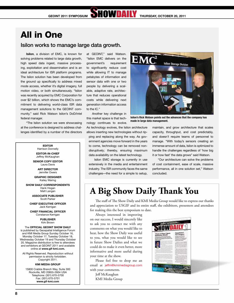
Spectral Imaging SensorHeadwall Photonics introduces handheld spectral sensor.
headwall Photonics is displaying their sig-
nature hyperspectral technologies at this year’s
symposium. “We’ve been in business for eight
years, and throughout that period of time what
we’ve been able to do is forge a leadership posi-
tion in a technology area known as hyperspec-
tral imaging, or hyperspectral sensing,” said
company CEO David Bannon. “This is a rather
important technology for this particular commu-
nity in that it allows a user to detect particular
targets within their field of view based on the
chemical composition of the target. So it’s more
than just a photograph. Our hyperspectral sen-
sor technologies are able to capture all of the
spectral data, which is chemical information, as
well as all of the spatial information within the
field of view of the sensor.”
“We’re rather unique in that we have space-
qualified payload hyperspectral sensors in ad-
dition to airborne sensors for unmanned aerial
vehicles of all sizes,” he continued.
The company used the sympo-
sium to introduce the Hyperspec Re-
con, a handheld hyperspectral sensor,
which is the first handheld produc-
tion unit that’s ever been made. “The
sensor is so precise that it will allow
the operator in the field to spectrally
resolve a 6 by 6 inch target from a
distance of one mile,” said Bannon.
“Basically, what we’re looking for is a face in a
treeline. The operator will have a set of target
signatures on a simple SD RAM card. Those
will be input into the sensor to establish mission
objectives—the Recon Hyperspec which is now
a handheld device looking for a discrete set of
targets. The operator aims the sensor, pushes
a button and in 1-3 seconds they will have a
hyperspectral image with that target set painted
on the screen of the sensor.”
Headwall was also showcasing the Micro-
Hyperspec. “I think one of the key things that
we’ve been able to do with our technology po-
sition is really shrink down the size of these hy-
perspectral sensors. The Micro-Hyperspec is a
very, very small hyperspectral sensor. It weighs
approximately 1.5 pounds, fully integrated, and
that provides for a great deal of flexibility when
it comes to SWaP [size, weight and power]
space within UAV payload compartments.”
David Bannon (left) describes the Hyperspec Recon, a hyperspectral sensor.
33
thursdAy, OCtObEr 20, 2011GEOint 2011 syMPOsiuM

Ltg Paul E. Menoher Named Lundahl Lifetime achievement award Recipient
LTG Paul E. Menoher has been named as
the recipient of the 2011 Arthur C. Lundahl Life-
time Achievement Award.
Menoher was an influential visionary and
innovator throughout his career. He held a se-
ries of demanding positions of great respon-
sibility during his 35 years of commissioned
service, including commanding general of the
Army Intelligence Agency, commanding general
of the U.S. Army Intelligence Center and Fort
Huachuca, commanding general of the Army
Intelligence and Security Command, and Army
Deputy Chief of Staff for Intelligence.
Menoher pioneered for the Civilian Per-
sonnel Proponency System for the Army,
taking the lead for Training and Doctrine
Command to fully integrate the civilian pro-
fessional intelligence workforce into the Mili-
tary Intelligence Corps. He directed the ac-
tion to consolidate and create new enlisted
military occupational specialties to leverage
the superb qualities of military intelligence
(MI) soldiers, economize operations and pro-
vide assignment flexibility across the force.
He directed an independent MI officer struc-
turing study that realigned the distribution of
MI officers, ensuring key MI officer authoriza-
tions were filled with
the right grades and
specialties. As a fore-
runner in the Army for
numerous language
initiatives, he was most
noted for the develop-
ment of a new MOS for
interpreter/translators
in the Reserve com-
ponent. He has truly
blazed a trail of excel-
lence for the Military
Intelligence Corps to
ensure its viability and
preparedness to meet
the challenges of the
new millennium.
The Arthur C. Lun-
dahl Lifetime Achieve-
ment Award is presented, upon selection by
the USGIF Board of Directors, to an influential
member of the community who has dedicated
much of his or her work to the geospatial in-
telligence tradecraft. Arthur C. “Art” Lundahl is
recognized as the father of imagery analysis. He
dedicated his life to the tradecraft, enabling him
to gain the confidence of four U.S. presidents
and significantly contribute to the GEOINT tra-
decraft and security of the United States. His
immense contribution to the pioneering of the
tradecraft is why the USGIF Lifetime Achieve-
ment Award was renamed the Arthur C. Lundahl
Lifetime Achievement Award.
K. Stuart Shea, USGIF CEO and chairman of the board (left) and Keith Masback, USGIF president (right), present the Arthur C. Lundahl Lifetime Achievement Award to LTG Paul E. Menoher.
Photo courtesy of Oscar Einzig
design back office and desktop; consolidation for infrastructures and provisioning of central services for all to use; a thin desktop for the ma-jority of IC users, and thick client for a small number that will require the extra power; cloud technology implemented with a set of standards that will permit interoperability with other clouds; significant network consolidation; and widgetized applications.
“In addition, our operating model has to change,” he said. “We have to move from agencies managing their own IT environments, to an IC enterprise model, where we’re managing on behalf of all. Some agency functions are unique and will have to remain separate, but we have to ensure their interoperability.
“Over time, as we become more comfortable with technology, with smart data and some of the other aspects of this architecture, we will continue to try to collapse more and more of the unique enclaves that exist today,” he said.
The current effort is being led by the agencies with the largest budgets—National Reconnaissance Office, National Geospatial-Intelligence Agency, National Security Agency, Defense Intelligence Agency and Central Intelligence Agency. But other members of the community are also participating as observers, and at some point they
will all plug into the core functions of the new architecture, Tarasiuk indicated.
“Besides the cost reductions, the value proposition for the IC is that we can become more agile, and more able to stand up missions quickly. We will have capacity and ability to more easily search, and better in-tegration. There will be improvements in information discovery, access and sharing, and a more defensible IT infrastructure,” he continued.
In addition, there will be a lot more consolidation of core in-frastructure, leading to an expected reduction in the amount of data center space.
The plan was presented to the leadership about a month ago, and they gave approval to move forward to the next step, which is developing an implementation plan. That plan is due to the leadership in December.
“We are scoping this out to start executing an implementation plan in this fiscal year. We have been asked to pay for this within our own budgets, so we are going through a process of examining what things need to be stopped and how we pull dollars to put against some of the priorities.
“We hope that by the end of FY17 we would have a large nucleus of core functions and at least five of the agencies operating most of their IT through this new architecture,” Tarasiuk said.
➥ COntinuEd frOM PAGE 1
4
thursdAy, OCtObEr 20, 2011GEOint 2011 syMPOsiuM

Analyze and CollaboratePerceptive Pixel and Esri create solutions for complex GIS issues.
Perceptive Pixel has announced that it has joined the Esri Partner Network, a worldwide community of companies that develop and deliver cutting-edge geospatial solutions and services based on Esri technol-ogy.
Through this new partnership, Esri and Perceptive Pixel will together develop revolutionary new GIS solutions that lever-age Perceptive Pixel’s advanced multi-touch technology platform, giving business and government professionals the ability to ana-lyze, collaborate on, and present complex
geospatial information using the power and ease of true, unlimited multi-touch inter-faces.
A prototype of Esri and Perceptive Pix-el’s joint development efforts is on display at Perceptive Pixel’s booth
“This new relationship will immediately benefit both companies’ significant customer base in the government, defense, intelligence, broadcast media and energy industries, as well as the broader GIS community,” said Esri president Jack Dangermond. “GIS tech-nology is about to take another leap forward
with the emergence of new and innovative ways to interact with geospatial information. We are thrilled to be with Perceptive Pixel.”
“Esri understands the enormous pos-sibilities that multi-touch offers for sharing and manipulating complex geospatial data,” said Jeff Han, founder and CEO, Perceptive Pixel. “They also understand that harness-ing these possibilities requires new ways of thinking about developing software. We are proud to join the Esri Partner Network and anticipate that the solutions we build togeth-er will truly impact the way GIS is done.”
Online tools Make a DifferenceRaytheon provides critical capabilities.
raytheon Company has developed two
online services to provide critical capabilities
to users in the defense, intelligence and first-
responder communities faster than they are
able to get them now.
The Appsmart market is a tool to develop
apps and access content, a market to buy
secure apps and a way to get capabilities to
users quickly. It is self-sustaining and perfor-
mance-based, protecting intellectual property
of third-party developers. Because it is a mar-
ketplace, Appsmart incentivizes innovation
through market forces.
“Because we have built Appsmart with
our own funds and are working directly with
third-party developers, we are reducing the
government’s risk and cost associated with
the procurement of new capabilities,” said
Mark Bigham, vice president of business de-
velopment at Raytheon Intelligence and Infor-
mation Systems. “Appsmart provides tools
that developers can use to quickly and se-
curely create, publish and market capabilities
for tactical-edge users.”
Built into the Appsmart is a social net-
work that lets the government announce their
needs and requirements, allows the develop-
ers to see those requirements and respond
directly to them.
Security is always a big issue and the
Appsmart has a mechanism in place that
adds a layer of protection. When a devel-
oper submits an app it is first
submitted to a clearinghouse.
The clearinghouse is built on
top of Raytheon’s SureView
technology, which is the same
techology that we use to pro-
tect Raytheon’s email system.
SureView opens and screens
the app and checks it for mali-
cious code. Once cleared, the
app is released for sale.
One of those is an emerging
capability, called GOtab, which
provides a mobile, geocentric,
user defined and tailored en-
vironment for discovering and
retrieving mission-relevant in-
formation. “GOtab puts rich
geospatial visualization in the
hands of users, from which
they can query and access a
range of online GEOINT ser-
vices to display, analyze and
exploit geographic and im-
agery intelligence, as well
as human geography,” said
Kevin T. Brown, technical director of GEOINT
Programs at Raytheon Intelligence and In-
formation Systems. “This would significantly
improve timely access to current information,
products and services for military operations,
natural disasters or humanitarian crises.”
Currently, several apps developed by
Raytheon and third-party entities are avail-
able via Appsmart, including programs for
situational awareness, buddy tracking, triage
tracking and language translation, among
other capabilities.
55
thursdAy, OCtObEr 20, 2011GEOint 2011 syMPOsiuM

Out in FrontU.S. Army Geospatial Center displays award-winning systems.
During this year’s symposium the U.S.
Army Geospatial Center (AGC) demon-
strated its award-winning BuckEye and Geo-
referenced PDF (GeoPDF) programs as well
as its Instrument Set, Reconnaissance and
Surveying (ENFIRE) kit, GeoGlobe and Re-
mote Ground Terminal (RGT).
BuckEye collects high-resolution, 3-D
terrain data using a 39-megapixel color cam-
era and light detection and ranging elevation
data to produce unclassified 10-15 centime-
ter resolution imagery for intelligence, surveil-
lance and reconnaissance and mapping mis-
sions in Afghanistan. The program received
Army Greatest Invention of the Year honors
in 2006 as well as USGIF’s 2006 Geospatial
Intelligence Achievement Award its valuable
contributions to the geospatial capability of
coalition forces during the global war on ter-
rorism.
GeoPDF, recipient of USGIF’s GEOINT
Achievement Award (military category) in
2008, allows soldiers to print easy-to-read
maps on demand and access detailed, up-
to-date information on Adobe PDF-enabled
computers. Raster and vector GeoPDF for-
mats provide a scalable display of the digital
map or image with crisp, clear delineation
of roads, rivers, contour lines and other fea-
tures. The AGC developed GeoPDF DVDs
for most countries of the world through its
partnership with the National Geospatial-
Intelligence Agency and GeoPDF DVDs for
all 54 U.S. states and territories through its
partnership with the United States Geologi-
cal Survey.
The Instrument Set, Reconnaissance and
Surveying, or ENFIRE kit, is a modern digital
engineering tool that replaces the Surveying
Set, Military Field Sketching set, which has
been in use since the early 20th century.
This Army program of record integrates
digital components into a common toolkit
for collecting and disseminating minefield,
reconnaissance and engineering data, en-
abling engineers to perform reconnaissance,
surveying, obstacle reporting, construction
site planning, engineering project manage-
ment and inventory management rapidly and
at a safer standoff distance than analog mea-
sures permit.
The RGT is a tactical, mobile, sensor-ag-
nostic direct downlink demonstration system
that will provide Soldiers with superior terrain
visualization and analysis by utilizing a com-
mercial common image processor to process
raw satellite imagery into standard formats.
The system is scalable; sensors (e.g., Geo-
Eye and TerraSar-X) can be added without
increasing its tactical footprint. The RGT also
operates online and as a disconnected sys-
tem.
The Army Geospatial Enterprise (AGE)
GeoGlobe is a worldwide, 3D-based visual-
ization tool that allows users to access the
AGC’s geospatial data and products through
a 3D client for the Internet Explorer web
browser. The system provides users with an
easy-to-use interface to find and view the
center’s Water Resources Database, Urban
Tactical Planner and BuckEye imagery as
well as Theater Geospatial Database data
from the Army Geospatial Planning Cells.
AGE GeoGlobe is also available as a stand-
alone system for disconnected users. The
AGE Geoglobe Laptop (AGL) will be demon-
strated at GEOINT at the AGC and Skyline
exhibit booths.
Also on display was the BuckEye un-
manned aerial system and remote ground
control station at the conference’s UAV static
display pavilion. This multi-purpose platform
supports requirements for the collection of
unclassified geospatial data.
6
thursdAy, OCtObEr 20, 2011GEOint 2011 syMPOsiuM

generating actionable IntelligenceITT strives to meet unmet operational needs.
itt Corporation showcased its newest
enterprise solution for the management and
dissemination of tactical imagery and video at
this year’s symposium.
JAGWIRE is a new product that combines
the capabilities of ITT’s adLib software with
its Enhanced AGILE Access solution. This will
give warfighters one seamless user interface
to search, discover and exploit still imagery,
wide-area motion imagery and full-motion
video.
“There is a significant volume and va-
riety of geospatial data available to today’s
warfighter,” stated S. Danny Rajan, director,
geospatial information solutions, ITT Geospa-
tial Systems. “In this business, organizing this
content and correlating it in a way that pro-
vides end users with actionable intelligence
is mission critical. We see a tremendous need
for ITT’s JAGWIRE solution. We are excited to
deliver the capability that will meet this unmet
operational need of being able to efficiently
discover and access intelligence, surveillance
and reconnaissance data across the enter-
prise.”
ITT recently released its v3.7.1 adLib video
and data management software. This unique
Web-based, net-centric, standards-compliant
solution has revolutionized situational aware-
ness by enabling users to capture, process,
store and disseminate full-motion video and intelligence informa-
tion in near real-time while optimizing system interoperability and
bandwidth use.
The Enhanced AGILE Access system is a deployable, enter-
prise-ready imagery management and dissemination system sup-
porting contingency operations that dramatically reduces the time
needed to deliver crucial data anywhere in the world. Now warfight-
ers in the field and users in the intelligence community can quickly
find accurate geospatial data to make fast, effective decisions that
impact mission success.
By uniting its adLib and Enhanced AGILE Access solution, ITT’s
JAGWIRE solution enables warfighters to have assured access to
imagery, wide-area motion imagery and full motion video (FMV)
within their existing infrastructure while maintaining interoperability.
At symposium, ITT also announced that it and Analytical
Graphics, inc. (AGi) joined to deliver increased search intelligence
within ITT’s current suite of FMV and imagery processing and dis-
semination products.
“As the volume and variety of geospatial intelligence data grows
enormously, the capabilities developed by ITT and AGI will enable
soldiers to effectively find and retrieve geospatial intelligence data
at an enterprise level,” said Rajan. “At the same time, these capa-
bilities provide mechanisms for managers of various Department of
Defense information systems to successfully administer the delivery
of critical operational intelligence. The ability to quickly find relevant
information in our rapidly growing data enterprises is the edge our
users need to be successful.”
Leveraging AGI’s intelligence, surveillance and reconnaissance
mission modeling software, ITT’s adLib and Enhanced AGILE Ac-
cess solutions now have increased capabilities within their native
search and discovery feature set for tactical users and operators.
Together, these enhancements will provide end users with added
intelligence and relevant data-driven results to geospatial queries,
while also significantly reducing the overall amount of data sent
back for review and analysis.
“AGI’s commercial software development kits and geometry
processing engine are a perfect fit to team with ITT’s imaging ser-
vices to enhance the timeliness and discovery of data along the pro-
cessing, exploitation and dissemination process,” said Scott Light,
regional director, AGI.
Screen captures of the JAGWIRE system in use.
77
thursdAy, OCtObEr 20, 2011GEOint 2011 syMPOsiuM
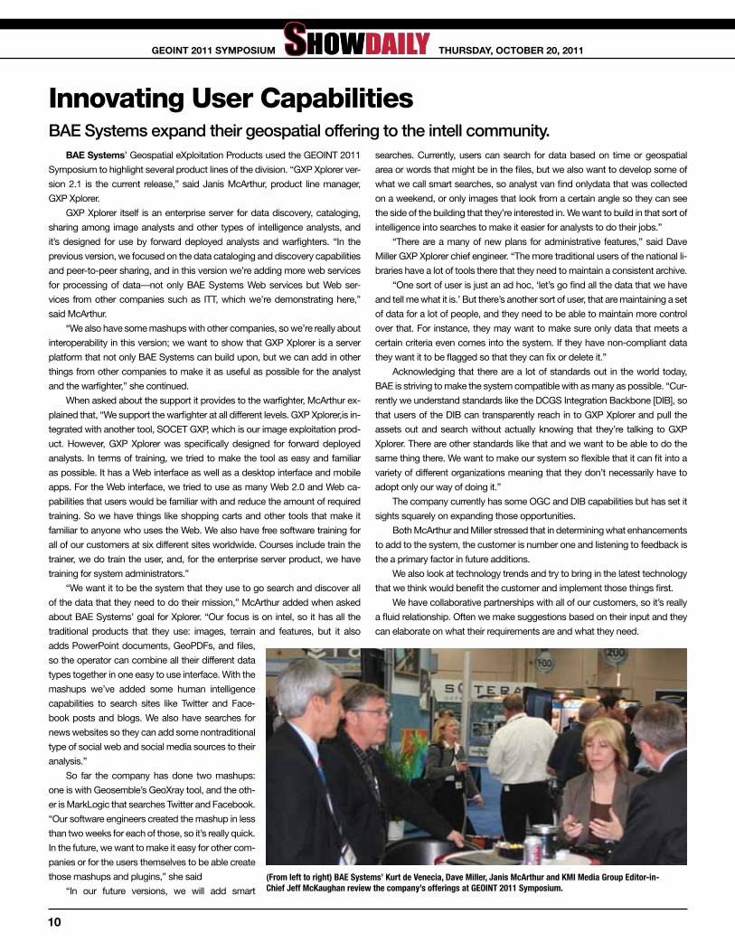
all in OneIsilon works to manage large data growth.
isilon, a division of EMC, is known for
solving problems related to large data growth,
high speed data ingest, massive process-
ing, exploitation and dissemination and is an
ideal architecture for ISR platform programs.
The Isilon solution has been developed from
the ground up specifically to address mixed
mode access, whether it’s digital imagery, full
motion video, or both simultaneously. “Isilon
was recently acquired by EMC Corporation for
over $2 billion, which shows the EMC’s com-
mitment to delivering world-class ISR data
management solutions to the GEOINT com-
munity,” said Rick Watson Isilon’s DoD/intel
federal manager.
“The Isilon solution we were showcasing
at the conference is designed to address chal-
lenges identified by a number of the directors
at GEOINT,” said Watson.
“Isilon EMC delivers on the
government’s requirement
to significantly reduce cost
while allowing IT to manage
petabytes of information and
sensor data with one or two
people by delivering a scal-
able, adaptive rate, architec-
ture that reduces operational
costs while delivering next
generation information access
to the IC.”
Another key challenge in
this market space is that tech-
nology continues to evolve.
As technology evolves, the Isilon architecture
allows inserting new technologies without rip-
ping and replacing along the way. As gov-
ernment agencies move forward in the years
to come, technology can be removed non-
disruptively; thereby, ensuring maximum
data availability on the latest technology.
Isilon EMC storage is currently in use
extensively in the media and entertainment
industry. The ISR community faces the same
challenges—the need for a simple to setup,
maintain, and grow architecture that scales
capacity, throughput, and cost predictably,
and doesn’t require teams of personnel to
manage. “With today’s sensors creating an
immense amount of data, Isilon is optimized to
handle the challenges regardless of ‘how big
it or how fast’ the data grows” said Watson.
“Our architecture can solve the problems
of cost containment, ease of scale, massive
performance, all in one solution set,” Watson
concluded.
Isilon’s Rick Watson points out the advances that the company has made in large data management.
EditOr Harrison Donnelly
EditOr-in-ChiEf Jeffrey McKaughan
sEniOr COPy EditOr Laura Davis
Art dirECtOr Jennifer Owers
GrAPhiC dEsiGnEr Kailey Waring
shOw dAily COrrEsPOndEnts Hank Hogan Matt Langan
AssOCiAtE PublishEr Scott Parker
ChiEf ExECutivE OffiCEr Jack Kerrigan
ChiEf finAnCiAl OffiCEr Constance Kerrigan
PublishEr Kirk Brown
The OffiCiAl GEOint shOw dAily is published by Geospatial Intelligence Forum
and KMI Media Group Sunday October 16, Monday October 17, Tuesday October 18,
Wednesday October 19 and Thursday October 20. Magazine distribution is free to attendees and exhibitors at GEOINT 2011 and available
online at www.gif-kmi.com.
All Rights Reserved. Reproduction without permission is strictly forbidden.
Copyright 2011.
KMi MEdiA GrOuP
15800 Crabbs Branch Way, Suite 300 Rockville, MD 20855-2604 USA
Telephone: (301) 670-5700 Fax: (301) 670-5701 www.gif-kmi.com
A Big Show Daily Thank YouThe staff of The Show Daily and KMI Media Group would like to express our thanks
and appreciation to USGIF and its entire staff, the exhibitors, presenters and attendees for making this the best symposium to date.
Always interested in improving on our success, I would sincerely like to ask you to contact me with any comments on what you would like to hear, how the Show Daily was useful to you, what you would like to see in future Show Dailies and what we could do to make it even better, more informative and more useful during your time at the show.
Please feel free to drop me an email at [email protected] with your comments.
Jeff McKaughanKMI Media Group
8
thursdAy, OCtObEr 20, 2011GEOint 2011 syMPOsiuM

Careful IC Budget Cuts ComingMembers of Congress weigh in on future funding.
The joint keynote from Congressmen Mike Rogers (R-Mich.) and C.A. Dutch Ruppersberger (D-Md.) contained bits of levity sprinkled amid what was otherwise a fairly serious subject: the future of intel-ligence community funding and the chal-lenges facing the country. Rogers, chairman of the House Permanent Select Committee on Intelligence, started it off by noting at the beginning that something unusual was about to happen.
“You’re going to have a Republican and a Democrat on the same stage and it’s not a debate,” he said, which provoked a round of applause.
Later, Ruppersberger added his own joke. He recalled that the East Coast earthquake struck 15 minutes after he, ranking member of the Committee, and Rogers had finalized their latest budget negotiations.
“When a Republican and a Democrat can find common ground in Washington, it is a big deal,” he said.
Most of the rest of the joint keynote, though, was more serious. The two surveyed the budget situation and the threats confronting the U.S., highlighting some areas of progress but more of concern.
All told, it was a case of the good, the not-so-good, and the pos-sibly positively ugly. The good was that for two years in a row the House has passed a budget covering the 17 intelligence agencies, something that had been successfully done only once in the previ-ous six years. The budgets for both FY 2011 and FY 2012 enjoyed bipartisan support, with over 384 yeas versus only, at most, 15 nays.
The not-so-good is that the latest budget slashed spending by over a billion dollars. This was done, the Congressmen asserted, with-out impacting the mission of the intelligence community. More sav-ings along these lines are possible, primarily by merging training and IT functions to achieve efficiencies.
The possibly ugly future is that such cuts may not be enough, given the reality of budget austerity in the years to come. The tempta-tion to cut more intelligence spending may be particularly strong as the wars in Iraq and Afghanistan wind down.
In the 1990s, Rogers noted, intelligence budgets dropped, a third of the workforce disappeared, and technology investments fell. America had won the Cold War, and it was thought the intelligence money would be more useful elsewhere. That was followed by con-siderable spending over the next decade as intelligence capabilities were rebuilt and enhanced.
“We shouldn’t take one step back in our ability to continue that advance,” Rogers said of future budgets.
That is particularly true given growing threats from non-state actors and from foreign countries in the cyber realm and in space.
China, for instance, has committed to a manned lunar landing by 2020 and has vaulted into one of the world’s leaders in supercomput-ers. Other countries are either peddling or trying to acquire nuclear weapons technology.
At the same time, some critical U.S. capabilities are withering. For example, the domestic space industry confronts soaring launch costs, as well as imaging resolution and other technology restrictions. These are at least partly responsible for a decline of the American share of the worldwide commercial space market from 70 percent 20 years ago to just 27 percent today, said Ruppersberger. He noted that a revision to the ITAR technology restrictions passed the House and is awaiting action in the Senate.
For a more general solution, Ruppersberger advocated shaking up established agency boundaries and engaging in some out-of-the-box thinking. One inexpensive way to revitalize the space program, for example, would be to launch robots and explore the Moon and planets. That needs to be followed by manned missions, he said, but the remote approach would keep industry active and the public in-terested until that time.
That intelligent use of technology in other ways can help with the situation. Automating analysis as much as possible would save mon-ey, because technology is cheaper than people. Furthermore, finding other uses for some of the capabilities that have been developed can keep them from atrophying.
Ruppersberger noted that eventually combat operations will end. He also mentioned the traffic snarling American cities. Finally, he brought up the point that the old approach used to monitor road congestion may no longer be needed.
As he said, “With the technology we have now, we don’t have to buy helicopters.”
Photo courtesy of Oscar Einzig
Congressman C.A. Dutch Ruppersberger (left) and Congressman Mike Rogers focused on the good, the bad and the ugly of upcoming budget issues.
99
thursdAy, OCtObEr 20, 2011GEOint 2011 syMPOsiuM
Innovating User CapabilitiesBAE Systems expand their geospatial offering to the intell community.
bAE systems’ Geospatial eXploitation Products used the GEOINT 2011
Symposium to highlight several product lines of the division. “GXP Xplorer ver-
sion 2.1 is the current release,” said Janis McArthur, product line manager,
GXP Xplorer.
GXP Xplorer itself is an enterprise server for data discovery, cataloging,
sharing among image analysts and other types of intelligence analysts, and
it’s designed for use by forward deployed analysts and warfighters. “In the
previous version, we focused on the data cataloging and discovery capabilities
and peer-to-peer sharing, and in this version we’re adding more web services
for processing of data—not only BAE Systems Web services but Web ser-
vices from other companies such as ITT, which we’re demonstrating here,”
said McArthur.
“We also have some mashups with other companies, so we’re really about
interoperability in this version; we want to show that GXP Xplorer is a server
platform that not only BAE Systems can build upon, but we can add in other
things from other companies to make it as useful as possible for the analyst
and the warfighter,” she continued.
When asked about the support it provides to the warfighter, McArthur ex-
plained that, “We support the warfighter at all different levels. GXP Xplorer,is in-
tegrated with another tool, SOCET GXP, which is our image exploitation prod-
uct. However, GXP Xplorer was specifically designed for forward deployed
analysts. In terms of training, we tried to make the tool as easy and familiar
as possible. It has a Web interface as well as a desktop interface and mobile
apps. For the Web interface, we tried to use as many Web 2.0 and Web ca-
pabilities that users would be familiar with and reduce the amount of required
training. So we have things like shopping carts and other tools that make it
familiar to anyone who uses the Web. We also have free software training for
all of our customers at six different sites worldwide. Courses include train the
trainer, we do train the user, and, for the enterprise server product, we have
training for system administrators.”
“We want it to be the system that they use to go search and discover all
of the data that they need to do their mission,” McArthur added when asked
about BAE Systems’ goal for Xplorer. “Our focus is on intel, so it has all the
traditional products that they use: images, terrain and features, but it also
adds PowerPoint documents, GeoPDFs, and files,
so the operator can combine all their different data
types together in one easy to use interface. With the
mashups we’ve added some human intelligence
capabilities to search sites like Twitter and Face-
book posts and blogs. We also have searches for
news websites so they can add some nontraditional
type of social web and social media sources to their
analysis.”
So far the company has done two mashups:
one is with Geosemble’s GeoXray tool, and the oth-
er is MarkLogic that searches Twitter and Facebook.
“Our software engineers created the mashup in less
than two weeks for each of those, so it’s really quick.
In the future, we want to make it easy for other com-
panies or for the users themselves to be able create
those mashups and plugins,” she said
“In our future versions, we will add smart
searches. Currently, users can search for data based on time or geospatial
area or words that might be in the files, but we also want to develop some of
what we call smart searches, so analyst van find onlydata that was collected
on a weekend, or only images that look from a certain angle so they can see
the side of the building that they’re interested in. We want to build in that sort of
intelligence into searches to make it easier for analysts to do their jobs.”
“There are a many of new plans for administrative features,” said Dave
Miller GXP Xplorer chief engineer. “The more traditional users of the national li-
braries have a lot of tools there that they need to maintain a consistent archive.
“One sort of user is just an ad hoc, ‘let’s go find all the data that we have
and tell me what it is.’ But there’s another sort of user, that are maintaining a set
of data for a lot of people, and they need to be able to maintain more control
over that. For instance, they may want to make sure only data that meets a
certain criteria even comes into the system. If they have non-compliant data
they want it to be flagged so that they can fix or delete it.”
Acknowledging that there are a lot of standards out in the world today,
BAE is striving to make the system compatible with as many as possible. “Cur-
rently we understand standards like the DCGS Integration Backbone [DIB], so
that users of the DIB can transparently reach in to GXP Xplorer and pull the
assets out and search without actually knowing that they’re talking to GXP
Xplorer. There are other standards like that and we want to be able to do the
same thing there. We want to make our system so flexible that it can fit into a
variety of different organizations meaning that they don’t necessarily have to
adopt only our way of doing it.”
The company currently has some OGC and DIB capabilities but has set it
sights squarely on expanding those opportunities.
Both McArthur and Miller stressed that in determining what enhancements
to add to the system, the customer is number one and listening to feedback is
the a primary factor in future additions.
We also look at technology trends and try to bring in the latest technology
that we think would benefit the customer and implement those things first.
We have collaborative partnerships with all of our customers, so it’s really
a fluid relationship. Often we make suggestions based on their input and they
can elaborate on what their requirements are and what they need.
(From left to right) BAE Systems’ Kurt de Venecia, Dave Miller, Janis McArthur and KMI Media Group Editor-in-Chief Jeff McKaughan review the company’s offerings at GEOINT 2011 Symposium.
10
thursdAy, OCtObEr 20, 2011GEOint 2011 syMPOsiuM
GXP Xplorer is deployed in Afghanistan on the PIX System—Protected In-
ternet Exchange—as an unclassified system for sharing information between
the U.S. government and military with the Afghani provincial reconstruction
teams, and other partners. GXP Xplorer server is also installed for demon-
stration purposes in the unclassified STIL, which is the St. Louis Information
Library, so that users on mobile devices can access GEOINT from the STIL
directly on their mobile devices.
SOCET GXP
Another of the division’s flagship systems is SOCET GXP, the company
is preparing for SOCET GXP Version 4.0, which will be released in February
2012. “It is the culmination of almost 10 years of work merging technologies
from the image analyst side and geospatial analyst side into one product,” said
Kurt de Venecia, director of product management. “We used to have two prod-
ucts, VITec and SOCET SET. We’ve now merged all of those technologies into
one product and enhanced it. The main thing that we’ve strived for in SOCET
GXP is flexibility and ease of use. In our older products, the photogrammetic
component was very powerful. Now, we want the image analyst to be able to
complete image analysis and photogrammetry in the one product.”
Drew Fisher, director of sales, Americas, explained how the company
moved forward with innovations to the system and that listening to the cus-
tomer was paramount. “We have an ongoing R&D effort to improve the soft-
ware. We consistently receive customer feedback from a variety of market
segments. Some of our bigger users include the Army, a lot of the combatant
commanders, SOCOM, and the Air Force.”
“As our support team goes out to help with software training and support,
they field requests for specific workflows unique to their environment,” Fisher
said. “Those get funneled back to product management, are prioritized and
then go to the engineering team for implementation. It’s a full cycle from sales,
support, product management and finally engineering.”
“We are a very customer conscious company. We can’t do everything at
once, so we have to prioritize, and sometimes one thing can make the release
and another can’t, because maybe that technology isn’t ready yet.”
As the company releases new features, customers with upgrade entitle-
ment plans are eligible for all the features and upgrades for their particular li-
cense level. This way customers always have the most current updates.
The company considers the version 4.0 release as their SOCET SET re-
placement. “We have a number of legacy customers that are using our SOCET
SET photogrammetic mapping application,” said de Venecia. “Some of the
key capabilities that we’ve added in 4.0 are volumetric feature extraction for
creating and rendering 3-D building models, advanced terrain editing capabili-
ties, and LiDAR point clouds. These capabilities are the result of the ability to
ingest, display, edit and extract the LiDAR data produced from laser systems.”
“SOCSET GXP 4.0 is really a monumental release for us, because for the
last 10 years we’ve been looking to combine our legacy VITec product and our
legacy SOCET SET product into one new product, SOCET GXP,” said Mark
Sarojak, director of global sales and marketing for the geospatial exploitation
products business. “That evolution has taken place over a long period of time.
We started with replacing the VITec functionality, which was adopted instantly
by the VITec users, those users then started asking us for more and more func-
tionality that was related to their requirements. We have subsequently accom-
modated these request.”
“In the end SOCET GXP version 4.0 is much more than VITec plus SOCET
SET,” said de Venecia.
“SOCET GXP is also much more intuitive than SOCET SET thanks to the
Microsoft Office Fluent user interface technology,” explained de Venecia. “Pre-
viously, to load and work with an image, you had to build a project before
working with the data which was a lengthy process. With SOCET GXP, you
simply select the image and load it, and it automatically displays the exact
position on the ground.
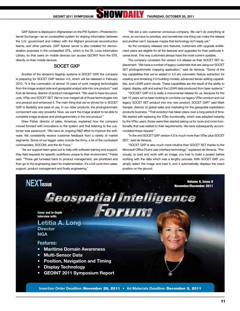
Volume 9, Issue 8 November/December 2011NEXT ISSUE
letitia A. longdirectornGA
Cover and In-Depth Interview with:
Features:• Maritime domain Awareness• Multi-sensor data• Position, navigation and timing• display technology• GEOint 2011 symposium report
insertion Order deadline: November 28, 2011 • Ad Materials deadline: December 2, 2011
1111
thursdAy, OCtObEr 20, 2011GEOint 2011 syMPOsiuM

J o i n t h e r e v o l u t i o n i n p l a c e - b a s e d d e c i s i o n - m a k i n g f o r b u s i n e s s a n d g o v e r n m e n t .
Brought to you by the Open Geospatial Consortium (OGC) and the United States Geospatial Intelligence Foundation (USGIF)
WhereCon was established to satisfy the
growing desire for a new dialogue on the
synergies that location-enabled and place-
based streams of activity are bringing to
historically stove-piped public and private
sector domains. The question of “Where?”
is increasingly becoming the organizing
principal for how public and private sector
enterprises get their jobs done.
Over 2 1/2 days, WhereCon will cultivate the
emerging community of leaders, thinkers
and practitioners that are struggling with the
changes posed by the emerging “location-
awareness” that portends great change
for the public policy, private enterprise,
technology and strategy – regardless of the
sector from which they hail.
April 10-12, 2012Walter E. Washington Convention Center • Washington DC
COME HEAR SPEAKERS FROM THE PUBLIC AND PRIVATE SECTOR DISCUSS THESE TOPICS
REGISTRATION OPENS IN NOVEMBER
Government & Military $399 OGC and USGIF Members $549
Industry $699 Academia and Full-Time Students $199
• Engaging the World through Foreign Affairs and Public Diplomacy
• Where does the SmartGrid think it is
• Locating Broadband and the Digital Divide
• Empowering the Mobile Workforce with Location Services
• Location Privacy
• GEOINT 3.0, the Future Framework of National Security
• Open Source Geospatial Technology and Cloud Computing
• Putting Policy on the Map
• Mapping the Mortgage Crisis
• Power to the People – Crowd Sourcing Geo-Democracy
• Geospatial Data and Enforcing Cap and Trade?
• Public/Private Partnerships in Mapping Critical Infrastructure
• Place-Based Justice and Public Safety
• Collaborating for Healthy Ecosystems
wherecon.com