geography 12: maps and spatial reasoning lecture 22: photogrammetry and air photos for mapping...
Post on 19-Dec-2015
220 views
TRANSCRIPT
Geography 12: Maps and Spatial Reasoning
Lecture 22: Photogrammetry and air photos for mapping
Professor Keith Clarke
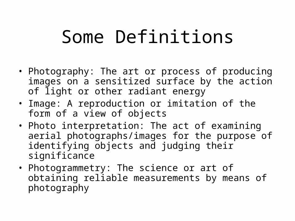
Some Definitions
• Photography: The art or process of producing images on a sensitized surface by the action of light or other radiant energy
• Image: A reproduction or imitation of the form of a view of objects
• Photo interpretation: The act of examining aerial photographs/images for the purpose of identifying objects and judging their significance
• Photogrammetry: The science or art of obtaining reliable measurements by means of photography
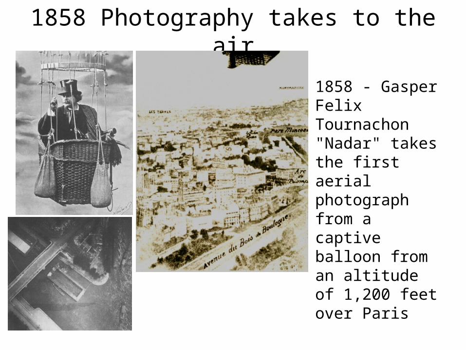
1858 Photography takes to the air
• 1858 - Gasper Felix Tournachon "Nadar" takes the first aerial photograph from a captive balloon from an altitude of 1,200 feet over Paris
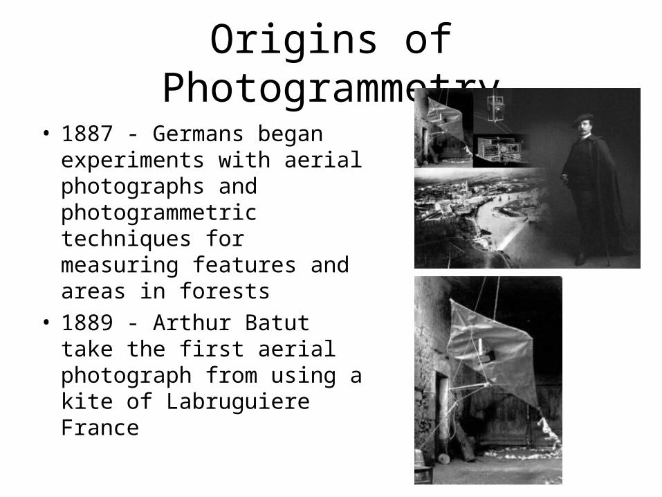
Origins of Photogrammetry
• 1887 - Germans began experiments with aerial photographs and photogrammetric techniques for measuring features and areas in forests
• 1889 - Arthur Batut take the first aerial photograph from using a kite of Labruguiere France

U-2 & Francis Gary Powers
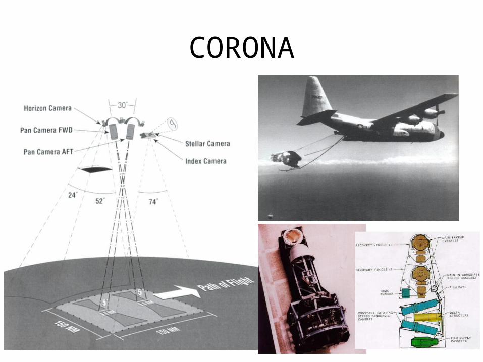
CORONA

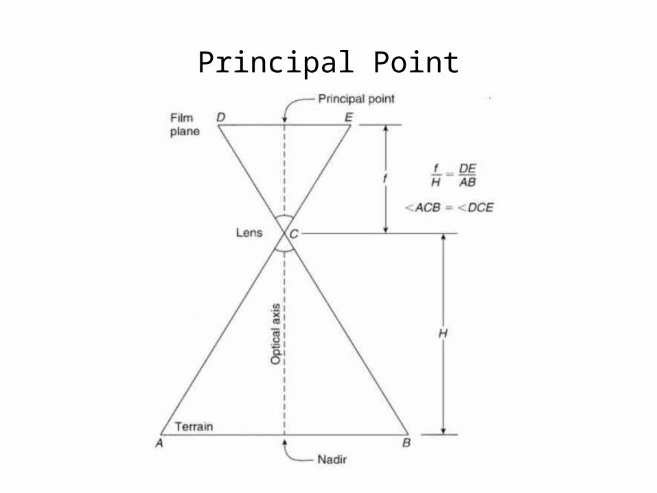
Principal Point
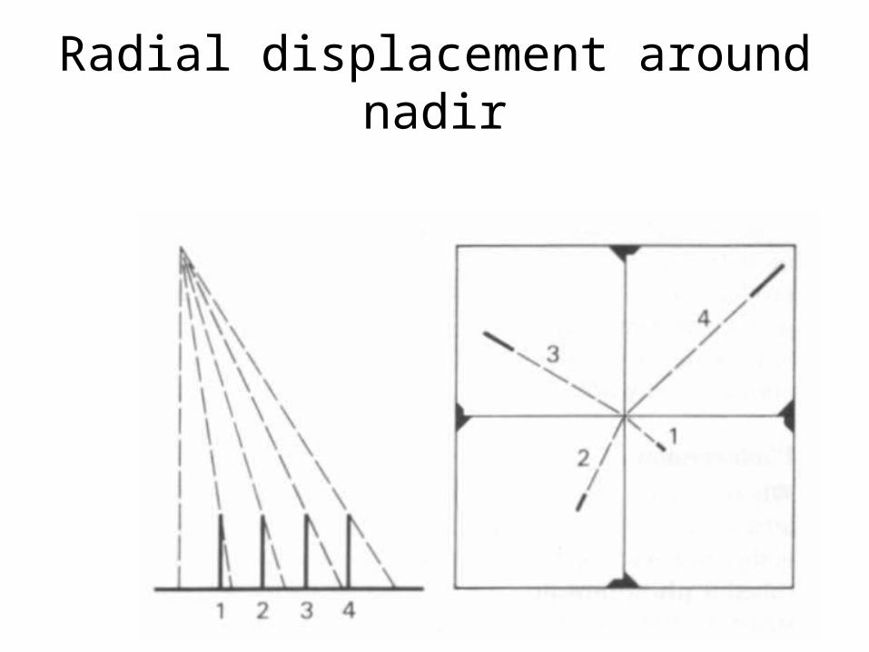
Radial displacement around nadir

Relief Displacement
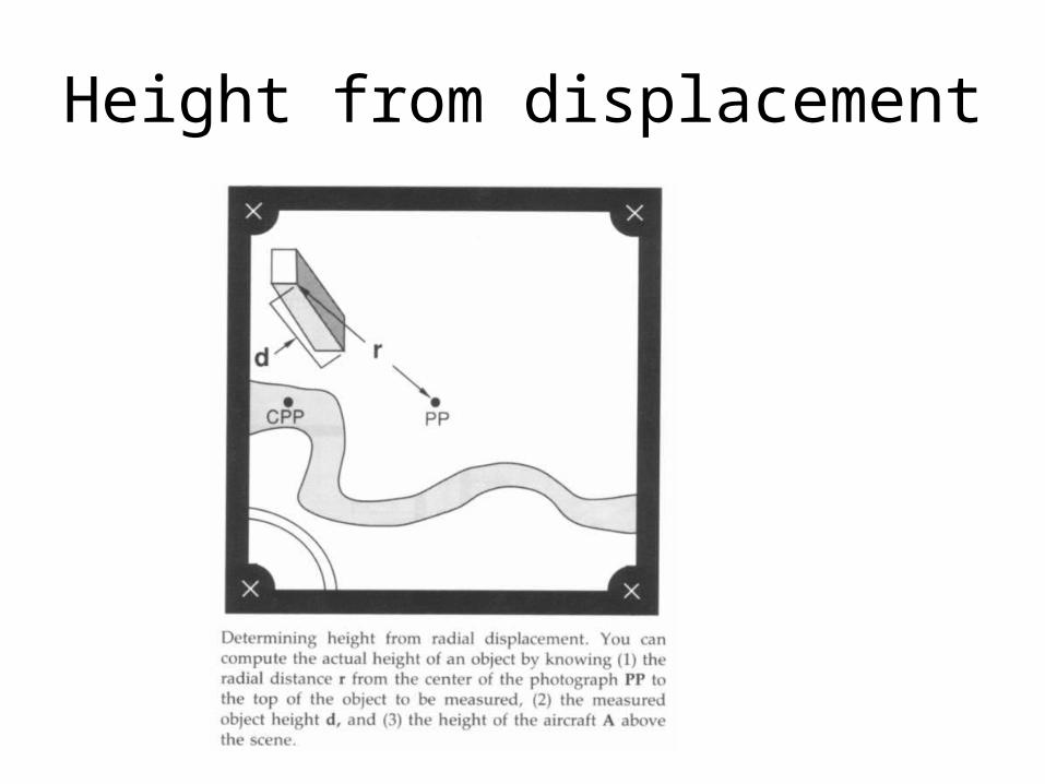
Height from displacement
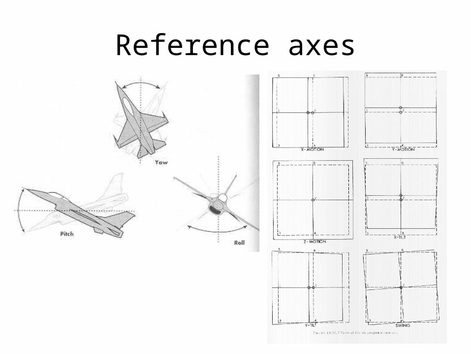
Reference axes
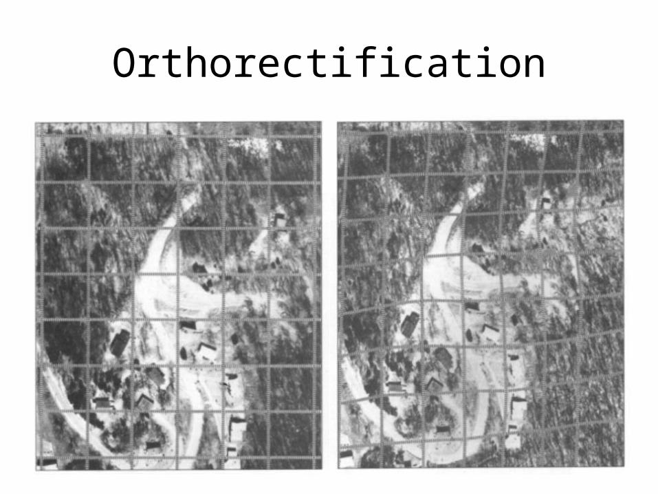
Orthorectification
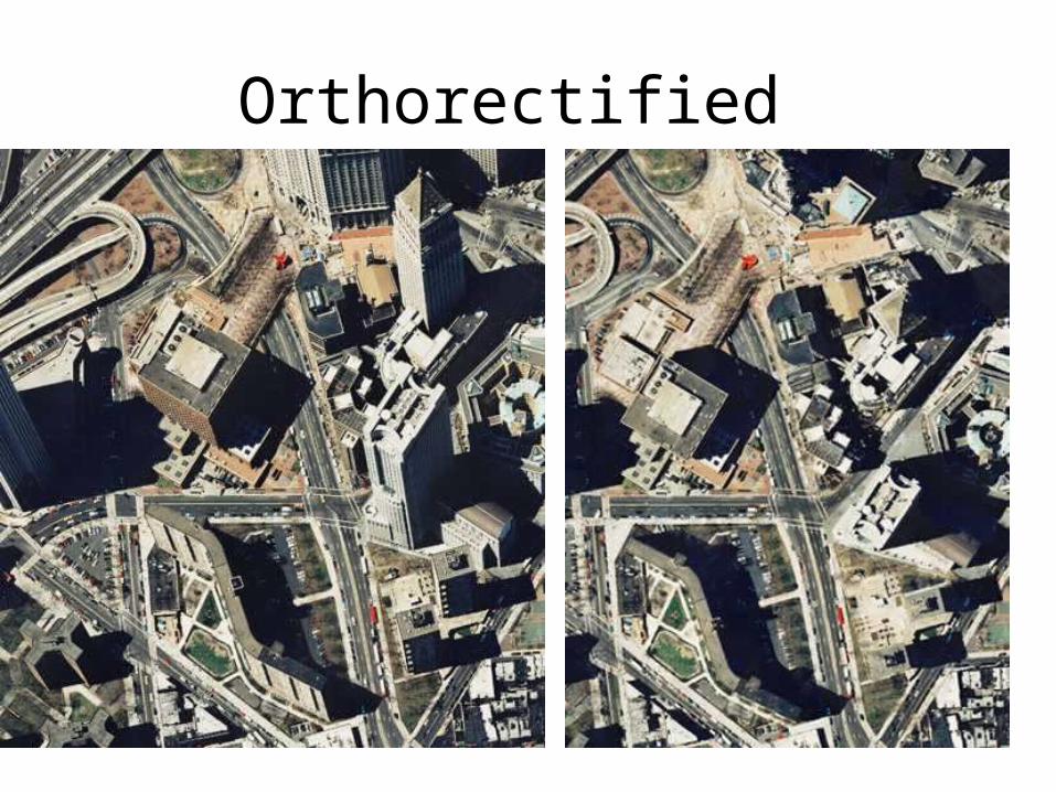
Orthorectified
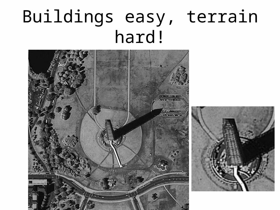
Buildings easy, terrain hard!
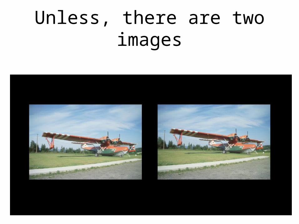
Unless, there are two images
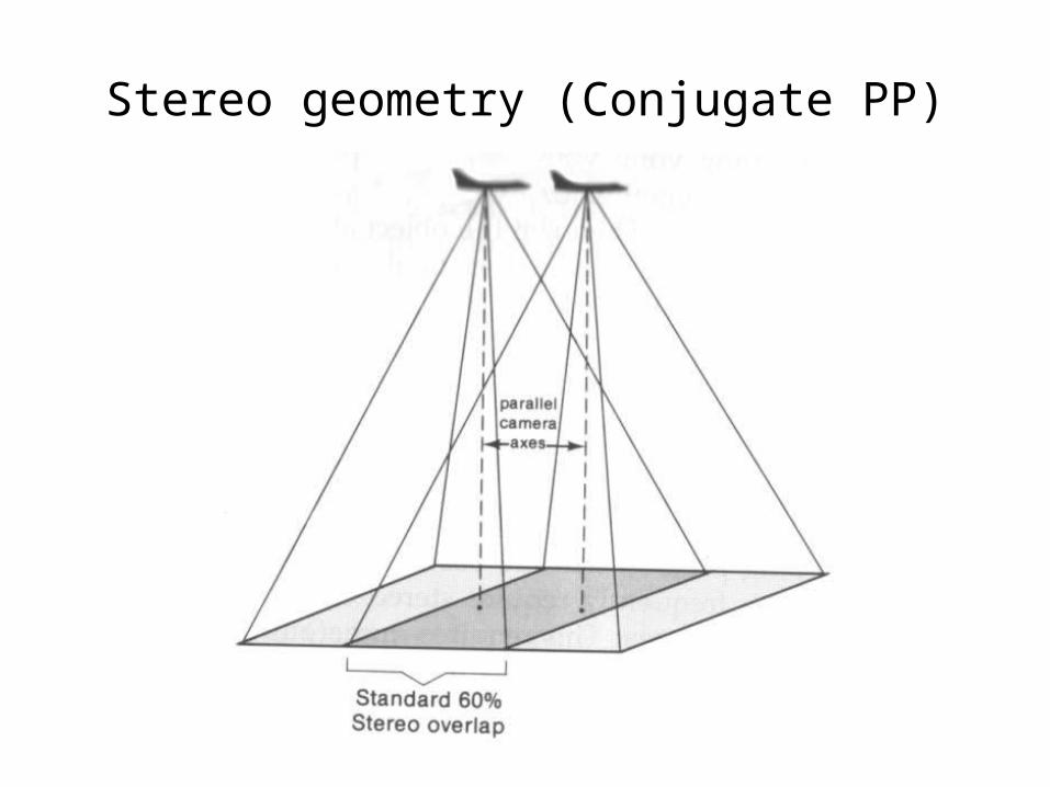
Stereo geometry (Conjugate PP)
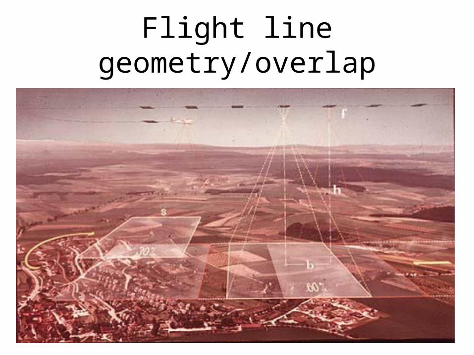
Flight line geometry/overlap
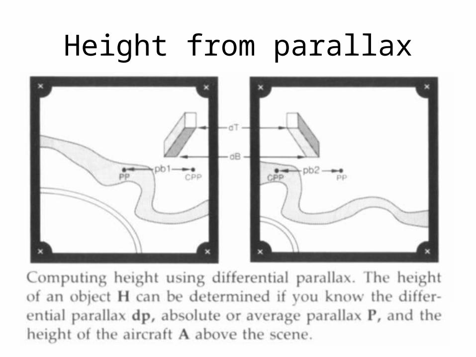
Height from parallax
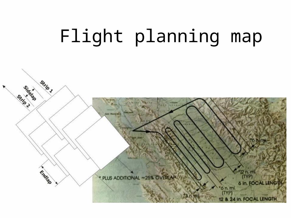
Flight planning map
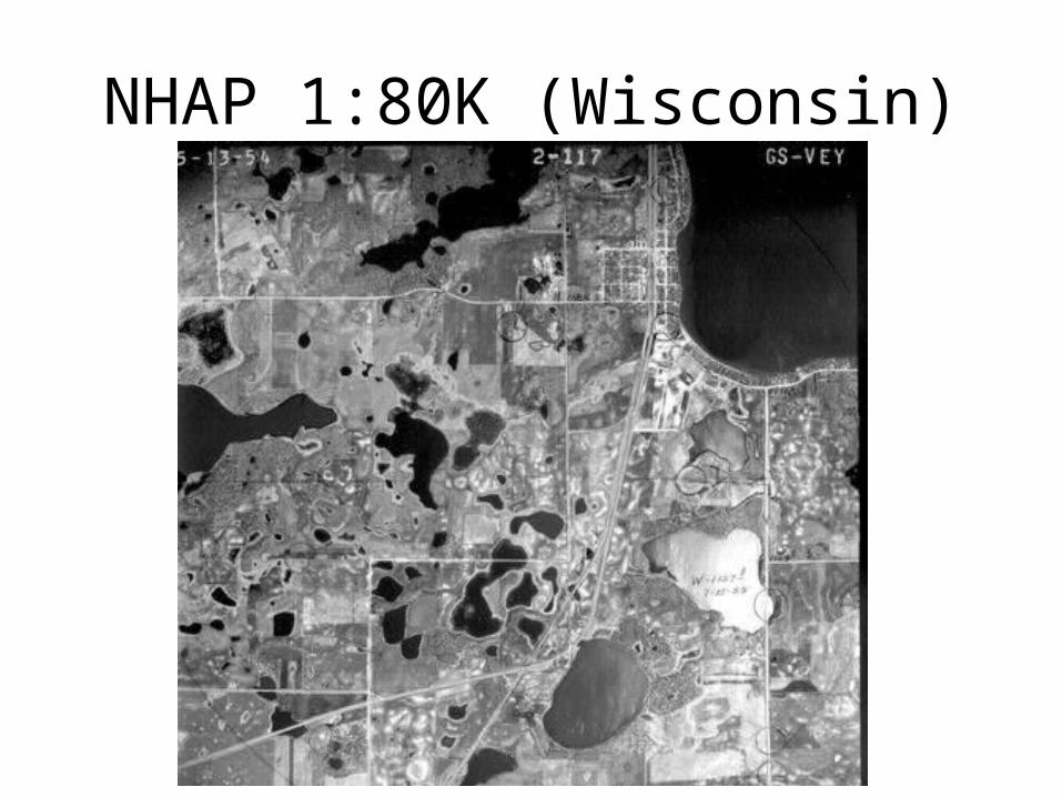
NHAP 1:80K (Wisconsin)
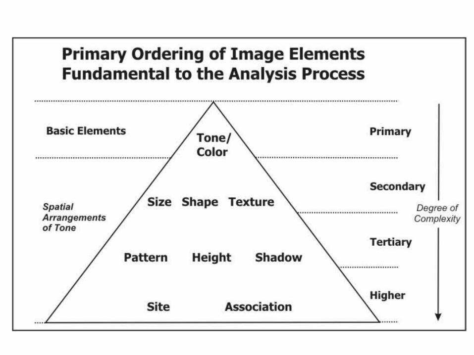
Photo Interpretation Tasks• Detection and identification of features, phenomena, or
processes– Detection and interpretation– Labeling– Confidence assessment
• Measurement and estimation• Use in topographic and special purpose mapping• Map update• Problem solving
– Object complexes– Object relations– Assessments/causes
• Rating of evidence– Assembly of information– Ranking and assessment
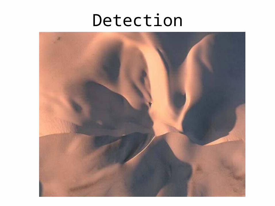
Detection
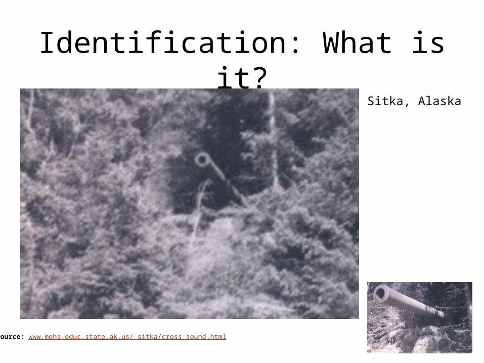
Identification: What is it?
Source: www.mehs.educ.state.ak.us/ sitka/cross_sound.html
Sitka, Alaska
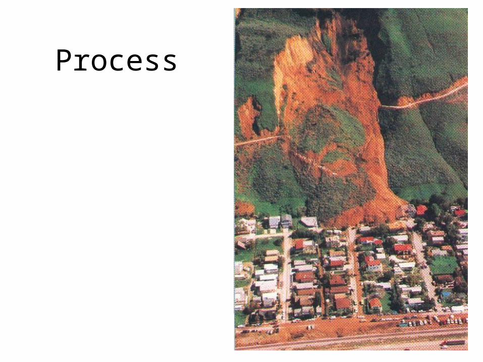
Process
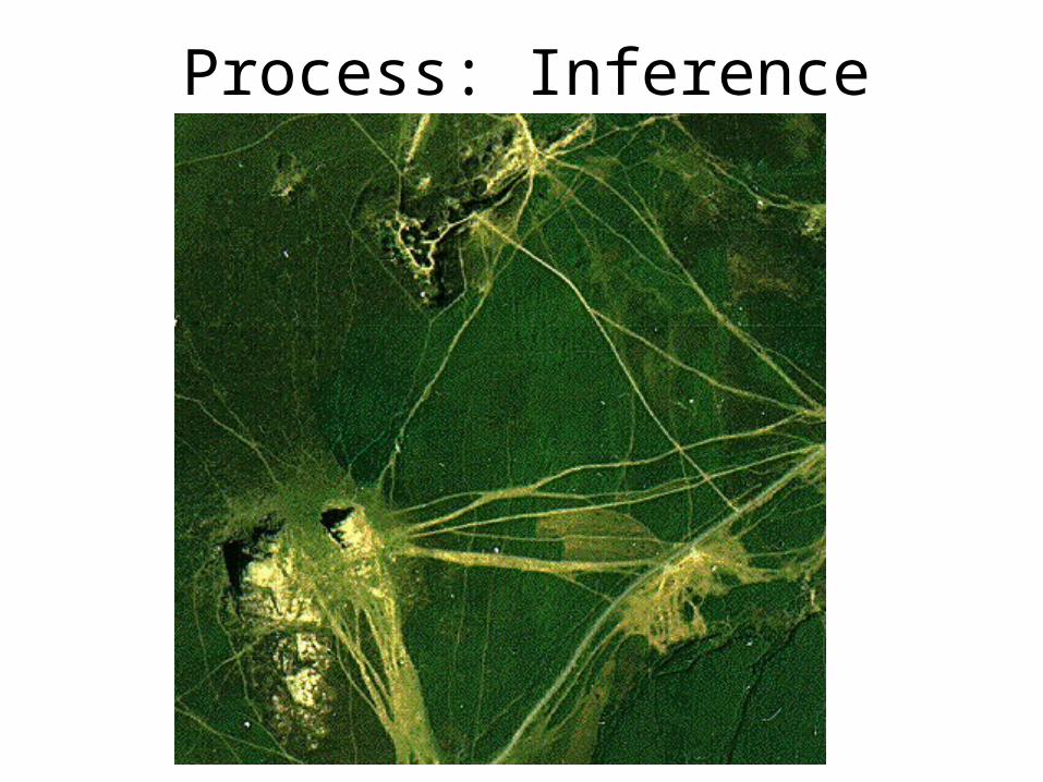
Process: Inference
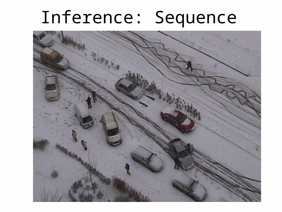
Inference: Sequence
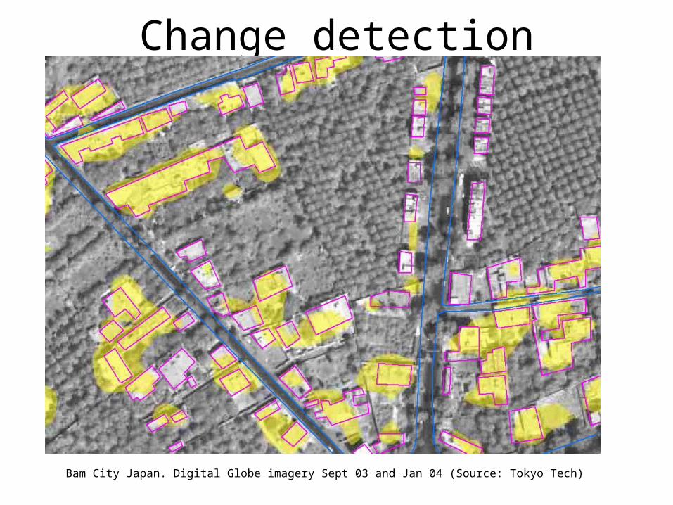
Change detection
Bam City Japan. Digital Globe imagery Sept 03 and Jan 04 (Source: Tokyo Tech)
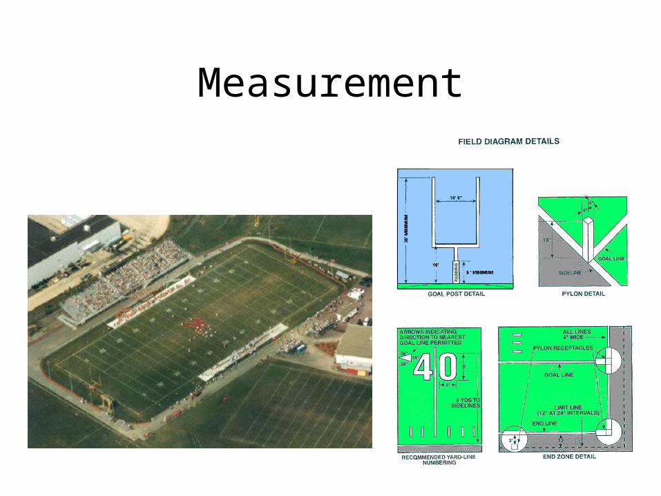
Measurement
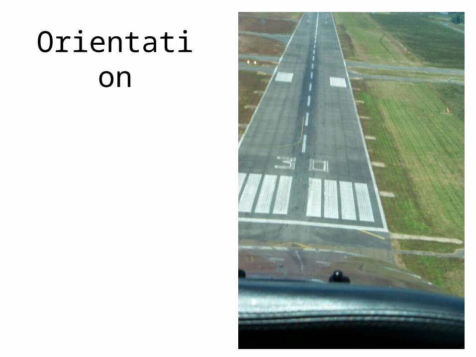
Orientation
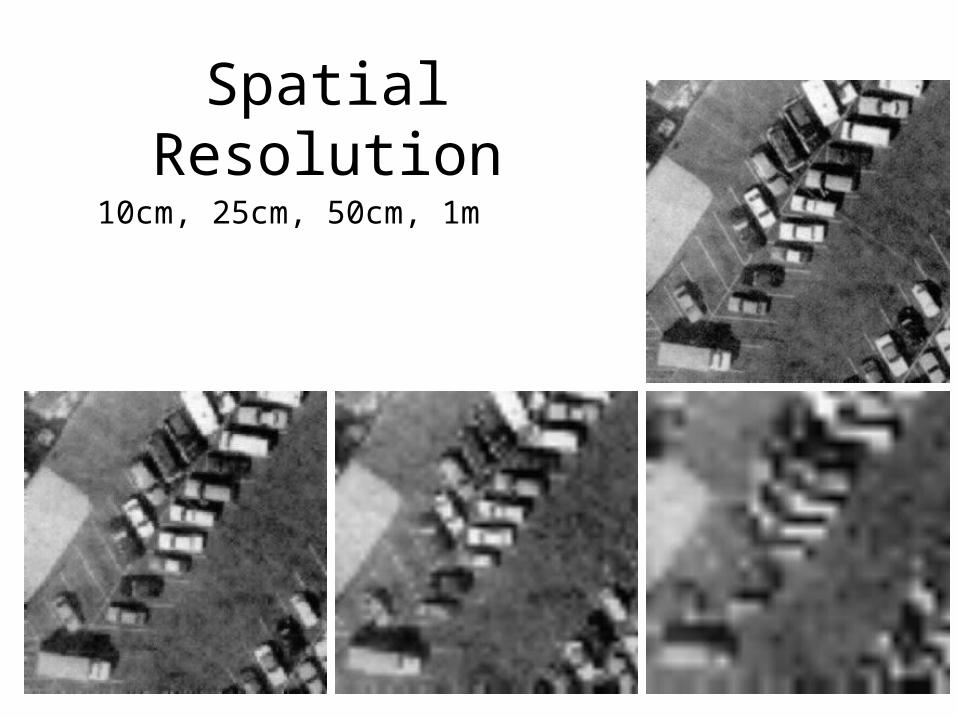
Spatial Resolution
10cm, 25cm, 50cm, 1m

Resolution
* See mecca_saudi_arabia_quickbird_feb11_2003.tif
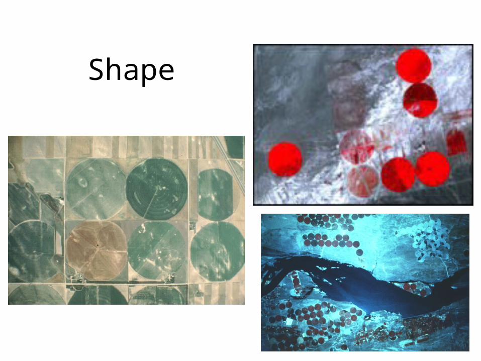
Shape
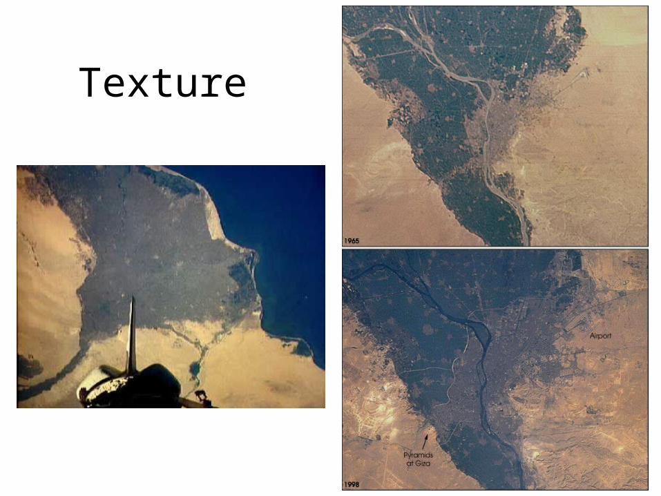
Texture
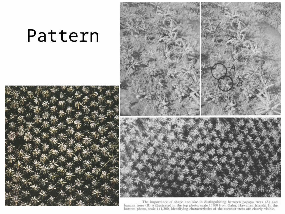
Pattern
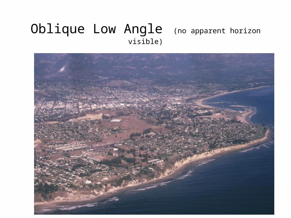
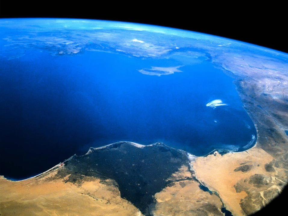
Oblique Low Angle (no apparent horizon visible)
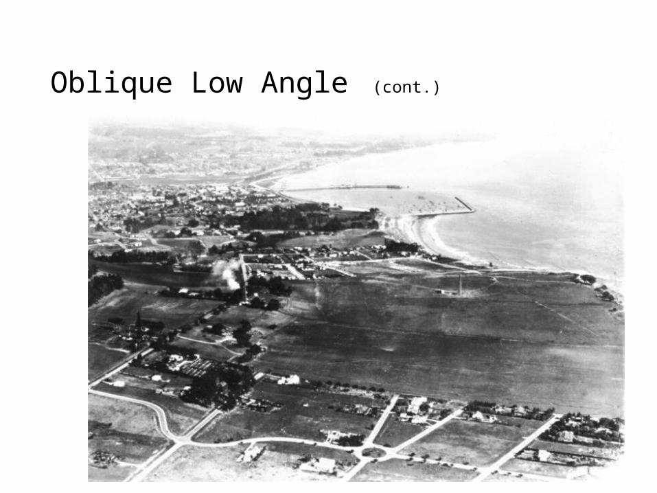
Oblique Low Angle (cont.)
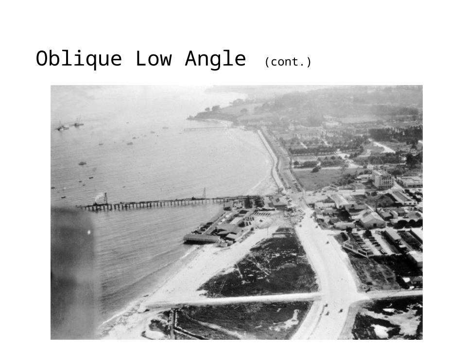
Oblique Low Angle (cont.)

Overhead Vertical True

Oblique: High Angle CIR (apparent horizon visible)
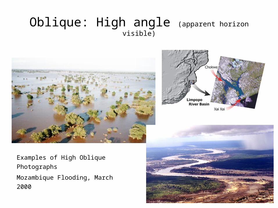
Oblique: High angle (apparent horizon visible)
Examples of High Oblique
Photographs
Mozambique Flooding, March 2000
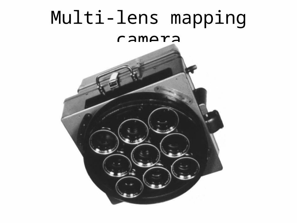
Multi-lens mapping camera
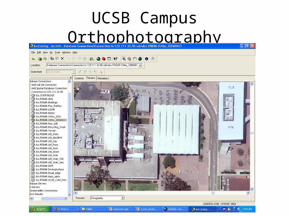
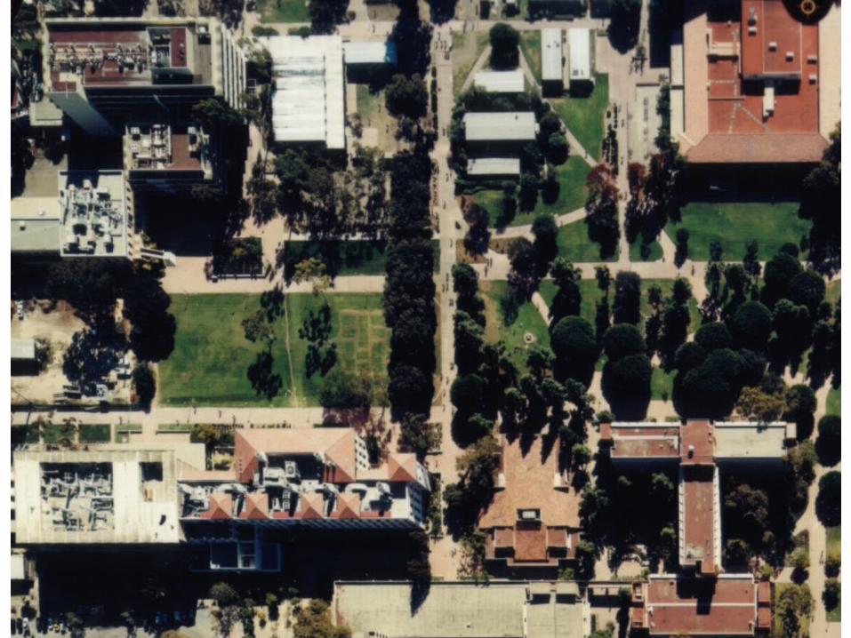
UCSB Campus Orthophotography
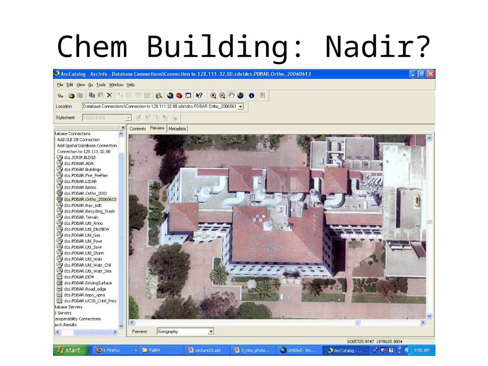
Chem Building: Nadir?
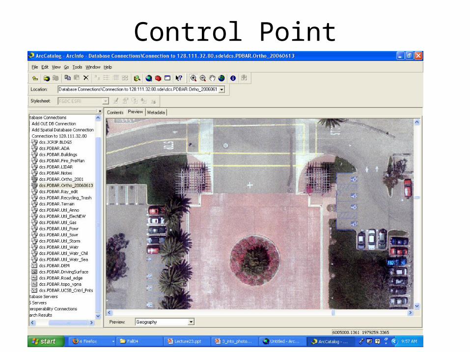
Control Point
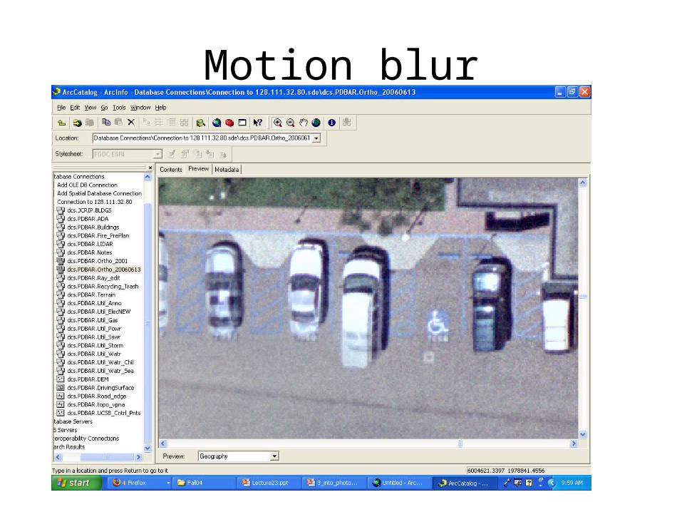
Motion blur
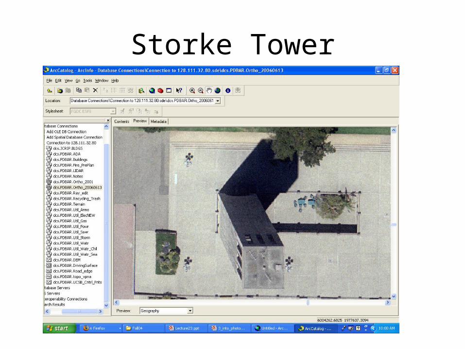
Storke Tower
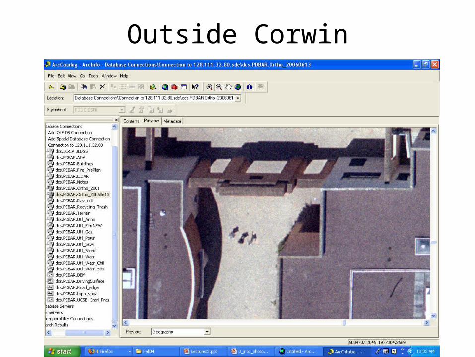
Outside Corwin

Goleta beach