geographic information system management plan
TRANSCRIPT

Geographic Information System (GIS) Plan
Unit Name Site Type - State
U.S. Department of the Interior – National Park Service
SIGNATORS

GIS Plan Park Name Here
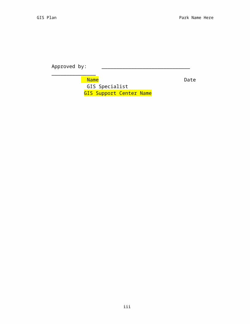
Approved by: ______________________________ _______________
Name Date Superintendent Site Name
Approved by: ______________________________ _______________
Name Date GIS Program Supervisor Site Name
Approved by: ______________________________ _______________
Name Date GIS Program Supervisor
GIS Support Center Name
Approved by: ______________________________ _______________
Name Date GIS Specialist GIS Support Center Name
ii
GIS Plan Park Name Here
iii

NOTE: Directions to complete this plan are highlighted in yellow, and should be deleted once completed. Standard text that should be included in the final draft of this plan is included in normal font. The Regional GIS Support Office will work in consultation with the park to develop this plan.
EXECUTIVE SUMMARYThe Executive Summary of the Park GIS Plan may be framed as either an analysis derived from the park GIS Plan Needs Assessment (GIS Needs Assessment Summary (Appendix #)) or as a statement reflecting the parks desire to enhance management efficiency and effectiveness. Generally, the summary might include statements regarding the selection of a GIS, the implementation timeframe, identification of resources, and the number of FTE’s that will be required to implement and operate the GIS. Provide a brief summary of the five year goal(s) of the parks GIS Program. You may use the sample text below if applicable. You may find it helpful to cut and paste from parks Strategic Plan or PMIS projects definitions.
Sample format:
Begin with a paragraph highlighting Park mission and significance. Then proceed with the following paragraphs…
The goal of Park is to have a comprehensive automated information system that will integrate spatial (geographic) and tabular data from a variety of sources to enable modeling of real and theoretical situations for management of all park resources. Follow this statement by indicating how this GIS Implementation Plan fits into the parks Strategic Plan, or what steps will be taken to get the fit.
Park management is organized into (XX#) divisions: List Divisions within this paragraph. Administratively, the (division) directs the GIS operations and applications. The purpose of the GIS program is to: (enhance the understanding of ecosystem processes / cultural resources, facilitate integration of baseline data, serve as a feature location database, serve as a tool for presentation and analysis of data to facilitate sound management decisions…). The GIS is considered a resource for park management and will be available to all park divisions to meet these objectives. To ensure the development of a strong program, the commitment from all park divisions is concurred and is detailed in this plan.
Applications and products generated from the GIS will enhance (list divisions and general applications—e.g. Natural Resources: management and monitoring of a specific T&E, GPRA Goal 2AB3).
Implementation costs will be ($$ for years 1-5). Personnel commitment will involve (XX FTEs and % of time for years 1-5). Differentiate among Park, Region, Program funding and personnel cost responsibilities by year.
The staff (list applicable divisions) of the park, region (list if applicable), neighboring agencies (list if applicable), and management directives shows full commitment to creating and operating a functional GIS. This plan will be useful in providing insight to types of information required by management. It provides long-term guidelines for GIS operation and aids in refining short-term objectives that are outlined in the appendices. The GIS Implementation Strategy section and the appendices may require annual updates due to the evolving nature of GIS and changing issues facing the park. This will provide flexibility to meet these needs without the necessity of continuously rewriting this plan. Note that sections of this GIS Implementation Plan are to be used
i
GIS Plan Park Name Here
directly with Project Management Information System (PMIS) and various grant proposals submission. Additionally, this plan
will simplify hardware/software purchasing, tracking of licenses, and data acquisition.
ii

TABLE OF CONTENTS SIGNATORS..............................................................................IEXECUTIVE SUMMARY..............................................................IIUNIT AND PLAN OVERVIEW......................................................1
Unit Description..................................................................................1Unit Management Organization..........................................................1Purpose, Need, Goal for Unit Plan.......................................................1
APPLICATIONS BY DIVISION AND PROGRAM..............................2Corresponding Themes.......................................................................2
CURRENT STATUS....................................................................3GIS Program........................................................................................3Data....................................................................................................3
Detailed List of Databases.............................................................3Existing Spatially Referenced Data List (Including Metadata Status)...........................................................................................3Geographic Boundaries.................................................................3
Unit Computer Network......................................................................3Hardware............................................................................................3Software..............................................................................................4Personnel............................................................................................4
DATA MANAGEMENT STRATEGY................................................4Data Base Design................................................................................4Relational Databases..........................................................................4Scale and Resolution and Reference Base Maps.................................4GPS data.............................................................................................4Metadata.............................................................................................4Archiving.............................................................................................5Projection and Datum.........................................................................5Data Quality Assurance Quality Control..............................................5Data Directory Structure.....................................................................5Integrated Data Tools.........................................................................5FOIA and Sensitive Data Protection....................................................5Data Distribution.................................................................................5National/Regional/ Program Linkages.................................................5Other Data Issues...............................................................................6
IMPLEMENTATION STRATEGY...................................................6Guidelines and Objectives...................................................................6System and Facility Design.................................................................6
Physical Location...........................................................................6System Support.............................................................................6Training and Staff Orientation.......................................................6Organizational Location.................................................................6
Division and Program Roles and Responsibilities................................6Plan Update Schedule.........................................................................6Implementation Narrative...................................................................7

Hardware.......................................................................................7Software........................................................................................7Personnel......................................................................................7Spatial Data Development and Acquisition...................................7Implementation Schedule Summary.............................................8
Other Implementation Issues..............................................................8Budget Narrative.................................................................................8
MAP 1 – GEOGRAPHIC POLITICAL BOUNDARIES..........................9MAP 2 – INSERT A MAP DEPICTING THE UNIT BOUNDARY..........10MAP 3 – LARGE UNIT SCALE MAP.............................................11GIS APPENDIX 1 - GIS NEEDS ASSESSMENT SUMMARY.............12GIS APPENDIX 2 - GIS APPLICATIONS.....................................13GIS APPENDIX 3 – DATABASE LIST (THERESA IS DEVELOPING
DRAFT CHECKLIST)........................................................14GIS APPENDIX 4 – EXISITING DIGITAL SPATIAL DATA (EXAMPLE
TO BE DEVELOPED).......................................................15GIS APPENDIX 5 - DATA THEMES TO BE DEVELOPED.................16GIS APPENDIX 6 – GEOGRAPHIC BOUNDARIES..........................18GIS APPENDIX 7 - NETWORK DIAGRAM....................................19GIS APPENDIX 8 - DRAFT: STANDARD DIRECTORY
STRUCTUREVERSION: 2/9/01..........................................20GIS APPENDIX 9 – DATA RELEASE STATEMENT.........................21GIS APPENDIX 10 – IMPLEMENTATION SUMMARY TABLE...........25
iv

UNIT AND PLAN OVERVIEW
UNIT DESCRIPTION
Provide a one or two paragraph description of the unit’s mission and character.
Example:Fort Laramie National Historic Site was established by congress on July 16, 1938. The park occupies 833 acres of land on the Laramie River, west of its confluence with the North Platte River in southeast Wyoming. (See Map 1) The park is primarily preserved as a historic site. The fort site was occupied first as a fur-trading center from 1834 to 1849, then subsequently as a military outpost from1849 through 1890. It further served as a way station for trappers, traders, and emigrants on the Oregon-California Trail, the Mormon Trail/Council Bluffs Road, the Pony Express route, the transcontinental telegraph line, and the Cheyenne-Deadwood Stage Route. The old fort site, located in the western end of the park, contains a complex of restored buildings and ruins, dating from mid and late 19th century, surrounding a lawn quadrangle. The remainder of the park contains disturbed areas and floodplains. From the fort site there is an unobstructed natural landscape view, with very few incidents of modern or man-made features observed on the visual perimeter, which is primarily outside of the park boundary.
It is the Mission of Ft. Laramie National Historic Site and the National Park Service is to preserve and protect for the future Fort Laramie National Historic Site’s historic landscapes, sites, and structures; and to further public understanding and appreciation of the historic events, inter-relationships of cultures, the many personalities of Fort Laramie and the northern plains, and their roles and motives in American westward expansion and Indian resistance.
UNIT MANAGEMENT ORGANIZATION
Provide a brief description of the unit’s divisional organization and management responsibilities.
Example:Park management is organized into three divisions:
Administrative Division Visitor Services Division Maintenance Division
These divisions routinely exchange information to achieve the park's management objectives. The Visitor Services Division has, over the years, collected numerous maps, site data, and photographs. These data are generally stored in paper form on various page sizes and at varying scales. As with all paper products, this information is difficult to use, expensive to keep, and subject to eventual deterioration and disintegration.
PURPOSE, NEED, GOAL FOR UNIT PLAN
All data collected by the Park Service should be georeferenced.
Please provide a statement indicating the priority of GIS in the park. A sample is listed below:
Sample:A centralized, integrated database, a Geographic Information System (GIS), has been a high priority in the yearly goals and the Resource Management Plan (RMP) over the past 5 years. A GIS provides the ability to relate resource data to each other in ways that cannot be done on paper maps or with numeric data bases and analyzing information on such a large, diverse, and isolated land area. GIS is a comprehensive, highly accurate tool that improves the efficiency and accuracy of decision-making by assisting park managers. Tracking and illustrating
document.doc Page 1 5/3/2023

current resource conditions accomplish this, and with modeling techniques can predict probable changes to resources within the park ecosystem and infrastructure.
The GIS program does not stand alone, but rather is an integrated tool for the overall management of Park. The NPS Strategic Plan, Mission Goal 1b, requires that “management decisions about resources and visitors are based on adequate scholarly and scientific information.” Long-term Goal #1b1 under Mission Goal states that acquiring “…outstanding data sets identified in 1999 of basic natural resource inventories of all parks.” is a desired outcome. These data sets are in digital form and can only be properly applied to the goal of using “scientific information” through the use of an adequately maintained and integrated GIS system that is available to and supported by the entire staff and management of this park. This Plan is necessary to identify the GIS program development required to satisfy and support these broader park management needs.
Purposes of this GIS Plan 1. To outline the long-term goals of the
GIS program 2. To associate those goals with the
long-term goals of the Park Strategic Plan
3. To encourage employees to discover the advantages that GIS can give them
4. To identify the necessary elements for a functional GIS program
5. To encourage the use of the GIS system and program as an integral part of accomplishing Park Goals as outlined in the Park Strategic Plan, Date.
APPLICATIONS BY DIVISION AND PROGRAM
To determine the use of a park GIS, a GIS Needs Assessment was completed in (date) by (list divisions), see GIS Needs Assessment
Summary (GIS Appendix 1). Park and regional staff, and neighboring cooperators identified the possible applications/use of a GIS within this park. A list of applications and those divisions the applications will benefit has been included in GIS Applications (GIS Appendix 2). Products can be identified from the list of applications. Products include a digital data integration and management system, hard copy maps, hard copy graphics, reports, and tabular information, scanned documents and images, and screen map and tabular displays. As projects are completed, new projects are initiated, and priorities shift, the objectives will change to meet these needs. List applications in GIS Applications (GIS Appendix 2). An example of this list can be found in exappendix2.doc.
CORRESPONDING THEMES
A coverage is a collection of like objects, for example roads, hydrography, etc. An attribute is a group of specific objects within a theme - for example, ‘paved’ within the roads theme or 'perennial streams' in the hydrography theme. What data themes will be needed in the GIS to address the problems cited in the applications? What maps or data would be useful to researchers, resource managers, maintenance, operations, and other managers on a daily basis?Based on the required unit applications listed in GIS Needs Assessment Summary (GIS Appendix 1) and GIS Applications (GIS Appendix 2), a list of data themes necessary to complete the application, project, or analysis has been developed and is displayed in either Exixting Spatial Data (GIS Appendix 4) or in Data Themes To Be Developed (GIS Appendix 5). This list will enable the development or procurement of spatial data, and lead to a better understanding of the various types of non-spatial data that need to be related to the GIS. Additionally this list is prioritized to aid in data development planning. List themes required for the applications and not appearing in GIS Appendix 4 in GIS Appendix 5. Prioritize themes based on their
document.doc Page 2 5/3/2023

necessity to complete applications. Categorize as immediate need (1-2 years), or future need (3 or more years out). Many themes will apply to multiple applications.
CURRENT STATUSGIS PROGRAM
Please provide a status of current or past GIS use by the park.
DATA
The intent here is to provide a comprehensive list of all relevant data . The first section provides a generalized list of all databases and the second section focuses provides details of the spatially referenced data.
Detailed List of Databases
This information is found in Database List (GIS Appendix 3). Compile and present in the Database List (GIS Appendix 3) a list of all current data bases available to each of the unit divisions. Employ the checklist as appropriate. Include tabular or non-digital feature data drawn on analog maps that should be included in the GIS database. Also include all relevant scanned images. Existing Spatially Referenced Data List (Including Metadata Status)
This information is found in Existing Digital Spatial Data (GIS Appendix 4). Existing Spatial Data (GIS Appendix 4) contains an inventory of the currently available digital spatial data (i.e., digital data that has coordinate locations). Be sure to include any digital base cartographic data (e.g. 1: 24K DLGs for transportation, railroads, hydrology, hypsography, boundary; 10 or 30 meter DEMs, DOQs, DOQQs, DRGs). Also include all digital aerial photography both current and historic (with date flown), satellite imagery (including date), digital vegetation data, T&E data from USFWS and
the State Natural Heritage Program, soils data from NRCS or SCS, geologic data from USGS and the NPS Geologic Resources Division, and any digital data generated by research from cooperating universities. All associated metadata should be included.
Geographic Boundaries
This information is found in Geographic Boundaries (GIS Appendix 6). This appendix identifies the boundaries for the regional extent of data collection. Identify by county level 15 minute quadrangle, USGS 7.5 minute quadrangle names, and 100K scale maps, listing each quadrangle in Geographic Boundaries (GIS Appendix 6).
UNIT COMPUTER NETWORK
This information is found in Network Diagram (GIS Appendix 7). Briefly describe the current computer networking status for both on-site and off-site information transfer. Include LAN, phone line, and other connections in the description. You may wish to use a network-diagramming program to simply this presentation (e.g., SmartDraw).
Additionally, you might provide information here that highlights unique aspects of the park that may make developing a GIS program challenging (i.e. 1 phone line, poor Internet access, limited networking capability for the near future…).
HARDWARE
This section will include a inventory of the various types of hardware that may be applicable to this GIS program. This inventory should include number and types of PCs that may be running any GIS software, PCs that may store any data--tabular and spatial--to be used or accessed in a GIS, digitizing tablet, color printers/plotters, and GPS units.
SOFTWARE
document.doc Page 3 5/3/2023

This section will include a list of the types of installed software including license information. This inventory should include software applications such as SYNTHESIS, NPS Theme Manager, Arcview, ArcInfo, MAPIT, MAXIMO, IRMS, FARSITE, Pathfinder Office for GPS differential correction, etc. Identify the machines on which the software is installed. You may wish to include this information on the network diagram described above and include it in Network Diagram (GIS Appendix 7).
PERSONNEL
This section will include a list of position(s) and percentage of time currently available to the unit to develop and implement a GIS. Include an estimate for regional program office(s) support for technical assistance, data development, and analysis.
DATA MANAGEMENT STRATEGY
DATA BASE DESIGN
Describe the GIS and CAD data formats that will be deployed (e.g, ESRI coverages, ESRI shapefiles, native AutoCAD files, etc.).
RELATIONAL DATABASES
This section is a detailed data integration plan, and should be developed in coordination with the regional office, parks system administrator, parks GIS staff, and cooperating neighboring agencies. What textual databases would be useful in conjunction with the GIS? Can they be easily integrated? How? Who is using it and how often? A complete list of all tabular/textual data should be included in Appendix 3 in order to determine the relationship with spatial data. This information enables the function of data management for the entire park (as will be discussed in Data Management Section of this Plan). Include any information here that specifies restrictions for the databases (i.e. sensitive or
proprietary). Include the format of the database (i.e. dBase, ACCESS, Oracle) and indicate the application that utilizes the database (i.e. FARSITE, IRMS, MAXIMO).
SCALE AND RESOLUTION AND REFERENCE BASE MAPS
This section identifies the standard operating scale that the park will strive to develop and maintain for their spatial database (i.e. 1:24,000, 1:100,000). Select and identify here an accurate base map or series of base maps to serve as a reference template. Scale will depend on existing data, and desired resolution and scale for proposed applications. Typically, this is based on USGS digital spatial products at 1:24,000 for vector products, 30 meter resolution for raster data, and 1:12,000 for imagery data.
GPS DATA
Identify the GPS equipment to be deployed. Every effort should be made to use at mapping scale (5 meter corrected) or better devices.
METADATA
Executive Order 12906 signed in April 1994 mandates all federal agencies to create metadata or “information about data” for all geospatial data. The Executive Order states that ‘Geographic information is critical to promote economic development, improve our stewardship of natural resources, and protect the environment. Modern technology now permits improved acquisition, distribution, and utilization of geographic (or geospatial) data and mapping.’ Additionally this order clarifies that this ‘means the technology, policies, standards, and human resources necessary to acquire, process, store, distribute, and improve utilization of geospatial data.’
As a result of EO 12906, the NPS GIS Program has a clearinghouse specifically designed to host all non-sensitive NPS GIS
document.doc Page 4 5/3/2023

data. This clearinghouse is linked to the Federal Geographic Data Committer (FGDC) Clearinghouse search enabling web users to locate NPS data from anywhere in the world. The park will comply with EO 12906 in the following ways:Determine and indicate methods that will be used to develop metadata for all spatial data, both new and existing, indicating timelines for metadata creation and posting, and responsible parties for creation of metadata (park or partner with Intermountain GIS Program Office, other agencies, etc.)
ARCHIVING
Determine and indicate how data will be backed-up, how often, and using what media. Where will backups be stored? Will copies be stored offsite? Also determine what data will permanently reside at the park, and what data will be stored either at the regional office, I&M, or another source.
PROJECTION AND DATUM
Determine and indicate the standard projection or grid coordinate system, and datum with which the unit will operate. Consultation with neighboring agencies and cooperators is important to determine the common format for developing and maintaining data. Indicate if any changes are required for existing data. Generally, it is recommended for new parks to use North American Datum 1983 (NAD 83), and North American Vertical Datum (NAVD 88) and their corresponding zone in UTM projection. Data served on the Internet, however, may require data to reside in decimal degrees.
DATA QUALITY ASSURANCE QUALITY CONTROL
Determine and indicate methods that will be used to inspect the quality of developed data (e.g. digitized data, newly registered data, GPS data). Additionally indicate methods
that will be used to maintain spatial data quality, particularly if there will be multiple users with access to the data.
DATA DIRECTORY STRUCTURE
This information is found in Data Directory Structure (GIS Appendix 8). Describe the data structure employed in the GIS. It is highly recommended that this structure follow the NPS theme standard (this is displayed in the attached sample Appendix 8).
INTEGRATED DATA TOOLS
Describe which of the data organization tools (Synthesis, IRMS, Theme Manager, etc.) will be deployed in the unit’s GIS.
FOIA AND SENSITIVE DATA PROTECTION
This information is found in Data Release Strategy (GIS Appendix 9). Place either the standard statement (see attached example Appendix 9) or its revision here.
DATA DISTRIBUTION
Describe how the data will be distributed to internal and external clients (e.g., NPS clearinghouse, unit developed CD’s, etc.). Include any plans for web delivery here.
NATIONAL/REGIONAL/ PROGRAM LINKAGES
Describe the unit’s relationship with and expectations of these programs and thier potential for enhancing the unit’s program.
OTHER DATA ISSUES
Identify any other data issues not covered above.
document.doc Page 5 5/3/2023
IMPLEMENTATION STRATEGY
GUIDELINES AND OBJECTIVES
State here the guiding principles for the program.
Example:The implementation of a GIS program at FOMC has two major objectives. First, it will provide an efficient system for storing displaying, and analyzing maps and related data to facilitate Park management and planning. Second, it will facilitate the communication of information about Park conditions among the three divisions (Administration, Visitor Services, and Maintenance) and with constituencies outside the Park.
1. The following guidelines will be used to implement the GIS program at FOMC:
2. The initial system must be simple enough to be operated on a part-time basis.
3. Although initially centered in the Visitor Services Division, the system must support all Park management operations.
4. The system must support reciprocal data exchanges with appropriate local and state GIS efforts.
5. The system must be compatible with the Park’s current software(e.g. ArcView, AutoCAD, dBase IV, Microsoft Word, Microsoft Access, and Microsoft Excel).
Prior to and during implementation, discussions with NPS GIS technical support centers, universities, personnel from local and state government agencies, and with staff from each Park division will form the basis for database development.
SYSTEM AND FACILITY DESIGN
This section identifies the physical set up for the GIS program.
Physical Location
Determine and indicate what division(s) will be responsible for overseeing the GIS operation and where it will physically reside.
System Support
Determine and indicate sources of funding, FTE(s) and percentage of time allocated for this operation. Also include any other support (i.e. administration, grant writing, regional technical assistance…).
Training and Staff Orientation
Determine and indicate what percentage of the annual operating budget will be used for training in GIS software, hardware, and applications.
Organizational Location
Identify the organizational location and the reporting and supervision structure for the program.
DIVISION AND PROGRAM ROLES AND RESPONSIBILITIES
This section describes the personnel and budgetary support to the GIS program provided by the various unit divisions. It should include data stewardship responsibilities.
PLAN UPDATE SCHEDULE
Identify the schedule for routine updates to this plan.
document.doc Page 6 5/3/2023

IMPLEMENTATION NARRATIVE
This section describes the implementation components and summarizes these actions in GIS Appendix 10.
Hardware
This section is a detailed 3-5 year hardware acquisition and obsolescence plan and should be developed in coordination with the regional office, park system administrator, park GIS staff, and cooperating neighboring agencies based on the unit’s GIS Needs Assessment Summary (GIS Appendix 1) and information provided in Hardware Inventory section of this GIS Implementation plan. Include in this section a long-term comprehensive evaluation of the network and available hardware. Evaluate the possibility of sharing hardware and disk space with cooperators/regional offices. Consider how data will be stored, shared, and served (network, ftp, CDs) among park staff, regional offices, and the public. Consider how products/graphics will be produced, and the desired sizes of hard copy maps. Evaluate how much data will be stored at the park and disk space necessary. Additionally, discuss any inherent problems that need to be overcome such as parks network connectivity to the NPS Intranet and Internet. Prioritize hardware procurement. Indicate where the hardware will physically reside. The budget will also be discussed here.
Software
This section is a detailed 3-5 year software implementation plan, and should be developed in coordination with the regional office, parks system administrator, parks GIS staff, and cooperating neighboring agencies. Use the information in the parks GIS Needs Assessment, and provided in Software Inventory Section of this GIS Implementation
plan as a basis for development. Software considerations should include database management, GIS modeling and analysis for both raster and vector, map products, support for hardware (i.e. GPS differential correction and output, printing software for larger (raster) datasets), and skill level(s) of the user(s). The budget will be discussed here. In budgeting for software, decide if the park will pay annual right-to-use fees that enable the park to receive software upgrades at no cost, or not paying right-to-use and having to purchase upgrades at full price. The cost savings can be determined based on the length of time the park can justify using dated software. It should prioritize software procurement. Additionally, explore software acquisition with the ESRI Conservation Grant Program to apply for discounts on ESRI products (often up to 50% savings).
Personnel
Describe any personnel to be added or duty changes beyond current assignments. Indicate timing, physical and organizational locations, and support requirements.
Spatial Data Development and Acquisition
This section is a detailed data development and acquisition plan, and should be developed in coordination with the regional office, parks system administrator, parks GIS staff, and cooperating neighboring agencies. A complete list of all data themes necessary for park applications as well as all data that currently are available is found in the table in Data Themes To Be Developed (Appendix #). Use this to identify outstanding data necessary to acquire or develop. In the table developed in Data Themes To Be Developed (Appendix #), complete the columns referencing the following: 1) are the data required available (already developed), or do they require developing, 2) are data available from any known source in digital format, or
document.doc Page 7 5/3/2023

in hard copy, 3) if available in digital format, indicate source, scale, resolution, projection, and price, 4) if only available in hard copy, indicate this, source, and price of hard copy, 5) prioritize the data acquisition/development. Additionally, estimate price for scanning or digitizing data. If data have not been developed, indicate procedure for development, whether development is a possibility, source for development, and estimate price and timeline here for each data theme.
The NPS has a metadata guidelines document indicating the standards for data development and should be followed if applicable (http://129.24.219.65/gis/misc-pages/Contract.htm).
Examples include GPS collection of data including differential correction and output, digitizing or scanning of various features recorded on maps (e.g. cultural sites, vegetation plots, burned areas, soils map, research from universities submitted in report form, historic maps, photos, or documents…).
Implementation Schedule Summary
This information is found in the Implementation Summary Schedule (GIS Appendix 10). Provide a timeline for the objectives in GIS Implementation Strategy Section. Present in annual increments if possible. May range up to five years and should: identify individual tasks (i.e. acquisition of data, hardware training, FTE’s), assign responsibilities to tasks, indicate estimated resources committed (FY and source of funding), and provide a list of products and milestones. An example schedule is provided in the attached sample Appendix 10.
OTHER IMPLEMENTATION ISSUES
Describe any implementation issues not covered above.
BUDGET NARRATIVE
Identify and explain the recurring and one-time costs of the program. Include, if appropriate, alternative budgets and their program implications.
document.doc Page 8 5/3/2023


MAP 1 – GEOGRAPHIC POLITICAL BOUNDARIESA map depicting the geographical context of the park in relation to major political boundaries. See example below


12
MAP 2 – INSERT A MAP DEPICTING THE UNIT BOUNDARY

13
MAP 3 – LARGE UNIT SCALE MAP

14
GIS APPENDIX 1 - GIS NEEDS ASSESSMENT SUMMARY
Summarized the GIS Needs Assessment interviews. Sample:
The Fort Laramie NHS GIS Needs Assessment identified the following items as being necessary for making sound resource management decisions at Fort Laramie NHS.
1. The ability to display and query past, present and proposed site conditions.
2. The ability to display the various resources (buildings, vegetation, waterlines, etc) through time to identify site appearance during significant time periods.
3. The ability to display and query associated information (photographs, drawings, information, maintenance, and future projects) for the various resources, especially structures.
4. The ability to identify and assess vegetation conditions to assist in control of exotic weeds and reestablishment of native species.
5. The ability to identify and assess river conditions for habitat improvement and erosion control of historic resources.
6. The ability to map, record information and return to specific locations for future monitoring, capable with GPS technologies.
The following GRPA Goals will be achieved using information and products provided by the GIS Program at Fort Laramie NHS.
1. Ia1A Disturbed lands/exotic species; the GIS Program will provide baseline information for identification and analysis of disturbed lands and for monitoring the results of restoration efforts.
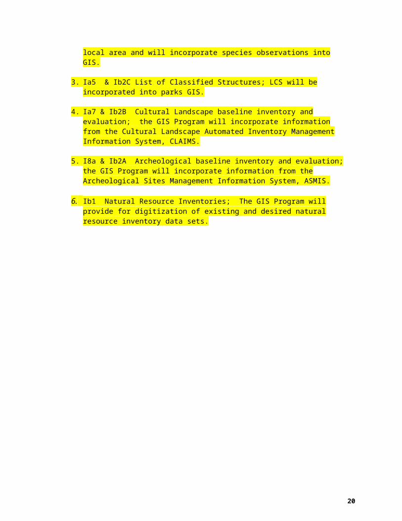
2. Ia2X Threatened and Endangered Species; the GIS Program will provide information of Wyoming endangered species in the local area and will incorporate species observations into GIS.
3. Ia5 & Ib2C List of Classified Structures; LCS will be incorporated into parks GIS.
4. Ia7 & Ib2B Cultural Landscape baseline inventory and evaluation; the GIS Program will incorporate information from the Cultural Landscape Automated Inventory Management Information System, CLAIMS.
5. I8a & Ib2A Archeological baseline inventory and evaluation; the GIS Program will incorporate information from the Archeological Sites Management Information System, ASMIS.
6. Ib1 Natural Resource Inventories; The GIS Program will provide for digitization of existing and desired natural resource inventory data sets.

15
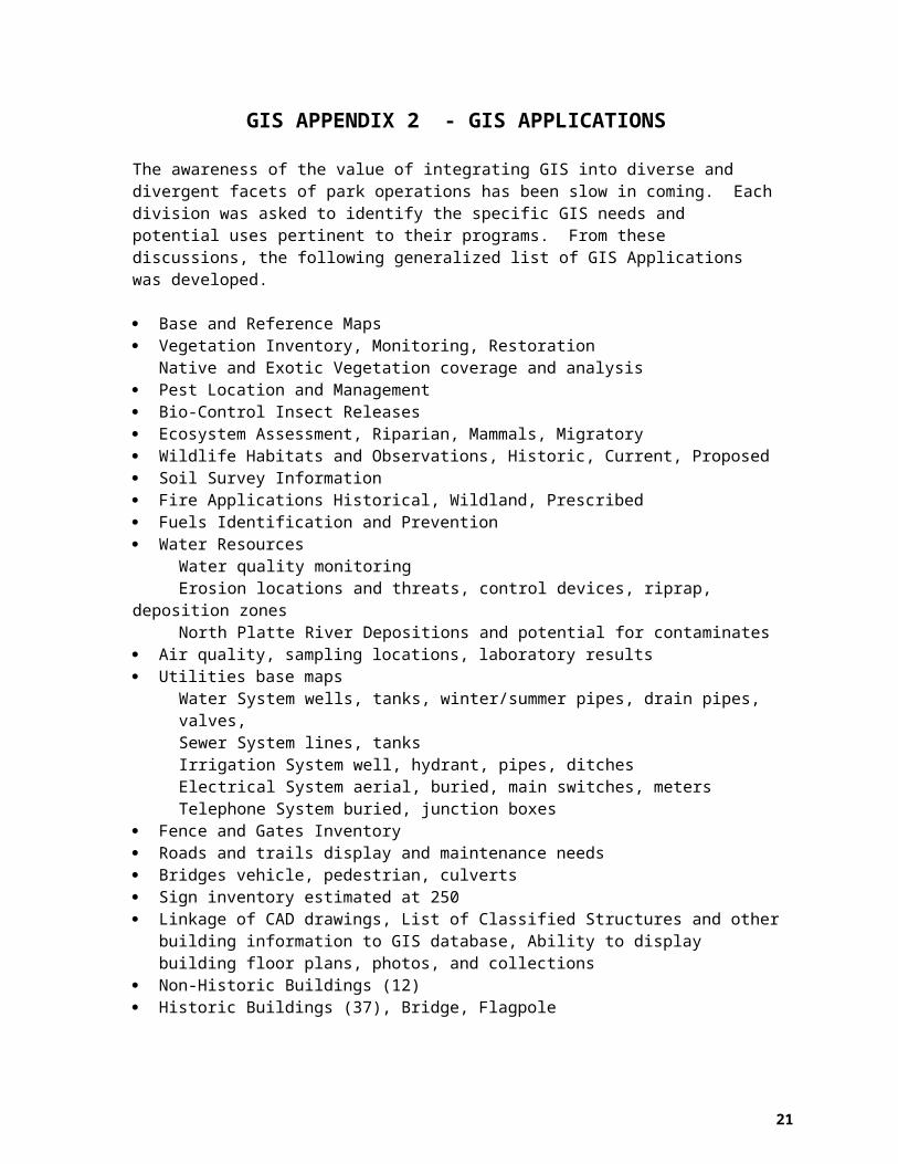
GIS APPENDIX 2 - GIS APPLICATIONSThe awareness of the value of integrating GIS into diverse and divergent facets of park operations has been slow in coming. Each division was asked to identify the specific GIS needs and potential uses pertinent to their programs. From these discussions, the following generalized list of GIS Applications was developed.
Base and Reference Maps Vegetation Inventory, Monitoring, Restoration
Native and Exotic Vegetation coverage and analysis Pest Location and Management Bio-Control Insect Releases Ecosystem Assessment, Riparian, Mammals, Migratory Wildlife Habitats and Observations, Historic, Current, Proposed Soil Survey Information Fire Applications Historical, Wildland, Prescribed Fuels Identification and Prevention Water Resources
Water quality monitoringErosion locations and threats, control devices, riprap, deposition zonesNorth Platte River Depositions and potential for contaminates
Air quality, sampling locations, laboratory results Utilities base maps
Water System wells, tanks, winter/summer pipes, drain pipes, valves,Sewer System lines, tanksIrrigation System well, hydrant, pipes, ditchesElectrical System aerial, buried, main switches, metersTelephone System buried, junction boxes
Fence and Gates Inventory Roads and trails display and maintenance needs Bridges vehicle, pedestrian, culverts Sign inventory estimated at 250 Linkage of CAD drawings, List of Classified Structures and other building information to GIS
database, Ability to display building floor plans, photos, and collections Non-Historic Buildings (12) Historic Buildings (37), Bridge, Flagpole Irrigation Application Areas, Ditches, Diversions, Culverts, Lawns, Fields, Trees Historic ruins inventory and display Archeological site database and location Cultural Sites Inventory Cultural Landscape mapping Bedlam ruts map Visitor Use patterns Historic Land Use Property Boundaries Historic and Current Recreate Historic Residential Landscaping Site bulletins Graphics GAP analysis for Natural and Cultural Resources

16
GIS APPENDIX 3 – DATABASE LIST (THERESA IS DEVELOPING DRAFT CHECKLIST)

17
GIS APPENDIX 4 – EXISITING DIGITAL SPATIAL DATA (EXAMPLE TO BE DEVELOPED)

18
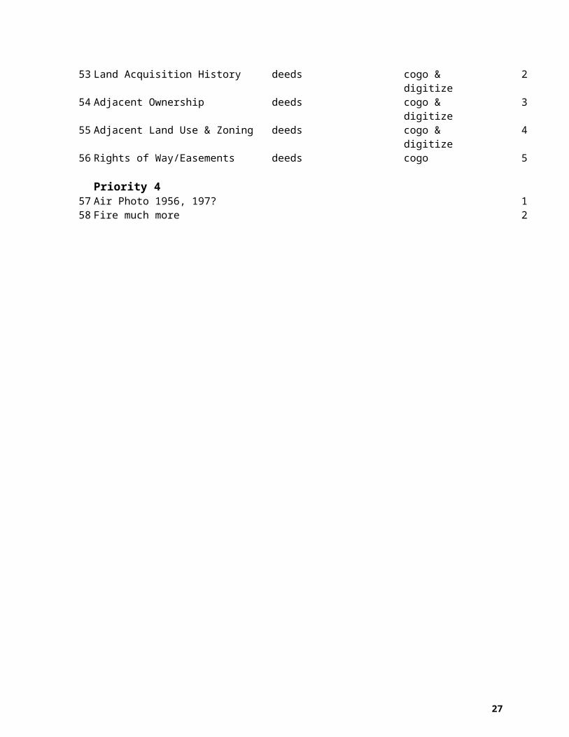
GIS APPENDIX 5 - DATA THEMES TO BE DEVELOPED Theme Name Source Method Priorit
yGPS Work – to be completed in summer of FY ’01, with Intermountain Support Office GIS Program Office Assistance
1 Park Boundary Fence field GPS 12 Roads, trails, sidewalks, paths field GPS 23 Bridges field GPS 34 Ditches current field GPS 45 Culverts field GPS 56 Sign locations field GPS 67 Monuments field GPS 78 Non-Historic Buildings field digitize or GPS 89 Trees current (Historic District) field GPS 9
10 Utility Lines maps & field GPS 1011 Utility Points maps & field GPS 1112 Hydrology field & DOQQ digitize or GPS 1213 Vegetation 2000 field GPS 1314 Wildlife habitats field GPS 1415 Exotic vegetation field GPS 1516 Erosion control methods field GPS 16
Priority 1 For GIS Specialist17 Historic Buildings Woods/LaDeaux/Devore convert 118 Archeological Sites CSI/MWAC convert 219 Cultural Landscape Report data CLR 2000 convert 320 Digital Air Photo 1995 I&M veg mapping
projectscan & convert 4
21 Digital Air Photo 1939 DSC/Devore sacn & convert 522 Soils NRCS convert 623 USGS Digital Quadrangle DRG convert 724 USGS Digital Ortho Photo 1994 DOQQ, new image convert 825 USGS Digital Line Graph I&M DLG convert 926 Vegetation I&M 1995 I&M convert 1027 Vegetation I&M 1995 I&M-veg photo point convert 1128 Vegetation I&M 1995 I&M-veg assessment convert 1229 Viewsheds DEM convert 1330 Slope Aspect DEM convert 14
Priority 2 For GIS Specialist31 Historic Roads & Trails maps & photos digitize 132 Vegetation historic maps & photos digitize 2

19
33 Disturbed lands & history maps & photos digitize 334 Ditches historic maps & photos digitize 435 Topography contours maps/Devore digitize 536 Slope Aspect maps/Devore digitize 637 Vegetation replanting maps digitize 738 Trees historic maps digitize 839 Cultural Landscape Report maps CLR 2000 digitize 940 Vegetation plan 1986 plan digitize 1041 Biocontrol release maps & forms digitize 1142 Wetlands maps or convert digitize 1243 Fire Management Zones 1991 park fire plan digitize 1344 External Threats staff digitize 1445 Agricultural Leases Staff digitize 1546 Visitor & staff safety patterns staff digitize 1647 Visitor Use Density staff digitize or GPS 1748 Visitor Activity Types staff digitize or GPS 1849 Plant Plots staff digitize 1950 Wildlife observations staff digitize 2051 Fire Fuel Models field digitize or GPS 21
Priority 3 For GIS Specialist52 Park Boundary Legal deeds cogo 153 Land Acquisition History deeds cogo & digitize 254 Adjacent Ownership deeds cogo & digitize 355 Adjacent Land Use & Zoning deeds cogo & digitize 456 Rights of Way/Easements deeds cogo 5
Priority 4 57 Air Photo 1956, 197? 158 Fire much more 2
20
GIS APPENDIX 6 – GEOGRAPHIC BOUNDARIES
List USGS quads defining the geographical boundary of the park sample:
USGS 7.5 minute, 1:24,000 scale, quadrangle Fort Laramie, Wyoming
USGS 30 x 60 minute, 1:100,000 scale, Torrington, Wyoming
USGS County Series, Goshen, Wyoming
21
GIS APPENDIX 7 - NETWORK DIAGRAM
GISCompaq
PrinterHP 820Cse
PlotterHP 750C
Router
Server
NetworkDrive
Internet
22
GIS APPENDIX 8 - DRAFT: STANDARD DIRECTORY STRUCTUREVERSION: 2/9/01
(< 8 Character Directory Names)
Under any of the thematic directories, the structure of the directories can include the following topics:
data
projects
ext
legends
crdata
boundary
dem
photos
doqq
drg
geology
ipm
hydro
plss
trans
indexmap
images
veg
shared
tools
workspac
aspect
hillshad
slope
gps
hypso
species
fire
soils
watershd
wetlands
wqgis
geodetic
noxweeds
ea_eis
amphib
birds
fish
mammals
plants
reptiles
te
pipetran
railroad
roadtral
nrdata
lands
basedata
monitor
amls
nwi
farsite
outputs
inputs
database
present
docs
CODEcode – alpha code
graphics
gis
maint
planning
Suggested I&M LayoutRecommended Standard Layout
graphics
docs
gis
database
metadata
present
graphics
thmmgr
Aksopak.avxGisthmgr.avxDrg.avx
DatacatNPBib

23
GIS APPENDIX 9 – DATA RELEASE STATEMENT SAMLE INTERNAL PROJECT REQUEST FORM
Routing
1. GIS Specialist 2. CRM 3. GIS Specialist
GEOGRAPHIC INFORMATION SYSTEM PROJECT REQUEST - GLCA
Requesting Agency/Division/Individual____________________________Phone #___ ___-____ ext.____Date __/__/__
QUESTIONS? Call GLCA/GIS at (520) 608-6271
Nature of Problem or Request:
Outline the proposed project. Include description of problem and expected output. List numbers and types of tables (attributes) needed. Give desired scale, dimensions and any specific color schemes. _______________________________________________________________________________________________________________________________________________________________________________________________________________________________________________________________________________________________________________________________________________________________________________________________________________________________________________________________________________________________________________________________________________________________________________________________________________________________________________________________________________________________________________________________________________________________________________________________________________________________________________________________________________________________________________________________________________________________________________________________________________________________________________________________________________________________________________________________________ Needed by __/__/__
GLCA-GIS (This section to be completed by GLCA-GIS.)From existing database? ___From a new database? ___Statistical report? ___Consultation for proposed project? ___Consultation for improvement to current project? ___Assistance needed from requestor? _________________________________________________________________________________________________________________________________________________________________ ___________________________________________________________________________________________________________________________________________________________________________________________________

24
Estimated time and resources to complete project. _____________________________________________________________________________________________________________________________________________________________________________________________________________________________________________________________________________________________________________________________________
CRM/GIS Comments
Date Due___________________________ RM/GIS Priority __________________ RM/GIS Recommendation __________________________________________
APPROVED BY CRM/GIS SPECIALIST __________________________________DATE__/__/__
Date Completed __/__/__ Initial ___

25
SAMPLE NONDISCLOSURE AGREEMENT
NONDISCLOSURE AGREEMENT FOR DATA ACQUIRED FROM THE GLEN CANYON NATIONAL RECREATION AREA GIS
UNITED STATES GOVERNMENT
User's Responsibility to Safeguard Data:Glen Canyon National Recreation Area GIS data and data products are the property of the Glen Canyon National Recreation Area. The User will safeguard the data or data products from theft, loss, or use contrary to the terms of this agreement. If loss or misuse of the supplied information should become evident, the User agrees to immediately notify the Superintendent of Glen Canyon National Recreation Area. The User will be responsible for reimbursing Glen Canyon National Recreation Area for the costs of personnel time and materials needed to provide this data. The Superintendent may waive these fees if it is determined that by providing this data to the User, the National Park Service will benefit.
Permitted Uses:The User may copy the GIS data for computer backup purposes.
The GIS data or data products may be used on computer equipment owned or leased by the User or by third parties under contract to the User organization.
Graphic displays and printed tabular listings derived from the GIS data base or data products may be distributed or used in publications and presentations, provided that the credit is given to the Glen Canyon National Recreation Area GIS, National Park Service as the source of the information.
Entering into third party agreements for one time use of data or data products is permitted subject to the following conditions:
a. Any use of the GIS digital data or data products must be in support of written contracts by the User, for application in the User's project that are approved by the NPS.b. The primary consultant or contractor needs to read and sign this agreement.c. The third party contractor is responsible for all subcontractors with respect to adherence to the terms of this Agreement and all requirements outlined.d. The third party contractor may retain and use the Glen Canyon National Recreation Area GIS data supplied only for the period of time during which the specific contract requiring its use is in effect.e. Glen Canyon National Recreation Area may request:
1. A signed copy of all related third party contracts for approval.2. Written notification when the contract has been completed and the GIS digital data and data products have been returned to the User.
f. The data remains the property of the National Park Service.
Uses Prohibited:
The User agrees not to distribute, copy, sell, loan or offer for use any copies of the Database or derivatives thereof, in whole or in part, to any party unless permission is received from the Superintendent of Glen Canyon National Recreation Area, except as permitted in this agreement.
Term
The User has the right to use the Glen Canyon National Recreation Area GIS data and data products as specified in this Agreement.
Promptly upon the completion of the User's project, or upon discontinuance or abandonment of the possession or use of the database the user must return or certify the destruction of all copies of the database, and variations thereof.

26
The data provided by Glen Canyon National Recreation Area is in an "as is" condition without warranty of any kind, including but not limited to the implied warranties of fitness for a particular purpose. In no event shall Glen Canyon National Recreation Area, or any employee of the National Park Service, be liable for any damages caused by the Users of the database or for any incidental or consequential damages.
I, the User, agree to all of the statements above:
Signed:________________________________ Date:______________
Typed Name:________________________________________________
I, the contractor or subcontractor of the User, agree to all of the statements above:
Signed:________________________________ Date:______________
Typed Name:________________________________________________
27
GIS APPENDIX 10 – IMPLEMENTATION SUMMARY TABLETASK RESPONSIBILITY ESTIMATED
COST FUNDING SOURCE
FY PROJECTED
FUNDING
FY ACTUAL FUNDING
FY COMPLETETED
DDevelop GIS Plan Chief Ranger, GIS
Specialist, IMDE-GIS$1,000 Park Base FY ‘00
Acquire Part-Time GIS Specialist
Supt., Chief Ranger, Personnel
$20,000 Park Base FY ‘00
Acquire PC for GIS Use
Chief Ranger $5,000 Park Base FY ‘00
Acquire Large Format Plotter
Chief Ranger $7,000 Park Base FY ‘00
Acquire Arcview Software
GIS $2,000 Park Base FY’01
Acquire Color Scanner
Chief Ranger $500 Park Base FY’01
Acquire Image Analyst Arcview
Chief Ranger $1,000 Park Base FY’01
Research Existing Geographic Data
GIS Specialist $3,000 Park Base FY ’01
Implement NPS Theme Manager
GIS Specialist/IMDE-GIS $500 Park Base FY ‘01
Train Staff on NPS Theme Manager
GIS Specialist/IMDE-GIS $1,000 Park Base FY ‘01
Train staff on GPS GIS Specialist $1,000 Park Base FY ‘01
Begin Data Acquisition
GIS Specialist $6,000 Park Base FY ’01
GIS Applications GIS Specialist/Staff $1,800 Park Base FY ‘01
Continue Data Acquisition
GIS Specialist $14,400 Park Base FY ‘02
Create Metadata GIS Specialist $1,500 Park Base FY ‘01Post Metadata and Browse Graphic to Clearinghouse
GIS Specialist $500 Park Base FY ‘01
Implement Synthesis
GIS Specialist, WASO Synthesis Team
Park Base FY ‘02
Create Hardware Obsolescence Plan
GIS Specialist $1,000 Park Base FY ‘03
Revise GIS Plan GIS Specialist $1,000 Park Base FY ‘05